🔥 Would you like to save this?
Southeast Florida is better known for neon nightlife and boardwalk crowds, yet a string of quiet coastal towns still keeps the old, unhurried rhythm of the Atlantic.
We gathered 25 of the most secluded places from Martin County down to the Lower Keys, each one offering shell-strewn beaches, low-rise skylines, and neighborhoods where the loudest sound after dark is often the surf.
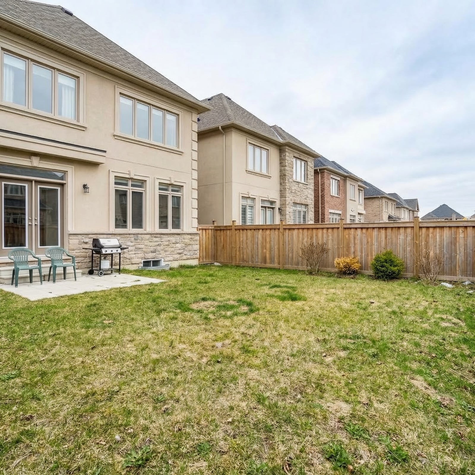
In order to come up with the very specific design ideas, we create most designs with the assistance of state-of-the-art AI interior design software.
These towns limit development in creative ways—capping building height, guarding gated bridges, or simply hiding homes behind thick mangroves—so residents can paddleboard at dawn and stargaze after dinner without traffic glare.
Visitors will find family-run fish shacks, pocket parks, historic lighthouses, and water as clear as a swimming pool.
Because most of the year-round populations number in the hundreds, newcomers catch sight of familiar faces quickly and strangers rarely feel like tourists for long. In short, each stop on this countdown provides a reminder that Florida’s coastline still has room for peace and quiet.
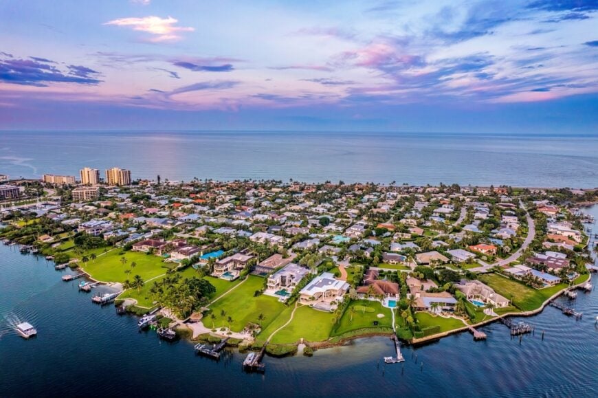
25. Indian River Shores
Indian River Shores is a hush of elegance just north of Vero Beach, where gated lanes curl beneath live oaks and private walkways lead over dunes to tranquil stretches of sand. With fewer than 5,000 residents and no commercial core, the town feels less like a municipality and more like a hidden enclave known only to those who belong.
Mornings pass in quiet rituals—barefoot strolls at sunrise, coffee on screened porches, the soft rustle of sea grape leaves in the wind. The hum of traffic never quite arrives here, and the stillness is part of the scenery.
Behind the hedgerows and palms, life moves in a measured hush that only deepens the longer you stay.
Where is Indian River Shores?
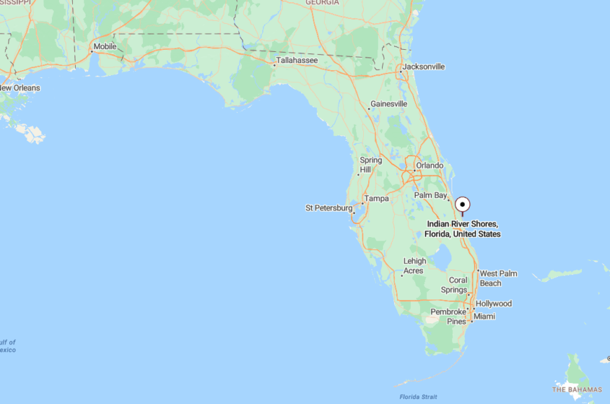
Tucked along the barrier island in Indian River County, Indian River Shores lies between the Atlantic Ocean and the Indian River Lagoon, just north of Vero Beach.
There are no major through-roads, only the winding A1A and a web of residential streets that discourage outsiders and reward those who know how to look.
24. Ocean Breeze
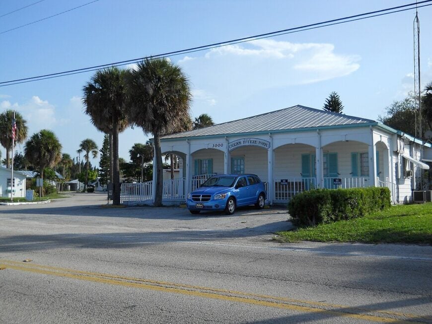
Ocean Breeze is a marina town of fewer than 400 people nestled tightly against the water, where docks stretch like fingers into the Indian River and every breeze seems to bring the smell of salt and diesel. Life here moves at the unhurried pace of pontoon boats and pelicans, with days marked by tides more than time.
Aluminum homes perch on stilts, and locals gather in the shade of awnings to chat about weather, fishing, and the quiet joy of doing nothing in particular.
It’s the kind of place where a thermos and a tackle box are all the company you need for an entire morning.
Where is Ocean Breeze?
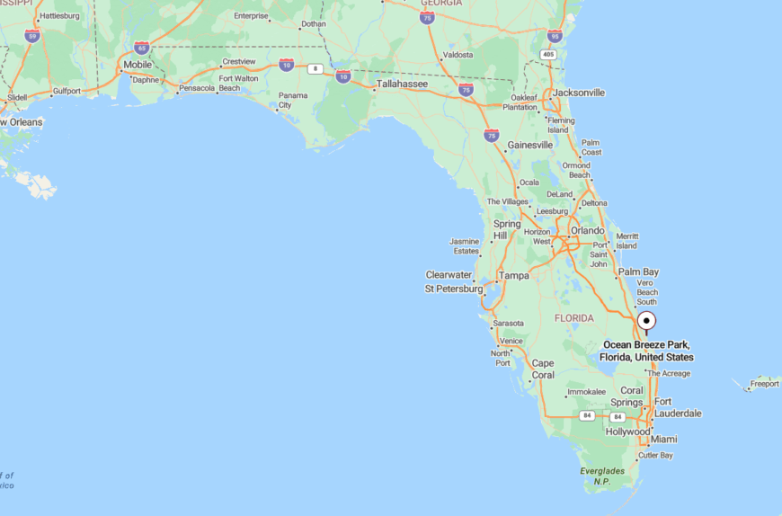
Ocean Breeze is located just east of Jensen Beach in Martin County, pressed up against the Intracoastal Waterway and hidden from main roads by marsh and mangroves.
The town has no large signs or busy storefronts, and its small footprint around the marina keeps it nearly invisible to those simply passing through.
23. Briny Breezes
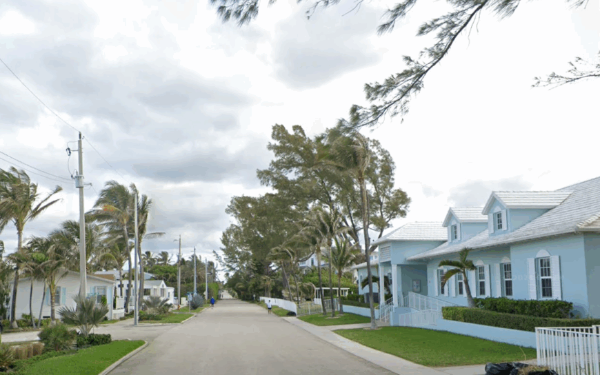
Briny Breezes is a seaside town so small it seems to have washed ashore and stayed, with vintage trailers lined up along sandy lanes like colorful seashells. The town’s residents, many of them retirees, wave from porches beneath striped awnings as the surf whispers just beyond the dunes.
It’s a throwback to an earlier era—where communities knew every neighbor’s dog, and beach chairs stayed out all night without worry.
Tucked between two of Florida’s busiest counties, Briny Breezes manages to remain defiantly modest, like a message in a bottle the tides forgot to collect.
Where is Briny Breezes?
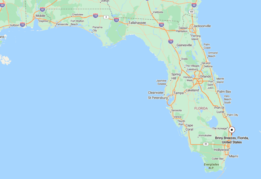
Located along A1A between Ocean Ridge and Gulf Stream, Briny Breezes occupies a narrow barrier stretch in southern Palm Beach County.
With just one main road and a residential-only layout, it’s easy to miss unless you’re specifically looking for it—and that’s part of the charm.
22. Gulf Stream
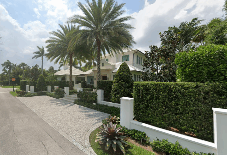
Gulf Stream is a quiet breath of coastal calm between Delray Beach and Boynton, where towering ficus hedges and vine-draped walls keep even the most elegant homes tucked far from sight. The absence of public beaches, shops, or sidewalks lends the town an unusual hush, as though it’s been designed to be overlooked.
Inside its lush borders, tennis courts echo quietly, palm fronds rustle overhead, and the horizon opens up without distraction or fanfare.
The town doesn’t announce itself—it reveals itself, slowly, only to those who take the time to see.
Where is Gulf Stream?
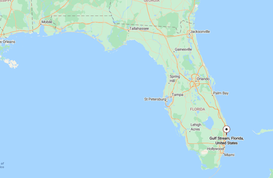
Gulf Stream sits along the barrier island in southern Palm Beach County, bordered by Ocean Ridge and Delray Beach.
Hidden behind a stretch of A1A with few signs or signals, it remains one of the least traveled and least disrupted towns on Florida’s southeastern coast.
21. Loxahatchee Groves
Loxahatchee Groves is one of the last places in Palm Beach County where dirt roads still stretch for miles and horses outnumber cars by more than a little. This is a town of quiet porches, old citrus trees, and mailboxes that lean toward the sun with nothing but sky behind them.
Neighbors wave from pickup trucks or horseback, and time stretches out like the horizon—wide, dusty, and golden.
Though technically a town, Loxahatchee Groves feels more like a hidden pocket of country life tucked between the sprawl, holding its own kind of time.
Where is Loxahatchee Groves?
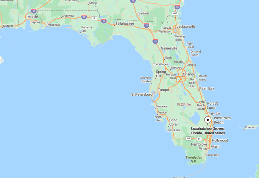
Loxahatchee Groves lies west of Royal Palm Beach, just beyond the reach of suburban build-out and at the edge of canal-lined farmland.
Accessible by Southern Boulevard but removed from major interstates, the town stays out of sight and mind, nestled into the long spaces between lakes and groves.
20. Lakewood Park
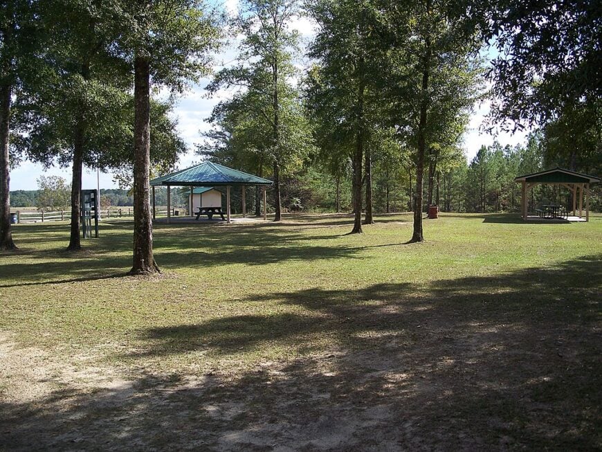
Lakewood Park is a broad, low-key expanse in northern St. Lucie County, where quiet roads meander through pine scrub, small lakes, and wide lots with plenty of space to breathe. There’s no central square or shopping district, just a gentle rhythm of daily life wrapped in birdsong and breeze.
Fishing boats trail down to hidden ponds in the early morning, and the evening air hums with the sound of tree frogs and screen doors closing.
It’s a place for families who value elbow room and stillness, where the biggest surprise on a walk might be a heron lifting off from the brush.
Where is Lakewood Park?
Situated south of Vero Beach and inland from the barrier islands, Lakewood Park stretches west of U.S. 1 along tree-lined lanes and quiet cul-de-sacs.
Without a strong commercial core or highway through-line, the area blends into the woods and wetlands that surround it, making it feel gently removed from the outside world.
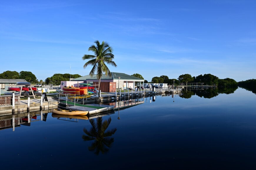
19. Flamingo (Everglades)
🔥 Would you like to save this?
Flamingo is the last outpost before the wilderness takes over—where the road ends, and the Everglades begin. Time here is measured in tides and sunrises, not clocks or commutes.
It’s a community of houseboats, park rangers, and anglers living with the rhythm of nature, surrounded by nothing but sawgrass, sky, and the call of wading birds. At night, the stars reflect off Florida Bay in a silence so deep, it hums.
There are no neighborhoods or strip malls—just the wide breath of the Everglades and a reminder that solitude still exists at the edge of the map.
Where is Flamingo?
Flamingo lies at the southernmost tip of mainland Florida in Monroe County, inside Everglades National Park. It’s the end of a 38-mile road from Homestead that winds through untouched marsh and forest.
With no nearby towns and only water on three sides, Flamingo feels worlds away from the rest of the state—a remote dock where land gives way to wilderness.
18. Canal Point
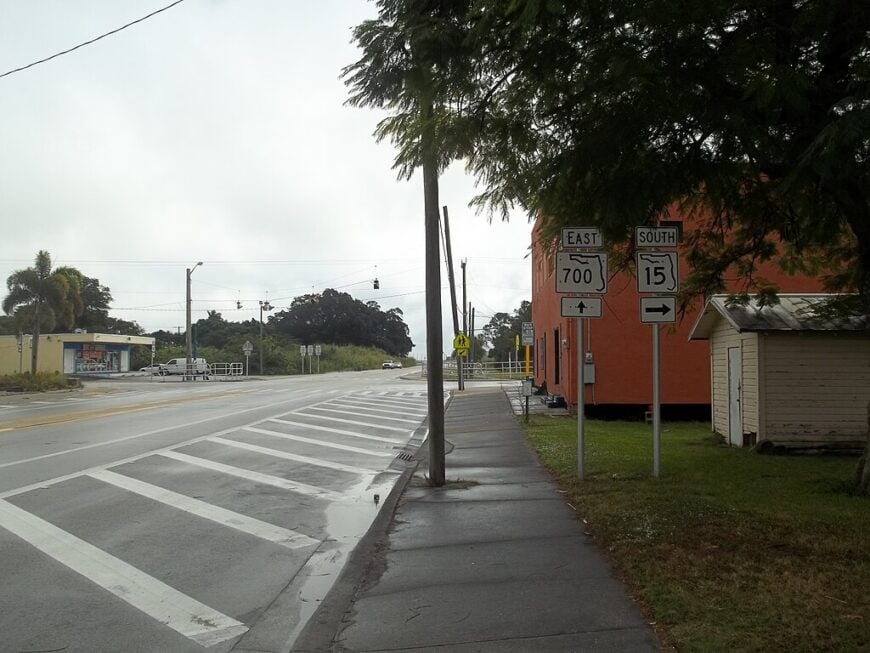
Canal Point is a sugar town that seems to drift along the edge of Lake Okeechobee, where fields of cane stretch for miles under an enormous sky and the water glitters just beyond the levee. Life here is shaped by the harvest, the soil, and the slow movement of the lake wind.
Homes are simple, porches are deep, and most of the day’s news can be gathered from a few words at the feed store or a nod from a neighbor. The sounds are of tractors, birds, and the occasional boat motor humming through the rim canal.
It’s not just rural—it’s timeless, rooted deeply in the land and protected by its own quiet distance.
Where is Canal Point?
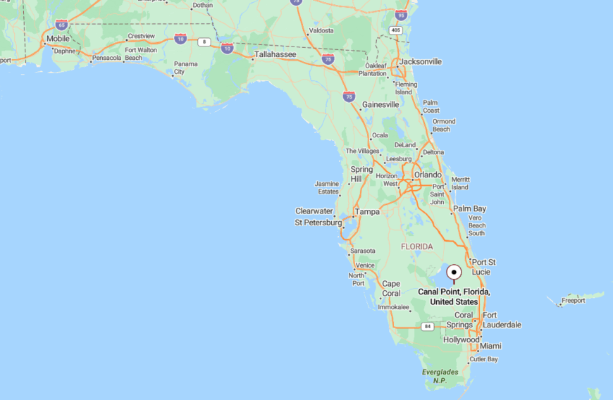
Located on the eastern shore of Lake Okeechobee in western Palm Beach County, Canal Point hugs State Road 441 just north of Pahokee.
Surrounded by sugarcane fields and bordered by the massive Herbert Hoover Dike, it feels physically and spiritually separate from the modern pace of the coast.
17. North River Shores
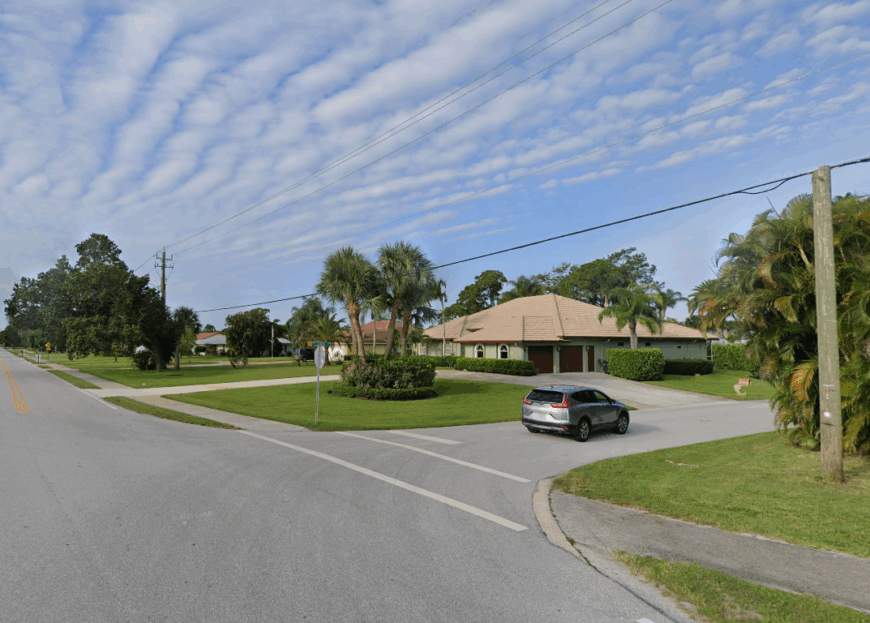
North River Shores curves gently along the waterline near Stuart, a quiet neighborhood where time seems to slow and soften near the river’s edge. Docks stretch into the St. Lucie River like long invitations, and mornings often begin with nothing more than a cast line and a steaming cup of coffee.
Old oaks shade modest homes, and winding roads feel like they’ve been there forever, edged by native palms and bougainvillea hedges. There’s no main drag, no fast food, no rush—just quiet streets that curl back on themselves like the bends in the river nearby.
It’s a place where you live with the tides, not the clock.
Where is North River Shores?
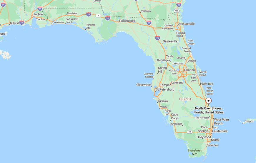
North River Shores sits just across the St. Lucie River from downtown Stuart in Martin County, its borders defined by curving canals and quiet cul-de-sacs.
Though geographically close to town, its winding shoreline and leafy canopy keep it feeling like a peaceful hideaway just out of sight.
16. Port Salerno
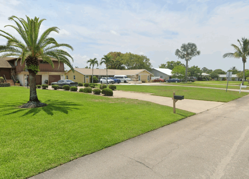
Port Salerno is an old working harbor that hasn’t given up its past, where shrimp boats still tug at the docks and fish shacks scent the air with salt and smoke. Artists and anglers mingle at waterfront bars, and murals splash color across timeworn walls like a celebration of everything the town has chosen to remain.
Life here is shaped by the sea—by tides, nets, and the patient rhythms of the water. Restaurants are small, stories are long, and the harbor stays busy even as the roads remain still.
There’s something enduring in the salt air, a rootedness that gives the town its quiet soul.
Where is Port Salerno?
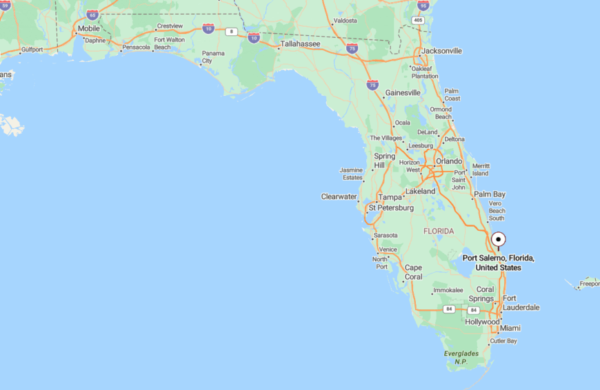
Port Salerno is located in Martin County, tucked just south of Stuart and wrapped around a protected cove known as Manatee Pocket.
Accessible by winding roads off U.S. 1, it sits slightly off the map in spirit, protected by its geography and preserved by its working-class heritage.
15. Tequesta
Tequesta is a river town where streets curve around the Loxahatchee and the air always smells faintly of salt and orange blossom. There’s a softness to life here—afternoons are for paddling through mangrove tunnels, and evenings stretch out on porches that face the setting sun.
The community is tight-knit, but not crowded, with no towers or sprawling developments to interrupt the skyline. Instead, you’ll find banyan trees, breezy parks, and the quiet comfort of a town that prefers privacy to popularity.
It’s the kind of place where every day feels like the start of a long weekend.
Where is Tequesta?
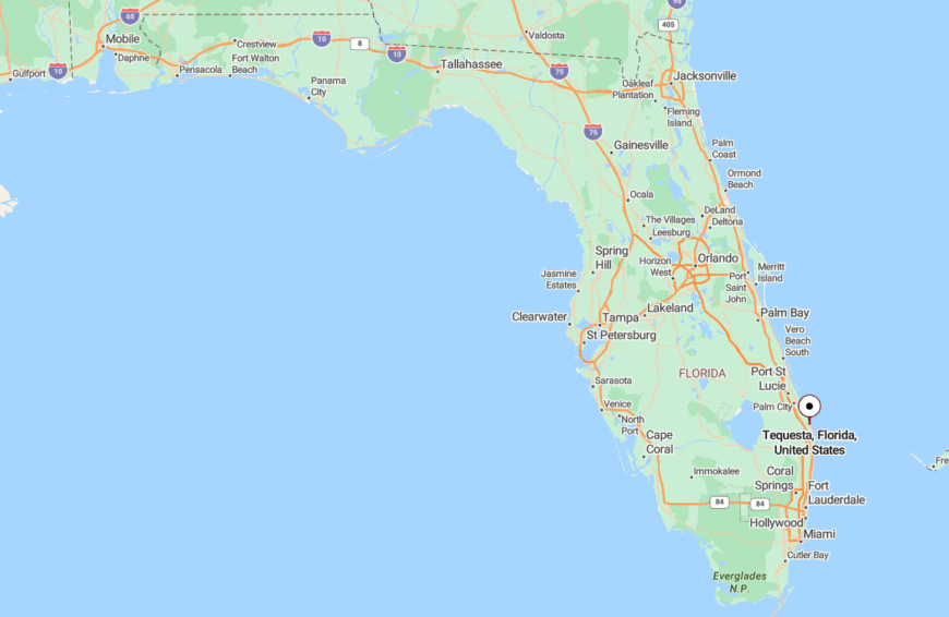
Tequesta sits at the northern tip of Palm Beach County and spills gently into Martin County, bordered by Jupiter and the wild reaches of Jonathan Dickinson State Park.
Flanked by rivers and buffered by green space, the town’s geography naturally insulates it from through-traffic and overdevelopment, preserving its peaceful atmosphere.
14. White City
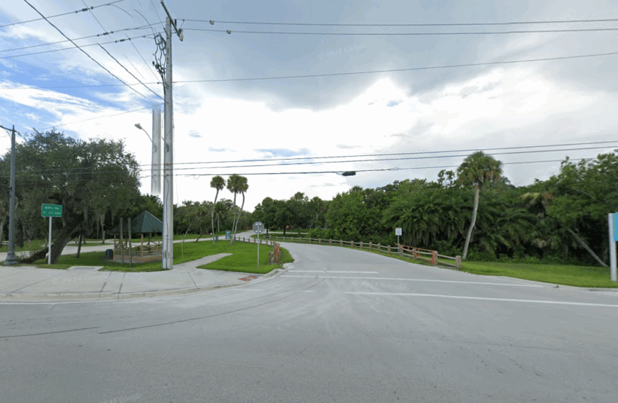
White City is a town that wears its age well, with moss-draped oaks and sandy roads that still hold the memory of horse hooves. It’s a place where gardens grow wild, homes are tucked behind hibiscus hedges, and the loudest sounds come from the wind through the trees.
There’s no main street or plaza—just a quiet grid of older homes and fields, many of them still run by the same families who settled here generations ago.
Evenings settle in slowly, and most folks are content to watch the stars come out from their front steps.
Where is White City?
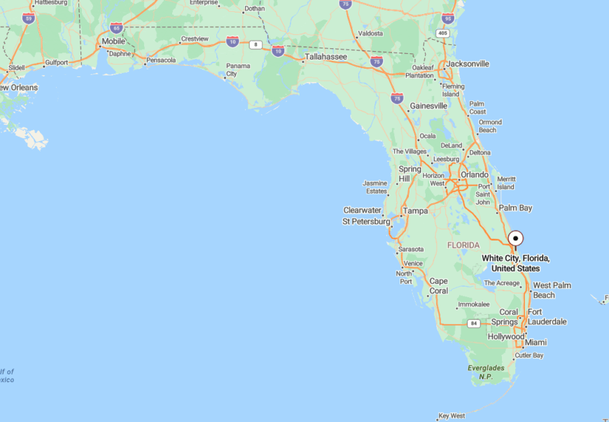
White City is located just inland from Fort Pierce in St. Lucie County, nestled between the Savannas Preserve and the Indian River Lagoon.
Though it lies only minutes from modern conveniences, its forested surroundings and quiet layout make it feel as though it exists in a time all its own.
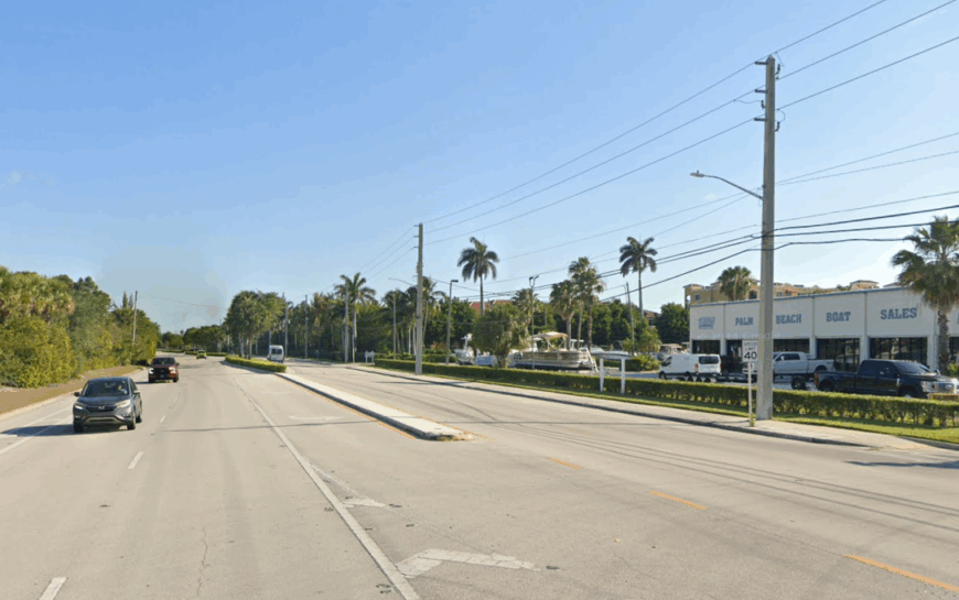
13. Hypoluxo
🔥 Would you like to save this?
Hypoluxo is a gentle whisper along the Intracoastal, a sliver of old Florida hidden behind palms and plumeria. Its streets are small and slow, its waterfront lined with native grasses instead of glossy condos.
There’s no tourist bustle here—just salt air, shaded footpaths, and the soft clink of sailboat rigging in the breeze. It’s a town that seems to blend into the landscape, as if it’s always been part of the shoreline itself.
Few people pass through by accident, and that’s part of the magic. Hypoluxo moves at its own pace, untethered from the city sprawl surrounding it.
Where is Hypoluxo?
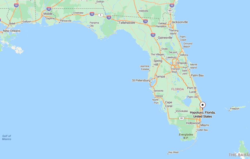
Hypoluxo is located in southern Palm Beach County, just west of the Intracoastal Waterway between Lantana and Boynton Beach. It’s nestled in a small coastal pocket buffered by wetlands and water.
With limited access points and no major attractions to draw crowds, the town remains softly hidden from the world beyond its mangrove edges.
12. Hobe Sound
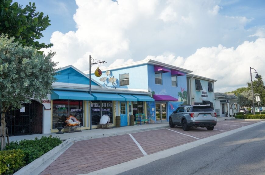
Hobe Sound is a coastal hush tucked between the ocean’s edge and a wild expanse of pine and scrub. It’s the kind of place where sea turtles outnumber streetlights and where even the breeze seems to slow down on its way through town.
Shaded by cabbage palms and sand pines, the streets carry the calm of a nature preserve more than a neighborhood. Residents pass quiet mornings walking windswept dunes or kayaking through mangrove creeks with hardly a soul in sight.
Hobe Sound keeps its rhythm low and lovely—no loud attractions, no towering buildings—just open sky, open water, and the kind of stillness that makes you forget what you were hurrying for.
Where is Hobe Sound?
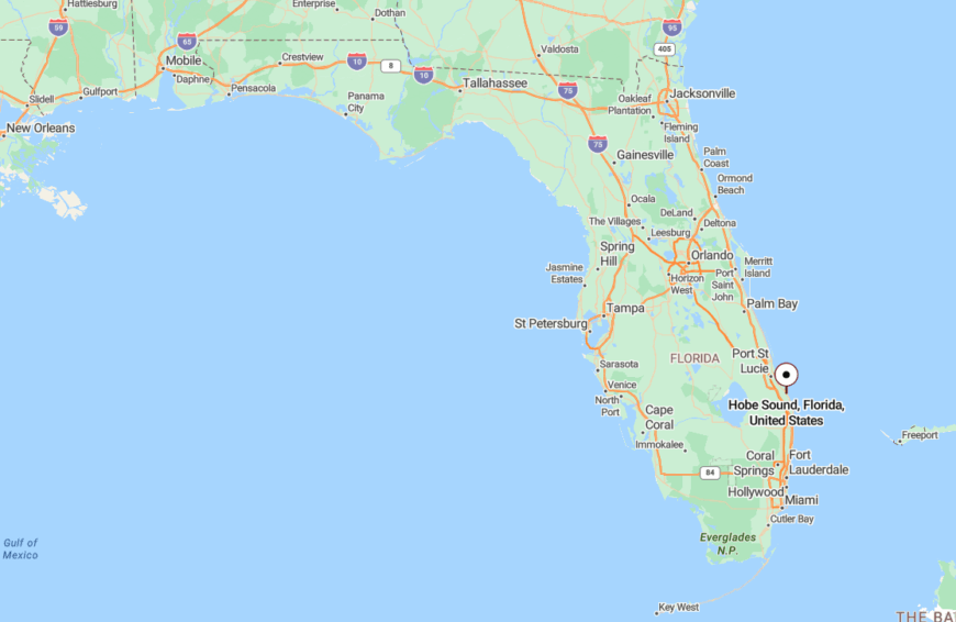
Hobe Sound rests along Florida’s Treasure Coast in Martin County, just off U.S. 1 between Stuart and Jupiter. The town stretches from the Indian River Lagoon to the Atlantic, wrapped in state parks and coastal preserves.
With Jonathan Dickinson State Park to the south and Hobe Sound National Wildlife Refuge to the north, development is hemmed in by wilderness. Its placement between these protected areas keeps the noise out and the quiet in.
11. Limestone Creek
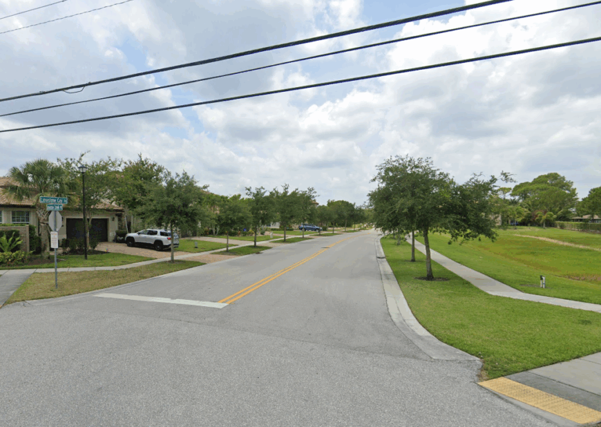
Limestone Creek is a small enclave just outside Jupiter that feels hidden in plain sight, where homes peek from behind tropical thickets and the air feels heavier with history. Once home to Seminole paths and early black farming families, the land here seems to remember every step that’s been taken on it.
Children play in shaded yards, and the creek itself winds quietly past, feeding the river and carrying with it the echoes of an older Florida.
In Limestone Creek, the past isn’t just preserved—it’s alive, folded into the rhythms of everyday life.
Where is Limestone Creek?
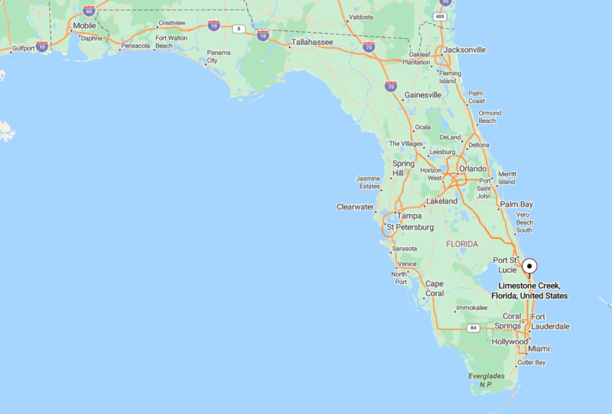
Limestone Creek is tucked into northern Palm Beach County, just west of Jupiter and bordered by the Loxahatchee River and Indiantown Road.
Despite its proximity to highways and growth, it remains sheltered by wetlands and woodlands, maintaining a quiet identity that feels far removed from the city’s pace.
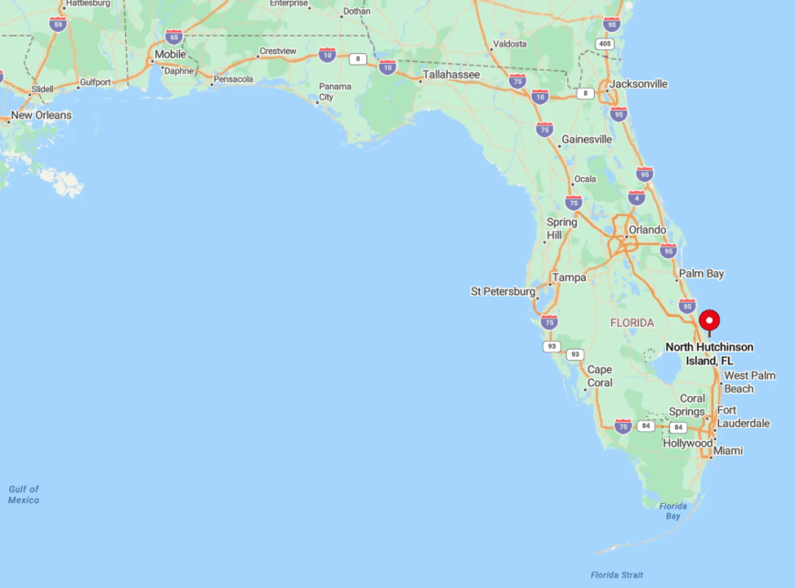
10. South Hutchinson Island (Jensen Beach)
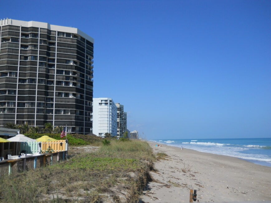
Roughly 1,500 residents spread out along the southern tip of Hutchinson Island, a barrier strand where pastel cottages peek above sea-grape dunes.
Days revolve around surfing at Dollman Beach, hunting for fossilized shark teeth near Jensen Sea Turtle Beach, or casting lines beneath the Ernest Lyons Bridge for snook that prowl the incoming tide.
The only commercial hub is a clutch of tiki cafés and bait shops clustered near the causeway, while the rest of the island relies on small vacation rentals and family-owned inns. Martin County forbids bright streetlights here, so night skies stay dark enough to pick out the Milky Way and the green flash of hatchling turtles.
Tourism provides seasonal income, but most full-time locals work in nearby Jensen Beach or Port St. Lucie, keeping the island free of big business signage. Low population density, strict lighting codes, and miles of undeveloped shoreline combine to create a hush that feels far removed from mainland bustle.
Where is South Hutchinson Island?
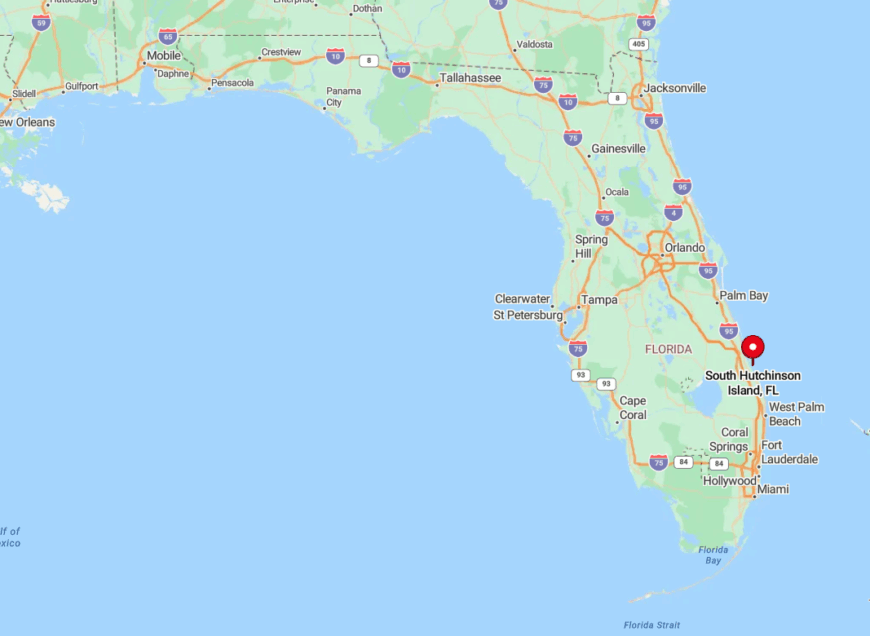
This stretch lies in Martin County, beginning just south of the St. Lucie River inlet and running three miles to the House of Refuge museum. Water surrounds it on all sides—Atlantic surf to the east, the Indian River Lagoon to the west—leaving a single drawbridge on NE Causeway Boulevard as the primary entry point.
Because no through-highway connects to the barrier islands farther north, casual motorists rarely stumble upon the area. Arriving guests either drive across the causeway from Jensen Beach or, for a scenic shortcut, tie up at the public dock after cruising down the Intracoastal Waterway.
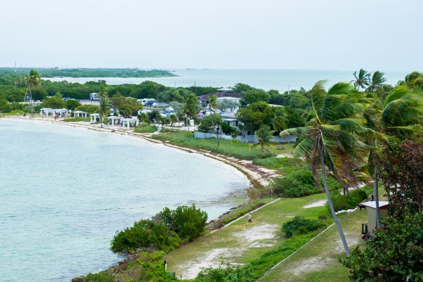
9. Layton on Long Key

Only about 200 people live in Layton, a speck of a town tucked midway down Monroe County’s Long Key. Anglers drift the ocean flats at sunrise hunting bonefish, while neighbors gather under shaded chickee huts at Sunset Park to swap the day’s catch.
The lone strip of shops is a kayak outfitter, a seafood grill, and the quirky Long Key Liquor & Deli where locals order Cuban coffee. Commercial fishing and eco-tourism support the town, yet zoning requires generous canal-front lots wrapped by mangroves that muffle highway noise.
Because streetlights are scarce and hotels nonexistent, nights are softer here than almost anywhere else in the Upper Keys. The absence of large resorts and the protective embrace of Long Key State Park on both sides make Layton feel like a whistle-stop village hiding in plain sight.
Where is Layton?
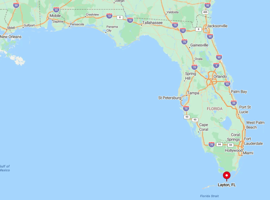
🔥 Would you like to save this?
Positioned at Mile Marker 68 on the Overseas Highway, Layton occupies the narrowest part of Long Key between Florida Bay and the Atlantic.
The oceanfront here drops into crystalline depths only a few strokes from shore, while bay-side flats remain knee-deep for acres, isolating the settlement by water as well as land. U.S.-1 provides the sole road access, yet most drivers zip past at highway speed, unaware a town exists beyond the coconut palms.
Visitors who slow down can turn onto Cortez Drive, cross a tiny bridge, and find themselves on streets where egrets outnumber cars.
8. Big Pine Key
About 4,400 residents share Big Pine Key, the largest island in the Lower Keys outside of Key West, yet much of its land belongs to the National Key Deer Refuge. Days begin with snorkeling at Looe Key Reef, biking the deserted roads of No Name Key, or photographing the petite Key deer that wander freely through backyards.
Small marinas, family diners, and a famed Sunday flea market comprise the modest commercial scene, with charter guides and wildlife officers forming the main year-round workforce.
Strict building regulations cap house heights to protect dark skies, and no big resorts have ever broken ground, ensuring a laid-back ambience. Grocery shopping requires a 30-minute drive up to Marathon, a distance that naturally limits population growth.
The combination of federal refuges, shallow backcountry waters, and limited services makes Big Pine feel like a pocket of wilderness despite the Overseas Highway running through it.
Where is Big Pine Key?
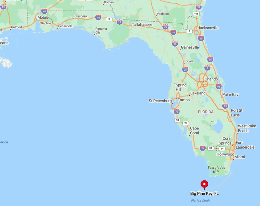
Located 30 miles north-east of Key West, Big Pine sits between the Bahia Honda Channel and Newfound Harbor in Monroe County. Waterways surrounding it are peppered with sandbars and seagrass meadows that deter heavy boat traffic.
Although U.S.-1 crosses the island, the lack of commercial sprawl encourages motorists to keep rolling, leaving neighborhood roads blissfully quiet. Travelers reach Big Pine by car or by flying into Key West International Airport and driving the last half hour past turquoise shallows.
7. Sewall’s Point
Sewall’s Point counts just over 2,000 inhabitants atop a live-oak-shaded peninsula bounded by the St. Lucie and Indian Rivers. Residents spend afternoons paddle-boarding to Bird Island, a spoil-island rookery where roseate spoonbills nest, or sipping wine at sunset on the town’s modest public beach.
No commercial strip exists beyond a single convenience store; most locals commute across the Evan’s Crary Bridge into Stuart for work in boating, healthcare, or marine research. Town ordinances require one-acre lots and cap building height at 35 feet, preserving river views and limiting density.
The absence of condos and hotels keeps both traffic and transient population low. Surrounded by water on three sides and governed by slow-growth zoning, Sewall’s Point feels like a leafy retreat even though it sits mere minutes from downtown Stuart.
Where is Sewall’s Point?
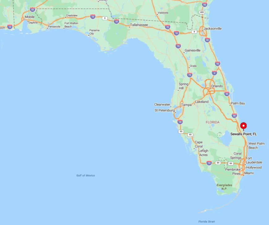
The peninsula lies in Martin County, wedged between the two forks of the St. Lucie River just west of the Intracoastal Waterway. Only two bridges—Evans Crary to the south and the quaint low-rise Sewall’s Point Road bridge to the west—connect it to the mainland.
With rivers forming natural moats, through-traffic is practically nonexistent. Most visitors arrive by car from U.S.-1 or slip a boat into the sheltered anchorage off Hell Gate Point.
6. North Hutchinson Island
Less than 3,500 full-time residents occupy the 12-mile reach of North Hutchinson Island that straddles St. Lucie and Indian River Counties.
Outdoor life revolves around beachcombing at Avalon State Park, kayaking through mangrove tunnels in the Jack Island Preserve, and watching loggerhead turtles nest under moonlight at Pepper Park.
Beyond two modest condo clusters, the island hosts mainly single-story homes and mom-and-pop motels; park rangers and marine scientists are among the few permanent employees. Undeveloped dunes dominate the horizon because large portions are state parks or wildlife refuges.
Nightlife is limited to porch conversations and the occasional beach bonfire, reinforcing the isle’s quiet nature. Long stretches of protected shoreline, sparse lighting, and a limitation on building height together ensure that North Hutchinson keeps its crowd-free character.
Where is North Hutchinson Island?
The barrier island begins north of the Fort Pierce Inlet and runs up to the Sebastian Inlet, flanked by the Atlantic on one side and the Indian River Lagoon on the other. With no direct bridge between Fort Pierce and Vero Beach except A1A, drivers either detour 20 miles inland or accept a leisurely coastal cruise, thinning visitor numbers.
Public transportation is nonexistent, so arrival almost always requires a private vehicle. Boaters favor the broad lagoon channels, tying up at unmarked spoil islands before wading ashore to near-empty beaches.
5. Jupiter Inlet Colony
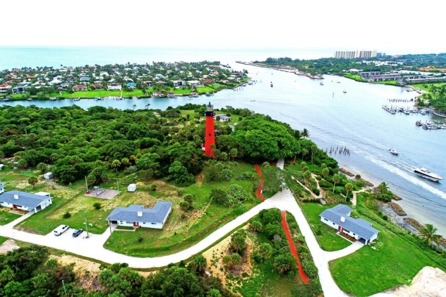
Fewer than 450 people live in Jupiter Inlet Colony, a tiny municipality that occupies the southern tip of Jupiter Island where the Atlantic meets the Loxahatchee River. Residents share three private beach walkovers, a community park shaded by sea grapes, and sunset docks ideal for spotting manatees drifting in the tide.
The absence of shops and restaurants inside town limits means most locals make the short drive to Tequesta for errands, while a volunteer police department and gated entrance add to the tucked-away feel. Marine services and real-estate management provide the bulk of local employment.
Because homes wrap around in a single loop road with no through-traffic, mornings are quiet enough to hear ospreys pluck fish from the inlet. Encircled by water on three sides and protected by a single guarded gate, Jupiter Inlet Colony remains one of the most private pockets in Palm Beach County.
Where is Jupiter Inlet Colony?

The town sits at the northern mouth of the Jupiter Inlet, an easy 30-minute drive north of West Palm Beach via U.S.-1. A drawbridge across the Intracoastal leads to Beach Road, then a guarded entrance gate allows residents and guests onto the circular neighborhood streets.
No public parking exists, so casual beachgoers rarely find a way in. Boats entering from the Atlantic can anchor off the sandbar, but deeper exploration requires an invitation from a local dock owner.
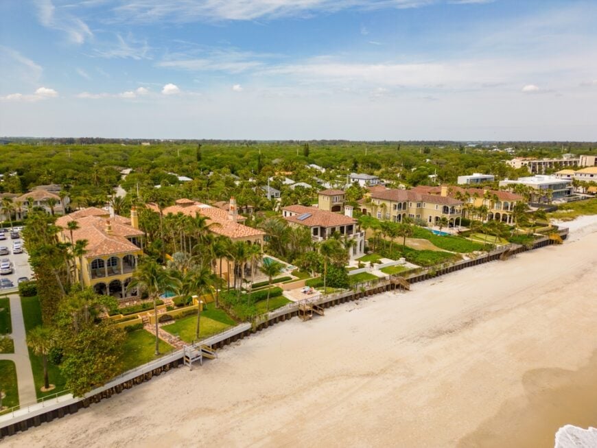
4. Hillsboro Beach
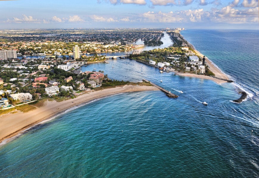
Hillsboro Beach hosts about 2,000 year-round residents along a mere three-mile ribbon known locally as “Millionaire’s Mile.” Walkers enjoy an uninterrupted beach path beside dune-hidden estates, or tour the 1907-era Hillsboro Inlet Lighthouse, still using one of the few Fresnel lenses in active duty.
Aside from a post office and a pair of boutique condos, commercial activity is nonexistent; most livelihoods stem from marine services or remote work. A single coastal road with no sidewalks keeps pedestrian traffic minimal and discourages sightseers.
The ocean to the east and the Intracoastal Waterway to the west act as natural buffers, while private security details ensure serenity. These factors make Hillsboro Beach feel like an exclusive hideaway despite its proximity to Pompano and Boca Raton.
Where is Hillsboro Beach?
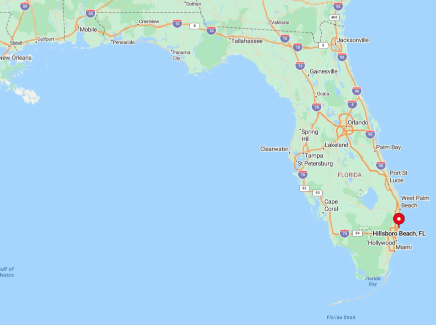
Located in northern Broward County, the town begins at the Hillsboro Inlet drawbridge and ends at the Deerfield Beach line. State Road A1A narrows to two lanes with no outlet, forcing drivers to turn around at the town’s end, which naturally limits pass-through traffic.
The closest public access is across the inlet, so beach crowds seldom spill over. Visitors arriving by boat can dock at the inlet marina, but shifting sandbars require local knowledge, reinforcing the secluded vibe.
3. Ocean Ridge
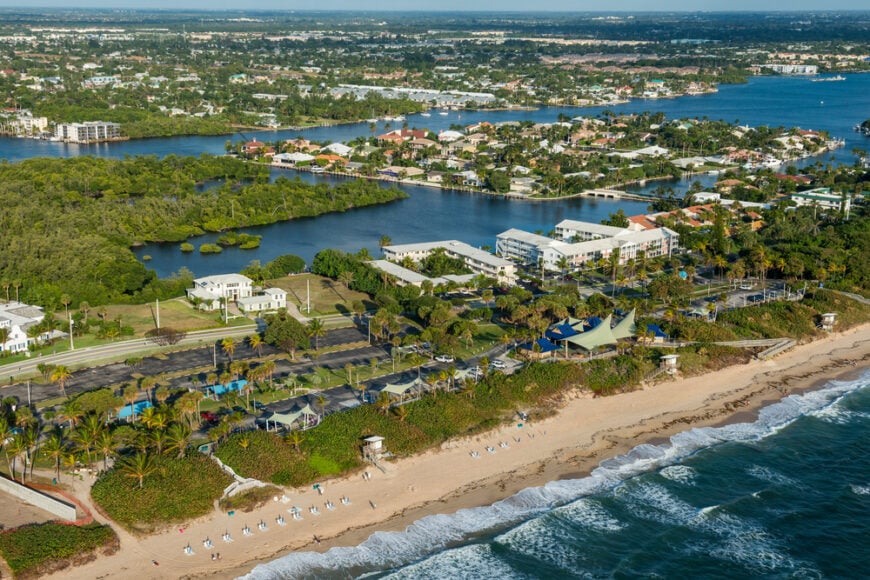
Ocean Ridge’s 1,800 residents live between the Atlantic and mangrove-lined lagoons that shield the town from the bustle of Boynton Beach.
They spend mornings walking to Town Hall Beach, afternoons snorkeling at the limestone reef just fifty yards offshore, and evenings attending turtle talks hosted by the Ocean Ridge Natural Area.
With only a handful of small inns and no high-rise condos, the local economy relies on home services and marine trades rather than tourism.
Strict zoning curtails commercial development, and dense mangrove buffers muffle the rumble of nearby U.S.-1. Streetlights use amber bulbs to protect sea turtles, giving nights a cozy glow instead of an urban glare. All told, Ocean Ridge maintains an under-the-radar charm rare in Palm Beach County.
Where is Ocean Ridge?
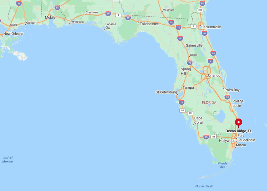
The town occupies a narrow barrier strip just south of Manalapan and east of Boynton Beach, connected to the mainland by the Ocean Avenue Bridge. Because A1A dead-ends at both town limits, only residents and dedicated beachgoers drive through.
Public parking is limited to a small lot by the police station, further deterring crowds. Many visitors prefer to paddle across the Intracoastal from Boynton’s marina, landing kayaks on hidden pocket beaches no car can reach.
2. Manalapan
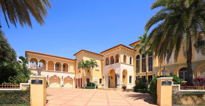
Manalapan counts roughly 480 people living on one-acre lots shielded by lush landscaping between the Atlantic and the Lake Worth Lagoon.
Residents often spend afternoons snorkeling at the natural reef off South Ocean Boulevard or lunching at the historic Plaza del Mar plaza—one of the few commercial corners in town.
Employment centers on property management, hospitality at the oceanfront Eau Palm Beach Resort, and marine construction firms servicing private docks. A network of private security patrols and limited street lighting keep activity hushed after twilight.
Double water frontage on most properties, along with deed restrictions limiting subdividing, preserves spaciousness. All these factors ensure a tranquil atmosphere only minutes from the grandeur of Palm Beach.
Where is Manalapan?
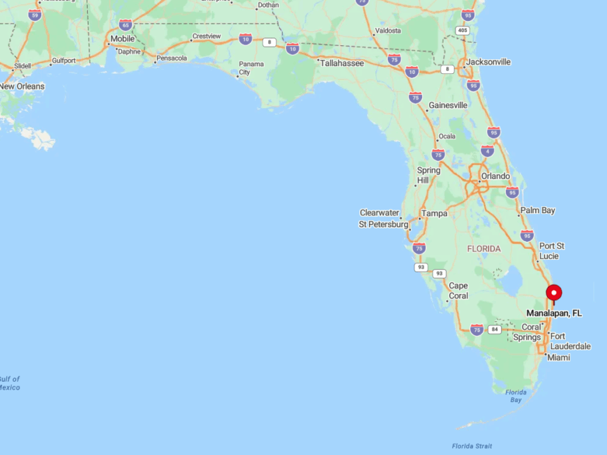
Sitting just south of the Town of Palm Beach in eastern Palm Beach County, Manalapan spans both sides of A1A with several home lots accessible only by boat. The single entry road from Ocean Avenue funnels traffic past a guardhouse, effectively screening casual drivers.
Visitors generally arrive via car from I-95 through Lantana, or tie their vessels at the Eau Resort’s marina slips. The surrounding Lake Worth Lagoon’s shallow flats act as a natural moat, reinforcing the town’s sense of privacy.
1. Jupiter Island
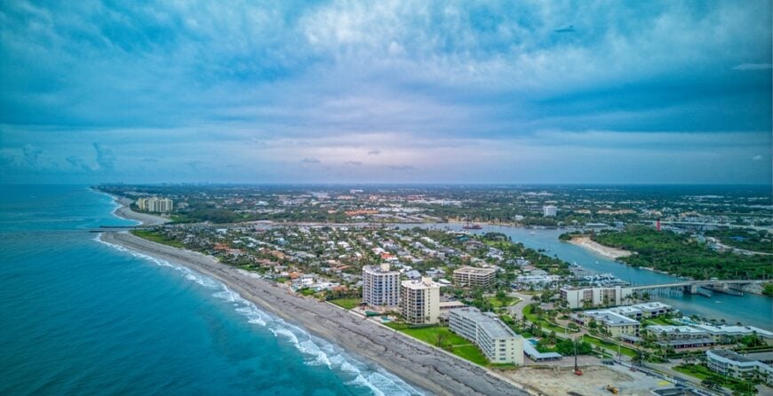
About 820 full-time residents inhabit Jupiter Island, a slender barrier island 17 miles long where palatial homes hide behind sea-grape tunnels, gumbo-limbo trees, and mangrove walls.
Locals fill mornings surfing Hobe Sound Beach, playing the storied Medalist Golf Club, or strolling the protected dunes of Blowing Rocks Preserve with its rare coquina outcrops.
Employment centers on estate management, conservation work, and small-scale charter fishing; there are no strip malls or hotels to clutter the horizon. Town ordinances enforce two-acre minimum lots and a 35-foot height cap, keeping development sparse and skyline invisible from the beach.
Because private driveways are intentionally unmarked and thick foliage screens architecture, casual passersby see little more than green walls and glimpses of turquoise water.
This careful balance of large parcels, stringent zoning, and natural buffers cements Jupiter Island’s reputation as one of Florida’s most secluded enclaves.
Where is Jupiter Island?
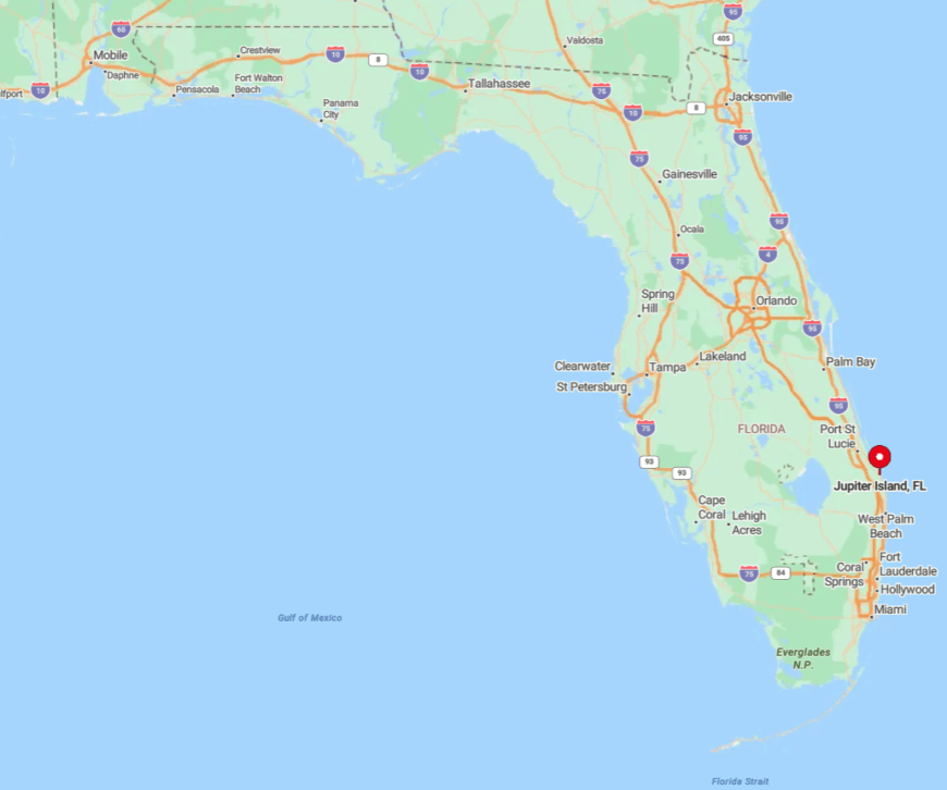
The island straddles Martin County’s eastern edge, 30 minutes north of West Palm Beach and separated from the mainland by the Indian River Lagoon. Access comes via the narrow Jupiter Island Bridge in the south or the scenic Gomez Bridge near Hobe Sound, both of which lack through-traffic signals.
No public beach parking exists within town limits; most tourists must use Hobe Sound Public Beach at the county park. Those arriving by boat often navigate the shallow Jupiter Narrows, where manatees graze the seagrass beds, underscoring the natural barriers that help keep the island so private.