🔥 Would you like to save this?
Eastern Massachusetts may sit within a few hours of Boston and Providence, yet pockets of genuine quiet still line the shore. These coastal backroads pass salt-marsh mazes, dune systems that swallow any hint of traffic, and island villages reached only by boat.
Photographers, birders, and anyone who enjoys an empty stretch of sand will find ten small towns where tides hush the outside world. Each community keeps crowds at bay through geography, limited public access, or zoning that prizes open space over development.
In order to come up with the very specific design ideas, we create most designs with the assistance of state-of-the-art AI interior design software.
The result is a chain of seaside hideaways where sailboats and seabirds often outnumber people. Here are 25 of the most secluded spots, counted down from the easiest to reach to the ones that feel almost lost to time.
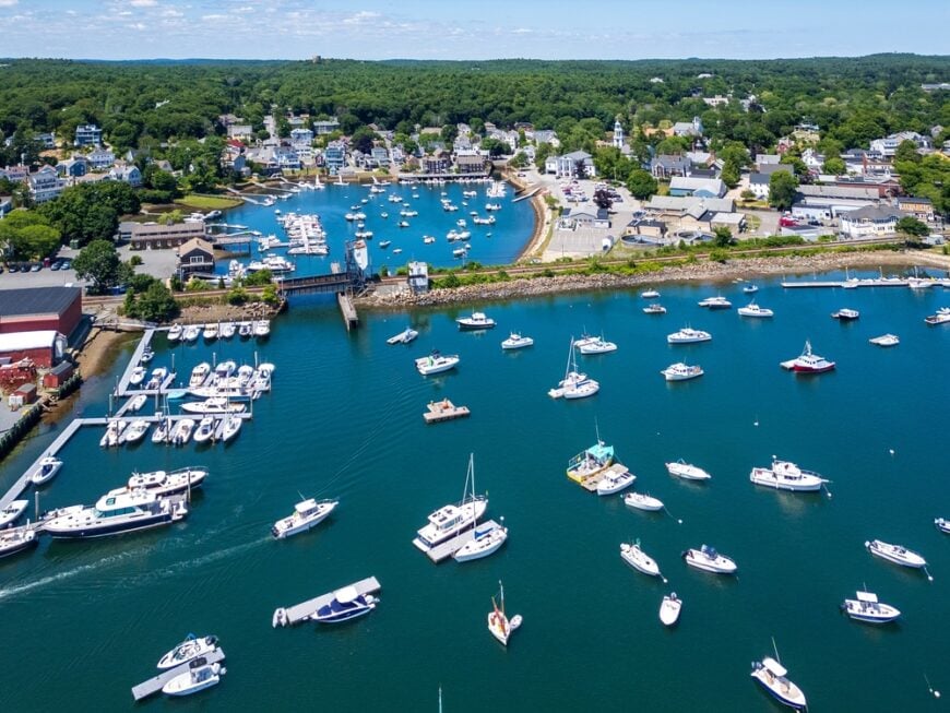
25. Nahant – Tiny Peninsula Wrapped in Atlantic Winds

Nahant feels almost like an island, connected to the mainland only by a slim causeway that vanishes under storm spray. Its seclusion comes from that narrow neck of road: once you cross, you’re in a world of sea cliffs, pocket beaches, and salt-sprayed stone walls.
The town vibe is part maritime, part timeless summer colony—Victorian cottages cling to headlands while waves hammer Black Rock Beach below. Residents make their living from fishing, small businesses, and commutes into Boston, though life here moves more to the tide rhythm than the city schedule.
Visitors can wander Bailey’s Hill Park, comb tide pools, or watch surfers braving Nahant Bay swells. With fewer than 4,000 people spread across the peninsula, you’ll often find yourself listening only to gull cries and surf. It’s the kind of place that feels like the sea has you half-embraced, half-hidden.
Where is Nahant?
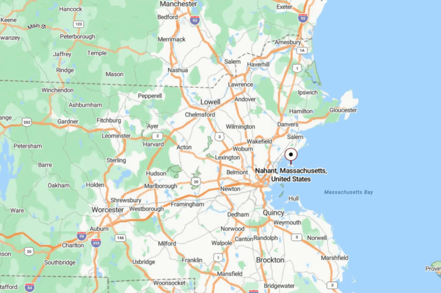
Nahant juts into the Atlantic just north of Boston, a peninsula south of Lynn, and only 14 miles from downtown. To reach it, drivers take Lynnway and then cross the two-mile Nahant Causeway, often lined with waves on both sides.
With no through-roads, every car here has come on purpose. Once across, the ocean makes sure you know you’ve left the mainland world behind.
24. Ipswich – Salt Marsh Kingdom of Clams and Quiet Shores

Ipswich stretches wide with marshes, dunes, and forests that swallow sound long before it reaches the village green. Its seclusion comes not from distance but from geography: Crane Beach’s miles of sand, tidal estuaries, and strict conservation zoning keep development from spilling across the horizon.
The vibe blends colonial history with rustic coastal living, where clapboard houses and farmers’ markets mingle with oyster shacks. Shellfishing, small agriculture, and tourism form the backbone of the economy.
Visitors can hike Castle Neck dunes, tour the grand Crane Estate, or paddle through Plum Island Sound. In the evening, fog slides over clam flats and muffles every note of the world. It’s a place that makes quiet feel like wealth.
Where is Ipswich?
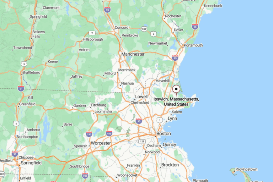
Ipswich lies 30 miles northeast of Boston on the North Shore, between Rowley and Gloucester. Route 133 and Route 1A both lead into town, but both slow quickly into winding lanes bordered by marsh grass.
The commuter rail stops here, though most tourists bypass it on their way to Cape Ann. That oversight leaves Ipswich quietly to itself.
23. Rockport – Granite Headlands and Painter’s Light
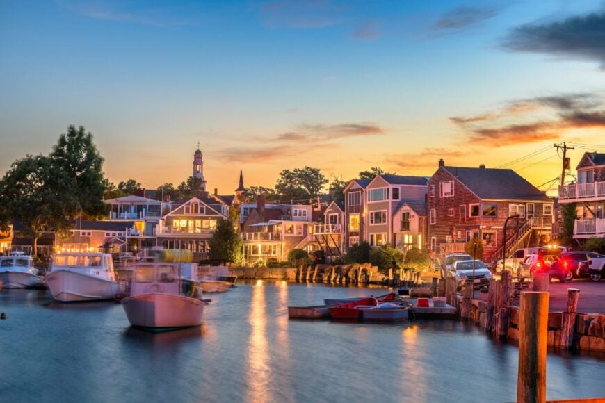
Rockport sits at the tip of Cape Ann, but feels like a world folded in on itself. The Atlantic hems it in on three sides, and the last approach winds through Gloucester, filtering out all but the deliberate.
The vibe is artsy and maritime: Motif No. 1 on the harbor draws painters from across the globe, while narrow Bearskin Neck feels more like an artist’s colony than a town center. Fishing, galleries, and small inns keep the local economy afloat.
Spend a day exploring Halibut Point State Park’s quarry ledges, watching storms roll in over Thatcher Island’s twin lighthouses, or wandering back lanes of weathered cottages. Sea air salts every shutter, every doorstep. It’s the sort of town where the light itself seems protective.
Where is Rockport?
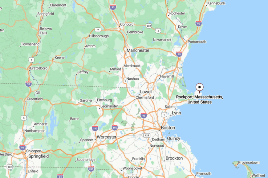
Rockport crowns Cape Ann, about 40 miles northeast of Boston. You reach it by following Route 128 all the way to its quiet end, then winding through Gloucester’s narrow backroads.
The peninsula dead-ends at the sea, with no shortcuts elsewhere. The journey ensures Rockport feels like a last stop rather than a waypoint.
22. Duxbury – Pilgrim Pines and Hidden Bay
Duxbury’s seclusion comes from geography: a barrier beach, sprawling pine forests, and a maze of tidal flats that make the coastline feel endless and unpeopled. Though it holds 16,000 residents, its wide spacing and conserved land preserve the hush.
The vibe is historic and maritime—oyster beds, colonial houses, and boats rocking in Bluefish River. Locals farm oysters, teach in schools, or commute to Boston, but the rhythm of tides dictates much of the year.
Visitors stroll Duxbury Beach Reservation, tour the Myles Standish homestead, or kayak quiet marsh channels. Dusk finds the bay glowing pink, as if the sky bent low to listen. It’s a place where history lingers like tide marks.
Where is Duxbury?
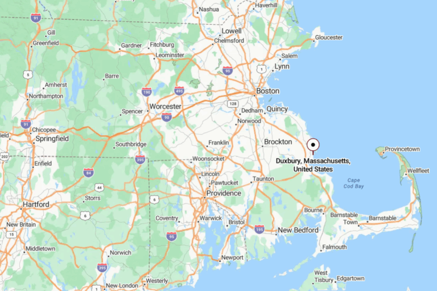
Duxbury rests 35 miles south of Boston, tucked between Marshfield and Plymouth along Cape Cod Bay. Route 3 skirts inland, so travelers must detour through forested backroads and bridges over tidal rivers.
Those meanders slow time before you even see water. The bay itself completes the feeling of separation from the world.
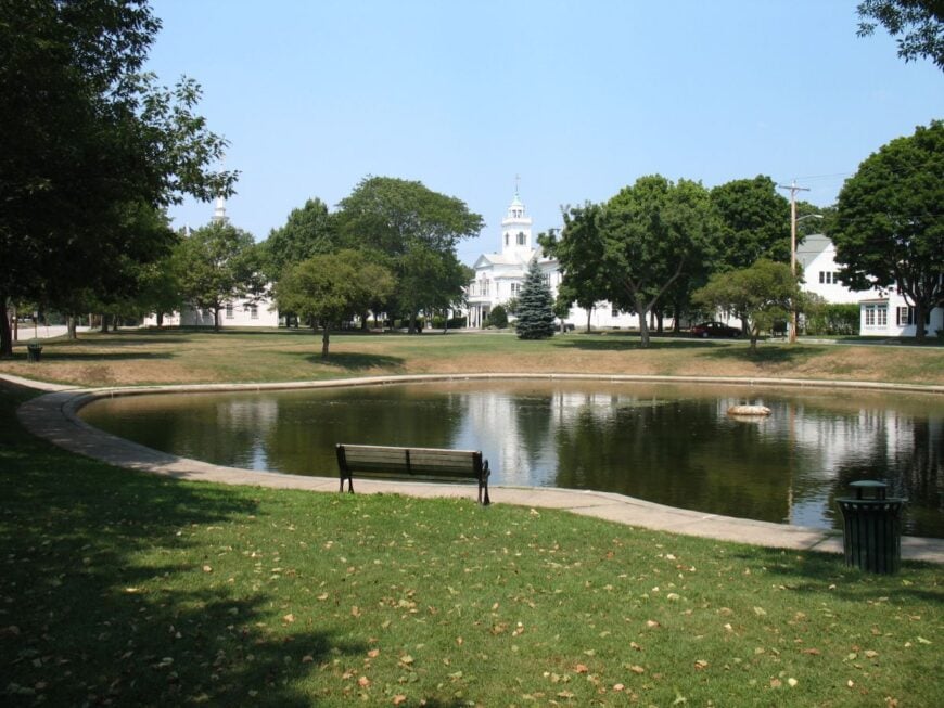
21. Mattapoisett – Saltbox Harbor Hidden from the Highway
Mattapoisett feels tucked away despite being near Route 6, thanks to its winding shoreline and strict zoning that keeps the town small. The seclusion comes from harbors and necks of land that fracture the coastline into quiet corners.
Its vibe is salty and historic, with shingled saltbox houses facing Buzzards Bay and a village green that could have been painted two centuries ago. Boatbuilding and sailing clubs anchor much of the economy, along with commuters heading into New Bedford.
Visitors bike the Mattapoisett Rail Trail, wander Ned’s Point Lighthouse, or sail from the snug town wharf. Even in summer, hidden coves here stay nearly empty. It’s the kind of town where the ocean speaks louder than people.
Where is Mattapoisett?
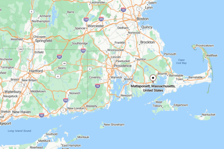
Mattapoisett sits on Buzzards Bay, 10 miles east of New Bedford and an hour south of Boston. Travelers exit I-195 and then follow winding local roads past cranberry bogs.
There are no large signs to guide you, only the smell of salt marsh to announce arrival. The harbor itself feels like a sheltered pocket turned inward.
20. Cohasset – Hidden Coves on the South Shore
Cohasset’s coastline folds itself into rocky coves and small harbors, which keeps much of the Atlantic hush preserved. Seclusion here comes from narrow roads that wind through forested neighborhoods, discouraging any notion of a quick pass-through.
The vibe is refined yet natural—shingled estates blend with clapboard cottages, while tide pools line Sandy Beach and Black Rock Beach. Fishing, commuting, and a small summer tourism trade provide the backbone.
Visitors stroll Cohasset Common, sail into the harbor, or hike Whitney Woods for views of granite ledges and kettle ponds. Evenings bring gull cries and the slow toll of harbor bells. It’s a town that seems to exhale calm.
Where is Cohasset?
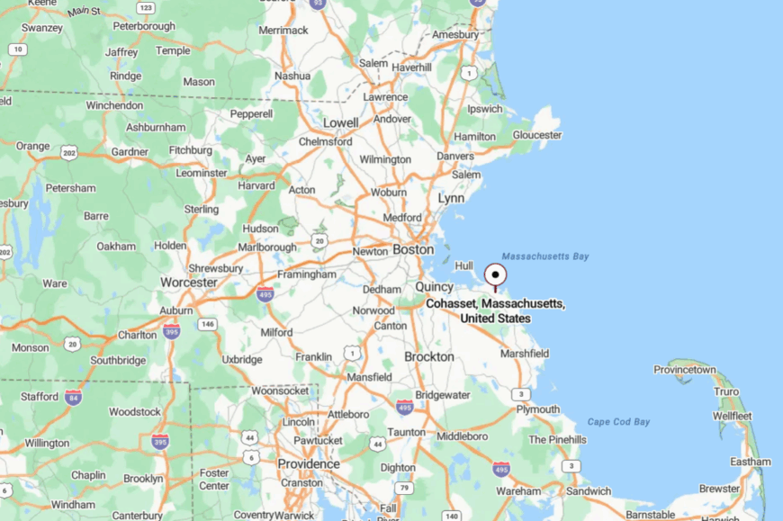
Cohasset is located 20 miles southeast of Boston, between Hingham and Scituate. It sits off Route 3A, but the last few miles narrow into tree-covered lanes.
The harbor bends inward like a shield, guarding the village. Arrival feels like slipping behind a curtain of woods and waves.
19. Scituate – Driftways Between Sea and Salt Marsh
🔥 Would you like to save this?
Scituate spreads along seven distinct villages, each cut off from the other by marshes, tidal rivers, or barrier beaches. Its secluded air comes from those divisions—you never feel the whole town at once, just small hamlets tucked in their own coves.
The vibe is maritime and weathered: fishing boats, lighthouse towers, and clapboard cottages resisting salt wind. Lobstering and small businesses anchor the economy, though summer rentals keep things lively.
Visitors climb Scituate Lighthouse, beachcomb Peggotty or Minot Beach, or watch storms from Driftway Park. Salt air rules every hour. It’s a town that teaches you how vast the Atlantic really feels.
Where is Scituate?
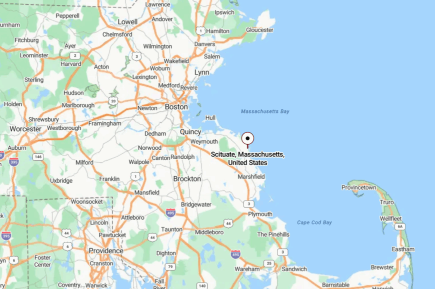
Scituate lies 25 miles southeast of Boston, between Cohasset and Marshfield on the South Shore. Route 3A is the main inland route, with local spurs leading toward the sea.
Each village is tucked down a separate road, so there’s no true through-way. That structure itself preserves Scituate’s sense of hidden corners.
18. Hull – Peninsula Town Ringed by Water
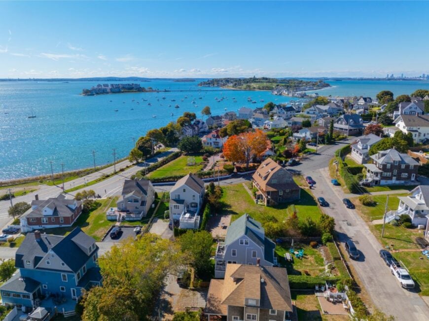
Hull feels like a narrow thread of land pulled between Boston Harbor and the open Atlantic. Its seclusion comes from geography: a thin peninsula with only one main road leading in, leaving it both accessible and apart.
The vibe mixes historic and breezy, from Fort Revere’s Revolutionary War ruins to the old carousel on Nantasket Beach. Fishing, commuting ferries, and summer cottages form the economy’s spine.
Visitors climb Telegraph Hill, walk wind-scoured Nantasket Beach, or ferry to Boston while watching gulls arc overhead. At sunset, the peninsula glows like an anchored ship. It’s a place that holds the sea close on both sides.
Where is Hull?
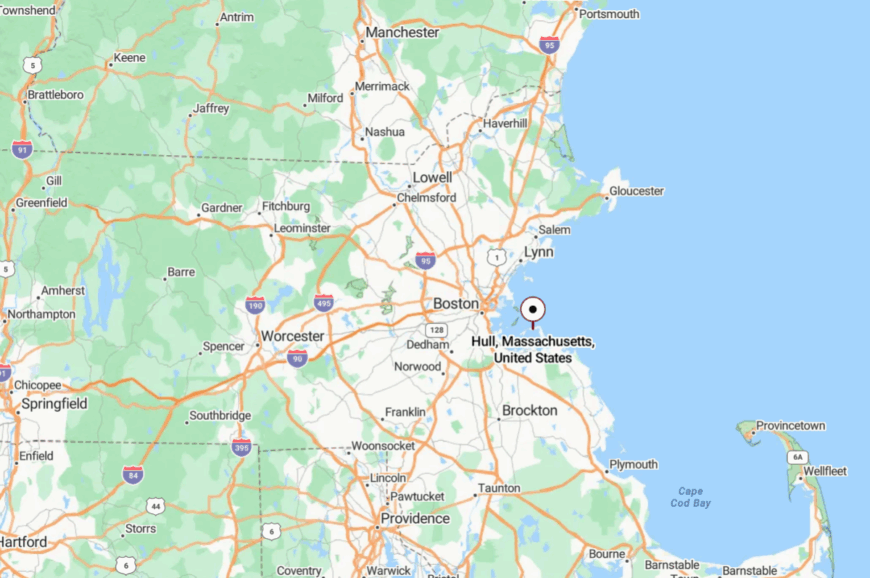
Hull is located 20 miles southeast of Boston, forming the southern arm of Boston Harbor. It is reached by Route 228 or by ferry from downtown Boston.
The approach narrows until only water and sky frame the way. By the time you arrive, you’re already on island time without leaving the mainland.
17. Marshfield – River Bends and Quiet Shores
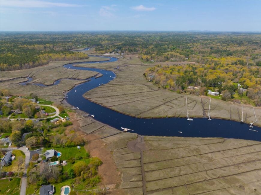
Marshfield feels hidden in plain sight: though Route 3 hums inland, the coastline is all barrier beaches, river estuaries, and hushed neighborhoods. Its seclusion comes from geography—each beach sits behind long winding access roads, never in a straight line.
The vibe is casual and sandy-footed, with clam shacks, salt marsh, and surfboards leaning against porches. Fishing and shellfishing are still lifelines, with Boston commuters filling in the rest. Visitors walk the Rexhame Beach dunes, kayak the North River, or linger at the Winslow House, one of the South Shore’s oldest.
Crickets, surf, and marsh winds set the soundtrack. It’s the kind of place that hides its liveliness behind layers of water and sand.
Where is Marshfield?

Marshfield sits 30 miles southeast of Boston, between Scituate and Duxbury. Access is via Route 139 off Route 3, followed by meandering local roads.
Each neighborhood lies at the end of its own spur, often surrounded by marsh or water. That fragmented geography ensures the town feels like several hideaways instead of one.
16. Bourne – Gateway Hidden in Pine and Canal
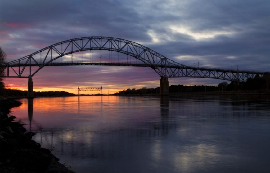
Though it’s the first town you enter on Cape Cod, Bourne remains one of its quietest, bypassed by travelers rushing to Hyannis or Provincetown. Its seclusion comes from being both everywhere and overlooked—hidden in pine woods and canal villages that the highway crosses but never lingers on.
The vibe is nautical and unhurried: marina slips, bike trails, and neighborhoods tucked into kettle hollows. Work centers on canal commerce, tourism, and year-round families who prefer slower rhythms.
Visitors ride the Cape Cod Canal Bikeway, fish from the jetty at Monument Beach, or picnic at Scusset Beach State Reservation. Pines and water swallow highway noise almost instantly. Bourne feels like Cape Cod’s best-kept secret.
Where is Bourne?
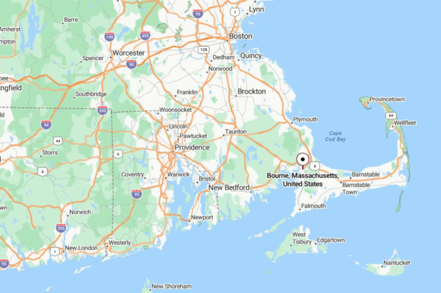
Bourne forms the northwestern gateway to Cape Cod, just across the Cape Cod Canal bridges. Route 6 and Route 28 slice through, but local roads dive quickly into pine and salt marsh.
Each village—Buzzards Bay, Monument Beach, Pocasset—feels like its own pocket. The bridges may carry thousands, but only a few truly stop to notice.
15. Orleans – Quiet Elbow of the Cape
Orleans nestles at Cape Cod’s “elbow,” where the outer arm swings east into the Atlantic. Its secluded nature stems from long beaches, marshes, and the Cape Cod National Seashore buffering most edges.
The vibe is artistic and maritime—galleries and bookstores meet clam shacks and small fishing fleets. Work leans on tourism and shellfishing, yet zoning and conservation keep the town from swelling too loud.
Visitors walk Nauset Beach, kayak Pleasant Bay, or bird-watch at Kent’s Point. In winter, wind rattles shutters and empties roads to near silence. Orleans feels like the hinge where Cape Cod slows down.
Where is Orleans?
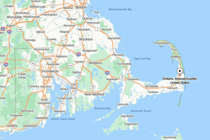
Orleans is located 90 miles southeast of Boston, between Eastham and Brewster on the Cape. Route 6 skirts inland, while Nauset Road carries travelers toward the dunes.
The drive curves around salt marsh and kettle ponds that screen each neighborhood. That geography creates quiet pockets despite summer crowds nearby.
14. Chatham – Atlantic Outpost on the Cape’s Elbow
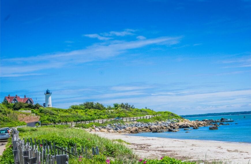
Chatham perches at Cape Cod’s southeastern tip, where tides from the ocean and the sound meet in restless currents. Seclusion comes from geography: the elbow curve isolates it, and shifting sandbars guard its waters like natural moats.
The vibe is historic and nautical—weathered captain’s houses, twin lighthouses, and working fish piers that still auction the day’s catch. Fishing and tourism sustain the town, but its narrow lanes keep life slower than flashier Cape resorts.
Visitors walk Monomoy Wildlife Refuge, climb Chatham Light, or watch seals offshore. Sea breezes never really let go. It’s the kind of place where the ocean feels both neighbor and guardian.
Where is Chatham?
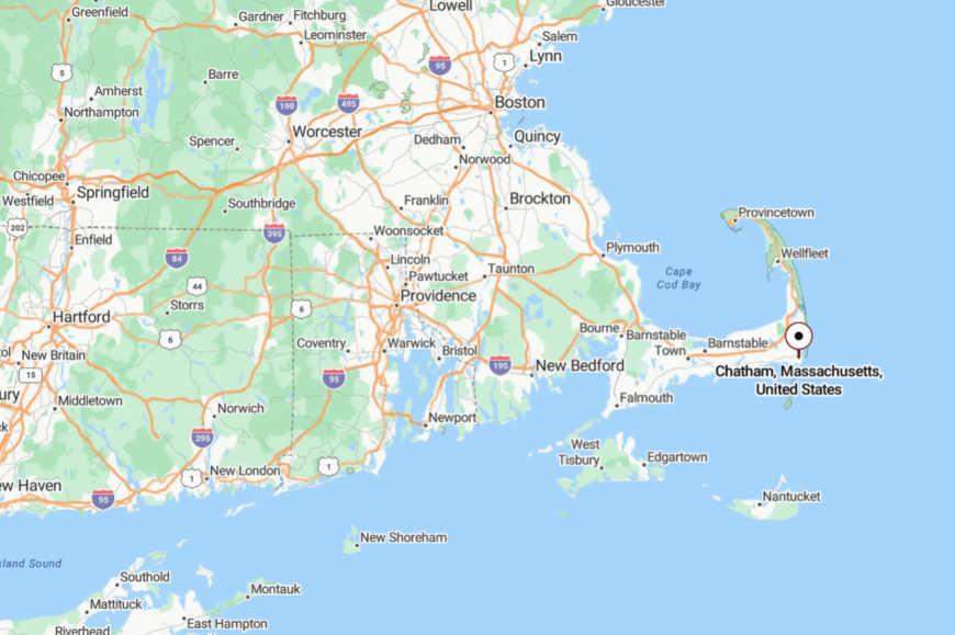
Chatham sits 95 miles southeast of Boston at Cape Cod’s far elbow. Route 28 winds its way here through village after village, making the approach unhurried by design.
Surrounded by ocean, sound, and barrier islands, it has no shortcut anywhere. That isolation explains its preserved quiet, even amid summer bustle.
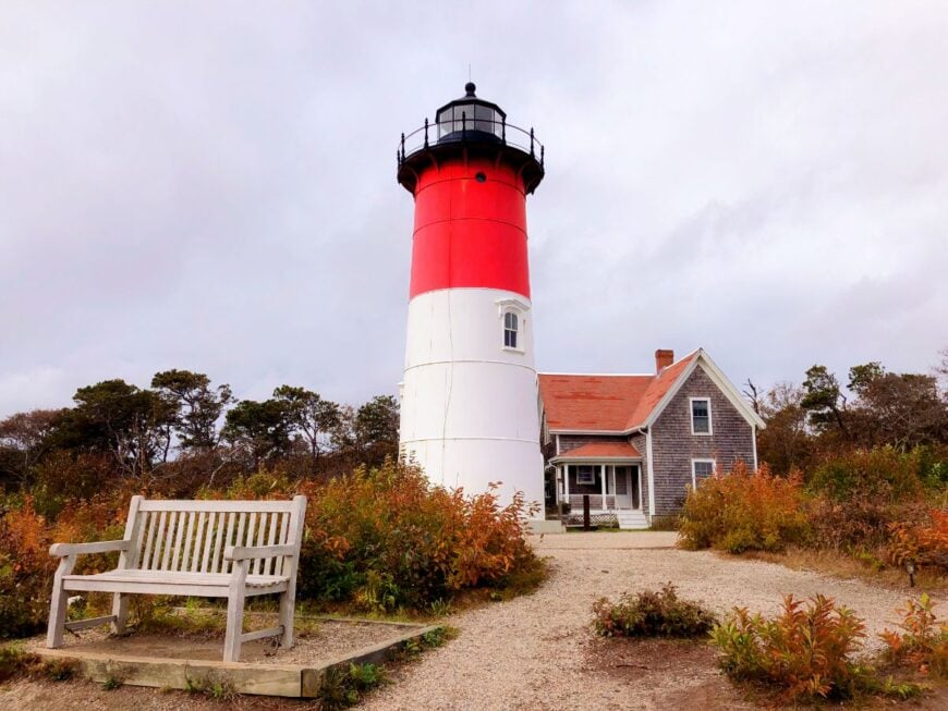
13. Eastham – Seashore Gateway of Quiet Trails
🔥 Would you like to save this?
Eastham holds the official entrance to Cape Cod National Seashore, yet remains quiet thanks to strict conservation and zoning. Its seclusion comes from the park’s vast acreage: kettle ponds, pine barrens, and dunes stretch far between neighborhoods.
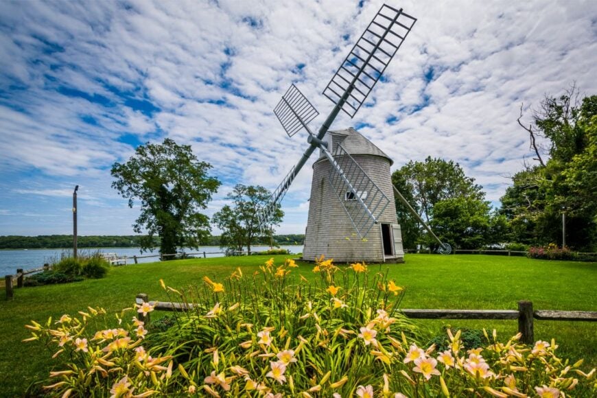
The vibe is rustic and beachy—clam shacks, trailheads, and historic windmills rather than busy plazas. Tourism is the mainstay, but only within limits set by park boundaries.
Visitors climb Nauset Light, cycle the Cape Cod Rail Trail, or paddle Great Pond in near silence. Sunsets over Cape Cod Bay feel like private performances. Eastham makes solitude part of its civic character.
Where is Eastham?
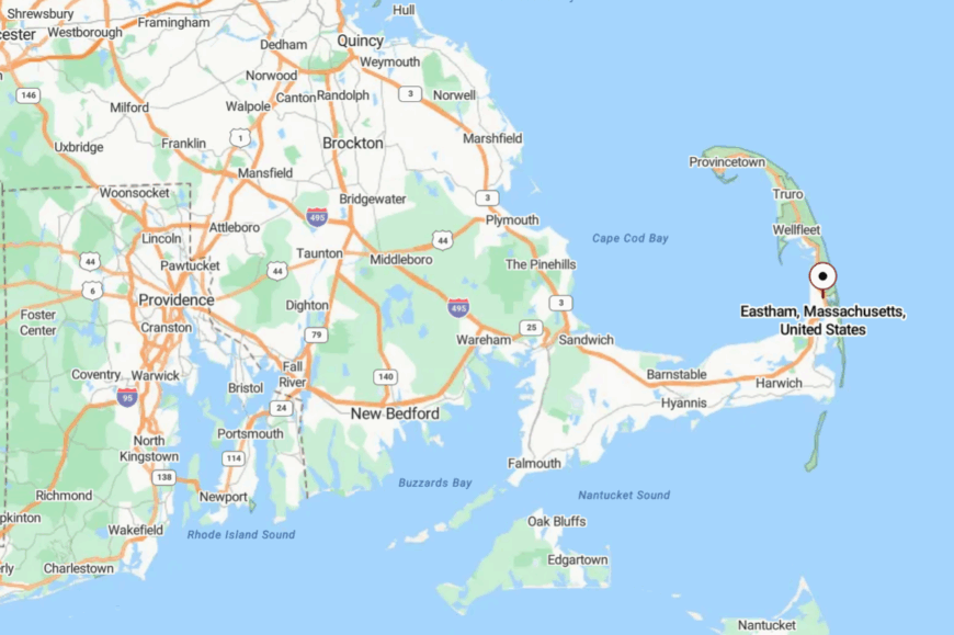
Eastham sits 85 miles southeast of Boston, north of Orleans and south of Wellfleet. Route 6 runs through, but development remains sparse, broken mainly by trailheads and ranger stations.
Most attractions lie at the end of sandy side roads, discouraging casual drive-bys. It’s a place where even main roads feel like backroads.
12. Salisbury – Marshlands and Barrier Beaches on the New Hampshire Line
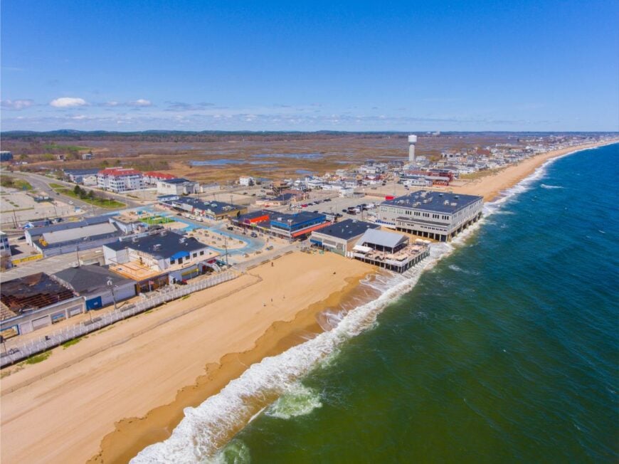
Salisbury is the northernmost town on Massachusetts’ coast, yet it feels more like a salt-marsh sanctuary than a border town. Its seclusion comes from geography: thousands of acres of tidal wetlands, a five-mile barrier beach, and the Merrimack River forming a wide natural moat.
The vibe is breezy and casual, with seasonal cottages tucked into dunes, clam shacks along the roadside, and migratory birds wheeling overhead. Tourism drives the economy in summer, but large stretches of the shoreline remain undeveloped within Salisbury Beach State Reservation.
Visitors can walk boardwalks over spartina flats, fish the Merrimack’s mouth, or watch fireworks from the wide sand. Nights bring the sound of surf echoing across the empty marsh. It’s the kind of place that feels like the last quiet corner before the state line.
Where is Salisbury?
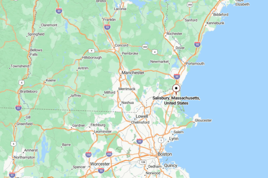
Salisbury sits at the very top of the North Shore, just south of Seabrook, New Hampshire, and about 45 miles north of Boston. Drivers reach it via I-95 or I-495, then follow Route 110 and local roads through farmland and marsh.
The last miles narrow until sea and salt hay frame both horizons. By the time you arrive at the reservation, the outside world has already slipped away.
11. Dennis – Cape Cod’s Mid-Cape Maze of Villages and Beaches
Dennis spreads across the “elbow” of Cape Cod, yet feels like several small towns stitched together by dunes and kettle ponds. Its seclusion comes from geography and design: five historic villages—Dennis Port, West Dennis, East Dennis, South Dennis, and Dennis—each with its own harbor, its own quiet rhythm.
The vibe is classic Cape: shingled inns, clapboard churches, sandy lanes, and harbors that smell of salt and boat varnish. Tourism and shellfishing anchor the economy, but conservation land and narrow roads prevent overgrowth. Visitors stroll Mayflower Beach at low tide, kayak Sesuit Harbor, cycle the Cape Cod Rail Trail, or watch theater at the Cape Playhouse.
Even on a summer evening, long stretches of sand belong only to shorebirds. Dennis has a way of making you believe the Cape was built for solitude.
Where is Dennis?
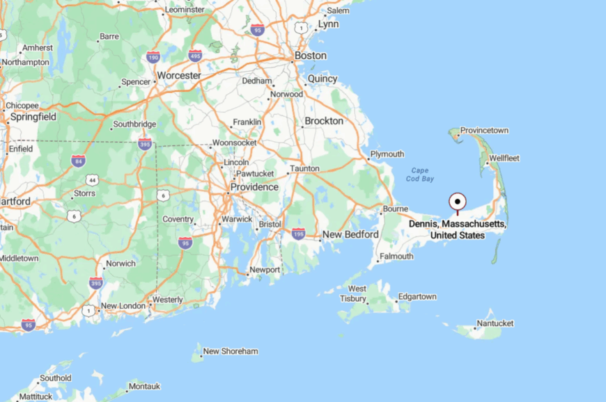
Dennis sits in the heart of Cape Cod, 80 miles southeast of Boston and about 10 miles from the Cape Cod Canal. Route 6 offers the main approach, but most beaches lie beyond winding local lanes that slow traffic to a whisper.
Each village feels like its own destination, separated by ponds, marsh, and pine groves. By the time you reach the shore, the bustle of the highway has already fallen behind.
10. Manchester-by-the-Sea — Granite Headlands Guarding Quiet, Pocket-Size Beaches
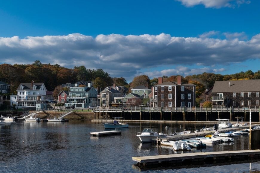
Roughly 5,600 residents call Manchester-by-the-Sea home, yet visitors often miss it while racing along Route 128. Singing Beach, White Beach, and secluded Black Beach sit behind high granite bluffs that muffle road noise and restrict sightlines, giving photographers clean horizons at sunrise.
Lobstering and a small artisan boat-building trade still anchor the harbor economy, while many locals commute to Boston by train. Summer strolls through the town’s pocket parks reveal shingle-style estates tucked behind old stone walls and enormous beeches, evidence of zoning that mandates generous setbacks.
Limited parking near the shoreline keeps day-trip numbers low even on hot weekends, preserving a near-private feel for swimmers and tide-pool hunters. Twilight brings church-bell chimes over calm harbor water, a reminder that this is still a working New England village, not a resort strip.
Where is Manchester-by-the-Sea?
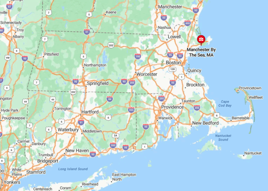
The town sits on the North Shore, ten miles northeast of Salem and forty miles from downtown Boston. Jagged headlands—Beverly Farms to the west, Coolidge Point to the east—shield its coves from through-traffic along coastal Route 127.
Visitors typically arrive by the MBTA Commuter Rail or via Exit 48 on Route 128, then follow two miles of tree-lined road that seems to shrink to single-lane width in places. Those narrow approaches, combined with scattered parking stickers, ensure the seclusion lasts once the ocean comes into view.
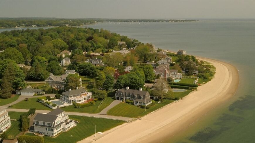
9. Marion — Hidden Harbors and Shingle Cottages on Buzzards Bay
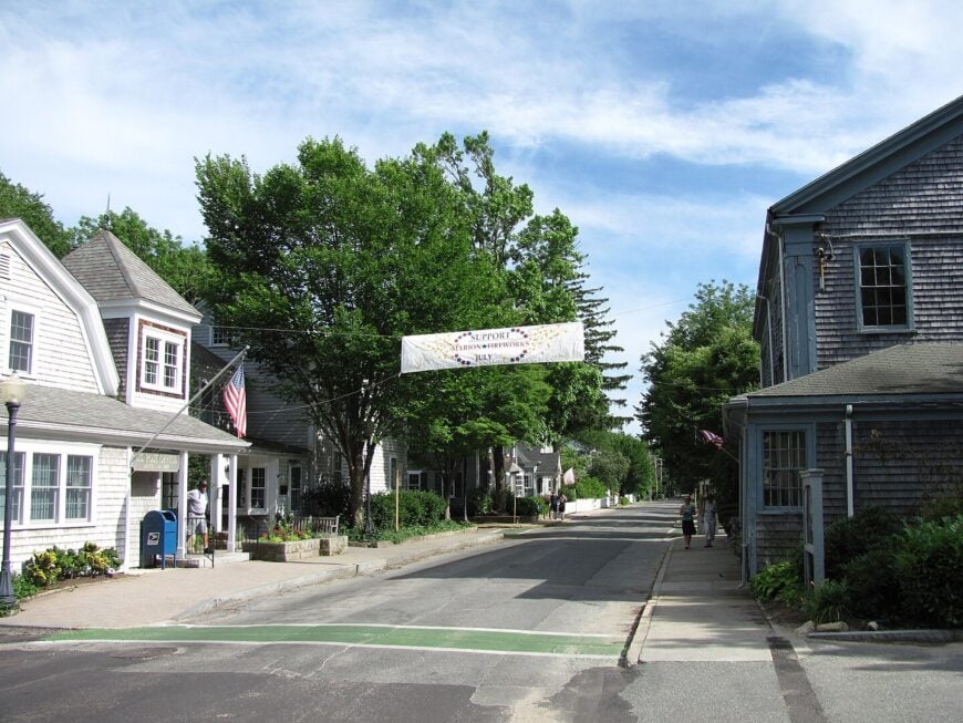
Marion hosts about 5,200 full-time residents, yet its indented shoreline creates a labyrinth of small basins where quiet reigns. Sippican Harbor supports a cluster of wooden boatbuilders and a respected yacht club that feeds local marine trades, while the Tabor Academy campus adds a mild academic buzz.
Kayakers glide into Wings Cove and Planting Island marshes, often spotting ospreys undisturbed by motor traffic. Large-lot zoning—two acres in many neighborhoods—means houses sit back among pines, invisible from public roads.
Conservation lands such as Washburn Park and the Aucoot District add further green buffers, blocking potential development. The combined effect feels like a hidden archipelago despite being minutes from Interstate 195.
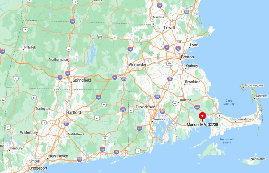
Where is Marion?
🔥 Would you like to save this?
Marion occupies a crook on Buzzards Bay, twenty minutes east of New Bedford and an hour south of Boston. Deep coves and sand spits make the coastline tricky to navigate, deterring casual boaters and keeping beaches almost empty outside regatta weekends.
Travelers exit I-195 at Route 105, then wind through five miles of cranberry bogs before the first water view appears. That sinuous approach and the absence of any state beach facilities explain why Marion remains nearly invisible to most Cape-bound tourists.
8. Rowley — Tidal Rivers and Broad Marshland Hiding a Colonial Seaport
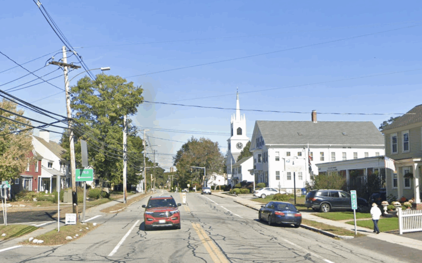
Only 6,200 people reside in Rowley, yet the town spreads across more than twenty square miles of salt marsh and hardwood upland, creating a ratio of open space to residents that feels positively rural.
The Parker River and Mill River weave past 17th-century farmsteads, attracting paddlers who can drift for hours without seeing a house. Antique shops and a handful of shellfish wholesalers along Route 1 hint at past shipbuilding glory, though today agriculture and small-scale aquaculture dominate.
Birders flock to Rough Meadows Wildlife Sanctuary, where fall migrations bring merlins and marsh hawks skimming across golden spartina.
Zoning caps building heights at two and a half stories, so church steeples remain the tallest structures for miles. Evening fog rolls off the marsh and muffles every sound but peeper frogs, contributing to Rowley’s gentle isolation.
Where is Rowley?
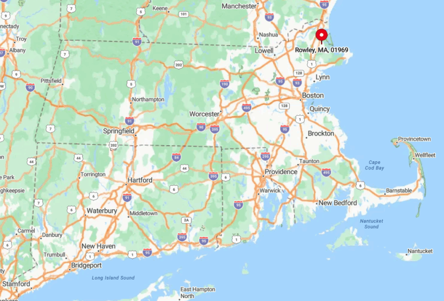
Positioned between Newburyport and Ipswich on the North Shore, Rowley lies about 35 miles north of Boston. Miles of tidal flats block any direct coastal road, forcing visitors inland along Route 1A or the commuter-rail stop hidden behind the village green.
Because there’s no public beach and only a handful of kayak launches, most drivers bypass the area entirely. Those willing to wander the back lanes are rewarded with empty river bends and colonial stone walls lost beneath moss.
7. Westport — Back-Road Farms Meeting the Surf at Horseneck Point
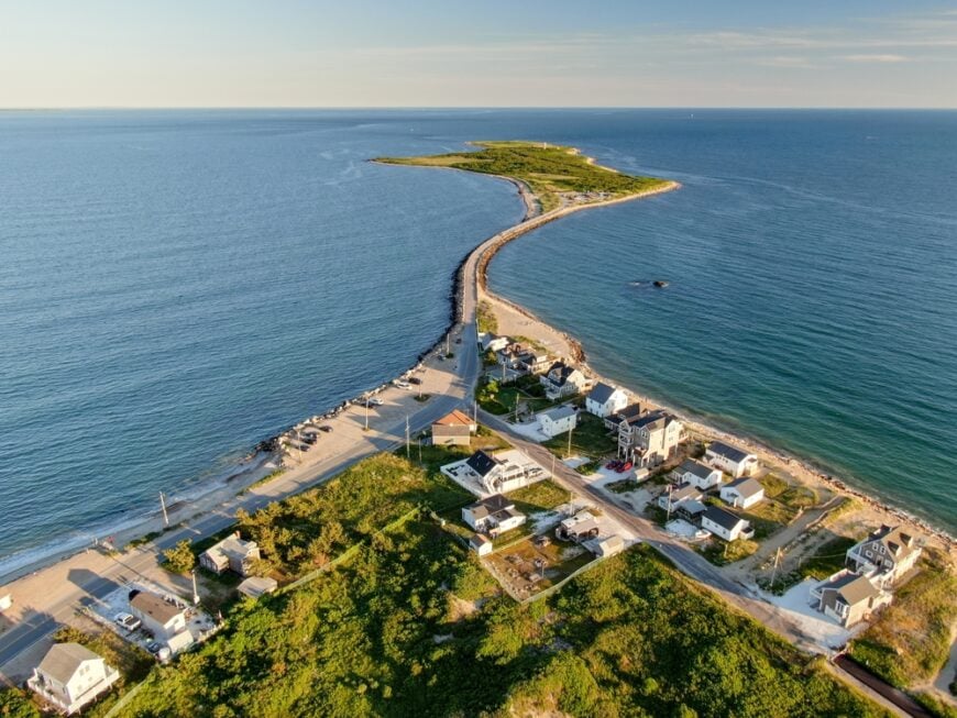
With 16,000 residents dispersed over 64 square miles, Westport feels more like countryside than coast until salt air suddenly drifts over fieldstone walls. Cattle graze at historic farms such as Gray’s Dairy, while shellfishermen harvest wild quahogs in the Westport River estuary, anchoring a small but steady seafood sector.
Cyclists ride Drift Road’s shaded ribbon past tidal inlets, then detour onto Horseneck Point for wind-scoured beaches where plovers nest undisturbed. Many homes sit on multi-acre lots protected by the Westport Land Conservation Trust, preserving sightlines of hayfields running straight to the dunes.
Public parking is limited to a state reservation two miles from any store, so food trucks substitute for crammed boardwalks. Sunset glows over Spindle Rock lighthouse, and only the hiss of surf competes with crickets.
Where is Westport?
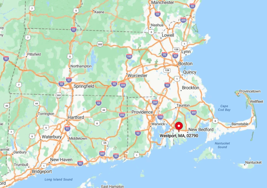
Westport forms the southwest corner of Massachusetts, bordering Rhode Island and fronting Buzzards Bay. The junction of Routes 88 and 177 provides the lone fast connection; every other road meanders through farm country, naturally throttling visitor numbers.
Once past the Dartmouth line, travelers cross a two-mile marsh causeway before the dunes rise, a stretch prone to wind closures that further limits impulse beach trips. Those quirks keep Horseneck and neighboring East Beach among the least crowded ocean strands in southern New England.
6. Essex — Salt-Marsh Labyrinths Guarding a Sleepy Shipbuilding Village
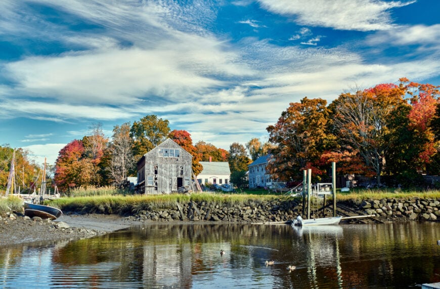
Essex supports just under 3,800 residents clustered along the Essex River, a waterway once world-famous for schooner construction and now dotted with clam skiffs.
Today antique shops and family-run fried-clam shacks form the retail backbone, complemented by a handful of artisanal boatyards still crafting wooden skiffs. Paddlers can lose whole mornings threading the 25,000-acre Great Marsh, often surprising whitetail deer standing belly-deep in spartina.
The surrounding hills, Turkey Hill and Apple Street Ridge, screen Route 133 traffic noises, making downtown feel miles from any highway.
Chain stores never arrived, and strict signage bylaws keep even gas-station lights low, so night skies remain dark enough for star photography. The town’s low-rise profile and wetlands buffer ensure expansion will remain minimal.
Where is Essex?
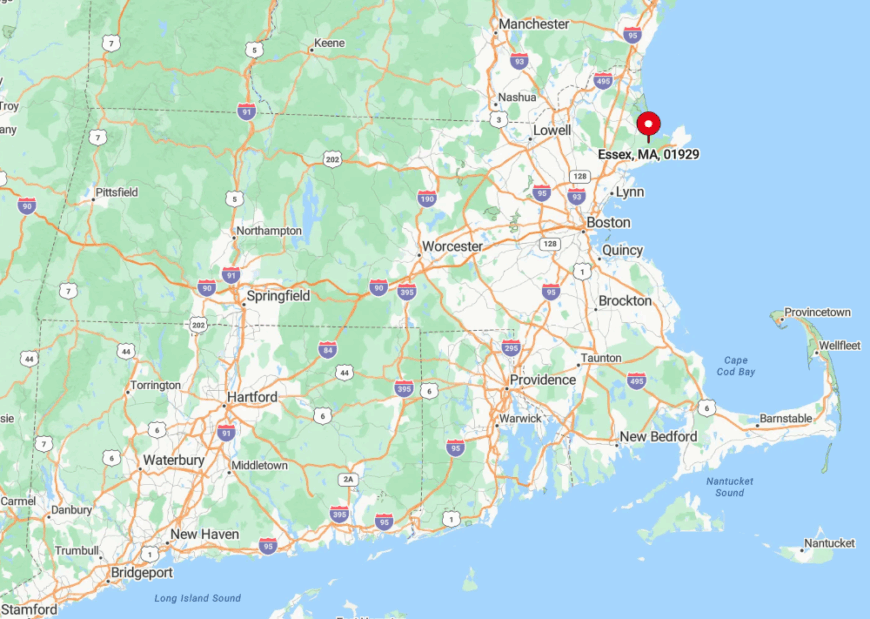
Nestled between Gloucester and Ipswich on Cape Ann, Essex lies 30 miles northeast of Boston yet feels tucked away behind winding estuaries. Only one main road—Route 133—crosses the marsh, and frequent tidal flooding discourages heavy trucking.
Visitors often arrive by kayak from satellite launches in Hamilton or by seasonal harbor shuttle, both adding an extra step that filters crowds. The result is a village center where foot traffic rarely overtakes the scent of salt hay.
5. Wellfleet — Oyster Flats and Pine Forests in Undeveloped Seashore Country
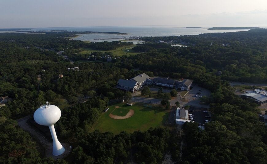
Wellfleet claims roughly 2,900 year-round residents, half of them linked directly or indirectly to the storied oyster beds of Blackfish Creek. Galleries, a small theatre, and the weekend flea market add a dash of culture, while the rest of commerce revolves around shellfish, surfcasting, and bicycle rentals.
Cape Cod National Seashore protects nearly 50 percent of town acreage, meaning kettle ponds and pitch-pine forests stretch unbroken from ocean to bay.
The limited buildable land concentrates homes on generous parcels, many buffered by cranberries or maritime forest, producing a quiet unknown to neighboring Provincetown.
Seashore beaches require steep dune descents on sandy footpaths, a workout that thins out even midsummer crowds. Dawn photographers often find themselves alone on Marconi Beach, hearing only distant shorebirds and the soft whistle of bay flats draining.
Where is Wellfleet?
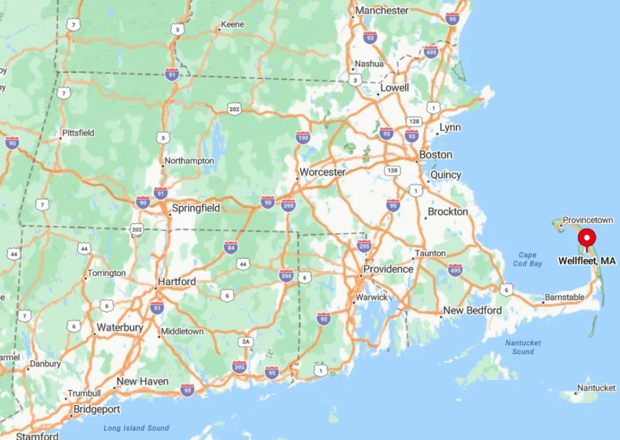
Located at the narrowest pinch of Cape Cod, Wellfleet sits thirty minutes south of Provincetown and forty minutes north of the Cape Cod Canal bridges. Route 6 speeds traffic past pine barrens, but every beach turnoff quickly degenerates into dirt roads and sand ruts, limiting casual drive-bys.
The nearest airport is a grass strip for single-engine planes; the closest ferry docks in Provincetown. That geographic pinch, plus federal conservation, locks Wellfleet in a timeless bubble between ocean swells and bay tides.
4. Truro — Endless Outer-Cape Dunes Between Ocean and Bay
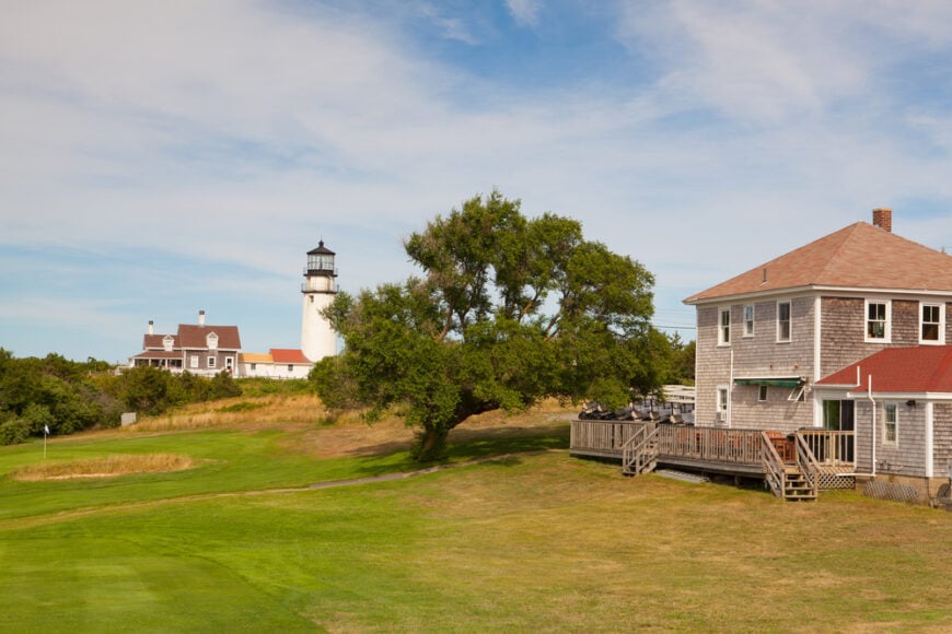
Truro’s 2,000 residents inhabit scattered cottage clusters separated by dunes that can rise 100 feet, buffering neighborhoods from one another as well as from Route 6.
Art studios, a single vineyard, and commercial fishing out of Pamet Harbor anchor a minimalist local economy, while the famed Highland Links golf course offers dramatic cliff-top views. Trails through the National Seashore lead to hidden coves like Ballston and Longnook, where steep sand ladders deter casual beachgoers.
Building regulations cap house size and forbid bright exterior lighting, preserving pitch-black skies that draw astrophotographers each summer.
The absence of a real town center pushes evening activity toward bonfires and stargazing rather than nightlife. In winter, wind whistling over parabolic dunes can sound like distant surf even miles inland, reinforcing Truro’s sense of vastness and solitude.
Where is Truro?
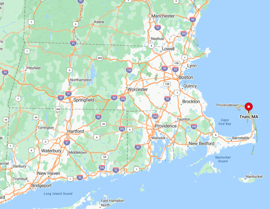
Perched near the tip of Cape Cod, Truro lies ten miles south of Provincetown and thirty miles from the mainland. Ocean and bay pinch to barely a mile wide here, yet no bridge crosses this waist-high dune belt, and the single-lane Old County Road floods during extreme tides, forcing detours.
Bus service from Hyannis runs infrequently, and the closest grocery store sits over the town line. These mild inconveniences keep Truro blissfully quiet even in peak August.
3. Chilmark — Sheep Meadows Rolling Down to Secret Vineyard Coves
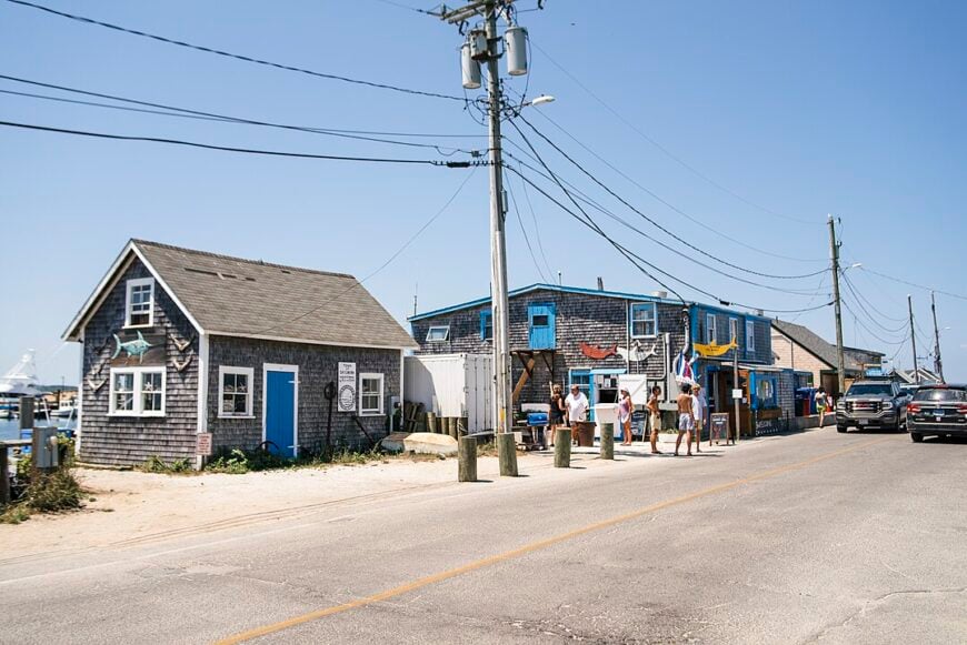
About 1,400 year-round residents share Chilmark’s 20,000 acres, but most live inland, leaving the shore to sheep pastures and windswept heaths. Fishing charters work out of Menemsha Harbor, while hillside farms supply the famed Wednesday farmers’ market, giving agriculture and small-scale fishing equal weight.
Stone walls slice the landscape into storybook parcels, and many beaches, such as Lucy Vincent and Squibnocket, are restricted to residents, preserving postcard-worthy scenery for painters and photographers.
Building setbacks and a two-acre minimum lot size scatter homes wide apart, so headlights feel rare on moonlit nights. Hidden coves like Great Rock Bight demand half-mile woodland hikes, adding another layer of privacy. The town library even loans out fishing rods, a quiet reminder of Chilmark’s slow, local rhythm.
Where is Chilmark?
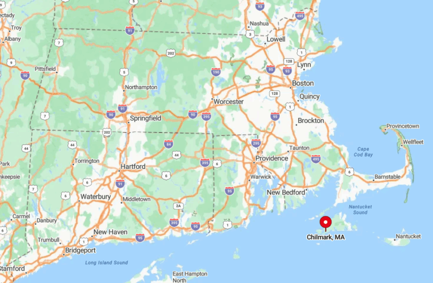
Chilmark occupies the hilly spine of Martha’s Vineyard’s western half, sandwiched between West Tisbury and Aquinnah. Public buses run, but the winding North and South Roads lengthen any trip, making rental cars or bicycles the preferred choice.
Ferries land at Vineyard Haven, a thirty-minute drive away, adding an ocean crossing that screens out casual Massachusetts mainland visitors. All told, a traveler makes two deliberate decisions—boat then back road—before reaching these hidden pastures.
2. Aquinnah — Clifftop Solitude on Martha’s Vineyard’s Westernmost Edge
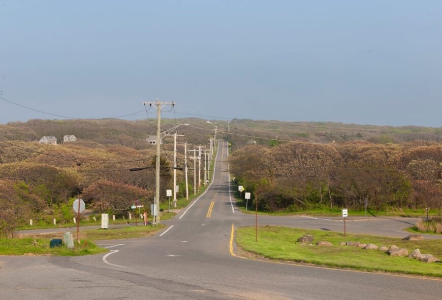
Aquinnah supports just 439 permanent residents, many belonging to the Wampanoag Tribe whose cultural center anchors town life. Visitors hike the clay Gay Head cliffs for sweeping sunset views, then descend wooden staircases to often-empty Moshup Beach where striped bass cruise the surf.
Small art shops and seasonal seafood shacks comprise most commerce, while tribal shellfishing permits sustain a modest marine economy. Zoning favors one-acre lots and limits new construction heights, so heathland and low blueberry barrens dominate, broken only by the red-and-white Gay Head Light.
The absence of nightlife and the long drive from ferry docks let ocean wind and bell buoys provide the evening soundtrack. Even in August, one can find stretches of sand where only gull tracks disturb the clay-stained foam.
Where is Aquinnah?
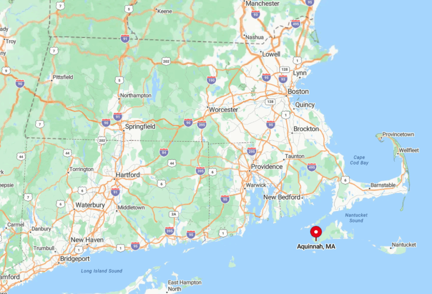
Aquinnah crowns the far western tip of Martha’s Vineyard, ten miles beyond the island’s main commercial centers. Only two roads—State Road and Moshup Trail—reach the cliffs, both winding, shoulder-less, and bordered by scrub oak that obscures distant traffic.
The nearest public transit terminus sits three miles away in Menemsha, requiring either a bike ride or seasonal shuttle connection. That last-mile barrier, plus the ferry crossing, seals Aquinnah’s sense of remote edge-of-the-world calm.
1. Gosnold — A Tiny Island Chain Where Sailboats Outnumber Year-Round Residents
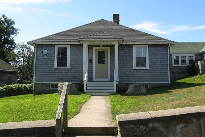
With an official population hovering near 75, Gosnold is the least-populated municipality in Massachusetts, spread across the windswept Elizabeth Islands west of Woods Hole.
Photographers treasure the rocky coves of Cuttyhunk and the grassy bluffs of Naushon, both offering unspoiled Atlantic panoramas unmarred by power lines or traffic noise.
Lobstering, striped-bass guiding, and a modest oyster operation form the backbone of a maritime micro-economy; summer cottages remain the only other business.
Cuttyhunk’s one-room schoolhouse doubles as a community center hosting potlucks. No cars are for rent, and most roads are dirt, so walking and golf carts dictate the island tempo. Night skies rival offshore decks thanks to the total absence of streetlights, making Gosnold a dream locale for astrophotography.
Where is Gosnold?
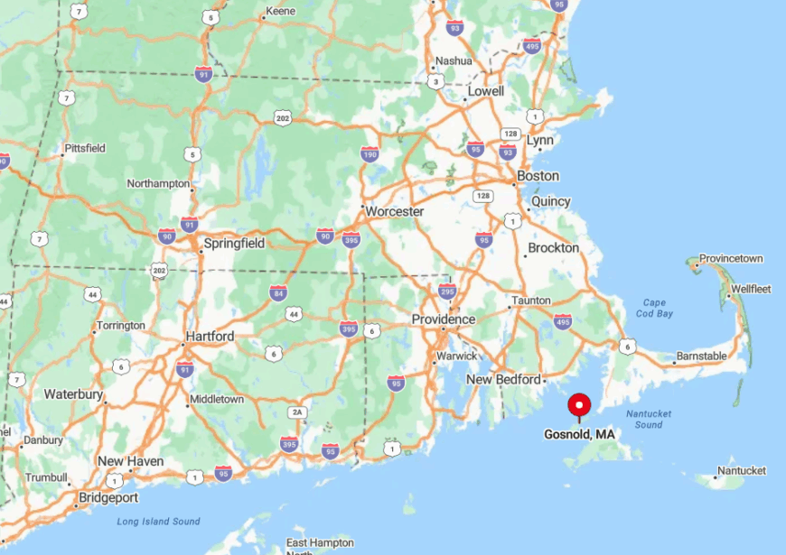
The Elizabeth Islands stretch southwest from Woods Hole toward Rhode Island, forming a natural barrier between Buzzards Bay and Vineyard Sound. There is no bridge or scheduled air service; access comes via the Cuttyhunk Ferry Company’s passenger boat or private yacht.
Once aboard, travelers land at Cuttyhunk Wharf after a 50-minute crossing, then rely on their feet or skiffs to reach neighboring islets. Ocean moats on all sides, combined with limited sailings, grant Gosnold the rare privilege of near-total privacy within sight of mainland lights.


