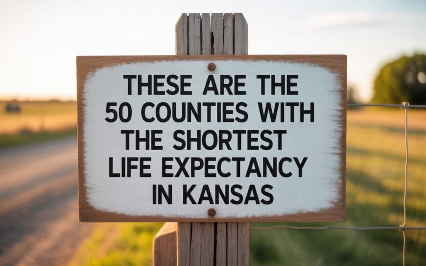
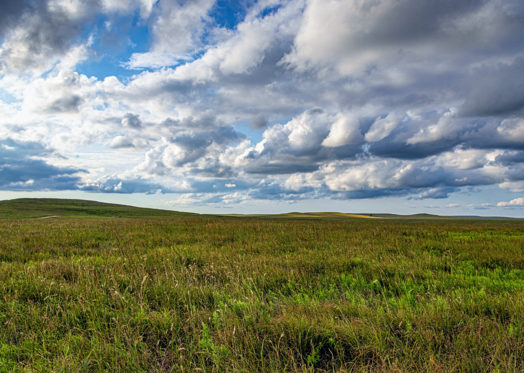
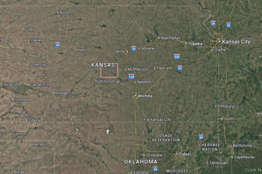
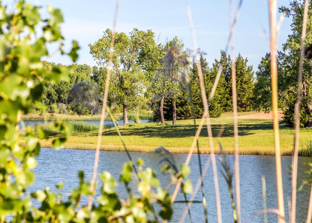
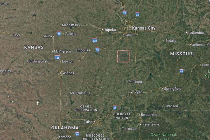
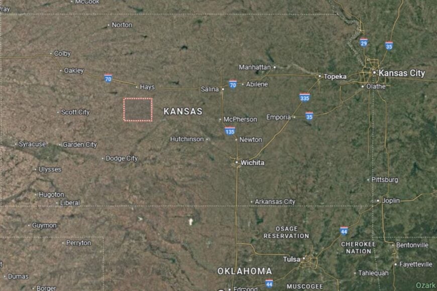
Counties with the shortest life expectancy in Kansas
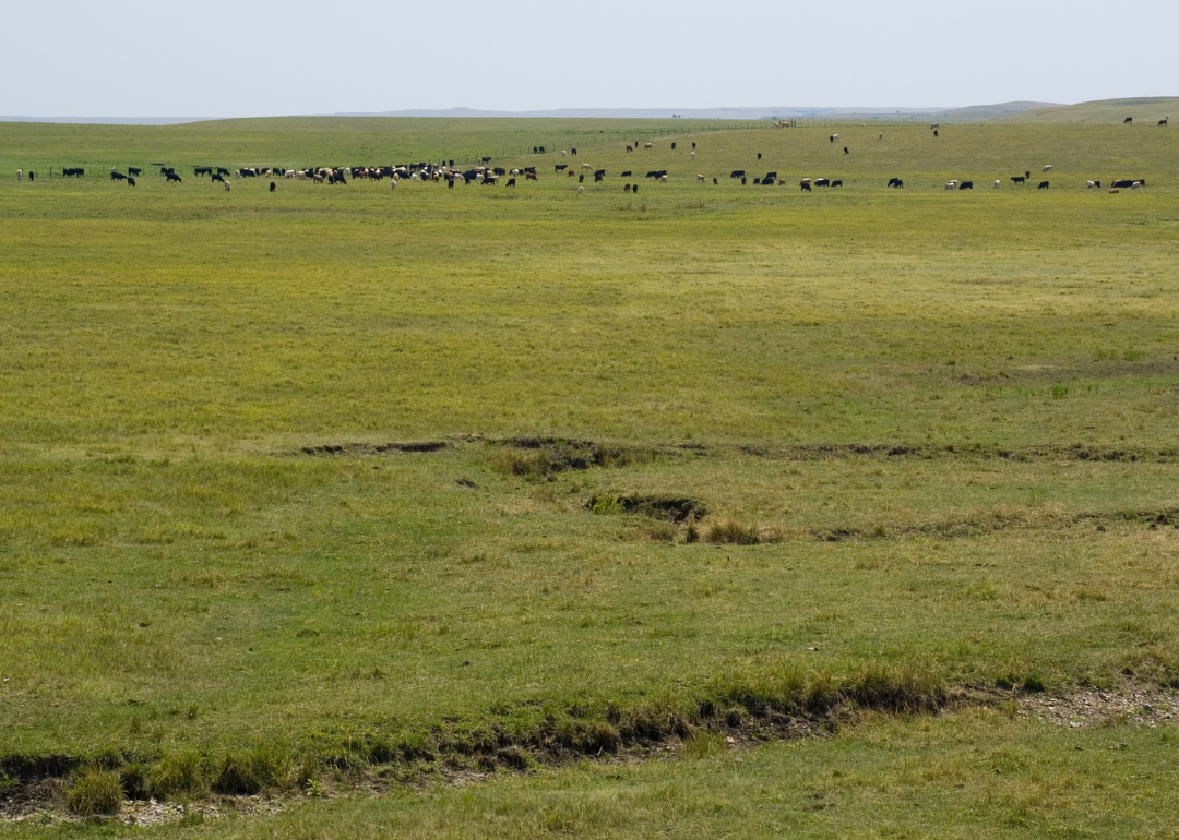
Life expectancy can be affected by a variety of factors. About 25% of your lifespan is determined by genetics, according to the National Library of Medicine. Health and wellness habits—like following a balanced, nutrient-rich diet; not smoking; drinking minimal alcohol; maintaining a healthy weight; and staying physically active—can add more than a decade to your life, research from the National Institutes of Health shows. While these factors are significant, another important element that you might not have considered is your environment and community.
In order to come up with the very specific design ideas, we create most designs with the assistance of state-of-the-art AI interior design software. Also, assume links that take you off the site are affiliate links such as links to Amazon. this means we may earn a commission if you buy something.
While life expectancy generally increases annually in the United States—jumping from about 70.8 years old to 77.5 between 1970 and 2022, according to the Centers for Disease Control and Prevention—this particular metric can vary from state to state or even county to county. In some parts of the country, the average lifespan is getting shorter based on a variety of risk factors on top of health, including socioeconomic factors like poverty, unemployment, income, and education.
According to a 2020 study from researchers at Penn State, West Virginia, and Michigan State Universities, communities with a higher population density, more fast food restaurants, and a high number of extraction industry-based jobs tend to have shorter life expectancies.
To find out how life expectancy varies within Kansas, Stacker used 2024 County Health Rankings & Roadmaps from the University of Wisconsin Population Health Institute to identify the counties with the shortest life expectancy. Life expectancy measures the average number of years from birth a person can expect to live and is calculated based on the number of deaths in a given time period and the average number of people at risk of dying during that period. Counties with unreliable or insufficient data were excluded from the analysis. Mortality data came from the National Vital Statistics System.
Read on to see if your county is on the list.
You may also like: Counties with the worst commutes in Kansas
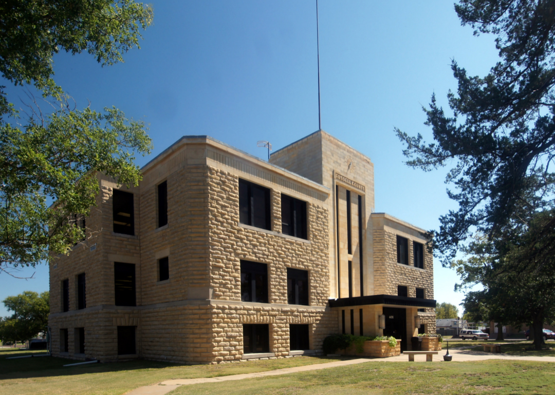
#50. Russell County (tie)
– Life expectancy: 76.3 years
— 0.7 years lower than the state average

About
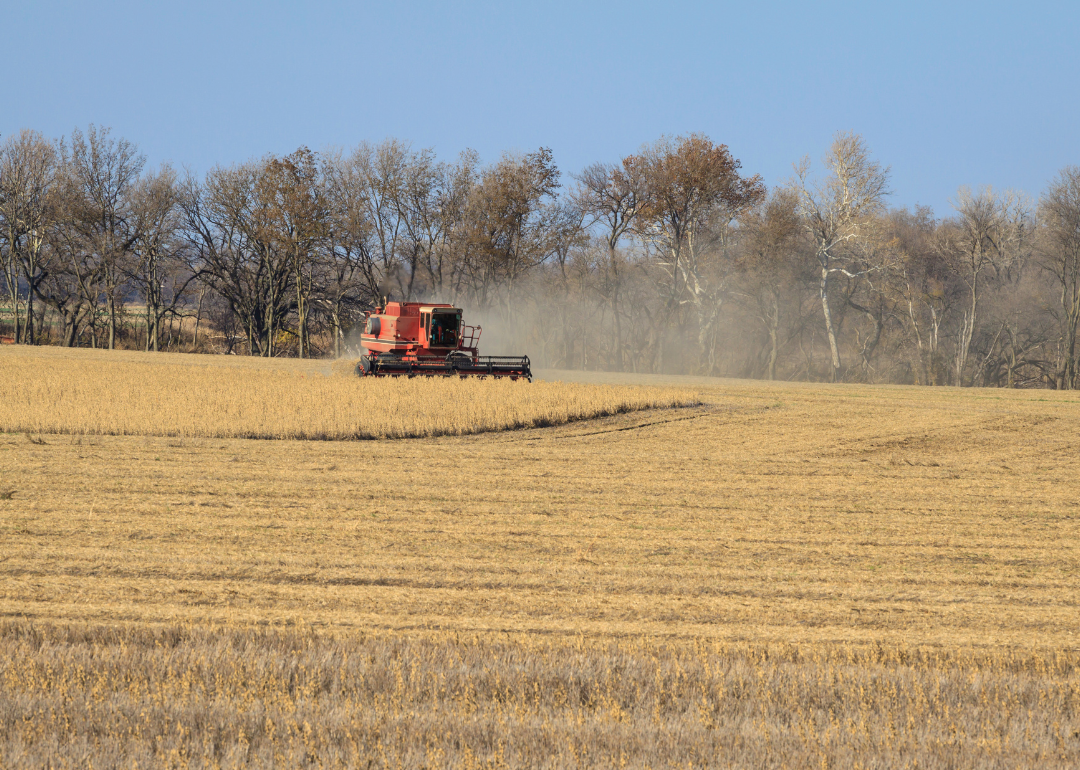
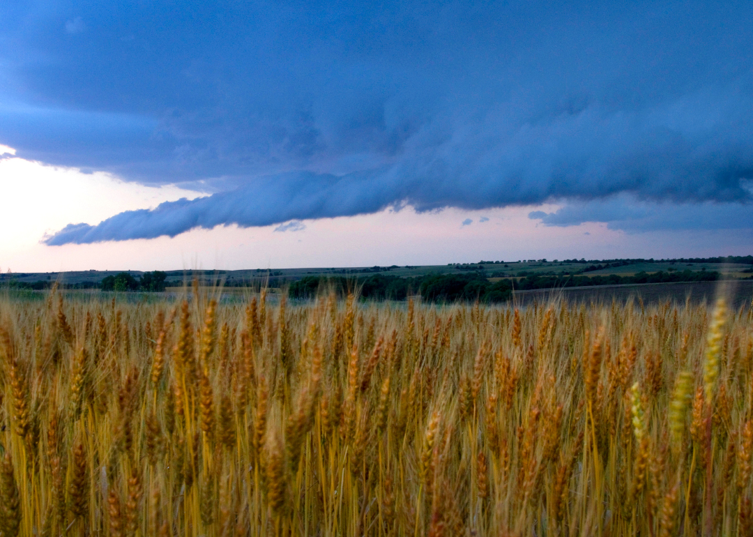
Russell County is a community that blends Kansas’ agricultural traditions with a strong sense of resilience and pride. Farming, particularly wheat and sorghum, is the cornerstone of the economy, supported by ranching and small-town businesses. Residents cherish the region’s quiet charm, where open skies and hard work define daily life.
Cultural heritage is celebrated through local museums, fairs, and historical societies. Outdoor enthusiasts enjoy fishing, hunting, and camping in the county’s lakes and parks. Russell County embodies the values of perseverance and community found throughout rural Kansas.
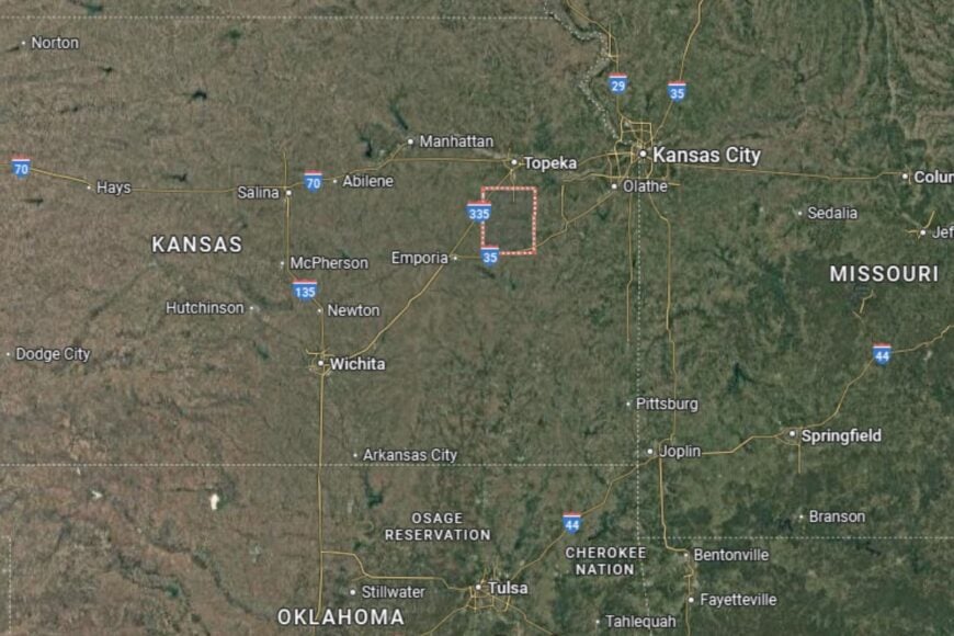
Where is Russell County?
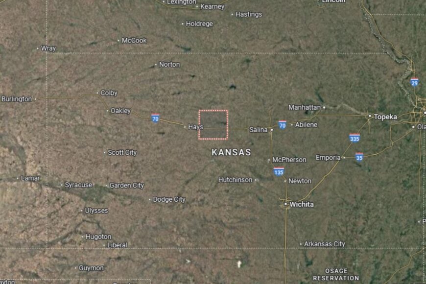
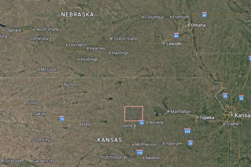
Russell County is located in north-central Kansas, about 70 miles west of Salina and 100 miles east of Hays. The county seat, Russell, sits along Interstate 70, making it a convenient stop for travelers crossing the state.
The Smoky Hill River and nearby reservoirs shape the county’s landscape, offering both recreation and irrigation resources. Neighboring counties include Osborne to the north and Ellsworth to the east. Russell County’s location positions it as a gateway between central and western Kansas.
#49. Atchison County (tie)
– Life expectancy: 76.3 years
— 0.7 years lower than the state average

About
Atchison County is steeped in history, known for its riverfront heritage and role as a center of early Kansas settlement. Agriculture remains important, but the county’s cultural identity is tied to its historic architecture, museums, and ties to aviation pioneer Amelia Earhart, who was born in Atchison.
Residents enjoy a mix of small-town living with access to cultural attractions and educational opportunities. Community events, parades, and riverfront festivals bring locals together, creating a lively sense of pride. Atchison County balances history with a modern community spirit.
Where is Atchison County?
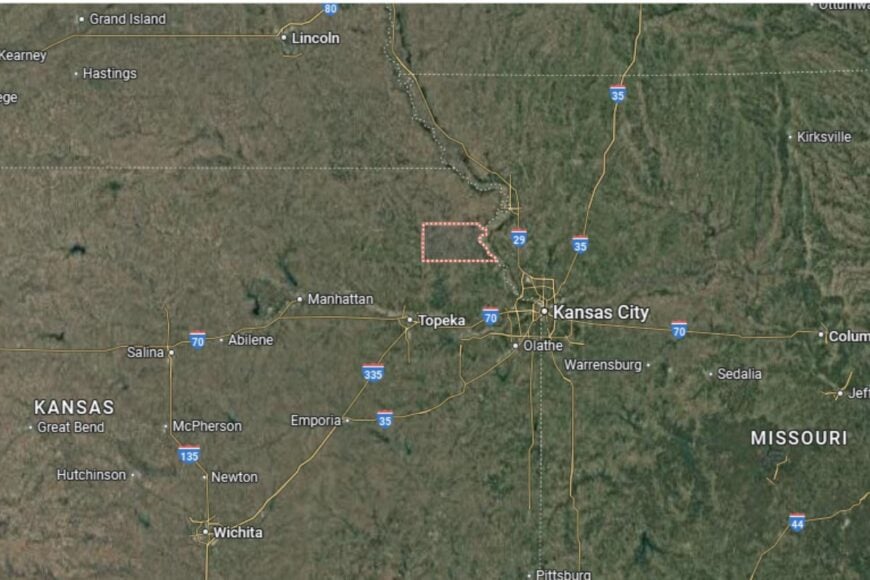
Atchison County is located in northeastern Kansas, along the Missouri River. The county seat, Atchison, lies about 50 miles northwest of Kansas City and is connected by U.S. Highways 59 and 73.
The river defines much of the county’s geography, giving it both historical significance and recreational appeal. Neighboring counties include Doniphan to the north and Leavenworth to the south. Atchison County’s location provides a unique blend of rural calm and easy access to metropolitan Kansas City.
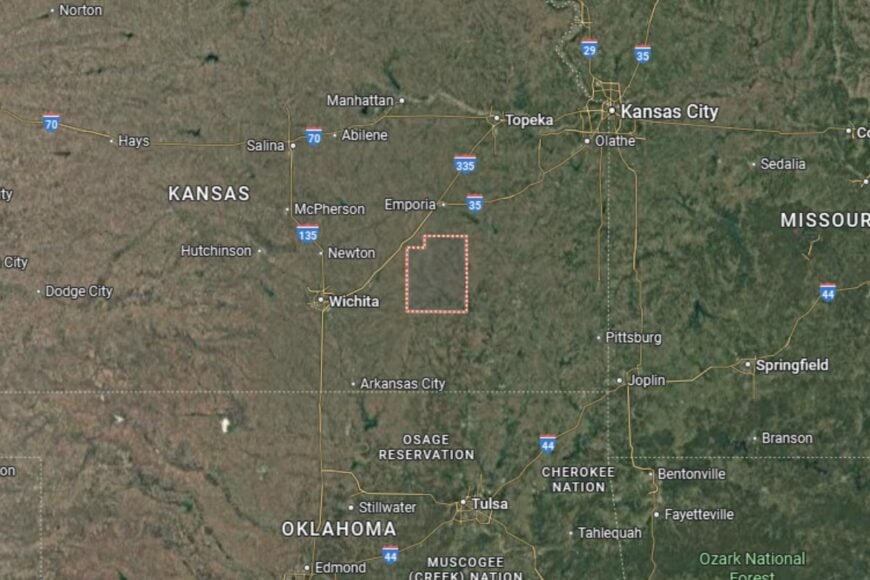
#48. Butler County (tie)
– Life expectancy: 76.3 years
— 0.7 years lower than the state average
About
Butler County is the largest county in Kansas by land area, combining agricultural strength with growing suburban communities. Farming, particularly wheat and cattle ranching, forms the economic base, but the county also benefits from its proximity to Wichita, providing jobs in manufacturing, healthcare, and retail.
Residents enjoy strong schools, healthcare facilities, and a variety of recreational opportunities. Lakes, trails, and local festivals highlight the county’s appeal. Butler County is known for its blend of rural landscapes and suburban convenience, offering the best of both worlds.
Where is Butler County?
Butler County is located in south-central Kansas, just east of Wichita. The county seat, El Dorado, lies along U.S. Highway 54 and Interstate 35, providing strong transportation links.
Neighboring counties include Harvey to the north and Cowley to the south. El Dorado Lake is a popular recreational spot within the county, drawing visitors from across the region. Butler County’s location makes it both a farming hub and a suburban extension of Wichita’s metro area.
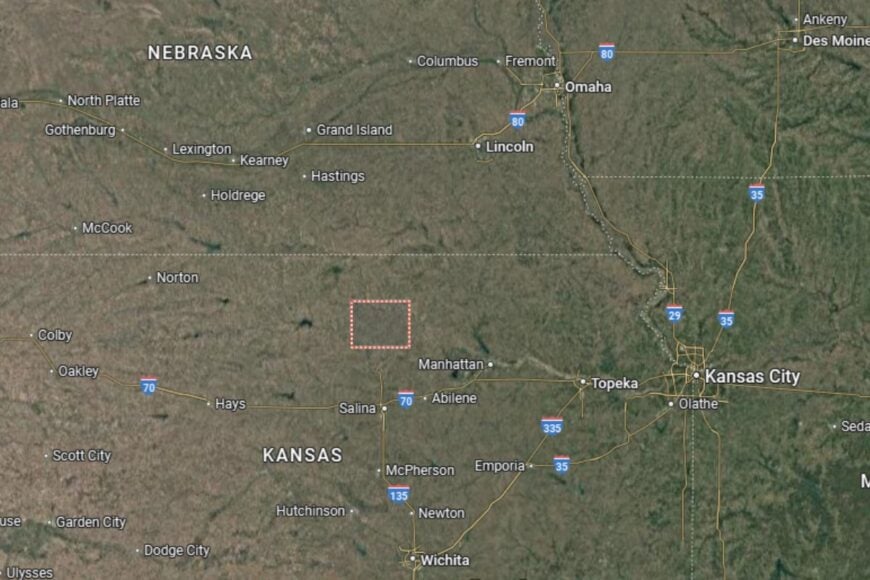
#47. Rooks County (tie)
– Life expectancy: 76.2 years
— 0.8 years lower than the state average
About
Rooks County is a western Kansas county where agriculture has long shaped its economy and identity. Wheat, sorghum, and livestock are staples of local production, and farming families have passed traditions down for generations. Small towns provide a welcoming atmosphere where neighbors know one another well.
The county also celebrates its cultural heritage through historical sites, museums, and community festivals. Residents enjoy a slower pace of life supported by schools, healthcare providers, and local organizations. Rooks County represents the enduring spirit of rural Kansas.
Where is Rooks County?
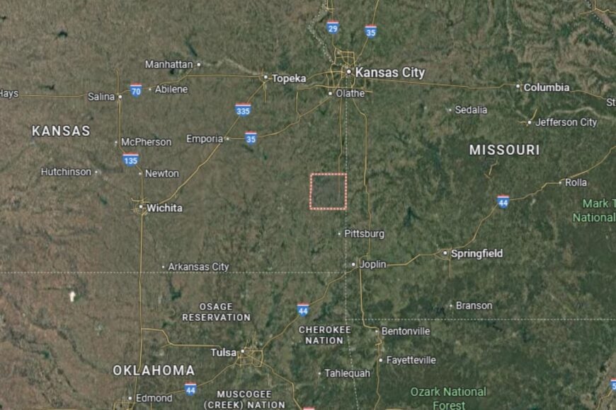
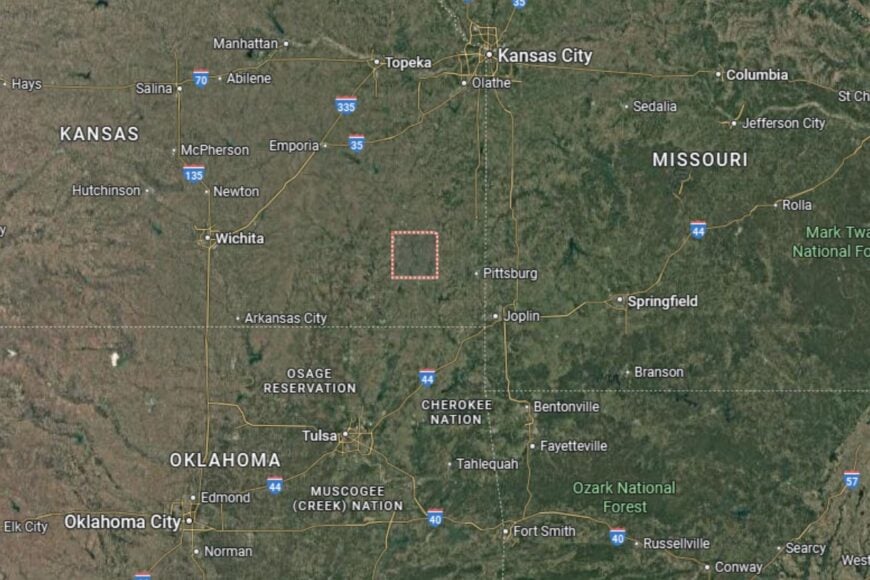
Rooks County is located in north-central Kansas, positioned west of Osborne and north of Ellis County. The county seat, Stockton, sits along U.S. Highway 24, which runs east–west across northern Kansas and provides connections to nearby towns and agricultural hubs. Plainville, another key town, lies just a few miles west and serves as an additional local center.
Hays, the regional anchor, is about 40 miles southeast of Stockton, giving residents access to larger healthcare and shopping options while preserving the county’s rural character. The surrounding plains provide fertile ground for wheat and sorghum farming, and the Solomon River basin influences the county’s landscape.
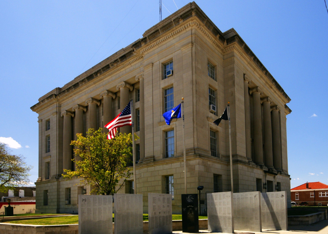
#46. Harvey County (tie)
– Life expectancy: 76.2 years
— 0.8 years lower than the state average
You may also like: Counties where children have the best opportunity for economic mobility in Kansas
About
Harvey County is a mix of agricultural tradition and suburban development, shaped by its proximity to Wichita. Farming remains vital, but healthcare, education, and manufacturing play growing roles in the economy. Residents value the balance between rural landscapes and easy access to city conveniences.
Community life includes schools, local festivals, and outdoor activities in parks and trails. The county is known for its cultural diversity, strong community organizations, and family-centered atmosphere. Harvey County thrives on its blend of old and new.
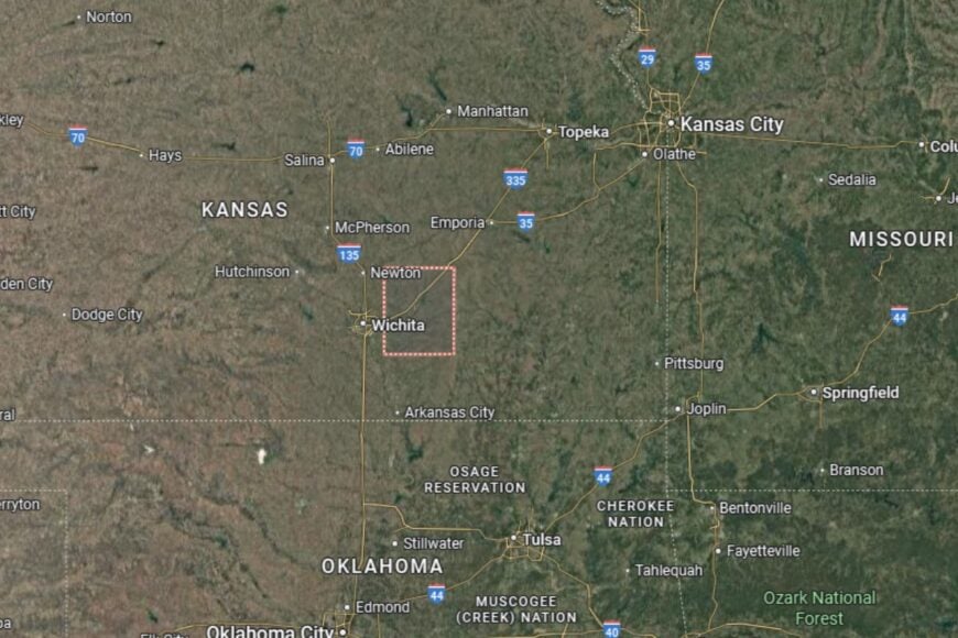
Where is Harvey County?
Harvey County is located in south-central Kansas, about 30 miles north of Wichita. The county seat, Newton, lies along Interstate 135 and U.S. Highway 50, providing excellent transportation access.
Neighboring counties include Butler to the east and McPherson to the north. Its location makes Harvey County part of the Wichita metropolitan area while retaining its rural character.
#45. Elk County
– Life expectancy: 76.1 years
— 0.9 years lower than the state average

About
Elk County is a small, rural county known for its scenic hills, farmland, and tight-knit communities. Agriculture remains the economic backbone, though its natural beauty also draws hunters, hikers, and those seeking a quiet retreat. Residents enjoy the slower pace and traditions that define life in southeastern Kansas.
Community gatherings, school events, and local fairs create a strong sense of pride and belonging. Outdoor recreation, including fishing and hiking, is plentiful across the county’s open spaces. Elk County remains a peaceful corner of Kansas with deep agricultural roots.
Where is Elk County?
🔥 Would you like to save this?
Elk County is located in southeastern Kansas, about 75 miles southeast of Wichita. The county seat, Howard, lies along U.S. Highway 160, a central route through the region.
The county is bordered by Greenwood to the north and Chautauqua to the south. Its landscape includes rolling hills and wooded areas uncommon in much of Kansas. Elk County’s position makes it a scenic and rural retreat.
#44. Chautauqua County
– Life expectancy: 76.0 years
— 1.0 years lower than the state average
About
Chautauqua County is a rural county where farming and ranching dominate the local economy. Cattle ranches and crop production form the foundation of daily life, while small businesses and schools provide essential services. Residents are proud of their county’s frontier history and enduring rural traditions.
The community celebrates its heritage through fairs, historical societies, and festivals. Outdoor opportunities, such as hiking in wooded areas and fishing in local lakes, add to the county’s appeal. Chautauqua County thrives on its mix of history, agriculture, and natural landscapes.
Where is Chautauqua County?
Chautauqua County is located in southeastern Kansas, along the Oklahoma border. The county seat, Sedan, is about 100 miles southeast of Wichita and lies near U.S. Highway 166.
The county is bordered by Elk to the north and Montgomery to the east. Its location along the state line creates ties with communities in northern Oklahoma. Chautauqua County’s geography features rolling hills and wooded valleys that stand out from the plains.
#43. Finney County (tie)
– Life expectancy: 75.9 years
— 1.1 years lower than the state average
About
Finney County is a cultural crossroads in southwestern Kansas, with Garden City serving as a regional hub. Agriculture drives the economy, particularly large-scale cattle feeding and crop farming, but the county also thrives on its diverse population and growing industries. Residents benefit from a unique blend of cultures, traditions, and cuisines.
Community life is vibrant, with festivals, sports, and cultural programs bringing people together. Schools and healthcare providers support the county’s growth, while parks and recreational facilities offer plenty of opportunities for families. Finney County is a dynamic part of the High Plains, where tradition meets diversity.
Where is Finney County?
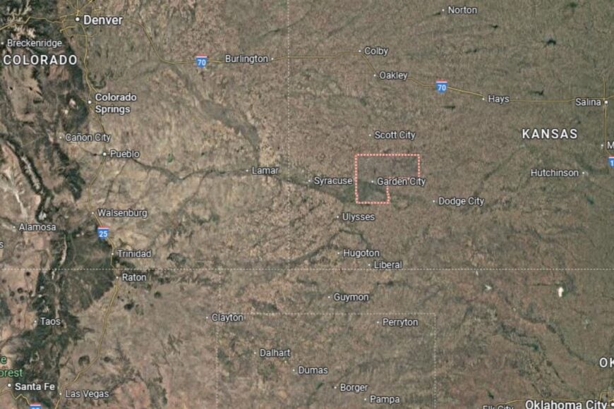
Finney County is located in southwestern Kansas, about 200 miles west of Wichita. The county seat, Garden City, lies along U.S. Highways 50 and 83, making it a key regional transportation hub.
The county is bordered by Kearny to the west and Haskell to the east. Its High Plains geography provides fertile ground for agriculture while offering sweeping views of Kansas prairies. Finney County’s location makes it both a farming powerhouse and a regional center.
#42. Rice County (tie)
– Life expectancy: 75.9 years
— 1.1 years lower than the state average
About
Rice County is a rural county in central Kansas where agriculture defines the economy and way of life. Wheat, sorghum, and corn fields stretch across the landscape, while livestock operations provide additional stability. The county has a reputation for strong community ties and small-town charm.
Residents enjoy a quieter pace of life with access to schools, healthcare, and local businesses. Annual fairs, parades, and community events highlight local traditions. Rice County remains rooted in its farming heritage while fostering a welcoming environment.
Where is Rice County?
Rice County is located in central Kansas, about 60 miles northwest of Wichita. The county seat, Lyons, lies along U.S. Highway 56, a major east–west route through the state.
The county is bordered by McPherson to the east and Ellsworth to the north. Its location in the Smoky Hills region provides both fertile farmland and scenic open spaces. Rice County sits at the crossroads of rural Kansas tradition.
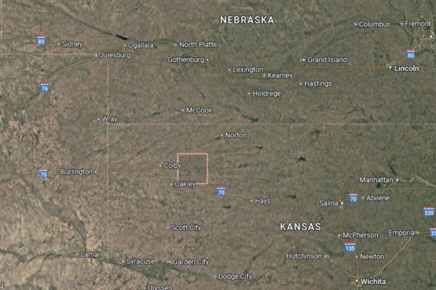
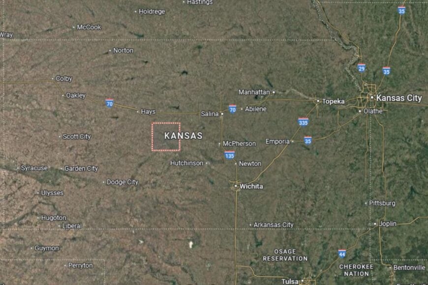
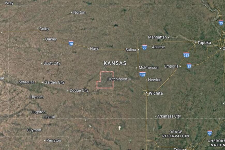
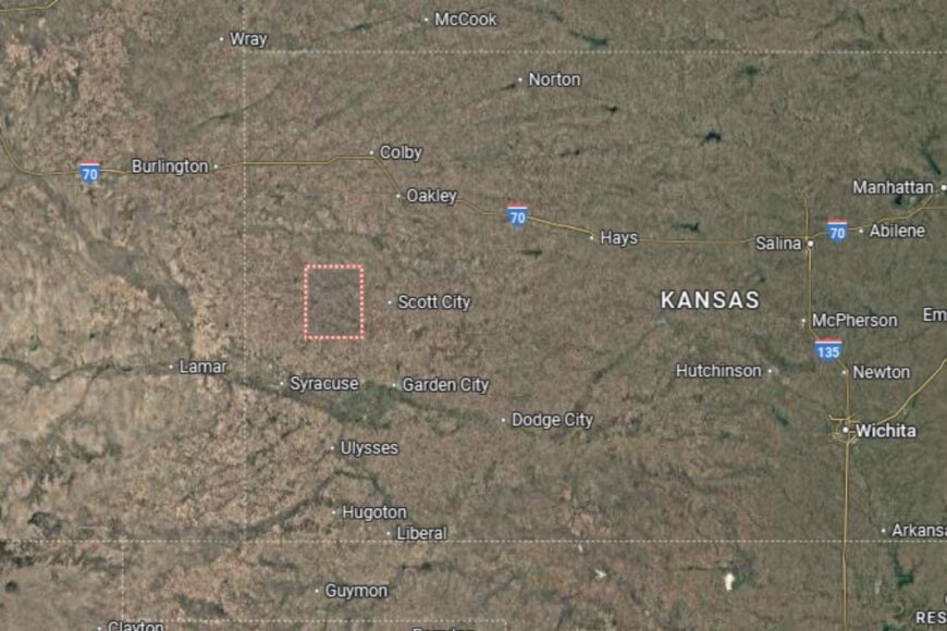
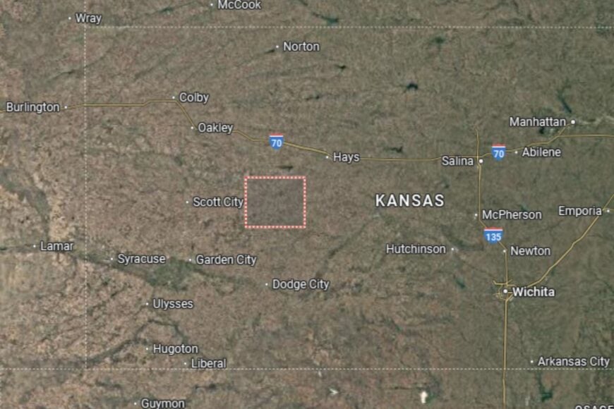
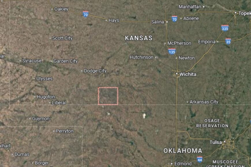
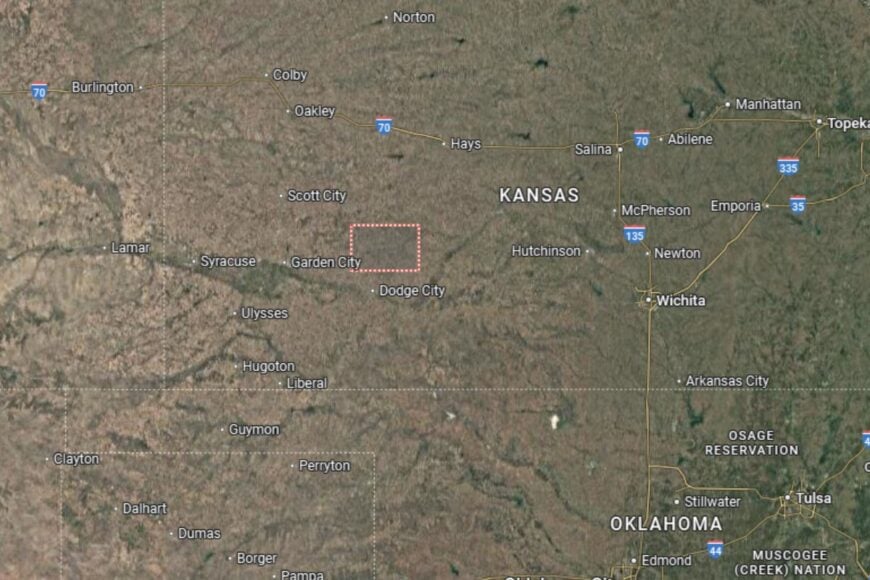
#41. Scott County (tie)
– Life expectancy: 75.9 years
— 1.1 years lower than the state average
You may also like: Demand for these health care jobs is increasing most in Kansas
About
Scott County is a High Plains community known for its agriculture and surprising natural landmarks. Farming, particularly wheat, corn, and cattle production, is the lifeblood of the county. Yet, it is also home to Scott State Park, a scenic area with unique geological features that draw visitors from across the state.
Residents enjoy a strong sense of pride in balancing agriculture with recreational and cultural opportunities. Schools, healthcare, and community organizations provide essential services, while local festivals add a sense of vibrancy. Scott County offers both agricultural productivity and unexpected beauty.
Where is Scott County?
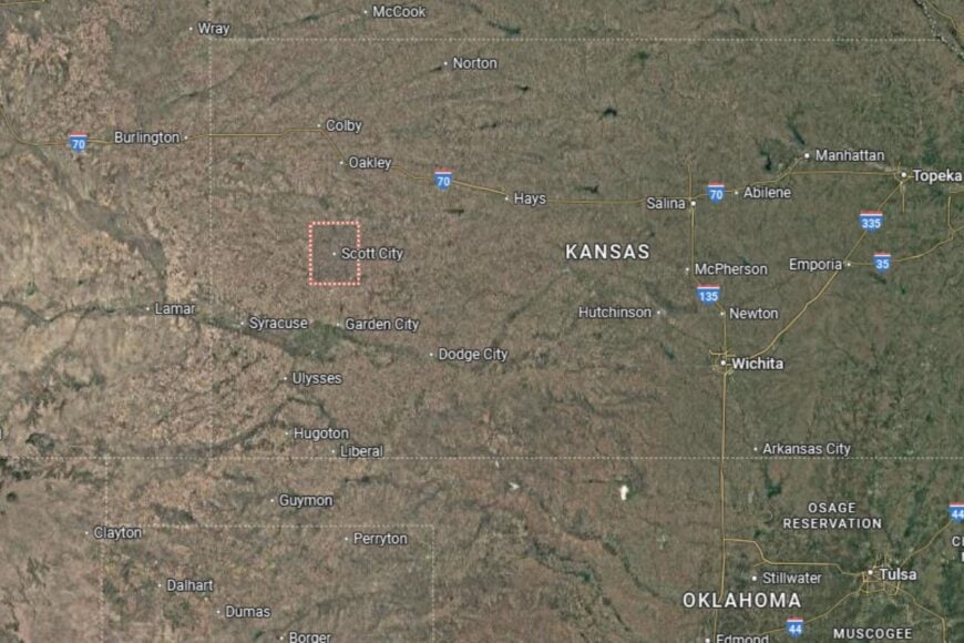
Scott County is located in western Kansas, about 50 miles north of Garden City. The county seat, Scott City, lies along U.S. Highway 83, a major north–south route.
The county borders Lane to the east and Wichita County to the west. Its flat farmland is punctuated by the scenic Smoky Hill River Valley. Scott County’s mix of prairie agriculture and natural landmarks makes it stand out in western Kansas.
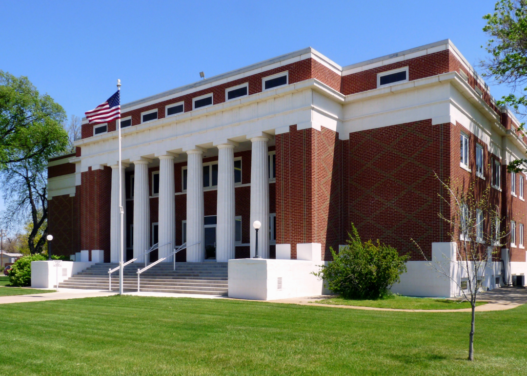
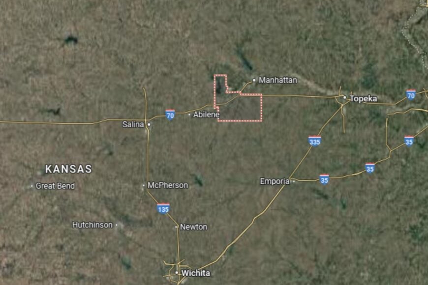
#40. Dickinson County (tie)
– Life expectancy: 75.9 years
— 1.1 years lower than the state average
About
Dickinson County is best known for its historic heritage and agricultural strength. Farming remains central, but the county is also home to Abilene, the boyhood home of President Dwight D. Eisenhower, which adds cultural and historic appeal. The economy blends agriculture with tourism and small industries.
Residents benefit from schools, healthcare facilities, and community events that foster pride and connection. Fairs, parades, and historic attractions create a lively sense of identity. Dickinson County balances its rural roots with its presidential legacy.
Where is Dickinson County?
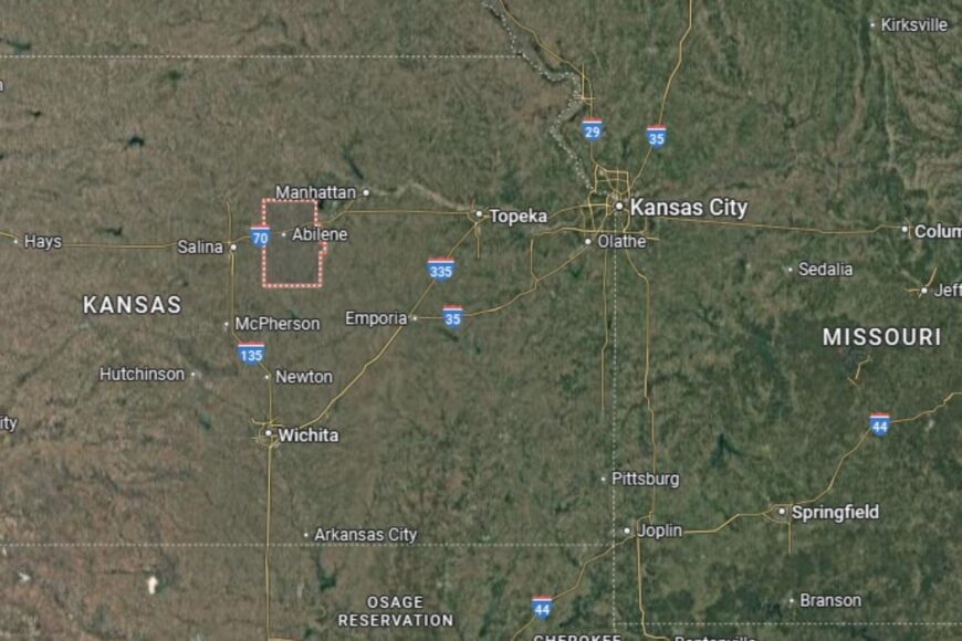
Dickinson County is located in central Kansas, about 30 miles southwest of Manhattan. The county seat, Abilene, lies along Interstate 70 and U.S. Highway 81, providing excellent transportation links.
Neighboring counties include Saline to the west and Geary to the northeast. Its location in the Smoky Hills gives it both fertile farmland and scenic charm. Dickinson County is both a farming hub and a historic destination.
#39. Allen County
– Life expectancy: 75.8 years
— 1.2 years lower than the state average
About
Allen County is a southeastern Kansas county that combines agriculture with small-town industry. Farming, ranching, and manufacturing support the local economy, while historic towns preserve the character of the region. Residents appreciate the county’s strong sense of tradition and community.
Local events, fairs, and festivals bring neighbors together, while schools and healthcare services provide stability. Outdoor recreation, from parks to lakes, is an important part of everyday life. Allen County reflects the balance of rural productivity and cultural pride.
Where is Allen County?
🔥 Would you like to save this?
Allen County lies in southeastern Kansas, with Iola as its county seat. Iola is located near U.S. Highway 169, a major north–south route that links the county to Kansas City and Tulsa. The town serves as the primary center for commerce and services in the area, while smaller towns like Humboldt contribute to the county’s identity.
Allen County is about 100 miles south-southwest of Kansas City, putting it within reach of metro markets while preserving its rural independence. Neighboring counties include Anderson to the north and Neosho to the south, and the Neosho River flows through the region, adding to its agricultural and recreational landscape.
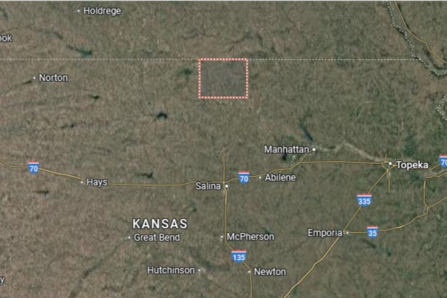
#38. Sheridan County (tie)
– Life expectancy: 75.7 years
— 1.3 years lower than the state average
About
Sheridan County is a quiet High Plains county where agriculture sets the rhythm of life. Wheat, sorghum, and livestock production dominate the economy, sustaining generations of farming families. Its small towns are known for their neighborly spirit and traditions that reflect the resilience of western Kansas living.
Community life is enriched by school events, fairs, and outdoor recreation, particularly hunting and fishing. Residents enjoy wide-open spaces and the kind of small-town support networks that create lasting connections. Sheridan County is a place where heritage and hard work still matter most.
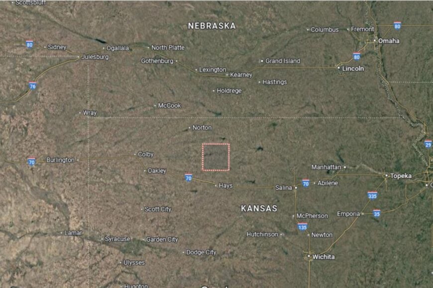
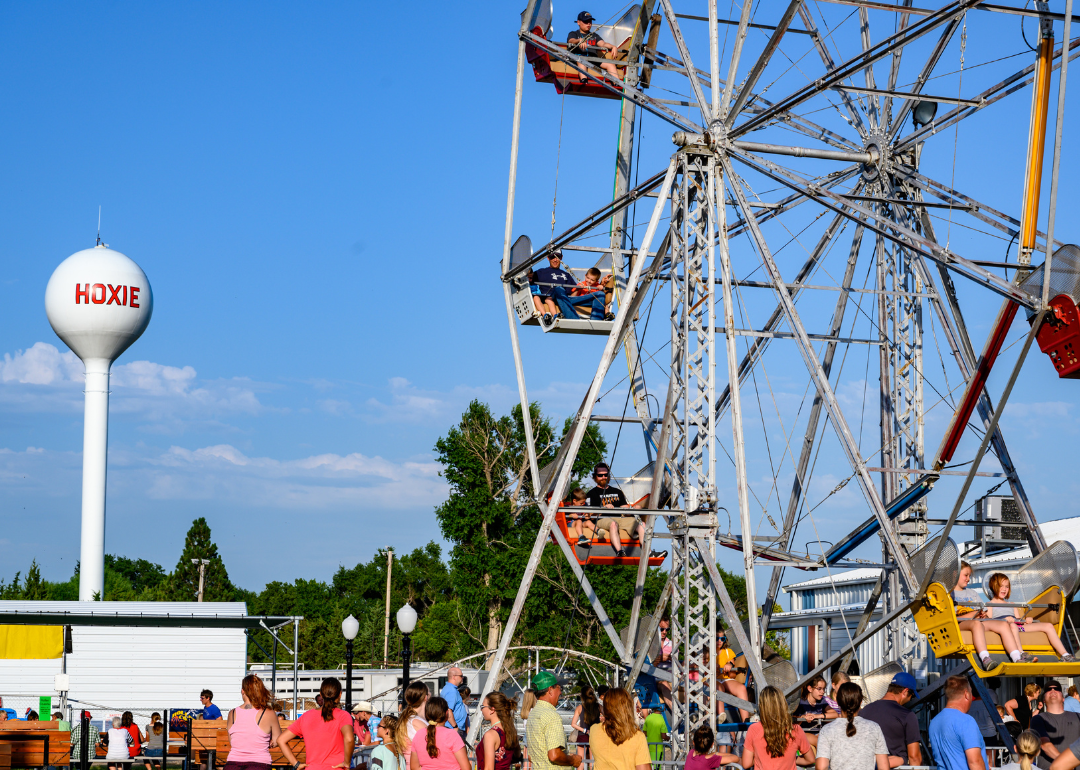
Where is Sheridan County?
Sheridan County is situated in northwestern Kansas, bordered by Thomas County to the west and Graham County to the east. The county seat, Hoxie, lies along U.S. Highway 24, which runs east–west across the northern part of the state and connects Sheridan to nearby regional centers.
Hoxie is about 60 miles northwest of Hays, making it reasonably close to larger services while maintaining a remote, High Plains identity. The county’s geography is defined by flat farmland and wide prairie skies, placing Sheridan firmly in Kansas’ grain belt.
#37. Shawnee County (tie)
– Life expectancy: 75.7 years
— 1.3 years lower than the state average
About
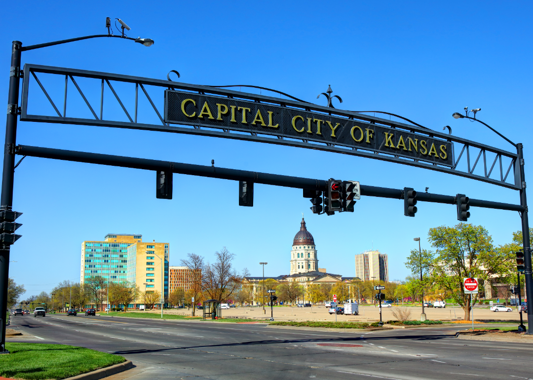
Shawnee County is home to Topeka, the state capital, blending urban life with the agricultural traditions of northeastern Kansas. The economy is diverse, with government, education, healthcare, and retail all playing major roles. While agriculture remains important in the surrounding areas, Topeka gives the county a metropolitan character.
Residents enjoy a wide range of cultural, recreational, and educational opportunities. From museums and theaters to parks and riverfront activities, Shawnee County offers a dynamic lifestyle while still holding onto its Kansas roots.
Where is Shawnee County?
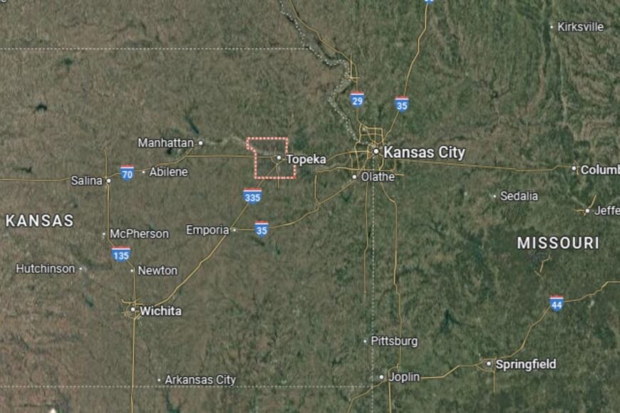
Shawnee County is located in northeastern Kansas, about 60 miles west of Kansas City. The county seat, Topeka, sits along Interstate 70, a major east–west corridor across the state.
The Kansas River flows through the county, shaping both its geography and history. Neighboring counties include Jackson to the north and Douglas to the east. Shawnee County’s location places it at the crossroads of Kansas politics, culture, and commerce.
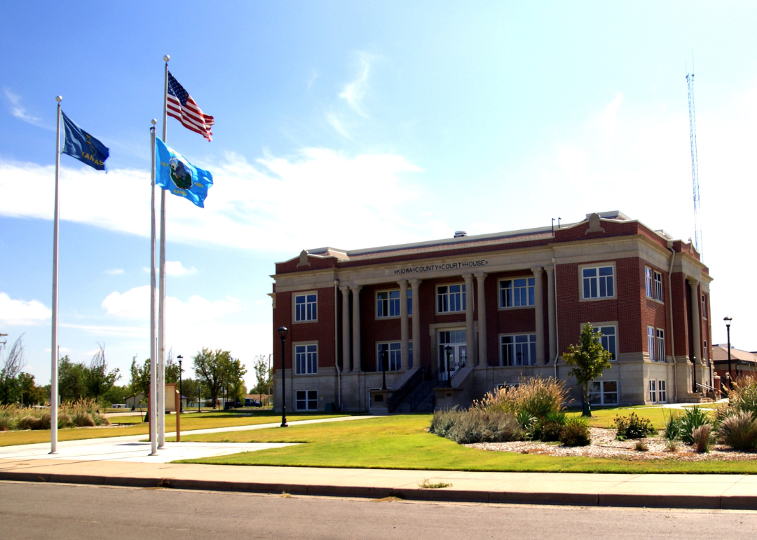
#36. Kiowa County (tie)
– Life expectancy: 75.7 years
— 1.3 years lower than the state average
You may also like: Best private high schools in Kansas
About
Kiowa County is a small western Kansas county where agriculture is the foundation of the economy. Wheat and livestock operations dominate, but the county also has a reputation for resilience after a devastating tornado in 2007 reshaped its county seat, Greensburg. The community rebuilt with an emphasis on sustainability and innovation, earning national attention.
Residents enjoy the mix of rural traditions and forward-thinking initiatives. Festivals, school events, and outdoor recreation strengthen community ties. Kiowa County demonstrates how small communities can combine heritage with new ideas.
Where is Kiowa County?
Kiowa County is located in south-central Kansas, about 100 miles west of Wichita. The county seat, Greensburg, lies along U.S. Highway 54, which provides a key east–west connection.
The county is bordered by Edwards to the north and Comanche to the south. Its landscape is typical of the High Plains, with broad farmland and open skies. Kiowa County’s location makes it both remote and uniquely resilient.
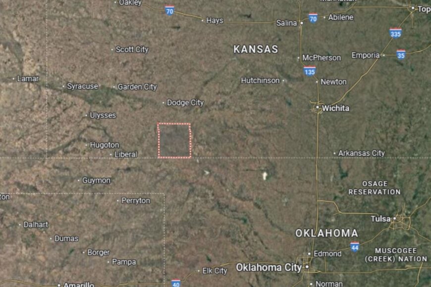
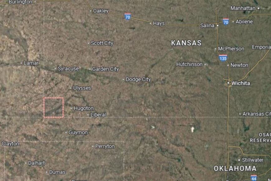
#35. Meade County
– Life expectancy: 75.6 years
— 1.4 years lower than the state average
About
Meade County is a western Kansas county with a proud agricultural base and a strong sense of heritage. Farming and ranching dominate the economy, while small businesses and community services sustain its towns. The county also highlights history with attractions like the Dalton Gang Hideout in Meade, celebrating its Wild West past.
Residents enjoy a balance of rural living and cultural pride. Community events, school programs, and recreational opportunities help strengthen connections. Meade County blends its agricultural role with a unique historical identity.
Where is Meade County?
Meade County is located in southwestern Kansas, near the Oklahoma border. The county seat, Meade, is about 35 miles southwest of Dodge City and lies along U.S. Highway 54.
The county is bordered by Gray to the north and Clark to the east. Its southern edge connects directly with Oklahoma. Meade County’s location combines rich farmland with historic ties to the frontier era.
#34. Sedgwick County (tie)
– Life expectancy: 75.5 years
— 1.5 years lower than the state average
🔥 Would you like to save this?
About
Sedgwick County is Kansas’ largest urban center, anchored by Wichita, the state’s largest city. The economy is diverse, with aviation manufacturing, healthcare, education, and retail leading the way. While agriculture is present in rural areas, Sedgwick is better known for its thriving industries and cultural offerings.
Residents enjoy urban amenities such as museums, theaters, sports, and a vibrant restaurant scene. Parks, trails, and riverfront areas add outdoor balance to city life. Sedgwick County represents Kansas’ modern, metropolitan side while maintaining its prairie heritage.
Where is Sedgwick County?
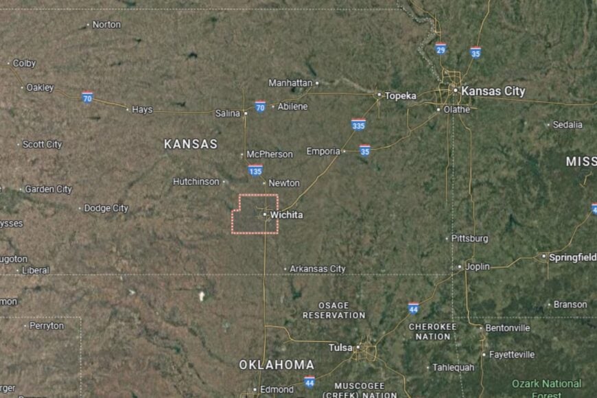
Sedgwick County is located in south-central Kansas, with Wichita at its heart. The city sits at the junction of Interstate 35 and U.S. Highway 54, making it one of the state’s best-connected regions.
Neighboring counties include Butler to the east and Harvey to the north. The Arkansas River flows through Wichita, shaping the city’s geography and history. Sedgwick County’s location makes it the economic and cultural anchor of Kansas.
#33. Franklin County (tie)
– Life expectancy: 75.5 years
— 1.5 years lower than the state average
About
Franklin County is a county that blends farming traditions with a growing suburban influence from nearby Kansas City. Agriculture, especially soybeans and corn, continues to be central, but manufacturing and retail have expanded around the county seat of Ottawa. This mix gives Franklin County both rural character and economic diversity.
Residents enjoy strong community institutions, from schools and libraries to civic organizations. Cultural life includes fairs, music events, and historic downtown districts that keep traditions alive. Franklin County has a reputation for neighborly hospitality and steady growth.
Where is Franklin County?
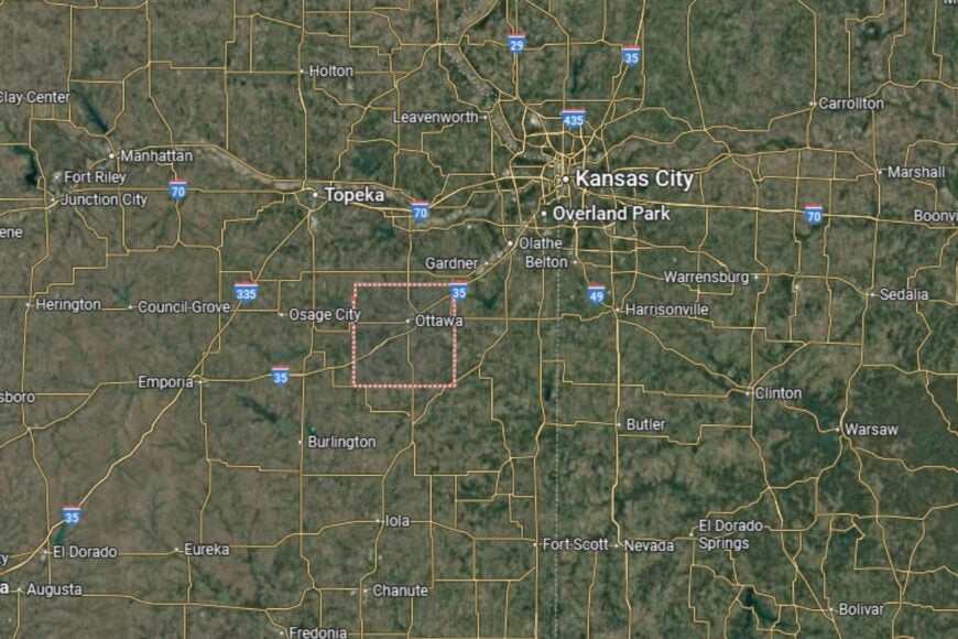
Franklin County is located in eastern Kansas, about 50 miles southwest of Kansas City. The county seat, Ottawa, lies along Interstate 35, which connects the region to both Wichita and Kansas City.
Neighboring counties include Douglas to the north and Anderson to the south. The Marais des Cygnes River runs through the county, offering scenic beauty and recreational opportunities. Franklin County’s location places it at the crossroads of agriculture and metropolitan expansion.
#32. Barton County (tie)
– Life expectancy: 75.4 years
— 1.6 years lower than the state average

About
Barton County is a western Kansas county where farming and energy production both play important roles. Wheat and sorghum fields stretch across the landscape, while oil and gas exploration provide another layer to the economy. Great Bend, the county seat, is a regional hub for healthcare, education, and retail.
Community life thrives through cultural festivals, fairs, and recreational activities centered around Cheyenne Bottoms, one of the most important wetlands in North America. Residents value the combination of natural beauty and economic opportunity that Barton County provides.
Where is Barton County?
Barton County is located in central Kansas, with Great Bend as its county seat and regional hub. Great Bend sits at the junction of U.S. Highways 281 and 56, offering strong north–south and east–west travel connections across the state. The Arkansas River also runs nearby, shaping part of the county’s geography.
The county is bordered by Ellsworth to the northeast and Pawnee to the west, placing Barton at the crossroads of central Kansas. Its location within the Smoky Hills and Great Bend Prairie makes it both an agricultural powerhouse and home to Cheyenne Bottoms, a wetland of international importance.
#31. Ottawa County (tie)
– Life expectancy: 75.4 years
— 1.6 years lower than the state average
You may also like: Best scenic drives in Kansas
About
Ottawa County is a quiet central Kansas county defined by farming, ranching, and a strong sense of rural identity. Agriculture is the backbone of the economy, but small businesses and community services sustain its towns. Residents take pride in their small-town traditions and neighborly support networks.
Outdoor recreation is part of local life, with parks, rivers, and trails offering fishing, hiking, and hunting. Annual fairs and festivals keep community spirit alive, while schools and healthcare facilities provide stability. Ottawa County reflects the values of hard work and simplicity.
Where is Ottawa County?
Ottawa County is located in north-central Kansas, about 25 miles north of Salina. The county seat, Minneapolis, lies along U.S. Highway 81, a major north–south route across the Great Plains.
Neighboring counties include Cloud to the north and Dickinson to the south. Its landscape features rolling farmland and prairies typical of central Kansas. Ottawa County’s location makes it an agricultural hub with close access to larger regional centers.
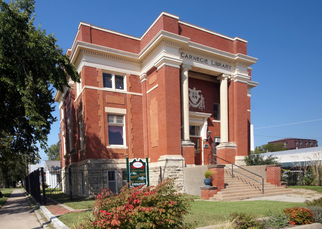
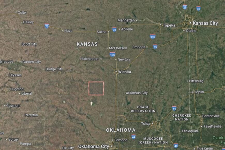
#30. Barber County
– Life expectancy: 75.2 years
— 1.8 years lower than the state average
About
Barber County is a scenic county in southern Kansas known for its Gypsum Hills, a rugged and colorful landscape unlike much of the state. Ranching and farming dominate the economy, while tourism tied to its natural beauty continues to grow. Residents appreciate the balance of working the land and enjoying its scenic rewards.
Cultural traditions run deep, with rodeos, fairs, and community events forming a lively calendar. Schools, healthcare, and civic organizations add to the county’s supportive environment. Barber County is as proud of its natural landscapes as it is of its ranching heritage.
Where is Barber County?

Barber County is located in south-central Kansas along the Oklahoma border. The county seat, Medicine Lodge, lies along U.S. Highway 281, a central north–south corridor.
The Gypsum Hills define much of the county’s geography, creating red-hued cliffs and scenic valleys. Neighboring counties include Pratt to the north and Comanche to the west. Barber County’s location gives it both rugged beauty and agricultural productivity.
#29. Osage County (tie)
– Life expectancy: 75.1 years
— 1.9 years lower than the state average
About
Osage County is a blend of rolling farmland, small lakes, and historic communities. Farming and ranching remain central to the economy, but the county also benefits from its proximity to Topeka and Lawrence, allowing for commuting and regional connections. The county has a reputation for balancing rural traditions with suburban access.
Recreational life thrives around Pomona Lake and Melvern Lake, which attract campers, anglers, and outdoor enthusiasts. Community events, historical sites, and small-town pride keep Osage County lively and connected.
Where is Osage County?
Osage County is located in northeastern Kansas, about 30 miles south of Topeka. The county seat, Lyndon, lies along U.S. Highway 75, which connects the region north to Topeka and south to Tulsa.
The county borders Franklin to the east and Coffey to the south. Its lakes and rivers provide both economic and recreational value. Osage County’s location makes it a quiet retreat within reach of Kansas’ urban centers.
#28. Sumner County (tie)
– Life expectancy: 75.1 years
— 1.9 years lower than the state average
About
Sumner County proudly calls itself the “Wheat Capital of the World,” reflecting its deep agricultural roots. Farming dominates the economy, with wheat fields stretching to the horizon, though small industries and businesses add diversity. The county is known for its welcoming small towns and rich farming heritage.
Community life includes county fairs, parades, and festivals that celebrate both agriculture and small-town pride. Schools, healthcare providers, and civic organizations create a supportive environment for families. Sumner County embodies the traditions of rural Kansas with a proud agricultural identity.
Where is Sumner County?
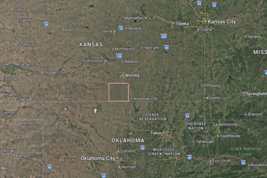
Sumner County is located in south-central Kansas, directly on the Oklahoma border. The county seat, Wellington, lies along U.S. Highway 81 and near Interstate 35, making it highly accessible.
The county is bordered by Sedgwick to the north and Cowley to the east. Its location provides both fertile farmland and easy connections to Wichita. Sumner County serves as both a farming powerhouse and a southern gateway into Kansas.
#27. Bourbon County (tie)
– Life expectancy: 74.8 years
— 2.2 years lower than the state average
About
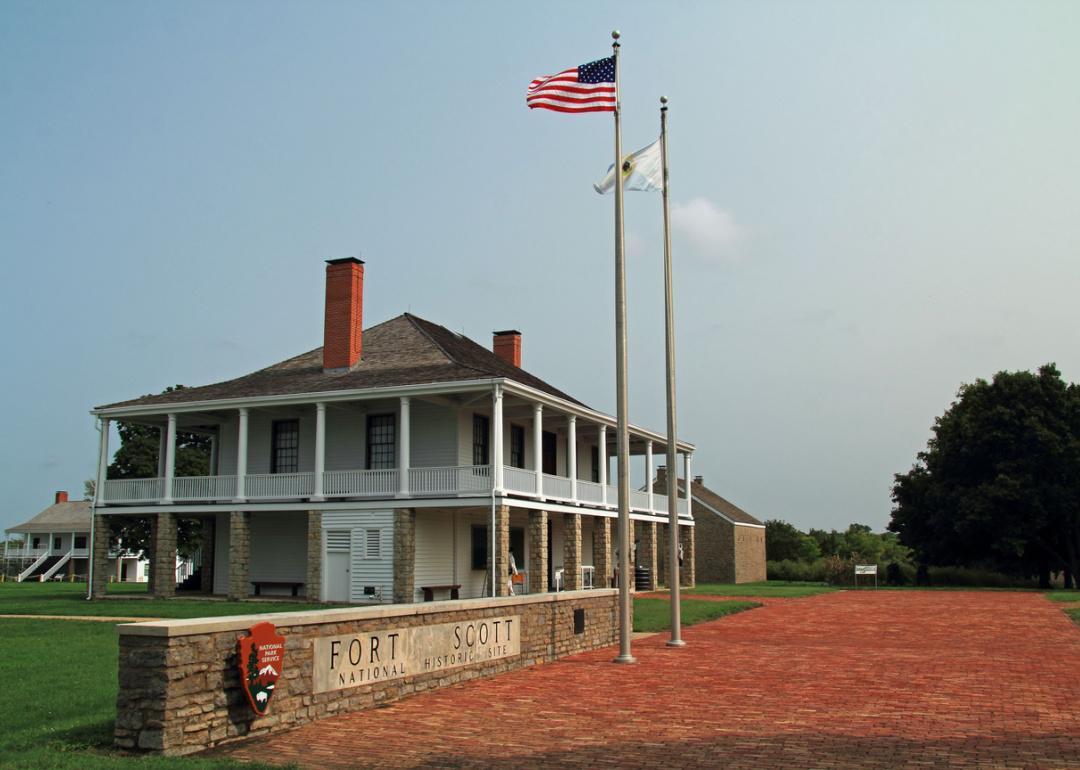
Bourbon County is a southeastern Kansas county rich in history and tradition. Agriculture and ranching remain important, but Fort Scott, the county seat, adds a cultural and historic dimension with its National Historic Site. Residents are proud of the county’s frontier heritage and agricultural resilience.
Community life is active, with parades, festivals, and cultural events filling the calendar. Schools, healthcare, and civic programs provide stability, while parks and trails support recreation. Bourbon County maintains a strong identity shaped by both history and farming.
Where is Bourbon County?
Bourbon County is located in southeastern Kansas, about 90 miles south of Kansas City. The county seat, Fort Scott, lies along U.S. Highway 69, a major north–south route.
The county borders Linn to the north and Crawford to the south. Its location along the Missouri border ties it to neighboring states while preserving a distinct Kansas identity. Bourbon County is both a historic destination and an agricultural hub.
#26. Neosho County (tie)
– Life expectancy: 74.8 years
— 2.2 years lower than the state average
You may also like: Counties with the most tornadoes in Kansas
About
Neosho County combines agricultural strength with industrial development. Farming remains central, but the county is also home to energy production and small-scale manufacturing. Residents appreciate the county’s balance of rural landscapes and economic opportunity.
Community pride shines through local fairs, cultural events, and schools that support family-centered living. Outdoor activities, including fishing and hiking, are popular in parks and along rivers. Neosho County thrives on its mix of tradition and steady progress.
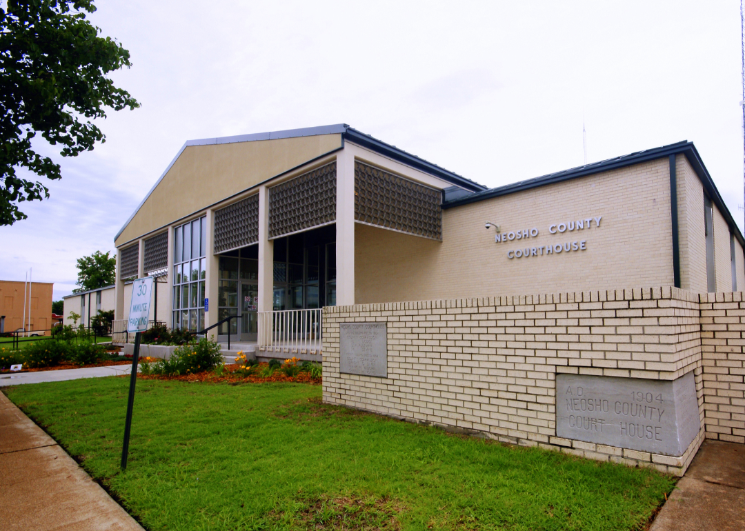
Where is Neosho County?
Neosho County is located in southeastern Kansas, about 120 miles southwest of Kansas City. The county seat, Erie, sits along U.S. Highway 59, which provides strong regional access.
The county borders Allen to the north and Labette to the south. Its location along the Neosho River adds both natural beauty and agricultural advantages. Neosho County stands as a quiet but productive part of southeastern Kansas.
#25. Cloud County (tie)
– Life expectancy: 74.8 years
— 2.2 years lower than the state average
About
Cloud County is a rural county that blends agriculture with education and cultural identity. Farming remains a dominant force, but Concordia, the county seat, is home to Cloud County Community College, which adds an educational dimension to local life. Residents value both the productivity of the land and the opportunities education provides.
Cultural and community pride are reflected in museums, festivals, and historic landmarks. Outdoor recreation, including fishing and hiking, is also part of everyday life. Cloud County is a place where rural heritage meets educational opportunity.
Where is Cloud County?
Cloud County is located in north-central Kansas, about 60 miles north of Salina. The county seat, Concordia, lies along U.S. Highway 81, a major north–south route through the state.
Neighboring counties include Republic to the north and Ottawa to the south. Its fertile farmland and prairie landscapes make it ideal for agriculture. Cloud County’s location ensures both productivity and regional connectivity.
#24. Harper County
– Life expectancy: 74.7 years
— 2.3 years lower than the state average
About
Harper County is a southern Kansas county defined by agriculture, energy, and small-town resilience. Farming and ranching remain important, but oil and gas development also play a role in the local economy. Residents value the county’s hardworking character and rural traditions.
Community life includes schools, healthcare services, and events that bring neighbors together. Parks, fairs, and civic organizations foster a strong sense of pride. Harper County thrives on its combination of farming roots and energy-driven growth.
Where is Harper County?
Harper County is located in south-central Kansas, directly on the Oklahoma border. The county seat, Anthony, lies along U.S. Highway 160 and near U.S. Highway 281, giving it regional connectivity.
The county is bordered by Kingman to the north and Barber to the west. Its southern border connects directly to northern Oklahoma. Harper County’s location provides both fertile farmland and links to energy-rich regions.
#23. Linn County
– Life expectancy: 74.5 years
— 2.5 years lower than the state average
About
Linn County blends farming traditions with the natural beauty of eastern Kansas woodlands. Agriculture remains central, but the county also benefits from its location near the Kansas City metro, allowing some residents to commute while still enjoying small-town life. History runs deep here, with Civil War-era landmarks and frontier stories shaping its identity.
Residents enjoy cultural events, outdoor recreation, and a strong sense of community pride. Parks, trails, and lakes give families plenty of opportunities for fishing, boating, and hiking. Linn County reflects the mix of history and rural simplicity.
Where is Linn County?
Linn County is located in eastern Kansas, along the Missouri border. The county seat, Mound City, sits about 60 miles south of Kansas City, along U.S. Highway 69.
The county is bordered by Miami to the north and Bourbon to the south. Its location places it at the crossroads of agricultural land and historic battlefields. Linn County’s proximity to Kansas City provides both convenience and rural tranquility.
#22. Rush County
– Life expectancy: 74.4 years
— 2.6 years lower than the state average
About
Rush County is a High Plains county with an economy deeply tied to farming and ranching. Wheat, sorghum, and cattle production form the economic backbone, while small-town businesses and services support daily life. Residents take pride in their hardworking agricultural traditions.
Community gatherings, fairs, and rodeos bring people together, reinforcing the county’s identity. With wide-open spaces and quiet landscapes, Rush County offers a peaceful, rural way of life.
Where is Rush County?
Rush County is located in central-western Kansas, about 35 miles west of Great Bend. The county seat, La Crosse, lies along U.S. Highway 183, a major north–south corridor.
The county is bordered by Ellis to the north and Pawnee to the south. Its rolling plains make it well suited for both farming and ranching. Rush County’s location gives it a solid place in Kansas’ agricultural heartland.
#21. Cowley County (tie)
– Life expectancy: 74.3 years
— 2.7 years lower than the state average
You may also like: How gas prices have changed in Kansas in the last week
About
Cowley County combines farming and industry, anchored by Winfield and Arkansas City. Agriculture is key, but manufacturing, higher education, and cultural institutions diversify the economy. Residents are proud of the county’s arts, music, and academic life, particularly with the presence of Southwestern College.
Community events, from music festivals to county fairs, make Cowley County lively and welcoming. Outdoor opportunities, including hiking, fishing, and boating along the Walnut River, add to the county’s appeal. Cowley County is a blend of rural roots and creative spirit.
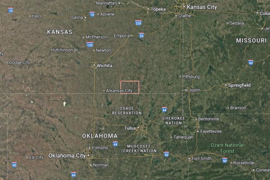
Where is Cowley County?
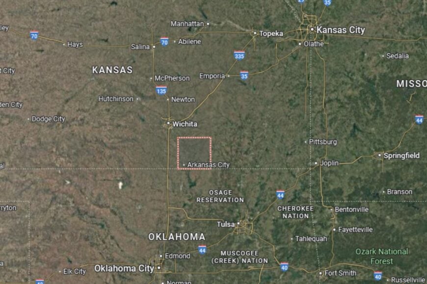
Cowley County is located in south-central Kansas, directly along the Oklahoma border. The county seat, Winfield, sits about 45 miles southeast of Wichita along U.S. Highway 77, while Arkansas City, the county’s second-largest community, lies further south near the state line. Together, the two towns anchor the county’s economy and cultural life.
The county is bordered by Butler to the north, Elk to the east, and Sumner to the west, with Oklahoma forming its southern edge. The Walnut River and Chikaskia River cut across the landscape, shaping both farmland and recreation areas. Cowley County’s location gives it a mix of prairie openness, river valleys, and close ties to neighboring Oklahoma communities.
#20. Republic County (tie)
– Life expectancy: 74.3 years
— 2.7 years lower than the state average
About
Republic County is a northern Kansas county with a heritage tied to farming and immigrant communities. Wheat and corn farming dominate, but the county also celebrates its Czech heritage with festivals and traditions that keep its cultural identity alive.
Residents enjoy a slower, rural pace of life supported by schools, healthcare services, and civic organizations. Outdoor activities like hunting, fishing, and county fairs keep the community connected. Republic County is a place where heritage and agriculture are deeply intertwined.
Where is Republic County?
Republic County is located in north-central Kansas, directly along the Nebraska border. The county seat, Belleville, lies along U.S. Highway 81, a major north–south route.
Neighboring counties include Cloud to the south and Washington to the east. Its northern border connects directly with Nebraska communities. Republic County’s location places it in the heart of Kansas’ farming belt.
#19. Greenwood County (tie)
– Life expectancy: 74.3 years
— 2.7 years lower than the state average
About
Greenwood County is one of Kansas’ most scenic rural counties, featuring rolling hills, tallgrass prairies, and expansive farmland. Agriculture remains its backbone, but ranching and conservation efforts also play key roles. Residents value the county’s quiet landscapes and traditions of land stewardship.
Community pride shines through annual fairs, festivals, and cultural activities. Outdoor recreation is abundant, particularly with hunting, fishing, and exploring the county’s unique tallgrass prairie environment. Greenwood County embodies both agricultural heritage and natural beauty.
Where is Greenwood County?
Greenwood County is located in southeastern Kansas, about 60 miles east of Wichita. The county seat, Eureka, lies along U.S. Highway 54, a key east–west corridor.
The county is bordered by Lyon to the north and Elk to the south. Its landscape is shaped by the Flint Hills, giving it one of the most distinctive geographies in Kansas. Greenwood County’s location provides both natural charm and agricultural productivity.
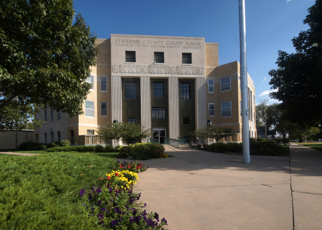
#18. Stafford County
– Life expectancy: 74.1 years
— 2.9 years lower than the state average
About
Stafford County is a central Kansas community where farming sets the pace of life. Wheat, sorghum, and corn fields stretch across the plains, while cattle ranching also plays a role in the local economy. The county is known for its quiet towns, strong schools, and community traditions that keep neighbors connected.
Beyond agriculture, residents appreciate the area’s hunting, fishing, and outdoor recreation opportunities. Annual fairs and festivals celebrate local pride and highlight Stafford County’s resilience and heritage. It remains a place where agriculture and community spirit go hand in hand.
Where is Stafford County?
Stafford County is located in central Kansas, about 30 miles southwest of Great Bend. The county seat, St. John, lies along U.S. Highway 281 and U.S. Highway 50, providing strong north–south and east–west connections.
The county is bordered by Barton to the north and Pratt to the south. Its landscape is largely flat farmland dotted with small lakes and prairies. Stafford County’s location keeps it firmly rooted in Kansas’ farming heartland.
#17. Wilson County (tie)
– Life expectancy: 74.0 years
— 3.0 years lower than the state average
About
Wilson County is a southeastern Kansas county that blends farming, ranching, and small-town traditions. Agriculture remains central, but local industries and small businesses provide additional stability. Residents take pride in their quiet towns, historic buildings, and close-knit way of life.
Community activities, fairs, and cultural events highlight the county’s character. Parks, rivers, and outdoor recreation offer opportunities for fishing, hunting, and family outings. Wilson County balances its agricultural heritage with natural beauty and cultural pride.
Where is Wilson County?
Wilson County is located in southeastern Kansas, about 50 miles west of the Missouri border. The county seat, Fredonia, lies near U.S. Highway 400, a key east–west route.
The county is bordered by Woodson to the north and Montgomery to the south. Rolling hills and farmland define the area, creating both economic productivity and scenic charm. Wilson County’s location places it in the heart of southeastern Kansas’ agricultural landscape.
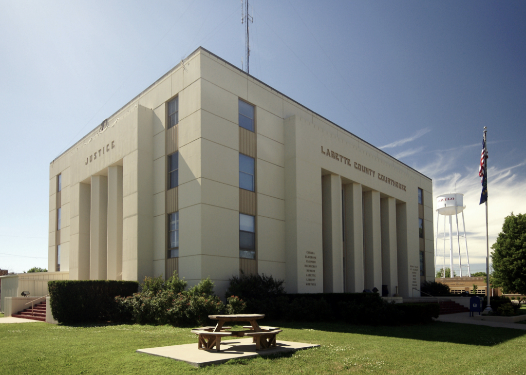
#16. Labette County (tie)
– Life expectancy: 74.0 years
— 3.0 years lower than the state average
You may also like: Chips, potatoes, and other groceries that dropped in price in the Midwest last month

About
Labette County combines farming with industry, anchored by Parsons, the county’s largest city. Agriculture remains a foundation, but the county also has manufacturing and rail connections that diversify the economy. Residents are proud of the county’s history and resilience through changing times.
Cultural life is supported by museums, festivals, and local traditions that strengthen community ties. Parks, trails, and rivers provide outdoor recreation for families and visitors. Labette County is a mix of rural heritage and industrial progress.
Where is Labette County?
Labette County is located in southeastern Kansas, about 150 miles south of Kansas City. The county seat, Oswego, lies along U.S. Highway 59, while Parsons serves as a regional hub.
The county borders Neosho to the north and Cherokee to the south. Its location close to Oklahoma and Missouri makes it a crossroads of southeastern Kansas. Labette County’s mix of farmland and rail heritage gives it a unique identity.
#15. Wyandotte County (tie)
– Life expectancy: 74.0 years
— 3.0 years lower than the state average
About
Wyandotte County is Kansas’ smallest county by land area but one of its most urban and diverse. Kansas City, Kansas, dominates the landscape, bringing industry, culture, and commerce to the forefront. While agriculture has little presence here, the economy thrives on logistics, retail, healthcare, and tourism, particularly with attractions like the Kansas Speedway.
Residents enjoy access to museums, theaters, restaurants, and sports venues. Community organizations and cultural festivals highlight the county’s diversity and energy. Wyandotte County represents the metropolitan side of Kansas.
Where is Wyandotte County?
Wyandotte County is located in northeastern Kansas, directly along the Missouri River and adjacent to Kansas City, Missouri. The county seat, Kansas City, Kansas, lies at the intersection of Interstates 70 and 635.
The county borders Leavenworth to the northwest and Johnson to the south. Its riverfront location gives it both historical and economic significance. Wyandotte County is one of Kansas’ key urban gateways.
#14. Hamilton County
– Life expectancy: 73.7 years
— 3.3 years lower than the state average

About
Hamilton County sits on the far western edge of Kansas, where wide-open prairies stretch endlessly toward Colorado. Agriculture is the backbone of life here, with wheat, corn, and cattle ranching driving the economy. Its small towns are marked by resilience and a deep appreciation for the land.
Community pride comes alive during county fairs, local sports, and civic events. Residents enjoy a slower pace of life, strengthened by strong schools and close family ties. Hamilton County reflects the rugged character of Kansas’ western frontier.
Where is Hamilton County?
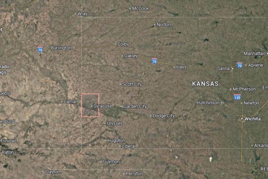
Hamilton County is located in far western Kansas, bordering Colorado. The county seat, Syracuse, lies along U.S. Highway 50, a major east–west corridor.
The county is bordered by Kearny to the east and Prowers County, Colorado, to the west. Its High Plains geography is characterized by flat farmland and big skies. Hamilton County’s location makes it a gateway between Kansas and Colorado.
#13. Wichita County
– Life expectancy: 73.6 years
— 3.4 years lower than the state average
About
Wichita County is a small but proud county where agriculture dominates. Wheat, sorghum, and cattle farming provide the foundation of the economy. Residents value the county’s simple, hardworking lifestyle and the quiet traditions of rural Kansas.
Despite its small size, the community is active with school events, fairs, and civic organizations. Outdoor recreation, including hunting and fishing, adds to local life. Wichita County is a reminder of the enduring strength of Kansas’ farming culture.
Where is Wichita County?
Wichita County is located in western Kansas, about 60 miles from the Colorado border. The county seat, Leoti, sits along Kansas Highway 96, an important east–west route.
The county is bordered by Scott to the east and Greeley to the west. Its open farmland and prairies are typical of the High Plains region. Wichita County’s location highlights its role in Kansas’ western agricultural belt.
#12. Ness County
– Life expectancy: 73.5 years
— 3.5 years lower than the state average
About
Ness County is a western Kansas county where farming and ranching dominate the local economy. Wheat and sorghum fields shape the landscape, while cattle ranches provide additional stability. Its towns are small but proud, with strong community traditions.
Festivals, parades, and fairs bring residents together throughout the year. Outdoor recreation and historical sites, including old limestone buildings, give the county a unique character. Ness County thrives on its mix of agricultural productivity and small-town heritage.
Where is Ness County?
Ness County is located in western Kansas, about 50 miles west of Great Bend. The county seat, Ness City, lies along U.S. Highway 283, which runs north–south through the county.
Neighboring counties include Rush to the east and Lane to the west. Its location in the High Plains ensures fertile farmland and scenic prairie views. Ness County’s geography makes it central to Kansas’ ranching and grain economy.
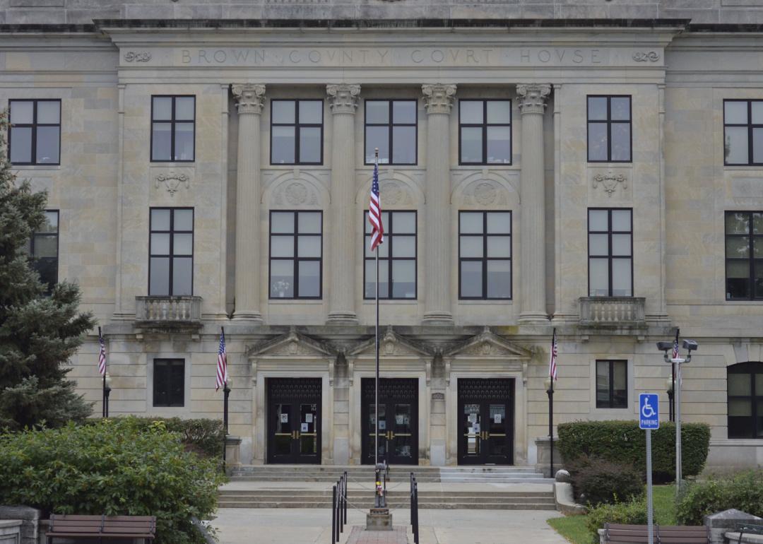
#11. Brown County
– Life expectancy: 73.4 years
— 3.6 years lower than the state average
You may also like: Counties with the highest STI rates in Kansas
About
Brown County blends farming traditions with Native American heritage. Agriculture, especially corn and soybeans, drives the economy, but the county is also home to the Kickapoo, Sac and Fox, and Iowa tribes, whose presence enriches its cultural identity. Residents are proud of their shared history and agricultural resilience.
Community pride is visible in local events, powwows, and festivals that celebrate both farming and Native heritage. Schools, healthcare facilities, and civic organizations provide stability. Brown County is a unique mix of cultures and traditions.
Where is Brown County?
Brown County is located in northeastern Kansas, near the Nebraska border. The county seat, Hiawatha, lies along U.S. Highway 36, a major east–west corridor across northern Kansas.
The county borders Doniphan to the east and Nemaha to the west. Its fertile land and rolling hills make it a productive farming area. Brown County’s location connects it to both Kansas and Nebraska cultural and agricultural networks.
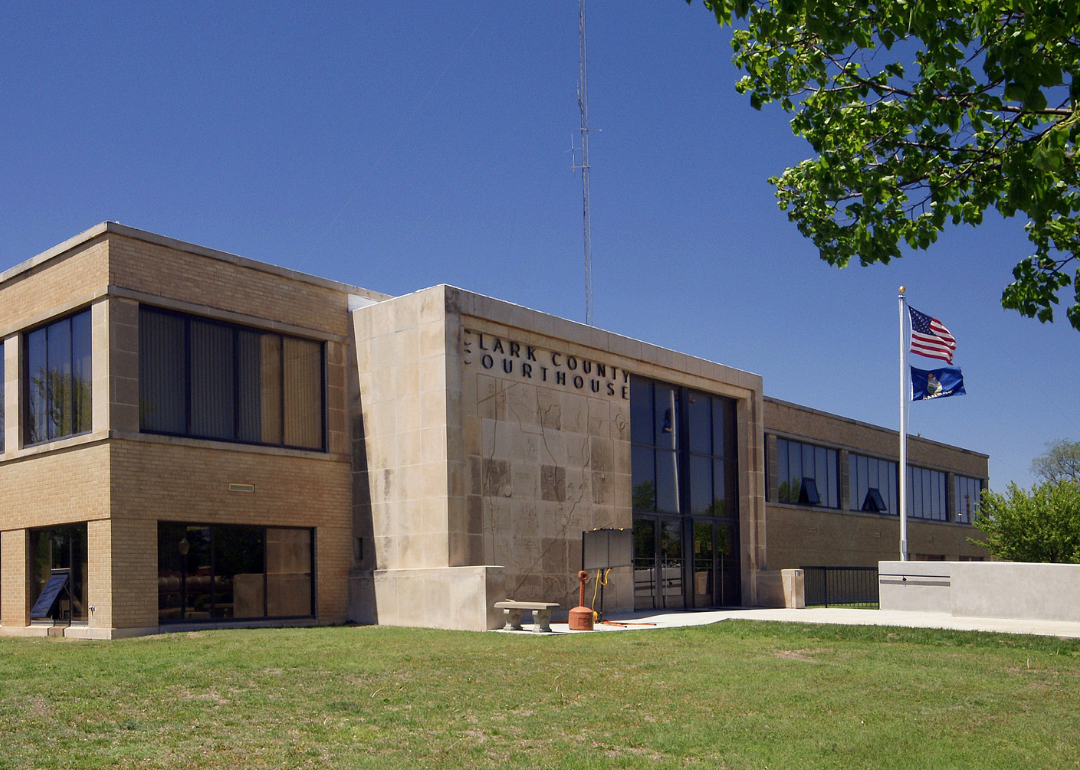
#10. Clark County (tie)
– Life expectancy: 73.3 years
— 3.7 years lower than the state average
About
Clark County is a sparsely populated county in southern Kansas where agriculture is the cornerstone of daily life. Wheat farming and cattle ranching dominate the landscape, with small towns providing essential services and community pride. The county is known for its resilience in the face of challenges, from weather extremes to economic shifts.
Community gatherings, fairs, and school events create strong bonds among residents. Outdoor recreation, such as hunting and exploring the county’s prairies, is also a part of life. Clark County represents the rugged character of rural Kansas.
Where is Clark County?
Clark County is located in southern Kansas, directly on the Oklahoma border. The county seat, Ashland, lies along U.S. Highway 160, a central east–west route.
The county borders Comanche to the east and Meade to the west. Its landscape features open plains and ranchland typical of the High Plains. Clark County’s location makes it both remote and distinctly agricultural.
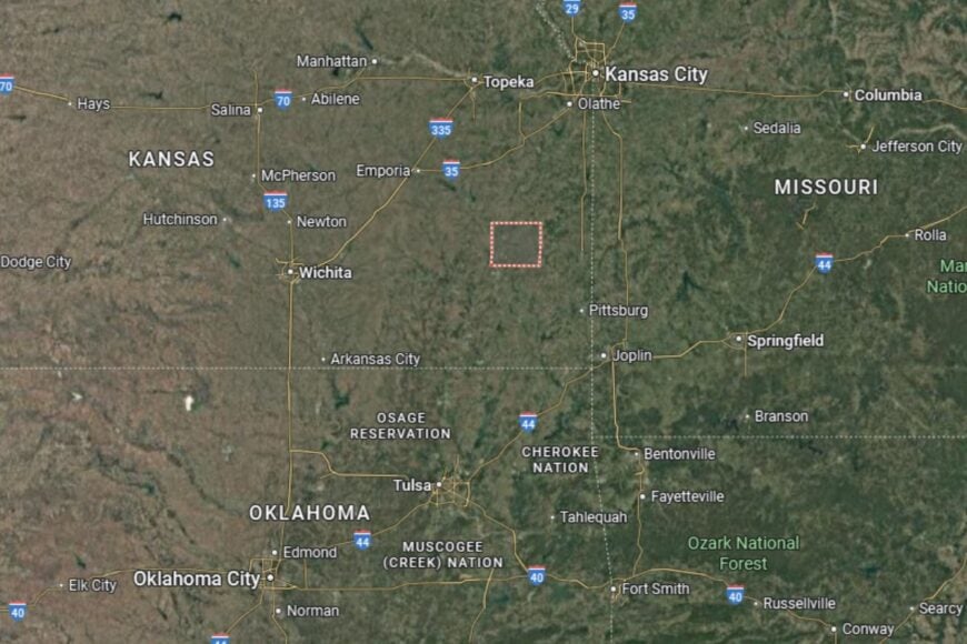
#9. Montgomery County (tie)
– Life expectancy: 73.3 years
— 3.7 years lower than the state average
About
Montgomery County is a southeastern Kansas county where agriculture and industry meet. Farming and ranching remain important, but the county has also been shaped by its oil and natural gas heritage. Independence, the county seat, is known for its historic downtown and cultural attractions, including ties to author Laura Ingalls Wilder.
Residents enjoy a balance of small-town traditions and industrial development. Festivals, fairs, and museums highlight community pride, while parks and trails provide outdoor opportunities. Montgomery County thrives on its mix of history, agriculture, and resilience.
Where is Montgomery County?
Montgomery County is located in southeastern Kansas, along the Oklahoma border. The county seat, Independence, sits along U.S. Highway 75 and U.S. Highway 160, providing good regional access.
The county is bordered by Labette to the east and Chautauqua to the west. The Verdigris River runs through the county, shaping both its economy and recreation. Montgomery County’s location makes it an important part of Kansas’ oil belt and agricultural region.
#8. Geary County
– Life expectancy: 73.2 years
— 3.8 years lower than the state average
About
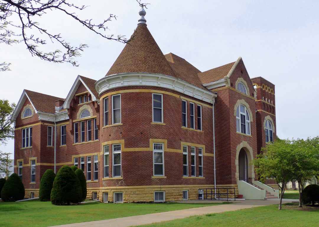
Geary County is a unique Kansas county that blends farming with military influence. While agriculture remains important, the presence of Fort Riley, a major U.S. Army installation, defines much of its economy and culture. Junction City, the county seat, reflects this mix of rural traditions and military pride.
Residents benefit from schools, healthcare, and community programs supported by both civilian and military populations. Parks, lakes, and cultural festivals provide recreational outlets. Geary County represents the intersection of Kansas farming roots and national defense.
Where is Geary County?
Geary County is located in northeastern Kansas, about 20 miles west of Manhattan. The county seat, Junction City, sits along Interstate 70, a key east–west corridor, and U.S. Highway 77.
The county borders Riley to the north and Dickinson to the west. Milford Lake, one of the state’s largest reservoirs, offers major recreational opportunities. Geary County’s location makes it both a military hub and a central Kansas community.
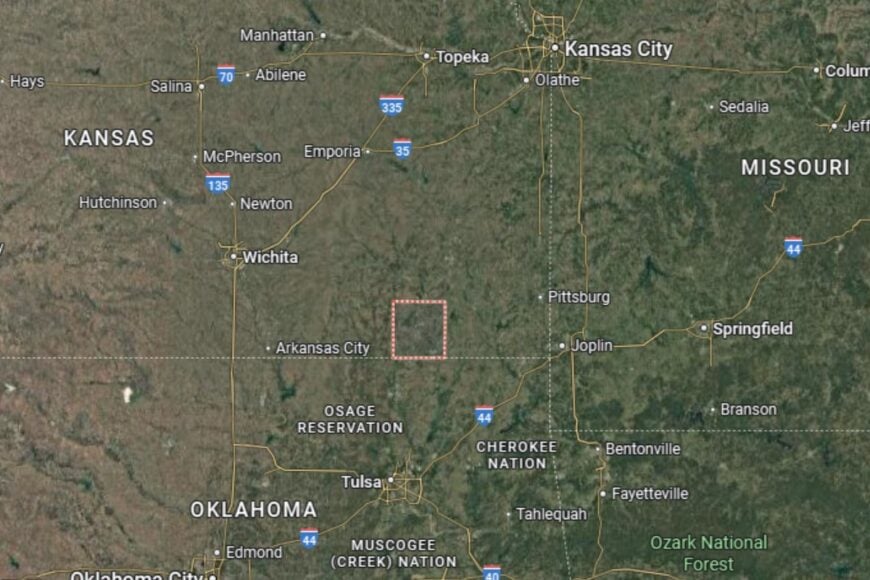
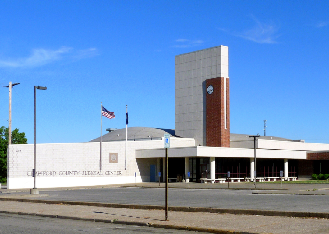
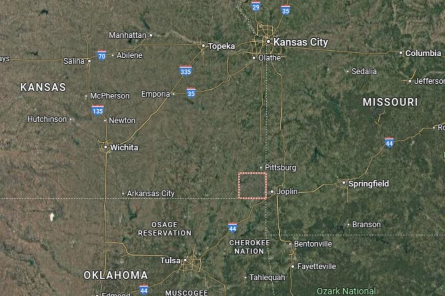
#7. Crawford County
– Life expectancy: 73.1 years
— 3.9 years lower than the state average
About
Crawford County blends agriculture with a rich cultural and industrial history. Pittsburg, the county’s largest city, has roots in coal mining and immigrant communities that helped shape its identity. Today, the economy includes farming, education, and healthcare, with Pittsburg State University adding an academic and cultural dimension.
The county celebrates its heritage through festivals, ethnic traditions, and community events. Residents also enjoy parks, trails, and recreational activities that reflect both natural and cultural pride. Crawford County thrives on its diversity and history.
Where is Crawford County?
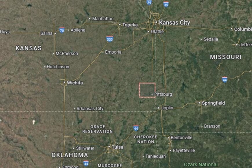
Crawford County is located in southeastern Kansas, near the Missouri border. The county seat, Girard, lies along U.S. Highway 69, while Pittsburg serves as the region’s cultural and economic hub.
Neighboring counties include Bourbon to the north and Cherokee to the south. Its location gives it close ties to both Kansas and Missouri. Crawford County’s mix of farming, education, and heritage makes it distinctive in the state.
#6. Comanche County
– Life expectancy: 72.4 years
— 4.6 years lower than the state average
You may also like: How many people are receiving mental health treatment in Kansas
About
Comanche County is one of Kansas’ least populated counties, defined by wide-open prairies and a lifestyle rooted in farming and ranching. Cattle ranches and wheat fields dominate the economy, with small towns providing essential services. The county is known for its rugged beauty and close-knit communities.
Residents embrace a slower pace of life, enjoying hunting, fishing, and outdoor traditions. Civic pride is reflected in school events, fairs, and volunteer-driven organizations. Comanche County represents the quieter side of Kansas living.
Where is Comanche County?
Comanche County is located in southern Kansas, directly on the Oklahoma border. The county seat, Coldwater, lies along U.S. Highway 160, which connects it to nearby counties.
The county borders Kiowa to the north and Clark to the west. Its geography includes flat farmland and prairie, with occasional rolling hills. Comanche County’s location makes it both remote and deeply connected to Kansas’ ranching heritage.
#5. Cherokee County
– Life expectancy: 72.3 years
— 4.7 years lower than the state average
About
Cherokee County is a southeastern Kansas county with a strong agricultural base and a history of mining. Farming and ranching provide stability, while the legacy of zinc and lead mining has shaped its towns and landscapes. Today, residents value their traditions and the county’s mix of rural life and historic character.
Community pride is evident in festivals, fairs, and cultural events that bring neighbors together. Outdoor recreation, from hunting and fishing to exploring historic sites, adds to daily life. Cherokee County combines its agricultural heritage with a resilient spirit.
Where is Cherokee County?
Cherokee County is located in the far southeastern corner of Kansas, directly bordering Missouri and Oklahoma. The county seat, Columbus, sits along U.S. Highway 160, while Baxter Springs and Galena connect it to Route 66 heritage.
The county borders Crawford to the north and Labette to the west. Its tri-state location makes it a crossroads of culture and commerce. Cherokee County’s geography and history set it apart in Kansas.
#4. Morton County
– Life expectancy: 71.3 years
— 5.7 years lower than the state average
About
Morton County is a rugged southwestern Kansas county where wide-open prairies define the landscape. Agriculture, especially cattle ranching and wheat farming, provides the backbone of the economy. Its small communities embody the resilience and independence of life on the High Plains.
Residents enjoy a quiet pace supported by schools, healthcare facilities, and civic organizations. Outdoor life is central here, with hunting, fishing, and prairie exploration offering recreation. Morton County captures the essence of Kansas’ frontier heritage.
Where is Morton County?
Morton County is located in the far southwestern corner of Kansas, touching both Colorado and Oklahoma. The county seat, Elkhart, lies along U.S. Highway 56, a key east–west route.
The county borders Stevens to the east and Baca County, Colorado, to the west. Its tri-state position makes it one of Kansas’ most geographically distinctive counties. Morton County is a gateway between states and cultures on the High Plains.
#3. Hodgeman County
– Life expectancy: 70.8 years
— 6.2 years lower than the state average
About
Hodgeman County is a small county in western Kansas where farming and ranching dominate. Wheat and sorghum fields define the economy, while cattle ranches add to its agricultural strength. Residents value the simple, hardworking lifestyle that rural Kansas provides.
Civic pride shines through local schools, community fairs, and traditions passed down through generations. Outdoor recreation, from hunting to prairie drives, adds to the county’s character. Hodgeman County remains a picture of rural resilience.
Where is Hodgeman County?
Hodgeman County is located in western Kansas, about 30 miles northeast of Dodge City. The county seat, Jetmore, lies at the junction of U.S. Highway 283 and Kansas Highway 156.
The county is bordered by Ness to the north and Ford to the south. Its open farmland and rolling prairies are typical of the region. Hodgeman County’s location makes it a quiet but productive part of Kansas agriculture.
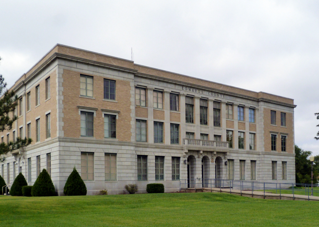
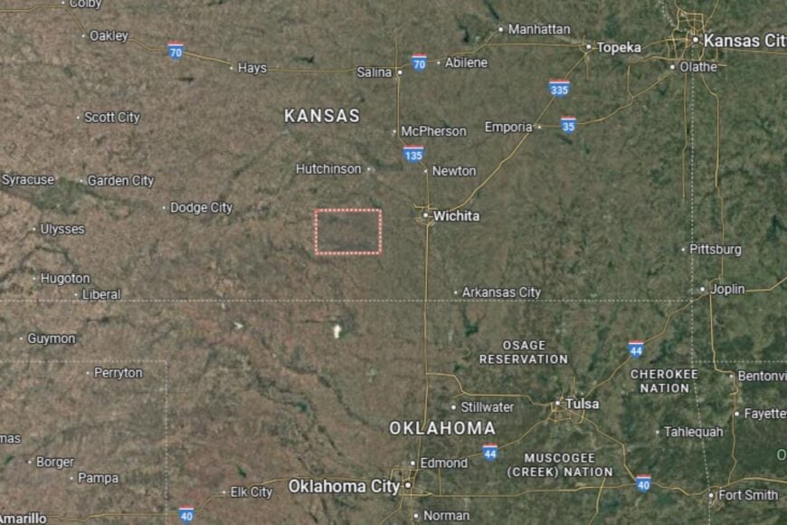
#2. Edwards County
– Life expectancy: 64.6 years
— 12.4 years lower than the state average
About
Edwards County is a central Kansas county where agriculture continues to shape the economy. Wheat, corn, and sorghum dominate the fields, while small towns serve as community anchors. Despite modern challenges, residents value their rural traditions and strong community ties.
Schools, healthcare providers, and civic organizations foster local pride and stability. Outdoor recreation, including hunting and fishing, adds to the county’s appeal. Edwards County reflects both the struggles and the enduring spirit of rural Kansas.
Where is Edwards County?
Edwards County is located in south-central Kansas, about 35 miles east of Dodge City. The county seat, Kinsley, lies along U.S. Highway 50, a major east–west route across the state.
The county borders Pawnee to the north and Kiowa to the south. Its location in the Arkansas River Valley provides fertile farmland. Edwards County stands at the intersection of Kansas’ agricultural traditions and modern challenges.
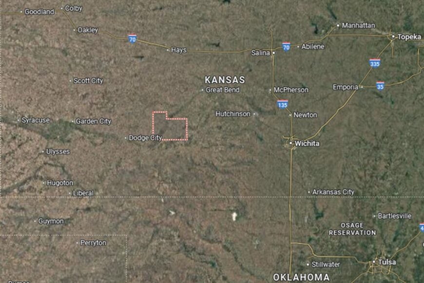
#1. Kingman County
– Life expectancy: 63.6 years
— 13.4 years lower than the state average
About
Kingman County is a south-central Kansas county where agriculture is central to both the economy and way of life. Wheat, corn, and cattle ranching dominate, while small industries and services support its towns. Despite facing health and economic struggles, residents maintain a strong sense of community.
Festivals, school events, and civic organizations keep traditions alive and foster pride. Residents also enjoy outdoor activities like hunting, fishing, and camping. Kingman County embodies the challenges and resilience of rural Kansas.
Where is Kingman County?
Kingman County is located in south-central Kansas, about 40 miles west of Wichita. The county seat, Kingman, sits along U.S. Highway 54, which provides direct access to both Wichita and western Kansas.
The county borders Reno to the north and Harper to the south. Its fertile farmland and small rivers contribute to its agricultural success. Kingman County’s location ties it closely to Wichita while preserving its rural character.
This story features data reporting by Karim Noorani, writing by Kiersten Hickman, and is part of a series utilizing data automation across 49 states.
You may also like: Fastest-growing jobs in Kansas
By Stacker