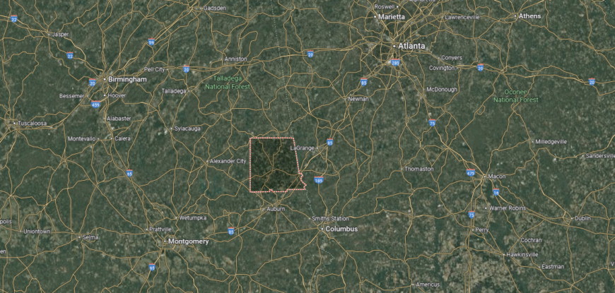
Counties with the shortest life expectancy in Alabama
Life expectancy can be affected by a variety of factors. About 25% of your lifespan is determined by genetics, according to the National Library of Medicine.
In order to come up with the very specific design ideas, we create most designs with the assistance of state-of-the-art AI interior design software. Also, assume links that take you off the site are affiliate links such as links to Amazon. this means we may earn a commission if you buy something.
Health and wellness habits—like following a balanced, nutrient-rich diet; not smoking; drinking minimal alcohol; maintaining a healthy weight; and staying physically active—can add more than a decade to your life, research from the National Institutes of Health shows. While these factors are significant, another important element that you might not have considered is your environment and community.
While life expectancy generally increases annually in the United States—jumping from about 70.8 years old to 77.5 between 1970 and 2022, according to the Centers for Disease Control and Prevention—this particular metric can vary from state to state or even county to county. In some parts of the country, the average lifespan is getting shorter based on a variety of risk factors on top of health, including socioeconomic factors like poverty, unemployment, income, and education.
According to a 2020 study from researchers at Penn State, West Virginia, and Michigan State Universities, communities with a higher population density, more fast food restaurants, and a high number of extraction industry-based jobs tend to have shorter life expectancies.
To find out how life expectancy varies within Alabama, Stacker used 2024 County Health Rankings & Roadmaps from the University of Wisconsin Population Health Institute to identify the counties with the shortest life expectancy. Life expectancy measures the average number of years from birth a person can expect to live and is calculated based on the number of deaths in a given time period and the average number of people at risk of dying during that period. Counties with unreliable or insufficient data were excluded from the analysis. Mortality data came from the National Vital Statistics System.
Read on to see if your county is on the list.
You may also like: Counties with the longest life expectancy in Alabama
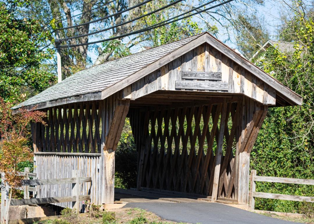
#34. Chambers County
– Life expectancy: 72.5 years
— 1.2 years lower than the state average
About
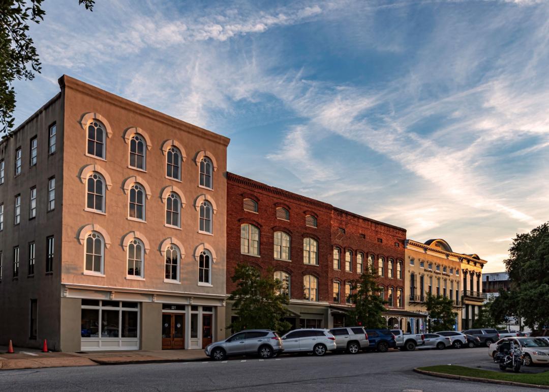
Chambers County rests along Alabama’s eastern border, where small towns and farmland reflect a story shaped by both river trade and textile mills. LaFayette, the county seat, carries the imprint of early settlement, while Valley and Lanett reflect the legacy of industry that long supported the region. Its landscape of rolling hills and creeks has provided both livelihood and setting for generations.
Traditions remain strong in community festivals, church gatherings, and civic events that highlight pride in place. While agriculture and manufacturing continue to shape the economy, education and regional commerce have added new opportunities. Chambers County reflects a balance of history, work, and community that still anchors daily life.
Where is Chambers County?
Chambers County is in eastern Alabama, bordered by Lee County to the south, Tallapoosa County to the west, and Randolph County to the north. Its eastern boundary follows the Chattahoochee River, which also marks the state line with Georgia. The county lies about 75 miles northeast of Montgomery and 80 miles southwest of Atlanta.
LaFayette, the county seat, sits near the center, while Valley, the largest city, is positioned along the Chattahoochee River close to the Georgia line. Other communities include Lanett and Huguley, both tied to the river corridor. With its location on the Alabama–Georgia border, Chambers County connects east Alabama with the Greater Atlanta region.
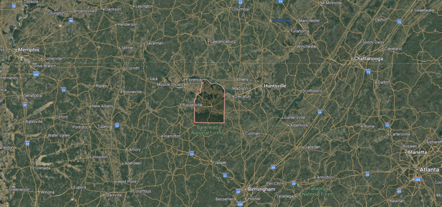
#33. Franklin County (tie)
– Life expectancy: 72.4 years
— 1.3 years lower than the state average
About
Franklin County lies in northwest Alabama, where forested hills roll toward the Tennessee River and creeks cut across quiet farmland. Russellville, the county seat, serves as both a civic hub and cultural gathering place, tying the county’s communities together. The land itself—with its ridges, valleys, and waterways—has long guided work and tradition.
Life here follows the seasons, from harvest festivals and music gatherings to fishing and outdoor traditions. Agriculture remains steady, while small industry and local enterprises add variety to the economy. Franklin County reflects a place where land, culture, and community spirit flow side by side.
Where is Franklin County?
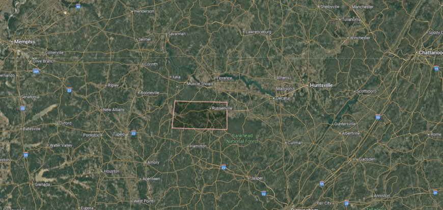
Franklin County is in northwestern Alabama, bordered by Colbert County to the north, Marion County to the south, and Lawrence County to the east. Its western edge meets the Mississippi state line. The county lies about 75 miles west of Huntsville and 65 miles northeast of Tupelo, Mississippi.
Russellville, the county seat, is positioned near the center and serves as the primary hub for government and commerce. Other communities include Red Bay along the Mississippi border and Phil Campbell in the eastern section. With its border location and network of small towns, Franklin County ties Alabama’s northwest corner to neighboring Mississippi.
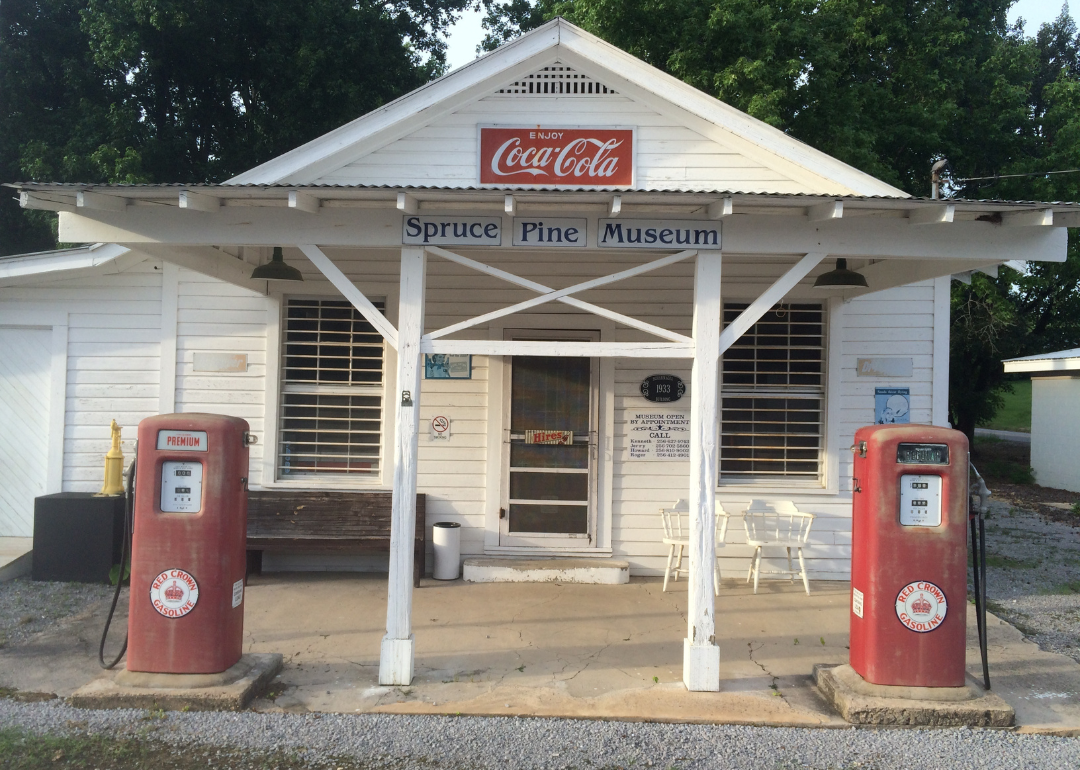
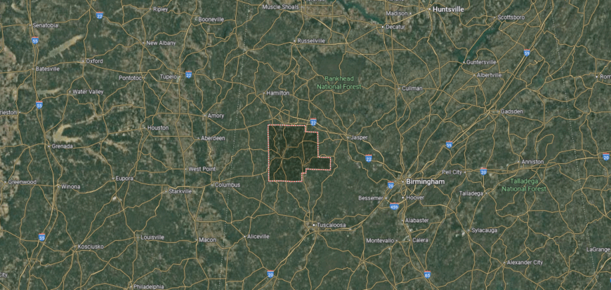
#32. Marion County (tie)
– Life expectancy: 72.4 years
— 1.3 years lower than the state average
About
Marion County sits in northwest Alabama, with Hamilton as its county seat and center of community life. The county’s identity is rooted in farming, small industry, and the traditions of its rural towns. Music and cultural gatherings have also left a mark, giving the area a creative spirit alongside its work.
Community pride is shown through school events, county fairs, and local festivals that bring neighbors together. Outdoor recreation in nearby forests and waterways adds balance to daily routines. Marion County reflects a steady mix of rural tradition, community strength, and cultural character.
Where is Marion County?

Marion County is in northwestern Alabama, bordered by Franklin County to the north, Fayette County to the south, and Winston County to the east. Its western edge touches the Mississippi state line. The county is about 85 miles northwest of Birmingham and 65 miles south of Tupelo, Mississippi.
Hamilton, the county seat, lies near the center along U.S. Highway 78. Other communities include Winfield in the southeast and Guin to the west. With its location near the Mississippi border, Marion County links Alabama’s hill country to the neighboring state’s northern region.
#31. Barbour County (tie)
– Life expectancy: 72.4 years
— 1.3 years lower than the state average

About
Barbour County rests in southeastern Alabama, where rolling farmland and wooded hills tell a story shaped by both Native heritage and early settlement. Clayton, the county seat, preserves historic courthouses and small-town traditions, while Eufaula, along the Chattahoochee River, is noted for its grand antebellum homes and cultural landmarks. The county’s history is closely tied to river trade, agriculture, and the civic life of its towns.
Heritage endures through historic districts, museums, and community festivals that connect present life with the past. Farming continues to play a role, while tourism, small industry, and regional commerce add variety to the economy. Barbour County reflects a place where history, culture, and community remain firmly intertwined.
Where is Barbour County?
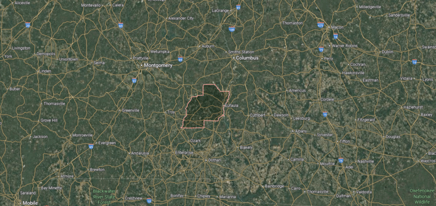
Barbour County is in southeastern Alabama, bordered by Russell County to the north, Henry County to the south, and Pike County to the west. Its eastern boundary follows the Chattahoochee River, which also forms the state line with Georgia. The county lies about 90 miles southeast of Montgomery and 45 miles southwest of Columbus, Georgia.
Clayton, the county seat, is located near the center, while Eufaula, the largest city, sits on the Chattahoochee River across from Georgia. Smaller communities include Louisville in the northern section and Bakerhill near the southern border. With its riverfront position and border location, Barbour County connects southeastern Alabama to western Georgia.
#30. Bibb County
– Life expectancy: 72.3 years
— 1.4 years lower than the state average
You may also like: Counties with the worst droughts in Alabama
About
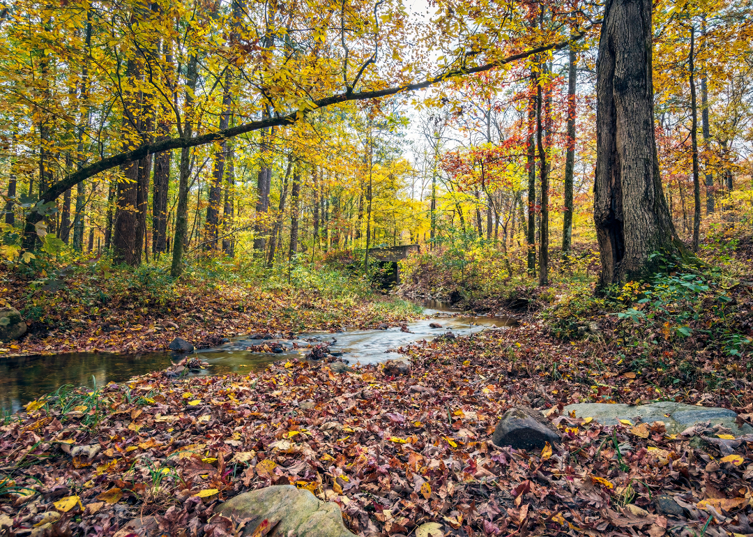
Bibb County lies in central Alabama, where forests, rivers, and rolling hills define its character. The Cahaba River, one of the state’s most scenic waterways, winds through its landscape, supporting both natural beauty and local identity. Centreville, the county seat, reflects small-town life rooted in history and steady community ties.
Life here often centers on outdoor traditions—hiking, fishing, and gatherings along the riverbanks. Forestry and small industry work alongside agriculture to sustain the local economy. Bibb County reflects a place where land, water, and community remain deeply connected.
Where is Bibb County?
Bibb County is in central Alabama, bordered by Jefferson County to the north, Perry County to the south, and Shelby County to the east. It lies about 35 miles southwest of Birmingham and 65 miles north of Montgomery. The Cahaba River runs through the county, shaping much of its landscape with valleys and wooded hills.
Centreville, the county seat, sits near the center along the Cahaba River. Brent, another key community, is located just to the south, forming the county’s main population hub. With its position between Birmingham and Montgomery, Bibb County serves as a crossroads of central Alabama.
#29. Pickens County
– Life expectancy: 72.2 years
— 1.5 years lower than the state average
About
Pickens County sits along Alabama’s western border, with Carrollton as its county seat and historic center. The county’s identity is tied to farming, forestry, and the traditions of its small towns. Its courthouse in Carrollton, marked by local legend, remains a lasting symbol of community pride.
Local life is carried through school events, county fairs, and church-centered gatherings that strengthen connections. Agriculture continues to anchor the economy, joined by small industry and trade. Pickens County reflects a steady rhythm of rural heritage, community life, and local tradition.
Where is Pickens County?
🔥 Would you like to save this?
Pickens County is in west-central Alabama, bordered by Tuscaloosa County to the east, Greene County to the south, and Fayette County to the north. Its western boundary follows the state line with Mississippi. The county lies about 35 miles west of Tuscaloosa and 115 miles southwest of Birmingham.
Carrollton, the county seat, is located near the center and serves as the hub of government and commerce. Other communities include Reform along U.S. Highway 82 and Aliceville in the southern part of the county. With its location on the Alabama–Mississippi border, Pickens County links the Black Belt region to neighboring Mississippi.
#28. Bullock County (tie)
– Life expectancy: 72.1 years
— 1.6 years lower than the state average
About
Bullock County rests in southeastern Alabama, its story shaped by farming traditions and the rise of railroads that once carried cotton and goods through the region. Union Springs, the county seat, reflects this history in its historic architecture, town square, and strong cultural identity. The county has long been tied to agriculture, hunting traditions, and small-town life.
Heritage lives on through community festivals, historic sites, and gatherings that celebrate both land and culture. Farming remains important, while tourism and outdoor recreation add new layers to the economy. Bullock County reflects a place where history, rural traditions, and community pride remain closely bound.
Where is Bullock County?
Bullock County is in southeastern Alabama, bordered by Macon County to the north, Barbour County to the south, and Pike County to the west. It lies about 45 miles east of Montgomery and 40 miles west of Columbus, Georgia. The county’s terrain is part of Alabama’s Black Belt region, with rolling hills and fertile soils.
Union Springs, the county seat, is located near the center and serves as the county’s main hub. Smaller communities include Midway to the southeast and Perote near the Pike County line. With its position between Montgomery and the Georgia border, Bullock County connects central Alabama to the state’s eastern edge.
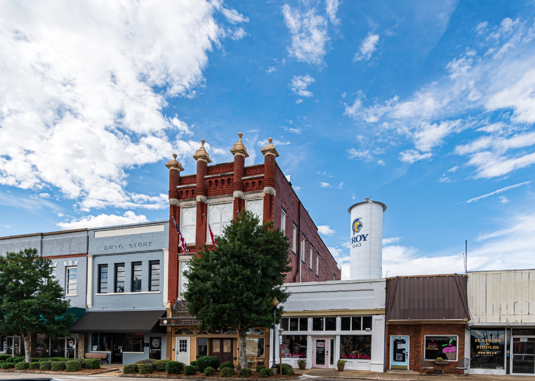
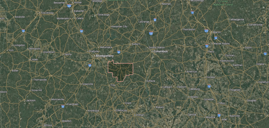
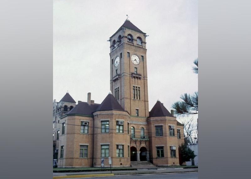
#27. Pike County (tie)
– Life expectancy: 72.1 years
— 1.6 years lower than the state average
About
Pike County rests in southeastern Alabama, where gentle hills, farmland, and wooded creeks shape both work and daily life. Troy, the county seat, blends small-town traditions with the energy of Troy University, giving the county a balance of heritage and growth. The landscape provides a steady rhythm, with seasons guiding both agriculture and community events.
Festivals, university traditions, and gatherings in town squares tie people together across generations. Farming and education serve as the county’s main anchors, complemented by small industries and local trade. Pike County reflects a place where land, learning, and community spirit move in harmony.
Where is Pike County?
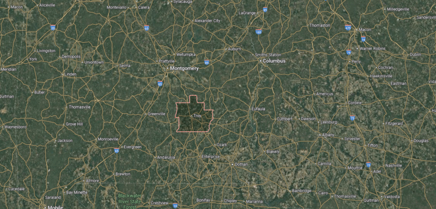
Pike County is in southeastern Alabama, bordered by Bullock County to the north, Crenshaw County to the west, and Barbour County to the east. It lies about 50 miles south of Montgomery and 55 miles north of Dothan. The county sits in the East Gulf Coastal Plain, with rolling hills and pine woodlands.
Troy, the county seat, is centrally located and serves as the largest city, home to Troy University. Other communities include Brundidge to the southeast and Banks near the northern border. With its mix of education, small towns, and highways, Pike County links central and southern Alabama.
#26. Macon County (tie)
– Life expectancy: 72.0 years
— 1.7 years lower than the state average
About
Macon County sits in east-central Alabama, with Tuskegee as its county seat and historic heart. The county is widely known for Tuskegee University and its role in African American education, culture, and history. Farming and small industry remain part of the local economy alongside education and research.
Community life is reflected in university traditions, local festivals, and civic events that highlight pride in heritage. Parks, museums, and historic sites connect residents and visitors to the county’s story. Macon County represents a steady blend of history, education, and community spirit.
Where is Macon County?

Macon County is in eastern Alabama, bordered by Lee County to the east, Montgomery County to the west, and Bullock County to the south. Its eastern boundary lies about 35 miles from the Georgia state line, with the county located roughly 40 miles northeast of Montgomery. The terrain is part of Alabama’s Black Belt region, known for its rolling hills and fertile soils.
Tuskegee, the county seat, is near the center and serves as the cultural and educational hub. Other communities include Shorter along Interstate 85 and Notasulga at the northern border shared with Lee County. With its position between Montgomery and Auburn, Macon County connects central Alabama to the state’s eastern borderlands.
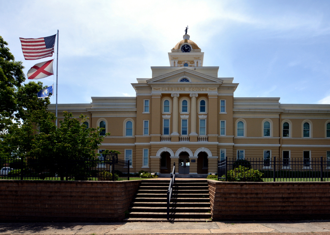
#25. Cleburne County (tie)
– Life expectancy: 72.0 years
— 1.7 years lower than the state average
You may also like: States sending the most people to Alabama
About
Cleburne County lies along Alabama’s eastern edge, its landscape defined by the southern Appalachians and the ridges of Talladega National Forest. Heflin, the county seat, grew from frontier settlements and later became a crossroads community tied to farming, trade, and the nearby railroads. The county’s history reflects both rugged mountain living and the resilience of rural traditions.
Heritage continues through festivals, historic sites, and gatherings that honor Appalachian culture and community pride. Farming, forestry, and outdoor recreation remain important to daily life, while natural beauty draws visitors to its trails and peaks. Cleburne County reflects a place where history, mountains, and community spirit stand closely linked.
Where is Cleburne County?
Cleburne County is in eastern Alabama, bordered by Calhoun County to the west, Randolph County to the south, and Cherokee County to the north. Its eastern edge follows the Alabama–Georgia state line. The county lies about 75 miles east of Birmingham and is home to Cheaha Mountain, the highest point in Alabama.
Heflin, the county seat, is located near Interstate 20 close to the Georgia border. Other communities include Ranburne to the southeast and Fruithurst to the northeast. With its position along the state line and its mountainous terrain, Cleburne County connects Alabama’s hill country to western Georgia.
#24. Clay County
– Life expectancy: 71.8 years
— 1.9 years lower than the state average
About
Clay County rests in the heart of east-central Alabama, where forested hills and winding creeks weave through the southern Appalachians. Ashland and Lineville, its two main towns, reflect small-town character surrounded by ridges and valleys that define the county’s setting. The land itself—quiet, rugged, and enduring—shapes both daily work and community traditions.
Seasons bring rhythm to life, from autumn fairs and school gatherings to summer festivals and outdoor recreation. Farming and forestry remain steady anchors, joined by local commerce and civic institutions. Clay County reflects a place where landscape and community move together in lasting harmony.
Where is Clay County?

Clay County is in east-central Alabama, bordered by Cleburne County to the north, Tallapoosa County to the south, and Talladega County to the west. It lies about 80 miles southeast of Birmingham and 65 miles northwest of Auburn. The terrain is part of the southern Appalachian foothills, with Cheaha State Park extending into its northern section.
Ashland, the county seat, is near the center of the county, while Lineville sits just to the northeast. Smaller communities such as Delta and Millerville add to its rural network. With its mix of mountain ridges, valleys, and small towns, Clay County reflects the character of Alabama’s hill country.
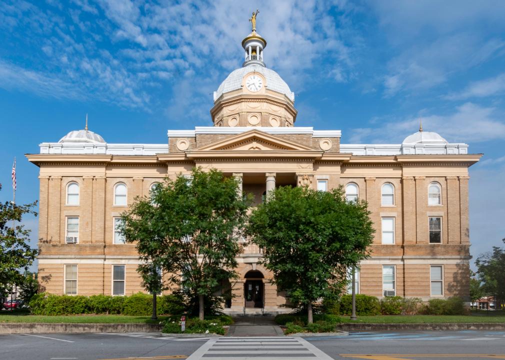
#23. Calhoun County (tie)
– Life expectancy: 71.7 years
— 2.0 years lower than the state average
About
Calhoun County sits in northeastern Alabama, with Anniston as its county seat and main center of commerce and culture. The county’s identity is shaped by military history at Fort McClellan, industry, and its location in the foothills of the Appalachians. Oxford, Jacksonville, and other towns add to its mix of civic and educational life.
Local pride is reflected in school traditions, festivals, and civic gatherings that bring residents together. Parks, trails, and nearby mountains connect the county to outdoor recreation. Calhoun County represents a blend of military heritage, community spirit, and steady regional growth.
Where is Calhoun County?
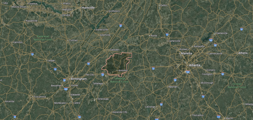
🔥 Would you like to save this?
Calhoun County is in northeastern Alabama, bordered by Cherokee County to the northeast and Cleburne County to the east. To the west lies Etowah County, with St. Clair County touching the southwest corner, while Talladega County borders directly to the south. Set in the Appalachian foothills, Calhoun sits about 65 miles east of Birmingham and 90 miles west of Atlanta.
Anniston, the county seat, is centrally located, while Jacksonville to the north hosts Jacksonville State University and Oxford to the south anchors commerce along Interstate 20. With its mountain setting and major transportation routes, Calhoun County serves as both a cultural hub and a regional crossroads in northeast Alabama.
#22. Greene County (tie)
– Life expectancy: 71.7 years
— 2.0 years lower than the state average
About
Greene County lies in Alabama’s Black Belt region, where fertile soil shaped both settlement and agriculture. Eutaw, the county seat, is known for its collection of historic antebellum homes and landmarks that reflect the county’s deep ties to Southern history. The legacy of farming, along with the struggles and triumphs of the civil rights era, remain central to its story.
Heritage endures through historic preservation, cultural events, and community gatherings that honor both past and progress. Agriculture continues to influence the economy, while tourism tied to history and heritage adds another dimension. Greene County reflects a place where land, culture, and history remain inseparably linked.
Where is Greene County?
Greene County is in west-central Alabama, bordered by Tuscaloosa County to the north, Hale County to the east, and Sumter County to the south. Its western edge meets the state of Mississippi, making it part of the Alabama–Mississippi border region. The county lies about 35 miles southwest of Tuscaloosa and 115 miles west of Montgomery.
Eutaw, the county seat, is located near the center and serves as the hub for government and commerce. Other communities include Boligee to the south and Forkland near the Black Warrior River. With its border position and rural setting, Greene County connects Alabama’s Black Belt region to neighboring Mississippi.
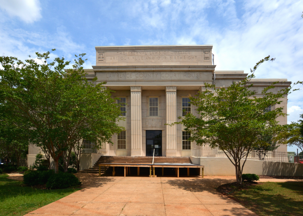
#21. Lawrence County
– Life expectancy: 71.6 years
— 2.1 years lower than the state average
About
Lawrence County lies in northern Alabama, where the Tennessee River curves past farmland, wooded hills, and quiet valleys. Moulton, the county seat, anchors a community shaped by both Native heritage and pioneer settlement. The land itself—riverbanks, ridges, and fields—provides the rhythm that guides work and tradition.
Life here reflects the seasons, with harvest festivals, school events, and gatherings that tie people to one another and the land. Farming remains central, supported by small industries and regional commerce. Lawrence County reflects a place where river, land, and community spirit remain closely bound.
Where is Lawrence County?
Lawrence County lies in northern Alabama, with the Tennessee River forming its entire northern boundary. Across the river sit Colbert and Lauderdale Counties. To the east is Morgan County, to the south Winston County, and to the west Franklin County. The county is part of the Tennessee Valley, about 40 miles west of Huntsville and 85–90 miles north of Birmingham.
Moulton, the county seat, is near the geographic center and serves as the main administrative hub. Other towns include Courtland along the Tennessee River and Town Creek in the northeast. With its mix of fertile river bottomland and rolling uplands, Lawrence balances rural farming traditions with ties to northern Alabama’s industrial corridor.
#20. Russell County (tie)
– Life expectancy: 71.5 years
— 2.2 years lower than the state average
You may also like: Healthy hotspots: The most physically active counties in Alabama
About
Russell County sits along Alabama’s eastern border, with Phenix City as its county seat and largest community. The county’s identity is tied to its position on the Chattahoochee River, shaping both trade and industry. Its towns balance agricultural roots with the growth that comes from proximity to Columbus, Georgia, and Fort Moore.
Community life is carried through school traditions, local festivals, and civic gatherings that strengthen connections. Agriculture, small industry, and cross-border commerce support the economy. Russell County reflects a blend of river setting, regional growth, and small-town tradition.
Where is Russell County?

Russell County is in eastern Alabama, bordered by Lee County to the north, Barbour County to the south, and Bullock County to the west. Its eastern boundary follows the Chattahoochee River, which also forms the state line with Georgia. The county lies about 80 miles southeast of Montgomery and directly across the river from Columbus, Georgia.
Phenix City, the county seat, sits on the Alabama–Georgia border and serves as the largest community. Other towns include Hurtsboro in the western part of the county and Fort Mitchell near the river. With its border location and river access, Russell County connects east Alabama to the Columbus metropolitan area.
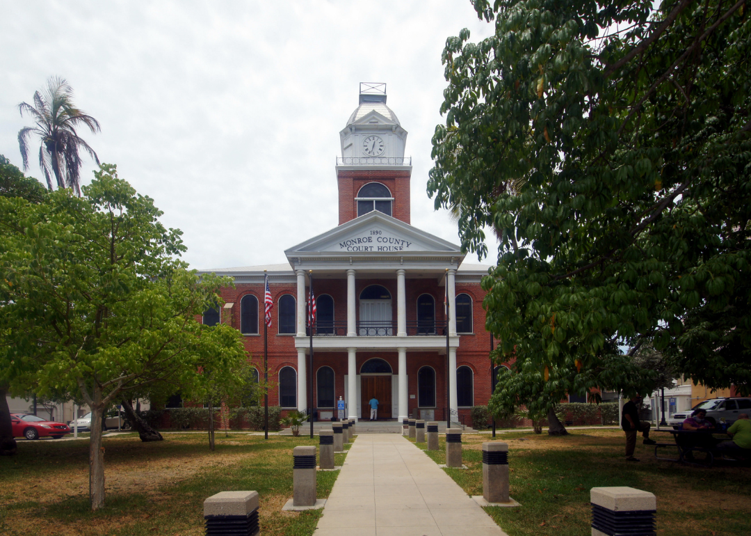
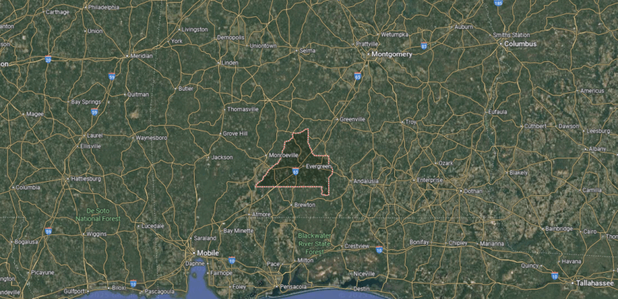
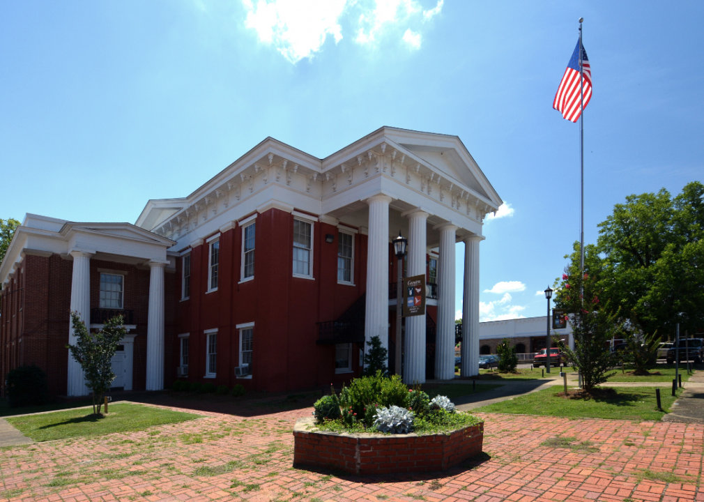
#19. Monroe County (tie)
– Life expectancy: 71.5 years
— 2.2 years lower than the state average
About
Monroe County rests in southwest Alabama, its history tied to farming, timber, and the cultural legacy of storytelling. Monroeville, the county seat, is widely known as the hometown of authors Harper Lee and Truman Capote, giving the community a place in American literary history. The county’s heritage reflects both rural traditions and the enduring influence of its writers.
Cultural pride is carried forward through festivals, museums, and historic sites that honor its literary and community legacy. Timber and farming remain important to the economy, while tourism tied to literature and history adds vitality. Monroe County reflects a place where heritage, creativity, and rural life remain inseparably linked.
Where is Monroe County?
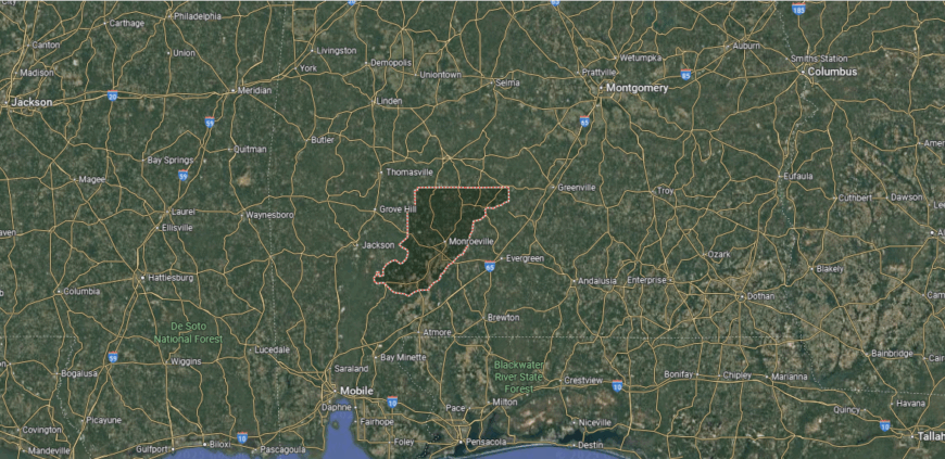
Monroe County is in southwestern Alabama, bordered by Wilcox County to the north, Conecuh County to the south, and Clarke County to the west. It lies about 100 miles southwest of Montgomery and 90 miles northeast of Mobile. The county sits in Alabama’s Coastal Plain region, with rolling hills, pine forests, and farmland.
Monroeville, the county seat, is located near the center and is the largest town in the county. Other communities include Beatrice to the north and Excel to the east. With its position between Montgomery and Mobile, Monroe County links central Alabama to the Gulf Coast region.
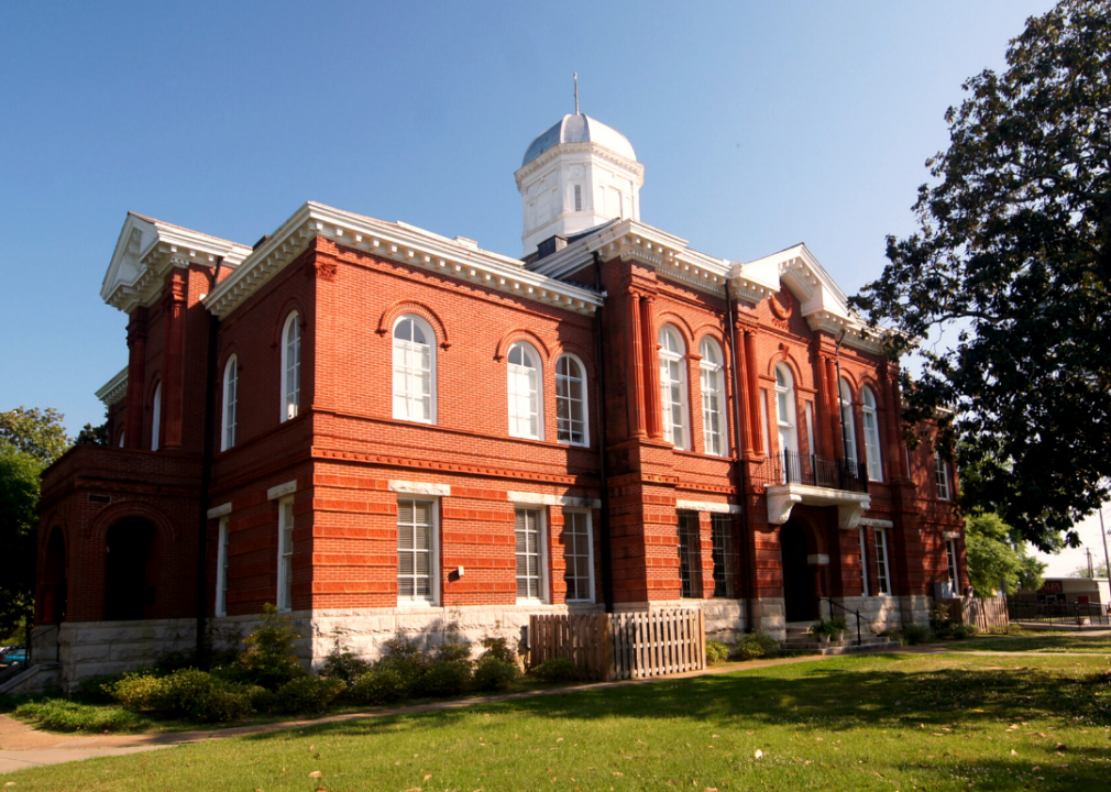
#18. Jackson County (tie)
– Life expectancy: 71.5 years
— 2.2 years lower than the state average
🔥 Would you like to save this?
About
Jackson County lies in the far northeast corner of Alabama, where mountains, valleys, and the Tennessee River create one of the state’s most scenic landscapes. Scottsboro, the county seat, anchors a community surrounded by ridges, caves, and waterways that have shaped both settlement and tradition. The land itself—rugged yet abundant—defines the rhythm of daily life.
Seasonal festivals, river recreation, and mountain trails keep residents connected to the natural setting. Farming, manufacturing, and tourism together sustain the economy, while heritage remains visible in historic towns and landmarks. Jackson County reflects a place where mountains, water, and community remain closely tied.
Where is Jackson County?
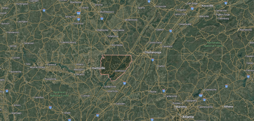
Jackson County is in the far northeastern corner of Alabama, bordered by Tennessee to the north and Georgia to the east. It is framed by Madison County to the west and DeKalb County to the south. The county lies about 40 miles east of Huntsville and is part of the southern Appalachian Mountain region, with ridges, valleys, and sections of the Tennessee River.
Scottsboro, the county seat, is centrally located along the Tennessee River. Other communities include Stevenson in the northeast near the Tennessee border and Bridgeport along the river close to Georgia. With its mountain setting and river access, Jackson County serves as a gateway between Alabama and its neighboring states.
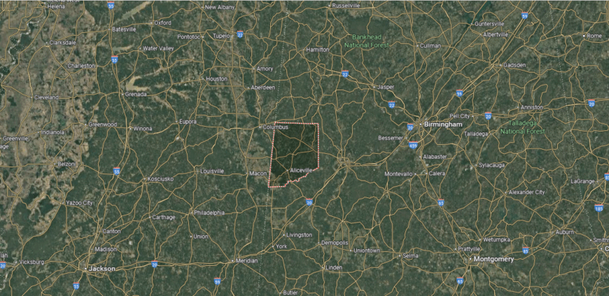
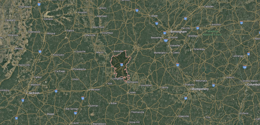
#17. Sumter County (tie)
– Life expectancy: 71.3 years
— 2.4 years lower than the state average
About
Sumter County sits in west Alabama along the Mississippi border, with Livingston as its county seat and center of civic life. The county’s identity is tied to farming, higher education, and small-town traditions. The University of West Alabama adds an educational and cultural presence to the region.
Local pride shows through school events, community festivals, and gatherings that strengthen ties across towns. Agriculture remains important, while education and regional commerce add to the economy. Sumter County reflects a steady mix of rural tradition, learning, and community connection.
Where is Sumter County?
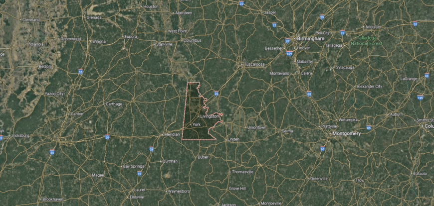
Sumter County is in western Alabama, bordered by Pickens County to the north, Greene County to the east, and Choctaw County to the south. Its western boundary follows the Alabama–Mississippi state line. The county lies about 120 miles southwest of Birmingham and 40 miles west of Demopolis.
Livingston, the county seat, is positioned near the center and serves as the county’s largest town. Other communities include York to the west near the Mississippi border and Cuba in the southern section. With its border location and rural setting, Sumter County anchors Alabama’s Black Belt along the Mississippi line.
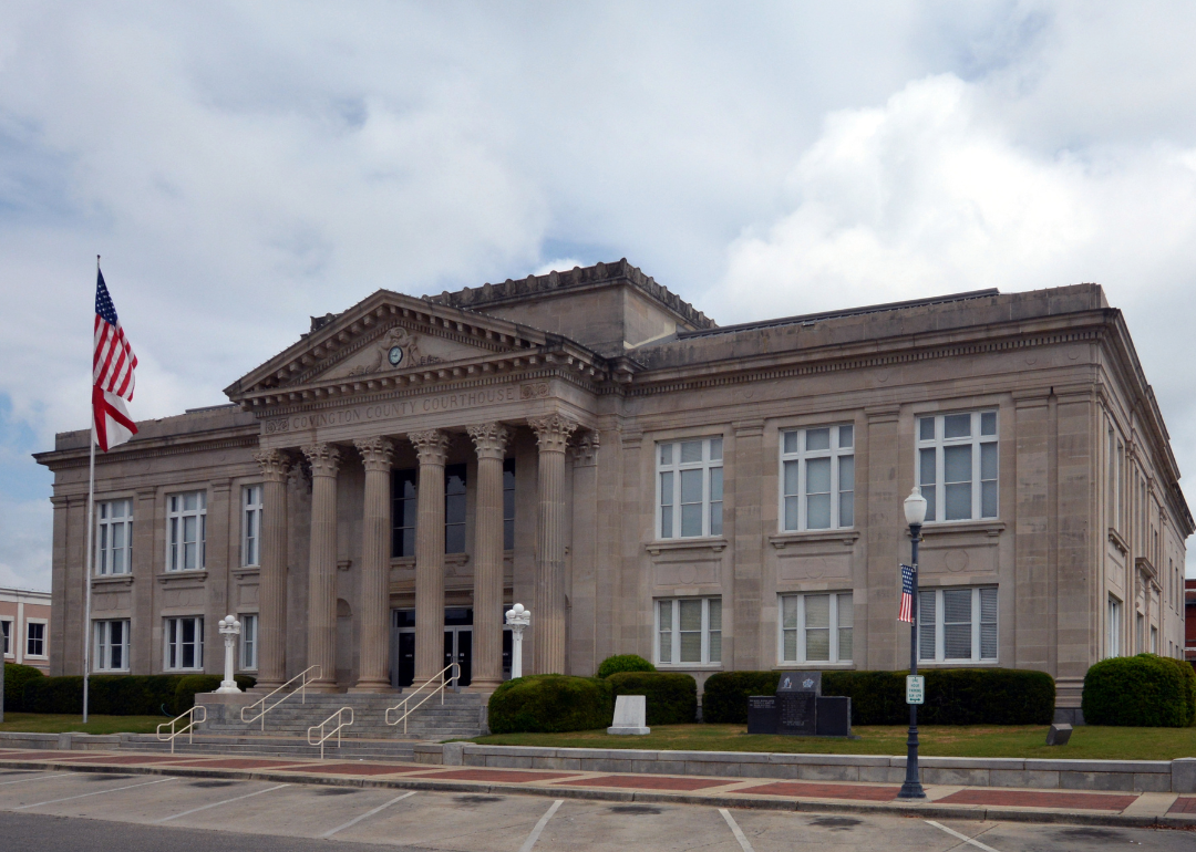
#16. Covington County (tie)
– Life expectancy: 71.3 years
— 2.4 years lower than the state average

About
Covington County lies in south Alabama, its story shaped by early farming, timber, and the development of small towns across pine-covered land. Andalusia, the county seat, reflects this heritage with historic districts and a role as the county’s civic and cultural center. The county’s history is tied to agriculture and the steady traditions of rural community life.
Heritage endures through local festivals, historic landmarks, and gatherings that highlight pride in place. Farming and forestry remain vital to the economy, joined by small industry and regional trade. Covington County reflects a place where history, land, and community ties remain firmly connected.
Where is Covington County?
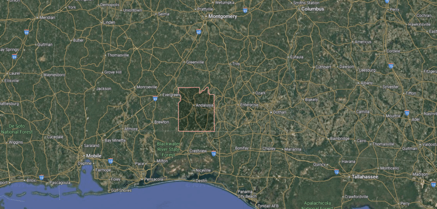
Covington County is located in southern Alabama, bordered by Butler County to the north, Coffee County to the east, and Conecuh County to the west. Its southern edge meets the Florida state line, tying it directly to Walton and Okaloosa Counties in Florida. The county is about 85 miles south of Montgomery and generally 60–85 miles north of Gulf Coast beaches, depending on the destination point.
Andalusia, the county seat, is centrally located and serves as the largest city, with Opp to the east and Florala sitting directly on the Florida border. With its position on the state line and proximity to both inland farmland and coastal routes, Covington County forms a transition zone between south Alabama and Florida’s Panhandle.
#15. Fayette County (tie)
– Life expectancy: 71.3 years
— 2.4 years lower than the state average
You may also like: Cities with the most expensive homes in Alabama
About
Fayette County rests in northwest Alabama, where rolling hills, woodlands, and quiet creeks give shape to both work and daily life. The city of Fayette, the county seat, anchors a community known for its small-town traditions and creative spirit in the arts. The natural landscape provides both setting and rhythm, tying people closely to the land.
Seasonal festivals, local music, and school events carry forward community pride. Farming and small industry remain important foundations, balanced by cultural expression and regional commerce. Fayette County reflects a place where hills, heritage, and creativity meet in enduring harmony.
Where is Fayette County?
Fayette County sits in the northwestern section of Alabama, with Marion County on its northern boundary and Tuscaloosa County lying to the south. Walker County borders it to the east, while Lamar County stretches along its western edge. The county is about 60 miles northwest of Birmingham and lies within the forested uplands of the Appalachian foothills.
The city of Fayette, serving as the county seat, is positioned close to the center. Smaller towns include Berry on the southeastern side and Glen Allen near the northern border. Surrounded by hills and woodlands, Fayette County is a link between central and northwestern Alabama.
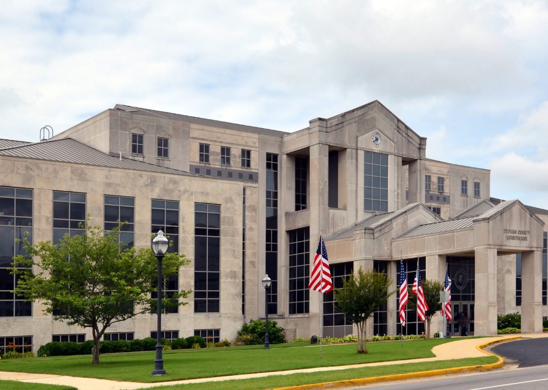
#14. Etowah County
– Life expectancy: 71.2 years
— 2.5 years lower than the state average
About
Etowah County sits in northeast Alabama, with Gadsden as its county seat and largest city. The county’s identity is tied to industry, trade, and its location along the Coosa River, which has shaped both economy and recreation. Small towns throughout the county add to its mix of civic and cultural life.
Community pride shows through school events, local festivals, and gatherings that connect residents across the region. Manufacturing, commerce, and river-based recreation all contribute to the economy. Etowah County reflects a blend of industry, tradition, and community strength.
Where is Etowah County?
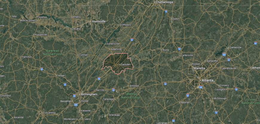
Etowah County is in northeast Alabama, bordered by Marshall County to the north, DeKalb County to the northeast, and Calhoun County to the east. Its southwestern boundary touches St. Clair County, while Blount County sits to the west. This places Etowah in the foothills of the southern Appalachians, about 60 miles northeast of Birmingham and 90 miles southwest of Chattanooga, Tennessee.
Gadsden, the county seat, lies along the Coosa River near the center of the county. Other towns include Attalla to the west and Rainbow City to the south. With its riverfront setting and network of highways, Etowah County serves as a hub linking Alabama’s Appalachian foothills to both Birmingham and north Georgia.
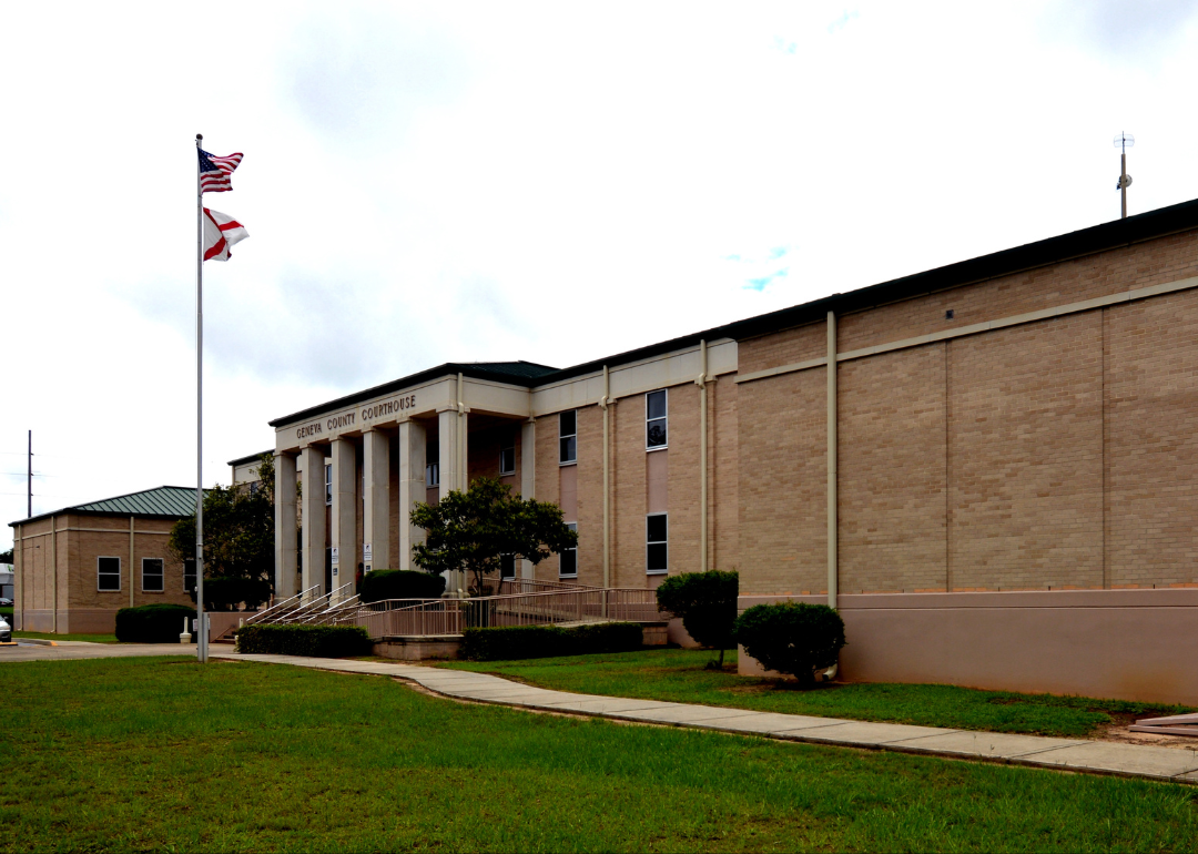
#13. Geneva County (tie)
– Life expectancy: 71.1 years
— 2.6 years lower than the state average
About
Geneva County rests in the southeastern corner of Alabama, where the Pea River and Choctawhatchee River converge. The city of Geneva, the county seat, reflects this heritage, with a history tied to river trade, farming, and the resilience of rural communities. The county’s traditions have long been shaped by agriculture and the steady rhythm of small-town life.
Heritage is carried forward through river festivals, historic landmarks, and gatherings that highlight local pride. Farming remains a central foundation, while forestry and small industries add to the economy. Geneva County reflects a place where land, water, and community history remain deeply connected.
Where is Geneva County?

Geneva County sits in the far southeastern corner of Alabama, firmly within the Wiregrass region. It is bordered by Coffee County to the north, Houston County to the east, and Covington County to the west. Its southern edge runs along the Florida state line, where it meets Holmes and Jackson Counties. The county lies about 95 miles southeast of Montgomery and roughly 85 miles north of Panama City, Florida, by road.
The county seat, Geneva, is located near the junction of the Choctawhatchee and Pea Rivers. Other communities include Hartford to the northwest and Slocomb to the northeast, each centered on farming and local trade. With its rivers, farmland, and border position, Geneva County connects Alabama’s Wiregrass directly to Florida’s Panhandle.
#12. Talladega County (tie)
– Life expectancy: 71.1 years
— 2.6 years lower than the state average
About
Talladega County rests in central Alabama, where the foothills of the Appalachians meet fertile valleys and winding rivers. The city of Talladega, the county seat, reflects both historic charm and a role as a cultural center, while other towns add their own ties to industry and rural tradition. The county is also home to the Talladega Superspeedway, a landmark of modern identity alongside its natural scenery.
Life here moves with the land—mountain trails, farmland, and seasonal festivals shape the rhythm of community life. Industry, motorsports, and outdoor recreation stand alongside farming as anchors of the economy. Talladega County reflects a place where mountains, culture, and modern energy flow together.
Where is Talladega County?
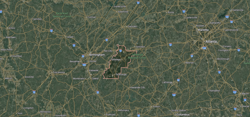
Talladega County is in east-central Alabama, bordered by Calhoun County to the north, Clay County to the east, and Coosa County to the south. Shelby County lies to the west, placing Talladega within the Appalachian foothills. The county is about 50 miles southeast of Birmingham and 100 miles north of Montgomery.
Talladega, the county seat, sits near the center, while Sylacauga lies to the southwest along U.S. Highway 280. Smaller communities include Lincoln on the Coosa River and Childersburg near the Shelby County line. With its location in the hill country and along major transportation routes, Talladega County links central Alabama to the Appalachian region.
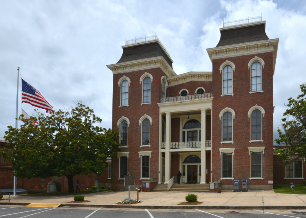
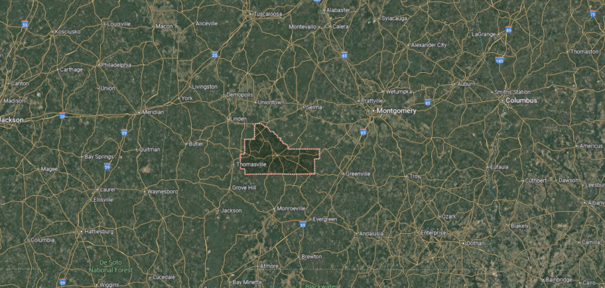
#11. Clarke County
– Life expectancy: 71.0 years
— 2.7 years lower than the state average
About
Clarke County sits in southwest Alabama, with Grove Hill as its county seat and center of civic life. The county’s identity is rooted in timber, farming, and the traditions of its rural towns. Rivers and forests frame both its economy and daily living.
Community ties are strengthened through school events, local festivals, and gatherings that highlight pride in place. Forestry and agriculture remain key economic drivers, joined by small industry and trade. Clarke County reflects a steady blend of natural resources, tradition, and community connection.
Where is Clarke County?
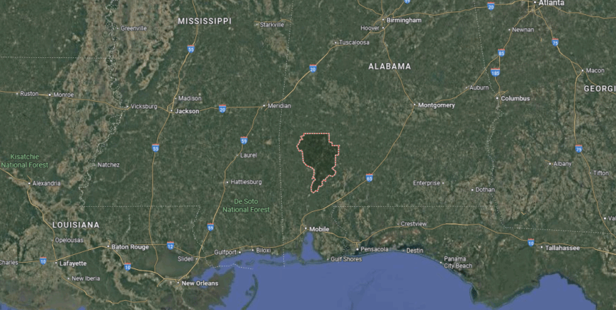
Clarke County is in southwestern Alabama, bordered by Marengo County to the north, Monroe County to the east, and Washington County to the south. Its western boundary follows the Tombigbee River, which separates it from Choctaw County. The county lies about 100 miles north of Mobile and 130 miles southwest of Montgomery.
Grove Hill, the county seat, is located near the center on U.S. Highway 43. Other communities include Jackson along the Tombigbee River and Thomasville in the northern part of the county. With its river access and crossroads location, Clarke County connects Alabama’s Black Belt region to the Gulf Coastal Plain.
#10. Crenshaw County
– Life expectancy: 70.9 years
— 2.8 years lower than the state average
You may also like: What Medicaid acceptance looks like at Alabama substance use treatment centers
About
Crenshaw County rests in south-central Alabama, its history shaped by farming, railroads, and the steady growth of small towns across rolling hills. Luverne, the county seat, reflects this heritage through its courthouse square and role as the center of civic and cultural life. The county’s story is tied to agriculture and the rural traditions that have guided generations.
Heritage continues through festivals, school events, and local gatherings that honor both history and community pride. Farming remains an important foundation, supported by forestry, small industries, and regional commerce. Crenshaw County reflects a place where history, land, and community spirit remain firmly connected.
Where is Crenshaw County?

Crenshaw County is in south-central Alabama, bordered by Montgomery County to the north, Pike County to the east, and Butler County to the west. Coffee County lies to the southeast, placing Crenshaw in the East Gulf Coastal Plain. The county is about 50 miles south of Montgomery and 100 miles north of Dothan.
Luverne, the county seat, is located near the center along U.S. Highway 331. Other communities include Brantley to the south and Dozier in the southwestern section. With its central position in the coastal plain, Crenshaw County serves as a link between Alabama’s Black Belt and Wiregrass regions.
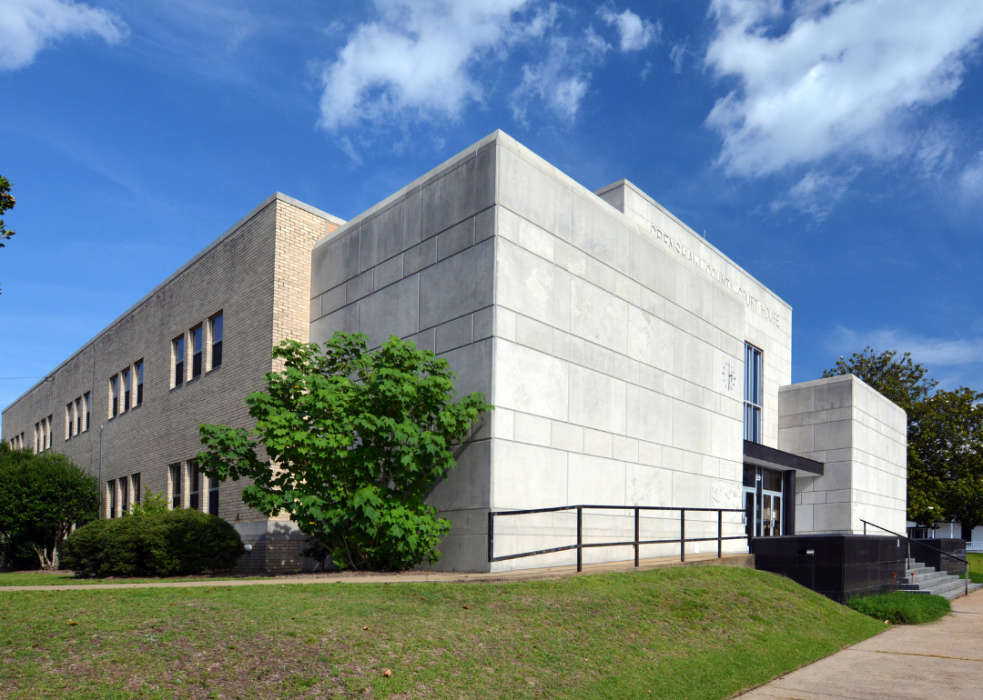
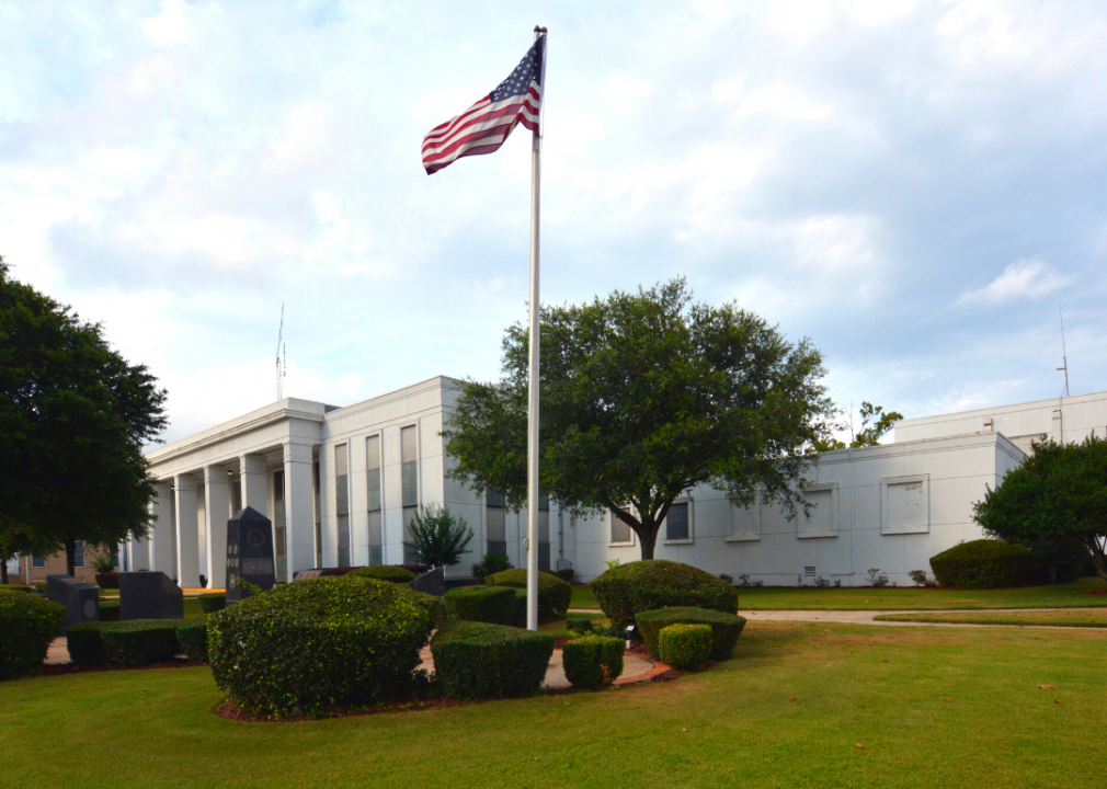
#9. Escambia County
– Life expectancy: 70.8 years
— 2.9 years lower than the state average

About
Escambia County lies in south Alabama, where pine forests, winding rivers, and fertile lowlands shape both work and tradition. Brewton, the county seat, anchors a community long connected to timber, farming, and railroads that once carried goods through the region. The land itself—quiet woods and flowing waters—remains central to the county’s identity.
Seasonal rhythms guide daily life, from festivals and school events to outdoor traditions rooted in the landscape. Forestry and agriculture continue as economic mainstays, while small industries and trade add balance. Escambia County reflects a place where land, history, and community move together in harmony.
Where is Escambia County?
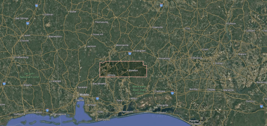
Escambia County is in southern Alabama, bordered by Conecuh County to the north, Baldwin County to the south, and Monroe County to the northeast. Its southern boundary meets the state of Florida, placing it along the Alabama–Florida line. The county lies about 110 miles south of Montgomery and 50 miles northeast of Mobile.
Brewton, the county seat, is located near the center close to the Florida border. Other communities include Atmore to the west and Flomaton at the state line. With its border setting and highway connections, Escambia County links southern Alabama to Florida’s Panhandle.
#8. Marengo County
– Life expectancy: 70.7 years
— 3.0 years lower than the state average
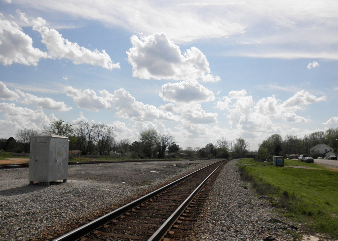
About
Marengo County sits in west Alabama’s Black Belt region, with Linden as its county seat and Demopolis as its largest city. The county’s identity is tied to farming, timber, and the legacy of river trade along the Tombigbee. Its towns reflect both rural tradition and historic character.
Community pride shows in festivals, school traditions, and local gatherings that bring neighbors together. Agriculture and forestry remain economic foundations, joined by small industries and commerce. Marengo County reflects a steady mix of rural strength, history, and community connection.
Where is Marengo County?
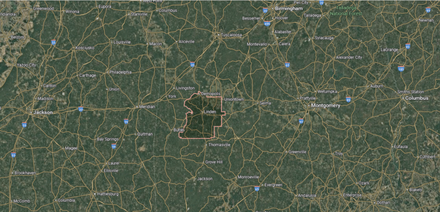
Marengo County is in west-central Alabama, bordered by Hale County to the north, Wilcox County to the south, and Perry County to the east. Its western edge follows the Tombigbee River, separating it from Sumter and Choctaw Counties. The county lies about 60 miles southwest of Tuscaloosa and 100 miles west of Montgomery.
Linden, the county seat, is positioned near the center, while Demopolis, the largest city, sits at the confluence of the Tombigbee and Black Warrior Rivers. Other towns include Sweet Water to the south and Thomaston to the northeast. With its river junctions and Black Belt setting, Marengo County serves as a crossroads of Alabama’s western region.
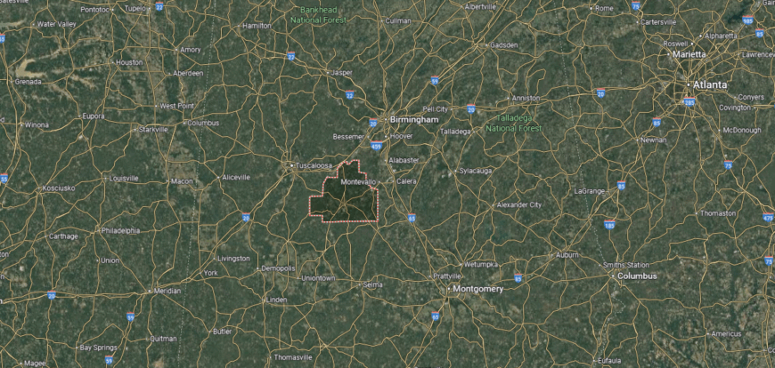
#7. Hale County
– Life expectancy: 70.2 years
— 3.5 years lower than the state average
About
Hale County rests in Alabama’s Black Belt, where fertile soil and rural traditions have long shaped its identity. Greensboro, the county seat, preserves historic architecture and cultural landmarks that reflect its 19th-century roots. The county is also known for its role in art and documentary photography, which brought national attention to its rural life.
Heritage continues through festivals, historic preservation, and community gatherings that honor both past and progress. Farming remains a steady foundation, while cultural and educational initiatives add new dimensions. Hale County reflects a place where history, land, and creative spirit remain closely connected.
Where is Hale County?

Hale County is in west-central Alabama, bordered by Tuscaloosa County to the north, Perry County to the east, and Marengo County to the south. Its western boundary follows the Black Warrior River, which separates it from Greene County. The county lies about 35 miles south of Tuscaloosa and 75 miles west of Montgomery.
Greensboro, the county seat, is near the center and serves as the county’s largest town. Other communities include Moundville along the northern edge and Akron to the southwest. With its river access and central Black Belt location, Hale County ties together west Alabama’s farmland and historic small towns.
#6. Conecuh County
– Life expectancy: 69.5 years
— 4.2 years lower than the state average
About
Conecuh County lies in south Alabama, where pine forests stretch wide and rivers wind quietly through gentle hills. Evergreen, the county seat, anchors a community long tied to timber, farming, and small-town life. The landscape itself, with its woods and waterways, shapes both work and tradition.
Seasonal rhythms carry life forward—festivals, school events, and outdoor gatherings strengthen community ties. Forestry and agriculture remain central to the economy, joined by local trade and small industry. Conecuh County reflects a place where land, people, and tradition remain deeply linked.
Where is Conecuh County?
Conecuh County is in southern Alabama, bordered by Butler County to the north, Escambia County to the south, and Monroe County to the east. Covington County lies to the west, placing Conecuh in the East Gulf Coastal Plain. The county is about 95 miles south of Montgomery and 80 miles north of Mobile.
Evergreen, the county seat, is located near the center along Interstate 65. Smaller communities include Castleberry to the south and Repton near the eastern boundary. With its position on a major highway corridor, Conecuh County connects central Alabama to the Gulf Coast.
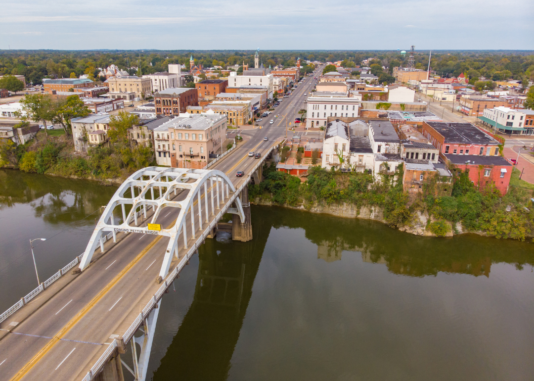
#5. Dallas County
– Life expectancy: 69.3 years
— 4.4 years lower than the state average
You may also like: Best lookout points in Alabama

About
Dallas County sits in central Alabama’s Black Belt region, with Selma as its county seat and historic heart. The county’s identity is tied to agriculture, civil rights history, and its role as a cultural and economic center in the region. Landmarks and institutions in Selma anchor both heritage and community life.
Local pride is shown through festivals, school traditions, and civic events that honor history while connecting residents today. Farming and small industry remain important, while tourism tied to historic sites adds to the economy. Dallas County reflects a steady mix of heritage, resilience, and community strength.
Where is Dallas County?
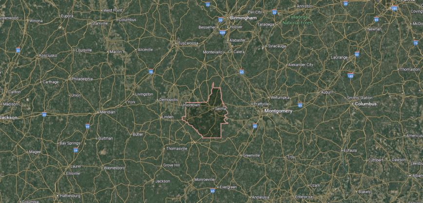
Dallas County is in central Alabama, bordered by Perry County to the north, Lowndes County to the east, and Wilcox County to the south. Its western edge meets Marengo County, with the Alabama River flowing through the region. The county lies about 50 miles west of Montgomery and 80 miles south of Birmingham.
Selma, the county seat, is located on the Alabama River and serves as the largest city. Other communities include Orrville to the west and Valley Grande to the north. With its river setting and central location, Dallas County links Alabama’s Black Belt to the state’s urban centers.
#4. Perry County
– Life expectancy: 69.0 years
— 4.7 years lower than the state average
About
Perry County lies in central Alabama’s Black Belt, where fertile soil supported early farming and settlement. Marion, the county seat, reflects a long history in education, faith, and civil rights, with institutions that shaped both local and national stories. The county’s heritage is tied to agriculture and to its role as a center of learning and activism.
Traditions endure through historic sites, cultural gatherings, and community events that keep the past alive. Farming continues as a foundation, while education and heritage tourism add to the economy. Perry County reflects a place where land, history, and civic spirit remain closely bound.
Where is Perry County?

Perry County is in central Alabama, bordered by Bibb County to the north, Dallas County to the south, and Chilton County to the east. Hale County lies to the west, placing Perry in the heart of Alabama’s Black Belt region. The county is about 75 miles west of Montgomery and 65 miles south of Birmingham.
Marion, the county seat, is located near the center and serves as the county’s largest town. Smaller communities include Uniontown to the southwest and Sprott near the eastern boundary. With its central position in the Black Belt, Perry County ties Alabama’s historic farmlands to surrounding regions.
#3. Wilcox County
– Life expectancy: 68.9 years
— 4.8 years lower than the state average

About
Wilcox County rests in Alabama’s Black Belt, where the Alabama River winds through fertile plains and wooded hills. Camden, the county seat, anchors a community surrounded by small towns that hold deep ties to the land. The river, forests, and fields shape both daily life and the county’s enduring identity.
Life here moves with the seasons—planting and harvest, church gatherings, and festivals that carry tradition forward. Farming and forestry remain central, while historic sites and riverfront settings add richness to community life. Wilcox County reflects a place where water, land, and heritage remain inseparably linked.
Where is Wilcox County?
Wilcox County is in south-central Alabama, bordered by Dallas County to the north, Butler County to the east, and Clarke County to the south. Its western edge follows the Alabama River, which separates it from Marengo County. The county lies about 85 miles west of Montgomery and 150 miles north of Mobile.
Camden, the county seat, is located near the center overlooking the Alabama River. Other communities include Pine Hill in the southern part and Yellow Bluff to the north. With its river access and central Black Belt location, Wilcox County reflects the rural and historic character of south-central Alabama.
#2. Walker County (tie)
– Life expectancy: 68.4 years
— 5.3 years lower than the state average
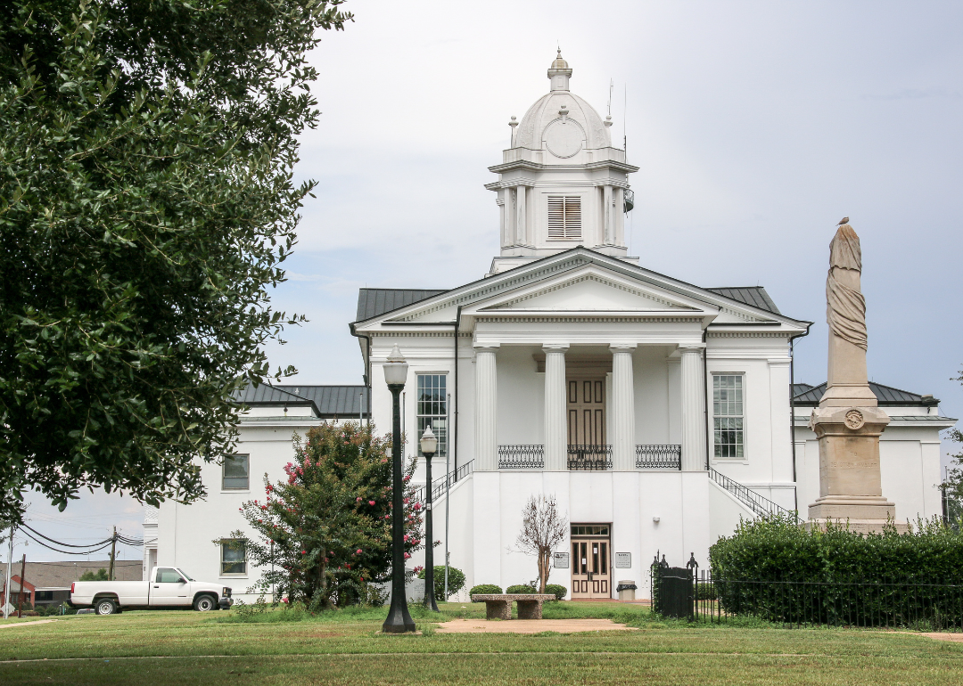
About
Walker County sits in north-central Alabama, with Jasper as its county seat and economic hub. The county’s identity is shaped by coal mining, manufacturing, and the traditions of its small towns. Its location in the foothills of the Appalachians adds both history and natural character.
Community ties are carried through school events, festivals, and local gatherings that highlight pride in place. Mining and industry remain important, joined by commerce and outdoor recreation. Walker County reflects a blend of working heritage, regional growth, and small-town connection.
Where is Walker County?
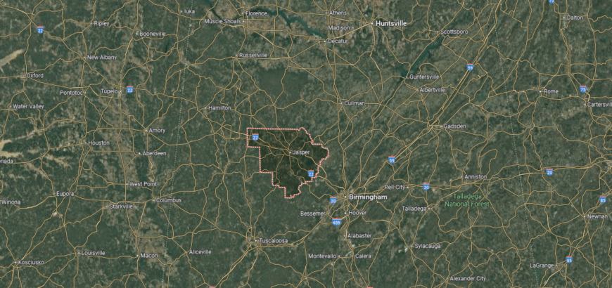
Walker County is in north-central Alabama, bordered by Winston County to the north, Jefferson County to the east, and Fayette County to the west. Its southern edge meets Tuscaloosa County, placing Walker in the foothills of the Appalachian Mountains. The county lies about 40 miles northwest of Birmingham.
Jasper, the county seat, is located near the center and serves as the largest city. Other communities include Sumiton on the eastern side and Carbon Hill in the northwestern part. With its hilly terrain and central location, Walker County connects Alabama’s coal country to the Birmingham metropolitan area.
#1. Lowndes County (tie)
– Life expectancy: 68.4 years
— 5.3 years lower than the state average
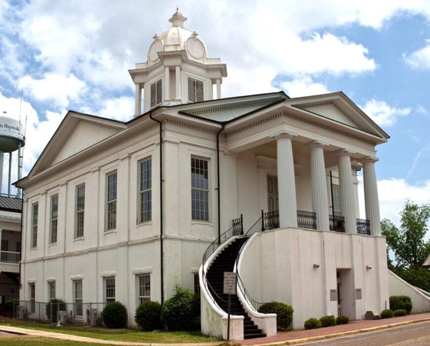
About
Lowndes County lies in central Alabama’s Black Belt, its fertile soil long tied to farming and plantation life. Hayneville, the county seat, reflects this heritage through historic landmarks and courthouse-centered community traditions. The county is also deeply connected to the civil rights movement, with the Selma-to-Montgomery March passing directly through its land.
Heritage is carried forward in museums, historic trails, and cultural events that preserve both agricultural and civil rights history. Farming remains a key part of the economy, joined by forestry and small-town commerce. Lowndes County reflects a place where land, history, and resilience remain inseparably linked.
Where is Lowndes County?
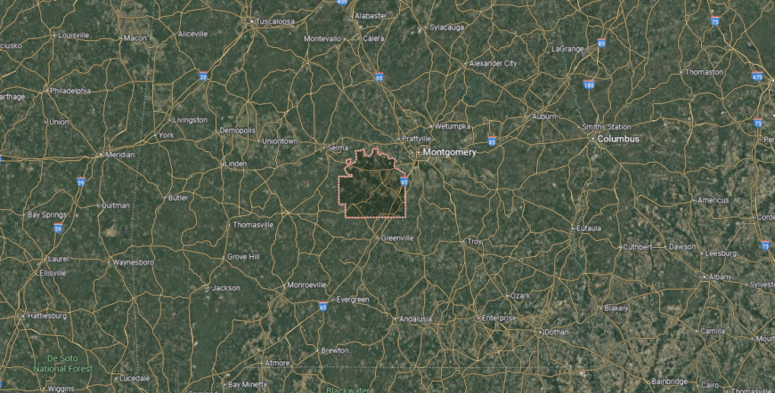
Lowndes County is in central Alabama, bordered by Montgomery County to the east, Dallas County to the west, and Wilcox County to the southwest. Butler County lies to the south, while Autauga County is just north across the Alabama River. The county is about 20 miles west of Montgomery, placing it within the state’s Black Belt region.
Hayneville, the county seat, is positioned near the center of the county. Other communities include Fort Deposit to the south and White Hall along U.S. Highway 80. With its river access and proximity to Montgomery, Lowndes County serves as a gateway between Alabama’s capital city and the western Black Belt.
This story features data reporting by Karim Noorani, writing by Kiersten Hickman, and is part of a series utilizing data automation across 49 states.
By Stacker