🔥 Would you like to save this?
Western Pennsylvania holds pockets where the night sky is still visible in full and roads seem to lead only to more quiet. These places are small enough that the shape of the land matters more than the grid of streets—creeks cut valleys, ridges block the horizon, and the next neighbor might be a mile away.
The towns here reflect the terrain. Some follow a river bend so closely that the current feels like part of the main street; others sit high on a bluff with a view that reaches past the county line. Work comes from the surrounding land—forestry, farming, and small trades—and the patterns of life shift with the seasons.
In order to come up with the very specific design ideas, we create most designs with the assistance of state-of-the-art AI interior design software.
Distances are measured less in miles than in the time it takes to get there. Roads narrow, slow, and climb as you approach, often leaving you unsure if you have already passed through or are still on the way. Many of these places are easy to miss without someone pointing them out.
We’ve gathered 25 such towns across the western part of the state, each with its own reason for being here and its own way of staying that way. Together they form a map of where Pennsylvania still feels open, shaped by rivers, ridges, and the people who have chosen to remain within them.
25. Kellettville
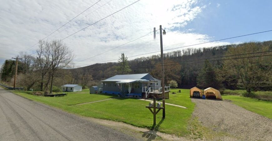
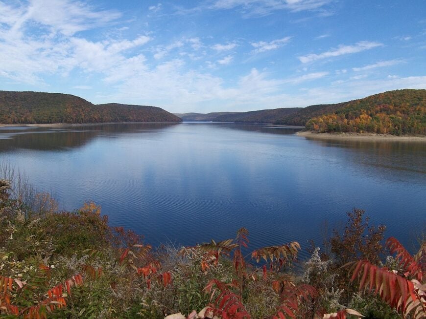
Kellettville is a quiet bend along Tionesta Creek where cabins outnumber year-round homes and mornings begin with mist curling off the water. The seclusion comes from its placement deep inside the Allegheny National Forest, far from any through-highway.
Locals fish for stocked trout in spring, paddle downstream past hemlock-shaded banks, or wander logging trails that fade into the hills. A handful of seasonal rentals and the small campground store make up the commerce here.
The rest is self-sufficiency—stacked firewood, gardens, and trips to town only when necessary. Nights are truly dark, save for the soft amber glow from cabin windows. It’s the kind of place that makes you forget the clock entirely.
Where is Kellettville?
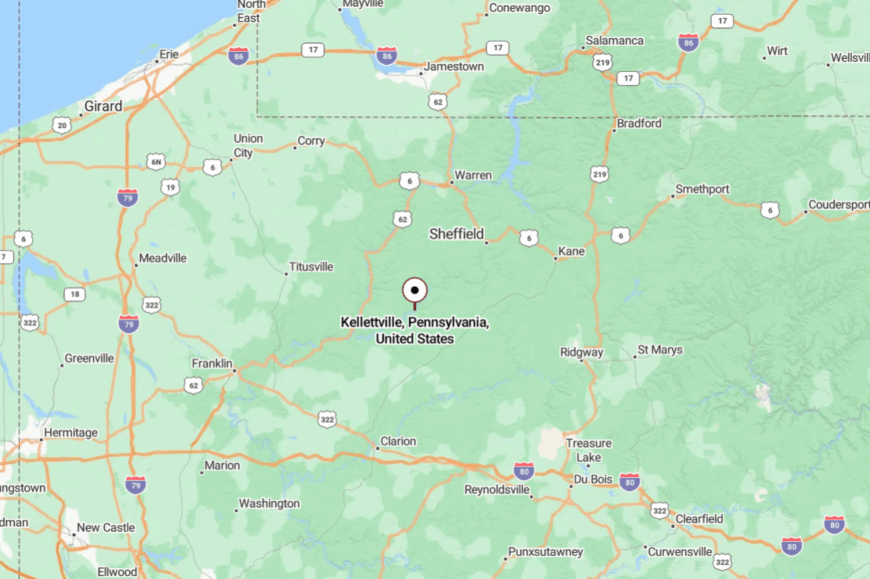
This hamlet lies in Forest County, about 14 miles northeast of Tionesta Borough. Access comes via PA Route 666, a narrow, twisting road that hugs the creek. The nearest major highway is more than half an hour away, keeping traffic minimal.
Arrive in the evening and you’ll hear the water before you see the first porch light.
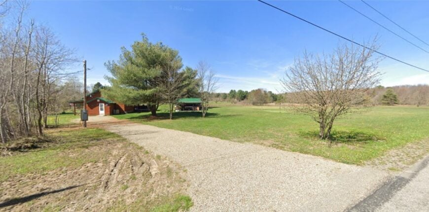
24. Mayport
Mayport sits beside a bend in Redbank Creek, a scattering of homes that seem content to let the outside world rush past. The nearest four-lane is miles away, and tree-lined banks keep the settlement hidden from passing eyes.
Residents tend small gardens, fish for bass and trout, or gather at the volunteer fire hall for monthly suppers. A faded general store still serves coffee to the early risers, though most work is found in nearby New Bethlehem.
The soundscape is creeksong, wind in the leaves, and the occasional rumble of a passing freight far off. It feels untouched by hurry, a place that wears its history quietly.
Where is Mayport?
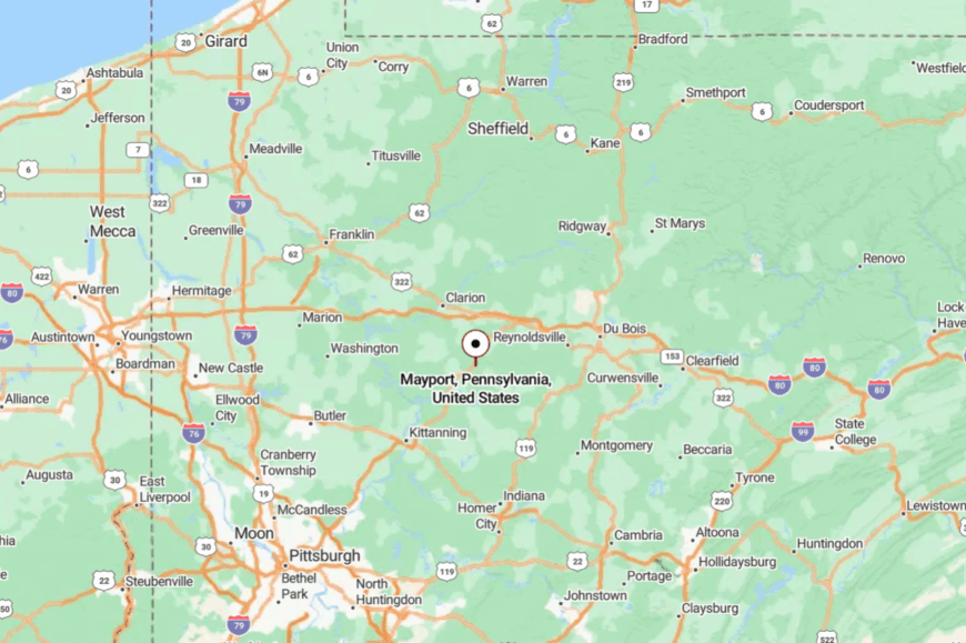
Mayport is located in Clarion County, about 10 miles south of New Bethlehem. You reach it by winding down PA Route 536, which threads between wooded ridges and farm fields.
The last descent follows Redbank Creek into a small valley. The turn into town comes so gently, you might miss it if not for the old post office sign.
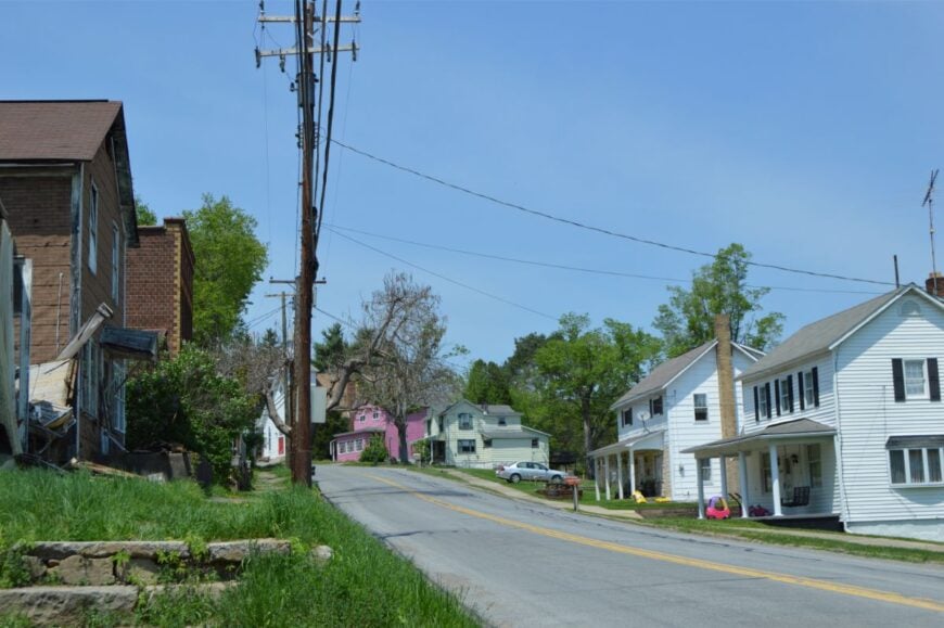
23. Starr
Starr is little more than a crossroads hemmed in by towering hardwoods, with just enough clearing for a few homes and an old church. Its seclusion stems from being tucked within the Allegheny National Forest, where every direction leads to miles of green.
Hike nearby trails, look for wild turkeys strutting across old logging roads, or stop at a single roadside stand selling maple syrup in spring. Locals often work in forestry or commute to Tionesta when supplies run low.
With no cell service and few visitors, time moves as steadily as the shade across the porch. It’s a place that lives quietly in the folds of the forest.
Where is Starr?
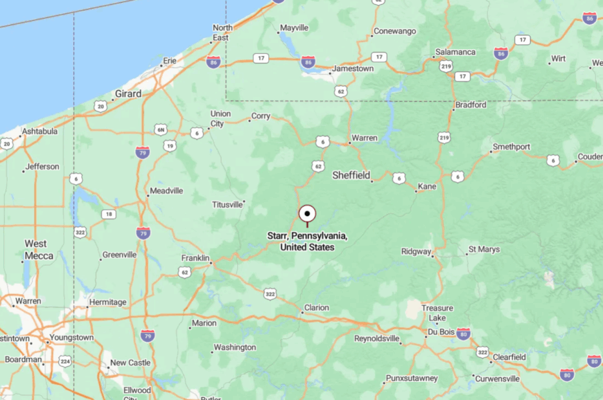
Starr lies in Forest County, about 6 miles south of Tionesta along PA Route 36. The approach runs under a high tree canopy with only glimpses of sky.
No major road cuts through, and the settlement sits just far enough back to avoid casual discovery. By the time you arrive, you’ll already feel the outside world drop away.
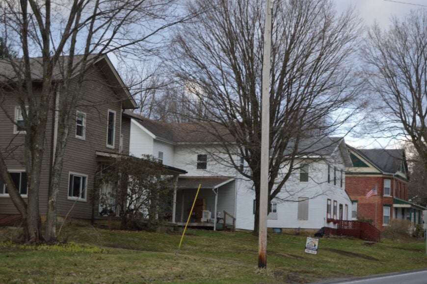
22. Glen Campbell
Once a coal boomtown, Glen Campbell has settled into a slower, humbler rhythm among Indiana County’s wooded hills. Seclusion here is born from the maze of backroads leading in, each twisting between hollows and over ridges.
The town offers a handful of century-old brick buildings, a small park, and quiet residential streets. Residents fish in nearby streams, explore remnants of old mining rail beds, or gather at the local ballfield on summer evenings.
Small businesses and commuting sustain the economy. There’s a sense of knowing everyone by name—and their grandparents, too. It’s the kind of place that trades noise for neighborliness.
Where is Glen Campbell?
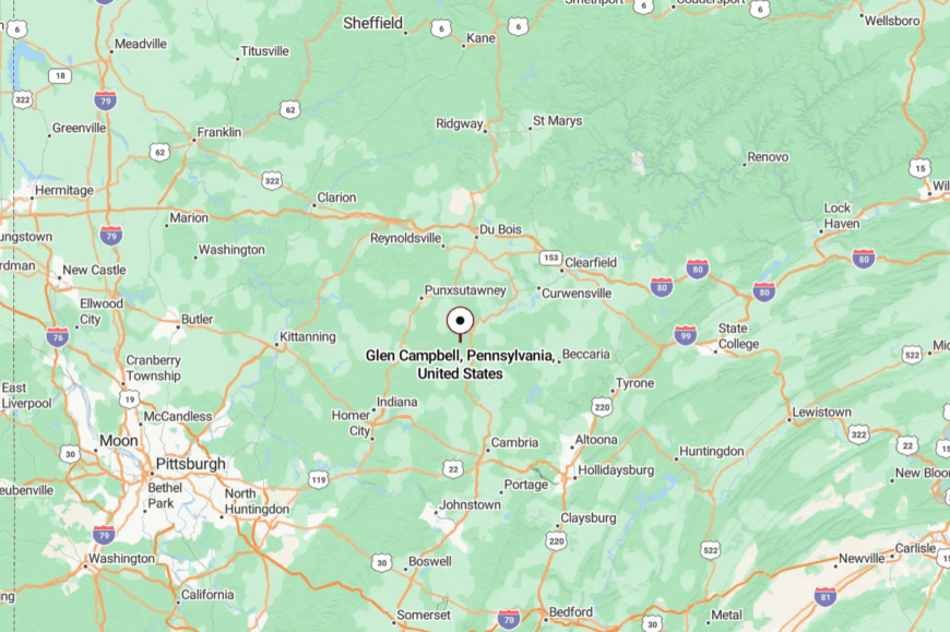
Glen Campbell sits in the northeastern corner of Indiana County, about 18 miles from Punxsutawney. It’s reached by PA Route 286 and a patchwork of rural connectors.
The roads weave through dense forest and farmland before the town appears in a small valley. Its tucked-away location keeps it off most travelers’ maps.
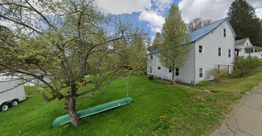
21. Corsica
Corsica is a one-stoplight borough that feels far larger in heart than in size, hidden in the rolling hills just south of the Clarion River. Although close to I-80, the surrounding ridges and farmland create a sense of remove.
Stroll its tidy streets, grab pie at the family diner, or wander down to the nearby riverbanks for fishing and birdwatching. The old brick storefronts speak to a busier past, now replaced by a slower, steadier beat.
Farming, small trades, and highway travelers keep the town ticking. At night, you can still hear crickets over the hum of distant traffic.
Where is Corsica?
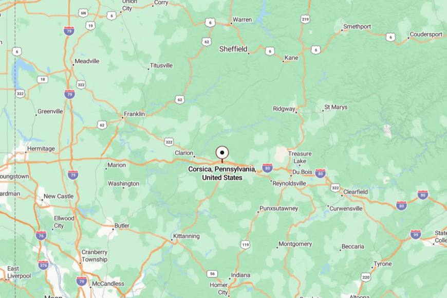
Corsica is located in Jefferson County, just a few minutes south of the Clarion River. It lies along U.S. Route 322, about 10 miles west of Brookville.
Approaching from the interstate, you crest low hills before dropping into the compact borough. It’s close to the main road, but feels a world apart once you step onto its quiet sidewalks.
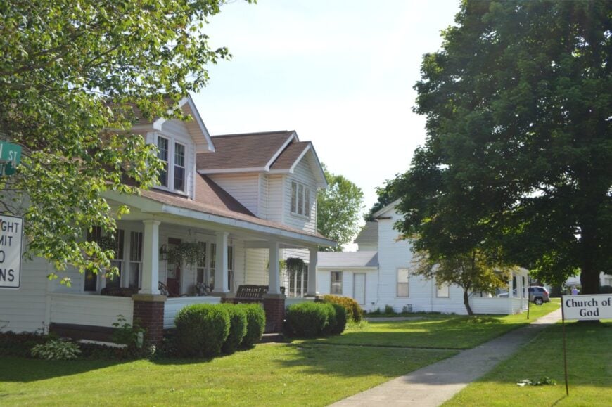
20. Ludlow
Ludlow is a narrow valley town where the clapboard houses seem to lean toward the creek for company. The Allegheny National Forest presses in from every side, making the rest of the world feel distant.
Visitors hike to Kinzua Creek’s waterfalls, ski in winter at nearby slopes, or simply follow the old rail trail through miles of untouched woodland. Lumber and tourism form the backbone of the economy, with a few cafés and lodges catering to hikers and hunters.
The rhythm here is slow: woodsmoke in autumn, trout in spring, cicadas in summer. It’s a pocket of quiet where nature sets the clock.
Where is Ludlow?
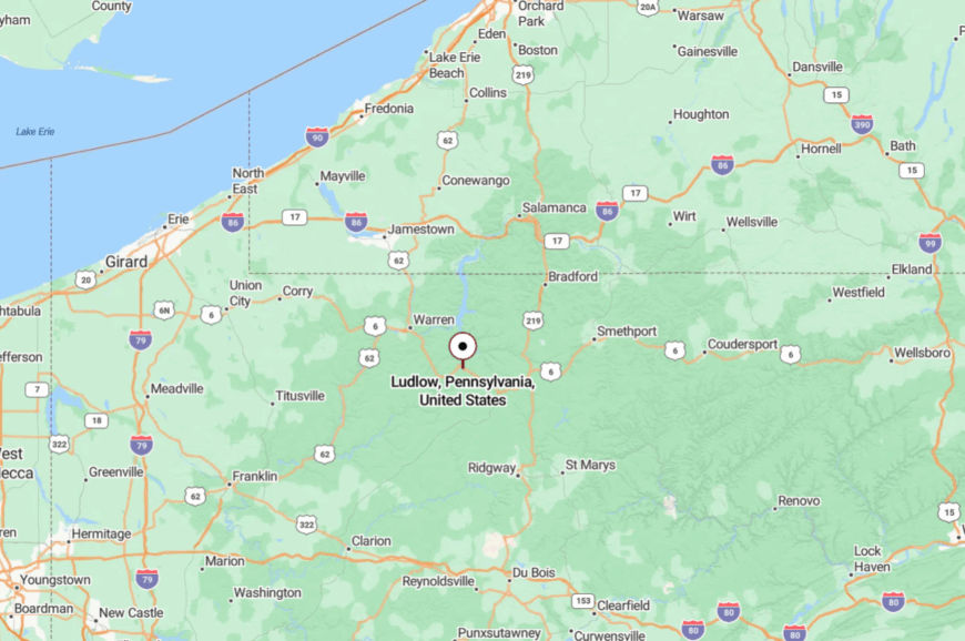
Ludlow sits in McKean County along U.S. Route 6, about 10 miles west of Kane. Tall trees and steep slopes frame every approach.
Even on the main road, traffic is light enough that deer often linger near the edge. The surrounding forest makes the valley feel sheltered and timeless.
19. Callensburg
🔥 Would you like to save this?
Callensburg overlooks the Clarion River from a bluff so steep it feels like a watchtower. Its isolation is partly geographic—the only roads in are narrow switchbacks climbing from the valley floor.
The village has a scattering of historic homes, a church, and a post office that doubles as a social hub. Locals fish below at the river access, tend tidy gardens, or gather for small community events.
Farming and a few trades keep things going. The air feels lifted here, crisp and clean, as if the town sits just beyond everyday reach.
Where is Callensburg?
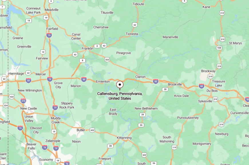
This small borough lies in Clarion County, about 15 miles south of the town of Clarion. It’s reached via PA Route 368 and a final climb that winds tightly up from the river.
The location offers sweeping views over the water and forested hills. It’s just far enough from main routes to keep casual visitors away.
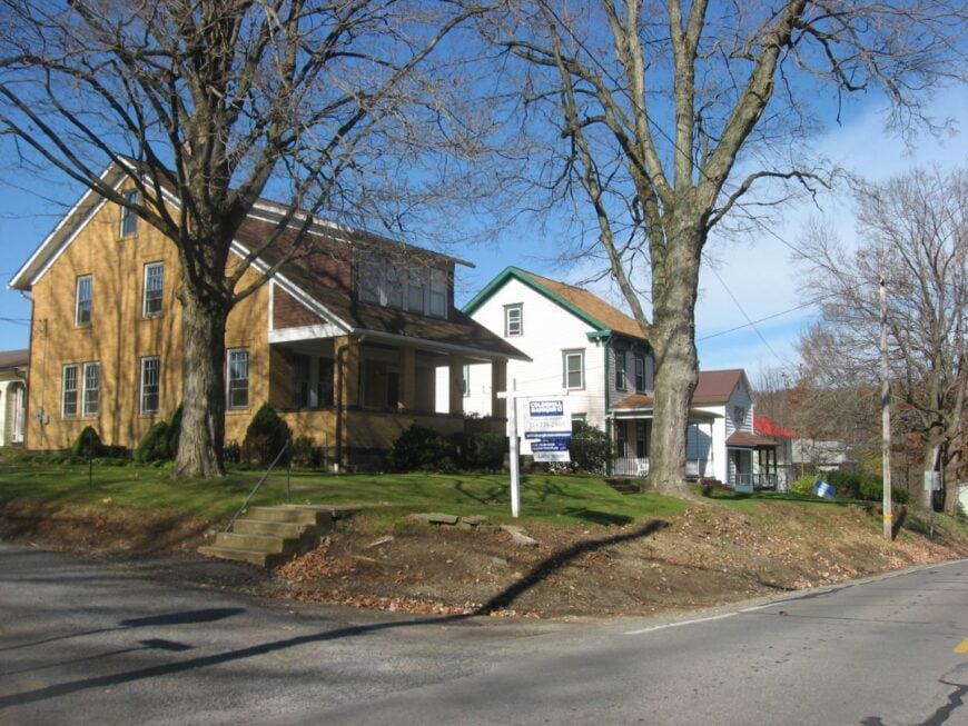
18. East Brady
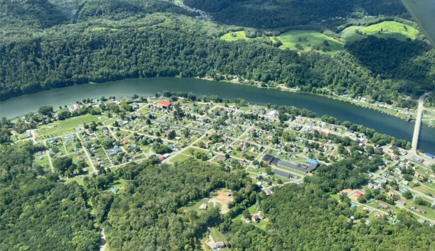
East Brady sits on a horseshoe bend of the Allegheny River, its waterfront lined with docks and old warehouses now turned to quieter uses. The bend hides the town from upstream and downstream view, creating a sense of being tucked into the river’s embrace.
Boating and fishing dominate the leisure scene, with summer evenings filled with the smell of grills along the shoreline. Small shops and river-related trades shape the economy.
The combination of water and surrounding ridges keeps life here easy and self-contained. It’s the kind of spot where days blur into the river’s slow current.
Where is East Brady?
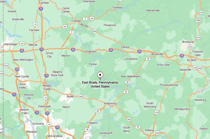
East Brady lies in Clarion County, near the Armstrong County line, about 60 miles northeast of Pittsburgh. You approach via PA Route 68, dropping into town through a hillside lined with hardwoods.
The final descent offers a sudden, sweeping view of the river bend. Once you’re in, the outside world feels a step removed.
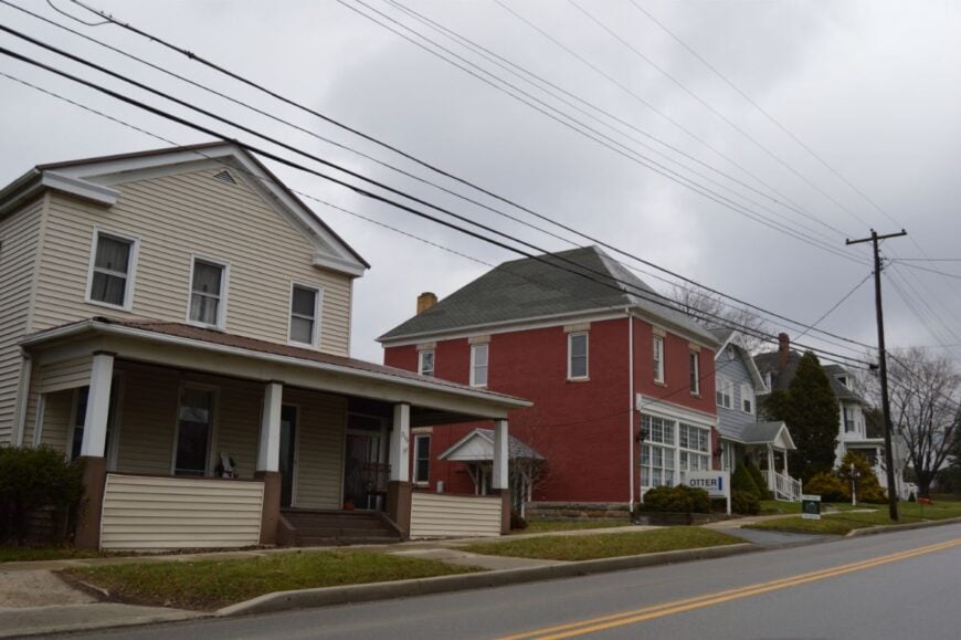
17. St. Petersburg
St. Petersburg is a tidy borough wrapped in farmland, with a few blocks of old houses and a sense of calm that never quite lifts. Its seclusion comes from being just far enough off U.S. Route 322 that few travelers detour in.
Locals stroll to the ice cream stand in summer, fish in nearby creeks, or gather for small-town parades. Agriculture remains the backbone, along with a handful of local services.
Evenings bring long, quiet views over the fields, punctuated by the sound of crickets. It’s a postcard scene that feels lived-in, not staged.
Where is St. Petersburg?
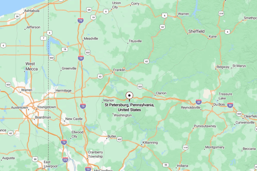
The borough sits in Clarion County, about 12 miles west of Clarion itself. Access is via local connectors from Routes 322 or 58.
The roads pass through rolling farmland, slowing you down as you near town. It’s close to main routes but set apart enough to keep its peace intact.
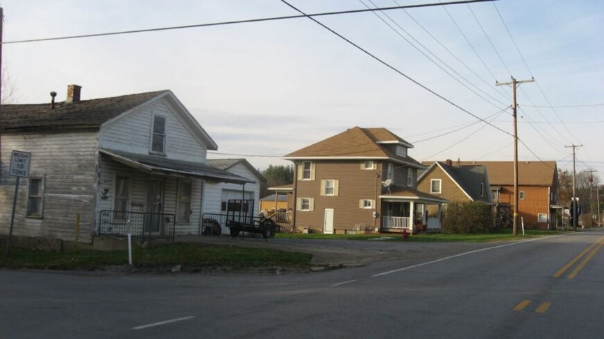
16. Shippenville
Shippenville is a crossroads town where the highway slows just enough to notice the tidy brick storefronts and church steeple. Beyond that main drag, the landscape quickly returns to fields and woods.
Hunting, fishing, and seasonal festivals give residents their rhythm, with small shops and diners holding the social fabric together. Its seclusion is more cultural than geographic—life here moves on local time, not commuter schedules.
The air smells of woodsmoke in winter and fresh-cut grass in summer. It’s the kind of place where your absence is noticed as quickly as your arrival.
Where is Shippenville?
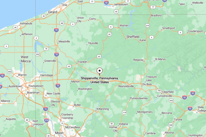
Shippenville is located in Clarion County along U.S. Route 322, just west of Clarion. The approach is gentle, through a mix of farmland and woodland.
While not far from I-80, the town feels quietly self-contained. You can be in the forest in minutes, yet still hear the church bell at noon.
15. Tylersburg
Tylersburg sits at the edge of Cook Forest State Park, surrounded by dense pine and hemlock stands. The park draws visitors, but the village itself stays low-key, with just a few homes and cabins scattered along the road.
Residents tend gardens in sunny clearings, explore shaded trails, or fish in nearby streams. Tourism jobs blend with forestry and small crafts.
The tall trees mute highway noise, making it feel more remote than its map location suggests. Even in peak season, evenings here belong to the sound of wind in the canopy.
Where is Tylersburg?
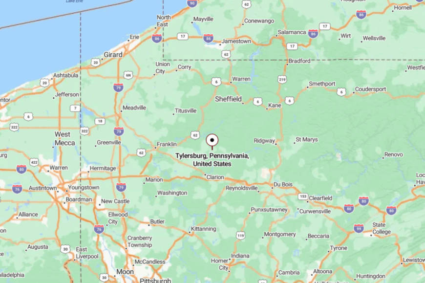
Tylersburg lies in Clarion County along PA Route 36, just north of Leeper. The drive from town quickly slips into the forest, with curves that limit long views.
It’s close to the park’s bustle but holds its own quieter identity. You could pass by in minutes and never know it was there.
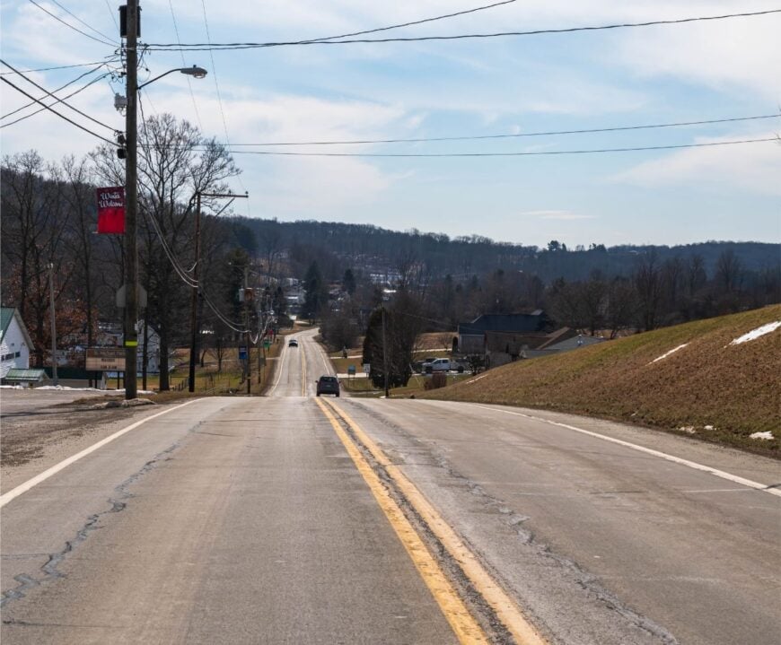
14. Lucinda
Lucinda is a ridgeline community where farms meet forest, and the horizon rolls away in every direction. Its seclusion is marked by the distance between neighbors and the way the forest swallows the sound of passing cars.
The village has a charming country store, a church, and access to nearby hiking in Cook Forest. Farming and small trades keep the pace measured.
The light here is crisp in winter, golden in summer—a painter’s dream. It’s the kind of view that makes you linger on the porch.
Where is Lucinda?
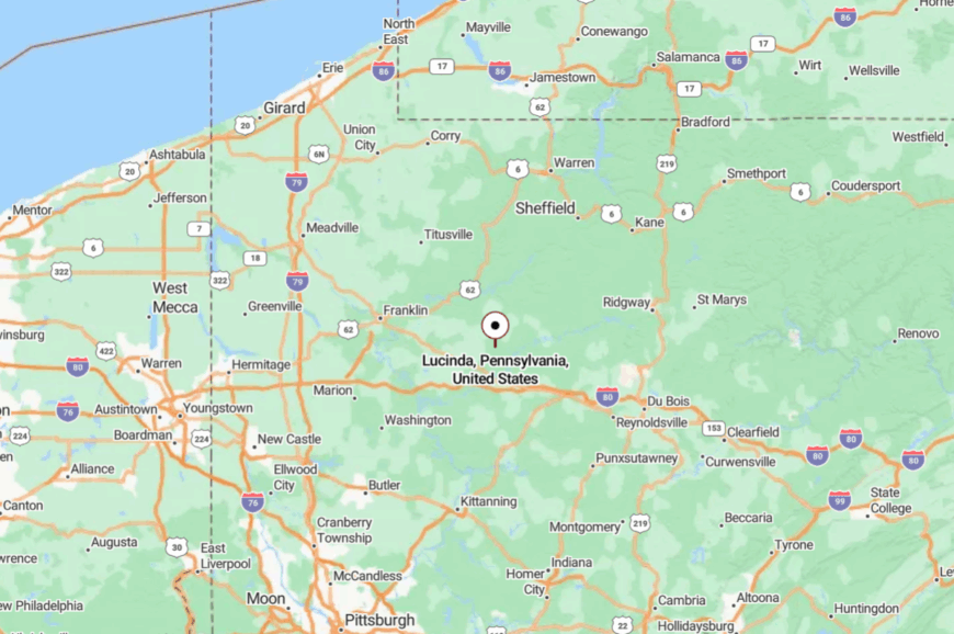
Lucinda is in Clarion County along PA Route 66, about 8 miles north of Clarion. Approaches run over low ridges and through farmland, with the occasional glimpse of forest.
The absence of heavy traffic preserves the ridgeline’s calm. Arriving feels like stepping into a landscape painting.
13. Fryburg
🔥 Would you like to save this?
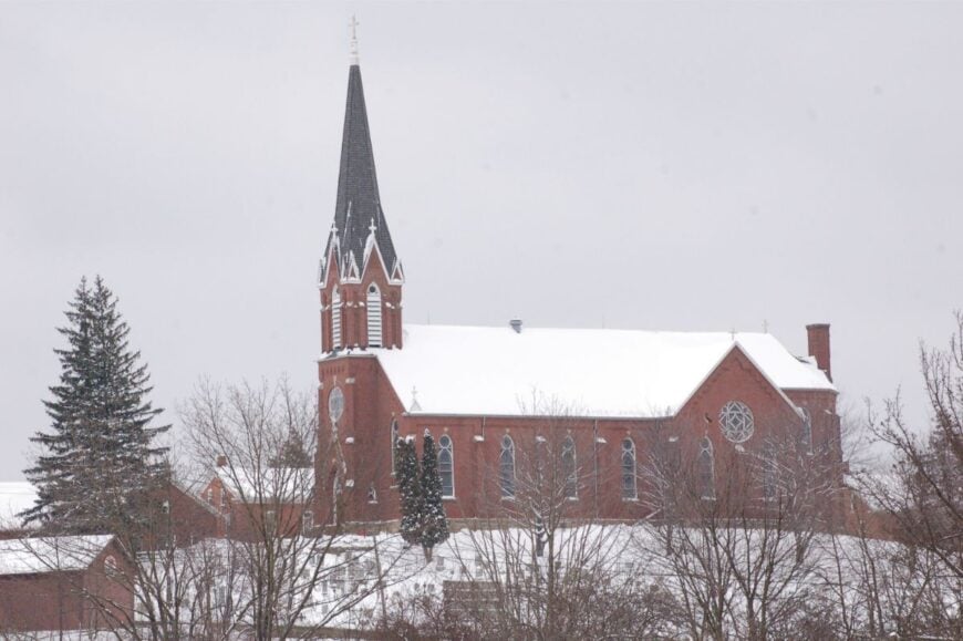
Fryburg is a close-knit hilltop village where the steeple of St. Michael’s crowns the skyline. Its height above the surrounding valleys lends both a view and a sense of remove.
Life here revolves around the church, the ballfield, and seasonal gatherings. The air smells of woodsmoke in winter, wildflowers in summer.
Agriculture and local trades keep the economy grounded. From up here, the rest of the world feels comfortably far away.
Where is Fryburg?
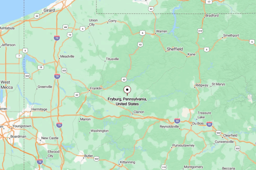
Fryburg sits in Clarion County along PA Route 208, about 10 miles northeast of Clarion. The approach is a steady climb through wooded slopes and open fields.
From the crest, the view stretches for miles. It’s a perch that feels set apart from the valleys below.
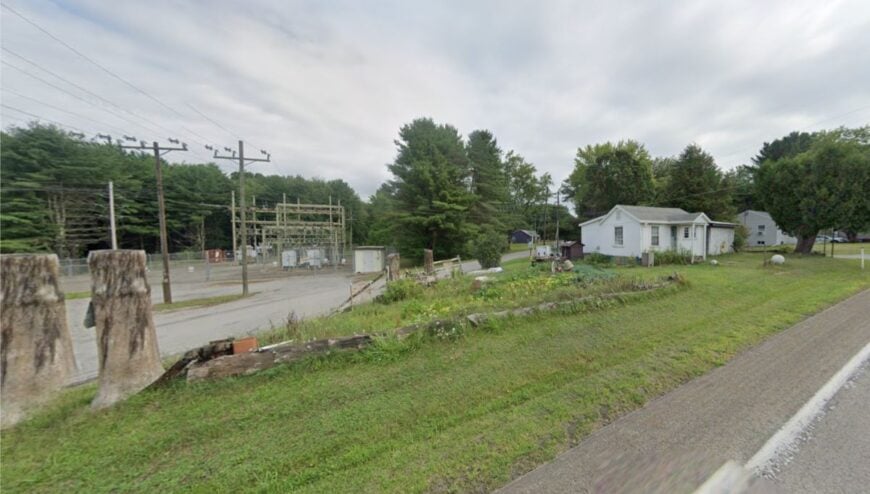
12. Leeper
Leeper is a four-corners kind of place, surrounded on all sides by forest and open land. Despite being a junction for a few state routes, it holds onto its quiet, with just a handful of businesses and homes.
Residents are minutes from Cook Forest’s trails and Clarion River’s fishing spots. Forestry and small hospitality businesses form the work base.
The vibe is relaxed—friendly waves, unhurried afternoons, and nights with more stars than streetlights. It’s a crossroad where you might just stop for good.
Where is Leeper?
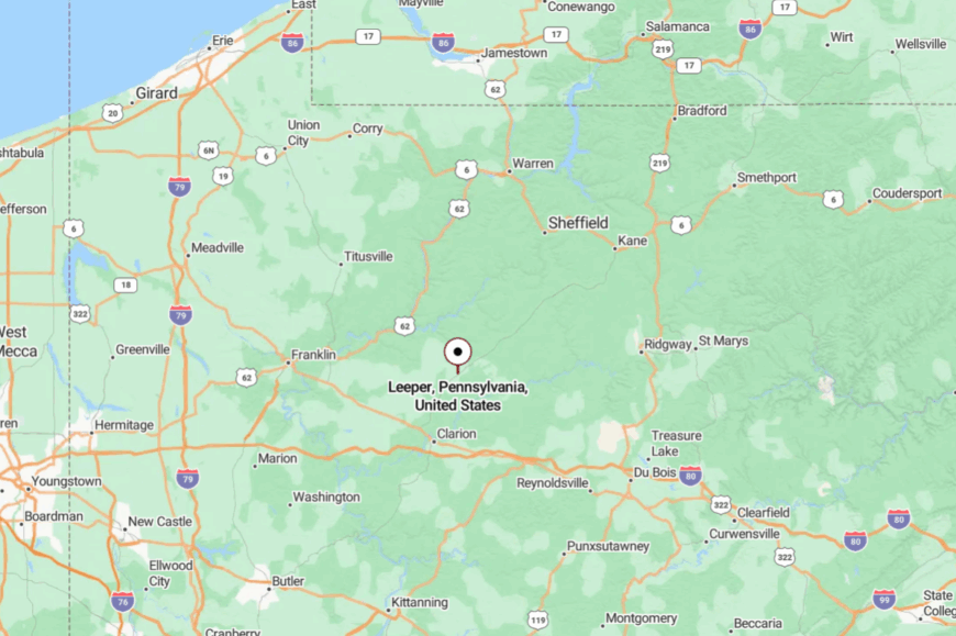
Leeper lies in Clarion County at the meeting of PA Routes 66 and 36, about 12 miles north of Clarion. The approach is flanked by forest in all directions.
While easy to find, it feels comfortably remote once you’re here. It’s the gateway to the forest, but with its own quiet charm.
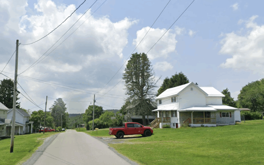
11. Crown
Crown is a scattering of homes and hunting camps tucked into the forest north of Clarion. The paved road narrows quickly, and the canopy closes in until the sky is just a ribbon overhead.
Locals hunt in the fall, pick berries in the summer, and heat with wood through long winters. There are no shops here—supplies mean a drive to the nearest borough.
The isolation is complete enough that silence feels like part of the landscape. It’s the kind of deep-woods quiet that settles into your bones.
Where is Crown?
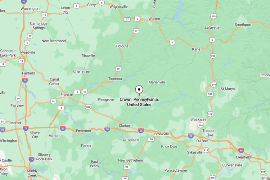
Crown is in Clarion County along PA Route 66, about 16 miles north of Clarion. Access is straightforward but feels increasingly remote the farther you drive.
Forest lines the route, broken only by occasional clearings. It’s close to the main road, yet feels like the end of one.
10. De Lancey
With roughly 120 residents, De Lancey feels like a rural outpost lost in time. Hikers follow the old Buffalo Rochester and Pittsburgh rail bed, now a quiet trail that parallels Mahoning Creek and reveals stone bridge abutments from the coal era.
Family farms and small timber outfits provide the few paychecks that still exist, though many households garden, hunt, or commute to Punxsutawney on occasion. Even the volunteer fire hall keeps limited hours, a sign of how little traffic rolls through the hollow.
Thick hardwoods and ridgelines wrap the community in a natural sound wall that muffles the nearest highway. Night skies stay pitch black, reinforcing how removed this hamlet is from modern bustle.
Where is De Lancey?
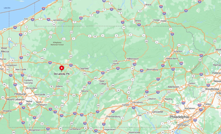
De Lancey sits in Jefferson County, roughly six miles north of Punxsutawney. Deep cut valleys and unlit county roads contribute to its tucked-away feel, while two mountain folds block any cell signal until one nears town.
The primary approach is PA Route 310 followed by a series of gravel lanes that dead-end at farm gates. Visitors often rely on printed directions because GPS drops out before the last turn.
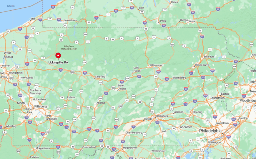
9. Lickingville
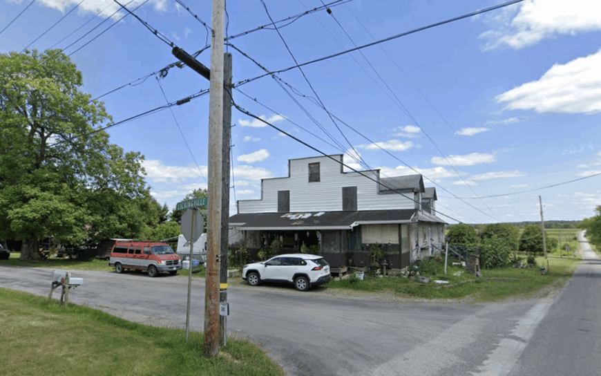
Home to fewer than 200 people, Lickingville rests amid sugar maple stands where steam still curls from springtime sap camps. Locals paddle upstream stretches of East Hickory Creek or slip into hidden trout holes that see more deer than anglers.
Part-time logging and modest dairy herds support the economy, though the post office remains the only commercial stop. Development pressure is virtually nonexistent thanks to the surrounding State Game Lands 24 and 72 that wrap the crossroads like a protective ring.
Unmarked dirt spurs fade into the forest within a mile or two, preserving quiet even on holiday weekends. Streetlights are so scarce that fireflies provide most of the summer sparkle.
Where is Lickingville?
🔥 Would you like to save this?
The village lies in Clarion County at the junction of Routes 208 and 1005, eighteen miles northeast of the borough of Clarion. Rolling hardwood hills and protected public acreage keep it visually and physically detached from suburban sprawl.
Travelers exit Interstate 80 and wind along two-lane roads that narrow as elevation rises. Winter visitors often see more snowplows than cars on the final stretch.
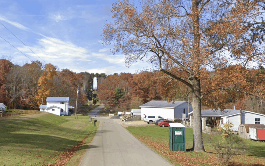
8. Bear Rocks
Perched at 2,600 feet on Chestnut Ridge, Bear Rocks claims about 250 full-time residents and a handful of weekend cabin owners. The high ground delivers sweeping views into Somerset County, plus autumn hawk migrations that thrill birders with kettles of broad-winged raptors.
Construction and seasonal tourism tied to the Laurel Highlands ski slopes create modest employment, though many homeowners telecommute or craft furniture from local oak. Dense mixed-oak forest surrounds the ridge-top chalets, cutting wind and masking any hum from U.S. Route 40 far below.
Gravel switchbacks and tight hairpins discourage casual drive-through traffic, heightening the sense of retreat. On clear nights, constellation spotting competes only with the distant blink of a lone radio tower.
Where is Bear Rocks?
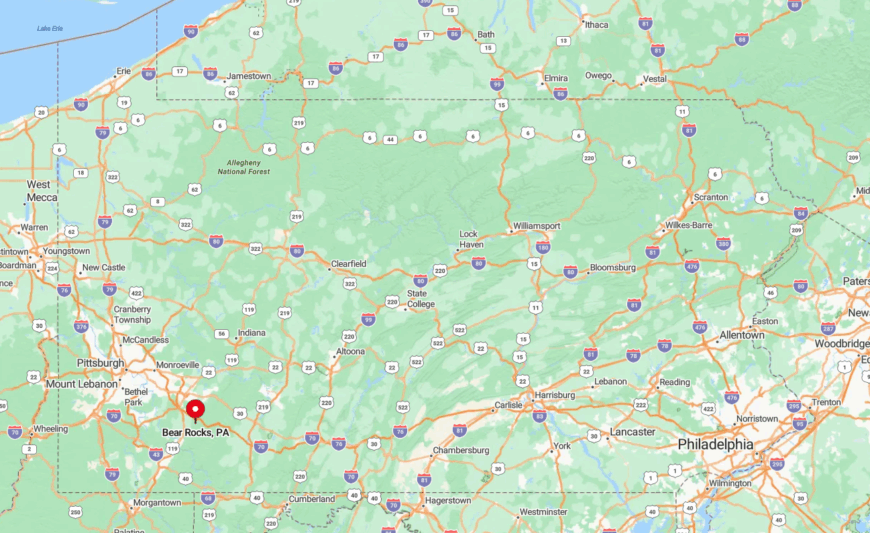
This mountaintop community sits in Fayette County, six winding miles southeast of Chalk Hill. Its elevated position above the Youghiogheny River gorge leaves it hidden from valley highways and resort chatter.
Access comes via Bear Rocks Road, a narrow route that climbs more than 1,000 feet in four miles before leveling off on the ridge. Four-wheel drive is recommended once snow coats the shade-locked curves.
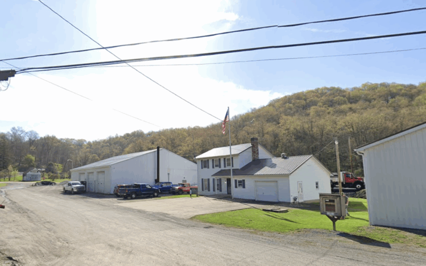
7. Kennerdell
Around 200 residents call Kennerdell home, most of them living on acre-plus parcels overlooking a dramatic horseshoe bend of the Allegheny River. Kayakers slide into the water at the seldom-used public launch, then drift past bald-eagle nests few tourists ever see.
River recreation and small custom woodworking shops comprise the main livelihoods after the oil boom faded a century ago. The village clings to a hilltop plateau wrapped by 50 percent undeveloped state forest that muffles outside sound.
Only one switchback road leads up from the valley, meaning traffic lights are nonexistent. Fog often blankets the bend at dawn, lending a remote, almost island feel.
Where is Kennerdell?
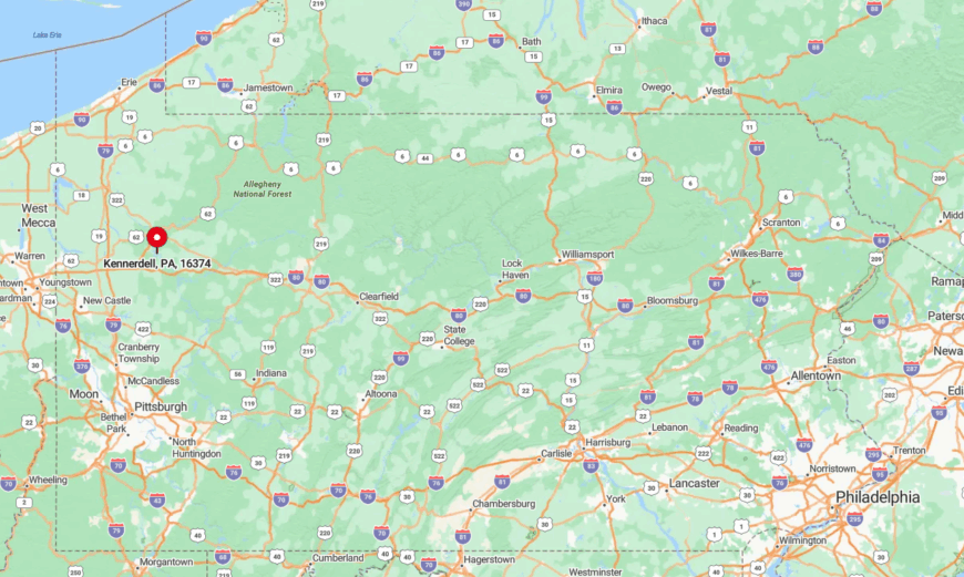
Kennerdell occupies a high perch in Venango County, fifteen miles south of Oil City as the crow flies. Steep slopes and the looping river isolate it from direct routes, forcing drivers to zigzag through Rockland Township.
The simplest approach is PA Route 308 to Kennerdell Road, a climb favored by bicyclists but shunned by delivery vans. Cell coverage fades halfway up the grade, returning only once one descends the opposite ridge.
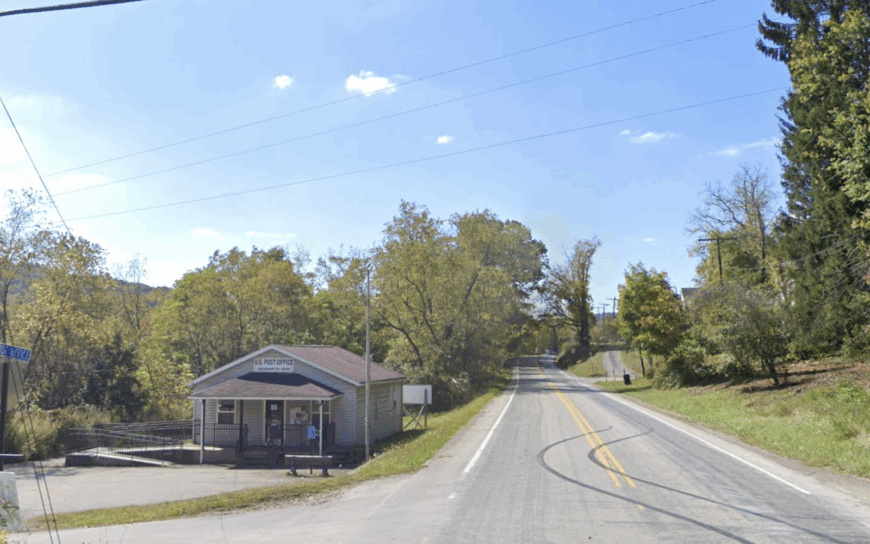
6. Spraggs
Spraggs counts close to 220 inhabitants scattered along Greene County’s open cattle pastures and riparian woodlots. Anglers slip canoes into Dunkard Creek for smallmouth bass and perch, while Sunday afternoons often feature local bluegrass at the century-old Spraggs Grange Hall.
Beef ranching and natural gas support the local payroll, complemented by a seasonal farmers market that sells heirloom tomatoes and sorghum syrup. Interstate noise is a distant rumor; the nearest divided highway sits sixty rural miles north near Pittsburgh.
Wide gaps between homesteads keep porch lights from overlapping, ensuring genuine darkness by nine. Only an occasional coal truck breaks the stillness as it crawls toward the Mount Morris exit.
Where is Spraggs?
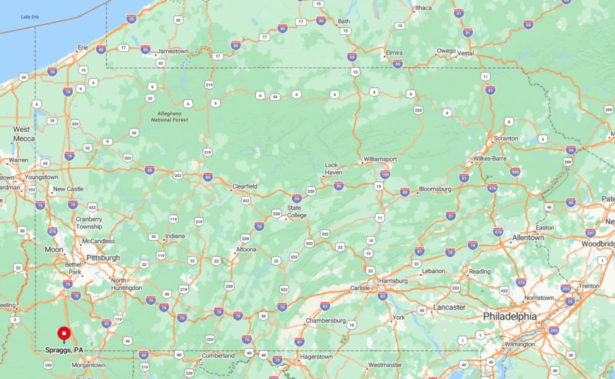
Situated along PA Route 218 in the state’s southwestern corner, Spraggs lies just four miles from the West Virginia line. Low ridges and limited bridges across Dunkard Creek limit through-traffic, adding to its hidden character.
Access requires leaving I-79 at Waynesburg and following rolling two-lane blacktop for eighteen miles. Fog often clings to the creek flats at sunrise, slowing the final approach to farm-road pace.
5. Sagamore
Approximately 300 residents inhabit Sagamore, a once-busy coal patch now marked by renovated farmhouses and tidy gardens. Locals explore reclaimed mine lands on horseback or ride ATV loops through State Game Lands 287 that bracket the settlement.
Small-scale cattle operations and commuting carpenters make up the workforce, with a community center hosting Friday fish fries that still draw neighboring towns. Two mountain ridges buffer Sagamore from both Kittanning and Indiana, each more than twenty miles away.
Mail trucks arrive by a single paved spur, turning around where the blacktop shifts to crushed limestone. Nighttime silence is broken only by whip-poor-wills or distant coyotes.
Where is Sagamore?
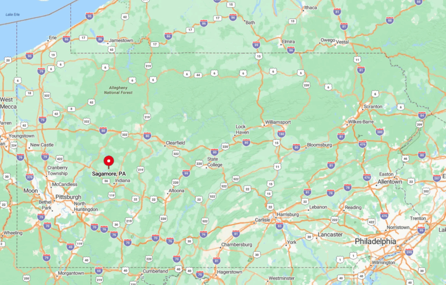
Sagamore rests in Armstrong County off PA Route 85, hidden between Sugarcamp Run and Plum Creek valleys. The folds of Chestnut Ridge cut sightlines to any sizable population center, enhancing the sense of isolation.
Travelers leave U.S. Route 422 at Elderton, then weave south along narrow country roads shared with farm equipment. Winter storms often force plows to pile snow in roadside fields because there are no shoulders to spare.
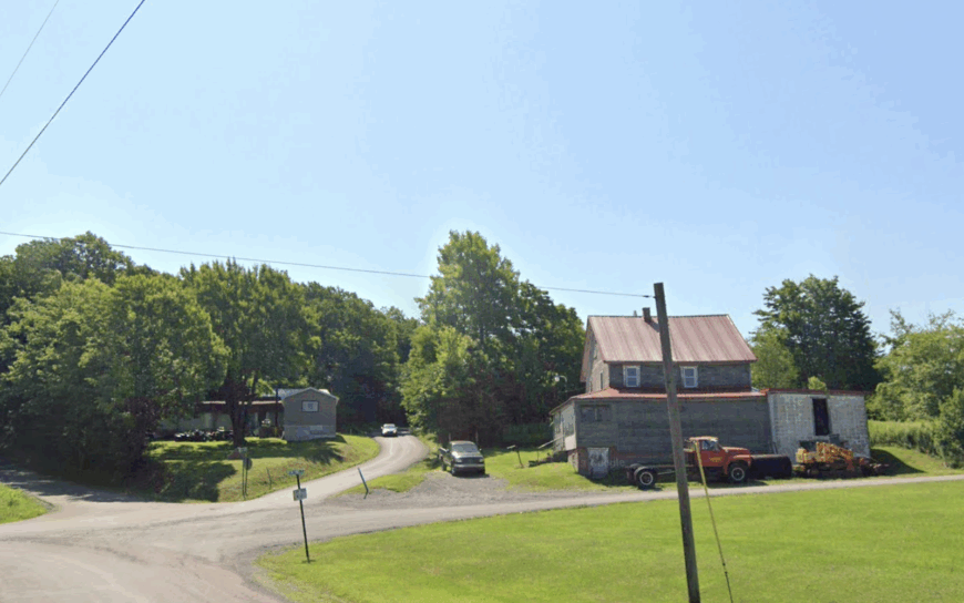
4. Clarington
Clarington’s population hovers near 80, a cluster of century-old wood homes lining Cherry Run where it meets the Clarion River. Paddlers appreciate the put-in beside the arched iron bridge, a launch that stays hushed while other river access points crowd up.
A few cabin-rental outfits survive, yet no formal commercial district exists, leaving gardening, forestry, and remote work as common income sources. Steep wooded hills surround the valley, blocking both cell towers and sunset light until late evening.
With no traffic lights and minimal signage, visitors often drive past before realizing a town lies below. The result is a pocket of stillness perfect for writers and fly-fishers alike.
Where is Clarington?
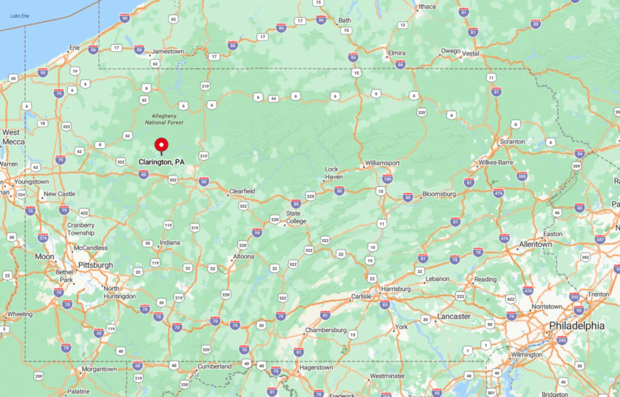
The hamlet sits in Forest County within sight of Cook Forest State Park’s southern boundary. Winding River Road is the lone artery, curling along the Clarion River for miles with cliffs on one side and water on the other.
Navigation apps lose signal midway, so locals post handmade markers to guide guests. The closest grocery store is a fifteen-mile round-trip, reinforcing Clarington’s hideaway status.
3. Gibbon Glade
Roughly 350 people live among Gibbon Glade’s rolling pastures at the foot of Chestnut Ridge. Family farms sell winter-sweetened maple syrup at roadside stands, and neighbors gather for weekly horseshoe leagues behind the fire hall.
Small dairy operations and greenhouse nurseries provide work, supplemented by trail guiding in nearby Forbes State Forest. Dense hardwood tracts form a natural sound barrier from the busy Laurel Highlands resorts just over the ridge.
Parcel sizes average more than an acre, so even summer barbecues feel private. Fog lifting off pasture ponds offers sunrise moments that rarely make Instagram feeds.
Where is Gibbon Glade?
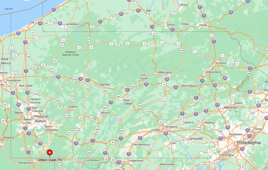
This Fayette County community lies eight miles southeast of Farmington along Gibbon Glade Road. The ridge creates a topographic wall that hides the village from U.S. Route 40 traffic and ski-weekend congestion.
Access demands a steady climb up gravel switchbacks, then a descent onto gentle meadowland. Public transit ends twenty minutes away, so arrival is always by private vehicle.
2. Marienville
Marienville supports about 600 residents, yet feels smaller thanks to streets that dissolve into the million-acre Allegheny National Forest after a handful of blocks. Off-highway vehicle riders cherish the nearby Timberline and Marienville ATV trails, while anglers stalk brook trout in secret spring seeps.
Game Commission offices and seasonal tourism tied to elk viewing sustain employment; the rest of the workforce staffs the state prison on the outskirts or crafts custom log furniture.
Tall white pines shadow dirt lanes, muting everyday noise and limiting line-of-sight beyond the first tree row. Even the local diner closes early because campers cook at fire rings more often than they dine out. After dark, stars blanket the village in a clarity that city dwellers seldom witness.
Where is Marienville?
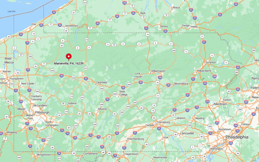
Positioned in Forest County at the junction of Routes 66 and 899, Marienville is 25 miles from the nearest proper town. Vast public land on all sides prevents suburban creep and keeps traffic volumes low.
Visitors usually exit I-80 at Clarion and dive north through steadily darkening forest before lights appear around the historic railroad depot. Once snow falls, the main routes double as snowmobile corridors, slowing travel to a leisurely pace.
1. Cooksburg
Only about 50 permanent residents occupy Cooksburg, a riverside bend within Cook Forest State Park that swells with cabin renters on holiday weekends. Daylight hours invite canoe trips under towering hemlocks, hikes to the 90-foot fire tower, and lazy picnics beside the Clarion River.
Seasonal outfitters and a small general store provide most jobs, though a few artisans carve bowls from old-growth windfalls salvaged after storms. The town’s one-acre riverfront lots are buffered by ancient evergreens that hush passing vehicles and camouflage cabins from prying eyes.
No four-lane road approaches within 15 miles, so the only sounds after dusk are whip-poor-wills and river riffles. Even the park’s famed “Forest Cathedral” old-growth stand sits a mile upstream, drawing more deer than people by sunset.
Where is Cooksburg?
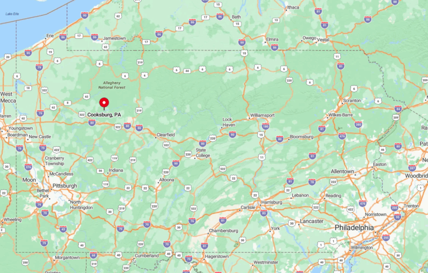
Cooksburg straddles the Clarion River at the Forest-Clarion county line, south of PA Route 36’s narrow bridge. Hemlock-shaded curves and the absence of shoulder space keep larger trucks away, preserving a slow-travel ethos.
Most visitors arrive from I-80 to the north or U.S. Route 322 to the south, following a final fifteen-mile stretch of two-lane blacktop that traces the river. Cell service drops upon entering the gorge, making paper maps or downloaded directions the smart choice.