Western Missouri hides more than cattle pastures and interstate exits; it shelters quiet corners where the gravel crunches under slow-moving pickups and the night sky still looks like an astronomy textbook.
We gathered 25 of those places—villages and unincorporated dots that many maps barely acknowledge—because they offer true distance from bright lights and busy calendars. Each spot has its own rhythm, be it a foggy lake dawn, a bluff-top sunset, or the whistle of wind through prairie grass.
Visitors may find a bait shop instead of a boutique, or an old brick schoolhouse instead of a visitor center, yet that sparse infrastructure is exactly the point. In these towns, neighbors know the back roads by memory and seasonal festivals by heart.
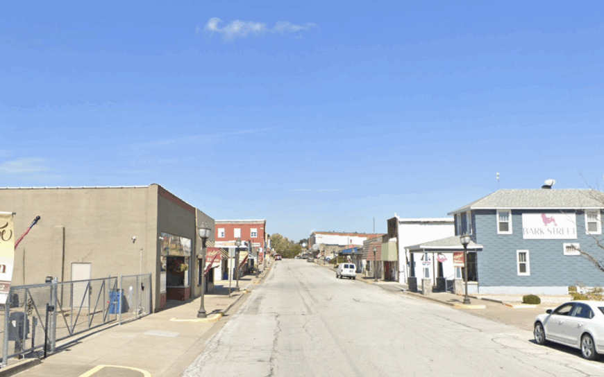
25. Hume – Fenceline Quiet on the Kansas Line
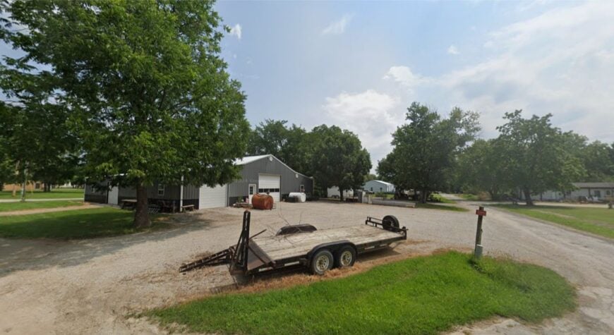
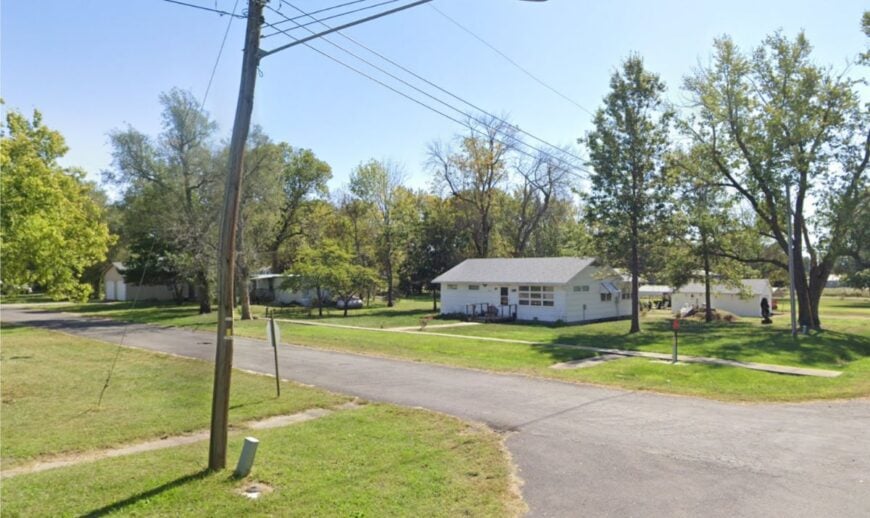
Hume is the sort of border-town dot where the prairie sky feels impossibly wide and the nights ring with coyotes more than car doors. Its seclusion is baked in: a small population, long gaps between farmsteads, and county roads that wander more than they deliver you anywhere fast.
The vibe is plainspoken and neighborly—feed caps at the café counter, tractors easing across one-lane bridges, and porch swings that keep time with the breeze. Walk gravel lanes at golden hour, cast for bass on small farm ponds (with permission), poke around century-old storefronts, or bird the hedgerows for meadowlarks.
Cattle, hay, and a few cross-border jobs keep the week steady. When the wind combs the grass, the whole town seems to exhale. It’s the kind of place that reminds you how quiet the world can be.
Where is Hume?
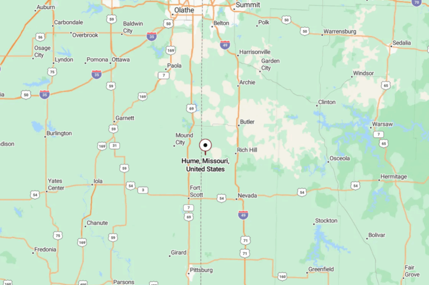
Tucked into far southwestern Bates County, Hume sits a few miles east of the Kansas state line and about 80 miles south of Kansas City. Most visitors come via I-49 to Butler, then follow MO-52 west before dropping onto smaller county blacktop.
With no through route, the last miles feel like a gentle detour into open country. Close enough for a day trip, far enough to shed the city noise.
24. Amsterdam – River-Bottom Farms and End-of-the-Map Calm
Amsterdam keeps to itself among bottomland fields and windbreak rows, a tiny grid where you can still hear screen doors close. Its seclusion comes from being tucked between the Marais des Cygnes and the state line, with only a few quiet approaches threading the fields.
The vibe is rural and sun-bleached—grain bins, farm dogs, and a Main Street that naps after lunch. Watch red-tailed hawks hunt fence lines, photograph weathered barns, cast for catfish along slow backwaters, or time a visit with a church potluck.
Row crops and livestock pay the bills; everything else runs on neighbor favors. Dusk brings one long, lavender sky. It’s close to the metro in miles, but it might as well be a different pace of life.
Where is Amsterdam?
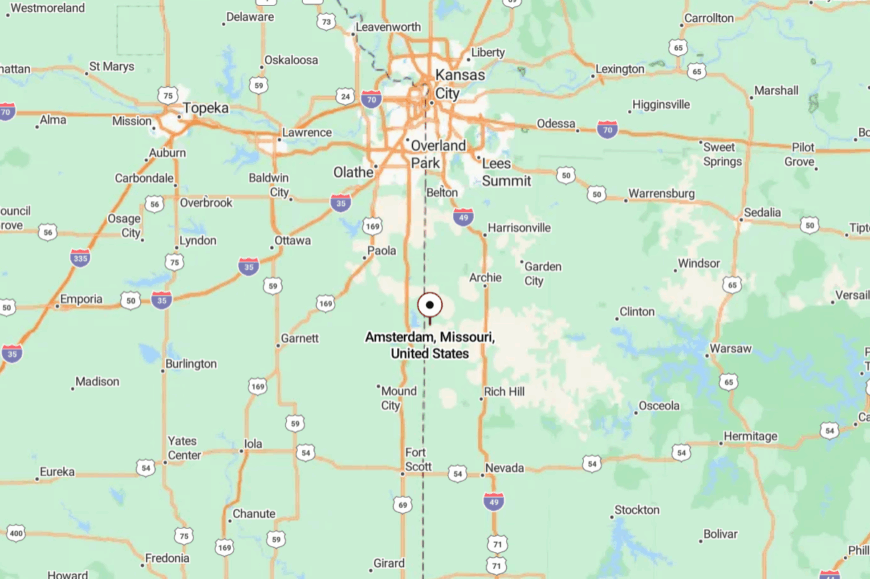
In western Bates County, Amsterdam sits roughly 60 miles south of Kansas City and a short hop from the Kansas line. Most folks reach it via I-49 to Adrian, then west on MO-18 and down quiet county roads.
There’s no bypass—just fields that widen and traffic that thins. The last turn feels like stepping off the clock.
23. Foster – A Three-Street Town with Big Horizons
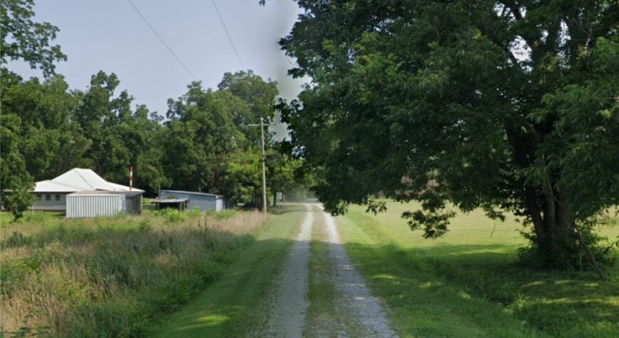
Foster is little more than a crossroads, a post office, and a handful of tidy houses tucked into ocean-wide pasture. It stays secluded thanks to its distance from any four-lane and a habit of pointing visitors down gravel instead of pavement.
The mood is hushed and homey—windmills ticking, dogs dozing in shade, and tractors idling by mailboxes. Walk the grid at sunrise, glass the prairie for deer, scout old cemeteries, or pack a thermos and watch thunderstorms build over the state line.
Cattle and hay dominate the rhythm of the week. On still nights, you can hear trains miles away. It’s a soft-spoken corner that rewards unhurried eyes.
Where is Foster?
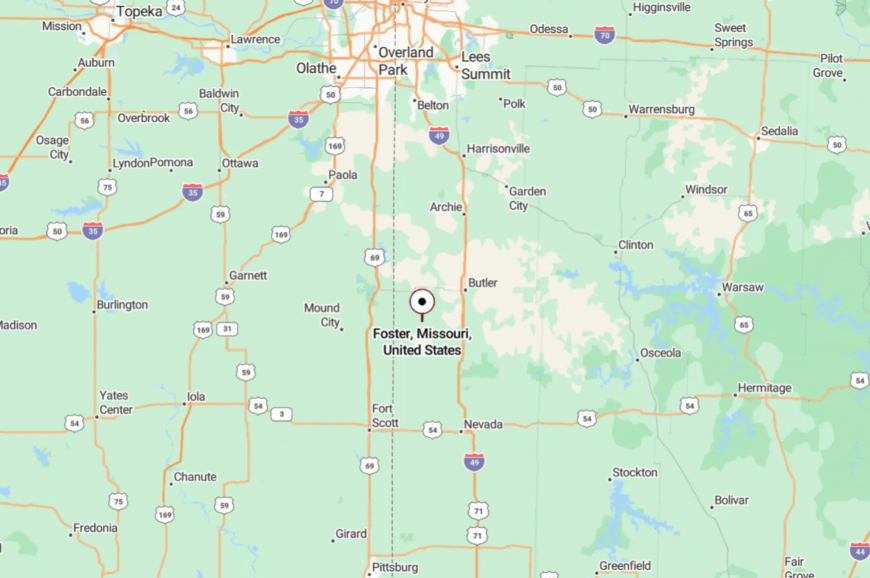
Foster rests in far southwestern Bates County, a few miles north of the Missouri–Kansas line and about 75 miles from Kansas City. From I-49, exit at Butler and follow MO-52 west before turning onto county roads that taper to gravel.
With no through traffic, you arrive because you mean to. The prairie makes sure you leave the rush behind.
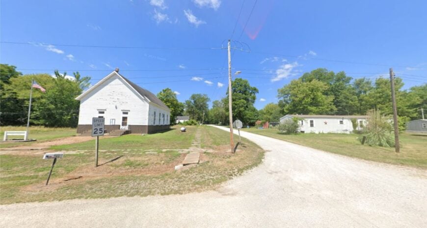
22. Blairstown – Big Creek Bridges and Church-Bell Afternoons
Blairstown sits near Big Creek’s timbered bends, a pocket of clapboard homes and garden plots that time misplaces on purpose. Its quiet comes from being off the main flows—well away from MO-13 and tucked behind a nest of county routes.
The vibe is old-town modest: white steeples, birdfeeders, and front porches that trade news more than phones do. Fish quiet creek pools, bike shady backroads, photograph iron bridges, or loop to nearby conservation areas for wildflowers.
Row crops and small cattle herds share space with commuters to Clinton or Warrensburg. Summer evenings sound like cicadas and a lawnmower two streets over. It’s a little town that greets you with a nod and a slower heartbeat.
Where is Blairstown?
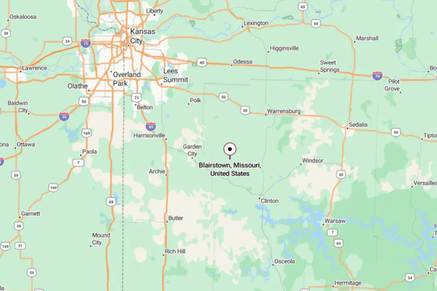
Northwestern Henry County claims Blairstown, about 20 miles northwest of Clinton and not far from the Johnson County line. Most visitors run MO-2 or county blacktops through open pasture to reach its short grid.
With no highway frontage, it sits comfortably out of the way. You’ll know you’re close when trees close over the road and the map zooms way in.
21. Brownington – Truman Backroads and Reservoir Sunrises
Brownington is a lakeside whisper—dock lights, gravel dust, and early-morning boats vanishing into Truman’s coves. Seclusion sticks because the town sits off the main routes, hemmed in by timber and conservation land that bends roads into loops.
The mood is camp-quiet and content: bait buckets, porch flags, and kids pedaling to the water. Launch at a small ramp, hunt mushrooms in oak hollows, watch waterfowl stack over the treeline, or picnic at a sun-faded pavilion.
Part-time lake jobs, farming, and retirees sharing tomato starts keep things humming lightly. When the stars come out, the lake mirrors them back. It’s where weekends feel longer than they should.
Where is Brownington?
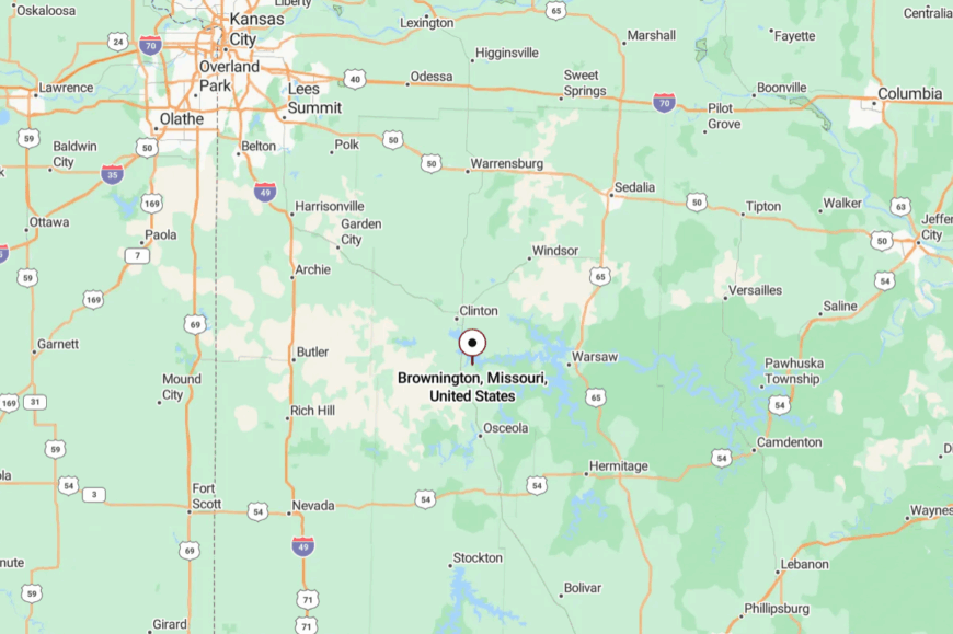
Set in southern Henry County near the Osage arm of Truman Lake, Brownington sits a short jog off MO-52. Drivers typically peel away from Clinton or Deepwater and finish on county pavement and gravel.
The reservoir and timber buffer the town from any hurry. One look at the water and you understand why it stays quiet.
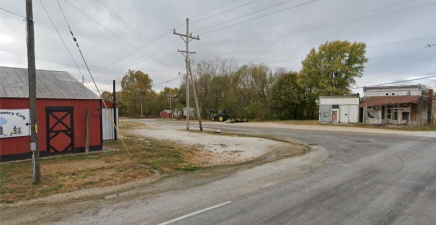
20. Jerico Springs – Stone-Clear Water and Backroad Peace
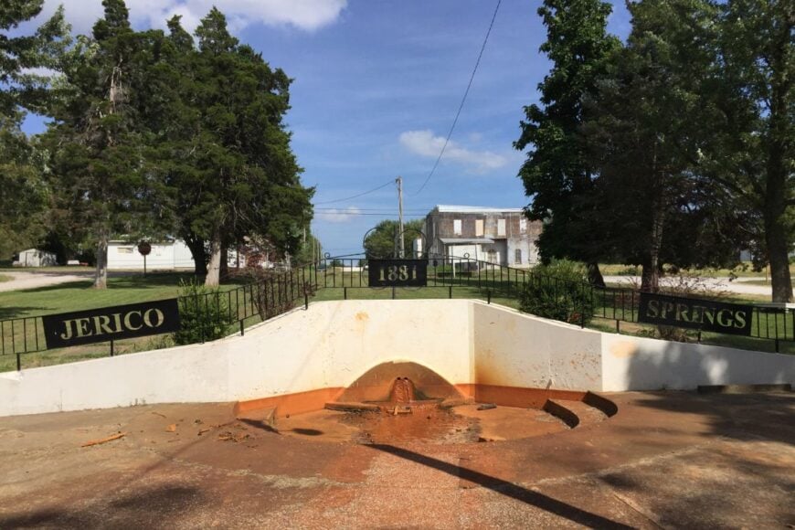
Jerico Springs lives up to its name with limestone-bright creeks and a sleepy crossroads that seems to sigh in the shade. Its tucked-away feel comes from sitting far from interstates and just far enough from Stockton and El Dorado Springs to miss passersby.
The vibe is old Ozark humble—porches, potlucks, and kids splashing in summer water. Explore clear creeks, visit small country churches, cruise MO-97’s hills, or detour to Caplinger Mills for Sac River history.
Cattle, hay, and small trades pay the way. When the katydids start up, conversation naturally slows. It’s the kind of place you find once and remember by heart.
Where is Jerico Springs?
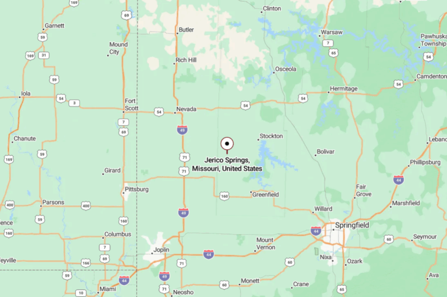
In northern Cedar County, Jerico Springs lies along MO-97, about 20 miles north of Stockton Lake. Travelers often arrive via MO-32 or MO-39, then slip onto quieter two-lanes under an oak canopy.
There’s no fast route; the roads meander because the land does. By the last turn, you’re traveling at creek speed.
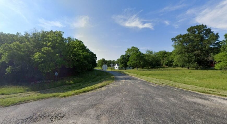
19. Arcola – Orchard Lanes Above Stockton’s Quiet Arms
🔥 Would you like to save this?
Arcola hides on the high ground north of Stockton Lake, a tidy village wrapped in orchards and hayfields. Its seclusion is helped by lake fingers that break up direct routes and a habit of steering through traffic elsewhere.
The feel is harvest-season warm—fruit stands, barn cats, and tractors parked by the store at noon. Pick apples in season, walk ridge roads at sunrise, drop to the lake for paddling, or find a Sac River gravel bar for skipping stones.
Fruit and cattle mix with a few lake-weekend rentals to round out the economy. Long views make evenings linger. It’s a small place with plenty of sky.
Where is Arcola?
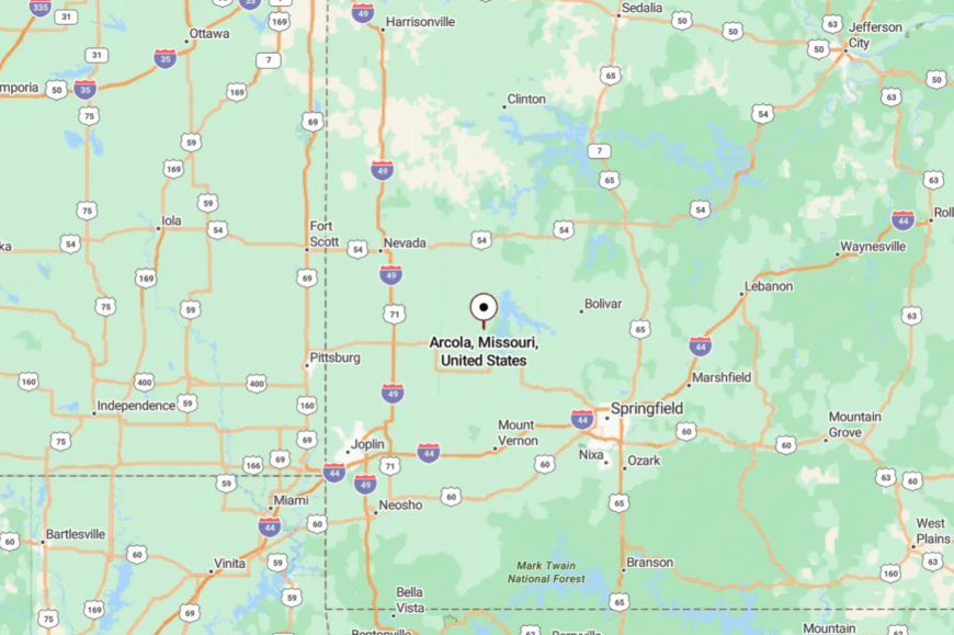
Set in northern Dade County, Arcola sits a few miles north of Stockton Lake and west of the Sac River. You’ll likely reach it via MO-123 and township roads that curl over ridges.
The lake’s inlets keep the landscape pleasantly complicated. You arrive with the feeling you’ve climbed above the noise.
18. Aldrich – Dam-Side Hamlet with Wind in the Wires
Aldrich perches near Stockton Lake’s dam where steady breezes turn wind chimes into background music. Seclusion comes from being at the end of a small state road with water and woodlots hemming in any sprawl.
The vibe is trim and easy—white churches, garden rows, and anglers trailering boats at dawn. Walk the dam overlook, fish for walleye on cool mornings, picnic beneath big oaks, or scan the sky for bald eagles in winter.
Weekend tourism bumps into everyday farming without disturbing it. Nights are dark enough to relearn constellations. It’s close to the lake yet wonderfully apart from the crowds.
Where is Aldrich?
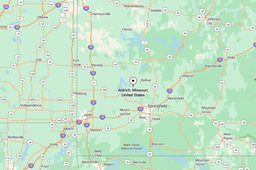
Aldrich sits in northern Polk County just below Stockton Lake’s dam, about 25 miles north of Springfield. MO-123 carries you most of the way before local turns finish the job.
There’s no bypass—just water on one side and pasture on the other. The last mile feels like a deep breath.
17. Flemington – Pomme de Terre Breezes and Porch-Light Evenings
Flemington is a curve of streetlights and porches tucked between rolling pasture and the southern arms of Pomme de Terre Lake. Its out-of-the-way feel comes from the long spaces between towns here and the lake roads that prefer detours to shortcuts.
The mood is lake-quiet and friendly—coolers, jon boats, and neighbors swapping garden produce. Launch a kayak at a low-key ramp, fish crappie around flooded timber, roam county roads for wildflowers, or linger over pie at a mom-and-pop.
Farming, weekend guiding, and retirees keep the lights on. After sunset, the only hurry belongs to the whip-poor-wills. It’s an easy town to settle into and a hard one to leave.
Where is Flemington?
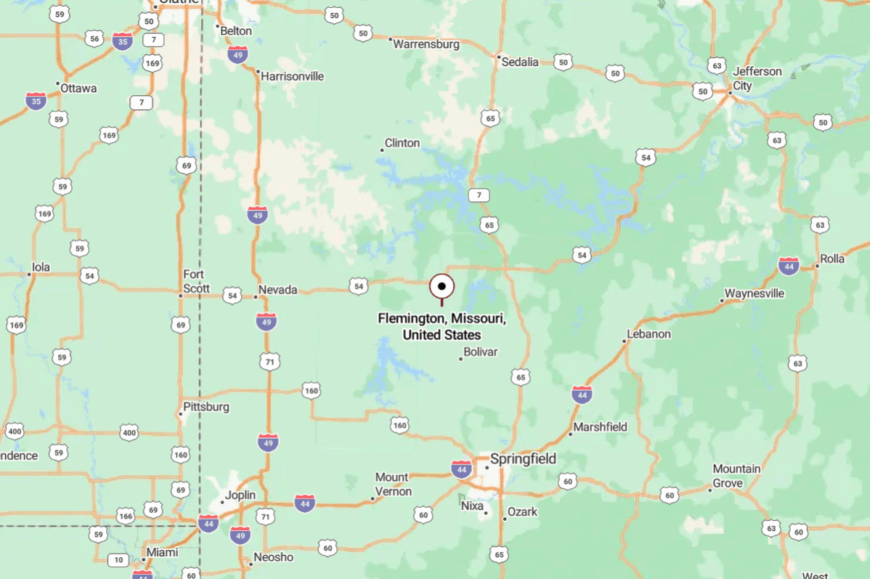
Northern Polk County claims Flemington, a few miles east of Pomme de Terre Lake and about 12 miles north of Bolivar. Most visitors follow MO-83 and then slide onto county routes that skim pasture edges.
The lake and hills break up the map nicely. By the time you roll in, the calendar already feels lighter.
16. Weaubleau – Osage Highland Hush Beside a Famous Spring
Weaubleau spreads out along a high ridge where the Osage Plains meet the Ozarks, a small town with a big spring and a comfortable hush. It stays secluded despite US-54 because the surrounding hills and timber swallow sound and slow everyone down.
The vibe is rural-steady—feed store chatter, Friday ballgames, and creekside picnics. Visit Weaubleau Park’s spring branch, explore local rock outcrops, cruise to Pomme de Terre for a paddle, or browse a roadside flea for vintage finds.
Ranch work and small shops underwrite the week. When evening shadows pool in the hollows, it feels like the town nods off with them. It’s a ridge-top perch with a gentle heart.
Where is Weaubleau?
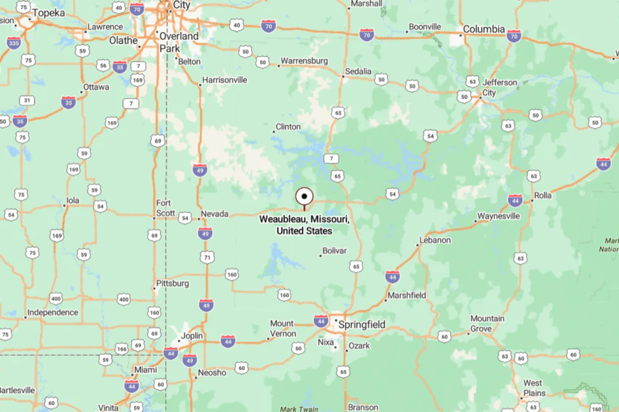
Weaubleau sits in western Hickory County along US-54, roughly 25 miles west of Hermitage and 30 miles north of Stockton Lake.
Approaches from MO-13 or MO-65 funnel you onto rolling two-lanes. Hills and timber make the world feel smaller as you climb. Near, but somehow nicely removed.
15. Cross Timbers – Oak Scrub, Slow Curves, and Sky

Cross Timbers rides a ridge of blackjack oak and prairie remnants, a small town named for the very thickets that make it feel tucked away. Its seclusion comes from the long miles between services and a habit of staying just out of sight from busier MO-65.
The vibe is no-rush rural—front porches, bird feeders, and an old café where coffee comes with stories. Wander oak-lined backroads, watch hawks ride thermals, slip north to Truman or south to Pomme de Terre for quiet water, or hunt mushrooms after spring rains.
Cattle and commuting keep the ledger balanced. The wind does most of the talking out here. It’s the pause button of western Hickory County.
Where is Cross Timbers?
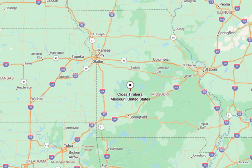
On the Hickory–Benton line, Cross Timbers sits a few miles east of MO-65 and west of US-65’s lake traffic. From Warsaw or Buffalo, you’ll thread two-lanes that rise and fall with the ridges.
There’s no shortcut, only the pretty way. By the time you arrive, the horizon has already done its work.
14. Macks Creek – Hollow to Hollow Above the Niangua
Macks Creek tucks into steep hollows where springs feed little runs and the ridgelines keep the outside world at arm’s length. Seclusion comes from broken terrain and a web of side roads that prefer switchbacks to straight lines.
The mood is Ozark-honest—smoke from woodstoves, hand-lettered produce stands, and kids fishing under low bridge shadows. Hike ridge spurs with long views, drop to Little Niangua for a paddle, scan glades for wildflowers, or poke around an old general store.
Logging trucks, cattle trailers, and lake-country trades share the week. Even busy summer weekends sound muted here. It’s a quiet fold in the map that holds onto you.
Where is Macks Creek?
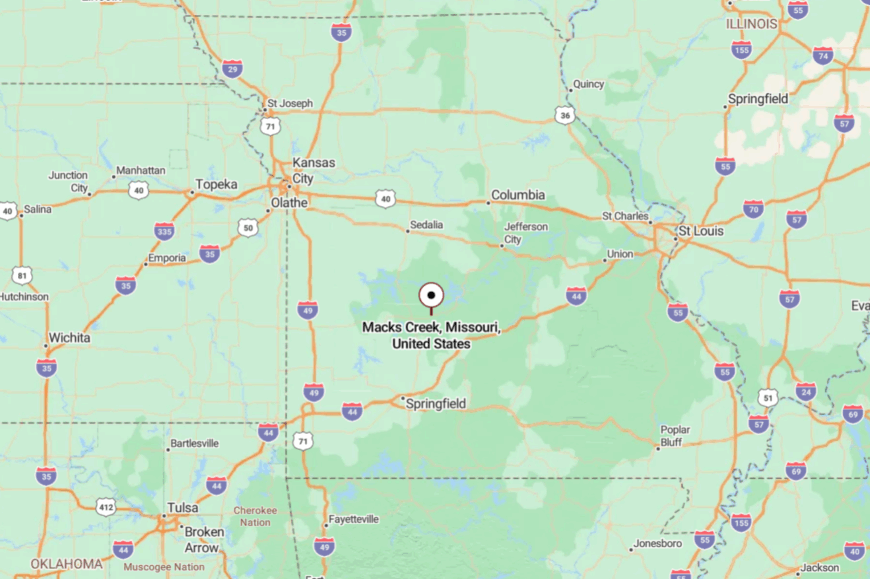
In western Camden County along MO-54, Macks Creek sits about 15 miles west of Camdenton and 30 miles east of Hermitage. The final approach winds through tight curves and wooded slopes.
Side roads drift toward the Little Niangua’s clear water. Close to Lake of the Ozarks, but sheltered in its own hills.
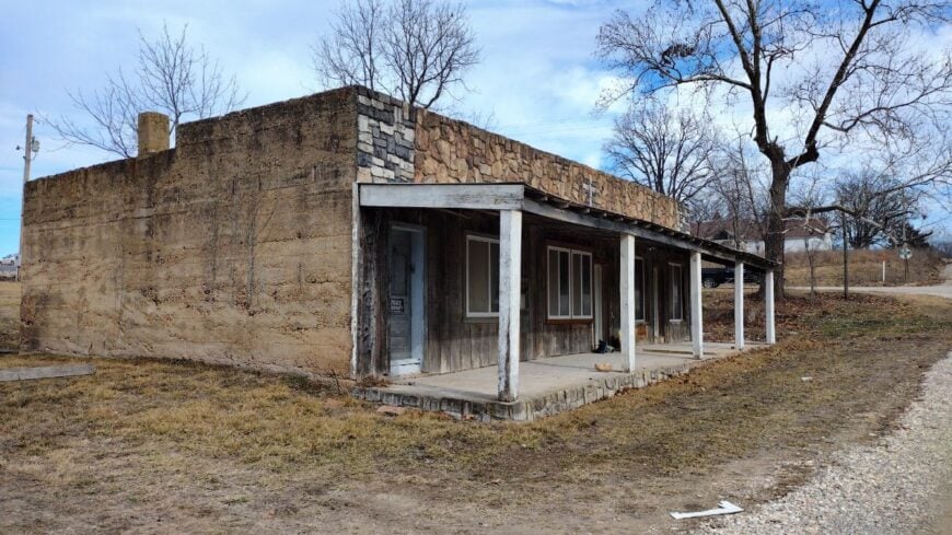
13. Climax Springs – Last Ridge Before the Quiet Water
🔥 Would you like to save this?
Climax Springs is all ridge lines and pine shade, a former incorporated town that never lost its small-place soul. It stays secluded thanks to its distance from resort hubs and a habit of backing up to deep woods.
The vibe is back-porch and unhurried—bait coolers, garden hoses, and dogs asleep under trucks. Hunt morels after spring rains, follow MO-7’s overlooks toward the Niangua arm, fish quiet coves, or watch the Milky Way from a gravel turnout.
Cattle, small trades, and lake-adjacent odd jobs make up the week. Nights fall softly here, like a blanket. It’s where the road runs out and the peace begins.
Where is Climax Springs?
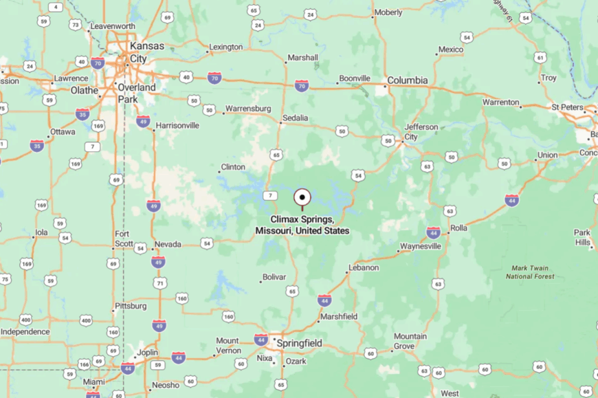
On the west side of Camden County, Climax Springs lies along MO-7 about 25 miles west of Camdenton. You reach it by rolling two-lanes that climb, dip, and thread hardwoods.
Lake peninsulas and steep hollows discourage any straight-shot travel. The last few miles feel like a gentle fade to quiet.
12. Gravois Mills – Small-Harbor Village on a Big Lake
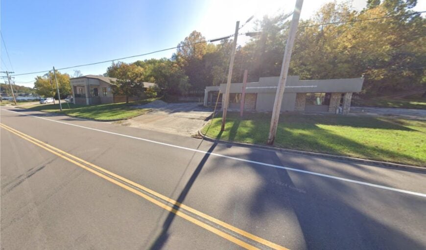
Gravois Mills sits where the lake narrows and the world gets friendlier—boat wakes, bait shops, and blue herons patrolling dawn shorelines. Its tucked-away feel persists because it’s on the quieter Gravois arm, well removed from the big-wake bustle.
The mood is laid-back and lakewise—porch flags, catfish suppers, and neighbors who know every cove by nickname. Paddle still mornings, cast for crappie around docks, browse a tiny market, or take a twilight drive up bluff roads for sunset.
Seasonal tourism blends with year-round trades and retirees. When the wind drops, the water turns to glass and time slows with it. It’s a pocket of calm on a busy lake.
Where is Gravois Mills?
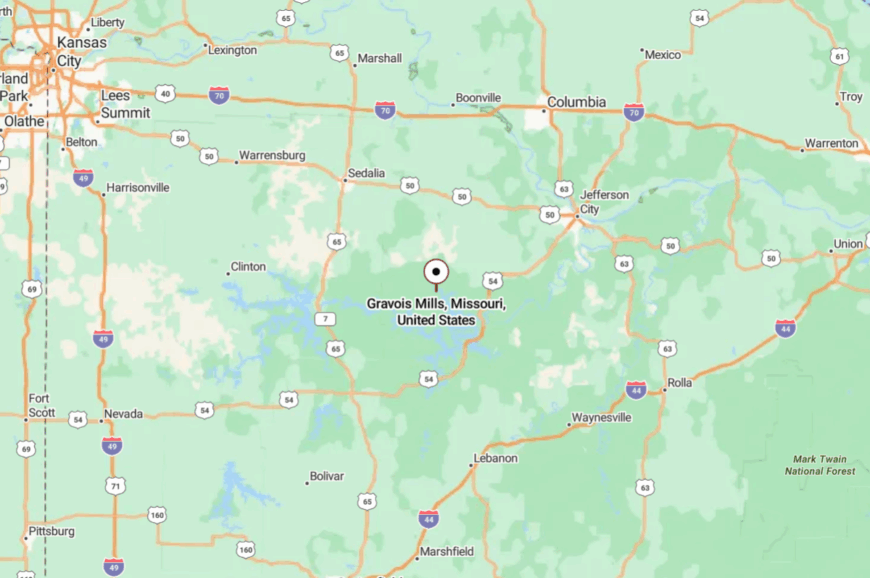
In western Morgan County along MO-5, Gravois Mills sits about 10 miles north of Laurie and 30 miles southwest of Versailles. MO-5 brings you close, then shoreline lanes take over.
Peninsulas and coves make the landscape feel folded and private. It’s easy to reach, yet the last turns feel like a deliberate retreat.
11. Schell City – Prairie Edge and Refuge Skies
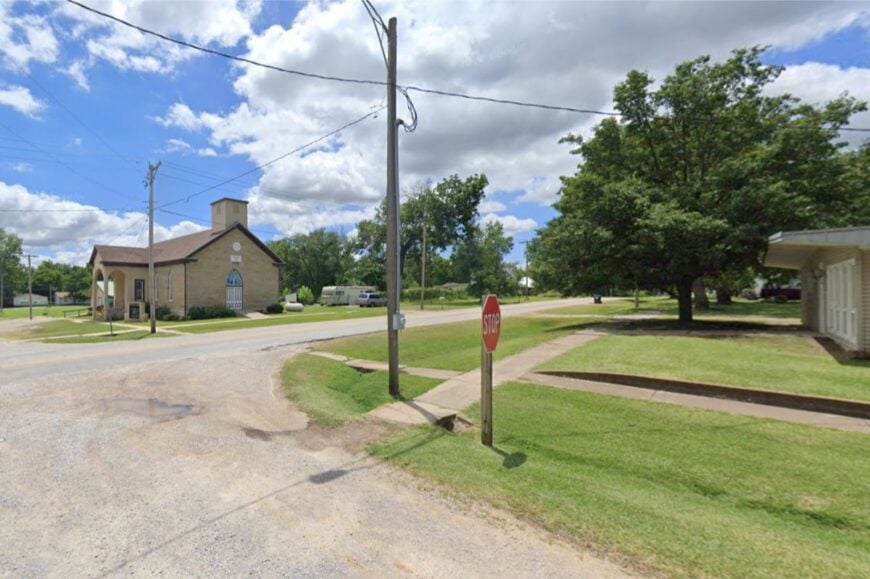
Schell City looks out over tallgrass remnants and wide wetlands, a quiet grid that hums with meadowlarks more than motors. Its seclusion rests on distance from interstates and the embrace of the Schell-Osage Conservation Area, which keeps the outskirts wild.
The vibe is gently historic—brick storefronts, shade trees, and Saturday mornings that smell like cut hay. Hike levee trails, watch waterfowl lifts at sunrise, fish the Osage backwaters, or explore prairie blooms in late spring.
Farming and a bit of outdoor tourism shape the calendar. Big skies make small talk even smaller. It’s a place where the horizon does the heavy lifting.
Where is Schell City?
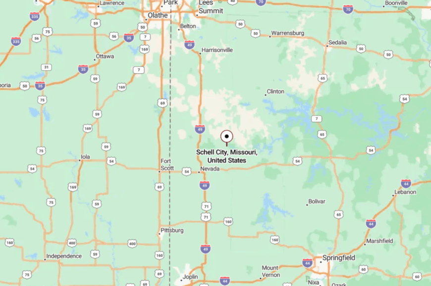
Northeastern Vernon County holds Schell City, about 15 miles northeast of Nevada and a short jog north of MO-54. Most travelers exit the highway and follow county roads along field edges and marsh.
With refuge lands on its flank, the town sits in a bird-rich hush. It’s close enough for supplies, but far enough to feel properly away.
10. Iconium – Lakeside Hideaway in the Osage Hills
Iconium claims roughly 40 year-round residents who share the shoreline hush of Truman Lake. Anglers launch johnboats at dawn, hikers explore the oak ridges of nearby Sparrowfoot recreation area, and summer evenings bring homemade pie at the century-old camp store.
Small-scale cattle operations and seasonal tourism around the lake provide the handful of local jobs. No streetlights, packed-gravel lanes, and 18 miles to the nearest town square keep outside traffic low and cell signals faint.
Families occupy farmhouses on five- and ten-acre lots where dense woods screen every porch from the next. The result is a pocket of stillness where herons outnumber mailboxes.
Where is Iconium?

This hamlet sits in southern St. Clair County, two winding turns off Missouri Route Z on the eastern coves of Truman Lake. Thick timber, Corps of Engineers shoreline easements, and only one paved road in or out create a natural barrier to sprawl.
Travelers leave US-65 at Osceola, follow MO-A for ten miles, then finish on gravel to reach the boat ramp and church that mark “downtown.” After dusk, the loudest sound is often a barred owl echoing across the water.
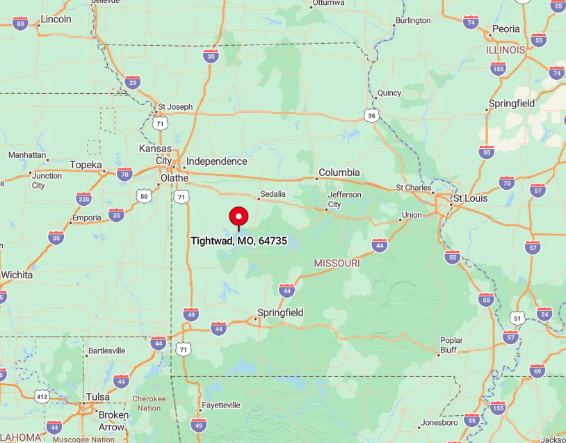
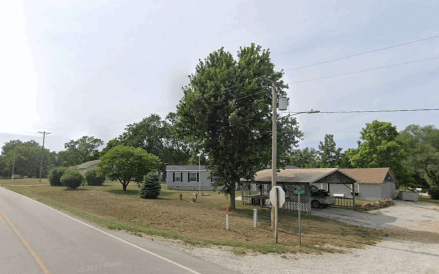
9. Tightwad – Quirky Hamlet on Wide-Open Prairie
Fewer than 70 people live under the playful green road sign that has made Tightwad a roadside legend. Daytrippers stop for a photo with the pint-size post office, then continue to Truman Lake for crappie fishing or to the neighboring golf course cleverly named Tightwad Bank Links.
Cattle ranching and hay production dominate the local economy, while the famously renamed bank sells souvenir checks to cover the light municipal budget. Seclusion comes from endless prairie stretching in every direction, broken only by windbreak rows and round hay bales the size of compact cars.
With no street grid, homes lie hundreds of yards apart along MO-7, and the horizon feels as expansive as a western movie set. After sunset, the prairie wind and the hum of a distant grain dryer are about all that can be heard.
Where is Tightwad?
🔥 Would you like to save this?
The village straddles Missouri Route 7 in far eastern Henry County, roughly midway between Clinton and Warsaw. Surrounding pastureland offers no commercial corridor, so the highway acts as the single thread to the outside world.
Visitors coming from Kansas City exit I-49 at Clinton and follow MO-7 southeast for twenty miles before the famous sign appears. Without that marker, most drivers might mistake the cluster of mailboxes for open range.
8. Roscoe – Bluff-Top Village Overlooking the Osage
Roscoe’s 90 residents occupy limestone high ground that peers over a sweeping bend of the Osage River. Popular pastimes include launching canoes below the bluffs, bow-fishing for gar at dusk, and gathering at the 1933 stone community hall for bluegrass nights.
Cattle grazing and small hardwood mills supply modest livelihoods, while seasonal campers drop by for bait and ice. The river on one side and forested hills on the other funnel visitors onto a single county road, keeping traffic thin and privacy high.
One-acre homesteads rimmed with split-rail fences sit under shaggy sycamores, giving the village a postcard look at golden hour. From most back decks, the nearest neighbor’s porch light is only a rumor.
Where is Roscoe?

Roscoe lies in southern St. Clair County, about ten miles south of Osceola on Route E, then a sharp descent toward the Osage. The village’s bluff position blocks sightlines to any highway, and river fog often cloaks the lower valley at sunrise.
Drivers coming from Springfield follow MO-13 north, turn west at Lowry City, and find Roscoe after a final five miles of curves. The last mile drops cell reception to a single bar, underscoring the town’s retreat status.
7. Lupus – Missouri River Ghost Town Turned Artist Haven
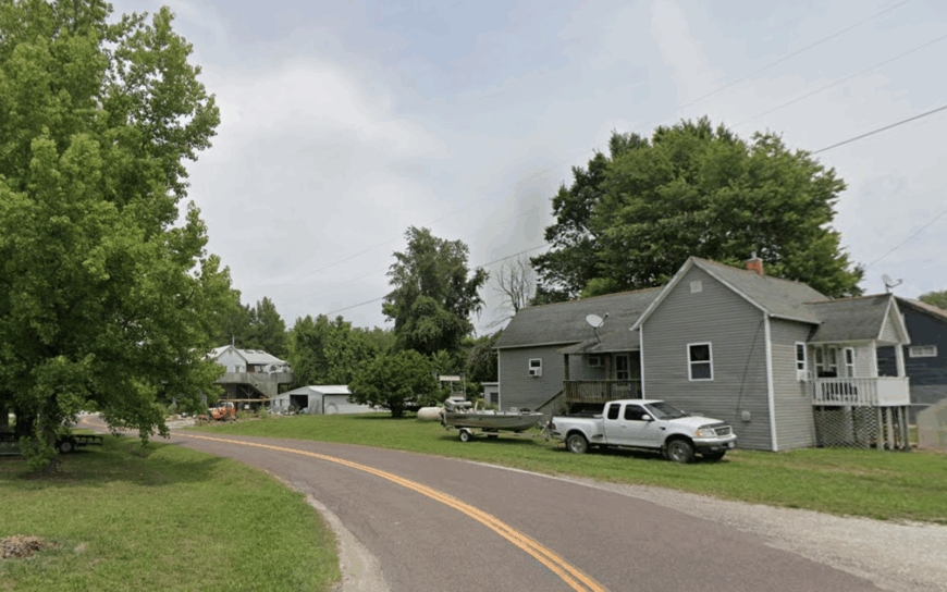
Only 25 people claim mailing addresses in Lupus, yet the village hosts one of Missouri’s more eccentric Halloween parades and an occasional riverfront music jam. Locals kayak the broad Missouri River, photograph half-collapsed warehouses from the steamboat era, and restore log cabins into studio spaces.
A mix of cottage rentals, artisan crafts, and seasonal events brings limited income, replacing the long-gone railroad economy. Isolation stems from floodplain forests that hem in the single lane of County Road 463, leaving the old depot corner as a tranquil cul-de-sac with river views.
When cottonwoods whisper in the evening breeze, the town feels a century removed from Jefferson City only twenty miles away. A commune-like sense of shared chores and potluck dinners keeps the community vibrant despite its tiny roster.
Where is Lupus?
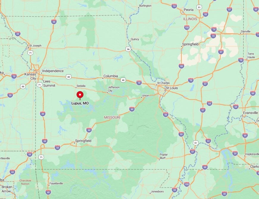
The hamlet sits hard against the Missouri River in Moniteau County, reached by crossing a low-lying bridge off Highway 179 and following a gravel ribbon that ends at the water. Seasonal floods routinely cut that route, reinforcing the settlement’s tucked-away quality.
Columbia visitors must detour south to Prairie Home before zigzagging through cornfields, a trip that feels longer than its twenty-five miles. River bluffs block cell towers, leaving conversation to front-porch chatter instead of screens.
6. Neck City – Forgotten Mining Settlement in Jasper County
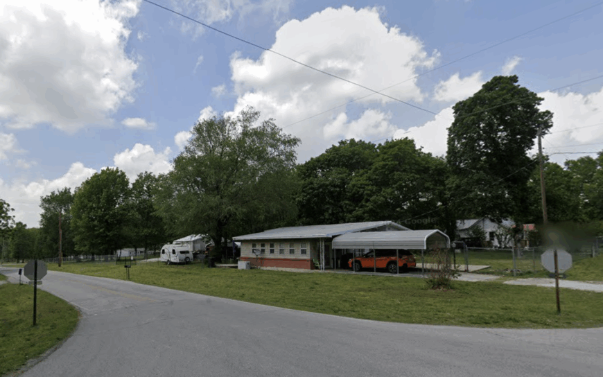
About 150 residents inhabit Neck City’s grid of large lots, each bordered by prairie grass and hickory groves that have reclaimed former lead-mining pits. Hobby historians explore brick ruins of smelters, while anglers sneak into hidden ponds created by subsidence.
Today’s paychecks come from commuting to Joplin or running small engine repair shops in converted garages. Thick vegetation screens the town from busy MO-171 only three miles east, and no through-street invites detours, so visitors arrive only on purpose.
Nighttime brings complete dark save for porch bulbs and the occasional glow of a passing freight train. Old mine tailings mounds double as sunset-view knolls for those who know the shortcuts.
Where is Neck City?
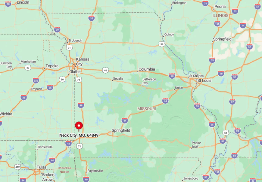
The village rests in north-central Jasper County, northwest of Carthage along County Road V. Discontinued rail spurs and overgrown slag piles form a natural moat that muffles highway noise.
From I-44, drivers weave north on county blacktops, cross Carter Creek, and eventually see the faded “Neck City” sign by an abandoned weigh station. Without GPS, first-timers often overshoot the single turn that accesses town.
5. Tiffin – Hilltop Farms Among Cedar-Lined Ridges
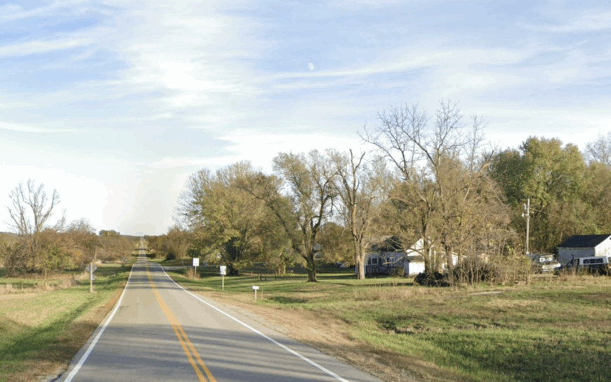
Tiffin houses about 85 people across a patchwork of ridge-top farms where sunrise burns off mist between cedar thickets. Residents ride ATVs to check cattle, fish farm ponds stocked with channel cat, and gather for pie auctions in the one-room community center.
Beef and hay remain economic staples, supplemented by seasonal logging of red cedar posts. Fifteen miles separate Tiffin from the nearest county seat, and the twisting ridge roads discourage casual visitors.
Houses perch on knolls a mile apart, with mailbox clusters marking neighborhood boundaries. Coyotes howling across hollows at night are more common than passing traffic.
Where is Tiffin?
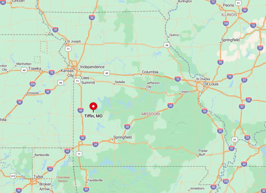
Located in northern St. Clair County, Tiffin sits west of Highway 82, accessible by County Road AA that snakes over steep Ozark folds. The ridge network limits line-of-sight, so even cell towers in El Dorado Springs rarely reach full strength.
Visitors coming from Kansas City exit US-71 at Nevada, head east, and spend the last ten miles on gravel with no services in sight. The final approach reveals wide views of cedar-dotted plateaus that explain the hamlet’s enduring charm.
4. Fleming – Orchard-Ringed Refuge North of the Missouri River
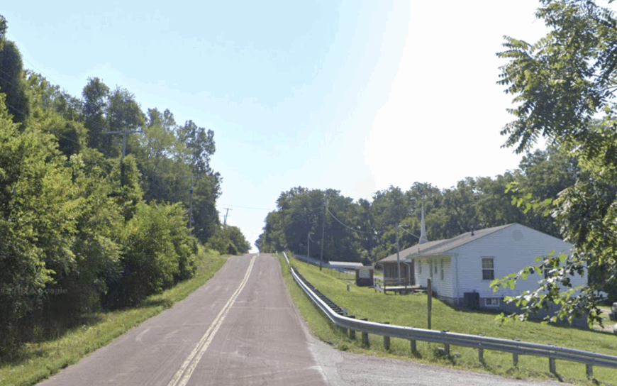
Fleming’s 128 residents wake to the scent of apple blossoms each spring, thanks to family orchards that encircle the village like a living moat. Locals sell cider at roadside stands, hold barn dances in October, and fish quiet farm ponds once chores are done.
Seasonal fruit sales and commuter jobs in Liberty sustain the modest economy. No commercial strip, a single church steeple, and shelterbelts that obscure every approach give the place a hidden-campus feel.
One-acre homesteads back onto quilt-pattern farmland where deer graze unbothered by traffic. Visitors often remark that GPS registers arrival before any rooftops appear through the trees.
Where is Fleming?
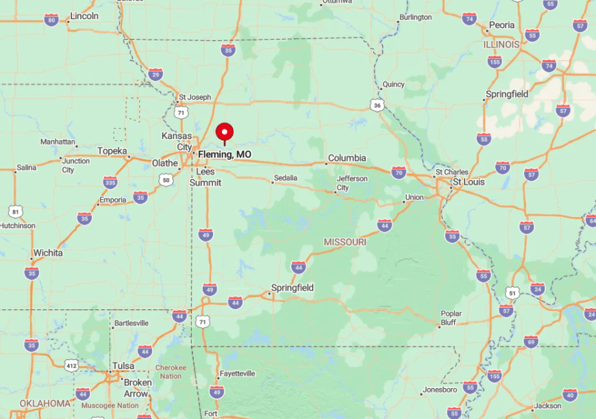
The village rests in northwestern Ray County, five miles north of the Missouri River and two miles off Route A. Rolling hills and orchard rows bend the minor roads into slow curves, blinding drivers to what lies ahead and muffling highway noise.
From Kansas City, travelers use I-35 to Excelsior Springs, then thread county lanes past apple-picking signs until the pavement narrows to two stripes. With no gas station or café, guests quickly sense why locals value self-reliance.
3. Racket – Truman Lake’s Wooded Backcountry Outpost
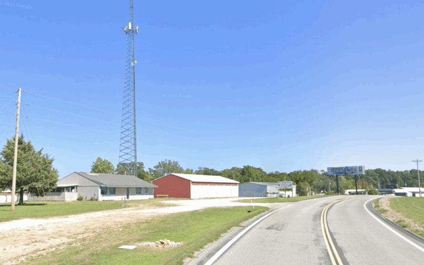
Racket hosts about 60 cabins and lake homes scattered through hardwood forest, yet only a couple dozen residents stay year-round. Days revolve around bass fishing, archery practice in tree-shaded yards, and dawn hikes where wild dogwood borders the trails.
Income comes mainly from guiding services, seasonal rentals, and a single bait-and-burger shop that closes mid-week in winter. Over half the surrounding acreage remains undeveloped Corps land, so dirt lanes dead-end at coves instead of through-traffic routes.
During autumn, red oak leaves flutter onto empty docks, and the only sound is a distant outboard motor. Many visitors never make it here because maps label Racket as a mere point of interest, not a town.
Where is Racket?
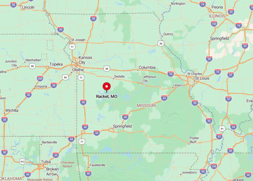
The settlement lies in southeastern Benton County along Route UU, about twelve miles southwest of Warsaw. Thick forest and lake arms fragment the road network into loops, discouraging shortcuts.
Drivers wind past deer crossings, then follow a final gravel mile to reach the volunteer fire station that doubles as a community bulletin board. Cell coverage fades near the water, so locals rely on VHF radios during storm season.
2. Cedarcreek – Ridge-Top Ozark Hamlet Near the Arkansas Line
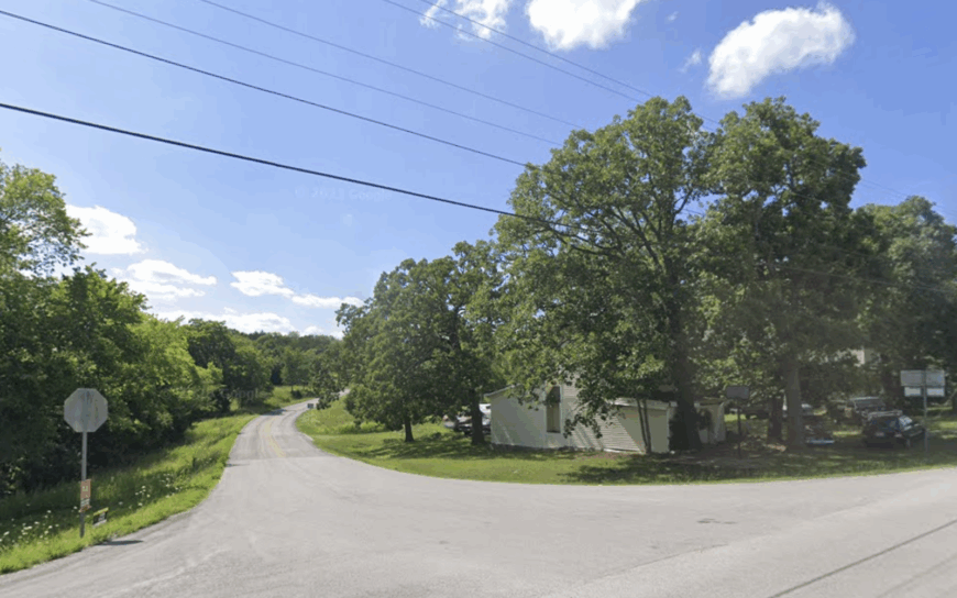
Cedarcreek supports roughly 35 permanent residents whose mailboxes perch along a high, narrow ridge where turkeys outnumber vehicles at dawn. Locals hunt mushrooms in spring, swap garden starts at the roadside pavilion, and enjoy panoramic photo ops that stretch across two states.
Livelihoods center on small logging crews, cattle grazing, and guiding visiting spearfishers on Bull Shoals Lake far below. Steep hollows and dense pine stands isolate each homestead, so porch lights glow like lone lighthouses after dark.
The nearest grocery sits eighteen miles away in Forsyth, reinforcing a culture of full freezers and neighborly food swaps. Many travelers glimpse Cedarcreek’s ridge only from an airplane window, never knowing a settlement exists there.
Where is Cedarcreek?
Positioned in eastern Taney County, Cedarcreek sits four miles north of the Arkansas line along State Route M. Switchback climbs and tight curves discourage large vehicles, granting residents the quiet of limited traffic.
Springfield visitors drive MO-76 to Forsyth, then tackle a final stretch of ridge road that climbs 400 feet in three miles. Radio static replaces streaming music long before they reach the weathered “Cedarcreek” sign.
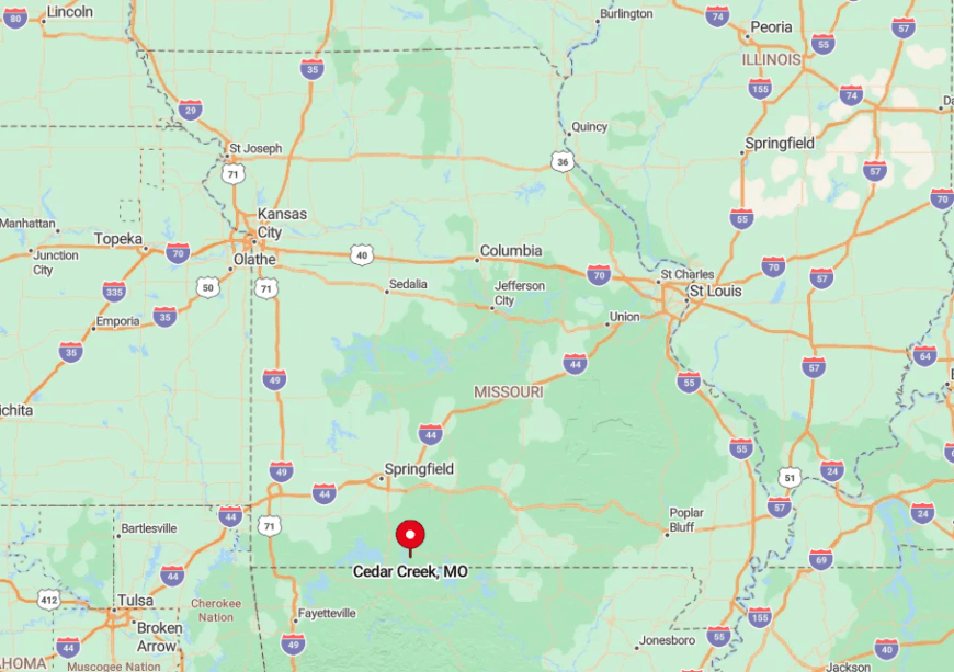
1. Rockville – Quiet Reservoir Village in Bates County
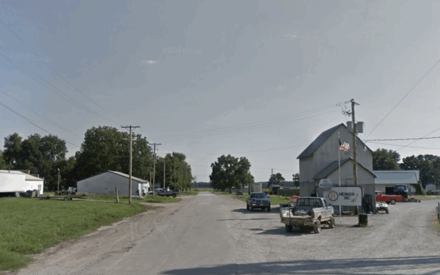
Rockville’s 160 residents share shoreline access to a modest reservoir where largemouth bass and quiet kayaking mornings are the norm. Weekends find locals casting lines from solitary docks, picnicking at the Civilian Conservation Corps shelter, and tracking migrating waterfowl on adjoining conservation land.
Farming and a small feeder cattle operation provide steady work, supplemented by part-time park maintenance roles. With no commercial traffic route, the main street feels like a wide sidewalk framed by shade trees, and the reservoir’s buffer land blocks any hint of sprawling development.
Generous lots host gardens, smokehouses, and the occasional vintage camper parked for guests. After dark, the lake mirrors star patterns undisturbed by city glow.
Where is Rockville?
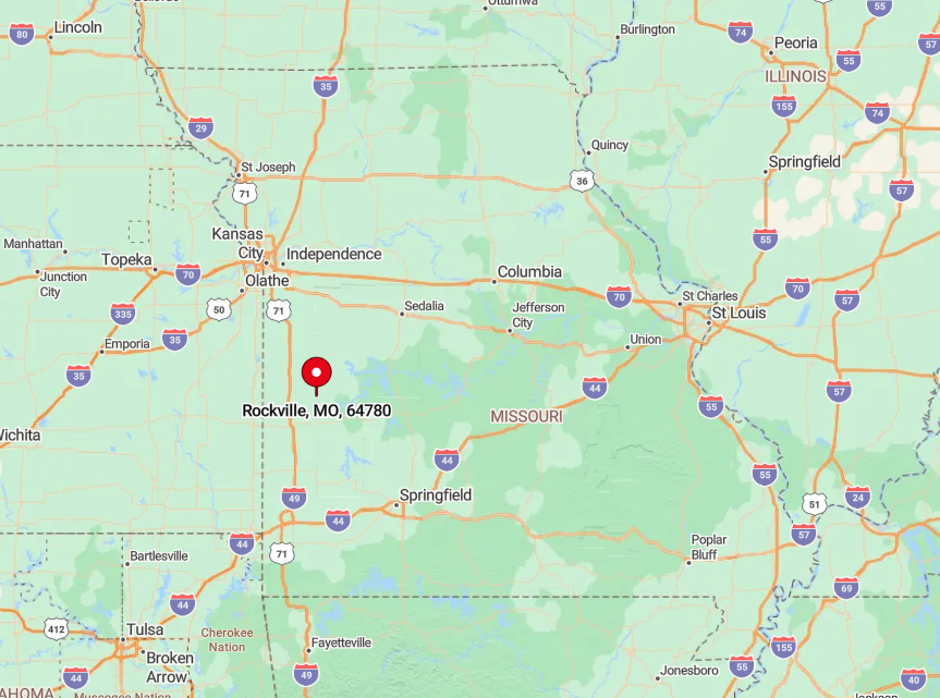
Sitting in southern Bates County, Rockville lies just west of Route H, twenty miles north of the Missouri–Kansas line. The town is ringed by protected habitat and privately owned timber, ensuring minimal noise from passing trucks.
From Kansas City, drivers follow MO-52 past Butler, then veer south onto county pavement that dead-ends at the reservoir’s earthen dam. By the time the asphalt narrows to chip-seal, visitors know they’ve crossed into a slower Missouri.


