Would you like to save this?
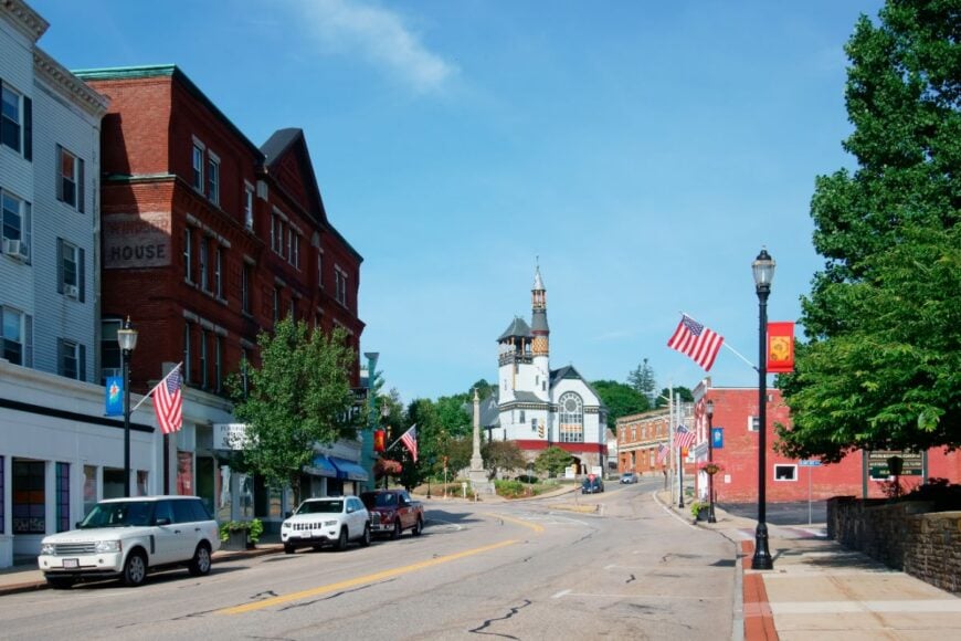
Western Massachusetts holds a cluster of hilltowns where gravel roads wind through maples, lakes sleep under morning mist, and village greens feel frozen in an earlier century. These are places that photographers chase for their unspoiled light and that daydreamers imagine when the city gets too loud.
Populations seldom crack four digits, streetlights are rare, and the loudest nighttime sound is often a barred owl calling from a hemlock stand. Visitors find pocket libraries, farm stands that still run on the honor system, and trailheads no travel magazine has listed yet.
Our survey counts down 25 such communities, each offering its own version of quiet, from ridge-top lookouts to stone-walled meadows. Anyone looking for a slower calendar and a wider horizon will recognize kindred ground in the miles between these towns.
25. Mount Washington – Sky-Island at the Corner of Three States
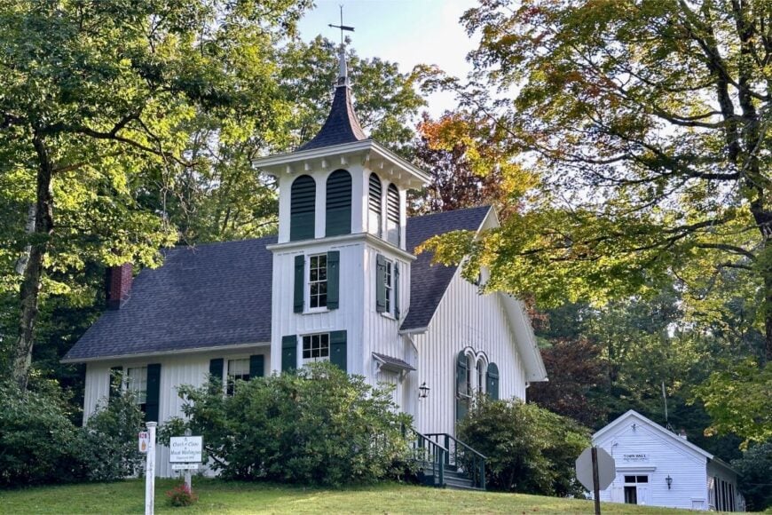
Mount Washington feels like a mountaintop village guarded by forests, cliffs, and the long shoulders of Mount Everett. Its seclusion is literal: one road up, no gas stations, and miles of state land buffering every edge.
The vibe is hushed and elemental—wind in the spruces, the smell of balsam, and porches that look toward distant New York ridgelines. Hike to the Mount Everett summit, wander Race Brook Falls, or slip over to Bash Bish Falls, where the gorge thunders after rain.
Birders scan for hawks riding thermals; winter brings snowshoe tracks across quiet lanes. A handful of inns and trail-adjacent jobs mix with home workshops and remote work. It’s the kind of high, quiet place that resets your pulse to mountain time.
Where is Mount Washington?
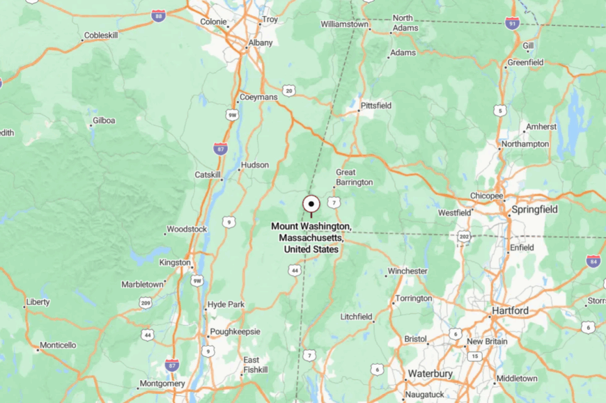
Tucked into the far southwestern tip of Berkshire County, Mount Washington borders both New York and Connecticut. It’s roughly 18 miles south of Great Barrington, up a stack of switchbacks that leave cell bars behind.
You reach it via Route 41 to West Street and then narrow mountain roads into the State Forest. Close on the map, it feels like a world apart when the trees close in.
24. Alford – Valley Fold with a Whisper
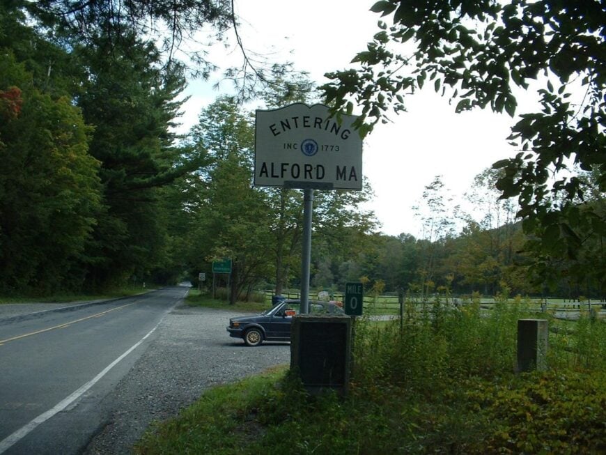
Alford hides in a green crease between Taconic ridges, where the Green River drifts past old dairy barns and sugarbushes. Its seclusion comes from being off any direct route—no traffic lights, few signs, and backroads that politely discourage haste.
The vibe is pastoral and careful: stone walls, tidy farm lanes, and a small town hall that doubles as a bulletin board. Walk BNRC’s Alford Springs for ridge views, photo-hunt covered bridges in neighboring valleys, or follow the river’s bends on a slow bike ride.
Maple and hay keep fields in motion, while remote professionals trade commutes for porch desks. Even on summer weekends, conversation rarely rises above birdsong. It’s a soft-spoken place that teaches you to listen.
Where is Alford?
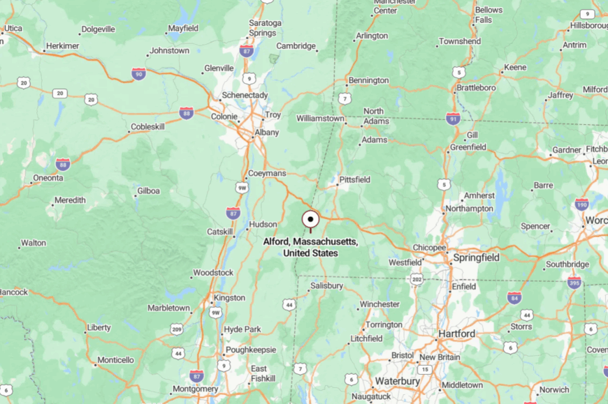
Set in southern Berkshire County, Alford sits just west of Great Barrington and north of the Massachusetts–Connecticut line. Most visitors slip in from Route 23 or 41 onto narrow town roads.
The Taconic foothills wrap it like a quiet curtain. It’s close enough for lunch in town, far enough to forget the clock.
23. Tyringham – Cobble, Brook, and Chapel Bells
Tyringham is a tiny valley settlement where white steeples rise over hayfields and the Appalachian Trail brushes along the ridge. Its tucked-away feel comes from the enclosing hills and the way Tyringham Cobble stands as a natural gatekeeper.
The vibe is storybook New England—sheep pastures, a small post office, and lanes shaded by maples that flare like torches in October. Climb the Cobble for sunrise, wade Hop Brook’s clear pools, or wander the village green with a camera.
Summer brings farm stands and impromptu concerts; winter folds the valley into hushed snow. Farming, craft lodging, and trail traffic make a modest economy. It’s the kind of quiet that hangs on your coat like woodsmoke.
Where is Tyringham?

You’ll find Tyringham in the hills of southern Berkshire County, about 12 miles southeast of Lee and the Mass Pike. Access comes by Route 23 and then small town roads that thread the valley.
With no through highway, most drivers arrive on purpose, not by accident. The last turn feels like stepping into a kept secret.
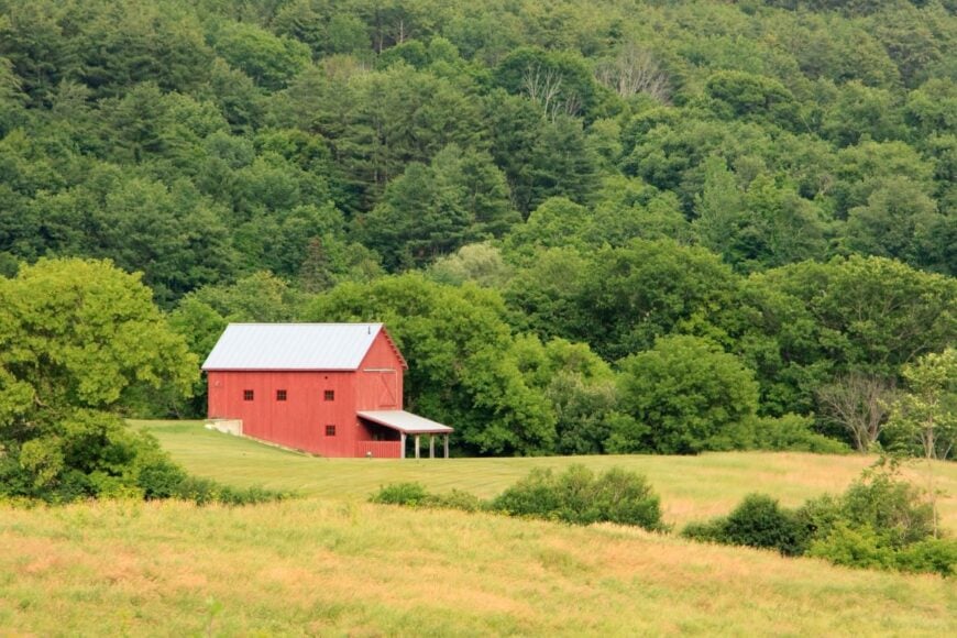
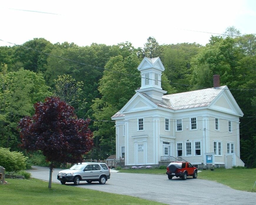
22. New Marlborough – Five Villages, One Calm
New Marlborough sprawls across five hamlets—Mill River, Southfield, Hartsville, Clayton, and New Marlborough Center—stitched together by stone walls and old maples. Seclusion comes from broad acreage, forest buffers, and the way backroads wander rather than shorten.
The vibe is vintage-country: white chapels, green commons, and farm ponds that mirror the sky. Picnic at Umpachene Falls, stroll historic lanes in Mill River, or detour to Campbell Falls on the state-line brook.
The Old Inn’s candlelit dining and seasonal markets give evenings a low, warm glow. Small farms, hospitality, and the trades keep things steady. It’s a spread-out quiet that invites long walks and longer conversations.
Where is New Marlborough?
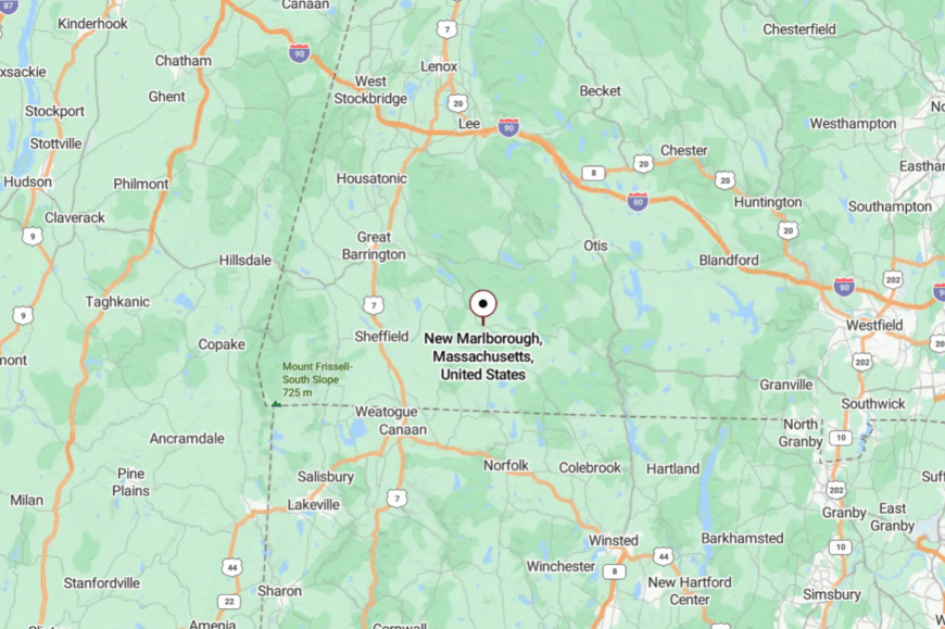
In southeastern Berkshire County, New Marlborough lies about 10–15 miles east of Great Barrington. Drivers come via Route 183 or 57, then roll along town roads between fields and forest.
Hills and conserved land keep it hidden from major corridors. You arrive and realize the map has more green than gray.
21. Becket – Forest, Quarries, and Quiet Lanes
Becket is a woods-first town where kettle ponds reflect sky and old granite quarries lie cool and blue under hemlocks. Its secluded feel comes from miles of state forest, curvy approaches, and houses tucked well back from the road.
The vibe is arts-and-outdoors: summer dance at nearby Jacob’s Pillow, trail days in October Mountain, and evenings that end around fire pits. Hike Finerty Pond on the AT, visit the Becket Land Trust Historic Quarry, or paddle a stillwater at dawn.
Contractors, artists, and seasonal hospitality jobs share the ledger. Even when summer arrives, the forest keeps the volume low. It’s the kind of place where you measure time by light through trees.
Where is Becket?
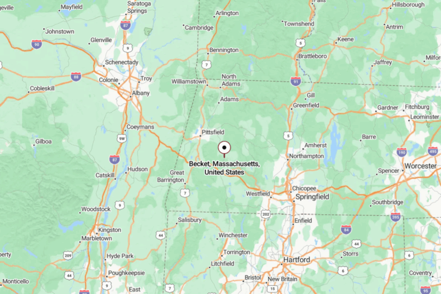
Becket sits east of Lee along Route 8, on the forested shoulder of the central Berkshires. The Mass Pike passes well to the south, leaving local roads to do the last, slower miles.
October Mountain and town conservation land buffer every approach. By the time you turn in, the pines have already taken over the soundtrack.
20. Otis – Lakes and Long Evenings
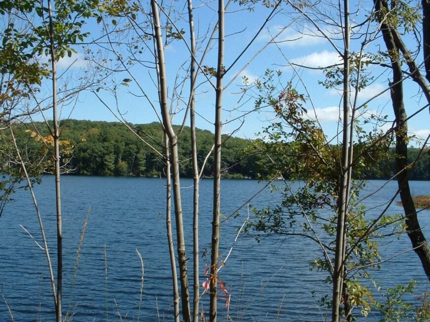
Otis spreads around coves and reservoirs, its houses half-hidden by pine and birch. Seclusion comes from water on all sides and a network of backroads that dead-end at shorelines and trailheads.
The vibe is camp-country—canoes leaning on fences, porch lights over screen doors, and loons calling after dark. Paddle the quiet corners of Otis Reservoir, fish the Farmington headwaters, or explore Otis State Forest’s footpaths. Hardware stores, small cafés, and seasonal rentals keep summer practical.


In winter, snow flattens sound and turns roads to storybook lanes. It’s a lakeside hush that lingers.
Where is Otis?
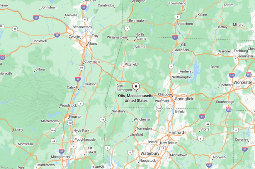
Located in south-central Berkshire County, Otis sits about 14 miles east of Great Barrington and 12 miles south of Lee. Most arrivals follow Route 23 or Route 8, then drift onto shoreline roads.
Forests and water make natural barriers to through-traffic. It’s close enough for errands, far enough to feel like a vacation.
19. Peru – High Meadow Stillness
Would you like to save this?
Peru rides a high shoulder of the Berkshires, a landscape of open meadows, big sky, and slow, clear brooks. Its seclusion stems from altitude, distance to services, and winter storms that enforce a slower calendar.
The vibe is spare and luminous—weathered barns, long views, and a town common that greets sunrises first. Ramble to Garnet Lake, follow stone-wall cart paths into birch stands, or snowshoe farm lanes when drifts rise.
Maple and hay anchor the year, with a few trades and remote gigs rounding out the week. At night, the stars feel freshly hung. It’s the kind of quiet that makes you notice your own footsteps.
Where is Peru?
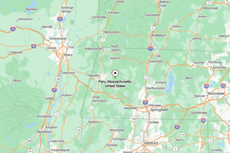
Peru sits in northeastern Berkshire County, roughly 14 miles east of Pittsfield. Routes 143 and 8A climb to the town, then narrow into backroads.
Elevation and open country keep it distant from highway noise. The approach trades speed for sky.
18. Windsor – Jambs, Bogs, and Big Snow
Windsor is a hill farm town where the wind never seems in a hurry and winter hangs a little longer. Seclusion comes from broad uplands, the Windsor Jambs gorge cutting through ledge, and a lack of any main commercial strip.
The vibe is outdoorsy and old-fashioned: sap steam in March, hay wagons in July, and skis in January. Ski Notchview’s groomed trails, visit the Jambs after a rain, or watch clouds spill across deep meadows from stone wall corners.
Forestry, maple, and a few lodges keep the lights on. When the snow muffles everything, Windsor becomes its own world. It’s the quiet that shows you how blue winter can be.
Where is Windsor?
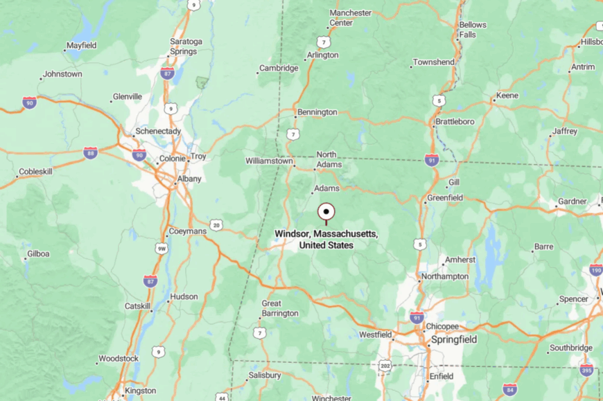
Northeast of Pittsfield in Berkshire County, Windsor sits along Route 9 with quick bends into smaller roads. Large tracts of conservation land and farms buffer it from nearby towns.
Winter storms can slow the last miles to a crawl. Once you crest the ridge, the rest of the world feels very far away.
17. Washington – Between Ridges, Beyond Rush
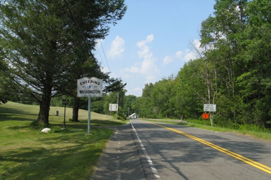
Washington rests in a saddle of forest where the Appalachian Trail slips by and traffic seldom does. Its tucked-away feel comes from Washington Mountain State Forest and the absence of any bustling center.
The vibe is woodsy and self-reliant: stacked cords of oak, trailheads at the end of dirt lanes, and neighbors who plow each other’s driveways. Hike the AT to Finerty Pond, explore wild carriage roads, or take a twilight drive.
Work here is a mix of trades, public lands crew, and remote desks. Night brings an easy darkness broken by owls. It’s a town that rewards those who like edges softened by trees.
Where is Washington?
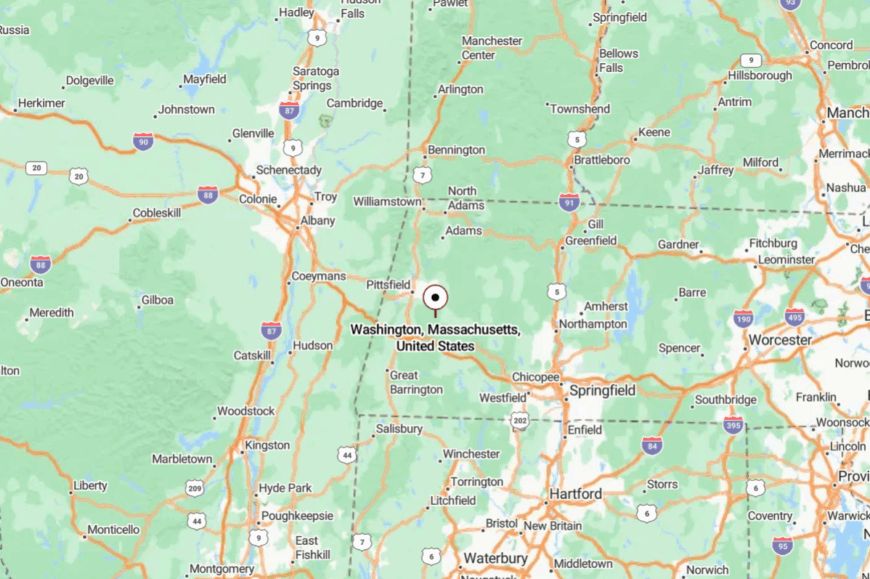
You’ll find it east of Pittsfield in central Berkshire County, tucked between Becket and Dalton. Access is via Washington Mountain Road or Route 8 with short turns onto forest lanes.
Hills and heavy timber keep it out of sight from busier routes. It’s close enough for a supply run, far enough for stars.
16. Hinsdale – Reservoir Light and Quiet Streets
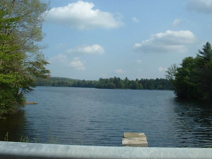
Hinsdale gathers around Ashmere and Plunkett, two broad reservoirs that hold evening light like polished metal. Its seclusion comes from lake coves, backroads, and a modest village center that yawns after dark.
The vibe is neighborly and low-key—kids fishing from docks, grills on small porches, and joggers circling water at dawn. Paddle at first light, picnic at the town beach, or follow the rail trail toward Dalton’s woods.
Schools, small shops, and lake-season rentals make up most jobs. After sunset, the shoreline turns to silhouettes and hush. It’s a water-town calm that creeps under your skin.
Where is Hinsdale?
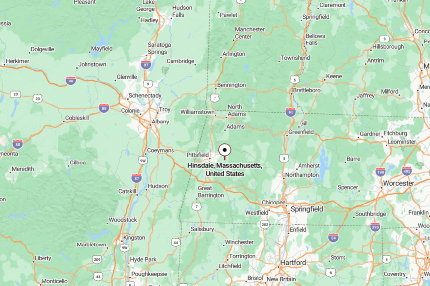
In eastern Berkshire County, Hinsdale sits about 9 miles east of Pittsfield. Route 8 brings you close, then shoreline lanes slow the pace.
With the hills folding around it, highway noise never arrives. You pull in, and the reservoirs do the welcoming.
15. Chesterfield – Gorge Country and Stone Walls
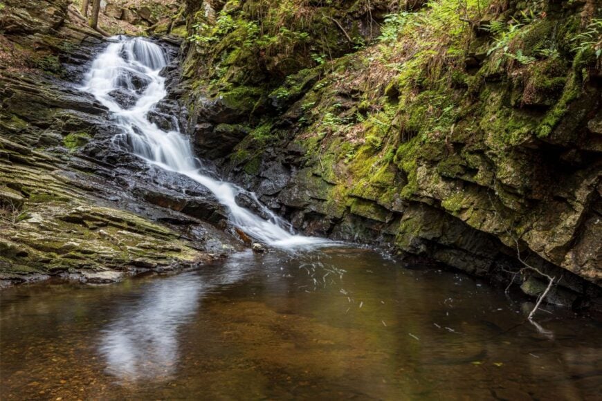
Chesterfield feels stitched together by stone walls and by the Westfield River, which saws through ledge at the dramatic Chesterfield Gorge. Its secluded air comes from hilltop farms and a road network that prefers meandering to shortcutting.
The vibe is historic-rustic: white churches, sugarhouse steam in March, and porches that watch thunderstorms roll over hayfields. Walk the Gorge trails, swim a deep river eddy in summer, or browse a small makers’ market on the green.
Small farms, carpenters, and commuting to nearby Northampton balance the books. On autumn evenings, the whole town seems to glow. It’s the kind of place that keeps a spare pair of boots by the door.
Where is Chesterfield?
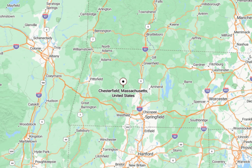
Set in western Hampshire County, Chesterfield is about 16 miles northwest of Northampton. Most visitors follow Route 143 into town, then drop to the Gorge on a narrow byway.
Surrounding hills block sightlines and sound from busier valleys. By the time you park, the river is the only voice you hear.
14. Cummington – Poems, Fairs, and River Bends
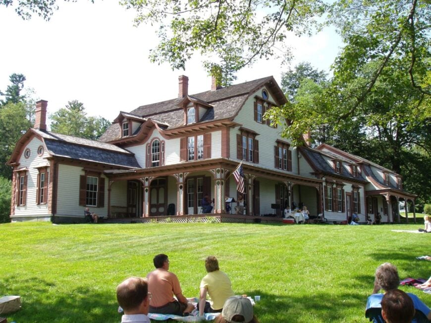
Cummington curls along the Westfield’s East Branch, where oxbows frame hayfields and the William Cullen Bryant Homestead anchors local lore. Seclusion comes from upland meadows and the long miles to any mall or chain store.
The vibe is literary-country: readings on porches, the sweet dust of the Cummington Fair, and stargazing from pasture gates. Tour the Homestead, fish shady pools, or join a contra dance in the old community hall.
Maple, small farms, and arts jobs mix with remote work. Nights settle softly here, like a well-loved book closing. It’s the quiet that invites sentences to finish themselves.
Where is Cummington?
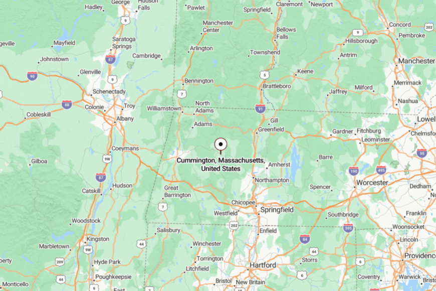
Cummington lies in northern Hampshire County on Route 9, about 25 miles west of Northampton. Side roads peel off into higher fields and timber.
With no big corridors nearby, pass-through traffic is rare. The last turn feels like you’ve been personally escorted off the grid.
13. Goshen – Lakes, Ledges, and Loon Calls
Would you like to save this?
Goshen sits high among pines and glacial ledges, where small lakes hide behind blueberry thickets. Its secluded feel comes from DAR State Forest’s broad sweep and scant commercial footprint.
The vibe is campfire-cozy—kayaks stacked by the door, screen porches, and loons marking the hour after dark. Paddle Upper or Lower Highland Lake, hike to overlooks beneath wind-bent pines, or scout for wild blueberries in August.
Seasonal camps and small trades join with town jobs to round out the economy. When fog lifts off the water at sunrise, it’s easy to forget anywhere else exists. It’s quiet that tastes like pine in the air.
Where is Goshen?
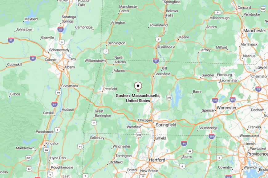
Perched on the western edge of Hampshire County, Goshen lies about 17 miles northwest of Northampton. Drivers climb Route 9 and turn into forested park roads to reach lakes and trailheads.
Elevation and state land keep it insulated from valley bustle. It’s close enough for a picnic, far enough for stars.
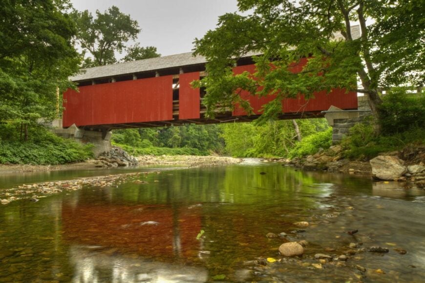
12. Colrain – Ridges, Rivers, and a Red Bridge
Colrain sprawls over ridges above the North River, a patchwork of hill farms and deep woods that feel far from anywhere. Its seclusion stems from long distances between villages and the way the roads cling to contours.
The vibe is rugged and welcoming: sugarhouses steaming, the Arthur A. Smith Covered Bridge painted bright against green, and roadside stands with honor boxes. Walk Catamount State Forest, wade pebble bars on hot days, or follow dirt spurs to views reaching Vermont.
Maple and small makers keep livelihoods modest but steady. Even the wind feels like a local here. It’s the kind of place where quiet comes in layers.
Where is Colrain?
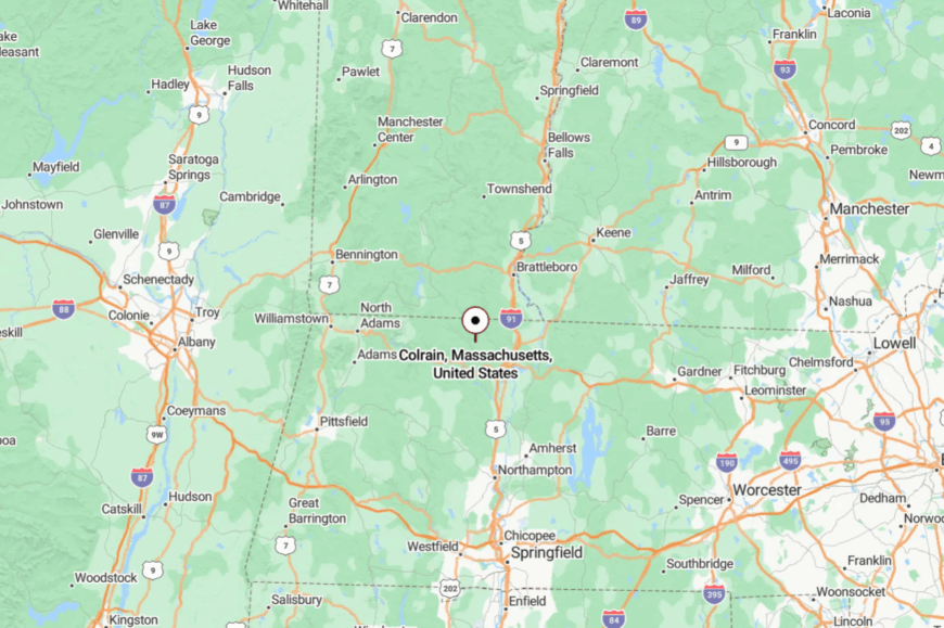
Northwestern Franklin County holds Colrain, roughly 8 miles north of Shelburne Falls. Access is via Route 112 and a web of winding town roads.
Ridges and river valleys make shortcuts impossible. The approach trades hurry for scenery without asking.
11. Heath – High Pastures on the Vermont Line
Heath rides the spine of the Berkshires where pasture meets sky and the nearest convenience store feels like a planned expedition. Seclusion comes from elevation, distance to services, and the way snow and mud season keep traffic honest.
The vibe is hill-farm plain and proud: red barns, the Heath Fair’s late-summer glow, and night skies dense with stars. Hike country lanes to stone piles and sugar maples, picnic at outlooks that scan to Vermont, or browse handwoven goods at a roadside shed.
Small agriculture, forestry, and home studios anchor the week. When the wind moves the grass, the whole town seems to breathe. It’s the kind of quiet that stays with you.
Where is Heath?
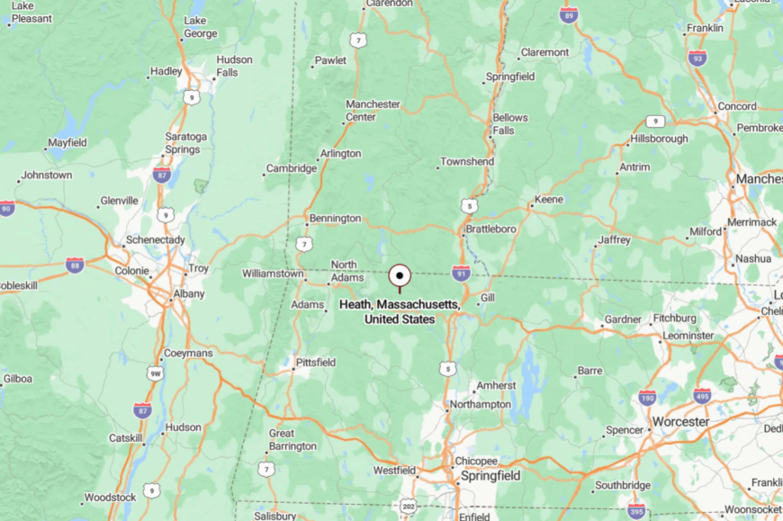
Heath sits in far-northern Franklin County, touching the Vermont border and about 20 miles northwest of Greenfield. Most visitors climb Route 8A or 112 and then navigate slender ridge roads.
Hills and long views make it feel farther than the miles suggest. You crest the last rise and the world opens into sky and pasture.
10. Hawley – Forest-Cushioned Hilltown
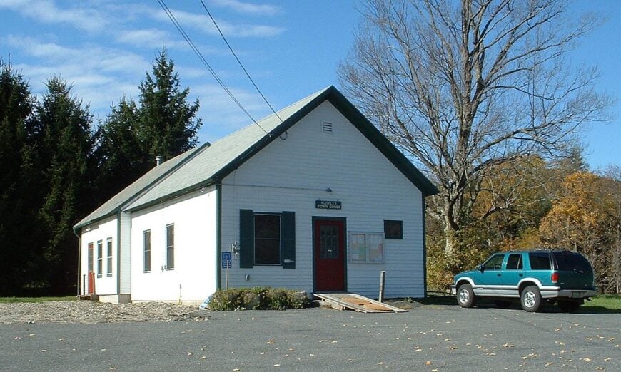
About 330 people share Hawley’s highlands, living among more than 6,000 acres of Mohawk Trail State Forest that keeps the settlement wrapped in deep green.
Hikers tackle the Charlemont Road ridge for sweeping Berkshire views, while winter families slide downhill at nearby Berkshire East Mountain Resort or strap on snowshoes behind 19th-century farmsteads.
Maple sugaring, small-scale forestry, and seasonal tourism supply most paychecks, though many residents commute to Shelburne Falls or Northampton for work. Photographers love the stone ruins of the old charcoal kiln and the pitch-black night sky that still shows the Milky Way without assistance.
Only two gravel arteries cross town, limiting through-traffic and maintaining a hush broken mainly by spring peepers and autumn chainsaws. That slim road network, along with an absence of commercial strips, gives Hawley the feeling of a settlement hidden inside its own private park.
Where is Hawley?
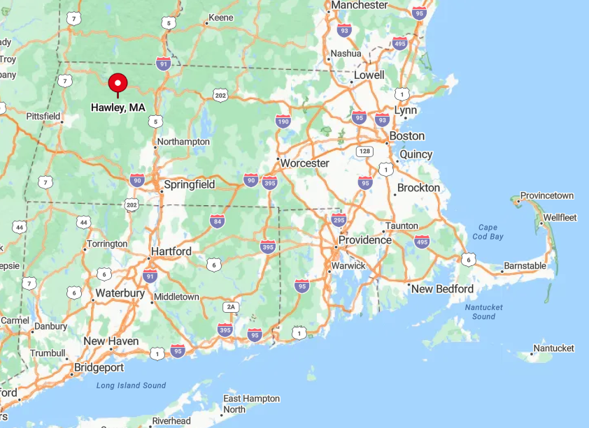
Hawley sits in Franklin County, roughly 25 miles west of Greenfield and 40 miles north of Pittsfield. Elevations rise past 1,800 feet, isolating the town from larger neighbors and keeping cell signals spotty.
Drivers reach it by climbing Route 8A or winding along the Deerfield River on Route 2 before turning onto dirt. The steep approach roads discourage casual passersby, preserving the hush that residents prize.
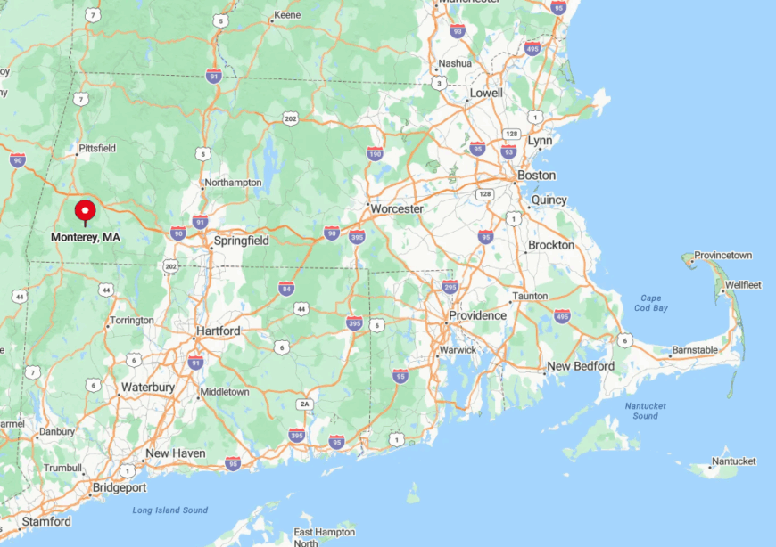
9. Monterey – Lakeside Quietude
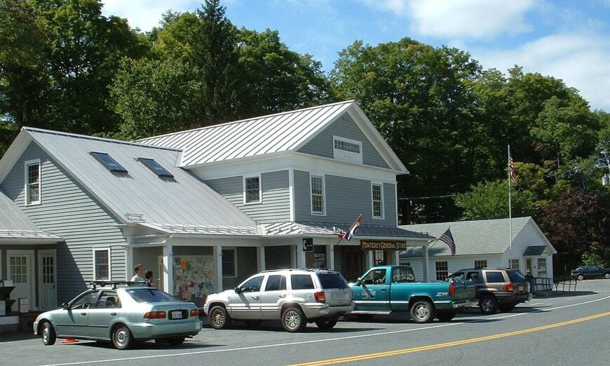
Monterey’s 1,100 residents spread out around Lake Garfield and Lake Buel, where dawn mist curls over glassy water to greet loon calls. Canoe launches, the century-old Monterey Library, and a tiny farm store on Tyringham Road form the town’s understated social core.
Seasonal rentals and second-home caretaking support many paychecks, while local growers supply Berkshire farmers markets with heirloom produce and maple products. Swimmers favor the public beach on Lake Garfield, and anglers cast for smallmouth bass in the quiet coves that larger crowds rarely find.
Absence of big box stores helps nights stay starry and streets empty after dusk. Houses sit along unnumbered lanes that dead-end in the forest, keeping Monterey off most GPS shortcuts and lending it a hideaway vibe.
Where is Monterey?
Would you like to save this?
Monterey occupies southern Berkshire County, ten winding miles south of Lee and the Mass Pike. The town is tucked between Beartown State Forest and Tyringham Cobble, giving it a natural buffer of ridges and wetlands.
Access is mainly via Route 23, a road that narrows to two lanes and frost heaves in winter, which slows traffic and limits daily visitors. Those arriving by bus or train must connect through Pittsfield, adding an extra layer of effort that screens out casual tourism.
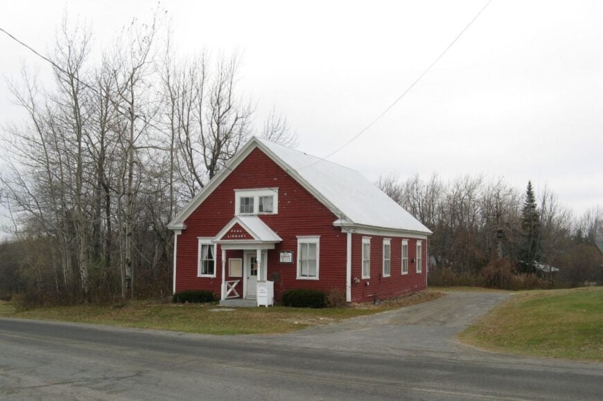
8. Leyden – Ridge-Top Retreat

Roughly 700 people live in Leyden, where one-acre minimum zoning and winding ridge roads keep neighbors at a comfortable distance. The Leyden Wildlife Management Area offers trout streams and quiet trails, while fall drives reward leaf peepers with fiery panoramas stretching toward Vermont.
Maple syrup operations and small livestock farms form the economic backbone, supplemented by remote workers who value the reliable fiber-optic network installed a few years ago. Residents meet at the historic Town Hall for contra dances or pick up eggs at Fox Hill Farm’s self-serve cooler.
The lack of any commercial strip beyond a post office and seasonal farm stands preserves round-the-clock stillness. Sitting atop a high spine of the northern Berkshires, the town stays hidden from main highways and remains overlooked even by many lifelong Bay Staters.
Where is Leyden?
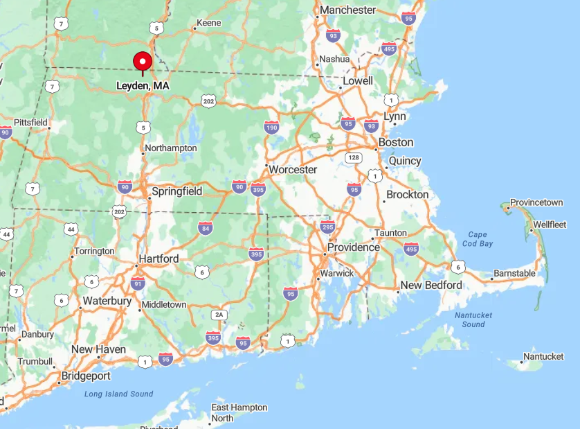
Leyden hugs the Vermont border north of Greenfield, with elevations that climb past 1,500 feet. Access comes via Route 5 in Bernardston before a steep ascent on West Leyden Road, a drive that can close in ice storms.
Thick maple stands shield homes from passing eyes, and the absence of a through-route eliminates commuter shortcuts. Visitors typically need a car and a good set of winter tires to reach this ridge-top getaway.
7. New Ashford – Taconic Pass Hamlet
Home to just two hundred residents, New Ashford nestles in a narrow valley between the Taconic and Greylock ranges. Outdoor enthusiasts hike the northern stretch of the Appalachian Trail that crosses the town line or cycle the steep climb over Brodie Mountain Pass.
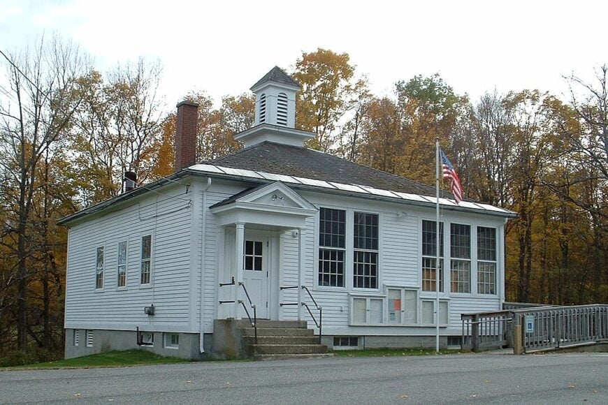
Dairy farming has dwindled but still dots the landscape, while bed-and-breakfast hosts and ski instructors at nearby Jiminy Peak form a modest service sector. The restored 18th-century one-room schoolhouse, still standing with original wavy glass, draws history buffs and photographers alike.
Mountains hem the settlement on three sides, leaving only one paved road that rarely carries more than a handful of cars per hour. Limited cell coverage and a total absence of streetlights after dusk cement its reputation as a hamlet where nights feel longer and quieter.
Where is New Ashford?
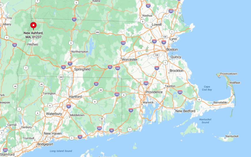
This village lies on Route 7 between Williamstown and Lanesborough, at the heart of Berkshire County’s northern corridor. Brodie Mountain to the west and Mount Greylock to the east form natural walls that screen it from larger towns.
The closest bus stop is in Williamstown, eight miles north, making a personal vehicle the only reliable way in. Winter storms regularly close the Taconic Pass, turning the town into an island of silence until the plows catch up.
6. Sandisfield – Endless Stone Walls and Meadowland
Spread across 53 square miles yet housing fewer than 1,000 people, Sandisfield is one of the least densely populated towns in Massachusetts.
Visitors paddle the quiet bends of the Farmington River, picnic near the hidden Spectacle Pond waterfall, or browse the tiny Sandisfield Arts Center housed in a restored 1839 church.
Forestry, small-scale hay farming, and rural contracting dominate payrolls, with a sprinkling of potters and woodworkers selling wares at weekend markets. Moss-covered stone walls line colonial cart paths that now serve as walking tracks beneath towering white pines.
The expanse of unbuildable wetlands and state forest parcels ensures long gaps between houses and an absence of utility corridors. Without a central village green or even a traffic light, Sandisfield blends into its own fields and forests almost invisibly.
Where is Sandisfield?
Sandisfield occupies the far southwest corner of Berkshire County, sharing a border with Connecticut. The town is reached by turning off Route 8 onto a network of numbered county roads that lose cellphone reception within minutes.
Its remoteness is amplified by the adjacent 5,000-acre Sandisfield State Forest, which blocks shortcut routes from the east. Travelers generally arrive by car from Great Barrington, 14 miles away, following signs that feel intentionally discreet.
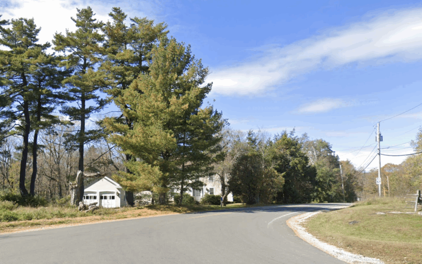
5. Tolland – Woodland Lakes Without Streetlights
Tolland’s 485 year-round residents live among white pine thickets and cabin-lined coves of Otis Reservoir and Cranberry Pond. Summer brings kayak traffic and loon calls, while autumn hikers tackle the isolated segment of the Appalachian Trail that crosses the eastern town line.
Seasonal tourism at lakeside cottages provides income, complemented by forestry crews and a volunteer-run fire department. Evenings see locals gathering at the tiny town hall for potluck suppers or astronomy nights organized by amateur stargazers who prize the unlit skies.
Because commercial zoning is practically nonexistent, there is no grocery, gas station, or neon sign to break the woodland atmosphere. Long stretches of unpaved road and deep snowpack in winter help keep the pace slow and the visitor count modest.
Where is Tolland?
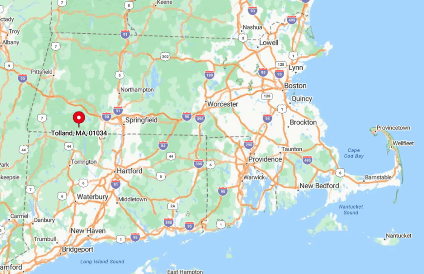
Tolland sits on the eastern edge of Berkshire County, brushing the Hampden County line. The town crowns a plateau at 1,900 feet, which forces drivers to ascend switchbacks from either Route 8 or Route 23.
Heavy forest on all sides screens it from nearby Blandford and Otis, and the lack of cellular towers deepens the sense of being off the grid. Reaching Tolland without a car is nearly impossible, as the nearest bus service is in Lee, 20 winding miles away.
4. Savoy – High Plateau Hideaway
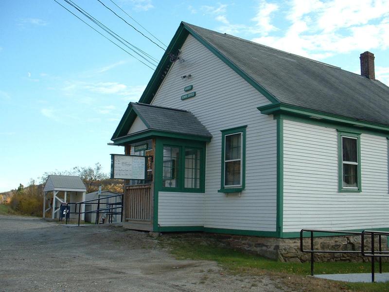
Only 700 people inhabit Savoy, a high plateau town where morning fog often parts to reveal wind turbines rising above spruce swamp and blueberry barren. Savoy Mountain State Forest lures campers to Tannery Falls and hikers to the quiet loop around Bog Pond, while winter snowshoe races start at the rustic CCC-era trailhead.
Logging, maple sugaring, and a handful of home-based artisans define the local economy, with seasonal campers adding a bump each summer. Photographers treasure the sunrise at Borden Mountain fire tower, where 360-degree views stretch to Vermont.
Savoy’s altitude and the surrounding state land buffer muffle highway noise and block the glow from North Adams and Pittsfield. A single general store serves as both supply depot and informal news center, underlining how self-contained life feels up here.
Where is Savoy?
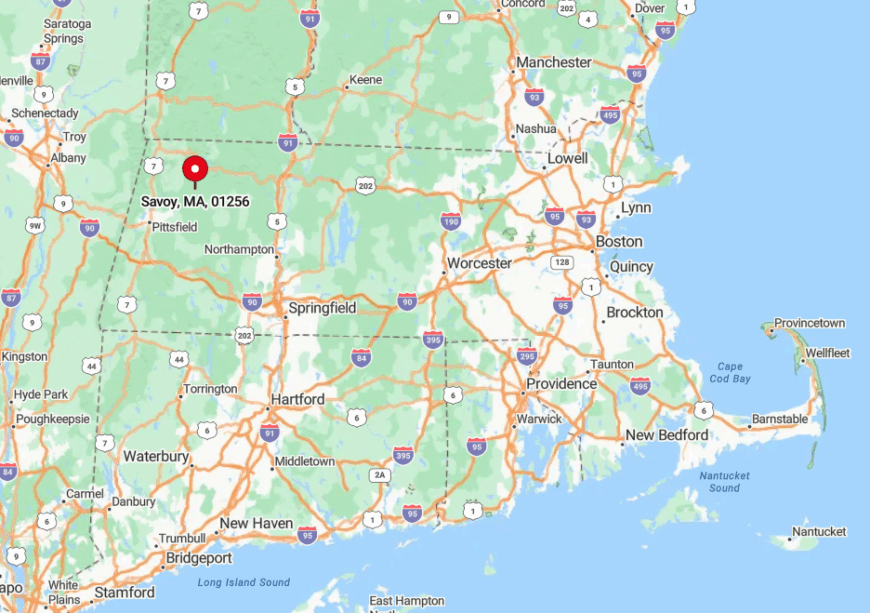
Savoy balances atop the Berkshire Highlands, 12 miles east of North Adams along Route 116. The road narrows and climbs quickly, leaving tractor trailers and casual sightseers behind.
Snowfall averages push past 100 inches, isolating the town for days after big storms until plows clear the hairpin turns. The nearest public transit stop is in Adams, forcing visitors to rely on private cars and good weather.
3. Rowe – Reservoir Views Minus the Crowds
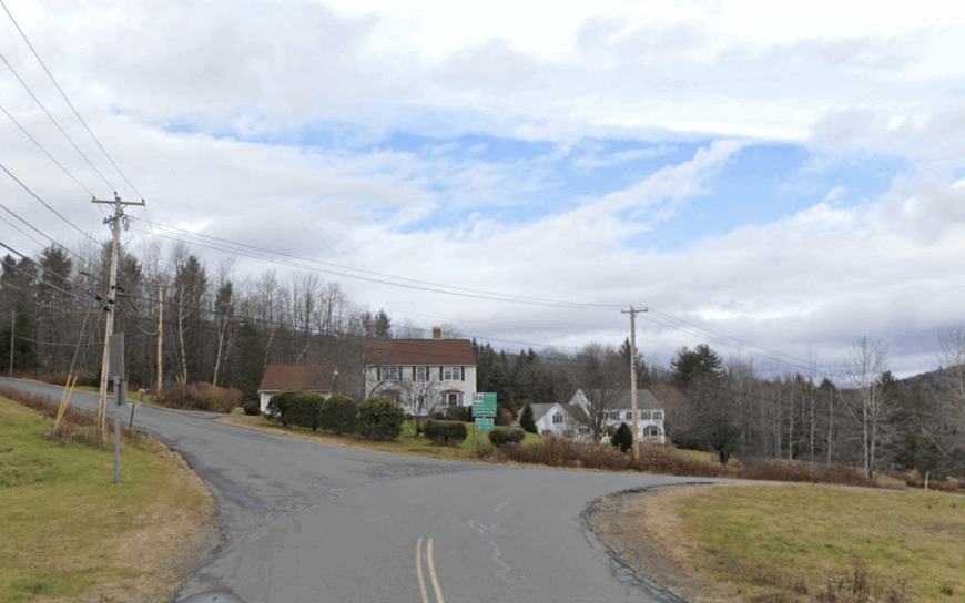
Rowe counts roughly 390 residents who wake to mirror-still Pelham Lake and fall asleep beneath some of the darkest skies in New England. Kayakers glide past beaver lodges, hikers follow the abandoned Hoosac Tunnel railbed, and summer concerts light up a lakeside pavilion that seats fewer than 100.
Modest property taxes from an old hydroelectric dam, along with small-scale agriculture and remote tech work, support the town budget. Unpaved village lanes lined with vintage clapboard homes grant photographers scenes that look unchanged since Calvin Coolidge’s era.
Lack of cellphone coverage and a deliberate decision to avoid commercial growth help maintain an atmosphere where loons outnumber traffic lights. With only two overnight lodging options, visitor numbers stay low, and the reservoir shoreline remains uncrowded even on peak foliage weekends.
Where is Rowe?
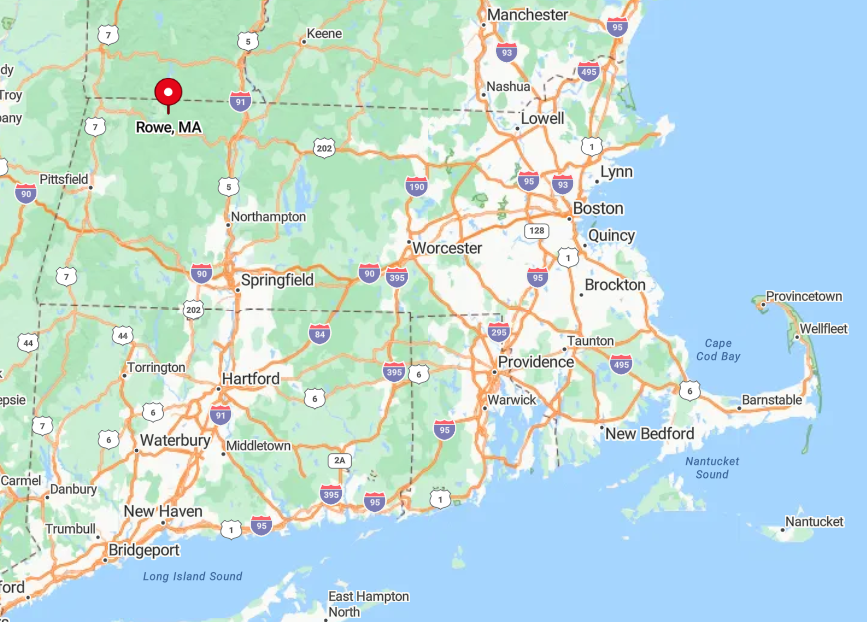
Rowe occupies Massachusetts’ northwest quadrant, wedged between the Vermont line and the Deerfield River gorge. Drivers reach it from Route 2 by turning north onto a twisting county road that climbs into dense forest.
The surrounding Hoosac Range blocks radio and cellular signals, deepening the sense of detachment. The nearest intercity bus stop is in Greenfield, 25 miles southeast, so most arrivals come by personal vehicle.
2. Plainfield – Quiet Farms at 1,600 Feet
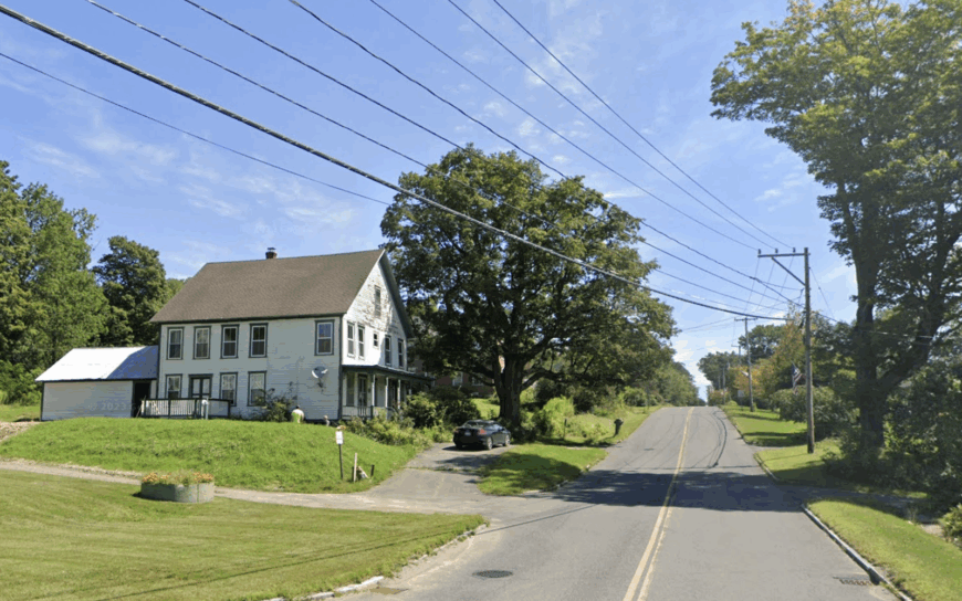
Plainfield’s population hovers near 600, scattered across high-altitude hayfields where barns stand framed against pastel dawn skies. Visitors explore the 1744 Shaw-Hudson House museum, join plein-air painters along Meadow Brook, or browse rare heirloom seeds at Trifolium Farm’s roadside stand.
Part-time farmers, craft cider makers, and digital freelancers anchor the modest economy, drawn by fast fiber internet completed in 2018. Summer brings star parties at Orchard Hill Observatory, while winter sees backcountry skiers carving tracks on an abandoned ski tow slope that only locals know.
Zoning bans most retail, keeping Main Street quiet enough that a passing pickup is an event. The 1,600-foot elevation places Plainfield above common weather patterns, so clouds often sit below the ridgeline, reinforcing the feeling of a settlement poised on its own island of sky.
Where is Plainfield?
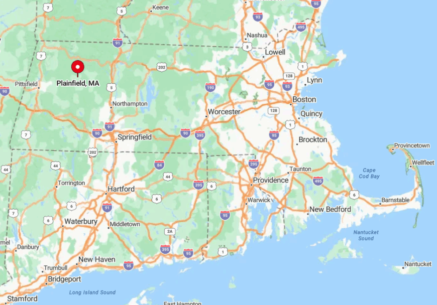
Plainfield rests near the junction of Hampshire, Berkshire, and Franklin Counties, roughly 25 miles northwest of Northampton. The town is accessed by climbing Route 116 through Chesterfield Gorge and following signs that vanish in winter drifts.
Encircling hills act as a natural sound barrier, muting the nearest highway six miles away. With no bus routes and limited taxi service, newcomers almost always arrive in a private car, ready for dirt road detours.
1. Middlefield – River Gorges and a Covered Bridge
Only about 520 people reside in Middlefield, spread along ridge farms and tucked beside the dramatic gorges of the Westfield River.
Hikers descend to Glendale Brook Falls, anglers stalk native brook trout in shaded pools, and history fans photograph the Keystone Arch Railroad Bridges that stand as the oldest stone railroad viaducts in the nation.
Small dairy herds, maple houses, and a growing cluster of home-based ceramicists keep the local economy humming, while the annual Middlefield Fair brings the whole town together for truck pulls and blueberry pie contests.
Miles of forested ravine isolate homesteads from one another, and the nearest convenience store sits two towns away.
Physical separation, coupled with patchy cell service, helps Middlefield feel like a throwback pocket of New England.
Where is Middlefield?

Middlefield is perched in the Berkshire foothills of western Hampden County, about 30 minutes west of Westfield via Route 20 and a series of steep switchbacks. The Westfield River cuts a deep gorge that deters direct east-west travel, so detours are lengthy and discourage casual visits.
CSX freight trains rumble through the river valley yet stop for no one, underscoring the town’s bypassed status. Without a bus line or rail passenger service, access depends entirely on personal vehicles navigating seasonal dirt roads.