Would you like to save this?
Western Florida still hides pockets of quiet where tidal creeks hum louder than traffic and porch lights remain the brightest marks in a star-soaked sky. These 25 communities sit off the beaten path yet close enough to natural riches—springs, barrier islands, longleaf forests—to fill a weekend or a lifetime.
We gathered them in a countdown, starting with larger towns and ending with postage-stamp areas where mail still arrives by boat or two-lane blacktop. Each place has its own flavor, from oyster shacks on forgotten bays to pecan groves shading century-old farmsteads.
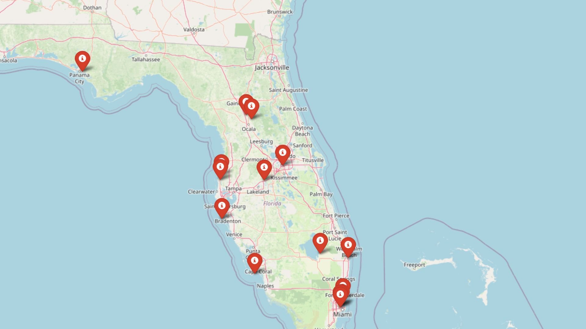
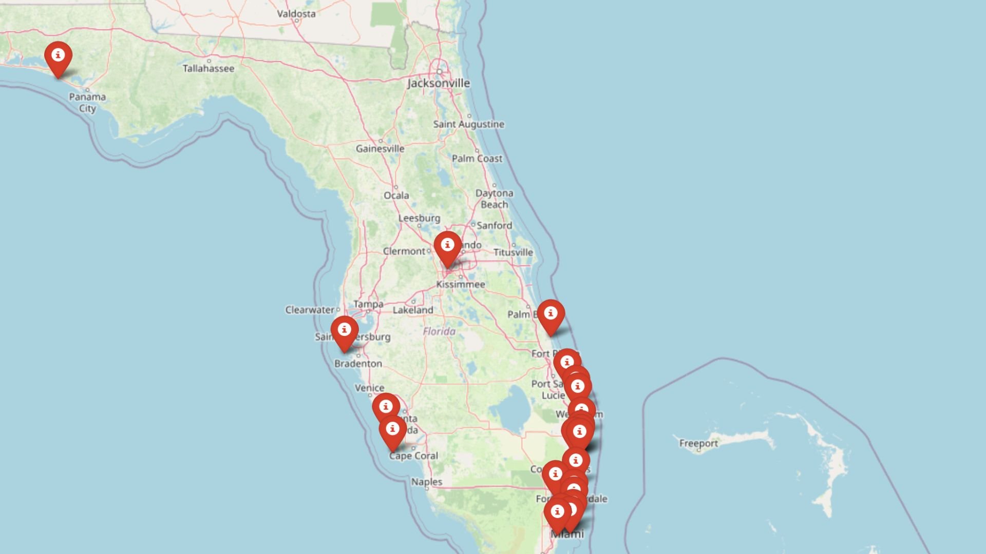
What they share is breathing room: acreage, dark nights, and the welcome hush that settles in once the day-trippers turn around. If quieter horizons call, the map below offers 25 fine excuses to keep driving past the last billboard.
25. Sumatra

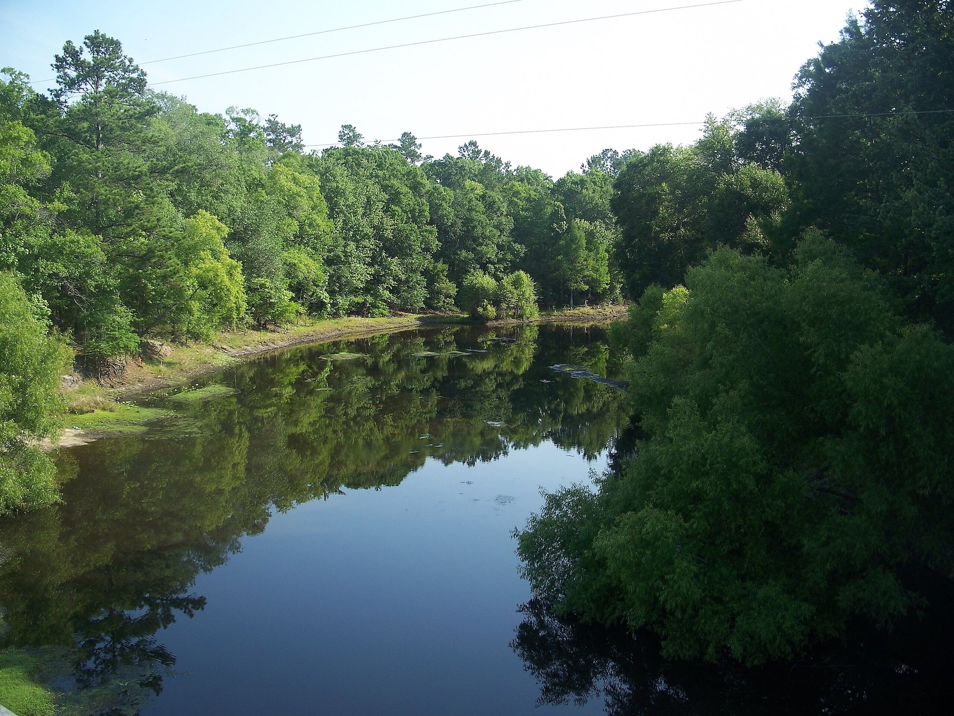
Tucked deep within the vast expanse of the Apalachicola National Forest, Sumatra is a blink-and-you’ll-miss-it community where only a few hundred people live at the pace of the woods, with frog songs, wood smoke, and river breezes shaping the rhythm of each day. Life here moves slowly, with fishing holes and forest clearings drawing more interest than anything resembling a store or café.
Its deep-green isolation shields it from all but the most determined visitors—there are no hotels, chain restaurants, or even a proper intersection, just the forest, the road, and the sky. Most folks here have roots that stretch back generations, and they seem perfectly content with the town staying a quiet dot on the map.
Sumatra is a place where roads vanish into palmetto thickets and cell reception yields to the whistle of whip-poor-wills, and for those seeking true solitude, there may be no better place to let time slip quietly by.
Where is Sumatra?

Sumatra is nestled in Liberty County, located along State Road 65 between Eastpoint and Hosford, surrounded entirely by protected public lands. The dense borders of Apalachicola National Forest ensure the town stays wrapped in a hush that few places still enjoy.
The nearest grocery or gas station lies over 20 miles away, and with no industry or sprawl anywhere nearby, Sumatra remains one of Florida’s quietest—and most forgotten—corners.
24. Eastpoint

Just across the bridge from the beachgoers of St. George Island, Eastpoint retains the feel of a working waterfront where time moves not with the tides of tourism, but with the slow rhythm of oyster hauls and crab traps. Here, old fishing boats still line the docks, and the scent of salt and sun-dried nets lingers in the air long after the workday ends.
Simple seafood shacks, a few bait shops, and hand-painted signs make up the main drag, but the true charm lies in the breeze off the bay and the sun setting behind the oyster boats. The town lives at its own pace, resisting outside reinvention with quiet determination.
Evenings settle into a deep coastal stillness, where the hush of waves under the dock and the rustle of marsh grass outshine any manmade light, and the stars return to their rightful place above.
Where is Eastpoint?

Kitchen Style?
Located in Franklin County along U.S. 98, Eastpoint sits directly on Apalachicola Bay, flanked by Apalachicola to the west and the bridge to St. George Island to the south. It is technically part of a well-known coastal corridor, yet it has somehow escaped the flash and crowding of nearby destinations.
The surrounding water and state forests hem it in just enough to preserve its gritty, old-Florida feel—a place still ruled by the tides, not timelines.
23. Ebro

With fewer than 300 residents and only a handful of visible buildings, Ebro is a modest place tucked among pine forests and backroads where the pace of life has barely budged in decades. Though best known for its now-quiet greyhound track, most days are marked by little more than a passing truck or a neighbor mowing a wide, sandy yard.
This is a community where the sounds of nature—wind in the pines, cicadas in the trees, water lapping at the creek—are more familiar than anything manmade. It doesn’t try to impress, and maybe that’s what makes it stick with you.
What Ebro lacks in excitement, it makes up for in stillness, and it feels like one of those towns where the mail still gets delivered by name, not by number.
Where is Ebro?

Ebro lies in southern Washington County, just north of the Bay County line, with State Road 79 cutting a solitary path through its modest center. Though it sits just 20 miles inland from Panama City Beach, the beaches feel a world away thanks to the town’s quiet, pine-shaded setting.
Surrounded by conservation lands and a patchwork of homesteads, it remains an overlooked outpost in a region many travelers simply speed past.
22. Noma

Home Stratosphere Guide
Your Personality Already Knows
How Your Home Should Feel
113 pages of room-by-room design guidance built around your actual brain, your actual habits, and the way you actually live.
You might be an ISFJ or INFP designer…
You design through feeling — your spaces are personal, comforting, and full of meaning. The guide covers your exact color palettes, room layouts, and the one mistake your type always makes.
The full guide maps all 16 types to specific rooms, palettes & furniture picks ↓
You might be an ISTJ or INTJ designer…
You crave order, function, and visual calm. The guide shows you how to create spaces that feel both serene and intentional — without ending up sterile.
The full guide maps all 16 types to specific rooms, palettes & furniture picks ↓
You might be an ENFP or ESTP designer…
You design by instinct and energy. Your home should feel alive. The guide shows you how to channel that into rooms that feel curated, not chaotic.
The full guide maps all 16 types to specific rooms, palettes & furniture picks ↓
You might be an ENTJ or ESTJ designer…
You value quality, structure, and things done right. The guide gives you the framework to build rooms that feel polished without overthinking every detail.
The full guide maps all 16 types to specific rooms, palettes & furniture picks ↓
With fewer than 250 people calling it home, Noma is a speck of a town resting peacefully near the Alabama border where life unfolds slowly along country roads lined with pine and pasture. Neighbors gather for potlucks or church picnics, and the day’s biggest news might be who spotted deer at the creek last night.
You won’t find a main street or a single chain restaurant here—just scattered houses, old barns, and a silence so rich it seems to hum. Life here is lived with intention, not distraction.
Noma isn’t just off the beaten path—it’s content to let the path forget it altogether.
Where is Noma?

Situated in Holmes County in Florida’s Panhandle, Noma hugs the state line just northwest of Bonifay, accessible only by county roads that twist past farmland and fencelines. The town is far removed from highways or commercial corridors.
This tucked-away setting—surrounded by forests and fields—ensures that Noma keeps its quiet grip on the land and remains delightfully overlooked.
21. Fountain

Fountain might sit on a highway, but its soul is rural and spread out, a patchwork of modest homes, long driveways, and pine groves where the biggest attraction might be the shade of an old oak. Though it straddles U.S. 231, it wears the look of a town forgotten in the shuffle—no traffic, no noise, and no need for hurry.
Locals tend gardens, raise animals, and wave from porches set well back from the road, content in their own rhythm. It’s a place where folks define time by the position of the sun and the sound of cicadas rather than a clock.
In Fountain, the pines stand tall and quiet, and the past never feels far behind.
Where is Fountain?

Fountain stretches across northern Bay County along U.S. 231, about 30 miles north of Panama City and well inland from the bustle of the Gulf. Despite being on a main road, the town is dispersed and rural, surrounded by pine plantations and low, sandy terrain.
This separation, both physical and cultural, preserves a sense of remove that even the highway can’t erase.
20. Gulf Breeze

Though the broader Gulf Breeze area edges into suburban sprawl, the Navarre Sound side remains hushed and tucked away, framed by quiet waters, maritime forest, and low-lying inlets that buffer it from the world. Here, you can wake to the sound of herons gliding over the water and spend the evening with toes in the sand as the sun dips low across the sound.
Homes nestle under palms and live oaks, and the pace is more ebb and flow than stop-and-go. The presence of the water—endless, quiet, and just steps away—instills a peaceful rhythm that softens everything.
Even though the city is technically near, this part of Gulf Breeze feels buffered by nature, protected by its geography, and distanced from the world’s rush.
Where is Gulf Breeze?

This tranquil edge of Gulf Breeze lies in Santa Rosa County, facing the calm waters of the Santa Rosa Sound across from Navarre Beach. It’s reached by veering off U.S. 98 onto a tangle of local roads that lead toward neighborhoods near Oriole Beach and Soundside Drive.
With coastal wetlands, estuaries, and a lack of tourist thoroughfares, it feels like a waterside enclave frozen in its own peaceful moment.
19. Two Egg

With a name that sparks curiosity and a footprint barely visible on a map, Two Egg is a humble rural stretch more legend than location. Its quiet beauty lies in the long views across pastureland, the scattered farmhouses, and the sense that time simply took a different path around this place.
There’s no center of town, just winding roads that pass by feed stores, fields, and the occasional historic marker hinting at stories deeper than the soil. Folks live simply and self-sufficiently, with most traditions carried on through memory and muscle.
Two Egg offers not just silence, but a kind of spiritual stillness—the kind you don’t find, but stumble into when you’ve gone far enough off the road.
Where is Two Egg?

Two Egg sits in northeastern Jackson County near the Alabama line, with access via State Roads 69 and 69A. The closest larger town is Marianna, about 15 miles southwest, but it feels worlds apart.
With fields, forest, and a total absence of modern development, Two Egg is a quiet outlier in an already quiet part of the state.
18. Immokalee

The heart of Immokalee is known for agriculture and movement, but step just a few miles out and everything changes. The outskirts stretch into flat expanses of citrus groves, cow pastures, and pine stands, where dirt roads lead to distant horizons and the hum of tractors gives way to birdsong.
It’s a place where the land opens up and the sky becomes endless, where old farmhouses rest under mossy trees and people tend their lives quietly, without hurry. There’s a softness in the air, a warmth that lingers even when the roads run empty.
The world slows down here—and if you let it, so will you.
Where is Immokalee?

North and east of central Immokalee, beyond the town’s limits, lie the wooded borders of Lake Trafford and expanses of citrus and pastureland.
The proximity to protected lands and the absence of development lend this area its sense of hush and hiddenness.
17. Goodland

Goodland is the kind of place where the water outnumbers the roads, and laughter on a Sunday afternoon spills out of seaside shacks like sunlight on the tide. It’s a haven of color and creativity—part fishing village, part artist’s retreat—where time forgets itself beneath the mangroves and every breeze carries the scent of the Gulf.
Old boats rest against docks worn smooth by decades, and locals gather around tables not for business, but for stories. There’s music here, always music, floating over the water as the tide rolls in and the light turns gold.
It’s a joyful kind of solitude, where even silence seems to hum.
Where is Goodland?

Goodland is located at the southeastern edge of Marco Island in Collier County, reached by a narrow road that threads through coastal flats and saltwater inlets. Bordered by the Ten Thousand Islands and shielded from major development, it maintains its tight-knit, off-the-map charm.
The town’s isolation is softened by its sense of community, but strengthened by the water that cradles it like a protective shell.
16. Vernon

Would you like to save this?
Vernon might carry the title of city, but it wears the spirit of a backwoods village, with Holmes Creek winding past quiet roads and Cypress Springs offering clear, cool water hidden under oak and cypress. It’s the kind of place where people know their neighbors’ birthdays, and the general store feels like the community’s front porch.
There’s a hum of life here, but it’s low and steady—marked by garden work, creek fishing, and Sunday services that end with potluck casseroles and homemade pie. The town holds its history gently, with timeworn buildings still standing proud along its main road.
Vernon may not advertise itself, but for those who find it, it feels like discovering a secret that still knows how to breathe.
Where is Vernon?

Vernon sits in central Washington County, along State Road 79, about 20 miles south of Chipley and just north of Holmes Creek’s winding channels. It’s near the edge of the Econfina Water Management Area, with scattered roads branching into dense pine forest.
The nearest bustling area is a half-hour away, leaving Vernon nestled in a pocket of time and space that stays blissfully unchanged.
15. Wewahitchka

Known affectionately as Wewa, this sleepy riverside town is steeped in tupelo honey, cypress knees, and a love for the water that courses through every backyard and conversation. Life follows the flow of the Dead Lakes, where mist rises in the morning and stillness settles like silt at dusk.
Fishing and farming still shape the local rhythm, and it’s not uncommon to see a jon boat tethered beside a pickup or jars of fresh honey lined up for sale at a roadside stand. There’s an honesty here, a closeness to the land and water that doesn’t shout but stays with you long after you leave.
Wewa is a town that whispers rather than calls—inviting, humble, and content to be known only to those who truly seek it out.
Where is Wewahitchka?

Wewa is located in northern Gulf County along State Road 71, just east of Port St. Joe and north of Apalachicola’s sprawling wetlands. It sits at the edge of the Dead Lakes and the Apalachicola River basin, offering miles of water, woods, and silence in every direction.
Though it lies only 45 minutes inland from the coast, the surrounding swamps and timberlands form a natural moat that keeps the town hidden and hushed.
14. Milligan

Once a hub along the railroad, Milligan has since faded into a soft rural landscape where pine woods and old fields stretch between homes that sit back from the road in quiet dignity. The tracks still run through, but few remember when they brought more than a passing whistle.
Life here feels measured and steady, with neighbors exchanging produce, stories, and time more freely than most places. On warm nights, tree frogs fill the stillness, and the air holds onto the scent of sweetgrass and pine resin.
Milligan isn’t flashy, but it holds its own kind of grace—the kind found in hard work, long walks, and a sky full of stars.
Where is Milligan?

Milligan is located in Okaloosa County, just west of Crestview, straddling U.S. 90 where the highway narrows and traffic fades. Though Interstate 10 lies nearby, thick woods and distance from exits keep the community insulated from noise and growth.
Its position along the Yellow River, flanked by farmland and timber tracts, preserves a sense of remove that’s hard to replicate elsewhere.
13. Clarksville

Clarksville stretches quietly across a rural swath of State Road 20, where fields meet forest and old barns slump gently into the grass like nodding elders. This is farm country, where peanut dust drifts on the breeze and tractors are more common than sedans.
You won’t find a town square or even a sidewalk here—just wide skies, fresh air, and the kind of stillness that makes you listen. It’s a place where time doesn’t press, and change tends to arrive by way of weather rather than city council.
Clarksville offers a glimpse of Florida unbothered by growth—a landscape of fields and families and the soft rhythms of a life well-paced.
Where is Clarksville?

Clarksville lies in Calhoun County along State Road 20, between Blountstown and Panama City, surrounded by farmland, longleaf pine, and very little else. It’s several miles from any interstate, and with no real town center, the area remains largely agricultural.
This lack of density—paired with a deep-rooted rural identity—helps keep Clarksville one of the quieter corners of the region.
12. Sopchoppy

Sopchoppy may have one of the state’s most whimsical names, but what you’ll find here is a deep-rooted sense of place anchored in longleaf pine, riverbank hammocks, and the company of whip-poor-wills at dusk. Its main street, lined with historic buildings, feels like a chapter of Southern history still unfolding in slow, thoughtful pages.
Best known for its Worm Gruntin’ Festival, the town otherwise keeps to itself, wrapped in moss and surrounded by natural preserves. The people are friendly, the porches wide, and the world outside feels very far away.
Here, silence has a texture, and every breeze through the trees feels like the town’s way of reminding you to breathe deeply and slow down.
Where is Sopchoppy?

Sopchoppy is located in southern Wakulla County, west of the St. Marks River and south of Tallahassee, bordered by the Apalachicola National Forest and Ochlockonee River State Park. U.S. 319 brushes past, but traffic is light and most roads here lead to water or woods.
Its remoteness is strengthened by geography, with protected lands on all sides helping it remain a true sanctuary of stillness.
11. Jay

Jay sits on the far northern edge of Florida’s Panhandle, surrounded by farmland and fields that stretch into Alabama, where life runs on harvest seasons rather than headlines. With just over 500 residents, the town feels preserved—rooted in peanut fields, cotton rows, and quiet country lanes.
Old trucks sit beneath magnolia trees, and locals gather at corner stores not for convenience but conversation. Change comes slowly, if at all, and that’s just how folks here prefer it.
Jay’s strength lies in its steadfastness—a town that keeps to its own rhythm, tucked away from the buzz of the coast or the glare of tourism.
Where is Jay?

Jay is located in northern Santa Rosa County near the Alabama border, accessible via State Road 4. It’s about 35 miles north of Pensacola, but buffered by endless farmland and pine groves.
With no direct commercial links to the nearby Gulf and only a scattering of through roads, Jay retains the peaceful edge of a place that time forgot—quiet, grounded, and fully its own.
10. Alligator Point

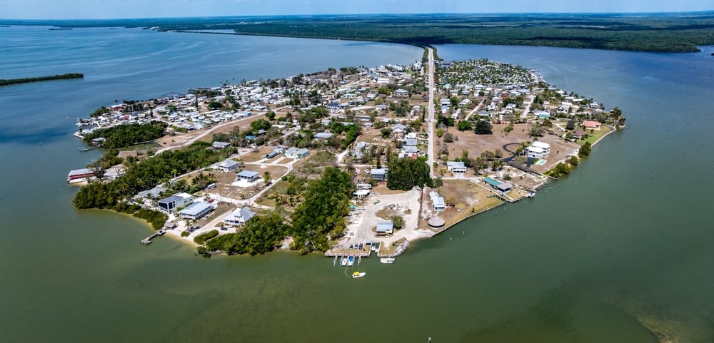
Roughly 400 full-time residents claim this slender peninsula in Franklin County. Daily rhythms revolve around beachcombing along miles of uncrowded Gulf shoreline, casting for pompano at sunrise, and watching migrating monarchs funnel across the dunes each fall.
Charter captains haul in grouper and snapper, while the only storefronts are a tiki bar, kayak outfitter, and small general market. Vacation rentals and second homes form the main business, complemented by commercial oyster leases in nearby Ochlockonee Bay.
Seclusion comes from geography: pastel stilt houses perch on roomy lots bounded by the Gulf on one side and the piney buffer of St. Marks National Wildlife Refuge on the other, leaving no pass-through traffic.
Locals whisper about Bald Point’s freshwater seep where roseate spoonbills gather—a spot rarely marked on tourist maps.
Where is Alligator Point?

The community sits at the southern tip of the “Forgotten Coast,” 45 miles south of Tallahassee on a finger of land between Apalachee Bay and the open Gulf. Only one two-lane road—County 370—links it to U.S. 98, ensuring spur-of-the-moment visits stay rare.
Drivers wind through refuge marshes, then cross a low bridge before the pines give way to dunes and sea oats. With no stoplights and only one way in or out, the peninsula keeps its slow, sea-breeze pace year-round.
9. Suwannee

Around 300 residents live where the Suwannee River finally meets the Gulf, creating a postcard fishing village buffered by 24 miles of marshland from the nearest four-lane highway.
Days begin with skiffs idling past moss-draped oaks toward grass-flanked creeks teeming with redfish and trout, and end at Salt Creek’s back-porch restaurants serving fried mullet caught hours earlier.
Guides, bait shops, and small vacation rentals form the economic backbone, while oyster and crab boats still tie up at aging docks. There’s no pharmacy, no chain fuel stop, and cell service flickers—the defining luxuries here are silence and dark skies.
Isolation stems from both distance and geography: the river’s vast delta, conservation lands, and tidal flats swallow noise and sprawl before they arrive. A hidden jewel is Shired Island Beach, a county park reachable by an unmarked shell road where locals hunt purple shell fragments after storms.
Where is Suwannee?

Suwannee rests in Dixie County at the very end of County Road 349, south of Old Town and 70 miles west of Gainesville. Marsh on three sides and the broad river on the fourth create an aquatic moat that visitors cross via one solitary bridge.
Most arrive by car, yet seasoned anglers often choose the river, motoring 30 miles downstream from Fanning Springs. Either way, the last leg always narrows to a canopy road where Spanish moss and salt air announce the village long before any street sign.
8. Chumuckla

About 850 people call unincorporated Chumuckla home, scattered across rolling red-clay farmland and century-old pecan groves. Local fun involves bluegrass jams at the Chumuckla Community Center, seasonal u-pick strawberry fields, and horse trails threading longleaf pines in the Blackwater River State Forest.
Agriculture rules the economy: hay, peanuts, cattle, and a family-run sawmill that still buys timber on a handshake. The community’s tucked-away feel comes from its surrounding forest blocks and lack of commercial strips, despite being only 20 miles north of Pensacola as the crow flies.
Nights stay so dark that residents set their clocks by the Milky Way instead of streetlights. A lesser-known attraction is Jim’s Hammock, a natural spring pool on private land occasionally opened for old-fashioned rope-swing swims.
Where is Chumuckla?

The hamlet sits in Santa Rosa County, north of Pace and south of the Alabama line, accessible primarily via State Road 197. Once the pavement leaves the Escambia River floodplain, it climbs gentle hills that hide the coast and city towers from view, enhancing the sense of remove.
Pensacola travelers follow U.S. 90 then weave through pine stands and hay rolls, a transition that feels like decades rather than miles. No public transit reaches Chumuckla, so the resident mailbox counts remain steady and low.
7. Indian Pass

Would you like to save this?
Only about 250 year-round residents share this shell-strewn spit wedged between Indian Lagoon and the Gulf of Mexico. Days revolve around surf-fishing for pompano, paddling to St. Vincent National Wildlife Refuge, and shucking oysters at the historic Indian Pass Raw Bar.
Short-term rentals and small charter outfits bring modest income, while a few locals still work commercial mullet nets under fall moonlight. A single paved lane ends at the ferry landing, beyond which nothing but dune, marsh, and federally protected barrier island exists, reinforcing the out-of-the-way vibe.
Night skies blaze because the nearest traffic signal sits 18 miles away in Port St. Joe. Locals prize the lagoon’s winter ribbon-snake migration, rarely noticed by casual visitors.
Where is Indian Pass?

The community lies in Gulf County, 70 miles southeast of Panama City, reached via County Road 30A. Drivers leave the busy Scenic 30A corridor near Cape San Blas and meander past scrub oak and salt prairie before the pavement peters out.
The only alternative arrival is the seasonal barge to St. Vincent Island, which still hauls hunters and beachcombers but no cars. With no through-road, every vehicle that rolls in must later turn around, preserving the peninsula’s hush.
6. Myakka City

Approximately 6,300 residents spread across a patchwork of ranches and oak hammocks east of Sarasota. Weekends fill with barrel-racing at the Posse Arena, cycling along Clay Gully Road, and bird-watching at Myakka River State Park’s canopy walkway.
Cattle, citrus, and niche horse farms anchor the local economy, supported by a handful of feed stores and roadside markets. Five-acre zoning, dirt lanes, and the vast park to the west block subdivision creep, giving the area a frontier spaciousness.
Night noises center on whip-poor-wills and an occasional distant airboat rather than traffic. Tucked behind a live-oak windbreak, Dakin Dairy Farms serves milk-shake flights and field tours few tourists ever find.
Where is Myakka City?

Sitting in eastern Manatee County, the town lines State Road 70 about 26 miles inland from Sarasota’s beaches. Beyond Lakewood Ranch, housing tracts fade and palmetto flats open, signaling entry into ranch country.
The closest interstate exit lies half an hour west, so visitors reach Myakka City only by deliberate detour. That buffer of pasture and prairie keeps horizons broad and crowds thin.
5. Steinhatchee

Just over 1,000 residents live where cedar docks line the tea-colored Steinhatchee River, a place renowned for summer scalloping yet curiously void of chain stores. Mornings start with coffee on wraparound porches before venturing upriver to paddle past limestone springs or downriver to scallop beds in Deadman Bay.
Charter fishing, scallop cleaning stations, and a handful of restaurants smoking mullet over oak coals form the economic mix. Forty minutes of two-lane highway separate the town from the nearest divided road, a gap that shields it from mass tourism.
The clapboard cottages, shade trees, and boardwalks give every street an old-Florida hush. A favorite secret is Steinhatchee Falls, Florida’s widest waterfall, hidden five miles up a sandy forest road.
Where is Steinhatchee?

The village straddles the Taylor–Dixie county line, roughly 70 miles southwest of Valdosta, Georgia. Approaching on State Road 51, drivers cross miles of pine flatwood and marsh before the river bends reveal boat masts.
The closest commercial airport lies in Tallahassee, a 90-minute haul, so most arrive by car or center-console boat. With the Gulf on one side and vast timberlands on the other, expansion has nowhere to run.
4. Bokeelia

Around 1,780 residents inhabit this sleepy settlement at Pine Island’s north end, surrounded by mango orchards, tidal creeks, and a turquoise rim of Matlacha Pass. Daily life means casting from the century-old wooden pier, meandering art galleries in nearby Matlacha, or kayaking to Cayo Costa’s unspoiled beaches.
Fishing charters and tropical fruit farms share economic honors, supplemented by seasonal snowbird rentals. Seclusion rests on geography: a 17-mile two-lane causeway over mangrove islands stands between Bokeelia and bustling Fort Myers, and there are no bridges beyond Pine Island.
The dark stillness magnifies the rustle of palms and trills of mangrove cuckoos at dawn. Locals rave about Randall Research Center’s Calusa shell mounds, an archaeological gem tucked behind a simple gate on Pineland Road.
Where is Bokeelia?

Bokeelia anchors Lee County’s Pine Island, reachable via Cape Coral, then a sequence of small bridges across Matlacha Pass. Once on the island, Stringfellow Road narrows to a palm-lined ribbon ending beside Charlotte Harbor.
No public transit enters Pine Island, so every visitor brings or rents wheels. Water, wildlife refuges, and zoning caps corral growth, maintaining the village’s unhurried rhythm.
3. Holt
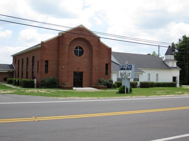
Nearly 3,200 residents live amid Okaloosa County’s sandhills, longleaf pines, and tannic creeks that lace the Blackwater River basin. Outdoor pursuits include tubing the cold, spring-fed river, exploring the Krul Recreation Area’s swinging bridge, and browsing local farm stands for tupelo honey.
Employment centers on small-scale agriculture, forestry, and the nearby rail depot that still loads yellow pine lumber. Tourist traffic from Destin seldom finds the backroads, and federal forest blocks keep development scattered and low.
Starry nights and whip-poor-wills underscore Holt’s separation from the Emerald Coast’s neon glow. A little-known perk is the “Green Fly” trailhead, where an abandoned logging rail grades into a wildflower corridor each spring.
Where is Holt?

The settlement hugs Interstate 10, yet lies ten miles down County Road 189 from the nearest exit, tucking it behind timberlands and sandy prairies. Once drivers leave the interstate, cell coverage flickers and FM radio dissolves into cicadas.
The nearest sizeable town, Crestview, sits 20 minutes east, making Holt’s feed store and post office focal points. With the Blackwater River State Forest to the north and Eglin reservation to the south, future sprawl finds no toehold.
2. Mossy Head

About 1,200 residents occupy rolling sand ridges in Walton County where homes sit on spacious acreage amid longleaf pines and wiregrass. Locals ride ATVs down forest service roads, target-shoot at the private range, and pick huckleberries along Juniper Creek in summer.
Employment revolves around small construction outfits, the nearby CSX rail yard, and Eglin Air Force Base support services. The area feels remote because Eglin’s vast reservation forms a southern wall while thousands of acres of state forest close in on the north, leaving county roads quiet and skies pitch-black.
Residents relish the hush so much that community meetings still occur at the volunteer fire hall rather than online forums. A hidden bonus is Speck Pond, an emerald sinkhole lake open only to those who snag one of a dozen daily permits.
Where is Mossy Head?

Positioned at the junction of U.S. 90 and State Road 285, Mossy Head lies 12 miles west of DeFuniak Springs and 40 minutes inland from Destin. Though Interstate 10 passes three miles south, dense forest buffers both noise and easy access.
Visitors exit at Crestview or DeFuniak Springs, then weave through pine barrens before the first mailbox appears. Without public utilities beyond water and power, large-parcel zoning keeps rooftops rare and night skies undimmed.
1. Ochlockonee Bay

Barely 200 people dwell where the Ochlockonee River widens into a namesake bay edged by thick Wakulla County pine flatwoods. Residents spend mornings pedaling the Florida Coastal Trail, afternoons paddling to oyster bars, and evenings savoring smoked mullet at the locals-only Mashes Sands fish fry.
Charter fishing and small oyster leases supply modest income, while tourism stays light thanks to 60 percent of surrounding land being state forest or wildlife management area.
The town’s remoteness owes to its position at a cul-de-sac of water, forest, and marsh, with no commercial strip and one blinking light for company. Here, creatures outnumber cars, and stars reclaim the horizon each night.
A closely guarded secret is the marsh-edge tower on Surf Road where, on still autumn evenings, red drum tail in unison beneath the boardwalk.
Where is Ochlockonee Bay?

The community sits south of Sopchoppy, 45 minutes southwest of Tallahassee, at the terminus of U.S. 319 before it bends toward the coast. The bay, the river, and St. Marks National Wildlife Refuge form a watery triangle that limits through traffic to a single causeway.
Visitors usually arrive by car, though seasoned sailors anchor in the bay and dinghy to the county pier for supplies. With state forest on two sides and salt water on the third, Ochlockonee Bay is likely to keep its stillness for decades to come.


