The stretch of land called southwestern Virginia holds a rhythm that feels steady, almost workmanlike, in the best sense. The Blue Ridge Plateau flattens the peaks just enough for pasture, then tilts into valleys where the New River gathers its bends. Here, 25 towns in southwestern Virginia carry the daily cadence of ridge, creek, and courthouse square without fanfare. Fancy Gap leans on its Parkway overlook, Floyd tunes a banjo on a Friday night, and the roads between them carry more cattle trailers than tour buses.
In order to come up with the very specific design ideas, we create most designs with the assistance of state-of-the-art AI interior design software.
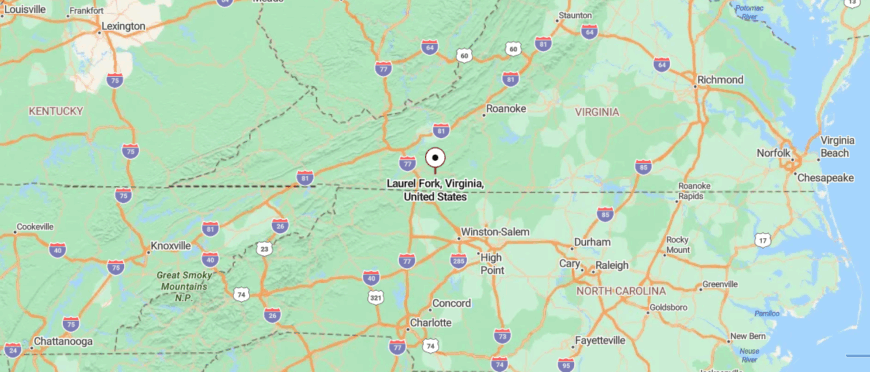
The map tells you this is the state’s hinge: West Virginia lies over one ridge, North Carolina across another, Tennessee not much farther. It’s a geography of crossroads, yet the sense on the ground is more of thresholds—one ridge leading to the next, each town keeping its own pace. The courthouse in Independence, the millstone at Mabry Mill, the trailheads near Whitetop: these are markers of continuity, reminders that history here often means what still gets used.
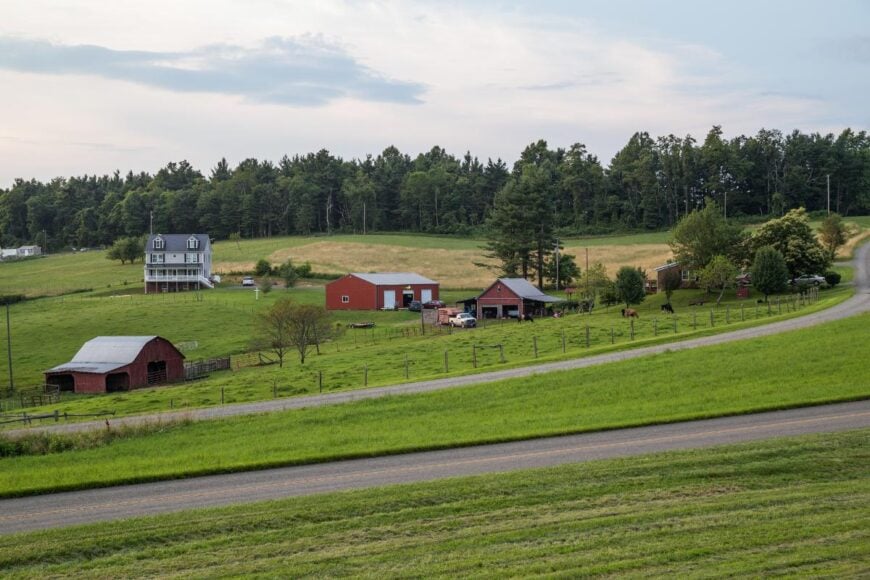
Agriculture stays visible—corn cut in strips along Route 221, orchards heavy near Cana, tobacco barns weathering backroads in Carroll County. Tourism runs alongside but never drowns the local economy; a visitor might rent a cabin in Meadows of Dan or hike the ponies in Grayson Highlands, but the county fair still measures the year.
The texture comes from details: the quiet splash of Reed Creek near Max Meadows, a stack of split wood beside a Pilot farmhouse, the faint hum of fiddles leaking from Galax storefronts. These towns don’t position themselves as destinations so much as points along a lived-in landscape. To spend time here is to step into that pace—unhurried, practical, rooted in the mountains, yet expansive enough to let the horizon breathe.
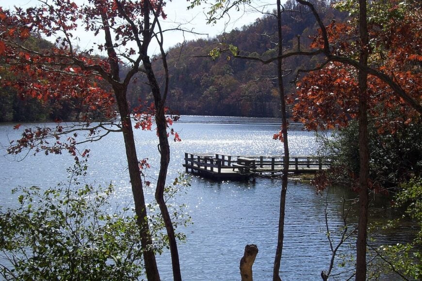
25. Laurel Fork
Laurel Fork, Virginia lies high on the Blue Ridge Plateau, its sense of seclusion shaped by winding mountain roads and thick forests that keep it far from the rush of city life. The town feels quiet and timeless, where mist clings to the valleys in the morning and the sound of wind through the trees is often the loudest noise.
History lingers in old homesteads and weathered barns, reminders of generations who worked the land and lived close to nature. Visitors are drawn to the Blue Ridge Parkway nearby, with its overlooks, hiking trails, and wildflower meadows that change with the seasons.
Farming and small-scale crafts still anchor the community, giving it a rhythm that feels steady and rooted. Laurel Fork leaves you with the feeling of a place that belongs more to the mountains than to time itself.
Where is Laurel Fork?
Laurel Fork lies high in Carroll County, Virginia, where the Blue Ridge Parkway winds across the mountains. It’s about 75 miles northwest of Winston-Salem, North Carolina, reached by U.S. 58 as it climbs into cooler, higher ground.
The road curves past overlooks, meadows, and dense forests that narrow the world to ridge and sky. By the time you arrive, Laurel Fork feels like a mountaintop retreat, where distance and quiet fold together.
24. Hillsville
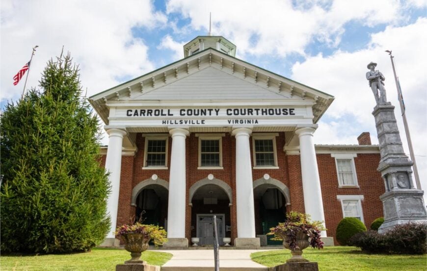
Hillsville, Virginia sits in the highlands of Carroll County, where mountain views and winding roads give it a sense of quiet separation. Its history is marked by the 1912 courthouse tragedy, a story still remembered in the town’s old brick square.
Each Labor Day, the flea market and gun show transform Hillsville into a bustling hub that draws thousands from across the region. On ordinary days, the pace slows to fishing in streams, walking shaded trails, or gathering at small-town parks.
Farming and family-run businesses keep the community rooted, carrying traditions from one generation to the next. Hillsville leaves you with the feel of a mountain town shaped by both history and the steady rhythm of rural life.
Where is Hillsville?

Hillsville sits in Carroll County, Virginia, at the crest of the Blue Ridge Plateau in the state’s southwest. It’s about 70 miles northwest of Winston-Salem, North Carolina, reached most directly by I-77 before shifting onto U.S. 58 into town.
The approach rises steadily, with the highway giving way to ridge-top views and winding stretches of country road. When you reach Hillsville, it carries the feel of a highland crossroads—elevated, quiet, and set apart in the mountains.
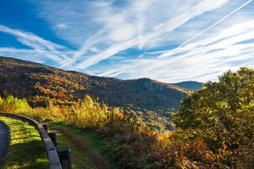
23. Fancy Gap
Fancy Gap, Virginia rests along the crest of the Blue Ridge Parkway, a mountain community often wrapped in mist that makes it feel hidden from the world below. Its seclusion comes from the high elevation and winding roads that climb steadily through forest and farmland to reach it.
The air feels cooler here, filled with the scent of pine and the sound of wind rushing over the ridges. Visitors stop for scenic overlooks, antique shops, and trails that lead into valleys alive with wildflowers and songbirds.
Many locals rely on small businesses, farming, and tourism tied to the Parkway, balancing tradition with the flow of travelers passing through. Fancy Gap leaves you with the sense of standing in a place where clouds and mountains meet, a quiet perch above the noise of everyday life.
Where is Fancy Gap?
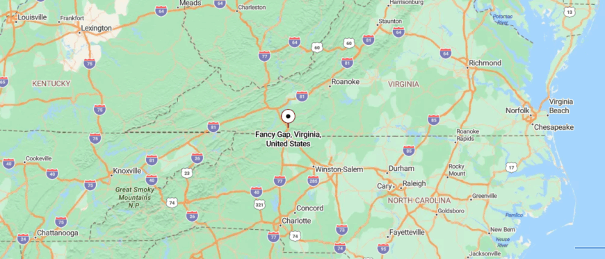
Fancy Gap rests along the Blue Ridge Parkway in Carroll County, Virginia, where the mountains drop steeply toward North Carolina. It’s about 75 miles northwest of Winston-Salem, reached by I-77 before turning onto winding mountain roads that climb into the fog.
The drive narrows through switchbacks and overlooks, each bend revealing a mix of sky and valley. By the time you arrive, Fancy Gap feels suspended on the ridgeline, a place where clouds drift low and the world below seems distant.
22. Floyd
Floyd, Virginia sits on the Blue Ridge Plateau, a mountain town whose winding roads and high elevation give it a sense of being set apart. Known for its artistic spirit, the town hums with live bluegrass music spilling from the Floyd Country Store and murals that brighten its streets.
On weekends, locals and travelers gather for the Friday Night Jamboree, where fiddles and banjos turn the town into a living stage of Appalachian tradition. Beyond town, rolling farmland and forest trails invite long drives, quiet hikes, and moments of stillness under wide skies.
Small farms, crafts, and tourism weave together to keep the community thriving without losing its rural roots. Floyd lingers with you as a place where art and mountain life blend, leaving the rhythm of music and nature in your memory.
Where is Floyd?
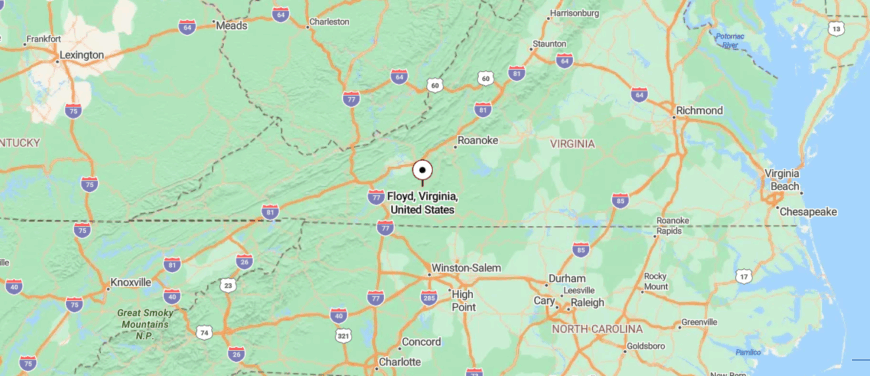
Floyd sits in the heart of Floyd County, Virginia, perched on the Blue Ridge Plateau in the southwestern part of the state. It’s about 45 miles southwest of Roanoke, reached by the scenic Blue Ridge Parkway or winding U.S. 221.
The journey moves through rolling farmland, forested hills, and stretches where the road seems to balance on the ridge itself. By the time you arrive, Floyd feels like a cultural high point hidden in the mountains, where music and quiet landscapes share the same air.
21. Ivanhoe
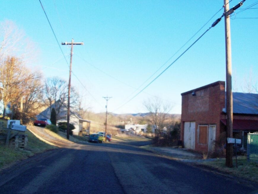
Ivanhoe, Virginia rests along the New River, its secluded feel shaped by steep hills and the winding water that cuts it off from the faster world beyond. Once a thriving iron and coal community, remnants of that past still linger in old structures and the stories passed down through families.
Today, the town is quiet, with life centered on fishing the river, hiking nearby trails, and gathering at small community spots. The New River Trail State Park runs through, drawing visitors who come by bike, foot, or horseback to follow the river’s bends.
Work is often found in surrounding towns, but Ivanhoe itself holds steady in its small, close-knit ways. It’s the kind of place where history and nature sit side by side, leaving a lasting sense of both endurance and calm.
Where is Ivanhoe?
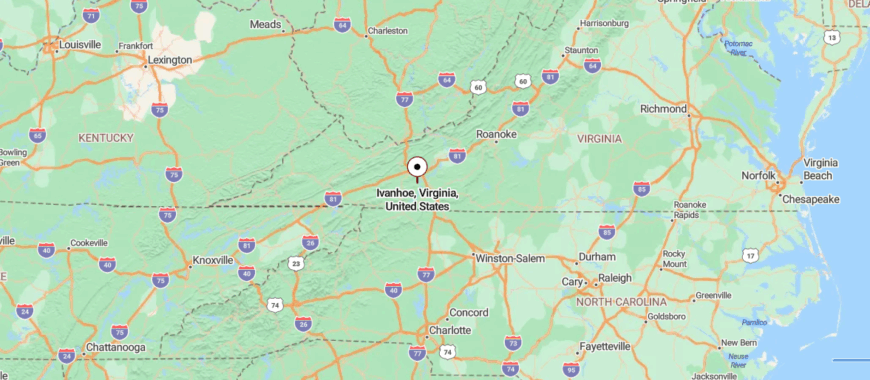
Ivanhoe rests along the New River in Wythe County, Virginia, tucked into the southwestern hills near the border with Carroll County. It’s about 70 miles southwest of Roanoke, reached by I-81 before turning onto winding state routes that follow the river’s curve.
The drive slips past forests, ridges, and stretches of water that mirror the sky. By the time you arrive, Ivanhoe feels like a riverside hollow, quiet and held close by the mountains.
20. Fries
Fries, Virginia sits on a bend of the New River, its seclusion shaped by the steep hills that surround it and the long, winding roads that lead into town. Once a bustling mill village, its history still shows in the brick homes and the quiet rhythm of streets built for workers long gone.
Today, the New River Trail State Park brings hikers, cyclists, and anglers who follow the river’s edge and pause to take in the stillness. The town itself feels calm and close-knit, with neighbors gathering at the community center or along the water where children still skip stones.
Small shops and local events keep tradition alive, even as many commute to nearby towns for work. Fries leaves you with the memory of a river town where past and present flow together, steady as the current itself.
Where is Fries?

Fries sits in Grayson County, Virginia, perched on a bend of the New River in the state’s southwest. It’s about 80 miles southwest of Roanoke, reached by I-81 before giving way to smaller mountain highways that trace the river valley.
The approach narrows into winding roads where the water stays close, guiding the way into town. By the time you arrive, Fries feels like a riverside pocket tucked into the hills, set apart and slowed by the current.
19. Independence
🔥 Would you like to save this?
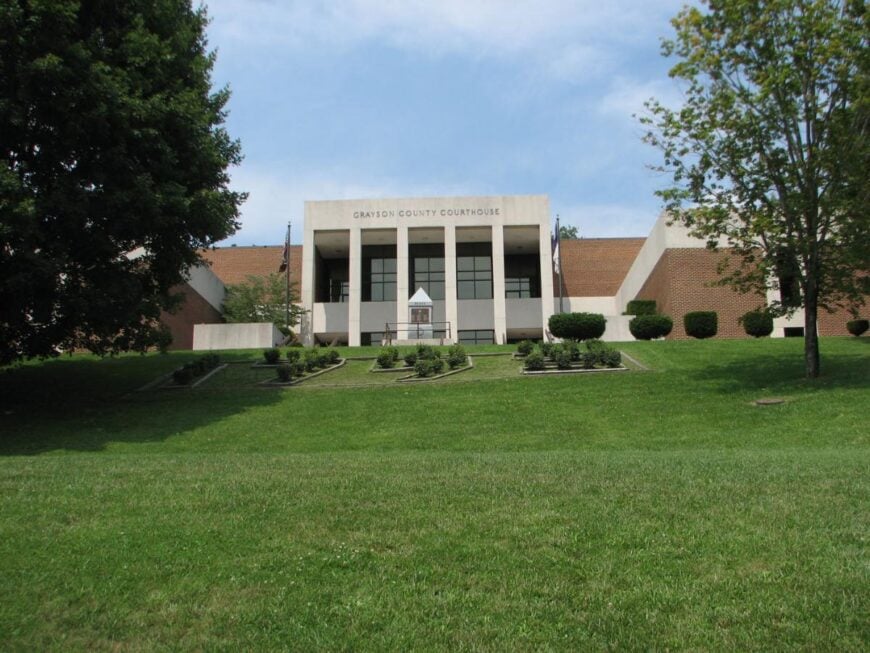
Independence, Virginia rests in the heart of Grayson County, its mountain backdrop and winding country roads giving it a sense of being quietly set apart. The historic courthouse square anchors the town, where old brick buildings and family-run shops keep tradition close at hand.
Life here is steady, with neighbors gathering for farmers markets, summer festivals, and bluegrass shows that echo through the hills. Outdoor escapes lie just beyond town—Grayson Highlands State Park offers wild ponies, high-elevation trails, and sweeping views that few places can match.
Farming and small businesses remain central, tying the community to both the land and its heritage. Independence leaves you with the impression of a mountain town rooted in history, yet alive with the rhythm of music and open skies.
Where is Independence?
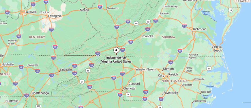
Independence lies in Grayson County, Virginia, nestled in the Blue Ridge highlands near the North Carolina border. It’s about 85 miles southwest of Roanoke, reached by U.S. 58 as it winds through forested ridges and rolling farmland.
The road rises and falls with the mountains, each curve carrying you deeper into quieter country. By the time you reach Independence, the town feels like a hilltop rest, steady and removed from the wider world.
18. Galax
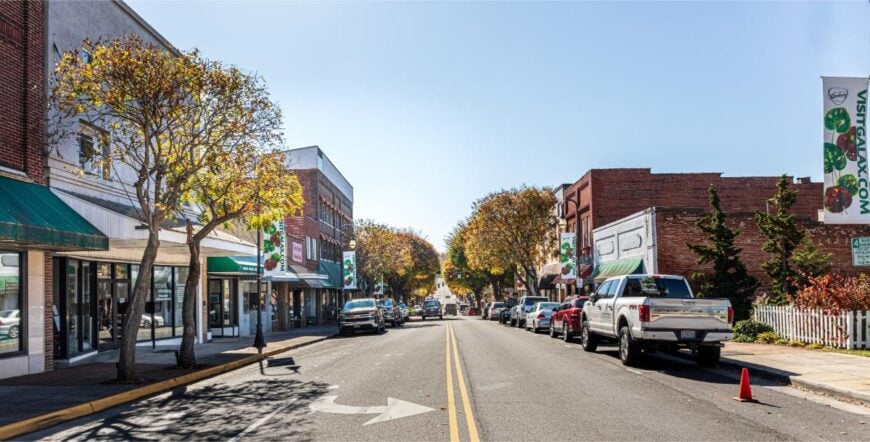
Galax, Virginia sits at the edge of the Blue Ridge Mountains, its seclusion shaped by winding roads that rise into the hills and keep it apart from faster-moving places.
The town is famed for its music, known worldwide as the host of the Old Fiddlers’ Convention where banjos, fiddles, and guitars carry Appalachian traditions into the night. Downtown still hums with small shops, historic brick buildings, and murals that celebrate its heritage.
Beyond the streets, the New River Trail offers miles of hiking and biking, while the river itself invites fishing and quiet afternoons along its banks. Furniture making and crafts have long anchored the local economy, blending skill with creativity.
Where is Galax?
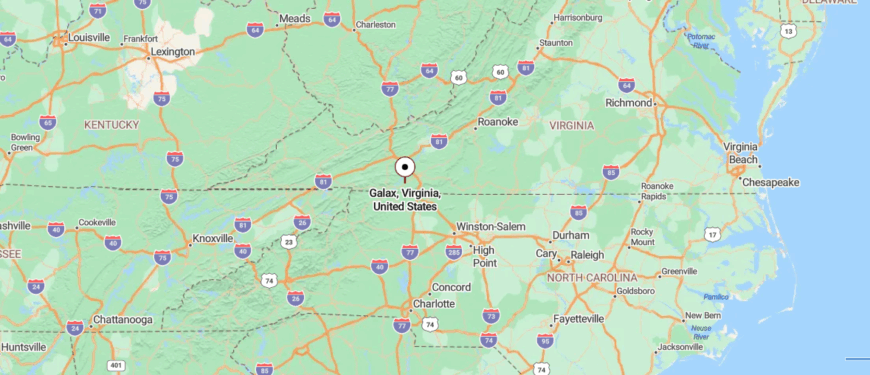
Galax rests on the edge of Carroll and Grayson Counties in southwestern Virginia, known as a gateway to the Blue Ridge Parkway. It’s about 80 miles southwest of Roanoke, reached by I-77 before easing onto U.S. 58, which winds through ridges and valleys.
The approach carries you past rolling hills and stretches of forest that open to wide views near town. By the time you arrive, Galax feels like a mountain gathering place, close to the music and scenery yet apart from the rush.
17. Baywood
Baywood, Virginia rests in the rolling hills of Grayson County, a rural community that feels quietly tucked away from the pace of larger towns. Its seclusion comes from winding backroads that slip past farms, forests, and meadows, keeping the town hidden in the folds of the countryside.
Life here is simple and steady, marked by church gatherings, school events, and the steady work of tending fields. Visitors passing through find charm in scenic drives, old barns, and the mountain views that frame the horizon.
Farming is the backbone, tying generations to the land and shaping the rhythm of each season. Baywood leaves you with the feeling of a place where calm and tradition walk hand in hand, unhurried and enduring.
Where is Baywood?
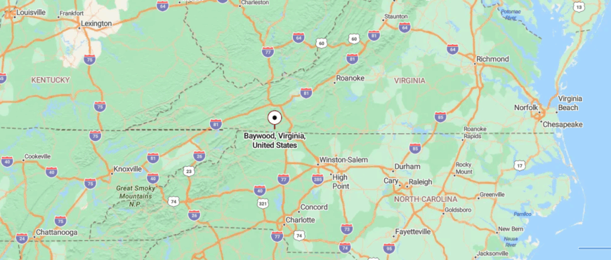
Baywood sits in eastern Grayson County, Virginia, just a short distance from the North Carolina line. It’s about 90 miles southwest of Roanoke, reached by U.S. 58 as it bends through farmland and wooded hills.
The drive narrows into quiet country roads where barns and fields stretch wide against the ridges. By the time you arrive, Baywood feels like a tucked-away corner of the highlands, simple and set apart in its stillness.
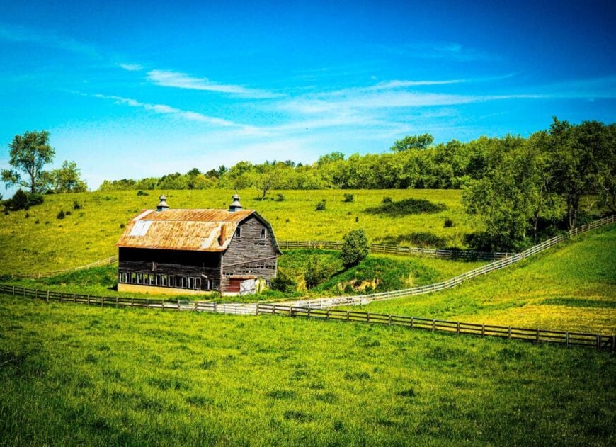
16. Pilot

Pilot, Virginia sits high in Montgomery County’s hills, where winding mountain roads keep it quietly apart from busier places. Its seclusion comes from the ridgelines and forests that surround it, giving the community a tucked-away, almost hidden feel.
Life here moves with the seasons—neighbors gather at churches, farms shape the landscape, and backroads lead to overlooks where the mountains roll endlessly. Visitors often pass through for scenic drives, birdwatching, or simply to take in the stillness that hangs over the valley.
Farming and forestry remain anchors of the local rhythm, keeping people closely tied to the land. Pilot leaves you with the sense of a mountain town defined less by size than by its closeness to the earth and sky.
Where is Pilot?
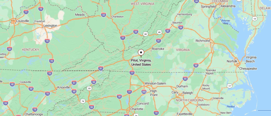
Pilot lies in Montgomery County, Virginia, tucked into the slopes of the Blue Ridge Plateau. It’s about 20 miles southwest of Blacksburg, reached by winding backroads that climb steadily away from the New River Valley.
The approach curves past forests, open ridges, and scattered farms where the air feels thinner with each mile. By the time you reach Pilot, the town feels perched on the edge of the mountains, quiet and far from the press of daily life.
15. Riner
Riner, Virginia stretches across the rolling countryside of Montgomery County, its open fields and winding roads giving it a quiet, set-apart feeling. Unlike many mountain towns, Riner is more spread out, with farms, churches, and small businesses scattered along Route 8 rather than clustered in one center.
Life here follows a rural rhythm—cattle grazing in pastures, children playing ball at the park, and families gathering at local diners after church on Sundays. Visitors find simple pleasures in scenic drives, farm stands, and views of the Blue Ridge that rise in the distance.
Agriculture remains the foundation, though many residents balance farming with work in nearby towns. Riner leaves you with the impression of a place rooted in land and tradition, where space and stillness feel abundant.
Where is Riner?

Riner sits in Montgomery County, Virginia, just a short stretch south of Christiansburg along Riner Road (VA-8). It’s about 35 miles southwest of Roanoke, reached by I-81 before tapering onto rolling two-lane roads.
The drive moves through farmland and gentle ridges, with the mountains rising softly in the distance. By the time you arrive, Riner feels like a countryside stopover, calm and steady beneath wide skies.
14. Rocky Gap

Rocky Gap, Virginia sits at the edge of Bland County, where the Appalachian Mountains press close and the town feels tucked into their folds. Its seclusion comes from the narrow roads and ridgelines that frame it, making the world beyond feel distant.
Life here is tied to the outdoors—neighbors hunt, fish, and hike the wooded trails that wind toward the Appalachian Trail and the nearby Jefferson National Forest. Visitors often pause at Wolf Creek or explore the winding backroads that reveal quiet farms and mountain views.
The community is small, but its rhythm is steady, shaped by the land and the traditions of those who’ve long called it home. Rocky Gap leaves you with the sense of a town held close by the mountains, where life feels rooted and enduring.
Where is Rocky Gap?
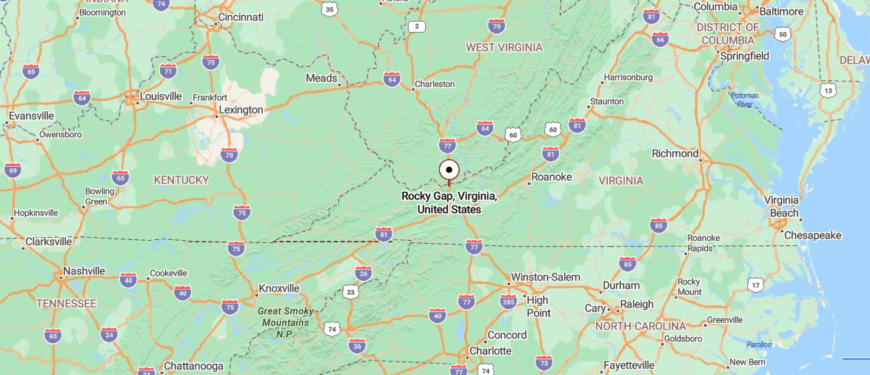
Rocky Gap sits in Bland County, Virginia, right along the West Virginia line in the Appalachian highlands. It’s about 90 miles west of Roanoke, most directly reached by I-77 as it climbs through tunnels and steep mountain grades.
The approach carries you between sharp ridges and forested slopes where the highway narrows to a winding pass. By the time you arrive, Rocky Gap feels like a mountain threshold, perched where the road itself seems carved from the hills.
13. Max Meadows

🔥 Would you like to save this?
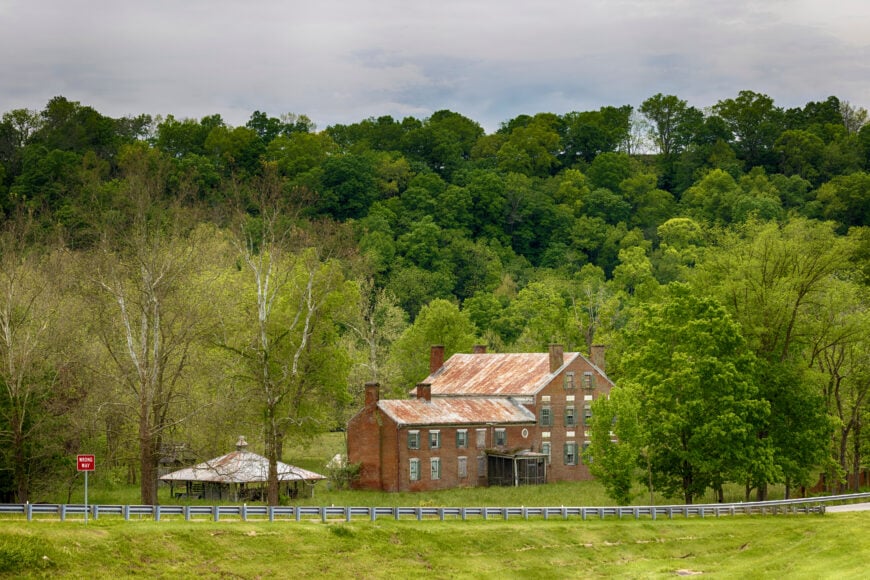
Max Meadows, Virginia sits along the New River in Wythe County, its quiet character shaped by farmland, forest, and the winding waterways that surround it. The town’s history is tied to the railroad and early industry, with traces of that past still visible in old buildings and local stories.
Today, the pace is unhurried—neighbors gather at churches, families spend afternoons fishing or kayaking, and country roads carry you past barns and rolling fields. Visitors often explore nearby Foster Falls or venture onto the New River Trail, where hiking and biking follow the river’s bends.
Farming and small trades remain the anchors of daily life, keeping tradition steady through the seasons. Max Meadows leaves you with the sense of a place where history, river, and land still flow together in harmony.
Where is Max Meadows?
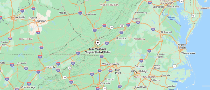
Max Meadows sits in Wythe County, Virginia, close to the confluence of the New River and Reed Creek. It’s about 70 miles southwest of Roanoke, reached by I-81 before giving way to smaller country roads that dip toward the valley.
The drive carries you past farmland, wooded ridges, and glimpses of the river winding alongside. By the time you arrive, Max Meadows feels like a hidden bend in the hills, quiet and gently removed from the rush of the interstate.
12. Crockett
Crockett, Virginia rests in Wythe County’s rolling hills, a small community that feels quietly tucked between farmland and forest. Its seclusion comes from winding country roads that weave past fields and ridgelines, keeping it far from the pace of larger towns.
The area’s history shows in old farmsteads, family cemeteries, and the stories of generations who built their lives close to the land. Visitors might enjoy scenic drives, seasonal foliage, or simply the stillness that seems to settle over the countryside.
Farming remains the steady backbone here, shaping both the landscape and the rhythm of daily work. Crockett leaves you with the impression of a place where life stays simple, rooted, and quietly enduring.
Where is Crockett?
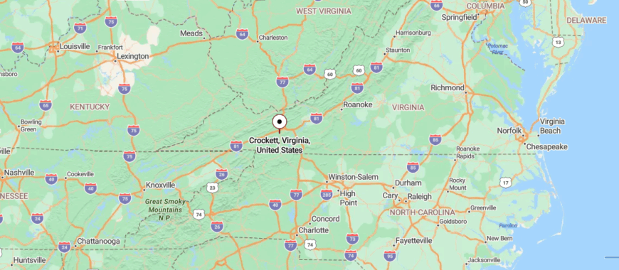
Crockett lies in Wythe County, Virginia, tucked into the ridges of the Blue Ridge foothills. It’s about 65 miles southwest of Roanoke, reached by I-81 before slipping onto narrow state roads that weave through farmland and forest.
The approach feels steadily quieter, with barns, fields, and mountain slopes guiding the way. By the time you arrive, Crockett carries the calm of a valley town, held close by the hills around it.
11. Speedwell
Speedwell, Virginia rests in a valley of Wythe County, surrounded by mountain ridges that make it feel sheltered and apart. Its quiet character is shaped by long country roads, scattered farms, and the steady rhythm of rural living.
History lingers in old homes and family cemeteries, reminders of the generations who carved a life from this land. Visitors can take in the mountain scenery, wander trails, or sit by streams that cut through the hills.
Farming and forestry continue to guide much of daily work, keeping the town closely tied to the seasons. Speedwell leaves you with the impression of a place where the landscape holds both memory and calm, unchanged by time.
Where is Speedwell?

Speedwell rests in Wythe County, Virginia, spread across rolling farmland at the base of the Blue Ridge Mountains. It’s about 80 miles southwest of Roanoke, reached by I-81 before turning onto winding country highways that climb into the valley.
The drive passes fields, streams, and stretches of forest that thin into wide mountain views. By the time you arrive, Speedwell feels like a tucked-away stretch of countryside, open yet quietly apart from the world.
10. Willis

Willis is a quaint community that truly embodies rural Virginia living. With a population of just over 1,000, it’s a place where everyone seems to know each other, and a friendly wave is never far away.
I love wandering through the rolling hills and open fields that define the landscape here. Outdoor enthusiasts can enjoy hiking, bird watching, and exploring the nearby Buffalo Mountain Natural Area Preserve.
Farming is at the heart of Willis, with many residents engaged in agriculture and livestock raising. The town’s seclusion comes from its location off the beaten path, away from major highways and urban centers, offering a peaceful retreat that’s hard to find elsewhere.
Where is Willis?

Nestled in Floyd County, Willis sits in the southwestern part of Virginia, surrounded by the majestic Blue Ridge Mountains. Its remote setting is accentuated by the winding country roads that lead you through picturesque scenery to reach it.
I find that the lack of commercial development and traffic makes it feel like a step back in time. To get to Willis, you can take U.S. Route 221 south from Floyd, then follow State Route 730 into the heart of this serene community.
9. Dugspur

Dugspur is another rural treasure with vast open spaces and quiet country roads that I find incredibly soothing. The community is small, with just a few hundred residents who appreciate the slow-paced lifestyle.
Here, you can enjoy activities like horseback riding, exploring local trails, and visiting the scenic Little Reed Island Creek. The area is primarily agricultural, with many family-owned farms dotting the landscape.
Dugspur’s seclusion is due to its sparse population and distance from bustling towns, making it an ideal spot for those seeking solitude amidst nature.
Where is Dugspur?

🔥 Would you like to save this?
Located in Carroll County, Dugspur lies in the heart of Southwest Virginia’s countryside. It’s tucked away along U.S. Route 221, surrounded by rolling hills and farmland as far as the eye can see.
The town’s remote nature is enhanced by the limited cell service and few commercial establishments. When I first visited, I felt like I had discovered a hidden corner of the world. To reach Dugspur, you’ll travel along scenic byways, enjoying the journey as much as the destination itself.
8. Troutdale

Troutdale is a small town that captures the essence of mountain living. With a population hovering around 200, it’s nestled in the heart of the mountains, providing abundant opportunities for outdoor recreation.
I’ve spent days hiking the trails of the nearby Mount Rogers National Recreation Area and fishing in the pristine streams. The main industries here revolve around tourism and outdoor activities, catering to adventurers and nature lovers.
Troutdale’s secluded charm comes from its elevation and the surrounding wilderness, offering a peaceful escape from the modern world.
Where is Troutdale?

Situated in Grayson County, Troutdale is accessible via winding mountain roads that offer stunning panoramic views. Its location near the highest peaks in Virginia adds to the town’s remote feel.
I find that the limited traffic and absence of urban noise make it a perfect getaway. To get there, you’ll navigate along State Route 16, embracing the serene journey through forests and valleys.
7. Woolwine

Woolwine is a peaceful hamlet known for its lush forests and historic covered bridges. With a small population, it offers a tight-knit community atmosphere that I find incredibly welcoming.
Outdoor activities abound, including hiking, kayaking on the Smith River, and picnicking near the Jack’s Creek and Bob White covered bridges. Forestry and small-scale farming are common industries here.
Woolwine’s seclusion is amplified by its wooded surroundings and minimal commercialization, making it a serene retreat.
Where is Woolwine?

Located in Patrick County, Woolwine sits amidst the foothills of the Blue Ridge Mountains. Its remote setting is accentuated by the dense forests that envelop the area.
I appreciate the quiet roads and the sense of being enveloped by nature. To visit Woolwine, you can take State Route 8, winding through scenic landscapes that emphasize the town’s hidden nature.
6. Meadows of Dan

Meadows of Dan is a picturesque village characterized by its open meadows and warm community spirit. With around 1,300 residents, it offers charming local shops, orchards, and access to the Blue Ridge Parkway.
I’ve enjoyed visiting Mabry Mill, one of the most photographed sites on the parkway, and exploring local artisan studios. The economy here thrives on agriculture, tourism, and crafts. Its seclusion stems from its mountain location and the tranquil environment that surrounds it.
Where is Meadows of Dan?

Perched in Patrick County, Meadows of Dan is conveniently located right off the Blue Ridge Parkway at milepost 178. Despite this, the town maintains a peaceful atmosphere due to the vast surrounding landscapes.
I find the drive along the parkway to be one of the most scenic routes to get there. Access is straightforward via U.S. Route 58, which connects you to this delightful mountain community.
5. Cana

Cana is a small town that captivates with its sprawling farmland and proximity to the Blue Ridge Parkway. Home to just over 1,200 people, it offers a peaceful rural setting that I find rejuvenating.
Activities include visiting local wineries, picking fresh fruits at nearby orchards, and enjoying scenic drives. Agriculture is the lifeblood of Cana, with many farms producing apples, peaches, and grapes. Its secluded nature is due to its location away from urban centers and its expansive rural landscapes.
Where is Cana?

Situated in Carroll County, Cana rests near the Virginia-North Carolina border. The town’s remote feel is heightened by the lack of major highways and the surrounding rolling hills.
I enjoy the leisurely pace of life here, far removed from city stresses. To reach Cana, you can take U.S. Route 52 or Interstate 77, and then meander along country roads that showcase the area’s natural beauty.
4. Copper Hill

Copper Hill is a serene enclave set amidst rolling hills and offering expansive countryside vistas. With a population of around 1,300, it’s a place where I can truly unwind and soak in the peaceful environment.
The town provides opportunities for hiking, visiting local farms, and exploring the nearby Appalachian Trail. The primary industries include agriculture and small-scale manufacturing. Copper Hill’s seclusion is attributed to its off-the-beaten-path location and the natural barriers created by the surrounding terrain.
Where is Copper Hill?

Located in Floyd County, Copper Hill is accessible via the Blue Ridge Parkway and U.S. Route 221. The town’s setting on the eastern slopes of the Blue Ridge Mountains adds to its remote appeal.
I often find the drive there to be calming, with panoramic views accompanying me along the way. To get to Copper Hill, you navigate through scenic mountain roads that emphasize the area’s untouched beauty.
3. Mouth of Wilson

Mouth of Wilson is a tranquil community nestled near the banks of the New River. With a small population, it’s a perfect spot for those seeking peace and quiet. I enjoy the abundance of outdoor activities, such as fishing, canoeing, and hiking in nearby Grayson Highlands State Park.
The local economy revolves around agriculture and outdoor tourism. Its seclusion comes from its location at the convergence of several rural routes and the natural seclusion provided by the surrounding mountains.
Where is Mouth of Wilson?

Positioned in Grayson County, Mouth of Wilson is located near the North Carolina border. The area’s rugged terrain and winding roads contribute to its remote feel. I appreciate how the New River adds to the sense of tranquility here.
Accessing the town involves traveling along State Route 16, which offers stunning views and a peaceful drive.
2. Konnarock

Konnarock is a small community surrounded by the lush landscapes of the Mount Rogers National Recreation Area. With a population of just a few hundred, it’s an ideal spot for reconnecting with nature.
I’ve hiked the Appalachian Trail segments that pass nearby and visited the historic Konnarock Lutheran Mission. The main industries include forestry and outdoor recreation services. Konnarock’s seclusion derives from its mountainous surroundings and limited development, offering a rustic charm that’s hard to resist.
Where is Konnarock?

Located in Washington County, Konnarock sits at a higher elevation, deep within the Appalachian Mountains. The town’s isolation is intensified by the dense forests and the protected lands that envelop it.
I find the journey there to be an adventure in itself, with winding roads leading through breathtaking natural scenery. To reach Konnarock, you can travel along U.S. Route 58, embracing the quiet and beauty of the region.
1. Whitetop

Whitetop is perhaps one of the most secluded communities I’ve had the pleasure of visiting. Nestled among the mountains, it offers panoramic views and untouched natural beauty that’s truly awe-inspiring.
With a very small population, it’s an escape from the crowds. I love hiking to the summit of Whitetop Mountain, the second-highest peak in Virginia, and exploring the Virginia Creeper Trail.
The area’s primary activities revolve around outdoor recreation and small farming. Whitetop’s seclusion is due to its high elevation, rugged terrain, and the limited access roads leading into town.
Where is Whitetop?

Situated in Grayson County near the North Carolina and Tennessee borders, Whitetop is perched high in the Blue Ridge Mountains. The town’s remote location is emphasized by its distance from major highways and the wilderness that surrounds it.
I always feel a sense of serenity arriving here, far above the hustle of everyday life. Access is mainly via U.S. Route 58, followed by smaller mountain roads that deliver you to this peaceful haven.


