🔥 Would you like to save this?
Southwest Nevada is often summed up by neon lights and busy highways, yet a short drive beyond the city limits uncovers tiny settlements where starlight outshines streetlamps and silence rules the evenings.
Our team gathered the 25 quietest communities tucked between Joshua-tree flats, alpine forests, and forgotten mining camps to show why a slower pace still thrives in the Silver State.
In order to come up with the very specific design ideas, we create most designs with the assistance of state-of-the-art AI interior design software. Also, assume links that take you off the site are affiliate links such as links to Amazon. this means we may earn a commission if you buy something.
Each place keeps its own rhythm—some revolve around small-scale farming, others around century-old saloons or evaporating lithium ponds—but they all share generous elbow room and miles of open road.
Visitors will find hiking among crimson cliffs, soaking in back-country hot springs, or sipping a root beer where prospectors once traded gold dust. Locals, meanwhile, enjoy front-porch sunsets with only mule deer or wandering burros for company.
Think of the following list as a roadmap to Nevada’s hush-hush corners where one can breathe deeper and see farther.
25. Sandy Valley: Remote Ranchlands with Room to Roam
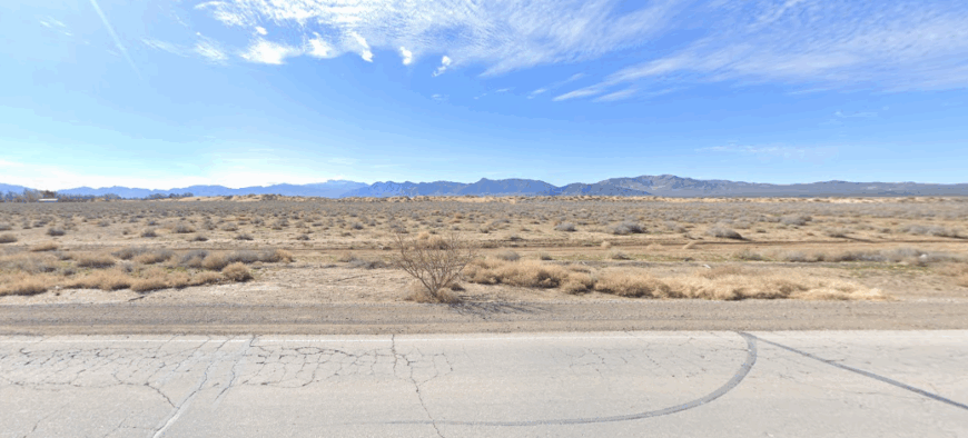
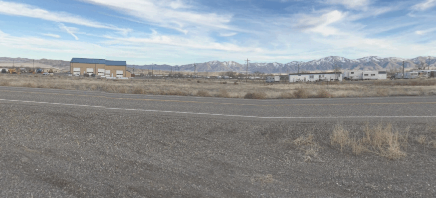
Sandy Valley lies quietly beyond the Nevada desert’s reach, nestled in a wide basin surrounded by rugged mountains that mute the noise of the world. Far from highways and framed by open land, it feels like a place preserved in stillness, where the sky stretches endlessly and cell signals drift with the wind.
The town hums with a frontier spirit—dusty roads, grazing horses, and neighbors who know each other by name. Days are spent riding trails, stargazing under untouched skies, or gathering at the community center for a dance, a story, or a shared meal.
With roots in ranching and a growing off-grid lifestyle, Sandy Valley thrives on self-reliance and room to breathe. Life moves with the rhythm of the land—unhurried and sun-soaked. It’s the kind of place that makes you feel small in the best possible way.
Where is Sandy Valley?
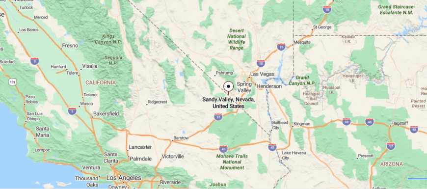
Sandy Valley stretches across the high desert near the California–Nevada border, where dusty roads, distant mountain ridges, and open skies define the landscape. About 45 miles southwest of Las Vegas, it’s reached by a long drive through the Mojave, far from neon and noise.
This unincorporated community lives quietly, with a spirit of self-reliance—solar power, wide lots, horses, and homemade everything. There’s no rush here, only sun, wind, and stars, with neighbors spread far but ties running deep. It’s a place where the horizon feels like home and the desert holds space for those who choose the wide and the wild.
24. Jean: Desert Junction with a Whisper of the Strip
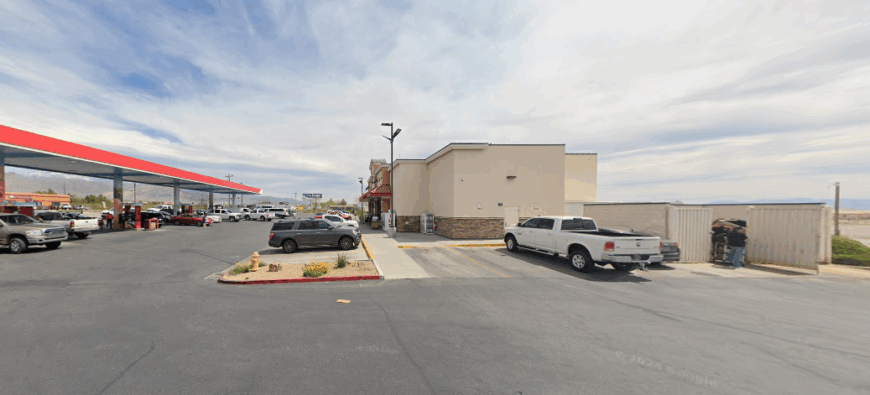
Jean might be just 30 miles from Las Vegas, but standing in its dusty lots, you could swear the Strip is another planet. Flanked by low desert hills and framed by miles of pale Mojave, it’s a place where neon fades into sun-glare and the soundtrack is mostly wind and the crunch of gravel under boots.
A few low-slung buildings gather around the highway exit — a truck stop, a shuttered casino, and the Nevada State Prison museum, where the air carries both history and dust. The population is almost entirely transient: truckers pausing for fuel, hikers stocking up before heading into the Sloan Canyon National Conservation Area, and a handful of locals who measure the day by the position of the sun rather than the clock.
Evenings here turn the mountains rose-gold, and the absence of suburban sprawl gives the sky a kind of unbroken reach. Jean doesn’t try to be picturesque — it’s simply the last wide spot before the road empties into bigger desert.
Where is Jean?
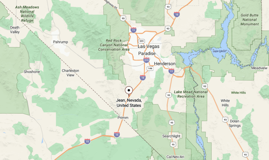
Jean sits in southern Clark County along Interstate 15, about 12 miles north of the California border. It’s the only exit between Las Vegas and Primm, and its flat basin location lets you see for miles in every direction.
The town anchors the junction of I-15 and State Route 161, the latter snaking west toward Goodsprings and the Spring Mountains. Surrounding land is mostly BLM-managed desert, dotted with dry washes and creosote flats, making Jean a convenient but still quiet waypoint for anyone heading deeper into Nevada’s backcountry.
23. Trout Canyon: Fire-Scorched Slopes and a Hand-Built Water Line
Trout Canyon clings to the edge of the Spring Mountains, hidden deep within canyons where dirt roads wind through juniper and pine. Far from highways and cell towers, it feels like a forgotten camp—untouched, remote, and quiet.
The air is dry, scented with dust and woodsmoke, and the only sounds are wind in the trees and boots on gravel. Locals live off-grid, drawing water from wells and power from the sun, carving out a slow life in the shadow of wild ridgelines. Days are filled with hikes, stargazing, or tending the land as mule deer pass through.
There’s no main street—just a few cabins and the mountains holding everything close. Trout Canyon doesn’t welcome crowds; it welcomes peace. It’s the kind of place that reminds you how far quiet can go.
Where is Trout Canyon?
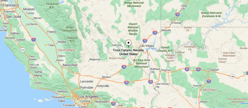
Trout Canyon lies in the Spring Mountains of southern Nevada, hidden in a narrow, forested valley west of Las Vegas. Reached only by rough dirt roads branching off State Route 160 near Mountain Springs, it’s the kind of place that disappears from view almost as quickly as it appears on the map.
With no paved roads, no city infrastructure, and a handful of scattered homes powered by solar panels and wells, Trout Canyon is pure off-grid living. The canyon runs along a seasonal creek beneath the shadow of Mount Charleston, where pines meet desert sky and the stars come unfiltered at night.
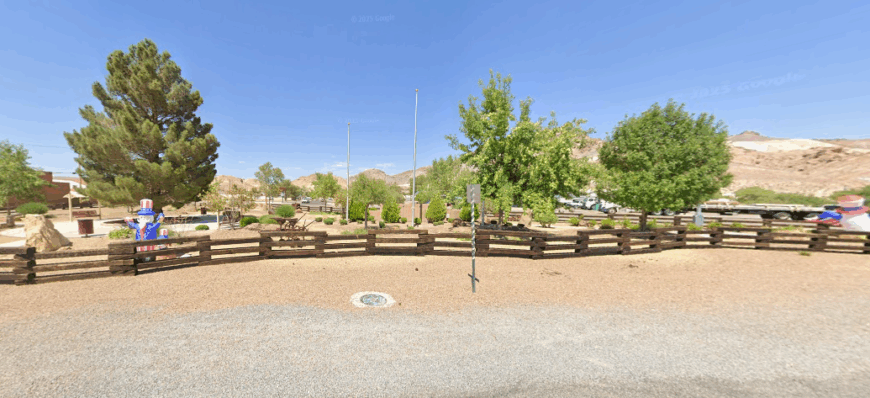
22. Pahrump’s North Fringe: Solar Cabins and Private Valleys
Pahrump stretches wide across the desert floor, cupped between mountain ranges and far enough from Las Vegas to feel like its own world. Surrounded by open skies and dusty winds, it moves at a slower rhythm, where days begin with blazing sunrises and end under starlit silence.
The air smells of creosote and warm sand, and the hum of life comes from roadside diners, feed stores, and neighbors chatting at the local market. Visitors find hot springs, off-road trails, and the occasional festival that lights up the calm. Once rooted in ranching and mining, Pahrump now blends retirees, artists, and off-gridders drawn to wide-open space and freedom.
It’s a town that lives without pretense—bare bones, sun-soaked, and quietly proud. Pahrump doesn’t try to be anything else. It’s the kind of place that lets you be exactly who you are, without asking why.
Where is Pahrump?
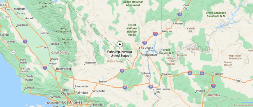
Pahrump sits in a wide desert valley just east of the California border, surrounded by rugged mountains and vast stretches of open Mojave land. About 60 miles west of Las Vegas, it’s reached by Nevada State Route 160—a long, sun-beaten road that cuts through cactus flats and distant ridgelines.
Originally a dusty ranching outpost, Pahrump has grown into a mix of off-grid independence and modern sprawl—where casinos, mobile homes, and solar farms sit side by side. The vibe is half frontier, half outpost suburb, with clear skies, sharp heat, and plenty of space to disappear.
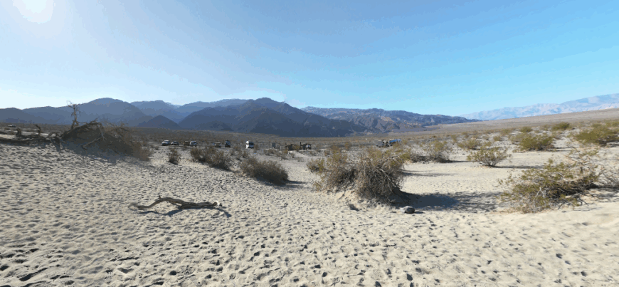
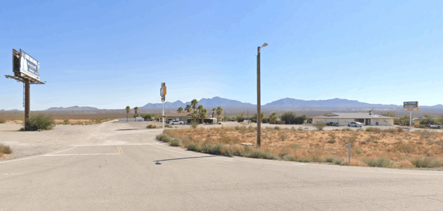
21. Beatty: Dry Canyons and Petroglyph Hideaways
Beatty sits along the edge of the Amargosa River, where the Mojave Desert begins to soften into rugged hills and forgotten rail lines. Surrounded by wide valleys and ghost towns, it feels like a last stop between memory and wilderness—quiet, sun-bleached, and stubbornly alive.
The scent of dust and sagebrush fills the air, and the silence is broken only by the rumble of trucks or the cry of a hawk overhead. Visitors come for nearby Death Valley, to wander through Rhyolite’s crumbling ruins, or to stargaze where light pollution fades to nothing.
Once a mining boomtown, Beatty now lives on tourism, local diners, and desert grit. It’s not flashy, but it’s steady—held together by stories, sunsets, and a deep sense of place. Beatty doesn’t try to impress; it endures. It’s the kind of place that makes the horizon feel like home.
Where is Beatty?
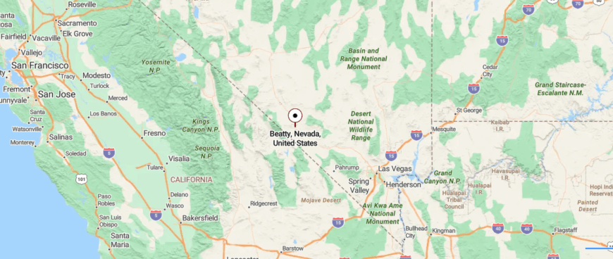
Beatty sits in the open expanse of southwestern Nevada, where U.S. Route 95 crosses bare desert flats just east of Death Valley’s edge. About 120 miles northwest of Las Vegas, it’s a high-desert outpost where the land stretches wide, the wind moves freely, and the past still echoes in scattered ruins and rusted tracks.
Once a booming gold rush town, Beatty now holds a quieter rhythm—motel lights flickering at dusk, burros wandering the streets, and travelers pausing between destinations. Surrounded by ghost towns, jagged peaks, and sun-bleached silence, it offers a rare mix of remoteness and welcome.
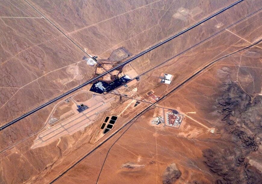
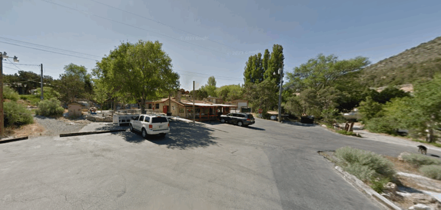
20. Cal-Nev-Ari: An Airstrip Hamlet in the Wide Mojave
Cal-Nev-Ari sits at a lonely bend on U.S. Route 95, where the desert stretches flat and the sky seems impossibly wide. Founded as a pilot’s dream town, it remains small—just a runway, a café, a casino, and a scattering of homes framed by creosote and sun-bleached signs.
The air buzzes with heat and quiet, and you can stand in the middle of town and hear nothing but wind. Locals gather at the airstrip or over coffee, sharing stories under the endless Nevada sky. Life here revolves around aviation, solitude, and the kind of independence only the desert allows.
There’s no rush, no pretense—just sun, sand, and sky for miles. Cal-Nev-Ari doesn’t need to grow to matter. It’s the kind of place that reminds you how much space a person really needs.
Where is Cal-Nev-Ari?
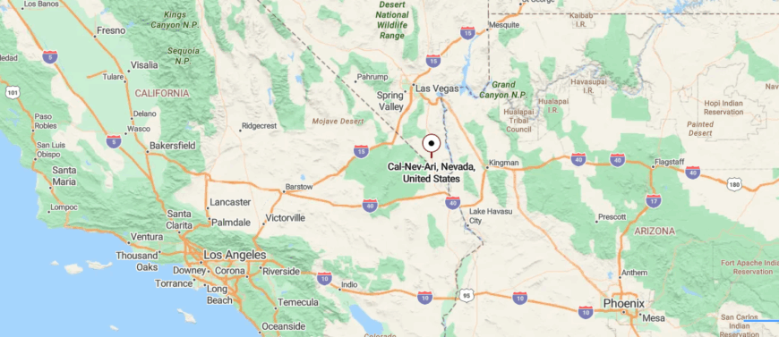
Cal-Nev-Ari sits in the far southern tip of Nevada, where a single stretch of U.S. Route 95 cuts through desert emptiness just north of the California-Arizona border junction. Roughly 70 miles south of Las Vegas, it was founded in the 1960s as an airstrip community—its name a blend of California, Nevada, and Arizona.
Built with pilots in mind, the town has a dirt airstrip at its core, a small casino, post office, and just a handful of homes scattered beneath endless sky. It’s a place of independence, minimalism, and wide-open space—where life moves with the sun and the desert doesn’t ask much, but expects self-reliance.
19. Mountain Springs: A Single-Ridge Outpost with Big Sky Views
🔥 Would you like to save this?
Mountain Springs rests high in the Spring Mountains, tucked between Red Rock Canyon and Pahrump, where cooler air and quiet set it apart from the desert below. With just a few homes, no gas stations, and one winding road in or out, it feels more like a clearing than a town.
Juniper and pine scent the breeze, and the only sounds are birdsong, wind, and the occasional motorcycle on the highway. Locals hike hidden trails, ride horses through rocky passes, or sit under skies that shift from golden dawns to starlit nights.
There’s no commerce here—just nature, stillness, and a few who choose solitude over speed. Life moves slowly, in step with the land. Mountain Springs doesn’t ask for attention—it offers retreat. It’s the kind of place that lets you disappear in the best possible way.
Where is Mountain Springs?
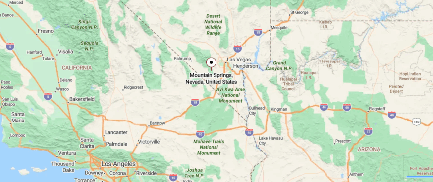
Mountain Springs lies high in the Spring Mountains of southern Nevada, tucked into a saddle along State Route 160 between Las Vegas and Pahrump. At nearly 5,500 feet above sea level, it’s more a scattering of homes and ranches than a formal town—surrounded by juniper, scrub pine, and endless ridgelines.
A stop for few but a pass-through for many, Mountain Springs marks a transition point—from Mojave desert floor to alpine slope, from city speed to open sky. With no gas stations or shops, only a historic marker and a handful of off-grid properties, it’s a place where the road narrows, the air cools, and silence settles deep.
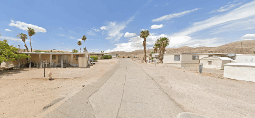
18. Mercury Vicinity: Government Fences and Forgotten Roads
Mercury lies behind locked gates in the heart of the Nevada Test Site, a desert town frozen in secrecy and time. Hidden from public roads and surrounded by miles of restricted land, it’s as off-limits as it is off-grid—accessible only to those with clearance and purpose.
The air is dry and silent, carrying echoes of a past marked by nuclear tests and Cold War urgency. There are remnants of mid-century life: empty dorms, weathered signs, and a cafeteria that once buzzed with scientists and security personnel.
No tourists, no residents—just guarded history and the lingering weight of what once happened here. Mercury exists not to be visited, but remembered. It’s the kind of place that reminds you some silence is intentional.
Where is Mercury?
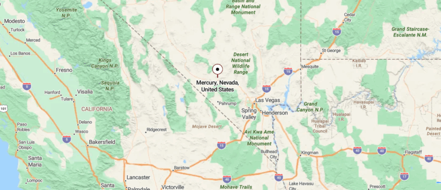
Mercury sits deep within the Nevada Test Site, shielded by mountains and desert, about 65 miles northwest of Las Vegas. It’s reached by restricted roads off U.S. Route 95—closed to the public—where security gates, dry valleys, and remnants of atomic history define the landscape.
Founded in the 1950s as a government base for nuclear testing, Mercury was once a bustling support town for scientists, military staff, and contractors—complete with housing, schools, and theaters. Today, it remains off-limits, controlled by the Department of Energy, its function reduced but its secrecy intact.
17. Cottonwood Cove: Lake Mojave’s Stillwater Refuge
Cottonwood Cove rests quietly on the banks of Lake Mohave, where desert hills slope into blue water and the world feels far away. Tucked inside the Lake Mead National Recreation Area, it’s reached by long, winding roads that blend into the landscape.
The air smells of sun-warmed stone and dry brush, with the soft slap of water against the docks breaking the stillness. Days are spent boating, hiking canyon trails, or watching the sky shift from sun to starlit calm.
There’s no town center—just a marina, a few cabins, and the rhythm of nature setting the pace. Life here revolves around the water and the quiet. Cottonwood Cove doesn’t need much—it gives you space. It’s the kind of place where everything slows down, even your thoughts.
Where is Cottonwood Cove?
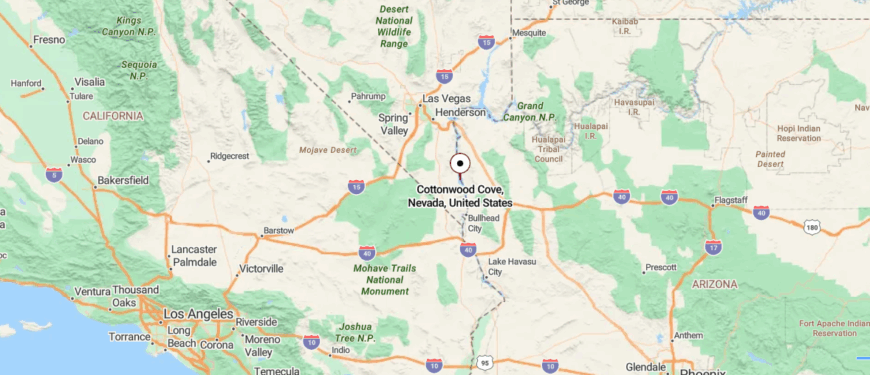
Cottonwood Cove lies along the northern shore of Lake Mohave in southern Nevada, nestled within the Lake Mead National Recreation Area. About 14 miles east of Searchlight and 90 minutes south of Las Vegas, it’s reached by Cottonwood Cove Road—a quiet stretch that descends through open desert and rugged hills.
Set against a backdrop of golden rock and blue water, Cottonwood Cove is a peaceful marina outpost—offering boat launches, cabins, and a handful of shaded palms where desert meets lake. It’s not a town, but a retreat—built for silence, sun, and slow mornings on the water.
16. Ash Meadows: Hidden Water in a Dry Basin

Ash Meadows lies at the edge of the Amargosa Desert, where crystal-clear springs rise from the earth and shimmer through an otherwise arid world. Tucked within a national wildlife refuge, it’s surrounded by desert silence, far from towns and highways, wrapped in rare wetlands and ancient rhythms.
The air smells of salt and sage, and the stillness is broken only by birdsong or the trickle of water through marsh grass. Visitors walk boardwalks over turquoise pools, glimpse endangered pupfish, or watch sunset light the valley in gold.
There’s no development—just protected land and the hum of life most never see. Ash Meadows isn’t shaped by people—it preserves what the desert nearly forgot. It’s the kind of place that makes you whisper, as if not to disturb its quiet miracle.
Where is Ash Meadows?
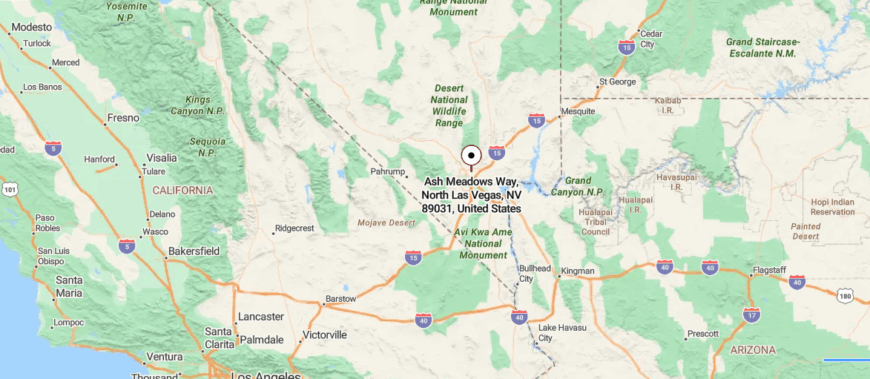
Ash Meadows rests at the edge of the Amargosa Desert in southern Nevada, where crystal springs emerge from alkaline soil and rare life clings to ancient wetlands. About 90 miles northwest of Las Vegas and just east of Death Valley, it’s reached by remote backroads off State Route 373—far from anything, but rich in stillness.
Protected as a National Wildlife Refuge, Ash Meadows is home to one of the highest concentrations of endemic species in North America, including the elusive Devil’s Hole pupfish. The landscape is surreal—white salt flats, turquoise pools, and desert blooms fed by an underground aquifer.
15. Crescent: Barnwood Homes in Sage-Covered Hills
Crescent sits deep in Nye County, where dirt roads cut across open range and the horizon stretches without end. Isolated by miles of high desert and shielded by the Pancake Mountains, it feels more like a memory than a town—quiet, sun-bleached, and nearly forgotten.
The air carries the scent of sage and dry dust, and silence lingers long after footsteps fade. There’s little here now but scattered remnants: a few cabins, weathered signs, and the trace of old mining roads leading nowhere fast.
Visitors might pass through chasing solitude or the ghost of something lost to time. There’s no industry, no noise—just land and sky and the space between. Crescent doesn’t stand out—it disappears.
Where is Crescent?
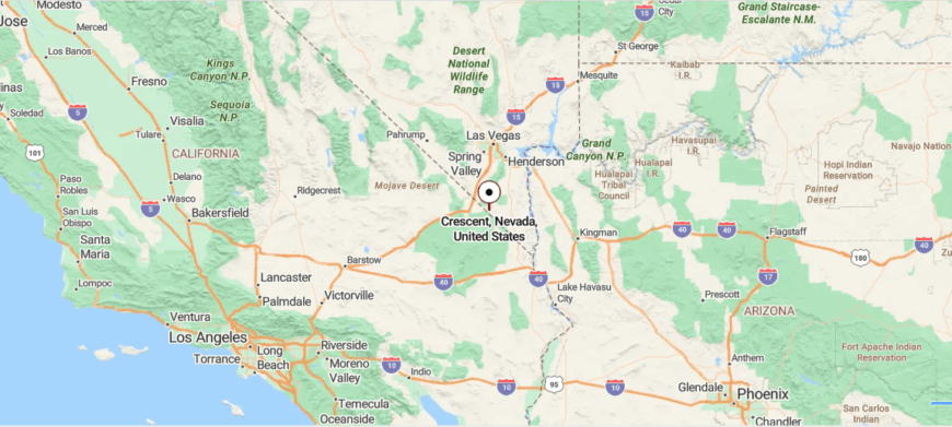
Crescent, Nevada, sits quietly in Nye County, long faded into near-obscurity amid the open desert between Tonopah and Ely. Located off U.S. Route 6, it’s reached by rugged roads that pass sagebrush, distant peaks, and a silence that deepens with every mile.
Once a mining camp born of silver and short-lived hope, Crescent has dwindled to scattered ruins—rusted remnants, collapsed wood, and the faint memory of a town that rose and fell with the ore. The wind moves freely now, unbroken by walls or voices.
14. Currant: Pinon Pines and Whispered Histories
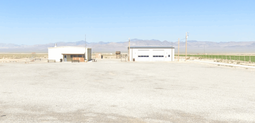
Currant rests quietly along U.S. Route 6, cradled by sagebrush plains and the distant shadows of the White Pine Range. Surrounded by vast, open land and miles from the nearest town, it feels like a place the world passed by and never disturbed.
The air is dry and still, carrying the scent of dust and stone, with the breeze whispering through forgotten homesteads. Once a stop for miners and ranchers, it now holds only a few signs of life—an old post office, scattered buildings, and endless sky.
Travelers pause for the silence, the stars, or to feel small beneath Nevada’s vastness. There’s no rush, no rhythm but the land’s own. Currant doesn’t call attention—it endures. It’s the kind of place that feels like the middle of nowhere, in the most honest way.
Where is Currant?
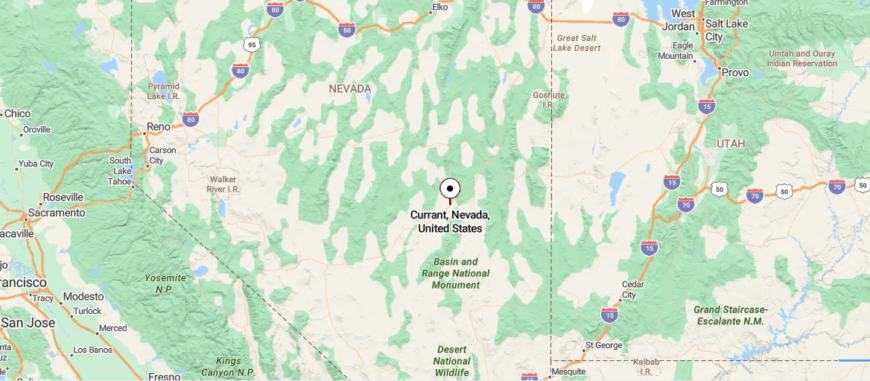
Currant sits in central Nevada’s White Pine County, where U.S. Route 6 crosses wide valleys framed by the towering White Pine and Grant Ranges. About 60 miles southwest of Ely, it’s little more than a quiet bend in the road—marked by a few ranch houses, old mining scars, and the long reach of desert silence.
Once a small settlement tied to nearby silver and fluorspar mines, Currant now endures as a rural waypoint, where cattle roam and traffic is rare. The landscape is vast and unyielding—high plains, distant peaks, and skies that seem to hold their breath.
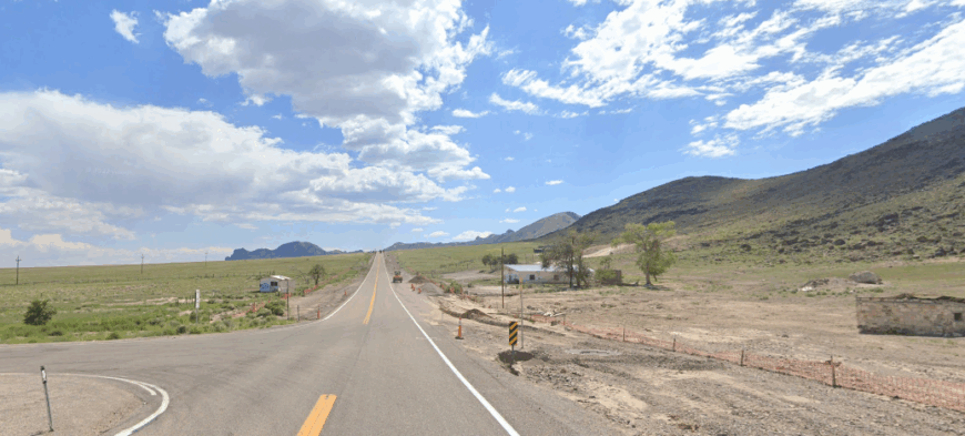
13. Warm Springs: An Abandoned Junction with a Hot Past
🔥 Would you like to save this?
Warm Springs lies at the lonely junction of Highways 6 and 375, where empty desert stretches in every direction and the silence runs deep. Surrounded by mountains and hot springs that once drew travelers, it now stands mostly abandoned—just a crumbling café, a few weathered buildings, and the ghost of a swimming pool fed by geothermal flow.
The air smells of minerals and dust, with only the hum of wind and the creak of old signs to break the stillness. Once a stop for ranchers and miners, Warm Springs now draws the curious—those chasing hot water, solitude, or the edge of the Extraterrestrial Highway.
There’s no town left in the usual sense, only a mood, a story, a pause in the road. No one stays long, but everyone remembers.
Where is Warm Springs?
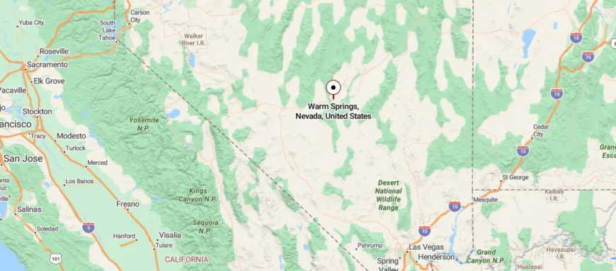
Warm Springs sits at the lonely crossroads of U.S. Route 6 and State Route 375 in central Nevada—where vast desert valleys meet mountain shadows and the wind carries more memory than sound. About 40 miles west of Ely, it’s surrounded by nothing but open land, distant ridges, and skies that never hurry.
Once home to a small settlement and a hot springs resort, little remains now beyond a few abandoned buildings and the still-steaming pools that gave the place its name. It’s a place where two roads meet and then keep going, where the silence is complete, and the horizon has no walls.
12. Ione: Pioneer Echoes in an Empty Gulch
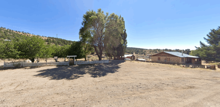
Ione sits tucked in the shadow of the Shoshone Mountains, where dirt roads wind through high desert and time seems to have quietly stepped aside. Once a silver boomtown, now barely a whisper, it’s surrounded by sagebrush, weathered timber, and the long sigh of wind through empty streets.
The scent of dust and old pine lingers in the air, and the silence is so complete it feels almost sacred. A few cabins remain, scattered like memories, along with the skeleton of a once-busy schoolhouse and the faint outlines of past dreams.
Visitors come for the solitude, the ruins, and the stories etched into stone and wood. There’s no commerce, no crowd—just the stillness of a place that never asked to be remembered, yet is.
Where is Ione?
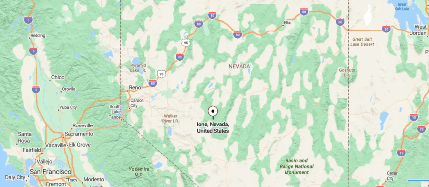
Ione sits deep in central Nevada’s Nye County, hidden in the Shoshone Mountains where dirt roads wind through sagebrush and the past lingers in sun-bleached wood. About 60 miles southeast of Austin, it’s reached by a long gravel drive off State Route 844—far from pavement, cell towers, and modern noise.
Founded in the 1860s during a silver boom, Ione once thrived as a county seat before fading into near-abandonment. Today, a few scattered buildings remain—weathered cabins, old mining ruins, and signs of quiet restoration by those drawn to the stillness.
11. Manhattan: Windblown Churches and Forgotten Gold
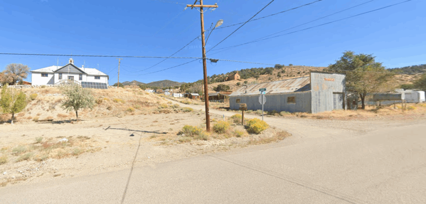
Manhattan lies tucked in the Toquima Range, surrounded by rugged hills and high desert that keep it far from everything but memory. Once alive with the rush of silver and gold, it now stands quiet—a scattering of cabins, mining ruins, and dust-covered dreams held close by the wind.
The scent of sage and rust lingers, and the silence is broken only by the creak of wood or the cry of a hawk overhead. Locals and wanderers come for the solitude, the history etched in rock and timber, and the starlit nights that stretch endlessly above.
A few still mine, a few just stay—drawn by the freedom distance brings. There’s no rush in Manhattan, only stories that settle like dust. It’s the kind of place that doesn’t fade—it simply waits.
Where is Manhattan?
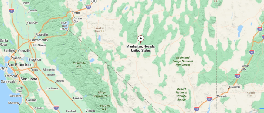
Manhattan sits tucked in the Toquima Range of central Nevada, where steep hills cradle old buildings and dirt roads trace a town born from gold and grit. About 50 miles north of Tonopah, it’s reached by a long drive off U.S. Route 376, climbing into high country where silence is thick and the past feels close.
Founded in the early 1900s during a gold rush, Manhattan once boomed with saloons and stamp mills before fading into near-stillness. A few residents remain—alongside cabins, mining ruins, and the wind-swept bones of history. It’s a place where Nevada’s frontier spirit lingers, untouched by time, and where the mountains keep their stories quiet.
10. Goodsprings: A Historic Mining Hamlet Under Vast Desert Skies
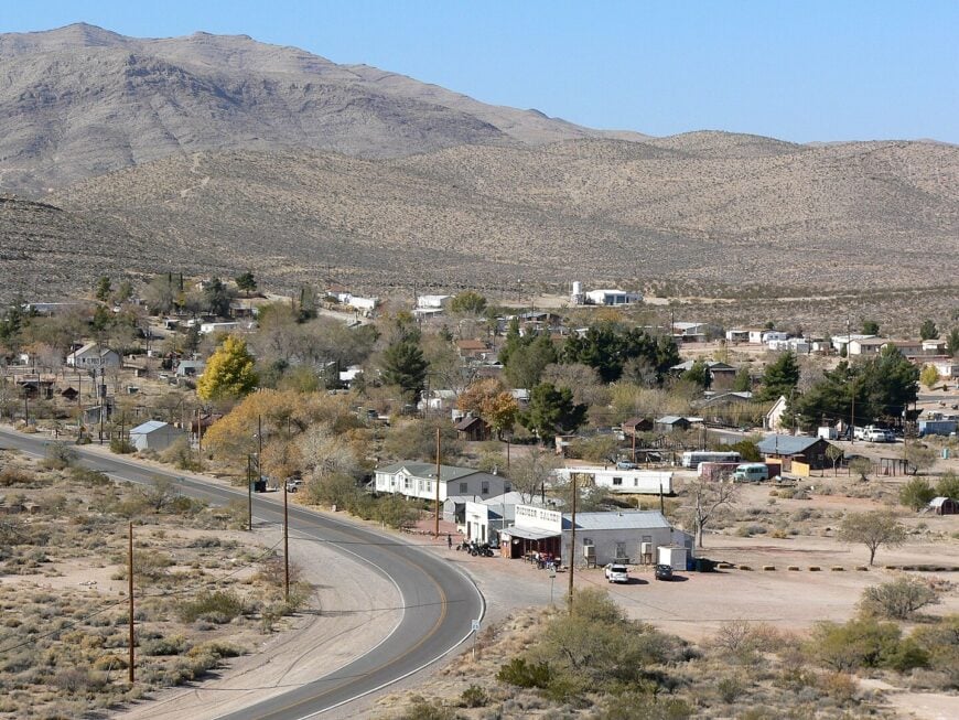
Roughly 200 residents call Goodsprings home, giving the place a neighborly feel that fits on a single dusty main street. Day-trippers stop for burgers at the 110-year-old Pioneer Saloon, then wander past rusted ore carts and stone smelter ruins that still hint at the town’s lead-zinc boom.
Red limestone hills invite trail runs and off-road rides, while nearby Jean Dry Lake hosts occasional land-sailing meets for those in the know. Today’s livelihood centers on heritage tourism, a scattering of ranch work, and weekend music gigs on the saloon’s creaky patio.
Evenings settle fast once the last motorcycle heads back toward Las Vegas, and porch lights sit islands apart on acre-plus lots ringed by silent Joshua trees. The absence of chain stores, curbside sidewalks, and urban glare makes Goodsprings feel several decades and a whole galaxy away from the Strip.
Where is Goodsprings?
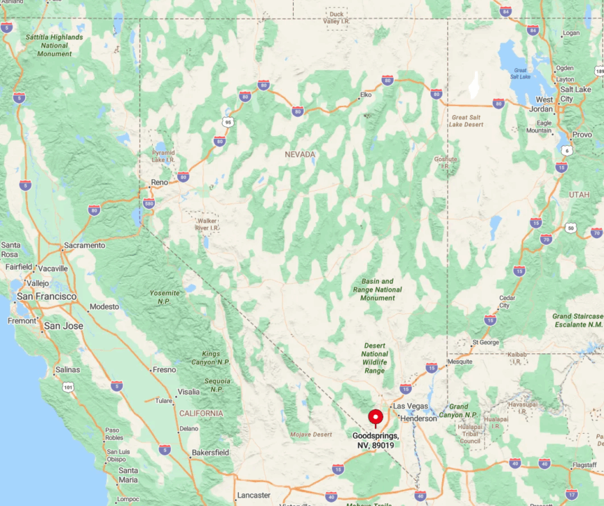
The hamlet lies 10 miles southwest of the final Vegas subdivision, just off State Route 161 at the base of the Spring Mountains. Low ridges block city noise and toss cell signals into dead zones, increasing the sense of retreat.
Drivers exit I-15 at Jean, fuel up at the lone truck stop, and follow a two-lane ribbon that ends at the saloon’s weather-beaten porch. Beyond that point, gravel tracks melt into the desert, and the next services sit nearly 40 miles off in Sloan or Primm.
9. Blue Diamond: Desert Wildflowers and Front-Porch Living
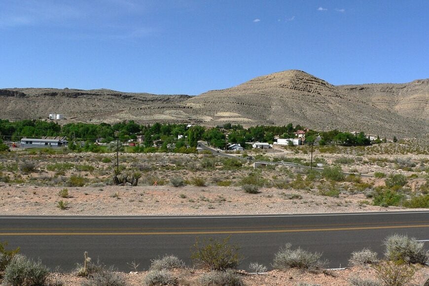
Fewer than 300 people share Blue Diamond’s shady cottonwood lanes, where pedal bikes outnumber cars and mule deer nibble landscaped sagebrush. Red Rock Canyon’s sandstone walls stand close enough for lunchtime hikes, and locals treasure the hidden Fossil Ridge Trail that starts behind the elementary school.
The century-old general store doubles as post office, coffee counter, and bulletin board, acting as the social glue for craft sales and potluck nights. While many residents telecommute or work in nearby gypsum operations, community life spins around volunteer gardening crews and morning yoga on the town green.
Compact homesteads sit on large lots, yet the nearest chain grocery sits over 12 miles away, reinforcing the self-reliant vibe. Twilight brings deep quiet broken only by canyon wind, reminding everyone why city dwellers envy this pocket of calm.
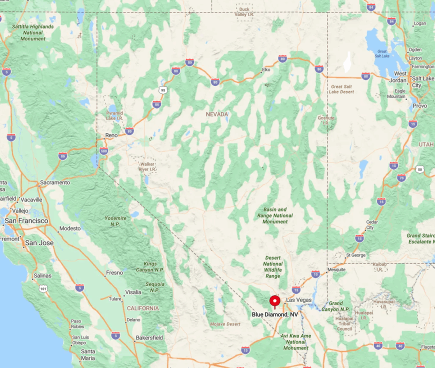
Where is Blue Diamond?
🔥 Would you like to save this?
The village rests in Red Rock Canyon National Conservation Area, 16 miles southwest of downtown Las Vegas yet psychologically far removed from urban bustle. Sheer cliffs on three sides block both noise and development, leaving a single paved route—State Route 159—to connect it with the outside world.
Visitors reach Blue Diamond by driving the scenic loop past Calico Basin and turning into the town’s only paved entrance road. Once inside, speed limits drop to 25 mph and time seems to do the same.
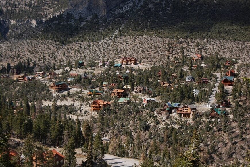
8. Mount Charleston Village: Pine-Scented Seclusion in the Sky
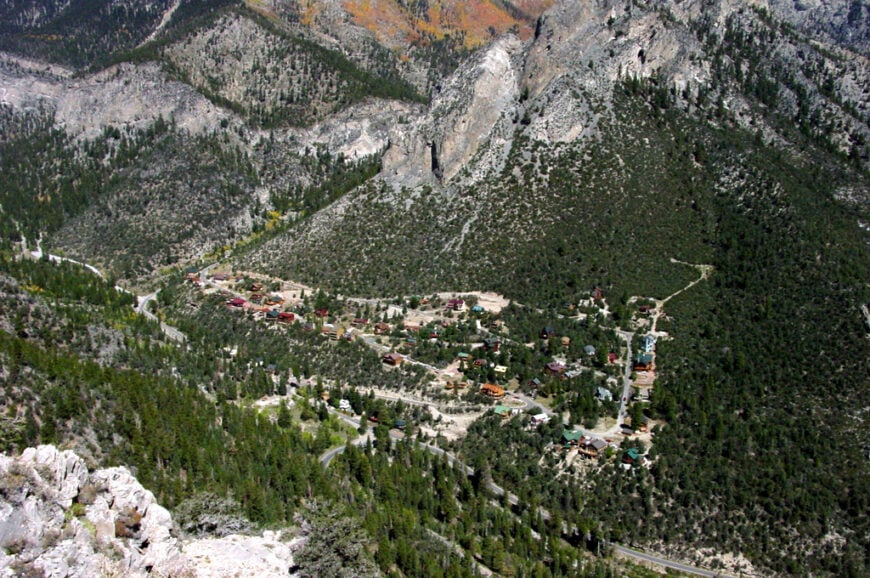
About 350 full-time residents inhabit this alpine hideaway 7,600 feet above sea level, where log cabins nestle among ponderosa and white fir. Hiking the Cathedral Rock or Mary Jane Falls trails rewards afternoon adventurers, while winter draws skiers to Lee Canyon’s chairlifts just up the highway.
Seasonal tourism and Forest Service jobs provide much of the income, supplemented by rustic lodges that host weddings beneath snow-dusted peaks.
The Silent Heroes of the Cold War memorial, tucked behind the fire station, honors an overlooked chapter of aviation history and vanishes beneath deep drifts each January.
Cabins sprawl across multi-acre parcels, and cellular coverage fades behind granite ridges, encouraging radio chatter over streaming services. Tall trees, heavy snowfall, and a 35-mile distance from the valley floor keep this hamlet genuinely detached from neon life below.
Where is Mount Charleston Village?
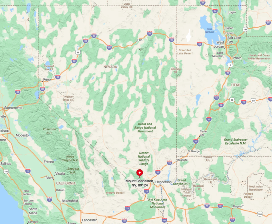
Located in the upper Kyle Canyon of the Spring Mountains, the village is accessed via State Route 157 off U.S. 95 north of Las Vegas. A steady 5,000-foot climb along switchbacks discourages casual commuters and drops temperatures nearly 30 degrees from the Mojave flats.
The two-lane road dead-ends at the trailheads, eliminating pass-through traffic and preserving nighttime stillness. In winter, chain controls and occasional closures further isolate residents, who often keep snowmobiles at the ready.
7. Crystal: A One-Road Desert Outpost with Star-Filled Nights
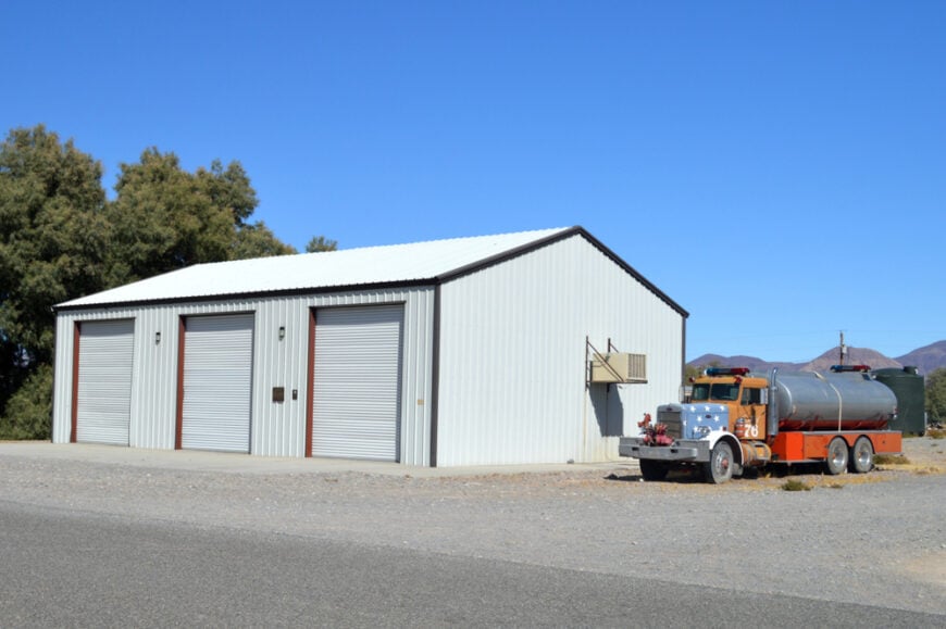
Crystal counts barely 100 year-round residents spread over wide ranch tracts dotted with mesquite and saltbush. Unpaved lanes radiate from the central frontage road, where a lone tavern, greenhouse co-op, and historic trading post serve as gathering spots.
Amateur astronomers cherish the gypsum hills that ring the settlement, blocking stray light and framing some of Nevada’s darkest skies for Milky Way photography. Small-scale ranching and a pair of legal brothels supply the scant payroll, while many households maintain solar panels and private wells for independence.
Nature lovers slip into the hidden Crystal Spring wetlands for birding, often spotting rare phainopeplas among the desert willows. With no school, no stoplights, and the nearest grocery 35 miles away in Pahrump, the village sits as quiet as its name suggests.
Where is Crystal?
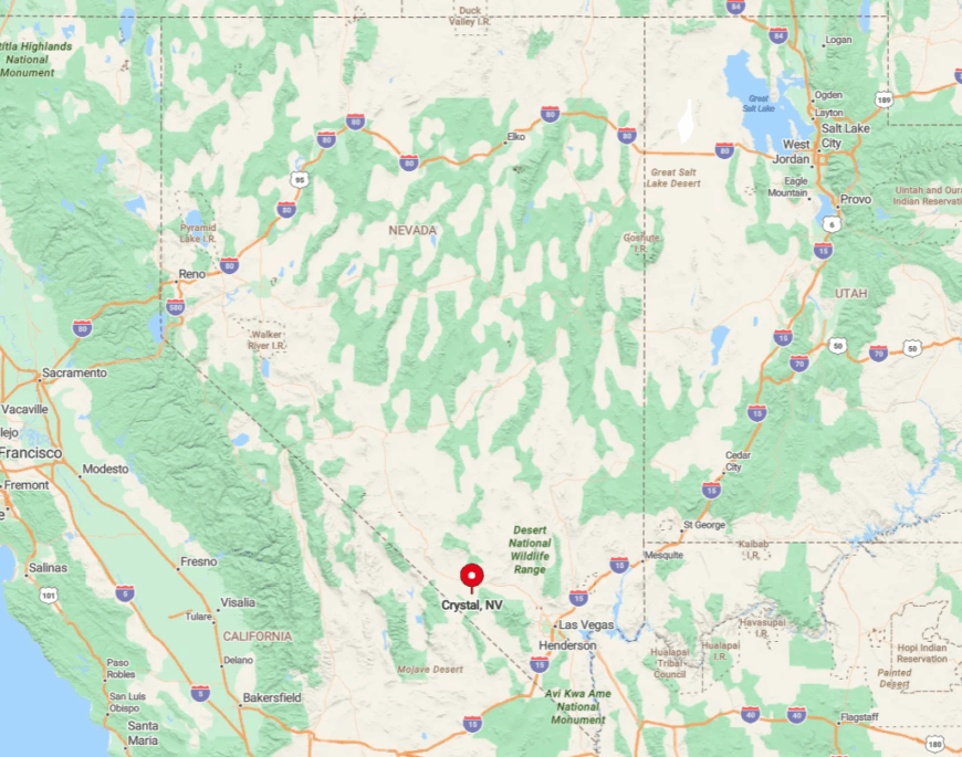
The hamlet rests in southern Nye County along State Route 160, 80 miles northwest of Las Vegas. Gypsum ridgelines and federal lands form a protective bowl that limits both expansion and cell coverage.
Travelers reach Crystal by turning onto Old Route 160, a cracked ribbon that abruptly ends at a “pavement ends” sign as if warning time travelers. Once past that marker, night skies turn ebony and silence becomes the loudest sound around.
6. Amargosa Valley (Lathrop Wells): Oasis Farming on the Edge of Nowhere
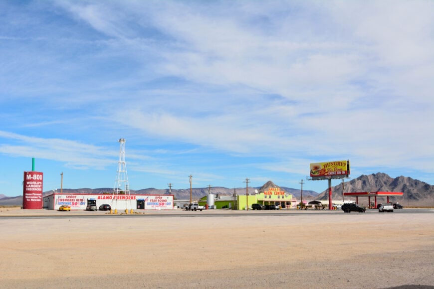
Roughly 400 people cultivate alfalfa circles and date palms where the Amargosa River briefly surfaces before sinking back underground. Day explorers photograph shifting dunes at Big Dune OHV area or visit the little-known Ash Meadows Amargosa pupfish refuge, home to species found nowhere else on Earth.
Pivot irrigation systems and a solar-thermal array near Highway 95 anchor most local employment, alongside truck-stop hospitality for motorists bound to Death Valley. The Longstreet Inn’s petroglyph-inspired architecture and stocked fishing pond provide a quirky overnight for those craving comfort in the sand.
Homes occupy multi-acre lots backed by wildlife corridors, and distances between neighbors can exceed shouting range. Surrounded by federal refuges and military test ranges, the valley feels like an island encircled by forbidden seas.
Where is Amargosa Valley?
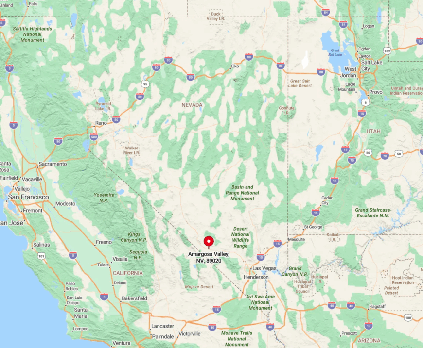
This settlement sits at the junction of U.S. 95 and State Route 373, 90 miles northwest of Las Vegas and 25 miles east of Death Valley Junction. Open desert in every direction means the nearest true town, Pahrump, remains 40 miles south, so quick errands are never quick.
Travelers arrive by desert highway, often stopping at the landmark Area 51 Alien Travel Center before continuing north. Mountain rain shadows and restricted airspace conspire to keep skies wide, roads empty, and life refreshingly slow.
5. Dyer: Snow-Tipped Peaks Guarding a Forgotten Ranch Town
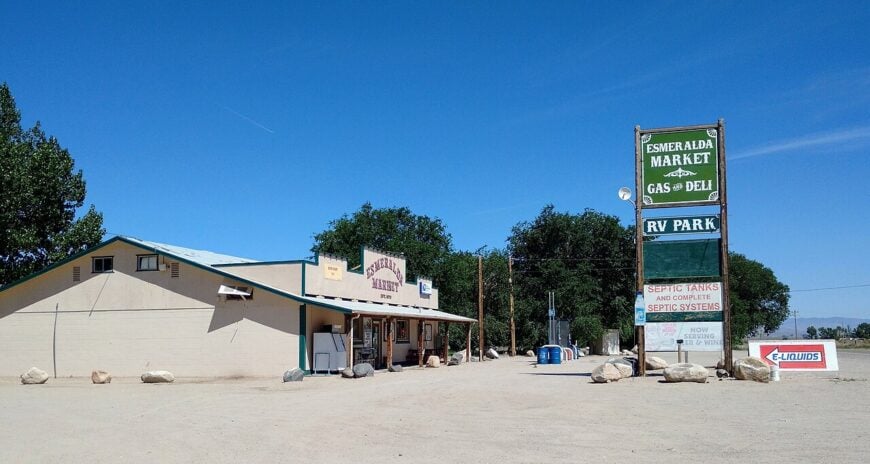
Dyer shelters about 250 residents in the fertile pocket of Fish Lake Valley, framed by the White Mountains’ high summits to the west. Hot Creek Hot Springs offers a steamy soak with Sierra views, and rockhounds scour surrounding hills for turquoise veins that seldom make guidebooks.
Livelihood revolves around alfalfa ranches, small-scale cattle operations, and the lone café-market that doubles as social hall. Locals hold an annual Valley Days parade complete with tractor dance routines, revealing a playful side few outsiders witness.
Homes sit back from the two-lane highway on parcels so long that evening walks can feel like miniature road trips. With the next gas station 35 miles north in Tonopah, Dyer guards its solitude like a prized heirloom.
Where is Dyer?
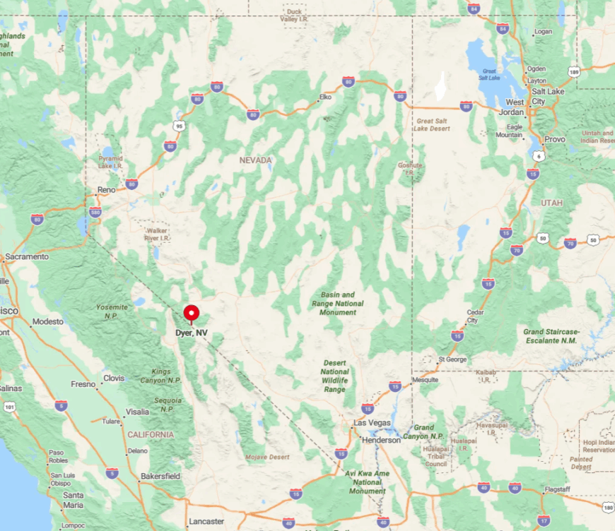
The village lies along State Route 264 near the California border, 180 miles northwest of Las Vegas as the crow flies. Fish Lake Valley’s broad basin and the towering Whites create a natural fortress that muffles traffic and weather fronts alike.
Access requires a purposeful detour off U.S. 95, rewarding drivers with empty roads and horizon-wide vistas. Limited cellphone towers and a single fiber line underscore how distance remains Dyer’s best defense against rush-hour woes.
4. Silver Peak: Salt Flats, Lithium Ponds and Total Isolation
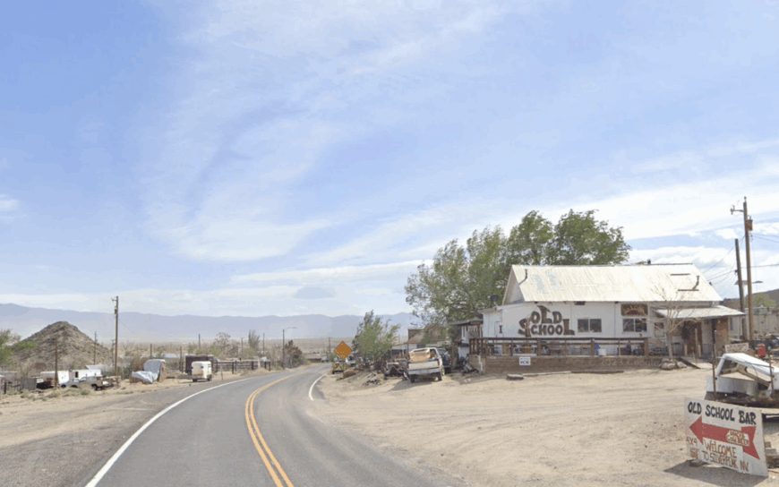
Only 125 residents inhabit Silver Peak, one of Nevada’s oldest mining settlements, where century-old cottages sit between shimmering blue-green brine ponds.
Visitors can drive the unmarked spur to the original 1860s stone schoolhouse, still standing amid tumbleweeds, or hike to Prospect Peak’s derelict tramway towers for sunset over Clayton Valley.
Nearly all employment ties to Albemarle’s lithium extraction facility, which pumps mineral-rich brine into vast evaporation beds visible from space. Weekends revolve around potlucks at the fire hall and afternoon quail hunts in the sage flats.
Unpaved streets and 40 miles of empty highway in every direction keep store deliveries infrequent and visitors rarer still. The resulting silence is so complete that locals track the time of day by the pitch of wind throating through abandoned headframes.
Where is Silver Peak?
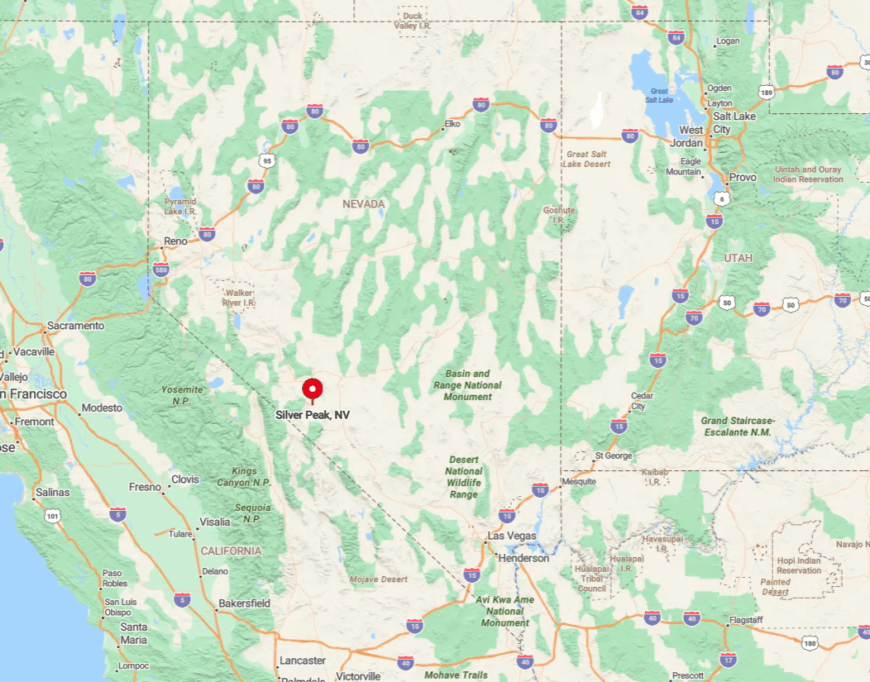
Silver Peak sits in Esmeralda County, 30 miles west of U.S. 95 via State Route 265, a lonely spur that sees more jackrabbits than cars. The settlement hunkers within Clayton Valley, boxed by low mountain ranges that hide it from main travel corridors.
An old airstrip and a daily mining shuttle are the only alternatives to driving, and both require prior permission. Once the sun dips behind the Palmettos, the nearest porch light beyond town lies half a county away.
3. Goldfield: Gilded-Age Ruins in a High-Desert Ghost Town
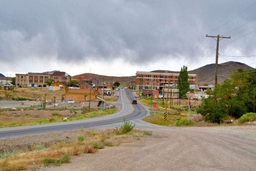
Fewer than 300 inhabitants share Goldfield’s broad avenues, walking past ornate, half-collapsed hotels that once hosted senators and silent-film stars.
Modern treasure hunters swing metal detectors around the old Florence Mine tailings, while art lovers hunt for Goldfield’s hidden car-forest sculpture garden painted with cosmic murals.
Employment comes from county offices, curiosity tourism, and a revived small-scale gold operation northeast of town. The Goldfield Days festival each August crowds Main Street with antique cars, chili cook-offs, and a spirited bed-race that rattles past Victorian façades.
Large lots blend into open sagebrush, and nighttime is so quiet that train whistles in faraway Mina echo like whispers. With no chain motel and only a single 24-hour gas stop, Goldfield savors its in-between-nowhere reputation.
Where is Goldfield?
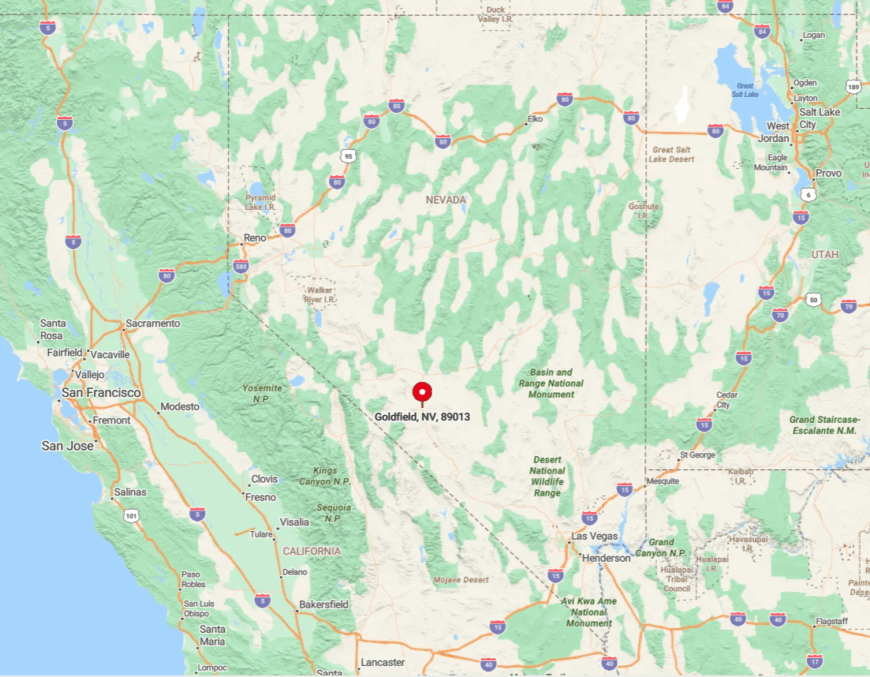
The town straddles U.S. 95 roughly halfway between Beatty and Tonopah at 5,600 feet elevation. Surrounding hills form a natural amphitheater, shielding Goldfield from wind and, more importantly, from cellular towers.
Drivers approach along long, empty stretches of highway where dust devils outnumber vehicles. Once inside town limits, the speed limit drops, and history seems to reclaim the landscape.
2. Gabbs: Basalt Bluffs and Endless Two-Lane Blacktop
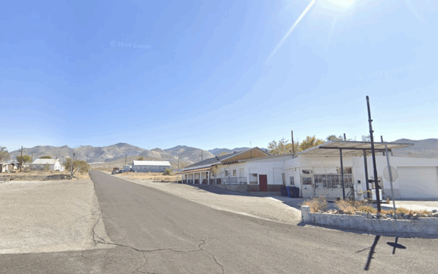
Gabbs counts about 250 residents scattered across a valley rimmed by dark basalt cliffs that glow caramel at sunset. Off-roading enthusiasts explore nearby Rawhide ghost camp, while birders scan Gabbs Valley’s alkali lake for seasonal avocets.
The Premier Magnesia mine employs a sizable share of locals, producing refractory materials from the surrounding hills since the 1940s. Community life gathers at the modest school gym, where basketball games double as town meetings and bake-sale showcases.
Houses perch on expansive acreages, and the next gas pump sits 60 miles away in Fallon or Hawthorne, making every supply run a journey. Such spacing ensures traffic rarely disturbs the pronghorn herds that meander down Main Street on quiet mornings.
Where is Gabbs?
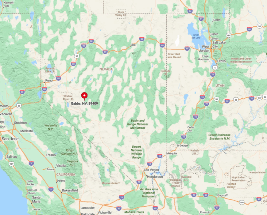
The town lies along State Route 361 in western Nye County, bordered by the Paradise Range and Gabbs Valley Range. No major highway crosses the region, and winter snow can close passes, further isolating residents.
Reaching Gabbs requires a 60-mile detour off U.S. 50 or U.S. 95, rewarding travelers with wide-open vistas and a complete absence of cell reception for long stretches. Mail still arrives by ground courier, underscoring how the outside world remains politely at arm’s length.
1. Lida: A Near-Empty Crossroads Frozen in Time
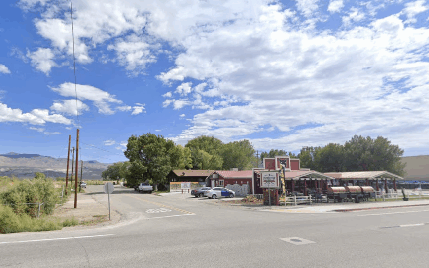
Permanent population hovers around 30, though coyotes may outnumber humans in this cottonwood-framed stagecoach stop founded in 1867. Travelers who pull over find adobe ruins, a hand-dug well still capped by an iron windlass, and the out-of-print Lida Post Office sign dangling from rusted brackets.
A handful of ranching families tend cattle on remote pastures, and rockhounds quietly sift nearby rhyolite cuts for fire-opal chips the guidebooks have forgotten. Evenings bring absolute hush broken only by owl calls and the crackle of wood stoves inside scattered homesteads set a mile or more apart.
There are no stores, no official town hall, and no scheduled events—only open range under an obsidian sky. Such emptiness delivers the ultimate privacy, making Lida feel like a secret penned into the state map in invisible ink.
Where is Lida?
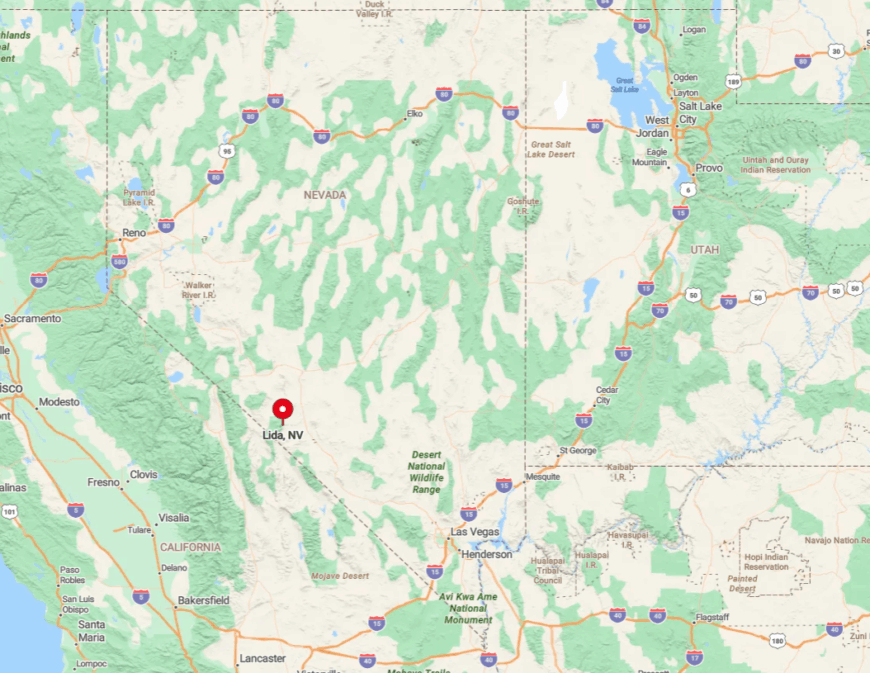
Lida sits at the junction of State Routes 266 and 774, 70 miles south of Tonopah and 110 miles north of Bishop, California. The community nests between the towering Palmetto and Last Chance ranges, which block radio and cell signals like stone walls.
Reaching it involves a lengthy, cell-free drive over Lida Summit at 7,420 feet, where snow gates can close the road for days in winter. Once past the summit, travelers drop into a silent valley where pavement narrows, signage fades, and Nevada’s forgotten past still breathes.