Would you like to save this?
Southwest Missouri is dotted with hamlets where gravel lanes outnumber stoplights and night skies still shimmer with Milky Way brilliance.
We uncovered places where privacy comes naturally, neighbors wave from a distance, and the nearest café might be a county or two away. Each town on this list holds fewer than a thousand residents—many far fewer—and leans on forests, lakes, or wide-open farmland to preserve its quiet rhythm.
From lakeside coves guarded by Corps of Engineers land to high ridges that fog drapes like a blanket at dawn, these settlements remind us how spacious Missouri can feel once the highways fade.
Hidden boat ramps, century-old bridges, and nearly forgotten storefronts add character without inviting crowds. Join us as we count down twenty five of the most secluded spots the region offers.
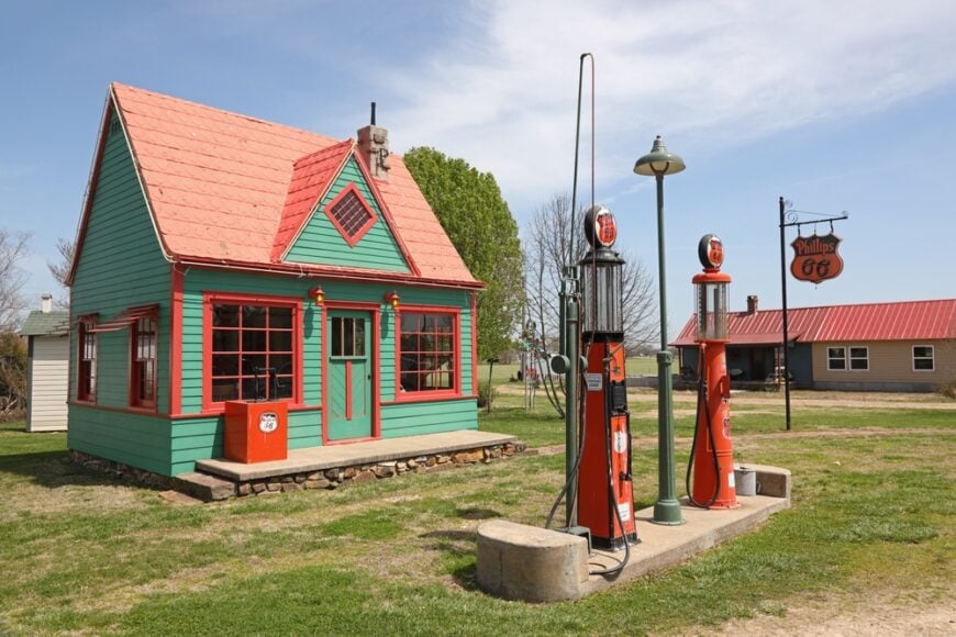
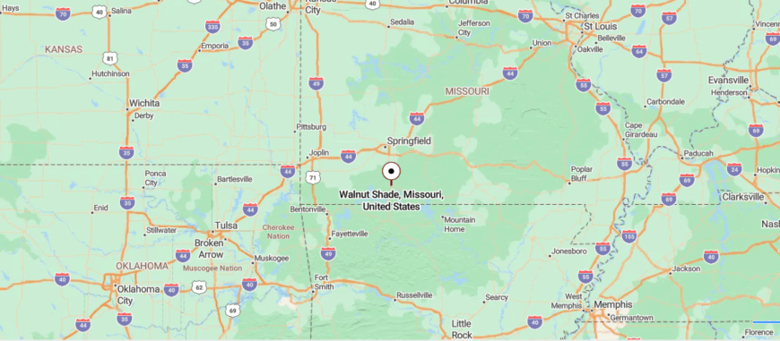
25. McClurg – Ozark Fiddle Hollow
McClurg sits hidden in the Ozark hills of southern Missouri, reached only by winding roads that carve through ridges and forests. Its isolation is clear in the quiet landscape, with just a few homes and gathering spots nestled among the hollows.
What gives the town its heartbeat is music—weekly jam sessions where fiddles, banjos, and guitars keep Ozark traditions alive. Life moves slowly here, tied more to the seasons and community bonds than to schedules or noise.
Visitors who arrive may spend an evening listening to the music, walk the wooded backroads, or sit beneath a sky thick with stars. McClurg lingers in memory as a place where seclusion feels alive, carrying the sound of culture preserved against time.
Where is McClurg?
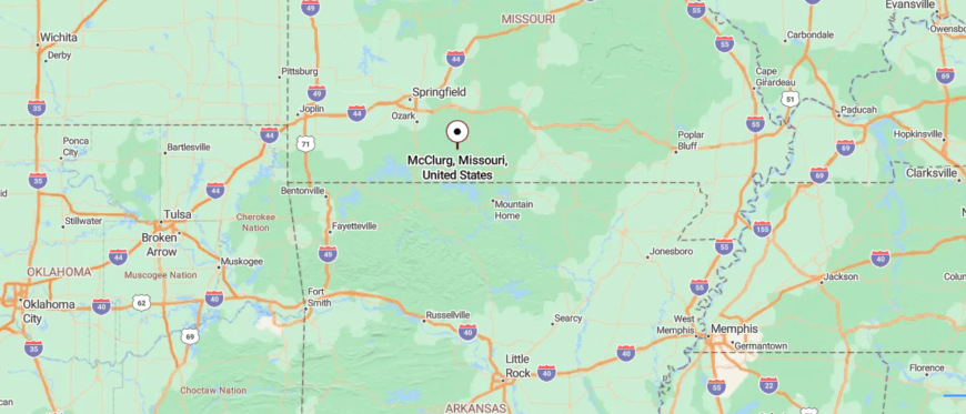
McClurg rests in the Ozark hills of southeastern Douglas County, deep in south-central Missouri. It’s about 25 miles east of Ava, reached by winding county roads that branch off State Highway W and dip through forested ridges.
The trip curves steadily through hollows and tree-covered slopes, with each mile carrying you farther from busy routes. By the time you reach McClurg, the wooded hills make it feel like a hidden hollow where time moves gently.
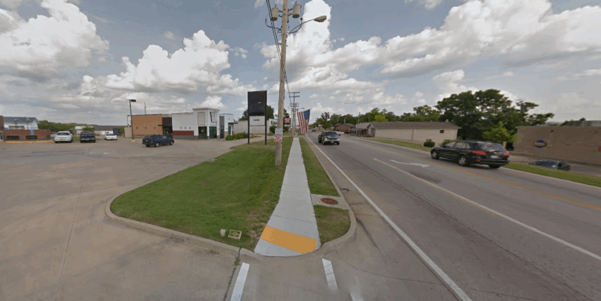
24. Squires – Post Office on a Hill
Squires rests quietly in the Ozark countryside, reached by winding backroads that seem to narrow until you arrive at its small crossroads. Its seclusion comes from both distance and scale, with only a handful of homes, farms, and a general store forming the heart of town.
Life here moves at an easy pace, shaped by the rhythm of hills, creeks, and the steady turning of seasons. Visitors may stop at the old store that has long been a gathering place, explore nearby trails through the Ozark hills, or simply take in the quiet of the surrounding countryside.
Community ties run deep, with neighbors relying on one another more than on anything beyond the valley. Squires lingers as a reminder that some places keep their seclusion by holding fast to simplicity.
Where is Squires?
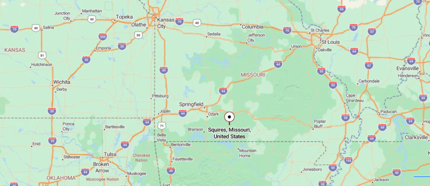
Squires is located in Douglas County in south-central Missouri, tucked into the Ozark Mountains. It sits about 15 miles south of Ava, reached by State Highway 5 before turning onto a winding stretch of Route N that dips through wooded hills.
The approach feels remote, with forests and ridgelines rising around the road as traffic thins. By the time you arrive, Squires feels like a quiet fold in the Ozarks, set apart by its hills and trees.
23. Thornfield – Bridge to Nowhere
Thornfield lies tucked in the rugged hills of southern Missouri, where winding Ozark roads and deep hollows make it feel far removed from the wider world. The town is small and spread out, with its identity rooted in the surrounding landscape of forests, creeks, and rolling ridges.
Life here is quiet and steady, carried by the sounds of wind through the trees and the rhythm of days shaped more by nature than by schedules. Visitors may find themselves exploring nearby Mark Twain National Forest, fishing along hidden streams, or driving the scenic backroads that wind endlessly through the hills.
Community life is simple, centered on the school and gatherings that bring neighbors together. Thornfield lingers as a place where seclusion is written into the land itself, offering a calm that feels both enduring and untouched.
Where is Thornfield?
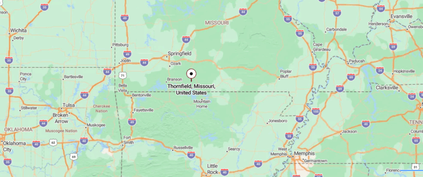
Thornfield lies in Ozark County in southern Missouri, surrounded by the rugged hills and valleys of the Ozarks. It’s about 30 miles northeast of Gainesville, reached by following State Highway 95 through winding forested ridges and open hollows.
The drive twists and dips, carrying you deeper into secluded country where the landscape itself slows your pace. By the time you reach Thornfield, it feels like a quiet place cradled in the folds of the hills.
22. Theodosia – Hidden Marina Village
Theodosia lies where the Ozark hills meet the wide expanse of Bull Shoals Lake, a town that feels tucked away behind winding roads and quiet coves. Its remoteness is softened by the water, with docks, boats, and lakefront cabins forming the rhythm of daily life.
Summers bring fishermen and families to the shoreline, while the rest of the year the town settles into a slower, almost timeless calm. Visitors can launch a boat into still waters, wander wooded trails nearby, or simply watch the lake reflect the colors of dusk.
Community ties run strong here, shaped as much by the water as by tradition. Theodosia lingers as a place where seclusion comes not from emptiness, but from the shelter of hills and the steady presence of the lake.
Where is Theodosia?
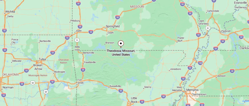
Theodosia rests in Ozark County of southern Missouri, perched near the northern shores of Bull Shoals Lake. It’s about 40 miles southeast of Branson, reached by taking U.S. Highway 160 as it winds through wooded ridges and descends toward the water.
The road offers glimpses of lake coves and forested hills, giving a sense of arriving at the edge of something tucked away. By the time you reach Theodosia, the mix of hills and water makes it feel like a hidden lakeside retreat.
21. Pontiac – Lakeside Sliver at the Border
Pontiac rests on the edge of Bull Shoals Lake, a small lakeside community that feels set apart by winding roads and forested hills. Its identity is bound to the water, where docks, cabins, and the marina shape the rhythm of daily life.
Summers draw people to fish, boat, and swim, while the rest of the year the shoreline settles into a deeper quiet. Visitors often camp beneath the trees, take drives through twisting Ozark backroads, or sit along the coves to watch the lake at dusk.
Nights here are marked by skies heavy with stars, the silence broken only by water against the rocks. Pontiac leaves an impression of seclusion shaped not by distance alone, but by the calm embrace of lake and hills together.
Where is Pontiac?
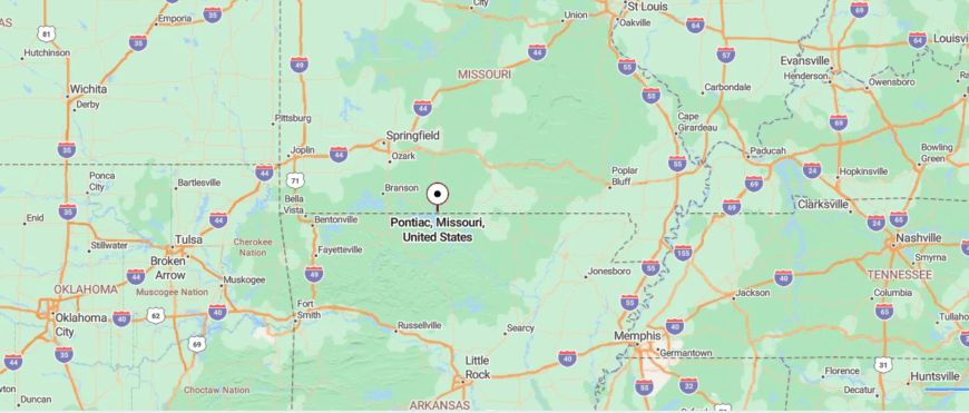
Pontiac lies in southern Missouri’s Ozark County, tucked close to the Arkansas line and resting along Bull Shoals Lake. The town is about 30 miles southwest of Gainesville, with access coming from U.S. Highway 160 before narrowing into winding county roads. Travelers descend through wooded ridges, where each curve brings a glimpse of water or hillside.
The lake begins to appear gradually, its coves and inlets framed by thick forests. By the time the road settles near shore, the pace of the drive has already slowed. Here, Pontiac feels like a lakeside hideaway shaped by distance, hills, and quiet water.
20. Taneyville – Forgotten Fork of Beaver Creek
Taneyville rests in the rolling Ozark hills, surrounded by winding creeks and wooded ridges that keep it quietly tucked away from busier towns. Its seclusion is felt in the stillness of narrow roads and the steady rhythm of rural life that hasn’t hurried to change.


The town is small, with its school and gathering spots serving as the heart of community connection. Visitors may explore the nearby forests, fish in the clear streams, or take scenic drives that reveal the beauty of the countryside.
Evenings bring a calm that settles across the hills, broken only by the sound of crickets or the rustle of leaves in the breeze. Taneyville lingers as a place where seclusion feels natural, rooted in the land and the slow passing of time.
Where is Taneyville?
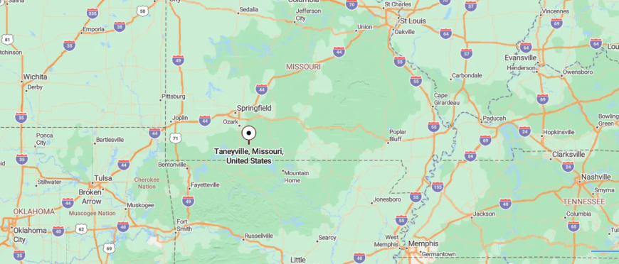
Taneyville is found in Taney County in southern Missouri, resting among the hills of the Ozarks. It sits about 15 miles northeast of Branson, reached by taking U.S. Highway 76 before turning onto smaller roads that dip through wooded ridges. The journey shifts from busier stretches into quiet country where farms and hollows break the landscape.
Hills rise and fall around the route, giving a sense of steady movement deeper into the Ozarks. As the road eases into town, the noise of travel falls away. Taneyville feels like a quiet stopover where the hills themselves create its sense of seclusion.
19. Oldfield – Crossroads of Silence
Would you like to save this?
Oldfield sits deep in the Ozark hills, reached by winding country roads that seem to narrow until they disappear into hollows and ridges. The town is small and scattered, its life centered around a few gathering places and the traditions that have carried on for generations.
The quiet here is steady, broken only by the sound of wind in the trees, distant birdsong, or the hum of a truck along gravel roads. Visitors may find themselves driving the backroads, exploring the surrounding hills, or pausing at the community hall where neighbors still come together.
Evenings bring wide skies filled with stars, a reminder of just how far Oldfield feels from the world beyond the hills. It lingers in memory as a place where seclusion feels not accidental, but written into the land itself.
Where is Oldfield?
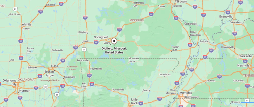
Oldfield sits in Christian County in the southern Ozarks of Missouri, surrounded by wooded ridges and winding valleys. It’s about 25 miles east of Springfield, reached by taking U.S. Highway 65 and then following State Route 125 as it narrows into twisting county roads.
The drive carries you past rolling farmland that quickly gives way to dense stretches of forest. Each turn seems to fold you deeper into the hills, where time feels slower. By the time you reach the community, the bustle of nearby cities is far behind.
18. Chadwick – Ridge Above the Hollow
Chadwick lies hidden in the Ozark hills, where thick forests and winding ridges make the town feel far away from everything else. Its streets are few, but the surrounding land stretches for miles, offering both quiet and a sense of untamed space.
The rhythm of life here is slow, tied to the woods and the change of seasons more than the clock. Travelers often arrive to ride the famous motorcycle and ATV trails, hike through the forest, or follow the narrow roads that twist across the hills.
Nights bring cool air and the sound of owls echoing through the trees. Chadwick remains in memory as a place where seclusion is shaped not only by distance, but by the rugged beauty of the Ozarks themselves.
Where is Chadwick?
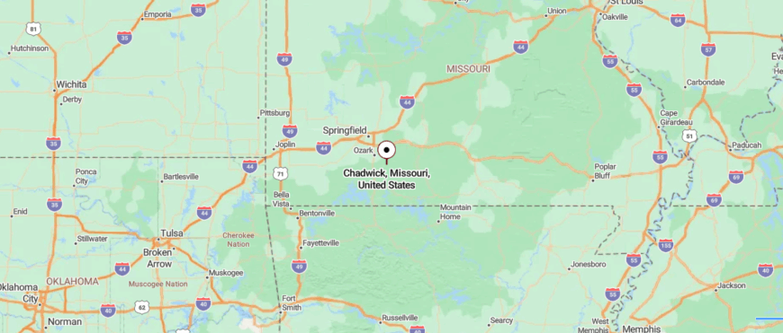
Chadwick lies in Christian County in southern Missouri, nestled within the deep valleys and ridges of the Ozarks. It’s about 30 miles southeast of Springfield, reached by taking State Highway 125 as it winds through forests and steep hills.
The route grows narrower and curvier the closer you get, with long stretches of trees enclosing the road. Small clearings open up between ridges, hinting at the quiet settlement ahead. The pace of travel naturally slows as the landscape presses in around you.
17. Bradleyville – River Bend Retreat
Bradleyville sits along the winding backroads of the Ozarks, where steep hills and forested hollows create a sense of being tucked away from the wider world. The town is small, its heart found in the school, church, and local gathering spots that have long anchored daily life.
Life here is quiet, marked by the rhythm of seasons, the hum of cicadas in summer, and the hush of snowy winters. Visitors might fish in nearby streams, explore the wooded ridges, or drive the scenic roads that curve endlessly through the countryside.
Evenings bring deep stillness, with only the sound of crickets and wind in the trees filling the air. Bradleyville lingers as a place where seclusion feels natural, a quiet rooted in land and tradition.
Where is Bradleyville?
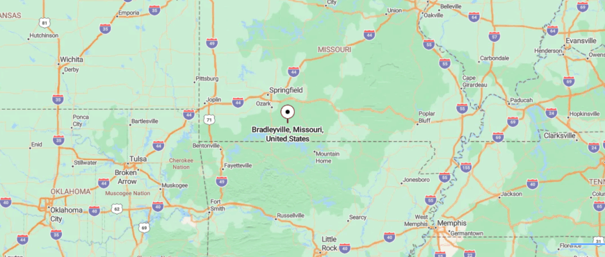
Bradleyville is in northeastern Taney County, set within the wooded hills of Missouri’s Ozarks. About 30 miles east of Branson, it’s reached by State Highway 76, a twisting road that climbs ridges and dips into hollows.
The drive moves through forests and scattered meadows, gradually slowing the pace. By arrival, Bradleyville feels like a quiet clearing folded into the hills.
16. Kissee Mills – Lakeside Outpost

Kissee Mills rests near the White River, where wooded hills and winding roads keep it sheltered from the pace of nearby towns. Its seclusion is shaped by the landscape, with ridges, creeks, and stretches of forest giving the area a quiet, almost hidden feel.
The town is modest, with life centered around a few gathering places and the steady rhythm of rural routines. Visitors often come to fish or boat on the nearby lakes, explore trails that weave through the Ozarks, or drive backroads that reveal sweeping views.
Evenings settle slowly here, with the sound of insects rising as the hills grow dark. Kissee Mills lingers as a place where seclusion feels calm and enduring, a quiet kept by water and woods.
Where is Kissee Mills?
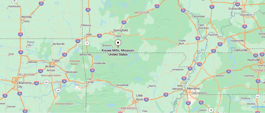
Kissee Mills lies in eastern Taney County, close to the upper stretches of Bull Shoals Lake in southern Missouri. It’s about 10 miles east of Forsyth, reached by taking U.S. Highway 160 as it winds through rolling hills and scattered farmland.
The approach shifts from open fields into wooded ridges, with the road narrowing as it nears the lake country. By the time you arrive, Kissee Mills feels like a quiet spot where water and hills shape the landscape’s calm.
15. Walnut Shade – Bluff-Top Stillness
Walnut Shade sits in the folds of the Ozark hills, where narrow roads wind through valleys and keep the town quietly apart. It is a small place, marked more by its natural setting than by busy streets or storefronts.
The rhythm of life follows the land—green hills in spring, blazing colors in autumn, and long quiet nights in winter. Travelers often come to fish along Lake Taneycomo, drive the backroads that rise and fall through the ridges, or simply stand still to take in the view.
Evenings settle slowly, with only the sound of insects and breeze through the trees. Walnut Shade leaves an impression as a place where seclusion is held gently by the hills themselves.
Where is Walnut?
Walnut Shade sits in Taney County of southern Missouri, nestled just north of Branson in the Ozark hills. It’s about 6 miles from Branson, reached by U.S. Highway 65 before turning onto winding local roads that climb ridges and dip into valleys.
The short drive leaves behind the bustle of the city and replaces it with quiet stretches of forest and open views. By the time you arrive, Walnut Shade feels like a ridge-top retreat set just far enough apart to hold its stillness.
14. Hollister – Beyond the City Lights
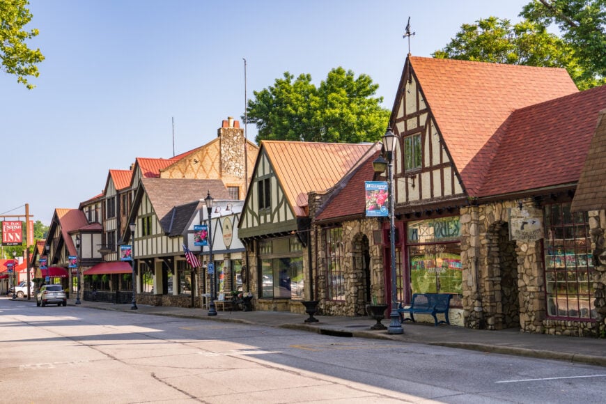
Hollister lies in the shadow of the Ozark hills, its old downtown framed by Tudor-style buildings that feel like a step into another time. The town is small, yet its setting along Lake Taneycomo gives it a sense of quiet distance from the outside world.
Daily life carries a slower pace, with neighbors meeting on Downing Street, church bells marking the hours, and the river flowing steadily nearby. Travelers often wander the historic district, cast a line into the lake, or follow the winding roads that rise into the hills.
Evenings settle softly here, with lights glowing against the stonework and the sound of water drifting through the valley. Hollister remains in memory as a place where seclusion feels shaped as much by history as by the land itself.
Where is Hollister?
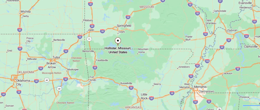
Hollister is in Taney County of southern Missouri, resting along the shores of Lake Taneycomo just across the river from Branson. It’s reached directly by U.S. Highway 65, with the road curving down into a valley framed by wooded hills.
The approach moves quickly from highway pace into quieter town streets that edge close to the water. Surrounded by lake and ridges, Hollister feels close to Branson yet quietly its own, shaped by the calm of the Ozarks.
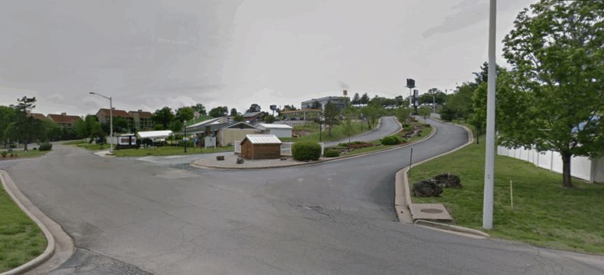
13. Kirbyville – Hilltop Community by the State Line
Would you like to save this?
Kirbyville sits along the rolling ridges east of Branson, where winding country roads and wooded hills make it feel quietly apart from the world. The town is small and scattered, its life tied to the rhythms of the land and the closeness of neighbors.
Days here unfold slowly, with the hum of cicadas in summer, the blaze of autumn leaves, and long winters of calm. Visitors might take drives through the countryside, fish in nearby creeks, or walk trails that disappear into the hills.
Evenings bring a deep stillness, broken only by the sound of wind moving through the trees. Kirbyville lingers as a place where seclusion feels steady, carried by nature and time rather than hurry.
Where is Kirbyville?
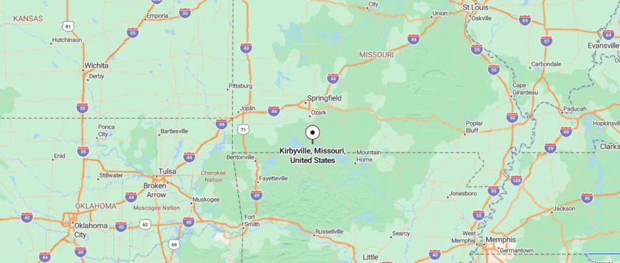
Kirbyville rests in eastern Taney County, tucked into the wooded hills of southern Missouri’s Ozarks. It’s about 10 miles east of Branson, reached by U.S. Highway 76 as it narrows into winding two-lane stretches through ridges and hollows.
The road twists steadily, carrying you past scattered farms and forest clearings. By the time you arrive, Kirbyville feels like a small hillside settlement set apart by distance and quiet.
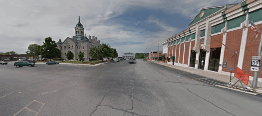
12. Ava – Edge of the Douglas Plateau
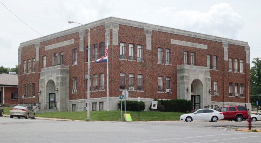
Ava rests in the folds of the Ozark hills, its small-town rhythm quieting once the day’s activity fades. As night settles, the courthouse square grows still, and the sound of traffic disappears into the ridges.
Darkness spreads quickly here, with the hills rising like quiet walls and stars crowding the sky in their place of streetlights. Visitors often notice how sharp the air feels, how distant even the nearest towns seem once evening takes hold.
Community life pauses, leaving only the faint glow of porches and the hush of crickets carried on the wind. Ava at night feels like a reminder that true seclusion is clearest when the world goes silent.
Where is Ava?
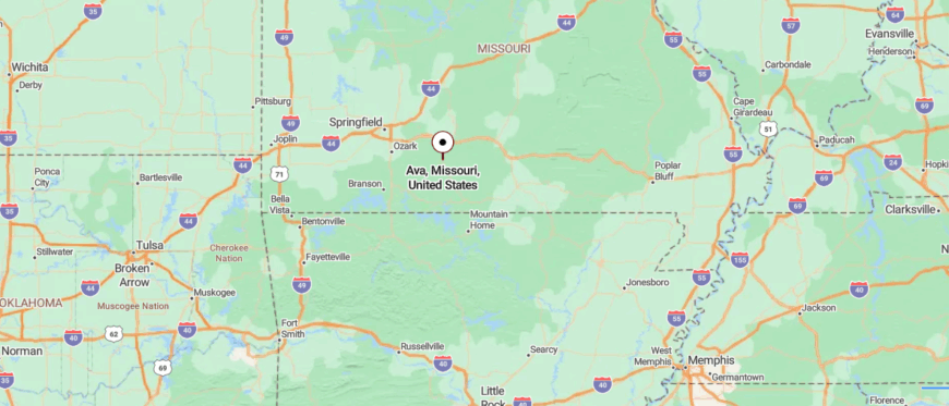
Ava is the seat of Douglas County in south-central Missouri, surrounded by the rolling terrain of the Ozarks. To get there from Springfield, you travel about 45 miles southeast along U.S. Highway 60 before shifting onto State Highway 5. The road bends through farmland and wooded valleys, with each mile pulling you deeper into hill country.
Farms give way to forest, and the horizon feels closer as the ridges rise around you. The town appears gradually, set at a crossroads where open land and woodland meet. In that setting, Ava carries the character of a quiet Ozark hub, both connected and apart.
11. Isabella – Shoreline Seclusion on Bull Shoals
Isabella sits near the waters of Bull Shoals Lake, its few roads winding through the Ozark hills until the town feels tucked into its own corner of the world. By day it is quiet, but it’s at night when its seclusion becomes most clear—darkness settles fast over the hills, and the lake reflects only starlight and the outline of trees.
The stillness is broken only by the call of night birds or the lapping of water against the shore. Visitors who camp nearby or drive the backroads often find themselves pausing just to take in the deep silence of the valley.
The town’s rhythm slows to almost nothing, marked only by the hum of crickets and the glow of a porch light here and there. Isabella at night feels like a place wrapped in shadow and calm, where the world beyond seems impossibly far away.
Where is Isabella?
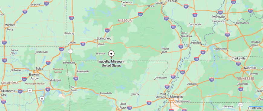
Isabella rests in Ozark County of southern Missouri, not far from the upper stretches of Bull Shoals Lake. It’s about 35 miles southeast of Ava, reached by following State Highway 5 and then turning onto Highway 181 as it winds through wooded ridges. The drive narrows into twisting stretches where the hills close in and the pace naturally slows.
Scattered clearings open to glimpses of farmland before the road dips back into forest. The town comes into view quietly, tucked low between ridges. In that hidden setting, Isabella feels like a place held gently by the Ozarks.
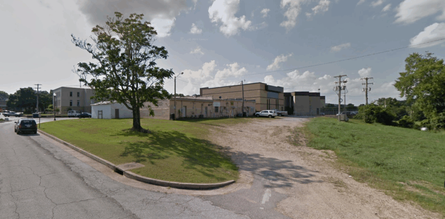
10. Protem – Bull Shoals Backwoods Bliss
With roughly 200 year-round residents, Protem strings one-acre homesteads along Ozark ridgelines overlooking the upper arms of Bull Shoals Lake. Anglers launch at the low-traffic McBride boat ramp, hikers wander into the nearby Hercules Glades Wilderness, and locals gather for potluck bluegrass nights at the volunteer firehouse.
Cattle grazing, seasonal vacation rentals, and small-scale logging supply most paychecks, though many retirees simply savor the slow pace. National forest on three sides, plus a full 40-minute drive to Branson’s bustle, keeps tourist overflow to a minimum.
Limited cell coverage and single-lane county roads deepen the sense of being tucked away. In Protem, wildlife traffic—white-tailed deer, wild turkey, and the occasional black bear—often outnumbers vehicles.
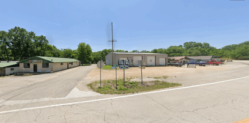
Where is Protem?
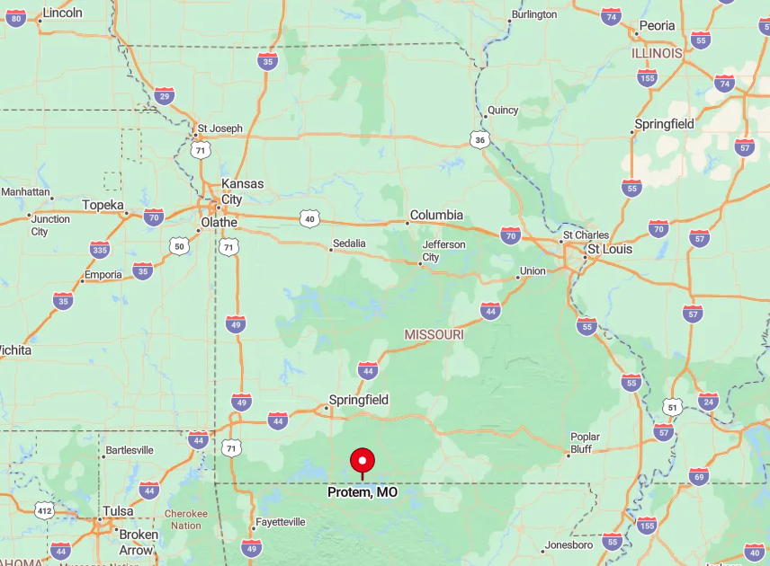
Protem sits in southeastern Taney County, two miles north of the Arkansas border and ten curving miles east of Highway 125. The lake’s jagged shoreline and thousands of undeveloped forest acres isolate the community from neighboring towns.
Drivers reach it by following Highway 125 south from Bradleyville, then winding along County Road U. Expect forty-five minutes of two-lane blacktop before the nearest chain grocery appears.
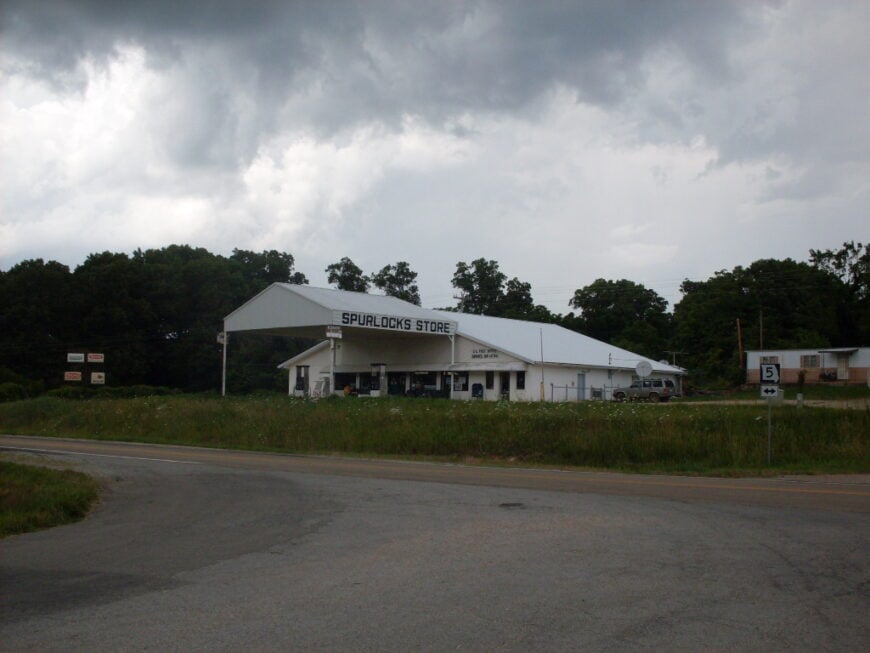
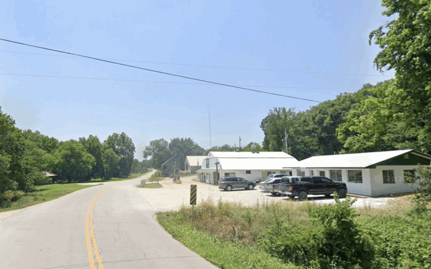
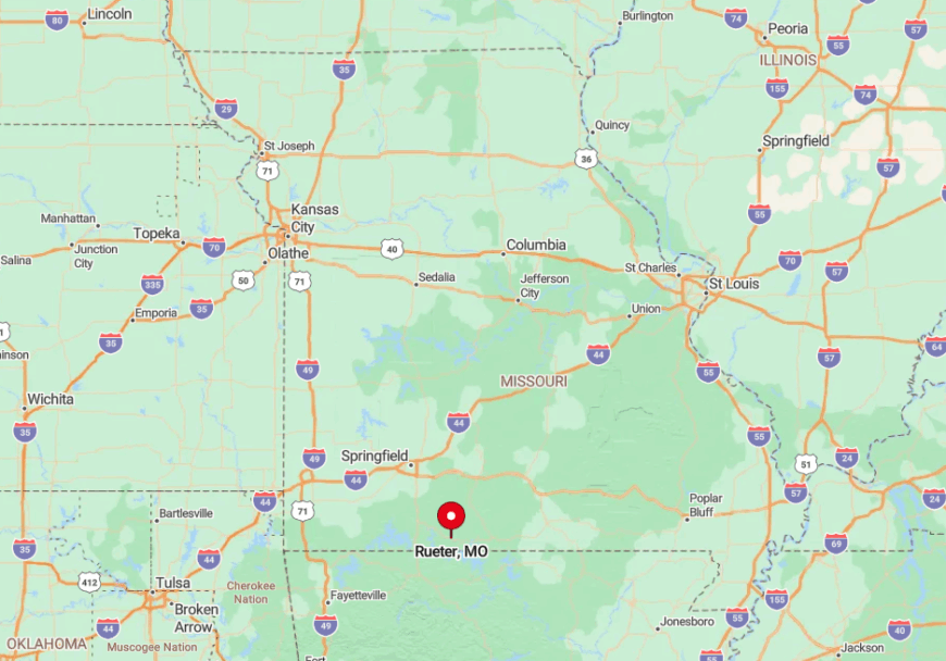
9. Rueter – Hillside Hideaway off Highway 160
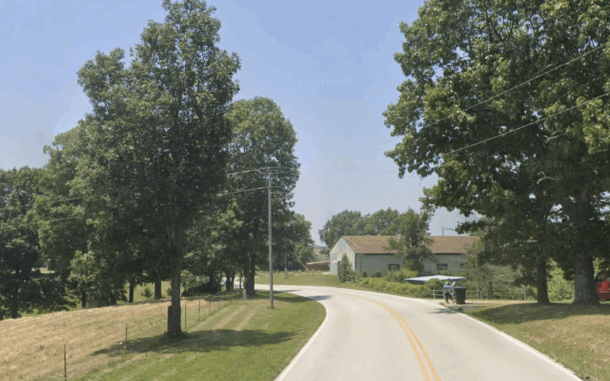
Rueter is little more than a crossroads with fewer than 100 homes scattered among oak-covered ridges, yet it carries a history as an early stagecoach stop. Today, birders seek out the tanagers and warblers flitting through Mark Twain National Forest, while hunters prize the area’s quiet glades during turkey season.
Employment centers on cattle farms, custom sawmills, and the occasional remote-work satellite dish peeking above a roofline. The nearest full supermarket sits twenty miles west in Forsyth, underlining how removed daily life feels.
Gravel lanes climb steep hollows where only die-hard parcel carriers dare go during icy spells. Silence settles quickly after sunset, broken only by whip-poor-wills and distant coyote calls.
Where is Rueter?
Would you like to save this?
Nestled at the junction of Highway 160 and Farm Road 125, Rueter occupies the high ground of eastern Taney County. Dense forest blocks all but local traffic, forcing through-drivers toward larger routes far to the north.
Springfield or Harrison, Arkansas, can be reached by an hour of two-lane highways, but most residents rely on weekly supply runs. Those visiting typically exit U.S. 65 at Ozark, then wind forty miles of Ozark highway curves to arrive.
8. Cedarcreek – Misty Ridge Overlook
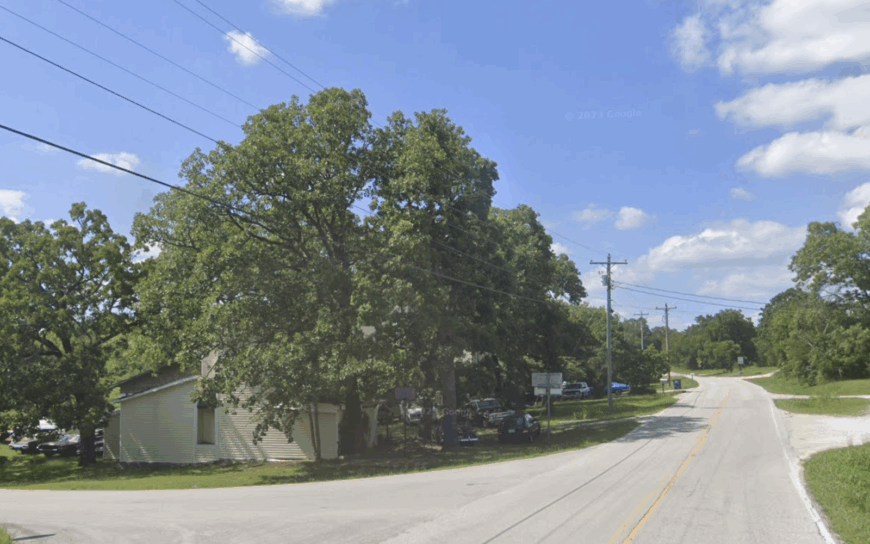
About 250 people call Cedarcreek home, many living on roomy five-acre parcels perched above the mist-laden bluffs of Beaver Creek. Paddlers slide canoes into the creek’s clear shoals, and horseback riders follow old logging trails that wend past limestone outcrops.
Small cow-calf operations, custom woodworkers, and home-based craft shops anchor the modest economy. No incorporated town lies within a half-hour’s drive, and rolling hills stuffed with hardwoods block most cellular data signals.
The result is an unplugged lifestyle where mail still travels via rural route and neighbors meet at a single-pump gas station. Dawn often greets residents with fog drifting up from the creek valleys, muting all evidence of the outside world.
Where is Cedarcreek?
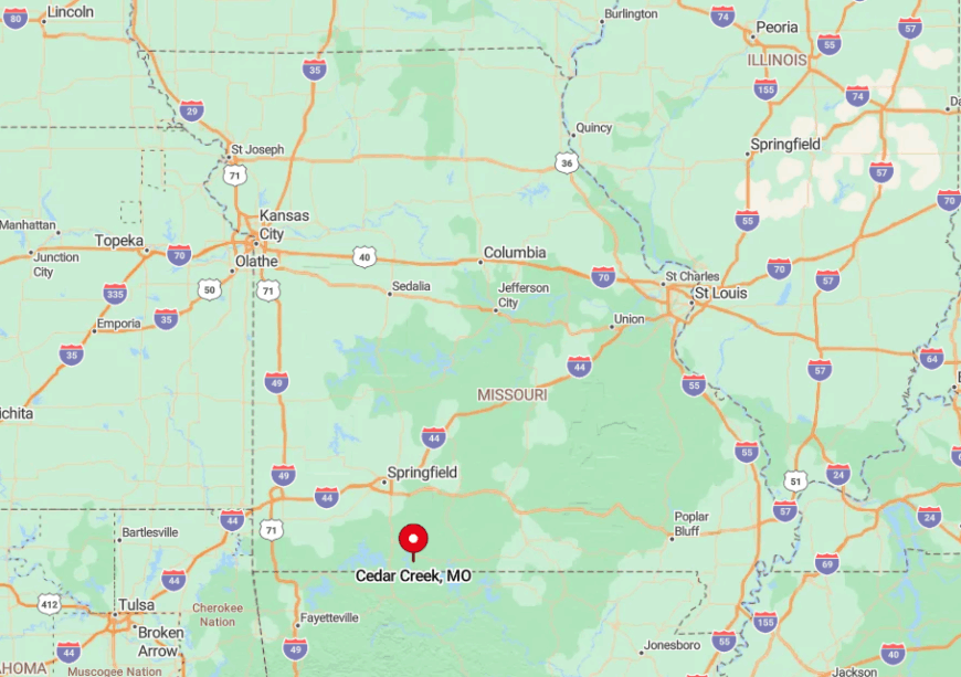
The settlement clings to a high ridge in southeastern Taney County, reached by County Road KK off Highway 160. Forested hollows on three sides and the meandering Beaver Creek on the fourth confine entry to a pair of switchback roads.
Visitors coming from Branson must travel thirty miles of serpentine pavement before the first mailbox marked “Cedarcreek.” Winter storms can close the last two miles of steep grade, sealing the ridge in peaceful isolation.
7. Cape Fair – Quiet Coves on Table Rock’s Upper Arm
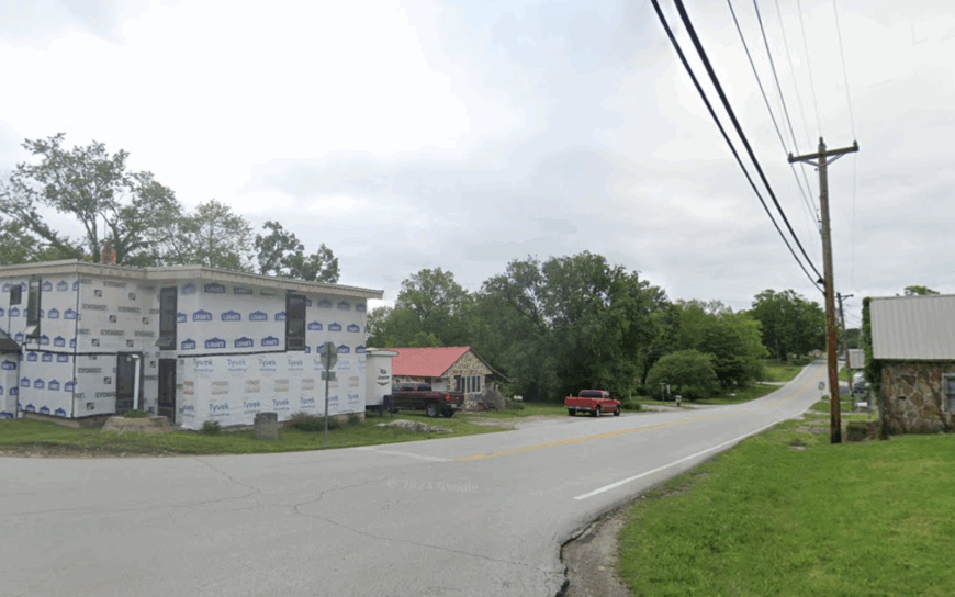
Cape Fair hosts roughly 500 residents spread along hidden fingers of Table Rock Lake where population density slips below 60 homes per square mile. Anglers chase spring white-bass runs up the James River arm, while locals relish weekday calm at the lesser-known Aunts Creek swimming area.
Guiding services, dockside cafes, and a sprinkling of hobby farms deliver most employment. Corps of Engineers land wraps the shoreline, preventing development and blocking through-roads that might draw crowds.
Many cabins sit behind gated lanes where deer graze undisturbed even on holiday weekends. Evening breezes carry only tree frogs and distant boat wakes across the water.
Where is Cape Fair?
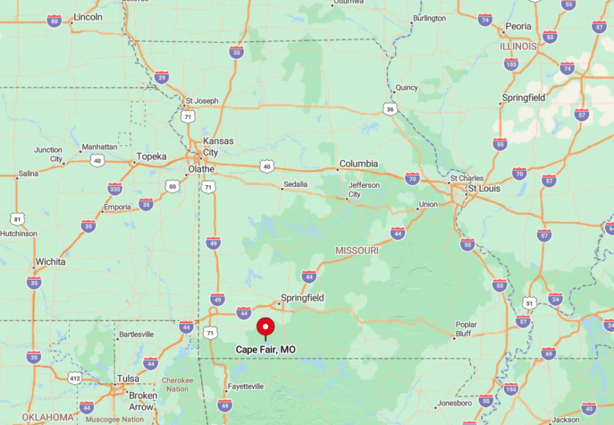
Located at the junction of Missouri 173 and Highway 76 in Stone County, Cape Fair lies twenty-five scenic miles west of Branson. Steep coves and protected parkland mean the quickest route in is often the same route out, reinforcing its cul-de-sac feel.
Springfield residents follow Highway 160 south before angling in on 176, a drive that takes about an hour. Seasonal visitors often dock at the small but well-kept Cape Fair Marina, then disappear into hidden inlets unreachable by road.
6. Blue Eye – Borderline Serenity
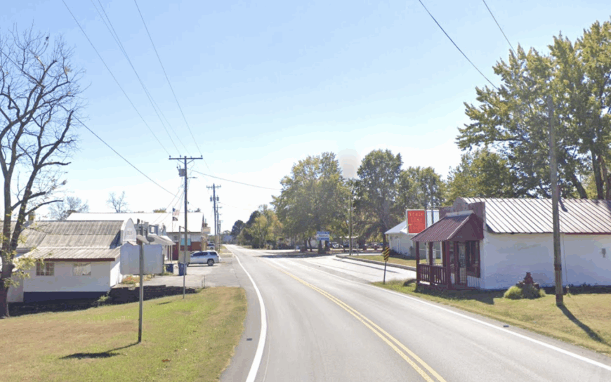
On Missouri’s final ridge before Arkansas, Blue Eye contains fewer than 300 permanent residents spread across rolling, one-plus-acre lots. Families swim at the seldom-busy Cricket Creek Recreation Area, and photographers hunt sunsets over Big Cedar Hollow.
Construction trades supporting vacation homes, small beef herds, and cross-border tourism gigs provide paychecks. The fifteen-mile ribbon of winding Route 86 to any city lights, paired with dense hardwood forest, ensures that night skies remain naturally dark.
Hunting cabins dot the hillsides without clustering, and cell-tower signals fade to zero in the deeper draws. Locals embrace the feeling that the state line is the only boundary they share with the wider world.
Where is Blue Eye?
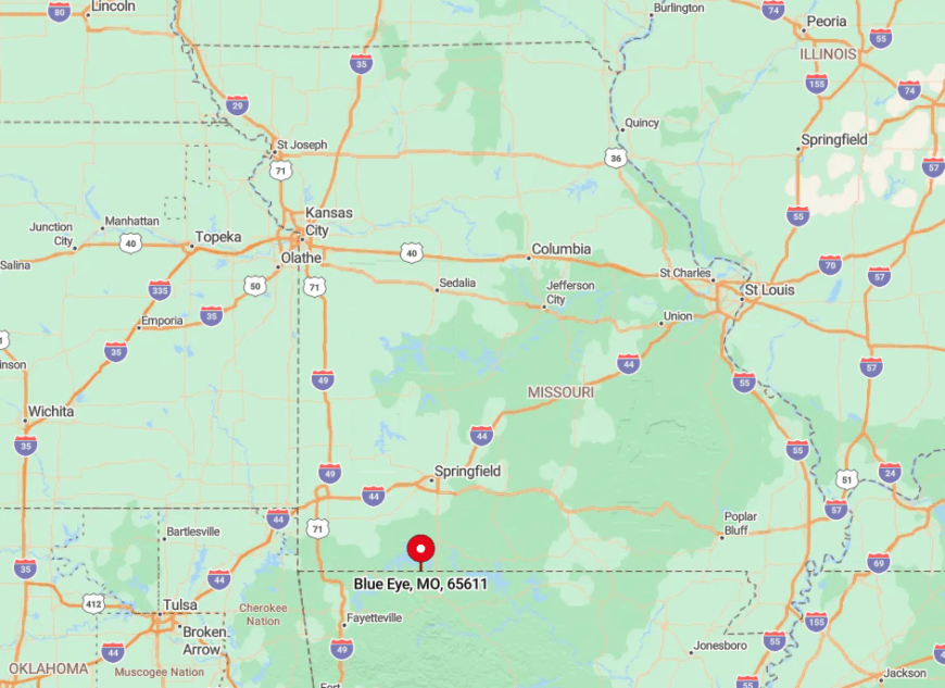
Blue Eye straddles State Route OO at Missouri’s southern tip, just north of Carroll County, Arkansas. Two-lane Route 86 delivers visitors from Branson West after a half-hour of hairpin curves.
Bluffs overlooking Table Rock Lake block larger highways, so GPS often reroutes to gravel shortcuts that fizzle into forest. Many arrive via boat, tying up at undeveloped coves before trekking uphill to their cabins.
5. Arcola – Prairie Hush in Dade County
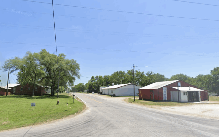
Arcola’s population hovers under 50, with clapboard homes peeking from windbreak rows planted a century ago. Anglers quietly conquer Stockton Lake’s lesser-known crappie holes, while bicyclists roll empty county lanes flanked by tallgrass and stone fences.
Row-crop farming, custom hay baling, and a single feed store sustain the local economy. Undeveloped shoreline on the lake’s east arm, combined with miles of open pasture, muffles any hint of busier marinas down south.
Traffic lights do not exist, and the sole gathering spot is a volunteer-run community center that hosts monthly chili suppers. Daytime soundtracks are carried mostly by meadowlarks and distant tractor engines.
Where is Arcola?
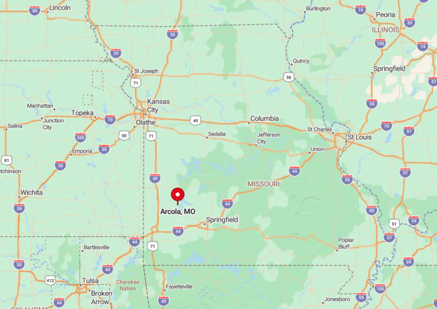
The village rests on Highway 123 about four miles north of Stockton Lake in northern Dade County. Vast stretches of Corps land and prairie ensure every approach road offers long, empty vistas.
Springfield lies 45 miles southeast via U.S. 160, but the last convenience store appears twenty minutes before reaching town. Visiting paddlers often slip kayaks into the lake at Mutton Creek, then paddle the quiet east arm that dead-ends just shy of Arcola’s back pastures.
4. Powell – Creek-Side Solitude in McDonald County
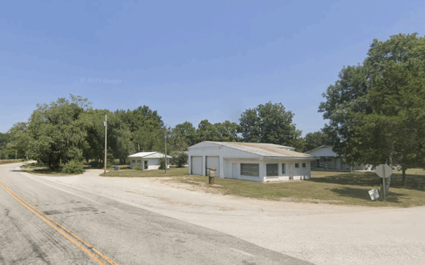
Powell numbers close to 100 residents living in storybook valleys along Big Sugar Creek beneath towering limestone bluffs. Summer brings inner-tubers to the clear water, while hikers wander the Wildcat Glade section of Big Sugar Creek State Park for trillium and Ozark chinquapin sightings.
Small cattle operations, a seasonal canoe outfitter, and homegrown produce stands provide limited commerce. Forested state land encircles the community, blocking cell signals and any prospect of subdivision sprawl.
A one-lane steel truss bridge from 1915 still stands, making it both a hidden gem and practical crossing. Nights settle with only whippoorwills echoing off rock faces.
Where is Powell?
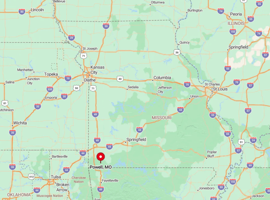
Powell lies on State Route E, roughly ten miles east of U.S. 71 in northeastern McDonald County. Winding creek valleys and steep hills make most alternate routes impractical, ensuring minimal pass-through traffic.
The nearest grocery is in Pineville, a thirty-minute drive away along twisty blacktop. Outdoor enthusiasts usually follow signs to Big Sugar Creek State Park, then continue another three miles to find Powell’s historic bridge and cluster of homes.
3. Red Oak – Forgotten Village on Highway 97
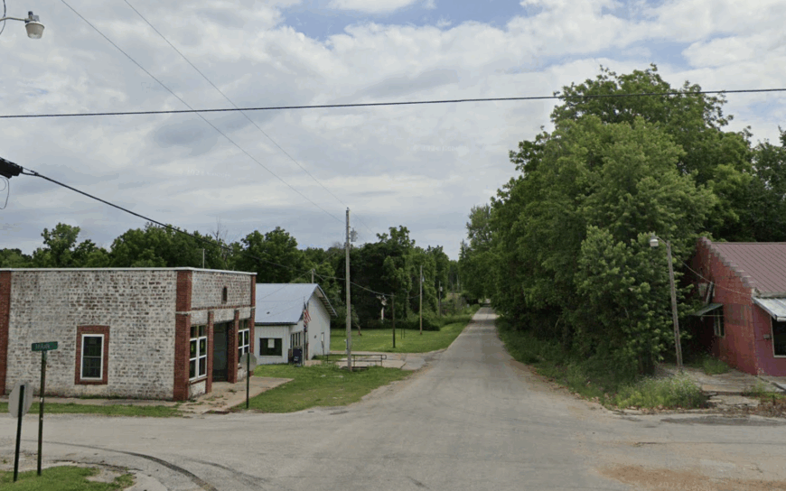
Only a handful of families remain in Red Oak, where historic brick storefronts stand empty beside wide gravel lots that once buzzed with railroad trade. Antique hunters roam the quiet main street for weathered tin ceilings and Art Deco facet glass, while photographers capture prairie sunsets framed by storefront ruins.
Today’s economy revolves around beef ranches and custom sawmills scattered across 50-plus percent undeveloped pastureland and oak timber. The absence of a post office, gas pump, or streetlight cements the town’s near-ghost status.
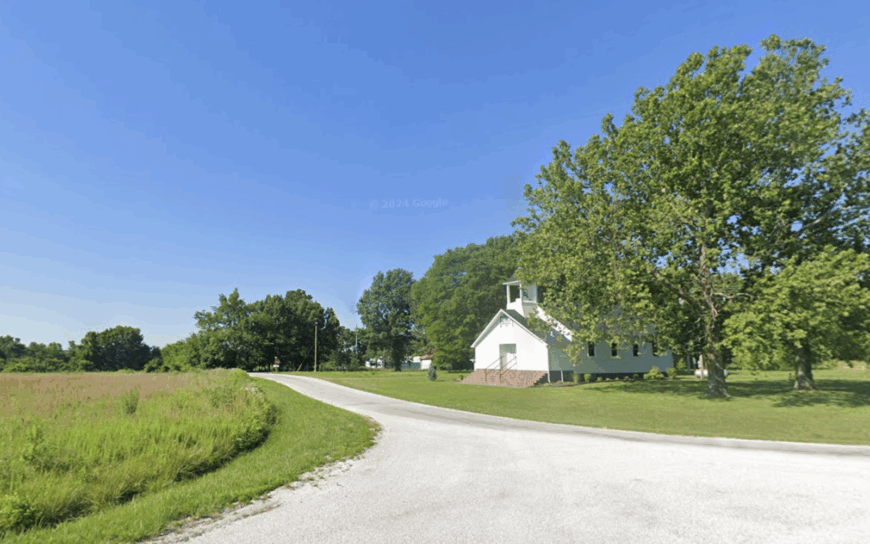
Neighbors gather at a single white-steepled church, the last institution still holding weekly hours. Long stretches of Highway 97 pass without seeing another vehicle, keeping Red Oak wrapped in near-permanent hush.
Where is Red Oak?
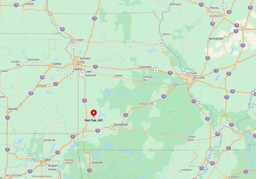
Positioned six miles south of Jerico Springs in Cedar County, Red Oak hugs Highway 97 yet sits far from any major intersection. Open prairie and timber tracts create a miles-wide buffer against larger communities.
Visitors typically reach it via Missouri 32, then head south on 97, a drive that offers endless views of grazing land. Once there, the only sounds are wind through the grass and the creak of an aging storefront sign.
2. Rocky Comfort – Newton County’s Hidden Hollow
Rocky Comfort shelters roughly 150 people in a rolling valley muffled by natural limestone ridges. Residents fish in the tiny East Fork Indian Creek, attend old-fashioned pie auctions at the community center, and explore unpublicized caves on private farmland.
Small poultry houses, custom woodworking sheds, and remote-work fiber lines stitched in by a regional co-op feed the local economy. Two-lane Route T provides the lone paved approach, and the ridges shield the hollow from highway noise and stray light, preserving pristine stargazing.
Dense forest makes property lines almost academic, giving wildlife an open invitation. The result is a pocket of serenity even many Missourians have never heard of.
Where is Rocky Comfort?
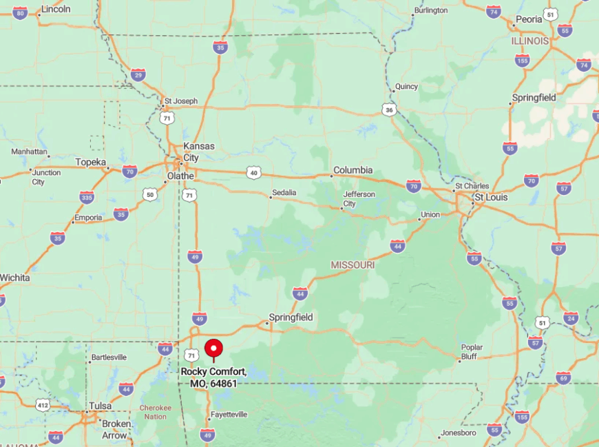
This unincorporated community sits twelve miles east of Noel, tucked just off Missouri Route 76 in southern Newton County. Ridges force all visitors to descend into the hollow on narrow switchbacks, a built-in filter against heavy traffic.
Joplin lies forty-five minutes north, but once darkness falls, its glow never reaches Rocky Comfort. Most newcomers find the town by turning south from Route 76 onto Route T, then following the creek until they spot the modest green population sign.
1. Everton – Rolling Farmland Pocket off the Rail Trail
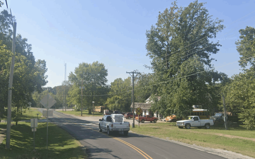
Everton, home to just over 250 residents, rests amid rolling grain fields where deep-set farmhouses sit on one-acre lots bordered by hedgerows. Cyclists on the Frisco Highline Trail pause at the restored depot museum, and locals picnic under century-old oaks in City Park while trains rumble by only in memory.
Grain elevators, custom metal shops, and commuter drives to Springfield shape most livelihoods here. Though a straight 25-mile shot from the city, Everton feels worlds away thanks to surrounding cropland that absorbs both noise and light.
Residents rely on a volunteer fire department and a twice-weekly farmers market for community connection. Evening brings the lowing of cattle and owl calls, reinforcing the unhurried pace.
Where is Everton?
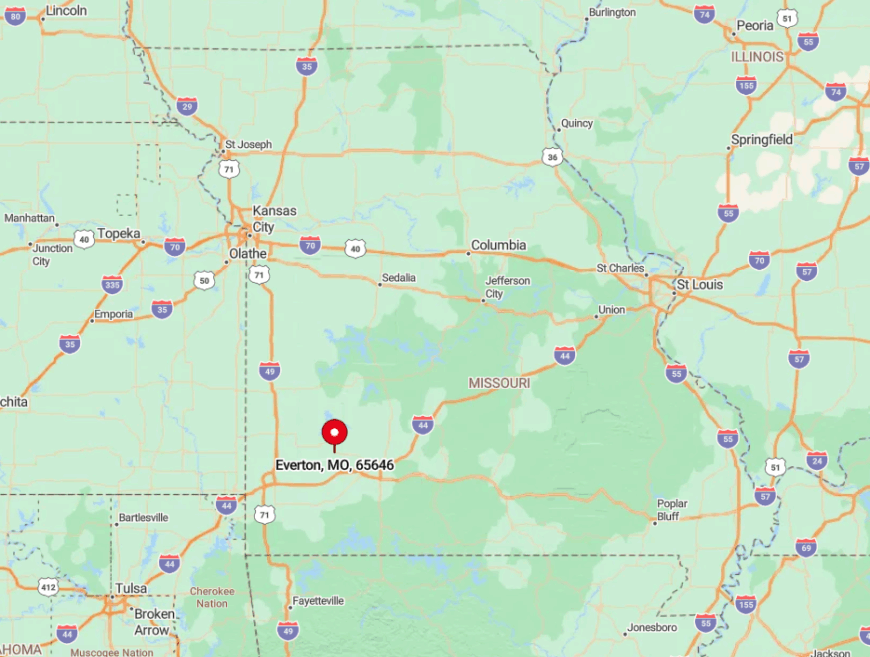
Located in northern Dade County, Everton anchors Missouri Route 160 between Ash Grove and Greenfield. The old Frisco rail bed—now a gravel trail—forms the town’s southern edge, with corn and soybean rows stretching out on every side.
Springfield travelers reach Everton in forty minutes, yet the last ten miles pass only silos and pasture, underscoring its seclusion. Visitors often arrive by bicycle from Walnut Grove, coasting into town just as the prairie sky turns a brilliant shade of coral.