Would you like to save this?
Southwest Illinois is better known for rich river soil and sleepy cornfields than for bright city lights, yet tucked among its ridges and bottomlands are villages where silence still rules the evening.
We gathered 25 of the most out-of-the-way towns in this corner of the state—places where gravel crunching under tires is often the loudest rush-hour sound and neighbors sit miles apart.
Each settlement offers a different flavor of quiet, from cliff-top eagle lookouts to orchard-lined ridges that smell of apple blossoms every spring. Small populations, limited through-roads, and landscape barriers all play their part in keeping these hamlets hidden.
Visitors find hiking trails, ferry rides, and historic taverns rather than chain stores or traffic lights. Those seeking genuine breathing room will discover plenty of it along the Mississippi, Illinois, and Kaskaskia river valleys.
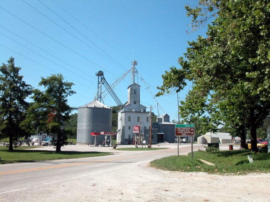
25. Kaskaskia – Island Village at the Edge of Illinois
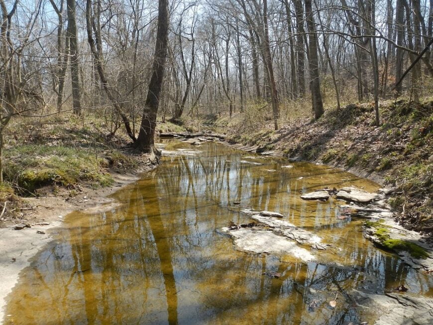
Set on an island in the Mississippi, Kaskaskia feels like a place the river borrowed from another century and forgot to return. Its isolation comes baked in: you reach it not from Illinois but by crossing over from Missouri, and high water can make the whole world feel even farther away.
The vibe is hushed and historical—bell towers, old cemeteries, and wind in the cottonwoods—more whispered legend than bustling town. People here work cattle, farm the bottomlands, or commute to nearby Chester when the river allows. Visitors poke around the Liberty Bell of the West shrine, cast for catfish from the levee, or drive quiet loops under soaring raptors.
When the sun sinks, the sound is mostly frogs and the river breathing. It’s the kind of place that makes time run on river speed.
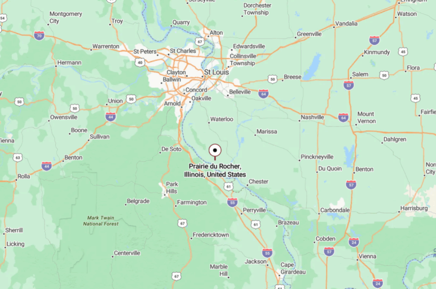
Where is Kaskaskia?
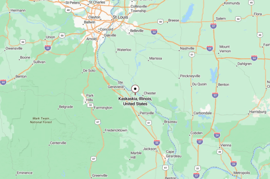
Tucked in far southwestern Illinois, Kaskaskia sits on Kaskaskia Island in the Mississippi River just west of Chester. It’s about 65 miles south of downtown St. Louis.
You reach it via Missouri roads and a narrow bridge across the river’s old channel, a route that feels more like a favor from the map than a promise. Close enough to find, but far enough to feel like you’ve slipped out of the state for an afternoon.
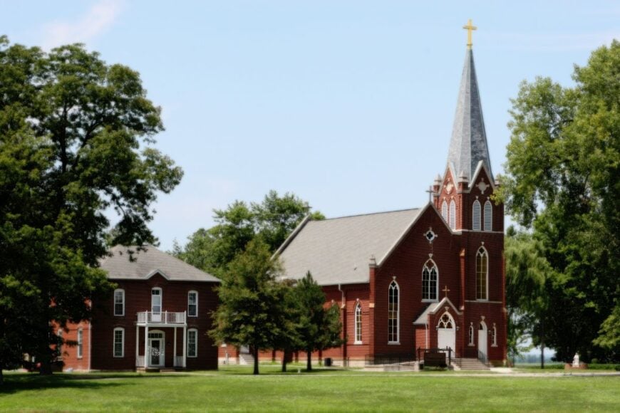
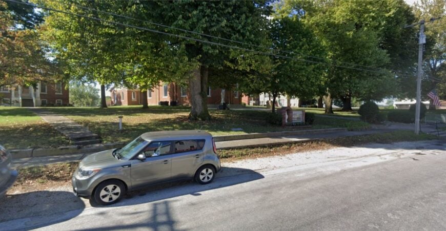
24. Prairie du Rocher – French Prairie Below the Bluffs
Protected by towering limestone walls and the wide table of the American Bottom, Prairie du Rocher keeps to a pace measured in church bells and porch talk. Seclusion comes from geography: the bluff to the east, the river bottoms to the west, and few reasons for anyone to pass through unless they mean to.
The village feels storied and soft around the edges—saltbox houses, Creole timber frames, and that gentle river light. Work centers on farming, small services, and heritage tourism tied to nearby Fort de Chartres. Wander the Creole House, picnic at the state historic site, or watch storms march along the valley floor like traveling plays.
Nights are dark, and the soundtrack is cicadas and the low thump of barge tows far off. It’s a place that remembers things the rest of us forgot.
Where is Prairie du Rocher?
On the Mississippi floodplain below the Randolph County bluffs, the village lies about 50 miles south of St. Louis and 15 miles northwest of Chester. Most travelers drift down IL-3, then slip west on county roads until the bluff opens to prairie.
The last stretch feels like a corridor of corn and sky. When the bluffs finally appear in your rearview, you know you’ve arrived somewhere quiet.
23. Brussels – Ferry-Fed Orchard Village
Brussels sits high on an orchard ridge where the Illinois and Mississippi nearly shake hands, a peninsula village that keeps its calendar by peach bloom and eagle flights. Its tucked-away feel comes from water on three sides and ferries that do the quiet work of gates.
The mood is neighborly and old-country—stone churches, tidy gardens, and fruit sheds that smell like summer. Work leans on fruit farming, the school district, and the nearby Two Rivers National Wildlife Refuge. Spend a morning birding the refuge, browsing roadside stands, or sipping coffee beneath shade trees while barges glide below.
Traffic noise never really finds purchase here; wind through leaves does. It’s the kind of place where a ferry ride is your first deep breath.
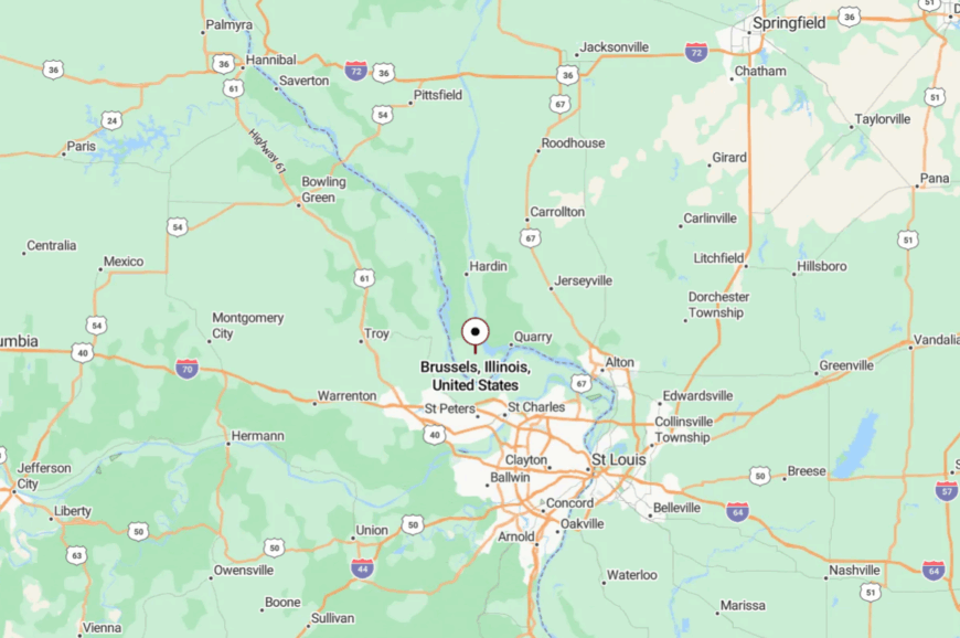
Where is Brussels?
Would you like to save this?
In central Calhoun County, Brussels rests about 60 miles northwest of St. Louis at the heart of the peninsula between the Illinois and Mississippi rivers. Most visitors come via the free Brussels Ferry or by winding in from Hardin on county blacktop.
Roads narrow, hills steepen, and orchards replace road signs. The approach itself feels like a gentle untying from the busy world.
22. Kampsville – River Landing Where Time Drifts
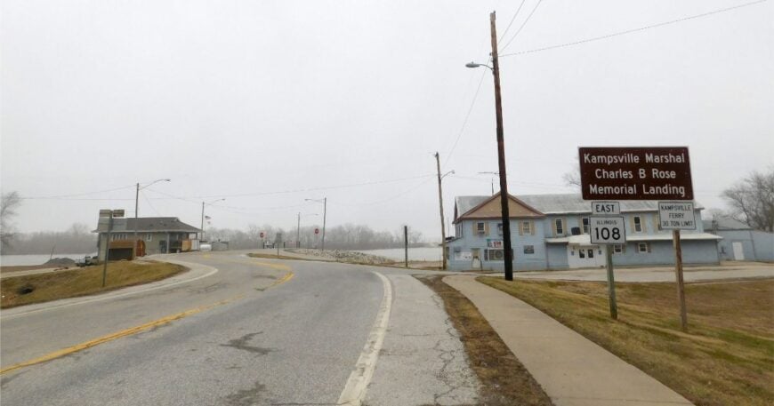
With the round-the-clock ferry as its slow metronome, Kampsville hums along at river speed. Seclusion comes from the fact that the Illinois River is both front yard and filter—most folks only arrive if they mean it.
The vibe is river-practical and scholarly all at once, thanks to the Center for American Archeology tucked among boat ramps and shade trees. Locals work in schools, orchards, river services, and seasonal tourism. Visitors ride the ferry just for the view, check out archaeology exhibits, or picnic while swallows stitch the sky.
Evenings fold into the soft clank of towboats and the slip of current against pilings. It’s the kind of spot where you can hear your own thoughts and like their company.
Where is Kampsville?
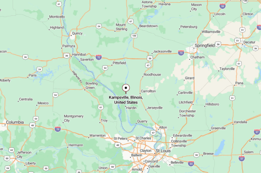
Set along IL-100 in Calhoun County, roughly 70 miles northwest of St. Louis, Kampsville hugs the west bank of the Illinois River. The village connects to Greene County via the free IL-108 ferry.
Approaches are two-lane and unhurried, the kind where you wave at the same car twice. The ferry crossing is your subtle threshold to quiet.
21. Elsah – Stone-Built Hollow by the River Road
Elsah keeps itself tucked into a narrow ravine where limestone homes lean into the hills and the river glitters just beyond the trees. The bluff walls and the Great River Road’s gentle detour around town keep through-traffic low, and walking often beats driving.
The mood is scholarly and serene thanks to Principia College up the ridge, with a dash of river-town romance. Locals teach, run inns, or tend to small shops; others commute along the river to bigger towns.
Spend a day strolling historic lanes, watching eagles from the pull-offs, or biking the flat ribbon of the Sam Vadalabene Trail. When porch lights blink on, the village looks like a painting. It’s close to everything and somehow apart.
Where is Elsah?
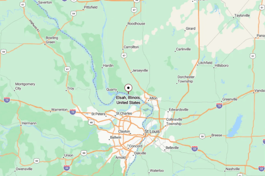
In Jersey County along the Mississippi, Elsah sits about 40 miles northwest of St. Louis between Alton and Grafton. Drivers follow IL-100, then slip into the hollow where stone houses and maples close ranks.
Roads narrow to whispers and walking becomes the right answer. It’s a pocket so sheltered you can hear the river without seeing it.
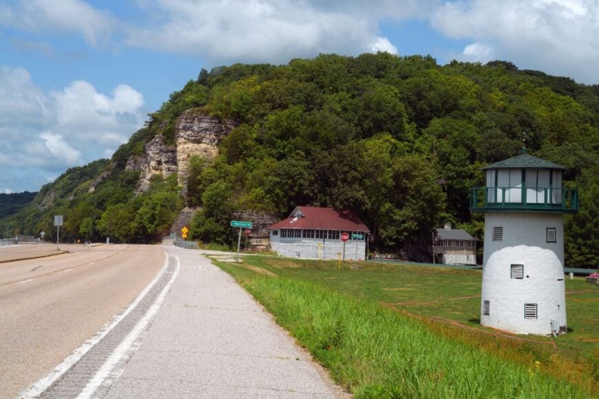
20. Golden Eagle – Tip of the Peninsula
At the southern tip of Calhoun County’s long finger of land, Golden Eagle feels like the peninsula’s last quiet word. Water hems it in on three sides, and ferry timing becomes a daily rhythm, which keeps casual passersby away.
The vibe is river-rustic: boat slips, willow shade, and fields that run right to the levee. People work orchards, tend cattle, and guide on the water when the seasons are right. Visitors bird the backwaters, throw a line for sauger, or laze away an afternoon watching the water change moods.
You measure distance here in bends and sloughs, not miles. It’s the kind of place that teaches you patience without trying.
Where is Golden Eagle?
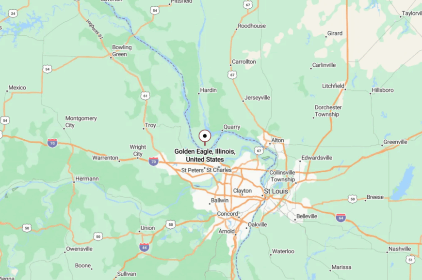
Golden Eagle sits in southern Calhoun County, roughly 5 miles south of Brussels at the peninsula’s tip. Approaches are ferry-fed and two-lane, with IL-100 and county roads doing the last, lovely work.
When the road runs out, the river takes over. The horizon is mostly sky and water, which is the point.
19. Michael – Little Bend on the River Road
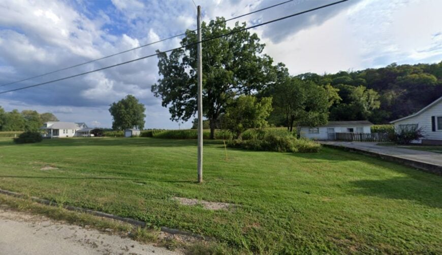
Michael is one of those places you can pass in a blink unless you’re looking for it—the kind of bend-side hamlet that stays small on purpose. It’s secluded by distance and disinterest: the nearest big errands are in Hardin, and IL-100 carries more scenery than commuters.
The feel is plainspoken and neighborly—boat trailers, tractors, and mailboxes in friendly clusters. Orchards, river work, and school jobs in the county provide most of the paychecks. Spend an hour watching eagles over the winter water, or drive slowly through peach country when the blossoms turn the air sweet.
Even silence here has a particular texture, like wind laid gently on water. It’s small enough that the sky feels like the town square.
Where is Michael?
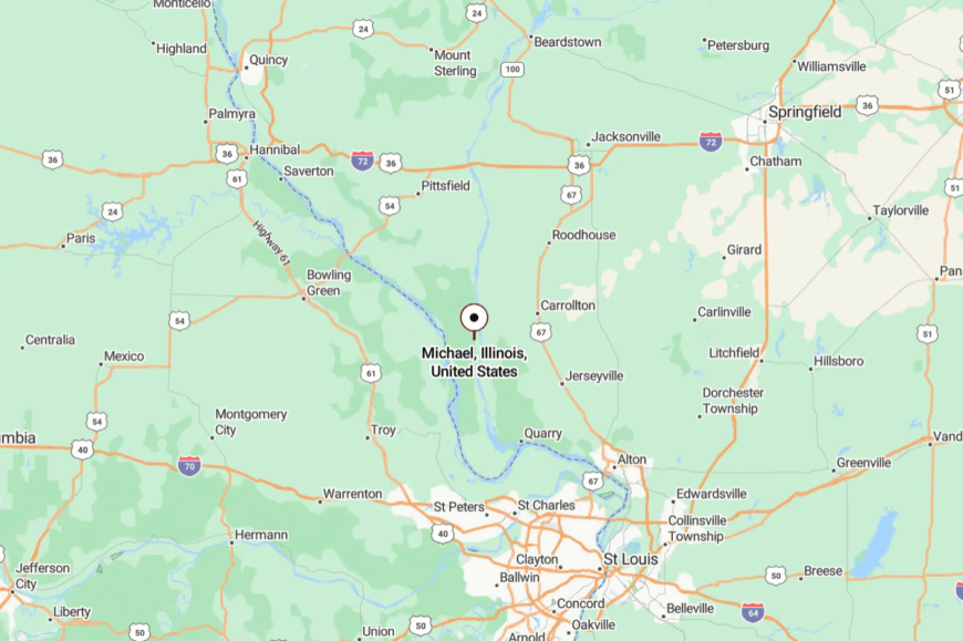
Michael lies along IL-100 about 5.5 miles north of Hardin in central Calhoun County. You reach it by following the river road past fields and timbered bottoms.
Landmarks are few by design, which keeps the place quiet. By the time you notice the sign, you’ve already arrived.
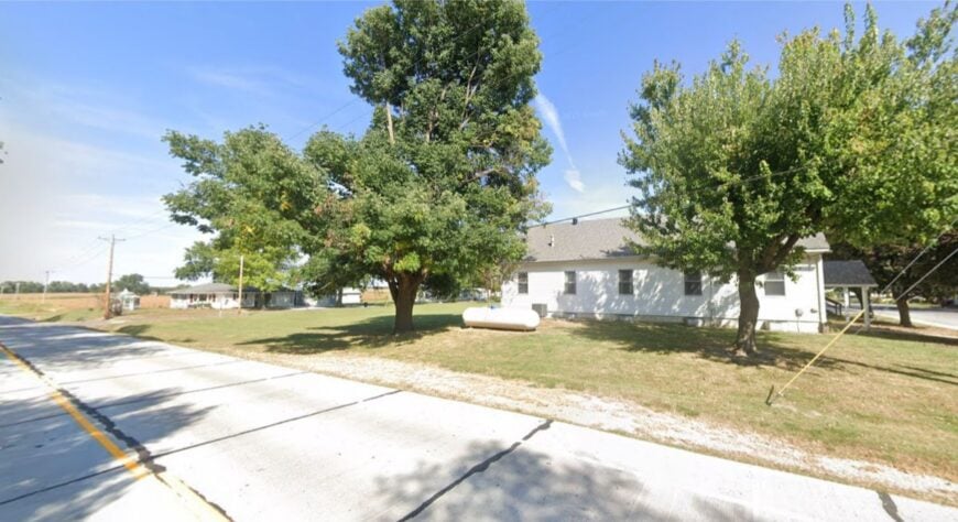
18. Gilead – Former County Seat Turned River Quiet
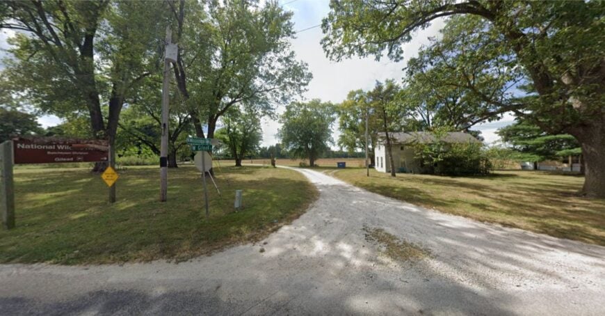
Gilead wears its history like an old jacket—comfortable, a little scuffed, and perfect for the weather. It once handled courthouse business; now it handles sunrise and chores. Seclusion is simple: the Mississippi on one side, orchard hills on the other, and no fast road that makes it a shortcut.
The mood is rural and reflective, where old stories are as much a crop as corn. Folks farm, guide, or head to Hardin when they must.
Visitors wander the backroads, poke around old sites, or sit on tailgates watching the river think. It’s the kind of quiet that keeps your voice low without asking.
Where is Gilead?
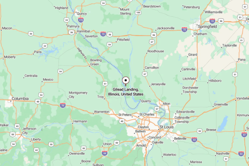
Gilead sits near the Mississippi, about 8 miles south of Hamburg in Calhoun County. County lanes thread down from IL-100, narrowing to shade and birdsong.
The route feels like a conversation between bluffs and water. When the pavement softens, so does your schedule.
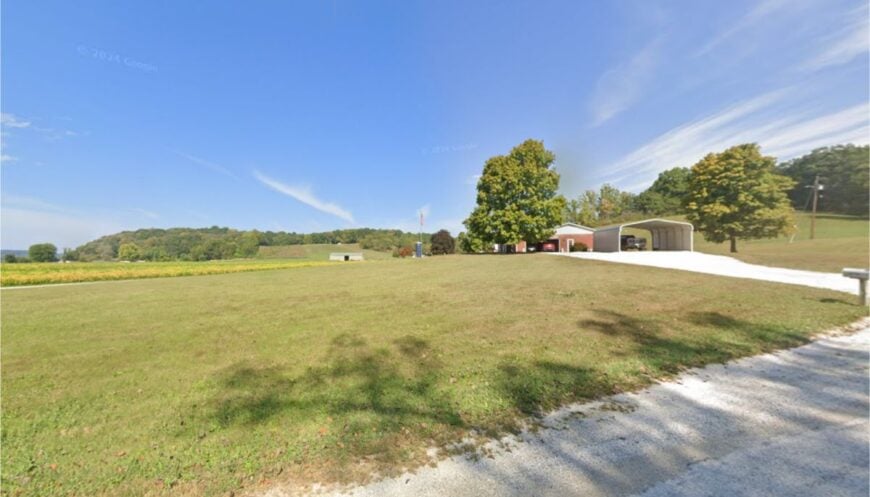
17. Otterville – Stone School and Slow Streets
Otterville feels like a wide-porch chapter of American small-town history, where the past is both a landmark and a neighbor. The town’s tucked-away feel comes from its position off the main corridors, with the big attractions and highways happily skirting around.
The vibe is earnest and bookish: a historic primary school, tidy yards, and quiet evenings. People work in schools, farms, and service jobs, with bigger commutes to Jerseyville or Alton.
Tour the Hamilton Primary School site, fish nearby creeks, or country-drive under high canopies of oak. It never seems in a hurry to be anywhere else. It’s the sort of place that fits like a favorite sweater.
Where is Otterville?
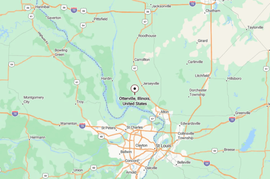
In northwest Jersey County, Otterville lies about 12 miles northwest of Jerseyville and 55 miles from St. Louis. You get there by stringing together two-lane state routes and county roads that prefer meanders to straight lines.
The approach feels agricultural and open, with the sky doing most of the talking. Out here, quiet has room to stretch.
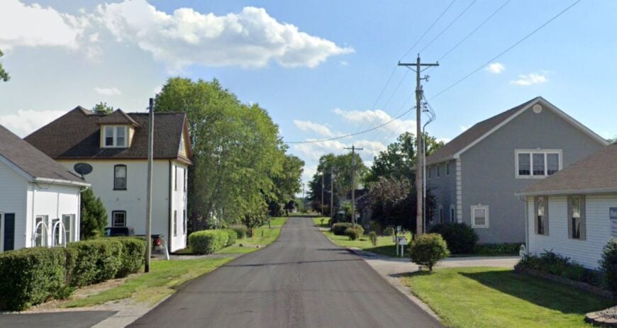
16. Rosedale – Edge of the Park, Edge of the World
Would you like to save this?
Rosedale seems to drowse in the green fringe just north of Pere Marquette State Park, where the hills turn to orchards and the river makes its long, slow arguments. It stays secluded thanks to the parklands and backroads that gently discourage quick passage.
The impression is pastoral and lightly wild—deer at dusk, hawks kiting over hayfields, and fog lifting off the bottom ground. Work is a mix of small farms, tourism spillover, and commutes to larger towns. Hike the nearby bluffs, detour to scenic overlooks, or hunt mushrooms in spring where the oaks keep secrets.
Sunset pours gold over everything like a benediction. It’s an easy town to miss and an easier one to miss once you’ve left.
Where is Rosedale?
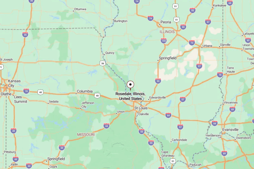
South of Fieldon in Jersey County, Rosedale sits just north of Pere Marquette State Park along a patchwork of county blacktop. It’s about 15 miles northwest of Grafton via IL-100 and local roads.
The last miles are winding and tree-tunneled. The park’s bluffs make a quiet wall between Rosedale and the rest of the world.
15. New Hanover – Bluffline Cluster with Old-World Roots
New Hanover gathers along the lower shoulders of the Monroe County bluffs, where fields meet timber and backroads tighten into habit. Its tucked-away feel comes from being neither town nor thoroughfare—just a settlement that exists because people chose it, not because anyone was passing through.
The mood is tidy and heritage-minded, with German roots showing up in church suppers, careful gardens, and quiet porches. Residents farm, run small trades, or commute into Waterloo or Columbia when needed.
Visitors trace the historic Kaskaskia-to-St. Louis corridor nearby, pause at shaded creeks, or catch kestrels on the fencerows. Even the mailboxes seem to speak in low voices. It’s a place that offers its first name before asking yours.
Where is New Hanover?
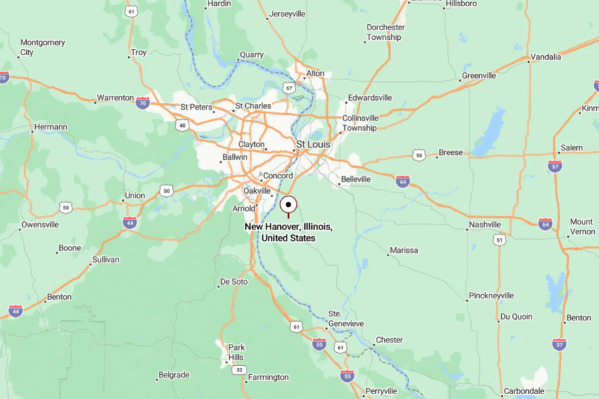
New Hanover sits in southeastern Monroe County, about six miles southwest of Columbia and twenty miles south of downtown St. Louis. The approach is via Bluff Road and county lanes that slip between bottomlands and bluffs.
The drive feels unhurried, with fields widening and trees closing ranks. By the time you roll in, you’re already at New Hanover speed.
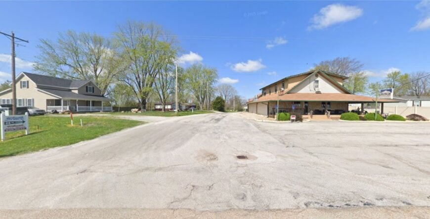
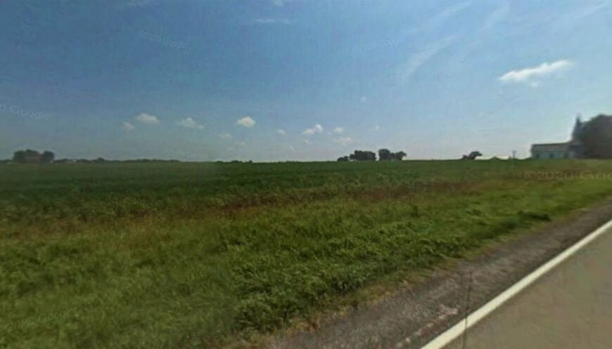
14. Tipton – Old Rail Stop in the Corn and Oaks
Tipton keeps its footprint small along the old St. Louis & Cairo line, a crossroads that never tried to be more than itself. Seclusion lives in its back-road status and the way the hills and fields swallow road noise.
The vibe is modest and sociable—farm gates, a church yard, and a sense that everybody waves. Work is farm-forward, with commutes to Waterloo or Columbia when necessary. Cyclists like the quiet lanes, and history buffs chase the Tipperary-to-Tipton story over afternoon drives.
Dusk brings whip-poor-wills and long shadows across soybeans. It’s a place that treats time like a neighbor, not a boss.
Where is Tipton?
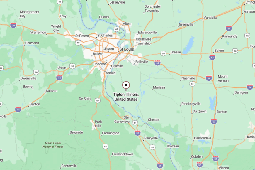
In central Monroe County, Tipton lies south of Columbia and west of Waterloo. You reach it from IL-3 via looping county roads that skim the bluff base.
There’s no reason to hurry—the landscape won’t let you. By the time you arrive, you’re already moving at Tipton speed.
13. Wartburg – Creek Bottoms and Church Bells
Wartburg tucks itself into a fold of the bluffs where a rural lane and a country church have been keeping company since before the Civil War. Its quiet persists because there’s no direct route through—just a reason to come, and reasons to stay.
The mood is pastoral and rooted: hay fields, youth camps, and evenings that end with windows open to crickets. People farm, help with the camp, or work in nearby Waterloo.
Visitors swing by Camp Wartburg trails, snap photos of stonework, or drive the backroads where the map wrinkles a bit. The air smells like cut grass and creekwater in summer. It’s the sort of stillness that lingers after you leave.
Where is Wartburg?
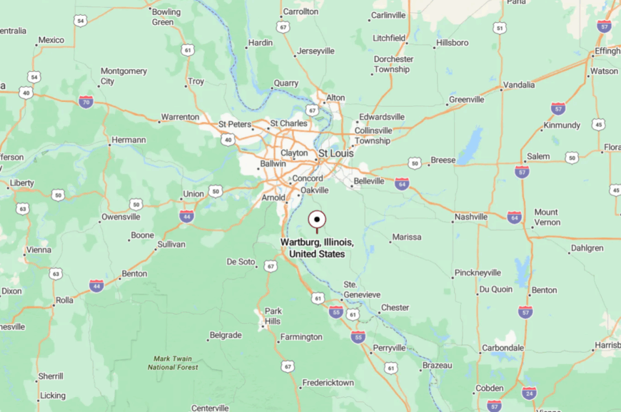
Wartburg sits southwest of Waterloo in Monroe County, a few miles off IL-3 along local roads. The approach bends through low hills and creek bottoms.
It’s close on the map but feels farther in the heart. The last turn always seems quieter than the one before it.
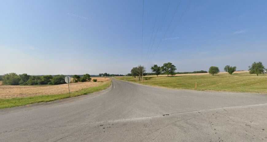
12. St. Joe – Fence-Line Hamlet on the Old Road
St. Joe is little more than a name where the historic Kaskaskia-to-St. Louis road pauses to take a breath, and that’s the charm. Seclusion stems from being between places—between Renault and Burksville, between bluff and bottom—with no fast lanes to speak of.
The feel is spare and sun-warmed: fence lines, pasture, and the occasional tractor rumble. Folks farm and head to Waterloo for what the land can’t provide. Visitors trace the old road, bird the hedgerows, or time their drive for golden-hour fields.
The sky feels oversized here. It’s a tiny dot that knows how to hold your attention.
Where is St. Joe?
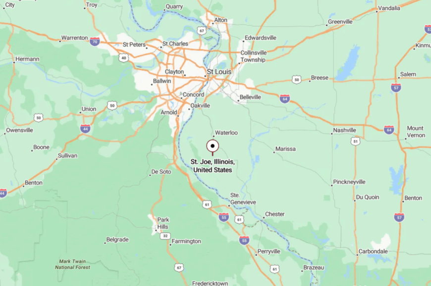
St. Joe sits in the New Design Precinct of Monroe County, roughly 10 miles south of Waterloo. Reach it from IL-3 via Bluff Road and county lanes that wander more than they aim.
The hills and history do most of the steering. You’ll know you’re close when the road starts to feel like a memory.
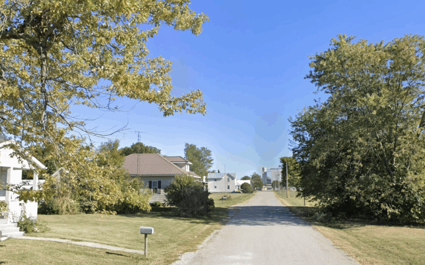
11. Wine Hill – German Vines and Quiet Ridges
Wine Hill perches on a Randolph County rise where 19th-century vineyards once caught every ounce of sun, and the landscape still looks made for lingering. Its secluded feel comes from distance and topography: low ridges, timber breaks, and no major through-road to invite a crowd.
The mood is rural and a little old-world—shingled farmsteads, tidy plots, and stars that arrive early. Work leans into agriculture and small trades, with errands run in Campbell Hill or Steeleville.
Spend a morning cruising ridge roads, spotting hawks, and nosing around old cellar sites; fish a nearby farm pond in the hush of late light. Wind off the hills brings the only steady noise. It’s the kind of quiet that makes you whisper hello.
Where is Wine Hill?
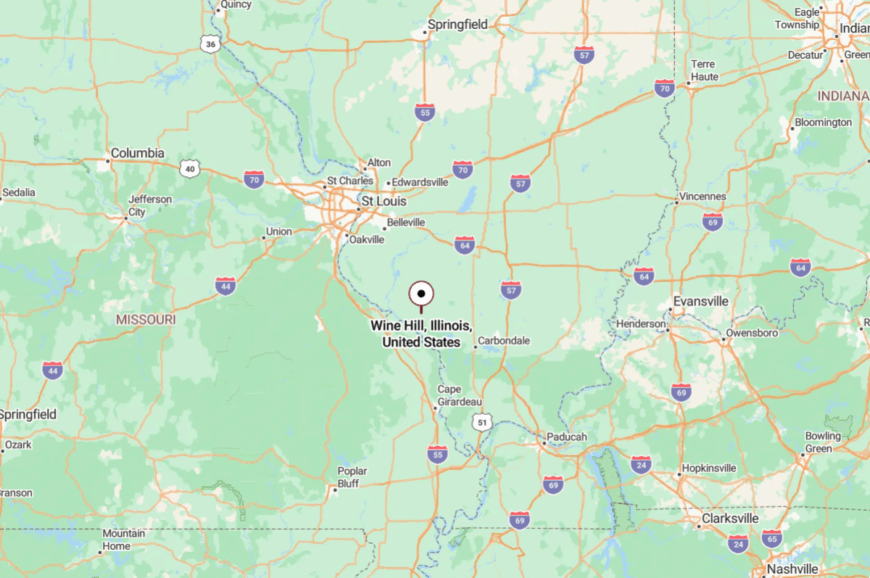
About 7 miles west-northwest of Campbell Hill in western Randolph County, Wine Hill sits among gentle uplands and a farm grid. You reach it on county lanes that trade speed for views.
The closer you get, the more the horizon opens. Out here, distance is measured in fields and sky.
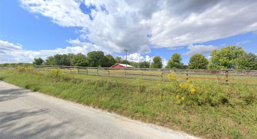
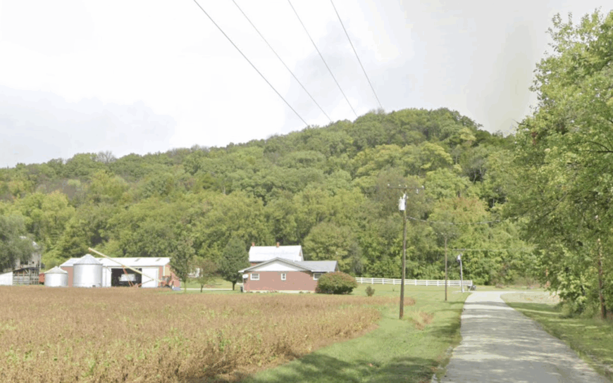
10. Fults – Bluff-Hugged Hamlet Hidden in the American Bottom
Home to roughly 25 residents, Fults sits under a sheer limestone wall that rises hundreds of feet above the floodplain. Locals pass evenings spotting peregrine falcons on the bluff face or wandering the nearby Fults Hill Prairie Nature Preserve, a pocket of rare dry prairie bursting with blazing star in July.
Farming and a handful of conservation jobs form the community’s modest economic base, and the nearest gas pump is eight miles away in Prairie du Rocher. No commercial strip or rail line breaks the hush; a single gravel lane loops past one-acre homesteads, barns, and a tiny white church.
The limestone barrier blocks both noise and cell signals, reinforcing the sense of being tucked out of sight. Fults feels less like a suburb of St. Louis and more like a forgotten frontier station.
Where is Fults?
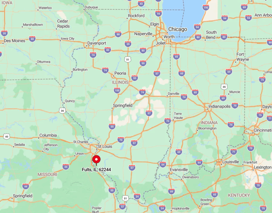
The hamlet lies 40 miles south of downtown St. Louis in Monroe County’s American Bottom, halfway between the Mississippi River and bluff crest. Steep walls on three sides and river backwaters on the fourth leave it shielded from major highways.
The only direct approach is Bluff Road, a two-lane route that dead-ends a few miles farther on. Travelers reach Fults by following Illinois Route 3 to Waterloo, then winding south along cornfields until pavement turns to gravel.
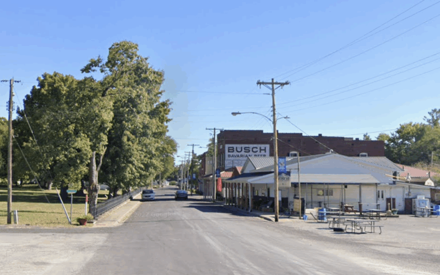
9. Meppen – Orchard-Dotted Ridge Above the Illinois River
Meppen counts about 80 people spread along twisting ridge roads in northern Calhoun County. Apple-picking at small family orchards, mushroom hunting in shaded ravines, and back-road cycling top the entertainment list.
Most residents earn their keep through fruit farming or seasonal work at packing sheds and roadside stands. There’s no retail strip; instead, a century-old stone church and a volunteer firehouse anchor the scene.
Elevation keeps the settlement buffered from the river valley traffic hundreds of feet below, while dense woods muffle the few trucks that climb the grade. The result is a ridgeline hamlet where quiet lingers even during harvest rush.
Where is Meppen?
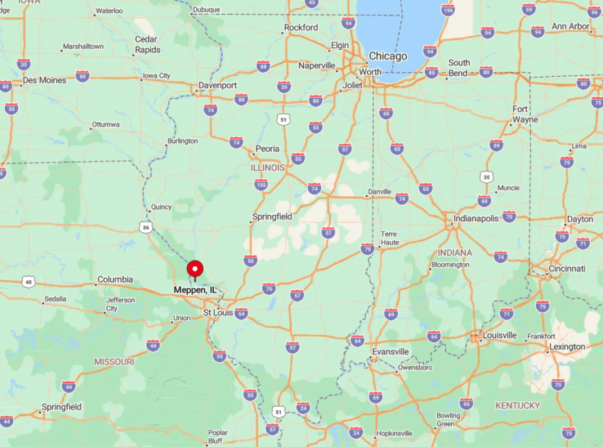
The village occupies high ground four miles east of the Illinois River’s scenic Horseshoe Bend, reachable only by county blacktop that twists up from Brussels Ferry. Thick oak forest and unbroken apple groves separate it from the nearest state highway by more than ten miles.
Visitors usually arrive via the free ferry from Missouri, then follow the ridge until farm gates outnumber mailboxes. Isolation is further reinforced every winter when ice can shut both river ferries, leaving Meppen a true island.
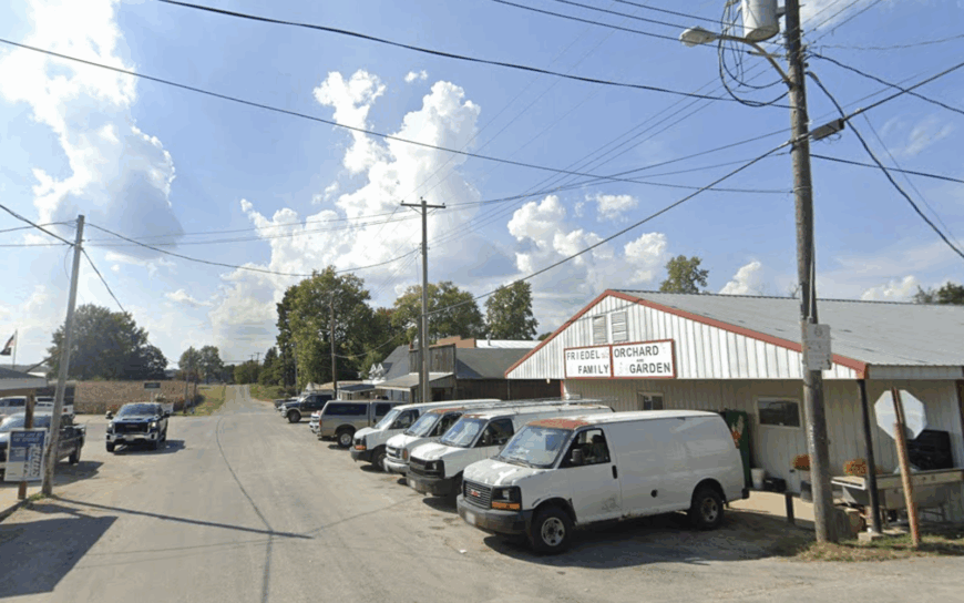
8. Modoc – Dead-End River Road Retreat
Roughly 200 people call Modoc home, gathering at the river landing to watch the pavement give way to the Mississippi’s gray water.
An afternoon might involve fishing backwaters for crappie, checking out the historic Liberty Bell of the West at Fort de Chartres five miles north, or hopping the tiny two-car ferry that carries drivers across to Ste. Genevieve, Missouri. Farming, barge work, and ferry operations supply most paychecks.
The key to Modoc’s hush is its literal dead end: beyond the last mailbox, Illinois Route 155 simply stops at the dock, so through-traffic never materializes. Timbered sloughs and levee berms buffer the settlement from highway noise. Nights belong to owls, not engines.
Where is Modoc?
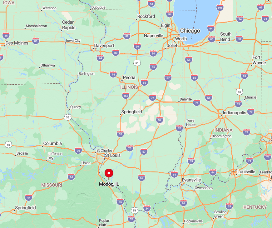
Modoc rests in Randolph County, 65 miles south of St. Louis and three miles off Illinois Route 3. Steep bluffs hem it in on the east, while the Mississippi runs against its western edge.
Travelers must follow Route 155 until the asphalt ends at the ferry ramp. Should the ferry close for high water, Modoc turns into a cul-de-sac surrounded by water and rock.
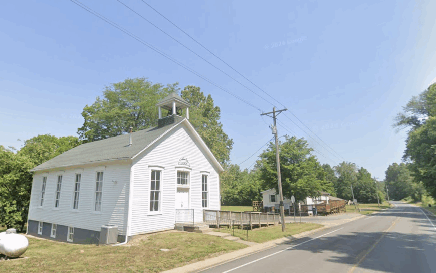
7. Batchtown – Calhoun County’s Sleepy Crossroads
Batchtown’s population of 170 gathers around a four-way stop that rarely sees more than a dozen cars an hour. Residents fill weekends with trap shooting at the local sportsmen’s club, paddling the quiet Batchtown Wildlife Area, or watching meteor showers in skies free of light pollution.
Limited farming and county jobs provide the main income, supplemented by seasonal peach and apple harvest work. With the nearest four-lane highway a 30-minute drive and cellular service spotty, digital noise is nearly as scarce as road noise.
House lots often stretch to five acres, separated by hay fields dotted with round bales. Porch-light glow, not retail neon, supplies the village’s evening illumination.
Where is Batchtown?
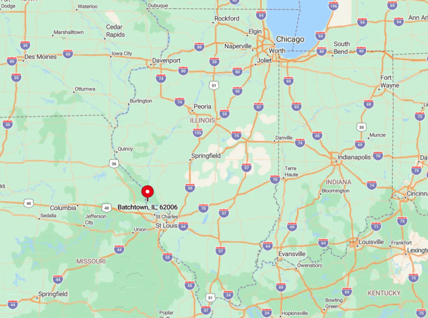
Batchtown occupies central Calhoun County, 15 miles north of Brussels on County Road 1. Flanked by the Mississippi to the west and Illinois River backwaters to the east, it sits on a narrow peninsula accessible only by winding levee roads.
Visitors usually arrive by ferry—either from Grafton or Winfield, Missouri—and then drive miles of dike-top pavement. The dual rivers create natural barriers that discourage casual pass-through traffic.
6. Rockwood – Forest-Rimmed Hollow off Route 3
Only about 45 people reside in Rockwood, their homes tucked into a bluff-sheltered hollow at the southern edge of Randolph County. Daylight hours see hikers climbing Pine Hills Trail, birders seeking cerulean warblers, and anglers casting lines in nearby Fountain Bluff backwaters.
A scattering of farms and seasonal tourism linked to Shawnee National Forest make up the local economy. Dense hardwood tracts on three sides and the Mississippi floodplain on the fourth create a natural sound wall.
No rail line or barge terminal punctures the hush, so cicadas dominate summer evenings. Rockwood’s post office closed years ago, a sure sign that pace here remains unhurried.
Where is Rockwood?

The village hides just west of Illinois Route 3, 20 miles north of Chester. A short county lane dips off the highway and disappears behind a curtain of timber before ending at a cluster of mailboxes.
With cliffs rising on both sides, satellite reception is fickle and big rigs avoid the tight turn. Reaching Rockwood requires a deliberate detour, which keeps the hollow undisturbed.
5. Eldred – River Bend Village Lost in the Bottomlands
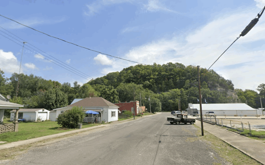
Eldred’s 180 residents live along gravel lanes bordered by sloughs and cattle pasture on the Greene County bank of the Illinois River. Locals spend free time duck hunting in winter, wading Sandy Creek in summer, or swapping stories at the one-room general store that doubles as the post office.
Farming, hunting-camp rentals, and small-scale cattle operations dominate the economy. Steep wooded bluffs pin the settlement against the river, eliminating any logical shortcut for drivers. Streetlights are absent, so the Milky Way unfurls brightly on clear nights. Evenings echo with tree frogs rather than tire hum.
Where is Eldred?
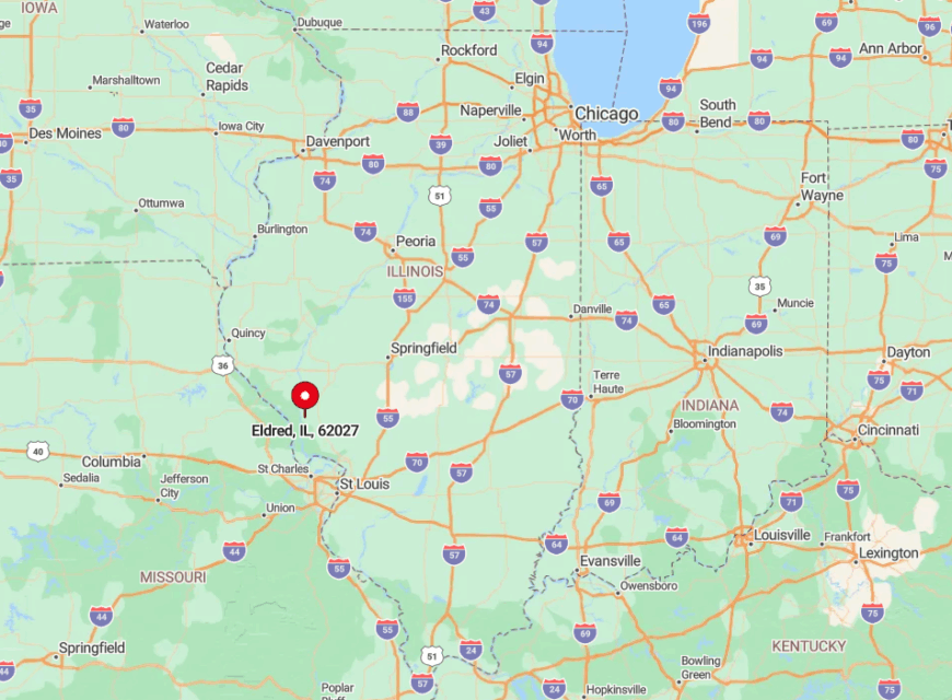
The village lies ten miles south of Carrollton along County Highway 2, ending where the road narrows to gravel at the Eldred River Access. Bluffs rising 250 feet behind the houses block signal towers and shield the area from highway sounds.
Visitors approach via Illinois Route 108, then wind downhill through switchbacks before the landscape opens to bottomland. The last gas station appears five miles back, reinforcing Eldred’s hideaway feel.
4. Hamburg – Mississippi Overlook with More Eagles than People
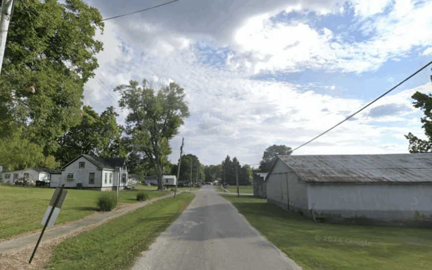
Hamburg shelters about 100 residents on a high bluff terrace overlooking a sleepy riverside landing. Winter brings clouds of migratory bald eagles that perch on cottonwoods outside living-room windows, while summer means porch-sitting with binoculars trained on passing tows.
Small-plot orchards, river fishing guides, and a co-op grain elevator supply limited employment. Homes line a single bluff-top street, and a switchback lane provides the only link to the boat ramp below; truckers choose easier routes, leaving Hamburg hushed.
Storms roll up the valley in full cinematic view, yet their thunder is often the loudest disturbance. Nightlife consists of the tavern’s jukebox and an occasional owl call.
Where is Hamburg?
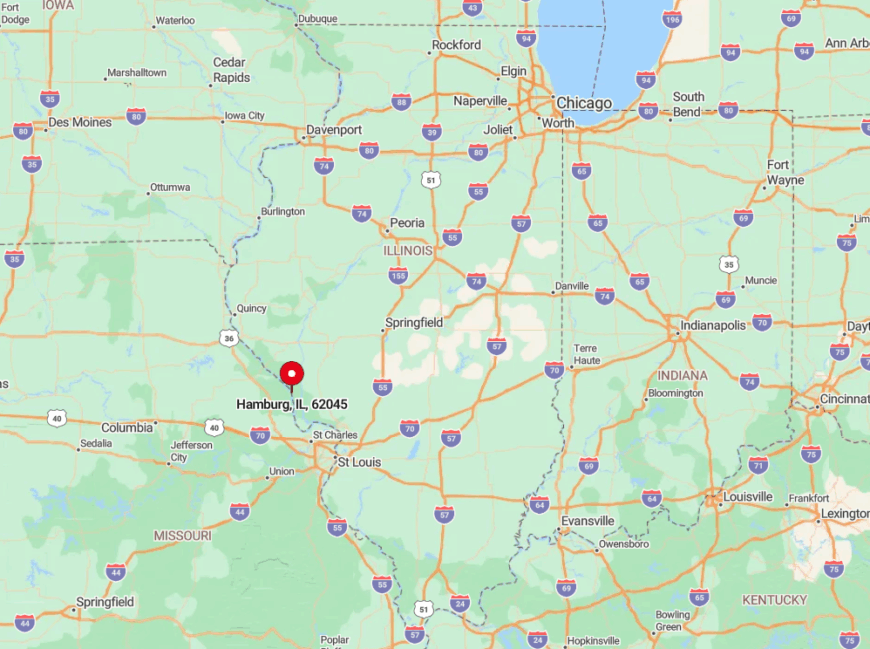
The village crowns the western edge of Calhoun County, 25 miles northwest of Grafton. To reach it, drivers cross the Illinois River at Brussels Ferry and follow the Great River Road before climbing a steep county blacktop.
With the river on one side and rolling orchard hills on the other, there is nowhere for an alternate route to cut through. That single approach and bluff elevation keep Hamburg peaceful year-round.
3. Foster Pond – One-Intersection Community on the Old Plank Road
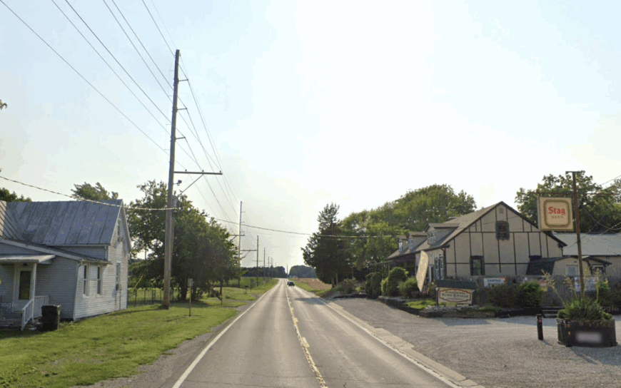
Foster Pond claims about 60 residents, anchored by a stone church built in 1849 and a tavern famed for Friday fish fries. Locals hike the 535-acre Salt Lick Point Land and Water Reserve or cycle the old Plank Road, once a stagecoach line linking St. Louis to the salt works at Harrisonville.
Grain farming and weekend tourism from nearby Waterloo provide modest income. Dense oak woods, sweeping cornfields, and a ten-mile drive to the nearest grocery ensure a stillness broken mostly by church bells.
Even the mail routes are rural; boxes cluster at crossroads rather than stand at each driveway. Nights reveal whip-poor-wills singing from fence lines under dark skies.
Where is Foster Pond?
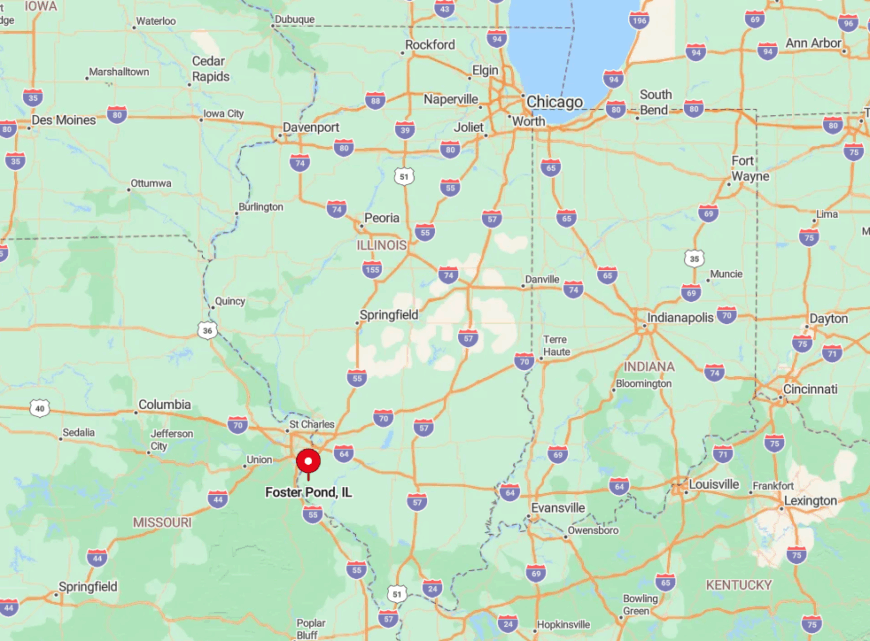
The hamlet sits in eastern Monroe County, eight miles south of Waterloo on Bluff Road. No state highway passes through; instead, a pair of county lanes meet at the church and then fade into farmland.
Visitors leaving Interstate 255 must weave fifteen minutes along levee dikes before trees swallow the horizon. The absence of direct routes secures Foster Pond’s privacy.
2. Medora – Jersey County’s Wide-Lot Prairie Pocket
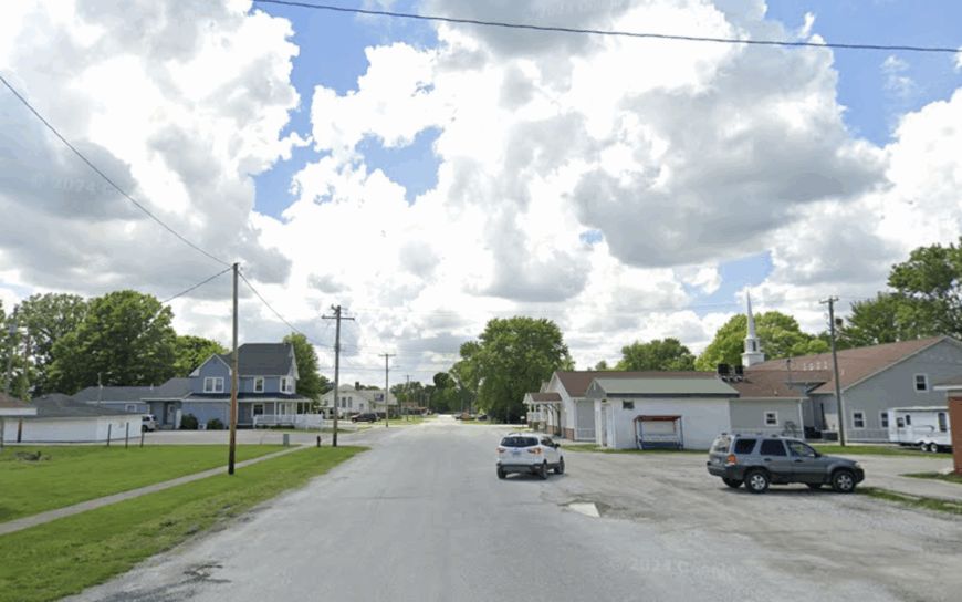
Medora is home to around 400 people living along unusually broad, tree-lined streets laid out in 1857. Popular pastimes include exploring Beaver Creek Conservation Area, browsing shelves at the volunteer-run Carnegie Library, or attending Friday night ballgames at Southwestern High School.
Agriculture and school-district employment provide most paychecks; there’s no factory whistle or rail spur to break the calm. Fields stretch to every horizon, and the closest sizeable town, Jerseyville, sits 20 miles east, leaving Medora free from suburban spillover.
Large lots—many two acres or more—put distance between neighbors, adding to the sense of space. Even during harvest, combine traffic is brief and predictable.
Where is Medora?
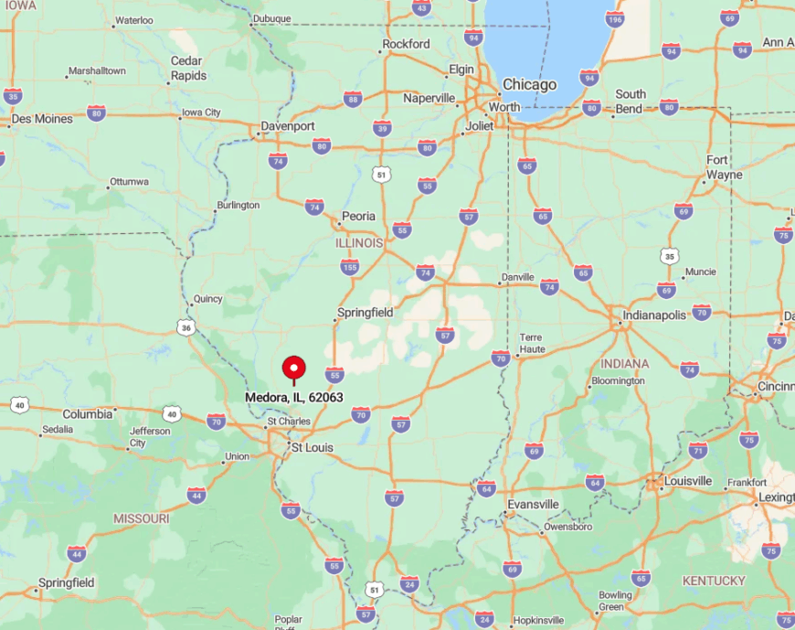
The village rests along Illinois Route 111 in the prairie flats of southwestern Jersey County. Though the state route offers a straight shot, it carries light traffic thanks to faster highways that bypass the area.
Lambert Airport sits an hour away, and no rail line cuts through, so most travelers arrive by two-lane road. Flat cropland in every direction serves as an open buffer against urban reach.
1. Walsh – Quiet Ridge Above the Kaskaskia River Valley
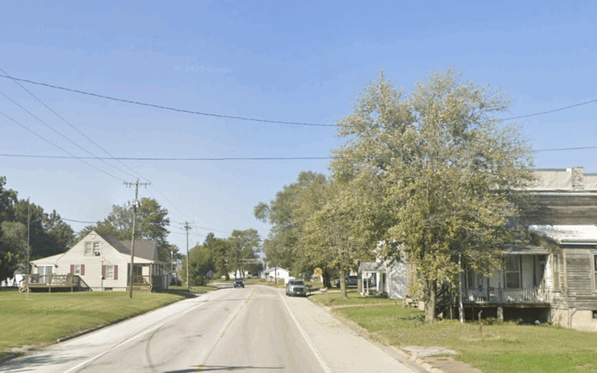
Walsh counts roughly 350 residents scattered across elevated pastureland edged by wooded creeks in Randolph County. Days revolve around trail rides at Pyramid State Recreation Area, garden swaps at the community hall, and bluegrass jams on front porches.
Cattle ranching and grain farming dominate the landscape, with a few folks commuting to Chester’s small industries 15 miles south. Set on a ridge above the Kaskaskia River, Walsh avoids flood traffic and benefits from consistent valley breezes that carry sound away.
With no traffic signals, a single convenience store, and vast sky views, car horns are practically unknown. Even Fourth of July fireworks from nearby towns appear only as distant glitter on the horizon.
Where is Walsh?
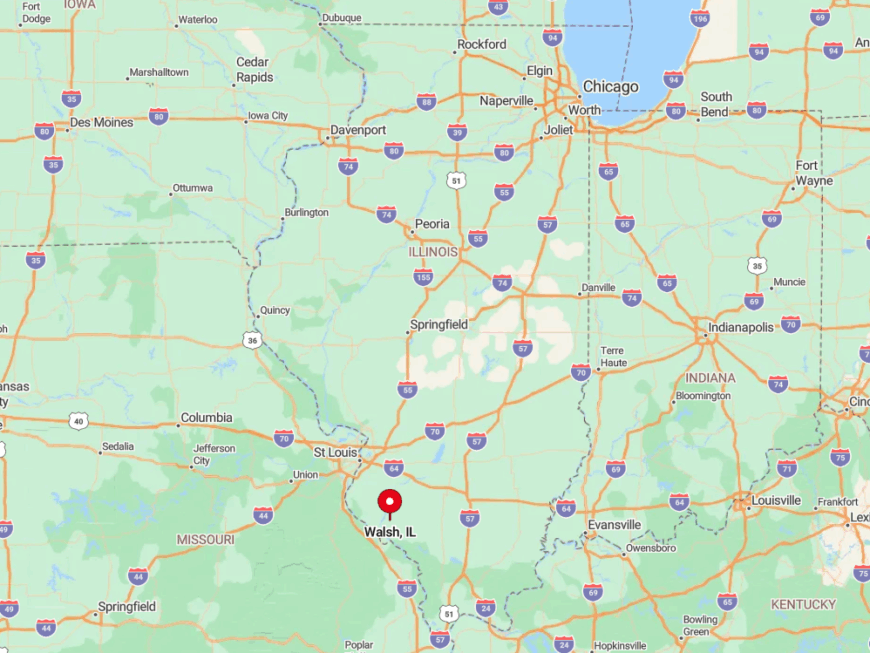
The settlement lies five miles north of Illinois Route 150, accessible by a pair of county ridgeline roads that roll past shale outcrops and cattle ponds. Creek bottoms on three sides funnel through-traffic elsewhere, leaving the ridge to locals and farm equipment.
Visitors usually exit Interstate 57 at Sparta and meander 25 miles of two-lane blacktop before noticing the “Walsh” sign nailed to a sycamore. That final stretch over narrow timber bridges reminds travelers they’ve left the busy world behind.


