🔥 Would you like to save this?
Southern Washington is a study in contrasts, stitched together by river valleys, timber slopes, and towns that don’t appear on most travel itineraries. The Columbia River cuts a dramatic line along its southern edge, with basalt cliffs in the east giving way to mossy foothills and wide floodplains in the west. Inland, the Cascade Range shapes weather and movement, creating pockets of settlement that feel shaped as much by geography as by history.
These are places where the nearest city is measured in winding road miles, and the backdrop is often a ridgeline, a river bend, or a field edged in Douglas fir. Local economies lean on timber, farming, river trade, and, in some corners, a steady trickle of visitors looking for something quieter than the Gorge’s headline attractions. The scale is human, the pace unhurried, and the identity closely tied to the surrounding land.
In order to come up with the very specific design ideas, we create most designs with the assistance of state-of-the-art AI interior design software.
From Klickitat County’s dry hills to the green lowlands of Clark and Cowlitz, each community has its own landscape logic. Elevation, soil, and river access have dictated where people built mills, laid tracks, or planted orchards. You can read these histories in the shape of a main street, the siding on an old warehouse, or the view from a town’s single gas pump.
The following list gathers 25 of these towns, stretching from the oceanward estuaries to mountain foothill clearings. Together they form a quiet map of Southern Washington, one defined less by highways than by the smaller roads that lead to the edge of the map—and keep going.
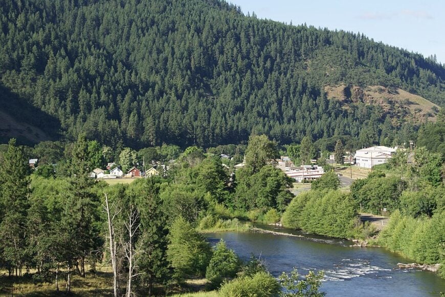
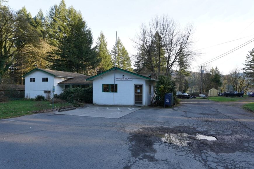
25. Randle’s Forest Quietude

Randle feels like a clearing in the green heart of Washington—a small cluster of weathered cabins where the forest breathes in long bellows around every window. Its seclusion comes from being perched along the route to Mount St. Helens, yet tucked so deep into the forest that commercial noise never arrives.
Hike the Loowit Trail, visit the pioneer museum beneath towering pines, or fish for steelhead in the mineral-cool White Salmon River. A handful of lodges, forest crew workers, and loggers keep life going gently.
Evenings wrap houses in birdcalls and candlelight. It’s rustic without being rough; storied without being loud. It’s the kind of place that quietly reminds you how deep trees can be.
Where is Randle?
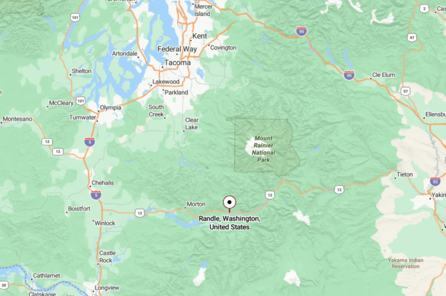
Randle sits in southwestern Washington’s Lewis County along State Route 12, about 30 miles east of Morton. The road rises into forested foothills, sheds traffic, and narrows into a country heartbeat.
The last stretch drifts through cedar and fir breaks before town appears like a memory. It’s close enough for a weekend, far enough to feel rediscovered.
24. Ariel’s River Muse
Ariel is a thumb of homes and farms poised over the Columbia River, where orchard blossoms scent the air and river light lingers late. The hush here owes to both orchard rows and a half-wave path of road that turns off Route 14 and softens speed.
Stroll peach groves in bloom, paddle calm bends of the Upper Columbia, or stop at the old mercantile that feels like living history. Part-time farmers and vintners keep the economy gentle.
Sunset glows linger in pink light, shading every fruit tree. It’s rural, romantic, and steady. It’s the kind of place that makes seasons feel sacred.
Where is Ariel?
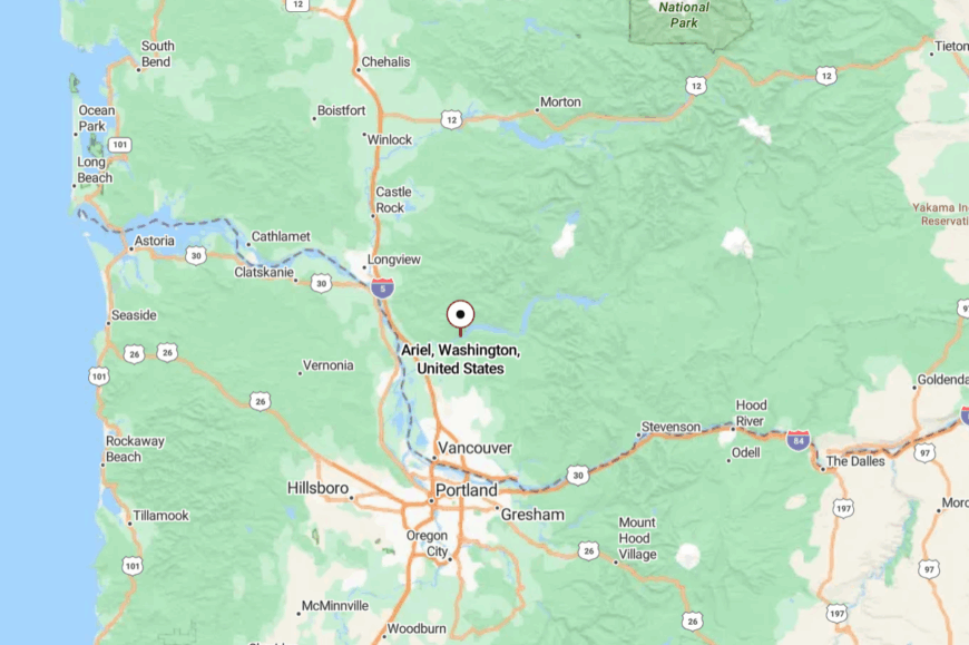
You’ll find Ariel in Cowlitz County, perched on bluffs above the Columbia River’s eastern shore, about 15 miles east of White Salmon via State Route 14 and a county spur.
The route opens into farmland and curves, then slides into bloom-lined lanes. Even passing drivers slow—naturally tuned to quiet. It’s near the water, yet always feels perched and private.
23. Goldendale’s High Country Hush
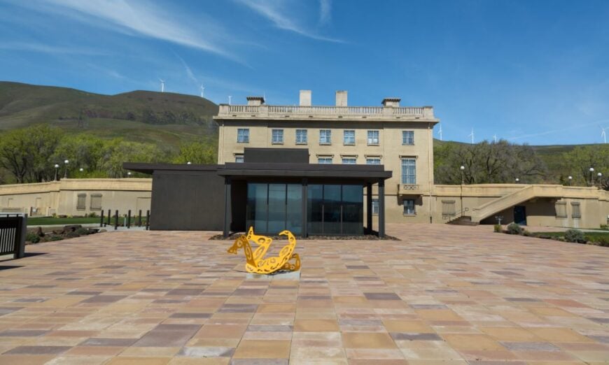
Goldendale feels suspended between sky and sage, a gold-toned town where astronomers look up and the rest of us pause to stare. Its seclusion stems from being buffered by ridges to the west and desert plains to the east, with only one highway threading through.
Tour the observatory under unspoiled stars, wander farm lane flower fields, or pause by the classical courthouse in morning sun. Agriculture and tourism set the rhythm, with wheat fields and star parties sharing calendar space.
Even nights rise quietly here, without city glare. It’s the kind of place that makes the sky feel reachable.
Where is Goldendale?
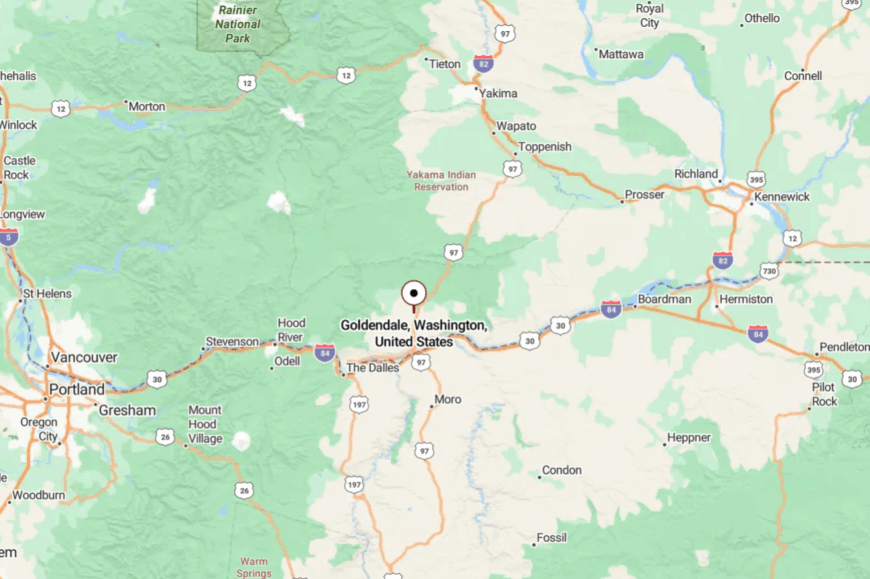
Located in Klickitat County, Goldendale sits atop a plateau 55 miles east of The Dalles, Oregon, reached via SR 14 and ridge-spun roads. The final climb lifts you above the forest into the prairie and sky.
Cell service thins as views open. It’s close to Lewis and Clark history, yet feels closer to the Milky Way.
22. Carson’s Gorge Embrace
Carson sits at the mouth of the Klickitat Canyon, where Highway 14 narrows into quiet and the river runs thick with tree shadows. Its isolation comes from being cut off by cliffs and forest, with few services and even fewer distractions.
Stand by the river at dawn for trout or eagles, walk under the bridge covered in petroglyphs, or trace the abandoned railway that vanishes into a tunnel. Forest maintenance crews, outfitter guides, and one café make up the town’s pulse.
Twilight brings a hush that falls like a feather. It’s tucked, slight, and vivid all at once. It’s the kind of place that teaches you to lean in and listen.
Where is Carson?
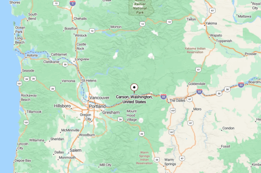
Carson lies in Skamania County, tucked into the Columbia River Gorge along Washington State Route 14, about 45 miles east of Vancouver. The town sits just inland from the river at the mouth of the Wind River, framed by steep, forested hills that rise sharply on either side.
The approach from the west follows the river’s edge before branching into Carson’s quiet streets. Surrounding ridges and deep woods give it a sheltered feel, while still keeping it within easy reach of the Gorge’s trails, waterfalls, and scenic lookouts.
21. Lacamas Prairie’s Open Horizon
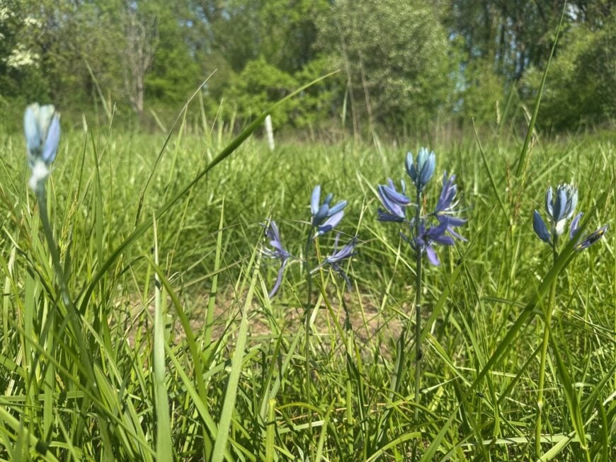
Lacamas Prairie isn’t so much a town as a scattering of farmsteads and weathered barns framed by rolling grasslands. Its seclusion comes from lying off the main tourist routes, hidden between ridgelines where the sky feels impossibly wide.
In spring, camas lilies bloom in violet sweeps, and in autumn, fog curls low across the pasture. You might walk the quiet country roads, watch sandhill cranes feed in the fields, or picnic beside the slow, reflective waters of Lacamas Creek.
The land is still worked by ranchers and hay growers, giving the place a steady, grounded rhythm. Here, the pace is set by sunrise and the rustle of wind through tall grass. It’s the kind of place where you feel like the horizon belongs to you.
Where is Lacamas Prairie?
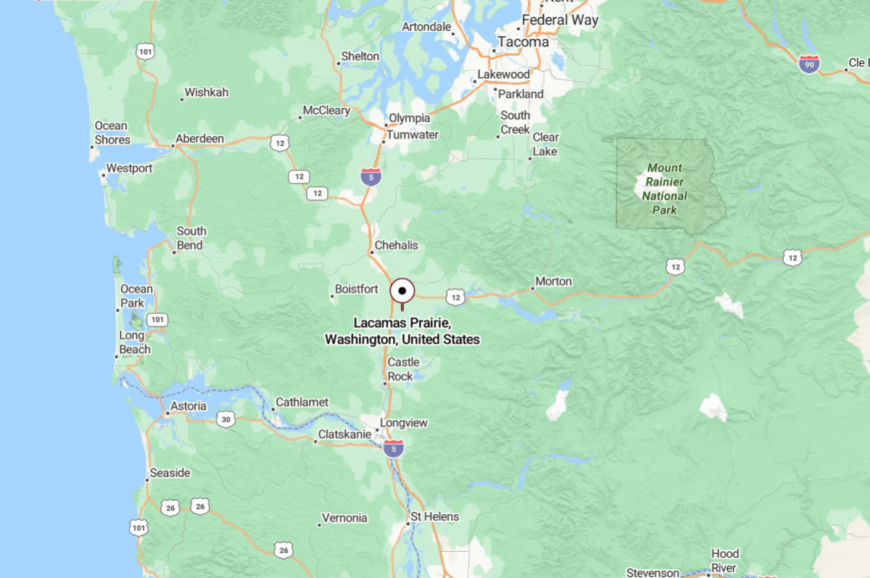
Lacamas Prairie is in eastern Clark County, roughly 15 miles northeast of Vancouver and just east of the city of Camas. It’s reached by turning off SR-500 or SR-503 onto smaller county roads that wind through stands of fir before opening into wide grasslands.
The prairie’s open fields stretch toward the Cascade foothills, with views that seem to run on for miles. Spring wildflowers blanket the meadows, and the absence of major through-roads keeps the landscape and its quiet pace largely undisturbed.
20. Morton’s Mountain Crossroads
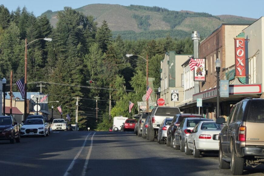
Morton is a tiny mountain hub where two highways meet before splitting into even lonelier roads. Its isolation comes from being hemmed in by the Cascade foothills, with forests pressing in on every side.
A stroll through its compact downtown takes you past the historic railroad depot, antique shops, and a café that’s been pouring coffee for generations. Nearby, the Tilton River offers fishing and picnicking, while Mount Rainier’s less-traveled southern trails are within reach.
Logging and tourism are the twin anchors here, though neither rushes life along. It’s the kind of place where a single whistle from a passing train can fill the whole valley.
Where is Morton?
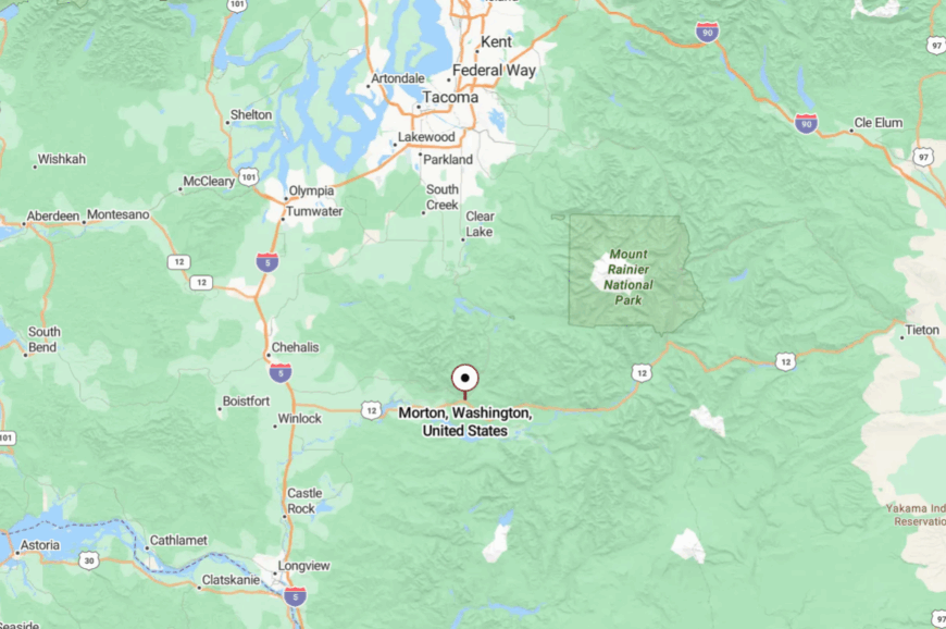
Located in Lewis County, Morton sits about 70 miles southeast of Olympia at the junction of U.S. 12 and State Route 7. Approaching from any direction means winding through forested foothills and river valleys.
The mountains rise quickly on the horizon, then close in as you near town. It’s a true crossroads—one that feels like it’s in the middle of the map and the middle of nowhere all at once.
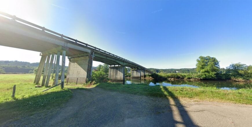
19. Rosburg’s River Bend
🔥 Would you like to save this?
Rosburg feels like a secret tucked in a curve of the Grays River, where tide and current mingle in soft rhythms. Its seclusion comes from being near the coast yet hidden inland, shielded by forests and wetlands.
You can launch a kayak from a gravel bank, watch herons stalk the shallows, or visit the century-old schoolhouse that still stands like a sentinel. The community is small, made up of families who farm, fish, or simply live quietly along the water.
Nights are deeply still here, save for the rush of wind in the trees and the distant call of owls. It’s the kind of place where even the river seems to slow its pace.
Where is Rosburg?
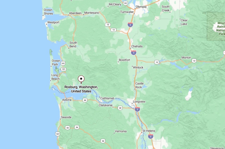
Rosburg lies in Wahkiakum County, about 15 miles east of the mouth of the Columbia River, reached via SR-4 and a final stretch of narrow county roads. The approach winds through farmland and along quiet riverbanks.
As you arrive, the forest parts to reveal open water and marshland. It’s a small bend in the map that feels like an entirely different world.
18. Cathlamet’s Quiet Harbor
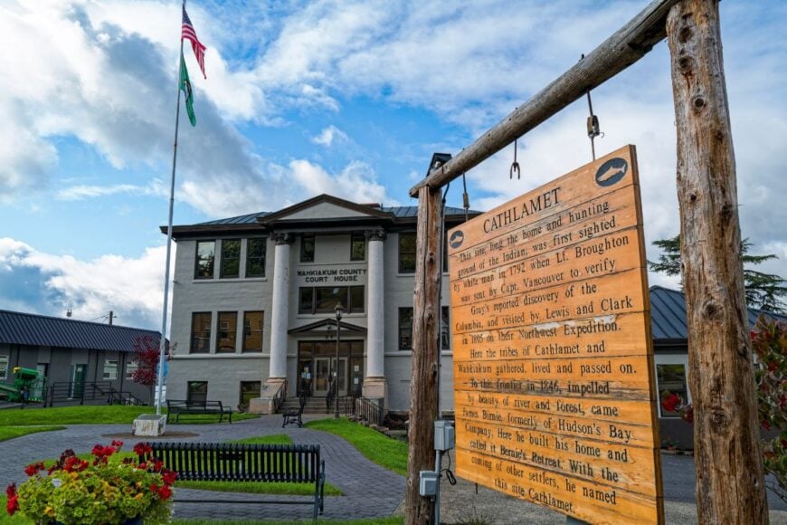
Cathlamet is a waterfront town where the Columbia River spreads wide, and fishing boats sway gently at their moorings. Its seclusion comes from its remote location in the lower river’s maze of islands and channels.
Walk the historic main street, explore the riverfront park, or catch a ferry to Puget Island for a bike ride through open fields. The economy leans on fishing, small-scale tourism, and local shops that still know their customers by name.
Afternoons are marked by the distant thrum of boat engines and the slow drift of river air. It’s the kind of place where the day’s most pressing decision might be where to watch the sunset.
Where is Cathlamet?
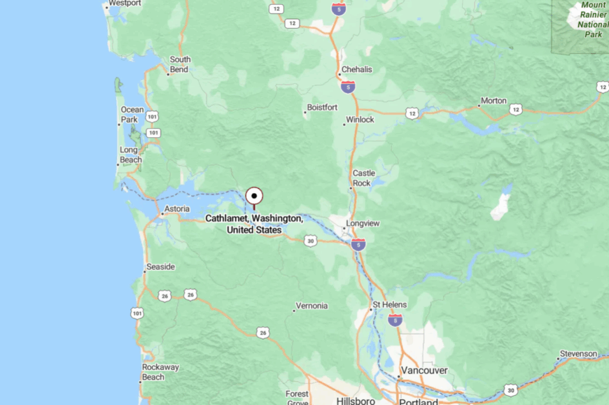
Cathlamet sits in Wahkiakum County along SR-4, about 60 miles west of Longview. The route traces the Columbia River before crossing a bridge onto the town’s small peninsula.
The water is nearly always in sight as you approach. It’s close to the coast yet feels firmly anchored in its own quiet harbor life.
17. Naselle’s Valley Calm
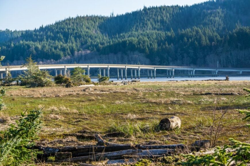
Naselle rests in a green valley where hills rise like protective walls and the Naselle River winds through in silver ribbons. Its seclusion comes from being bypassed by major highways, with most visitors heading to coastal towns further west.
Spend a day at the Finnish-American Folk Festival, hike the nearby Willapa Hills, or wander the riverside park. The town is rooted in logging, fishing, and farming, all carried out at a measured pace.
Evenings bring the scent of woodsmoke and the echo of river water against rocks. It’s the kind of place where a handshake still feels like a promise.
Where is Naselle?
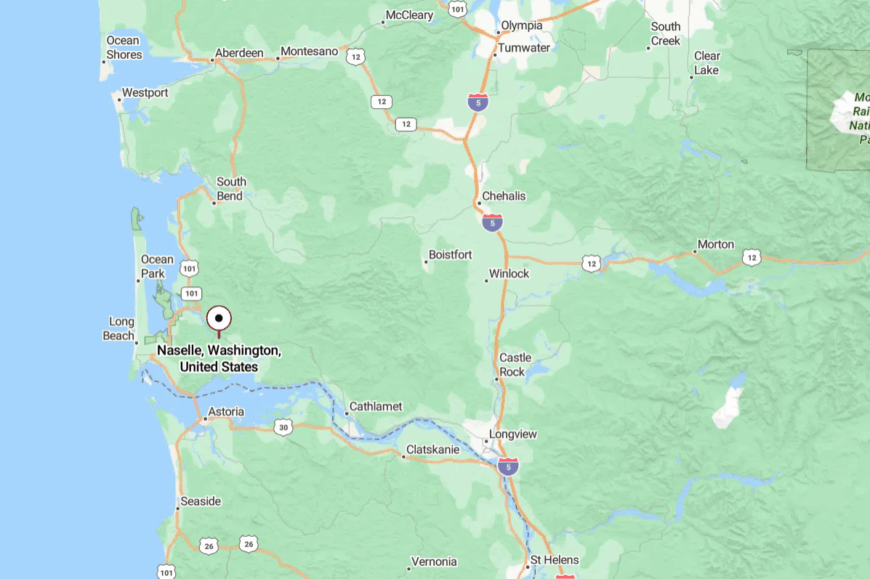
Naselle lies in Pacific County, about 10 miles east of the Columbia River’s mouth, reached by SR-4 or SR-401. The approach is a winding ribbon between wooded slopes and open meadows.
You’ll pass more barns than billboards. It’s a gentle entry into a valley that seems built to hold its peace.
16. Pe Ell’s Time-Worn Charm
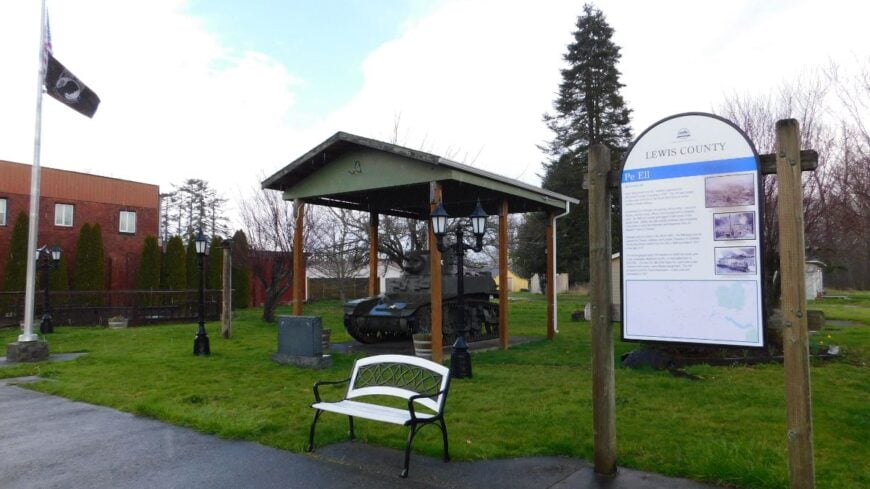
Pe Ell is a small, unhurried town where the main street still feels like it belongs to another decade. Its seclusion is a mix of geography and choice, with the Willapa Hills rising on one side and forest lands stretching on the other.
Visit the local café for a slice of homemade pie, bike the Willapa Hills Trail, or explore backroads where moss-covered barns lean into the wind. Logging once defined the economy; today, it’s a mix of agriculture and small-town trade.
Time feels elastic here—afternoons seem to linger just a little longer. It’s the kind of place that makes you wonder if you’ve stumbled into a postcard.
Where is Pe Ell?
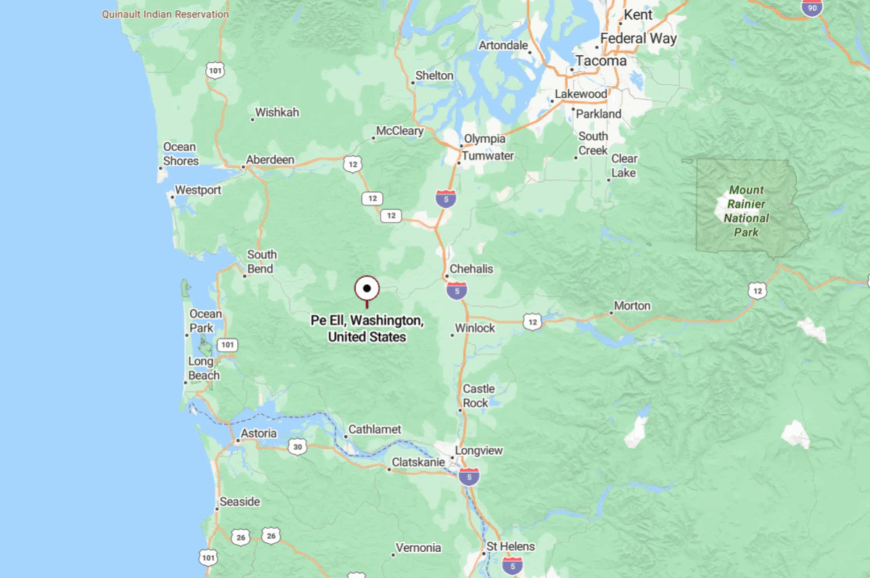
Pe Ell is in Lewis County, about 30 miles west of Chehalis, accessible via SR-6. The drive follows the Chehalis River and climbs gently into the hills.
The closer you get, the fewer signs of modern sprawl you see. It’s close enough for a Sunday drive, yet far enough to feel like a deliberate detour.
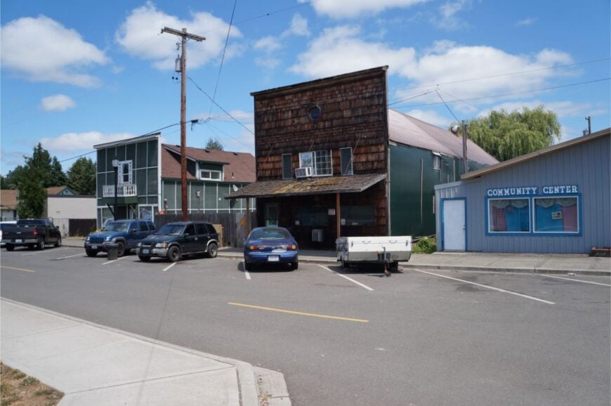
15. Ryderwood’s Retiree Haven
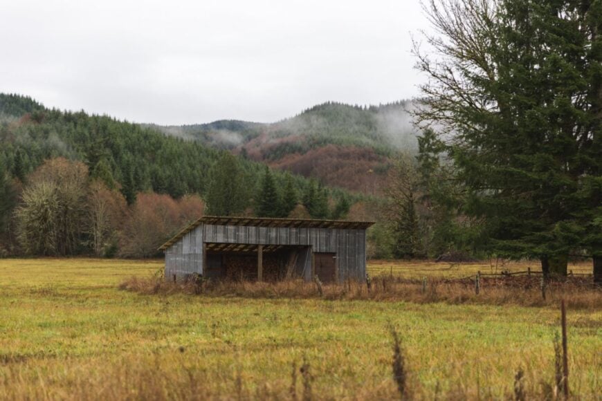
Ryderwood is a planned retirement community built for former loggers, now quietly thriving as a village of well-kept homes and neighborly porches. Its seclusion comes from being deep in the Willapa Hills, far from commercial hubs.
Enjoy community potlucks, stroll shady streets, or explore nearby forest roads where deer outnumber cars. With no industry beyond local services, life is entirely self-paced.
Even the air seems to move slower here. It’s the kind of place where days are measured by coffee refills and the length of afternoon shadows.
Where is Ryderwood?
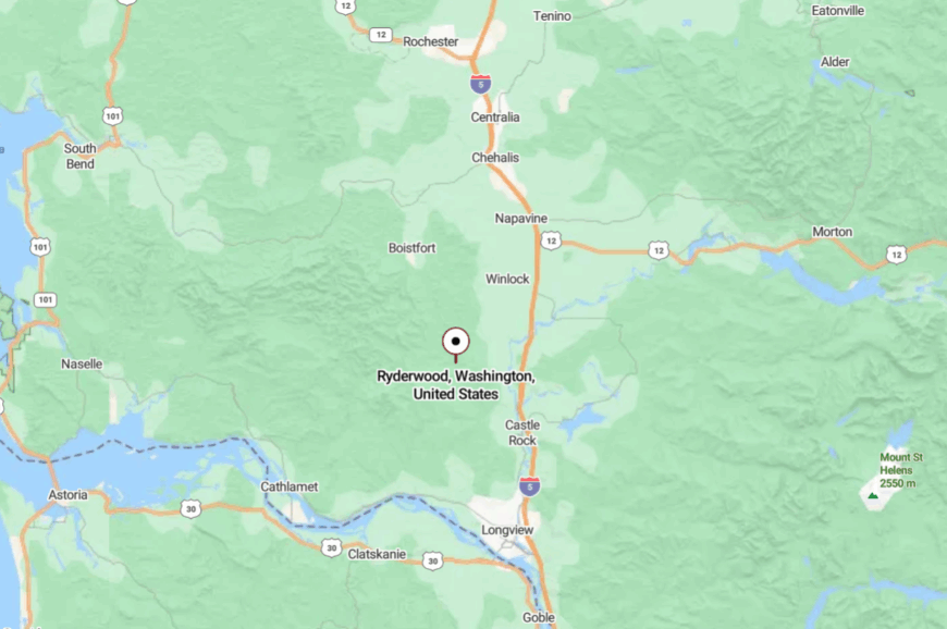
Ryderwood is in Cowlitz County, about 20 miles west of Interstate 5 at Castle Rock. You reach it via SR-506, which narrows into a quiet, tree-lined road. Hills fold in around the valley as you approach.
It’s tucked far enough away that you feel like you’ve arrived somewhere meant to be kept.
14. Vader’s Brick-and-Rail Quiet
Vader is a little brick-built town along the railroad, where the occasional passing train is the day’s loudest event. Its isolation comes from being bypassed by the interstate and surrounded by farmland and low hills.
Visit the quaint city park, walk past the historic jailhouse, or browse the tiny library. The economy is modest—small shops, local services, and commuting residents.
Nights are punctuated by the soft call of owls from the surrounding woods. It’s the kind of place that still feels anchored to its past.
Where is Vader?
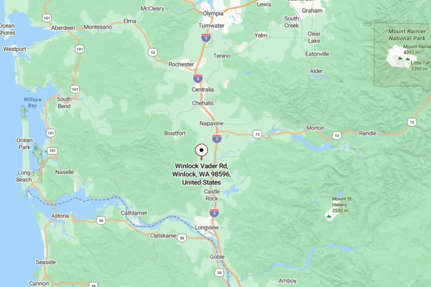
Vader is in Lewis County, about 8 miles south of Castle Rock, reached by Old Highway 99 or I-5 exits onto smaller roads. Approaching through farmland, you see the brick storefronts appear almost suddenly.
It’s close to the freeway but feels a world apart. The stillness settles in quickly here.
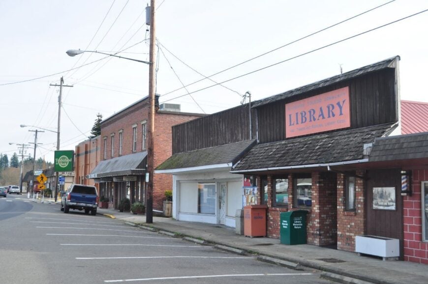
13. Toledo’s River Bend Slowdown
🔥 Would you like to save this?
Toledo curves around the Cowlitz River, a town where river life shapes the days. Its seclusion comes from its position off the main interstate, reached only by local roads through farmland.
Fish for salmon, visit the historic commons, or attend the annual Cheese Days festival. Agriculture and small businesses keep the town humming softly.
Mornings begin with mist lifting from the water, and evenings close with a slow sunset over the river. It’s the kind of place that makes you breathe deeper without realizing it.
Where is Toledo?
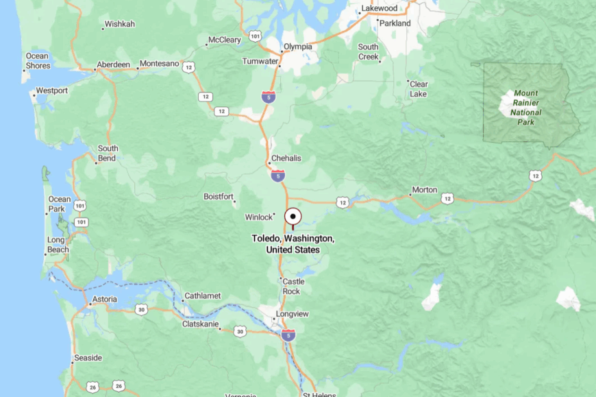
Toledo lies in Lewis County, about 6 miles east of I-5 at Winlock. County roads wind past dairy farms and hop fields before dipping into the river valley.
The water greets you as soon as you arrive. It’s just far enough off the highway to feel removed, yet close enough for easy visits.
12. Winlock’s Egg-Laying Claim to Fame
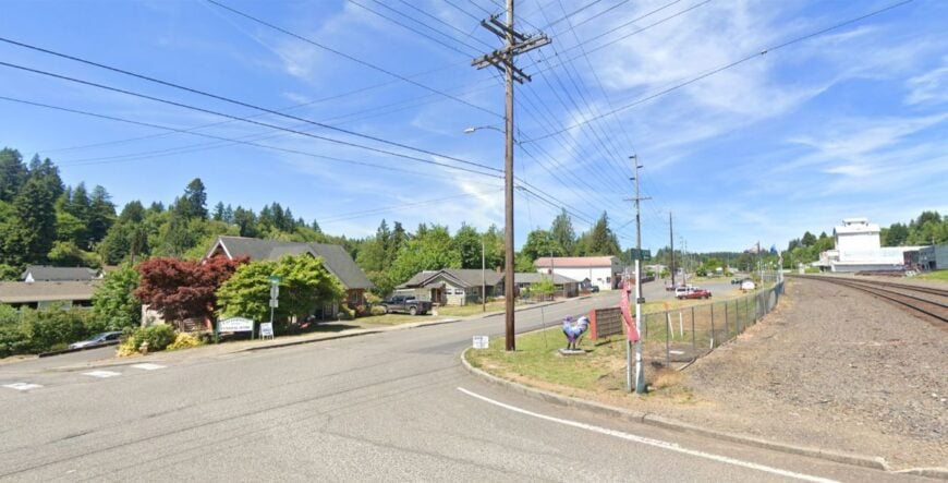
Winlock is known for its giant egg statue, a nod to its poultry-farming heritage, but beyond that quirky landmark lies a quietly self-contained town. Its seclusion comes from being wrapped in farmland and set away from main commercial corridors.
Browse antique stores, walk through the small downtown, or catch a community baseball game. Farming is still central, though many residents commute to nearby towns.
The pace is steady, almost comforting. It’s the kind of place where local pride shows in every painted storefront.
Where is Winlock?
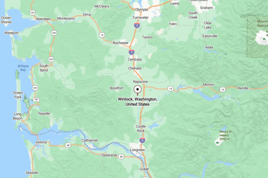
Winlock is in Lewis County, about 5 miles west of I-5 at Napavine. County roads weave through open fields dotted with barns.
The transition from highway to hometown is almost immediate. It’s close enough for a quick stop but slow enough to make you linger.
11. Castle Rock’s Gateway Quiet
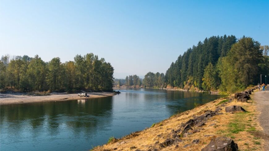
Castle Rock sits at the foot of Mount St. Helens, a gateway town that somehow stays unhurried despite its location. Its seclusion comes from being overshadowed—literally—by the surrounding hills and the Cowlitz River’s bends.
Hike the nearby river trails, visit the Mount St. Helens Visitor Center, or just wander the flower-lined streets downtown. Tourism plays a role, but many here work in logging, farming, or small trades.
The mountains keep the horizon close, and the river hums its own song through town. It’s the kind of place where the gateway feels like the destination.
Where is Castle Rock?
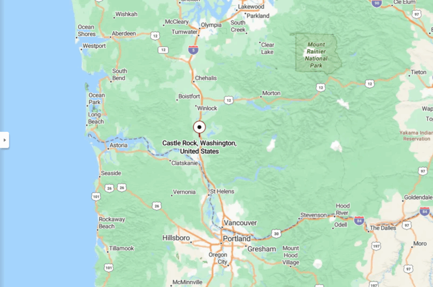
Castle Rock is in Cowlitz County, about 50 miles north of Vancouver, reached via I-5 or Old Pacific Highway. As you leave the interstate, tree-covered hills frame the view.
The road slips into a valley where the river curves lazily. It’s right on the map, but feels tucked in tight against nature’s edge.
10. Underwood: Vistas and Vineyards
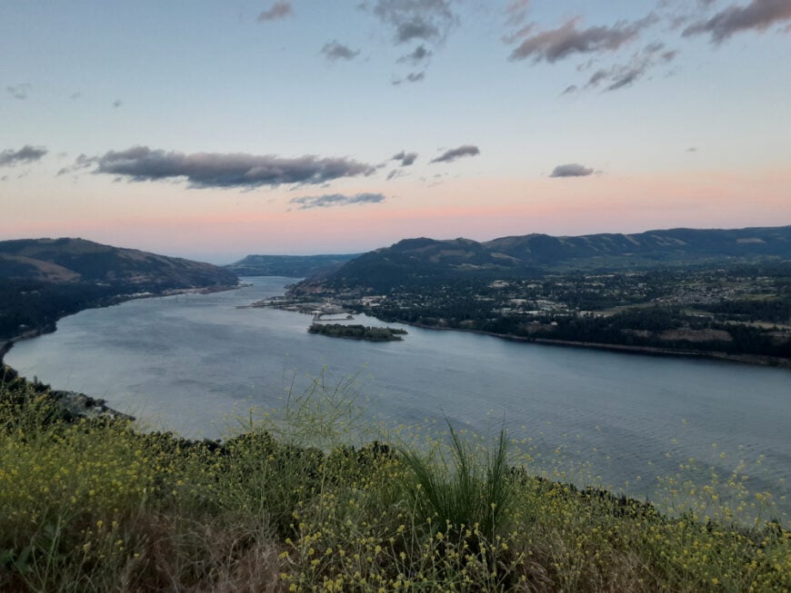
Underwood is a charming community with a population of around 1,000 residents. Nestled on the cliffs overlooking the Columbia River, I love how this town offers breathtaking vistas and a serene atmosphere.
Underwood is known for its vineyards and orchards, contributing to a blossoming local wine industry that’s a delight to explore. Outdoor enthusiasts can enjoy hiking, biking, and windsurfing, while the picturesque landscapes provide endless opportunities for photography.
The town’s small size and minimal commercial development make it a peaceful retreat from urban life. Underwood’s seclusion is enhanced by its lush rolling hills and the sense of tranquility that permeates the area.
Where is Underwood?
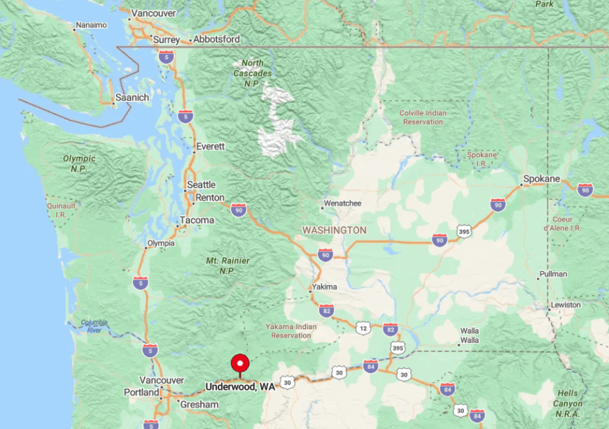
Located in Skamania County, Underwood sits opposite Hood River, Oregon, across the Columbia River. This prime location offers stunning views of the river and Mount Hood in the distance.
Its seclusion comes from its position amid expansive vineyards and the surrounding natural landscapes that shield it from bustling city life. To get there, I usually take Highway 14 east from Vancouver, enjoying the scenic drive along the river before arriving at this peaceful haven.
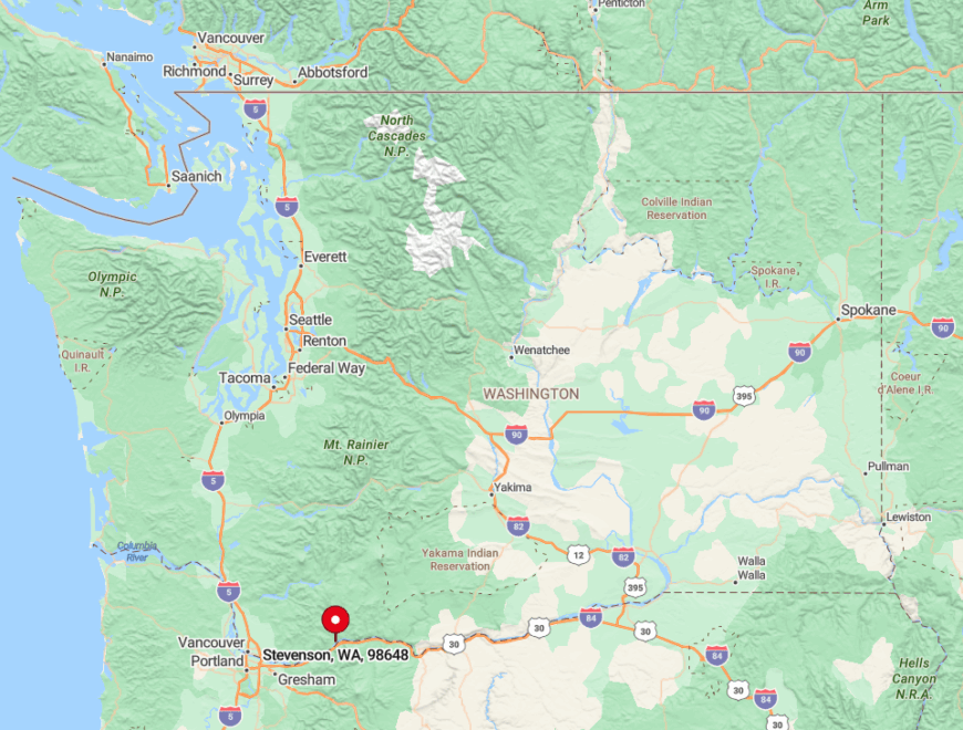
9. Stevenson Outskirts: Forested Peace
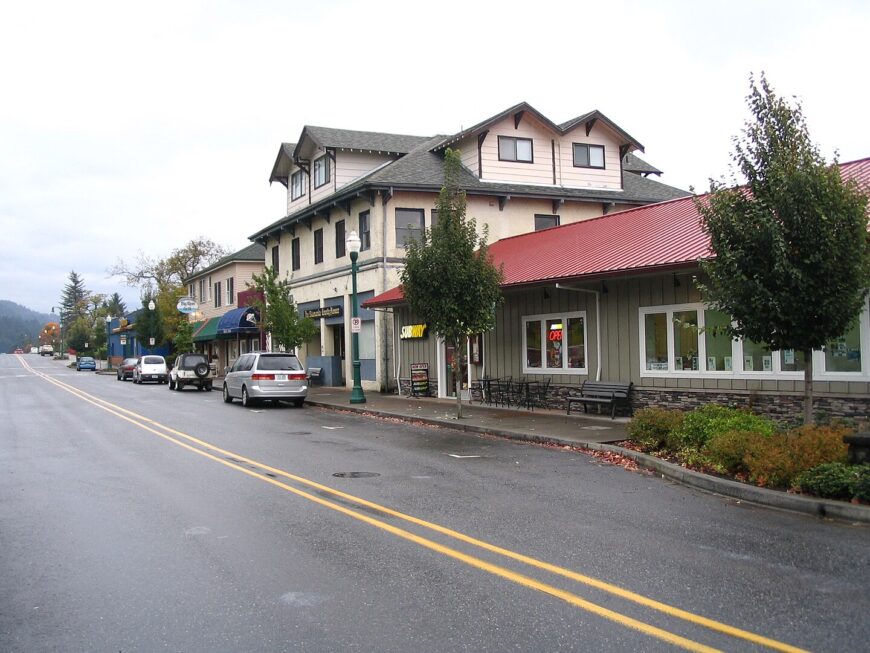
The outskirts of Stevenson offer a tranquil escape with a small community of around 1,500 people in the town itself, but even fewer as you venture out. I appreciate how the dense forests envelop you here, providing a sense of solitude and connection with nature.
The area is perfect for hiking, fishing, and exploring the natural wonders of the Columbia River Gorge. The local economy thrives on tourism and small businesses, yet the outskirts remain largely untouched.
It’s the thick woodlands and minimal development that make this place wonderfully secluded. Wandering through the forest trails, you’re likely to encounter more wildlife than people.
Where is Stevenson Outskirts?
🔥 Would you like to save this?
Sitting in Skamania County, the outskirts of Stevenson are nestled along the Columbia River in Southern Washington. This area is more isolated due to the rugged terrain and dense forests that surround it.
I find that the lack of major roads and the protective embrace of the gorge’s cliffs keep it hidden from the hustle and bustle. To reach these outskirts, you can follow Highway 14 east from Vancouver, then venture onto smaller local roads that wind into the peaceful woods.
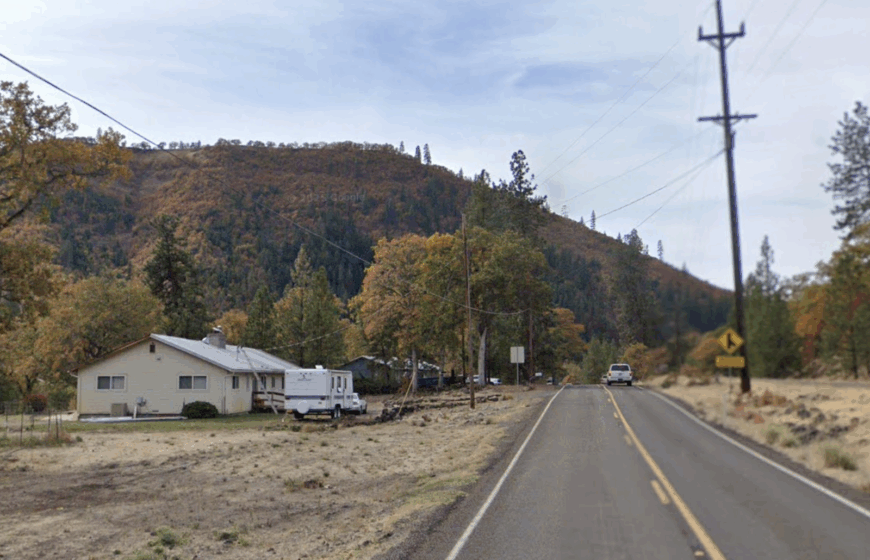
8. Klickitat: Riverside Quietude

Klickitat is a tiny community with a population of about 350 residents, making it a perfect spot for those seeking serenity. Nestled alongside the Klickitat River, I enjoy the opportunities for fishing, rafting, and hiking in the surrounding canyons.
The town has a rich logging history, but today it’s the natural beauty that draws people in. With few businesses and minimal traffic, Klickitat offers a peaceful lifestyle away from the crowds. Its secluded nature is amplified by the expansive natural landscapes and the soothing sounds of the river flowing nearby.
Where is Klickitat?
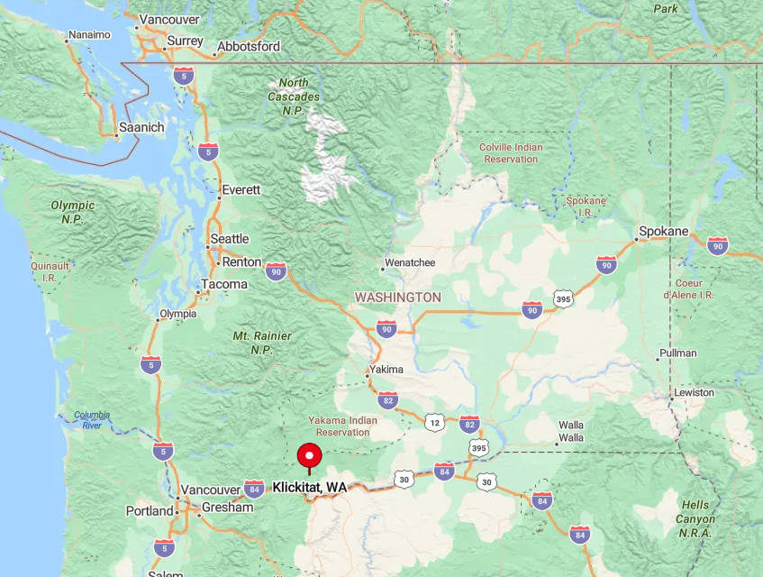
Located in Klickitat County in Southern Washington, the town sits north of the Columbia River Gorge. The seclusion comes from its position deep within the Klickitat Canyon, away from major highways and urban centers.
When I want to visit, I take State Route 142 from Lyle, enjoying a scenic drive through winding roads and breathtaking vistas. This remote route contributes to the town’s hidden charm, making Klickitat a true riverside retreat.
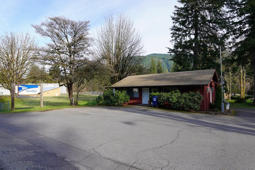
7. Wahkiacus: Hidden Valley Haven
Wahkiacus is a tiny unincorporated community with a population of fewer than 100 people. Tucked away in a quiet valley, I find it to be the epitome of peaceful countryside living. The area offers expansive properties, making it ideal for those seeking space and privacy.
Outdoor activities include hiking, horseback riding, and enjoying the abundant wildlife. There’s little in the way of commercial industry here, which enhances its secluded atmosphere. The rolling hills and absence of significant development make Wahkiacus a hidden gem off the beaten path.
Where is Wahkiacus?
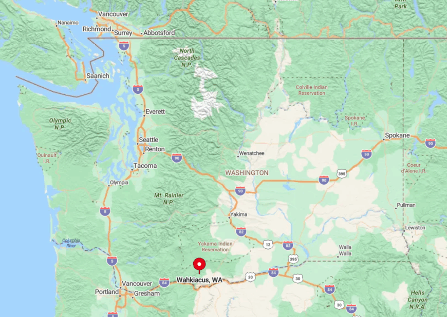
Situated in Klickitat County, Wahkiacus lies northeast of the Columbia River Gorge. Its seclusion is due to its remote valley location, surrounded by hills and forests that isolate it from larger towns.
To get there, I usually travel along State Route 142 from Goldendale, then take smaller county roads that weave through the scenic countryside. The journey itself feels like a step back in time, emphasizing the tranquility that waits in Wahkiacus.
6. Cougar: Wilderness Embrace
Cougar is a small community with around 100 residents, perfect for those wanting to be close to nature. Nestled near the Lewis River and in the shadow of Mount St. Helens, I appreciate how this town offers unparalleled access to wilderness adventures.
Activities include hiking, fishing, and exploring the Mount St. Helens National Volcanic Monument. The local economy revolves around tourism and outdoor recreation. Cougar’s seclusion comes from its dense surrounding forests and proximity to vast wilderness areas, making it an ideal spot for immersion in nature.
Where is Cougar?
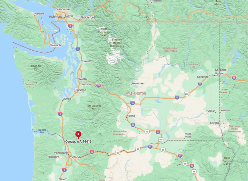
Located in Cowlitz County in Southern Washington, Cougar is set deep within the Gifford Pinchot National Forest. Its remote location, far from major highways and urban centers, enhances its secluded feel.
When I visit, I take State Route 503 from Woodland, winding through forested roads that lead directly into the heart of nature. The journey through the towering trees and the pristine environment underscores the peaceful isolation of Cougar.
5. Packwood: Gateway to Wilderness
Packwood is a quaint mountain town with a population of about 350 residents. Serving as a gateway to the Gifford Pinchot National Forest and Mount Rainier National Park, I love the wealth of outdoor activities available, from hiking and skiing to wildlife viewing.
The town hosts an annual flea market that draws visitors, but otherwise remains quiet and laid-back. The main industries include tourism and logging. Packwood’s seclusion is owed to its mountainous surroundings and the vast wilderness areas that envelop it.
Where is Packwood?
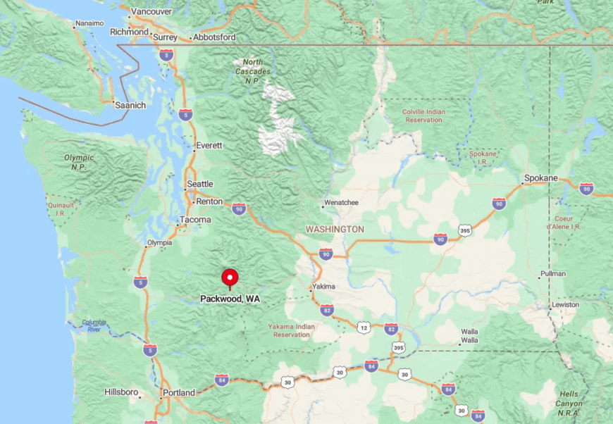
Situated in Lewis County, Packwood lies in the southeastern part of Southern Washington. Its location along U.S. Route 12 provides access, but the surrounding Cascade Mountains and forests create a sense of isolation.
I often drive through winding mountain roads to get there, passing through stunning landscapes that make the journey as enjoyable as the destination. The remoteness and natural barriers contribute to Packwood’s peaceful atmosphere.
4. Grays River: Historic Serenity
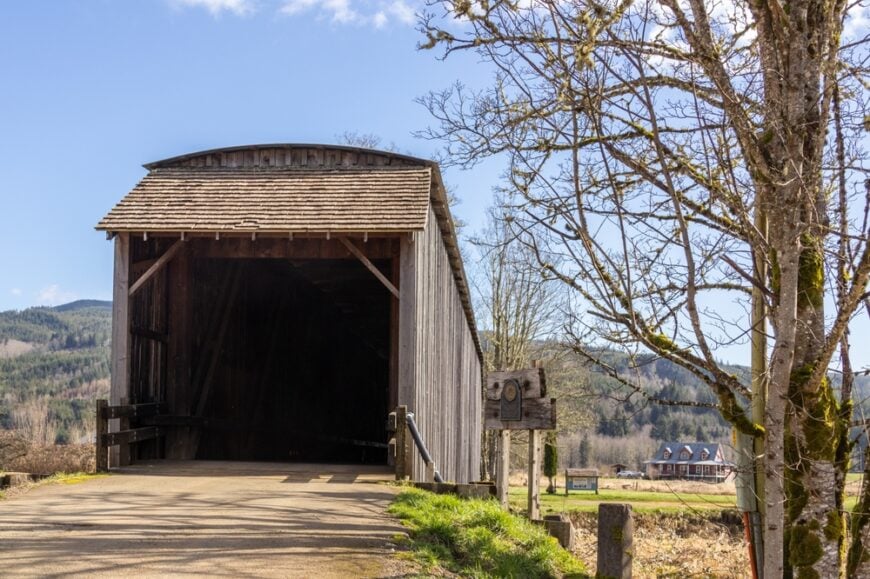
Grays River is a small, unincorporated community with a population of under 1,000 residents. Known for the historic Grays River Covered Bridge—the only covered bridge still in use in Washington—it’s a place where history and nature intertwine.
I enjoy the pastoral landscapes of forests and farmlands, perfect for leisurely drives and relaxation. The area lacks major industries, adding to its quiet charm. Grays River’s seclusion is enhanced by its remote setting and the timeless quality that seems to linger in the air.
Where is Grays River?
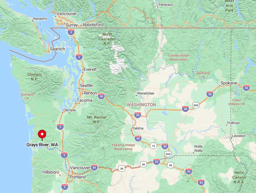
Located in Wahkiakum County in southwestern Washington, Grays River sits near the mouth of the river that shares its name. Its seclusion stems from being surrounded by dense forests and being off the main transportation routes.
To reach it, I take State Route 4 west from Longview, then turn onto winding local roads that lead to this hidden enclave. The journey through the lush landscapes accentuates the sense of escape that Grays River offers.
3. Skamokawa: Riversides and Rolling Hills
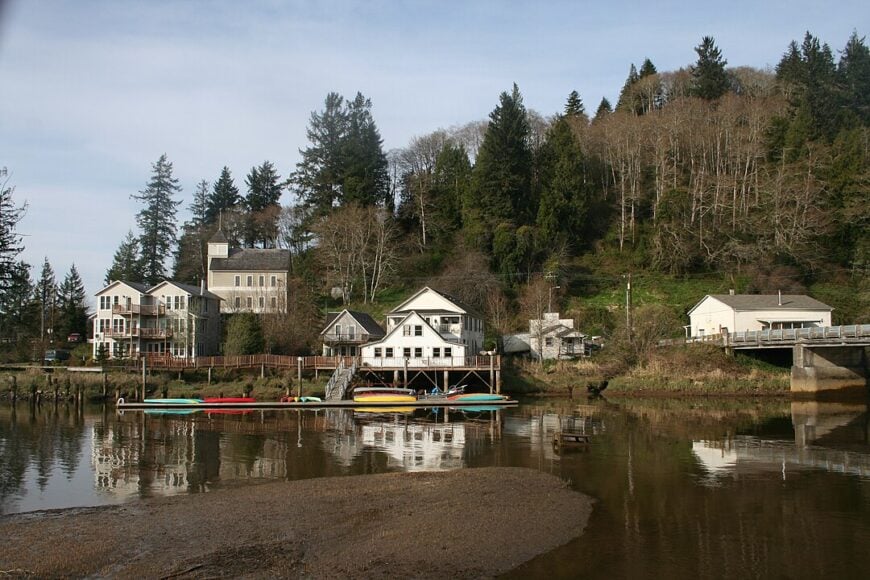
Skamokawa is a quaint riverside community with a population of around 400 people. Perched along the Columbia River, I find it ideal for kayaking, bird watching, and enjoying the serene waterways. The Skamokawa Vista Park is a favorite spot of mine for picnics and sunsets over the river.
The town has minimal commercial development, preserving its tranquil ambiance. Skamokawa’s seclusion comes from its remote location and the lush, rolling hills that surround it, making it a perfect escape from busy city life.
Where is Skamokawa?
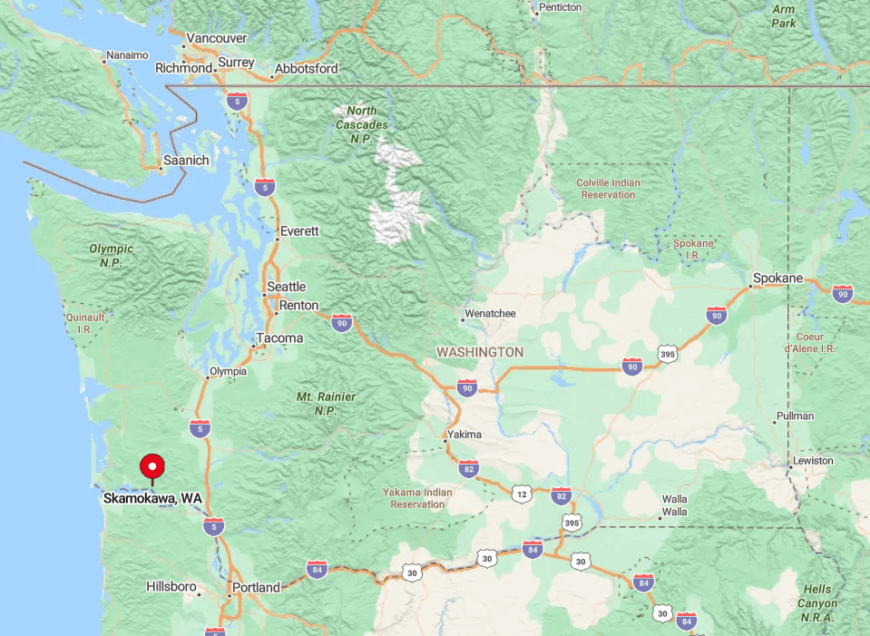
Situated in Wahkiakum County, Skamokawa lies along State Route 4 in southwestern Washington. Its seclusion is a result of its position along the river and being nestled between forested hills.
Getting there involves a scenic drive west from Longview on State Route 4, where the road meanders alongside the Columbia River. I always feel a sense of calm as I approach Skamokawa, the journey itself reinforcing the peacefulness that awaits.
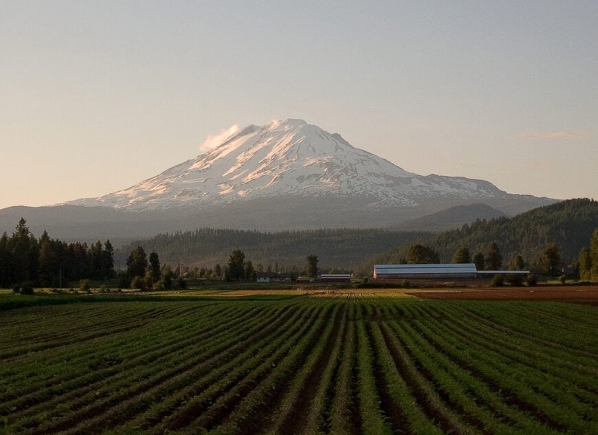
2. Glenwood: Quiet Countryside Retreat
Glenwood is a serene rural community with a population of about 700 residents. Set in a valley beneath the towering presence of Mount Adams, I appreciate the wide-open spaces and the strong sense of connection to nature. The town is surrounded by forests and farmlands, offering activities like hiking, fishing, and wildlife viewing.
The main industries are agriculture and forestry. Glenwood’s seclusion is due to its remote location and the natural barriers formed by the surrounding mountains and forests, providing a peaceful countryside retreat.
Where is Glenwood?
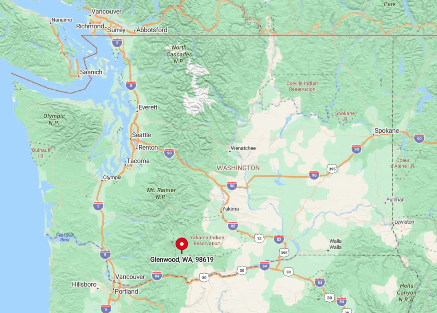
Located in Klickitat County, Glenwood sits in the heart of southern Washington’s wilderness. Its seclusion comes from being nestled in a valley, with limited access roads connecting it to larger towns.
To reach Glenwood, I take State Route 141 north from White Salmon, then follow winding rural roads that lead into this hidden haven. The journey through dense forests and past panoramic mountain views adds to the sense of seclusion that defines Glenwood.
1. Trout Lake: A Mountain Sanctuary
Trout Lake is a peaceful community with approximately 600 residents, nestled at the base of Mount Adams. I find it to be a true sanctuary, offering expansive meadows, crystal-clear creeks, and a backdrop of majestic mountains.
Activities include hiking, horseback riding, and exploring the Gifford Pinchot National Forest. The local economy revolves around agriculture, forestry, and small businesses that cater to outdoor enthusiasts.
The town’s secluded nature is amplified by its remote location and the extensive natural landscapes that surround it, making Trout Lake an ideal spot for those seeking solace in nature.
Where is Trout Lake?
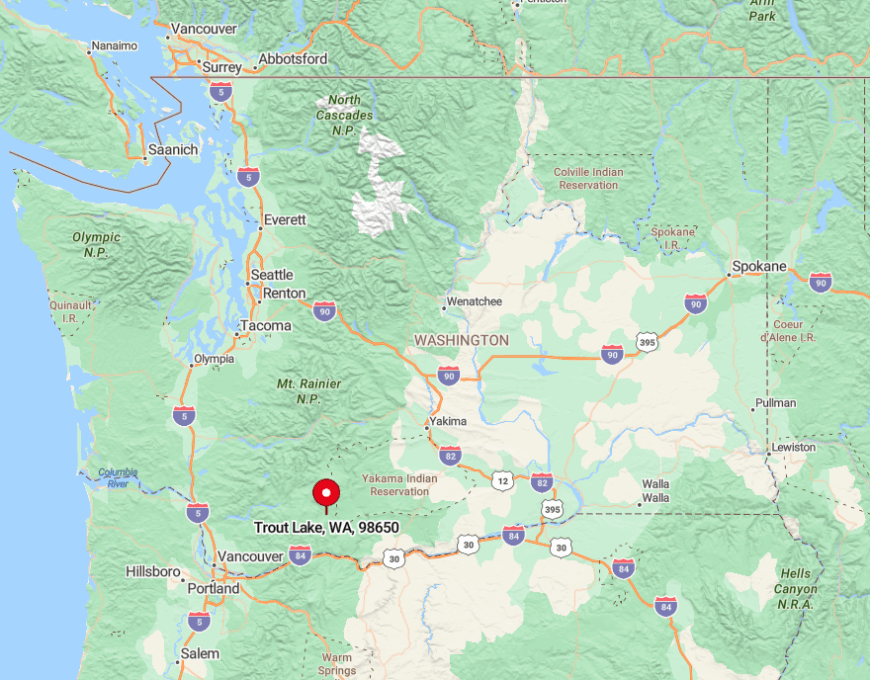
Situated in Klickitat County, Trout Lake is located in southern Washington near the Oregon border. Its seclusion is due to being enveloped by forests and mountains, with limited routes in and out of the area.
When I head to Trout Lake, I take State Route 141 north from White Salmon, traveling through scenic terrain that underscores the town’s isolation. The journey is a retreat in itself, leading to this mountain haven where tranquility reigns.


