🔥 Would you like to save this?
Southern Indiana still keeps pockets of deep quiet where cornfields give way to hardwood forests, gravel lanes, and river bends that feel lost in time. Our team gathered 25 of the most tucked-away communities south of Interstate 70, each offering its own mix of history, scenery, and elbow room.
Visitors find century-old churches, fruit orchards, and empty boat ramps instead of chain stores and traffic lights. Farming, small-scale timber work, and seasonal tourism support most residents, yet silence remains the area’s greatest asset.
In order to come up with the very specific design ideas, we create most designs with the assistance of state-of-the-art AI interior design software. Also, assume links that take you off the site are affiliate links such as links to Amazon. this means we may earn a commission if you buy something.
These towns prove that the Hoosier State holds more than racetracks and university crowds. A slow drive on a back road is all it takes to step into their calm.
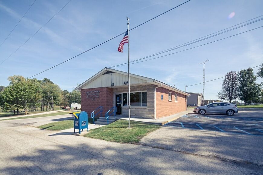
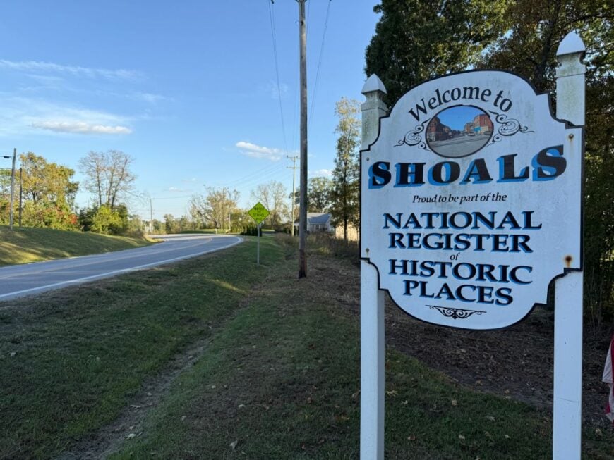
25. Shoals
Shoals, with around 750 residents, rests in a limestone valley that feels entirely its own. Bluffs of solid rock rise abruptly behind houses, shading gardens until late morning.
The East Fork of the White River snakes through, bringing anglers to its slow pools and photographers to its dramatic Jug Rock formation—the largest free-standing table rock east of the Mississippi. Farming, small limestone operations, and a scattering of local shops keep the town ticking at an unhurried pace.
The absence of chain stores and its distance from any interstate give Shoals a cocooned calm. Even trains pass quietly here, winding along the river at a pace that matches the town’s own. It’s the kind of place where you can still hear the difference between rain on leaves and rain on tin roofs.
Where is Shoals?
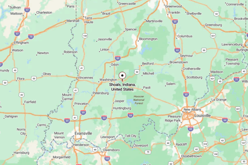
Shoals sits in Martin County, about 30 miles southwest of Bedford. You reach it by following US-50 until the highway begins hugging the White River and cliffs press close to the road. The drive narrows into bends that slow everyone down. By the time you crest into town, the rest of the world already feels far behind you.
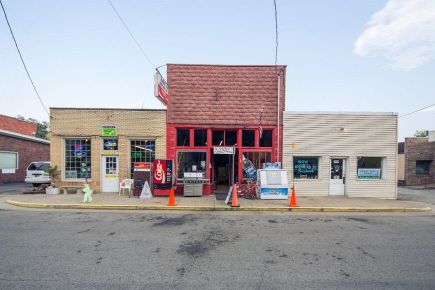
24. West Baden Springs
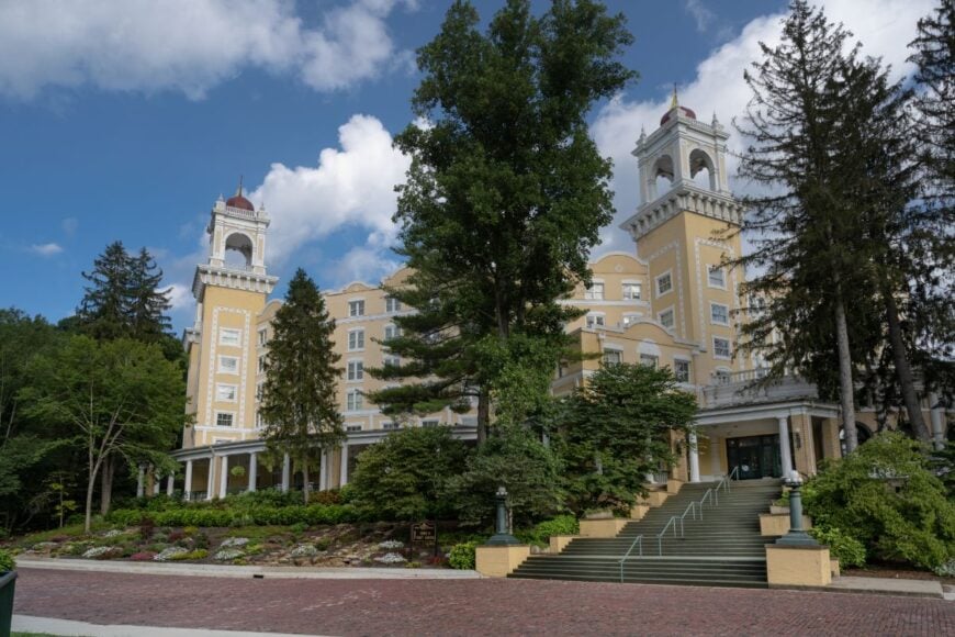
Known for its grand, domed hotel yet surrounded by deep Hoosier National Forest, West Baden Springs blends historic elegance with a hidden-away feel. Its population hovers near 600, most tied to tourism or hospitality at the resort and its gardens.
Beyond the landmark, quiet residential streets fade into wooded hills where deer wander at dusk. Visitors stroll through the old brick downtown, sip coffee on shaded porches, or follow trails to hidden mineral springs.
The resort’s architectural splendor might draw eyes, but the surrounding hills swallow noise and movement. It’s a rare mix of grandeur and seclusion. Nights here are so still, you can hear your own footsteps echo on the resort’s verandas.
Where is West Baden Springs?
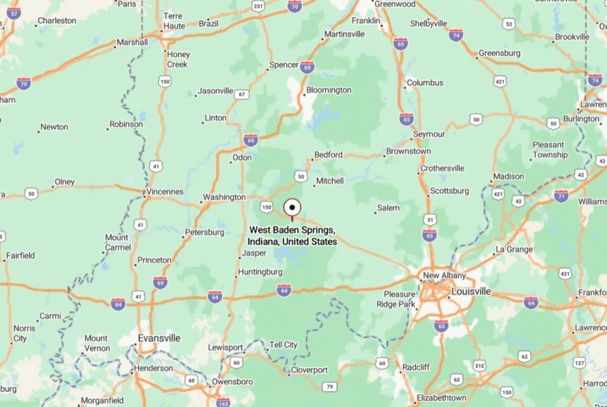
The town lies in Orange County, a few miles west of French Lick along State Road 56. Winding forest roads connect it to the nearest highway, making arrival an unhurried affair.
With national forest to the south and ridges to the north, there’s no sprawl to speak of. Even a short stay feels like stepping into a world apart.
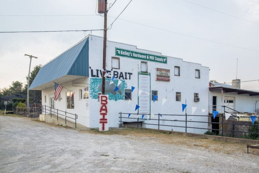
23. Milltown
Milltown straddles the Blue River, its 800 residents sharing Indiana’s wooded southern edge with limestone bluffs and clear, swift water. Paddlers drift past caves and rock outcroppings, while locals gather at the old mill site turned riverside park.
Small antique shops and diners supply just enough commerce to sustain a quiet main street. The town’s distance from major roads leaves the river as its main thoroughfare, with conversation and business often conducted over a paddle.
The forest canopy closes in quickly outside town, sealing off any sign of sprawl. This is a place where time is measured in river levels and seasons.
Where is Milltown?
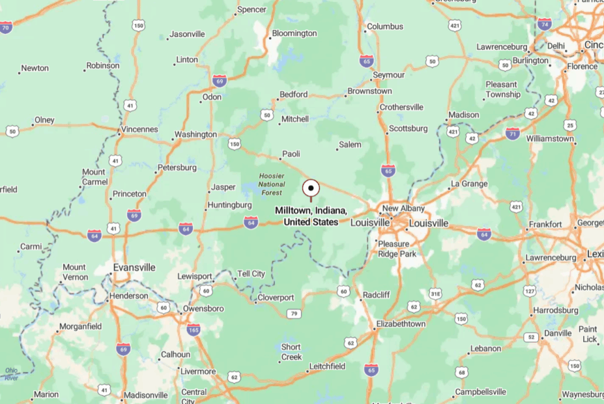
Set along the Crawford–Harrison County line, Milltown is about 20 miles west of Corydon. State Road 64 winds into the valley, crossing the Blue River before reaching the old downtown.
The last few miles are lined with forest and occasional farmland. Once you hear the river, you know you’ve left the busy world behind.
22. Ramsey
Ramsey’s modest 400 residents live amid gently rolling farmland broken by pockets of hardwood forest. Life revolves around the feed store, the ballfields, and Sunday services at churches whose steeples stand out above cornfields.
It’s a place where drivers wave at every passing car, and roadside produce stands still run on the honor system. Nearby Harrison-Crawford State Forest offers trails, hunting grounds, and deep green shade in summer.
Without commercial centers or fast-food signs, Ramsey feels more like an oversized family than a town. Even the air seems slower here, carrying the scent of hay and woodsmoke.
Where is Ramsey?
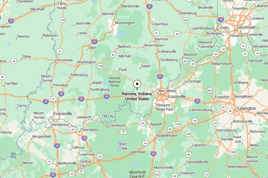
Ramsey lies in Harrison County, about 10 miles north of Corydon along State Road 64. The drive from larger towns takes you through open fields and pastures before dipping into a quiet valley.
No interstate comes close, and the nearest big-box store is a county away. That absence of hurry defines Ramsey’s charm.
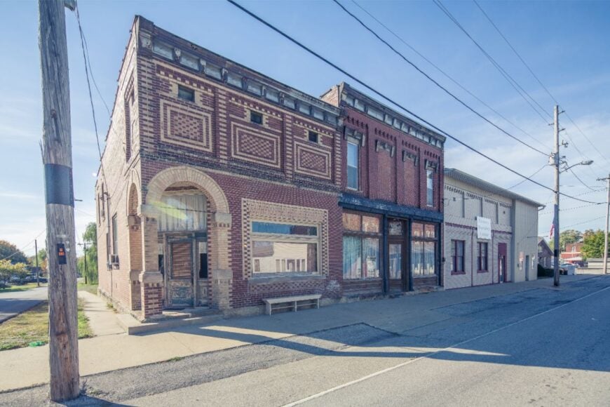
21. English
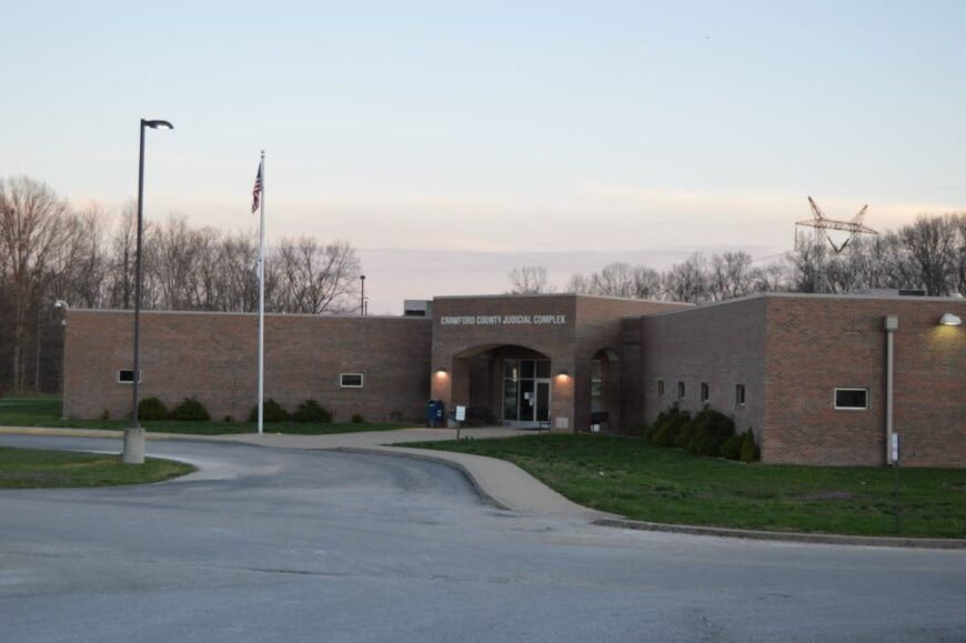
As the county seat with just over 600 residents, English is as small-town as its name suggests. Nestled in a bend of the Blue River and backed by national forest, it’s a base for canoeists, hikers, and hunters.
Downtown consists of a handful of brick buildings and a courthouse, with little to interrupt the silence after dark. Seasonal events, like the Crawford County Fair, provide bursts of activity that fade back to stillness.
The surrounding forest cuts it off from most through-traffic, keeping noise and light low. The pace here makes you forget you’re on any map at all.
Where is English?
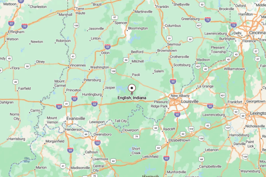
Located in central Crawford County, English is about 45 miles west of Louisville. State Road 64 winds through hills to get here, with the forest closing in the closer you come.
With only a couple of ways in or out, it’s a town easy to miss unless you’re looking for it. Those who do find it often linger.
20. Birdseye
With fewer than 500 residents, Birdseye sits tucked against Hoosier National Forest in Dubois County. Locals keep gardens big enough to feed neighbors, and summer evenings bring people together at the town’s single ballfield.
The Birdseye Trailhead offers a gateway into miles of hiking and horseback riding paths. Small woodworking shops, hunting supply stores, and the grain elevator form the economic core.
Its location away from interstates and larger towns makes it easy to overlook, which is exactly how residents like it. The forest here doesn’t just surround the town—it defines it.
Where is Birdseye?
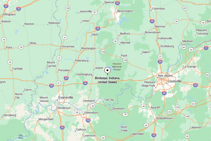
Birdseye is located along State Road 145, about 12 miles north of Interstate 64. You approach through rolling farmland that suddenly turns into dense forest.
The shift in scenery signals you’ve reached somewhere different. Once inside Birdseye, there’s little to distract from the trees and the sky.
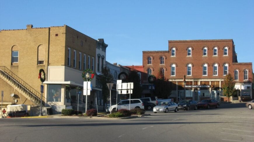
19. Paoli
🔥 Would you like to save this?
Paoli blends history and quiet charm, its courthouse square dating back to the early 1800s. About 3,500 residents enjoy a pace marked by seasonal festivals, courthouse concerts, and lazy afternoons at the nearby lake.
Surrounded by rolling hills and forest, the town feels removed despite being the county’s hub. Main Street holds a mix of antique stores, cafés, and outfitters catering to nearby trails.
The lack of heavy traffic keeps even the center of town hushed. In the evenings, music from a porch or a passing train whistle is all you’ll hear.
Where is Paoli?
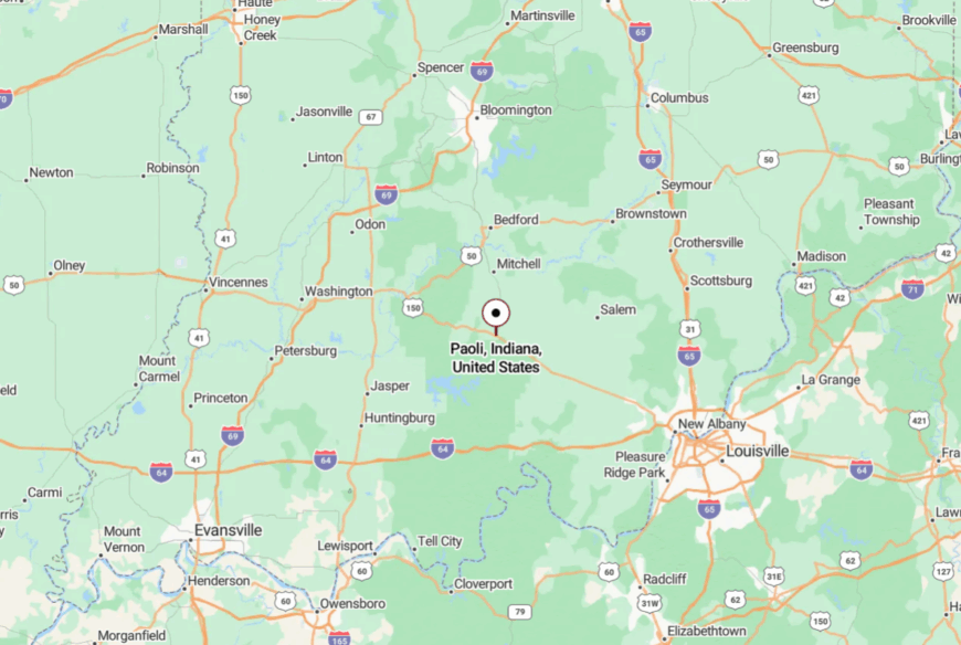
Paoli sits in Orange County, roughly 60 miles northwest of Louisville. State Road 37 and State Road 150 converge here, but both are two-lane and scenic.
The drive in from any direction is framed by forested hills. That approach makes arrival feel like a slow reveal.
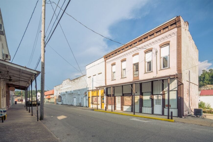
18. Hardinsburg
Hardinsburg’s 250 residents share a crossroads community where cornfields stretch for miles in every direction. A single diner, a post office, and a handful of churches anchor its social life.
The rest is farmland and gravel roads leading to even smaller places. Locals fish and paddle in nearby Blue River backwaters or explore wooded tracts just beyond the fields.
With no industry beyond agriculture, there’s little reason for outsiders to pass through. That’s just the way Hardinsburg likes it—unbothered and unhurried.
Where is Hardinsburg?
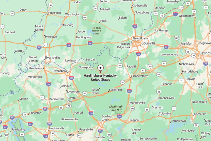
Hardinsburg lies in Washington County, 15 miles west of Salem along US-150. The highway narrows as it enters town, bordered by wide fields.
There’s no bypass, so the only traffic is local. A sunset drive here feels like something out of another decade.
17. Marengo
Marengo’s 800 residents are proud of their world-famous caves, but the rest of the town keeps to itself. Beyond the guided tours, streets remain lined with modest homes, shaded by mature trees.
The Blue River runs nearby, offering paddling and fishing without the crowds of more publicized spots. A few small shops, a gas station, and the school make up its visible commerce.
With forested hills rising just beyond the rooftops, there’s a sense of being hemmed in by nature. Life here feels simple, with the caves as both a landmark and a metaphor for the quiet beneath the surface.
Where is Marengo?
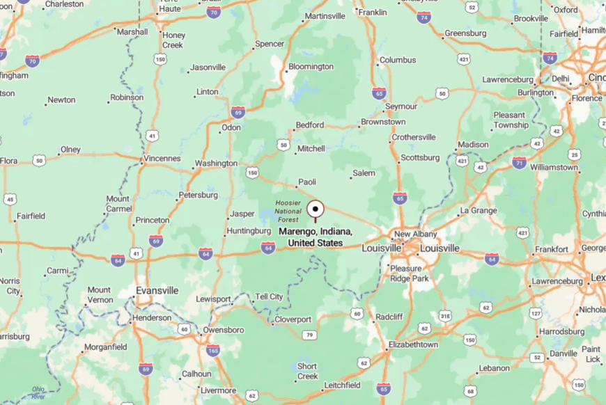
Marengo is in Crawford County, about 35 miles west of Louisville. State Road 64 leads straight into town, with views alternating between farmland and wooded slopes.
The absence of large-scale development makes the transition from highway to small town seamless. You arrive already in a slower frame of mind.
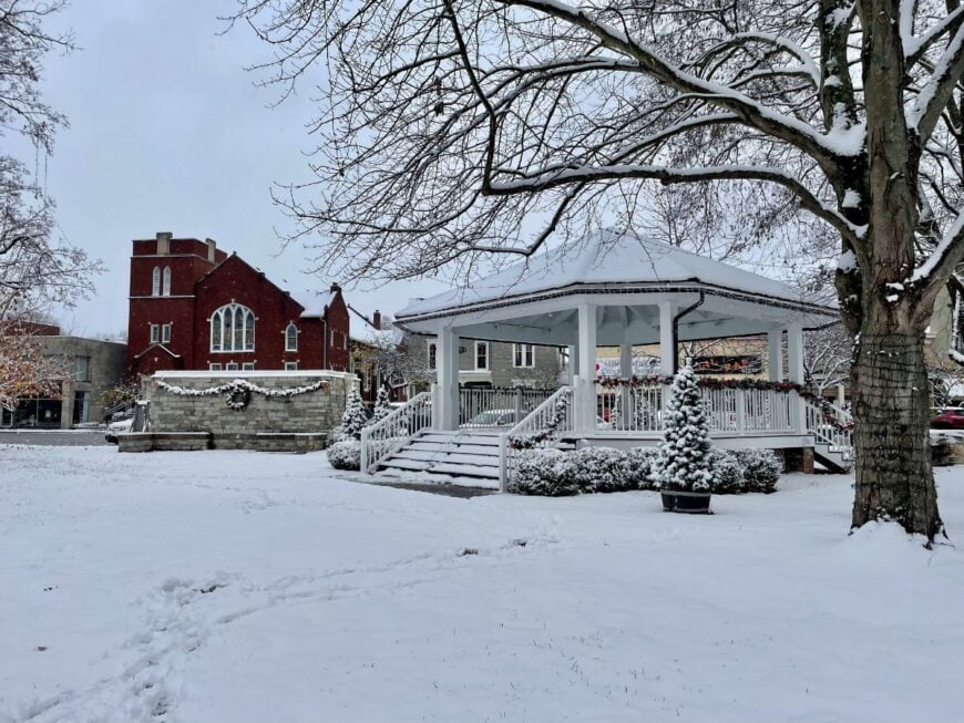
16. Orleans
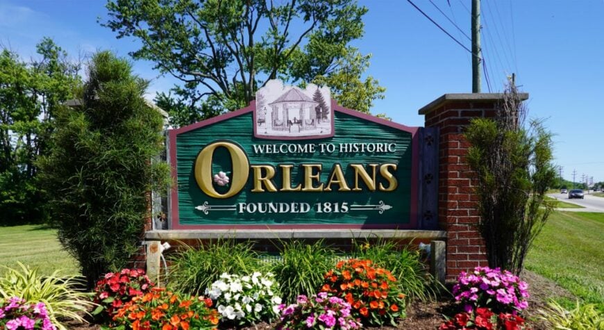
Orleans has around 2,100 residents and a historic square anchored by a 19th-century bandstand. The surrounding farmland is fertile and open, but the town itself is shaded by mature maples and oaks.
Seasonal farmers’ markets fill the air with the scent of peaches and tomatoes. Life moves at a measured pace, with schools, churches, and small shops making up the rhythm of the week.
Without major highways nearby, traffic stays light and familiar. The town’s name fits—it feels orderly, calm, and timeless.
Where is Orleans?
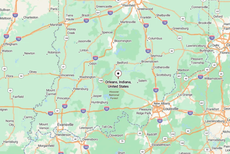
Orleans sits in Orange County, about 15 miles south of Bedford. Reaching it requires winding along State Road 37 or 337 through a patchwork of fields and forest.
Both routes are scenic and quiet. By the time you reach the square, the rest of the world seems far away.
15. Corydon Junction
Corydon Junction is more crossroads than town, but its cluster of homes, old barns, and quiet lanes exude an undeniable charm. Residents farm, run small repair shops, or commute short distances to Corydon proper.
Nights are quiet enough to hear coyotes calling across the ridges. The Ohio River lies just a few miles south, offering boat access and riverside walks.
Without retail or entertainment venues, the community’s focus is on neighbors and land. Here, you measure distance not in miles but in fencerows.
Where is Corydon Junction?
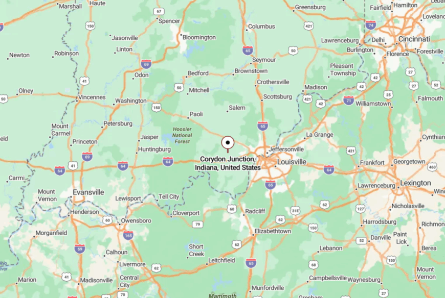
This hamlet is just east of Corydon in Harrison County, reached by narrow county roads branching off State Road 62. The last stretch is all wooded curves and open fields.
With no reason for through-traffic, the road feels like it’s just for you. That’s part of what keeps the junction’s quiet intact.
14. Fredericksburg
Fredericksburg’s 80 or so residents live in a valley carved by the Blue River. Floodplains keep development light, and the town has adapted with elevated homes and a focus on recreation.
Canoe launches, fishing holes, and shady picnic spots draw a trickle of visitors in summer. The rest of the year, it’s just the river and the locals.
No streetlights, no stoplights, and no big signs clutter the view. On a clear night, the stars double in the river’s reflection.
Where is Fredericksburg?
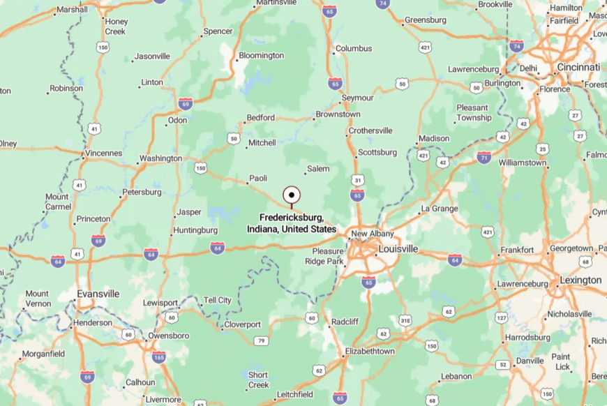
Fredericksburg lies in Washington County along State Road 150, about 20 miles west of Salem. The highway descends into the valley just before the bridge.
Once you cross the river, you’re in town—and surrounded by quiet. The water is as much a boundary as the hills that rise beyond it.
13. New Amsterdam
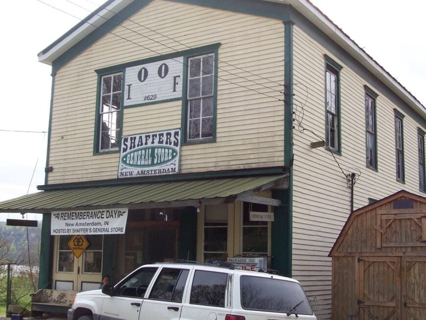
🔥 Would you like to save this?
With fewer than 30 residents, New Amsterdam is Indiana’s smallest town, and it feels every bit as secluded as its numbers suggest. Perched on a narrow Ohio River floodplain, it has a handful of homes, a historic church, and views that stretch across the water to Kentucky hills.
Life revolves around the river—its moods, its floods, and its gifts of fish and driftwood. The lack of services means residents are self-reliant, tending gardens and sharing resources.
It’s an existence shaped by water and weather. For those who stay, that’s the appeal.
Where is New Amsterdam?
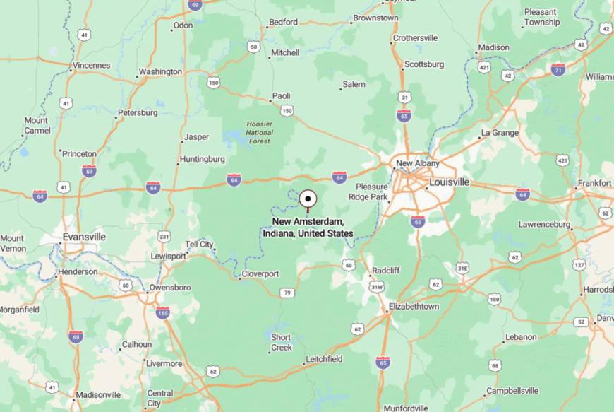
The town sits in Harrison County, 15 miles west of Mauckport, reachable by State Road 111. The drive hugs the river’s edge, often beneath steep wooded bluffs.
In high water, the road itself can disappear, isolating the town entirely. That vulnerability is part of its deep solitude.
12. Campbellsburg
Campbellsburg’s 600 residents share a grid of quiet streets lined with modest homes and big gardens. The town’s grain elevator and feed mill nod to its agricultural roots.
Summer means ballgames at the park, church suppers, and farm stands stocked with sweet corn. With no chain stores or traffic lights, life moves at a neighborly pace.
Surrounded by fields and a scattering of woodlots, the horizon feels open yet private. It’s a place where quiet isn’t just the absence of noise—it’s the foundation of daily life.
Where is Campbellsburg?

Campbellsburg lies in Washington County along US-150, about 12 miles west of Salem. The two-lane road runs straight and steady through farmland before narrowing slightly at the edge of town.
No bypass diverts cars, so traffic remains familiar and light. The approach alone sets the mood for the unhurried days ahead.
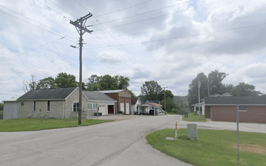
11. Millersburg
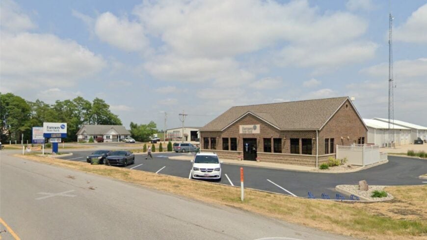
Millersburg is a small, unincorporated community where the sound of roosters often beats the sunrise. The nearest store is miles away, and the road in is flanked by cornfields that seem to go on forever.
Residents work small farms, tend to livestock, and help neighbors with harvests. Old barns and weathered fences line the lanes, giving the place a postcard quality.
Without signage or commerce, it’s easy to drive past without knowing you missed it—which is exactly why locals love it. Life here is about land, sky, and the people who know both well.
Where is Millersburg?
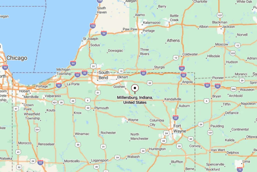
Millersburg sits in Orange County, northwest of Paoli, reached by County Road 500 North. The approach takes you past fields, over gentle rises, and into a shallow valley.
The nearest highway is over ten minutes away. Once you arrive, it feels like the rest of Indiana is somewhere far off in another time.
10. Williams
Home to Indiana’s longest single-span stone bridge and roughly 150 residents, Williams feels like a turn-of-the-century postcard along the White River. Anglers cast for smallmouth beneath the 1884 bridge arches, while paddlers launch canoes at a gravel bar a mile upstream.
Small family farms and a handful of home-based woodshops make up the local economy, with most goods traded at the Saturday market in nearby Bedford. There is no gas station, no stoplight, and phone service fades once you dip below the river bluffs, reinforcing the hamlet’s quiet.
Even mail delivery still runs on rural routes that trace the same dirt lanes used a century ago. All of this combines to keep Williams firmly insulated from hurried modern life.
Where is Williams?
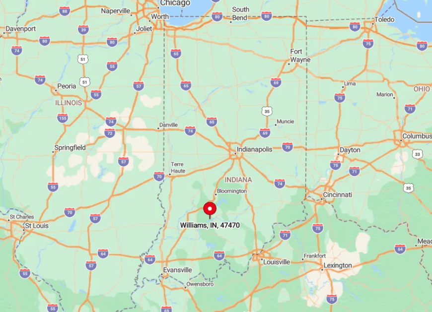
The settlement sits in Lawrence County on a broad horseshoe bend of the East Fork of the White River. Thick limestone ridges hem it in on three sides, so commercial traffic prefers wider highways to the north.
Visitors reach town by following Indiana 450 west from Bedford, then crossing the historic bridge into the river bottom. The single approach road means the only sounds at night are crickets and the river itself.
9. Taswell
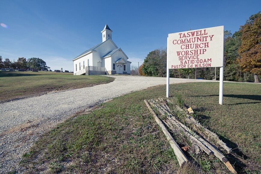
Taswell counts fewer than 200 residents scattered along Indiana 64 where it threads through Crawford County’s hardwood uplands. Outdoor lovers stop for Blue River canoe launches, deep-woods hiking on the nearby Potato Run Trail, and early-morning mushroom hunts that locals keep quietly mapped.
A tiny sawmill and seasonal outfitters supply the chief paychecks, while modest beef farms round out incomes. Towering oak and hickory forests on Hoosier National Forest land crowd right up to back porches, masking any hint of the interstate two counties away.
Streetlights are so rare the Milky Way paints the sky on clear nights. The town’s isolation is further safeguarded by the winding two-lane road that deters through-traffic.
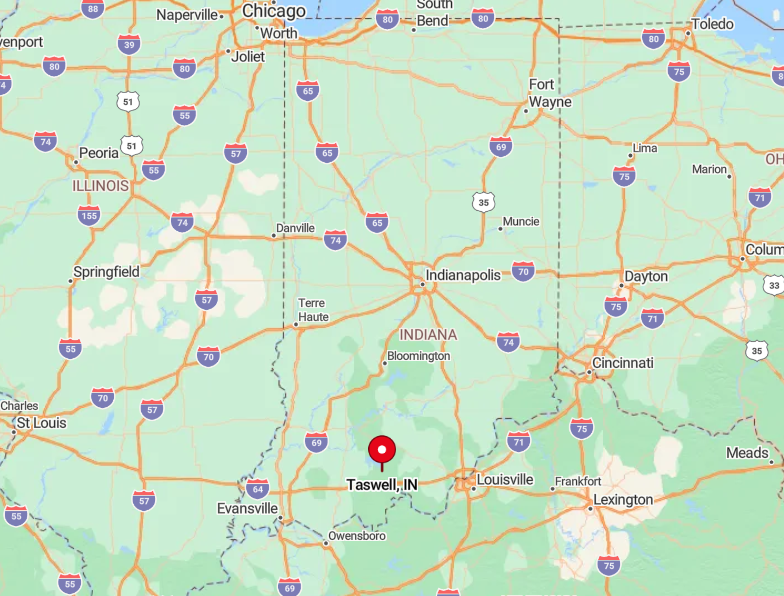
Where is Taswell?
🔥 Would you like to save this?
Taswell lies roughly 12 miles northwest of Corydon, just north of the Blue River’s limestone ledges. No major highways pierce this part of the county, leaving Indiana 64 as the only paved ribbon in or out.
Drivers approach from the east or west, but either way they negotiate miles of switchbacks before the first mailbox appears. That natural buffer preserves Taswell’s hush year-round.
8. Velpen
With about 250 people, Velpen occupies a flat between Patoka River wetlands and a chain of reclaimed mining lakes that have turned into blue-green oases for anglers and kayakers. Bird-watchers tick off sandhill cranes and prothonotary warblers at dawn, and goose hunters set blinds in flooded timber each fall.
Logging crews and a small pallet factory provide steady employment, yet long stretches of the day pass with only wind rattling cattails. The lack of a commercial strip within ten miles keeps shopping trips intentional rather than impulsive.
Gravel forest roads spider south toward the Patoka National Wildlife Refuge, making the town feel ringed by water and woods. That natural moat leaves Velpen off most travelers’ radar despite its fishing potential.
Where is Velpen?
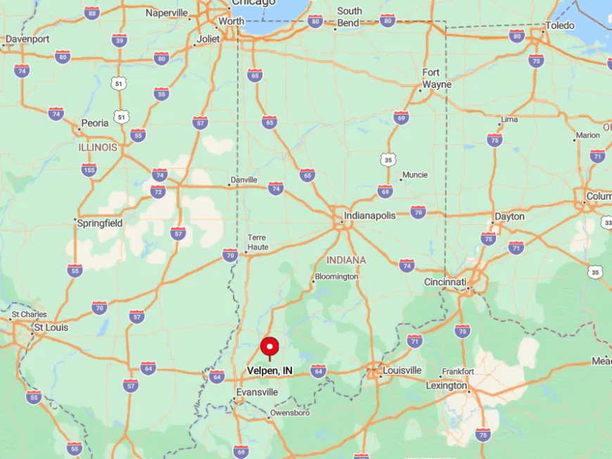
Velpen rests in Pike County, halfway between Petersburg and the eastern arm of Patoka Lake. State Road 257 skirts the edge of town, but no four-lane corridor approaches within twenty minutes.
The nearest interstate exit lies more than thirty miles west, so weekend anglers generally arrive by winding county roads. As soon as headlights swing away, frogs and owls reclaim the soundscape.
7. Magnet
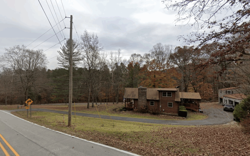
Magnet’s population hovers under 50, its clapboard homes stretched along a narrow bench above a sweeping Ohio River bend.
River buffs beach jon boats on undeveloped sandbars, and history fans visit the 1865 Union Civil War memorial perched beside the lane—one of the few built behind Union lines during the war itself.
Timber cutting and river fishing remain the only local trades, though summer cabins add a dash of tourism when the water is calm. Dense sycamore and maple bluffs form a visual wall between town and the nearest state highway five miles inland.
After dusk, house lights flicker off and towboats’ distant engines replace any hint of car noise. Such geography protects Magnet’s peace better than any zoning ordinance could.
Where is Magnet?
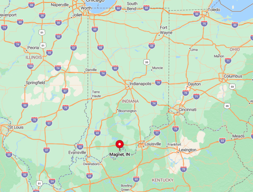
The village clings to the south edge of Perry County, reachable only by State Road 66, a serpentine route that hugs the river like a roller coaster. Steep slopes prevent any shortcut, so drivers meet no cross traffic until Cannelton or Tell City.
GPS apps often lose signal under the canopy, giving the last miles an exploratory feel. The combination of water barrier and bluff ensures unhurried days and night skies unspoiled by neon.
6. Celestine
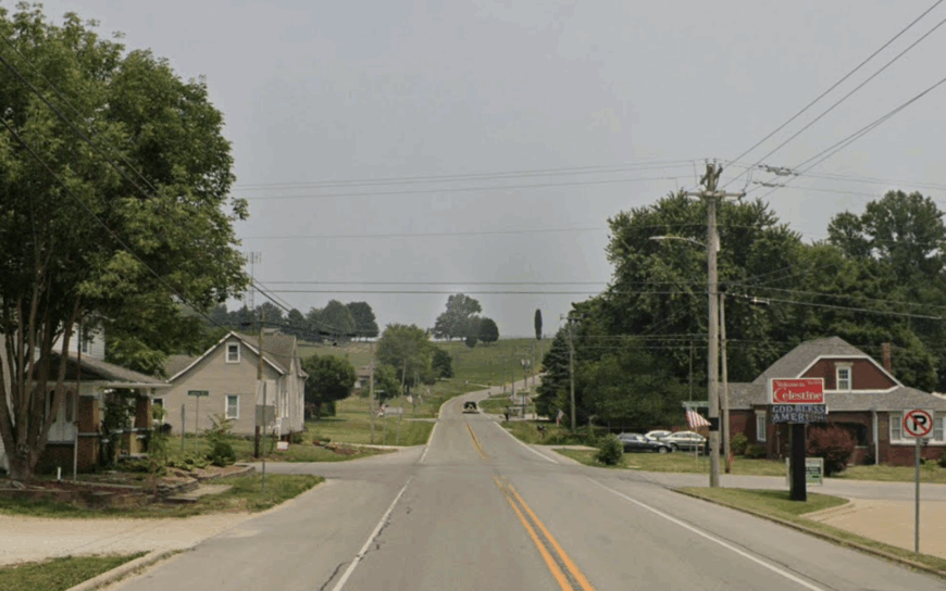
Celestine counts just over 250 residents, many linked by family ties that stretch back to the mid-1800s when its stone-spire church first rose above rolling Dubois County pastureland.
Visitors slip into St. Celestine Catholic Church for a look at German-crafted stained glass, then drive country loops to photograph century-old barns and browse the seasonal farm-stand for sweet corn.
Dairy herds, row crops, and an independent cabinet shop support households, while a twice-yearly picnic draws guests for homemade noodles and quilt raffles. Wide buffers of corn, soybeans, and forest cloak the settlement from nearby Jasper’s brighter lights.
There is no through street; instead, two county lanes meet at the church and simply taper off into fields. That dead-end layout leaves traffic at a crawl and conversation at porch-swing volume.
Where is Celestine?
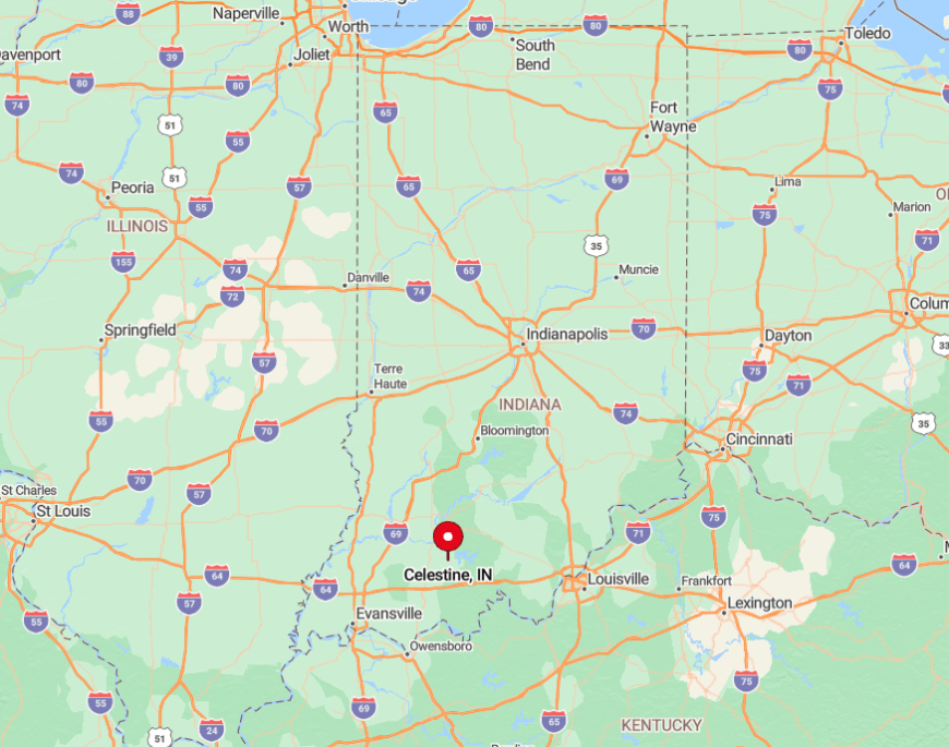
The hamlet sits eight miles northeast of Jasper on a high knoll that rises from the Patoka River valley. Travelers follow County Road 164, which narrows to one lane in places before cresting the hilltop.
Without billboards or gas stops, only the church steeple signals arrival. The return trip after sunset is lit mainly by fireflies and the occasional tractor headlamp.
5. Needmore
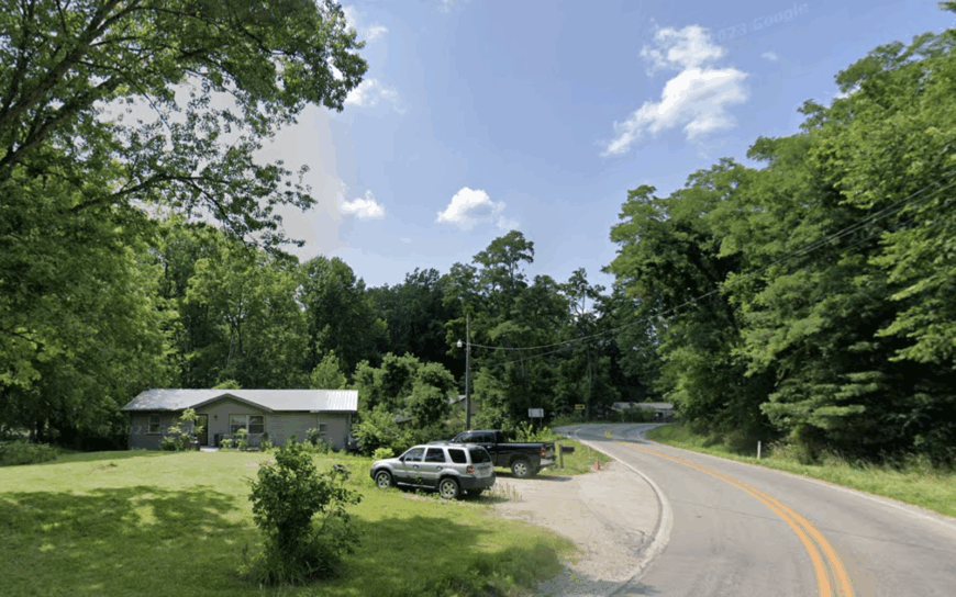
Needmore, whose 300 residents joke that the town “needs more” of almost everything, nestles among limestone outcrops and half-wooded farms in northern Lawrence County. Rock-climbers explore abandoned quarries on private land, and hunters roam state-managed Morgan-Monroe backcountry a few miles north.
Cattle operations and a roadside sawmill anchor the modest economy, with many commuters driving to Bedford quarries for shifts cutting Indiana limestone. The absence of a four-lane road within 12 miles, paired with patchy cell coverage, keeps impulse visits rare.
House numbers fall off quickly as gravel lanes turn to forest tracks. Needmore’s residents cherish that isolation, maintaining a volunteer fire station as the town’s lone civic hub.
Where is Needmore?
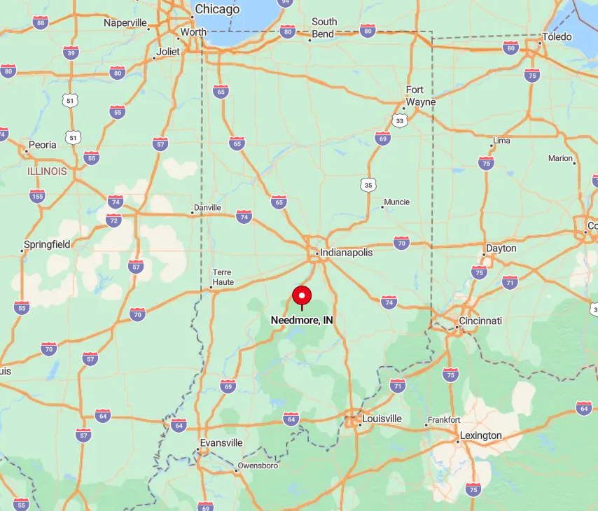
The community lies just off State Road 54, but thick ridges force a curvy approach no matter the direction. Bloomington sits 20 miles north, yet the lack of a direct highway stretches the trip to nearly forty minutes.
Many locals mark the town limit by the weathered white church and adjacent ball field rather than a sign. After dark, vehicle lights vanish behind hills within seconds of departure.
4. Rome
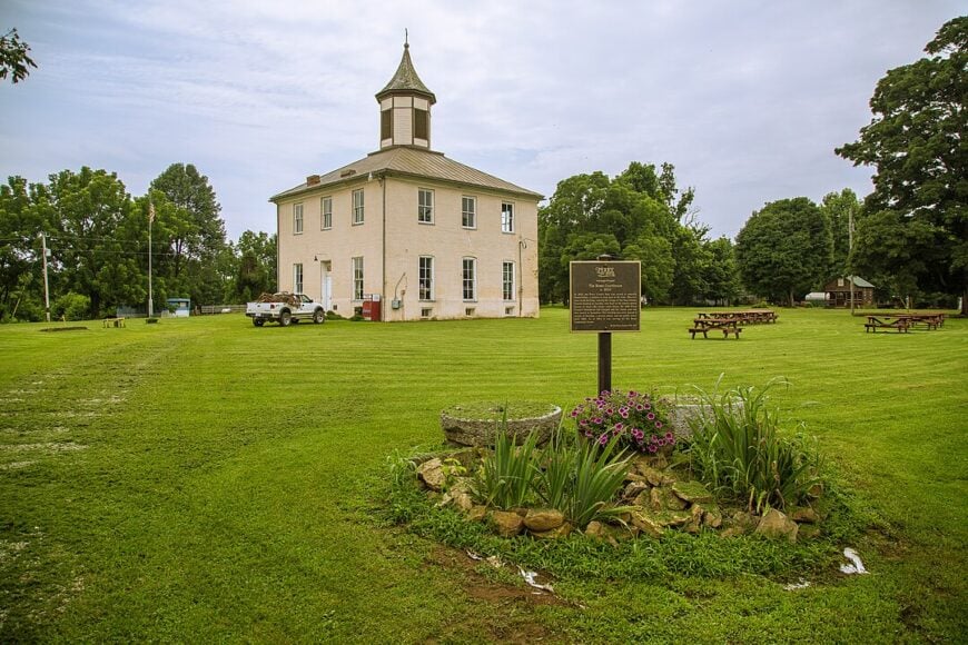
Once Perry County’s seat, Rome now houses fewer than 75 souls and a cluster of weathered brick buildings that echo steamboat days on the Ohio. Travelers photograph the 1819 courthouse ruin, picnic under giant sycamores, and kayak the secluded river stretch where bald eagles routinely fish.
Farming bottomland corn pays a few bills, but most residents rely on seasonal construction or head north to Tell City mills. Thick river bluffs and a sweeping bend hide Rome from any arterial roads, muting modern bustle.
Gravel streets end at the riverfront, and floodplain fields ensure there is little reason for outsiders to pass through. As a result, silence blankets the town long after dawn mist lifts from the water.
Where is Rome?
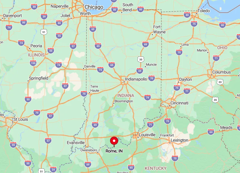
Rome sits on the Ohio River’s southernmost Indiana curve, accessible only by a spur of State Road 66 that dead-ends at the old courthouse. The nearest bridge crosses into Kentucky twenty miles east, adding to the sense of enclosure.
Visitors descend a series of switchbacks before the river suddenly appears at their bumper. With no alternate route out, the road itself feels like a time tunnel.
3. Starlight
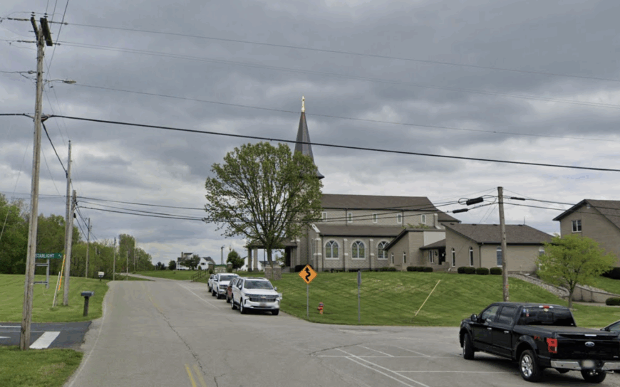
Perched on Floyd County ridge tops, Starlight tallies roughly 600 inhabitants spread across orchard-dotted acreages that make fall smells of apples and cider unavoidable.
Huber’s Winery and Joe Huber Family Farm draw weekend crowds for peach-picking, wagon rides, and bluegrass concerts under open-air barns. Agriculture rules the payroll here—fruit trees, u-pick berries, and agritourism events mix with small beef herds on rolling hills.
Even so, nights stay pitch-black because Louisville’s glare fades behind layers of ridges and woods. Farm lanes stretch a mile or more between mailboxes, and locals keep an informal stargazing calendar for meteor showers.
That ridge-line elevation and lack of commuter traffic preserve Starlight’s quiet despite its relative closeness to suburbia.
Where is Starlight?
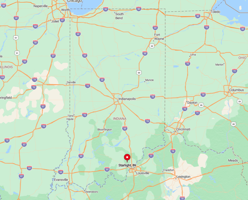
The community crowns the highest ground in Floyd County, about 15 miles northwest of downtown New Albany. Access comes via narrow Budd Road or St. John’s Road, both climbing snake-like out of the Ohio River Valley.
Once atop the plateau, cell towers dip below the horizon, and vistas open toward the Knobs and distant Kentucky hills. Only two roads connect back to highways, so visitors depart the same way they arrived.
2. Leopold
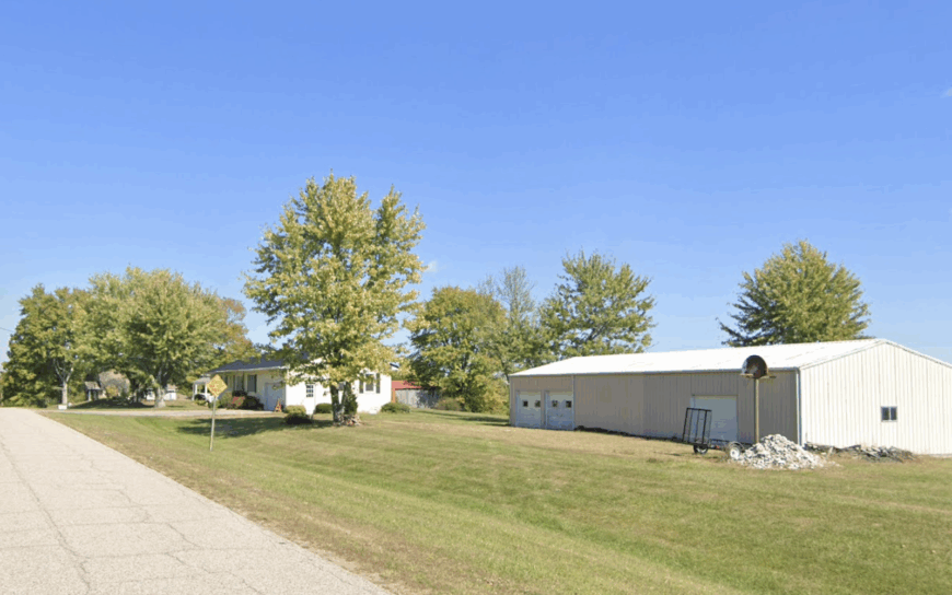
Leopold’s population barely tops 75, yet its stone St. Augustine Church and surrounding woodland create a French-settler tableau that feels lifted from rural Alsace.
Pilgrims attend the once-a-year August picnic featuring authentic coq au vin, while hikers slip into Hoosier National Forest trails that start behind the parish hall. Limited logging, small beef herds, and part-time jobs at Tell City industries sustain households, with the church acting as cultural anchor.
Forested hills roll for miles, muffling any distant road noise and screening the night sky from light pollution. Yards blend into oak groves where whip-poor-wills call after dusk. The sleepy rhythm stays intact largely because no major development ever reached these hills.
Where is Leopold?
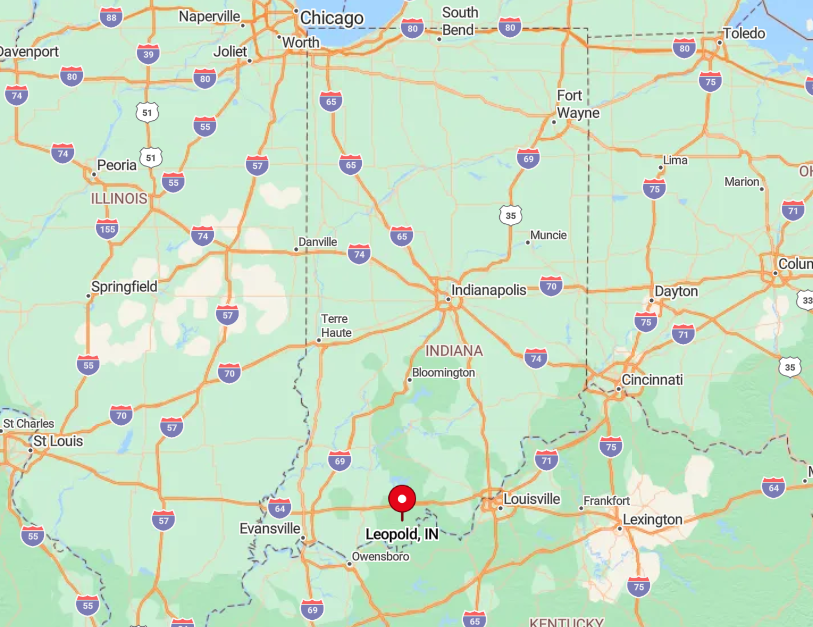
Leopold sits high on Perry County’s eastern plateau, fifteen minutes off State Road 37 via twisty Leopold Road. The route gains 600 feet in elevation, rising through dense timber before the church steeple pierces the canopy.
No public transit or ride-share services operate this far out, so arrival demands a private vehicle. That simple fact keeps the flow of newcomers extremely light.
1. Story
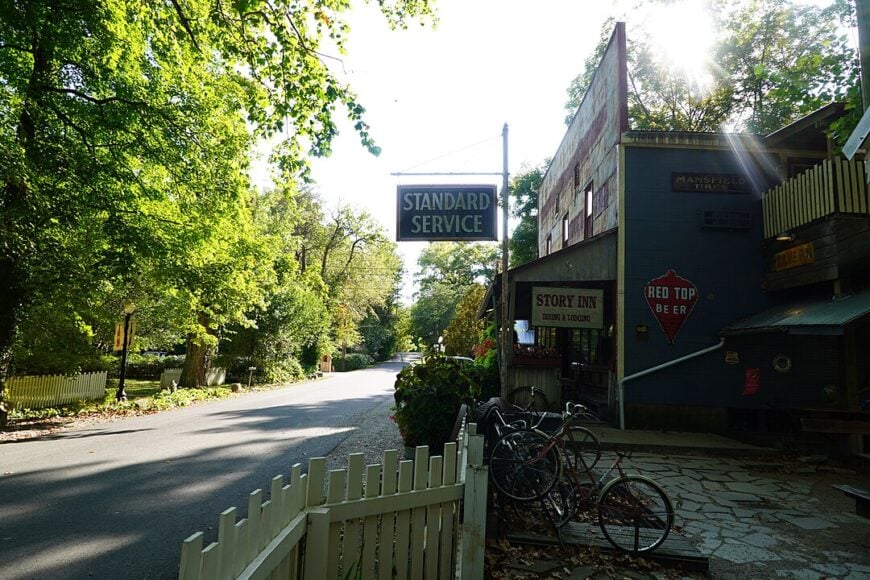
Story, with fewer than 100 residents, occupies a forest hollow inside Brown County State Forest where a 19th-century inn, blacksmith shop, and scattering of cabins remain frozen in pioneer charm.
The Story Inn dishes up gourmet meals under kerosene lamps, and guests follow lantern-lit paths to century-old cottages after dinner. Mountain bikers jump on the Nebo Ridge Trail at dawn, while wildflower seekers wander hushed lanes lined by tulip poplar and beech.
Tourism and hospitality at the inn provide most local jobs, supplemented by seasonal forestry contracts. Seclusion is baked into the setting: gravel roads extend 15 miles to the nearest town of Nashville, and forest acreage blocks any cellular signal.
Porch rockers, cicadas, and the scent of woodsmoke fill the hush where traffic never intrudes.
Where is Story?
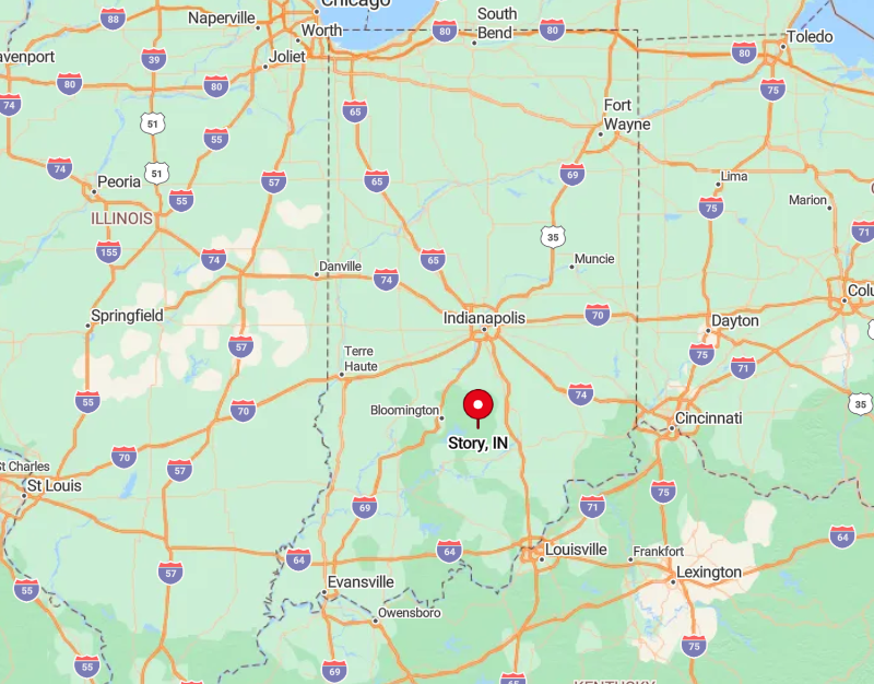
The hamlet hides in Brown County’s southern reaches, one mile north of the Salt Creek valley and two ridges removed from State Road 135. Drivers follow unstriped Highway Story—really a glorified lane—until the forest suddenly opens on the blue hotel flag.
With no alternate routes, visitors arrive and depart on the same gravel path, often pausing for deer that wander across the track. Between the long approach and dense woods, Story remains about as unplugged as Indiana gets.