Would you like to save this?
There are towns that seem to hold their breath—places where the road narrows, the air stills, and time forgets to hurry. In the folds of Southern California’s backcountry, tucked between weatherworn hills and sunlit canyons, these towns sit quietly, neither abandoned nor eager to be seen.
They are shaped by oak and dust, wind and memory—marked by one-room post offices, hand-painted signs, and the sound of crickets filling wide, open nights. Life here doesn’t announce itself; it hums gently in rhythm with the land.
For those who come looking—not for entertainment, but for space, silence, and something that feels a little like before—these 25 secluded towns are still waiting, just as they’ve always been.
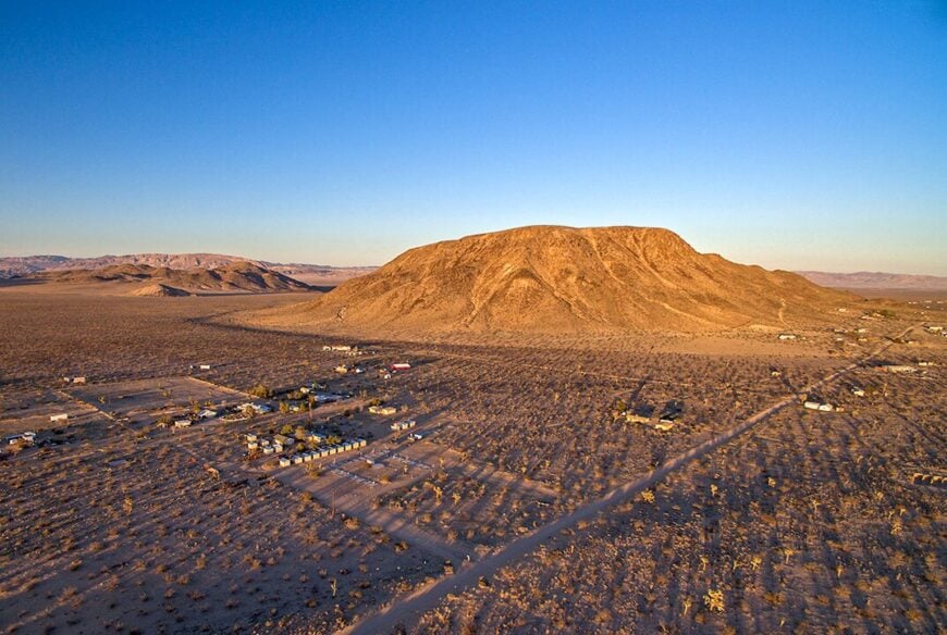
25. Shelter Valley
Shelter Valley’s 330 residents occupy a secluded pocket of the Anza-Borrego Desert at 2,500 feet elevation. Days are spent exploring desert canyons, fossil beds, and old mining roads that lead to nowhere fast.
There’s no gas station, no grocery store, and just one volunteer fire crew. Locals rely on solar panels, satellite dishes, and mutual aid to maintain their off-grid lives.
At night, the desert becomes pitch black, save for the glimmer of distant stars. Wind whistling through ocotillo branches is often the loudest sound for miles.
Where is Shelter Valley?
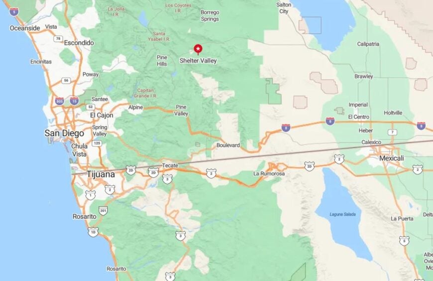
Shelter Valley lies just south of Julian, along the winding county-maintained S-2 route known as the Great Southern Overland Stage Route. It’s within San Diego County but far from any urban sprawl.
Flanked by the Laguna Mountains and vast Anza-Borrego desert wilderness, the town sits isolated from through-traffic. Visitors must plan with extra fuel and water in mind before venturing out.
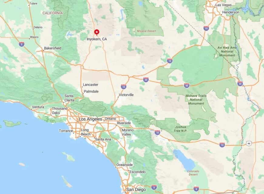
24. Inyokern
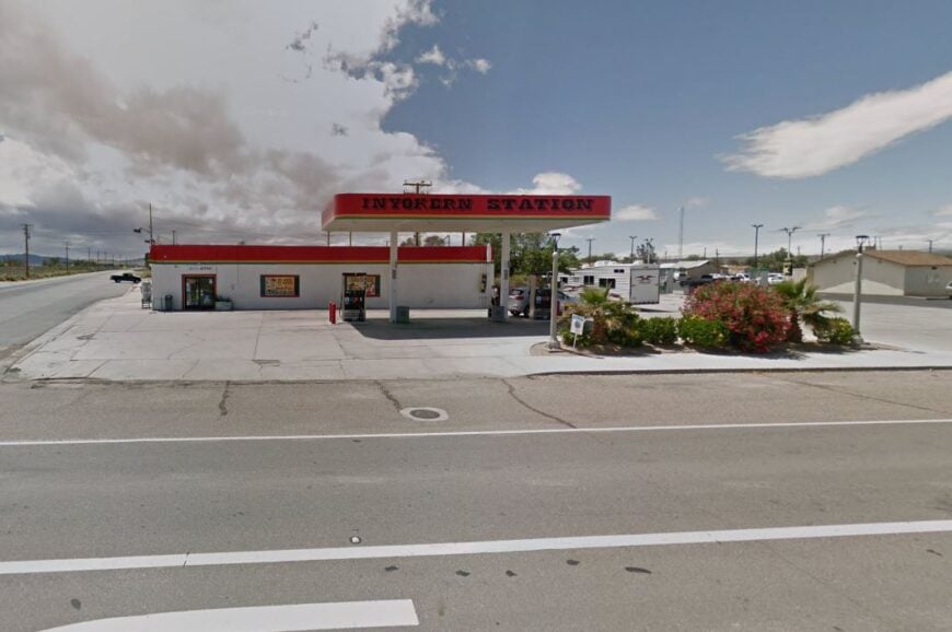
Inyokern, known as the “Sunshine Capital of the U.S.,” has around 1,000 residents and is framed by the Sierra Nevada and the Mojave Desert. The airfield and the shadows of nearby peaks give it a Cold War-era aura.
Wide gravel driveways, crumbling hangars, and scattered mobile homes define the settlement’s layout. There’s no rush here—just time to watch dust devils dance.
Local life revolves around aerospace testing, astronomy meetups, and vintage car rebuilds. On clear nights, telescopes come out and headlights disappear.
Where is Inyokern?
Were You Meant
to Live In?
Inyokern is located off U.S. Route 395 in northeastern Kern County, near Ridgecrest but well apart from urban noise. The Inyokern Airport marks its largest landmark.
The community is flanked by wilderness to the west and the Naval Air Weapons Station to the east. There’s no public transit—only long desert highways and sunbaked scenery.
23. Canebrake
Canebrake sits hidden in the far southeastern corner of Kern County, where foothills give way to desert. With fewer than 100 people, the hamlet blends quietly into its surroundings.
Most homes are off-grid or seasonal cabins, often passed through generations. Life here means feeding chickens, tending gardens, and watching for bighorn sheep.
Cell reception is spotty, and amenities nonexistent. But sunrise over Walker Pass and silence on Canebrake Creek make it feel like another century.
Where is Canebrake?
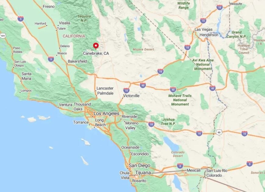
Canebrake lies along Highway 178 between Lake Isabella and the eastern edge of the Sierra. The nearest store or gas station is in Onyx, a 20-minute drive away.
The area is buffered by Bureau of Land Management land and steep canyon terrain. Travelers find themselves truly alone once they leave pavement.
22. Adobe Valley

Adobe Valley remains largely uninhabited, with only a handful of ranchers and naturalists living in trailers and historic cabins. Set in Mono County near the Nevada border, the area thrives on silence.
Wild horses roam the valley floor, and snow often lingers on the nearby Glass Mountains into May. Migratory birds flock to the alkali lakes each spring.
There are no utilities, no fences, and almost no roads—just a few trails and windblown fence posts. This is California at its rawest.
Where is Adobe Valley?
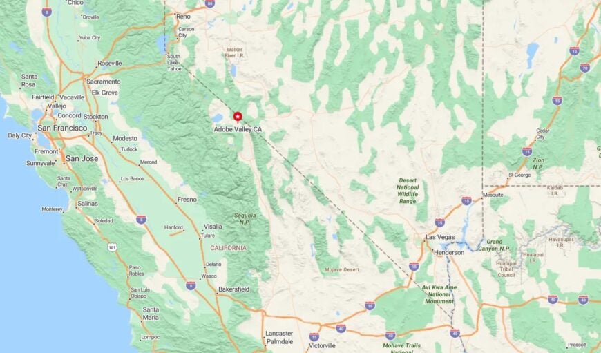
Adobe Valley sits southeast of Mono Lake and northeast of Mammoth Lakes, reached only by rugged dirt tracks off Highway 120 or Highway 6. Most vehicles don’t venture past the cattle guards.
The valley is ringed by volcanic ridges and seasonal wetlands. To reach it is to leave paved civilization behind entirely.
21. Ballarat
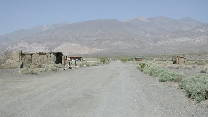
Ballarat was once a bustling mining camp, but now fewer than five people live there full-time. Crumbling stone ruins, rusted Model Ts, and one surviving general store define the space.
Time flows differently here—hot, dry, and unhurried. Visitors come to photograph ghost-town textures or camp under the stars.
There’s no electricity, no internet, and no local governance. Ballarat survives purely on stubbornness and solitude.
Where is Ballarat?
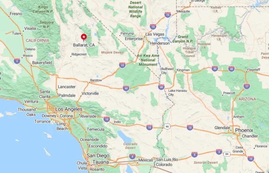
Ballarat is located at the western edge of Death Valley National Park, down a 6-mile dirt road off Trona Wildrose Road in Inyo County.
The nearest services are in Panamint Springs, over an hour away. Once inside Ballarat, all you hear is wind, and all you see is empty sky.
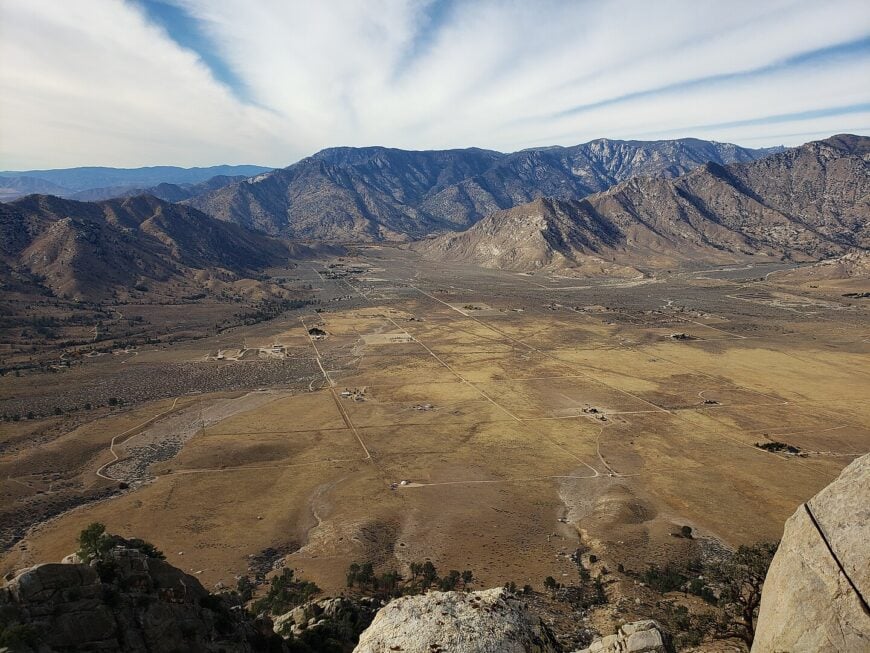
20. Forest Falls
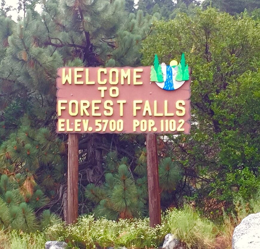
Forest Falls clings to the base of San Gorgonio Mountain, with cabins nestled into a canyon carved by Mill Creek. With under 1,100 year-round residents, it feels like the last town before wilderness.
Towering pines and waterfalls mask all sound from the valley below. Locals hike to Big Falls, tend wood stoves, and gather at the single café near the trailhead.
The steep terrain means cell coverage drops within a mile, and winter storms routinely knock out power for days.
Where is Forest Falls?
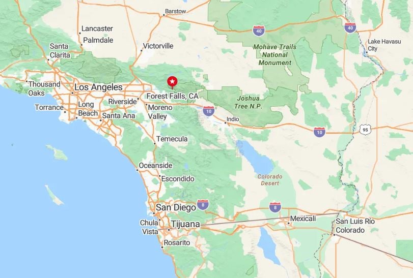
Located in San Bernardino County, Forest Falls lies off Highway 38, northeast of Redlands and up Mill Creek Road. Its placement inside the San Bernardino National Forest limits sprawl.
The road ends at a cul-de-sac surrounded by wilderness. There’s no pass-through traffic—only those who intend to find it ever do.
19. Potrero
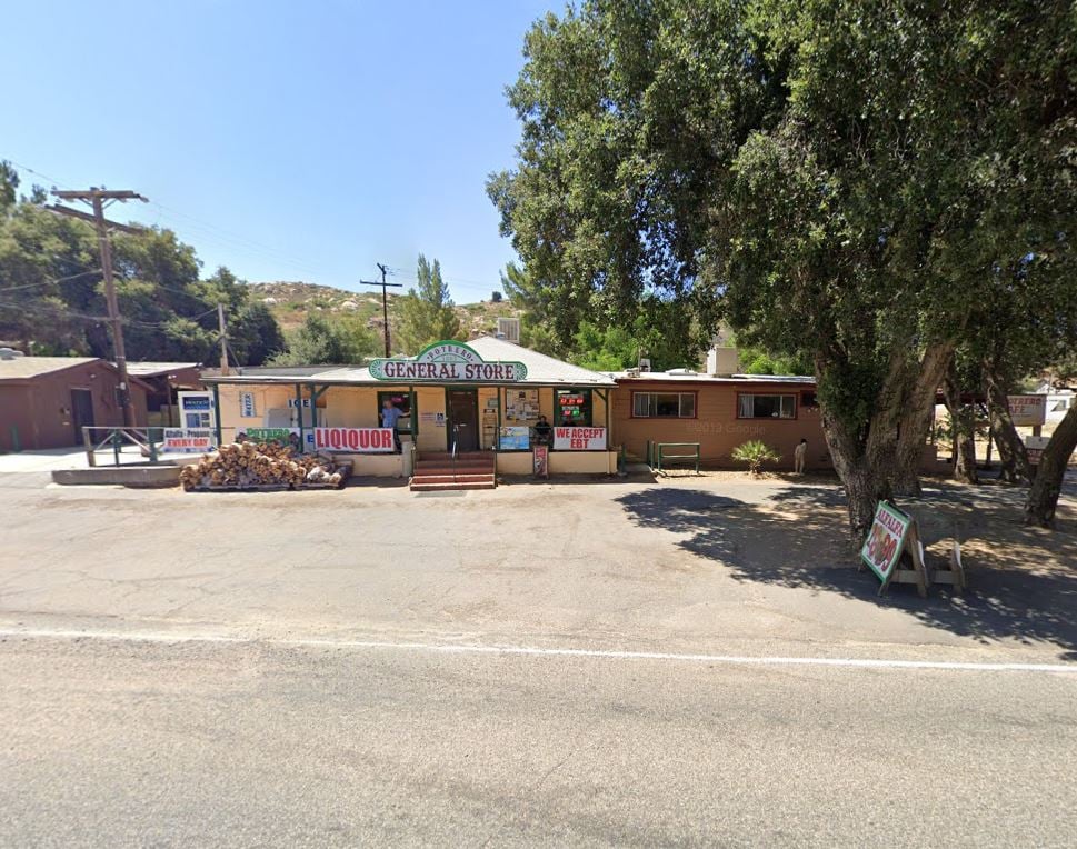
Potrero is a remote community in southeastern San Diego County, best known for its peaceful pastures and sweeping views of rolling chaparral. Fewer than 700 residents call it home.
Days here are punctuated by breezes, hummingbirds, and long conversations on wide porches. Horse trailers outnumber sedans, and main roads often go unnamed.
The village has no commercial strip, only a post office and a general store with irregular hours. It’s a backcountry world unto itself.
Where is Potrero?
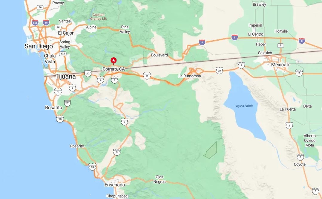
Potrero lies 40 miles southeast of San Diego via Highway 94, tucked into the hills near the Mexican border. No highway cuts directly through it.
The terrain is hilly, undeveloped, and bounded by Border Patrol land and wildlife preserves. Roads are narrow and quiet, perfect for those who seek obscurity.
18. Niland

Niland, at the edge of the Salton Sea, is both strange and starkly beautiful. With about 700 residents and no real downtown, it is known more for what surrounds it than what’s within.
Slab City, Salvation Mountain, and East Jesus form an off-grid artistic enclave nearby. Electricity is optional, and mailboxes are often just metal pails on a stick.
Desert winds rule the day, and silence rules the night. Niland is where people go to vanish on purpose.
Where is Niland?
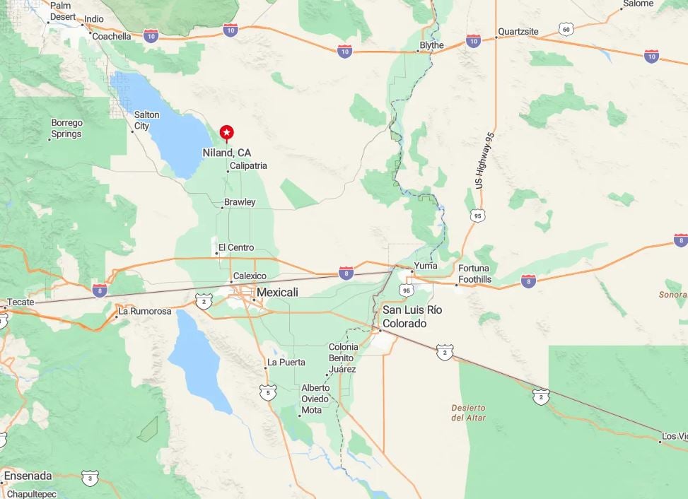
Niland is in Imperial County, reached via Highway 111, 30 minutes north of Brawley and just west of the Chocolate Mountains.
Surrounded by abandoned farmland and geothermal fields, it’s well off any tourist circuit. Drivers must navigate rural byways and sand-blown intersections to find it.
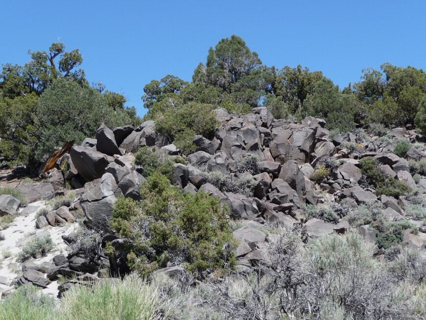
17. Cima
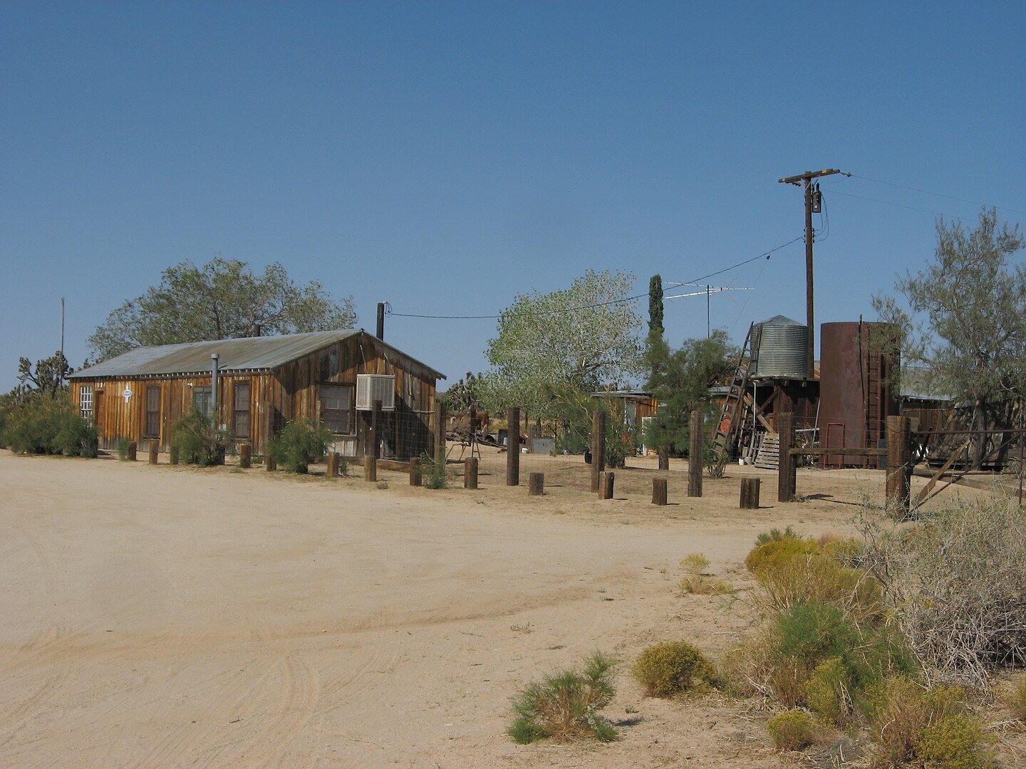
Cima is a ghostly outpost in the Mojave National Preserve. Only a handful of railroad and maintenance staff live nearby, surrounded by Joshua trees and silence.
A burnt-out general store, the Union Pacific line, and a one-lane road define the area. Coyotes, lizards, and quail far outnumber people.
Trains thunder by in the distance, and time feels entirely elastic. This is solitude not just felt—but heard.
Where is Cima?
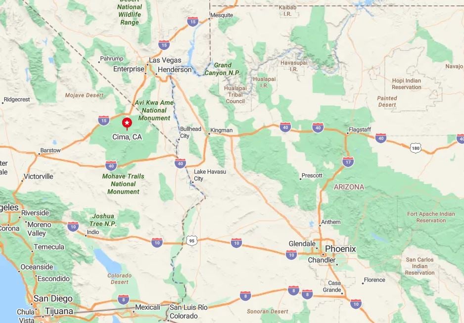
Cima sits in eastern San Bernardino County, at the junction of Cima and Kelso Cima Roads inside the Mojave National Preserve.
Reaching it requires exiting Interstate 15 near Baker, then driving 30-plus miles into the preserve. There are no services, and the sense of distance is total.
16. Fawnskin
Would you like to save this?
Fawnskin, on the north shore of Big Bear Lake, offers a calmer counterpoint to the busier resort town across the water. With around 400 full-time residents, it maintains a timeless alpine charm.
Historic log cabins, a general store, and an arts center shape daily life. Mule deer and deer outnumber tourists most months.
Roads narrow, trees thicken, and streetlights vanish as you drive into town. The lake reflects nothing but sky and trees.
Where is Fawnskin?
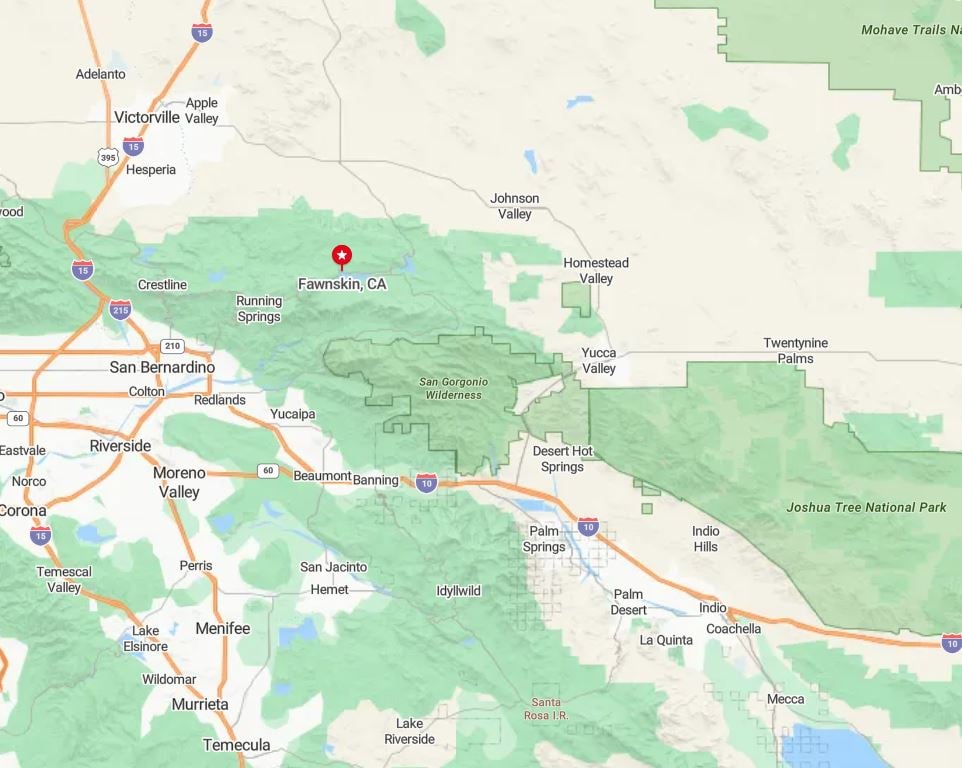
Located in San Bernardino County, Fawnskin is accessed via Highway 38 and the Rim of the World Scenic Byway. It’s just across the lake from Big Bear but feels a world apart.
Public transit doesn’t serve the town, and snow often closes routes in winter. For most, arrival involves patience, chains, and a thermos of cocoa.
15. Blair Valley
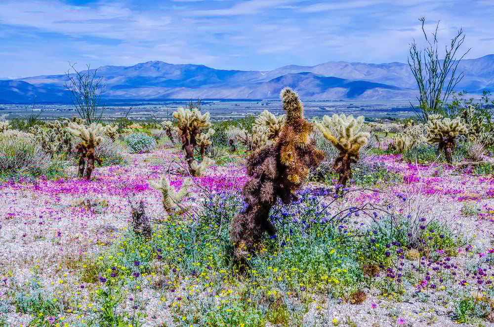
Blair Valley is more a place than a town, home to a few hardy homesteaders and hikers drawn to the solitude of Anza-Borrego’s interior. Petroglyphs, stone circles, and Native American trails crisscross the valley.
There are no houses in view, only ocotillo, boulders, and wind. Even dirt roads disappear after a while, blending back into the desert.
On moonless nights, the Milky Way seems close enough to touch. Silence wraps the valley like a blanket.
Where is Blair Valley?
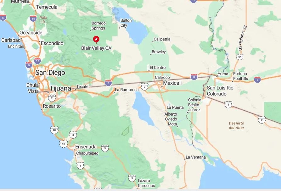
Blair Valley sits inside Anza-Borrego Desert State Park, accessed via the narrow dirt track from S-2 Highway. The valley rests below Ghost Mountain and is part of the park’s backcountry.
Visitors need high-clearance vehicles and self-sufficiency. It’s one of the last places in California without any artificial light or noise.
14. Warner Springs
Warner Springs blends high meadows and open skies in northern San Diego County, just above 3,000 feet. Home to just a few hundred residents, the town features ancient oaks and hot springs.
It was once a Pony Express stop and still feels like the edge of the old frontier. Locals ride horses, run small vineyards, or tend alpacas.
There are no fast-food outlets, and gas must be planned for. Tranquility is the town’s main export.
Where is Warner Springs?
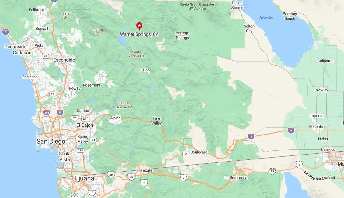
Situated along Highway 79 between Temecula and Julian, Warner Springs is bordered by ranchlands and Palomar Mountain foothills.
The Pacific Crest Trail crosses here, bringing occasional thru-hikers. Otherwise, the road remains empty and the valley still.
13. Llano
Llano is a quiet stretch of the Antelope Valley with remnants of utopian dreams. Population is sparse, with scattered ranch homes and abandoned resorts.
Ruins of the Llano del Rio commune still sit on the edge of town, whispering forgotten ideologies. Jackrabbits dart across silent roads.
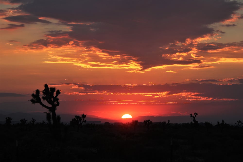
Most residents are off-grid, working in nearby towns or living purely for the silence. Sunsets paint the desert in impossible shades.
Where is Llano?
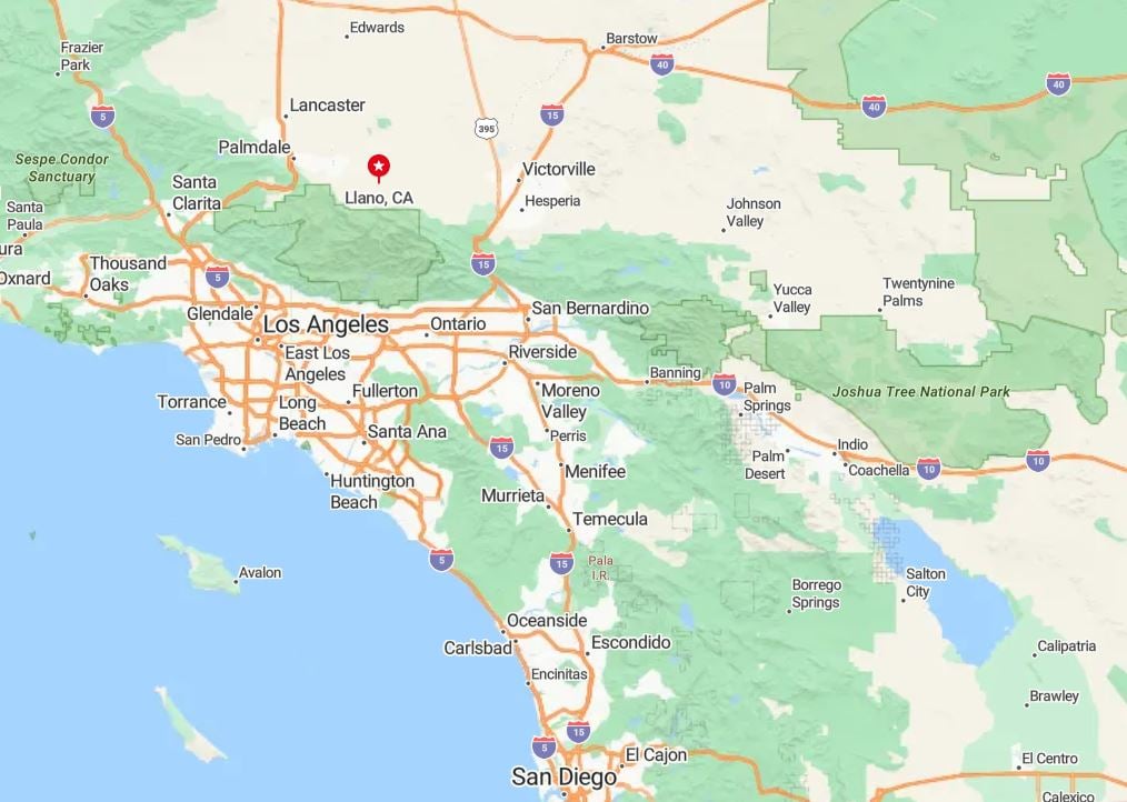
Llano lies along Pearblossom Highway (CA-138) in Los Angeles County’s high desert. It’s roughly 25 miles east of Palmdale, but feels remote.
The landscape is flat, dry, and full of mystery. It’s easy to pass through without realizing the town ever existed.
12. Tecopa
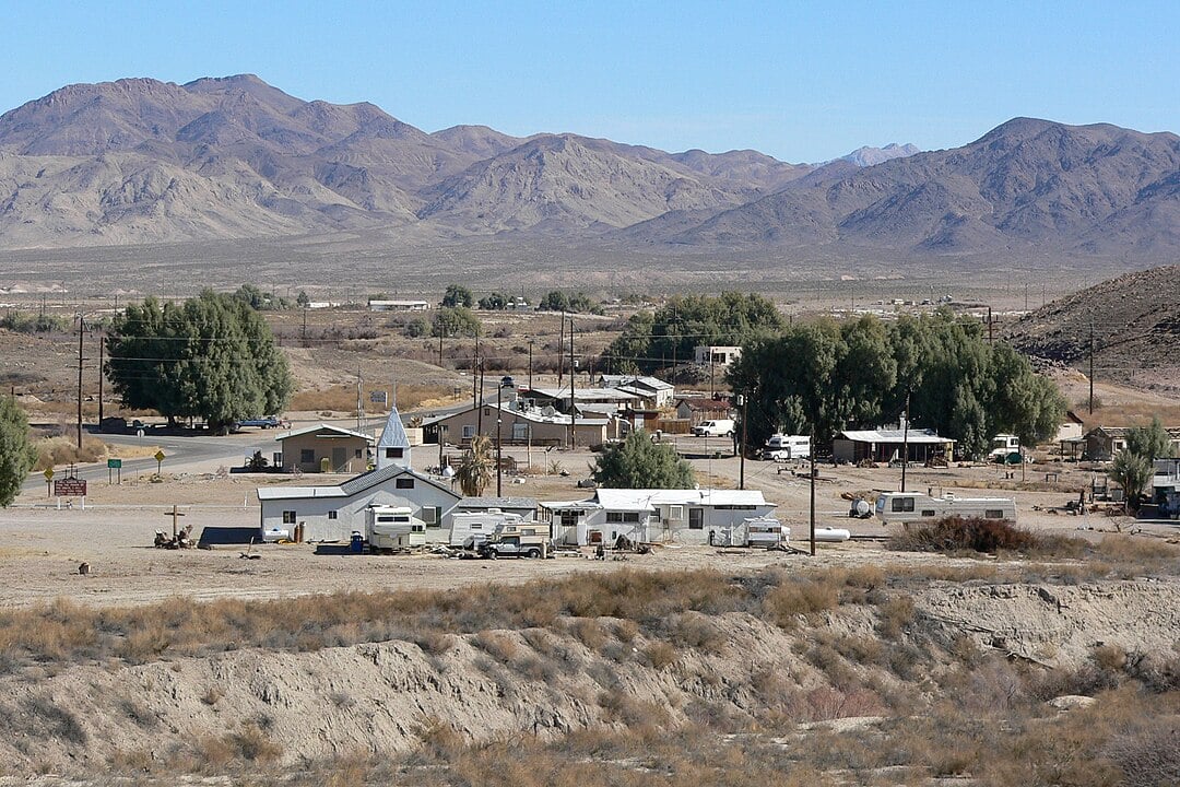
Tecopa is a desert oasis best known for its hot springs and silence. With a population of under 200, it’s a place to soak, reflect, and disappear.
The town has a brewery, a date farm, and a hot mud bath—but no stoplights, and barely a signal. People come for healing or hiding.
At night, coyotes sing across the valley, and the stars stretch horizon to horizon.
Where is Tecopa?
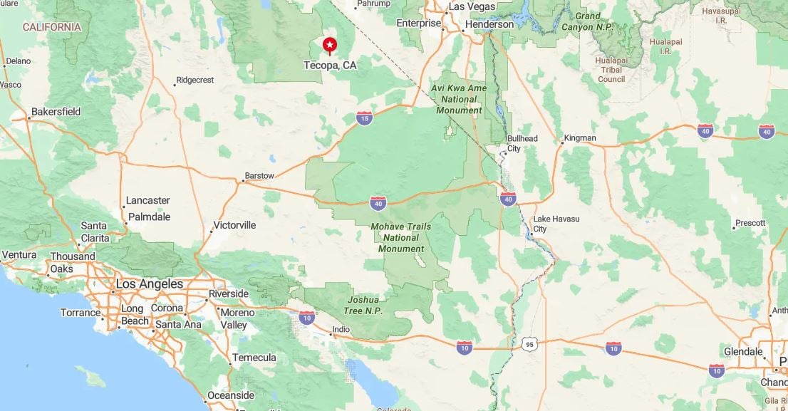
Tecopa is in Inyo County near the Nevada border, southeast of Death Valley Junction. It’s accessed via Highway 127 from Baker.
Surrounded by salt flats and the Amargosa River, it’s one of the most isolated spa towns in the Southwest. Bring water, sunscreen, and an appreciation for quiet.
11. Oak Glen
Oak Glen offers alpine apple orchards and crisp fall mornings at 4,700 feet elevation. The town draws crowds in autumn but sleeps in winter, with a full-time population under 600.
Homesteads line quiet country roads, and local businesses center on cider, pie, and heirloom fruit. Wi-Fi is weak, but wildlife sightings are frequent.
When the snow falls, the hills become nearly silent. That’s when Oak Glen feels most like its secluded self.
Where is Oak Glen?
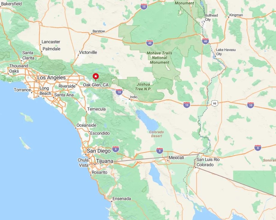
Oak Glen sits northeast of Yucaipa in San Bernardino County, reached via Oak Glen Road off Highway 38. It’s just a short drive from the city—but feels far away.
Bordered by San Bernardino National Forest and Wildlands Conservancy reserves, the area remains protected and pristine. Access is possible year-round, but serenity peaks in the off-season.
10. Lockwood Valley

Lockwood Valley counts roughly 150 residents scattered across one-acre ranch parcels tucked deep in Ventura County’s backcountry. Weekends invite horseback rides on old fire roads, target practice at the shooting range, and mushroom hunts after early-spring rains.
Cabin rentals, small-scale cattle operations, and Forest Service work form the primary livelihood here. Even during holiday weekends the valley stays quiet because there are no restaurants, gas stations, or cell towers in sight.
Surrounding peaks of Los Padres National Forest block most traffic corridors, reinforcing the sense of shelter. As darkness falls, the Milky Way spreads overhead without a hint of city glow.
Where is Lockwood Valley?
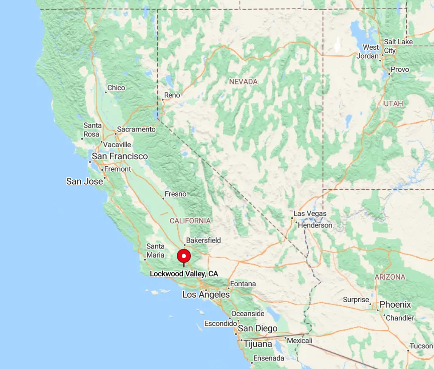
The settlement sits about 35 miles north of Ojai, reached by twisty Highway 33 and a final stretch of Lockwood Valley Road. Steep grades and winter closures keep casual drivers away, amplifying its remoteness.
There is no public transit, and snow often closes the pass from Frazier Park, so visitors plan with care. A full tank and reliable map are the ticket into this isolated Ventura County niche.
9. Landers

Landers supports near 2,800 people spread across the Mojave’s open flats, each lot often five acres or more. Explorers can climb the volcanic dome of Goat Mountain, visit the otherworldly sound bath at the Integratron, or search for desert lilies after rare rain.
Small art studios, off-grid rentals, and the local water company shape the modest economy. No streetlights, sparse signage, and long gravel driveways make it feel like the edge of nowhere.
Prevailing silence at night is broken only by coyotes and the distant rumble of the Marine Corps base over the mountains. This expanse of Joshua trees lets residents watch thunderheads form fifty miles away.
Where is Landers?

Positioned north of Yucca Valley in San Bernardino County, Landers lies along Old Woman Springs Road. Surrounding Bureau of Land Management acreage and a patchwork of private claims restrict sprawl.
The closest grocery store sits fifteen miles south, and most routes involve two-lane highways with limited services. Drivers from Los Angeles must commit to a two-and-a-half-hour journey through sagebrush and sand to reach this quiet high-desert hamlet.
8. New Cuyama

New Cuyama records about 740 inhabitants clustered around a single crossroads on State Route 166. Daytime diversions include tasting flights at Cuyama Buckhorn, bird-watching at the nearby Carrizo Plain, and stargazing programs hosted by visiting astronomers.
Farming, ranching, and the elementary school anchor local employment. Surrounded by vast rangeland and gated ranch roads, the town rarely sees pass-through traffic between Bakersfield and Santa Maria.
Evenings bring wide vistas of the Caliente Mountains glowing pink, with only one traffic light blinking in the distance. The minimal development ensures a stillness more typical of the 1950s than modern California.
Where is New Cuyama?

The town sits in northern Santa Barbara County, about ninety minutes northeast of Santa Maria along Highway 166. Empty miles of grassland and the Carrizo Plain National Monument buffer it from neighboring cities.
No major airport or rail line serves the valley, reinforcing its isolation. Travelers rely on personal vehicles and an occasional wine-country shuttle that stops twice a week.
7. Aguanga

Would you like to save this?
Aguanga’s roughly 1,200 residents occupy rolling chaparral hills dotted with oak, sage, and expansive horse estates. Recreational pilots land at tiny Rancho California Airport, anglers cast lines at Lake Riverside, and hikers tackle trails in nearby Beauty Mountain Wilderness.
Home-based ranch businesses, boutique wineries, and commuting firefighters make up the employment mix. Sparse commercial zoning means nights stay free of neon and traffic jams.
The community’s seclusion is heightened by vast stretches of public land and the Palomar Mountains forming a natural barrier. Clear mornings reveal distant views of the Salton Sea shimmering on the horizon.
Where is Aguanga?

This Riverside County enclave lies twenty miles east of Temecula along State Route 79. Only one gas station and a general store greet travelers on the 50-mile stretch between Hemet and Warner Springs.
The winding highway, frequent wildlife crossings, and limited cell coverage keep casual traffic light. Most visitors arrive by car from Interstate 15, then disappear into the quiet hills.
6. Lake Hughes

Lake Hughes claims about 650 locals living among pines, junipers, and a modest reservoir at 3,200 feet. Weekenders fish for catfish, sip cold drinks at the 1920s Rock Inn, and roam the Elizabeth Lake Canyon trails. Small hospitality gigs, film-location rentals, and Forest Service posts provide income.
The lack of big box stores, spotty internet speeds, and winding mountain access roads foster genuine detachment from urban pace. With few streetlights, the sky turns deep indigo, and owls patrol silent dirt lanes. Residents value the calm so much that local bylaws limit excessive exterior lighting.
Where is Lake Hughes?

Nestled on the western edge of the Antelope Valley, the hamlet sits thirty minutes west of Lancaster via Pine Canyon Road. Steep canyon walls and Angeles National Forest terrain discourage expansion.
Public transit does not reach the community, and snowfall can briefly close the main route each winter. Arrivals typically come by high-clearance vehicle, especially when summer thunderstorms carve ruts in the road.
5. Boulevard

Boulevard supports close to 400 inhabitants spaced across oak-studded mesas near the Mexican border. Days are filled with horseback rides on the Pacific Crest Trail, wildflower drives along Historic Highway 80, and visits to the tiny Wisteria Candy Cottage that has been hand-dipping treats since 1921.
Ranching, Border Patrol assignments, and home-based artisanship sustain the economy. There are no traffic lights, and the nearest fast-food outlet is twenty miles away, preserving the hush of open country.
Wide parcels average forty acres, so neighbors are more often heard by two-way radio than by shouting over a fence. Coyotes and nightjars provide the evening soundtrack under a sky unbroken by city glare.
Where is Boulevard?

The town sits in southeastern San Diego County, just off Interstate 8 roughly sixty miles east of downtown San Diego. Surrounding BLM land and Kumeyaay reservations limit development on all sides.
The local two-lane Highway 94 provides a scenic but slow approach, carving through granite boulders and chaparral. Most visitors exit I-8 at Ribbonwood Road and immediately feel the drop in ambient noise.
4. Valyermo

Valyermo has near 450 residents residing in scattered ranch homes beneath the north flank of the San Gabriel Mountains. Popular pursuits include fishing for trout in Jackson Lake, picnicking at Devil’s Punchbowl Natural Area, and riding on miles of dirt roads that crisscross open pastureland.
Livelihoods center on horse breeding, organic orchards, and seasonal tourism to nearby Mountain High ski area. The settlement lacks a main street, and cellphone reception vanishes behind the ridges, keeping distractions minimal.
Morning fog often settles in the creek basin, muffling any hint of distant activity. By sunset, the only glow arises from wood-burning stoves and porch lanterns.
Where is Valyermo?

Located in the eastern Antelope Valley, Valyermo hides south of Pearblossom Highway along a winding segment of Big Rock Creek Road. Angeles National Forest land encircles the valley, blocking expansion and through-traffic.
There is no public bus service, and snow occasionally forces closures at the nearby mountain pass. Drivers from Los Angeles must plan an hour-and-a-half trip that ends in a narrow canyon lined with cottonwoods.
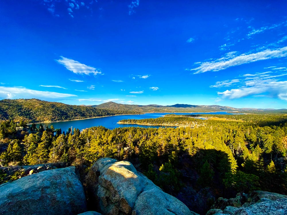
3. Green Valley Lake

Green Valley Lake is home to fewer than 500 people who share dense pine forests and a 9-acre stocked lake at 7,200 feet elevation. Visitors paddle small boats, hike the unofficial Cabin 51 trail to panoramic views, and hunt for chanterelles after late-summer rains.
Seasonal cabin rentals, the local marina, and a single cafe shape the small economic footprint. Surrounded by San Bernardino National Forest, the hamlet has no pass-through roads, so traffic remains light even on holiday weekends.
Winter brings deep snow that silences the landscape and temporarily locks in residents. The result is an alpine refuge far removed from the suburban valleys below.
Where is Green Valley Lake?
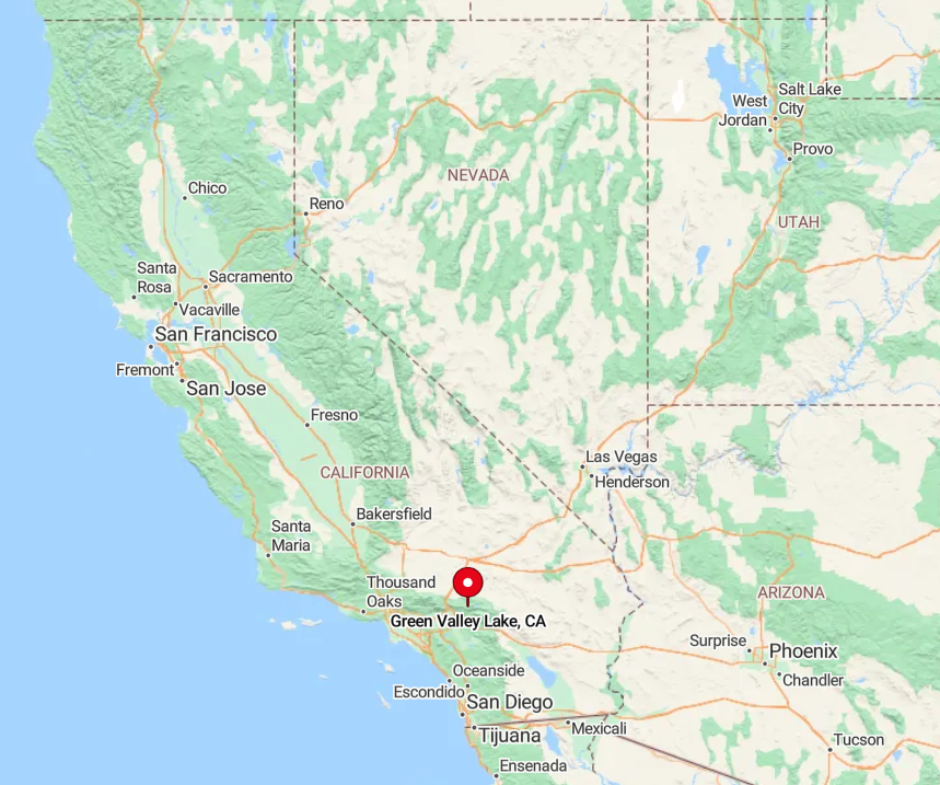
The community sits between Running Springs and Big Bear City, reached by a spur off Highway 18 known as Green Valley Lake Road. Switchbacks, narrow lanes, and frequent fog dissuade hurried travelers.
No public shuttle runs to the lake, leaving personal vehicles as the only option. Once the road ends at the shoreline, asphalt gives way to dirt lanes servicing the handful of cabins.
2. Campo

Campo hosts about 3,200 residents amid rolling grasslands and scattered oaks, fifty miles east of San Diego’s coastline. Day activities range from touring the Pacific Southwest Railway Museum to hiking segments of the Pacific Crest Trail that pass the town’s western edge.
Government work, border operations, and heritage tourism form the employment backbone. Spacious homesteads and the absence of suburban lighting let night skies unfold in full clarity.
The hills absorb freeway hum, leaving only the distant horn of a vintage locomotive on weekends. Clear sightlines stretch all the way to Mexico’s Laguna Mountains on calm mornings.
Where is Campo?
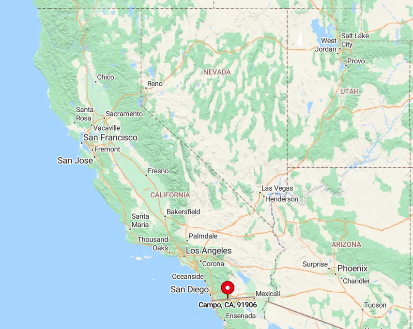
Sited along Highway 94 in southeastern San Diego County, Campo is boxed in by Cleveland National Forest land and the international border. Winding two-lane roads with few services discourage commuter growth.
Although Interstate 8 sits within 15 miles, the intervening mountains add drive time and isolation. The rural bus line from El Cajon runs twice a day, so most visitors choose to navigate the scenic highway by car.
1. Pine Valley

Pine Valley counts nearly 1,800 inhabitants living among expansive meadows and Jeffrey pines at 3,700 feet elevation. Popular pastimes include fly-fishing Pine Valley Creek, cycling the Sunrise Highway, and strolling the little-known Noble Canyon Trail that climbs into the Laguna Mountains.
Local businesses revolve around small inns, a single hardware store, and seasonal wildfire-fighting crews. The town is hemmed in by Cleveland National Forest, limiting growth and preserving quiet streets even during peak tourist season.
Evening breezes carry the scent of ponderosa sap rather than exhaust fumes. Wide parcels and strict signage rules keep nightlight to a soft glow emitted by cabin windows.
Where is Pine Valley?

The village rests thirty-five miles east of San Diego, a short hop from Interstate 8 via Pine Valley Road. Surrounding forest land and the Laguna Mountain ridge act as natural buffers from coastal sprawl.
Public transport is nonexistent, and winter storms can blanket the highway in snow, which further curtails casual visitors. Once the freeway is left behind, the road narrows, traffic thins, and the pine-scented stillness announces arrival.
Haven't Seen Yet
Curated from our most popular plans. Click any to explore.