🔥 Would you like to save this?
Southeast Virginia hides pockets of quiet that feel far removed from the region’s busier historic districts and beach corridors. Our roundup explores 25 tiny settlements where soybeans, salt marsh, and slow rivers do more to keep out commotion than any highway sign ever could.
Each place offers a different flavor of stillness—some with 360-degree Chesapeake vistas, others with dark-sky pine barrens that make the Milky Way look close enough to touch. Populations here rarely crack a thousand, so expect waves from every passing truck and enough space between porch lights to see fireflies in June.
In order to come up with the very specific design ideas, we create most designs with the assistance of state-of-the-art AI interior design software.
We hope these snapshots help readers imagine fresh-air mornings, unhurried conversations, and the gentle hush that settles over fields when the sun slips behind loblolly pines. If a weekend ramble or a permanent retreat beckons, the following towns prove that solitude still thrives east of Richmond.
25. Newsoms – Pines, Peanuts, and Long Horizons
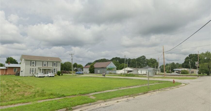
Newsoms rests near the North Carolina border, its modest grid of streets wrapped in pine stands and peanut fields. The town’s quiet stems from its distance from major highways, with farmland as its nearest companion.
Days here move at the pace of the seasons, from the bright green of spring crops to the golden sweep of harvest. Porch-sitters wave to passing tractors, while roadside produce stands sell just-picked bounty.
You can wander over to the old depot, watch a high school ball game, or cast a line in one of the nearby ponds. The wind’s steady hush through the pines becomes a familiar soundtrack. In Newsoms, the land itself feels like the truest neighbor.
Where is Newsoms?
Situated in southern Southampton County, Newsoms is accessible via VA-671, about 12 miles from Courtland. The drive in winds through tall pines, narrowing until the road feels like it’s meant for locals alone.
Farmland frames the approach, giving way to a compact downtown. It’s a tucked-away corner that seems untouched by the passing years.
24. Claremont – River Bluffs and Ferry Echoes
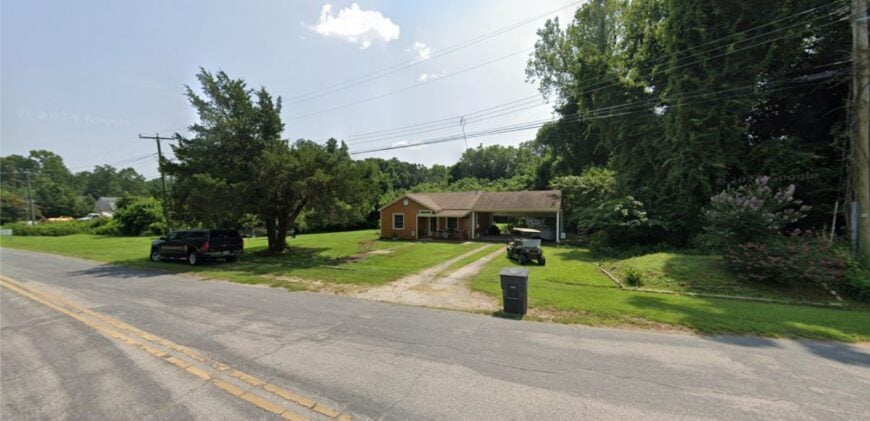
Claremont sits high above the James River, its streets and steeples forming a quiet silhouette against the sky. Private timberlands and farm parcels keep it apart from busier corridors, adding to its hushed charm.
Victorian rooftops peek from behind towering oaks, and the summer air hums with cicadas. The river below gleams in the light, shifting from silver to steel with the day.
Visitors can walk bluff overlooks, trace history at the old depot site, or beachcomb along the shore at low tide. Each path here seems to end with a view worth pausing over. Claremont feels like a hilltop whisper carried by the river’s breeze.
Where is Claremont?
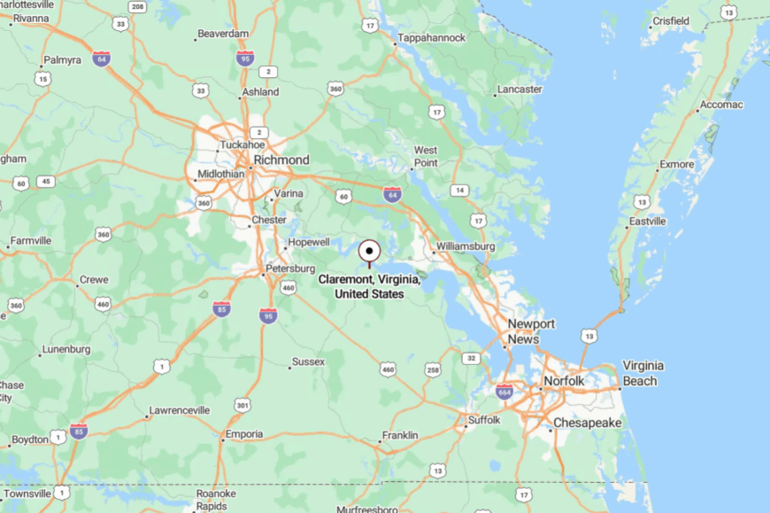
Located in Surry County on the south bank of the James River, Claremont is about 20 miles west of Williamsburg. VA-613 meanders through open fields before dropping toward the water.
Timberland borders much of the route, adding to the sense of separation. Though close in distance, its mood belongs to another time.
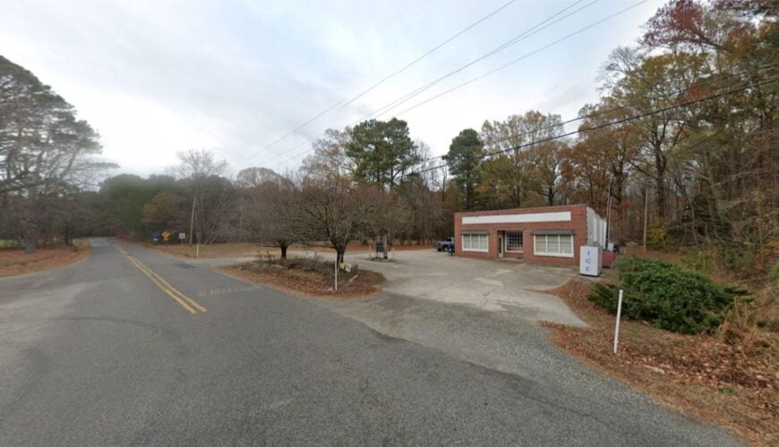
23. Dendron – Pines, Peanuts, and Big-Sky Silence
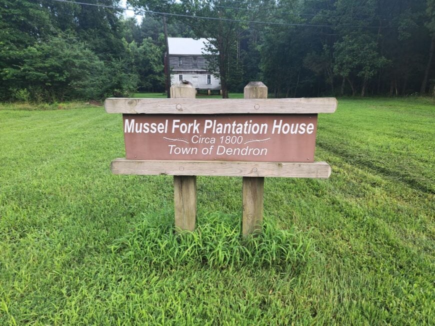
Dendron hides behind a green wall of loblollies and farmland, a small grid where trains once ran and forest edges have since crept in. Long stretches of timberland and minimal commerce make it feel deeply set apart.
The pace is steady and grounded—neighbors gathering at church suppers, tractors resting at field edges, songbirds crossing open lots. History lingers in the traces of its lumber past, while today’s rhythms are defined by the land. Quiet roads invite cycling, and pine margins make for rewarding birdwatching.
On breezy days, the treetops sound like distant surf. Dendron is a place to trade the rush for wide skies and simple company.
Where is Dendron?
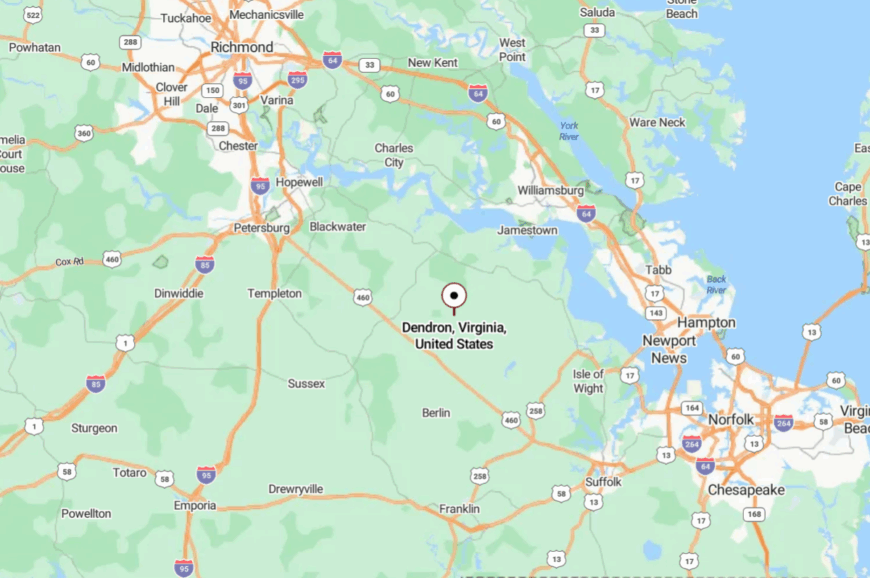
Found in central Surry County, Dendron lies about 15 miles south of the James River. County roads weave between pines and crop fields on the way in.
The approach itself feels like a gentle deceleration. By the time you arrive, you’ve matched the town’s unhurried pace.
22. Elberon – A Postmark in the Pines
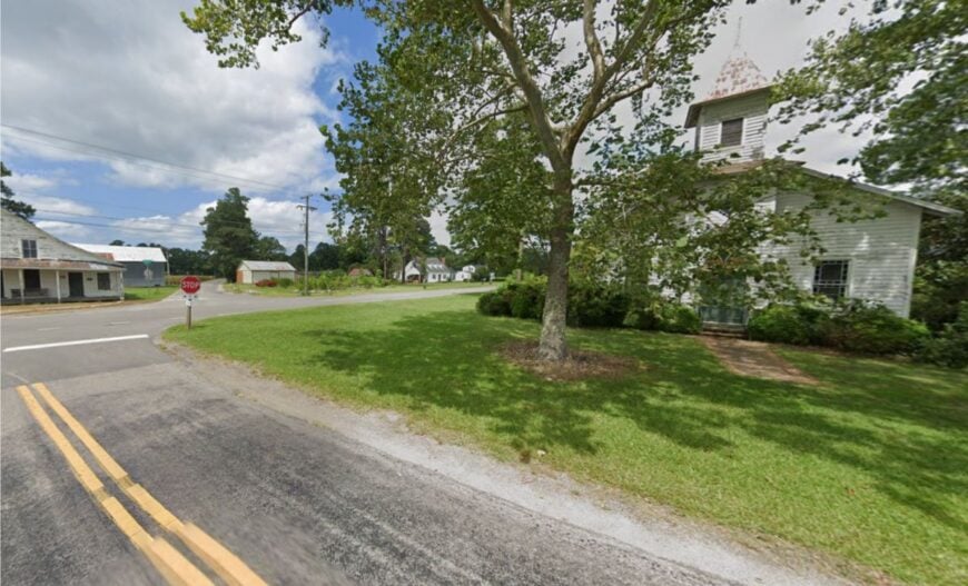
Elberon is more a cluster than a town—homes, a post office, and narrow lanes disappearing into the woods. Its seclusion is intentional, with little signage and even fewer businesses.
The mood is cozy and private—front porches with rocking chairs, woodsmoke curling into autumn skies, and starlight unobstructed by streetlamps. Days here often end in stillness, save for the calls of night birds. Visitors might branch out to Chippokes State Park, cycle shaded back roads, or linger long enough to catch the owls in song.
In Elberon, time feels like a choice rather than a constraint. It’s a pause tucked between field and forest.
Where is Elberon?
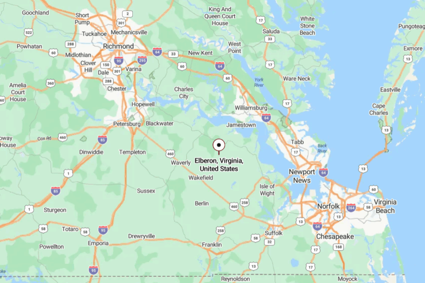
Positioned in Surry County, Elberon lies along VA-31, about 10 miles from the James River ferry landing. The approach narrows into tree-lined corridors, giving the sense of crossing a threshold.
The last miles feel far removed from busy routes. It’s an entrance into a place where calm takes precedence.
21. Spring Grove – Where the Fields Meet the Sky
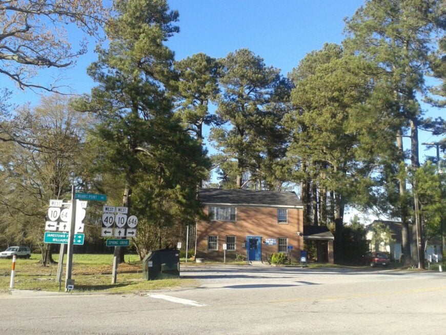
Spring Grove opens wide to the horizon—long fields, sparse tree lines, and farmhouses set deep off the road. Its apartness stems from its crossroads location, miles from larger town centers.
The mood is expansive and airy—barns bright against blue sky, swallows flashing over soybean rows, farm trucks moving at a measured clip. Visitors might stop at the market, photograph weathered churches, or watch harvests roll steadily through.
Every view here feels uncluttered, the sky a constant presence. Spring Grove’s sense of space is its greatest companion. Even the wind seems to linger in the openness.
Where is Spring Grove?
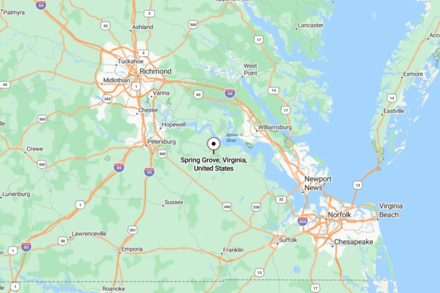
In Surry County, Spring Grove sits where VA-10 and VA-40 meet, about 12 miles west of Surry. Approaches from either direction offer broad, uninterrupted views.
Fields stretch outward, merging with the horizon. It’s a place that feels owned as much by the sky as the land.
20. Waverly – Depot Town with a Slow Beat
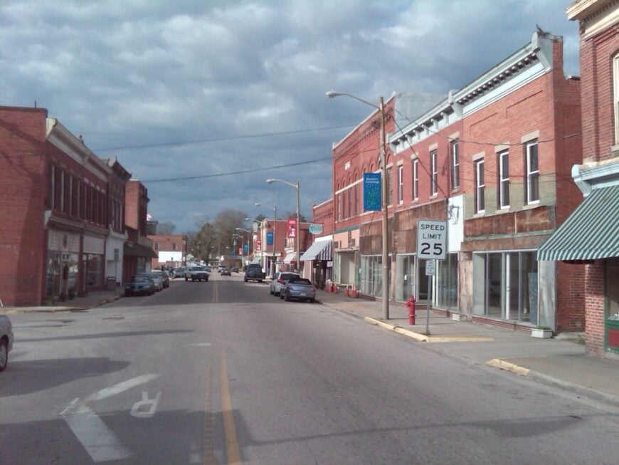
Waverly carries its rail heritage in a restored depot and a small but enduring main street. Farmland and pine corridors cushion it from the faster pace nearby.
Its quiet draws from being just far enough from I-95 to avoid casual pass-through traffic. Neighbors greet one another at the diner, slow trains move across the horizon, and the air holds the scent of barbecue.
Antique shops and local farms offer leisurely diversions, each adding to the town’s gentle rhythm. Visitors find history preserved not as an exhibit but as daily life. Waverly is where tradition settles comfortably into the present.
Where is Waverly?
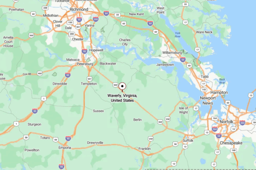
Set in Sussex County, Waverly sits at the junction of US-460 and VA-40, about 45 miles west of Norfolk. The approach from either road passes through flat farmland and tall pines.
The entrance feels like passing a natural gate into a calmer space. By arrival, the shift in pace feels complete.
19. Disputanta – Pines and Porches Between Cities
🔥 Would you like to save this?
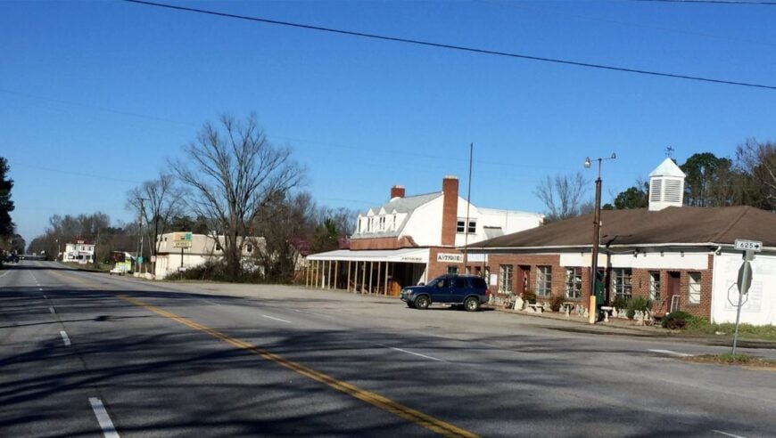
Disputanta stretches quietly along US-460, its name a relic from a rail dispute long past. Pine forests and farmland embrace its edges, with many homes tucked just off the main strip.
Life here feels unhurried—produce stands on the roadside, weekend church gatherings, and porches perfect for evening coffee. Freight trains pass like slow-moving markers of time.
Visitors can take back lanes into the woods or linger under open skies thick with stars. Between two cities, Disputanta still feels like the end of the road. Its quiet isn’t an absence, but a choice.
Where is Disputanta?
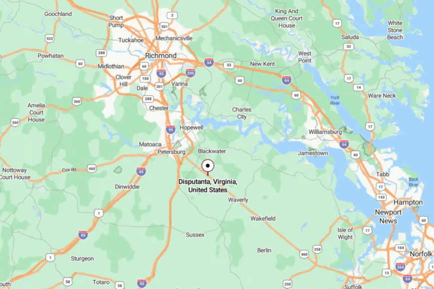
In Prince George County, Disputanta lies about 15 miles east of Petersburg and 40 miles west of Suffolk. US-460 serves as the main artery, but side streets move at a slower pace.
Pine corridors line much of the approach, filtering the light. It’s a midpoint on the map that holds its own sense of distance.
18. Ophelia – Sandbars, Ospreys, and Salt in the Air
Ophelia is more shoreline than street, a scatter of homes tucked among pines where ospreys cry overhead. Its tucked-away feel comes from back-road access and long views across Ingram Bay that make towns feel far.
The vibe is spare and beautiful: skiffs at anchor, sandy spits, and sky that seems wider than usual. Beachcomb the points, watch dolphins on a calm morning, paddle to hidden coves, or bring binoculars for migrating waterfowl.
Life here leans on fishing, crabbing, and quiet weekends. Nights arrive with the soft slap of tide against pilings. Ophelia is the sound of the Bay breathing.
Where is Ophelia?
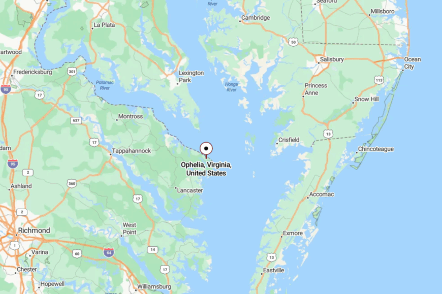
Located in eastern Northumberland County, Ophelia is about 75 miles east of Fredericksburg. You reach it via US-360 and VA-644/643 as the land narrows to water.
Pines and creeks keep the world at arm’s length. It’s near the open Bay, yet feels like a private cove.
17. Weems – Tidewater Lanes Between Rivers
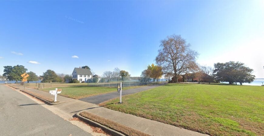
Weems drifts between the Rappahannock and Corrotoman, a leafy tangle of lanes where porches face moving water. Seclusion settles in thanks to deep coves and a web of side roads that prefer shade to speed.
The vibe is gracious and slow—white fences, church steeples, and the occasional boat horn. Tour the Historic Christ Church nearby, paddle a glassy creek at dawn, bike to Kilmarnock for a café run, or sit dockside and count egrets.
Small services and marina work keep things humming. After sunset, the river becomes a mirror. Weems is a quiet between two tides.
Where is Weems?
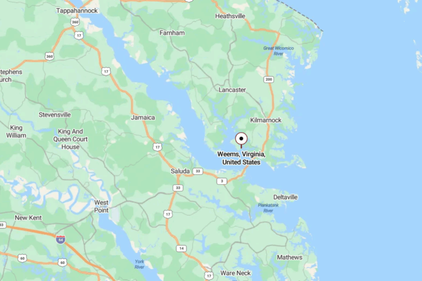
Weems lies in Lancaster County, about 65–70 miles east of Fredericksburg. VA-3 to VA-222 threads you past farm fields and into creek country.
Water on all sides trims the traffic to a whisper. It’s close to errands, far from noise.
16. Merry Point – Ferry Turn with Peepers at Dusk
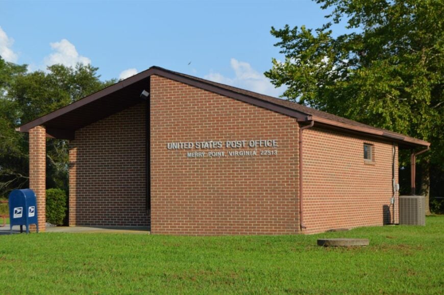
Merry Point is a pocket of river and woods best known by locals and the cable ferry that still shuttles a few cars across the Corrotoman. Seclusion is the point: one-lane approaches, tall pines, and the water deciding the day’s speed.
The feel is simple and green—dock cleats, jon boats, and frogs tuning up after sundown. Ride the Merry Point Ferry, cast from shaded banks, drift a kayak under cypress knees, or bring a book and surrender to the porch swing.
Work here is part farm, part river. When the ferry chain hums, you know you’re home. Merry Point is a gentle pause on the map.
Where is Merry Point?
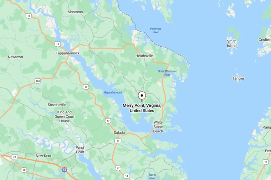
Tucked in central Lancaster County, it’s about 65 miles east-southeast of Fredericksburg. Follow VA-3 to VA-354, then slip onto VA-604 toward the ferry landing.
Creek fingers and timber screen out the hurry. It’s close to water, distant by mood.
15. Irvington – White Pickets and Creek Breezes
Irvington wears its quiet with style—white picket fences, small inns, and a creek that reminds you to take your time. Its seclusion comes from big lots, winding lanes, and the soft moat of Carter Creek around town.
The vibe is gracious but relaxed: farmers’ market mornings, wine tastings, and bikes leaning against garden walls. Browse small galleries, walk to a creek overlook, charter a sunset cruise, or sip a local pour with oysters on the half shell.
Hospitality and boating trades share the ledger. When the evening breeze runs up the creek, porch talk lowers to a murmur. Irvington makes unhurried feel elegant.
Where is Irvington?
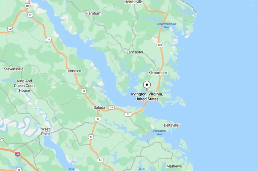
In Lancaster County near Kilmarnock, Irvington sits about 70 miles east of Fredericksburg. VA-3 to VA-200/VA-646 leads you through farmland and into creek country.
Water and conservation keep the edges soft. It’s near everything you need—and far from everything you don’t.
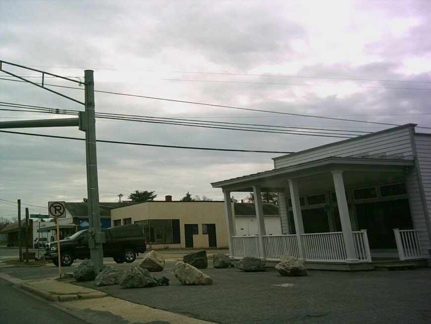
14. White Stone – Little Bridge Town to the Bay
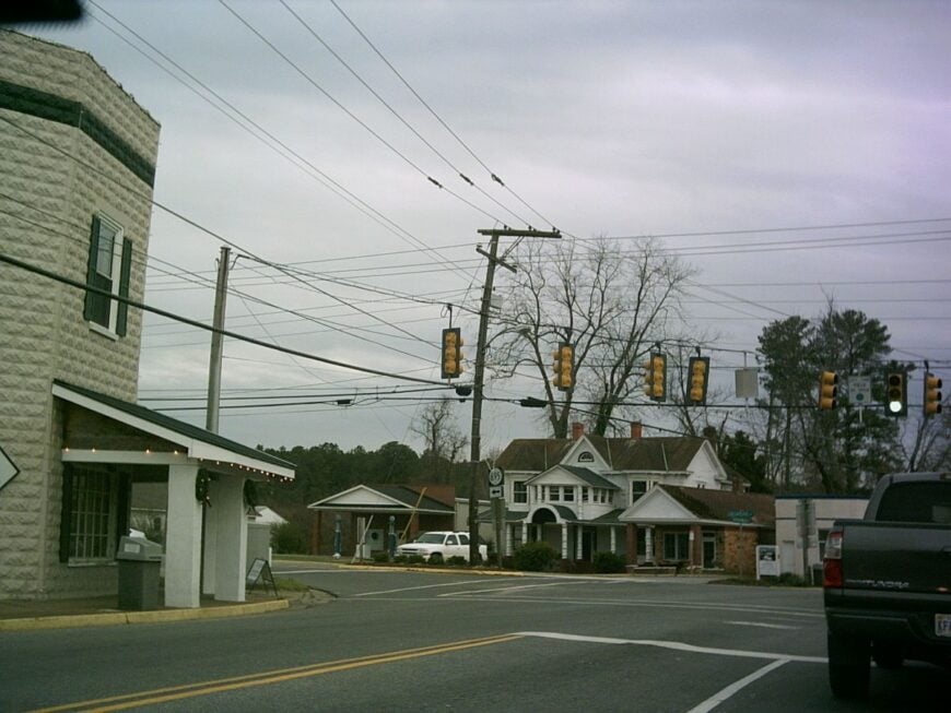
White Stone is a crossroads with salt in its lungs, perched just north of the Rappahannock where the bridge leaps toward the Middle Peninsula. It feels tucked away because the river hems one side and back roads stitch the rest.
The vibe is light and breezy: seafood shacks, bait coolers, and sunsets that wash the bridge in copper. Walk to a river overlook, hunt vintage signs in town, launch a kayak under the spans, or linger over hushpuppies and a cold drink.
Small shops and marina work keep the day honest. After dark, the river becomes the evening’s conversation. White Stone is a pocket of Bay air.
Where is White Stone?
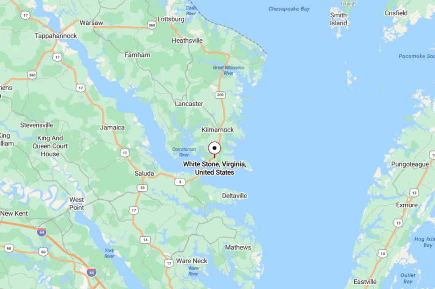
You’ll find it in Lancaster County, just north of the Norris Bridge, about 68 miles east of Fredericksburg. VA-3 delivers you straight into town before the river crossing.
Water and open pasture make a quiet frame. It’s a hinge between peninsulas that still feels secluded.
13. Lively – Crossroads of Peaches and Crab Pots
🔥 Would you like to save this?
Lively is a tidy fork in the road where farm trucks and skiffs share stories at the market. Seclusion stays put thanks to long distances between bigger towns and a lattice of county lanes that prefer tractors.
The mood is neighborly and practical: feed store sacks, porch flags, and tomatoes lined up on roadside tables. Grab a sandwich at the country store, detour to a u-pick orchard, fish a nearby creek, or roll gravel roads for golden-hour photos.
Farming and small trades keep the week steady. Night falls and crickets stitch the silence. Lively proves small places can feel roomy.
Where is Lively?
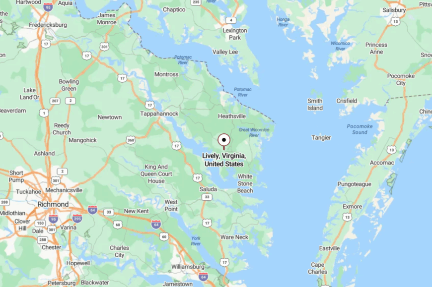
Central Lancaster County holds Lively about 62 miles east of Fredericksburg. Take VA-3, then VA-201/VA-222, into a landscape of fields and creeks.
With no major highway on its doorstep, pace drops naturally. It’s an easy turn—and a calmer world.
12. Callao – Porch-Light Main Street under Tall Pines
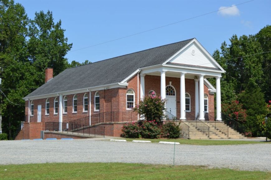
Callao gathers along US-360, but step off the shoulder and you’ll notice the hush of tall pines and side streets that end in marsh. Its seclusion comes from distance and timber—miles of flatwoods that sip up sound.
The vibe is small-town friendly: Friday fish fries, feed stores, and hand-painted signs that haven’t changed in years. Visit a seafood market, cast for spot at a nearby pier, poke around antique corners, or follow back roads to hidden landings.
Fishing, farming, and local shops share the load. Evenings feel like turning a page. Callao is a lantern in the pines.
Where is Callao?
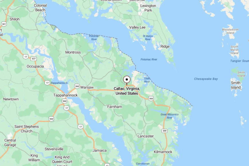
Northeastern Northumberland County claims Callao, about 53 miles east of Fredericksburg on US-360. As the miles roll by, stores thin to pines and pasture.
Creeks cut quiet detours off the main drag. It’s on the route—but a world to the side.
11. Heathsville – Courthouse Village with Long Shadows
Heathsville keeps company with its historic courthouse green and oaks that throw generous shade. It’s secluded by wide farm parcels and the easy sprawl of the Northern Neck, where distances stretch conversations.
The vibe is heritage-calm: quilt shows, farmers’ markets, and a museum tucked in old brick. Walk the historic district, bike country loops, browse artisan stalls, or duck down to creek landings for osprey and marsh light.
County offices and small shops keep a steady heartbeat. At dusk, the green glows and the past feels near. Heathsville lets time saunter.
Where is Heathsville?
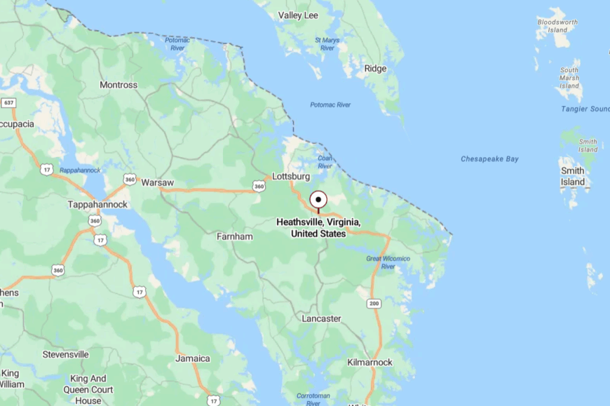
It sits on US-360 in central Northumberland County, roughly 60 miles east of Fredericksburg. The approach is two-lane and tree-lined, with fields widening between bends.
Creeks and long views dull the urge to hurry. It’s a county seat that still whispers.
10. Bacon’s Castle Hamlet
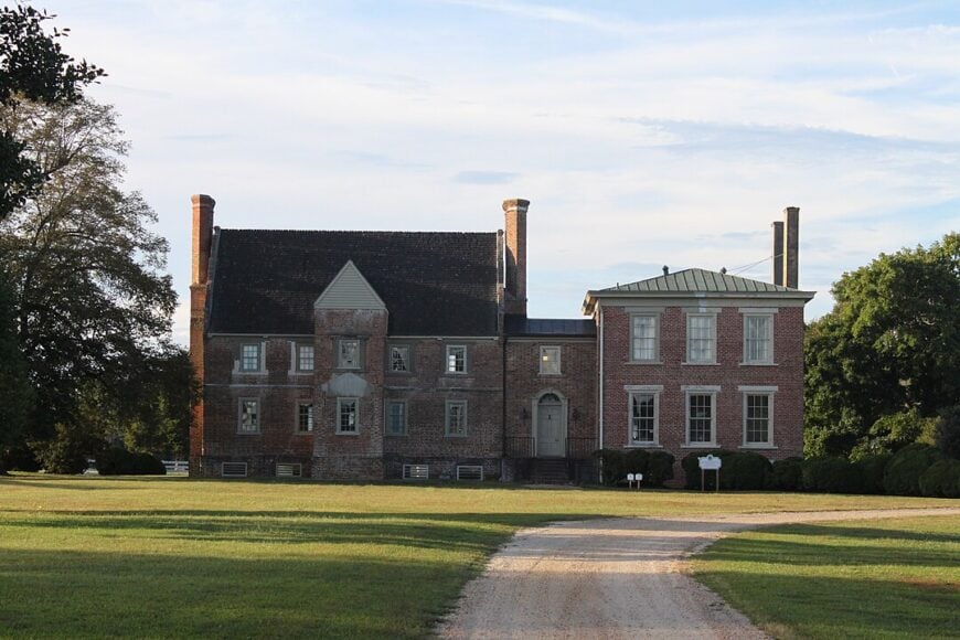
This hamlet of roughly 80 residents clusters around Bacon’s Castle, a 1665 Jacobean brick manor that anchors an otherwise open patchwork of soybean rows and 300-year-old oaks. Visitors tour the restored house, picnic beneath ancient trees, and photograph nightly “ghost light” programs led by local historians.
Farming and heritage tourism form the area’s modest economic base, with a single produce stand selling melons and heirloom peanuts in season. Dawn fog rolling off the James River muffles even rooster crows, and with no stoplights for fifteen miles, traffic rarely rises above a tractor’s rumble.
After sunset, whip-poor-wills and distant tugboat horns supply the only soundtrack. The combination of low population, flat farmland, and wide river buffers makes Bacon’s Castle one of Tidewater’s most peaceful corners.
Where is Bacon’s Castle?
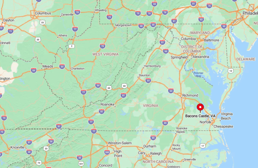
The settlement sits five miles northwest of the town of Surry, tucked between Route 10 and the James River’s south bank. Thick woods and private farmland block through-roads, so the only practical access is via Bacon’s Castle Trail off Colonial Trail West.
Lack of commercial development around the manor keeps ambient noise and light almost nonexistent. Drivers coming from Williamsburg board the free ferry at Scotland Wharf, adding a pleasant twenty-minute river crossing to the journey.
9. Zuni on the Blackwater
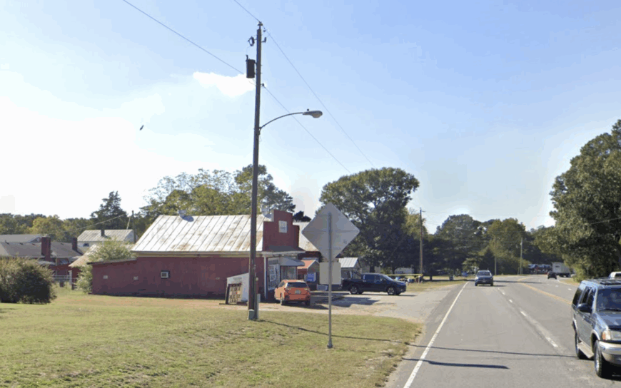
About 230 people call Zuni home, most of them living in restored Victorian farmhouses that overlook a languid bend of the Blackwater River. Canoe launches, rope-swing swimming holes, and a private disc-golf course on an old mill site offer simple recreation.
Small-scale row-crop farming and specialty lumber milling support local incomes, while a beloved barbecue shack two miles away doubles as the community hub. One-acre lots bordered by cypress swamp keep neighbors invisible once dusk settles.
The nearest chain grocery sits twelve country miles east in Windsor, making weekly errands feel like mini road trips. Waterlogged lowlands on three sides and rail tracks on the fourth create a natural acoustic barrier that locks in Zuni’s hush.
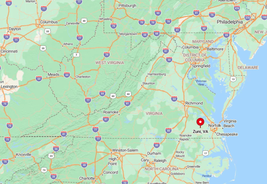
Where is Zuni?
🔥 Would you like to save this?
Zuni lies along U.S. 460, thirty minutes west of Suffolk, yet the Blackwater’s looping course hides the village from highway sightlines. Travelers must cross a one-lane truss bridge and follow a tree-tunnel service road before old storefronts come into view.
Limited cell coverage and a single blinking caution light remind newcomers they have exited the bustle of Hampton Roads. If rain pushes the river above flood stage, the bridge closes, briefly turning Zuni into a de facto island.
8. Sebrell’s Pine Barrens
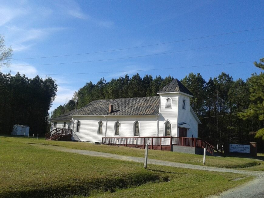
Sebrell counts just under 100 residents spread around an unincorporated crossroads marked by one weathered country store and a volunteer fire station. Stargazers adore the area’s near-total darkness—longleaf pines swallow stray light while sandy farm roads offer perfect tripod spots for night photography.
Field-grown peanuts and timber cutting remain the chief livelihoods, with seasonal hunting leases adding pocket income. Recreational life centers on birding in the pine savanna and kayaking shallow tributaries of the Nottoway River.
With Franklin a half-hour east, city glow never reaches the treetops. The sweeping forest canopy and mile-wide gaps between porch lights secure Sebrell’s reputation as a dark-sky refuge.
Where is Sebrell?
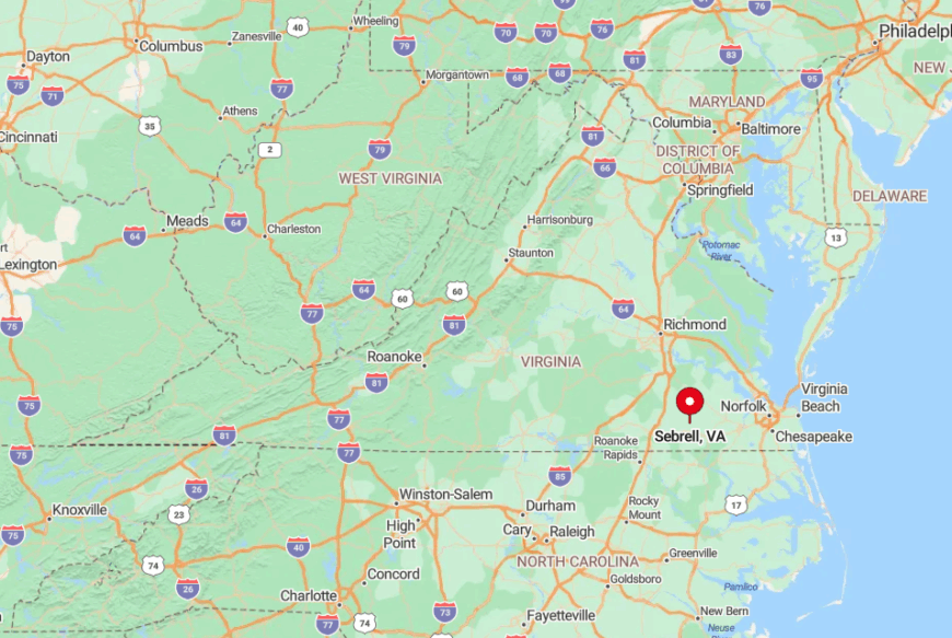
The crossroads sits off State Route 35, roughly five miles south of Courtland, yet sand roads quickly stray from pavement into dense pine barrens. No public transit runs here; visitors rely on a personal vehicle or bicycle, and GPS signals often flicker among the trees.
Tall pines and gently rolling sand ridges form a sound break that mutes highway noise. After heavy rains, unpaved spurs turn to sugar-sand ruts, adding to the sense of isolation.
7. Burdette’s Broad Fields
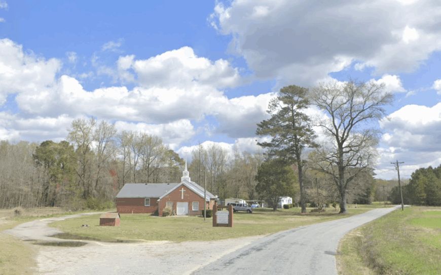
Home to around 160 residents, Burdette unfolds as a scatter of clapboard farmhouses, century-old barns, and 50-acre peanut tracts bordered by loblolly windbreaks.
Neighbors gather under a tin-roof shelter for seasonal fish-fry fundraisers, then disperse across fields wide enough to lose sight of parked trucks. Agriculture reigns supreme, with bulk peanut drying sheds and a small seed-cleaning outfit supplying most jobs.
Bird-watching on fall migration days and horseback rides along the Poplar Spring bridle path fill off-hours. Because two long gravel lanes serve as the only connectors to paved roads, traffic seldom disturbs grazing deer.
Tree lines, minimal lighting, and deep property setbacks combine to make Burdette feel miles farther from civilization than it is on a map.
Where is Burdette?
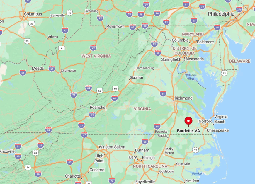
Burdette is located eight miles south of Franklin, accessible by a right turn off U.S. 258 onto Burdette Road, then another onto indigo-shaded gravel. The dense loblolly strips act as living walls, forcing passing sounds upward and away from homesteads.
Delivery drivers sometimes miss entrances because mailbox clusters sit a quarter mile from actual houses. Anyone arriving after dark should bring printed directions, as cell coverage drops once the pines close in.
6. Rescue on the Waterfront
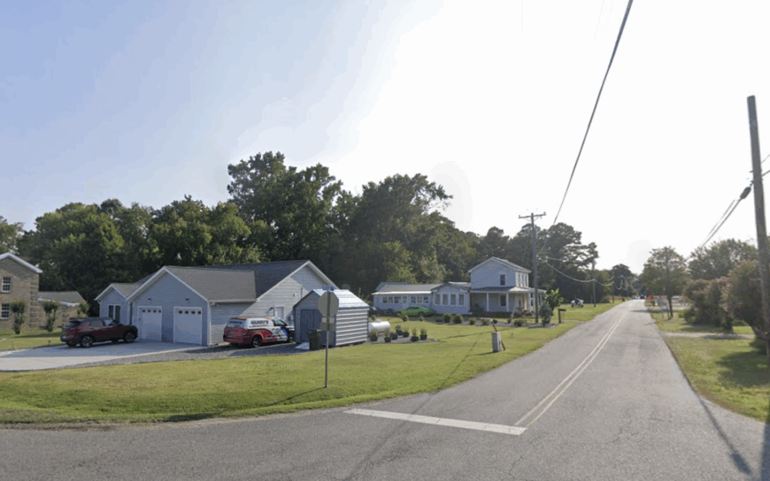
Roughly 220 people reside in Rescue, a waterside enclave where crab-pot docks share shoreline with weathered fishing shacks and renovated bungalows. Afternoons feature kayak runs up Jones Creek, cast-net lessons at low tide, and seafood suppers of blue crab caught the same day.
Commercial crabbing and small-scale charter fishing underpin the local economy, while some commuters drive to Smithfield’s pork-processing plants. Gravel lanes dead-end at the creek, so vehicles loop back the way they came—a layout that keeps through-traffic almost nonexistent.
Golden-hour sunsets paint unbroken horizons because no tall buildings interrupt the view. The combination of tidal water on three sides and a cul-de-sac road network protects Rescue from the wider county’s bustle.
Where is Rescue?
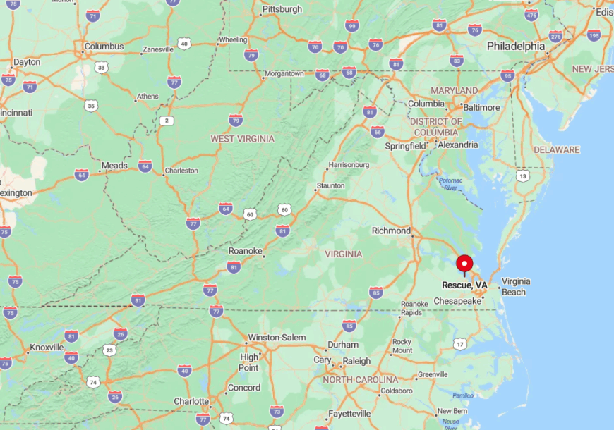
The village occupies a narrow peninsula five miles northeast of Smithfield, reached by Rescue Road off State Route 704. Drivers cross a low-clearance wooden bridge before coasting down to the docks, a natural bottleneck that limits visitor numbers.
Salt-marsh cordgrass absorbs ambient noise, adding to the sense of calm. During spring tides, portions of the approach road flood, briefly reinforcing Rescue’s semi-island character.
5. Sedley’s Oak-Shaded Lanes
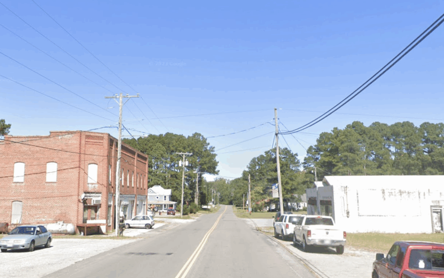
About 450 residents live along Sedley’s sleepy grid of wide-porch farmhouses, many shaded by oak trees planted before World War I. A historic roller mill hosts bluegrass jams each second Saturday, while nearby cotton fields double as walking trails after harvest.
Farming, small-batch lumber milling, and the region’s peanut industry anchor local paychecks. Kids fish for bream in Mill Swamp and count shooting stars from back-porch swings, thanks to low light pollution.
Sedley sits far enough from any major highway that passing 18-wheelers are a rarity. Those broad cotton flats absorb residual sound, creating a soft hush that settles like dust on autumn evenings.
Where is Sedley?
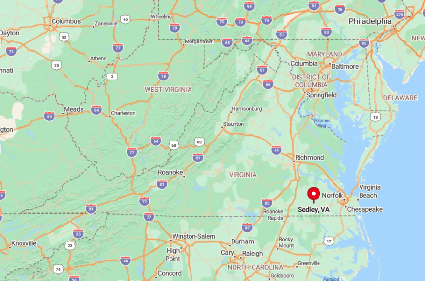
Sedley lies six miles west of Courtland along State Route 40, yet the road narrows and bends just enough to discourage speeders. Tall oaks arch over side streets, creating a living tunnel that visibly separates the village from surrounding farm country.
Travelers without a personal vehicle will find no bus line or rideshare service here. Once inside town limits, streetlights remain spaced far apart, preserving Sedley’s tranquil after-dark ambiance.
4. Hacksneck’s Marshlands
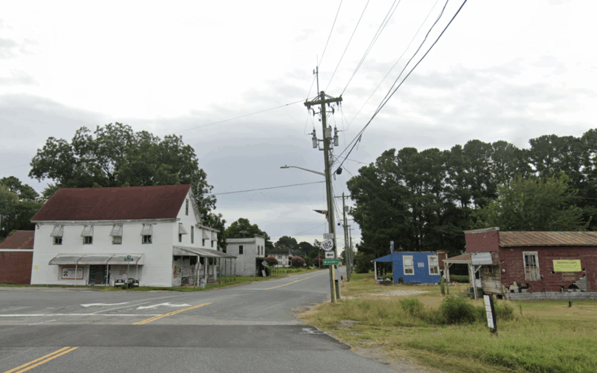
A mere 120 residents inhabit this finger of land thrust into the Chesapeake, where tidal creeks braid through salt-marsh reeds and osprey outnumber people. Days revolve around clamming, waterfowl photography, and spring monarch butterfly counts at a local nature preserve few outsiders know.
Watermen, oyster gardeners, and a single crab-picking house form the backbone of the micro-economy. Because the peninsula narrows to a half-mile, breezes carry the scent of bay water to every doorstep.
Dense marsh on both sides means no space for strip malls, and the nearest gas pump is fourteen miles inland. With migratory birds as the closest neighbors, Hacksneck earns its secluded reputation easily.
Where is Hacksneck?
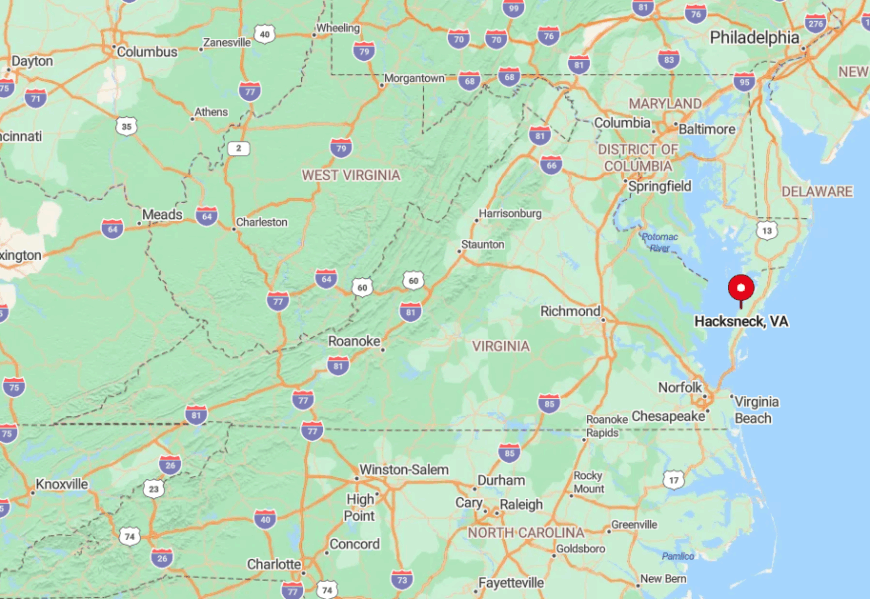
The community lies off State Route 639, twenty minutes east of Parksley, accessible only after a series of right-angle turns through cornfields and timber lots. Marsh channels flank the final causeway, discouraging casual drive-bys.
Cell towers inland fail to penetrate the low-slung horizon, so residents rely on landlines and VHF radios during nor’easters. Winter nor’easter flooding occasionally limits access, reinforcing the sense of remoteness.
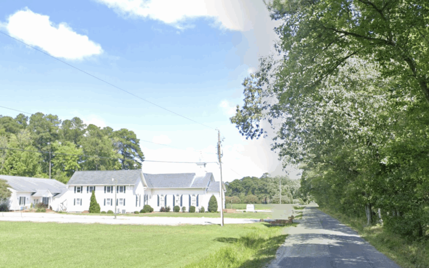
3. Quinby’s Barrier Island Gateway

Quinby hosts about 280 residents, many of whom work the pastel seafood sheds lining Upshur Bay or guide anglers through barrier-island surf. A broad public boat ramp launches paddlers toward uninhabited Parramore Island, while cyclists ride a disused rail bed that locals have quietly turned into a wildflower corridor.
Oyster shucking, soft-crab processing, and charter eco-tours keep paychecks flowing when tourist traffic fades. Miles of undeveloped marsh shield the village from the main road, funneling sea breezes through every screen door.
Evening crab boils happen on elevated decks that catch both sunrise and moonrise over open water. Because development stops at the tide line, Quinby stays hushed save for gull cries and workboat engines at dawn.
Where is Quinby?
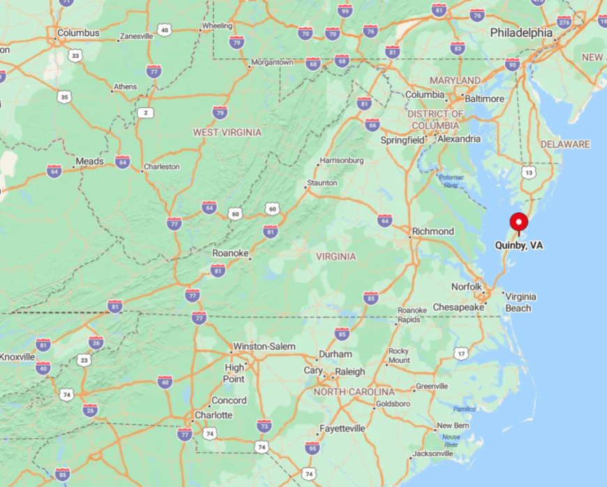
The village sits eight miles east of U.S. 13 via a single spur, Upshur Neck Road, which dead-ends at the harbor. Salt flats and shallow creeks hem in the pavement, so detours are impossible and traffic remains light.
Drivers from the north often miss the turn because the only landmark is a weather-worn produce stand. With no bridges connecting to nearby barrier islands, reaching Quinby feels like arriving at the coast’s farthest edge.
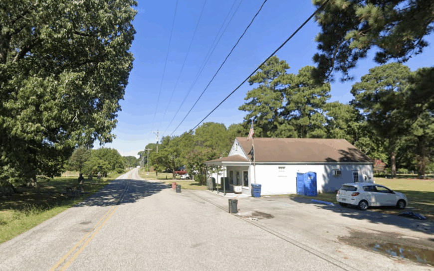
2. Moon’s Village Serenity
Moon counts roughly 150 souls, gathered around two white church steeples, a tiny post office, and clusters of 19th-century cottages. Family oyster gardens populate Mill Creek, while cyclists favor one-lane bridges that cross silent hardwood swamps.
Watermen, boat-repair artisans, and a small honey-bee collective represent the primary livelihoods, with seasonal oyster roasts funding local scholarships. Hardwood forest ten miles deep muffles any hum from neighboring Gloucester or Mathews Court House.
Residents joke that night skies here are dark enough to “see the real moon in Moon,” thanks to minimal street lighting. Combined creek, forest, and low traffic craft a pocket of serenity rare this close to Tidewater’s busier corridors.
Where is Moon?
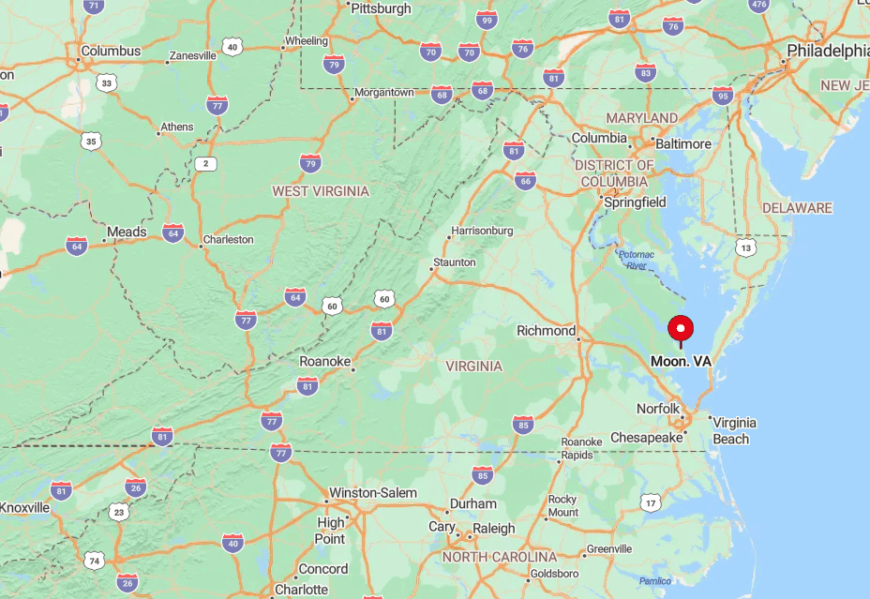
The village lies at the terminus of State Route 198, roughly an hour east of Williamsburg, past a sequence of narrowing roads and tidal ditches. Because the route dead-ends at Callis Wharf, only residents and boat owners pass through.
Tall gum and oak forests absorb echo, making approaching vehicles audible only at the last moment. Visitors often find no cell signal until they backtrack at least two miles toward Mathews Court House.
1. Gwynn’s Island Seclusion
Roughly 700 residents live on Gwynn’s Island, a place accessed by a single swing bridge that spans Milford Haven and seems to pivot visitors into a slower decade. Cedar-lined lanes wind among 19th-century cottages, while shorelines grant 360-degree Chesapeake vistas perfect for sunrise kayaking and sunset fishing.
Island commerce revolves around a marina, a tiny museum chronicling Revolutionary-era battles, and a pair of family-run seafood joints famous for soft-shell crab sandwiches.
Saltwater surrounds act as a natural moat, and locals love that bridge openings for sailboats momentarily halt car traffic, reinforcing the island’s unhurried pulse. Summer evenings bring lantern-lit dock socials where bay breezes replace air-conditioning.
With no chain stores, streetlights, or divided roads, Gwynn’s Island delivers an authentic, water-wrapped calm.
Where is Gwynn’s Island?
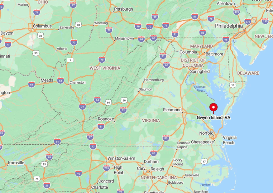
The island sits off Virginia’s Middle Peninsula, reached by State Route 223 from Mathews Court House, then over the historic Haven Beach swing bridge. Once across, the road narrows, and GPS navigation often loses clarity amid crab-pot markers and looping shore drives.
Water on all sides limits expansion, making the island’s six square miles feel worlds apart from mainland schedules. During major storms, bridge closures briefly turn Gwynn’s into a self-reliant sanctuary, heightening its sense of seclusion.