🔥 Would you like to save this?
The wide-open steppe of Southeast Oregon hides pin-prick communities where silence is broken only by wind in the sage and the occasional cattle truck rumbling past.
Our guide explores 25 of the loneliest dots on the map, places where porch lights are few, star fields are immense, and the nearest chain store is often a county away.
In order to come up with the very specific design ideas, we create most designs with the assistance of state-of-the-art AI interior design software.
Each settlement carries its own flavor, from high-desert hot springs to fossil-rich canyons, yet all share the same gift of distance that keeps traffic low and night skies dark. We sifted local lore, road-trip notebooks, and county data to highlight activities, industries, and quirks a first-time visitor might miss.
Whether planning a relocation or simply hungry for a back-road adventure, readers will find practical details on what makes each town tick and how to reach it. Pack extra fuel, roll down the windows, and discover why less-traveled really does mean more room to breathe in Oregon’s far corner.
25. Andrews: Empty Storefronts and Big-Sky Silence
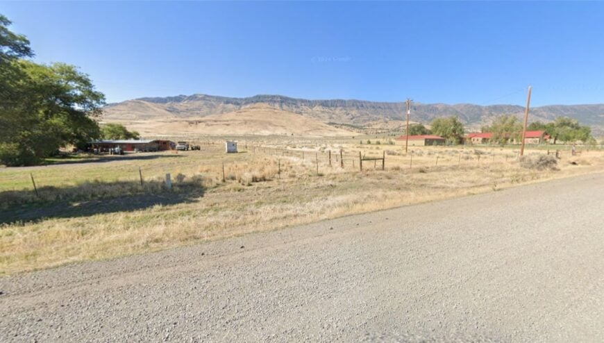
Andrews is little more than a name on a mailbox and a few wind-scoured buildings, but the quiet here is cathedral-deep. Its seclusion comes from the East Steens gravel road that skirts the Alvord Desert—miles of sage in every direction and not a traffic light to be found.
The vibe is ghost-town gentle: sun-faded lumber, meadowlarks on fence wire, and heat mirages wavering over alkali flats. Visitors walk the empty grid, glass for wild horses on the bajadas, soak at nearby Alvord Hot Springs, or climb the low rimrock to watch evening light spill down Steens Mountain.
A handful of ranches and seasonal hot springs are the only anchors to a modern calendar. When darkness falls, the stars feel close enough to clink together. It’s the kind of place that reminds you how quiet the world can be.
Where is Andrews?
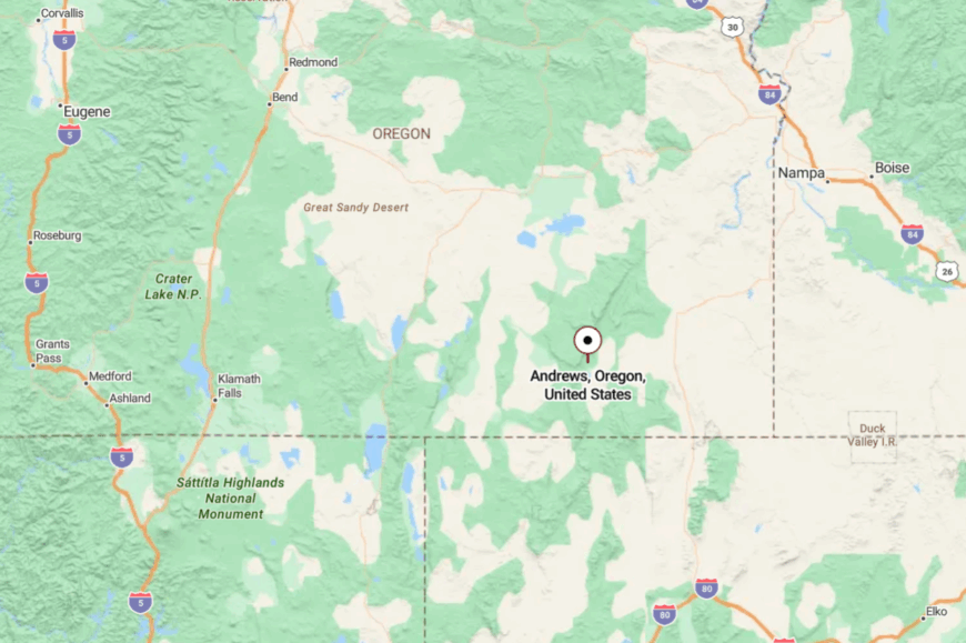
Andrews sits on the east side of Steens Mountain in Harney County, along the East Steens Road about 35 miles north of Fields and roughly 70 miles southeast of Burns. You reach it via OR-205 to Fields or Frenchglen, then turn onto the well-graded gravel that parallels the Alvord Desert.
With no services for long stretches, the journey is unhurried by design. It’s close enough for a day’s ramble, far enough to feel like you’ve slipped off the map.
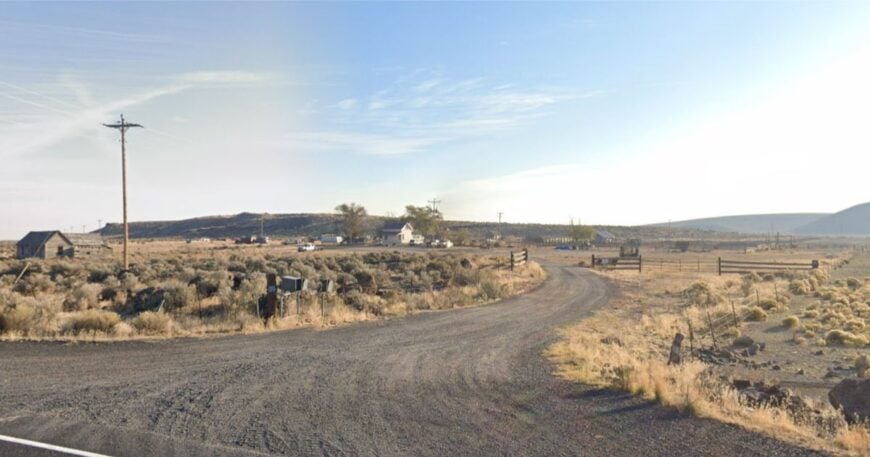
24. Arock: Basque Stonework in Owyhee Canyons Country
Arock keeps a humble profile at the edge of the Owyhee uplands, where basalt palisades break the wind and sheep trails thread the sage. Its isolation owes to a web of gravel ranch roads west of US-95 and the sheer size of the country around it.
The vibe is stoic and storied—Basque surnames on mailboxes, hand-laid stone buildings, and a schoolhouse that still rings for class. Explore petroglyph sites along the Owyhee, wander the Leslie Gulch rock cathedrals, picnic by Jordan Creek, or follow antelope tracks across wide fans of volcanic ash.
Ranching and the school are the mainstays, with seasonal guide work when the river runs. Dusk paints the cliffs copper, and the whole valley goes still. It’s the kind of quiet that lingers long after you drive away.
Where is Arock?
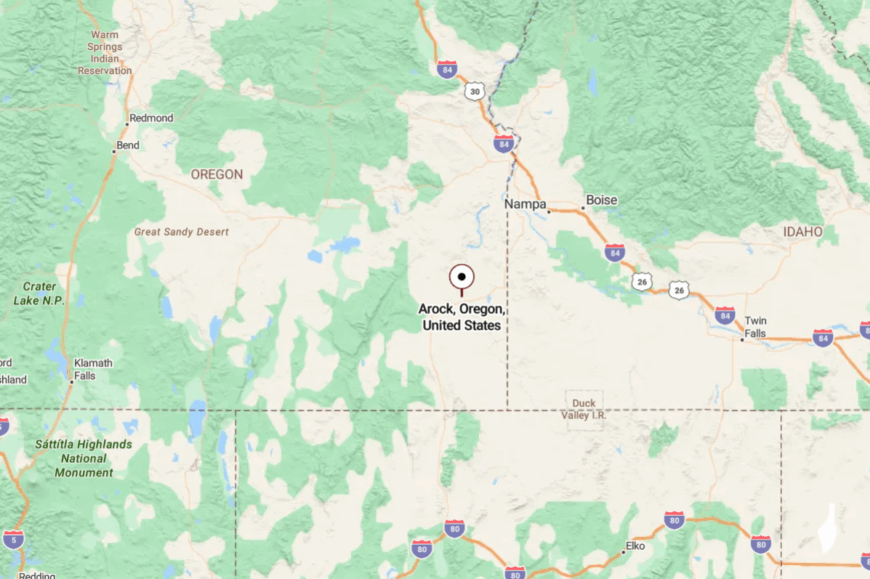
Arock sits in Malheur County about 20 miles west of Jordan Valley and roughly 12 miles off US-95. From the highway, turn onto Yturri Boulevard and continue as it becomes Arock Road, a graded gravel road that meanders through open range.
The Owyhee River canyons and rimrock keep the landscape wild and the pace slow. You’ll know you’re close when the road narrows and the sage starts to smell like rain.
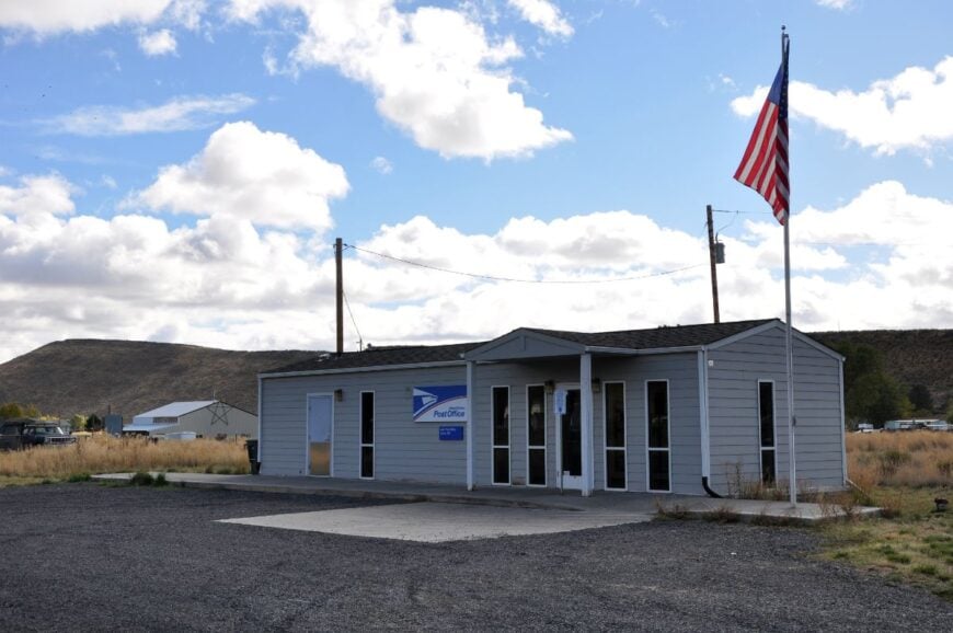
23. Narrows: Refuge Gate with Wind, Water, and Herons
Narrows is your whisper-quiet threshold to Malheur National Wildlife Refuge, a pocket of RV pads, a café, and big skies. Its seclusion springs from the waterlogged flats of Malheur and Harney lakes, which push towns back and keep the night dark.
The vibe is binoculars-on-the-dash simple—coffee at sunrise, sandhill cranes bugling from the marsh, and wind tickling the reed beds. Birdwatch along the Center Patrol Road, photograph terns and avocets in spring, paddle sheltered sloughs on calm mornings, or linger for storms that turn the sky into a cinema.
A small lodge, seasonal refuge work, and ranch support jobs are the local lifelines. When the last pickup leaves the lot, you hear only wings and wind. It’s solitude with feathers.
Where is Narrows?
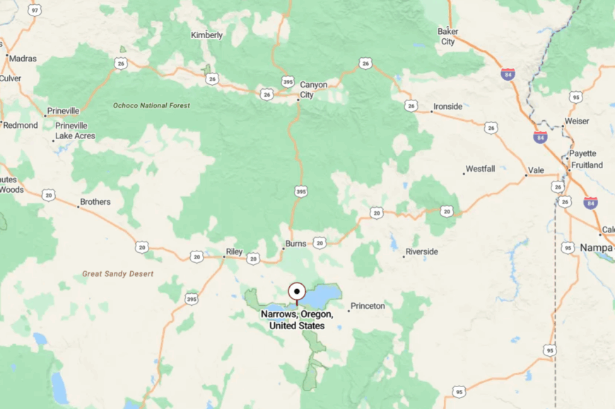
Narrows sits about 30 miles south of Burns/Hines on OR-205, where the causeway crosses between Malheur and Harney lakes. Approaches are flat and wide, with mirage-bright water hemming in the road.
Services are limited to a small store and café, so come topped up. It’s an easy drive that still feels like the edge of the world.
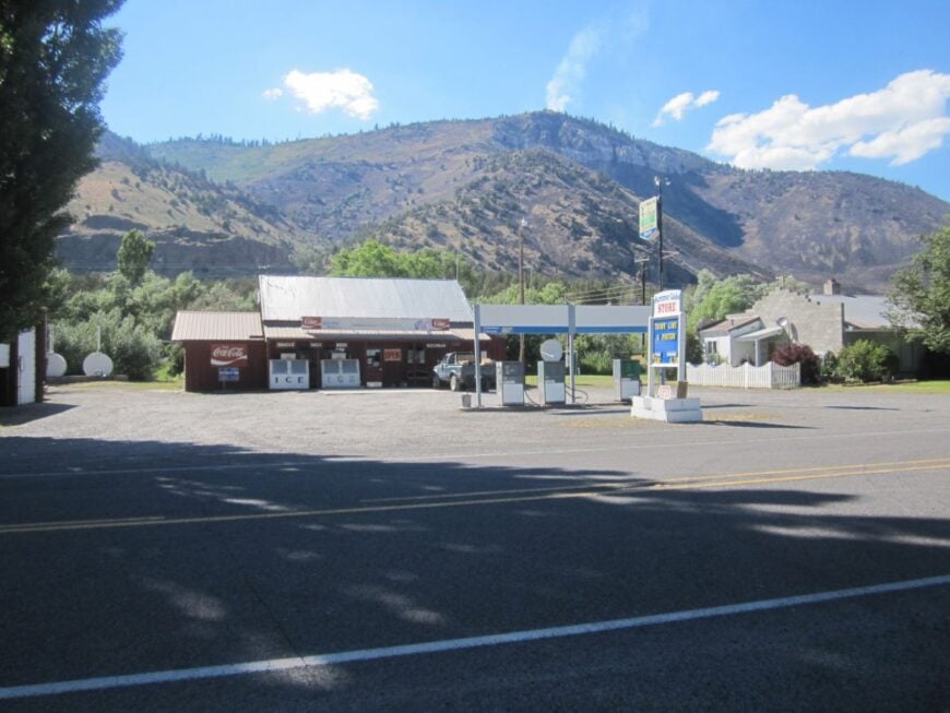
22. Crane: Hot Springs and High Desert Horizons
Crane keeps a tidy grid beside hay meadows, with the steam of its famous hot springs drifting into the big blue. Seclusion here is about distance—Crane sits well east of Burns on OR-78, with long gaps between neighbors and even longer gaps between cell bars.
The vibe is unhurried and utilitarian: school buses, stock trailers, and a café that knows every ranch hand by name. Soak at Crane Hot Springs, watch pronghorn on evening drives, cast for trout on the South Fork of the Malheur, or thumb through antiques at the tiny shop off the highway.
Ranching and school sports anchor the calendar, with a trickle of road-trippers year-round. Night pulls a blanket over the basin, and everything gets very, very quiet. It’s a place that trades speed for space.
Where is Crane?
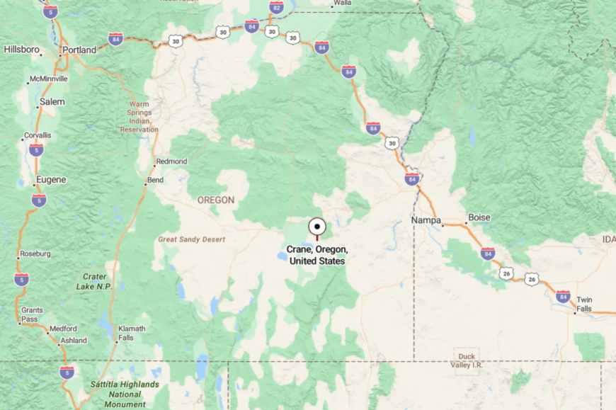
Crane lies 30 miles east of Burns in Harney County along OR-78 (the Steens Highway). The two-lane undulates across sagebrush basins with few services en route.
Most visitors come via Burns or from the US-95 junction near Marsing, Idaho. The last miles open wide—close enough to reach in an hour, far enough to feel remote.
21. Princeton: Willows, River Bends, and a Rancher’s Rhythm
Princeton clusters near the South Fork Malheur River—cottonwoods, old barns, and fence lines yawning toward the horizon. Its tucked-away feel comes from being the last quick stop before gravel carries you to Diamond or the refuge backroads.
The vibe is work-boot practical with a soft edge: irrigation water glinting at dusk, meadowlarks tuning up, and neighborly waves from every truck. Fish side channels, drive the back way to Diamond Craters’ lava domes, scan for cranes on hay fields, or follow antelope into the low hills.
Ranching is the heartbeat here; everything else bends to seasons and weather. When twilight slides under the clouds, the whole valley hums with stillness. It’s the sort of quiet that sinks into your bones.
Where is Princeton?
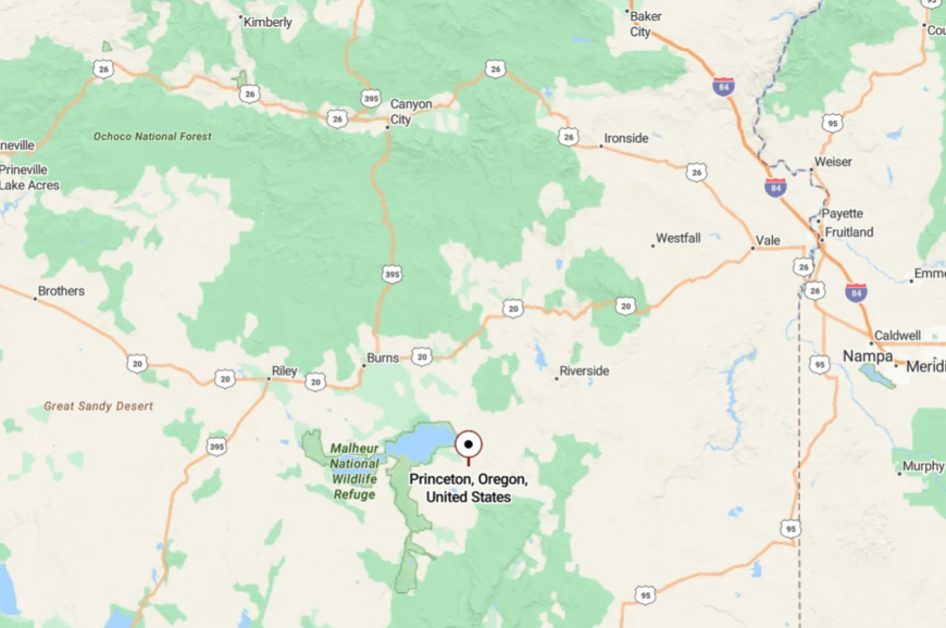
Princeton sits on OR-78 about 40 miles east of Burns in Harney County. From town, county gravel heads south toward Diamond and the refuge loop, while the highway rolls on to Juntura.
With no nearby supermarkets and sketchy reception, trips are planned with lists and fuel cans. The approach is easy, but the departure is always reluctant.
20. Juntura: River Bends, Hot Springs, and Basalt Walls

Juntura presses close to the Malheur River, a ribbon of green carved into dark basalt. Its seclusion stems from a long stretch of US-20 that sees more pronghorn than people and from canyons that swallow sound.
The vibe is river-slow: an inn with a café, a school, and fishermen easing along willow banks. Soak at the riverside hot springs, watch bighorn sheep on canyon rims, ramble up to the old bridge, or cast for trout in shaded eddies.
Ranching and wayfarer services keep lights on without crowding the riverbank. At night, the Milky Way arcs over the canyon like a lanterned bridge. It’s a place that invites you to linger between bends.
Where is Juntura?
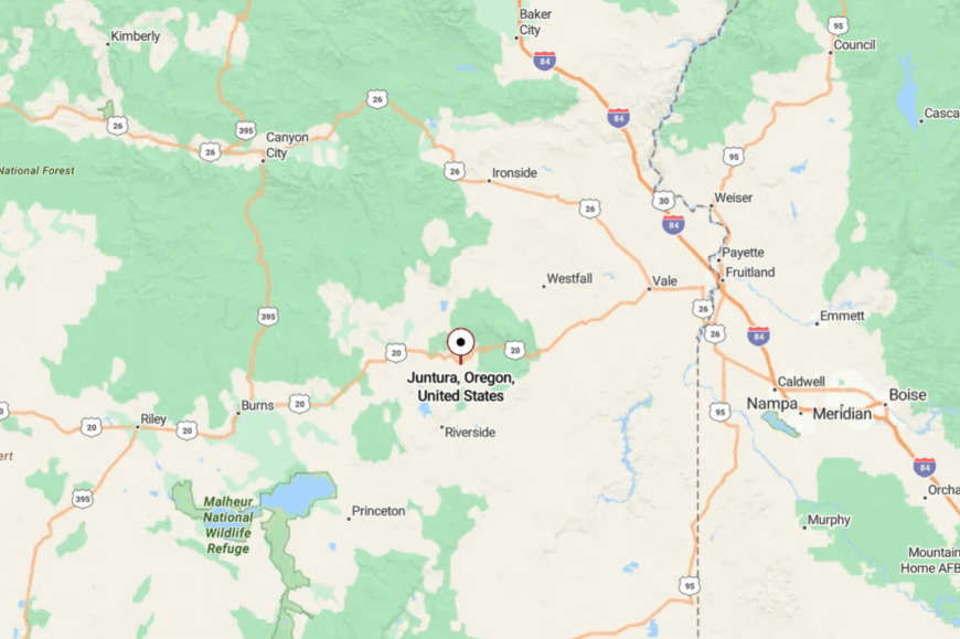
Juntura lies on US-20 in Malheur County, about 58 miles west of Vale and 75 miles east of Burns. The highway narrows into a canyon drive with few pullouts and fewer distractions.
Access is as simple as staying the course—and slowing down when the river appears. It’s close to the pavement, yet wrapped in its own world of stone and water.
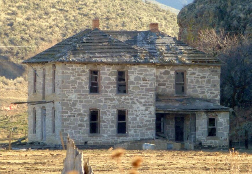
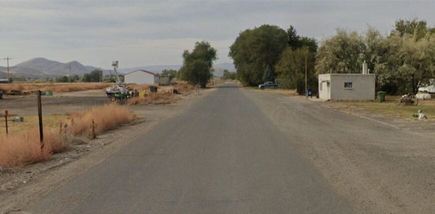
19. Westfall: Cottonwood Shade on a Forgotten Cutoff
🔥 Would you like to save this?
Westfall feels tucked into time, a handful of homes under cottonwoods where an old stage route once ran. The isolation comes from lying off US-20 on a county spur that dead-ends into rangeland and hills.
The vibe is porch-swing plain: horses blowing through nostrils at the gate, dust devils dining on the road, and neighbors trading news at the mailbox. Walk the creek, scan hillsides for mule deer, poke around the cemetery for pioneer dates, or drive the loop to Bully Creek Reservoir for a sunset picnic.
Ranching is the constant here; everything else is weather and season. Even the wind seems to tiptoe. It’s the kind of hush that makes yesterday feel very near.
Where is Westfall?
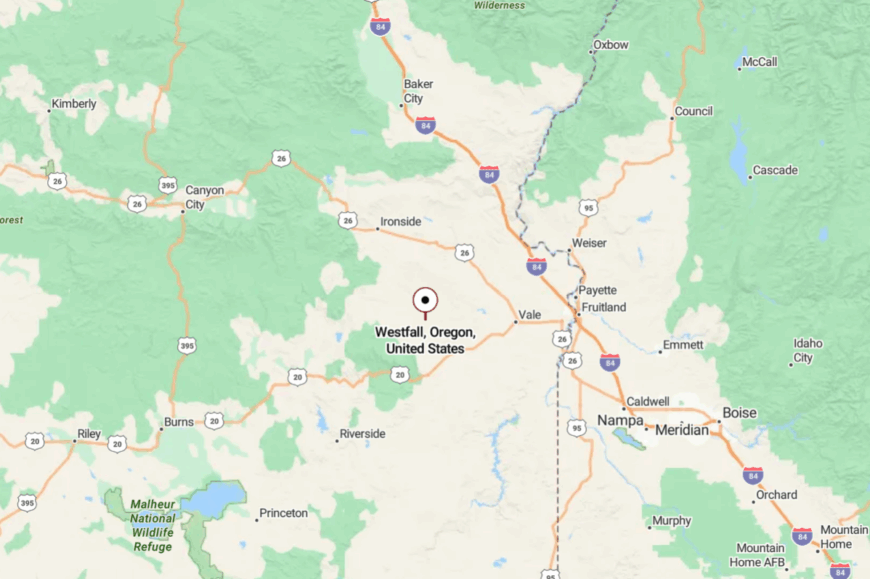
Westfall sits in Malheur County about 24 miles west of Vale, reached by turning south off US-20 at Harper and following county roads. The last miles narrow to chipseal and gravel beneath willow shade.
Rimrock and rolling pasture keep the horizon wide and the traffic light. It’s easy to miss—and that’s half the charm.
18. Harper: Hay Fields and Basalt Bluffs Beside the Malheur
Harper strings a school, a store, and a few streets along green irrigation lines flanked by basalt bluffs. Its secluded feel comes from the broad distance between Malheur County towns and the way the highway bends away from river bottoms.
The vibe is pure farm-and-ranch: pivot sprinklers ticking, hay stacked in sunlit towers, and evenings so quiet you hear owls on the rim. Float a mellow stretch of the Malheur, birdwatch along shelterbelts, sip coffee at the lone café, or roam backroads to wildflower slopes in spring.
Agriculture anchors everything here—schedules, stories, seasons. When the sun drops behind the bluff, a cool shadow slides across the valley like a curtain. It’s a small dot that feels miles deep.
Where is Harper?
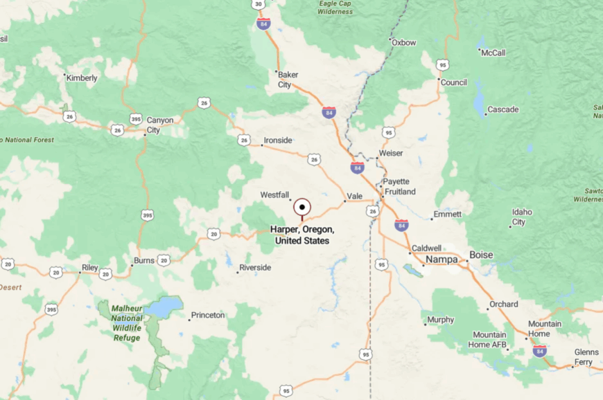
Harper lies on US-20 about 23 miles west of Vale and 45 miles east of Juntura. The approach follows the Malheur River through broad benches of hay fields.
With services sparse, most travelers stop, exhale, and top off. It’s on the main road, yet the fields make it feel far away.
17. Ironside: Pine-Touched Uplands on US-26
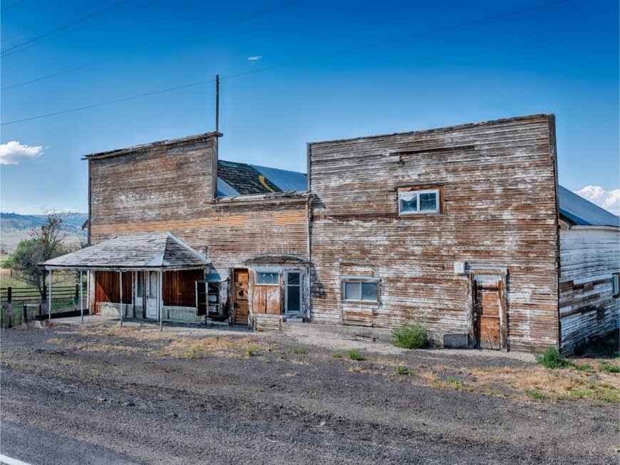
Ironside sits where sage gives way to pine, a weathered outpost on a high upland. Its seclusion owes to US-26’s lightly traveled stretch between John Day country and Vale, and to ridges that fold the town out of sight.
The vibe is lean and woodsmoke-clean: old ranch yards, a grange hall, and long views to snow in shoulder seasons. Hunt elk in nearby timber patches, fish Willow Creek, wildflower-watch in late May, or take a slow loop over Drinkwater Pass.
Ranching and timber work mark the year more than any calendar page. Night comes early when the ridge catches the sun. It’s a crossroad that chooses quiet over speed.
Where is Ironside?
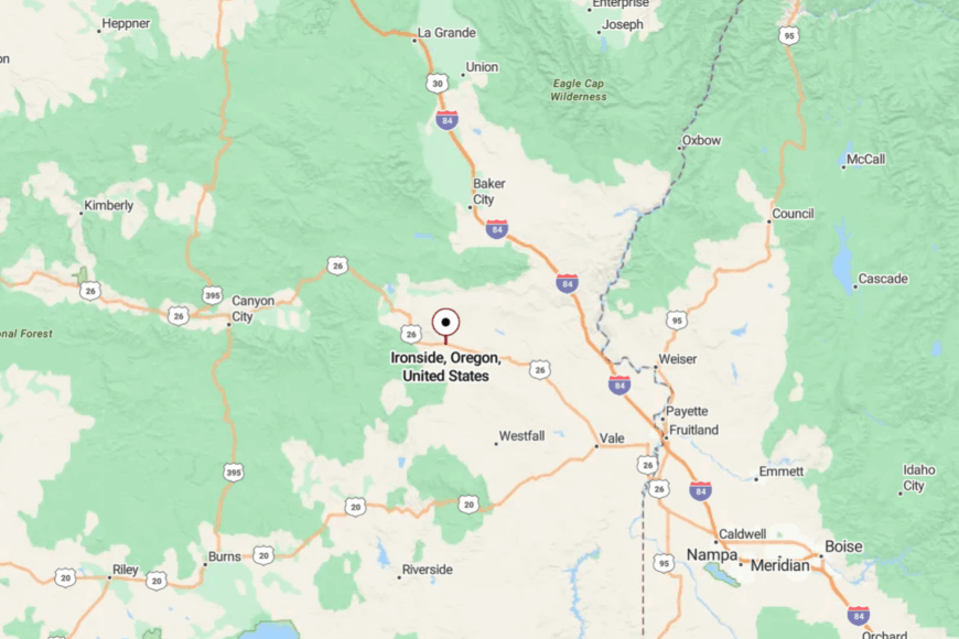
Ironside is in northeastern Malheur County along US-26, roughly 46 miles northwest of Vale and 30 miles southeast of Unity. The road climbs and dips through open range with few services for long stretches.
Snow can linger on passes in spring, keeping things extra still. It’s a straightforward drive that ends in pine-scented hush.
16. Brogan: End-of-the-Line Orchard Country
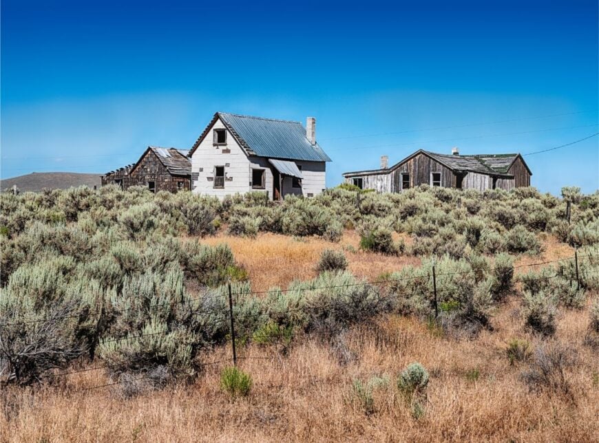
Brogan feels like a green exclamation point at the end of a long sentence—orchards and gardens pooled along a creek beneath tawny hills. Its tucked-away mood comes from being off the main drag on a spur of US-26 where the pavement simply stops.
The vibe is homey: fruit trees, tidy yards, and a tiny cluster of buildings that share more shade than signs. Pick apples in season, walk the creek at dusk, drive to Bully Creek Reservoir for a swim, or scout wildflowers on nearby ridgelines.
Small farms and ranches carry the weight here, with a few commuters to Vale or Ontario. When the sun sets behind basalt, the valley exhales. It’s the kind of seclusion measured in slow evenings and quiet porches.
Where is Brogan?
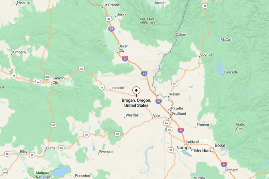
Brogan lies along US-26 in Malheur County about 30 miles northwest of Vale. After Willowcreek, the highway narrows and rises into folds of rimrock before dropping into the green ribbon of town.
There’s no through route beyond, which keeps traffic sparse. It’s an easy detour that feels like a discovery.
15. Summer Lake: Mirages, Migrating Birds, and a Storybook Lodge
Summer Lake is a long, bright platter of water that tricks the eye and soothes the nerves, with a small community tucked along its western shore. Seclusion stems from Highway 31’s hundred-mile quiet and the huge wildlife area that buffers everything with reeds and open sky.
The vibe is refuge-slow: scopes on dashboards, a historic stone lodge, and miles of fen humming with life. Watch geese and cranes at the Summer Lake Wildlife Area, soak at nearby hot springs, hike up to the Rim for sunrise, or roam petroglyph sites under rimrock.
Tourism is gentle and seasonal; ranching fills the gaps with hay cuttings and cattle drives. At night, the lake becomes a mirror for the stars. It’s the kind of stillness that resets your pulse.
Where is Summer Lake?
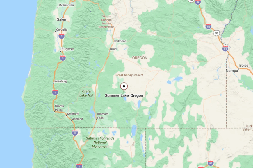
Summer Lake sits in northern Lake County along OR-31, about 100 miles southeast of Bend and 42 miles north of Paisley. The byway slides between rimrock and marsh with scant services in either direction.
Expect long, beautiful stretches with nothing but birds and sky. It’s a straight shot—and a different tempo.
14. Silver Lake: Old-Stage Stop with Big Horizons
Silver Lake keeps the bones of an old stage stop—false fronts, broad streets, and a café that catches the morning crowd. Its seclusion comes from its spot midway along OR-31, a long, lightly served highway through rim country.
The vibe is plainspoken and wind-brushed: hay trucks, antelope on the flats, and dust devils stepping across the basin. Grab a burger at the cafe, birdwatch at Thompson Reservoir, drive to Fort Rock’s volcanic amphitheater, or catch high-desert sunrises that fill every window.
Ranching and highway services set the pace, and that pace is measured. After sundown, coyotes sound like they’re keeping time. It’s a small dot with room to breathe.
Where is Silver Lake?
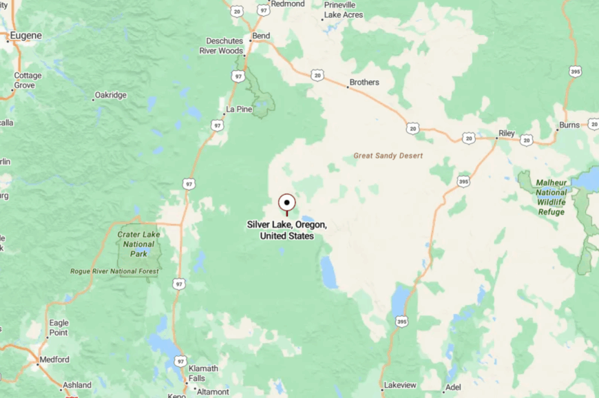
Silver Lake sits in north-central Lake County, about 32 miles west of Summer Lake and 54 miles east of La Pine along OR-31. The road runs arrow-true across basins and climbs gently toward timber.
Services are sparse—fuel and food are worth taking when you can. It’s easy to pass, easier to stay a while.
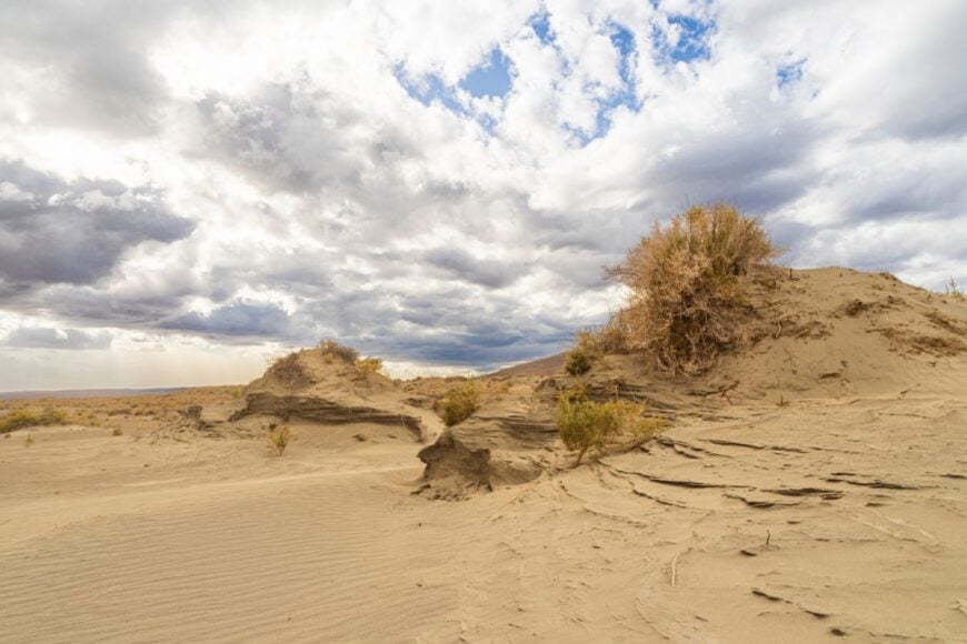
13. Christmas Valley: Sand Dunes and Sagebrush Neighborhoods
🔥 Would you like to save this?
Christmas Valley spreads out beneath a ring of low buttes, its grid of streets dissolving into sagebrush and sky. Seclusion here is a matter of distance and sand—miles from any interstate, with an OHV dune field muffling sound to the east.
The vibe is lightly off-grid: garden plots, solar panels, and a two-pump station that’s also a bulletin board. Ride the Christmas Valley Sand Dunes, hike Crack-in-the-Ground’s slot, hunt fossils at nearby beds, or birdwatch along the alkali lakes.
Small businesses, alfalfa pivots, and recreation traffic fuel the local economy. Night brings an orchestra of owls and the hiss of wind over sand. It’s the open-ended kind of quiet that people drive hours to find.
Where is Christmas Valley?

The community sits 20 miles north of OR-31 in Lake County, reached by the signed Christmas Valley Highway from Silver Lake or Fort Rock. Roads are paved but remote, with long gaps between services.
The dunes and lava features surround the town in a wide ring of public land. You arrive with dust on the bumper and a slower heartbeat.
12. New Pine Creek: Borderline Quiet on 395
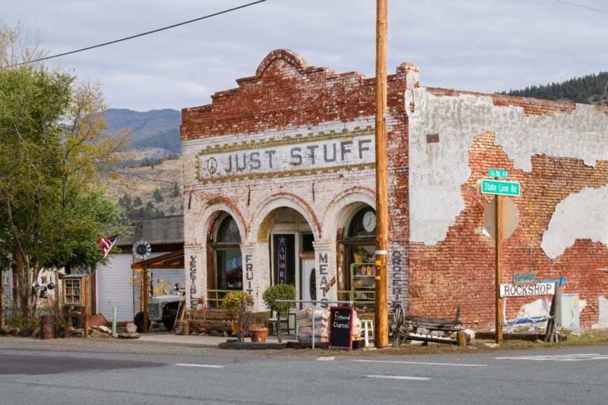
New Pine Creek straddles the Oregon–California line, a slim thread of houses backed by juniper hills and lake country. Its seclusion owes to being nearly the last Oregon address on US-395, with Goose Lake’s broad basin absorbing noise and light.
The vibe is unassuming and neighborly: roadside produce in season, quiet porches, and long looks south toward the Siskiyous. Fish nearby streams, explore Goose Lake State Recreation Area, wander juniper flats for birds, or day-trip to obsidian beds across the state line.
Ranch work and highway trickle trade are the local constants. When twilight hits the basin, you can hear trains across the state line like they’re in the next field. It’s a border town that belongs mostly to the sky.
Where is New Pine Creek?
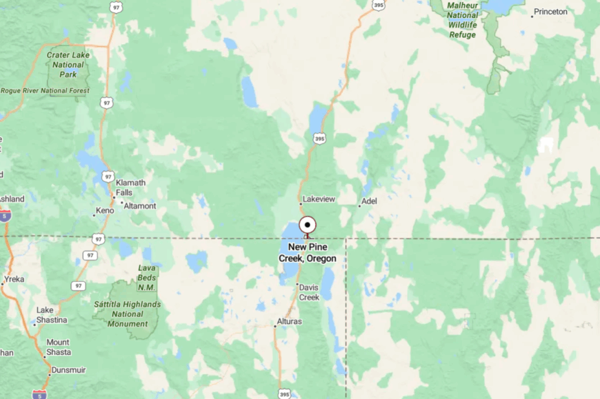
New Pine Creek sits 10 miles south of Lakeview on US-395 at Oregon’s southern tip. The highway runs straight and spare along Goose Lake’s eastern edge.
Fuel and services thin quickly in both directions, especially at night. It’s a through road that somehow feels like a cul-de-sac on the map of the world.
11. Valley Falls: Two-Lane Junction Beneath Abert Rim

Valley Falls is a wide spot where two long roads cross, and the land does all the talking—Abert Rim towering to the east, hay fields greening the flats. Its seclusion is defined by the scale around it: one of the West’s highest fault scarps on one side, miles of open basin on the other, and scant buildings between.
The vibe is windswept and elemental: a sign, a mailbox, and the feeling that you’ve arrived at the center of the map’s white space. Watch golden eagles ride the thermals off the Rim, scan Abert Lake for saline-tolerant birds, picnic among basalt cobbles, or drive the lakeshore at sunset when water turns mercury.
Ranching out on the benches keeps the few lights glowing. When the wind finally dies, the silence is ocean-deep. It’s a junction that feels like an ending, in the best way.
Where is Valley Falls?
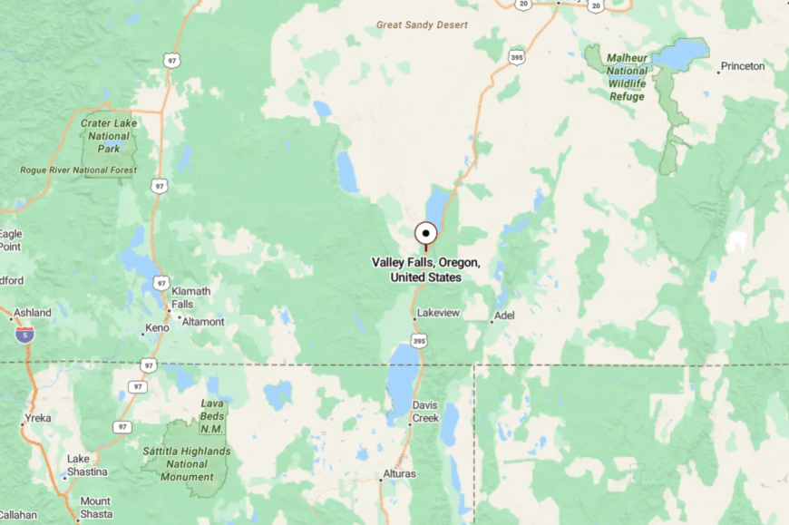
Valley Falls sits in Lake County at the junction of US-395 and OR-31, about 16 miles south of Lakeview and 22 miles north of the Abert Lake overlook. Approaches are easy but empty, with no services for long stretches beyond town.
The Rim rises a sheer 2,000 feet above the road, closing out both noise and horizon. It’s close enough to reach before lunch, far enough to feel like you’ve left everything behind.
10. Frenchglen: A One-Stoplight Hamlet on the Edge of the Steens
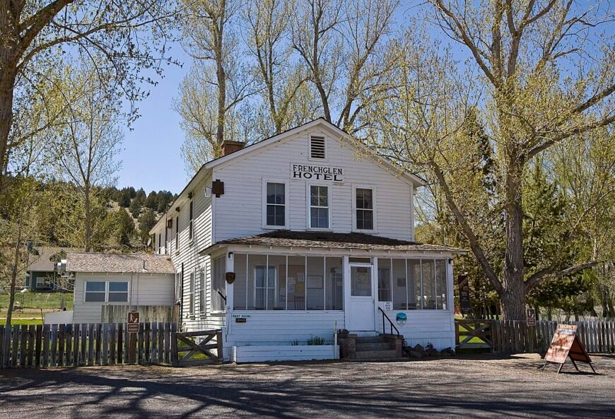
Frenchglen keeps a year-round population of about 12 residents, most of whom can be found at the historic Frenchglen Hotel or tending cattle on neighboring ranches.
Visitors come for dawn chorus bird walks at Malheur National Wildlife Refuge, autumn leaf-peeping on the 59-mile Steens Mountain Loop Road, and late-night stargazing that rivals any observatory.
Ranching and refuge work form the economic backbone, supplemented each summer by a trickle of hotel guests hungry for the dining room’s famed family-style meals. Photographers linger for views of Kiger Gorge and wild-flower meadows that blush purple in June.
Seclusion here is baked into the geography: Frenchglen sits 60 miles from the nearest grocery aisle and cell coverage fades long before town signs appear. Those who stay a night or two often remark that the loudest thing they hear is the crunch of gravel under their boots.
Where is Frenchglen?
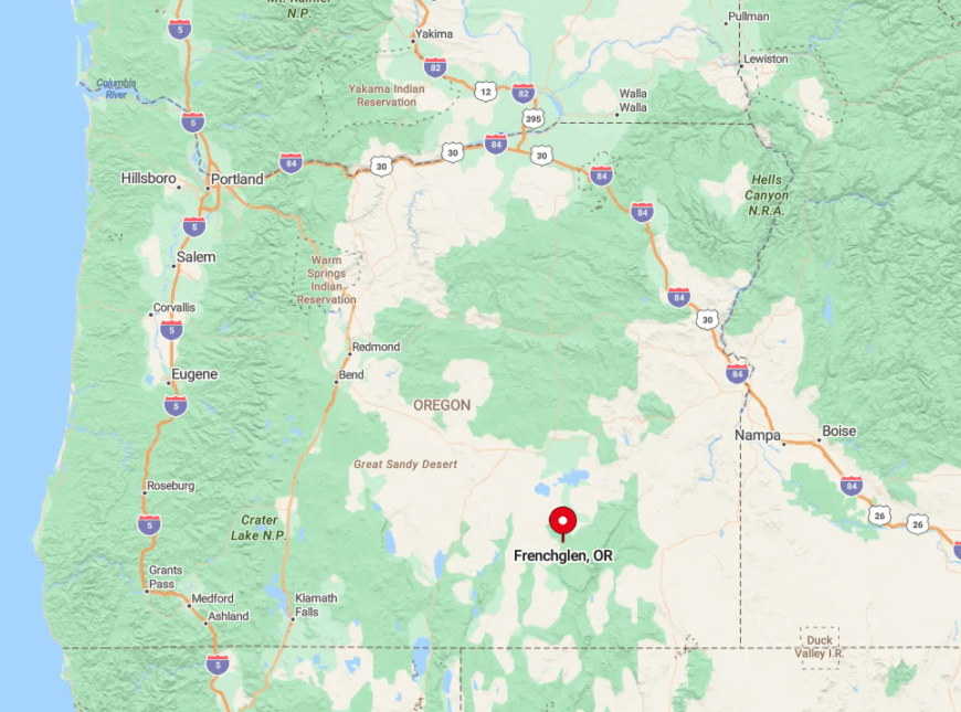
The hamlet lies in Harney County at the foot of Steens Mountain, roughly 60 miles south of Burns via Oregon Highway 205. A backdrop of thousand-foot glacial gorges and public lands ensures no urban sprawl will creep in soon.
Limited year-round residents, a single fuel pump, and long winter road closures amplify the feeling of splendid isolation. Reaching Frenchglen requires a scenic drive across the Harney Basin, so travelers should top off their tanks and bring snacks before leaving Burns.
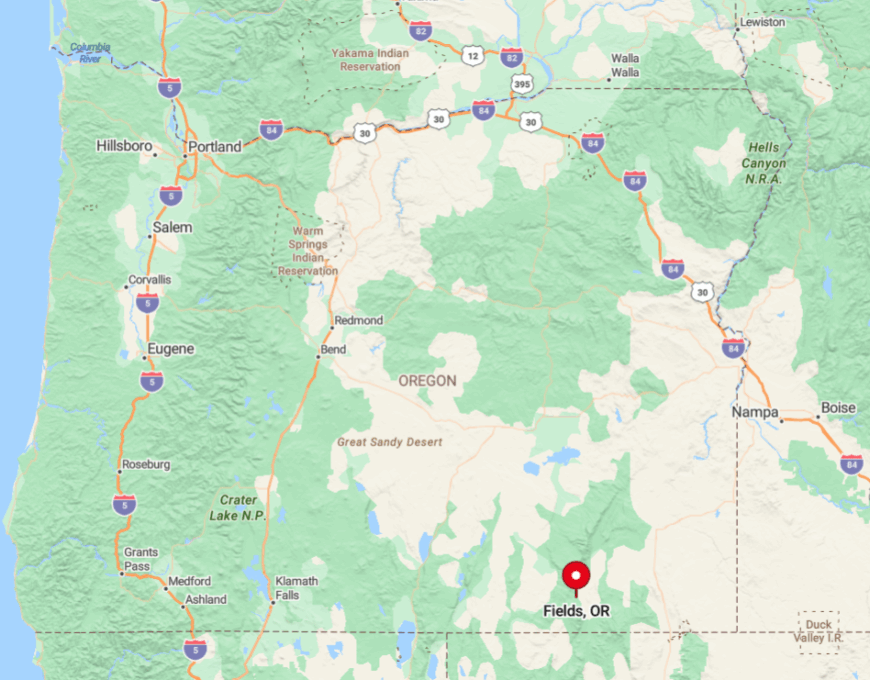
9. Fields: High-Desert Oasis You Can Count on Two Hands
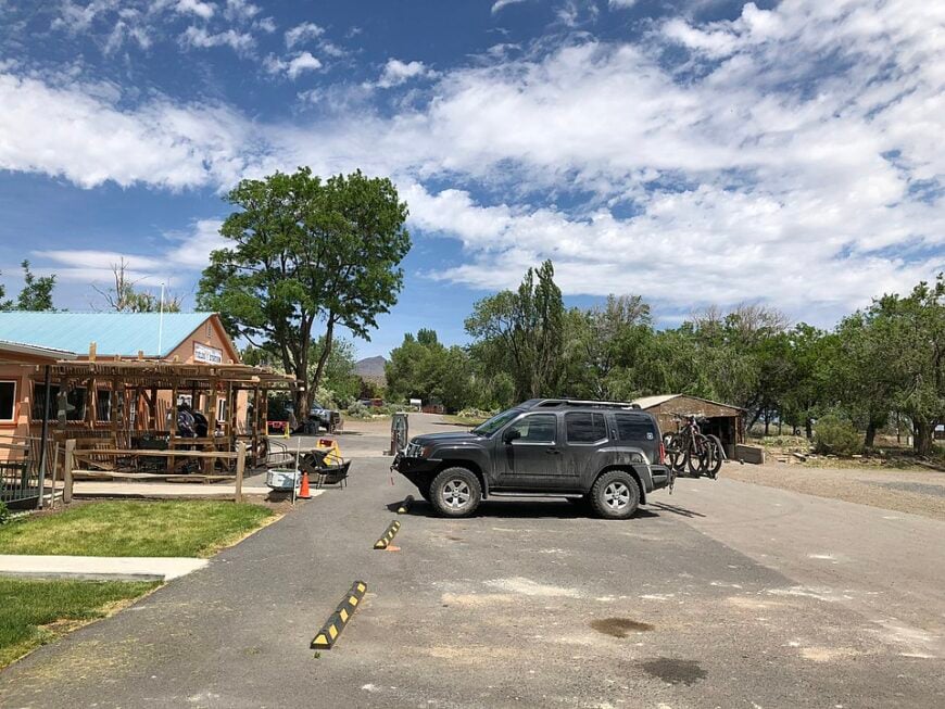
Fields lists fewer than ten full-time inhabitants, all of whom orbit the century-old Fields Station that doubles as café, motel, and post office. Day-trippers savor house-made milkshakes the size of a mason jar, then soak in nearby Alvord Hot Springs or explore the alkali flats where land-sailing is a local pastime.
Cattle ranching and station hospitality keep the lights on, while autumn hunters swell numbers for a short season. A dusty landing strip welcomes back-country pilots who swap trail gossip over burgers and gasoline pumps that operate by handwritten ledger.
Isolation is guaranteed by a surrounding sea of sagebrush and the Nevada border just six miles south. Even the pronghorn seem surprised when a car appears on the horizon.
Where is Fields?
🔥 Would you like to save this?
Fields sits at the southern tip of Harney County along gravel-rimmed State Route 205, 118 miles from Burns and 140 miles from Winnemucca, Nevada. Rugged Pueblo Mountains to the west and the shimmering Alvord Desert to the east form natural barriers that keep through-traffic minimal.
No cellular towers reach this far, and winter storms often close the only paved approach. Drivers coming from the north should plan a fuel stop in Frenchglen; those from the south typically top off in Denio, Nevada.
8. Diamond: Ranch Country Hidden Beneath Rimrock Bluffs
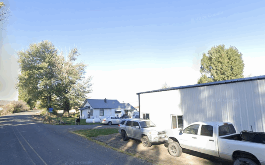
Diamond supports roughly 20 residents clustered around barns, hay fields, and an 1880s schoolhouse that now serves as a community hall. Travelers trace wagon-rutted roads to Peter French Round Barn, then picnic beside aspens that quake in the wind tunneling down Diamond Valley.
Livestock grazing dominates local income, though birders drift in to scan for sandhill cranes on the valley marshes each spring. The town’s lone guesthouse, Diamond Hotel, still rings its dinner bell to summon guests to long tables set with ranch-raised beef.
Diamond’s seclusion stems from the encircling basalt cliffs and the absence of any service between it and Highway 78, 26 miles away. Even GPS units often default to blank screens once the pavement ends.
Where is Diamond?
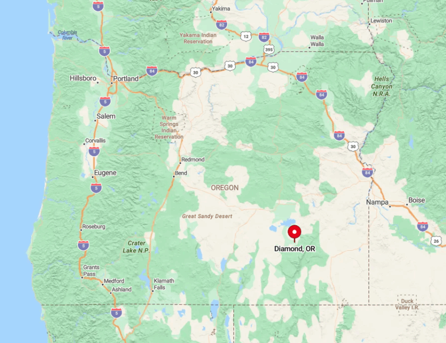
Nestled 16 miles north of Frenchglen via gravel Frenchglen-Diamond Road, the settlement occupies a notch between the Steens foothills and the rocky buttes of Harney Basin. With no gas station or store, visitors must arrive self-sufficient.
Sparse signage and seasonal mud make the road a slow cruise, reinforcing the sense of leaving the modern grid behind. The easiest access comes from Highway 78 at New Princeton, followed by a 25-mile drive over county gravel.
7. Plush: Sagebrush Settlement Famous for Sunstones
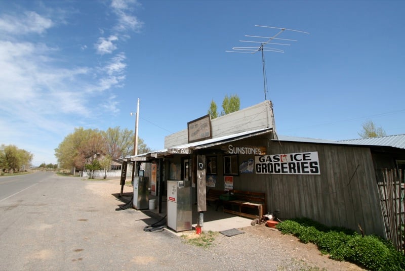
Plush claims around 40 neighbors who meet weekly at the Plush Café for coffee and gossip about cattle prices and rock-hounding finds. Summer explorers comb the Bureau of Land Management sunstone fields, pocketing iridescent gems that flash green in the sun.
Ranch work, small-scale tourism, and the nearby Hart Lake campground make up the local economy. Kayakers paddle the Warner Lakes chain while pronghorn graze unbothered along the shoreline.
Plush remains secluded thanks to miles of reed-lined lakes backed by fortress-like basalt plateaus that block radio and phone signals. Nighttime brings a velvet darkness where meteor showers look close enough to touch.
Where is Plush?
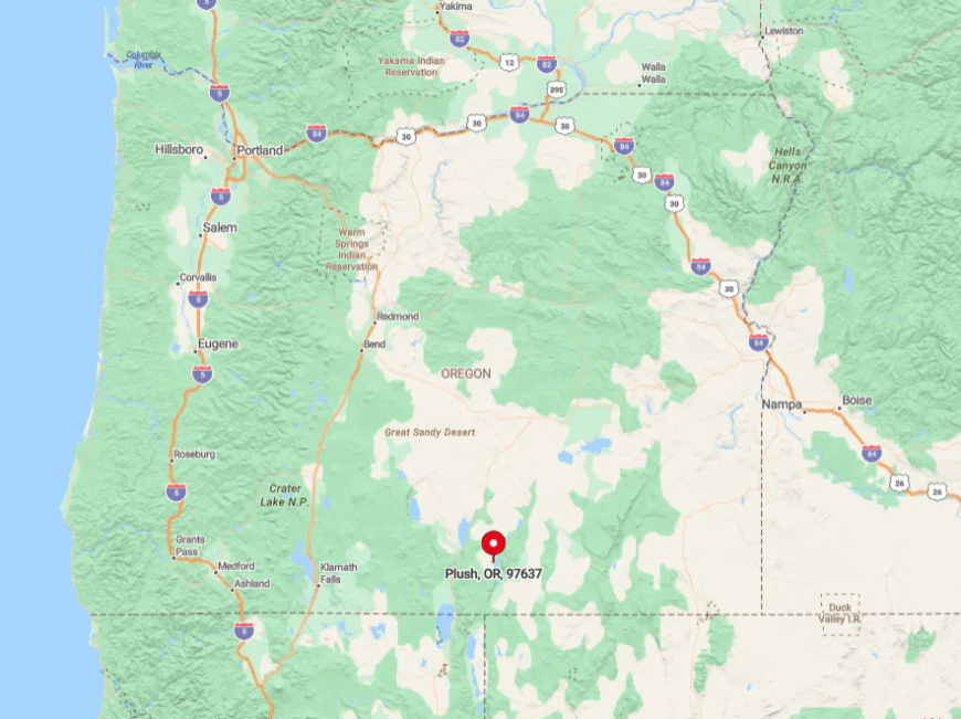
The village rests 27 miles northeast of Lakeview via County Road 3-13, just east of Hart Mountain National Antelope Refuge. Lack of major highways and winter snowdrifts that close the Hart Mountain summit road limit casual visitors.
A single gasoline pump at the café serves anyone venturing farther into the high country. Those arriving from the north often detour through Adel, then follow gravel Warner Valley roads that snake between shallow lakes and rimrock.
6. Adel: Remote Crossroads Near Guano Valley Hot Springs
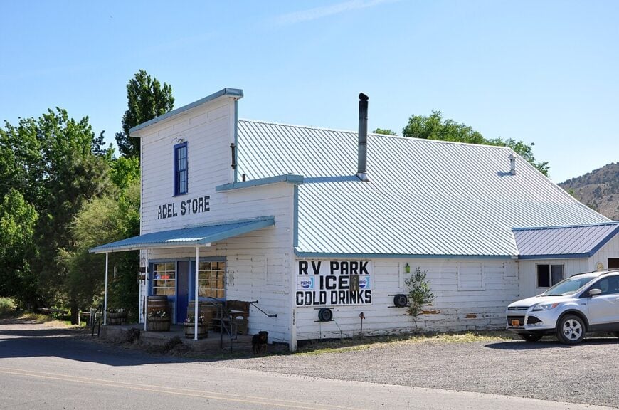
Adel’s population hovers near 200, scattered across hay meadows and sagebrush benches that roll toward the Warner Mountains. Travelers stop for homemade pies at Adel Store, then soak in rock-rimmed Guano Valley Hot Springs five miles south.
Ranching dominates livelihoods, supplemented by seasonal hunters tracking mule deer and chukar partridge across public land. Evening entertainment might be a spur-of-the-moment fiddle session on the store’s front porch.
Seclusion derives from the 35-mile gap to Lakeview, the absence of any neighboring towns, and winter passes that often close with drifting snow. The result is a tight community that still relies on radio party lines for local news.
Where is Adel?
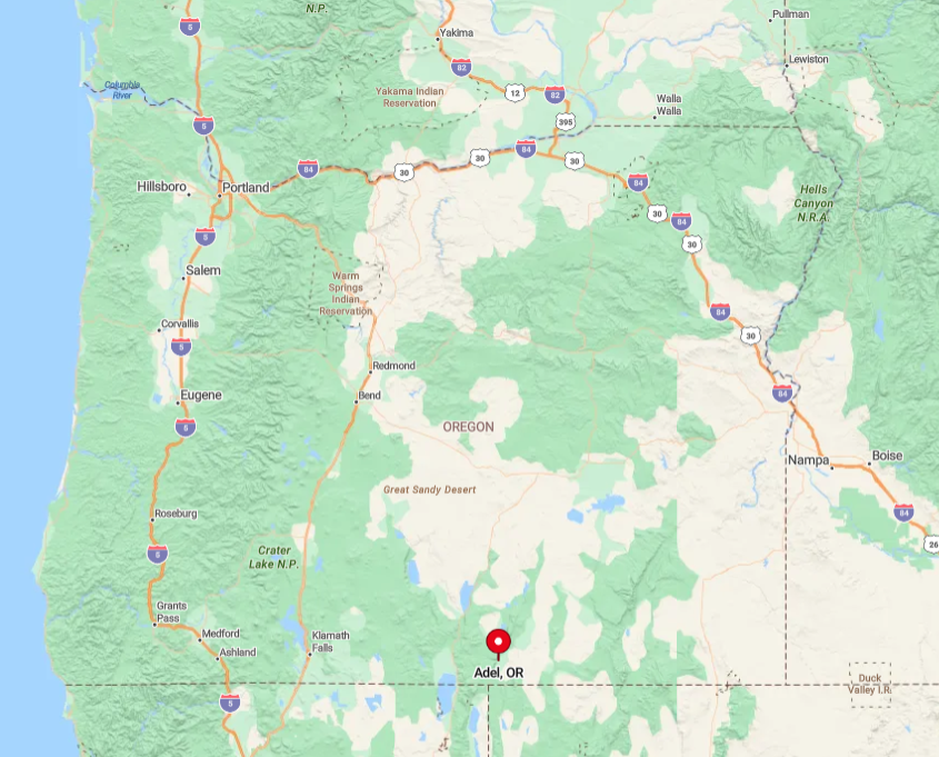
Sitting on Oregon Highway 140, Adel lies halfway between Lakeview and Denio Junction, Nevada. The highway crosses high plateaus where fuel stations are nonexistent for nearly 80 miles.
Limited cell coverage and sweeping grasslands heighten the feeling of being alone on the range. Visitors should gas up in Lakeview or Fields before tackling the empty two-lane ribbon to Adel.
5. Drewsey: Tiny River Town with a Century-Old Saloon
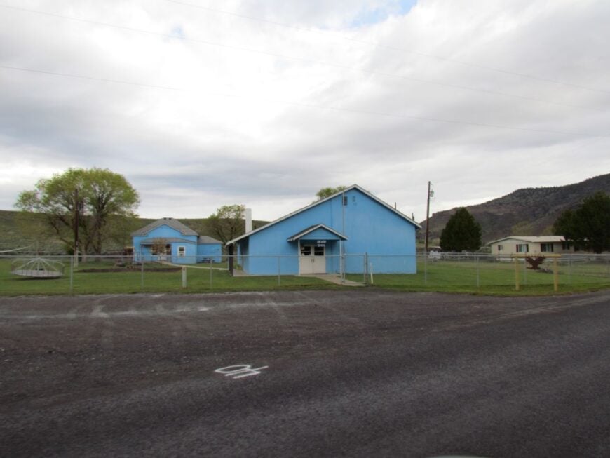
Drewsey’s 150 residents trace their roots to stagecoach days when the Drewsey Mill turned pine logs from nearby hills. Modern visitors stop at the Snaffle Bit Saloon, pouring drinks since 1883, and cast flies for redband trout in the Silvies River that meanders through town.
Hay, cattle, and small-scale logging anchor the economy, while hikers explore Burns Paiute petroglyphs etched into rimrock south of town. Every July, a modest rodeo draws ranch hands from as far as Seneca.
Seclusion comes from the 120-mile drive to the nearest interstate and winters that blanket Highway 20 in black ice. Nights remain so quiet that passing trains on distant tracks sound closer than they are.
Where is Drewsey?
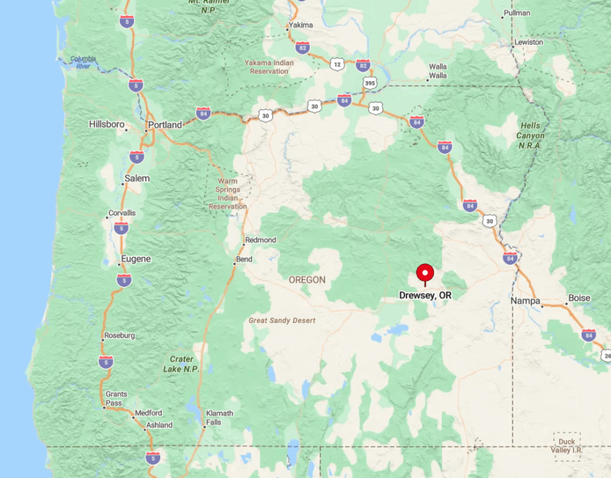
The town sits on U.S. Highway 20, 47 miles east of Burns and 95 miles west of Ontario. Surrounding ponderosa hills and open federal range mean no suburbia will spill in.
Sparse traffic and long gaps between services prompt travelers to plan rest stops carefully. Drewsey is best reached by following Highway 20 across Stinkingwater Pass, then descending into the Silvies River Valley where cottonwoods line the banks.
4. Riley: Windswept Junction at the Heart of Nowhere
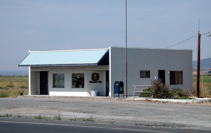
Riley boasts fewer than 45 residents, most affiliated with sprawling ranches that fence off hundreds of acres each. The lone Sinclair pump, a post office, and a feed store mark the intersection where Highways 20 and 395 cross like a giant plus sign on the sage plain.
Cattle trucking and highway services form the minimal economic activity, though birders pause to scout roadside ponds for long-billed curlews in spring. Winds howl unimpeded across 5,000-foot elevation prairies, shaping a rugged lifestyle.
Riley feels secluded because the next town in any direction is at least 45 miles away across empty Bureau of Land Management land. Most evenings end with sunsets that stretch in all directions without a single telephone pole to block the view.
Where is Riley?
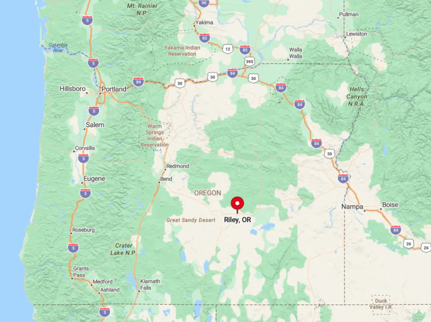
Located 29 miles west of Burns at the meeting point of U.S. Highways 20 and 395, Riley sits squarely in Oregon’s geographic center of sparsity. Flat terrain and low population density leave cell signals weak and radio static-filled.
Travelers approach from either Burns or Hines to the east or from Bend after a 95-mile desert drive to the west. The gas pump runs limited hours, so it is prudent to arrive with a nearly full tank.
3. Rome: Badlands Outpost Beside the Owyhee

Rome tallies roughly 90 inhabitants who share an all-in-one outpost serving fuel, groceries, and ice-cream bars to rafters bound for the Owyhee River. Daytime diversions include sandstone spires at Leslie Gulch, fossil hunting in Chalk Basin, and spring floats through the river’s towering red-wall canyons.
Seasonal river guides and ranch hands provide most employment, supplemented by students attending a two-room schoolhouse that still hosts Friday night potlucks. June wildflower blooms splash color across sage flats, drawing painters and photographers alike.
The settlement’s remoteness is reinforced by zero cellular coverage, vast stretches of unpaved county road, and winter snow that renders the Owyhee country impassable for days. This isolation preserves a stillness broken mainly by meadowlarks and the roar of spring runoff.
Where is Rome?
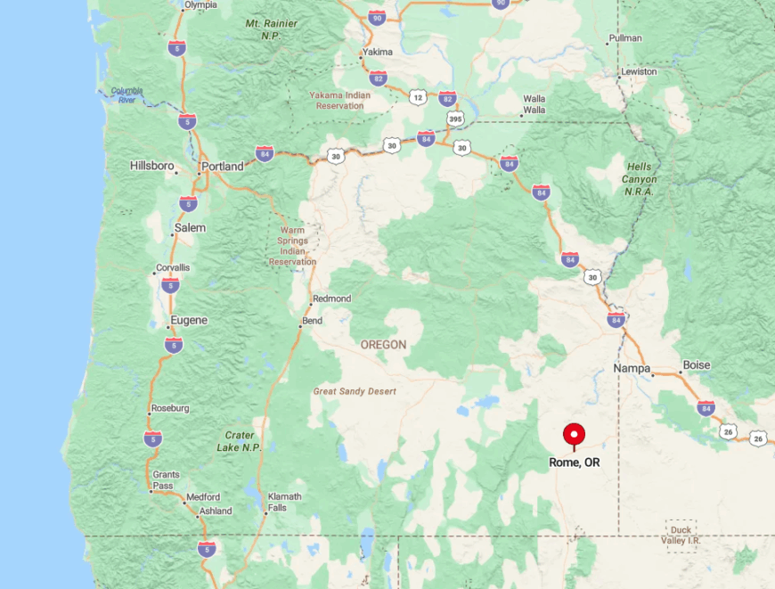
Rome lies on U.S. Highway 95 in Malheur County, 94 miles southwest of Ontario and 154 miles northwest of Winnemucca, Nevada. The Owyhee River cuts a twisting canyon just five miles east, forming a natural barrier to development.
Visitors typically exit Interstate 84 at Ontario, then drive south across high desert before dropping into the Owyhee drainage. Fuel is available only at the Rome Station, making it a mandatory stop before exploring backcountry roads toward Leslie Gulch.
2. Paisley: High-Country Hideaway under the Summer Lake Rim
Paisley maintains a steady population near 250, many of whom ranch cattle or work in the Fremont-Winema National Forest. Tourists soak at the solar-heated Paisley Hot Springs, hike 8,000-foot Hager Mountain for sunrise views, and base-camp for hang gliding from lofty Summer Lake Rim.
The community supports a historic 1888 hotel, a surprisingly well-stocked mercantile, and an annual Mosquito Festival that pokes fun at local winged pests while fundraising for the volunteer fire crew. Small-scale forestry, guide services, and artisanal cheese making round out the economic picture.
Seclusion springs from its location at the end of Highway 31, far from interstates and bounded by thousands of acres of wildlife refuge and national forest. Nights settle into deep quiet broken only by distant coyote yips echoing off the rim.
Where is Paisley?
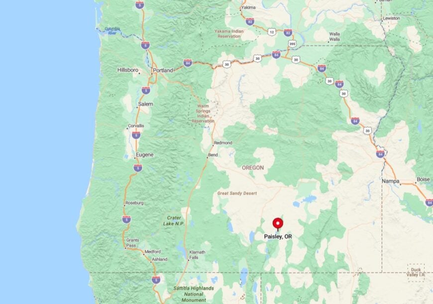
Sitting along the Chewaucan River, Paisley is 42 miles north of Lakeview on Oregon Scenic Byway 31, also called the Outback Parkway. The towering basalt escarpment of Summer Lake Rim blocks cell service in many spots, ensuring few digital intrusions.
Visitors coming from Bend face a 140-mile trip past Fort Rock and Silver Lake, with limited amenities en route. Winter storms can make the final miles treacherous, so travelers often check Oregon’s TripCheck site before setting out.
1. Jordan Valley: Basque-Heritage Village in the Owyhee Uplands

Jordan Valley’s 175 residents celebrate Basque ancestry with stone sheepherder ovens, an annual lamb barbecue, and pelota games at the outdoor fronton behind the old school. Explorers can climb lichen-painted rhyolite at Cliffs of Rome, wander into Jordan Craters for moon-like lava flows, or hunt for agates along Succor Creek.
Sheep ranching and small-scale agriculture headline local livelihoods, while a smattering of travelers stop for Basque chorizo sandwiches at the JV Café. Weekends often feature impromptu dances under string lights beside the 1898 Masonic Hall.
The village feels remote because the nearest supermarket sits 75 miles away in Ontario and winter snows close Succor Creek Road for months. Sagebrush plains fade into shimmering heat mirages, convincing many visitors they have slipped into another era.
Where is Jordan Valley?
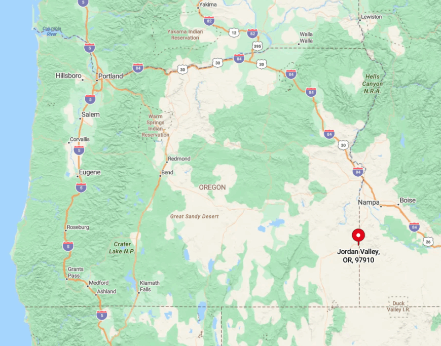
Jordan Valley straddles U.S. Highway 95 just north of the Idaho line, 85 miles southwest of Boise and 77 miles southeast of Burns Junction. Rugged Owyhee Canyonlands surround the town, restricting expansion and discouraging casual day trips.
Most travelers reach it by heading south from Interstate 84 at Boise, then driving an hour through rolling steppe with no fuel until town. Those venturing deeper into the backcountry should carry extra water, as gravel spurs toward Three Forks and Jordan Craters can be rough and completely unserviced.


