🔥 Would you like to save this?
Southeast Mississippi is stitched together by sandy pinelands, meandering creeks, and farm roads that rarely see more than a handful of cars in a day. Tucked inside this quiet landscape are small communities where porch lights outnumber streetlights and the nearest chain store sits many miles away.
We gathered 25 of the most secluded towns in the region, each one offering its own brand of calm, whether that means a stilted cabin above a blackwater stream or a farmhouse ringed by quail fields.
In order to come up with the very specific design ideas, we create most designs with the assistance of state-of-the-art AI interior design software. Also, assume links that take you off the site are affiliate links such as links to Amazon. this means we may earn a commission if you buy something.
Populations are tiny, local industry leans on timber, row crops, or cattle, and night skies stay dark enough to catch the Milky Way without squinting. Visitors often pass them by, yet those who make the drive find creek-side trails, century-old barns, and neighbors who still wave at every passing truck.
Here is our countdown of places where solitude comes easily and the modern world feels far away.
25. Vestry, Jackson County – Creek-Bend Quiet under Tall Pines

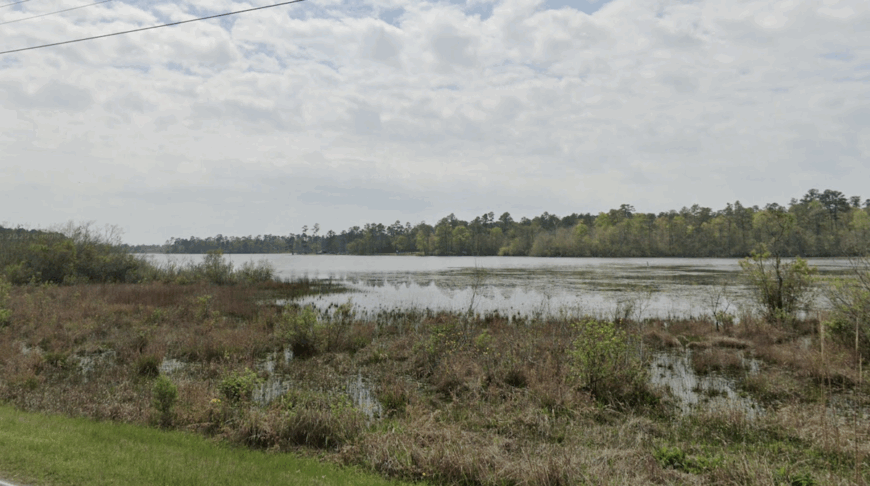
Vestry feels folded into the woods, a handful of mailboxes and sandy drives vanishing toward Bluff Creek. Its seclusion comes from big timber tracts and a lattice of dirt roads that slow life to the speed of dragonflies.
The vibe is piney and peaceful—screened porches, garden rows, and the far-off rumble of a jon boat. Spend a morning paddling Bluff Creek, try a cane pole at an oxbow, photograph old turpentine trees, or follow a birding loop where prothonotary warblers light up the shade.
Work leans on logging, small cattle herds, and handy folks who can fix anything with baling wire. Night brings a chorus of frogs loud enough to make conversation pause. It’s the kind of place that reminds you how quiet the world can be.
Where is Vestry?

Tucked in northwest Jackson County, Vestry sits about 20 miles north of Ocean Springs and 15 miles southwest of Lucedale. You reach it via MS-57, then smaller county roads that taper to hard-packed sand.
Pine forest and blackwater creeks keep through-traffic to a whisper. It’s close enough for a day paddle, far enough to feel like you slipped off the map.
24. Wade, Jackson County – River Flats and Front-Porch Evenings

Wade gathers at a crossroads beside the Escatawpa’s lazy channels, more boat ramps than storefronts. Seclusion hangs on wide floodplain woods and the long gap to any interstate.
The mood is practical and neighborly—porch swings, farm trucks, and bait coolers stacked by the door. Launch a skiff at the public landing, fish for bream under cypress shade, wander oak-lined lanes for birds, or grab a plate lunch at the little café that closes before dark.
Jobs revolve around small shops, farms, and commutes to Pascagoula’s yards. After sunset, you’ll hear whip-poor-wills more often than tires on pavement. Wade is a soft corner in a loud world.
Where is Wade?

Northern Jackson County holds Wade at the meeting of MS-63 and MS-614, roughly 20 miles north of Pascagoula. The simplest approach follows MS-63 through pine and bottomland.
River bends and timber lots buffer the outskirts in every direction. It’s easy to find on a map and easier to forget the map once you arrive.
23. Hurley, Jackson County – State-Line Backroads and Big Skies

Hurley spreads wide on high ground near the Alabama line, homes set far apart behind windbreaks and pecan trees. Its tucked-away feel comes from long distances between towns and a habit of roads turning to gravel just when they get interesting.
The vibe is church-supper friendly: tractors at the store, youth ball under bright lights, and sunrise mist lifting off pastures. Cast for catfish in the Escatawpa, follow a rural cycling loop, browse a seasonal produce stand, or picnic under the water oak by the old school.
Work is a mix of farming, trades, and driving to the coast. Even storm days feel roomy out here. Hurley keeps its horizon uncluttered and its pace humane.
Where is Hurley?
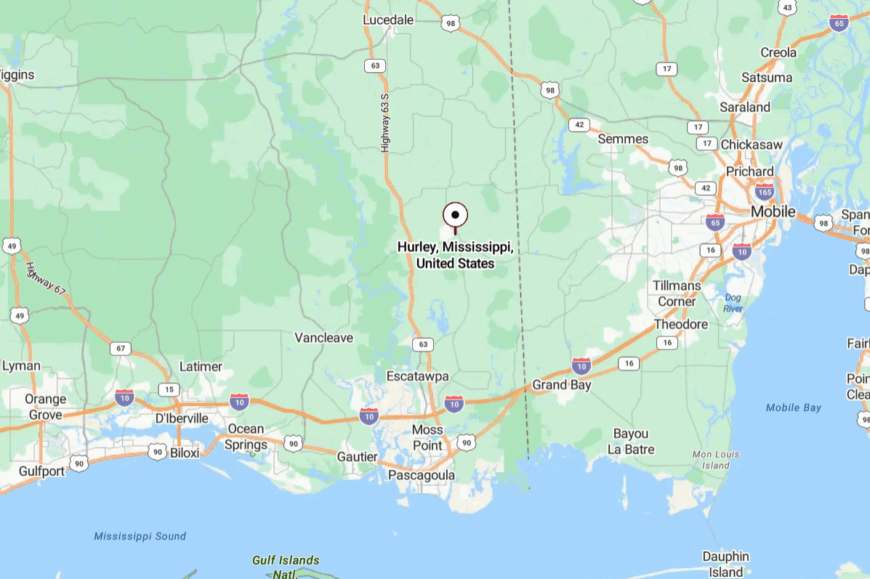
Northeast Jackson County places Hurley about 25 miles northeast of Pascagoula and 30 miles west of Mobile, Alabama. Get there via MS-614 or county roads threading pasture and pine.
With no freeway nearby, traffic thins to local plates. It’s close to the line, but far from the rush.
22. Big Point, Jackson County – High Bluff over the Escatawpa
Big Point perches on sandy rises above the river bottoms, a patchwork of hay fields and home gardens. Seclusion comes easily thanks to dead-end lanes and floodplain woods that swallow sound.
The vibe is old-country calm—screen doors, coops, and tractors easing between fields. Drop a kayak on the Escatawpa, watch swallow-tailed kites in summer, photograph weathered barns at golden hour, or swap stories at the feed store.
Cattle, row crops, and small shops keep folks busy without raising the volume. When night falls, the sky feels wide enough to hold a storm and a promise. Big Point is a fine place to hear yourself think.
Where is Big Point?

You’ll find it in northern Jackson County, roughly 22 miles north of Pascagoula and 12 miles east of Vancleave. Local spurs peel off MS-613, narrowing into quiet country lanes.
River swamps to the east and pine to the west keep it pocketed. It’s close enough for an evening drive, far enough for stars.
21. Merrill, George County – Leaf River Bend with Mill-Town Echoes
Merrill sits tight to a looping bend of the Leaf, shaded by sycamores and cypress. Its out-of-the-way calm comes from being a few turns off the highway and pressed between water and woods.
The mood is mellow and practical: dogs at tailgates, garden tomatoes on tables, and the low thrum of cicadas. Try a bank-fishing spot below the bridge, bird the sandbars for herons, walk the old rail alignment, or float a short paddle between landings.
Timber work and hay fields are the main anchors. Dusk turns the river silver and the tree line ink-black. Merrill wears quiet like a well-used hat.
Where is Merrill?

Northern George County holds Merrill about 8 miles north of Lucedale along county roads off MS-98 and MS-613. The last mile drops into bottomland and slows naturally.
River and forest form a soft perimeter. It’s nearby on the odometer, but pleasantly distant on the senses.
20. Shipman, George County – Pine Ridge Crossroads
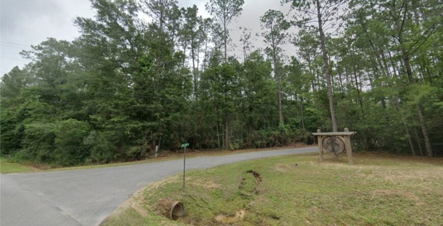
Shipman is little more than a cross and a name on the map, but the woods around it feel like the state’s green heart. Seclusion stems from big timber leases and sparse development—nothing to hurry to and no reason to cut through.
Expect a utilitarian charm: tractors fueling up, hand-painted signs, and trucks with mud still drying on the fenders. Walk sandy lanes listening for pine warblers, scout for chanterelles after summer rain, cast a farm pond (with permission), or linger at a barbecue trailer when the smoke is right.
Logging, fence crews, and a few cattle herds set the rhythm. When wind moves through loblolly crowns, it sounds like surf. Shipman is proof that quiet has texture.
Where is Shipman?
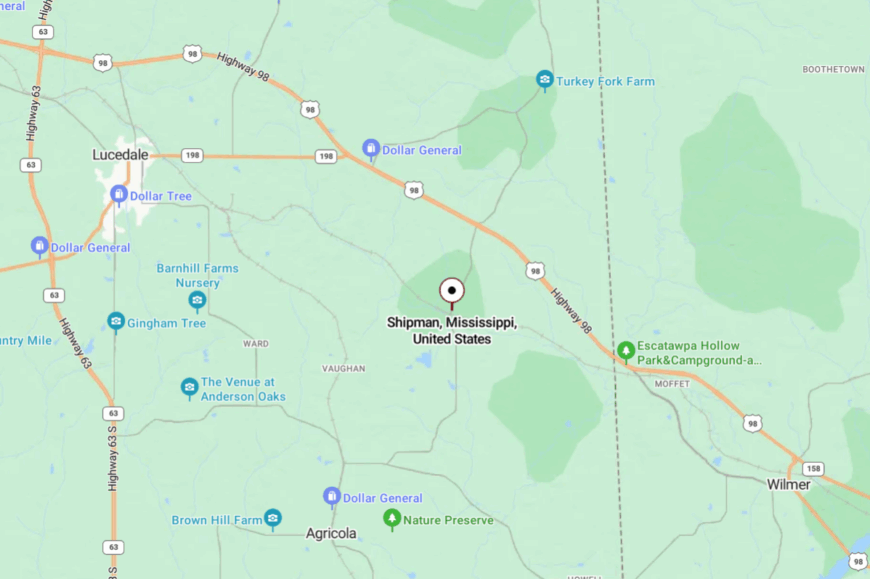
Central George County places Shipman west of Lucedale and north of Agricola, reached by spurs off MS-26 and MS-613.
Roads narrow from pavement to sand near the last turn. Pines on all sides make an honest windbreak. It’s easy to miss—and that’s part of the appeal.
19. Bexley, George County – Chalk Banks and Long Views

🔥 Would you like to save this?
Bexley sits along a gentle rise where fields fall away to the Pascagoula basin, horizons wider than most folks are used to. Its secluded feel comes from distance—miles between neighbors and no interstate for company.
The vibe is open and sunlit: big hay rolls, white egrets in ditches, and a sky that does its best work at dusk. Photograph chalky roadcuts glowing after rain, hunt arrowheads with landowner permission, watch kestrels ride fence lines, or follow a gravel loop that loops again.
Row crops and a few repair shops keep the lights on. After dark, constellations look close enough to tap. Bexley is quietly wrapped in daylight.
Where is Bexley?
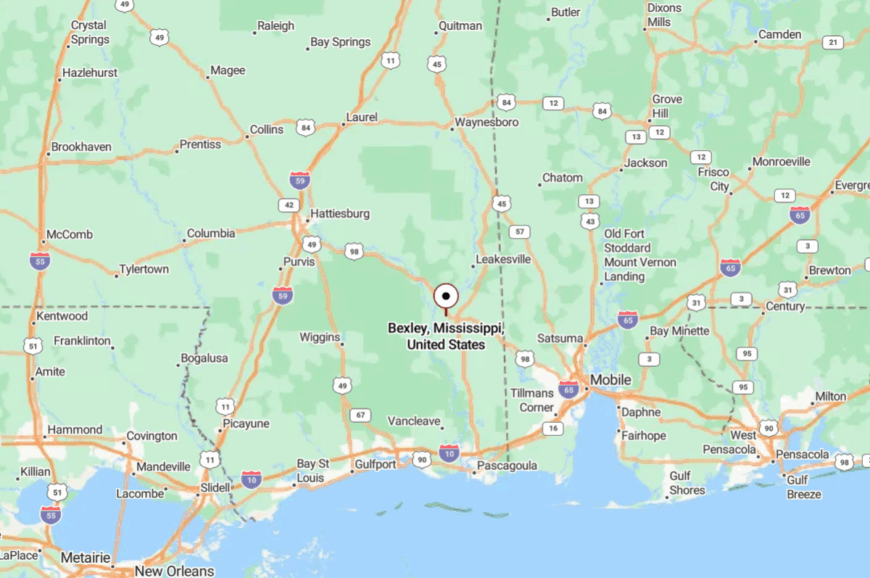
Eastern George County claims Bexley along MS-26, about 7 miles east of Lucedale and 10 miles from the Alabama line. The highway thins to two lanes, and the shoulders widen into pasture.
With timber and fields alternating, there’s little to draw a crowd. It’s a straight shot that still feels like a detour.
18. Leaf, Greene County – River Campfires and Rail-Road Whispers

Leaf clusters near the river that gave it a name, a scatter of houses, camps, and old store sites shaded by oaks. Seclusion is built in—bottomland on one side, pine flats on the other, and few reasons for strangers to wander in.
The mood is camp-chair casual: cookouts, trotlines, and stories that grow with the flames. Paddle a lazy reach of the Leaf, watch for otter slides, poke around a long-gone depot site, or scout deer sign along sandy ridges.
Timber jobs and weekend river camps share the calendar. Night settles soft as ash. Leaf is where the water decides the day.
Where is Leaf?
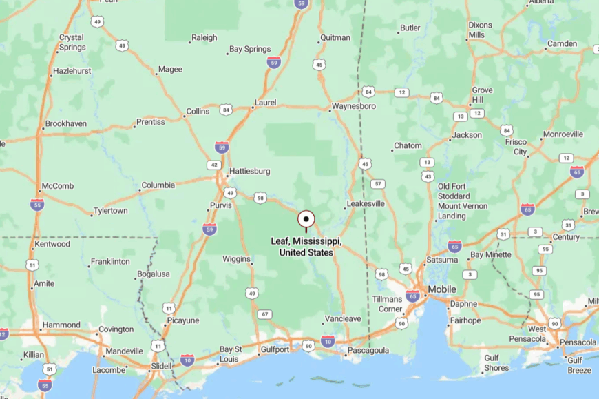
South-central Greene County holds Leaf between McLain and Leakesville, a couple of turns off US-98.
County roads dip into river lowlands and rise again, slowing every approach. Forest and floodplain hush the edges. It’s near the highway, yet far from highway noise.
17. Piave, Greene County – Sawmill Ghost and Sandhill Light
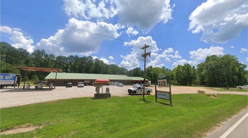
Piave wears its sawmill past lightly—street grids fading into wiregrass and a handful of homes tucked under longleaf. Its seclusion owes to retired rail spurs, pine company lands, and the way sandhills swallow sound.
Expect an airy, sun-washed vibe: red clay, pale grass, and woodsmoke on cold mornings. Walk old mill streets now claimed by quail, spot Bachman’s sparrows in spring, scan stump fields for fox squirrels, or photograph the last standing commissary wall.
Seasonal logging and hunting leases keep a modest pulse. When the wind slides over the grass, the whole place sighs. Piave is a bright quiet.
Where is Piave?
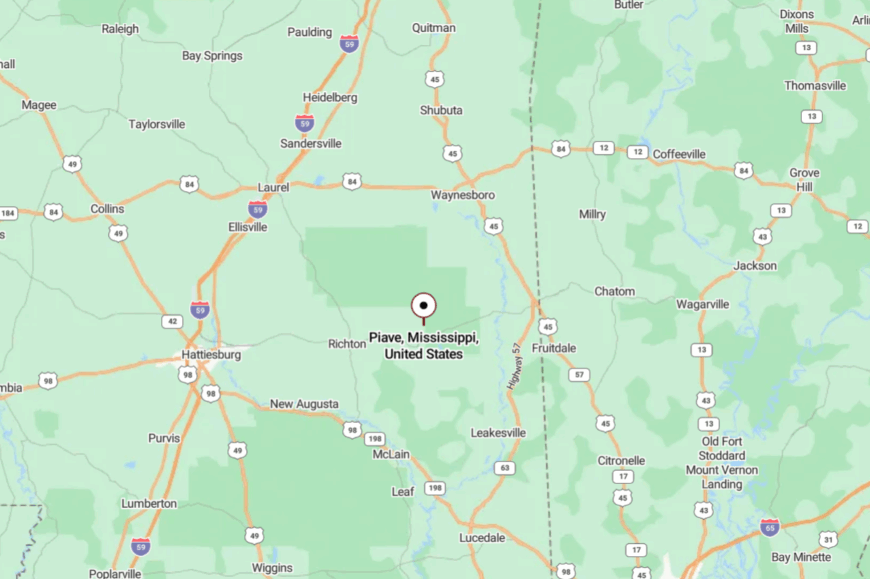
It sits in western Greene County, a few winding miles off MS-63, roughly 15 miles north of Lucedale. The final approach rolls over sandy ridges and into longleaf flats.
No fast route exists by design or by luck. It’s close by crow, distant by road.
16. McLain, Greene County – Bridge Town between Forests
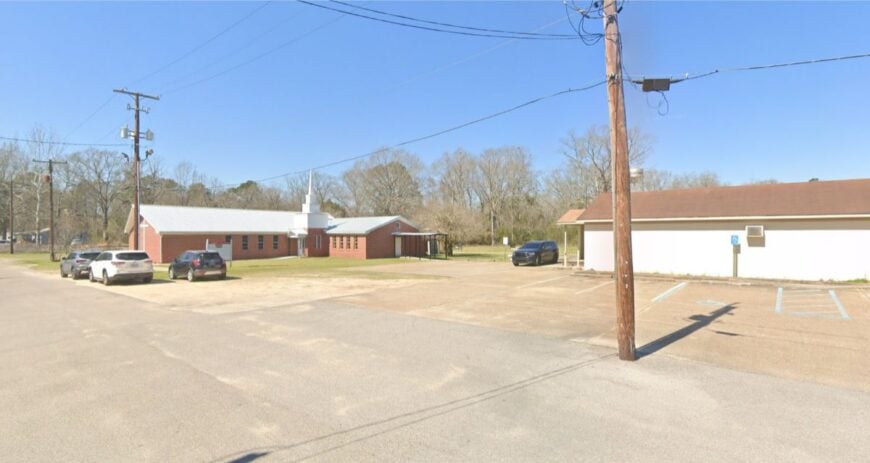
McLain straddles US-98 but lives at a slower speed, with porches facing the Leaf River and pines pressing close. Seclusion persists because big federal and private timberlands hem it in on three sides.
The vibe is small-town steady: café plates at lunch, Friday ballgames, and a depot memory in brick and paint. Drop a line at a quiet bank, wander to a sandbar after work, scan for swallow-tailed kites, or detour to De Soto National Forest trails ten minutes west.
Sawmills and service jobs share the week. At night, the river noise drowns any hint of the highway. McLain is a pause between forests.
Where is McLain?
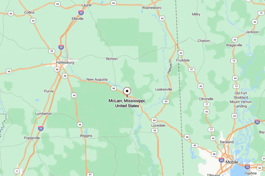
Southeast Mississippi places McLain midway between Hattiesburg and Mobile along US-98. The highway brings you in, but trees and water quickly take over the soundscape.
With creeks, flats, and tall timber, it feels pocketed from the corridor. It’s easy to reach, yet stubbornly serene.
15. Hintonville, Perry County – Railside Gardens and Red Clay

Hintonville is a handful of homesteads stretched along a former rail line, where tomatoes ripen on strings and the shop bell rings when it feels like it. Seclusion comes from back-road access and the pine breaks that block cross-traffic.
The vibe is practical and warm—front-yard figs, tractors sunning by sheds, and dogs dozing in tire-ruts. Walk the old rail bed at dusk, fish a stock pond (with permission), follow MS-42’s low hills for cycling, or swap garden starts at a Saturday stand.
Logging crews and small farms anchor the week. When the katydids start up, conversations get shorter and smiles get wider. Hintonville is a country with a capital C.
Where is Hintonville?

South of Richton in western Perry County, Hintonville hides a mile or two off MS-42. Narrow county lanes fold through pine and pasture before the first mailbox appears. With no big road nearby, sound travels as birdsong. It’s a small detour that lands far away.
14. Mahned, Perry County – River Bluff and an Old Iron Bridge
Mahned rests on high ground above the Leaf, its name whispered by an iron truss bridge and a churchyard that keeps the years. Seclusion is a mix of blufftop woods, private gates, and the river’s easy moat.
The feel is quietly historic: family cemeteries, fence posts gone silver, and sandbars that remember every flood. Photograph the century-old bridge, launch a sandbar picnic, scout deer trails along the ridge, or listen for barred owls as night comes on.
Work nearby is timber, fence crews, and a little hunting lease income. Twilight turns the bridge to silhouette and the river to ink. Mahned is memory with a view.
Where is Mahned?

Southeastern Perry County holds Mahned downriver from Richton, a few curving miles off MS-42. The last stretch slips through tall pines to a bluff above the Leaf. Water and woods keep it naturally private. It’s close enough for an evening drive, far enough to hush your phone.
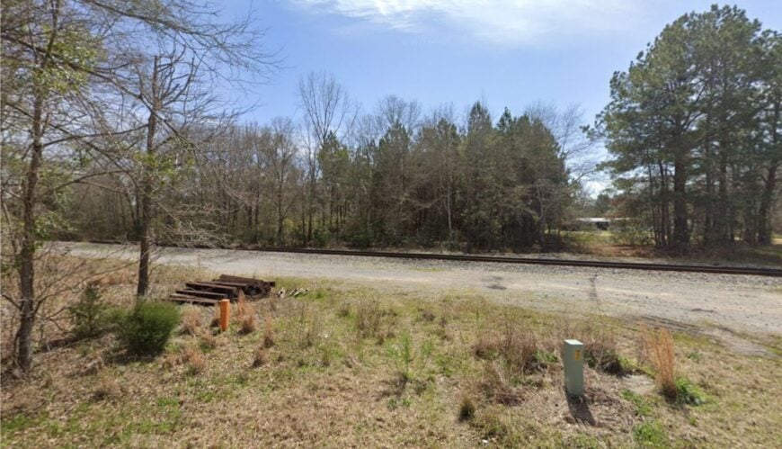
13. Beaumont, Perry County – Cypress Shadows on a Two-Lane

🔥 Would you like to save this?
Beaumont is a small grid tucked between cypress bottom and pine uplands, a place that still waves at every truck. Its seclusion lingers despite US-98 nearby because creeks, timber, and wide parcels buffer the bustle.
The mood is friendly and unpretentious: ballfields, café breakfasts, and porch plants under tin awnings. Walk to the creek at first light, hunt fossils in sandy cutbanks, browse a church bake sale, or bike a flat loop that smells like sun-warmed pine.
Sawmills, small shops, and school runs keep time. When the evening train blows far off, it sounds like a story starting. Beaumont is a calm bend in the road.
Where is Beaumont?
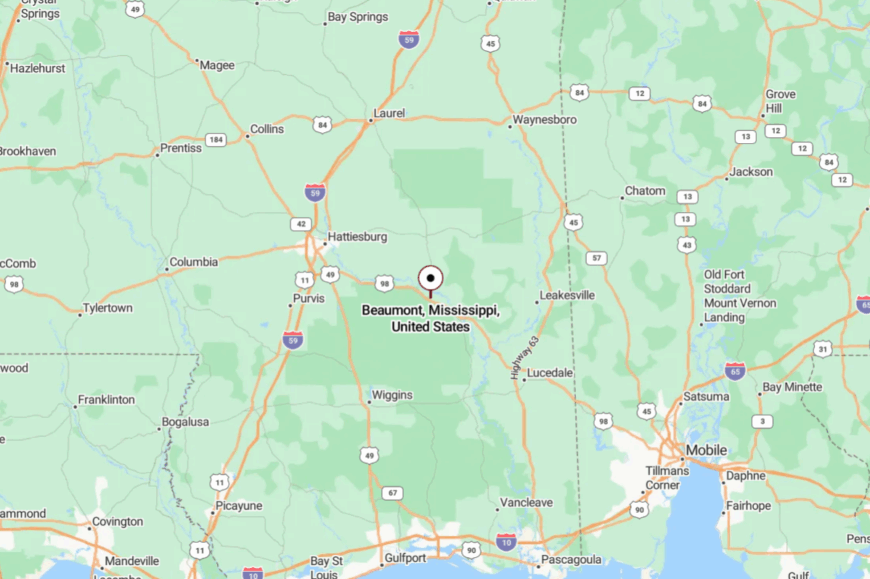
Eastern Perry County sets Beaumont along US-98, about 25 miles east of Hattiesburg and 25 miles west of Lucedale. Two-lane approaches pass pine and pasture with few billboards for company.
Cypress sloughs and timber tracts mute the corridor’s noise. It’s easy to access and easier to slow down.
12. Perkinston, Stone County – Big Pines and a College on the Hill

Perkinston blends longleaf forest with a tiny campus and a few streets where the shade is generous. Seclusion stems from big parcels, timber all around, and US-49 sliding by without much reason to exit.
The vibe is pine-sweet and steady—church bells, student guitars on porches, and cicadas sawing the afternoon thin. Hike fire lanes for wildflowers, paddle Wolf River down the road, explore old turpentine scars, or catch a small-town ballgame before sunset.
Forestry, the local college, and farm work share the ledger. Night brings a sky rimmed in treetops. Perkinston is a clear breath between the coast and the pine belt.
Where is Perkinston?

Northern Stone County holds Perkinston on US-49, about 12 miles south of Wiggins and 30 miles north of Gulfport. The highway makes it reachable, but the forest on all sides keeps it tucked in.
Side roads turn to sand within minutes. It’s on the way to everywhere and content to be nowhere fast.
11. McHenry, Stone County – Old Sawdust Town with River Light
McHenry rides a low ridge above the Wolf River’s clear runs, a remnant sawmill town that swapped steam whistles for birdsong. Its tucked-away feel comes from longleaf flats, sand roads, and a pattern of dead-end lanes that lead to water more often than traffic.
The vibe is sun-bleached and easy: shuttered depots, front-yard swings, and the smell of resin after heat. Wade the Wolf River on a summer afternoon, hunt fossils in shallow runs, cycle quiet loops into the pine, or nosh at a weekend barbecue pop-up.
Timber work and trades keep most folks busy. When dusk drapes the sandbars, the river keeps just enough light to walk by. McHenry is what slow looks like on a map.
Where is McHenry?
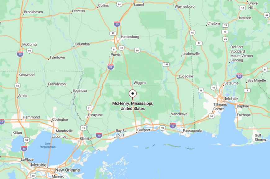
South-central Stone County places McHenry along US-49, roughly 10 miles south of Wiggins and 35 miles north of Gulfport. Turnoffs drop quickly from highway pace to sand-road amble.
Wolf River sloughs and timber lots hem it in neatly. It’s close to the coast, but it feels a world inland.
10. Benndale, George County – Pine Barrens Hideaway
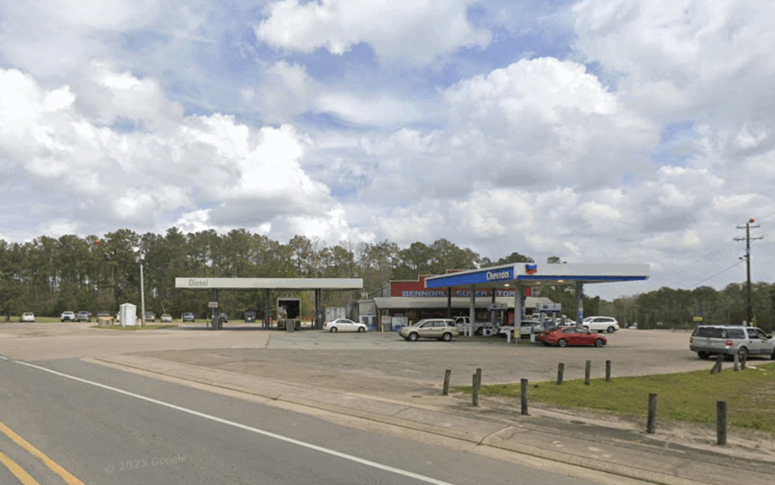
Roughly 1,100 residents call Benndale home, most of them scattered along sandy lanes that wind through longleaf pines. Weekends bring locals to nearby Red Creek for kayak floats, while hunters slip into De Soto National Forest at first light.
Small sawmills and tree farms provide steady work, though many households still keep backyard gardens and a few hens. Seclusion thrives here because one-acre lots are the norm, and dense pine stands act as living privacy fences between neighbors.
After sunset, the absence of city glare turns the sky into a planetarium, perfect for stargazing from a back porch swing. A little country store beside the volunteer fire station doubles as the town’s informal news hub, yet closes by dusk, leaving evenings wrapped in quiet.
Where is Benndale?
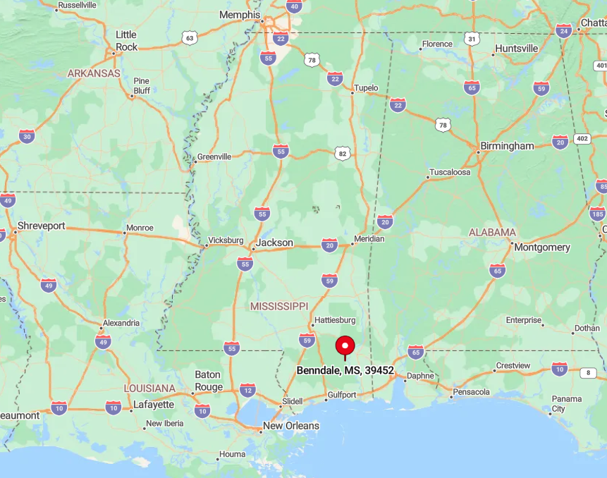
Benndale sits in southern George County, about 35 miles north of the Gulf Coast and well off the four-lane of Highway 98. Forest on three sides and private timberland on the fourth keep the settlement tucked away from through-traffic.
The simplest route is a turn onto Benndale Road from MS-57, then a ten-mile drive that feels like a tunnel of pines. Cell service fades in patches, a reminder that this pocket of Mississippi still moves at its own unhurried pace.
9. Ovett, Jones County – Creek-Side Seclusion
With an estimated population near 400, Ovett hugs the bends of Tallahala Creek where cane thickets hide blue herons and wood ducks. Anglers cast for bream under the Highway 15 bridge, and locals gather at the volunteer fire department for monthly fish fries.
Timber cutting and small cattle operations anchor the local economy, supplemented by jobs in nearby pulpwood yards. Twenty miles of pasture and pine separate Ovett from the bustle of Hattiesburg, allowing crickets and frogs to handle the nightly soundtrack.
Homes often sit on five- or ten-acre parcels, giving families room for horses, gardens, and the occasional goat. The old depot, now a community hall, hosts bluegrass pickin’ sessions that drift across the creek on cool evenings.
Where is Ovett?

🔥 Would you like to save this?
Found in southeast Jones County, Ovett lies just east of US Highway 15 yet remains invisible until drivers turn onto Ovett-Moselle Road. Thick forest buffers the town from highway noise, and Tallahala Creek forms a natural barrier to expansion.
Visitors coming from Hattiesburg head north on I-59, exit at Ellisville, then follow county roads that narrow with every mile. That shrinking pavement is the best clue that you are closing in on true quiet.
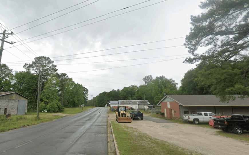
8. Neely, Greene County – Hill-Ringed Hamlet

Neely’s roughly 350 residents share a landscape of rolling hills where farmhouses perch above misty hollows. Outdoor fun centers on rabbit hunting along Gashed Creek and spring crawfish boils under the old live oaks at the community center.
Agriculture, mainly beef cattle and hay, pairs with seasonal logging jobs to keep the local economy turning. Tree-covered ridges on every horizon mute the sound of the distant highway, giving each holler its own private stillness.
Evenings bring whip-poor-will calls that carry farther than any engine noise. A hand-painted “Fresh Honey” sign on Neely-Avera Road leads to an honor-system stand known only to folks willing to explore the back roads.
Where is Neely?
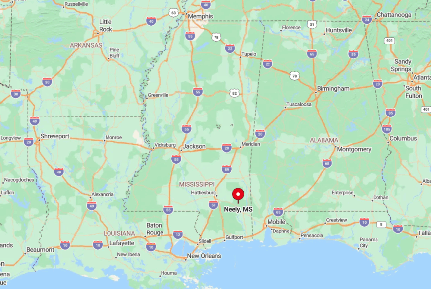
Neely sits in northern Greene County along State Route 63, yet is hidden by steep, wooded slopes that rise quickly from the asphalt. The town center amounts to a crossroads store and a post office set a mile from the highway, reducing casual pass-through traffic.
Drivers from Mobile take Highway 98 east, then turn north onto 63 for twenty quiet miles before catching the small green sign that points to Neely. Those last few bends reveal why the place feels miles deeper in the country than the map suggests.
7. Runnelstown, Forrest County – Pastoral Patchwork
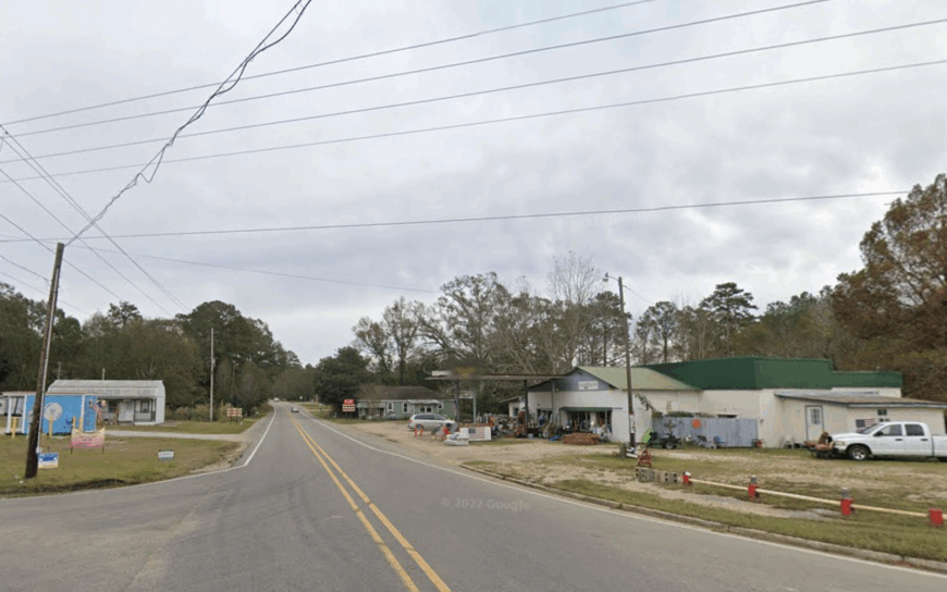
About 425 people reside in Runnelstown, where one-lane roads weave among cattle pastures, hay meadows, and pecan groves.
Residents frequent Black Creek for cane-pole fishing, while birders stroll the old rail bed that parallels U.S. 98. Beef operations and feed-store jobs dominate employment, though a handful of folks commute to Hattiesburg’s medical centers.
Fifteen miles of farmland and no streetlights keep nights remarkably dark, and live-oak windbreaks shield homesteads from neighbors’ porch lights. The community’s small size means potluck suppers at the Baptist church serve as both entertainment and social calendar.
A retired welder runs a weekend knife forge behind his barn, turning out blades prized by area hunters but unknown beyond county lines.
Where is Runnelstown?
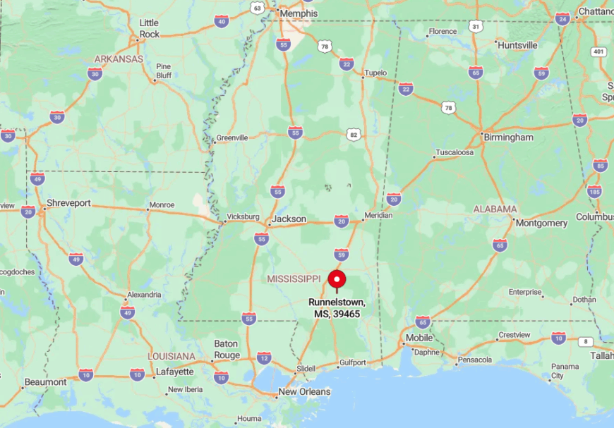
Located east of Hattiesburg on Mississippi 42, Runnelstown hides behind a curtain of livestock gates and round hay bales. No interstate or rail stop passes close, so only locals and lost travelers find themselves on its narrow lanes.
Visitors leave four-lane Highway 49, then wind through pine stands for twenty minutes before farm fences announce arrival. GPS coverage flickers, which is part of the charm for those seeking a pause from technology.
6. Janice, Perry County – Forest-Guarded Refuge

Janice has barely 150 residents, most living in cabins or hobby farms carved out of De Soto National Forest. Daylight hours invite horseback rides along the Bethel Bike Trail and mushroom foraging after spring rains.
A small fire cache and seasonal forestry crews form the bulk of local employment, with occasional income from guiding turkey hunters. Towering loblolly stands surround each home, absorbing road noise and screening out passersby.
Night choruses belong to barred owls rather than traffic, and stars spill across the sky without interference. Locals swap produce and venison at a produce shed that operates by the honor system three days a week.
Where is Janice?
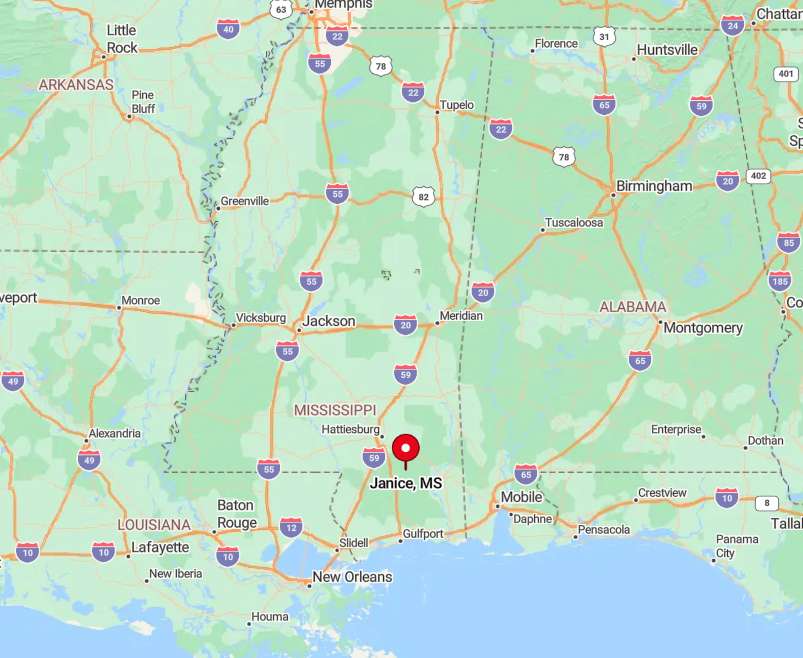
Janice lies in northwest Perry County, reached by a spur off Highway 29 that dead-ends into the national forest. The settlement is enveloped on all sides by federal land, leaving no room for sprawl and discouraging random visitors.
The nearest gas station sits twelve miles south in New Augusta, so travelers top off their tanks before venturing in. Low-traffic forest roads make the journey feel like a step back in time.
5. Agricola, George County – Fields Beyond the Freeway
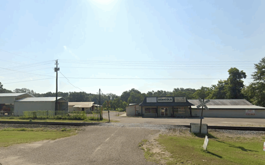
Close to 750 residents dot the open plains of Agricola, where soybean swaths and century-old barns stretch toward distant pine lines. Locals cheer for Little League games at the lighted community field, and fall brings Saturday-morning swaps at the tractor shed.
Farming and a nearby poultry plant anchor the economy, with many families managing both row crops and backyard gardens. The town is safely distant from four-lane Highway 98, so engine noise gives way to cicadas humming over the fields.
Parcel sizes often exceed ten acres, ensuring wide vistas and privacy gates at the end of long gravel drives. A hidden perk is the abandoned farm tramway that rail enthusiasts photograph, though it never appears in tourist brochures.
Where is Agricola?

Agricola rests in southern George County, eight miles south of Lucedale and a good detour off Highway 613. Because no major corridor cuts through, the fields stay undisturbed by travelers headed to the coast.
Reaching the town requires a patchwork of county roads that narrow from asphalt to gravel in the final mile. That last stretch past rust-red grain silos signals arrival in a place insulated by farmland.
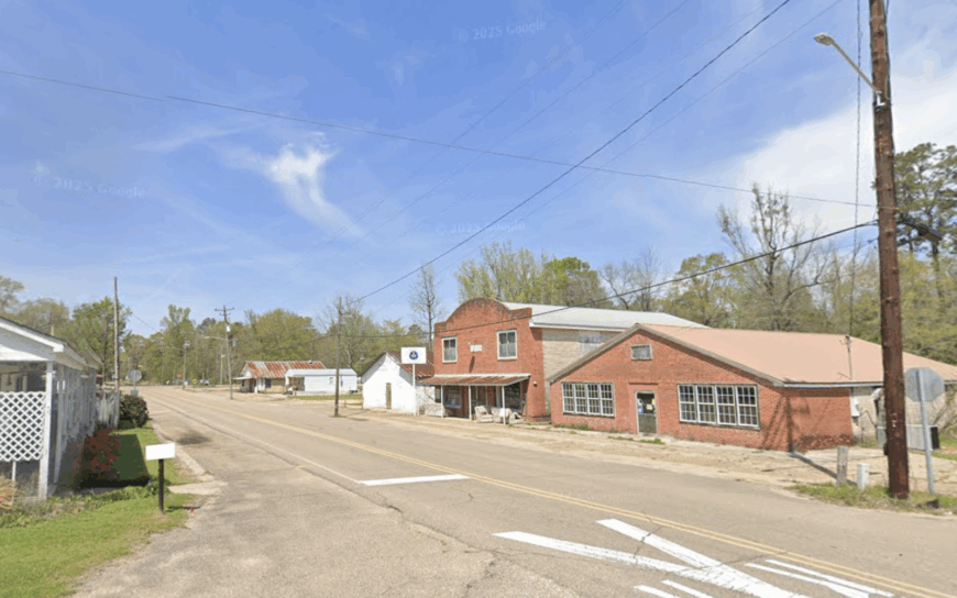
4. Vernal, Greene County – Hidden High-Ground

About 200 people inhabit Vernal, their homes placed on elevated lots that rise above surrounding wetlands. Outdoor recreation centers on deer blinds set along pine ridges and spring paddles on Big Creek’s clear water. Employment is a mix of logging, small cattle herds, and seasonal work at a nearby catfish hatchery.
Because ridges block lines of sight to neighboring towns and highways, Vernal remains virtually invisible until visitors crest the final hill. Quiet reigns after dusk, when wind sifts through pine needles and coyotes call from the flats below.
A century-old Methodist church hosts shape-note singings that draw enthusiasts from three states but barely dent local traffic.
Where is Vernal?
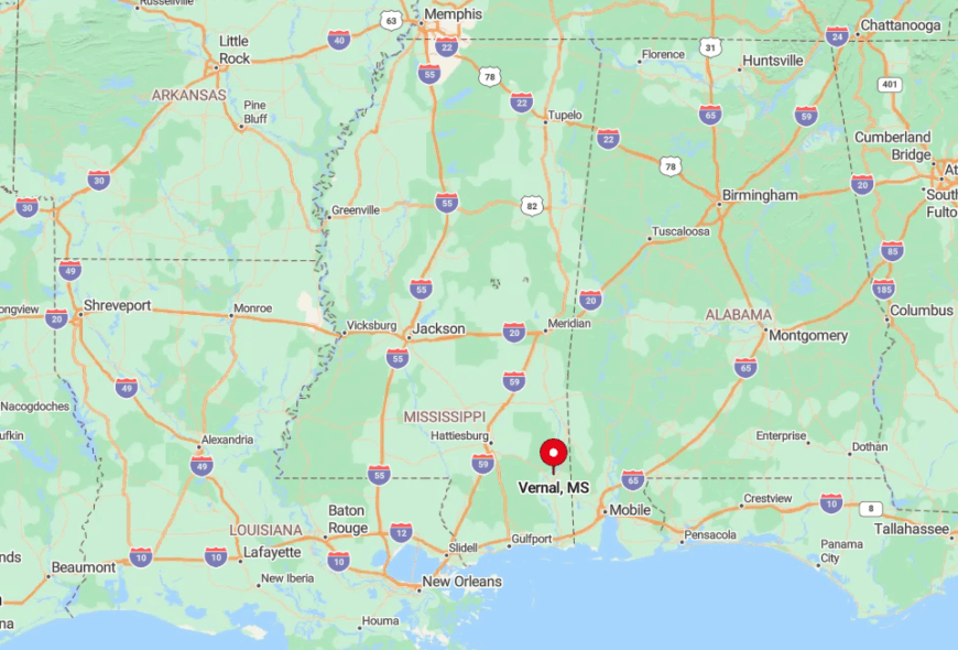
Vernal stands in east-central Greene County at the terminus of State Route 57 Spur, creating a true end-of-the-road setting. Surrounding pine ridges shield the settlement from both Highway 57 noise and casual motorists.
Travelers from Mobile exit I-65 at Citronelle, then cross the state line on back roads that twist through timber tracts. Those final miles climb steadily, revealing why the community sits like an island of high ground amid endless forest.
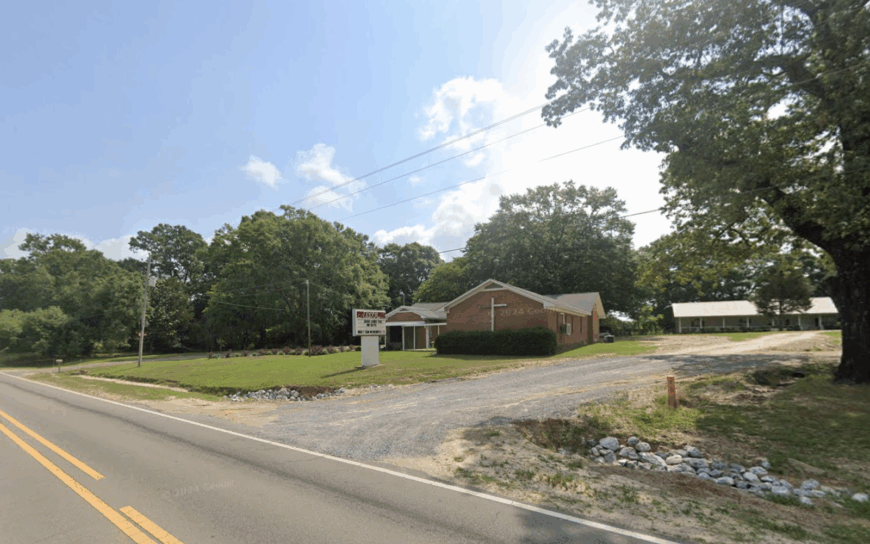
3. Brooklyn, Forrest County – Black Creek Retreat
Brooklyn’s population hovers near 500, many living in stilted cabins or low-slung ranch homes along Black Creek’s sandy banks. The creek, designated a National Wild and Scenic River, lures canoeists, anglers, and summer swimmers to shaded sandbars.
Local jobs revolve around seasonal outfitter businesses, small sawmills, and a longstanding catfish café that fries up weekend suppers. Traffic is scarce because most roads end at private landings, and towering cypress knees hamper any hint of development.
Evenings echo with tree frogs, and streetlights are so few that boaters often use the North Star to guide late-night paddles. A short, unmarked trail behind the post office leads to a rare stand of native Florida anise, scented like licorice after a rain.
Where is Brooklyn?
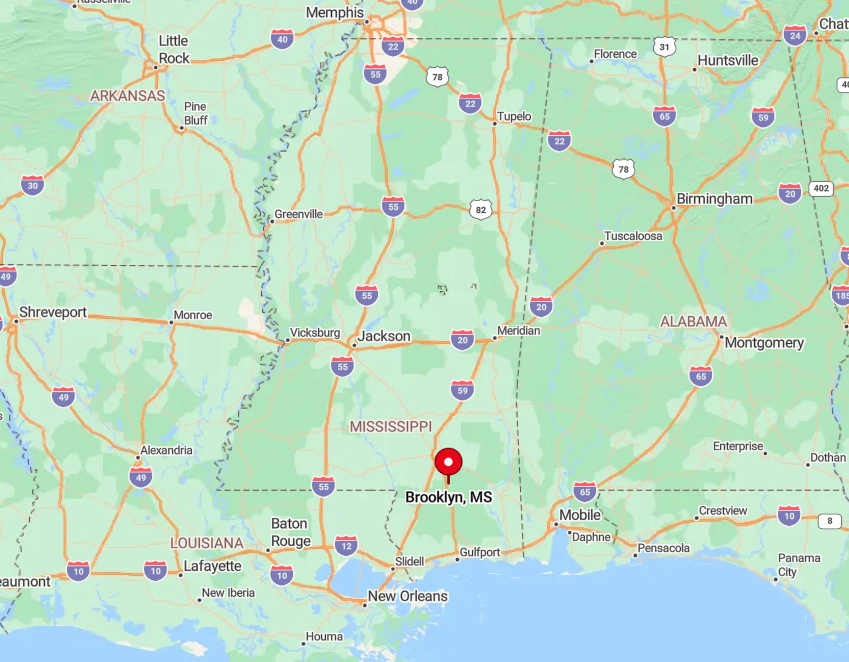
Brooklyn nestles in south-central Forrest County, accessible by Old Highway 49 after a twenty-minute drive south from Hattiesburg. Black Creek meanders in wide oxbows around the community, limiting road connections to a pair of small bridges.
Visitors usually launch canoes upstream at Brooklyn Landing, then drift six miles through wilderness before pulling out near the old railroad trestle. That watery approach underscores the area’s isolation even more than the quiet roads.
2. Avera, Greene County – Oak-Lined Lanes
Avera counts roughly 190 residents, their homes reachable by gravel lanes that tunnel under arching live oaks. Days off find locals tending muscadine vines or driving north to Leaf River Wildlife Management Area for squirrel season.
Logging crews and a family-run veneer mill supply most paychecks, while roadside vegetable stands fill freezers each summer. Thirty miles separate Avera from the nearest shopping district, and spotty cell coverage lets crickets claim center stage at night.
Five-acre spreads are common, each fenced with split cedar and guarded by a pair of dogs who know every passing truck. A forgotten Civil War earthwork sits on private land behind the Baptist church, visited only with a nod from the property owner.
Where is Avera?
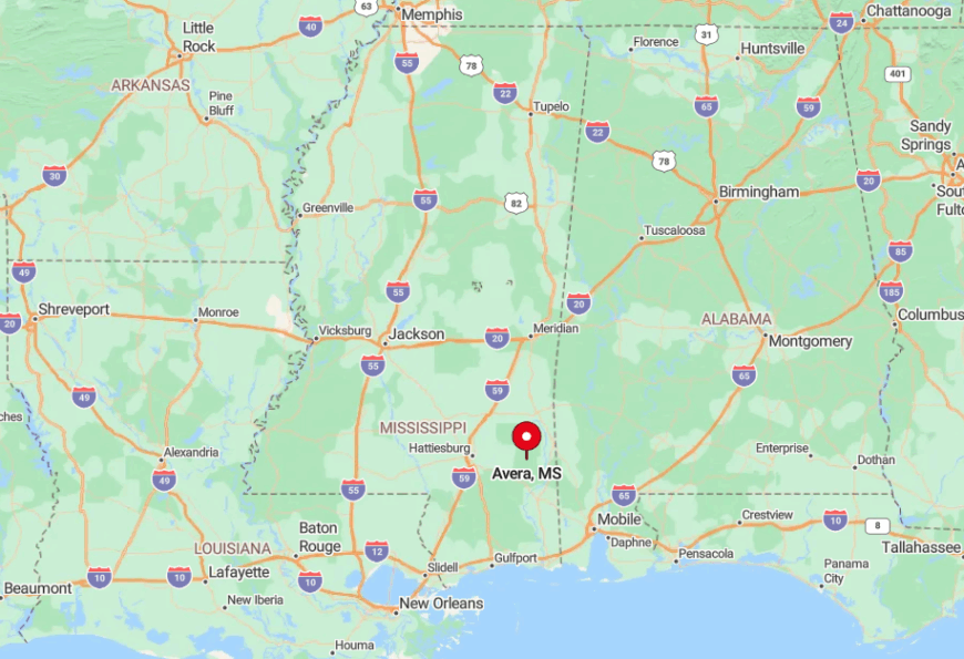
Avera lies in northwest Greene County, reached by County Road 20 that branches off State Route 63 with no gas stations for the next eighteen miles. Thick oak canopies and a lack of signage hide the town from travelers barreling between Lucedale and Waynesboro.
Drivers wind through two single-lane bridges and a final unpaved stretch before mailboxes appear. That transition from pavement to gravel signals an entry into slower living.
1. Carnes, Forrest County – Quiet Quail Country

Home to almost 600 people, Carnes spreads across rolling fields prized by quail hunters and dotted with distant farmsteads. Residents enjoy Saturday morning clay shoots at the sportsman club and evening fish fries beside Camp Branch Lake.
Farming, game-bird production, and a small feed mill shape the modest economy, while many families still plant rows of peas purely for tradition. Half the surrounding land remains undeveloped forest, keeping traffic minimal and allowing bobwhite whistles to outnumber passing cars.
Farms commonly exceed twenty acres, granting sightlines that roll unbroken to the horizon. Hidden among loblolly stands is an abandoned fire tower that, with the ranger’s permission, offers a view stretching clear to the Pascagoula swamps on cloudless days.
Where is Carnes?

Carnes occupies northern Forrest County at the junction of State Routes 13 and 26, yet dense timber and scattered fields conceal it from motorists until the final mile. No interstate runs nearby, and freight trains bypass the area altogether.
Travelers from Gulfport drive fifty miles north on Highway 49, then cut west on a two-lane road that sheds cell service halfway through. Once the pavement dips between quail fields, the stillness confirms arrival in one of Mississippi’s quietest corners.


