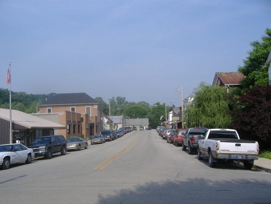
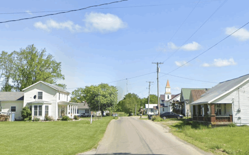
Southeastern Indiana looks ordinary on the map, a wedge of farmland and river country pressed between Cincinnati and Louisville. Drive it slowly, though, and a different pattern emerges. Roads bend with the ridges, creeks cut into limestone, and towns appear in the valleys like afterthoughts—quiet, self-contained, and often overlooked.
In order to come up with the very specific design ideas, we create most designs with the assistance of state-of-the-art AI interior design software. Also, assume links that take you off the site are affiliate links such as links to Amazon. this means we may earn a commission if you buy something.
These communities aren’t preserved for visitors or marked with signs along the interstate. They exist because families stayed, because farming ground held value, because a bridge or rail line made them viable once and habit carried them forward. Their scale is small enough that the loudest moment in a week might be a church supper or a high school game.
Geography does most of the work. The Ohio River hems in places like Patriot and Lamb, the Whitewater Valley tucks Metamora into its canal corridor, and wooded ridges keep Canaan or Cross Plains at arm’s length from anything resembling a city. Isolation isn’t a pose; it’s the natural outcome of where these towns ended up.
This list brings together 25 secluded towns that show how seclusion still shapes daily life. They’re not museum pieces or tourist stops. They’re lived-in places, steady in their rhythms, set apart by the bends of the land and the decisions of people who chose to remain.
25. New Alsace – A Ridge-Top Hamlet with German Roots
New Alsace rests among rolling farmland and wooded hills, hidden far from major highways and the constant pull of modern noise. The air carries the sound of church bells drifting across fields, while neighbors linger on porches as if time has no reason to rush.
Dirt lanes wind past weathered barns, and the faint scent of hay lingers in the breeze, giving every walk the feeling of stepping back a generation. Visitors find quiet joy in exploring the historic church, browsing the shelves of the old general store, or wandering into forest trails and fishing spots along gentle creeks.
Farming remains the anchor of life here, shaping both its economy and its unhurried rhythm. It’s the kind of place that reminds you how peaceful the world can still be when it chooses to remain tucked away.
Where is New Alsace?
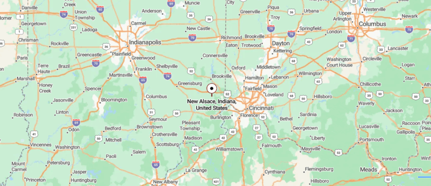
New Alsace lies in the southeastern corner of Indiana within Dearborn County, set just a short distance from the Ohio border. The town sits about 35 miles west of Cincinnati, reached by following U.S. Route 52 before turning onto winding county roads that cut through farmland and woodland.
The shift from highway to narrow backroads makes the journey itself part of the seclusion. It’s a quiet pocket that feels removed, even while the city remains within easy reach.
24. New Trenton – A River Bend Community Sheltered by Bluffs
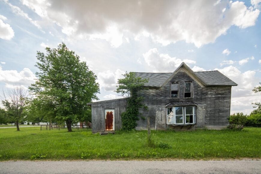
New Trenton lies hidden along a winding stretch of the Whitewater River, where steep hills and shaded woods create a feeling of being worlds away. The town’s center holds an old-fashioned charm, with brick storefronts and church steeples that seem untouched by time.
Life moves quietly here, measured by river breezes and the echo of footsteps on weathered sidewalks. Visitors can explore the covered bridge nearby, cast a line into the river, or take scenic drives that reveal rolling valleys and tucked-away cabins.
Local gatherings, from small-town parades to seasonal festivals, give it a sense of closeness that outsiders rarely get to see. It’s the sort of place that lingers in memory, not for what happens there, but for how still and rooted it makes you feel.
Where is New Trenton?
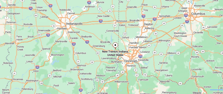
New Trenton rests in the Whitewater River Valley of southeastern Indiana, near the Ohio state line. It’s about 35 miles northwest of Cincinnati, reached by U.S. Route 52 before narrowing into river-hugging roads that wind through low hills.
The trip follows the curve of the valley, where the water and woods quiet the pace of travel. By the time you arrive, it feels as if the river has carried you somewhere apart from the world beyond.
23. Guilford – Covered Bridge and Creekside Quiet
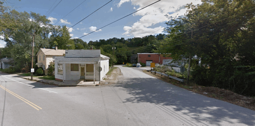
Guilford sits quietly in a wooded valley where narrow roads wind past creeks and ridges, making it feel cut off from the wider world. The town is best known for the Guilford Covered Bridge, a 19th-century landmark restored to carry foot traffic and local lore across Tanners Creek, adding a sense of timeless character to the landscape.
Days move at an easy pace, with the sound of rushing water and birdsong carrying farther than traffic ever does. Visitors often find themselves walking the covered bridge, picnicking by the riverbanks, or exploring the backroads that reveal century-old homes tucked into the hills.
Community gatherings, whether at the town park or along Main Street, give Guilford a spirit of togetherness that is as enduring as its history. It’s the kind of place that draws you in gently, reminding you how beauty often hides in the smallest, most untraveled corners.
Where is Guilford?
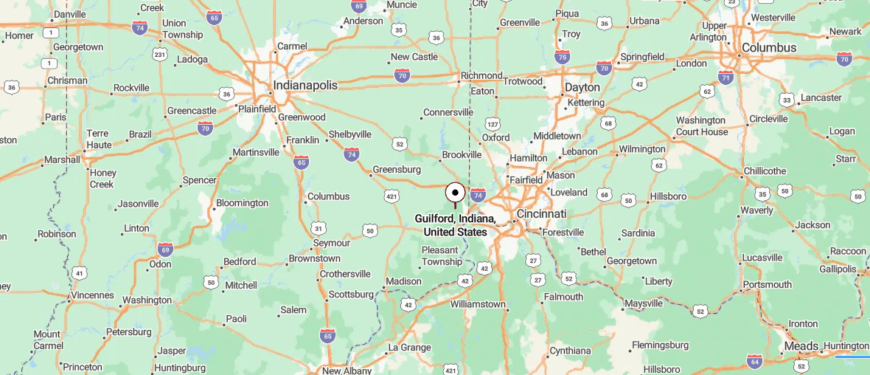
Guilford sits in the rolling countryside of Dearborn County, tucked into Indiana’s far southeast corner. It lies roughly 30 miles west of Cincinnati, reached along State Road 1 before smaller roads branch into wooded ridges and farm fields.
The approach winds gently, trading speed for scenery as the terrain grows more rural. By the time you arrive, the quiet hills feel like a natural barrier from the outside world.
22. Sunman – Fields and Silence Beyond the Rail Line
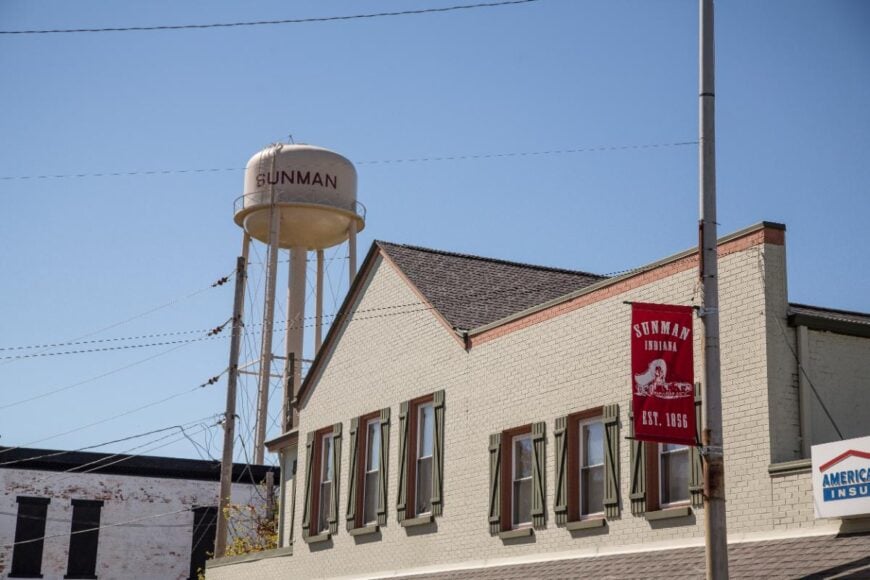
Sunman rests in a landscape of rolling fields and tree-lined ridges, set far enough from busy highways that it feels like its own hidden pocket of Indiana. The town carries a sense of old-world rhythm, with a main street dotted by small shops, a historic church steeple, and neighbors who still greet one another by name.
Afternoons here might be spent wandering a nearby nature trail, visiting a local winery, or joining in at a community fair where music and food bring everyone together. The pace is unhurried, and the days often seem marked more by the change of seasons than by the clock.
There’s a quiet charm in watching sunlight stretch over the fields as evening settles in, as if time itself has slowed to match the town’s calm. Sunman stays with you not for its noise or bustle, but for the way it reminds you that stillness can be a kind of treasure.
Where is Sunman?
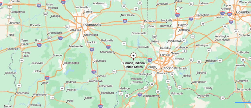
Sunman lies in northern Dearborn County, placing it between the larger towns of Batesville and Lawrenceburg in southeastern Indiana. It sits about 76 miles from Indianapolis and 45 miles from Cincinnati, accessible by I-74 before you turn onto local roads that slip past stretches of farmland.
The highway fades quickly into a landscape of fields and clusters of trees, giving the sense that the town is tucked away from the main routes. It’s a setting where distance feels measured less in miles than in the calm that settles around you.
21. Milan – The Quiet Legacy of a Basketball Miracle
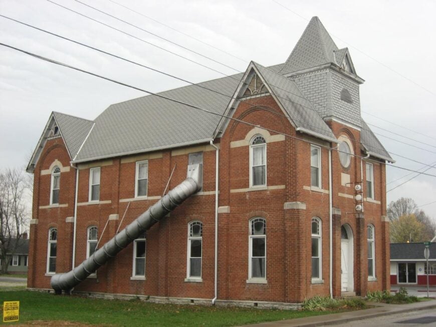
Milan is tucked into the gentle hills of southeastern Indiana, a place where history and quiet landscapes blend to create its secluded feel. The town is remembered for its legendary 1954 high school basketball victory, and echoes of that story still linger in the local museum and conversations at corner cafés.
Life unfolds at a measured pace, with evenings marked by the sound of crickets and the glow of porch lights across quiet streets. Visitors can wander through the small downtown, stop by antique shops, or follow backroads that wind past lakes and wooded trails.
Local festivals and high school games continue to serve as touchstones of community spirit, keeping neighbors closely connected. It’s the kind of town where memory feels alive in the present, and where the stillness carries the weight of both pride and belonging.
Where is Milan?
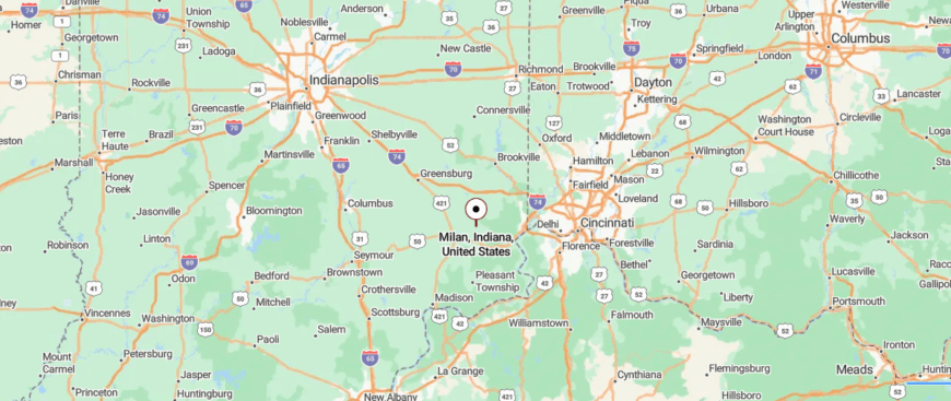
Milan rests in Ripley County, in the southeastern part of Indiana, surrounded by farmland and small wooded valleys. The town is about 50 miles west of Cincinnati and 70 miles southeast of Indianapolis, reached most directly by State Road 101 after leaving U.S. 50.
The drive carries you past quiet fields and country stretches where the horizon feels wide and unhurried. By the time you reach Milan, the stillness makes it feel like a place apart, shaped by its own rhythm.
20. Versailles – Courthouse Square Among Still Woods
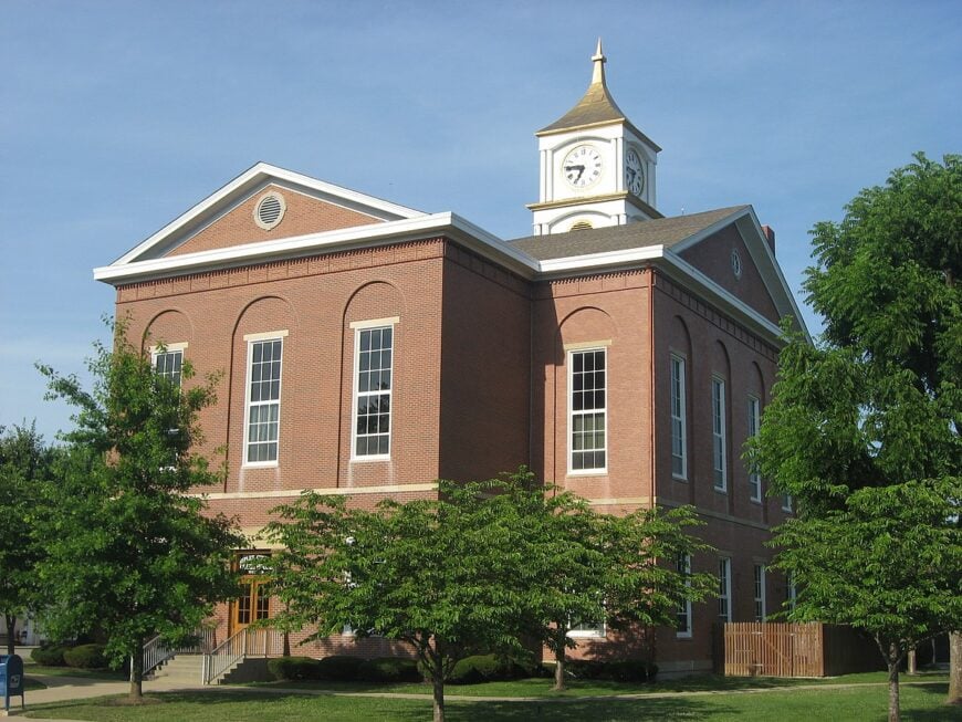
Versailles rests along the edge of a state park, where dense woods and a sprawling lake surround the town like a natural shield from the outside world. The streets are lined with historic brick buildings and quiet storefronts, giving it the feel of a place that hasn’t hurried to keep up with modern pace.
Trails through Versailles State Park lead to hidden waterfalls, shaded forests, and calm waters where kayaks and fishing boats drift without disturbance. In town, a courthouse square anchors community life, while small diners and seasonal events add a thread of warmth and familiarity.
The atmosphere is hushed, shaped more by birdsong and rustling leaves than the sound of traffic. It’s the sort of town that makes you pause and breathe deeper, as if reminding you that stillness is its own kind of wealth.
Where is Versailles?
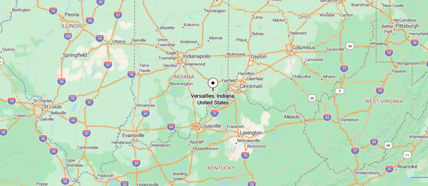
Versailles anchors the heart of Ripley County in southeastern Indiana, where the land folds into gentle hills and a wide state park borders its edge. It’s about 65 miles west of Cincinnati and 70 miles southeast of Indianapolis, reached by U.S. 50 before turning onto town streets shaded by old trees.
The route shifts from broad highway into slower roads that seem to guide you into a different pace of life. Surrounded by woods and water, Versailles feels both central and hidden, a place where quiet lingers.
19. Osgood – Grain Silos and Garden Plots
🔥 Would you like to save this?
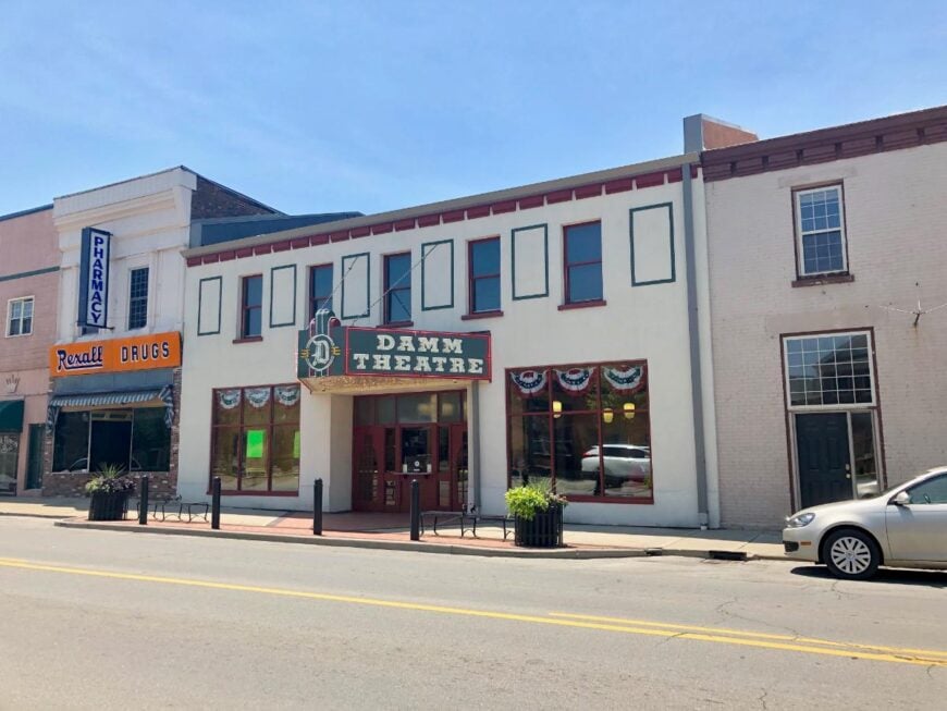
Osgood feels like a town folded into the heart of Indiana countryside, where train tracks and quiet streets stretch across open land with little intrusion from the outside world. Its rhythm is unhurried, carried by the sound of passing locomotives and the hum of cicadas on summer evenings.
The centerpiece is the town square, where the Bilby steel survey tower and surrounding shops create a gathering place that has barely changed in decades. Visitors often stop at the Osgood Historical Museum, stroll the shaded park paths, or take part in small-town festivals that bring music and food to the streets.
There’s a sense of permanence here, as though Osgood has chosen to hold on to a slower, steadier way of life. It’s the kind of place that makes you realize how comforting familiarity can be when the world beyond is always shifting.
Where is Osgood?
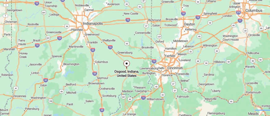
Osgood sits near the center of Ripley County in southeastern Indiana, surrounded by farmland and intersecting rail lines that hint at its small-town roots. It lies about 65 miles west of Cincinnati and can be reached by following U.S. 421 before easing onto local streets.
The drive carries you steadily from larger highways into a quieter grid of roads bordered by open fields. Once there, the wide skies and unbroken horizon make the town feel quietly removed from everything else.
18. Napoleon – A One-Light Stop with Deep Roots
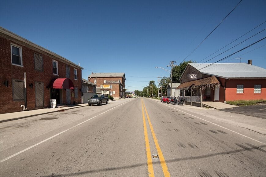
Napoleon sits quietly at a rural crossroads, a small cluster of homes and old storefronts that feels worlds away from the rush of nearby cities. The town carries a sense of deep-rooted history, with its brick buildings and church steeple standing as reminders of the generations who built their lives here.
Life moves with a steady calm, marked more by the turning of the seasons than by the ticking of clocks. Visitors might explore the surrounding backroads, stop for a meal at a local diner, or pause to admire the simple architecture that has endured for well over a century.
Conversations still happen on front porches, and the quiet evenings often stretch long under star-filled skies. Napoleon holds onto a rare stillness, the kind that makes you feel as though you’ve stepped into a gentler time.
Where is Napoleon?
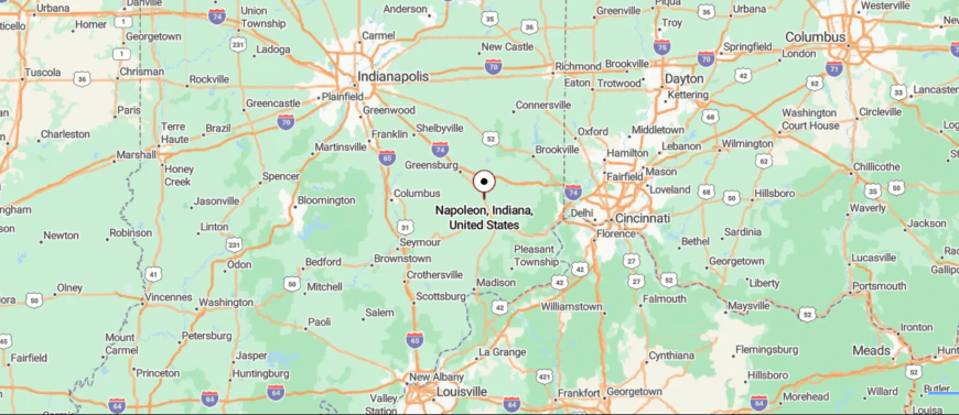
Napoleon rests in western Ripley County, a small crossroads community in southeastern Indiana. It sits about 65 miles southeast of Indianapolis and 70 miles west of Cincinnati, most often reached by U.S. 421 as it cuts through stretches of farmland and open prairie.
The approach is straightforward, with the highway gradually giving way to a slower pace once you near town. Surrounded by fields that seem to stretch endlessly, Napoleon feels like a pocket of stillness set apart from busier routes.
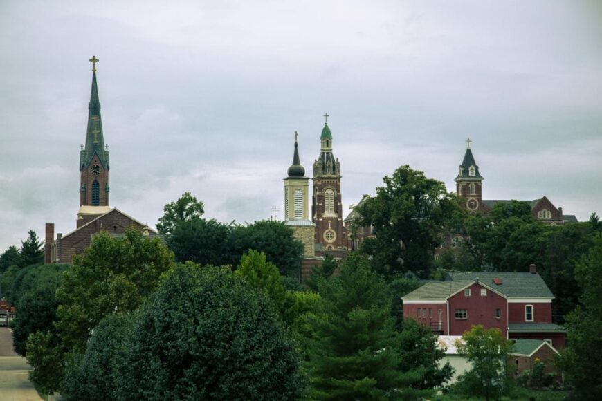
17. Batesville – A Furniture Town Wrapped in Woods

Batesville is nestled between forested ridges and winding backroads, giving it the feeling of being tucked away while still carrying a strong sense of its own identity. The town has deep German roots, reflected in its architecture, traditions, and the pride that threads through its community gatherings.
Around town, life moves at a thoughtful pace—morning walks through shaded neighborhoods, afternoons spent exploring local shops, and evenings marked by quiet conversations at family-run restaurants. Visitors often wander toward Liberty Park, paddle across Bischoff Reservoir, or join in one of the festivals that fill the streets with music and food.
Though industry once helped anchor Batesville, its heart remains in the traditions and connections that bind neighbors together. It’s the kind of place where heritage and quiet landscapes weave together, reminding you that seclusion can feel both rich and welcoming.
Where is Batesville?
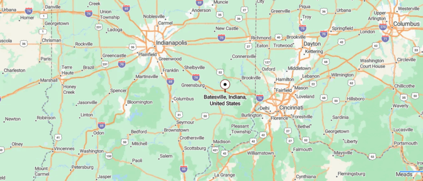
Batesville lies on the border of Ripley and Franklin counties in southeastern Indiana, known for its spot along I-74 between Indianapolis and Cincinnati. The town sits about 67 miles southeast of Indianapolis and 48 miles northwest of Cincinnati, making it reachable by a direct highway route before narrowing into tree-lined streets.
The shift from interstate speed to small-town roads creates a noticeable change in pace. Wrapped in forest edges and open fields, Batesville holds a sense of calm despite its easy access.
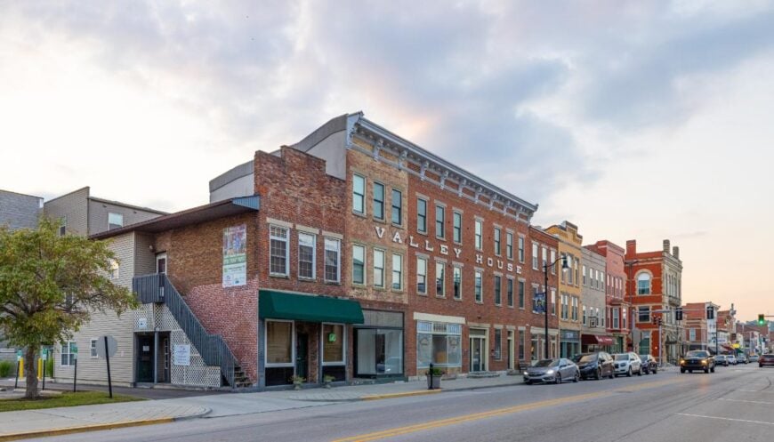
16. Oldenburg – A German Village in the Hills
Oldenburg, often called the “Village of Spires,” feels set apart from the world with its cluster of steeples rising above rolling fields and narrow, winding roads that keep it hidden from heavy travel. The town’s German heritage lingers in its brick architecture, painted trim, and even the echoes of dialect that surface during local gatherings.
Walking its streets feels almost like stepping into a European village, where quiet cafés, convent gardens, and ornate churches create a rhythm that is both hushed and deeply rooted in tradition. Visitors can spend time exploring the Franciscan monastery, wandering historic cemeteries, or simply sitting in the town square where life passes slowly.
Seasonal festivals bring bursts of music and laughter, but even then the air holds a timeless calm. Oldenburg stays with you as a place where faith, history, and quiet seclusion meet, offering the sense that you’ve discovered a corner of Indiana that belongs to another time.
Where is Oldenburg?
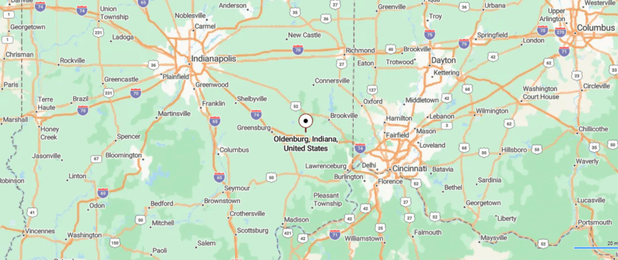
Oldenburg sits in Franklin County in southeastern Indiana, just a few miles north of Batesville and close to the Ohio border. It’s about 60 miles from Indianapolis and 45 miles from Cincinnati, reached by exiting I-74 and following smaller county roads that wind through farmland.
The approach slows into a town where church steeples rise above historic brick buildings, giving it a distinctive character. Surrounded by quiet countryside, Oldenburg feels like a place where time moves gently, apart from the rush beyond.
15. Brookville – Reservoir Shores and Rolling Quiet
Brookville rests where two rivers meet, tucked into a valley surrounded by steep, green hills that give it a sense of shelter from the outside world. The Whitewater River and nearby Brookville Lake define its landscape, offering both beauty and a natural boundary from busier places.
Historic brick storefronts and a courthouse square form the heart of town, where life moves at an easy, steady pace. Visitors often spend their days kayaking, fishing, or hiking through the wooded trails that branch out from the valley.
Local shops and family-run restaurants provide simple comforts that add to the town’s quiet character. Brookville lingers in memory as a place where water and hills protect a slower way of living, creating its own pocket of seclusion.
Where is Brookville?

Brookville rests in the Whitewater River Valley of Franklin County, in the far southeastern corner of Indiana. It’s about 50 miles northwest of Cincinnati and reached by U.S. 52, where the highway begins to narrow into winding roads that trace the river’s edge.
The town gathers around Brookville Lake and the surrounding hills, making the journey in feel tucked between water and ridges. With its valley setting and quiet waters, Brookville carries the sense of a place naturally sheltered from the outside world.
14. Laurel – A Creekside Village with One Main Street
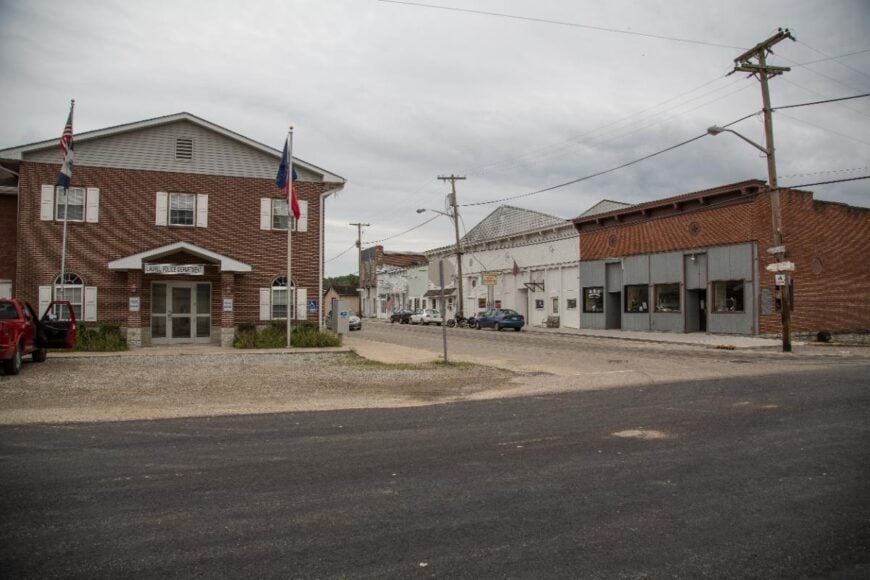
Laurel sits quietly in the Whitewater Valley, surrounded by wooded ridges and winding country roads that keep it tucked away from the outside world. The town is small and still, with the river nearby and the occasional train passing through as a reminder of its history.
A few historic buildings mark its center, carrying the stories of the 19th century when Laurel was more connected to the rail. Visitors often fish along the Whitewater River, explore the scenic backroads, or join neighbors at a simple community gathering.
Life here moves slowly, with sunsets and quiet walks feeling like events of their own. Laurel holds its seclusion gently, as though it has chosen to remain untouched by time.
Where is Laurel?
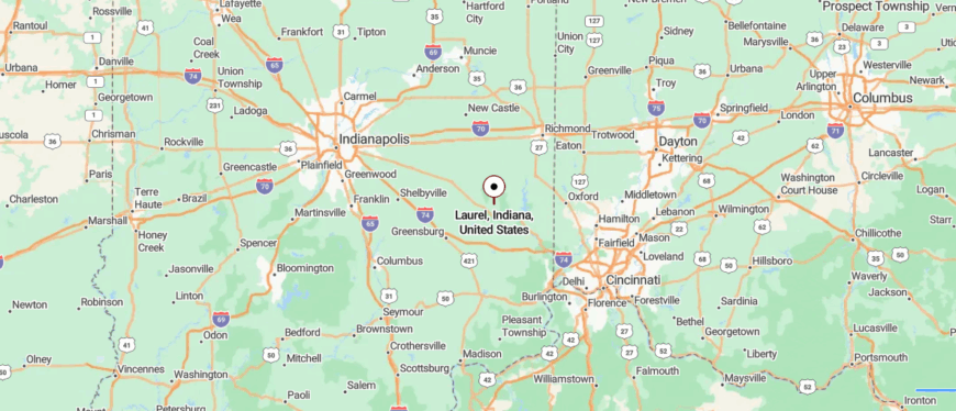
Laurel sits in the northern part of Franklin County, where southeastern Indiana begins to fold into low ridges and farmland. It’s about 65 miles southeast of Indianapolis and 55 miles northwest of Cincinnati, reached by following State Road 121 after leaving U.S. 52.
The road slips past open fields and wooded creeks, easing travelers into a quieter rhythm. By the time you arrive, the town feels like it’s set just far enough off the main paths to hold its own hush.
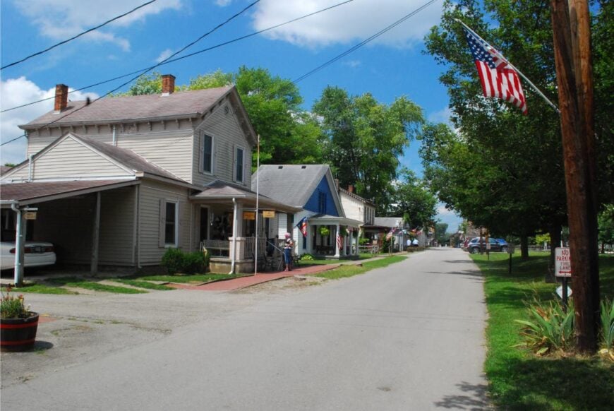
13. Metamora – Canal Town Frozen in Time
🔥 Would you like to save this?
Metamora rests in the Whitewater Valley, where wooded hills and winding roads make its historic canal town feel tucked away from the modern world. The Whitewater Canal still flows through the center, with a working grist mill and canal boat rides that carry the memory of another century.
Along its streets, antique shops, craft stores, and small cafés create a rhythm that is lively yet unhurried. Visitors often stroll the towpath trail, watch the water wheel turn, or spend time browsing handmade goods.
Seasonal festivals bring music and color, but the town always holds on to its timeless calm. Metamora leaves you with the sense that history and seclusion can walk side by side, offering a beauty that endures quietly.
Where is Metamora?
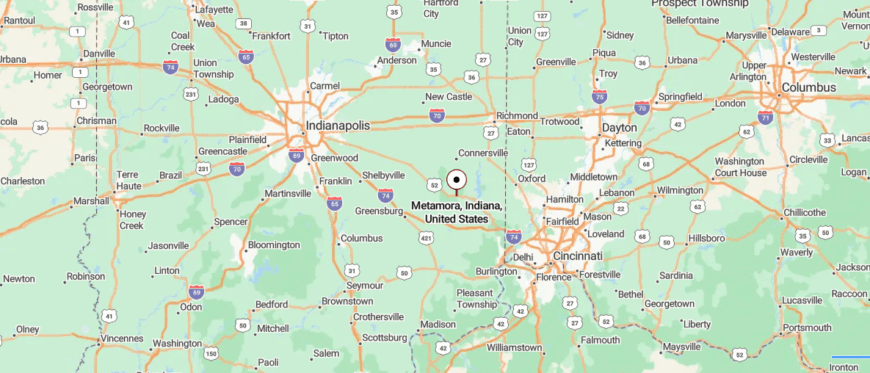
Metamora lies in Franklin County in southeastern Indiana, nestled along the Whitewater Canal. It’s about 60 miles northwest of Cincinnati and 70 miles southeast of Indianapolis, reached by U.S. 52 before narrowing into village roads that hug the canal’s path.
The approach carries you past wooded hills and water, hinting at the slower rhythm waiting inside the town. With its canal locks and quiet streets, Metamora feels like a place suspended just beyond the press of time.
12. Cedar Grove – Bluffs, Bridges, and Bypassed Silence
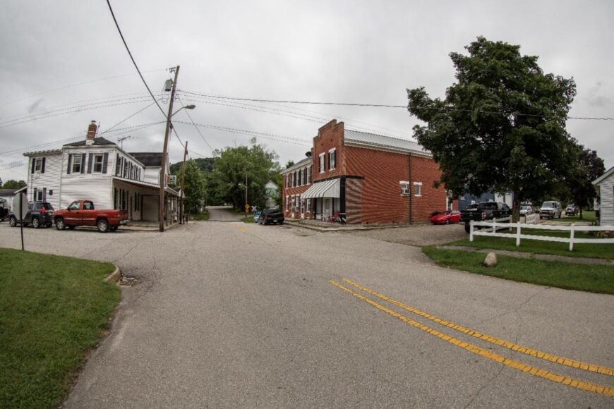
Cedar Grove lies close to the Ohio border, pressed against rolling hills and thick woods that keep it tucked out of sight from the main routes. The town is small and hushed, its narrow streets lined with old houses and a few weathered storefronts that speak to a quieter era.
Life here drifts at an easy pace, with neighbors gathering on porches and the sound of church bells carrying farther than traffic ever could. Visitors often enjoy fishing or paddling along the Whitewater River, wandering backroads that weave through farmland and forest, or pausing at the town’s historic church.
Even simple drives around the valley reveal views that feel far removed from the bustle of nearby cities. Cedar Grove leaves you with the sense that some places remain secluded not by chance, but by holding tightly to their stillness.
Where is Cedar Grove?
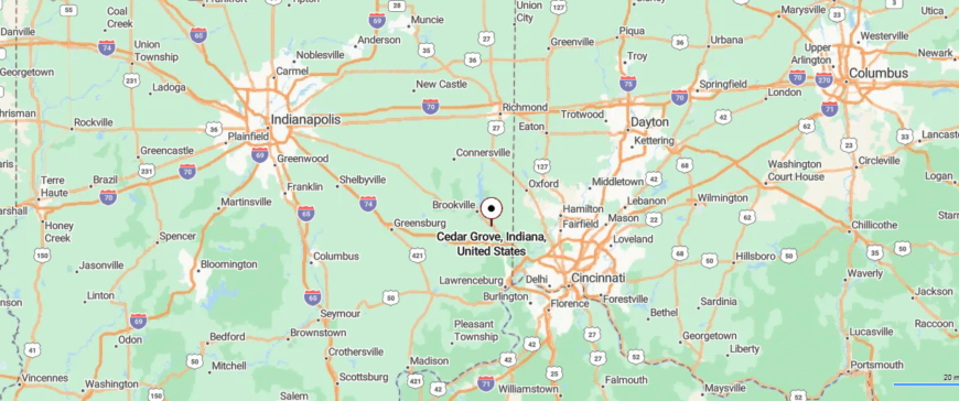
Cedar Grove is tucked into the southeast corner of Franklin County, only a few miles from the Ohio border. The town sits about 30 miles northwest of Cincinnati, reached by U.S. 52 before turning onto a winding two-lane road that dips into the valley.
The drive follows the Whitewater River, with hills rising on either side as the community comes into view. Nestled low between ridges, Cedar Grove feels quietly hidden, as if cradled by the landscape itself.
11. St. Leon – High Ground and Wide Horizons
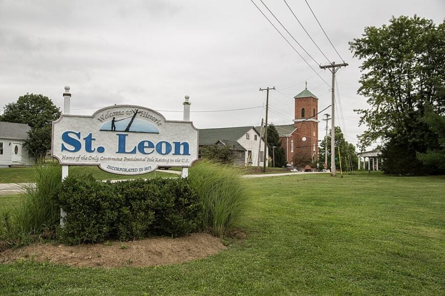
St. Leon sits high on the ridges of Dearborn County, where winding country roads and stretches of farmland make it feel set apart from the outside world. The town carries a deep sense of community, with its church, school, and gathering halls acting as the anchors of daily life.
Evenings here are marked by the quiet hum of crickets and the glow of porch lights scattered across the hills. Visitors often find themselves enjoying a local festival, watching a high school game, or simply taking a drive through the countryside where the views stretch wide and unbroken.
Though small, St. Leon has a rooted strength, shaped by tradition and the closeness of neighbors who know each other well. It’s the kind of place where seclusion doesn’t mean loneliness, but rather the comfort of belonging to something steady and enduring.
Where is St. Leon?

St. Leon sits high on the ridge tops of northern Dearborn County in southeastern Indiana. It’s roughly 25 miles northwest of Cincinnati, most often reached by taking I-74 before exiting onto State Road 1 and winding up into the hills.
The highway fades quickly into narrow roads edged with farms and woodland, giving a sense of stepping away from busier routes. With its elevated setting and quiet stretches of countryside, St. Leon feels like a town perched just beyond the everyday rush.
10. Friendship – A Hidden Muzzleloader Haven in Ripley County
Friendship’s year-round population hovers near 150, yet twice a year black-powder enthusiasts from across the nation pour in for the National Muzzle Loading Rifle Association shoots. Between festivals, residents fish along Laughery Creek, browse the Friendship Flea Market, or kayak through shaded backwaters lined with sycamores.
Cottage rentals and a single diner serve the small trickle of visitors, while farming and handcrafted gunstock work remain steady anchors of the local economy. The main paved approach is County Road 800 off State Road 129, with a few other narrow county lanes connecting to the valley; ridges press close on all sides, muting noise from the outside world.
Parcels tend to be large, so neighbors sit comfortably apart, with plenty of room for gardens, barns, and quiet. Together, these details give Friendship a tucked-away feel that lingers long after you’ve left.
Where is Friendship?
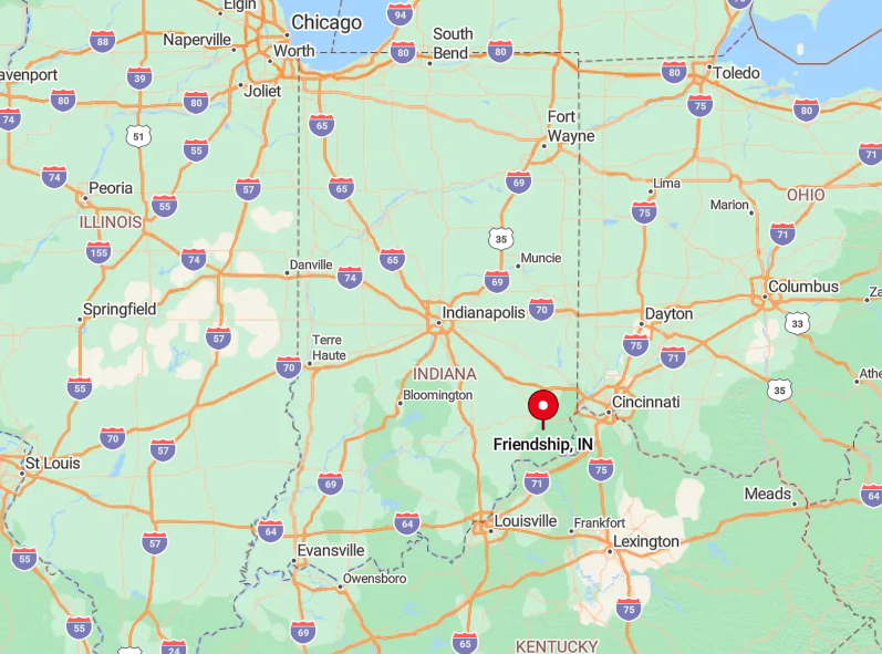
The hamlet sits in southern Ripley County, roughly halfway between Versailles and the Ohio River. Thick woods and rolling ridges isolate it from U.S. 50 traffic just eight miles to the north.
Drivers reach Friendship by turning south onto State Road 129, then winding along County Road 800 for the last tree-tunnel mile. The lack of through-routes ensures that only people who intend to visit ever appear on its quiet main street.
9. Bennington – Rolling Hill Farms and Miles of Silence
Bennington counts about 200 residents spread across broad Switzerland County uplands checkered with corn and hay. Locals spend free hours hunting morel mushrooms, casting lines into creeks stocked with smallmouth, and trading heirloom seeds at the historic Bennington Schoolhouse.
Agriculture—primarily soybeans, dairy, and farm-gate produce—anchors the modest economy, while a few artisans sell hardwood bowls and quilt work. Gravel lanes branch in every direction, and farmhouses sit so far apart that porch lights glow alone in the night.
Wind through the trees carries little more than rustling stalks and the hum of distant combines. Such wide spacing keeps life remarkably hushed even during planting season.
Where is Bennington?

🔥 Would you like to save this?
Positioned about nine miles northwest of the county seat of Vevay, Bennington rises on high ground well back from the Ohio River. Thick tree lines and unmarked crossroads deter casual explorers.
Reaching town involves a scenic climb along State Road 250 followed by a right onto Bennington Pike, a route GPS units sometimes mislabel. The absence of any direct highway or rail link preserves the calming isolation residents prize.
8. Cross Plains – Where Forested Ridges Guard Every Back Road
A mere 100 people call Cross Plains home, sharing a landscape of steep hardwood ridges that fold like a natural amphitheater. Outdoor recreation centers on horseback rides along old stagecoach traces and stargazing parties on ridge tops where Milky Way bands look close enough to touch.
Limited logging, custom sawmilling, and boutique maple-syrup operations provide the bulk of local employment. Streetlights never reached these hills, so evenings remain pitch-black aside from porch lanterns and campfires.
Houses perch on high knolls, each one buffered by thick oak and hickory stands that block both wind and prying eyes. The contours alone make spontaneous visitation nearly impossible.
Where is Cross Plains?

The village occupies southeast Ripley County, tucked between Versailles State Park and the Ohio border. Back roads follow serpentine creek valleys that discourage speed and confuse newcomers.
From State Road 62, travelers must navigate two signed but unmapped turns before the first mailbox appears. The protective maze of ridges is why residents jokingly say the night sky is their only streetlight.
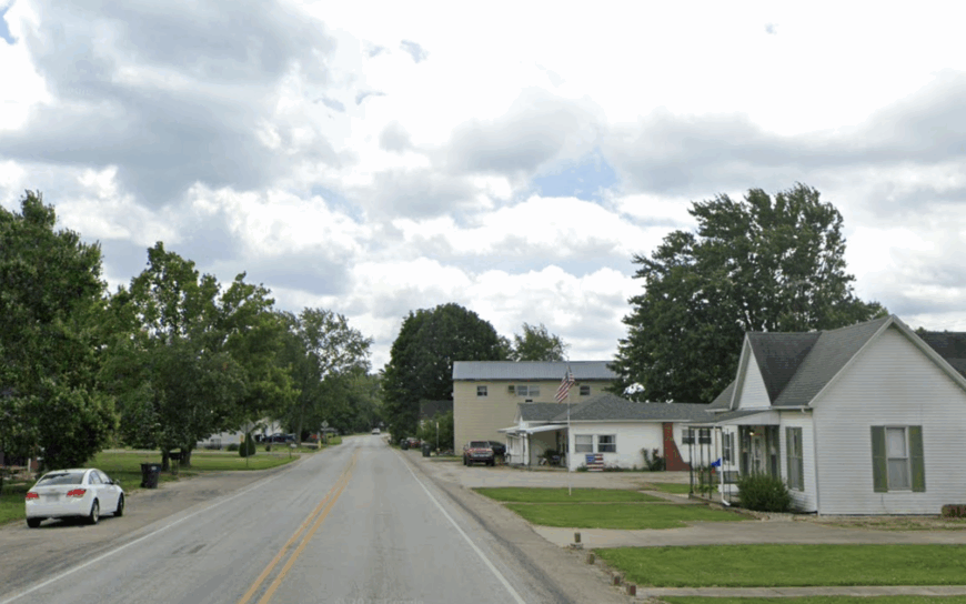
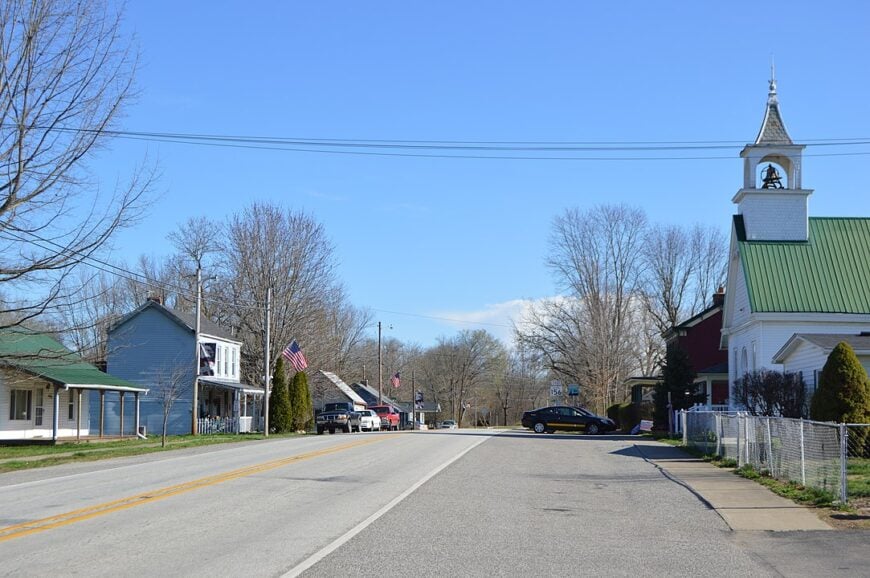
7. Canaan – A One-Intersection Community Lost in the Bean Fields
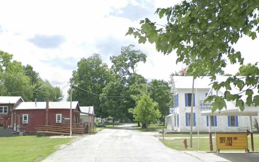
Canaan lists fewer than 90 full-time inhabitants clustered around a single flashing light where the general store doubles as post office and coffee spot. Locals organize fish fries beside Indian-Kentuck Creek, cheer at the Canaan Fall Festival tractor pull, and check trail cameras more often than social media.
Small grain farming and a co-op grain elevator form the economic core, supplemented by seasonal work in nearby tobacco barns. Endless soybean acreage and flat horizons remove any visual hint of suburbia.
With no chain businesses or stop signs beyond the crossroads, motorists rarely brake except to let a combine pass. The simplicity makes Canaan feel like a place time forgot—by design.
Where is Canaan?
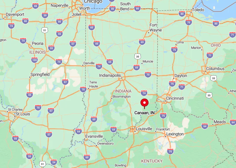
Canaan sits in northeastern Jefferson County, Indiana, about 13 miles north of Madison on the Ohio River. The settlement lies at the junction of State Roads 62 and 250, a crossroads marked by open fields and a handful of clustered buildings.
Travelers approach most often along SR-62, which runs east–west between Madison and Dillsboro, or SR-250, which climbs in from the west. Beyond the intersection, county lanes stretch into farmland and bean fields, reinforcing the sense that Canaan is a place apart from busier routes.
6. Patriot – Ohio River Bluffs with More Eagles than People
Patriot counts about 200 residents, most living on a narrow rise above a sweeping bend of the Ohio River. Bald eagles drift on thermals from the bluffs, while anglers below cast into eddies where the current slows. The compact center holds little more than a firehouse, a riverside park, and a few modest storefronts, yet its setting makes it feel larger than its footprint.
Work in Patriot centers on small farms, river-related trades, and seasonal tourism from birders and boaters. Residents prize the stillness—streets that see more bicycles than cars, nights that echo with frogs instead of traffic, and days when the river itself seems like the only soundtrack.
With cliffs on one side and wooded hills on the other, the town feels boxed in by geography, and that isolation is part of its appeal. Patriot has endured floods, high water, and hard seasons, but its setting keeps it quietly apart from the bustle upstream and down.
Where is Patriot?
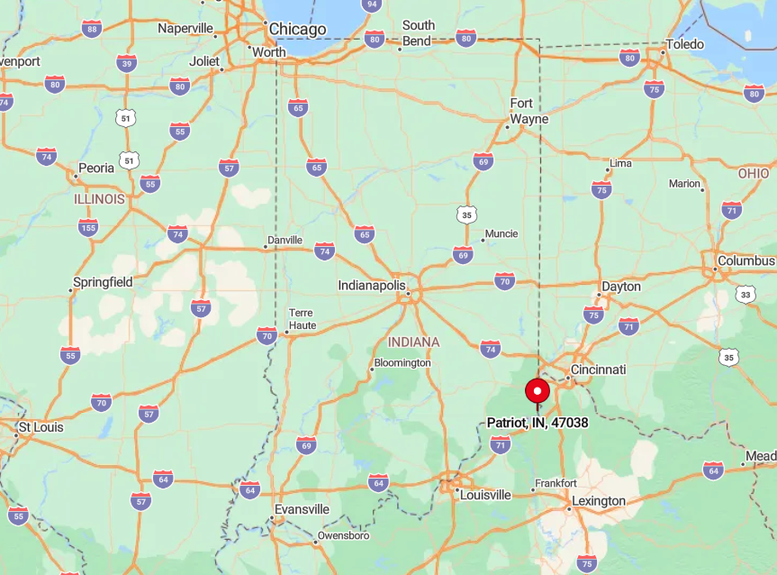
Patriot sits in southeastern Switzerland County, Indiana, perched directly on the north bank of the Ohio River. It lies downstream from Vevay and upstream from the Markland Locks and Dam, with State Road 156 running straight through town along the river’s edge.
Cincinnati is about 45 miles northeast by road, reached by following SR-156 until it meets larger highways. With the Ohio on one side and steep bluffs behind, Patriot feels more like a river landing than a crossroads, a settlement cradled between water and hills.
5. Moores Hill – Hilltop Homesteads Above the Valley Fog
Moores Hill’s population hovers near 700, but the town spreads across multiple ridgelines where houses perch above the morning fog. Residents gather each spring for the Moores Hill Strawberry Festival, hike shaded lanes that wind toward Laughery Creek, and watch dawn break over fields that roll away into quiet valleys.
Daily life balances small-scale farming, a handful of local businesses, and commutes that bend along State Road 350’s switchbacks. Remote work has slowly found a place here too, with barns converted into offices and fiber lines edging into the hills.
Evenings are marked by owls calling through the hardwoods, stars filling wide skies, and the rare interruption of a passing truck. With no commercial strip and only the occasional community event, silence remains the town’s most constant companion.
It’s a hilltop rhythm that prizes open views and calm nights, the sort of seclusion that lingers even when nearby highways lie just minutes away.
Where is Moores Hill?
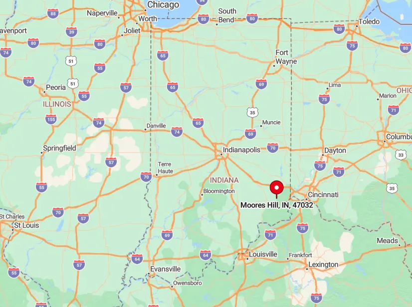
Set in northwestern Dearborn County, Moores Hill overlooks Laughery Valley roughly halfway between Batesville and Lawrenceburg. Switchback climbs via State Road 350 discourage heavy truck traffic and incidentally limit visitor numbers.
The town lacks a direct interstate connection; Interstate 74 sits 15 minutes north, reached by a series of county roads. Those extra turns ensure the ridge remains tranquil even as nearby suburbs expand.
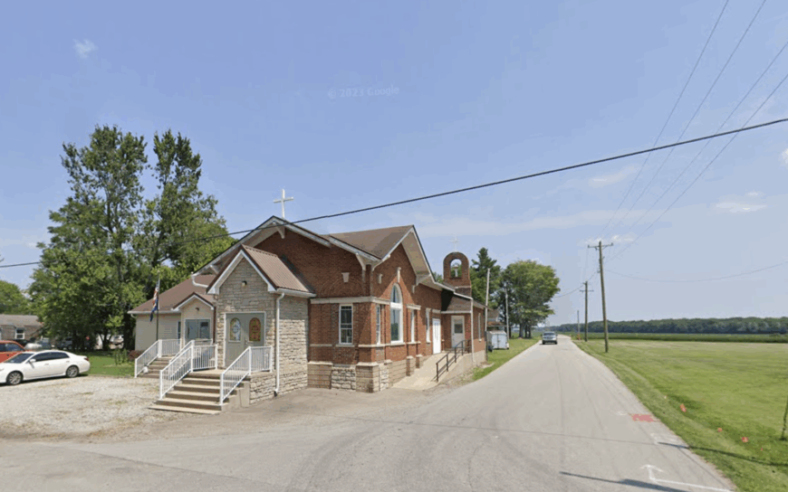
4. Deputy – Jefferson County’s Whisper-Quiet Crossroads
Deputy registers close to 95 residents, most of whom can greet every passerby from their front porch by name. Recreation centers on creek-side bonfires, softball games at the Deputy Community Park, and weekend canoe trips launched from Muscatatuck River access points.
Small cattle operations, custom hay baling, and a cluster of home construction crews supply modest incomes. A fifteen-mile buffer of woods and cropland separates Deputy from Madison’s restaurants and nightlife.
Front-porch swing conversations often outlast cell-phone batteries thanks to marginal reception. That digital silence is part of the charm locals guard fiercely.
Where is Deputy?
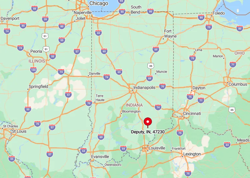
The hamlet lies near the center of Jefferson County’s northern half, accessible via State Road 3 but hidden from it by a mile-long spur. Surrounding meadows stitched with limestone creeks act like a natural moat against urban encroachment.
Visitors exit I-65 at Scottsburg, then wind eastward on county roads that narrow to one lane before arriving. The absence of any through-traffic corridor preserves Deputy’s unhurried mood year-round.
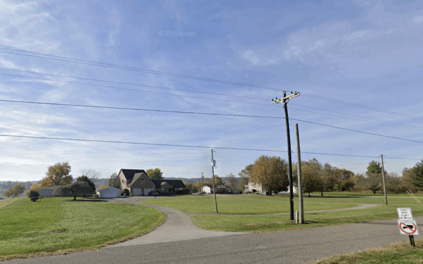
3. New Marion – Civil-War-Era Silence in Modern Times
New Marion, population roughly 110, still displays the stone foundations of 19th-century wagon shops alongside active Amish buggy sheds. Locals picnic near the old rail depot grounds, hunt wild turkey in adjoining hardwood stands, and trace family names on weathered headstones at the hillside cemetery.
Farming—mostly beef cattle and alfalfa—and a small Amish cabinetry shop form the backbone of commerce. Unpaved lanes throw dust in summer and mud in spring, discouraging casual sightseeing rides.
Expansive pastureland provides deep sightlines yet few dwellings, so even barking dogs echo without reply. The result is an atmosphere where history and solitude coexist undisturbed.
Where is New Marion?
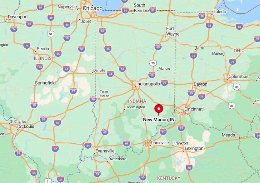
This unincorporated spot occupies the southern tier of Ripley County, just west of Otter Creek’s wooded valley. Lacking signage on U.S. 421, it’s easy to pass the gravel turnoff without noticing.
The closest four-lane highway sits 20 minutes away, and the abandoned Baltimore & Ohio railbed marks the town’s only hint of former connectivity. Modern travelers rely on a single-service gas station five miles north to refuel before venturing in.
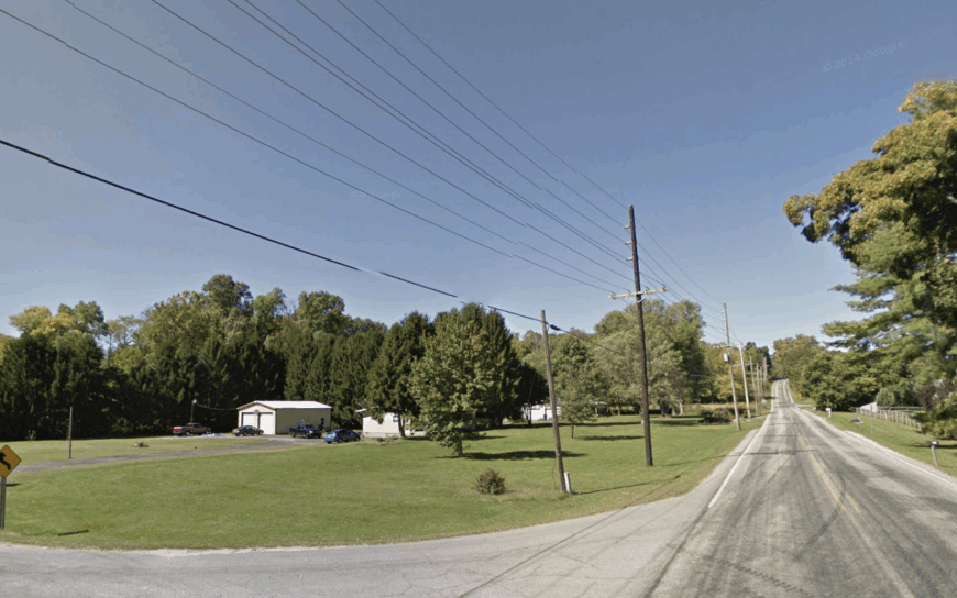
2. Lamb – River Bends and Secluded Bottomland Cabins
Only about 50 year-round residents settle in Lamb, many occupying clapboard cabins that cling to levee tops above fertile floodplain. Favorite pastimes include bow-fishing for carp in oxbow lakes, foraging pawpaws in wet woods, and watching great blue herons patrol hidden sloughs.
Seasonal tobacco patches and small commercial mussel harvesting on the Ohio provide the scant income opportunities. A narrow levee road often closes during high water, cutting off through traffic and reinforcing the settlement’s hideaway feel.
Half the surrounding acreage remains undeveloped wetlands frequented by migratory ducks. Nightfall rings with cricket song rather than car engines.
Where is Lamb?
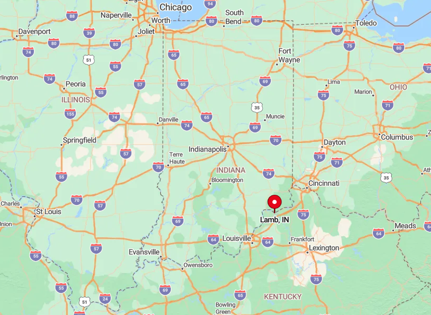
Lamb nestles near a deep bend of the Ohio River in western Switzerland County, south of State Road 56’s ridgeline. Bottomland geography forces travelers to descend a steep switchback to a one-lane levee that ends in the village.
When river stages rise, the road can flood, leaving boats as the only reliable link to the outside world. That natural gatekeeper keeps Lamb’s cabins and wildlife undisturbed for much of the year.
1. Big Cedar – Limestone Hollows Cloaked in Oak and Quiet
Big Cedar’s year-round headcount barely crests a few dozen, scattered along a limestone hollow where the namesake creek threads past moss-dark rock shelves. Days pass in the hush of oak and hickory canopy—footsteps on leaf litter, spring water ticking from karst seeps, and the occasional woodpecker rat-a-tat echoing off the bluff.
Most activity is small-scale and seasonal: cutting and stacking storm-felled limbs, tending gardens tucked against sun-warmed stone, and walking old farm lanes that rise to ridge tops with long views. Visitors keep it simple—listening for barred owls at dusk, watching fireflies stitch the dark, or following the creek until it narrows to a ribbon between ferny banks.
Steep walls and tight curves make the hollow feel like its own room in the landscape, and cell signals fade to a rumor under the trees. What remains is quiet—unbothered, steady, and complete enough that even a passing pickup sounds like an event.
Where is Big Cedar?
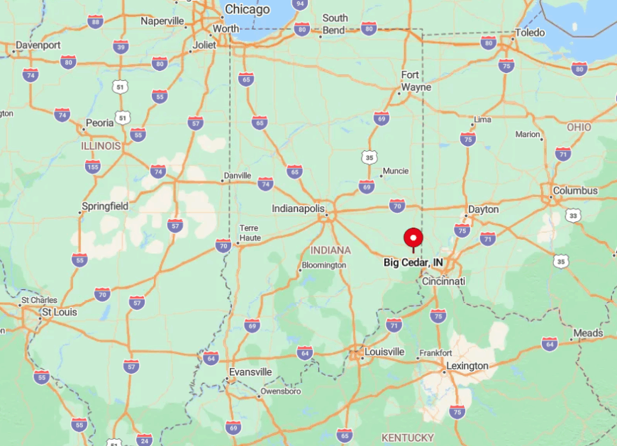
The hollow lies in extreme southwestern Franklin County, touching the triple-county point with Ripley and Dearborn. Access requires turning off State Road 252 onto an unmarked gravel path that drops into the gorge; a hand-painted cedar plank is the only confirmation of arrival.
Once inside, high ridges block FM radio signals, and winter snows linger longer than in surrounding uplands. Visitors who brave the descent discover why locals joke that Big Cedar is easier to hear about than to find.