The farther you drive into Northwest West Virginia, the more the map starts to feel like memory. Valleys narrow until the daylight fades early, creeks run beside the road like uninvited companions, and ridges rise steep enough to block both wind and signal. Small towns appear suddenly at bends in the road, then vanish again once the hills close back around them.
In order to come up with the very specific design ideas, we create most designs with the assistance of state-of-the-art AI interior design software. Also, assume links that take you off the site are affiliate links such as links to Amazon. this means we may earn a commission if you buy something.
Distance here isn’t measured only in miles but in time. A short drive on the map can stretch long across switchbacks and gravel spurs, with hayfields, covered bridges, and old churches slowing the journey. The landscape insists that travelers move at its rhythm.
Life in these places is shaped by quiet routines: farm trucks heading to pastures, neighbors gathering on porches, and church bells that carry farther than any traffic. The histories run deep — oil booms, rail spurs, and courthouse squares — but what endures is a steady calm that the hills have always guarded.
This collection highlights 25 of the most secluded towns in the state’s northwest corner. Each one shows how geography and memory can hold a community apart, from river bends to ridge crests, places that keep their identity by keeping their distance.
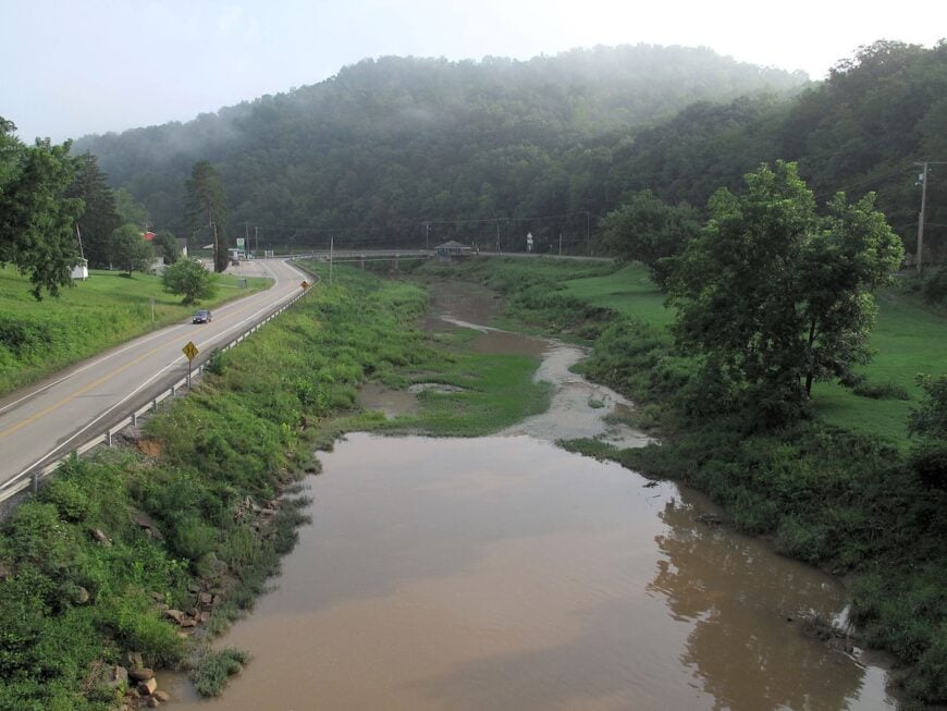
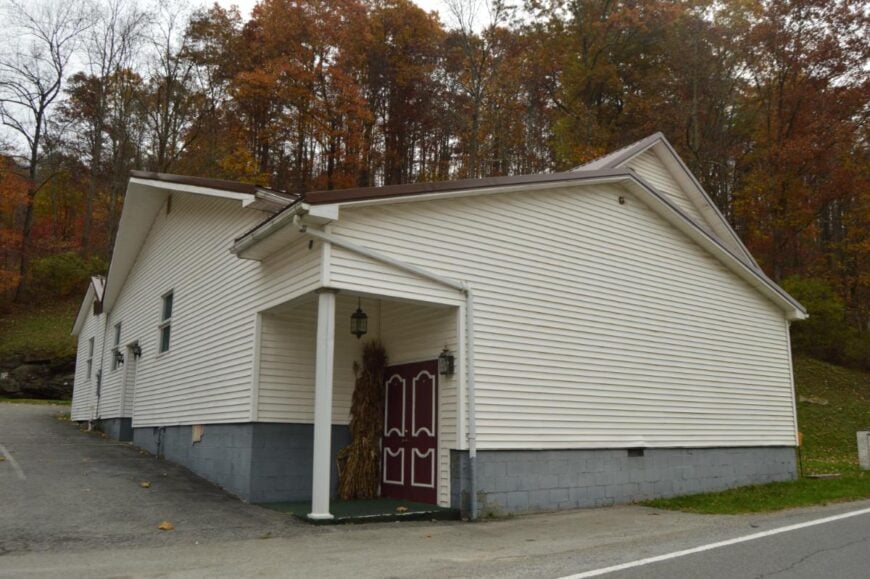
25. Wallace: Railbed Trails and Woodland Ridges
Tucked into the rolling hills of Harrison County, Wallace, West Virginia feels like a place set apart from the rush of the world. Its seclusion comes from winding backroads far from major highways, with forests and farmland forming a quiet barrier around the town.
Life moves at an unhurried pace, where the chatter at the local diner and the creak of old porches mark the rhythm of the day. Visitors find simple pleasures here—fishing in nearby streams, walking wooded trails, or pausing at the small general store that has served generations.
Farming remains the backbone of the community, tying families to the land in a steady, familiar way. Wallace is the kind of place that reminds you how peaceful the world can feel when time slows down.
Where is Wallace?
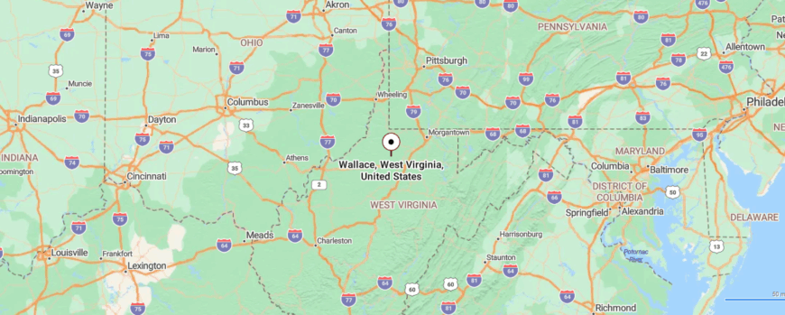
Wallace, West Virginia, sits in the north-central part of the state, tucked into Harrison County’s rolling hills. It lies about 18 miles northwest of Clarksburg, with the easiest route following narrow country roads branching off U.S. Highway 50.
The drive winds through wooded valleys and small farming communities before reaching the quiet settlement. It’s close enough to Clarksburg to stay connected, but its tucked-away roads make it feel like you’ve stepped into a world apart.
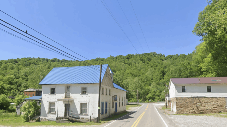
24. Metz: Meadows Framing a Two-Church Hamlet
Metz, West Virginia sits quietly along a bend in the West Fork River, hidden from the hurried pace of bigger roads and towns. Its sense of seclusion comes from the fact that few people pass through unless they mean to, giving it a tucked-away charm.
The town carries a historic, timeworn feel, with weathered homes, old barns, and the steady rhythm of nature framing daily life. You can spend an afternoon walking the riverbanks, spotting wildlife in the woods, or driving the backroads that wind toward small country churches and cemeteries.
For generations, farming and local trades have been the steady work here, shaping Metz into a place of rooted simplicity. It’s the kind of town where the silence itself feels like an invitation to breathe a little deeper.
Where is Metz?
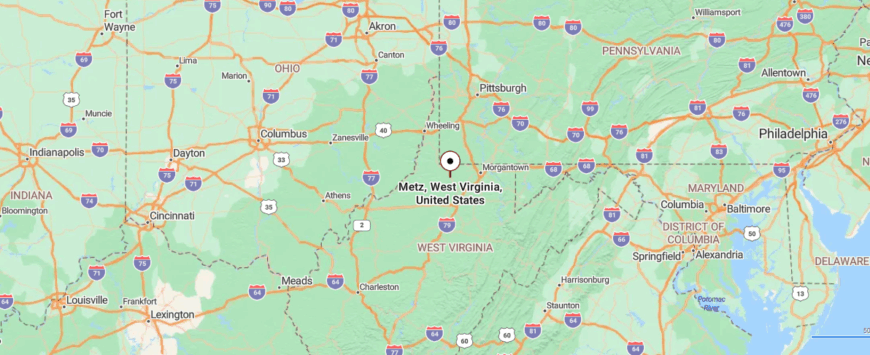
Metz lies in northern West Virginia, a small community tucked into Marion County’s countryside. It sits about 12 miles northwest of Fairmont, reached by following U.S. Route 250 as it narrows into quieter stretches of two-lane road.
The approach winds past farms and low ridges until the houses appear close together along the roadside. It feels like a place you stumble upon gently, where the pace slows and the outside world falls away.
23. Smithfield: Hillside Farms and Forgotten Crossroads
Smithfield, West Virginia, clings to a quiet bend in Wetzel County where hillside farms roll down toward narrow creeks. Its seclusion comes not just from geography but from its location off the main travel corridors, a place that rarely finds itself on anyone’s route unless it’s the destination.
The town holds a small grid of streets where porches and church steeples rise above gardens and hayfields. Daily life is measured in livestock chores, neighbors trading stories at the post office, and children riding bikes on streets with more dogs than cars. The sense of stillness comes quickly, as the ridges seem to close ranks around the town.
Though once tied to oil and gas, today Smithfield leans on farming and family ties that stretch back generations. Visitors passing through might find the appeal in simple scenes: laundry fluttering in the wind, cattle grazing against wooded hills, or the hush that falls when dusk settles across the valley.
Where is Smithfield?
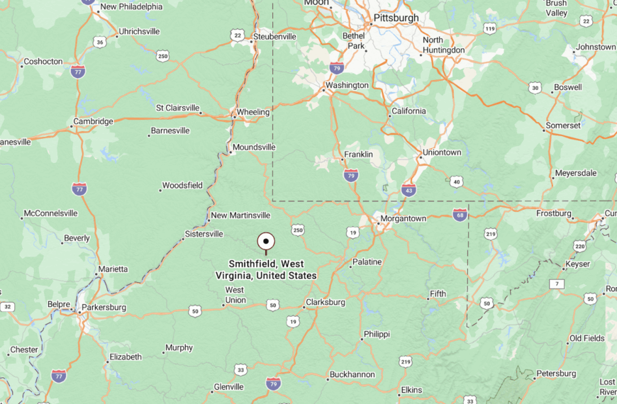
Smithfield sits in southern Wetzel County, about 15 miles southeast of New Martinsville. It’s reached along WV Route 89, a winding two-lane that climbs and dips across ridge after ridge before narrowing into town streets.
The trip delivers a landscape of hayfields and tree lines, reminding travelers that this corner of West Virginia is stitched together more by memory and tradition than by traffic.
22. Reader: A Coal Patch Turned Hollow Hideaway
Reader, West Virginia feels like a world apart, folded into the valleys and ridges of Wetzel County where time drifts slower than the outside world. Its isolation stems from narrow country roads that wind endlessly through forest and farmland before leading you into town.
Life here carries a hushed simplicity—neighbors gather at the local store, and the air often holds the scent of woodsmoke and freshly cut hay. For those passing through, there are quiet pleasures to be found: hiking shaded trails, or visiting the small country churches that dot the hills.
Once shaped by oil and gas, the area now leans on farming and the quiet resilience of families rooted here for generations. Reader leaves you with the sense that sometimes the most meaningful places are the ones that ask nothing of you but still give you peace.
Where is Reader?
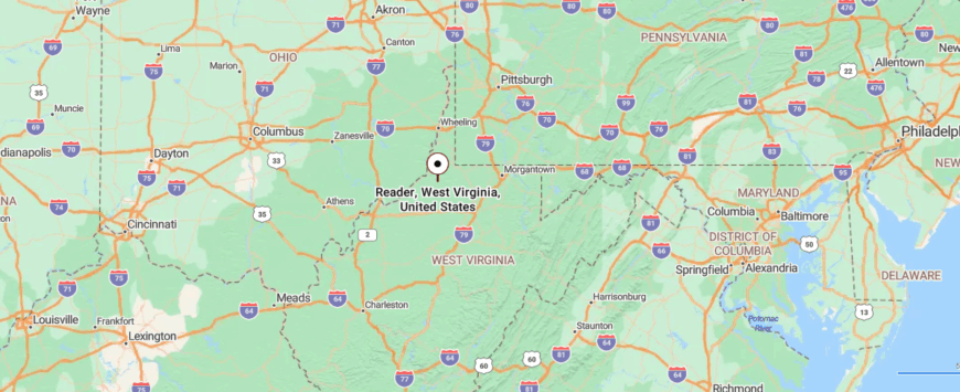
Reader sits in Wetzel County in northern West Virginia, nestled between low ridges and streams. It lies about 25 miles south of New Martinsville, with WV Route 20 serving as the main thread that connects it to the outside.
The drive winds through farmland and shaded hollows, giving the sense of slipping deeper into quiet country. By the time you reach town, the hush of the hills makes it feel like a pocket of West Virginia kept apart from time.
21. Pine Grove: Creeks and Timber Framing a Small Town Core
Pine Grove, West Virginia rests at the edge of the mountains, where narrow roads curl past thick woods and the quiet feels almost absolute. Its seclusion comes not from distance alone but from the way the hills fold in around the town, holding it close and apart from busier places.
The atmosphere is rustic and neighborly, with the sound of church bells and the hum of front-porch conversations carrying farther than any traffic. Visitors can find small joys here—wandering along Middle Island Creek, tracing the history of the old oil and gas boom, or joining the annual community gatherings that bring the town to life.
Work has long revolved around natural resources and farming, tying families to the land in a steady rhythm. Pine Grove lingers in memory as the kind of town where the stillness of the hills makes the world feel gentler.
Where is Pine Grove?
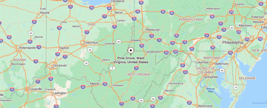
Pine Grove is tucked in Wetzel County in northern West Virginia, surrounded by wooded hills and winding creeks. It lies about 15 miles southeast of New Martinsville, reached along WV Route 20 as the road curves through narrow valleys.
Travelers pass stretches of forest and open fields before the small town appears along the Middle Island Creek. It’s the kind of place where the landscape closes in softly, offering the sense that you’ve found a quiet corner away from the rush.
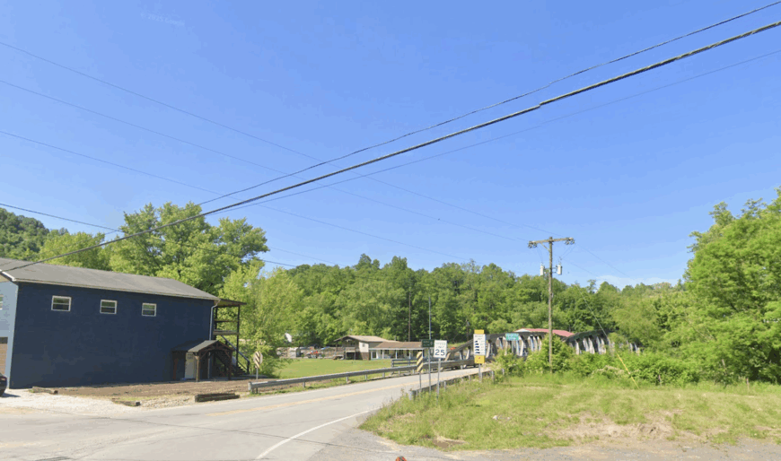
20. Shirley: Valley Pastures and Hand-Built Bridges
Shirley, West Virginia lies hidden along quiet country roads, where the forest presses close and the hills seem to guard it from the outside world. Its sense of seclusion comes from being far from highways, a place you reach only by winding through miles of farmland and shaded hollows.
The town’s rhythm is unhurried—roosters crow in the morning, neighbors wave from passing trucks, and evenings settle into the soft glow of porch lights. Visitors might enjoy casting a line in nearby creeks, wandering wooded trails, or pausing at small country cemeteries that tell the story of generations past.
Farming and simple trades remain the backbone here, shaping a way of life both steady and quiet. Shirley has a way of reminding you that the most lasting beauty is often found in places that ask you to slow down and listen.
Where is Shirley?
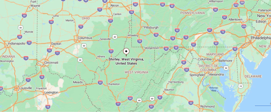
Shirley is found in Tyler County, resting in the northwestern hills of West Virginia. It sits roughly 30 miles from Clarksburg, reached by a mix of WV Route 23 and narrower county roads that twist through wooded ridges.
The journey passes farmsteads, streams, and stretches of forest that grow quieter the further you go. By the time you arrive, the town feels folded into the hills, a spot where life slows to a gentler rhythm.
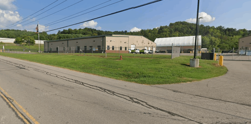
19. Jacksonburg: A Valley Known for Watercress and Wells
🔥 Would you like to save this?
Jacksonburg rests deep in Wetzel County, folded into a narrow valley where hills close in tight around the town. Its isolation comes from long backroads that weave through forest and pasture before dropping into the settlement, leaving it with a hushed, almost forgotten presence.
The town carries reminders of its oil and gas past — scattered pump jacks still dotting the hillsides, weathered houses along the main street, and old foundations softened by moss. For many locals, the land’s quiet bounty matters more now: fishing creeks, garden plots, and springs that feed the valley.
What lingers most is the stillness. Evenings settle fast, the valley echoing with whip-poor-wills instead of highway noise, while mornings bring mist hanging low over fields where little has changed for generations.
Where is Jacksonburg?
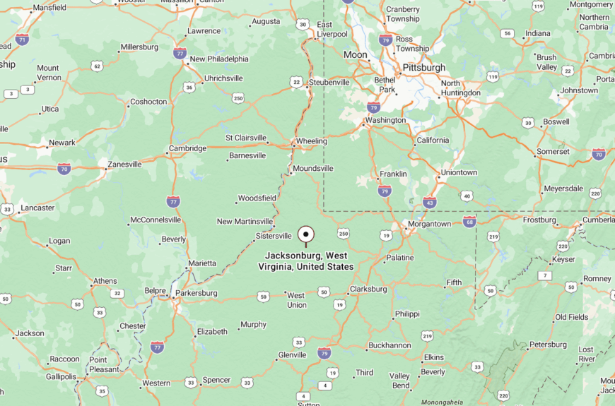
Jacksonburg sits in northwestern Wetzel County, about 30 miles west of Clarksburg. Travelers reach it by following WV Route 20 before turning onto smaller county roads that slip deeper into the hills.
The approach winds past creeks and woodland, narrowing until the town appears almost suddenly in the valley floor. With ridges rising on both sides, Jacksonburg feels sealed into its own secluded pocket.
18. Toll Gate: Where Pastures Meet an Abandoned Rail Spur
Toll Gate is a quiet stop in Ritchie County, sitting beside U.S. Route 50 where open fields press against the low ridges. Its name reaches back to the 19th century, when stagecoaches rattled through and travelers paid to pass the gate that marked the route.
The community feels like a pause in the landscape — a handful of homes, farm plots, and an old store that once served rail and road alike. Though trains no longer pass, the path of the Baltimore & Ohio has been reborn as the North Bend Rail Trail, where cyclists and walkers now trace what locomotives left behind.
Seclusion here is subtle, found not in distance from the road but in the way time has thinned its traffic. Toll Gate exists on the edge of movement, where the past feels preserved in the fields and railbeds that still shape the land.
Where is Toll Gate?
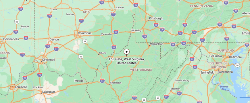
Toll Gate lies in Ritchie County along U.S. Route 50, just five miles east of Pennsboro. The highway cuts a narrow line through ridges before the settlement appears at a bend in the road.
Farm lanes and trailheads branch away here, leading into hollows and toward the North Bend Rail Trail. Though it sits directly on a highway, the town feels pocketed away, with the hills keeping it quiet once you step from the pavement.
17. Rosemont: Forgotten Farm Roads Leading to Open Meadows
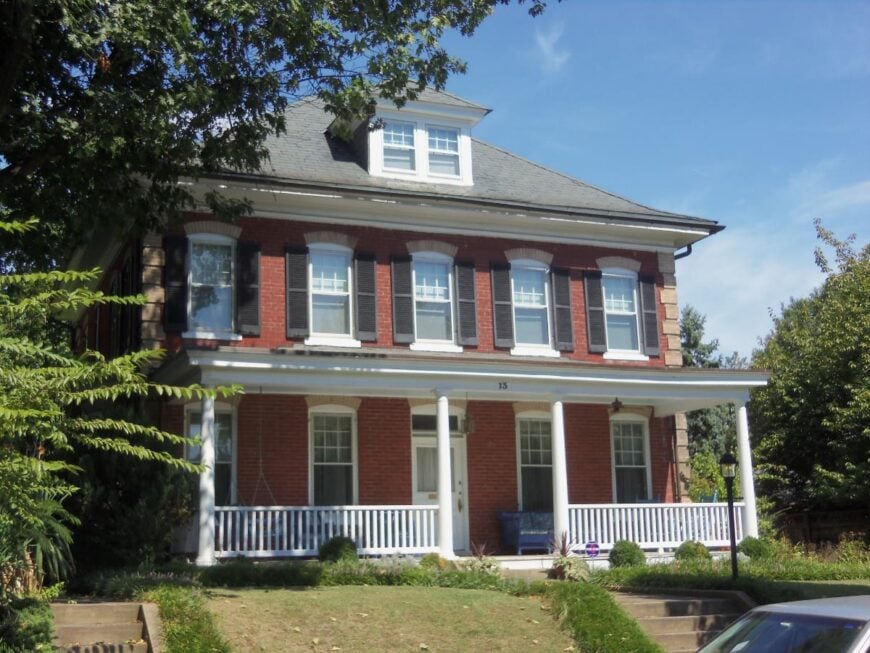
Rosemont, West Virginia is tucked into the gentle hills of Taylor County, a place you find only after following winding backroads past fields and streams. Its seclusion rests in the fact that it isn’t on the way to anywhere—you come here with purpose, not by accident.
The town carries a quiet, pastoral rhythm, where mornings begin with the call of birds and evenings end under skies scattered with stars. A visitor might take a drive through the rolling countryside, stop at a local church that’s stood for generations, or wander along the Tygart Valley River nearby.
Farming has long provided the backbone of daily life, with families tending land that feels as much a part of them as their own names. Rosemont lingers in the heart as the kind of place that shows how still and steady the world can be when left in peace.
Where is Rosemont?
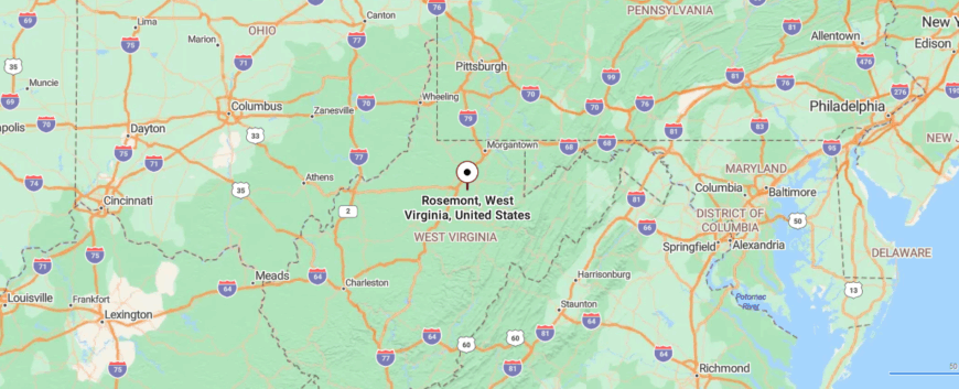
Rosemont rests in Taylor County, in the north-central part of West Virginia. It’s about 10 miles east of Clarksburg, reached by smaller county roads that branch from U.S. Route 50 and wind through farmland and open fields.
The drive carries you past barns and low ridges until the town’s quiet streets come into view. It feels close enough to the city for convenience, yet distant enough to feel wrapped in its own calm pocket of countryside.
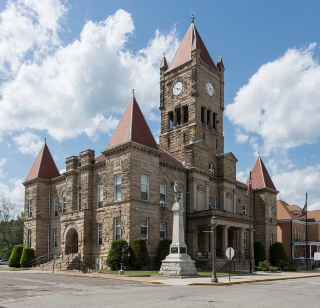
16. Middlebourne: Courthouse Quiet Beside the Creek
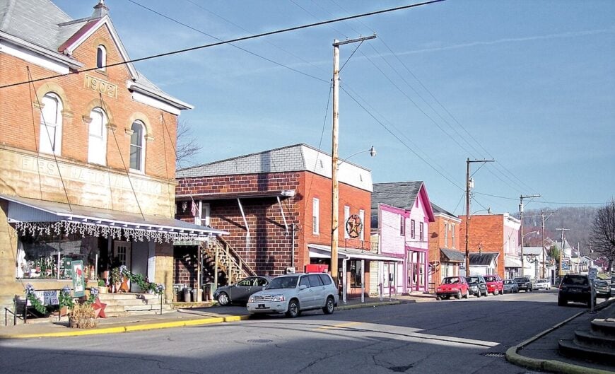
Middlebourne, the seat of Tyler County, feels like a courthouse town tucked into the folds of Middle Island Creek. Its seclusion comes not from distance alone but from the way the valley walls close in until the streets appear suddenly around the square.
The 19th-century courthouse anchors the center, surrounded by brick storefronts, shaded porches, and narrow lanes that slope toward the creek. Days pass with the rhythm of fishing poles along the banks, quiet drives through farmland, and the slow turning of the river.
Life revolves around county business, family farms, and community gatherings, all underscored by the hush of the surrounding hills. Middlebourne carries the weight of its history with a stillness that makes the outside world feel far away.
Where is Middlebourne?
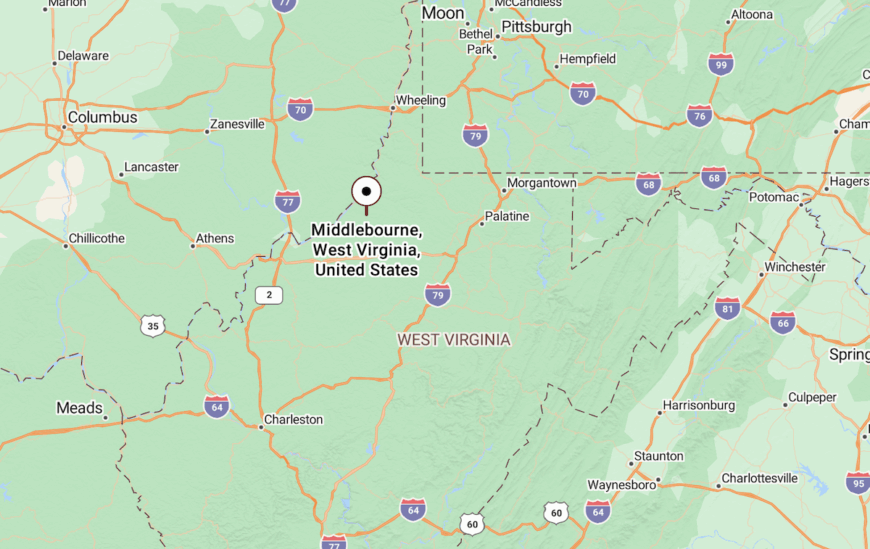
Middlebourne lies in Tyler County along WV Route 18, about 20 miles south of New Martinsville.
The drive follows the bends of Middle Island Creek through wooded ridges and open pastures before the town’s courthouse dome rises into view.
15. Cairo: A Canal Town Quieted by Time
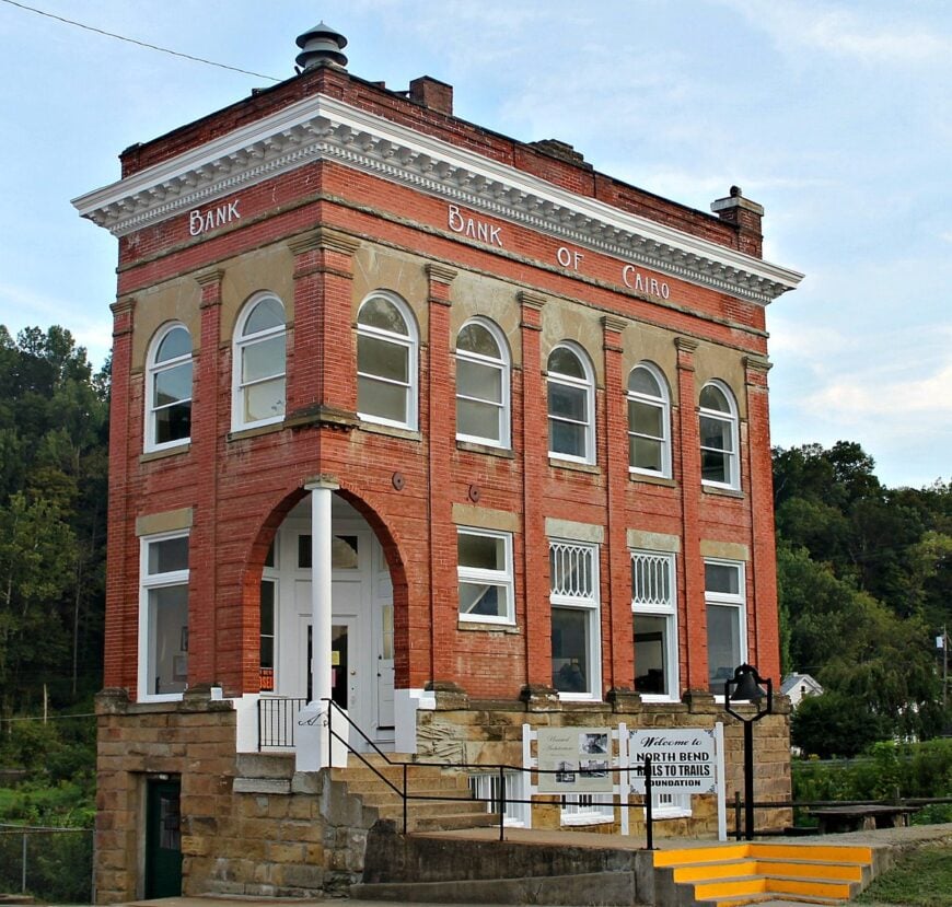
Cairo, West Virginia rests along the North Bend Rail Trail, a former railroad line that now winds quietly through the hills and valleys of Ritchie County. Its seclusion comes from being a small town off the main highways, where the sound of passing trains has long since faded into birdsong and bicycle wheels.
The town carries a historic charm, with century-old buildings, a classic general store, and the easy pace of neighbors who all know one another. Visitors can bike or hike the rail trail, fish in North Bend State Park’s lake, or explore the remnants of Cairo’s oil and gas past.
Once a bustling hub, the economy now leans on tourism and small businesses that cater to travelers along the trail. Cairo leaves you with the feeling of stepping into a slower time, where the quiet of the hills gently lingers.
Where is Cairo?
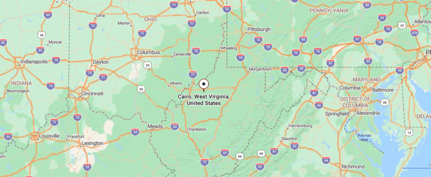
Cairo is set in Ritchie County in northwestern West Virginia, nestled along the North Bend Rail Trail. It lies about 25 miles east of Parkersburg, reached by U.S. Route 50 before turning onto WV Route 31, where the road narrows into wooded curves.
The approach takes you past farmland, forest, and stretches of old rail line that echo the town’s history. By the time you arrive, the quiet valley setting makes it feel like a pocket of the past, sheltered away from the busy world.
14. Littleton: Forgotten Coal Hollow Along the County Line
Littleton, West Virginia sits in a narrow valley near the Pennsylvania border, where forested hills close in and the roads feel more like pathways than highways. Its seclusion comes from being far off the main routes, a former boomtown now softened into quiet by time and distance.
The town carries a historic weight—you can still see hints of its coal and oil past in old buildings and the stories locals keep alive. Visitors might spend time exploring the countryside or tracing the remnants of Littleton’s once-bustling downtown.
Today, life here is simple and steady, with farming and small trades anchoring the community. Littleton leaves you with the haunting charm of a place that remembers its past while holding fast to its slow, quiet present.
Where is Littleton?
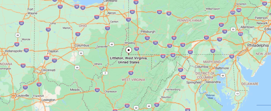
Littleton sits in the northern tip of Wetzel County, not far from the Pennsylvania border. It’s about 35 miles northwest of Morgantown, reached by a series of curving county roads that break away from WV Route 7.
The route moves through forested hills and quiet hollows where cell service fades and the pace of life slows. By the time you reach town, the stillness of the ridges makes it feel like a forgotten corner tucked deep in the hills.
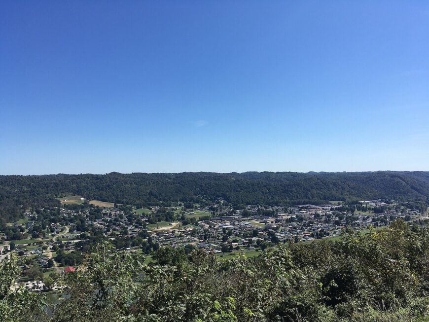
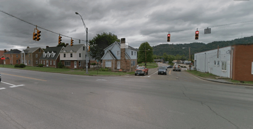
13. New Martinsville: Riverfront Echoes Beneath Steep Ridges
🔥 Would you like to save this?
New Martinsville rests along a broad curve of the Ohio River, where steep bluffs rise behind neighborhoods and fog drifts over the water at dawn. Though larger than the nearby hamlets, it moves with the same riverbound stillness.
Once busy with oil, gas, and glassmaking, the town now leans on community ties, small shops, and a quieter rhythm. The riverfront draws anglers and walkers, while side streets lined with maples and old houses keep the feel of a place shaped more by water and hills than by traffic.
Even as the county seat, New Martinsville feels slower than its history might suggest, its streets tuned to the river’s steady flow. The ridges that crowd close lend it a hushed, almost enclosed atmosphere.
Where is New Martinsville?
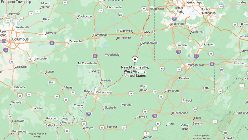
New Martinsville sits in Wetzel County along WV Route 2, about 45 miles south of Wheeling. The Ohio River defines its western edge, while wooded ridges rise sharply to the east.
Approaching from the north or south, the town appears pressed between river and hill, a narrow strip of life held close by the landscape.
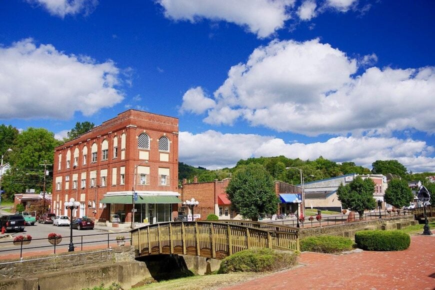
12. Wilbur: Stone Churches and Unbroken Pastures
Wilbur, West Virginia rests deep in Tyler County’s hills, a place you reach only by narrow country roads that seem to wander endlessly through forest and farmland. Its seclusion comes from being far from main routes, leaving it wrapped in stillness and a sense of being forgotten by time.
The town’s rhythm is simple—neighbors gather at small churches, fields stretch quietly toward the tree line, and the creeks provide a steady soundtrack. A visitor might spend time fishing, walking wooded paths, or exploring the backroads dotted with historic family cemeteries.
Farming and small trades remain the backbone of daily life, tying generations closely to the land. Wilbur lingers in memory as a town where the quiet feels almost sacred, a reminder of life’s slower pace.
Where is Wilbur?
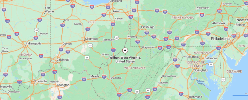
Wilbur rests in Tyler County, a small community hidden among the northwestern hills of West Virginia. It lies about 20 miles southeast of Middlebourne, reached by following WV Route 18 before turning onto narrower county roads that wind through valleys and forested slopes.
The journey is marked by stretches of farmland broken by creeks and shaded hollows, each mile feeling a little more removed. By the time you arrive, Wilbur feels folded into the hills, a place where quiet lingers and the outside world feels far away.
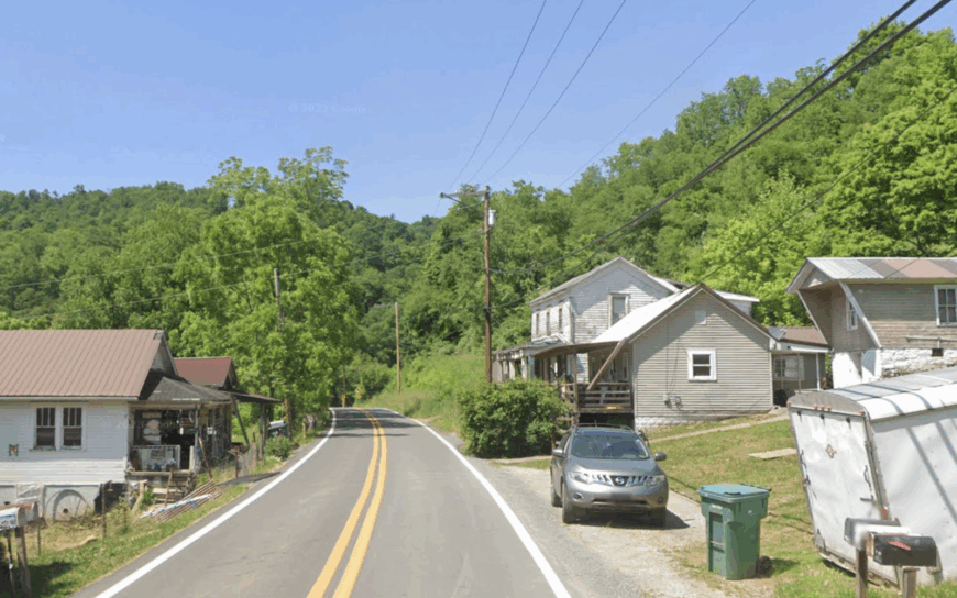
11. Coburn: Creek Bends and a One-Room Schoolhouse
Coburn, West Virginia is tucked into the bends of Ritchie County, where wooded hills and narrow backroads keep it hidden from passing eyes. Its seclusion comes from being far off the main highways, the kind of place you only find if you set out to look for it.
The town carries a quiet, rural rhythm—porches face gravel lanes, creeks wind through hollows, and life unfolds at an unhurried pace. Visitors can enjoy walking along country trails, fishing in shaded streams, or tracing the old rail lines that once connected the area to larger towns.
Farming and small-scale trades have long supported the families here, weaving a steady way of life rooted in the land. Coburn leaves you with the feeling of a town that exists gently apart, content in its own stillness.
Where is Coburn?
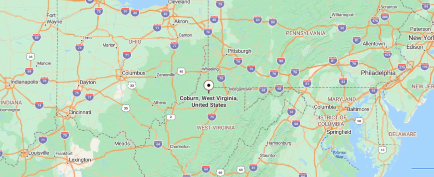
Coburn lies in Ritchie County, tucked into a quiet valley framed by wooded ridges and farmland. It sits about 12 miles southeast of Harrisville, reached by smaller county routes that split from WV-16 and WV-31 before narrowing into winding backroads.
The approach takes you past creeks, barns, and shaded hollows where traffic thins out and the hills draw closer. By the time you arrive, the sense is less of finding a settlement than of discovering a place folded into the land, hidden from the main flow of travel.
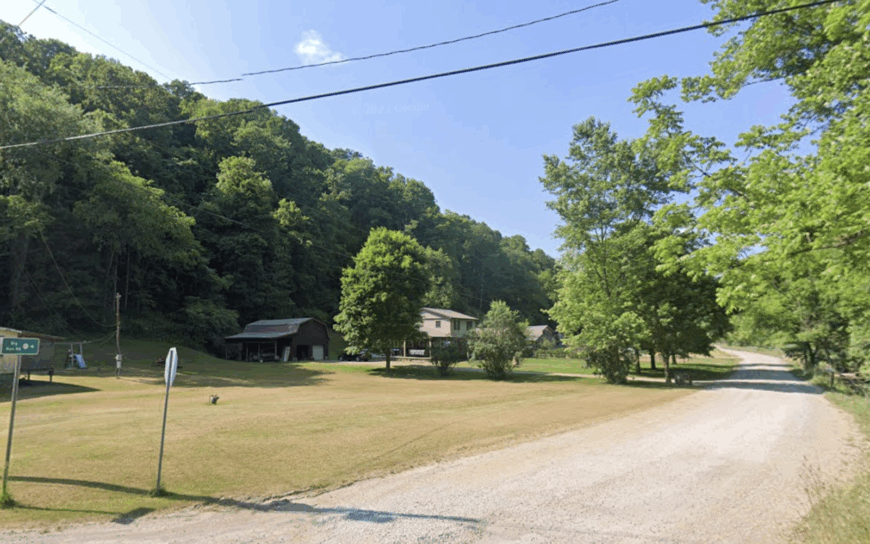
10. Center Point: Covered Bridges and Quiet Hollows
Center Point keeps its unofficial population under 750 by virtue of geography as much as by choice. Travelers come for the 1888 Center Point Covered Bridge, perfect for sunrise shots when mist drifts off the North Fork of Middle Island Creek.
Weekend activity revolves around trout fishing, small-plot farming, and a summer heritage festival held on the schoolyard lawn. Energy jobs tied to natural-gas wells provide the main paychecks, while a few residents sell maple syrup and handmade quilts.
Because the settlement sits well away from any four-lane highway, traffic rarely climbs past a dozen vehicles an hour. Dense ridgelines crowd the horizon, leaving the farmhouses and bridge in a pocket of near perfect stillness.
Where is Center Point?
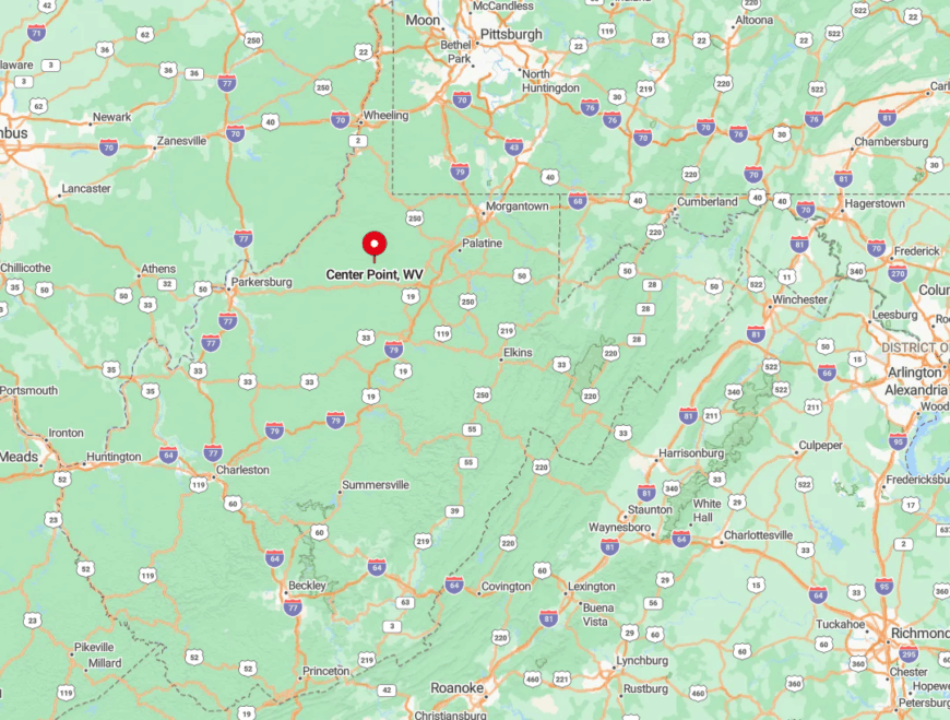
Center Point sits in Doddridge County, about 14 miles southwest of West Union, reached by narrow county roads that branch off WV Route 23. The approach winds through forested ridges and scattered farmsteads until the town comes into view in the McElroy Creek valley.
At the heart of the community stands the 1888 Center Point Covered Bridge, which crosses the North Fork of Middle Island Creek on a quiet lane away from through traffic. Surrounded by steep hills and farmland, the bridge and the village remain tucked into a pocket of countryside that has changed little in more than a century.
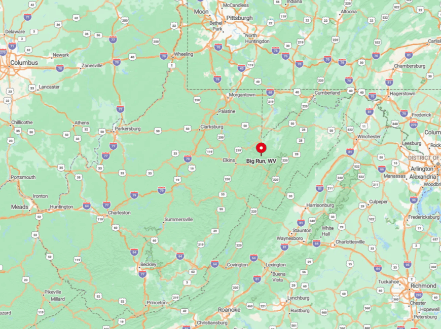
9. Big Run: Creekside Cabins Hidden Among Hemlocks
Fewer than 250 people claim Big Run as home, many of them in spaced-out cabins sitting on five- to ten-acre lots. Fly anglers wade for stocked rainbow trout while photographers wait for dawn fog to snake between the hemlocks that cling to the creek banks.
A handful of outfitters rent cabins and sell bait, and timber cutting on the surrounding slopes brings in supplemental income. Otherwise the valley stays quiet, its steep walls muting any sound that isn’t water or birdsong.
The absence of streetlights means night photography of star trails is exceptional. Visitors often note they can hear the creek all night but never the distant hum of tires.
Where is Big Run?
🔥 Would you like to save this?
The community rests in northeast Wetzel County along County Route 7, roughly 11 miles from Hundred. High ridges on both sides of the stream hide it from US-250 traffic and make radio reception spotty.
Drivers wind downhill through second-growth forest before the first cabin appears beside the water. Four-wheel drive is wise after heavy rain, as the last mile can wash gravel into shallow fords.
8. Alma: Rolling Farmland Miles from the Main Road
Alma counts close to 180 residents spread across broad hayfields dotted with red barns and silo crowns. Sunrise silhouettes of split-rail fences and cattle herds draw landscape artists year-round. Most locals farm beef and hay, while a small number commute west to gas compressor stations near Middlebourne.
There is no stoplight, and the post office shares space with a feed store that closes right after supper. Seclusion comes from distance: the closest grocery is 25 minutes away and the nearest city lights even farther. Nights here settle into a deep hush broken only by whip-poor-wills and lowing cows.
Where is Alma?
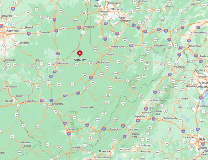
This Tyler County village sits along WV-18 about 15 winding miles south of Middlebourne. Surrounding ridges and unpaved spurs discourage through traffic and keep the night sky pitch black.
The easiest route is WV-18 from Sistersville, though travelers should expect slow speeds past open-range cattle gates. Those who make the drive find camera-ready farmland on every side.
7. Wana: Ridge-Top Views With Nothing but Sky
Roughly 400 people live in Wana, many on one-acre homesteads spread along the uplands near Chestnut Ridge. Daytime diversions include ATV trails, blueberry picking on abandoned pasture, and birdwatching for hawks that ride the updrafts.
Some residents lease mineral rights to natural-gas operators, while others work part-time in Morgantown but retreat home to the quiet. Because the hamlet sits atop a ridgeline with 50 percent forest cover, sunsets stretch across a clean horizon free of utility poles.
Few tourists find their way here, and those who do often comment on the complete absence of traffic noise. Even lawnmowers seem distant once they drop over the next ridge.
Where is Wana?
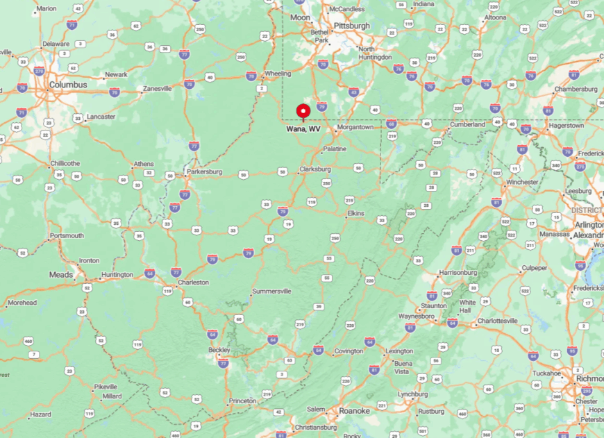
Wana occupies a high knob in northwestern Monongalia County roughly 18 miles from Interstate 79. WV-7 provides the only paved access, then a spur climbs steeply for three miles to the ridge crest.
The elevation blocks cell service in the hollows below, reinforcing the sense of separation. Tall treelines and minimal development guarantee unbroken views in every compass direction.
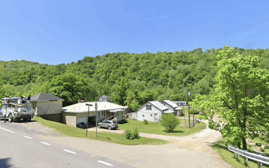
6. Wick: One-Lane Roads Through Endless Hayfields
Few people call Wick home, nearly all of them living along single-lane gravel roads edged by split-rail fences. Summer brings baled hay stacked beside the road and the low rumble of antique tractors chugging between fields.
Small-scale cattle farming remains the primary livelihood, with a few residents tapping hardwood stands for syrup in late winter. No commercial strip intrudes, and power lines dive into woodland corridors to stay out of sight.
Leafy hills form a natural sound wall, so even diesel engines fade fast once they crest a ridge. Photographers often use drones here, capturing wide-angle views of quilt-square pastures untouched by signage.
Where is Wick?
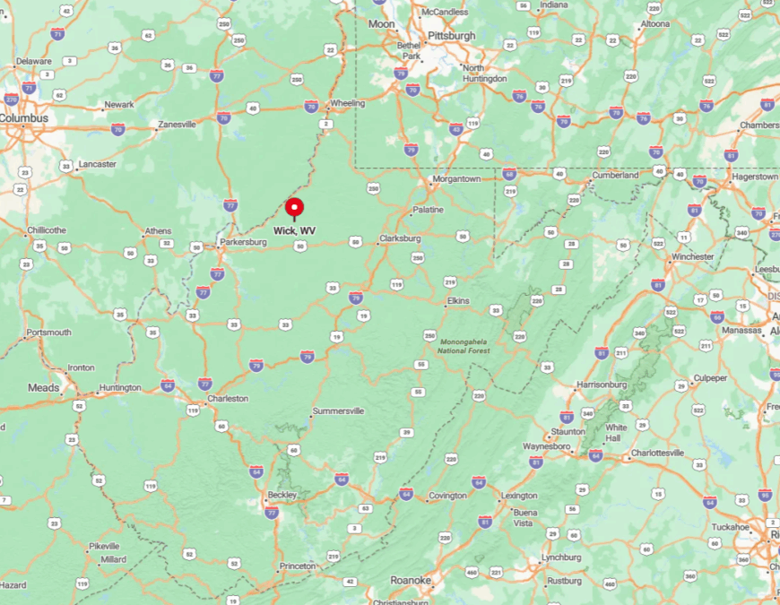
The settlement lies in southern Tyler County along County Route 21, roughly 12 miles southeast of Middlebourne. Hills and sharp bends mean drivers rarely exceed 30 miles per hour, keeping visitor numbers low.
The nearest gas pump sits back in Middlebourne, underscoring Wick’s isolation. Reaching it rewards travelers with classic Appalachian farm scenes in every direction.
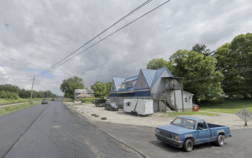
5. Porters Falls: Waterfall White Noise Instead of Traffic
Porters Falls hosts about 200 residents clustered near a lively cascade on Middle Island Creek. Locals fish for smallmouth bass, paddle canoes beneath overhanging sycamores, and wander the mossy rock ledges for macro photography.
Some work in timber or drive to Paden City glass plants, yet evenings find most gathered on porches listening to the constant rush of water. Because the falls mask distant sounds, visitors quickly forget the outside world.
Limited housing stock and flood-plain restrictions keep growth minimal. The result is a village where the soundtrack is always creek song, never honking horns.
Where is Porters Falls?
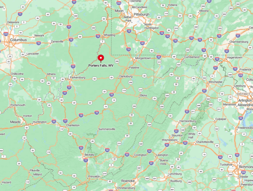
This Wetzel County spot sits on WV-20 about nine miles south of Pine Grove. Steep valley walls and the winding creek road discourage heavy trucks, preserving the calm. A small turnout by the bridge allows visitors to park and walk a short path to the falls. From there the highway bends away, leaving only the waterfall’s echo.
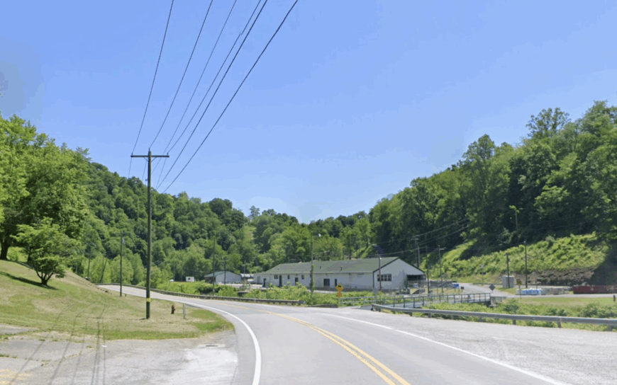
4. Bens Run: River Bends Guarded by Sycamore Groves
Bens Run counts roughly 300 inhabitants spread along a quiet backwater of the Ohio River. Anglers launch jon boats at dawn, photographers capture mirror-smooth water framed by towering sycamores, and children hunt for arrowheads on the gravel bars after high water.
Farming and river-related barge work supply most local jobs, though a few retirees keep gardens and honeybee hives. Dense tree stands between the river and WV-2 hush the place even when barges drift past.
With no tourist docks or marinas nearby, the shoreline feels private and undisturbed. Evening lights reflect off the water in gentle ripples rather than neon glare.
Where is Bens Run?
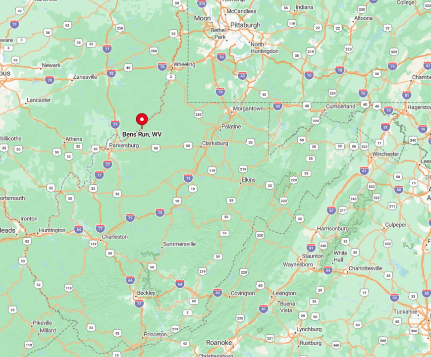
The community clings to a long curve of the Ohio River in southwest Tyler County, about 10 miles north of St. Marys. Drivers exit WV-2 onto a short riverside lane that dead-ends at the last house, ensuring practically zero through traffic.
High bluffs across the river and thick sycamore groves on both banks block sightlines to industry farther south. Access is simple yet limited, which keeps the population low and the scenery pristine.
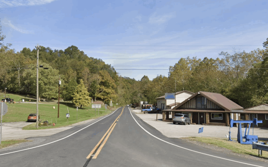
3. Hastings: Abandoned Oil-Boom Streets Reclaimed by Forest
Hastings supports fewer than 60 permanent residents living among brick company houses left from an early-1900s oil boom. Adventurous visitors explore crumbling storefronts now framed by second-growth hardwoods, while photographers capture eerie alleyways carpeted in moss.
A handful of hunting cabins bring a flicker of seasonal commerce, and the remaining locals often work in nearby New Martinsville. The town’s half-empty grid and absence of new construction create a time-capsule feel unmatched in the region.
Forest edges creep closer each year, softening hard lines and muting echoes. After sunset, only tree frogs and distant train whistles break the silence.
Where is Hastings?
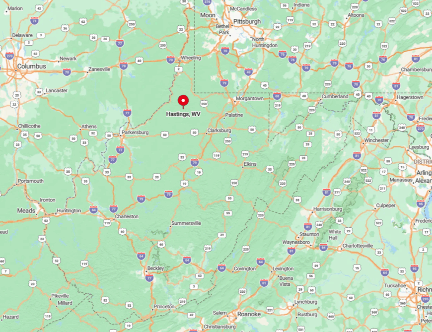
The near-ghost town lies in central Wetzel County off WV-7, then two miles down an unnumbered spur that once served oil tank wagons. Tall timber hides the former main street from passing drivers, and a low railroad trestle limits large vehicles.
GPS signals often drift, so paper maps prove handy. Those who persist find an atmospheric slice of Appalachian history surrounded by woodland.
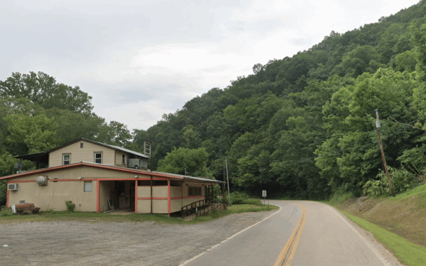
2. Smithville: A Single General Store Serving Miles of Meadows
Smithville’s population sits near 420, strung along WV-47 with homesteads separated by broad cow pastures. The clapboard general store doubles as a sandwich counter and mailbox hub, giving travelers a taste of mid-century rural life.
Cattle ranching dominates the local economy, supplemented by occasional pipeline maintenance jobs. With no billboards, stoplights, or chain businesses, the roadside offers unbroken meadow vistas that roll to the horizon.
Even during hay season the hum of tractors remains distant across wide fields. After dark the store’s lone streetlamp becomes the brightest point for miles.
Where is Smithville?
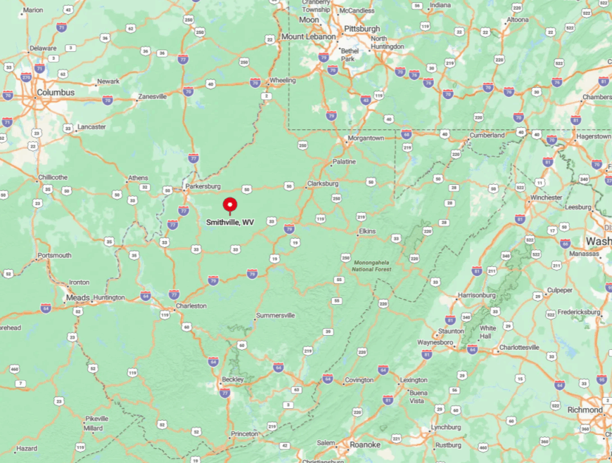
This Ritchie County village sits 20 miles east of Harrisville along WV-47. Hills on both sides act as buffers, and the two-lane highway seldom sees heavy traffic.
Drivers commonly share the road with wandering guinea hens or the local mail jeep. The route promises classic country scenes at every bend and almost no competition for parking.
1. Macfarlan: Valley Homesteads Tucked Behind Slate Bluffs
Macfarlan hosts about 175 residents scattered along a twisting hollow carved by Spring Creek. Daylight hours see anglers testing the creek’s rocky pools, photographers shooting sheer slate outcrops, and families tending gardens shaded by black walnut trees.
Small farms and part-time forestry work provide income, while a community center in a converted schoolhouse hosts quilt circles and potluck suppers. Towering bluffs and dense woodland ensure almost total darkness at night, making Milky Way photography exceptional.
Because the hollow lies far from any urban glow, even minor sounds echo off the rock walls before vanishing. Visitors often remark they feel wrapped in stone and forest the moment they turn off the state road.
Where is Macfarlan?
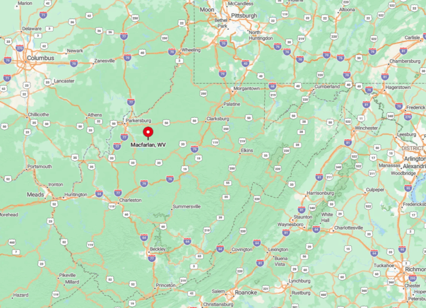
The village rests in southern Ritchie County on WV-47, then a sharp turn south onto County Route 5/17 that follows Spring Creek for five secluded miles. High slate bluffs rise on both sides, hiding the valley from satellite towns.
Road access narrows to one lane in spots, so traffic remains minimal and deliberate. Those willing to navigate the bends discover star-laden skies and creek fords that seem a world away from the interstate grid.