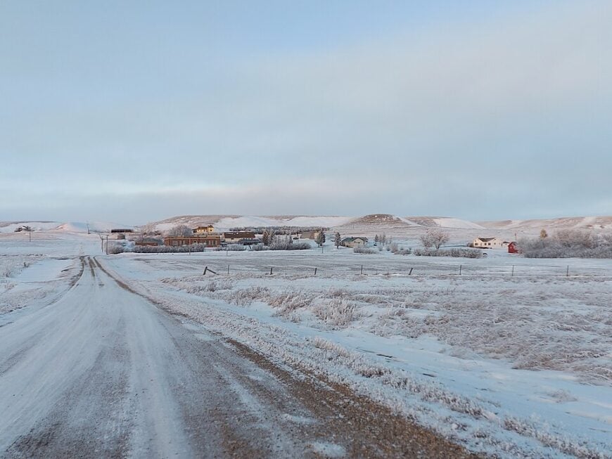
Northwest North Dakota breathes in long, slow syllables across prairie wind. This is the quadrant where the grid thins and the map folds at its quietest crease. Out here, towns like Zahl and Crosby ride the edge of the sky, tucked between amber wheat fields and soft-spoken hills. They linger far from the thunder of interstates and closer to the pulse of rattling cottonwoods and horizon-line calm.
In order to come up with the very specific design ideas, we create most designs with the assistance of state-of-the-art AI interior design software. Also, assume links that take you off the site are affiliate links such as links to Amazon. this means we may earn a commission if you buy something.
This is the Williston Basin, named for the boomtown but defined by what came before and what still resists speed. Before fracking rigs and before fence lines, this was Hidatsa and Assiniboine land. Today, it’s a canvas of low population, high sky, and towns that keep their own counsel. Here, a streetlamp flickers and holds the dark like it matters.
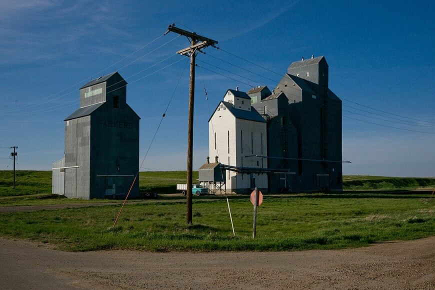
Zahl’s population hovers around a dozen; Hanks barely registers. Yet the stories stack up—grain elevators, abandoned schoolhouses, ghost diners painted in prairie light. A short drive from Crosby, the Writing Rock State Historic Site guards sacred petroglyphs carved long before Lewis and Clark squinted west.
Solitude runs deep here, steady as the wind across the wheat. Spend enough time, and the land recalibrates you.
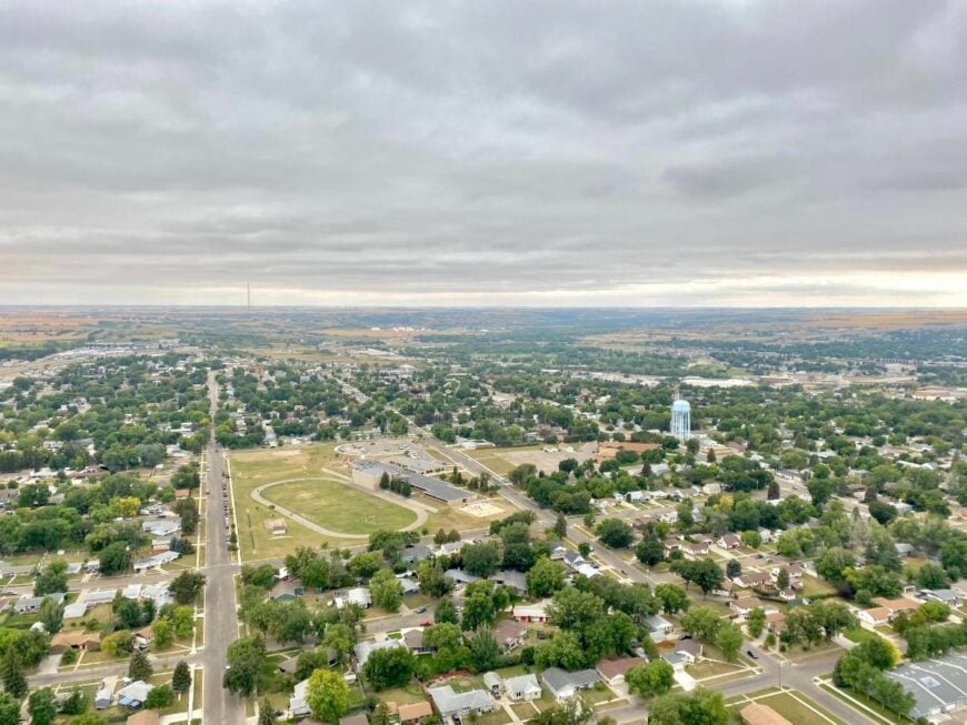
25. Williston: The Vibrant Heart of the Bakken
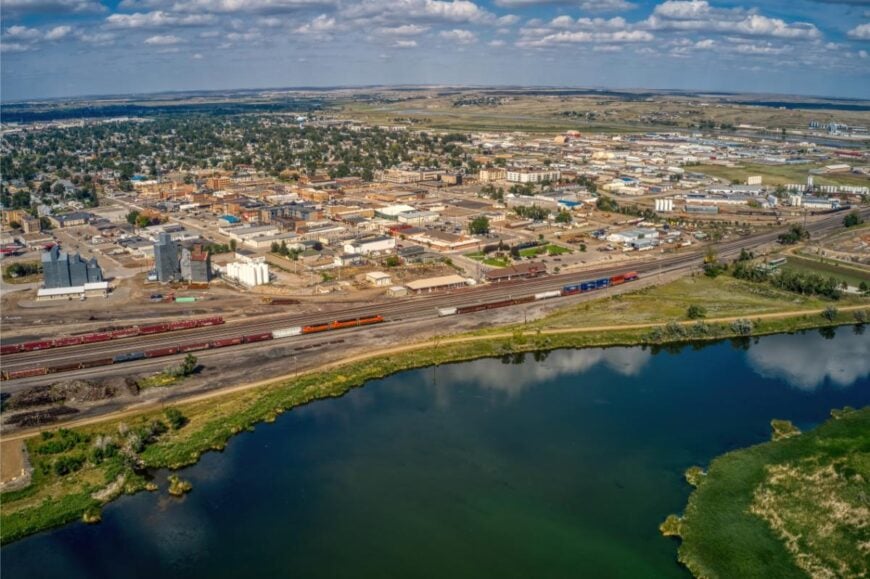
Williston, North Dakota sits in the far northwest corner of the state, where prairies stretch endlessly and the horizon feels impossibly wide. Its seclusion comes from the sheer distance—hours from major cities, with open highways that only emphasize its remoteness.
The town reflects both grit and resilience, shaped by the oil boom while still holding onto its agricultural roots. Locals find escape on Lake Sakakawea, fishing the Missouri River, or exploring the rugged beauty of Theodore Roosevelt National Park.
History echoes in museums and frontier landmarks, reminders of settlers who carved lives from the windswept land. Williston remains a place where the frontier spirit endures, and the vast landscape sets the rhythm of life.
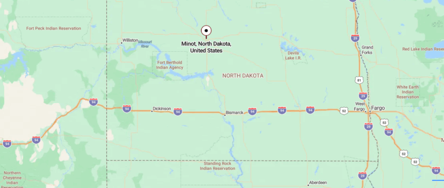
Where is Williston?
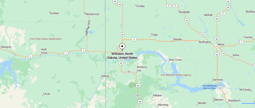
Williston sits in northwestern North Dakota, close to the Montana border and less than 70 miles south of Canada. It lies along US Highway 2 and US Highway 85, routes that carry travelers across rolling prairie before narrowing into the Missouri River Valley where the town stands.
The area is best known as a hub of the Bakken oil fields, yet the wide plains and long horizons still give it a sense of open solitude. Out here, the distances themselves create the seclusion, with sky and land stretching so far they seem to quiet everything else.
24. Minot: The Magic City
Minot, North Dakota rests along the Souris River, surrounded by wide prairies that give it a sense of distance from the rest of the world. Though larger than many nearby towns, it feels set apart by the miles of open land that stretch in every direction.
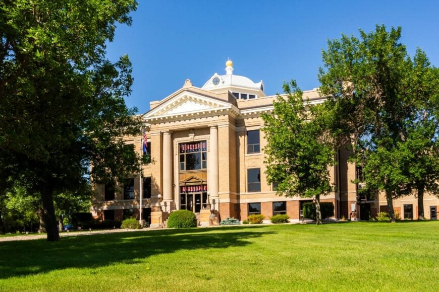
The city is shaped by the nearby Air Force base and also carries the charm of its historic downtown with old theaters and brick storefronts. Visitors can stroll the riverwalk, spend time at Roosevelt Park Zoo, or join the annual Norsk Høstfest, a festival honoring Scandinavian roots.
Each season brings a new rhythm, from snow-covered winters to summers alive with fairs and music. Minot leaves you with the impression of a prairie town that balances tradition with steady growth.
Where is Minot?
Minot rests in north-central North Dakota, about 100 miles south of Canada and 120 miles north of Bismarck. The town is reached by US Highway 83 or US Highway 2, where long stretches of prairie road pass fields and open sky.
It sits in the Souris River Valley, a setting that feels like a sheltered pocket within the plains. Surrounded by vast distance, Minot carries the quiet seclusion of a place set apart by the horizon itself.
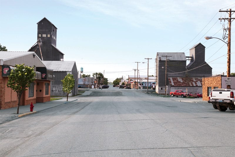
23. Stanley: The Agricultural Hub
Stanley, North Dakota rests in the heart of Mountrail County, where prairies stretch wide and the horizon feels endless. Its seclusion comes from being far from major cities, connected mostly by long highways that cut through open fields and sky.
The town is closely tied to the oil industry, with rigs and wells marking the landscape while small businesses keep the community grounded. Visitors can explore local museums that preserve pioneer history, or take quiet drives through the countryside where wildlife often crosses the roads.
Festivals and gatherings bring neighbors together, giving the town a warmth that balances its rugged surroundings. Stanley carries the feel of a place where the land’s vastness shapes both daily life and enduring spirit.
Where is Stanley?
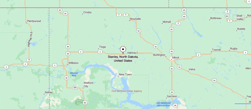
Stanley lies in northwestern North Dakota, about 55 miles east of Williston and 65 miles west of Minot. Travelers usually arrive by US Highway 2, a broad stretch of road that crosses rolling farmland and open prairie.
The town emerges quietly along the route, small against the backdrop of endless sky and fields. Its setting gives it a steady sense of seclusion, where wide horizons make the bustle of larger cities feel far away.
22. Tioga: The Charming Retreat
Tioga, North Dakota sits in the northwest corner of the state, surrounded by rolling prairies that stretch to the horizon. Its seclusion comes from distance, with miles of farmland and open sky separating it from larger towns and cities.
Known as the “Oil Capital of North Dakota,” the town’s identity is rooted in the energy industry that fuels much of its economy. Visitors can stop at the Tioga Farm Festival, explore local history at small museums, or enjoy fishing and boating on nearby Lake Sakakawea.
The streets remain quiet, with community gatherings providing the strongest pulse of daily life. Tioga leaves the impression of a town shaped by both resilience and the vast landscape around it.
Where is Tioga?
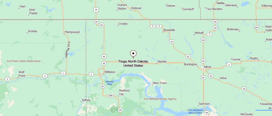
Tioga sits in northwestern North Dakota, about 50 miles northeast of Williston and 70 miles west of Minot. It is reached by US Highway 2, where the road carries you over miles of open prairie and farmland before narrowing toward town.
The community is closely tied to the Bakken oil fields, yet its scale feels modest against the sweep of the plains. Surrounded by wide horizons, Tioga holds the quiet remove of a place where distance shapes daily life.
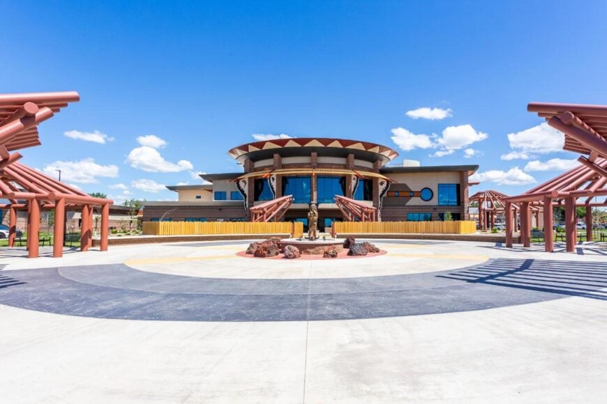
21. New Town: The Cultural Center
New Town, North Dakota sits along the northern edge of Lake Sakakawea, where water and prairie meet in sweeping, open views. Its seclusion comes from the sheer expanse of the lake and surrounding plains, which create both distance and quiet from busier parts of the state.
The town is the center of the Mandan, Hidatsa, and Arikara Nation, giving it a cultural depth that shows in local art, history, and traditions. Visitors can fish or boat on the lake, hike trails with wide panoramas, or explore Native heritage at the Earth Lodge Village and cultural center.
Despite its growth, New Town still carries the stillness of the plains, where sunrises stretch unbroken across the horizon. It’s a place where land, water, and tradition come together, offering a rhythm that feels both timeless and strong.
Where is New Town?
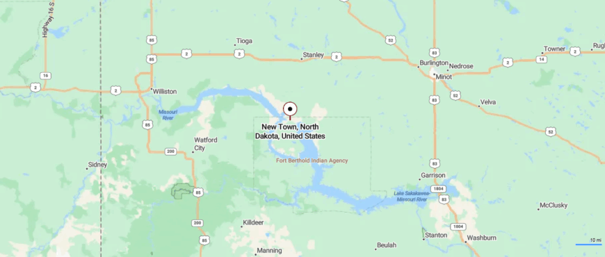
New Town rests in northwestern North Dakota along the northern shore of Lake Sakakawea, about 45 miles southeast of Williston. The main approach is via ND Highway 23, a route that winds across rolling prairie before giving way to open views of the lake.
Water defines the town’s edges, with bridges and causeways linking it to the wider region. That meeting of prairie and water gives New Town a feeling of quiet remove, as if it sits on its own island within the plains.
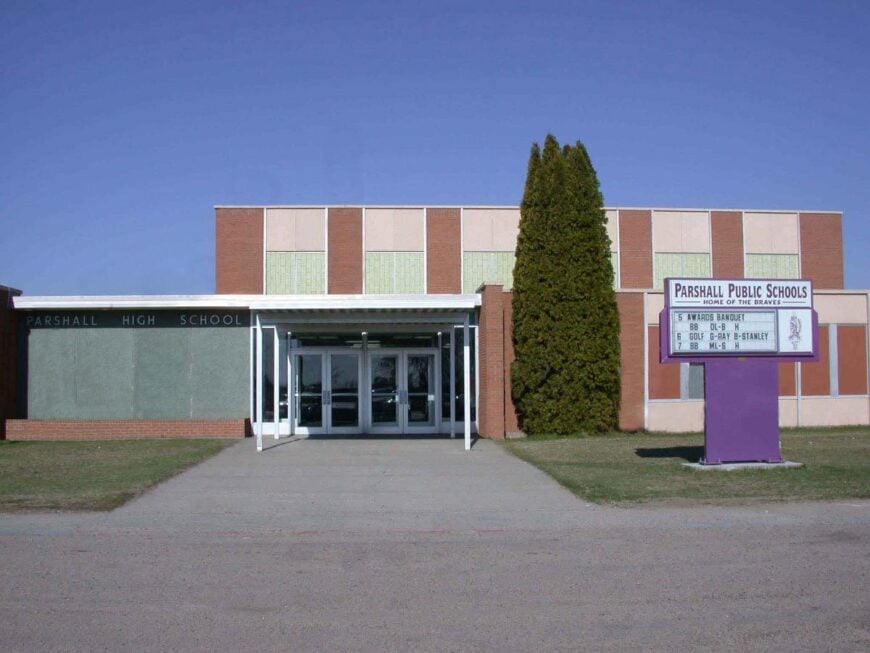
20. Parshall: The Community Spirit
Parshall, North Dakota rests on the prairie within the Fort Berthold Reservation, a small town surrounded by miles of open land and sky. Its seclusion comes from being far from larger cities, with quiet highways the only link to the outside.
The town is closely tied to Native heritage, with the Mandan, Hidatsa, and Arikara Nation shaping its culture and traditions. Visitors can explore local history at the MHA Nation Museum, attend community powwows, or enjoy the wide prairies that offer endless views.
Oil production plays a large role in the economy, yet the town still holds onto its close-knit atmosphere. Parshall carries the feeling of resilience, where culture and landscape remain at the heart of daily life.
Where is Parshall?
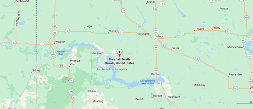
Parshall is located in Mountrail County in northwestern North Dakota, about 60 miles southeast of Williston and 65 miles west of Minot. The drive in along ND Highway 23 passes wide stretches of farmland and prairie that seem to stretch endlessly.
The town sits close to Lake Sakakawea, where the land meets water in long, open views. That blend of prairie distance and quiet shoreline lends Parshall a sense of being tucked gently away from the rush of larger places.
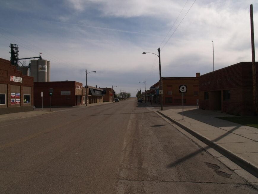
19. Bowbells: The Quaint Town
🔥 Would you like to save this?
Bowbells, North Dakota rests near the Canadian border, a prairie town surrounded by endless fields and wide horizons. Its seclusion comes from geography—miles of farmland and quiet roads separate it from larger cities, leaving it peaceful and remote.
The town’s character is reflected in its historic courthouse, small shops, and the steady rhythm of community gatherings. Visitors often explore the nearby Des Lacs National Wildlife Refuge, where wetlands, trails, and migrating birds bring the prairie to life.
Farming remains important here, but it blends with the simple charm of a place where neighbors know one another well. Bowbells leaves you with the sense of a prairie town where quiet and open skies define each day.
Where is Bowbells?
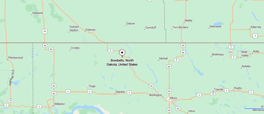
Bowbells sits in Burke County of northwestern North Dakota, about 20 miles south of the Canadian border and 75 miles northwest of Minot. Travelers reach it by US Highway 52, a route that crosses miles of open prairie dotted with fields and windbreaks.
The town appears modestly along the highway, its streets surrounded by the wide quiet of farmland. Out here, the horizon itself is the boundary, giving Bowbells a solitude shaped by open land and sky.
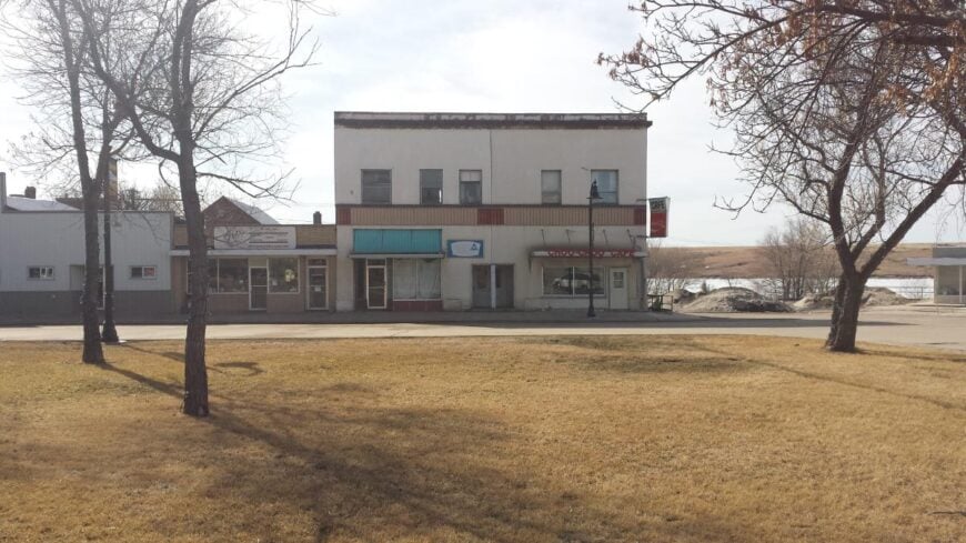
18. Mohall: The Serene Community
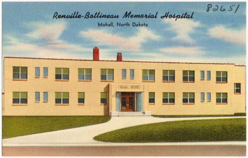
Mohall, North Dakota sits quietly in Renville County, surrounded by rolling farmland and the vast skies of the northern plains. Its seclusion comes from its distance to larger cities, with long stretches of highway reinforcing the feeling of being set apart.
The town’s centerpiece is its historic courthouse and a small main street that speaks to its enduring role as a county hub. Nearby, visitors can enjoy outdoor escapes like wildlife watching, hunting, or exploring prairie trails that cut through open country.
Community events and school activities bring residents together, giving the town a strong sense of connection despite its small size. Mohall carries the calm of a prairie town where tradition and wide horizons shape daily life.
Where is Mohall?
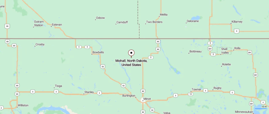
Mohall lies in Renville County of north-central North Dakota, about 20 miles south of the Canadian border and 40 miles northwest of Minot. It’s reached by US Highway 52, a road that carries you over sweeping fields and open prairie with few breaks in the horizon.
The town sits quietly in the middle of farmland, its streets framed by wide stretches of sky. That surrounding openness gives Mohall a steady sense of seclusion, as though distance itself defines its calm.
17. Kenmare: The Picturesque Town
Kenmare, North Dakota rests near the Des Lacs River, framed by rolling hills and the nearby Des Lacs National Wildlife Refuge. Its seclusion is felt in the way the prairie stretches out endlessly around it, with the refuge creating a natural buffer of lakes, marsh, and quiet trails.
The town is known for its historic square and Scandinavian roots, celebrated in small festivals and community traditions. Visitors come for birdwatching, photography, and the sweeping views offered by the refuge’s scenic drives.
Local shops and diners give the community a warm, familiar rhythm that contrasts with the vast openness outside town. Kenmare leaves the impression of a prairie town where heritage and nature meet in peaceful balance.
Where is Kenmare?
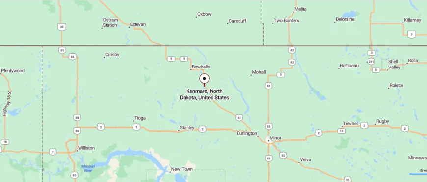
Kenmare rests in Ward County of northwestern North Dakota, about 50 miles northwest of Minot and 25 miles south of the Canadian border. US Highway 52 leads the way in, a route that rolls over farmland and prairie before curving toward the Des Lacs River valley.
The town is set near the Des Lacs National Wildlife Refuge, where water and wetlands break up the sweep of open fields. That mix of prairie distance and quiet marshland gives Kenmare a feeling of being tucked at the edge of the plains.
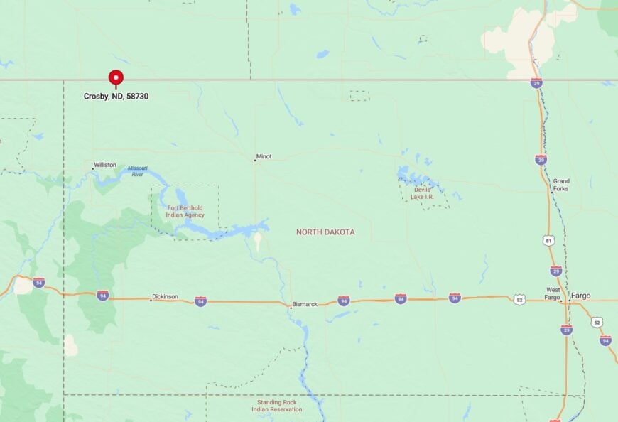
16. Crosby: The Friendly Town
Crosby, North Dakota lies in the far northwest corner of the state, only a few miles from the Canadian border, where open prairie stretches into quiet horizons. Its seclusion comes from that distance—long highways cross miles of farmland before leading into this small, sturdy town.
The community’s roots are reflected in its historic courthouse and local museum, which preserve stories of homesteaders and pioneers. Outdoor life is close at hand, with hunting, fishing, and wide prairie drives offering simple escapes into the surrounding landscape.
Oil and agriculture shape much of the local economy, though the pace of daily life remains unhurried. Crosby feels like a place where history, land, and wide skies come together to define the rhythm of living.
Where is Crosby?
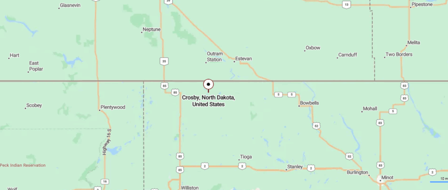
Crosby sits in Divide County at the far northwestern corner of North Dakota, only a few miles from the Canadian border and about 80 miles northwest of Minot. The approach comes along US Highway 85, a long prairie road stretching past farmland and open sky with little to break the view.
The town emerges quietly from the plains, small against the vast sweep of horizon. Its remote setting gives Crosby a sense of stillness, where distance itself feels like part of daily life.
15. Ray: The Bustling Community
Ray, North Dakota rests along Highway 2 in the northwest part of the state, surrounded by wide prairies that stretch in every direction. Its seclusion is felt in the long distances between nearby towns, where the open land makes the horizon seem endless.
The community’s history reaches back to the railroad days, still reflected in small landmarks and stories passed down through generations. Visitors can enjoy quiet drives through the countryside, take part in local festivals, or head toward Lake Sakakawea for fishing and boating.
Oil development plays a large role in the area, yet the town holds onto its small-town character and close-knit feel. Ray leaves you with the impression of a prairie town steady in its roots, shaped by land and sky.
Where is Ray?
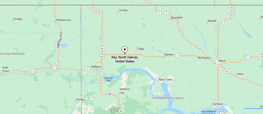
Ray is set in Williams County of northwestern North Dakota, about 20 miles east of Williston and 70 miles west of Minot. US Highway 2 brings travelers across rolling farmland and open prairie before narrowing into the town’s quiet streets.
The landscape feels wide and uncluttered, with long views stretching in every direction. That openness leaves Ray with a quiet sense of separation, as though it sits in its own pocket of prairie calm.
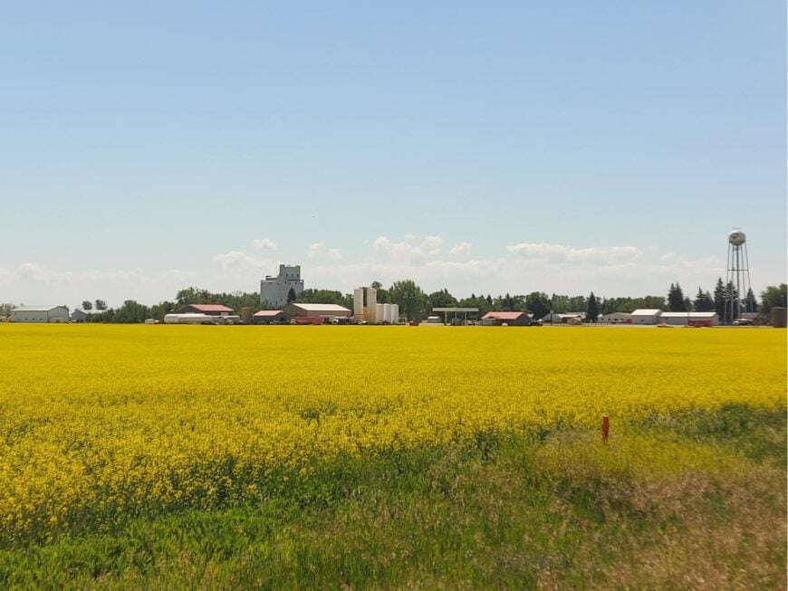
14. McClusky: The Serene Lifestyle
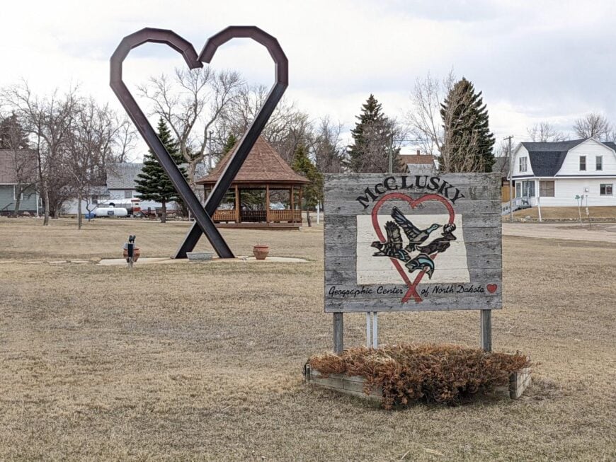
McClusky, North Dakota sits in the center of the state, often called the “Heart of North Dakota,” surrounded by endless farmland and prairie lakes. Its seclusion comes from the long stretches of quiet roads that lead to town, with the distance itself giving it a tucked-away feel.
The community is small but steady, with a main street of shops, a historic courthouse, and gathering places that reflect its role as Sheridan County’s seat. Outdoor life is close by, with fishing on area lakes, birdwatching, and prairie drives offering calm escapes into open country.
Local events and traditions tie neighbors together, giving the town a sense of warmth despite its remote setting. McClusky leaves the impression of a heartland town where simplicity and open skies define daily life.
Where is McClusky?
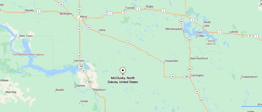
McClusky sits in Sheridan County at the geographic center of North Dakota, about 60 miles northeast of Bismarck. It’s reached by ND Highway 200, a two-lane road that winds through farmland, open fields, and small lakes before arriving in town.
The setting is surrounded by prairie and water, giving it a quieter rhythm than the larger cities to the west and south. That balance of distance and stillness makes McClusky feel like a town both central and yet gently set apart.
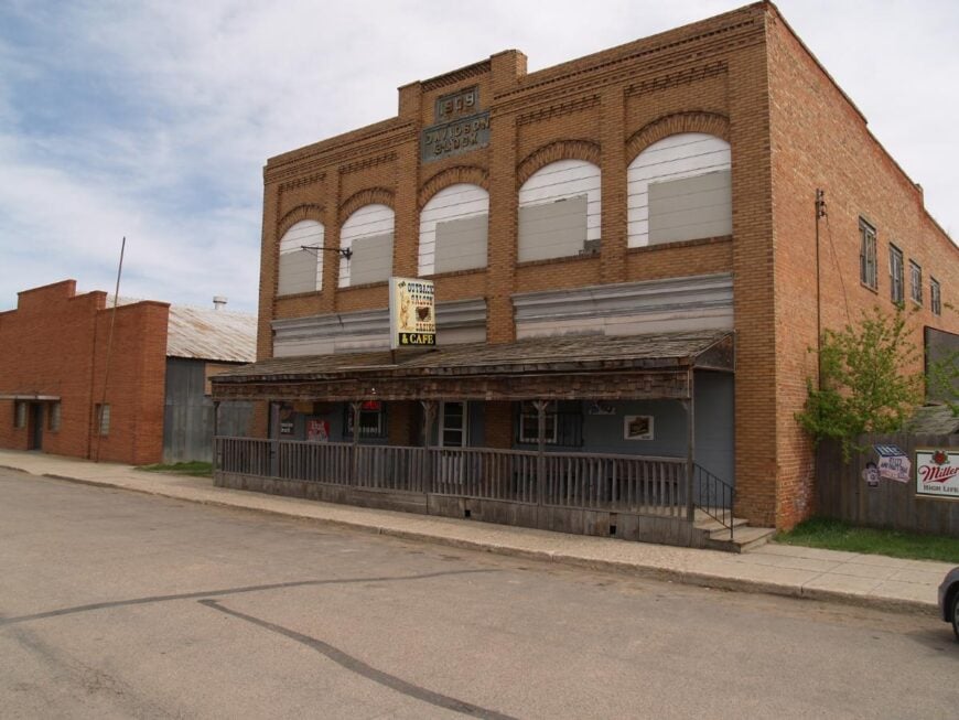
13. Lignite: The Coal Mining Community
🔥 Would you like to save this?
Lignite, North Dakota rests close to the Canadian border, a small town surrounded by open prairie and quiet backroads. Its seclusion comes from distance—miles of farmland and sky separate it from larger towns, leaving it peaceful and remote.
The community traces its history to the coal mines that once gave the town its name, with echoes of that past still present in local memory. Visitors can explore the nearby Des Lacs National Wildlife Refuge, where wetlands, trails, and bird migrations bring the prairie to life.
Local gatherings and school events provide the strongest pulse of daily life, keeping neighbors closely connected. Lignite feels like a place where history, land, and open horizons continue to shape the rhythm of living.
Where is Lignite?
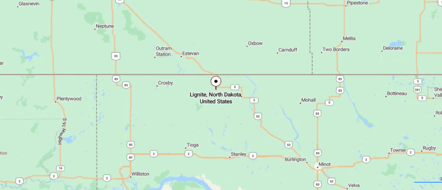
Lignite rests in Burke County of northwestern North Dakota, just 8 miles south of the Canadian border and about 85 miles northwest of Minot. Travelers arrive by US Highway 52, a road that stretches across farmland and prairie before reaching the town’s small grid of streets.
The community takes its name from the coal once mined nearby, though today it’s surrounded mostly by quiet fields. Its position near the border and the wide sweep of land around it give Lignite a strong sense of solitude.
12. Portal: The Border Town
Portal, North Dakota sits at the northern edge of Burke County, right on the Canadian border, where the prairie feels wide and unbroken. Its seclusion comes not only from distance but from being a true border town, with quiet roads stretching far between larger communities.
The town’s history is tied to the railroad and international crossing, still visible in old buildings and the steady movement of trains. Visitors can pause at local landmarks, explore nearby countryside, or watch migratory birds along the prairie wetlands.
Life here carries a steady rhythm, shaped by both cross-border ties and the calm of open land. Portal leaves the impression of a town balanced between two countries yet rooted firmly in prairie quiet.
Where is Portal?
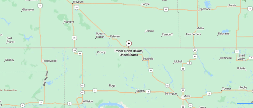
Portal sits at the very top of Burke County in northwestern North Dakota, directly on the Canadian border and about 85 miles northwest of Minot. It’s reached by US Highway 52, a long prairie route that ends where the town meets the international crossing.
Small streets press against vast open fields, with the border station marking the edge of daily life. That mix of quiet farmland and frontier line gives Portal a feeling of remoteness, as if it stands both at the edge of the state and apart from it.
11. Watford City: The Gateway to the Badlands
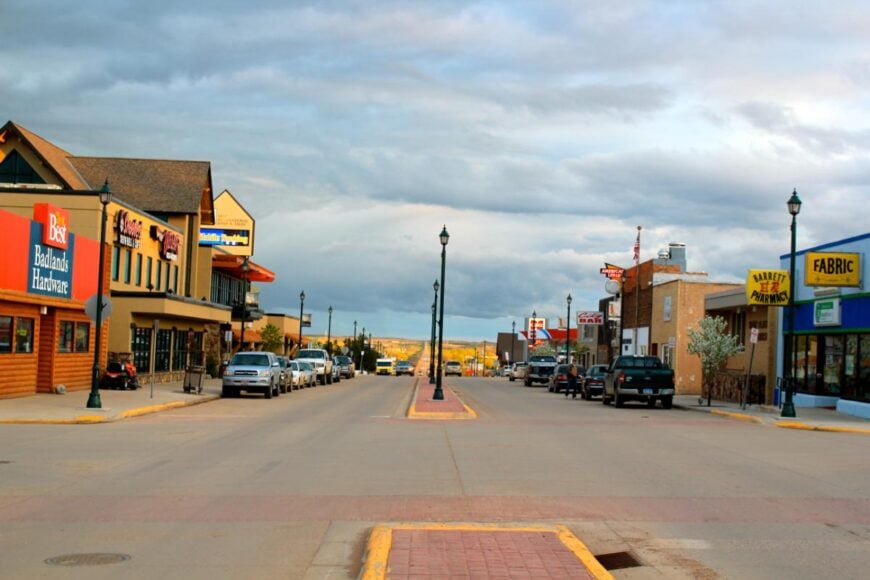
Watford City, North Dakota sits at the edge of the Badlands, surrounded by rugged buttes and wide stretches of prairie that create a sense of distance from the rest of the world. Its seclusion comes from geography—miles of open land separate it from larger towns, giving it a frontier-like feel.
The community has grown rapidly with the oil boom, blending modern development with its small-town heart. Visitors are drawn to Theodore Roosevelt National Park nearby, where trails, wildlife, and sweeping views define the landscape.
Local festivals, rodeos, and gatherings fill the calendar, adding vibrancy to life on the plains. Watford City carries the spirit of a town shaped by both resilience and the vast beauty of the land around it.
Where is Watford City?
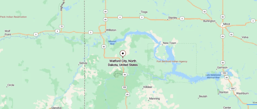
Watford City lies in McKenzie County of western North Dakota, about 45 miles southeast of Williston and 100 miles northwest of Bismarck. The town is reached by US Highway 85, a road that cuts through rolling prairie and into the rugged breaks leading toward the Badlands.
Its setting places it near Theodore Roosevelt National Park, where buttes and wide skies frame the horizon. That blend of open land and dramatic landscape gives Watford City a sense of being both connected and distinctly set apart.
10. Zahl: The Secluded Corner of the Northwest

Zahl is a tiny unincorporated community with a population hovering around 15 people. Here, you can immerse yourself in the tranquility of the open plains, where the skies seem endless and the sunsets are breathtaking. While there aren’t typical tourist attractions, the area is perfect for birdwatching and photography, capturing the untouched beauty of North Dakota’s landscape.
The main industries are agriculture and ranching, with local farms dotting the horizon. What makes Zahl truly secluded is its minimal population and the vast distances between homes, giving you a real sense of solitude that’s hard to find elsewhere.
Where is Zahl?
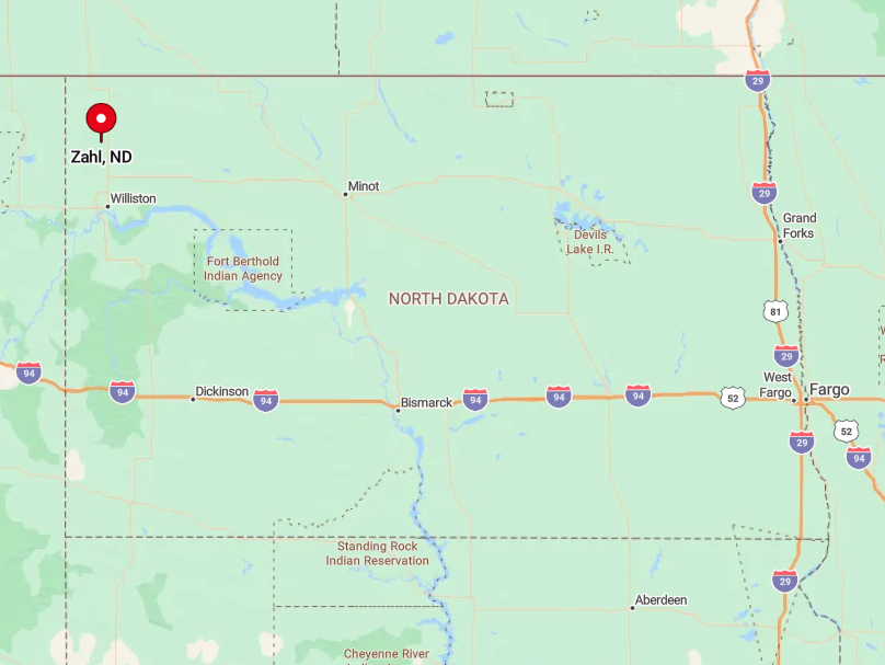
Zahl is located in the extreme northwest corner of North Dakota, just a few miles from the Canadian border.
Its remote location contributes significantly to its seclusion, as it’s far from major highways and urban centers. To get there, take Highway 85 north from Williston and then head west on a series of smaller county roads.
The journey itself is part of the charm, leading you through peaceful countryside and rolling prairies. The isolation of Zahl makes it an ideal spot for those looking to disconnect and enjoy the simplicity of rural life.
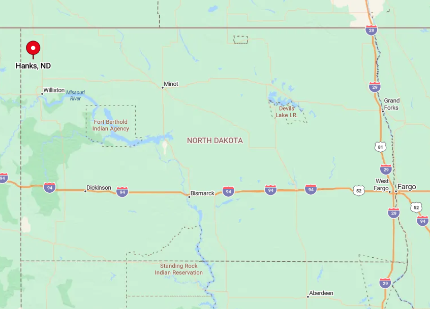
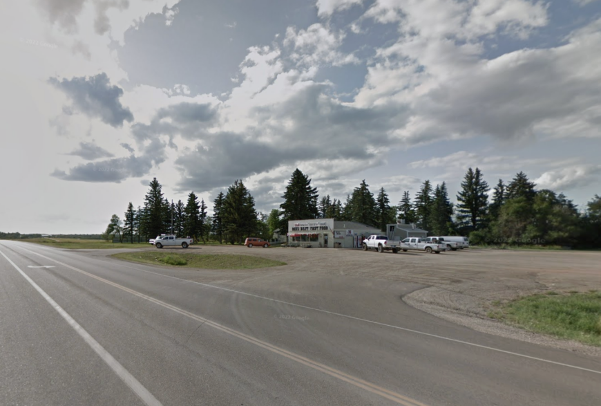
9. Hanks: Lost in the Tranquility of the Open Plains

Hanks is another unincorporated community with a population of less than 10 people, offering an unmatched level of peace and quiet.
The town is surrounded by expansive fields and gentle rolling hills, making it perfect for nature walks and contemplative solitude. While there aren’t any commercial attractions, exploring the remnants of historic buildings hint at its past.
Agriculture is the primary industry here, with vast farmlands stretching as far as the eye can see. Hanks’ seclusion comes from its virtually nonexistent population and the miles of open land that separate it from neighboring towns.
Where is Hanks?
🔥 Would you like to save this?
Located in Williams County, Hanks sits northwest of Williston, nestled close to the Montana border. Its remote setting is accentuated by the lack of major roads passing through, making it a quiet retreat away from traffic and noise.
To reach Hanks, drive west from Williston on Highway 2 and then venture onto lesser-known county roads that wind through the prairie. The journey is a peaceful one, with the vast landscape providing a serene backdrop. Hanks’ isolation is ideal for anyone seeking a deep sense of escape from the bustle of everyday life.
8. Epping: A Retreat into North Dakota’s Quiet Countryside
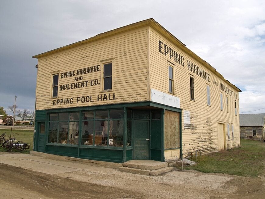
With a population of around 100 residents, Epping offers a small-town feel that is incredibly welcoming.
The town is surrounded by vast farmlands, providing ample opportunities for scenic drives and photography. For activities, you can visit the nearby Epping-Springbrook Dam Recreation Area, a hidden gem for fishing, picnicking, and enjoying the outdoors.
The main industries are agriculture and some oil production, but the pace of life remains slow and relaxed. Epping’s seclusion is due to its small population and the expansive rural surroundings that make it feel miles away from the nearest city.
Where is Epping?
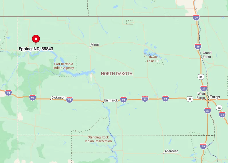
Epping is situated in Williams County, about 20 miles northeast of Williston. Its location off the beaten path contributes to its quiet atmosphere, with minimal traffic passing through.
Get there by taking Highway 2 east from Williston and then turning north onto Route 42. The town’s setting amidst rolling fields and wide-open spaces reinforces its secluded nature. For those looking to unwind in a peaceful rural environment, Epping is a delightful escape.
7. Lunds Valley: The Quiet Beauty of Unspoiled Nature

Lunds Valley is an unincorporated area with a sparse population that emphasizes its serene environment. The region is characterized by rolling hills and valleys, which are perfect for hiking and nature photography.
There aren’t any commercial activities, but the natural scenery provides a backdrop for relaxation and exploration. Agriculture remains the mainstay of the local economy, with family-owned farms scattered throughout the area.
What makes Lunds Valley secluded is its untouched landscapes and the feeling of being enveloped by nature without the interruptions of modern life.
Where is Lunds Valley?
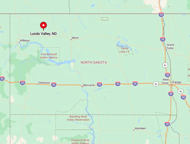
Located in Mountrail County, Lunds Valley lies east of Tioga, nestled among the gentle hills of northwest North Dakota. Its isolation is heightened by the absence of major roads and the low population density of the county.
To reach Lunds Valley, drive east from Tioga on Highway 2 and then navigate through smaller county roads that lead into the heart of the valley.
The journey offers picturesque views that make the trip worthwhile. The seclusion of Lunds Valley is ideal for those who wish to immerse themselves in the quiet beauty of nature.
6. White Earth: Tranquility at the Edge of the Plains

White Earth is a small community with around 50 residents, offering a peaceful atmosphere where the prairie meets the sky. The town is a great spot for those interested in wildlife, as the nearby White Earth Valley offers opportunities for birdwatching and enjoying undisturbed habitats.
Agriculture is the main industry, with wheat fields and pastures dominating the landscape. The seclusion of White Earth comes from its small size and lack of urban development, allowing you to experience the simplicity of rural living.
Where is White Earth?
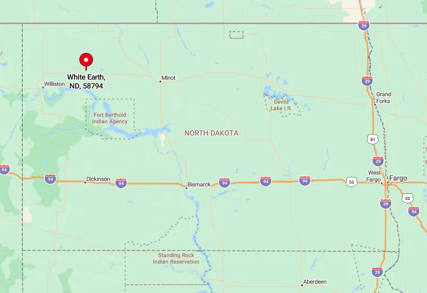
Situated in Mountrail County, White Earth is located southeast of Tioga and northeast of Stanley. Its position away from major highways enhances its secluded feel. Access it via Highway 2, turning onto smaller county roads that weave through the countryside.
The journey through open fields and gentle hills contributes to the sense of escape. White Earth’s remote location makes it a perfect destination for those seeking tranquility away from crowded places.
5. Ambrose: A Tiny Town with Endless Horizons

Ambrose is a small town with a population of about 25 people, offering a quiet setting where open landscapes stretch as far as the eye can see. Visit the nearby lakes for fishing and the peaceful countryside for leisurely walks.
The primary industry is agriculture, with a focus on grain farming. What makes Ambrose secluded is its minimal population and the vast expanses of farmland surrounding it, providing ample space for reflection and solitude.
Where is Ambrose?

Located in Divide County near the Canadian border, Ambrose is northwest of Crosby. Its remote location contributes to its tranquility, with few travelers passing through.
Reach Ambrose by taking Highway 5 west from Crosby and then heading north on local roads. The town’s isolation amidst the vast plains makes it an ideal spot for those looking to disconnect and enjoy the quietude of rural North Dakota.
4. Alamo: Secluded Serenity on the Western Plains
Alamo is a tiny community with around 50 residents, offering a serene environment perfect for escaping city life. The area is great for outdoor activities like hunting and wildlife observation, with prairies and wetlands nearby.
Agriculture is the main industry, focusing on crops like wheat and canola. Alamo’s seclusion stems from its small population and the miles of open land that buffer it from larger towns, creating a peaceful retreat.
Where is Alamo?

Situated in Williams County, Alamo lies northwest of Williston. Its position far from major highways enhances its secluded atmosphere. Get there by driving west from Williston on Highway 2 and then north on smaller county roads.
The vast open spaces and minimal traffic make the journey to Alamo a peaceful one, reinforcing its appeal as a secluded destination.
3. Keene: Rustic Tranquility in the Heart of McKenzie County

Keene is an unincorporated area with a population of about 50 people, surrounded by the unspoiled beauty of rural North Dakota. The town is close to the Arnegard Dam Recreation Area, where you can enjoy fishing and picnicking by the water.
The main industries are agriculture and some oil production, but the community maintains a quiet, rustic charm. Keene’s seclusion is due to its sparse population and the rolling landscapes that offer a sense of peaceful isolation.
Where is Keene?
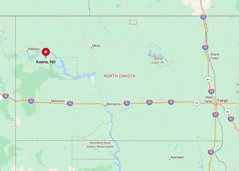
Located in McKenzie County, Keene is southeast of Williston and north of Watford City. Its remote setting is accentuated by the surrounding prairies and minimal development.
To reach Keene, take Highway 23 east from Watford City, then head north on local roads. The journey through the open countryside adds to the feeling of seclusion, making Keene a perfect spot for those seeking a quiet escape.
2. Charlson: A Peaceful Hamlet Amid Rolling Hills
Charlson is an unincorporated community with a handful of residents, offering a tranquil atmosphere amidst North Dakota’s gentle hills. The nearby Lake Sakakawea provides opportunities for fishing, boating, and enjoying the waterfront.
Agriculture and ranching are the main industries, contributing to the area’s rustic character. Charlson’s seclusion comes from its tiny population and the expansive rural areas that surround it, making it an ideal location for solitude.
Where is Charlson?

Charlson is located in McKenzie County, east of Watford City and near the shores of Lake Sakakawea. Its position away from major roads enhances its quiet ambiance.
Reach Charlson by taking Highway 23 east from Watford City and then turning onto smaller county roads that lead toward the lake. The scenic drive through rolling hills and open fields reinforces the town’s secluded nature, perfect for a peaceful retreat.
1. Crosby: Nearby Writing Rock State Historic Site

Crosby is a small but charming city in Divide County, North Dakota, with a population of just over 1,000 people. Nestled near the Canadian border, it boasts a quiet, peaceful atmosphere surrounded by rolling prairies and open skies, making it a serene retreat from the busier parts of the state.
The area offers unique attractions, such as the nearby Writing Rock State Historic Site, which showcases ancient Native American petroglyphs. Outdoor enthusiasts can enjoy activities like birdwatching, fishing, and hiking in the picturesque countryside.
The local economy is supported by agriculture and energy industries, with farming and oil production playing significant roles. What makes Crosby secluded is its distance from major urban centers, offering residents and visitors alike a tranquil escape into North Dakota’s scenic northwest.
Where is Crosby?
Located in Divide County, Crosby lies near the Canadian border, offering a peaceful atmosphere and a sense of solitude surrounded by rolling prairies. Its remote location in the northwest corner of North Dakota gives it a serene, tucked-away charm.
To get there, take Highway 5 west from Williston, enjoying the wide-open landscapes and peaceful countryside. Crosby’s tranquil setting and distance from urban centers make it an ideal destination for those looking to immerse themselves in the natural beauty and quietude of the northern plains.


