🔥 Would you like to save this?
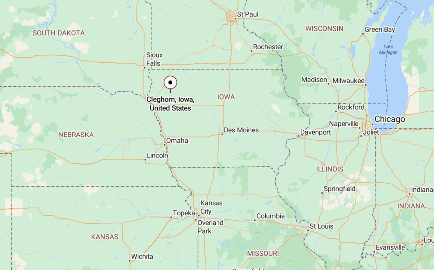
Northwest Iowa hides a scattering of villages where cornfields, river bends, and wooded bluffs muffle the outside world. Our survey of these places uncovers communities that keep populations under 600, celebrate quiet main streets, and cherish wide landscapes instead of wide Wi-Fi.
Grain elevators double as landmarks, night skies stay ink-black, and a trip to the grocery store often begins with a gravel road. Each town offers its own small surprise, from a one-room museum to a bridge that hums in the wind.
In order to come up with the very specific design ideas, we create most designs with the assistance of state-of-the-art AI interior design software. Also, assume links that take you off the site are affiliate links such as links to Amazon. this means we may earn a commission if you buy something.
Visitors soon notice that front doors stay unlocked and everybody waves, yet the next stoplight might sit twenty miles away. For anyone drawn to slower pulses and bigger horizons, the following twenty five spots deserve a closer look.
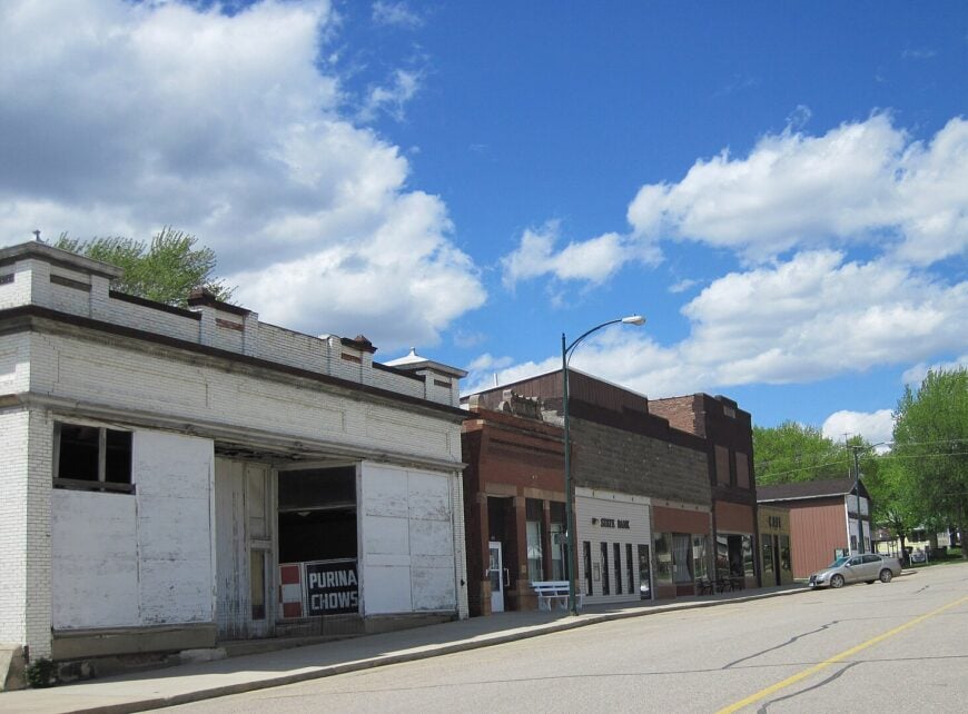
25. Hospers – Dutch-Inspired Hamlet Along the Floyd River Flats
Set amid the rolling farmland of northwest Iowa, Hospers feels like a small dot on the map where life moves at a neighborly pace. Far from big cities and surrounded by fields that stretch to the horizon, it’s a place where the sound of wind through corn rows is as common as the ring of a church bell.
Founded by Dutch settlers, its roots still shape the town’s traditions, from community gatherings to well-kept streets lined with tidy homes. Days here might include a stop at the local café, a high school ballgame under the lights, or a drive along quiet country roads.
Farming anchors the local economy, with fields and livestock operations surrounding the town in every direction. Evenings bring wide-open skies lit by brilliant sunsets or an endless sweep of stars. It’s the kind of place where time feels unhurried, and the simple rhythms of rural life take center stage.
Where is Hospers?
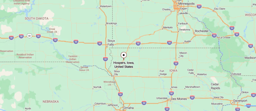
Hospers is in northwestern Iowa, about 50 miles northeast of Sioux City and 8 miles north of U.S. Highway 18. The route in follows open county roads through farmland and wide prairie, with few towns along the way.
Its location away from major highways helps it keep a calm, close-knit feel. It’s near enough for a short drive to larger towns, yet far enough that the quiet settles in quickly.
24. Struble – Rail-Bend Village Between Corn Rows and River Timber
North of the Floyd River, Struble is a quiet rural community that feels more like a crossroads than a destination. Surrounded by open farmland and far from bustling city streets, it’s the kind of place where the horizon seems endless and the pace of life is steady.
Once a small hub along the railroad, its history lingers in a few weathered buildings and the stories passed between neighbors. Today, farming remains the backbone of daily life, with fields, silos, and livestock defining the landscape.
Visitors might pass through on a scenic drive, pause to photograph the grain elevators, or simply enjoy the quiet of the countryside. The air here carries the scent of fresh-cut hay in summer and woodsmoke in winter. It’s the kind of place where the stillness feels complete, and the outside world seems very far away.
Where is Struble?
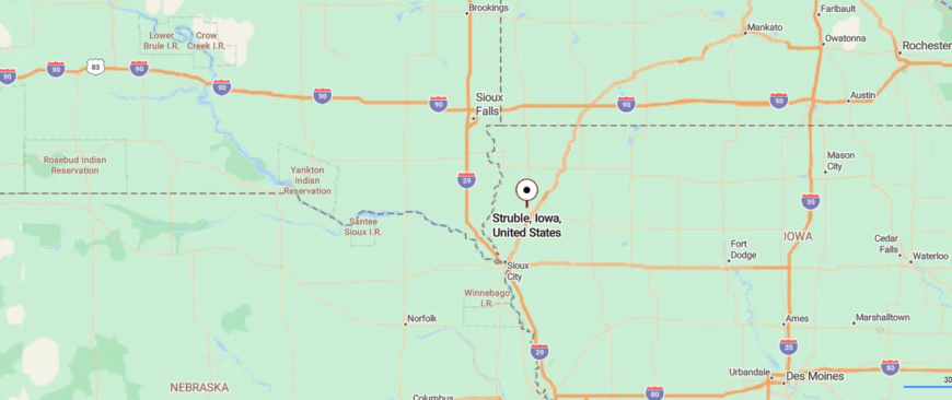
Struble is located in northwestern Iowa, about 45 miles northeast of Sioux City and 6 miles north of Le Mars. You reach it by way of county roads that branch off U.S. Highway 75, passing through stretches of farmland and open sky.
Its small size and distance from main travel routes keep it peaceful and slow-paced. It’s close enough for easy access, yet far enough to feel like you’ve stepped into a quieter world.
23. Alvord – Prairie-Edged Settlement in Lyon County’s Farmland
Tucked in Iowa’s far northwest corner, Alvord is a tiny farming town surrounded by fields that stretch for miles in every direction. With no major highways nearby, it feels set apart, where the hum of tractors and the rustle of crops are the day’s background music.
Founded in the late 1800s, its roots remain in agriculture, and family farms still anchor the community’s rhythm. Life here is quiet but connected—neighbors gather at the local church, ballfield, or small-town café. Visitors might pass through on a rural drive, catching sight of silos against a big, open sky.
Sunsets spill across the land in long streaks of gold and pink, and nights bring a deep, uninterrupted stillness. It’s the kind of place where the world feels wide, and time moves with the turning of the seasons.
Where is Alvord?
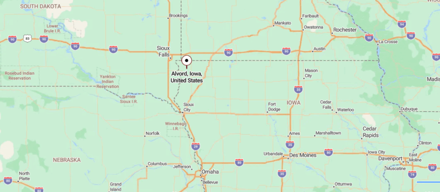
Alvord sits in northwestern Iowa, about 60 miles northeast of Sioux City and 12 miles north of U.S. Highway 18. The approach follows quiet county roads through rolling farmland and open prairie.
Its location far from major cities and highways preserves a still, unhurried atmosphere. It’s close enough for a quick trip to nearby towns, yet far enough to feel entirely removed from the rush.
22. Granville – Ridge-Top Village with Catholic Roots

Granville sits in the rolling farmland of northwest Iowa, a small community with roots stretching back to its 19th-century founding by German and Luxembourg settlers. Far from large cities, it’s surrounded by open fields, quiet gravel roads, and the steady pace of agricultural life.
The town’s close-knit spirit shows in its well-kept homes, active church life, and local gatherings that draw neighbors together year-round. Farming remains the backbone of the economy, with grain elevators and farmsteads dotting the surrounding landscape.
Visitors might pause to admire the historic St. Joseph Catholic Church, stop at a local diner, or simply enjoy the peaceful countryside views. Evenings bring broad, colorful sunsets fading into starlit skies. It’s the kind of place where tradition holds strong and the quiet feels deeply rooted.
Where is Granville?
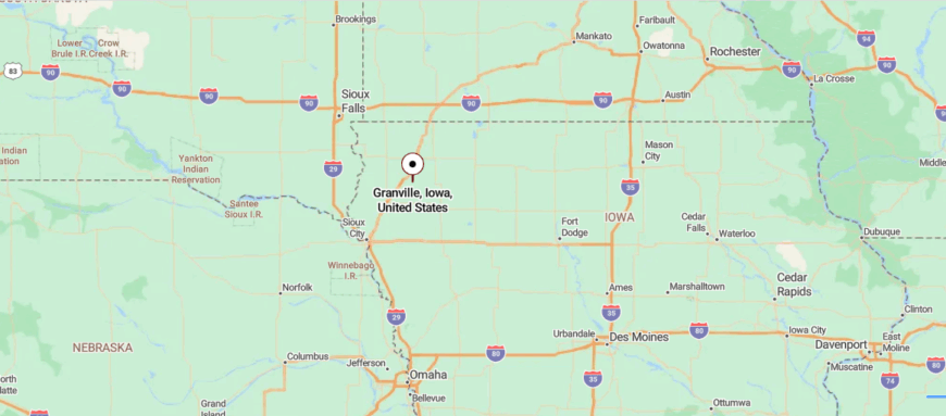
Granville is in northwestern Iowa, about 55 miles northeast of Sioux City and 6 miles north of U.S. Highway 20. The drive there follows rural highways and county roads bordered by farmland and wide-open fields.
Its position away from major interstates helps it maintain a calm, small-town character. It’s near enough for daily connections, yet far enough that the quiet of the countryside takes over.
21. Inwood – Loess-Hill Gateway Beside the West Fork
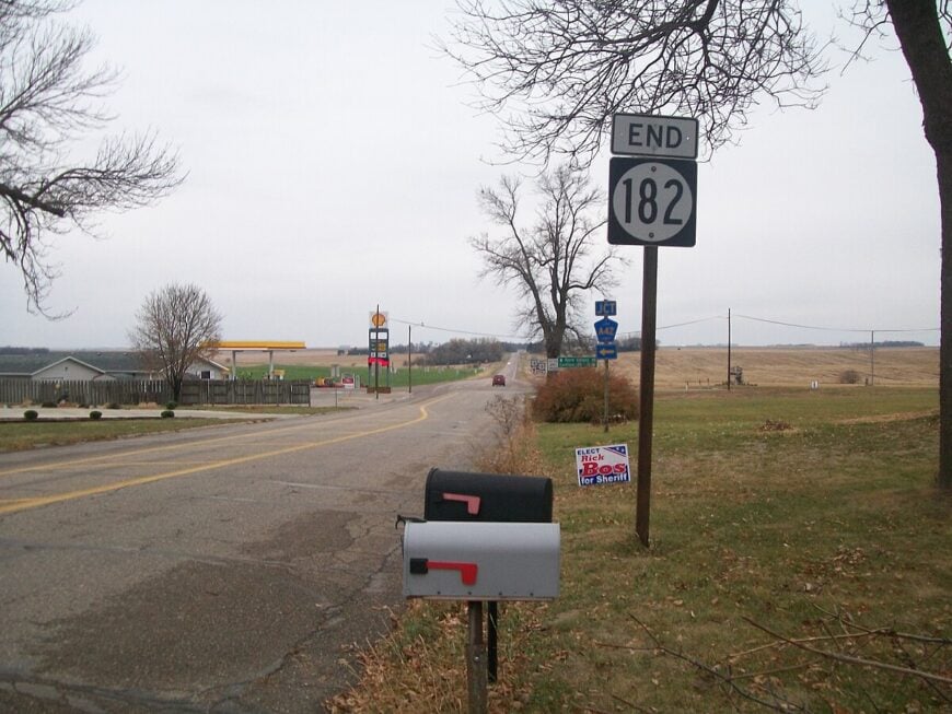
Near Iowa’s border with South Dakota, Inwood sits amid wide stretches of farmland where the horizon seems to go on forever. Far from big-city pace, it keeps a steady rhythm shaped by agriculture, small-town gatherings, and a strong sense of community.
Founded in the late 1800s, it still reflects its farming heritage, with grain elevators, livestock operations, and fields surrounding the town in every direction. Days here might include a stop at the local café, a high school game, or a walk through one of the parks shaded by old trees.
Farming drives the economy, but the town’s heart lies in its neighborly connections. Sunsets spread across the sky in soft layers of gold and pink, and nights are still enough to hear crickets in summer or the crunch of snow underfoot in winter. It’s the kind of place where life feels steady, open, and warmly familiar.
Where is Inwood?
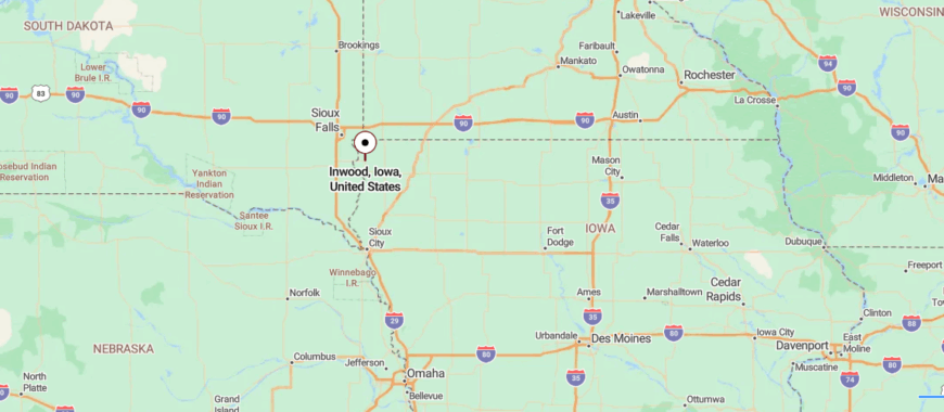
Inwood is located in northwestern Iowa, about 45 miles southeast of Sioux Falls, South Dakota, and 10 miles south of the Minnesota border. You reach it via state and county highways that pass through farmland and gentle prairie hills.
Its distance from larger cities and placement near open fields give it a calm, spacious feel. It’s close enough for cross-border trips, yet far enough to feel firmly rooted in the quiet countryside.
20. Ireton – Timber-Lined Streets Along the West Branch
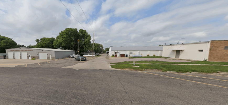
Ireton sits on the open prairie of Sioux County, where the West Branch of the Floyd River curves past farmsteads and shelterbelts. Founded in the 1880s, it still carries the look of a classic Midwest crossroads town — grain elevators marking the skyline, a water tower rising above tidy neighborhoods, and a main street where locals greet each other by name.
The rhythms here follow the seasons: spring planting, summer fairs, autumn harvest, and winter evenings when snow muffles every sound. Agriculture drives the local economy, with corn and soybeans the dominant crops, though small businesses and community groups keep the town’s social calendar full.
Visitors can stroll the tree-lined streets, stop in for coffee at the café, or watch a high school game under the lights. On clear nights, the sky spreads wide and bright, unbroken by city glare, while the river glints faintly under the moon. It’s a place where the land and community share the same steady pace.
Where is Ireton?
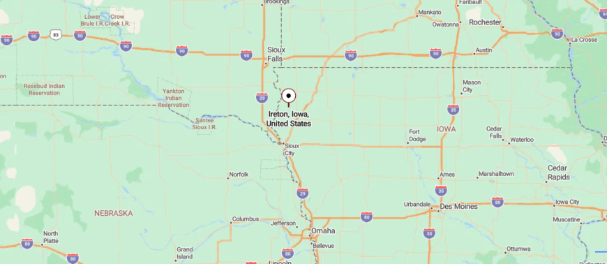
Ireton is in northwestern Iowa, about 50 miles north of Sioux City and 10 miles west of U.S. Highway 75. The drive in follows county roads through farmland and prairie, with the river bending close to town on its southern edge.
Its location away from busy corridors preserves a quiet, settled feel, while larger towns remain close enough for easy trips.
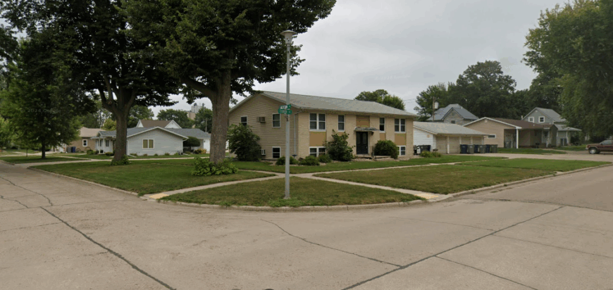
19. Remsen – Hilltop Town with German Heritage
🔥 Would you like to save this?
In the rolling farmland of northwest Iowa, Remsen blends small-town warmth with a strong sense of heritage. Founded by German and Luxembourg settlers in the late 1800s, its traditions still shape community life, from church gatherings to annual festivals.
Surrounded by fields and far from major highways, the town keeps a steady rhythm tied to agriculture, with grain elevators and family farms defining the landscape. Visitors might stroll its tidy main street, stop at a local café, or join in the lively Oktoberfest that celebrates its roots.
Farming remains the economic anchor, but its cultural pride is just as central. Sunsets here stretch wide across the prairie, giving way to quiet, starlit nights. It’s the kind of place where history, community, and the land all feel closely intertwined.
Where is Remsen?
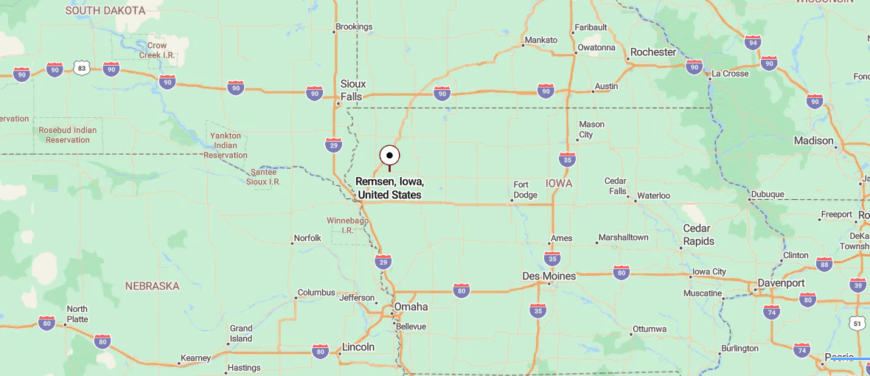
Remsen is in northwestern Iowa, about 40 miles northeast of Sioux City and just south of U.S. Highway 20. The drive there follows open stretches of highway and county roads lined with farmland.
Its position away from major cities helps it maintain a quiet, small-town pace. It’s near enough for quick access to larger communities, yet far enough that the countryside feels uninterrupted.
18. Akron – River Bend Hub at the Dakota Border
At the far northwest corner of Iowa, Akron rests beside the winding Big Sioux River, its streets framed by fields that change with the seasons. Life here is tied to both the farmland and the water—spring planting, summer fishing, autumn harvest, and the quiet freeze of winter.
The town’s history shows in its century-old buildings and the stories passed down through generations. Locals gather for community events, high school games, and riverfront outings, while visitors come for the canoe launches, small shops, and easygoing pace.
Agriculture drives the economy, but the river shapes the town’s character, offering both recreation and a scenic backdrop. When evening falls, the horizon glows gold over the fields, and the river drifts by in steady silence. It’s the kind of place where the connection to land and water feels constant, and the outside world seems far away.
Where is Akron?
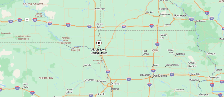
Akron sits in the far northwestern corner of Iowa, about 35 miles northwest of Sioux City along Iowa Highway 12. The approach follows the Big Sioux River valley, with roads winding between farmland and gentle bluffs.
Its riverside setting and distance from major interstates give it a peaceful, tucked-away feel. It’s close enough for a scenic drive from the city, yet far enough that the quiet of the valley takes over.
17. Craig – Hidden Hamlet Along the Union Pacific Spur
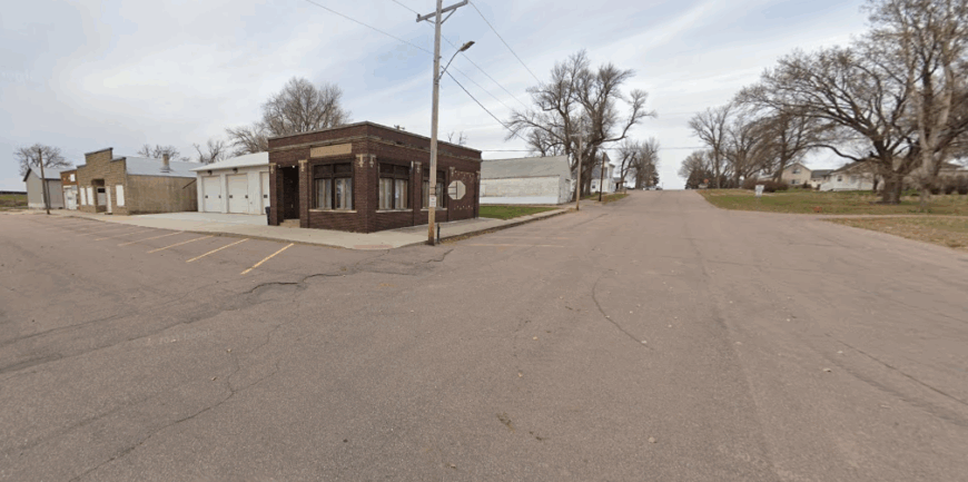
In the quiet farmland of northwest Iowa, Craig is one of the smallest towns you’ll find—just a few streets surrounded by miles of open fields. Far from major highways, it moves at a pace set by the seasons, with planting, harvest, and the changing sky marking time.
Once a small railroad stop, its history lingers in a handful of older buildings and the stories shared among neighbors. Farming is the backbone of life here, with grain bins, silos, and tractors as familiar sights.
Visitors might pass through in minutes, but the sense of calm and open space leaves a lasting impression. Evenings bring prairie sunsets that stretch across the horizon, fading into a canopy of stars. It’s the kind of place where quiet isn’t rare—it’s the everyday soundtrack.
Where is Craig?
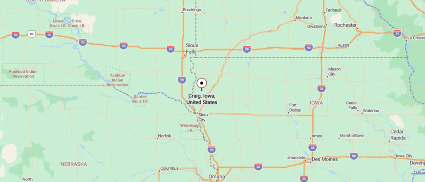
Craig is located in northwestern Iowa, about 45 miles north of Sioux City and 6 miles west of Le Mars. You reach it by way of county roads that pass through farmland and wide stretches of open prairie.
Its small size and position away from main highways keep it calm and unhurried. It’s close enough for quick access to nearby towns, yet far enough to feel like the countryside has it all to itself.
16. Hawarden – Riverside Town with a Twin Across the Border
On the banks of the Big Sioux River, Hawarden stands as a crossroads of farmland and flowing water. The surrounding prairie stretches wide, broken only by fields, tree lines, and the slow curve of the river.
Once a busy hub for trade and rail, the town still carries that legacy in its historic buildings and enduring community traditions. Life here moves with the rhythm of the land—planting in spring, harvest in fall, and crisp, quiet winters.
People gather for local events, riverfront walks, and Friday night games that draw the whole town together. The economy leans on agriculture and small enterprises, but the sense of belonging is the real foundation. As evening settles, the river catches the last light, and the town feels wrapped in a steady, familiar calm.
Where is Hawarden?
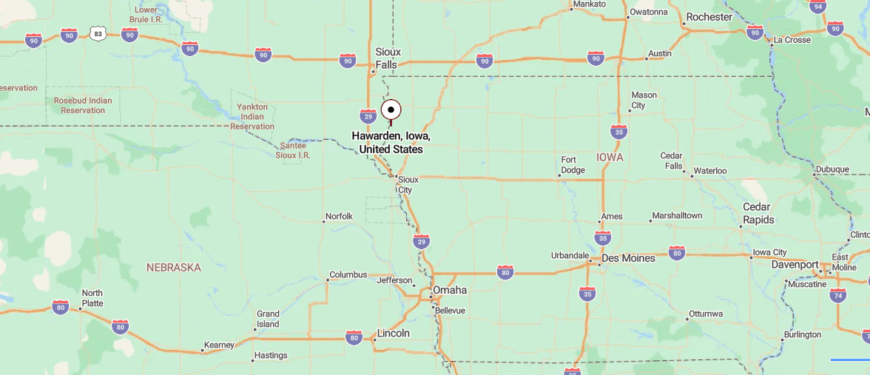
Hawarden lies in northwestern Iowa, about 55 miles north of Sioux City and right along the Big Sioux River at the South Dakota border. The drive in follows state highways through farmland and small towns before reaching the river’s edge.
Its border location and distance from major interstates give it a distinct, out-of-the-way feel. It’s close enough for easy cross-state travel, yet far enough that life here moves at its own steady pace.
15. Maurice – Crossroads Town with a Skyline Grain Elevator
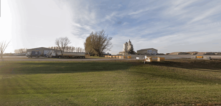
In the heart of Iowa’s farmland, Maurice is a small town where the horizon runs unbroken in every direction. Surrounded by fields that shift from green to gold with the seasons, it feels rooted in the steady cycle of rural life.
The town began as a stop along the railroad, and while the trains are long gone, the close-knit community remains. Agriculture drives the days—tractors in the fields, grain trucks on the roads, and harvest dust drifting in the autumn air.
Neighbors meet at church, the café, or the ballfield, where conversations flow as easily as the prairie wind. There’s no rush here, just the quiet hum of work and the beauty of open space. As the sun sets in wide bands of color, the whole town seems to pause, wrapped in the stillness of the land.
Where is Maurice?
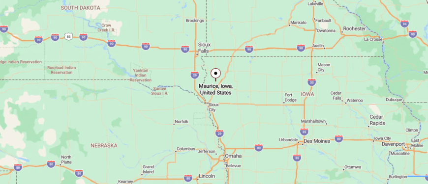
Maurice is in northwestern Iowa, about 50 miles north of Sioux City and 6 miles south of Sioux Center along U.S. Highway 75. The approach follows open stretches of highway bordered by farmland and wide prairie views.
Its small size and location between larger towns keep it quiet and unhurried. It’s close enough for quick connections, yet far enough to feel like the countryside is all around you.
14. Rock Valley – River Town Ringed by Recreation
Along the Rock River in northwest Iowa, Rock Valley sits surrounded by wide stretches of farmland and open sky. The town grew from its 19th-century farming roots, and while agriculture still drives daily life, it’s also become a hub for local business and community events.
Streets are lined with a mix of historic buildings and newer storefronts, reflecting a balance of tradition and growth. The river adds a scenic thread—canoes drifting in summer, ice forming along the banks in winter.
Neighbors meet at ballfields, festivals, and church gatherings, keeping the sense of connection strong. The pace is steady, marked by the turning of the seasons and the work of the land. As sunset paints the horizon, the river glows, and the town settles into a calm that feels both grounded and enduring.
Where is Rock Valley?
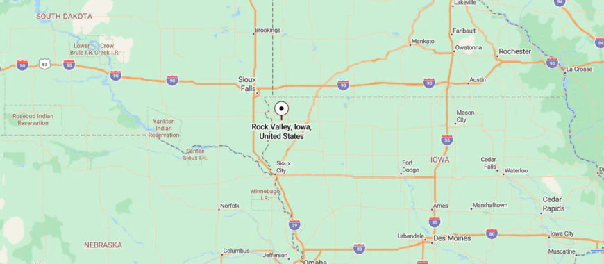
Rock Valley rests in northwestern Iowa, roughly an hour’s drive north of Sioux City and not far from the South Dakota line. The road in rolls past farmsteads, open pasture, and long horizons before meeting the town’s edge.
Its spot off the main interstates lets it keep a slower, small-town rhythm. It’s near enough for easy travel, yet distant enough that the prairie’s quiet feels unbroken.
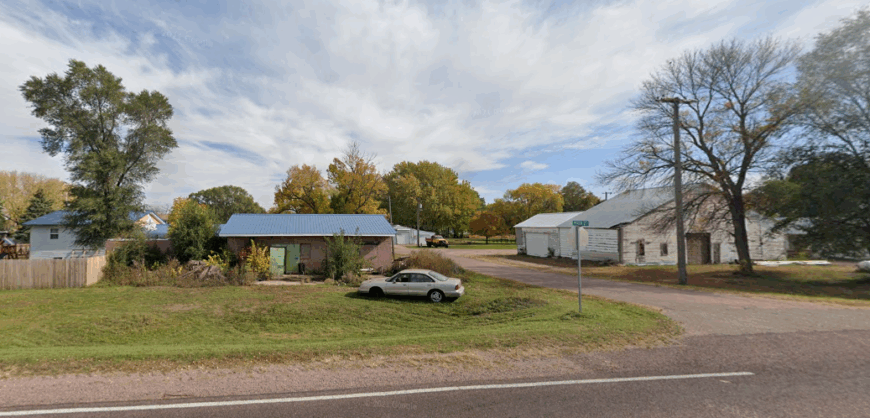
13. Chatsworth – Riverbank Outpost with a Sparse Grid
🔥 Would you like to save this?
Near the Big Sioux River in Iowa’s far northwest corner, Chatsworth is a small, quiet community surrounded by farmland and open prairie. Far from major highways, it moves at a slow, steady pace shaped by the rhythm of planting, harvest, and the changing seasons.
Once a modest railroad town, its history lingers in the layout of its streets and the stories shared among longtime residents. Farming anchors local life, with fields, silos, and barns marking the edges of the community.
Neighbors gather for church events, local ballgames, and the occasional town celebration. Evenings bring wide views of the prairie sky, with sunsets fading into starlit silence. It’s the kind of place where the land, the river, and the people all feel deeply connected.
Where is Chatsworth?
Chatsworth is in northwestern Iowa, about 55 miles north of Sioux City and a few miles east of the South Dakota border. The approach follows rural highways and county roads that wind past farmland and open prairie.
Its position away from major routes keeps it peaceful and lightly traveled. It’s close enough for a short drive to larger towns, yet far enough to feel like the prairie has it to itself.
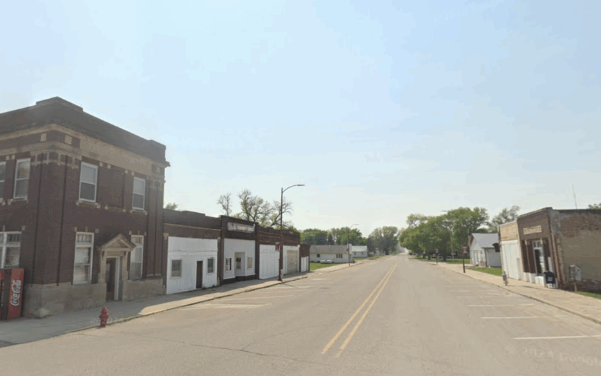
12. Seney – Grain-Side Hamlet Along the Floyd River Flats
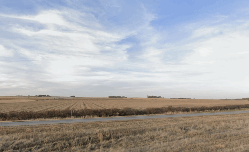
Seney is little more than a handful of homes, a few outbuildings, and the ever-present silhouette of its grain elevator, but that’s exactly what keeps it grounded in its own quiet rhythm. Nestled on the open prairie north of Le Mars, it has no post office, no school, and no rush hour—just the slow turn of seasons across surrounding farmland.
Founded in the late 1800s as a rural rail stop, its history is still visible in the straight grid of streets and the occasional weathered structure that predates the automobile. Today, most residents work nearby farms or commute to Le Mars, returning each evening to the deep quiet that settles when the last grain truck heads home.
Seney’s charm lies in its openness: a horizon that feels close enough to touch, air that carries the scent of fresh-cut hay, and nights so dark you can trace the Milky Way from one end of the sky to the other. It’s a place where the only hurry is the wind across the fields.
Where is Seney?
Seney sits in northwestern Iowa, about 6 miles north of Le Mars along U.S. Highway 75. The community is bordered by flat cropland and the Floyd River valley, with county roads threading out toward neighboring farmsteads.
Approaching from the south, travelers spot the elevator and water tower long before reaching the turnoff. Its location away from commercial centers keeps it firmly in the realm of prairie quiet, while still close enough to Le Mars for everyday needs.
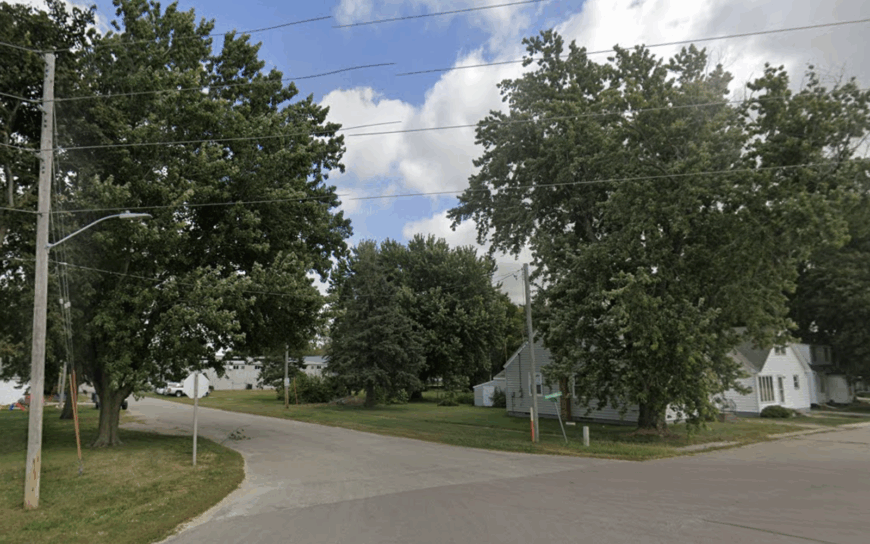
11. Cleghorn – Rail-Era Outpost Amid the Cherokee County Plains
Cleghorn began as a stop along the Illinois Central Railroad in the late 19th century, and while the trains no longer roar past, the grid of streets and solid brick storefronts still reflect its rail-era roots. Just a few hundred residents keep the place humming, surrounded by an ocean of cornfields that change from soft green in June to rattling gold by October.
Life here pivots between the harvest calendar and the town’s own traditions — summer ballgames at the park, pancake breakfasts in the community hall, and the annual Cleghorn Festival that pulls in neighbors from miles around. Agriculture is the economic backbone, but small shops and homegrown services keep Main Street from going quiet.
Evenings bring a slow settling-in: porch lights winking on one by one, a hint of diesel from a passing grain truck, and the broad Cherokee County sky fading into a deep prairie blue. Cleghorn’s size and setting make it a place where the horizon feels just as close as the community ties.
Where is Cleghorn?
Cleghorn is in northwestern Iowa, about 12 miles northwest of Cherokee along County Road L36. The drive in follows straight-line farm roads through open cropland, with few other towns in sight.
Its location off major highways keeps the atmosphere calm, while the easy reach to Cherokee ensures that small-town life here comes without feeling cut off.
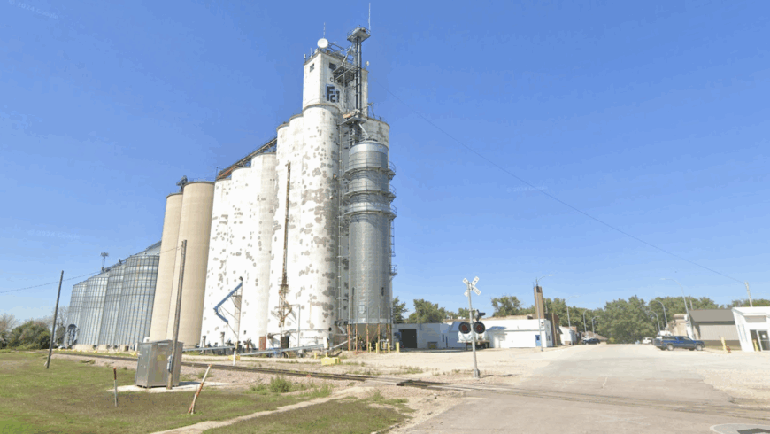
10. Archer – Tiny Crossroads Amidst O’Brien County Soybean Seas
Archer counts roughly 120 residents who share a dozen tidy blocks and a vintage water tower. An hour can be filled by browsing the micro-library inside a 1907 brick bank or photographing the weather-worn Archer Elevator that still creaks during fall harvest.
Farming and a small seed-corn cooperative provide the backbone of local income, with a few home-based repair shops rounding things out. Nights remain pitch-dark because commercial lighting lies more than fifteen miles away in Sheldon.
The absence of rail whistles, interstate hum, or even a convenience store underscores how little outside noise seeps in. Soybean fields stretch to every horizon, wrapping the village in a living green curtain from May through September.
Where is Archer?
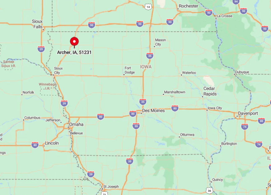
The town sits at the meeting of County Roads B40 and L40 in eastern O’Brien County, about fifteen minutes east of Sheldon and thirty minutes north of Cherokee. Flat cropland acts as a natural moat, so no neighboring communities are visible from Archer’s lone four-way stop.
Drivers exit Iowa Highway 60 at Sheldon, then follow gentle S-curves through open fields until the grain elevator rises ahead like a lighthouse. With no rail service or bus line, personal vehicles remain the only practical way to reach this quiet crossroads.
9. Pierson – Woodbury County Hills-Wrapped Settlement
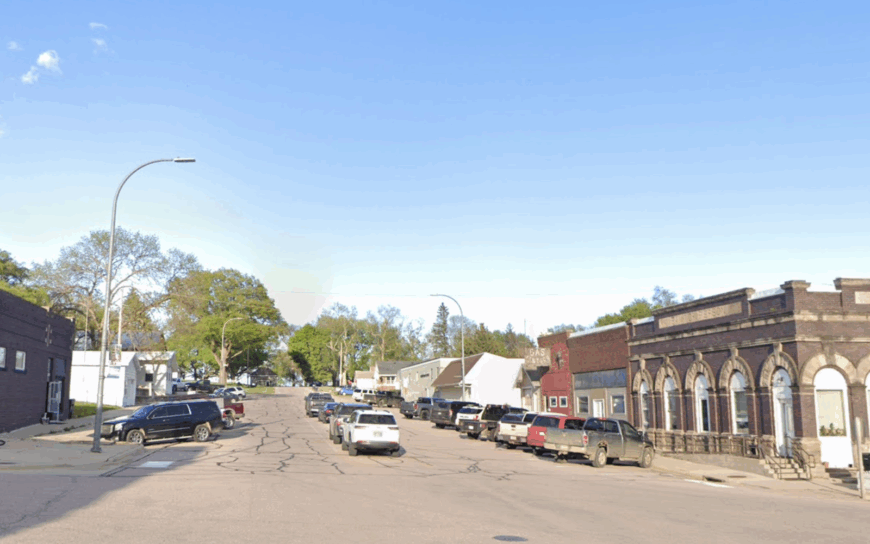
Pierson shelters nearly 340 residents along a maple-lined Main Street where the streetlights wear antique globes. Afternoon wanderers can hike the short but steep Pierson Hill Trail, hunt for morel mushrooms in adjacent oak groves, or grab homemade pie at Jill’s Country Café.
Farming and a pair of trucking outfits dominate the local payroll, while a volunteer-run fine-arts theater fills weekend evenings. Gentle loess hills shield the town from the rumble of U.S. 20, which passes five miles south yet feels a world away.
Cell signals fade in certain draws, adding to the sense of detachment. Even longtime Woodbury County drivers sometimes miss the turnoff, proving how well the landscape hides this enclave.
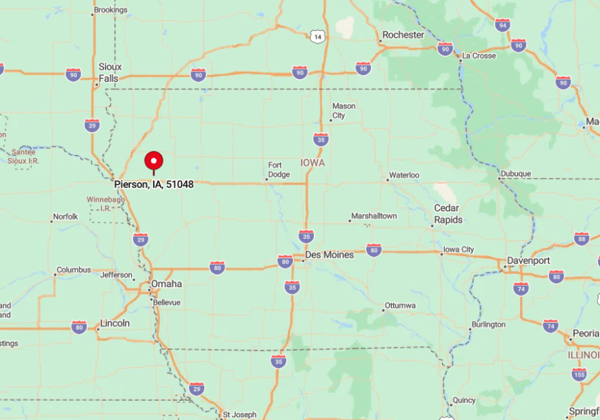
Where is Pierson?
🔥 Would you like to save this?
Pierson lies twenty-five miles east of Sioux City, tucked among rolling hills just north of County Road D38. The surrounding ridges act like an amphitheater wall, muting highway noise and blocking line-of-sight to larger towns.
Most visitors leave U.S. 20 at Correctionville, then weave north on P64 through a patchwork of corn and timber. The nearest public transit stop is the Sioux City airport, so arrival by car remains the norm.
8. Doon – Meadow Town at the Fork of the Rock and Little Rock Rivers
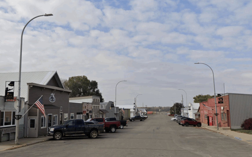
Doon’s population of about 500 enjoys a landscape where two rivers braid through meadows and create natural green belts. Anglers cast for channel catfish at the lesser-known “Sandbar Hole” while birders scan for piping plovers on spring sandbars.
Agriculture dominates daily life, and the local ethanol plant provides steady jobs plus the warm aroma of distilling grain on calm evenings. A ten-mile buffer of pastureland keeps the nearest city lights far off, preserving spectacular firefly shows in June.
Low traffic counts mean parents still let kids pedal bikes across town without worry. The dual rivers form gentle barriers that help maintain Doon’s hushed atmosphere even during harvest rush.
Where is Doon?
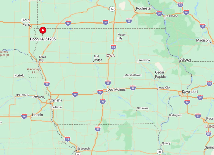
The town rests in southeastern Lyon County, sixteen miles northeast of Rock Rapids and a dozen miles south of Larchwood. The Rock and Little Rock Rivers encircle Doon on three sides, with flood-plain meadows discouraging new development and through traffic.
Drivers usually leave Iowa Highway 75 at Alvord or Hull, then cut west on gravel or paved county lanes that shadow the river bends. No commercial flights land closer than Sioux Falls, forty-five minutes away, so arrival is a relaxed road-trip affair.
7. Larrabee – Prairie-Ringed Grain-Elevator Village
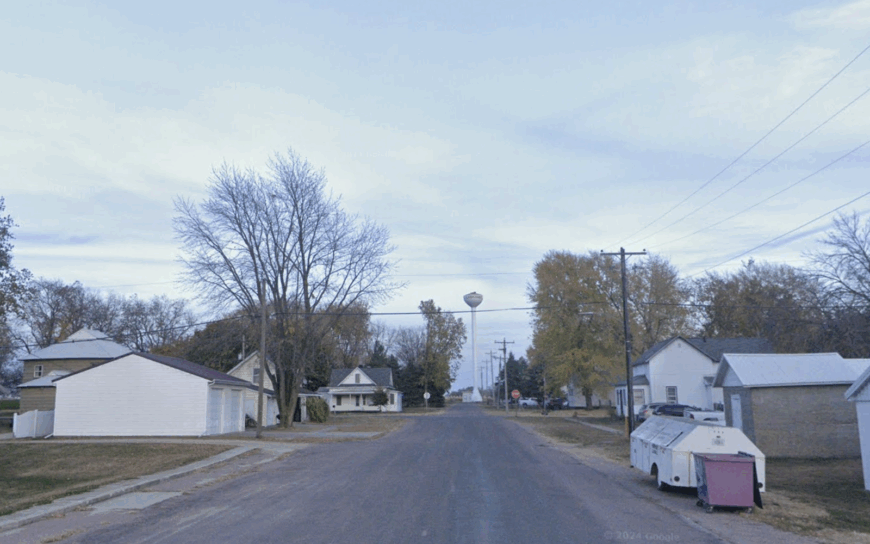
Larrabee supports nearly 130 residents, most of whom can spot the silver Farmland Cooperative elevator from their kitchen windows. Afternoon entertainment might include hunting pheasant on the surrounding state grasslands or browsing Victorian plat maps in the town’s two-room depot museum.
Grain farming and seasonal seed cleaning keep the few downtown storefronts busy, while a family-run greenhouse sells native prairie plants each spring. Miles of tallgrass prairie buffer Larrabee from larger Cherokee or Storm Lake centers, muffling both traffic and commercial encroachment.
The abandoned rail spur, last used in 1986, now hosts prairie smoke and purple coneflower instead of boxcars, reinforcing the town’s slow tempo. Even GPS units occasionally mislabel the final gravel turn, proving how lightly traced this spot is on the digital map.
Where is Larrabee?
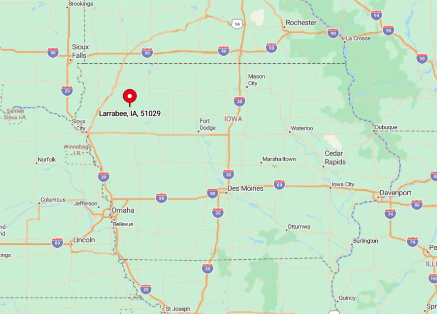
Larrabee sits five miles north of Highway 59 in northern Cherokee County, bracketed by state wildlife areas and private conservation easements. Those restored prairies swallow sound and sightlines, making the village invisible until drivers crest the final low ridge.
Travelers leave the highway at Calumet, turn west onto C65, then follow county blacktops past windblown grasslands. No bus routes serve this stretch, so arrivals usually involve dust on fenders and a friendly wave from the postmaster.
6. Peterson – Bluff-Top Settlement Overlooking the Little Sioux Valley
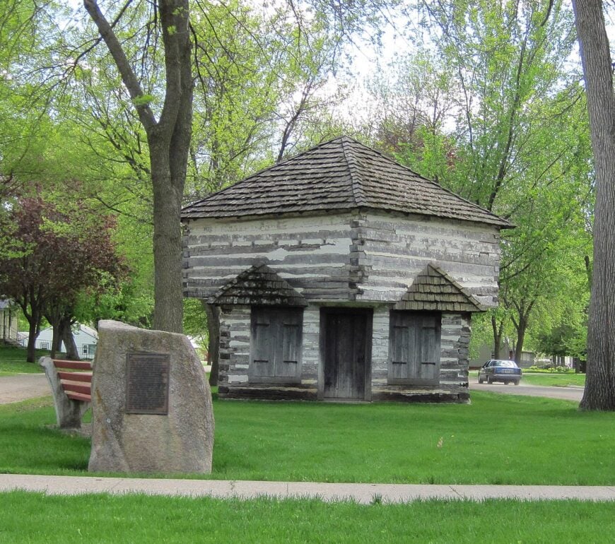
Peterson’s 300 residents live atop sandstone bluffs that command sweeping views of the Little Sioux River and its oxbow wetlands. Daytime diversions range from kayaking the river’s gentle riffles to roaming the well-preserved Fort Peterson Blockhouse historic site.
Agriculture and tourism share the economic stage, with woodland logging providing a modest seasonal boost. Over fifty percent of the surrounding acreage remains forested, muffling road noise and sheltering wildlife corridors.
The stone-paved downtown streets stay cool in summer and echo lightly under the occasional horse hooves. Sunset from the bluff-edge overlook paints the river valley in copper tones, reminding visitors how distance and elevation guard this town’s peace.
Where is Peterson?
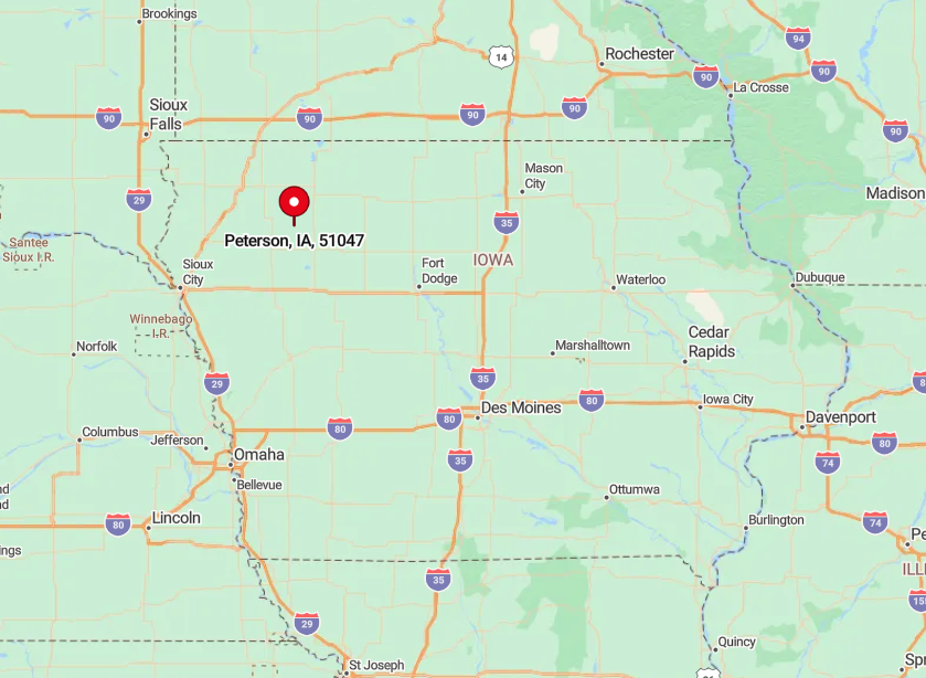
The community rests in southwestern Clay County, reached via a serpentine climb on County Road M27 some eight miles south of U.S. 18. Steep wooded slopes flank the approach, discouraging any shortcut or high-speed detour.
Travelers coming from Spencer descend into the valley, cross a single-lane truss bridge, then twist upward before the first house appears. With no commercial airport within fifty miles, personal cars or bicycles remain the only routes in and out.
5. Washta – Cherokee County’s Frosty Hollow Along a Quiet River Bend
Washta claims roughly 200 inhabitants and proudly advertises itself as “Iowa’s Coldest Spot” after recording a –47°F reading in 1912. Residents ice-fish the Little Sioux in winter, kayak its gentle bends in summer, and hike thick riparian timber that surrounds the town on three sides.
Livelihoods pivot on corn, soybeans, and a boutique maple-syrup venture that taps valley silver maples each March. A folded river valley hides Washta from the traffic of nearby U.S. 59, wrapping it in layered bluffs that muffle highway drone.
Farmhouses spaced an acre apart and towering cottonwoods contribute to an almost lodge-country atmosphere. Small-town chatter centers on river levels and bald-eagle nest counts rather than commute times.
Where is Washta?

This hamlet sits twelve miles south of Cherokee, accessible via County Road C66, then a descent into the sheltered river valley. Thick timber shrouds the final mile, so the town appears suddenly as the road breaks from trees into open lawns.
Most visitors exit U.S. 59 at Quimby, cross patchwork fields, and drop into the hollow where reception bars fade on cell phones. Lack of a rail spur or bus service leaves private vehicles as the only dependable entry.
4. Linn Grove – Hillside Hamlet Above the Little Sioux in Buena Vista County
Linn Grove hosts around 160 residents who wake to birdsong bouncing off limestone bluffs. Locals launch canoes at the rarely crowded Linn Grove Dam, fish for walleye downstream, or stroll the bluff-top Savanna Trail where prairie smoke blooms in June.
Farming and a small limestone quarry sustain the tax base, while a riverside arts retreat brings occasional painters in search of solitude. A lone steel truss bridge and limited river crossings funnel nearly all traffic to one entrance point, minimizing through-vehicles.
Broad lawns dotted with ancient cottonwoods impart a park-like hush even during planting season. The sheer limestone walls and looping river create a pocket that feels far removed from surrounding farmland.
Where is Linn Grove?
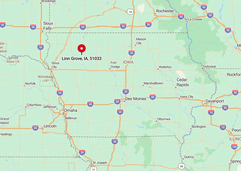
The town stands in northwestern Buena Vista County along County Road C13, about twenty-five minutes northwest of Storm Lake. Limestone bluffs box the river on three sides, leaving only one road in and out, which enhances a hideaway feeling.
Travelers usually leave U.S. 71 at Sioux Rapids, then snake west on C13 before easing downhill to the bridge. With no commercial services within five miles, visitors plan fuel stops beforehand and embrace the isolation once they arrive.
3. Westfield – Riverside Nook Where the Big Sioux Loops Under Tree-Covered Ridges
Westfield’s 310 residents occupy century-old houses nestled between the Big Sioux River and protective forested ridges. Kayakers favor the secluded “Whispering Pines” launch just north of town, while hikers explore ridge-top deer trails that offer views across both Iowa and South Dakota.
Agriculture, supplemented by a modest river-tour outfitter, powers the local economy, and the milk run from a nearby dairy co-op rattles through twice daily. Being miles from any primary highway, the town hears more songbirds than semis.
Thick hardwood stands act as a living sound barrier, making even lawn-mower engines seem distant. Twilight often brings a chorus of owls that underscores just how little human bustle intrudes here.
Where is Westfield?
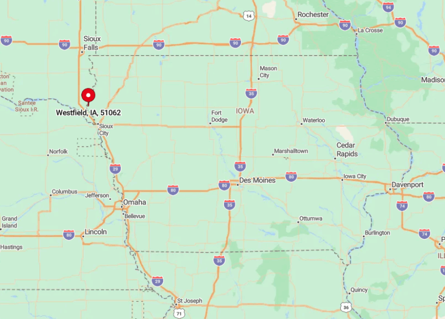
Westfield rests in extreme northwest Plymouth County, twelve winding miles west of Akron via County Road C16. The Big Sioux forms a sweeping loop north of town, and the adjoining ridges restrict development and traffic corridors.
Visitors usually exit Iowa Highway 12 at Akron, then follow shoreline curves until the river bend delivers them to Main Street. No bus route crosses the county line here, so private cars or bicycles hugging the river trail remain the surest arrival methods.
2. Brunsville – Rail-Side Settlement Beside the Floyd River Bluffs
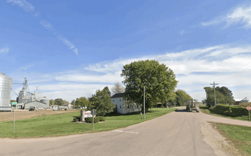
Brunsville counts close to 150 residents whose clapboard homes sit on acre-sized lawns beside rust-red grain bins. Our Lady of the Four Winds park offers shaded picnic tables, while anglers sneak to a hidden cutbank on the Floyd River known locally as “Catfish Alley.”
Grain hauling and a small agronomy service anchor the economy, and the still-active rail siding loads corn under stealthy summer moons. Wooded bluffs flank the eastern edge, cutting off direct sightlines to Highway 75 and ensuring the only consistent rumble comes from occasional freight trains.
The lack of any through-street keeps local traffic slow and sparse. Even the town’s beloved Brunsville Cardinals baseball field sits shielded by elm groves, making games feel almost pastoral.
Where is Brunsville?
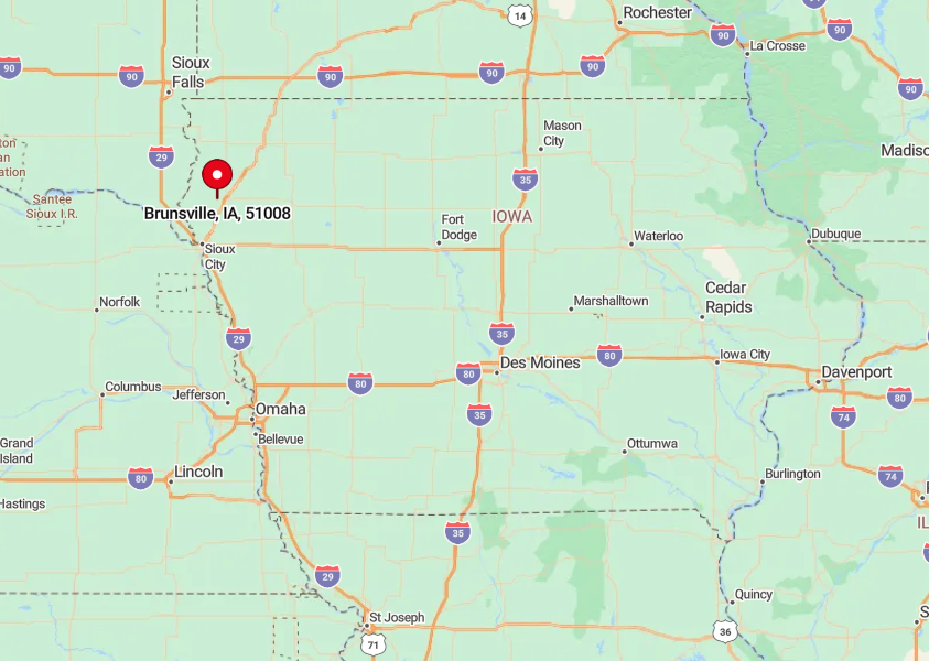
The village lies eight miles southwest of Le Mars in Plymouth County, connected by County Road C38 and a spur that parallels the Burlington Northern track. Thick river bluffs and rail embankments screen Brunsville from passing motorists, hiding it until the final quarter mile.
Drivers exit Highway 75 at Le Mars, dip into the Floyd River valley, and emerge at a blinking yellow light that marks town center. Without a bus depot or taxi service, visitors arrive by car, often surprised at how abruptly the modern world falls away.
1. Oyens – A One-Church Village Hidden in Plymouth County Cornfields
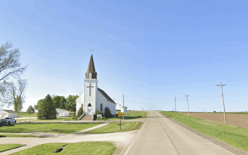
Oyens shelters around 100 residents clustered near the white-steepled St. Catherine’s Church, whose bell still rings the noon angelus. Afternoons invite a stroll down gravel lanes where towering corn creates cool, whispering walls in midsummer, or a visit to the old creamery that now hosts a once-a-month antique sale.
Farming is the working heartbeat here, complemented by a family-run cabinet shop that ships handcrafted oak cupboards nationwide. Being twenty-five miles from Sioux City and several miles from any state highway, Oyens seldom sees more than a handful of vehicles per hour.
Cottonwood windbreaks hush prevailing winds, so even distant combines sound muffled. On clear nights the Milky Way glows brighter than the town’s lone streetlamp, reminding residents how remote their hamlet truly is.
Where is Oyens?
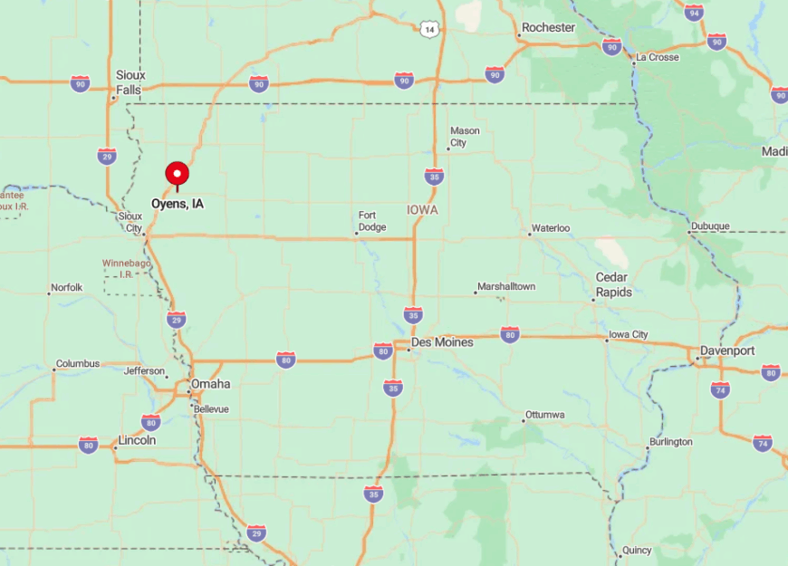
Situated on County Road C44 in central Plymouth County, Oyens is five miles east of Highway 75 and ten miles south of Le Mars. Towering cornfields and section-line windbreaks hide the village from view until travelers crest a low rise just outside town.
Most visitors leave the highway at Merrill, then follow two gravel miles that turn into pavement only at the church steps. With no public transit or taxi network, arrival depends on personal vehicles or bicycle, both of which roll to a gentle stop on the churchyard’s timeless gravel.