🔥 Would you like to save this?
Northern West Virginia hides quiet pockets of life that many travelers overlook, but locals cherish. These towns sit on ridges, in creek bends, and beside forgotten rail beds where night skies stay dark and front-porch talk still matters.
Our list counts down 25 of the most secluded spots in the region, each with its own mix of history, scenery, and hush. Populations rarely climb past a few hundred, industries lean on the land itself, and highways remain safely distant.
In order to come up with the very specific design ideas, we create most designs with the assistance of state-of-the-art AI interior design software.
We focus on places where a short drive can feel like a journey back in time. If silence, scenery, and elbow room call, the following villages deserve a closer look.
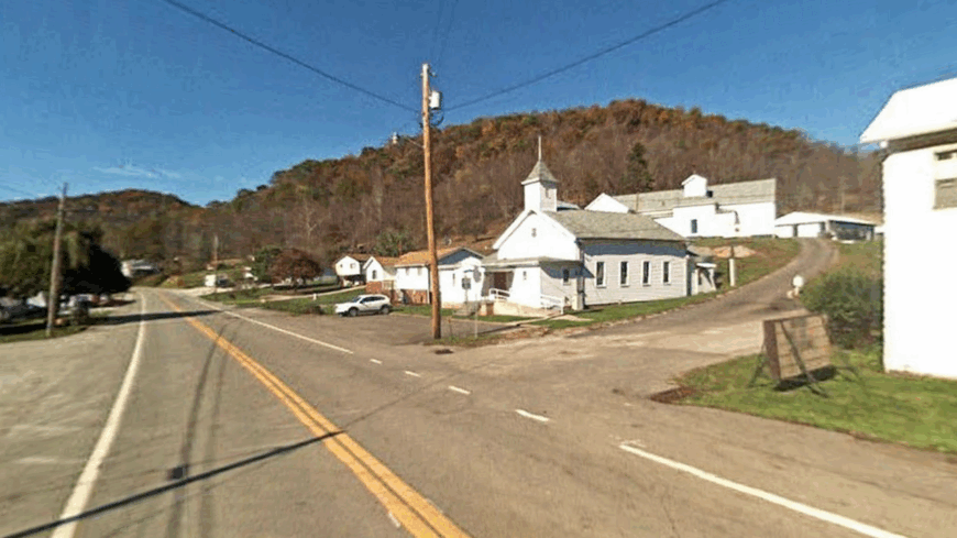
25. Blacksville – Border Village with a Quiet Creek
Blacksville sits softly on the Pennsylvania line, a handful of streets edging Dunkard Creek where fog hangs low on spring mornings. Its seclusion comes from hills that fold over each approach and a habit of sending travelers the long way around on county roads.
The vibe is unhurried and neighborly: porch swings, garden rows, and a store where someone still knows your favorite snack. Walk the old iron bridge for sunset light over the water, fish quiet eddies for smallmouth, or poke around century-old cemeteries on the ridge.
When festivals pop up, they’re more potluck than parade, and everybody brings a story. Small farms, gas leases, and a few commuters keep the lights on, but evenings belong to crickets and creek talk. It’s the kind of place that reminds you how quiet the world can be.
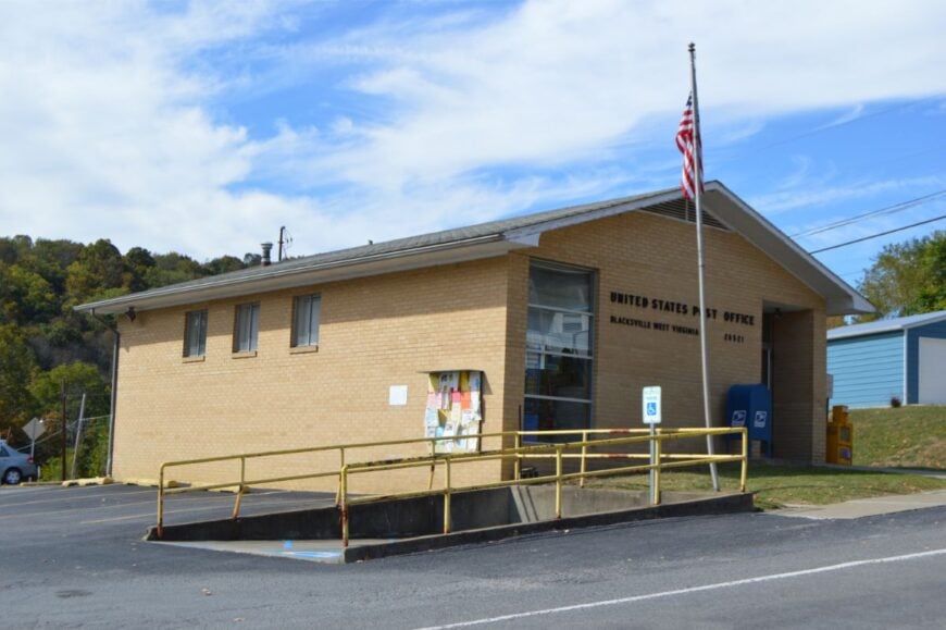
Where is Blacksville?
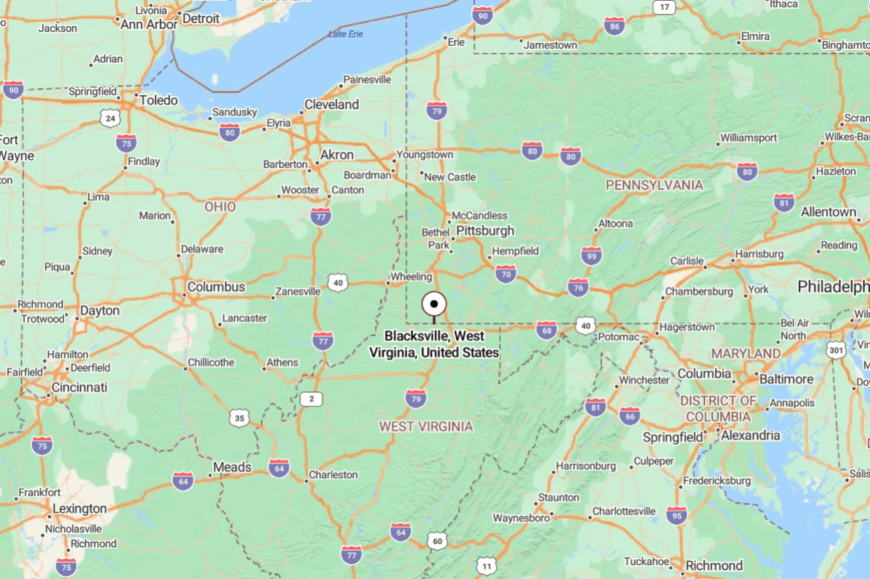
Tucked in northern Monongalia County, Blacksville rests about 17 miles northwest of Morgantown. You reach it by following WV-7 before dropping onto smaller county lanes that wind along the creek.
The hills shoulder out highway noise and cell bars alike. It’s close to the border, but far from anything hurried.
24. Bruceton Mills – River Coves Beyond the Interstate
Bruceton Mills may sit near an interstate exit, but the moment you turn toward the Cheat River backwaters, the modern rush fades. Hemmed by forest and sandstone, it’s a pocket of water and rock where kayaks whisper across coves and herons lift like gray smoke.
The town itself is quiet—church bells, bait buckets, and the steady shuffle of folks headed to the post office. Paddle the Cheat Lake tailwaters, explore backroads to mossy culverts, cast for trout in shaded runs, or wander tiny shops for maple candy and handmade lures.
Weekends bring campers and climbers, then nights fall silent again under a dome of stars. Locals split their time between outdoor work, small shops, and seasonal tourism. Stay a day and you’ll start measuring time by ripples instead of clocks.
Where is Bruceton Mills?
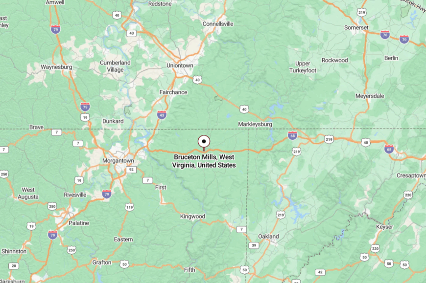
Set in northeastern Preston County, Bruceton Mills is roughly 20 miles east of Morgantown. From I-68, you slip onto WV-26 and immediately trade engine roar for tree-lined bends.
Cliffs and forest wall the town from the highway’s sight and sound. It’s close enough for an afternoon, yet it feels like a hideaway.
23. Rowlesburg – Cheat River Bend Under the Rails
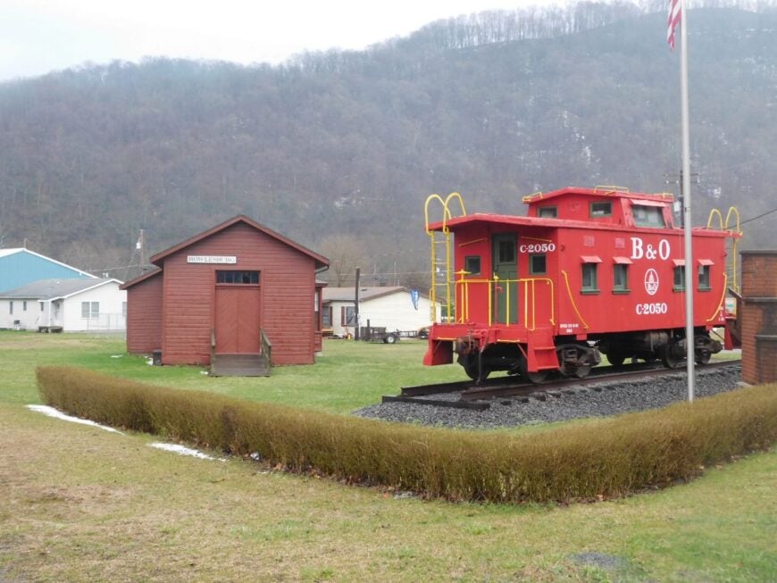
Rowlesburg gathers at a grand bend in the Cheat, where the river glints below railroad trestles and steep mountains box in the sky. Seclusion comes from those very slopes—WV-72 clings to the hillside like a ribbon, discouraging hurry and keeping traffic to a whisper.
The mood is sturdy and nostalgic: a museum nods to B&O rail days, and neighbors swap garden starts in spring. Spend an afternoon watching kayakers thread rapids, hiking Cannon Hill for sweeping views, or picnicking by the river while long freight trains echo through the valley.
Autumn turns the hills into a quilt of color and the sidewalks into leaf-crunching paths. Many folks work in nearby towns or in seasonal outdoor trades, but home is here where the rails sing. Rowlesburg makes time feel beautifully elastic.
Where is Rowlesburg?
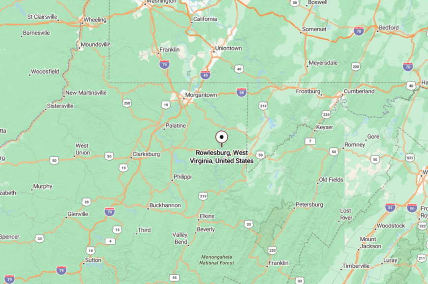
In southeastern Preston County, Rowlesburg sits about 35 miles southeast of Morgantown along WV-72 and WV-7. Approaches follow the Cheat River’s curves, trading speed for scenery.
Steep valley walls muffle outside noise and hide the town until the last bend. It’s a place you arrive at slowly—and don’t mind.
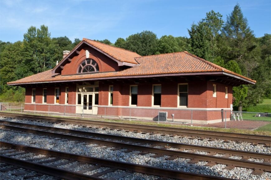
22. Albright – Whitewater Doorway with Sleepy Streets
Albright is a riverside cluster where laurel thickets shine after rain and porch flags barely stir in the afternoon stillness. It feels remote because the Cheat’s gorge walls and limited crossings funnel visitors into town on nature’s timetable.
The vibe is barefoot and practical: boats on trailers, dogs snoozing in driveways, and a store that remembers your coffee order. Watch rafts shoot the rapids on the Cheat Narrows, hike riverside paths to sandy bars, spot warblers in spring, or angle for trout in shaded pools.
Old railroad remnants peek from the brush, telling quiet stories between bird calls. Work here leans on outdoor outfitters, small farms, and commuting carpenters. Albright is an easy place to trade news for the sound of water.
Where is Albright?
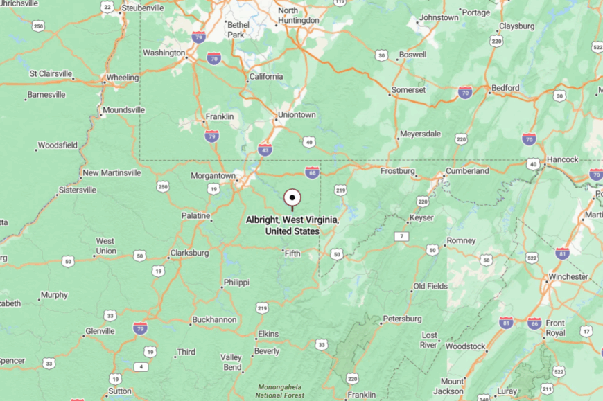
You’ll find Albright in central Preston County, about 16 miles southeast of Morgantown via WV-7 and WV-26. The last miles track the river, tightening to canyon curves that naturally slow you down.
Cliffs and hardwoods dampen highway hum. It’s a short drive that feels like a reset.
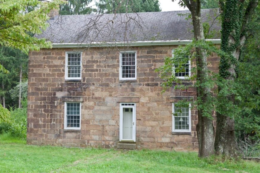
21. Tunnelton – Porches Above the Historic Bore
Tunnelton wears its name proudly—born of the old Kingwood Tunnel that once drew railroad men and left a legend in the hills. Seclusion lingers because the valley is narrow and the routes are few; even the air seems to move on train time.
The feel is vintage: tidy porches, mailbox roses, and a pace that honors weather reports more than news cycles. Visit the tunnel’s historic site, walk shaded lanes to photo old stonework, cast lines in nearby creeks, or drive to high ridges for sunsets over layered hills.
Festivals are small, homemade, and heartfelt. Work follows ranch chores, school schedules, and shifts in nearby towns. Tunnelton is the kind of place where history sits politely on the front steps.
Where is Tunnelton?
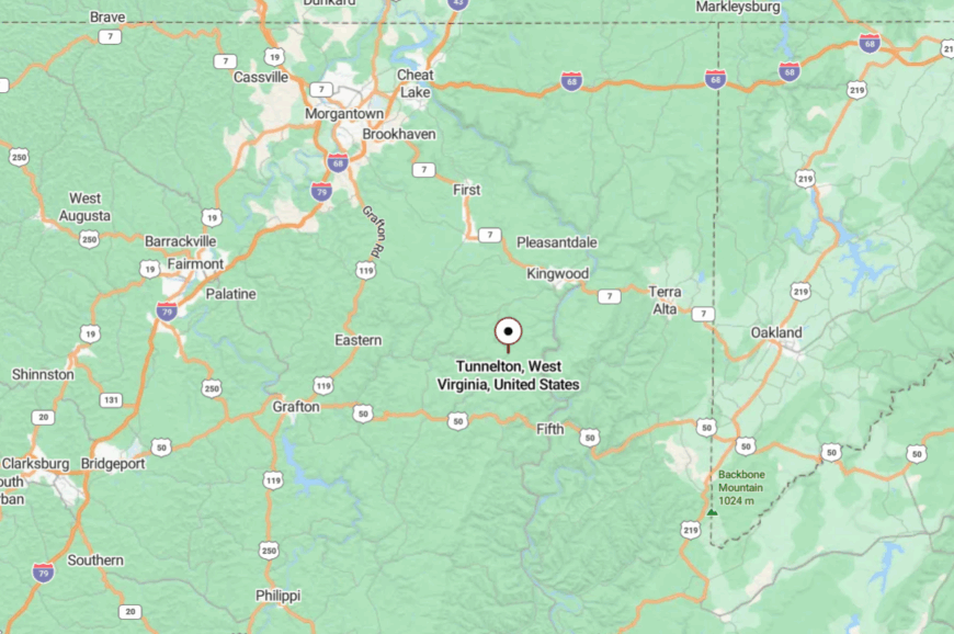
In southern Preston County, Tunnelton lies about 24 miles southeast of Morgantown along WV-26. The approach trades rolling pasture for close-in hollows and tight curves.
Hills rising on all sides block both wind and city glow. It’s tucked just far enough to feel private.
20. Reedsville – Rail-Trail Terminus with Meadow Calm
Reedsville is where the hills ease open into meadows and the Deckers Creek Rail-Trail finds its quiet finish. It feels secluded because farms and woodlots ring the town, keeping through-traffic light and evenings hushed.
The vibe is sunny and small-town: backyard swings, farmers’ stands, and neighbors comparing tomato seedlings at the curb. Bike the last miles of the rail-trail, wander gravel lanes to barn quilts, birdwatch along fencerows, or sip coffee outside the little café as clouds sail past.
Weekend makers sell soaps and honey on folding tables while kids chase each other on the green. Work spans small agriculture, home shops, and commuting into the university town over the hills. Reedsville offers a soft landing—and an even softer twilight.
Where is Reedsville?
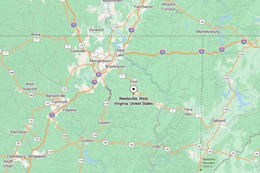
Located in west-central Preston County, Reedsville sits about 20 miles southeast of Morgantown along WV-92 and county roads. The final stretch runs through open pasture where cell service blinks and speed limits feel optional.
Low ridges buffer the town from highway noise. It’s close enough for a bike ride, yet removed enough to breathe.
19. Terra Alta – High Ground in the Clouds
🔥 Would you like to save this?
Terra Alta lives up to its name, perched on a plateau where fog drifts like a second river and mornings taste like pine. Seclusion comes from elevation and distance—roads climb steadily, then level into a town ringed by lakes, woods, and wind.
The mood is easygoing resort-rustic: kayaks on roofs, golfers on a nine, and porch talk about weather more than work. Paddle Alpine Lake, stroll shady neighborhood loops, explore nearby Cranesville Swamp Preserve, or ski skinny tracks after a fresh snow.
Little galleries and diners lend a friendly hum without crowding the streets. Seasonal tourism meets year-round work in carpentry, small trade shops, and schools. Terra Alta feels like a cloud-island you can actually live on.
Where is Terra Alta?
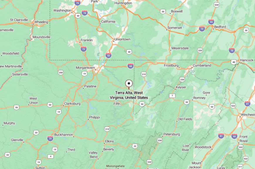
In eastern Preston County near the Maryland line, Terra Alta is roughly 30 miles east of Morgantown along WV-7. The road climbs in long, gentle grades before leveling atop open highlands.
Forest and distance keep the place insulated from city commotion. It’s a high perch that still welcomes company.
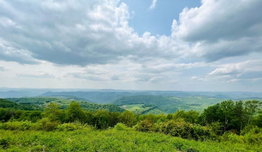
18. Eglon – Ridge Farms Near the State Line
Eglon is a name half-whispered by wind over hayfields, a crossroads where ridge farms touch the sky and life keeps to its own cadence. It’s secluded because the roads here are for locals—narrow, curving, and framed by hemlock shade that swallows signal bars.
The vibe is work-worn and gracious: woodpiles stacked high, barns painted with care, and a mailbox flag that means stop by for coffee. Visit nearby Cathedrals State Park to stand beneath ancient hemlocks, photograph rolling farms at golden hour, pick up syrup from roadside stands, or wander gravel spurs to forgotten cemeteries.
Most folks ranch, log selectively, or commute to small towns, but suppers are always local. Sound travels far; gossip never does. Eglon is a postcard of the quiet life.
Where is Eglon?
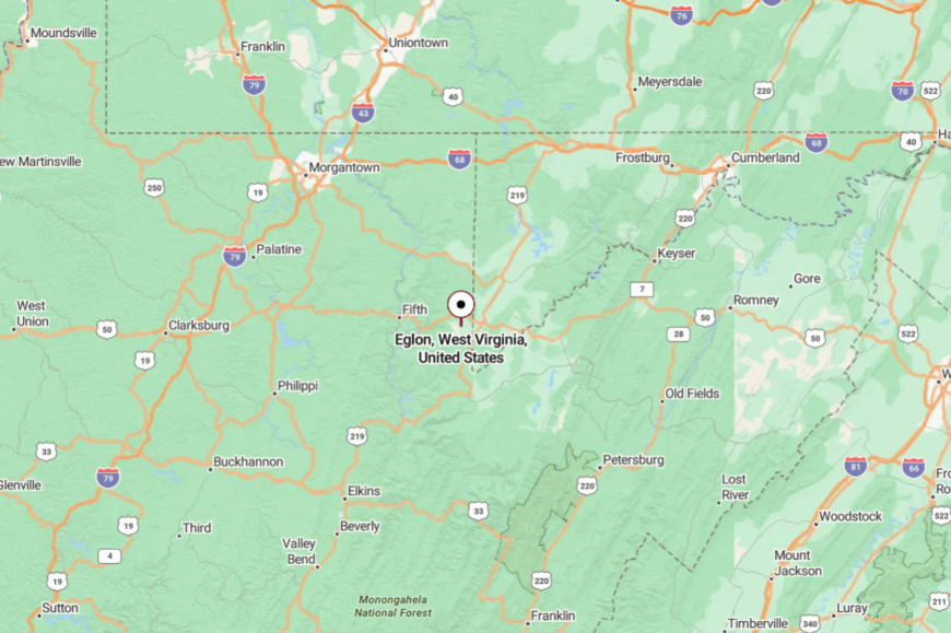
Southeastern Preston County claims Eglon, about 40 miles east-southeast of Morgantown near WV-42 and WV-24. Getting there means leaving main routes for ridge-top lanes and shaded dips. Hills shoulder out highway noise and hurry. It’s where a map dot becomes a real place.
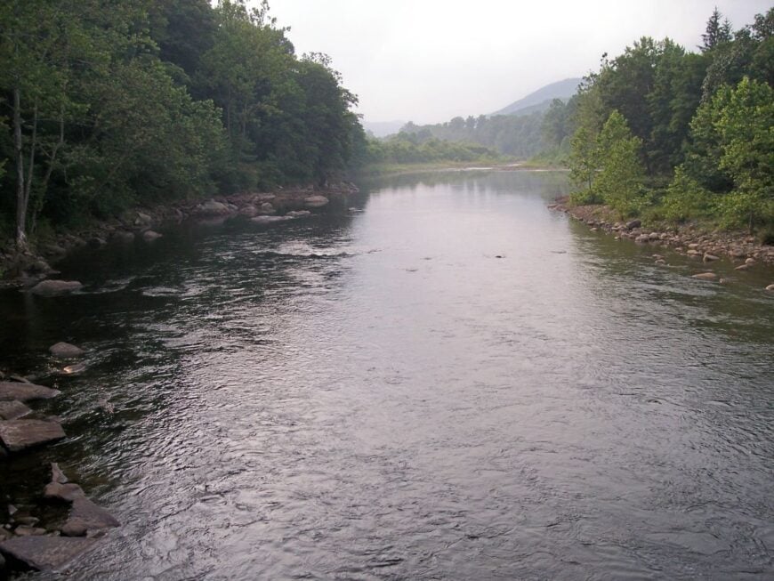
17. Hambleton – Pocket Town on the Black Fork
Hambleton tucks neatly against the Black Fork, a river town so small you can hear the water talking to the stones. Seclusion clings to the canyon—steep slopes keep the world at arm’s length and the road’s curves make haste feel silly.
The mood is modest and river-wise: waders hung to dry, coolers on porches, and friendly waves from folks who know this bend by heart. Fish riffles at dawn, stroll the riverside lane for kingfishers, pedal the nearby Allegheny Highlands Trail, or wander into Parsons for a milkshake and back before sunset.
Work leans on small shops, seasonal outdoor jobs, and county offices up the road. Nights are for crickets and the hush after trains. Hambleton teaches you to listen.
Where is Hambleton?
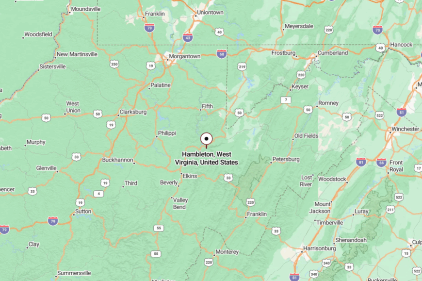
In northern Tucker County, Hambleton sits about 45 miles southeast of Morgantown via US-219 and WV-72. The last miles track the river through shaded narrows.
Steep timber buffers the town from bigger roads. It’s close to trails, far from traffic.
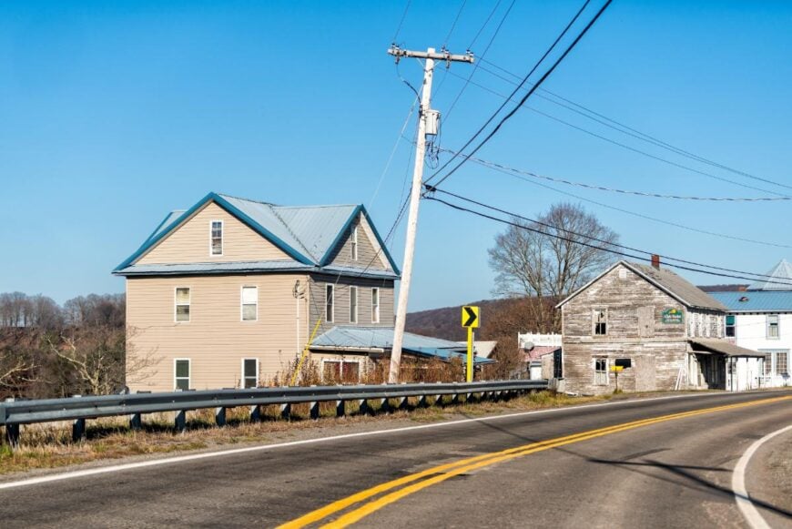
16. Hendricks – Confluence Village at Canyon’s Mouth
Hendricks rests where the Blackwater meets the Black Fork, a tiny place that feels like it breathes with the river. Its seclusion is shaped by canyon walls and the fact that most drivers are headed somewhere else—Thomas or Davis—leaving this little seam of water and spruce to the patient.
The vibe is cabin-cozy and outdoorsy: fly rods by doorways, bikes on tailgates, and kids skipping stones under towering sycamores. Walk the Blackwater Canyon rail-trail toward Thomas, birdwatch for warblers in spring, picnic at the confluence, or photograph fog lifting off the river at sunrise.
Residents split time between guiding, park work, and small trades. As sunlight fades, only water noise remains. Hendricks is the quiet between two beloved mountain towns.
Where is Hendricks?
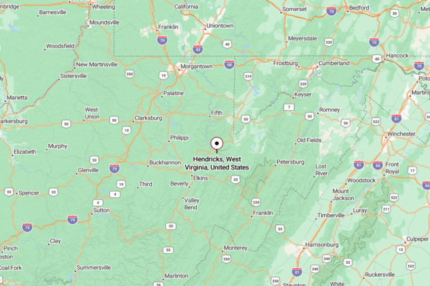
Hendricks sits in Tucker County, about 47 miles southeast of Morgantown. The most direct route follows US-219 to Parsons, then a short drive on WV-72 along the Black Fork.
The road narrows as it approaches the canyon, with river bends and steep banks naturally slowing the pace. It’s easy to find on a map, yet it still feels hidden when you arrive.
15. St. George – Old Seat on a Bend of the Cheat
St. George keeps the calm of a former county seat, its few streets curving with the river and its courthouse memories living in sandstone and shade. Seclusion comes from the Cheat’s high banks and a network of backroads that discourage the casual passerby.
The atmosphere is story-rich and restful: porch chairs, wood smoke in fall, and the occasional guitar drifting over water. Cast for trout in deep runs, camp along the river, follow WV-72’s winding ribbon to hidden overlooks, or explore the remains of earlier civic buildings.
Locals work in nearby towns, in forestry, and in small home shops, but sunset tends to reclaim everybody. Owls speak up as the day’s last voices fade. St. George holds the quiet like an heirloom.
Where is St. George?
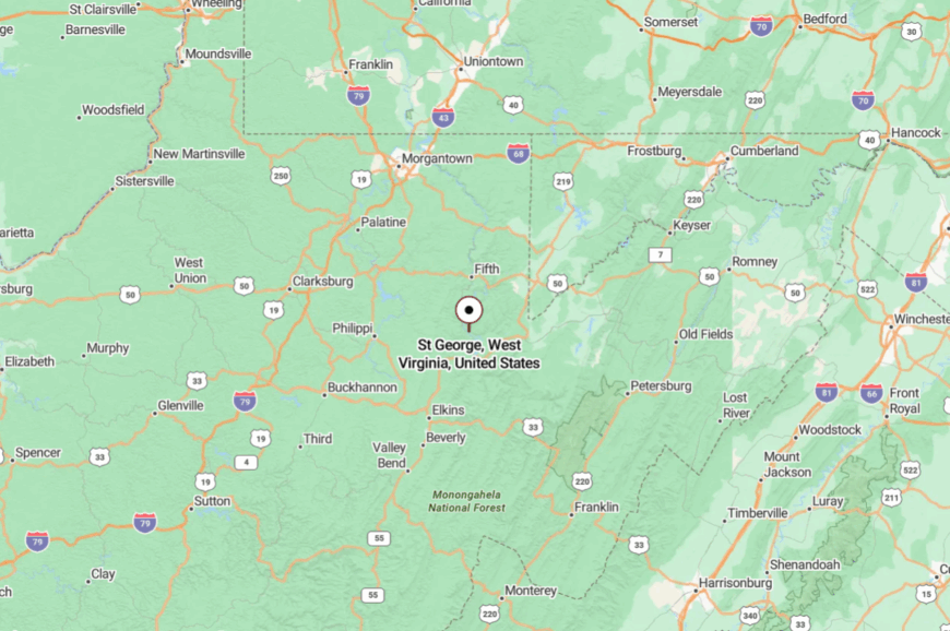
You’ll find St. George in northern Tucker County, roughly 50 miles southeast of Morgantown. The approach is WV-72—a scenic, narrow river road that asks you to slow down and watch.
Steep woods and close banks seal out hurry and highway rumble. It’s a small bend that feels like a world.
14. Thomas – Artsy Heights Above the Canyon
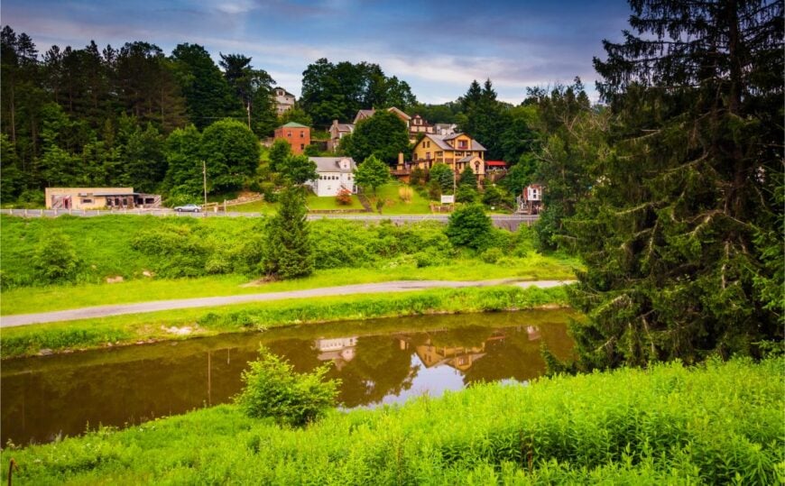
Thomas wears its coal-town bones and artist heart proudly, perched above Blackwater Canyon where clouds snag on spruce tops. It feels secluded because the mountain roads in and out are curving, elevated, and often dusted in winter snow that shortens lists and lengthens conversations.
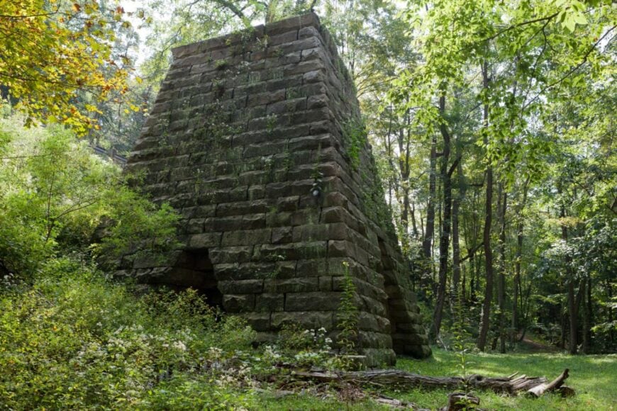
The vibe blends galleries with grit: music spilling from the Purple Fiddle, antiques in brick storefronts, and coffee steam curling into mountain air. Stroll the rail-trail to canyon overlooks, browse studios for handmade prints, catch a live set, or detour to Coketon’s coke-oval ruins for moody photos.
Nearby waterfalls and bogs make day trips easy and crowds unlikely outside peak weekends. Work now mixes arts, hospitality, and park service with old family trades. Thomas feels like a high-country secret that decided to welcome you.
Where is Thomas?
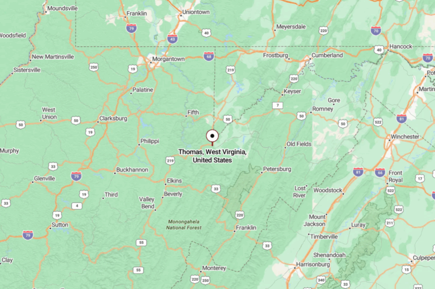
In central Tucker County, Thomas stands about 60 miles southeast of Morgantown along US-219. You climb through forested ridges before town breaks across the hilltop.
The canyon on one side and highlands on the other keep things insulated from sprawl. It’s the high shelf between past and present.
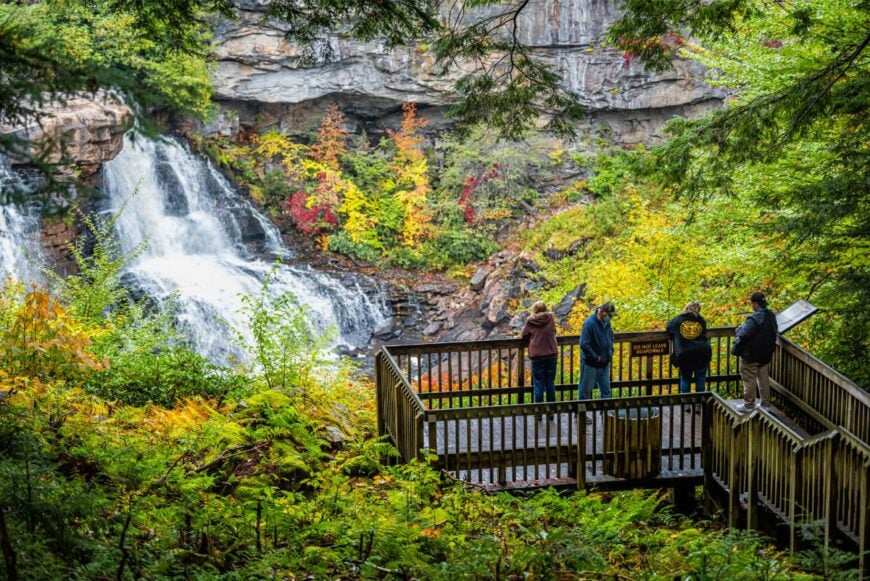
13. Davis – Edge of Falls and High Valley
🔥 Would you like to save this?
Davis sits at the lip of Blackwater Falls and the doorway to Canaan Valley’s open meadows, where wind makes the grass ripple like water. Seclusion comes from altitude, snow, and long ridge roads that filter visitors into a smaller, gentler crowd.
The vibe is mountain-warm: gear shops, stout soup, and trail mud drying on boots by the café window. Hike to Blackwater Falls overlooks, bike plantation trails, wander Canaan Valley boardwalks, sample local brews, or snowshoe after a fresh dusting.
Between seasons, the town exhales and the streets go quiet except for ravens. Tourism anchors the economy, but winter still decides the schedule. Davis is a threshold town that invites you to stay past the sunset.
Where is Davis?
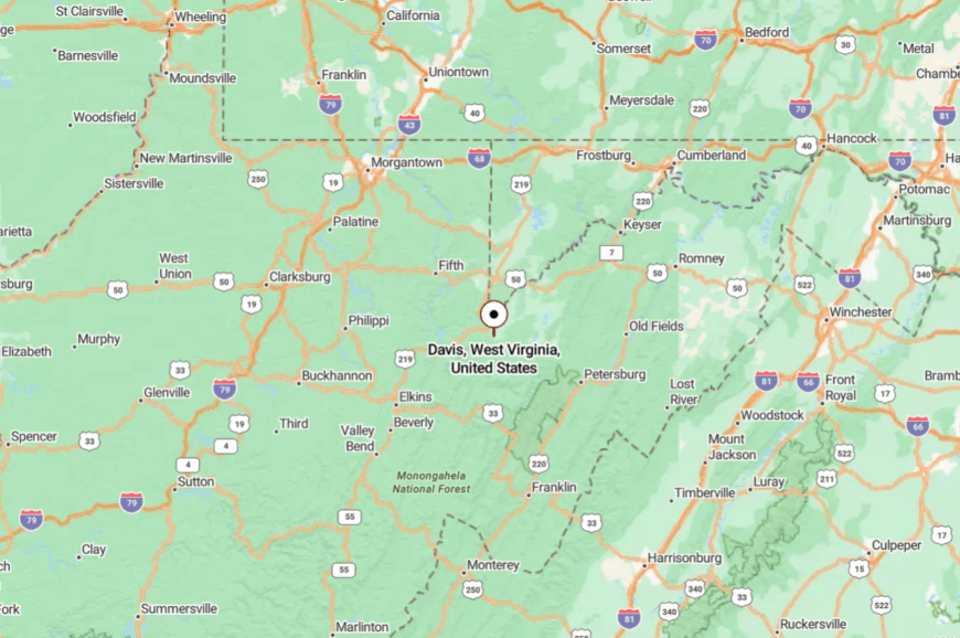
Davis is in central Tucker County, about 62 miles southeast of Morgantown via US-219. The last miles cross high bogs and spruce before the road tips toward the canyon rim.
Elevation and open sky keep it apart from the valley hum. It’s a ridge town with the heart of a trailhead.
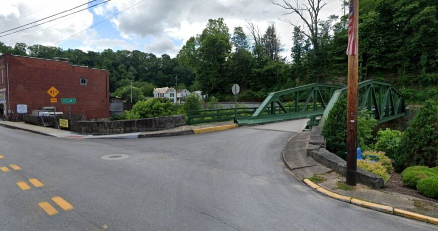
12. West Union – Rail-Trail Capital with Candlelit Evenings
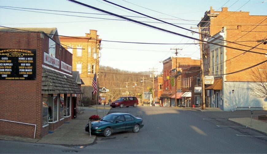
West Union keeps to a valley rhythm along Middle Island Creek, its brick courthouse watching over a main street that glows soft after dusk. Seclusion lingers because US-50 bypasses just enough of downtown to leave the sidewalks sleepy and the nights starry.
The feel is heritage-sweet: old hardware signs, a classic diner, and front doors propped for cross-breezes. Ride or walk the North Bend Rail Trail through tunnels and over high trestles, browse antique nooks, fish the creek at first light, or join a courthouse-square festival where the music feels homemade.
Small shops, county offices, and trail visitors keep a steady hum without raising the volume. When lights blink on one by one, the valley grows quiet again. West Union is a gentle pause between hills.
Where is West Union?
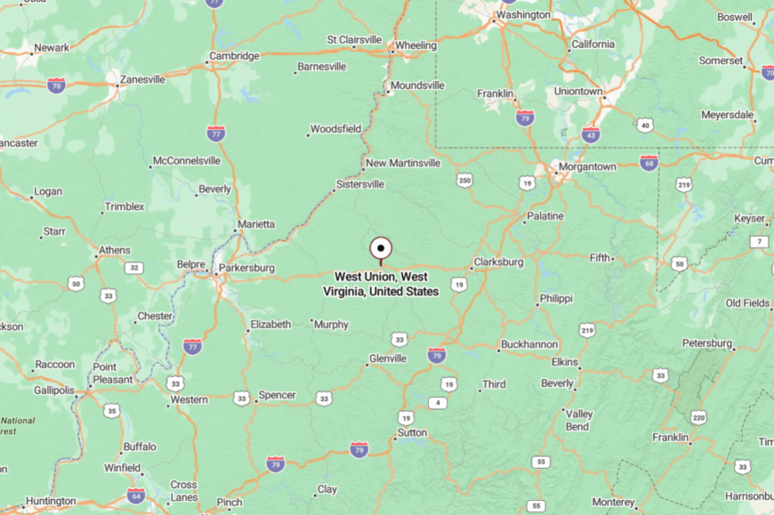
Set in Doddridge County, West Union sits about 50 miles southwest of Morgantown along US-50. Exit to WV-18 and the road narrows into a creek-lined corridor.
Hills close in just enough to hush the through-traffic. It’s easy to reach, but it asks you to slow down once you arrive.
11. Cairo – Rail-Trail Hollow of Brick and Oil-Boom Echoes
Cairo tucks into a tight hollow where the North Bend Rail Trail slips right through town, past storefronts that remember an oil-boom yesteryear. Its seclusion stems from curvy approaches and the way the hills gather close, hiding the place until you’re nearly on it.
The vibe is wonderfully time-worn and friendly: a restored bank turned museum, pie in the window, and cyclists leaning bikes against old brick. Pedal the rail-trail under stone arches, trace the history of the oil fields, paddle the Hughes River, or wander to North Bend State Park for quiet overlooks and foxfire nights.
A few shops and trail services meet visitors without crowding the streets. The town moves at the speed of conversation. Cairo is the sort of hollow that keeps your footsteps—and your thoughts—soft.
Where is Cairo?
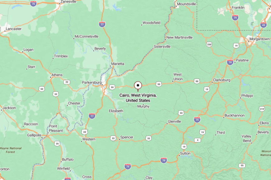
Cairo sits in Ritchie County about 23 miles east of Parkersburg, tucked along WV-31. You reach it via US-50, then meandering two-lane that shadows the river and narrows into town.
High walls of green and a lack of big signage protect its calm. It’s close enough for a day ride, yet far enough to feel like you’ve left everything behind.
10. Aurora – A Mountaintop Hamlet Where Meadows Meet Mist
Aurora holds roughly 200 residents who share sweeping views from 2,700 feet above sea level. Visitors spend days hiking the nearby Table Rock trail, fishing in Horseshoe Run, or browsing pottery at the historic Red House.
Small-scale farming and seasonal tourism supply most paychecks, with maple syrup operations adding a sweet bonus each spring. The village feels secluded because Monongahela National Forest surrounds three sides, while dense fog often cloaks the lone access road at dawn.
Old farmsteads sit on multi-acre parcels that keep neighbors comfortably distant. At night, little more than barn lights interrupt the starlight.
Where is Aurora?
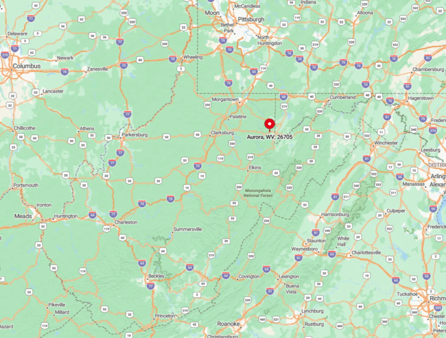
Aurora lies in eastern Preston County close to the Maryland border. Its mountaintop setting means travelers wind upward on Route 50 before turning onto quiet County Route 24.
Tall hardwood stands block highway noise, preserving the calm. Most visitors arrive from Morgantown in just over an hour, yet the final miles feel worlds apart.
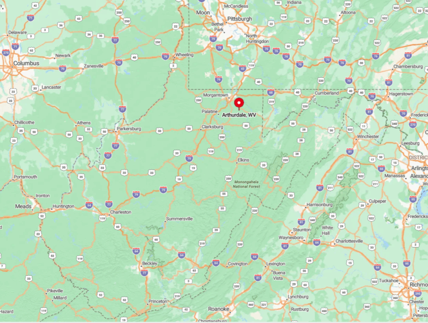
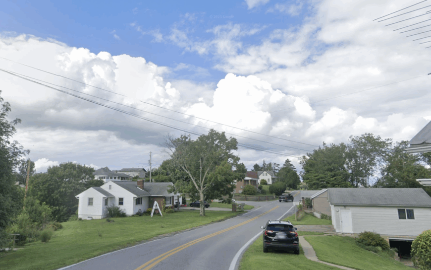
9. Arthurdale – New-Deal Homesteads Hidden Among Rolling Fields
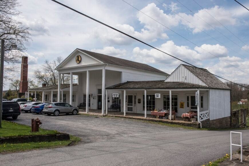
About 600 people live among the stone cottages and broad lawns of Arthurdale. Guests tour the New Deal Homestead Museum, shop at the monthly artisans market, or follow the gentle trails that trace Reedsville Lake.
Employment centers on small farms, crafts, and heritage tourism sparked by First Lady Eleanor Roosevelt’s 1930s experiment in planned rural living. Distance from major roads, plus a ring of hay fields and woodlots, shelters the settlement from outside hustle.
Houses sit on one-acre lots, spacing families far enough to leave only birdsong in between. Even the post office closes early, reinforcing the unhurried pace.
Where is Arthurdale?
🔥 Would you like to save this?
The community rests fourteen miles southeast of Morgantown in Preston County. Drivers leave busy Interstate 68, thread through pastureland on Route 92, and soon find cell service fading. Low ridges form a natural sound wall that muffles city clatter. Despite the short mileage, the trip feels like stepping into a living museum.
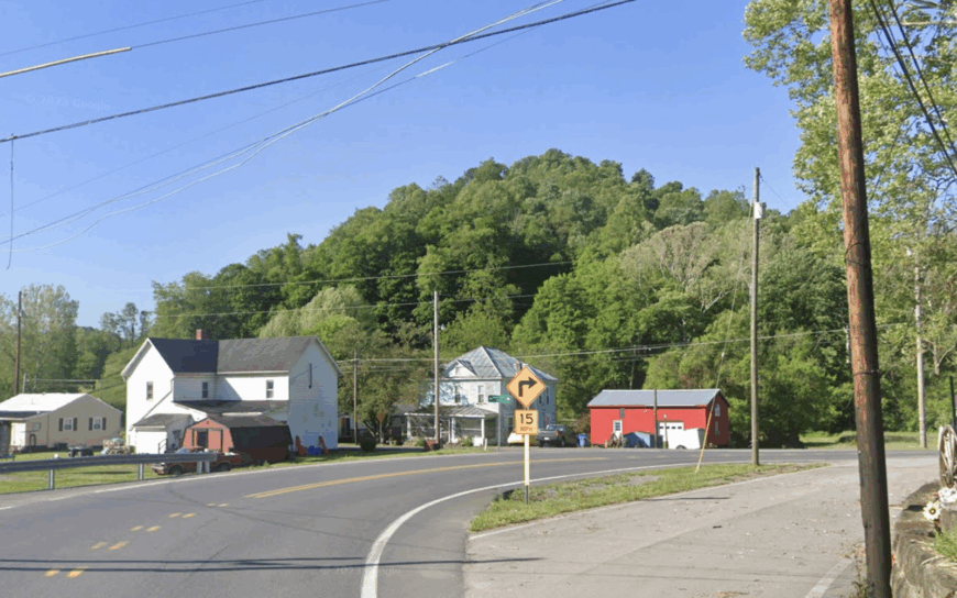
8. Dallas – Hilltop Refuge Above Wheeling Creek
Dallas counts fewer than 300 residents spread across wooded ridge lots at the Ohio–Marshall county line. Weekend pastimes include horseback riding on old logging roads, trout fishing in Wheeling Creek, and browsing antiques at the century-old general store.
Jobs come from beef cattle, small sawmills, and commuting carpenters who value the quiet ride home. The town’s elevation and surrounding hollows block views of Wheeling’s city lights, preserving an unbroken night sky.
Sparse development keeps through-traffic nearly nonexistent, leaving children free to bicycle the single main road. Even garbage pickup is weekly, not daily, underlining the slower rhythm.
Where is Dallas?
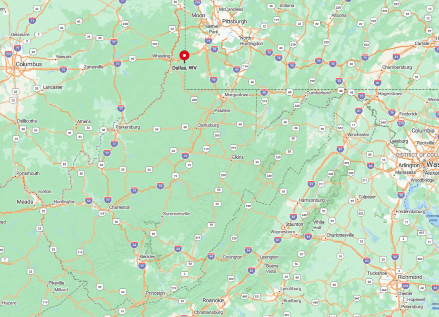
Dallas sits twelve winding miles southeast of Wheeling atop a broad plateau. County Routes 7 and 3 intersect here, yet both see more tractors than sedans. Deep ravines on three sides discourage shortcut seekers. Most visitors exit Interstate 70, climb into rolling hills, and soon lose radio reception, a sure sign they have arrived.
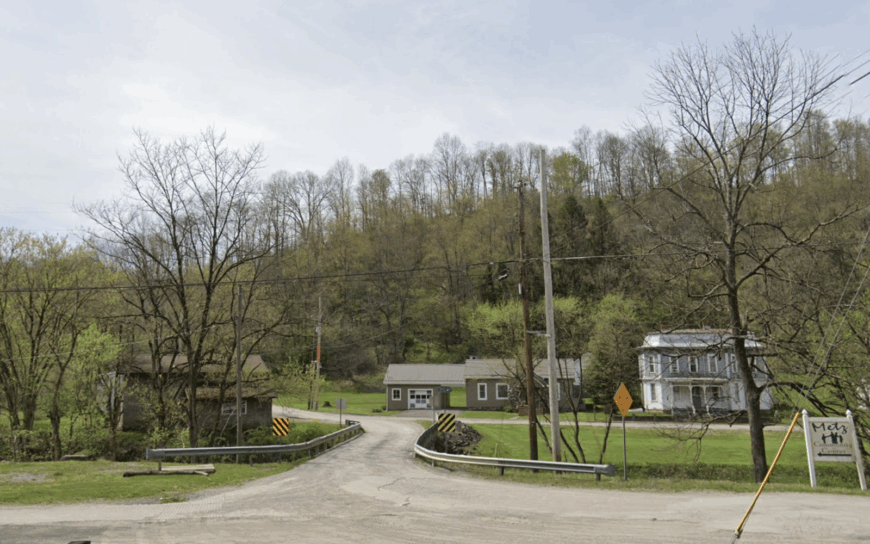
7. Wadestown – Ridge-Top Farms Wrapped in Endless Forest
Around 400 people live in Wadestown, many on family land dating back a century. Locals hunt whitetail in the morning, then gather at the volunteer fire hall for potluck dinners or bluegrass jams. Small dairy herds, natural gas wells, and a single feed store form the economic backbone.
Seclusion comes from the unbroken oak forest that surrounds County Route 7, turning every driveway into its own winding lane. House lights disappear behind tree lines, granting privacy even between close cousins. Traffic rarely rises above the hum of a pickup hauling hay.
Where is Wadestown?
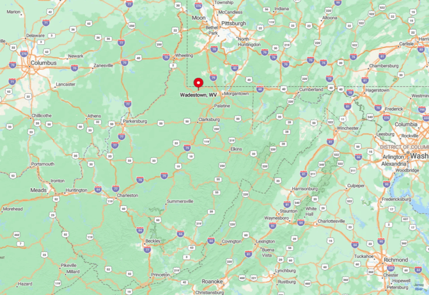
Wadestown lies in southern Monongalia County near the Pennsylvania border. State Route 7 skirts to the east, leaving the ridge-top community served only by its namesake county road.
Thick woodland and steep grades discourage commercial development. Travelers usually reach the town by exiting Interstate 79 at Waynesburg and following rural backroads for twenty scenic minutes.
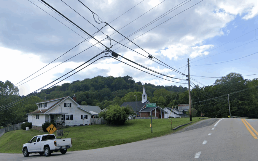
6. Metz – Creek-Valley Crossroads You’ll Miss If You Blink
Metz hosts fewer than 200 residents beside the quiet flow of Buffalo Creek. Anglers cast lines under the railroad trestle, while hikers explore the hidden waterfall behind the old iron bridge. The feed mill and a handful of family farms provide limited employment, with many residents bartering garden produce or firewood.
Forested hills rise sharply on both sides, trapping morning fog and muting outside noise. Homes cluster loosely, leaving room for vegetable plots and chicken coops between neighbors. The single church bell marks time more reliably than any traffic signal.
Where is Metz?
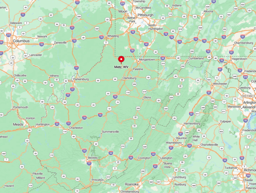
The village sits in northeastern Marion County along County Route 73. Narrow creekside turns slow visitors arriving from Fairmont, seventeen miles away.
Hills and sharp bends deter tractor-trailers, ensuring light traffic year-round. Anyone heading in should watch for the vintage red caboose; miss it, and they are already past the town limits.
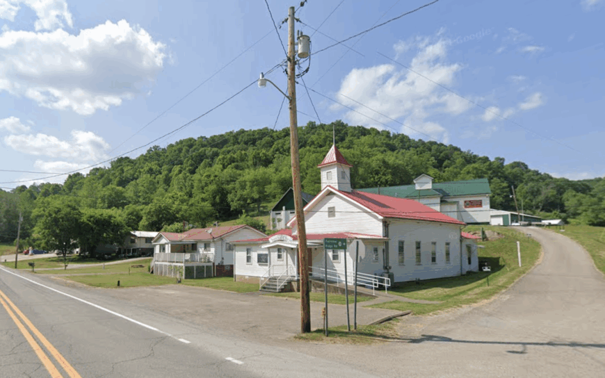
5. Core – Rolling Pastureland West of Morgantown’s Reach
Core supports about 300 residents scattered across green hills and white-railed horse farms. Weekends draw locals to Cobun Creek Reservoir for kayaking or to the century-old Grange Hall for square dances.
The main livelihoods are beef cattle, small-batch honey, and remote university staff who telecommute from porches overlooking misty valleys. Seclusion stems from natural ridgelines that block the sight and sound of Interstate 79 despite its relative closeness.
Large acreage lots maintain wide buffers, so evening crickets outnumber car horns. Streetlights remain rare, keeping the Milky Way fully visible.
Where is Core?
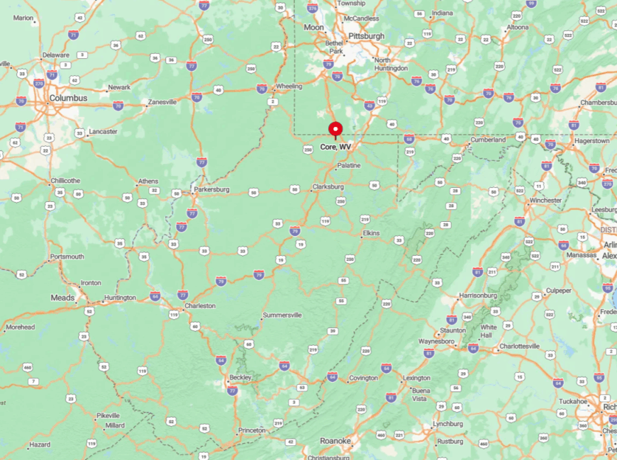
Located sixteen meandering miles west of Morgantown, Core hugs County Route 50 in Monongalia County. The final approach uses one-lane bridges and blind curves that naturally slow the pace.
Dense tree cover and rolling pasture hide most homes from the road. Visitors commonly rely on printed directions because cell signals fade on the last five miles.
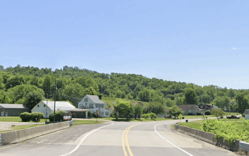
4. Wileyville – Hardwood Haven off the Old Railroad Grade
Wileyville claims roughly 160 inhabitants lining Fishing Creek’s wooded banks. Residents spend free hours mushroom hunting, floating the creek, or browsing vintage photos in the tiny rail depot museum. Timber harvesting, natural gas leases, and cottage woodworking shops keep the lights on.
Seclusion owes much to the abandoned rail grade that once provided easy access; with tracks gone, only a twisty county lane reaches town. Houses peek through maple stands, masking the village from anyone rushing by. Deliveries arrive twice a week, reinforcing the slow heartbeat of daily life.
Where is Wileyville?
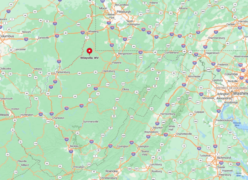
The hamlet rests in Wetzel County, southwest of New Martinsville. County Route 20 snakes along Fishing Creek for eighteen miles before yielding to Wileyville’s single main street.
Steep hillsides and a lack of cell towers create a welcome digital void. Most travelers reach the area via State Route 7, then follow creekside curves until pavement narrows to gravel.
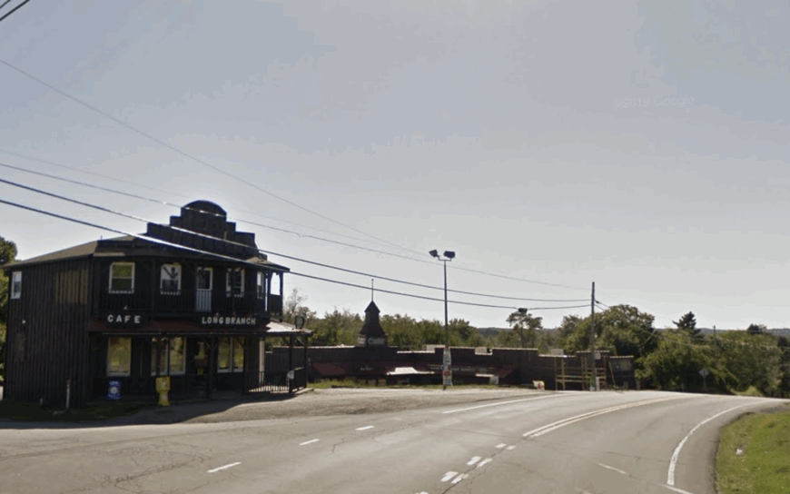
3. Reader – Secluded Riverbend With More Deer Than Neighbors
Reader’s population hovers near 400, with homes tucked beside lazy bends of Fishing Creek. Locals angle for smallmouth bass, explore the remote Shoemaker Mine ruins, or gather at the century-old Reader Church for bluegrass nights.
Employment includes small oil leases, family farms, and home-based crafts that ship quietly through the modest post office. Thick pines on steep slopes block both wind and road noise, helping deer outnumber people by a comfortable margin.
Waterfront lots run deep, so even neighboring docks stay out of sight. Dark skies and the absence of traffic cement the town’s escape-hatch feel.
Where is Reader?
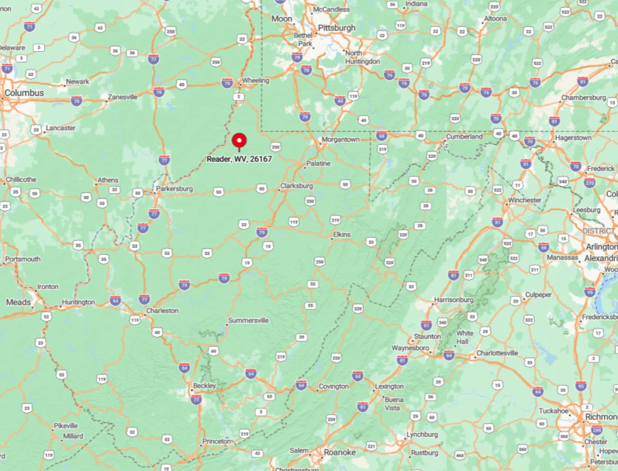
Reader lies twelve miles south of Wileyville, still within Wetzel County. State Route 20 skirts the creek line but stops short of any direct highway, forcing travelers onto narrower lanes.
The surrounding hills fold inward, making the village nearly invisible until one reaches the bridge at its center. Visitors often rely on the historic Baltimore and Ohio milepost beside the road as the only obvious marker.
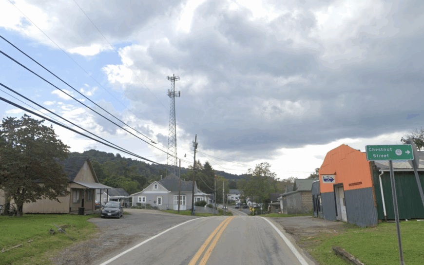
2. New Manchester – Panhandle Plateau Lost in Time
New Manchester shelters about 800 residents among weathered farmsteads and the stone shell of an 1890 courthouse. Day trips involve hiking to the ruins of the ghost town of Cliftonville, birding in Tomlinson Run State Park, or browsing heirloom apple varieties at a family orchard that traces back six generations.
Farming and specialty timber provide most local income, aided by small-scale antique dealers who repurpose bricks from long-abandoned kilns. The plateau sits high above the Ohio River, and thick forest plus disused county roads cut it off from river traffic and tourist flow.
Large woodlots and abandoned industrial sites ensure wide gaps between homes. Nighttime silence is broken only by barred owls echoing through ravines.
Where is New Manchester?
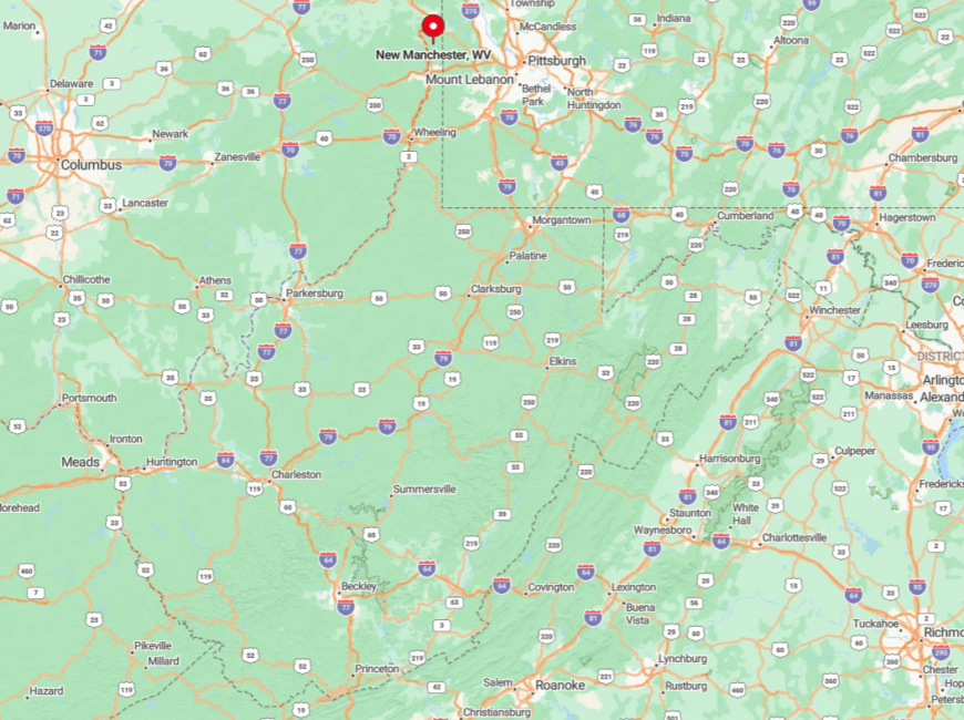
The town stands in Hancock County near the northern tip of the panhandle, eight miles east of the Ohio River. Accessible primarily via State Route 8, it sees little through-traffic because the route dead-ends at Pennsylvania’s rural backroads.
Elevation and tree cover shield it from both Pittsburgh and Wheeling light domes. Most visitors leave U.S. Route 30, climb the ridge for fifteen minutes, and feel the modern world fade behind them.
1. Viropa – Tiny Timber Settlement at the State Line
Viropa houses fewer than 50 people along a single gravel stretch shadowed by towering white pines. Residents spend mornings foraging ramps, splitting firewood, or checking game cameras before sharing coffee at the lone community pavilion.
Livelihoods revolve around sustainable logging, maple syrup, and remote online work powered by a cooperative satellite link that residents pool funds to maintain.
The thick pine stands, rolling fog, and lack of public utilities combine to make Viropa the most secluded spot on our list; even mail delivery is limited to three days a week, and wildlife often outnumbers vehicles on the road.
Where is Viropa?
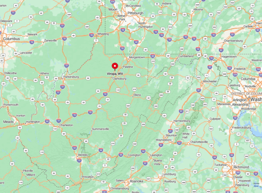
Perched on the Hancock County border, Viropa sits where West Virginia meets Pennsylvania and Ohio forest tracts overlap. Reaching it requires leaving State Route 8, then creeping five miles on gravel through timber company land.
Dense canopy blocks GPS signals, so visitors often follow painted blue blazes nailed to trees by locals. Once past the final bend, the gravel narrows, and the forest hush signals arrival.


