🔥 Would you like to save this?
Northern Maine rewards travelers who trade fast-food drive-thrus for logging roads, and traffic lights for starlight. Scattered between vast spruce forests and glacier-carved lakes, a handful of tiny communities offer elbow room measured in square miles rather than square feet.
Here, nightly entertainment might be the crack of a bull moose in the alders or the milky sweep of the aurora. Our rundown introduces 25 settlements where solitude still rules the day, each one delivering its own mix of wilderness, history, and homespun ingenuity.
In order to come up with the very specific design ideas, we create most designs with the assistance of state-of-the-art AI interior design software. Also, assume links that take you off the site are affiliate links such as links to Amazon. this means we may earn a commission if you buy something.
Pack a spare tire, top off the tank, and discover why locals proudly say “You don’t pass through— you arrive on purpose.”
25. Connor Township – Fields and Forest on the Fringe

Connor Township is a quiet spread of farmland and forest in northern Aroostook County, where the roads run long and straight before disappearing into spruce thickets. With no main street or commercial hub, life here revolves around family farms, seasonal hunting camps, and the rhythms of planting and harvest.
The Saint John River forms its northern boundary, offering quiet fishing spots and views across to Canada. Winter brings deep snow, and snowmobiles become the preferred way to visit a neighbor a mile away. In summer, the air smells of hay and fresh-cut wood, while autumn paints the fields in gold and rust.
The seclusion comes not from inaccessibility, but from how spread-out and self-contained it is — every home has its own world. It’s the kind of place where you can hear a tractor long before you see it crest the hill.
Where is Connor Township?
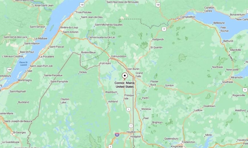
Connor Township is located northwest of Caribou, bordered by the Saint John River to the north and Van Buren to the east. It’s reached by following State Route 161 out of Caribou and then turning onto smaller township roads.
The trip passes through rolling farmland and quiet woodlots. By the time you arrive, the hum of the city feels far behind you.
24. Masardis – A Tiny Trailhead Town
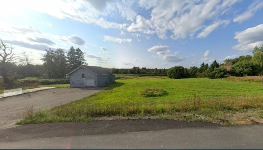
Masardis is a modest settlement along the Aroostook River, known more as a gateway to the North Maine Woods than for any bustling center. Fewer than 250 people live here, their homes scattered between the riverbank and the tree line.
Canoeists and anglers stop to launch from the river access, while hunters gear up before heading west into vast timberlands. There’s a post office, a general store, and long stretches of quiet road in between.
Logging trucks still rumble through, but the heart of Masardis is in its calm stretches of water and the hush of the surrounding woods. In autumn, the maples along the river turn flame-red, reflecting in the current like fire on glass. It’s a place where the stillness is as much a resource as the timber.
Where is Masardis?
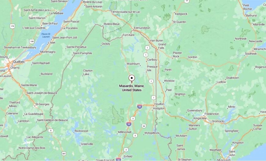
Masardis sits in central Aroostook County on U.S. Route 11, about 15 miles south of Ashland. The approach is through miles of mixed forest, with occasional glimpses of the Aroostook River.
From here, the road west leads straight into the North Maine Woods. Once you pass the last house, it’s just trees, water, and sky.
23. Garfield Plantation – Off the Mainline
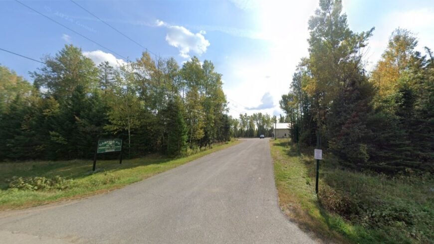
Garfield Plantation is a small, spread-out community where dirt lanes branch into fields and the forest seems to press in from every side. There’s no shopping center, no gas station — just homes, woodlots, and the occasional roadside stand in summer.
Residents farm potatoes and grains, cut firewood, and hunt in the surrounding woods. The pace is unhurried, with days marked by weather and chores more than by a clock. Winter winds sweep across open fields, leaving drifts that can linger until April.
In summer, barn swallows dive over hayfields while the air smells of clover and cut grass. It’s a place where quiet isn’t sought out — it’s simply the default.
Where is Garfield Plantation?
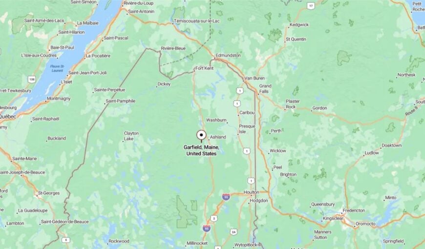
Garfield Plantation is in central Aroostook County, west of Patten and south of Ashland. You reach it by following State Route 11 and turning onto smaller rural roads that lose their pavement quickly.
The surrounding countryside is a patchwork of farmland and forest. By the time you reach the last house, you’re more likely to hear the wind in the trees than another car.
22. Cyr Plantation – Fields, Forest, and the Borderline
Cyr Plantation is a small farming community spread across open potato fields and patches of mixed forest, right along the Canadian border in northern Aroostook County. With fewer than 100 residents, life here moves at the pace of the seasons—planting in spring, tending crops through summer, and long stretches of snowbound quiet in winter.
The St. John River runs just north of town, offering peaceful fishing spots and views across to New Brunswick. There’s no main street or business district—only family farms, weathered barns, and the occasional roadside vegetable stand in summer.
In autumn, migrating geese fill the skies, their calls echoing over the fields. Cyr Plantation’s beauty lies in its wide horizons and the feeling that you’re standing at the very edge of the country.
Where is Cyr Plantation?
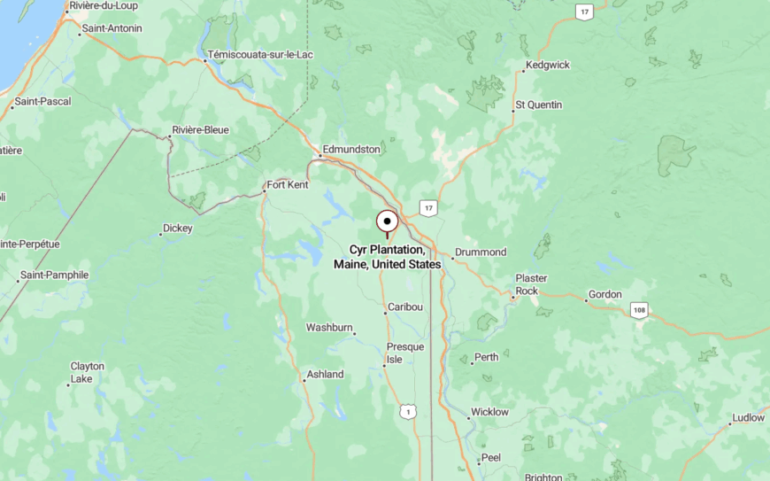
Cyr Plantation is in northern Aroostook County, about 10 miles east of Van Buren and just south of the St. John River. It’s reached via U.S. Route 1, with small side roads leading into the farmland.
The approach is lined with open fields and distant tree lines that seem to run forever. By the time you arrive, the quiet and space make the rest of the world feel far away.
21. New Sweden – Swedish Heritage in the Pines
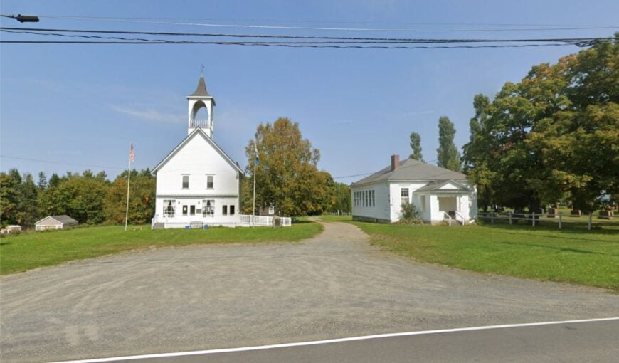
New Sweden is a small, forested community with roots tracing back to 1870, when Swedish immigrants settled here under a state-sponsored program. Today, its quiet roads pass by neat farmhouses, small potato fields, and stretches of deep pine forest.
The pace is unhurried, and the heart of town is marked by its historic Lutheran churches, where community suppers and festivals still bring neighbors together. Each June, the Midsommar festival fills the air with fiddle music and the smell of fresh-baked cardamom bread.
The winters are long and serene, with cross-country ski trails weaving through the fields and woods. It’s far from tourist routes, giving it a peaceful, lived-in charm that feels untouched by time. In New Sweden, the sound of the wind in the pines is just as important as any conversation.
Where is New Sweden?
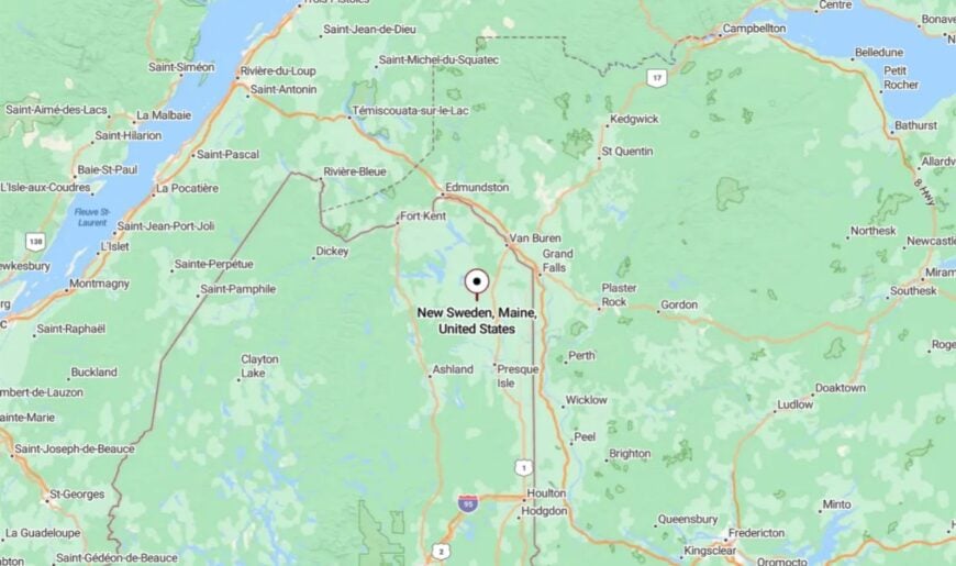
New Sweden sits in northern Aroostook County, about 15 miles west of Caribou. It’s reached via State Route 161, which winds through farmland and mixed forest.
The nearest large stores are in Caribou, making the township feel pleasantly removed. The surrounding trees and open land create a natural buffer from the outside world.
20. Soldier Pond – Riverside Hamlet Near the Canadian Border
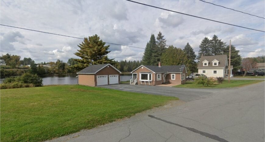
Soldier Pond is a tiny community hugging a quiet bend in the Fish River, where the current slows just enough for anglers to wade out and cast for brook trout. The settlement is little more than a scattering of houses, a post office, and a riverside park that becomes the center of life in summer.
Families picnic under tall pines, kids swim in the slow-moving water, and canoeists drift downstream toward Eagle Lake. Winters are deep and silent, broken only by the hum of snowmobiles connecting to the nearby ITS trail network.
Most residents work in nearby Fort Kent or in seasonal forestry, but home is where the river bends, the deer cross at dusk, and the stars seem impossibly close. It’s a spot that feels made for watching the seasons turn.
Where is Soldier Pond?
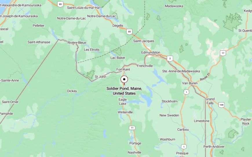
Soldier Pond is in northern Aroostook County, just south of Wallagrass and about 12 miles from Fort Kent. It sits along U.S. Route 11, though the road curves gently away from the river, keeping traffic and noise at a distance.
Visitors often arrive from Fort Kent, following the Fish River upstream until the water widens into the pond itself. Its location between forest and river gives it the feeling of being both sheltered and open to the wild.
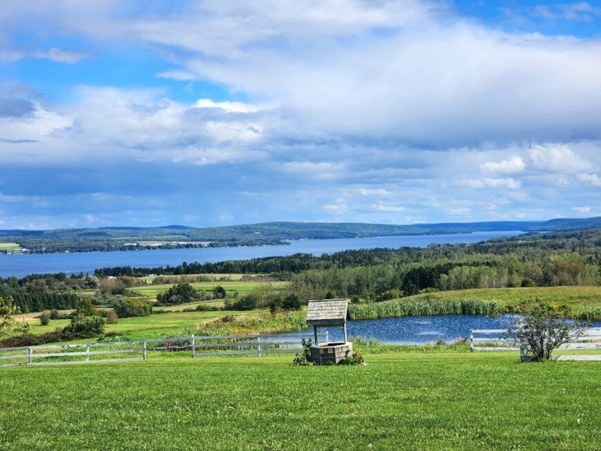
19. St. Agatha – High Above Long Lake
🔥 Would you like to save this?
St. Agatha sits on a ridge above Long Lake, offering wide views of water and distant hills that roll into Canada. With around 730 residents, it’s small enough to feel personal but big enough for a café and a general store.
Farming, fishing, and small tourism businesses keep the community going. Summers are lively with boaters, while winters are marked by snowmobile trails and ice-fishing shacks. The Long Lake Sporting Club is a local institution, serving hearty meals with sunset views.
Even in the busiest season, the air feels calm and unhurried. From this height, the rest of the world seems far away.
Where is St. Agatha?
St. Agatha is in the far north of Aroostook County along State Route 162, about 12 miles south of Madawaska. The road climbs steadily from the lake’s edge, revealing panoramic views.
The nearest larger town is Madawaska, roughly 20 minutes away. The ridge setting keeps it feeling sheltered and apart.
18. Sinclair – A Ribbon Along Long Lake
Sinclair is a slender village tracing the curve of Long Lake, where cottages and camps sit just steps from the water. Life here is dictated by the seasons: fishing in spring, paddling in summer, hunting in fall, and snowmobiling in winter.
The shoreline is quiet, with no large marinas or resort developments. Many homes are seasonal, leaving the place nearly empty outside of summer weekends. Even on its busiest days, Sinclair has an easy, unhurried feel.
The scent of lake water and pine lingers in the air long after you leave. It’s a community made for people who love life at water’s edge.
Where is Sinclair?
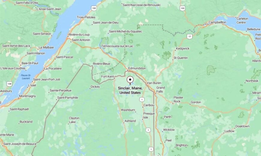
Sinclair is in northern Aroostook County along State Route 162, between St. Agatha and Madawaska. The road hugs the lake for miles, offering constant views of the water.
It’s about 25 minutes from Madawaska. The closeness to the water and the distance from bigger towns make it feel like its own world.
17. Wallagrass – Fields Along the Fish River
Wallagrass is a peaceful river valley town where hayfields meet wooded hillsides, and the Fish River runs clear all summer long. About 600 residents call it home, with most homes lining the main road or tucked behind stands of spruce.
Farming and small-scale forestry remain staples of local life. Outdoor recreation is close at hand, from fishing and kayaking to birdwatching in the river meadows. Winters are quiet, save for the hum of snowmobiles passing through.
The scenery is simple but striking: rolling land, blue water, and a sky that goes on forever. It’s a town that lets you breathe.
Where is Wallagrass?

Wallagrass is in northern Aroostook County on U.S. Route 11, between Eagle Lake and Fort Kent. The road follows the Fish River through open fields and forest.
The nearest large grocery store is in Fort Kent, about 15 minutes north. The gentle valley setting keeps it peaceful year-round.
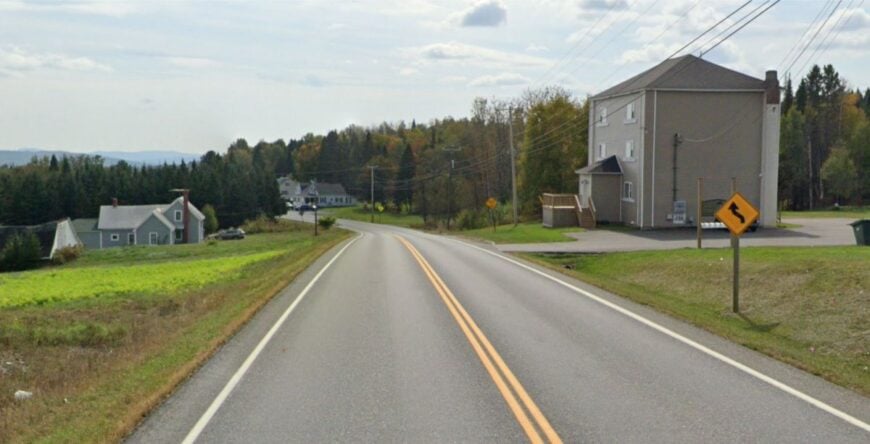
16. Moro Plantation – Hills, Farms, and Forested Horizons
Moro Plantation is a speck of a community where potato fields meet the northern slopes of the Katahdin foothills. With fewer than 50 residents, it’s the kind of place where the post office doubles as a meeting spot and the road grader’s passing is newsworthy.
Summers bring a patchwork of hayfields and lupine blooms, while winters wrap the hills in deep, powdery snow. Hunting and small-scale farming anchor the local rhythm, and logging crews work the surrounding woods when conditions are right.
On quiet evenings, the only movement might be a deer stepping out of the tree line into a stubbled field. It’s a place where the land feels bigger than the people, and that’s just how the locals like it.
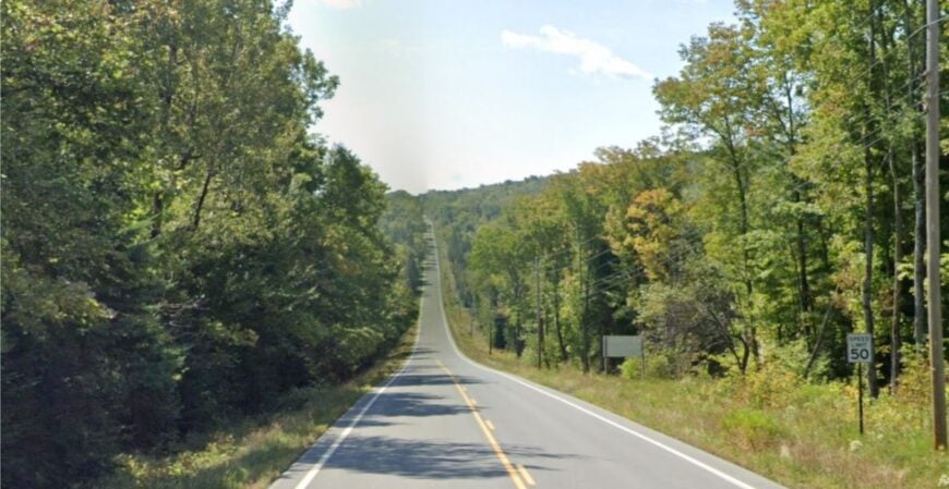
Where is Moro Plantation?
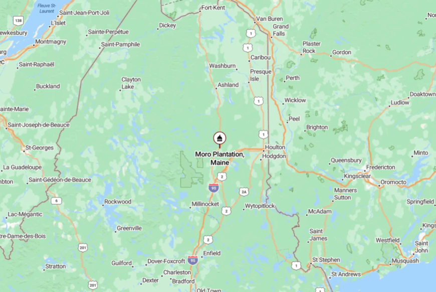
Moro Plantation lies in southern Aroostook County along State Route 212, about 15 miles east of Patten. The approach winds past rolling farmland with long views of Mount Katahdin’s northern ridge.
There’s no direct interstate access, and traffic is light enough that meeting another vehicle can be an event. The blend of open sky and encircling forest gives it a settled yet far-off feel.
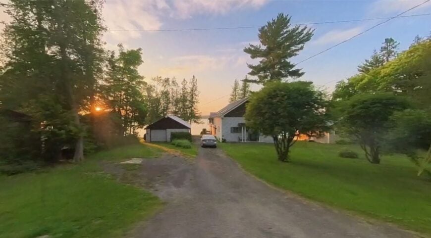
15. Eagle Lake – Pines, Water, and Winter Trails
Eagle Lake is a lakeside village where the water and surrounding forest shape nearly every part of life. Around 800 people call it home, but the long stretches of undeveloped shoreline make it feel far smaller.
Fishing, paddling, and birdwatching dominate the warmer months, while winter brings ice fishing, cross-country skiing, and snowmobiling. The lake’s calm surface often mirrors the green wall of spruce that surrounds it, making for postcard-perfect mornings.
Small shops and a visitor center serve locals and travelers without intruding on the peace. Wildlife sightings—from loons to moose—are a daily possibility. Here, the horizon always seems just a little wider.
Where is Eagle Lake?
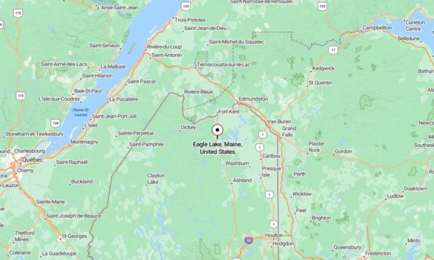
Eagle Lake lies in north-central Aroostook County on State Route 11, between Fort Kent and Ashland. The road hugs the shoreline for long stretches, offering constant glimpses of the water.
Larger stores are in Fort Kent, about 15 minutes away. The public lands surrounding the town keep their setting wild and quiet.
14. Madawaska Lake Township – Still Waters in the North Woods
Madawaska Lake Township is a quiet retreat in the Fish River chain, where camps and cottages peek from between the pines along a sheltered shoreline. Most residents are seasonal, arriving in summer to fish for brook trout, swim in the cool water, and watch loons glide across glassy coves.
In the off-season, only a few year-round homes remain occupied, their woodstoves sending thin ribbons of smoke into the frosty air. The absence of a town center or commercial strip means life here is defined entirely by the lake and the forest.
Evenings are slow and golden, with sunsets that spill across the water until they fade into a sky thick with stars. It’s a place where time seems to fold into the rhythm of the seasons.
Where is Madawaska Lake Township?
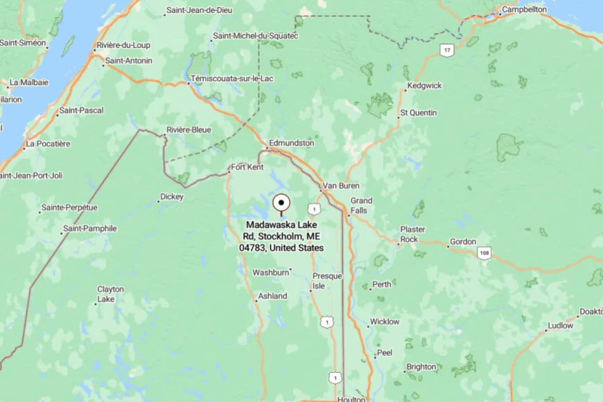
The township sits in central Aroostook County along State Route 161, between Stockholm and Van Buren. The main road hugs the lakeshore, offering frequent glimpses of water through the trees.
It’s about 30 minutes from Caribou, the nearest hub for supplies, and far enough from highways to keep traffic to a trickle. The distance and the water’s edge combine to make it feel a world apart.
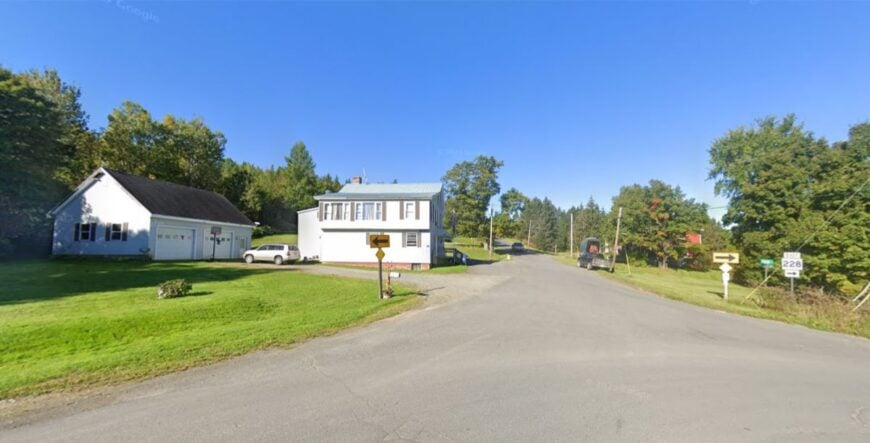
13. Perham – Rolling Fields and Quiet Roads
🔥 Would you like to save this?
Perham is a rural town of about 400 residents, surrounded by low hills and a patchwork of potato fields, hay meadows, and forest. Life here moves to an agricultural rhythm, with planting, harvest, and hunting seasons marking the year.
The town is small enough that community events still happen in the school gym or at the volunteer fire station. Dirt roads lead to fishing holes and berry patches known mostly to locals.
On a clear night, the Milky Way spills across the sky without competition from streetlights. The winters are long, but the stillness they bring is part of the charm. Perham’s beauty lies in its simplicity—land, sky, and time enough to enjoy both.
Where is Perham?

Perham is in north-central Aroostook County, about 12 miles northwest of Caribou. It’s reached via State Route 228, which runs through farmland before narrowing to rural backroads.
Larger stores are in Caribou, roughly a 20-minute drive. The distance and open space create a sense of breathing room that’s hard to find elsewhere.
12. Benedicta – Where Farmland Meets the Forest
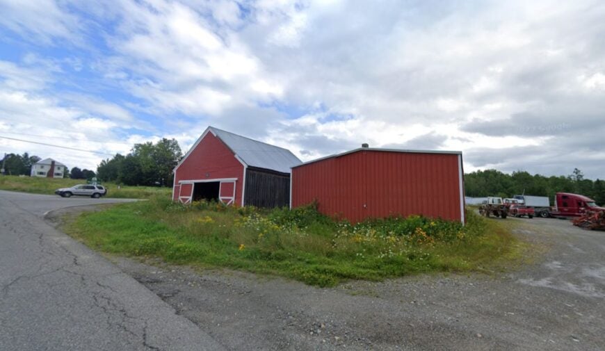
Benedicta is a small, unincorporated community at the southern edge of Aroostook County, where open farmland gives way to the wooded foothills of northern Maine. With fewer than 300 residents, it’s a place of white-steepled churches, tidy farmhouses, and hayfields that stretch to the horizon.
The surrounding forest is laced with old logging roads that double as ATV and snowmobile trails. Locals gather for church suppers, small-town baseball games, and autumn festivals.
The air here smells of fresh-cut hay in summer and woodsmoke in winter. The quiet is broken only by the occasional tractor or a dog barking in the distance. Benedicta offers a slower pace that feels miles away from the nearest highway.
Where is Benedicta?
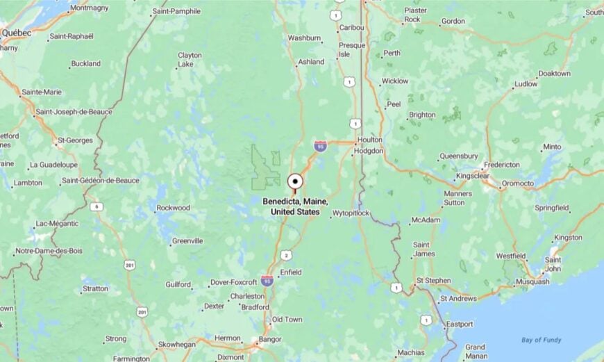
Benedicta is in southern Aroostook County along U.S. Route 2, about 10 miles south of Patten. It’s easily reached from Interstate 95 via Exit 264 in Sherman.
Larger shopping and services are in Houlton, roughly 30 minutes away. The gentle hills and open views give it a settled yet secluded feel.
11. Island Falls – Lakes, Trails, and Timberland
Island Falls is a small town surrounded by water and woods, with Pleasant and Mattawamkeag lakes on its doorstep. Around 750 residents live here year-round, enjoying a mix of fishing, boating, hiking, and snowmobiling.
The town has a classic New England feel, with white clapboard buildings, a historic inn, and a central green. Beyond the village, the forest quickly takes over, leading to logging roads and trails that go on for miles.
Summers bring campers and anglers; winters bring sledders and skiers. The nearby golf course, built in 1928, feels almost like a secret in the pines. Life here moves to the rhythm of the seasons, with just enough bustle to keep things lively.
Where is Island Falls?

Island Falls is in southern Aroostook County, just east of Interstate 95 and south of Patten. It’s accessible via U.S. Route 2 and State Route 159. Larger services are in Houlton, about 25 minutes south.
The lakes and surrounding forest give it a peaceful, tucked-away feeling despite being near the interstate.
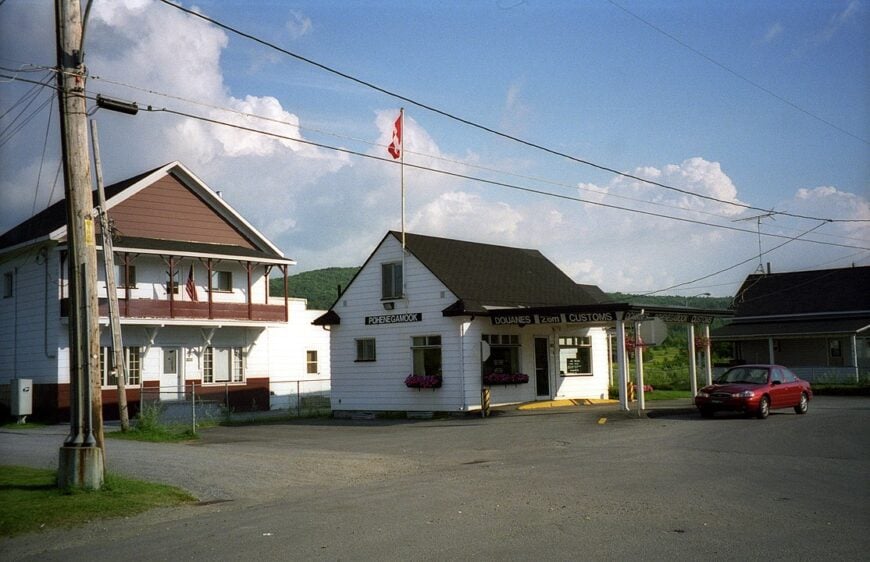
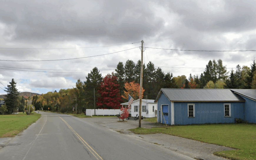
10. Estcourt Station – America’s Northernmost Village at the End of the Logging Road
Fewer than ten people keep year-round watch over this border-straddling hamlet tucked inside Big Twenty Township. Visitors come to photograph Boundary Marker No. 1, cast for brook trout on the nearby St. Francis River, and scout for moose that wander unbothered down the gravel main street.
Work, when it exists, centers on seasonal logging crews and a two-person U.S. Customs post that opens when Quebec vacationers drift south for cheap gas. Estcourt Station feels utterly cut off; thirty miles of washboard gravel separate it from the nearest paved road, and snowdrifts regularly close the route for days.
A quirky secret is the lone pump at Pohenegamook’s general store in Canada—Americans walk across the boundary line, swipe a card, and pump stateside fuel without leaving the country. With no café, no cell service, and only the crackle of VHF radios, residents share their evenings with loons and an infinite hush.
Where is Estcourt Station?
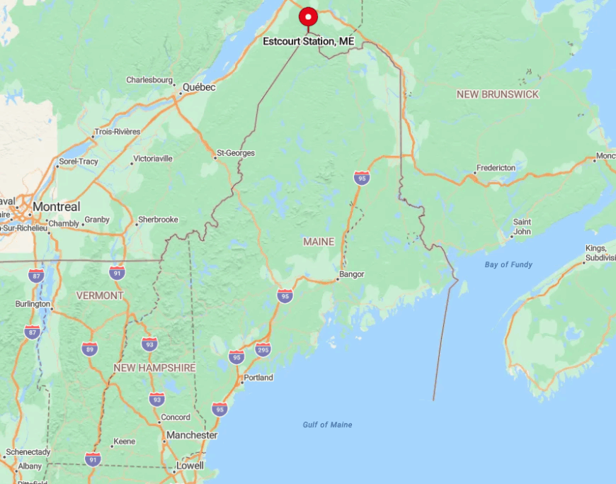
The village sits on Maine’s northern tip, a thumb of land surrounded on three sides by Quebec and brushed by the Saint John River watershed. Endless softwood forest blocks any direct southern route, so most travelers reach it by driving to St. Francis, then grinding along the privately maintained Realty Road to the border.
The isolation is magnified in winter when plows give priority to logging trucks, not tourists. Those who make the trip cross three remote checkpoints and sign a trailhead-style logbook—fitting rituals for the most secluded corner of the United States east of Alaska.
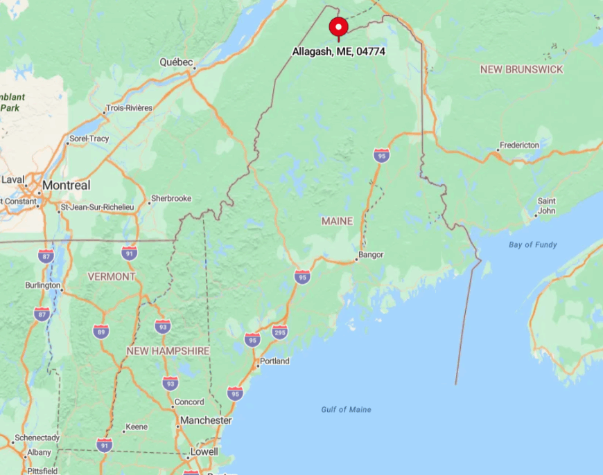
9. Allagash – A Riverside Outpost Beyond the Last Gas Pump
About 200 hardy residents make their home where the Allagash and St. John rivers meet beneath a canopy of birch and fir. Canoeists launch here for the 92-mile Allagash Wilderness Waterway, anglers chase landlocked salmon, and locals trade stories at Two Rivers Lunch, the town’s de facto gathering spot.
Guiding, small-scale timber work, and handmade ash basketry keep a modest economy turning. Cell towers are blocked by surrounding hills, and the nearest chain store sits an hour south in Fort Kent, reinforcing the sense of being off the grid.
A little-known treat is the century-old Allagash Historical Society building, opened by appointment for anyone curious about log drives and river drivers’ lore. Evenings end with wood-stove heat, the glow of kerosene lamps, and a river that sounds louder than any highway ever could.
Where is Allagash?
🔥 Would you like to save this?
Allagash lies at the terminus of Route 161 in far northwestern Aroostook County, just shy of the Quebec line. Dense forest on every side ensures that, once the pavement stops, only logging roads continue west toward Canada.
Travelers typically fuel up in Fort Kent before following the St. John River valley for 56 remote miles. A single blinking light at the town line signals arrival—after that, the only roar comes from whitewater below the bridge.
8. Oxbow – A Former Town Turned Wilderness Township
Oxbow’s permanent population hovers around forty-five, scattering across abandoned potato farms and 100-acre woodlots reclaimed by alder and aspen. Hunters prize the area for grouse and whitetail, while paddlers slip into the wild Aroostook River for a swift ride south.
With municipal status surrendered in 2017, the township runs on volunteer fire calls and informal neighborly agreements; modest forestry and seasonal guiding represent the main paychecks.
No streetlights, no municipal plowing beyond the county line, and miles of dirt track make the place feel more like the Yukon than New England.
A gem most outsiders miss is the tiny Oxbow Picnic Area, a grassy bank beside the river where stargazers spread sleeping bags to watch the Perseids undimmed by any glow. Coyotes, not commuters, provide the nightly soundtrack.
Where is Oxbow?
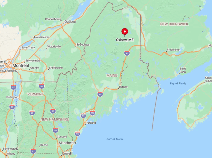
Situated thirty miles southwest of Presque Isle, Oxbow clings to the upper reaches of the Aroostook River basin. Thick timberland surrounds every approach road, and snow often lingers on shady corners of Oxbow Road until late April.
Visitors exit U.S. Route 11 at the village of Masardis, then follow a winding ten-mile ride that turns to gravel halfway in. Once the asphalt ends, mailbox numbers drop quickly—so do cell bars.
7. Beaver Cove – Quiet Cabins on Moosehead’s Northern Shore
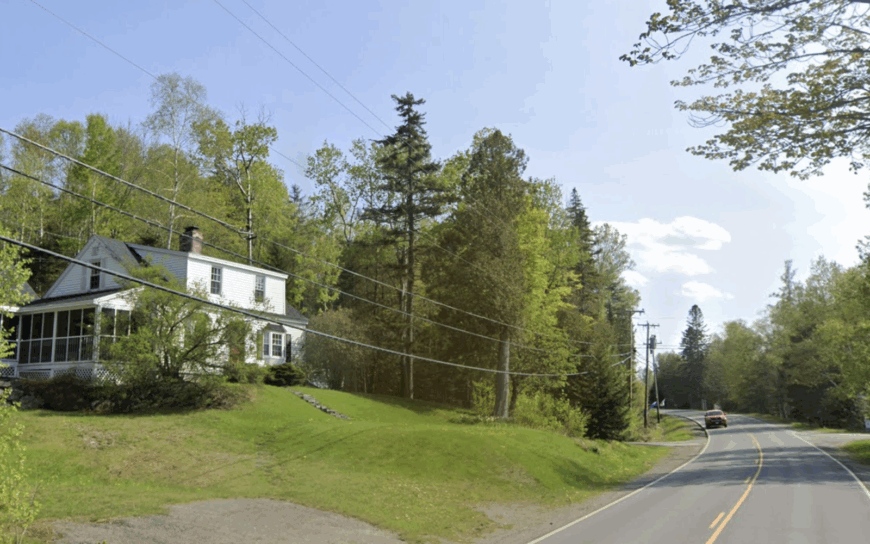
Only 122 year-round residents share the northern rim of Maine’s largest lake, where spruce-rimmed coves reflect more loon wakes than boat wakes. Summer days revolve around paddling to Sugar Island, hiking the easy Burnt Jacket Mountain trail, or browsing local crafts at the one-room Orthodox Church bazaar held each August.
Seasonal rental cabins and a scattering of logging jobs supplement income, with Greenville’s outfitters providing occasional work. Seclusion is guaranteed by an eighteen-mile drive to the nearest grocery aisle, an absence of streetlamps, and state-owned forest hemming in private lots.
A little secret: at dawn, moose often wade the shallow cove beside the old Bee Cove icehouse foundation—a prime viewing spot reached by footpath from Town Landing. Even the mailboat’s horn feels loud in the stillness that follows sunset.
Where is Beaver Cove?
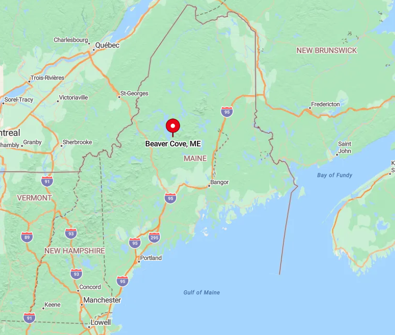
The village hugs Moosehead Lake’s eastern shoreline, nine miles north of Lily Bay State Park in Piscataquis County. Access comes via the paved but lightly trafficked Lily Bay Road, which leaves U.S. Route 15 in Greenville and dead-ends into forest north of town.
Once past the state park gate, cell reception fades and deer outnumber cars. Winter travelers should carry chains; lake-effect snow often turns the final stretch into a postcard and a challenge in equal measure.
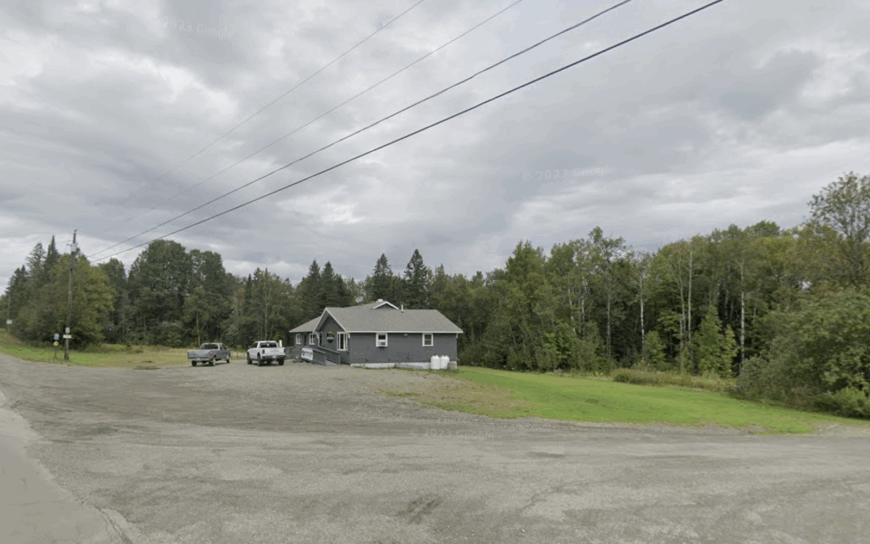
6. Nashville Plantation – A Two-Digit Population in Endless Fir
Roughly sixty people inhabit this unincorporated plantation where driveways often double as former skidder trails. ATV riders explore abandoned logging spurs, while snowmobilers connect to ITS 85 for hundred-mile loops without crossing a stop sign.
Economic life centers on small woodlots, maple sugaring shacks, and a lone family excavation business that plows roads when storms roll in. With seventy percent of the land held as undeveloped timber, neighbors might live a mile apart, and nighttime skies reveal constellations city dwellers forgot exist.
A hushed highlight is the moss-carpeted Cold Spring Hollow, a brook-fed ravine dripping with clubmoss and pitcher plants that reward patient botanists. Silence hangs thick enough to notice the flutter of a boreal chickadee’s wings.
Where is Nashville Plantation?
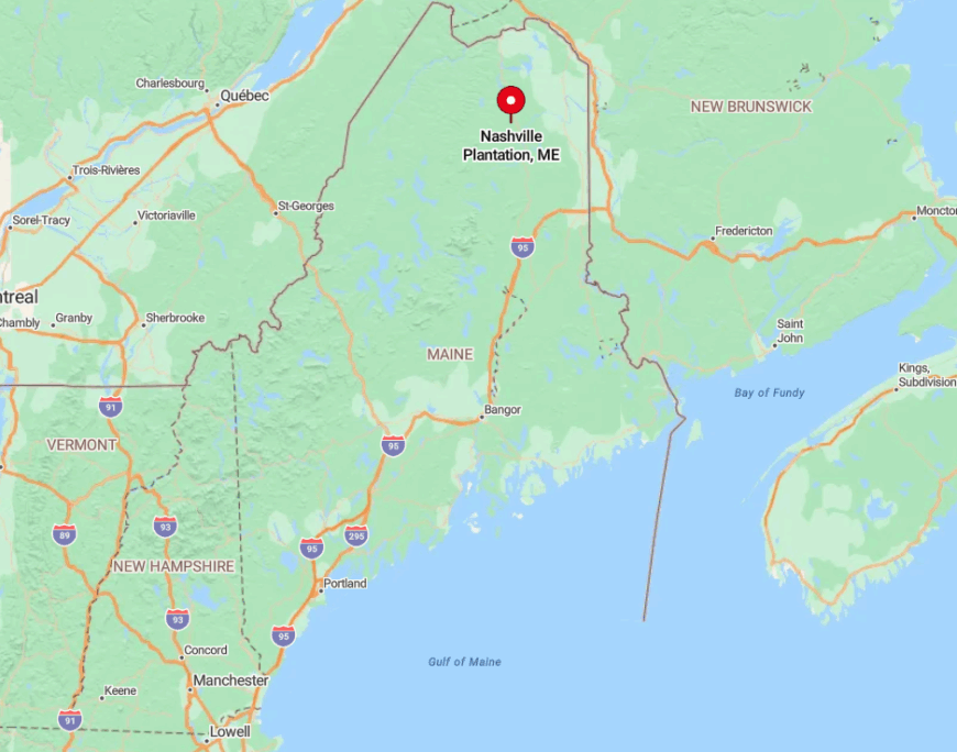
This speck on the map lies midway between Ashland and Portage on State Route 11 in northern Aroostook County. Thick fir and spruce create a living wall beyond the roadside mailboxes, muting any sense of passing traffic.
Most visitors arrive from Interstate 95 via Exit 264 in Medway, then follow an hour of two-lane blacktop northward. Gas up first—there are no pumps for twenty miles in any direction.
5. Mount Chase – Gateway to Katahdin’s Quiet Side
Home to 171 residents, Mount Chase sprawls across low blueberry barrens that rise toward 2,440-foot namesake peaks visible from nearly every back porch.
Day hikers tackle the Trout Brook Mountain loop in nearby Baxter State Park’s wild northern section, while berry pickers fill buckets along the abandoned Ash Hill fire road each August. Small inns, guide services, and a handful of blueberry farms provide income, with logging trucks rumbling through in winter.
The nearest traffic light is forty minutes south in Patten, and Route 11’s evening traffic might consist of one logging rig and a fox.
An overlooked treasure is the old CCC-built fire tower atop Mount Chase, still climbable for sweeping views of Katahdin’s knife-edge to the southwest. After dark, cabin windows glow like scattered embers against a sea of dark timber.
Where is Mount Chase?
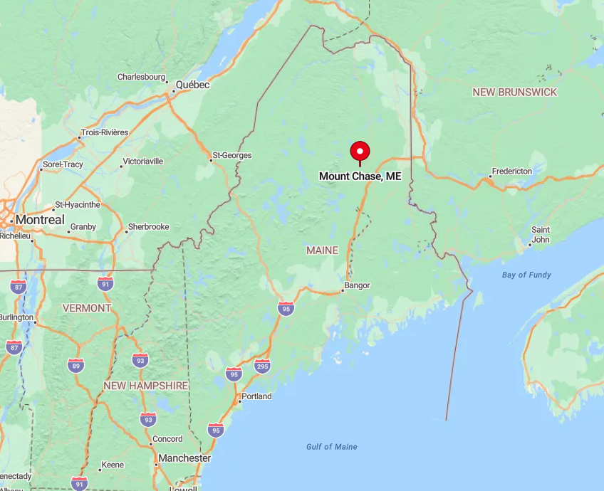
The village sits just west of Maine Route 159, twelve miles north of Patten and an hour from Interstate 95. Surrounded by the Katahdin Woods and Waters National Monument, it enjoys a buffer of public land that keeps development minimal.
Travelers exit the interstate at Sherman, fill the tank, and wind north through rolling farm country before the pavement narrows and the scent of balsam deepens. Winter access sometimes depends on whether the town grader has made a pass after the latest nor’easter.
4. Winterville Plantation – Spruce-Rimmed Shores of St. Froid Lake
Winterville’s 196 residents wake to mist curling off six-mile-long St. Froid Lake, where landlocked salmon rise to mayflies in June. Anglers launch at the public ramp, cross-country skiers glide the 6.5-mile Lakeside Trail, and weekend storytellers gather at the century-old Winterville Grange Hall.
Modest tourism and selective logging balance the books; streetlights never arrived, and even porch lights are scarce. A fifteen-mile cushion of forest separates the village from U.S. Route 1, preserving ebony-black skies ideal for photographing the Milky Way.
A surprisingly unknown spot is the rocky point at Windy Brook where, each fall, thousands of lake trout crowd the shallows—a snorkeler’s secret spectacle. After sunset, owl calls ripple louder than any outboard motor.
Where is Winterville Plantation?
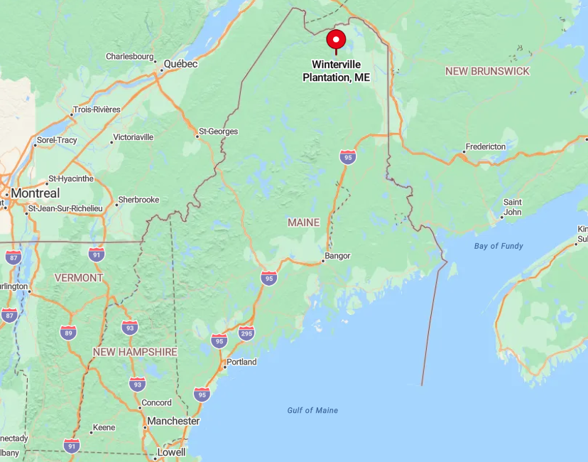
Located along Maine Route 11 between Ashland and Fort Kent, Winterville hides behind a curtain of spruce that screens the lake from passing traffic. The absence of commercial buildings past the town office contributes to its back-of-beyond feeling.
Most visitors turn off Interstate 95 at Exit 264 and follow a ninety-minute drive north through rolling timber country. Snowplows keep Route 11 open, but side roads often transform into sled tracks until spring thaw.
3. Portage Lake – Dawn Mist Over a Hundred Homes
Portage Lake’s year-round population sits just under 400, yet cottages scatter so widely around the 2,500-acre lake that neighbors can barely spot each other’s dock lights.
Morning paddles reveal loons, and golfers tee off at the nine-hole Portage Hills course carved from former potato fields. cottage rentals, a small sawmill, and guiding for ice-out salmon runs fuel the local economy, while public reserve land hugs the shoreline to block new subdivisions.
The nearest full supermarket waits 25 miles south in Ashland, reinforcing the feeling of being tucked away. A small wonder many miss is the annual “Foggy 5K,” a community fun run held at sunrise when low mist shrouds the lake—participants joke they can’t see the competition, only hear footsteps on damp dirt roads.
After the race, the soft thunk of canoe paddles resumes its rule over the cove.
Where is Portage Lake?
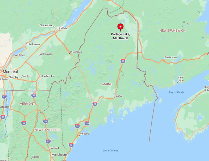
The village rests along State Route 11, 12 miles north of Ashland and 45 miles south of Fort Kent. Flanked by public reserve lots and vast industrial timberland, the lake forms a natural bowl that keeps highway noise at a distance.
Travelers generally enter via Interstate 95 in Houlton, then wind northwest for ninety minutes through potato country and mixed forest. Cell coverage fades near mile marker 158, the unofficial sign that civilization is slipping behind.
2. St. Francis – Northern Terminus of the St. John River Corridor

About 400 residents farm riverfront plots where the St. John bends toward Canada, and century-old clapboard farmhouses line the narrow main street. Kayakers drift downstream to observe nesting bald eagles, anglers cast for muskie, and families gather at Pelletier’s Rustic Farm for maple taffy pulled on fresh snow.
Employment comes from small potato plots, border-patrol postings, and artisan cedar shingle mills tucked into the pines. Mixed forest muffles any hint of Route 161 traffic, and the nearby border-crossing gate often sees fewer than ten cars a day, making evenings as quiet as a library reading room.
A lesser-known treat, “Green Point,” offers a sandy beach perfect for river swims—locals mark the spot by a lone white pine leaning over the current. Fireflies replace porch lights once dusk settles over the valley.
Where is St. Francis?
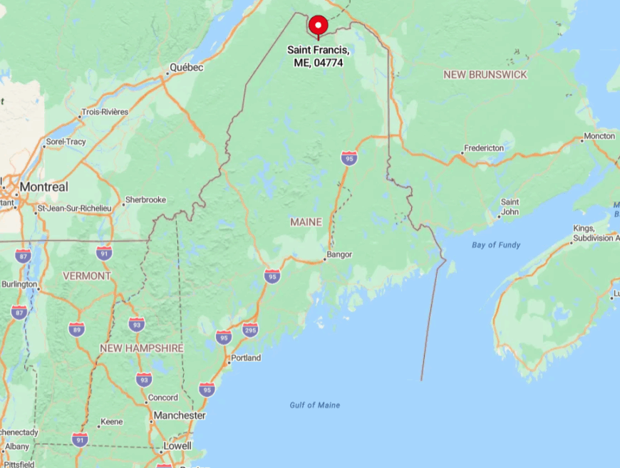
The town sits at the end of a 44-mile drive northwest from Fort Kent on State Route 161, hugging the Canadian line in Aroostook County’s farthest corner. Escarpments of spruce and fir rise immediately behind the last house, ensuring any expansion meets solid rock and timber.
Travelers top off fuel in Fort Kent—the final gas pump until Québec—then follow the river’s lazy bends past hayfields and deer crossings. Winter drives require patience; drifting snow can narrow the road to one lane, heightening the feeling of reaching the end of the map.
1. Long Pond Township – Five Residents, Millions of Trees
Long Pond Township claims exactly five year-round inhabitants, each living along miles of gravel roads where spruce tops whisper higher than church steeples.
Daytime diversions include fly-fishing for wild brookies on Long Pond Stream, bushwhacking to unnamed waterfalls, and autumn bog foraging for cranberries known only to local bears.
Economic activity is virtually nonexistent beyond occasional stumpage sales and a seasonal warden checkpoint; mail delivery happens once a week via four-wheel-drive Jeep. With no public utilities, no maintained trails, and undeveloped ridgelines dwarfing every cabin, spotting another human feels rarer than catching a cell signal.
A hidden marvel is the glacially carved kettle hole called Raven’s Nest—a perfectly round, moss-rimmed pool visible only from the air or to those willing to hike two hours through trackless forest. Nights descend with a silence so complete that even wind through the firs sounds like distant surf.
Where is Long Pond?
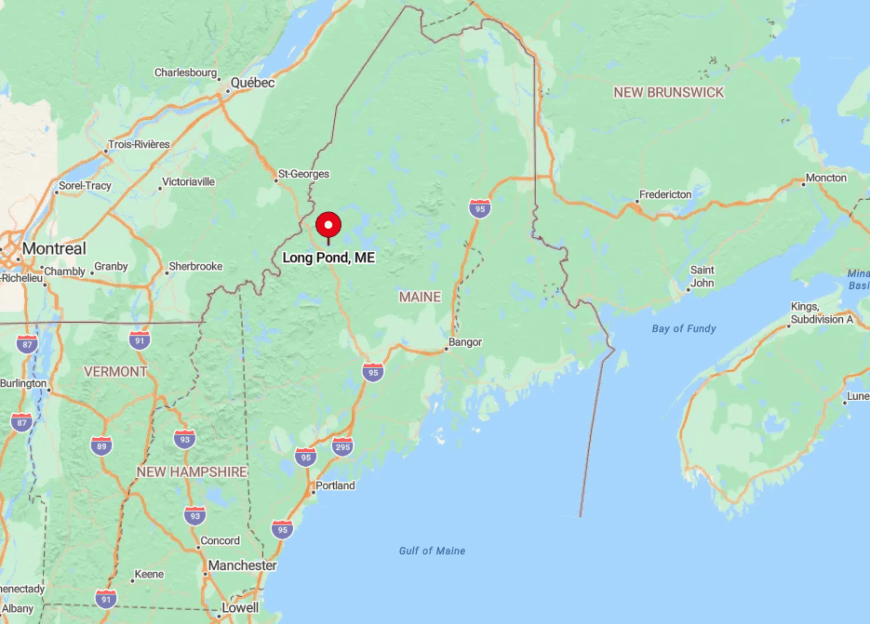
This unorganized territory lies southwest of Jackman, wedged between the Appalachian Mountain Club’s 100-Mile Wilderness corridor and the Canadian border.
The only access is the privately maintained Spencer Road, which branches from U.S. Route 201 and bounces fifty minutes through paper company land before reaching the township line.
No services exist beyond a self-serve checkpoint where travelers sign in and pay a modest gate fee. Once past the barrier, it’s just forest, gravel, and a sense that the modern world has slipped quietly out of range.


