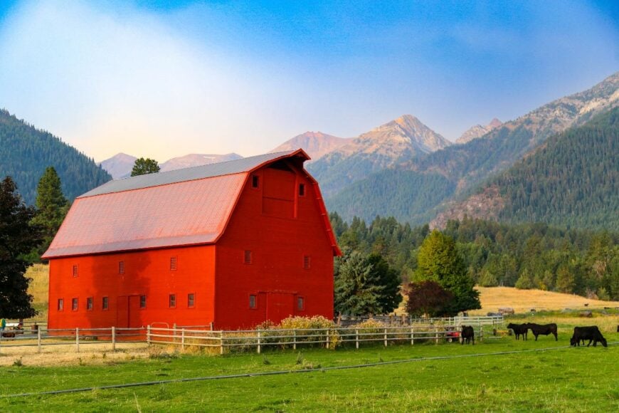
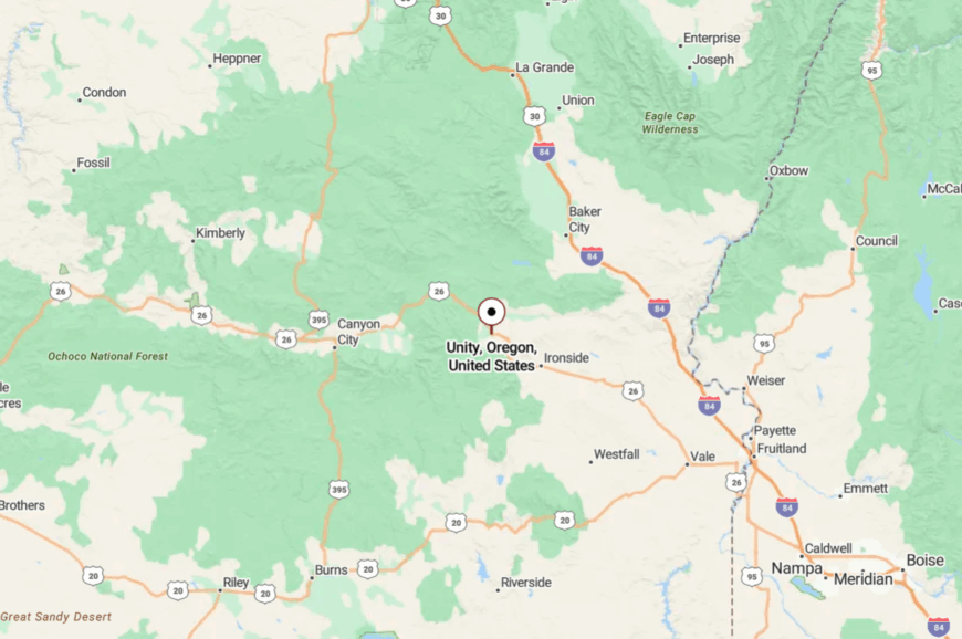
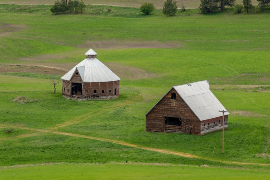
Northeast Oregon is a part of the state where the roads thin out and the horizon expands. It is a landscape defined by the Wallowa Mountains rising in sudden drama, by the Blue Mountains rolling in long, forested swells, and by the high valleys where wheat and cattle share the same wind. The pace is not slower so much as steadier, as if the land itself sets the rhythm.
In order to come up with the very specific design ideas, we create most designs with the assistance of state-of-the-art AI interior design software. Also, assume links that take you off the site are affiliate links such as links to Amazon. this means we may earn a commission if you buy something.
Communities here rarely reach a few hundred residents, yet each holds its own texture: a mill town that lost its mill but not its purpose, a farming hamlet surrounded by fields that move like water, a riverside outpost where anglers and outfitters are the only regular strangers. Roads often end at these places, and that sense of finality is part of their appeal.
In this survey of 25 secluded towns, the focus is on the everyday details that give them shape. False-front storefronts that still frame a main street, irrigation pivots circling against rimrock, and one-room post offices that carry more gossip than mail all speak to how people adapt to distance. Isolation is not absence here—it is character.
Visitors drawn to these towns will not find resorts or curated attractions. What they will find are quiet intersections where geography has the upper hand: mountain passes that collect snow, canyons that funnel rivers, and valleys that seem to hold their own weather. The reward is not spectacle but recognition—the chance to see how people and place hold together on the far edge of Oregon.
25. Flora
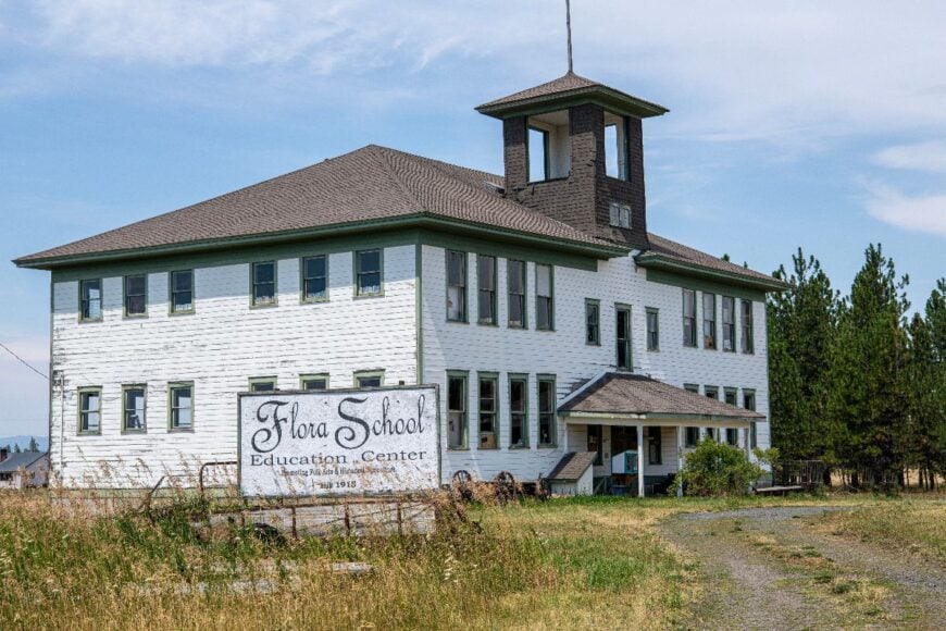
Flora feels like a page left open in the wind—empty boardwalks, weathered false fronts, and big sky rolling toward Idaho. Once a boomtown, it’s now a near-ghost dotted with hay fields and old schoolhouses where swallows nest in the eaves.
Afternoons drift by with drives out to the Zumwalt Prairie, wildflower walks, and photo stops at century-old ranch gates. A handful of ranches and seasonal caretaking jobs keep the lights on, but darkness returns quickly after sunset.
The quiet comes from distance: no services for miles, no highway to funnel strangers through, only gravel that crunches under slow tires. Even the breeze seems to lower its voice as it slips through bunchgrass. It’s the kind of stillness that makes you linger on the porch a beat longer than planned.
Where is Flora?
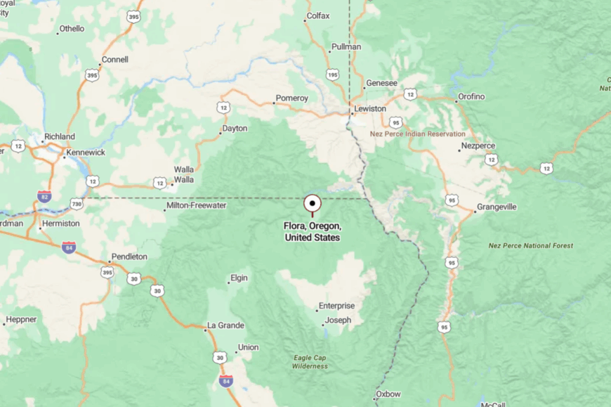
Tucked in Wallowa County’s far northeast corner, Flora sits about 40 miles north of Enterprise. The approach is a lattice of county roads that leave Highway 3 and climb onto high prairie.
There’s no paved through route—your road ends at the town. Close enough to reach in an afternoon, far enough to feel like the horizon is yours alone.
24. Minam
Minam gathers beside the confluence of the Wallowa and Minam Rivers, a pocket of cottonwoods and river stone where rafts slip into green water. The mood is creek-cool and unhurried: fly lines unfurl, campfire smoke rises, and freighted clouds drift over canyon walls.
Visitors launch whitewater trips, fish riffles for trout, hike into the Eagle Cap backcountry, and linger over pie at the highway café. A tiny cluster of outfitters and seasonal cabins anchors the economy.
What keeps it secluded is topography—steep flanks on both sides and a narrow valley floor that holds only one main road and a ribbon of river. Nights are for crickets and constellations. It’s the kind of place where the morning mist feels like a welcome.
Where is Minam?
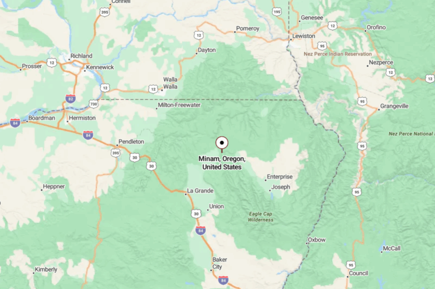
Minam lies in Wallowa County, about 40 miles northeast of La Grande on Highway 82. The road follows river bends through a tightening canyon, with few chances to pass.
There’s one store, one launch, and a lot of sky. By the time the cliffs close in, the rest of Oregon feels pleasantly far away.
23. Lostine
Lostine is a slim main street bookended by barns and peaks, with porch flags lifting in mountain breeze. The vibe is agrarian and artful—grain trucks in harvest, handmade signs on café doors, and children pedaling to the creek.
Days fill with stops at the old mercantile, strolls to Lostine River Campground, canyon hikes, and summer ice cream on the curb. Ranching and small shops keep the lights on, while trailheads just up the road feed a trickle of hikers.
Seclusion comes from scale and setting: a valley notch, a two-lane highway, and few reasons to rush. After dusk, the Wallowas silhouette against the last light. It’s the sort of quiet that loosens your shoulders.
Where is Lostine?
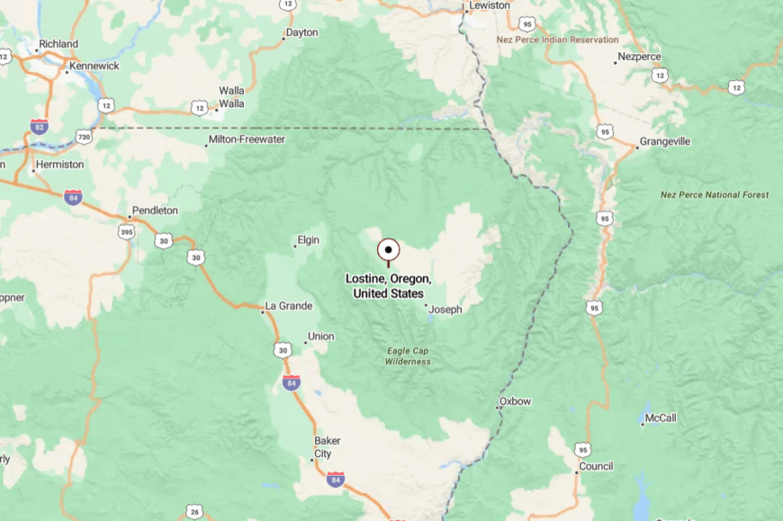
Lostine sits in the heart of Wallowa County on Highway 82, about 8 miles west of Enterprise. The town is wedged between farm fields and the mouth of Lostine Canyon.
You simply ease off the highway and slow with the grid. Close on the map, it still feels like the mountains have it surrounded.
22. Wallowa
Wallowa keeps an easy cadence where grain silos meet river bends and freight whistles echo off low hills. The feel is blue-collar and neighborly—feed stores, tidy lawns, and a small museum that remembers when timber wagons rolled this valley.
Travelers walk the riverfront path, browse antique nooks, cast for trout, and time day trips to the canyons north. Agriculture and school jobs are the staples, with a ripple of summer travelers passing through.
What keeps Wallowa quiet is its in-between-ness: too far for city commuters, just far enough for weekenders to think twice. After sundown, the valley hushes except for trains and owls. It’s a gentle, steady kind of seclusion.
Where is Wallowa?
Set along Highway 82 in Wallowa County, Wallowa lies about 18 miles west of Enterprise. The road follows the river and a line of low ridges.
You roll in on two lanes and roll out the same way. The mountains watch from a distance, and the pace drops a gear without asking.
21. Richland
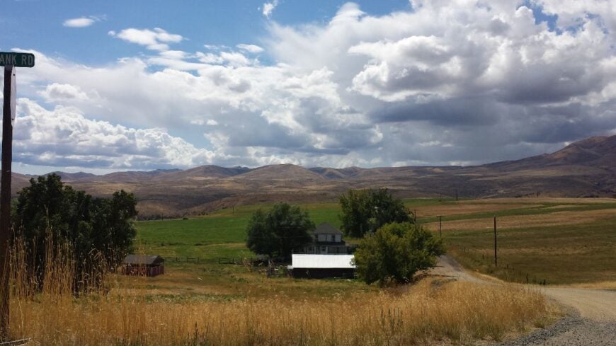
Richland spreads along the Powder River in a basin of sun and hay, framed by rimrock and the blue cut of the Snake country beyond. The vibe is warm and practical—irrigation lines ticking in the fields, lawn chairs under shade trees, and small talk at the store that doubles as a café.
Visitors drive the Hells Canyon Scenic Byway, paddle on nearby Brownlee Reservoir, hike to overlooks, and pick fruit from backyard stands in season. Ranching, orchards, and a few fishing rentals make up the local ledger.
Its hush is geographic: the road in is pretty, curvy, and deliberate; the road out is the same. Nights carry the sweet smell of cut hay and river cool. It’s a valley that asks you to exhale.
Where is Richland?
Richland sits in Baker County along OR-86, about 40 miles east of Baker City. The highway winds through brown hills before dropping into the green pocket of Pine Valley.
There’s one way in from each direction and little reason to hurry. By the last curve, you can already taste the river air.
20. Oxbow

Oxbow is more bend than town, a tight fold in the Snake River where canyon walls glow at dusk. The mood is river-forward and lightly populated—boat trailers at dawn, shade tents by noon, and the soft thrum of the dam downstream.
Visitors fish coves for bass, run jet boats into the gorge, drive to Hells Canyon Overlook, and watch desert bighorn tiptoe across ledges. Utility work and guiding form the backbone, supplemented by a small store and cabins.
Seclusion is absolute: cliffs on both sides, a dead-end road to the dam, and no cell bars worth chasing. When the wind drops, you can hear your own paddle. It’s the kind of silence that sticks to the skin.
Where is Oxbow?
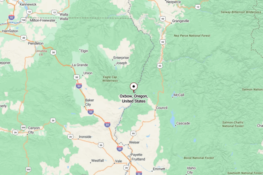
Perched on the Oregon–Idaho line in Baker County, Oxbow lies roughly 65 remote road miles east of Baker City. You follow OR-86, then a narrow river road that threads through basalt.
It’s all canyon driving—slow and scenic. The final stretch feels like the world narrowing to water and rock.
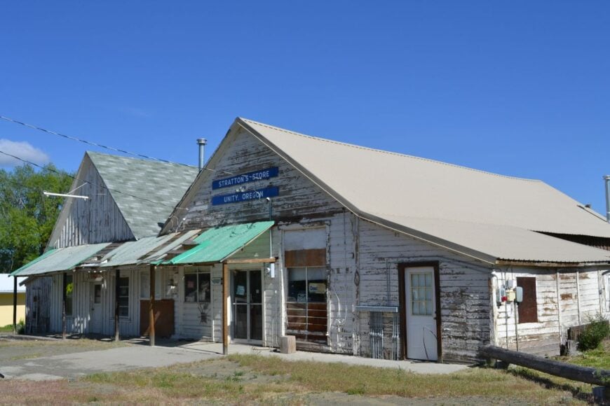
19. Unity
🔥 Would you like to save this?
Unity sits high and spare, a few streets and a glossy reservoir wrapped in lodgepole and sage. The town feels practical and resilient—woodpiles, smoke from chimneys, and fishermen in insulated bibs at dawn.
Days revolve around boating and ice fishing at Unity Lake, wildlife watching in the sage flats, and gravel-road loops into the Malheur National Forest. Cattle, logging, and a small park concession keep cash registers humming.
Seclusion lives in the distance between neighbors and the slow curves to reach any size grocery store. Stars come on early and bright. It’s a wide-open quiet that feels earned.
Where is Unity?
Unity sits in western Baker County near Highway 26, about 45 miles southwest of Baker City. Approaches rise over forested passes that collect snow late into spring.
You peel off the highway for the last miles to the lake and town. The space around you stretches as the road narrows.
18. Summerville – Wheat-Rimmed Hamlet Under Big Skies
Summerville is a tiny grid wrapped in wheat and alfalfa, with the Elkhorns shouldering the horizon and meadowlarks carrying the news. The vibe is farm-steady and sunlit—screen doors, windbreaks of poplar, and tractors easing down two-lane roads.
Afternoons unfurl as slow bike rides on the bench, u-pick orchards in late summer, and lingering chats outside the grange hall. Come fall, leaves cut in wide arcs while children chase leaf piles along quiet lanes.
There’s no tourist strip, no hurry—just fields, fences, and a church bell that keeps its own time. Agriculture is the heartbeat, and evenings end in starlight bright enough to read by. It’s the kind of calm that settles into your shoulders and stays.
Where is Summerville?

Set in Union County, Summerville sits about 13 miles north of La Grande on the valley’s east bench. Drivers leave OR-82 at Imbler and follow county roads that narrow as farms widen.
With no through route, traffic arrives only on purpose and leaves just as slowly. Close to town conveniences, but far enough that you can still hear the wind cross the grain.
17. Meacham – Snow-Lined Outpost in the Blues
Meacham keeps a weathered hold on a high saddle of the Blue Mountains, where lodgepole pines lean into the wind and storms rewrite the schedule. The mood is alpine-quiet—woodsmoke, stacked cords, and a main street that seems to nap beneath the snow.
Days are for snowshoeing along forest roads, spotting elk at daybreak, summer picnics by cold creeks, and thunderstorm watching from a covered porch. A handful of highway services, seasonal cabins, and forest crews make up the workweek.
Even with the interstate nearby, the trees and elevation muffle the world to a hush. Night lays a heavy quilt of stars over the ridge. It’s a mountaintop pause where time slows to match the weather.
Where is Meacham?
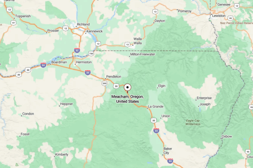
In Umatilla County, Meacham sits about 22 miles southeast of Pendleton and 25 miles northwest of La Grande along I-84. Exits lead to a short spur buffered by timber, quickly leaving highway noise behind.
Winter squalls often ice the grades, making the last miles deliberate. It’s easy to reach on a map—and easier to forget the map once you arrive.
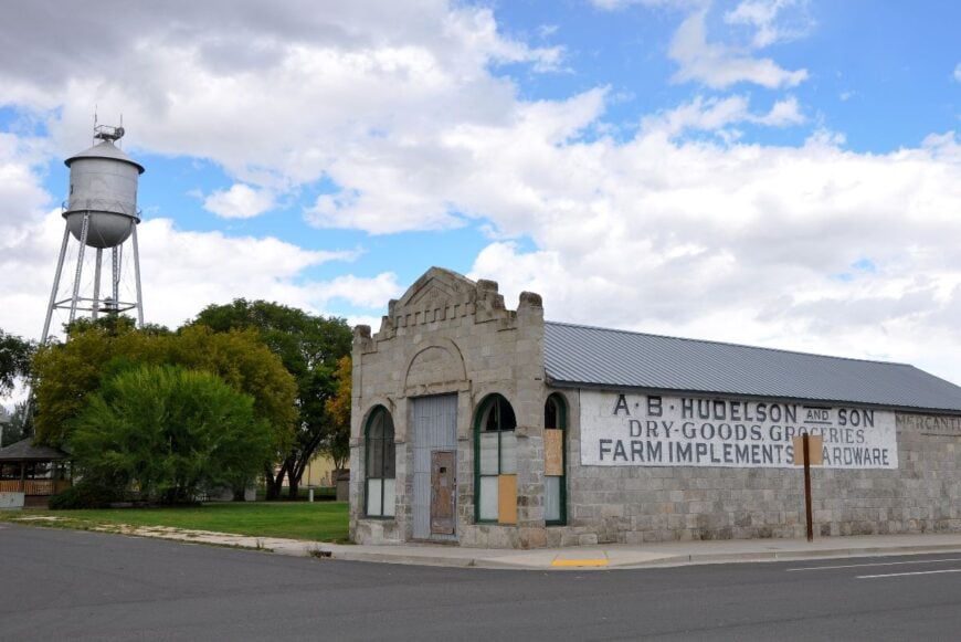
16. Elgin – River Junction Town on the Grande Ronde

Elgin stands at the bend where the Grande Ronde sweeps into wide valley pasture, its tidy grid framed by pine slopes and wheat ridges. The mood is frontier-practical: a working sawmill, a century-old opera house that still stages plays, and a main street lined with storefronts painted against the weather.
Days here run on a mix of logging trucks, matinee rehearsals, and families gathering for the annual Elgin Stampede Rodeo. Visitors set off for rafting trips down the Grande Ronde, drive Summit Road into the Wallowas, or catch a ride on the Eagle Cap Excursion Train that winds along canyon cliffs.
What keeps Elgin feeling secluded is its position just off the beaten path—close enough to La Grande for errands, but wrapped in its own valley where the highway narrows and slows. Nights are quiet except for a passing freight train or wind moving across the benchlands.
Where is Elgin?
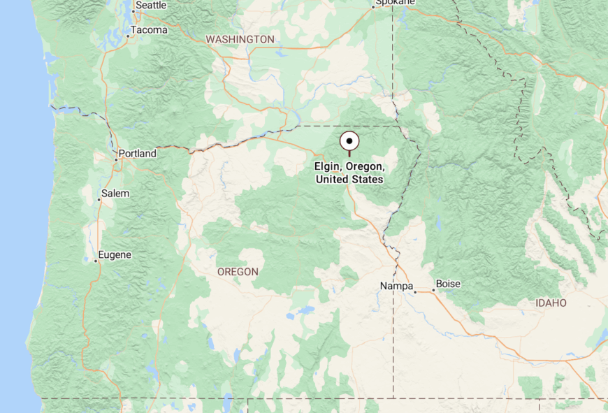
Elgin sits in Union County, 20 miles northeast of La Grande along Highway 82. The road leaves the interstate corridor, follows the river, and gradually trades speed for scenery. It’s the gateway for travelers heading deeper into Wallowa County, but the town itself holds a sense of pause before the mountains close in.
15. North Powder – Gateway Fields to Alpine Lakes
North Powder is a farm town with grain elevators for steeples and the Powder River sliding past like a slow conversation. The feel is practical and open—garden rows, ballfields, and pickups dusted from gravel lanes.
Mornings start with sandhill cranes calling from wetlands; days wander to Anthony Lakes for alpine hikes, summer wildflowers, or crisp winter turns; evenings circle back to porch chairs and wide sky. Agriculture, school, and highway travelers keep the lights on, but the tempo never breaks a trot.
Though I-84 runs nearby, the town sits just far enough aside that only locals drift through. When the wind settles, you can hear irrigation tick across the fields. It’s a gentle quiet that asks you to stay for one more sunset.
Where is North Powder?
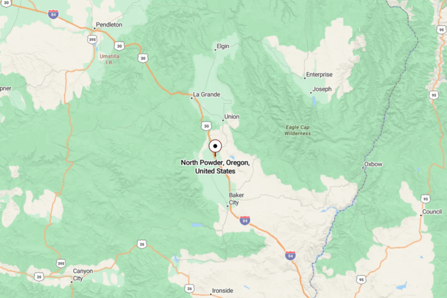
North Powder sits in Union County at the southern edge of the Grande Ronde Valley, just north of the Union–Baker county line. It’s about 20 miles south of La Grande and roughly 25 miles north of Baker City along I-84; exit the interstate and you’re on a short main street that quickly gives way to fields and the Powder River.
From town, a signed turnoff climbs west toward Anthony Lakes and the Elkhorns on a winding two-lane. Close to the corridor, yet a few minutes off the pavement feels like you’ve stepped into a quieter country.
14. Whitney – Sawdust Ghost on the Burnt River
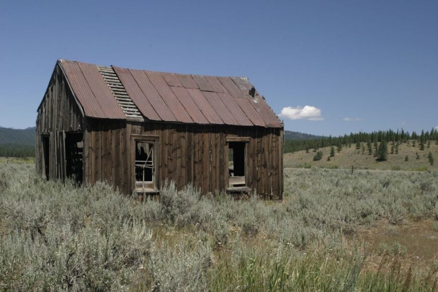
Whitney lingers where the mill once roared, a scatter of cabins and timbers softening back into meadow under the Blue Mountains. The vibe is time-capsule quiet—old rail grades threading the pines, woodsmoke in cold months, and a sky that feels close enough to touch.
Visitors photograph weathered bunkhouses, follow the old Sumpter Valley Railway bed on foot or bike, cast small creeks for trout, and snowshoe forest roads when storms pile deep. There’s no storefront, just the hush of wind through lodgepole and the faint clink of a woodstove door.
Its seclusion is absolute: miles from services, patchy signals, and winters that arrive early and stay late. Elk move like gray shadows at dusk, and stars crowd the black above the meadow. It’s the kind of solitude that resets your senses.
Where is Whitney?
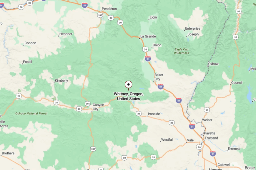
Whitney sits in Baker County along OR-7 between Sumpter and Austin Junction, about 35 miles west of Baker City. A short spur road leaves the highway and turns to gravel as it nears the old mill site.
Snow can close access early, so travel is slow and deliberate outside of summer. By the time the trees open to the meadow, the modern world has already gone quiet.
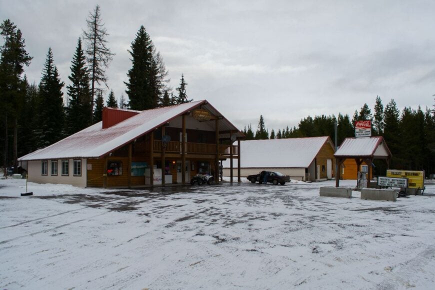
13. Tollgate
🔥 Would you like to save this?
Tollgate is a ridge-top scatter of cabins and snowbanks where winter sticks around like a favorite guest. The vibe is alpine-casual—snow machines at the door, stacked firewood, and a tiny café steaming up its windows.
Visitors ski local trails, sled long hills, hike and bike toward Summit Road in summer, and watch thunderstorms march over wheat country below. Seasonal recreation and cabin caretaking are the mainstays.
Its seclusion is geographic and meteorological: miles from towns in any direction and a pass that writes its own weather. Nights carry the hush of deep snow. It’s a mountaintop pause button.
Where is Tollgate?
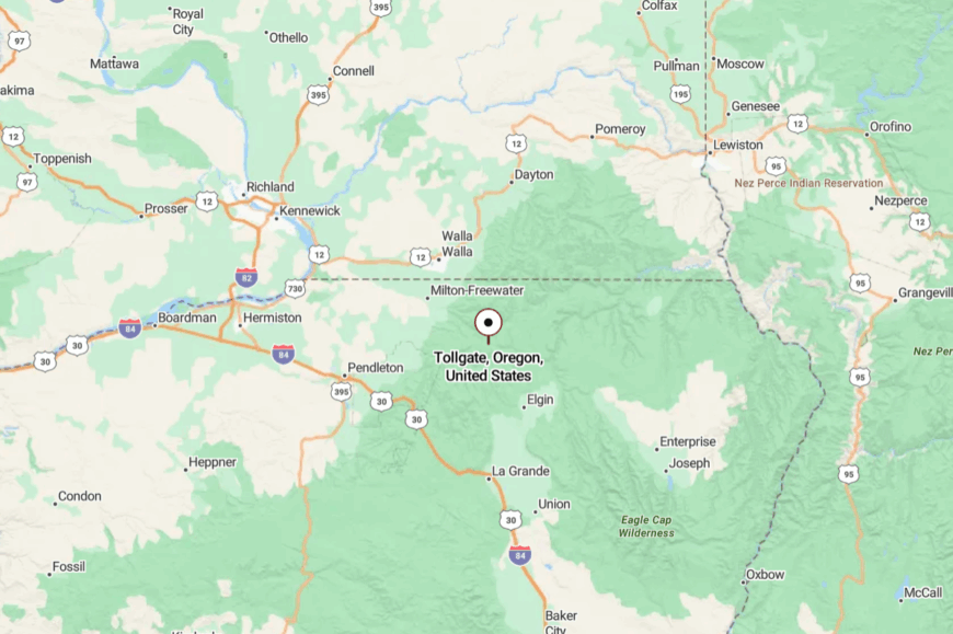
Perched on OR-204 between Weston and Elgin, Tollgate sits in the Blue Mountains of Umatilla County. It’s midway between Weston and Elgin on OR-204.
The two-lane climbs steadily and can be icy well into spring. When the trees open, the world drops away on both sides.
12. Starkey
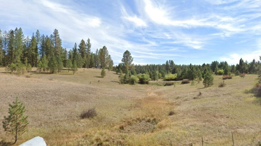
Starkey spreads out where meadow meets timber, a handful of lanes and ranch yards stitched together by the Grande Ronde’s headwaters. The mood is meadow-quiet—bluebirds on fence posts, wind in the aspen, and the occasional whistle from the mill site long gone.
Days are for wildlife drives in the Starkey Experimental Forest, trout casts, and gravel-road rambles to remote trailheads. Ranching and forest crews form the workweek; weekends belong to campfires and star shots.
Seclusion comes easy: no services to speak of, no reason to pass through unless you meant to. Darkness settles fast and friendly. It’s the sort of peace that lands softly and stays.
Where is Starkey?
Starkey sits in Union County, about 22 miles southwest of La Grande, off OR-244. The approach follows the river through the tightening timber.
You turn onto quieter county roads for the last stretch. The meadow opens like a secret kept by the pines.
11. Keating – Powder River Valley Open to the Sky
Keating spreads wide across hay fields and pasture where the Powder River loops lazily under big, blue country. The mood is ranch-steady and spacious—high clouds, long fences, and tractors idling at dawn while sandhill cranes call from the flats.
Days run on simple pleasures: photographing old barns against distant ridges, fishing quiet bends of the river, pedaling gravel lanes, and watching thunderstorms parade the horizon. Work is hay, cattle, and a few seasonal crews; there’s no main street to draw a crowd.
Seclusion comes naturally with distance from any highway town and a web of county roads that end at gates or hills. Nights fall clean and star-bright, with coyotes stitching the dark together. It’s a valley that teaches you how to slow down.
Where is Keating?
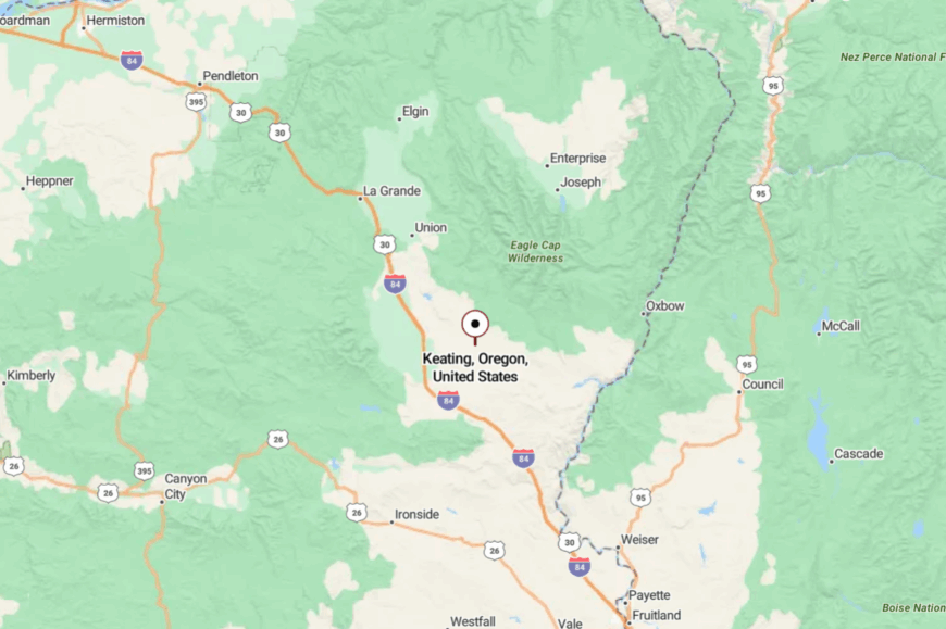
In northeastern Baker County, Keating lies roughly 20 miles east of Baker City off OR-86 via Keating Road. The final miles cross open ranchland with the river never far from view.
There are no services en route, just long sightlines and the steady curve of two-lane pavement. It’s close enough for a day trip, but far enough to feel like the map thins out.
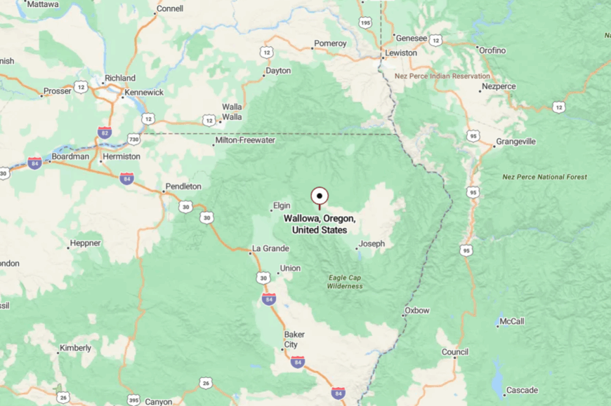
10. Cove – Orchard Village Beneath the Wallowa Foothills
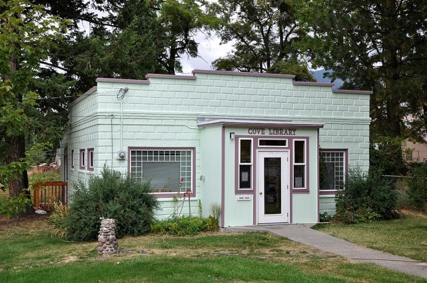
Cove’s roughly 600 residents tend apples, pears, and cattle on roomy valley lots that soak up afternoon light beneath verdant canyon walls. Visitors stop for a soak in the Cove Warm Springs Pool, a century-old concrete basin filled by a steady 86-degree artesian flow that locals swear keeps winter colds away.
Small farm stands sell heirloom cider and honey, while the historic Ascension Chapel, built from native stone in 1869, hosts summer chamber concerts. Agriculture is the primary livelihood, supplemented by small-scale agritourism and seasonal hires during harvest.
Absence of chain stores and the seven-mile canyon detour from Highway 82 keep foot traffic light and nights pin-drop quiet. The town’s pastoral rhythm, guarded by steep ridgelines, delivers the seclusion that orchardists and newcomers cherish.
Where is Cove?
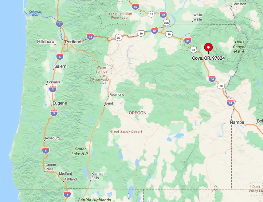
Cove lies on the east side of the Grande Ronde Valley, about 16 miles southeast of La Grande. The only paved approach, the gently twisting Cove Highway, dead-ends in town, meaning no one passes through by accident.
Pine-cloaked ridges block cellular towers, and winter storms can close the nearby Ladd Canyon grade, reinforcing Cove’s tucked-away feel. Drivers should exit Interstate 84 at La Grande, follow Highway 82 toward Imbler, then turn east on the signed Cove cutoff to reach Main Street in under 25 minutes.
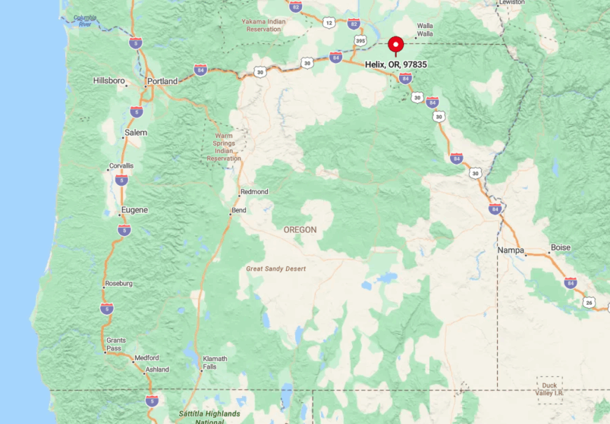
9. Helix – Wheat-Field Refuge on the Palouse Edge
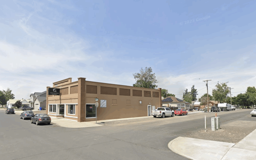
A mere 180 people call Helix home, and most of them see each other at the grain elevator or the Blue Mountain Tavern, the lone watering hole that doubles as meeting hall. Summer brings an ocean of golden wheat rippling to the horizon, ideal for sunset photography and leisurely gravel-bike rides.
Dry-land farming dominates the local economy, with massive combines carving quiet arcs across swells of loam. Community events center on the annual Wheatstock festival, where regional bands play from a hay-wagon stage beside vintage tractors.
Helix feels secluded because it sits ten miles from the nearest state highway and lacks any river, canyon, or interstate to draw tourists. The result is a soundscape ruled by meadowlarks and distant sprinkler pivots.
Where is Helix?
🔥 Would you like to save this?
The town sits in northern Umatilla County, 25 miles northeast of Pendleton and just shy of the Washington line. Arrivals follow Highway 11 to the tiny junction at Havana and then drive east on County Road 136, losing cell bars with each rolling hill.
With no through route and winter drifts that routinely blanket the road, the settlement remains a self-contained island in a sea of grain. Those coming from Walla Walla or Pendleton should plan for a scenic 35-minute country drive and bring their own provisions.
8. Sumpter – Ghost-Town Charm in the Elkhorns
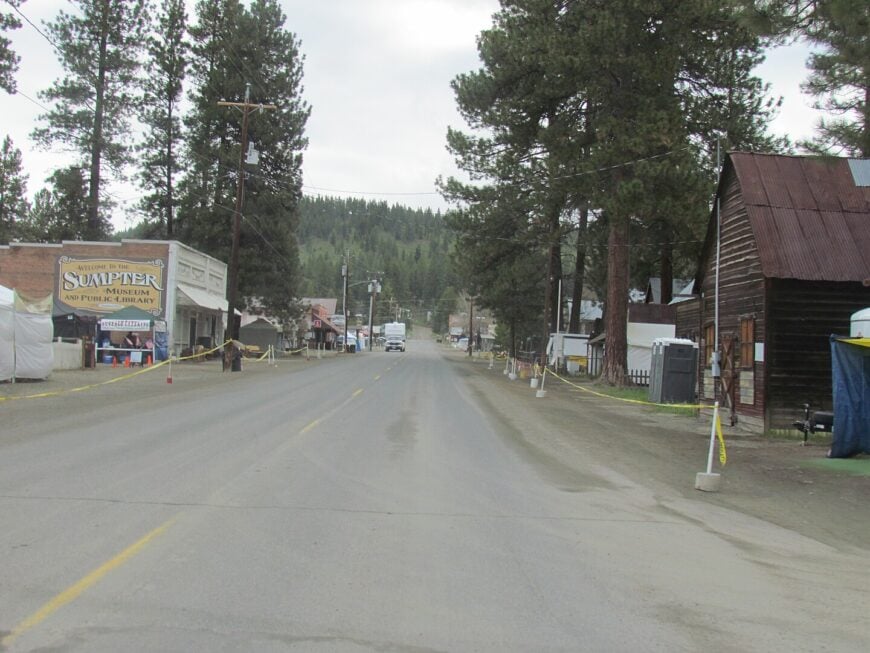
About 210 year-round residents—and perhaps twice as many resident deer—share this pine-scented basin ringed by the Elkhorn Mountains. Highlights include touring the massive Sumpter Valley Dredge, riding the narrow-gauge steam train on summer weekends, and browsing rock-hound stalls at the annual flea market.
Heritage tourism and small-scale logging support the local economy, with snowmobiling and back-country skiing extending the visitor season into winter. Weathered log cabins, abandoned rail cars, and rust-stained mining equipment create dramatic backdrops for history buffs and photographers.
The town’s seclusion stems from its location 25 miles up a winding spur of State Route 7, a road often snow-packed and empty outside holiday periods. Add dense fir forest and sporadic cell reception, and Sumpter feels decades removed from city bustle.
Where is Sumpter?
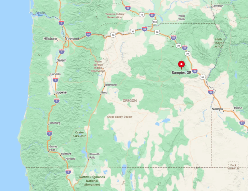
Sumpter sits southwest of Baker City in Baker County, tucked in a high valley at 4,400 feet. Travelers leave Highway 7 at McEwen and follow the Sumpter Stage Highway, a serpentine two-lane climbing through forest for 15 slow-going miles.
Heavy snowfall can close the pass in severe winters, so locals count on their own plows and stockpiled supplies. Summer visitors often combine the trip with a loop over Forest Road 73 through Granite and back to Baker City for a rugged, mountain-view circuit.
7. Medical Springs – Hot-Pool Hamlet Off the Grid
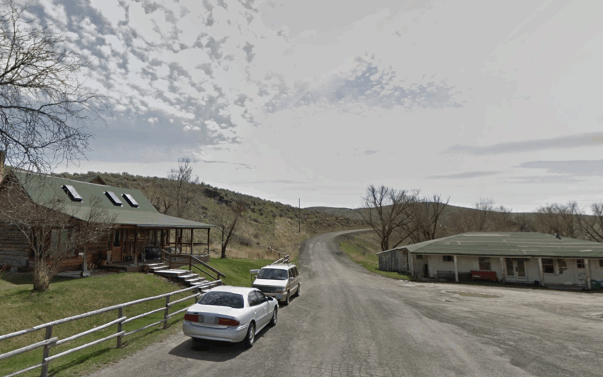
Medical Springs lingers as a reminder of Oregon’s early spa era, where settlers once built a stone bathhouse around steaming mineral water in 1868. A grand resort and pool later drew visitors from across the region, but fire and decline left only fragments—weathered masonry and whispers of the boom days.
Today, fewer than 50 residents tend ranches and cabins along Catherine Creek. Hunters pass through in season, and photographers stop to frame the ruins beneath cottonwoods, but there are no services, no café, no open pool. The town’s rhythm is shaped by isolation, with power flickering in storms and mail arriving on its own irregular schedule.
Seclusion comes naturally here: a gravel spur leaves Highway 203 and drops to creek level, narrowing until it feels more trail than road. Cell signals vanish, and the silence settles in with the dusk. What remains of Medical Springs is not recreation, but memory—quiet, remote, and profoundly off the grid.
Where is Medical Springs?
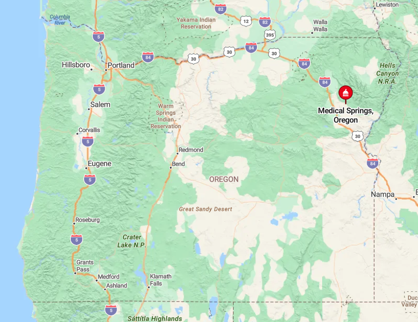
The hamlet hides in Union County, 24 miles southeast of Union and 36 miles from Baker City. Route 203 threads narrow canyons before a signed turn drops to creek level, where pavement gives way to gravel.
Snow and mud can render the final stretch tricky, so locals keep chains in the trunk year-round. Visitors driving from La Grande should plan an hour for the scenic, slow-speed approach.
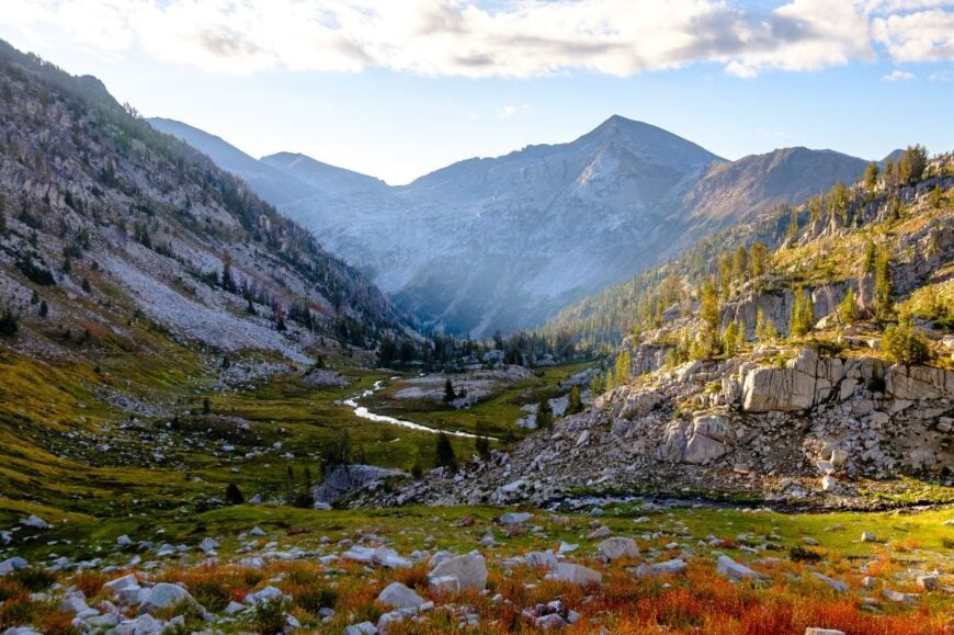
6. Joseph – Arts Hub Beneath the Wallowa Peaks
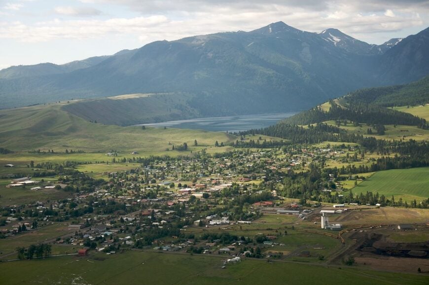
Joseph rests at the foot of snow-bright Wallowa Mountains, a handful of blocks that glow with bronze foundries, galleries, and cafés beneath 9,000-foot peaks. The mood is part-cowboy, part-creative: murals on barn walls, hitching posts outside shops, and bronze sculptures standing guard on street corners.
Days fill with lake walks at Wallowa Lake, horseback rides into the Eagle Cap Wilderness, or browsing the small museums and studios that keep town life humming. Bronze casting and summer tourism anchor the economy, joined by ranching families whose herds still graze the surrounding valleys.
What preserves Joseph’s seclusion is its geography—at the literal end of the road, surrounded on three sides by mountains, with only one way in and out. When the evening light falls on the peaks and the lake mirrors the sky, you feel how far this little town is from the ordinary pace of Oregon.
Where is Joseph?
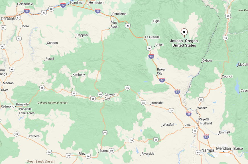
Joseph lies in Wallowa County, 70 miles east of La Grande and 6 miles south of Enterprise on Highway 82. The highway narrows as it nears Wallowa Lake and finally dead-ends at trailheads.
With the mountains pressing close and cell service thinning, Joseph feels like the last true outpost before wilderness.
5. Ukiah – Meadow Town in the Middle of Nowhere
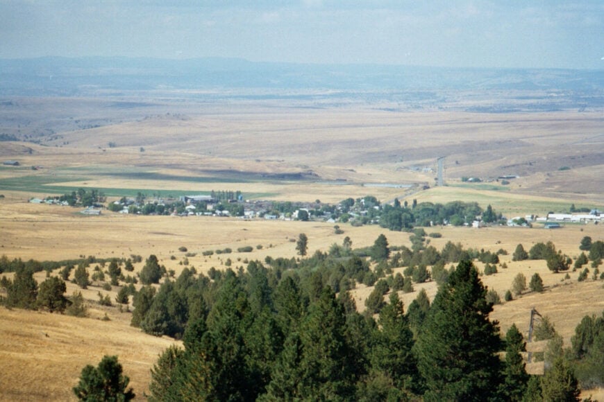
Ukiah’s population hovers below 200, but the town’s summertime rodeo packs the wooden bleachers with fans from miles around. Prairie meadows and ponderosa stands invite dispersed camping, while the Camas Creek Cutoff lures fly-fishers chasing redband trout.
Logging once dominated, yet today seasonal hunters, ATV riders, and small ranch operations keep the cash registers ringing at the Ukiah General Store. Vintage gas pumps, a clapboard schoolhouse, and quiet board sidewalks evoke a movie set at golden hour.
Surrounded by fifty miles of national forest in every direction, Ukiah lives up to its reputation as the “middle of nowhere.” Minimal traffic, scarce connectivity, and the nearest pharmacy an hour away ensure true retreat.
Where is Ukiah?
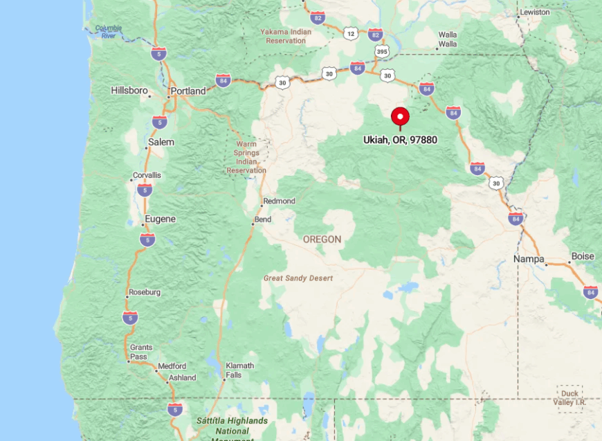
The town lies on Highway 244, 50 winding miles southwest of La Grande and 45 miles east of Heppner. Both approaches rise over 4,000-foot passes that collect deep snow, often closing for avalanche control.
No commercial flights land within 90 miles, so most guests arrive by car with chains in winter or by motorcycle in July when roads run clear. Fuel and groceries should be secured beforehand; the single store’s hours follow small-town logic rather than strict schedules.
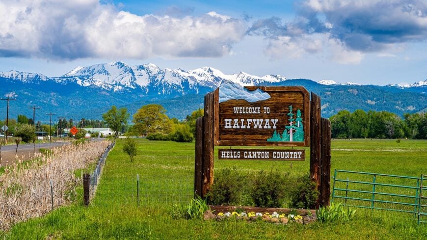
4. Halfway – Quiet Gateway to the Hells Canyon

Roughly 300 residents share Halfway’s broad valley floor, framed by hay fields and the snow-dusted Wallowa Mountains. Visitors hike the nearby Pine Lakes Trail, launch rafts on the Snake River out of Oxbow, or browse the 1910 brick storefronts sheltering cafés and a volunteer-run history museum.
Ranching and outdoor recreation supply most paychecks, and a growing cluster of remote tech workers have added fiber-optic service without changing the town’s tempo. During winter, locals embrace isolation by staging a jovial poker run on snowmobiles that raises scholarship funds for high-schoolers.
The long approach—54 mountain miles from the Baker City freeway exit—discourages spontaneous urban day-trippers. Add a lone AM radio station and patchy signals, and Halfway feels deliciously detached.
Where is Halfway?
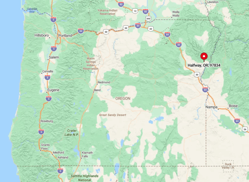
Halfway anchors Pine Valley in Baker County, about 54 miles east of Baker City along Highway 86. Drivers leave Interstate 84 at exit 302, trace the Powder River through sage hills, then climb over a 4,000-foot pass before dropping into town.
From here, the road continues east to Oxbow and the Snake River, putting Halfway squarely on the Oregon approach to Hells Canyon. The long mountain miles, patchy service, and curving descent into the valley ensure it feels far removed from freeway bustle.
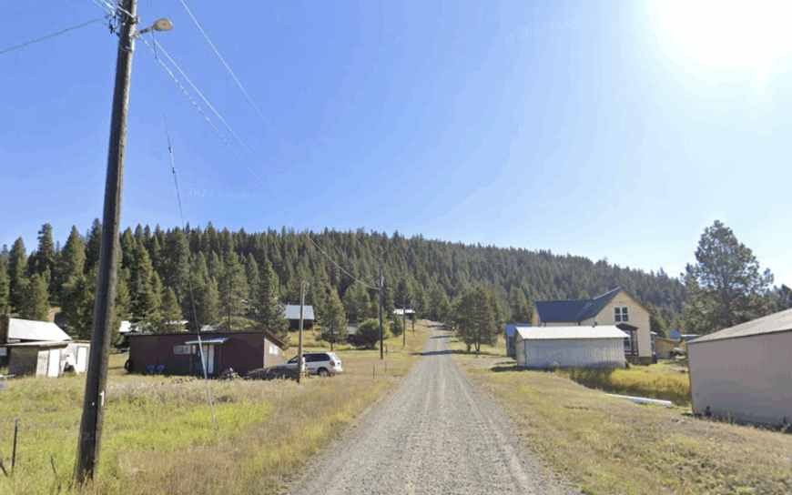
3. Troy – One-Bridge Hamlet on the Grande Ronde
With about 25 full-time residents, Troy may be Oregon’s smallest settlement with an operating K-8 school. Anglers drift the Grande Ronde for steelhead, while hikers traverse the Wenaha River Trail that departs right from town.
A lone general store and RV park see to visitor needs, supported by ranching and seasonal guiding work. Evenings settle into cricket chatter as darkness reveals Milky Way river reflections seldom found elsewhere.
The community’s seclusion derives from its position at the bottom of a deep river canyon, linked to the outside world by a single 1960s steel bridge. Lack of cell service and the two-hour gravel trek to the nearest supermarket preserve its hushed ambiance.
Where is Troy?
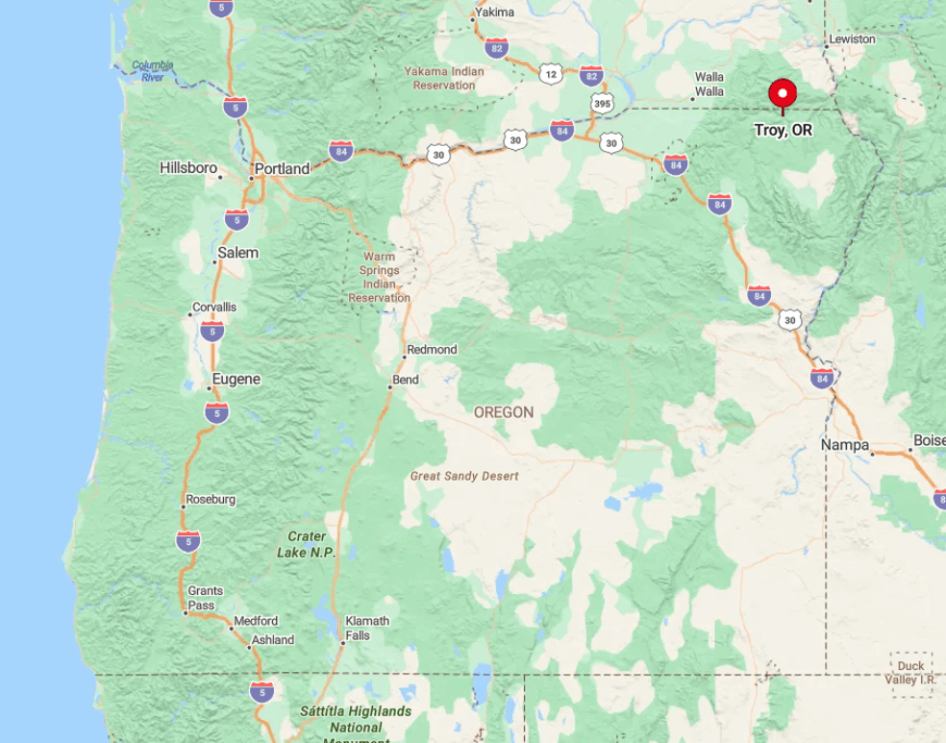
Troy crouches in Wallowa County near the Washington border, 50 air miles but nearly 70 road miles northwest of Enterprise. The final approach involves 26 miles of graded gravel on the Ronde River Road, hugging cliffs with sparse guardrails.
Winter storms and spring washouts can render the road impassable, so locals track weather more keenly than calendars. Most visitors reach Enterprise via Highway 82, top off at the last fuel stop, and commit to the slow, scenic descent to river level.
2. Granite – Oregon’s Least-Populated Incorporated City
Granite claims fewer than 40 permanent residents, yet its vacant boardwalks and antique gas lamps whisper tales of 1890s gold strikes. Today, hobby miners pan streams while hikers launch into the North Fork John Day Wilderness just outside town.
Employment is sparse—some seasonal forestry work, a pair of rustic lodges, and winter snowmobile guiding pay the bills. Crumbling false-front facades against dense pine forest give photographers moody frames in every direction.
Sitting at 4,900 feet amid the Blue Mountains and lacking cell towers, Granite loses touch with the modern world as soon as the sun drops behind the ridgeline. Highway maintenance is minimal, and snowfall often strands residents for days, adding to the town’s storied isolation.
Where is Granite?
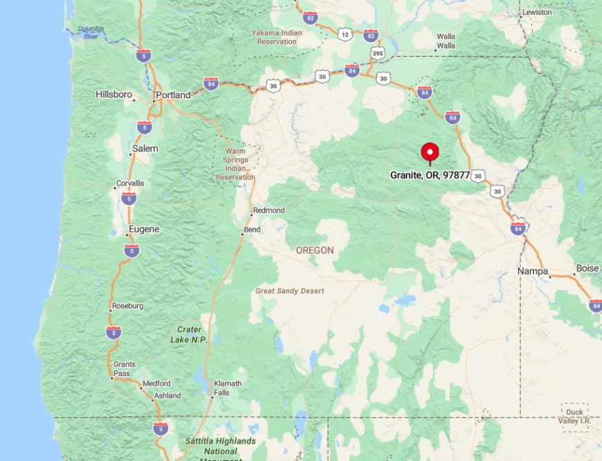
Located 47 mountain miles west of Baker City, Granite is reached via Highway 7 and a final 12-mile spur along narrow, often sanded pavement. The route climbs steeply, crossing Summit Creek Pass before descending into town at the headwaters of Clear Creek.
In winter, visitors need four-wheel drive and a strong dose of self-reliance; in summer, motorcyclists relish the twisty ride and thin air. No fuel is sold in Granite, so travelers usually fill up in Sumpter or Baker City and bring extra snacks for good measure.
1. Imnaha – Last Stop Before Hells Canyon

Around 80 people live along the cottonwood-lined Imnaha River, their cabins huddled beneath towering basalt walls that funnel both wind and wonder toward the Snake River gorge.
Anglers cast for smallmouth bass, photographers chase alpenglow on 8,000-foot Hat Point, and everyone gathers at the Imnaha Store for world-class burgers and local gossip. Ranching persists in the valley, though guiding rafters and hunters heading into Hells Canyon brings needed seasonal income.
The sense of seclusion is immediate: no streetlights, no cell bars, and a night sky so dark satellites outshine aircraft. Imnaha’s dead-end county road, hemmed by cliffs and open range, means every driver either lives here or came with intent. The canyon’s sheer remoteness wraps the town in a quiet no freeway could ever break.
Where is Imnaha?
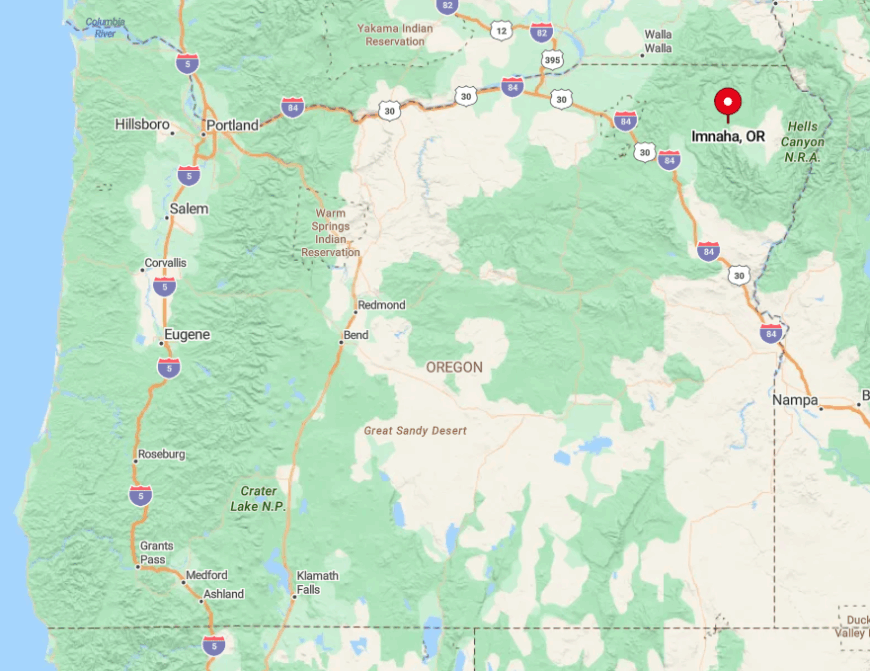
Imnaha sits 30 miles northeast of Joseph at the very terminus of Wallowa County Route 350. The paved road narrows to a ribbon beside the river, with steep drop-offs and free-roaming cattle keeping speeds honest.
In winter, rockfalls and ice can close the grade, cutting residents off until county plows arrive from Enterprise.
Summer explorers often continue another 24 rugged, gravel miles to Hat Point Lookout for the highest drivable view of Hells Canyon, but only after topping off at Imnaha’s old-time gas pump that still shows gallons on spinning numbers.


