🔥 Would you like to save this?
Northeast North Dakota rewards those who like the horizon wide and the traffic light. Beyond the college towns and interstate exits, a string of hamlets holds tight to the prairie, each one offering its own brand of quiet.
Grain elevators stand guard over empty streets, cottonwood groves screen old farmsteads from the wind, and kettle lakes flash blue between rolls of glacial hill country.
In order to come up with the very specific design ideas, we create most designs with the assistance of state-of-the-art AI interior design software.
We gathered 25 of the most secluded spots in this corner of the state, places where the sky fills more of the map than the people do. Whether the goal is a weekend detour or a complete reset, these settlements prove that remoteness can be inviting.
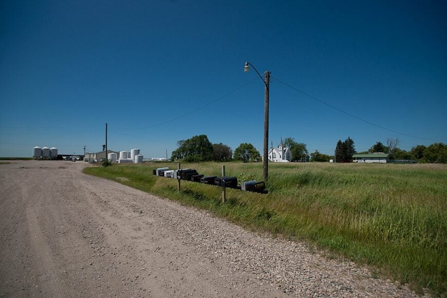
25. Hansboro’s Prairie Crossroads Stillness
Tucked along the Canadian border in northeast North Dakota, Hansboro feels like a place time forgot. With only a handful of residents and miles of open prairie in every direction, it’s far from busy highways and city noise.
The air carries the scent of freshly turned soil from nearby farms, and the horizon stretches endlessly under the wide Dakota sky. Visitors can explore gravel backroads, fish in nearby lakes, or enjoy the changing colors of the Turtle Mountains.
Farming anchors daily life, with wheat and canola fields shaping both the land and the economy. At night, the absence of city lights reveals a sky full of stars, offering a quiet that feels entirely your own.
Where is Hansboro?
Hansboro is a tiny community in northeastern North Dakota’s Towner County, less than 5 miles from the Canadian border. It’s reached by following ND Highway 5, where the road runs through open prairie and gently rolling farmland.
The approach is wide and unobstructed, with distant grain elevators marking the horizon. It’s close enough to cross into Canada in minutes, yet feels set in the stillness of the northern plains.
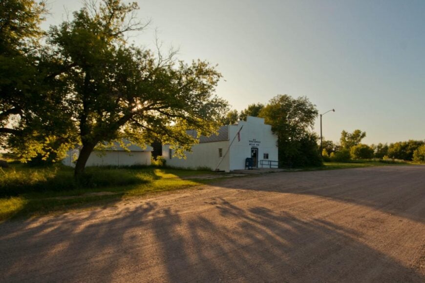
24. Munich’s Elm-Lined Outpost
Set amid the quiet farmland of northeastern North Dakota, Munich sits far from major highways and the rush of urban life. Surrounded by fields that change with the seasons, the town moves at the pace of planting and harvest.
Days here might include walking to the small downtown café, fishing at nearby lakes, or exploring the rural backroads that weave through rolling prairie. Farming is the foundation of the local economy, with wheat, soybeans, and canola fields framing the horizon.
Evenings bring long, golden sunsets that fade into skies dense with stars. It’s the kind of place where stillness feels natural, and the world beyond can seem a lifetime away.
Where is Munich?
Munich is located in the northeast corner of North Dakota, about 30 miles southwest of Langdon and near the border with Canada. Travelers reach it by following Highway 5 through rolling farmland, where small clusters of trees break the wide horizon.
The approach is quiet and open, with long stretches between towns adding to the sense of distance. It’s the kind of place where you arrive feeling the world has slowed down, leaving the noise far behind.
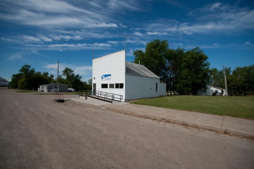
23. Mylo’s Shelterbelt Loop
Nestled in the open prairie of north-central North Dakota, Mylo feels worlds away from the hum of busy roads and crowded towns. With just a small cluster of homes and vast farmland stretching in every direction, the landscape shifts from green in summer to snow-swept white in winter.
Life here revolves around agriculture, with fields of grain and canola forming the backbone of the community. Visitors can enjoy quiet drives along rural gravel roads, stop by nearby small-town diners, or take in the serene beauty of the prairie at sunrise.
Nights bring an uninterrupted canopy of stars, undimmed by city lights. It’s the kind of place where the silence feels as much a part of the scenery as the land itself.
Where is Mylo?
Mylo rests in northeastern North Dakota, about 15 miles east of Rugby, the town known as the geographic center of North America. You reach it by traveling along Highway 17 and then turning onto smaller county roads that pass through expansive farmland.
The drive offers uninterrupted views of open prairie, with only the occasional farmhouse in sight. It’s a spot that feels tucked away, where the quiet stretches as far as the horizon.
22. Egeland’s Rail Spur Memory
Tucked away in the rolling prairies of Towner County, Egeland feels far removed from the busier corners of the state. The nearest major road lies miles away, leaving only the sound of wind through the fields and the calls of meadowlarks.
Farming sustains the town, with wide expanses of wheat and canola changing color with the seasons. Visitors might take a slow drive past century-old farmsteads, watch pelicans and ducks on nearby prairie lakes, or simply sit and listen to the quiet.
In winter, snow smooths the land into a white, endless plain, while summer brings skies so wide they seem to swallow the horizon. It’s a place where solitude isn’t sought—it’s simply part of everyday life.
Where is Egeland?
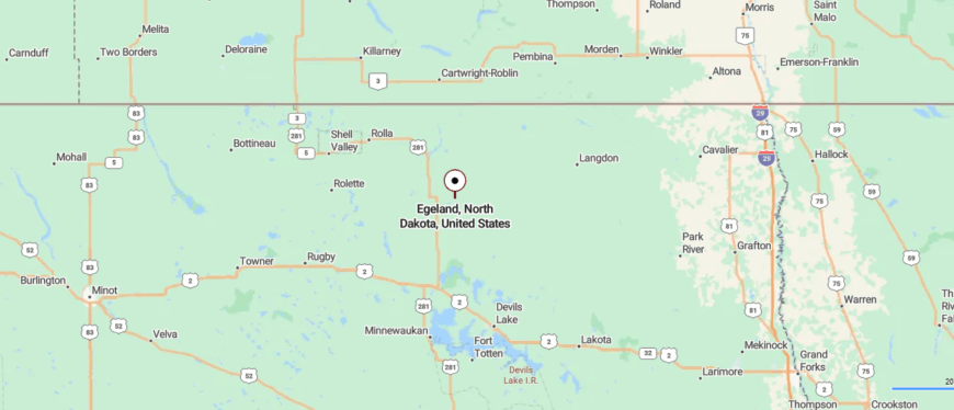
Egeland lies in the northeastern region of North Dakota, roughly 25 miles west of Cando and not far from the Turtle Mountains. Access comes via Highway 66, followed by smaller rural roads that thread through sweeping fields and open sky.
The approach is marked by long, straight stretches with little traffic, creating a calm, unhurried pace. It’s the kind of place where the road seems to lead you away from everything except the quiet of the land.
21. Rocklake’s Twin Shorelines
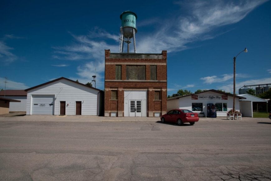
Surrounded by prairie and dotted with small glacial lakes, Rocklake sits in a quiet corner of northern North Dakota, far from the pull of busy highways. The town moves at a steady, unhurried pace, shaped by the rhythms of farming and the changing seasons.
Visitors can fish or kayak on the nearby waters, follow gravel roads past weathered barns, or watch migratory birds along the lake shores. Agriculture remains the lifeblood here, with golden wheat fields and bright yellow canola marking the landscape.
As evening settles, the wide sky turns brilliant shades of orange and pink before fading into a star-filled night. It’s the kind of place where the land and water seem to hold the world at a comfortable distance.
Where is Rocklake?
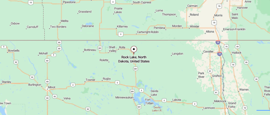
Rocklake sits in northeastern North Dakota, about 25 miles northwest of Cando and not far from the Canadian border. It’s reached by following Highway 281 and then turning onto local roads that pass through wide stretches of farmland and prairie lakes.
The drive is open and uncluttered, with water and grassland trading places along the horizon. It’s close enough to reach in under an hour, yet far enough to feel wrapped in stillness.
20. Bisbee’s Elevator Sentinel
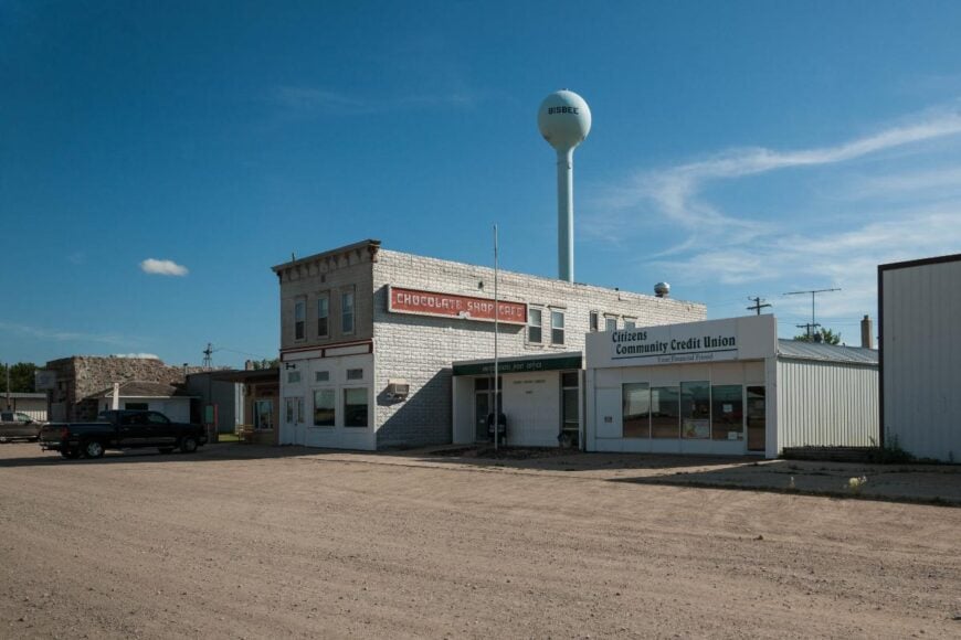
In the far north of North Dakota, Bisbee sits quietly among sweeping fields and open prairie, far from the pull of busy highways. With only a small population and miles of farmland in every direction, the town feels wrapped in its own unhurried rhythm.
The scent of fresh-cut hay drifts on the wind in summer, while winter brings a hush that blankets the streets. Life here revolves around agriculture, with wheat, canola, and soybeans shaping both the economy and the view from every road.
Visitors might fish at a nearby lake, take a slow drive past weathered barns, or linger at the local café where everyone knows each other’s name. As the sun sets, the horizon glows gold and rose before giving way to a star-filled sky. It’s the kind of place that reminds you how still and spacious the world can feel.
Where is Bisbee?
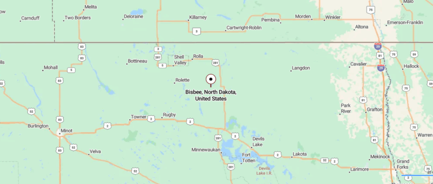
Bisbee is located in northeastern North Dakota, about 20 miles northwest of Cando and roughly 40 miles from the Canadian border. You get there by following Highway 66 through quiet farmland, then taking smaller roads that pass open fields and shelterbelts.
The approach is marked by long, uninterrupted stretches where the landscape feels timeless. It’s close enough to connect with nearby towns, but distant enough to feel like its own quiet corner of the prairie.
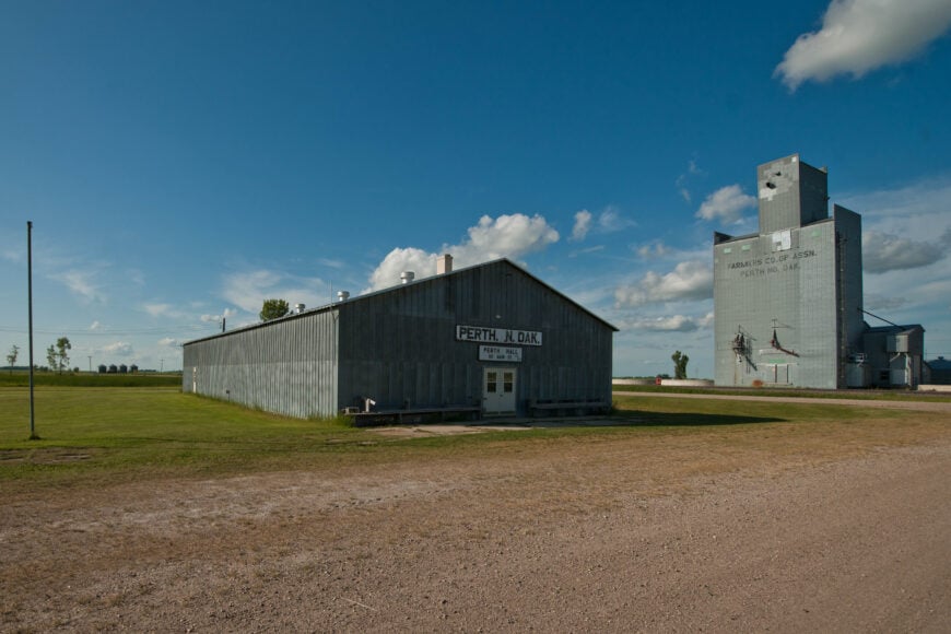
19. Perth’s Grain-and-Garden Cluster
🔥 Would you like to save this?
Tucked into the quiet farmland of northern North Dakota, Perth sits far from major highways, where the prairie stretches wide and uninterrupted. The town’s few streets and close-knit community move at a pace set by the seasons, with fields of wheat and canola framing every horizon.
On a summer afternoon, you might hear nothing but the rustle of wind through the crops, while in winter, the land lies silent under a smooth layer of snow. Life here is rooted in agriculture, but there’s time for fishing at nearby lakes, exploring gravel backroads, or visiting neighbors over coffee.
The sunsets linger long, painting the sky in soft golds and pinks before fading into starlit stillness. It’s the kind of place where the distance from everything else feels like part of its charm.
Where is Perth?
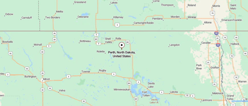
Perth is in northeastern North Dakota, about 10 miles east of Rolla and a short drive from the Canadian border. It’s reached by traveling along Highway 5, then turning onto local roads that cut through broad, open farmland.
The route offers wide views in every direction, with few interruptions to the horizon. It’s near enough for a quick trip from surrounding towns, yet remote enough to feel apart from the rest of the world.
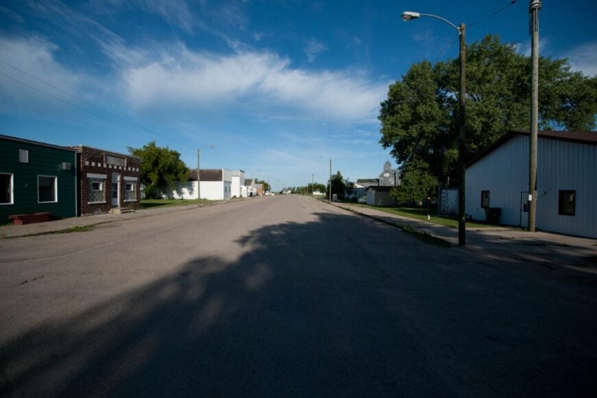
18. Edmore’s Prairie Junction
Hidden in the broad prairie of northeastern North Dakota, Edmore feels like it exists in its own wide pocket of stillness. The nearest bustle is miles away, leaving only the sound of wind moving through rows of wheat, soybeans, and canola.
Gravel roads lead past weathered barns and open fields, sometimes ending at a quiet lake or an abandoned homestead. Life moves to the measured pace of the land, where planting, growth, and harvest set the rhythm.
Locals gather for small events or a shared meal, keeping the town’s sense of connection strong despite its remoteness. It’s a place where the open space itself becomes the landmark, and where the rest of the world feels comfortably far away.
Where is Edmore?
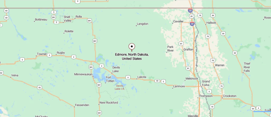
Edmore sits in northeastern North Dakota, roughly 30 miles west of Devils Lake and surrounded by miles of agricultural land. Reaching it means following Highway 1 or nearby county roads that run straight across open fields and gentle hills.
Along the way, the horizon seems to stretch endlessly, broken only by the occasional barn or tree line. By the time you arrive, the pace of the outside world feels a long way off.
17. Starkweather’s Windbreak Row
Starkweather rests quietly in the farm country of northeastern North Dakota, far from the pull of busy highways and larger towns. The streets are few, framed by fields of wheat, corn, and canola that stretch toward the horizon in every direction.
Gravel roads fan out from the edge of town, leading to fishing holes, country churches, and windbreaks of old trees sheltering weathered homesteads. Agriculture shapes the pace of life, each season marked by planting, growth, and harvest.
The soundscape is simple—wind over the grass, the hum of a tractor, and the occasional call of a meadowlark. It’s a place where space and quiet feel endless, and the rest of the world stays comfortably far away.
Where is Starkweather?
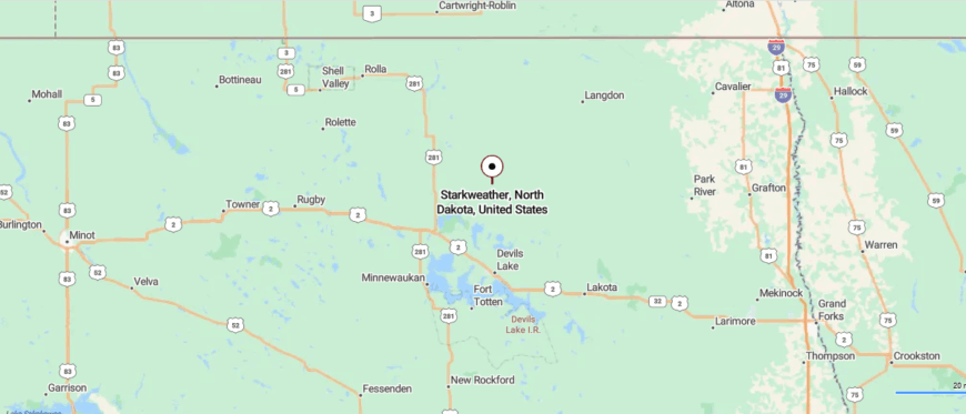
Starkweather is in northeastern North Dakota, about 25 miles north of Devils Lake along Highway 20. The route passes through open prairie and farmland, with the road running straight under a wide, uninterrupted sky.
Small clusters of trees and farmsteads appear sporadically, giving way again to long views of the land. It’s a place where the stillness of the prairie settles in as soon as you arrive.
16. Nekoma’s Missile and Wheat Fields
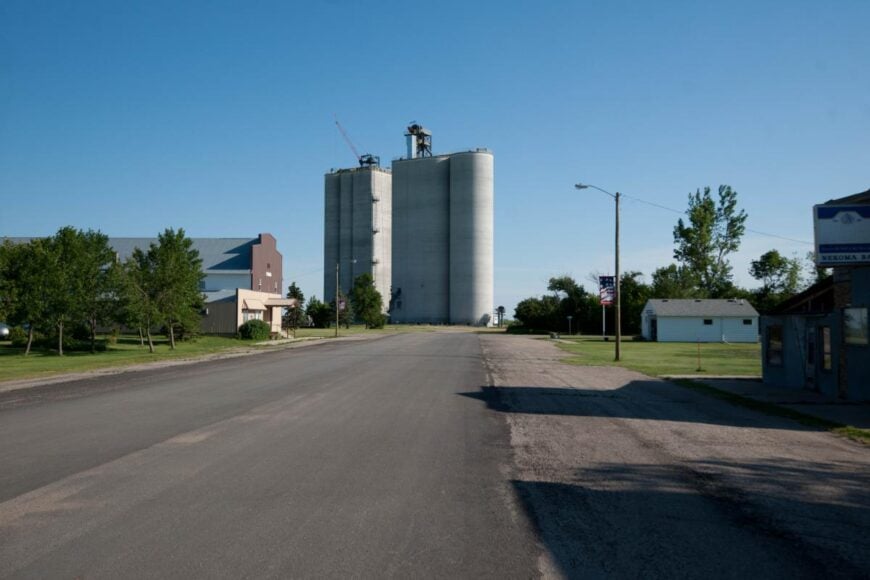
Nekoma lies in the far northeast of North Dakota, a small grid of streets surrounded by open farmland and sky that seems to go on forever. The town is best known for its Cold War–era pyramid-shaped radar structure, a striking landmark rising from the prairie.
Life here is shaped by agriculture, with wheat, soybeans, and canola fields defining the seasons and the view from every road. Those passing through might explore the unusual history of the radar site, take a slow drive along backroads, or pause at nearby lakes and wildlife areas.
The quiet is constant, broken only by wind moving through the crops or the low rumble of farm equipment. In Nekoma, the sense of remoteness feels less like distance and more like being in a world apart.
Where is Nekoma?
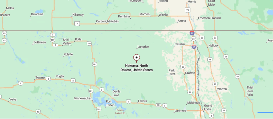
Nekoma rests in the northeast corner of North Dakota, about 20 miles south of Langdon and close to the Canadian border. It’s reached by following Highway 1 through open farmland, where grain elevators and the occasional shelterbelt mark the horizon.
The drive is quiet and steady, with few signs of traffic along the way. By the time you roll into town, the wide prairie feels like it has folded you into its solitude.
15. Osnabrock’s Tree-Framed Lanes
Osnabrock sits tucked into the farmland of northeastern North Dakota, far from major highways and the hum of busy towns. Its small grid of streets is surrounded by fields of wheat, soybeans, and canola, the colors shifting with each season.
A drive in any direction leads past old farmsteads, quiet prairie lakes, and stretches of gravel road that seem to go on without end. Farming is the anchor here, providing both livelihood and identity.
Local gatherings, from community suppers to small celebrations, keep neighbors connected in a landscape defined by wide horizons. It’s a place where the quiet feels steady and enduring, as if it’s been here all along.
Where is Osnabrock?
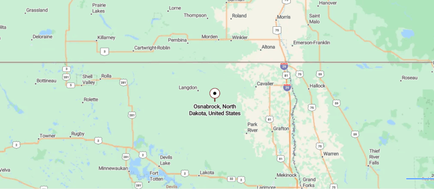
Osnabrock is located in the northeast region of North Dakota, about 15 miles west of Langdon and not far from the Canadian border. Travelers reach it by following Highway 5, a route that cuts through flat farmland and open prairie.
The scenery shifts only with the rise of grain bins or the edge of a windbreak, making the approach feel steady and unhurried. It’s the kind of place where the horizon stays wide and the quiet lingers.
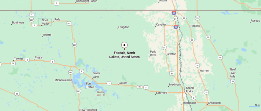
14. Clyde’s Prairie Hollow
Clyde is a small mark on the wide prairie of northeastern North Dakota, surrounded by farmland that rolls out in every direction. With no major highways nearby, the town keeps a quiet rhythm shaped by the cycles of planting and harvest.
Wheat, canola, and soybeans dominate the view, broken only by tree lines and the occasional farmhouse. Nearby gravel roads lead to fishing spots, old barns, and stretches of open land where the wind moves without interruption.
Life here is rooted in agriculture and close ties between neighbors. It’s the kind of place where the stillness feels like part of the landscape itself.
Where is Clyde?
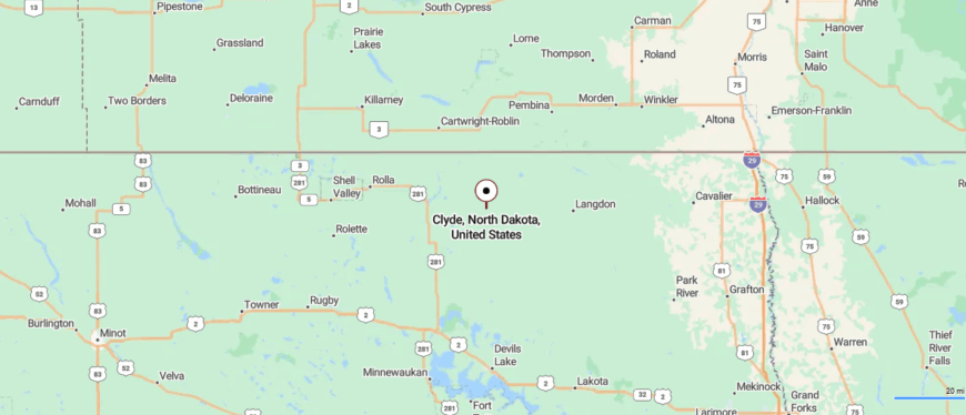
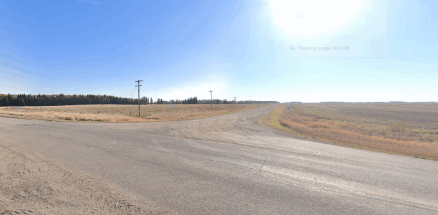
Clyde lies in northeastern North Dakota, about 25 miles southwest of Langdon and surrounded by stretches of prairie and farmland. The trip there follows Highway 1 before turning onto smaller county roads that feel more like private lanes through open country.
Along the way, the land unfolds in broad, uninterrupted views under a wide sky. By the time you reach town, the stillness feels like it has settled in for miles around.
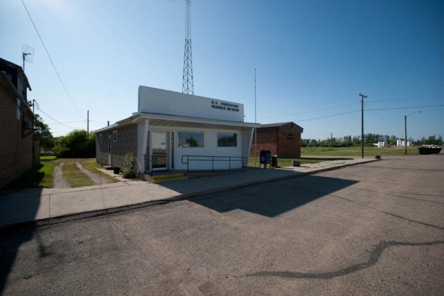
13. Fairdale’s Ridge-Top View
🔥 Would you like to save this?
Fairdale sits in the open prairie of northeastern North Dakota, a small community surrounded by farmland that stretches to the horizon. The nearest bustle lies many miles away, leaving only the sounds of wind through the crops and the steady pace of rural life.
Wheat, soybeans, and canola shape both the economy and the scenery, changing color with the seasons. Gravel roads lead past shelterbelts, old farmsteads, and quiet fishing lakes tucked into the countryside.
Neighbors know each other well, gathering for local events that mark the year. It’s a place where space feels abundant, and the rest of the world seems to fade far into the distance.
Where is Fairdale?
Fairdale sits in northeastern North Dakota, about 40 miles northwest of Grafton and surrounded by rolling farmland. The drive in follows quiet county roads that branch off from Highway 32, passing long fields and the occasional farmstead.
The horizon stays wide and open, with few signs of traffic or bustle. By arrival, it feels as though the prairie has wrapped the town in its own quiet space.
12. Vang’s Border Bluff
Vang rests near the Canadian border in the far northeast corner of North Dakota, surrounded by sweeping farmland and open prairie. The town’s few streets are bordered by fields of wheat, soybeans, and canola, their colors shifting with each season.
Backroads stretch for miles, passing windbreaks of trees, old barns, and hidden prairie lakes. Farming is the lifeblood here, guiding the rhythm of daily life and connecting generations to the land.
The quiet is constant, broken only by the wind or the call of birds overhead. In Vang, the sense of distance feels complete, as if the world beyond exists on the other side of the horizon.
Where is Vang?
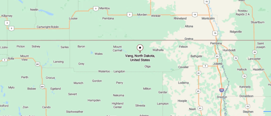
Vang is tucked into the far northeastern corner of North Dakota, just a few miles south of the Canadian border and about 30 miles northeast of Langdon. You reach it by traveling along Highway 32 and then following smaller rural roads through sweeping farmland.
The approach offers long views with little more than grain bins and windbreaks to break the horizon. By the time you arrive, it feels like the edge of the world in the best possible way.
11. Milton’s Prairie Cross-Tie
Milton sits quietly in the rolling farmland of northeastern North Dakota, far from major highways and the rush of larger towns. Fields of wheat, canola, and soybeans surround the community, shifting in color as the seasons pass.
The roads leading out of town wander past weathered barns, open pastures, and small lakes where fishing and birdwatching come easy. Agriculture anchors daily life, with work and seasons closely tied to the land.
The air carries a steady calm, broken only by the hum of farm equipment or the wind moving through the crops. It’s a place where the openness itself feels like a defining feature, holding the rest of the world at a distance.
Where is Milton?
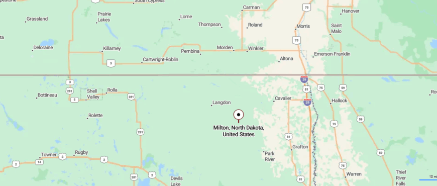
Milton is in northeastern North Dakota, about 25 miles northeast of Langdon and only a short drive from the Canadian border. Access comes via Highway 66, a quiet stretch flanked by open fields and scattered farmsteads.
The scenery remains wide and unbroken, with the road stretching ahead under an endless sky. Arriving here feels like stepping into a place where time moves at the pace of the prairie.
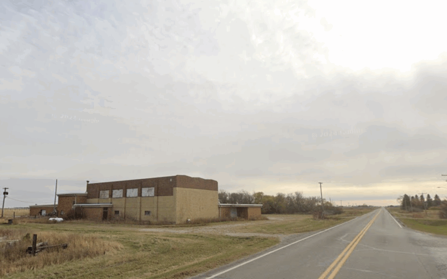
10. Whitman’s Wind-Swept Grain-Elevator Hamlet
Whitman keeps a year-round population of roughly six, and most days the wooden grain elevator is the tallest sign of life for miles. Visitors photograph the elevator at sunrise, scan roadside sloughs for sandhill cranes, or wander through the overgrown schoolyard that still holds a rusted merry-go-round.
Farming—chiefly spring wheat and canola—remains the only industry, run by families whose land spreads clear to the horizon. No stores, no gas pumps, and no post office underline how completely the town sits outside modern bustle.
Nights are so dark that the northern lights regularly ripple over the elevator roof without competition from electric glare. The nearest porch light belongs to a farmhouse half a mile away, underscoring Whitman’s near-ghost status.
Where is Whitman?
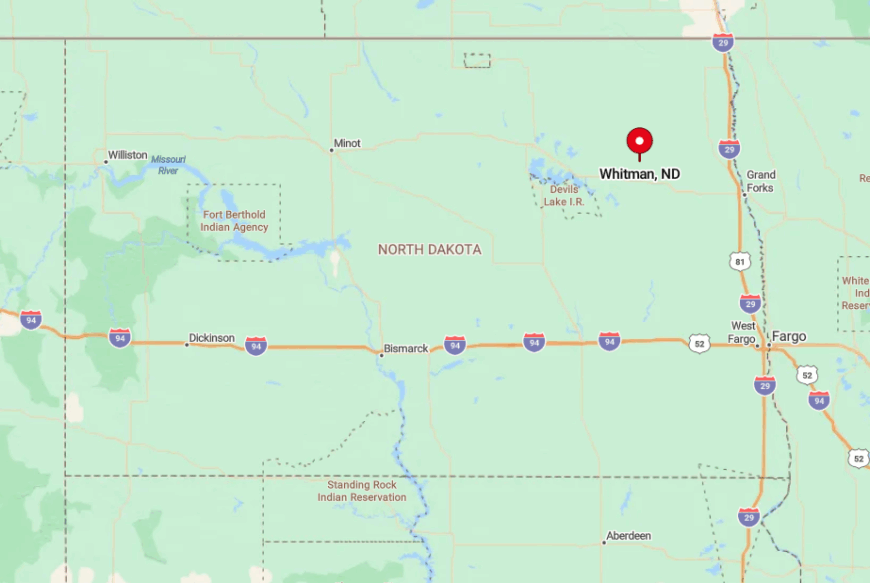
The hamlet rests in northwestern Nelson County, about 14 miles north of the U.S. 2 junction at Michigan City. Prairie cropland wraps the settlement in every direction, and the next true population center—Devils Lake—lies 30 miles to the west.
County Road 1 provides the only paved approach; local drivers turn west on a short gravel spur that dead ends beside the elevator. In winter, a single plow pass may be the town’s only connection to the wider world for days at a time.
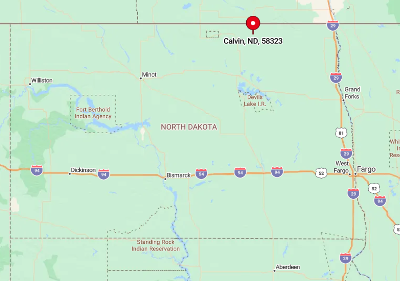
9. Calvin’s Borderland Coulee Hideaway
Calvin counts close to twenty full time residents who live among shelterbelt forests tucked in rolling coulees just three miles south of Canada. Anglers toss lines into nearby Dick’s Lake, snowmobilers ride the abandoned rail grade, and locals keep a picnic table shaded by spruce at tiny Calvin City Park.
Grain and beef operations pay the bills, with trucks hauling barley and feeder calves along a gravel grid that never seems busy. Windbreaks swallow most sightlines, so a visitor can stand on Main Street and hear only chickadees for minutes at a stretch.
Light pollution is practically nonexistent; stargazing here feels like stepping into a planetarium minus the ceiling. A disused customs station on the border road offers a quirky photo op few travelers ever discover.
Where is Calvin?
🔥 Would you like to save this?
Set in north central Cavalier County, Calvin sits nine miles east of U.S. 281 and a similar distance west of ND Highway 5. Dense rows of poplar and ash shield the village from prairie gusts, and the lack of through highways ensures quiet both day and night.
Most visitors reach Calvin by turning north off ND 5 onto County Road 23, where pavement yields to gravel for the final stretch. Winter access depends on county plows that sometimes arrive a day after a storm, reinforcing the town’s hidden quality.
8. Auburn: The Brick Bank Ghost on the Prairie
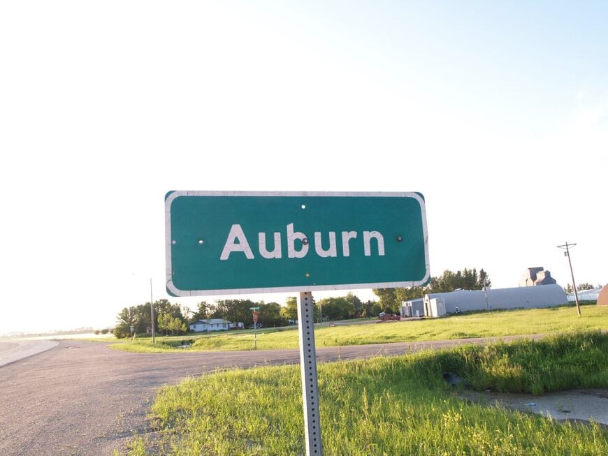
Fewer than ten residents remain in Auburn, though the 1905 red brick bank still towers above two surviving blocks like a movie set frozen in time. Photographers flock to capture the bank’s ornate façade, while upland hunters chase pheasants through nearby stubble fields and ditch lines.
Dryland wheat and soybean fields dominate the local economy, now supervised by satellite guided tractors that roll past the bank without stopping. Auburn’s only paved route ends a mile outside town, and many locals say they can sit on the former main drag an hour before seeing a vehicle.
Night skies glow only with stars, making summer meteor showers a community event of porch chairs and blankets. The old vault door inside the bank, still on its hinges, draws history buffs willing to brave dusty floors.
Where is Auburn?
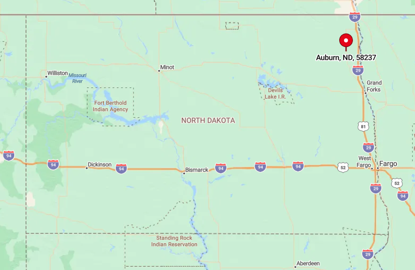
Auburn occupies a lonely corner of Walsh County about eleven miles southwest of the small city of Cavalier. Surrounding section roads form a gravel lattice, but none align with state highways, so travel in or out involves at least ten minutes of crunching tires and wheat scents.
Drivers usually exit U.S. 81 at Park River, then weave west and north on farm roads that pass only empty granaries. During spring thaw, soft gumbo soil can render those roads impassable, temporarily sealing Auburn away from the rest of the county.
7. Hensel’s Tongue River Woodland Pocket
Hensel supports around forty-five residents who live in scattered farmsteads shaded by cottonwoods along the slow moving Tongue River. Canoeists slip into the river at a grassy landing, anglers cast for northern pike, and bird watchers seek out nesting great horned owls in the towering trees.
Sugar beet piles and grain bins reveal agriculture as the economic backbone, with trucks humming only during fall harvest. Because the nearest supermarket is fifteen miles away and the closest four lane road even farther, daily life unfolds at a self-contained pace.
Tree cover muffles wind and road noise, giving the settlement an almost creekside hush, unexpected on open prairie. A modest but beloved picnic shelter beside the river hosts a potluck each July that draws former residents home.
Where is Hensel?
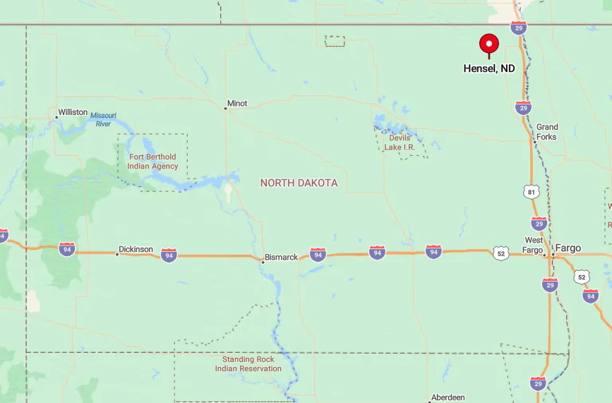
The town lies in south central Pembina County, roughly twelve miles north-northwest of Park River via ND Highway 32 and County Road 1. Thick riverbottom timber screens Hensel from surrounding farmland, and the absence of an east west highway keeps through traffic negligible.
Visitors often miss the turnoff because the only sign is a mailbox cluster and a small wooden “Hensel” board nailed to a cottonwood. Winter access depends on County Road 1, which snakes through the river valley and can drift shut when north winds pile snow in the bends.
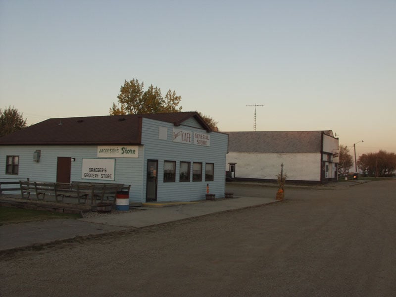
6. Hampden’s Glacier-Carved Hill Country
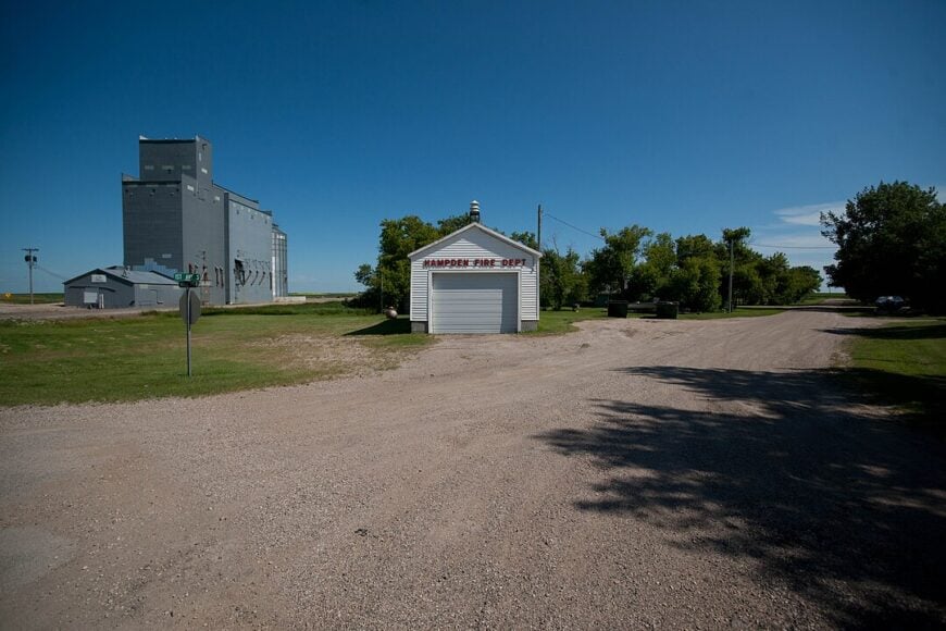
Hampden’s population hovers near thirty, its dozen homes perched amid rolling moraine hills and kettle lakes left by the last Ice Age. Locals fish for perch on Alice Lake, cycle gravel loops that crest ridge tops, and gather for Friday pie at the volunteer-run cafe inside the former school.
Cattle, hay, and spring wheat form the village economy, with ranchers trailing beef herds across undulating pasture. Only County Road 8 connects Hampden to ND 20, so most trips begin with ten miles of curves and hills that hamper cell service.
Dense willow thickets and scattered glacial boulders conceal the town until the final half mile, adding an element of surprise. The moraine knobs block distant glow, making the Milky Way bright enough to cast shadows on cloudless nights.
Where is Hampden?
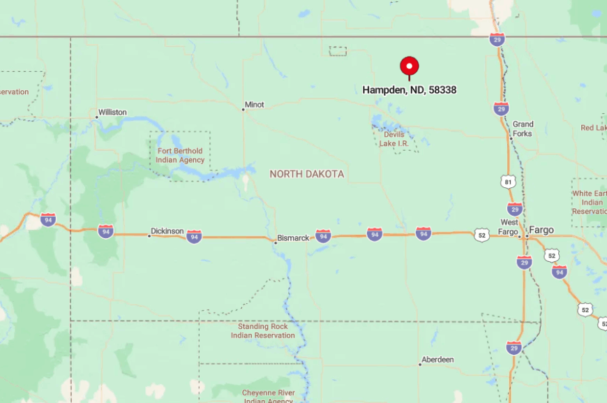
The settlement sits in southwestern Ramsey County, about twenty-two miles southwest of Devils Lake and far from any major commercial corridor. A patchwork of pothole lakes and ridges isolates it, as roads must thread around water and elevation changes.
Travelers usually leave ND 20 at the tiny junction of Penn and follow County Road 8’s roller coaster path into town. After heavy snow, those same hills can delay plows, reinforcing Hampden’s natural seclusion.
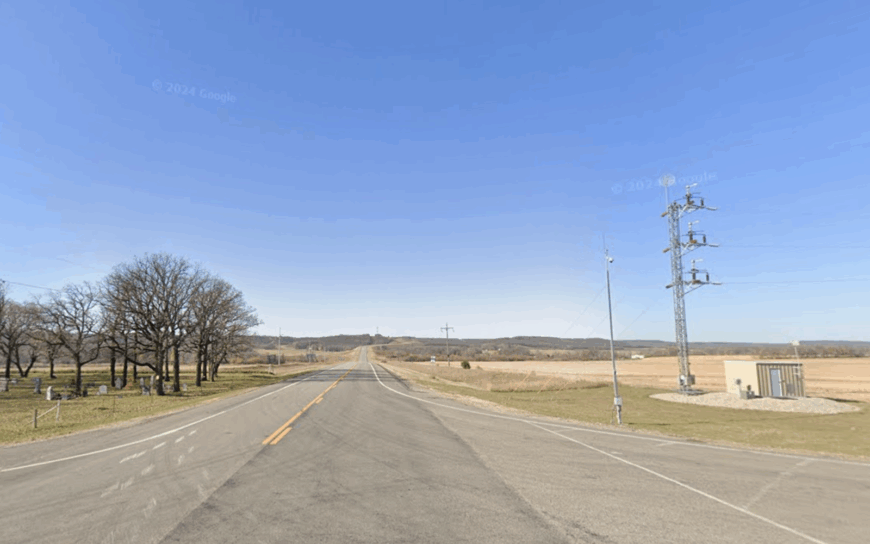
5. Brocket’s Big-Sky Farmstead Cluster
Brocket lists fifty-five residents on the last census, most living in a tidy grid where barns often outnumber houses. Goose hunters set decoys in surrounding wheat stubble, cyclists tackle the flat farm roads at dawn, and neighbors converge each December for a famed lutefisk supper in Skjeberg Lutheran Church’s basement.
Wheat and soybean operations dominate, with periodic side ventures in sunflower and edible beans adding color to summer fields. The nearest grocery store sits twenty miles away in Lakota, and a single two-pump station five miles south supplies fuel.
Endless cropland offers no shelter from wind, so the town seems stitched onto pure sky, reinforcing its sense of openness and removal. Hidden behind the abandoned schoolyard, a rare concrete stave silo from 1915 stands intact, attracting architecture buffs who know where to look.
Where is Brocket?
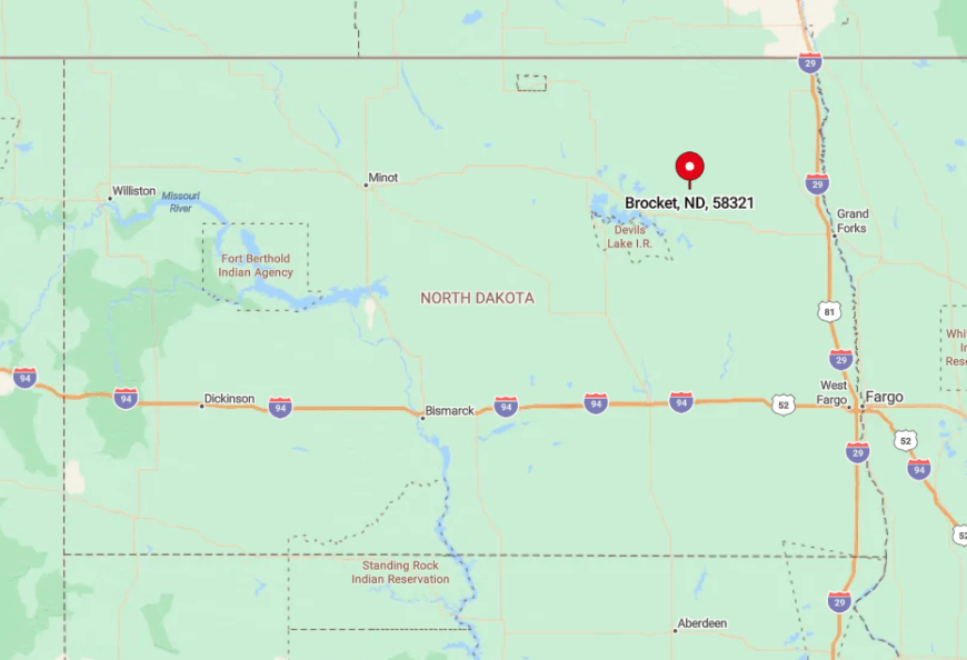
Brocket lies in eastern Ramsey County on ND Highway 1, yet even that paved link sees little more than local grain trucks and farm pickups. To the east and west stretch twenty-mile lanes of uninterrupted wheat, and the closest four way stop is seven miles off.
Most visitors exit U.S. 2 at Lakota, drive north on Highway 1, and spot Brocket only when the elevator appears over the rye. A winter whiteout can erase the landscape so thoroughly that the entire town feels suspended in blank space.
4. Concrete’s Riverside Cottonwood Strip
Concrete hosts perhaps five full time residents whose homes line a single gravel lane hugging the Pembina River. Kayakers slide beneath arching cottonwoods, agate hunters search mid river sandbars, and migrating warblers create a spring chorus that rivals any state park.
Agriculture still funds landowners, but row crops stop at the riverbank, leaving most of the immediate scenery wild. Concrete’s only street deadends at a low water crossing, eliminating all pass through traffic.
With dense timber behind and a river in front, the settlement feels pocketed away from the larger world. The abandoned one-room school now serves as an informal museum filled with local memorabilia that opens by request.
Where is Concrete?
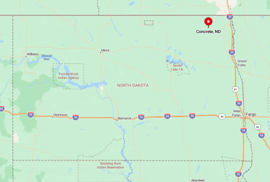
Hidden in northwestern Pembina County, Concrete is reached via a narrow gravel spur off County Road 55 roughly seven miles south of Cavalier. Tall cottonwoods shield the town from aerial visibility, and no highway signs mark the turn.
During spring floods, the Pembina River can overtop the low road, temporarily isolating residents. Visitors planning a trip often check water level reports first to be certain they can return the same day.
3. Sarles Outskirts: Prairie Meets Aspen Bluff
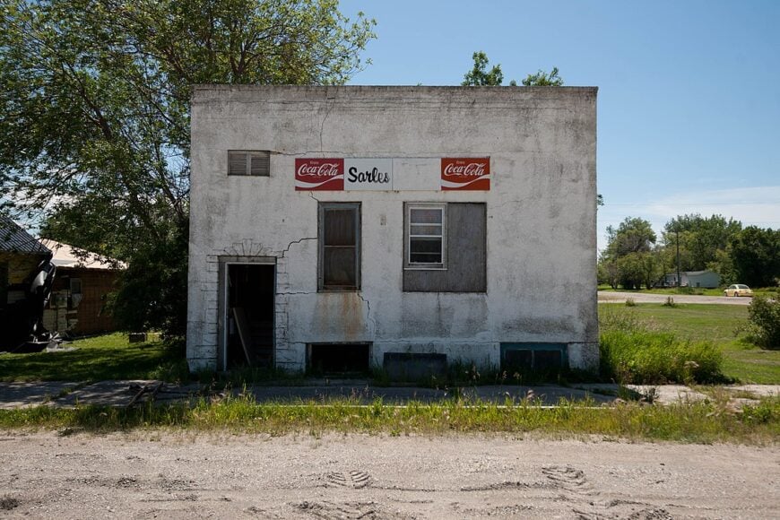
Sarles itself counts sixteen residents, but the true seclusion lies in the surrounding farmyards where prairie grasses give way to low aspen bluffs. Local hunters track whitetail deer along the bluff edge, and photographers climb a nearby rise called Lookout Knob for sunset panoramas that stretch into Manitoba.
Wheat, canola, and mixed hay keep tractors busy until frost, after which life shifts to ice fishing shacks on small ponds. With county density under two people per square mile, a neighbor’s porch light may be the only glow on a ten-mile night drive.
The fringe of aspen muffles wind, creating an unexpected hush on days when open prairie howls. A century old stone well at an abandoned homestead south of town rewards explorers who hike across stubble fields.
Where is Sarles?
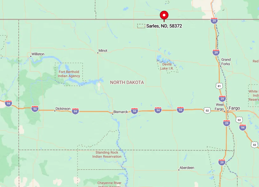
The village sits at the junction of ND Highway 3 and ND Highway 17, one mile south of the Canadian border. Despite the asphalt, traffic remains sparse because major freight routes favor crossings thirty miles east or west.
Travelers usually reach Sarles from Langdon, then continue south on gravel township roads to the bluff-backed farmsteads that define the area’s solitude. Blowing snow can close Highway 3 for hours, turning those side roads into the only link for residents.
2. Lawton’s Marsh-Fringed Refuge
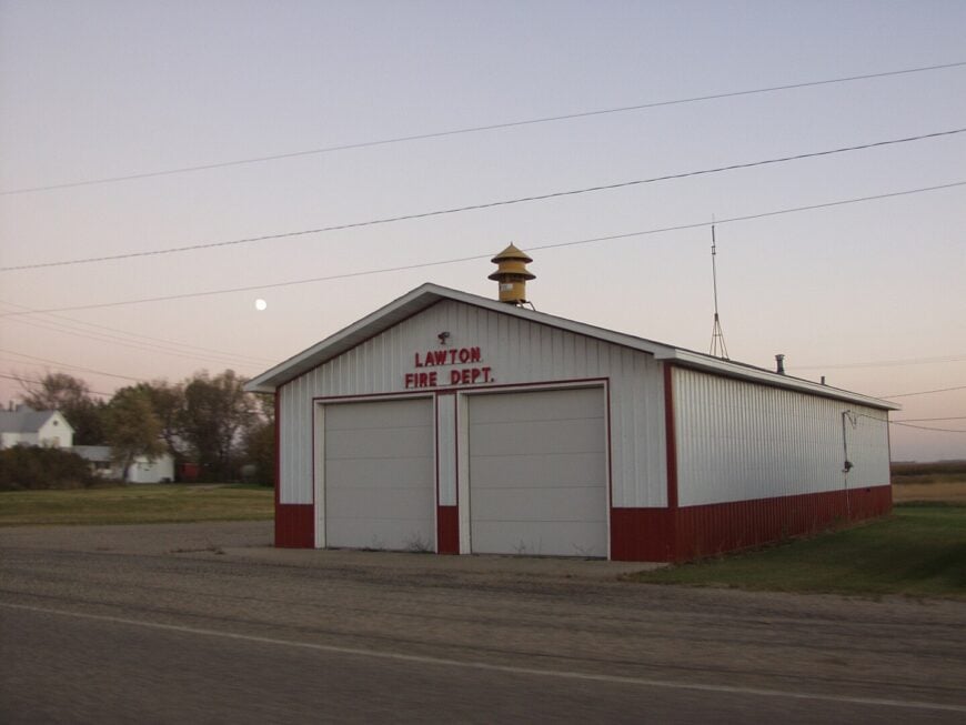
About fifteen people call Lawton home, their houses encircled by cattail marshes and prairie pothole lakes alive with ducks and white pelicans. Birders set up scopes along Township Road 4, anglers pull northern pike from Stump Lake, and winter visitors join a spirited ice fishing derby hosted on tiny Bertsch Lake.
Grain and cow-calf operations sustain the tax base, though seasonal guiding for waterfowl has become a modest side business. The town lacks a fuel pump, café, or store, so daily errands mean an eighteen-mile trip either east to McVille or west to Lakota.
Marshlands absorb road noise and light, giving Lawton an almost hushed, watery ambience. A hidden gem is the century-old stone grotto behind St. Andrew’s Church, hand built by parishioners and rarely seen by outsiders.
Where is Lawton?
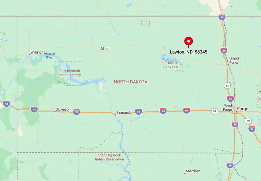
Lawton sits in southeastern Ramsey County just off ND Highway 35, yet is almost invisible behind reed beds that rise taller than a pickup cab. Visitors exit U.S. 2 at Lakota, follow Highway 35 south for ten miles, then turn onto a short gravel spur into town.
Cattail marsh flanks the road on both sides, so evening fog can make the drive feel like floating through a tunnel. Spring flooding sometimes overtops low sections, briefly restoring the hamlet’s island feel.
1. St. Michael’s Quiet West-Shore Spread

St. Michael supports roughly 350 residents spread across a wide expanse of Spirit Lake Nation prairie west of Devils Lake. Families host visitors at annual powwows, anglers launch boats at the Mission Bay ramp, and hikers roam White Horse Hill National Game Preserve to spot bison and elk.
Tribal administration, commercial fishing on Devils Lake, and small grain farming form the employment core, with a community college satellite providing additional jobs. Despite population size, the settlement feels spacious because homes sprawl across open grass instead of clustering on a grid.
Devils Lake itself acts as a natural barrier, forcing a long drive around the shoreline for most services. Just west of town, the remains of an 1880s mission school stand as a seldom noticed historical site with interpretive plaques.
Where is St. Michael?
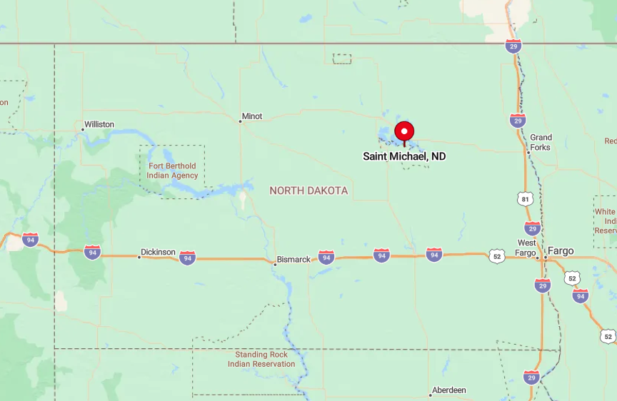
The community lies in Benson County along ND Highway 57 on Devils Lake’s western shore, about sixteen miles south of the city of Devils Lake. Water surrounds three sides of the settlement, and the sole paved access is the causeway-like Highway 57, which can close during high water events.
Alternative routes are gravel section roads that skirt the lake’s expanding bays and regularly flood in spring. Those periodic closures leave St. Michael peaceful and self-reliant, the perfect finale to a tour of northeast North Dakota’s secluded towns.