🔥 Would you like to save this?
Northeast North Carolina is full of places that reward anyone who enjoys hearing tree frogs instead of traffic. Our team traced back roads, tidewater peninsulas, and forgotten crossroads to find communities where neighbors are few and horizons feel endless.
Each town on this list is small, lightly developed, and bordered by water, forest, or farmland that keeps outside noise at arm’s length. Visitors will notice wide skies, unhurried conversations, and the kind of night darkness that still reveals the Milky Way.
In order to come up with the very specific design ideas, we create most designs with the assistance of state-of-the-art AI interior design software.
From bluff-top river hamlets to villages hiding behind pines, these destinations show how much quiet the Albemarle region can still offer. Here are 25 of the most secluded spots we found, counted down from number 25 to number one.
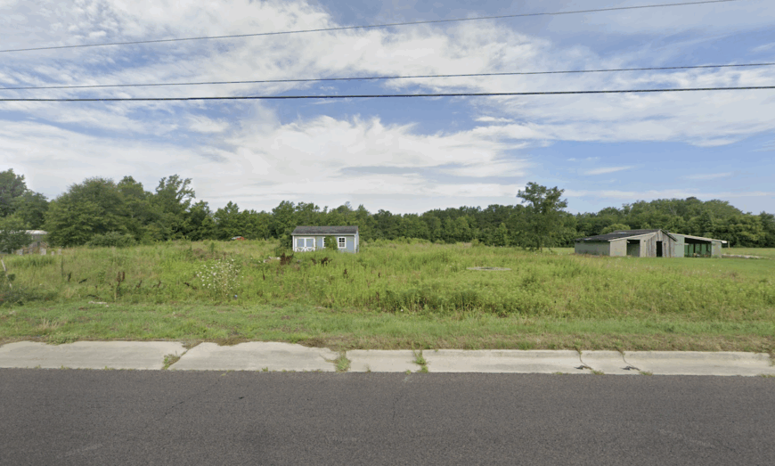
25. Harrellsville – Swamp-Edged Stillness in Hertford County
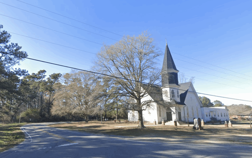
Harrellsville lies tucked along the banks of the Chowan River in northeastern North Carolina, where cypress knees rise from still waters and fields stretch wide under an ever-changing sky. With just a handful of streets and generations-old homes, it feels like a place folded into the land—quiet, remote, and deeply rooted.
The nearest town is miles away, and the rhythm here moves with the river, the seasons, and the stories passed down on porches. You can fish where the cypress casts long shadows, paddle the river’s quiet bends, or visit nearby historic churches and farmlands that whisper of centuries past.
Farming remains the backbone of local life, along with a strong sense of kinship and resilience. There’s no rush here, just the slow hum of nature and memory. Harrellsville is the kind of place where time lingers, and the silence feels like something sacred.
Where is Harrellsville?
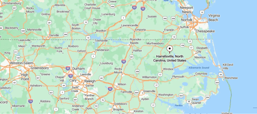
Harrellsville lies in the far northeastern corner of North Carolina, nestled near the banks of the Chowan River in Hertford County. It’s about 30 miles south of the Virginia border and 10 miles southeast of Ahoskie, reached by following NC-561 and NC-45 through fields, forests, and long stretches of quiet two-lane road.
The route curves gently past farmland and shaded bends before arriving at this small riverside town. Wrapped in stillness and shaped by water, Harrellsville feels like a place the world passes by—unrushed, tucked in, and peacefully apart.
24. Barco – Bayside Pockets off the Currituck Sound
Barco rests at the edge of Currituck County, where the mainland thins toward the Outer Banks and the landscape stretches flat and wide beneath the coastal sky. Surrounded by fields, marshes, and the quiet pull of the Intracoastal Waterway, it feels like a gateway town—but one that never lost its stillness.
With just a few crossroads, a school, and long stretches of open road, Barco moves at the pace of tide and tractor. You can explore the nearby Currituck Sound by kayak, birdwatch in the salt marshes, or drive toward the barrier islands where sea breeze and farmland meet.
Agriculture and marine trades still anchor much of daily life, shaped by both the land and the water. There’s a quiet resilience here, steady and unspoken. Barco is the kind of place where the wind carries salt, the fields carry stories, and time seems to wait just a little longer.
Where is Barco?
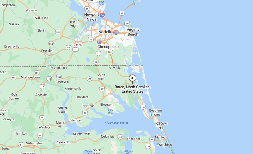
Barco is tucked into the northeastern edge of North Carolina’s Currituck County, just inland from the Currituck Sound and the Outer Banks. It’s about 45 miles south of the Virginia border and 25 miles north of Kitty Hawk, reached by driving down US-158 as it stretches through marshes, farmland, and coastal pine.
The highway narrows slightly as it approaches this small junction town, where the land flattens and the salt air begins to drift in. With its crossroads setting and quiet proximity to the coast, Barco feels like a calm threshold—close to the ocean, but grounded in quiet, inland pace.
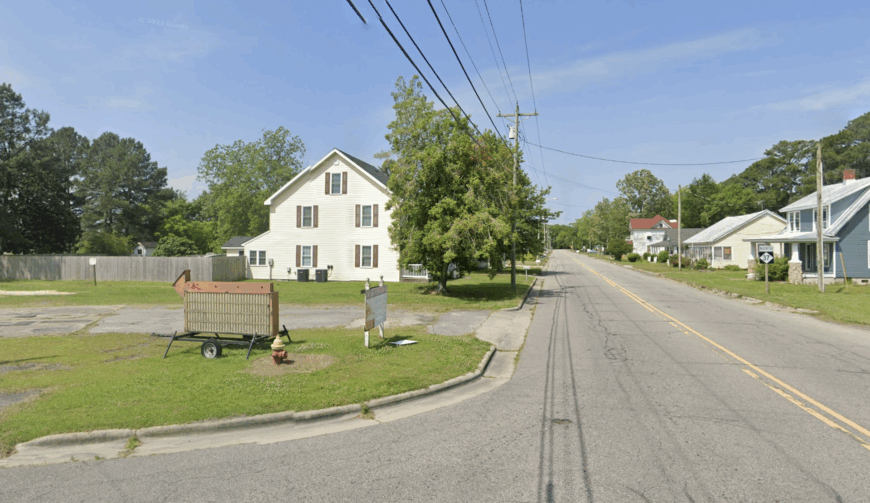
23. Cofield – Tree-Fringed Peace on the Edge of Phelps Lake
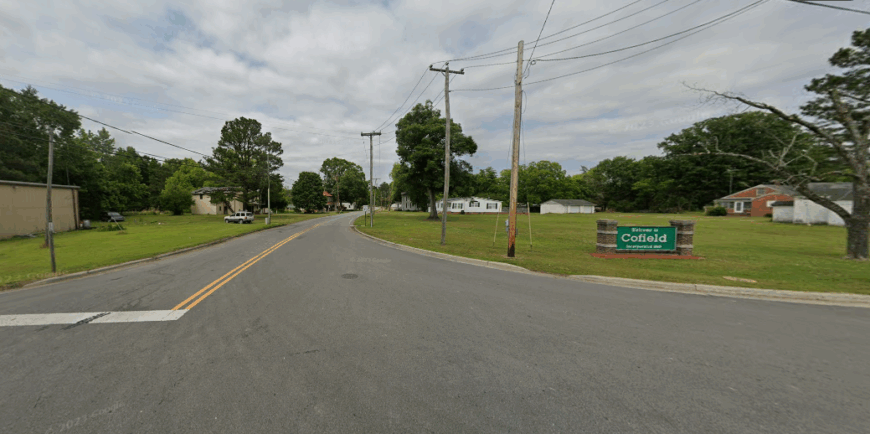
Cofield rests quietly in the flatlands of northeastern North Carolina, where fields stretch far and the sky feels endless above old farm roads and weathered homes. Tucked near the Chowan River and bordered by wetlands and woodland, it feels deeply removed—held in a hush broken only by birdsong or the rustle of wind through crops.
There’s no rush of traffic, no city hum—just the rhythm of rural life shaped by farming, forestry, and the steady hands of those who’ve been here for generations. You can fish the nearby waters, walk the trails of Merchants Millpond, or visit historic churches that mark time with quiet grace.
Life here leans into the land, unhurried and enduring. Cofield doesn’t call attention to itself—it simply endures, season after season. It’s the kind of place where silence speaks, and the horizon always seems to hold a little more room.
Where is Cofield?
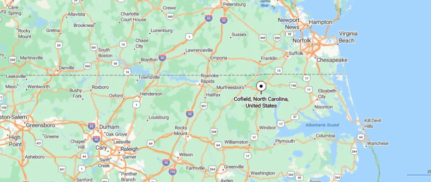
Cofield is nestled in northeastern North Carolina, in Hertford County, just west of the Chowan River and surrounded by farmland and forest. It’s about 8 miles north of Ahoskie, reached by quiet rural highways like NC-45 and NC-42 that wind past cotton fields and pine groves.
The road in is calm and open, with the horizon stretching wide before narrowing into a cluster of homes and quiet streets. With its close-knit feel and riverland hush, Cofield feels gently tucked away—steady, rooted, and quietly apart from the world beyond.
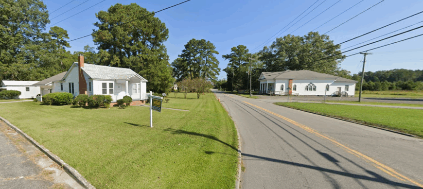
22. Winfall – River Hamlet with Big Sky Silence
Winfall sits gently along the banks of the Perquimans River, where cypress trees dip their roots into still waters and the breeze carries the scent of salt and farmland. Though close to Hertford and the Albemarle Sound, it feels quietly tucked away—surrounded by fields, shaded roads, and the kind of calm that lingers.
The river shapes the town’s rhythm, offering fishing at the public pier, kayak launches, and slow sunsets that turn the water to gold. You might spot herons gliding low, explore nearby nature preserves, or simply sit and listen to the hush between passing boats.
Agriculture and commuting sustain daily life, but the real anchor is the peace woven through land and tide. Winfall moves softly, like the river that defines it. It’s the kind of place where the world feels quieter, and every evening invites you to pause.
Where is Winfall?
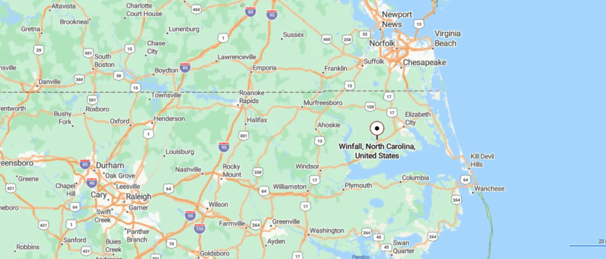
Winfall is tucked into northeastern North Carolina’s Perquimans County, just west of the Albemarle Sound and along the banks of the Perquimans River. It’s about 45 miles south of the Virginia border and 20 miles east of Edenton, reached by US-17 as it winds through lowland forests, fields, and quiet riverside stretches.
The road into town crosses still waters and marshy inlets, where cypress trees reflect in the current and the air hangs soft. With its riverside calm and gentle coastal light, Winfall feels like a quiet pause—close to the tide, yet sheltered in its own rhythm.
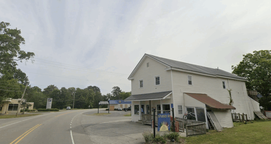
21. Creswell – Time Capsule at the Edge of the Lake
Creswell lies tucked in the quiet northeast corner of North Carolina, where the land flattens into farmland and cypress swamps, and the horizon feels both endless and near. Just off the beaten path, surrounded by fields, forest, and the dark waters of Lake Phelps, it carries the stillness of a place that’s held time gently.
You can explore the historic Somerset Place plantation, paddle the ancient cypress stands of Pettigrew State Park, or watch the sun rise over waters once paddled by generations past. The town itself is small—just a few streets, a church steeple, and neighbors who wave from porches—but its roots run deep in both history and soil.
Farming and forestry still shape the heartbeat of daily life. Creswell doesn’t speak loudly—it listens. It’s the kind of place where quiet settles in early, and the land feels older than memory.
Where is Creswell?
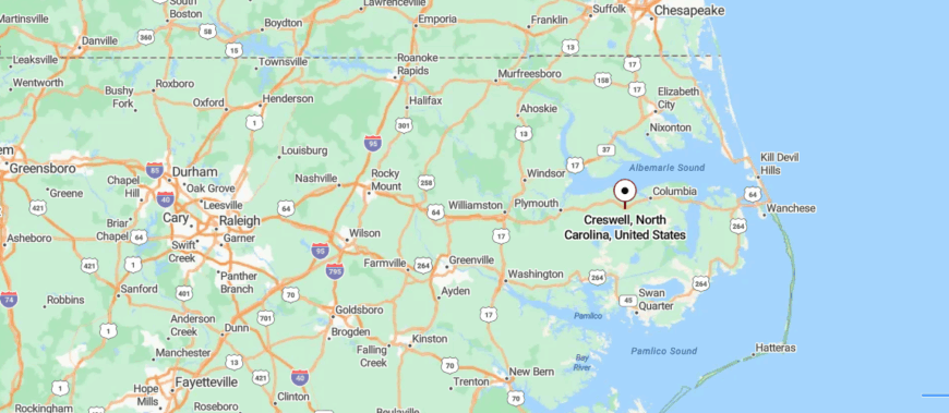
Creswell is tucked into the northeastern coastal plain of North Carolina, in Washington County near the edge of the vast Pocosin Lakes National Wildlife Refuge. It’s about 35 miles west of the Outer Banks and 15 miles east of Plymouth, reached by driving NC-94 through stretches of farmland, pine forest, and cypress swamp.
The road flattens into open sky and still waters as you near the town, where quiet streets meet fields and forest. Surrounded by wetlands and history, Creswell feels like a still corner of the state—rooted in nature, hushed, and gently apart from the everyday.
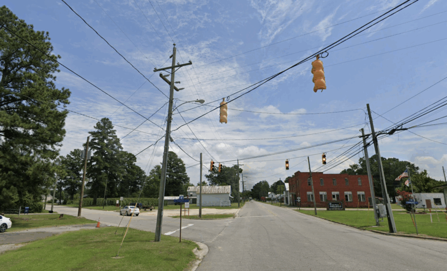
20. Sunbury – Soundless Junction in Gates County
Sunbury sits at a quiet crossroads in Gates County, where long fields meet dense woods and the horizon stretches wide under the Carolina sky. Surrounded by farmland and just a breath from the Great Dismal Swamp, it feels gently set apart—close to the Virginia line, yet far from the rush of anything fast.
The town is little more than a cluster of homes, a post office, and roads that curve slowly past cotton fields and pine groves. You can explore the nearby Merchants Millpond State Park, watch deer move through misty mornings, or drive country backroads where every bend feels familiar.
Life here is rooted in agriculture and long-held ties—quiet, steady, and unshaken by change. Sunbury doesn’t need to be busy to be full. It’s the kind of place where stillness is a way of life, and the landscape does most of the talking.
Where is Sunbury?
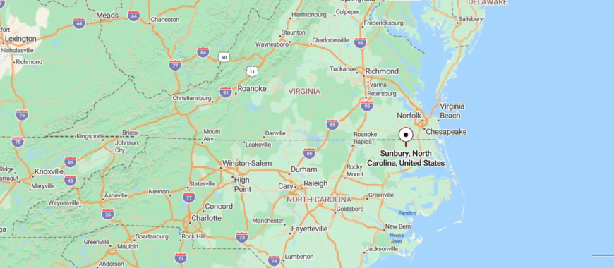
Sunbury is nestled in northeastern North Carolina’s Gates County, just south of the Virginia border where fields meet forest along the edge of the Great Dismal Swamp. It’s about 25 miles north of Elizabeth City, reached by taking US-158 as it stretches through farmland, pine stands, and scattered homesteads.
The highway quiets as it approaches the village, where time seems to slow beneath big skies and long shadows. With its open fields and wooded hush, Sunbury feels like a quiet crossroad between two states—peaceful, grounded, and gently off the beaten path.
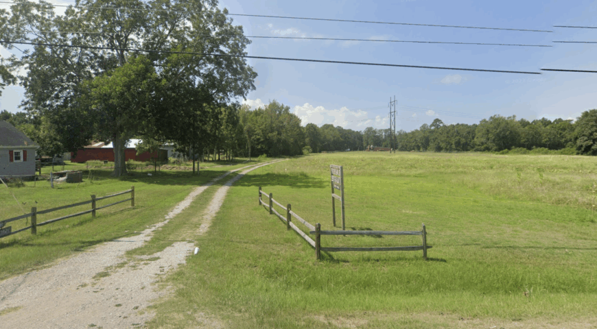
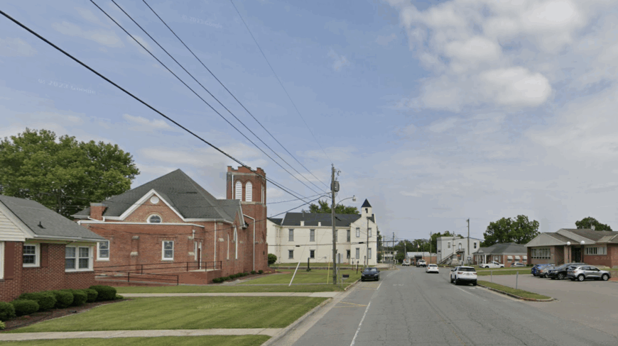
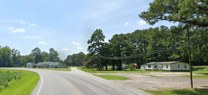
19. Powellsville – One-Street Stillness South of Ahoskie
🔥 Would you like to save this?
Powellsville rests quietly in Bertie County, surrounded by fields that stretch in every direction and roads that seem to lead into sky and soil. It’s a small town where life moves with the seasons—marked by planting, harvest, and the steady rhythm of rural days.
With only a few streets, a school, and front porches shaded by tall oaks, Powellsville feels tucked gently into the land, far from highways and crowds. You can drive beneath open skies, visit nearby historic towns, or simply sit and listen as the wind moves through rows of corn and cotton.
Farming remains the backbone here, along with a strong sense of community that runs deep and quiet. There’s nothing hurried, nothing forced. Powellsville is the kind of place where time slows naturally, and each day feels rooted in something lasting.
Where is Powellsville?
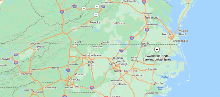
Powellsville is tucked into the quiet farmland of northeastern North Carolina, in Bertie County, where open fields meet stands of pine and cypress. It’s about 10 miles southeast of Ahoskie, reached by NC-42 and local roads that stretch past cotton fields, old barns, and country churches.
The approach is slow and steady, with the landscape wide and still before the small town emerges. Surrounded by rural calm and rooted in tradition, Powellsville feels like a peaceful stop between fields—humble, quiet, and far from the rush.
18. Mamie – Marsh-Skirted Stillness in Lower Currituck
Mamie sits quietly along the edge of Currituck Sound, where marsh grasses sway with the tide and the horizon feels stitched between water and sky. With no main street and just a scattering of homes along narrow roads, it feels more like a whisper than a town—tucked away from the world, known mostly to those who’ve always been here.
The air carries salt and birdsong, and the stillness is only broken by the rustle of reeds or the occasional hum of a boat in the distance. You can fish the nearby canals, watch herons lift from the shallows, or drive scenic backroads that pass between farm fields and wild wetland.
Life here is rooted in the rhythms of water, family, and land—quiet, steady, and unbothered by change. Mamie doesn’t draw attention; it keeps its peace close. It’s the kind of place where the quiet feels natural, and the view out your window stretches all the way into calm.
Where is Mamie?
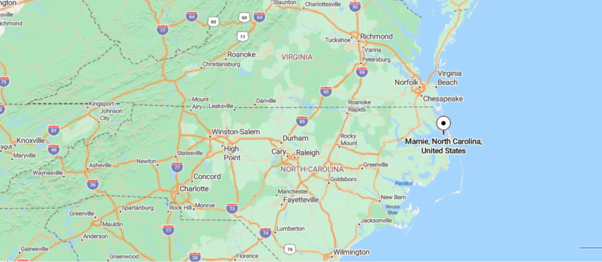
Mamie is a small unincorporated community in Currituck County, northeastern North Carolina, situated within the rural township of Poplar Branch near the coastal soundlands. It lies about 8 miles northwest of Kitty Hawk and roughly 5–6 miles west of Duck and Southern Shores, accessed via local lanes branching off from US 158 and NC‑12 that meander through pine groves, open farmland, and tucked-away residential pockets.
The journey into Mamie feels gentle and gradual: from the main road onto narrower country roads shaded by trees, with the coastal breeze faint but constant. Hushed by marsh and forest, Mamie feels quietly sheltered—a small, overlooked place gently held between land and water.
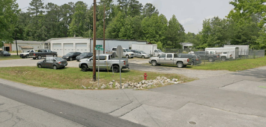
17. Gatesville – Riverfront Stillness Behind the Courthouse
Gatesville sits quietly along the bend of Bennetts Creek, surrounded by cypress swamps, farmland, and the soft hush of northeastern North Carolina’s rural heart. As the county seat of Gates County, it’s modest and unassuming—just a few government buildings, old homes shaded by oaks, and roads that slip gently into forest and field.
Though small, it carries a strong sense of place, where local history lingers in brick courthouses and stories passed from porch to porch. You can paddle the slow-moving creek, explore the backroads near the Great Dismal Swamp, or visit the old jail museum that whispers of centuries past.
Agriculture and small-town services shape daily life, quiet and steady as the land itself. Gatesville isn’t flashy—but its quiet feels intentional, like something preserved on purpose. It’s the kind of place where life holds still just long enough for you to notice the beauty in its stillness.
Where is Gatesville?
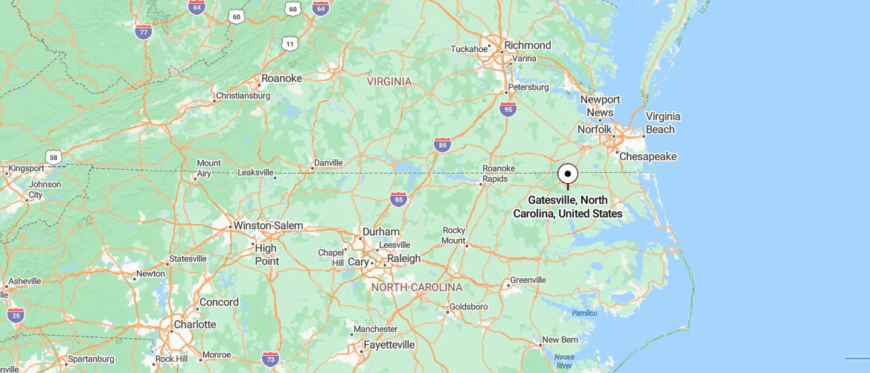
Gatesville lies in the far northeastern corner of North Carolina, serving as the county seat of Gates County close to the Virginia state line. It’s roughly 25 miles northeast of Elizabeth City, accessible via US‑158 and NC‑37 through open farmland and quiet forested stretches.
Taking the highway through gently rolling rural roads, the drive gradually narrows until the courthouse and a smattering of historic storefronts emerge around the town square. Firmly rooted in agrarian rhythm and edged by the Great Dismal Swamp, Gatesville feels like a still pocket of time—grounded, reflective, and softly apart from the wider world.
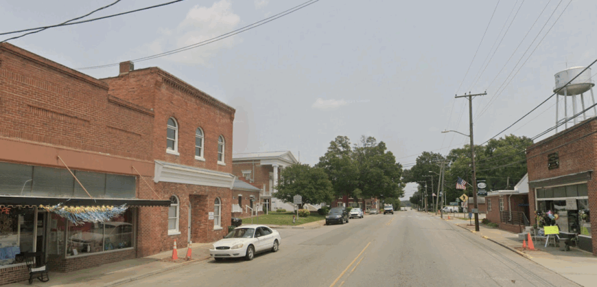
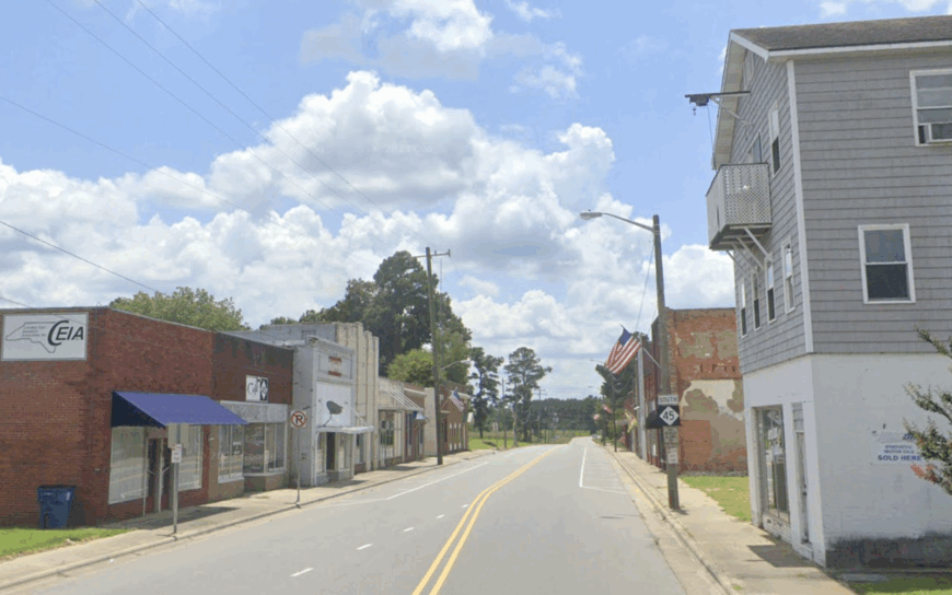
16. Rich Square – Old Bricks and Empty Blocks
Rich Square rests in the flat, open lands of Northampton County, where cotton fields stretch wide beneath a sky that seems to go on forever. Once a bustling hub for rail and agriculture, the town now moves at a gentler pace—its quiet streets lined with historic homes, aging storefronts, and echoes of a busier past.
There’s a stillness here, the kind that settles in softly and stays, shaped by deep roots and steady hands. You can explore local churches with long histories, drive scenic backroads through farmland, or visit small-town events where neighbors still gather like family.
Farming remains the backbone of the community, alongside a spirit of resilience that carries forward through generations. Rich Square doesn’t rush to be seen—it simply endures. It’s the kind of place where the land remembers, and the quiet leaves room for reflection.
Where is Rich Square?
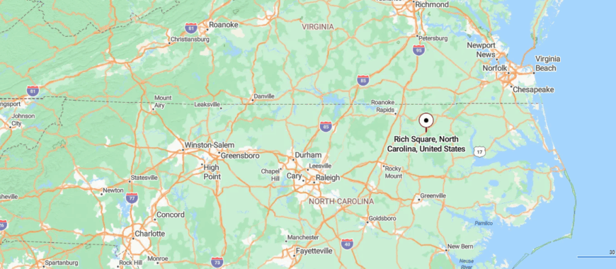
Rich Square is nestled in northeastern North Carolina’s Northampton County, near the Virginia state line where open farmland stretches toward low coastal plains. It’s about 25 miles northeast of Elizabeth City, accessible by driving along US 158, then turning onto NC 561 and NC 305 through gently rolling fields and stands of pine.
The journey moves steadily from highway to two‑lane local roads, gradually softening into a quiet town with historic storefronts and old Quaker‑founded landmarks. With its agricultural roots, wide skies, and serene stillness, Rich Square feels like a peaceful outpost between history and horizon.
15. South Mills – Canal-Guarded Pocket on the Dismal Swamp Trail
South Mills rests just above the Great Dismal Swamp, where canals slip through cypress shadows and the air hangs thick with quiet. Tucked into the far northeastern edge of North Carolina, it’s a place shaped by water and trees—isolated not by distance, but by the feeling that time slows as soon as you arrive.
The village hums with history, from the lock system on the Dismal Swamp Canal to Civil War trails that wind through the woods. You can kayak past moss-draped branches, walk the canal towpaths, or explore the nearby state park where nature wraps around you like a hush.
Life here leans into the land and water, with a rhythm shaped by boating, tourism, and a small-town steadiness that holds firm. South Mills doesn’t need to say much—it lets the swamp do the talking. It’s the kind of place where the stillness runs deep, and every breeze feels like part of an old story.
Where is South Mills?
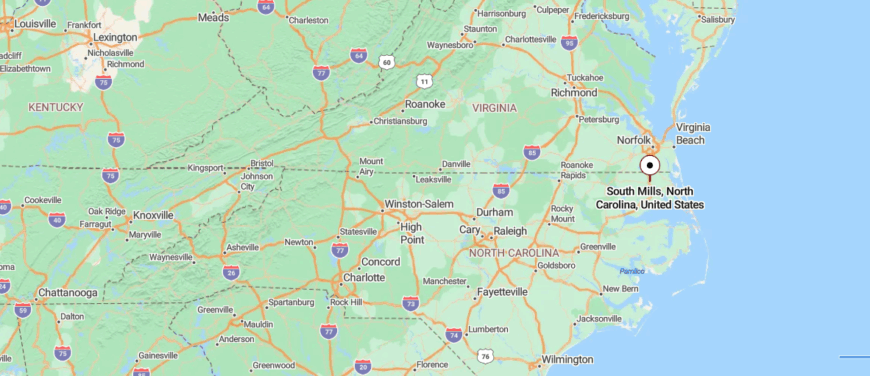
South Mills is tucked into the northeasternmost edge of North Carolina, in Camden County just shy of the Virginia line. It sits only about 15 miles north of Elizabeth City, reachable by following U.S. 17 and NC 343 through open farmland and alongside the historic Dismal Swamp Canal.
The road gently curves past wooded wetlands and quiet canal locks, narrowing into a peaceful stretch before you arrive under still skies. With its riverside hush, canal-side history, and few modern distractions, South Mills feels quietly set apart—close enough to reach, but remote enough to let the world slip away.
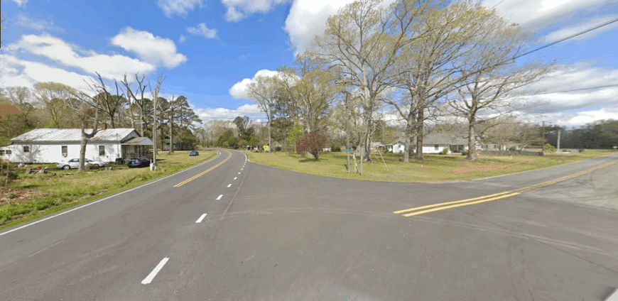
14. Jackson – Brick-Paved Silence in Northampton’s Heart
Jackson, North Carolina sits gently in the heart of Northampton County, where courthouse bells still echo through tree-lined streets and the past feels close enough to touch. As one of the state’s oldest towns, its charm lies not in bustle but in its quiet pride.
Surrounded by wide farmland and old pecan trees, Jackson feels tucked into a slower rhythm shaped by tradition and soil. You can stroll through its historic district, visit the 1850s courthouse museum, or drive through miles of open countryside where cotton and peanuts still shape the seasons.
Government, farming, and community life hold the town steady, rooted in a deep respect for its own history. Jackson doesn’t try to impress—it simply stands firm. It’s the kind of place where time feels loyal, and the quiet reminds you that some things are meant to last.
Where is Jackson?
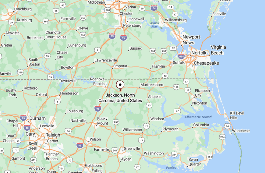
Jackson sits in southwestern Northampton County, North Carolina, on U.S. 158 about 13 miles south of the Virginia state line. As the county seat, it stands amid farmland and pine stands between the Albemarle Sound lowlands to the east and the Roanoke Rapids area to the west.
The town lies roughly 17 miles southeast of Roanoke Rapids, reached by following US 158 through pine groves and past cotton fields. Edenton is about 51 miles farther southeast via NC 305 and NC 35, a drive that crosses open lowlands, historic crossroads, and gentle river crossings.
13. Roduco – Whispering Pines in Rural Gates County
🔥 Would you like to save this?
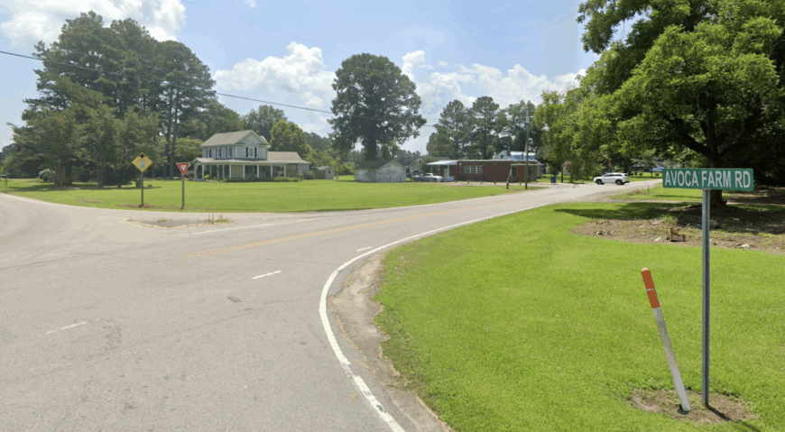
Roduco rests in the quiet northeastern corner of North Carolina, a small dot on the map where pine woods meet open farmland and the roads stretch long and empty. With no main strip and only a handful of homes, it feels more like a memory than a destination.
The wind moves softly through the trees, and the landscape hums with the gentle rhythm of rural life. You can drive for miles without seeing a storefront, only fields, old barns, and the occasional deer crossing at dusk.
Farming and forestry shape what little industry remains, with daily life grounded in land and legacy. Roduco doesn’t ask to be found—it simply is. It’s the kind of place where silence feels like company, and the land speaks louder than words ever could.
Where is Roduco?
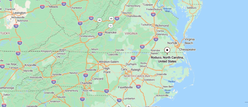
Roduco is a small, rural community in northeastern Gates County, North Carolina, about 5 miles northwest of Gatesville and 15 miles from Ahoskie. It’s reached by turning off U.S. 158 onto quiet country roads that wind through farmland and woods.
The drive is slow and open, with scattered homes and wide fields. With fewer than 200 residents, Roduco feels like a quiet edge of the map—simple, still, and far from the rush.
12. Merry Hill – Blufftop Tranquility by the Albemarle Sound
Merry Hill unfolds quietly along the Albemarle Sound, where farmland meets water and the sky feels wide enough to hold every kind of stillness. Tucked into the eastern edge of Bertie County, it’s a place where roads curve past cotton fields, and the breeze carries the scent of salt, soil, and pine.
There’s no town square, just country roads, family farms, and the slow rhythm of life lived close to the land. You can fish or kayak at Scotch Hall Preserve, watch the sun dip behind the trees lining the sound, or simply sit on a porch and listen to nothing at all.
Farming remains the lifeblood here, along with a quiet pride that runs deep through generations. Merry Hill doesn’t try to be anything but itself—humble, rooted, and peaceful. It’s the kind of place where the horizon always feels just within reach, and the quiet holds more than it says.
Where is Merry Hill?

Merry Hill is a quiet community in eastern Bertie County, North Carolina, near where Salmon Creek meets the Chowan River. It’s about 30 miles southwest of Edenton, reached by U.S. 17 and NC‑45 through open farmland and wooded bends.
The road narrows into calm country lanes, passing creeks and historic homesteads. With its waterside setting and wide-open skies, Merry Hill feels peaceful, grounded, and far from the noise.
11. Chapanoke – Forgotten Fork Between Fields and Pines
Chapanoke rests quietly in the open lowlands of northeastern North Carolina, where fields stretch wide and the breeze moves slow across flat, fertile ground. Tucked between Hertford and Elizabeth City, it’s more crossroads than town—just a handful of homes, farmland, and memory wrapped in sky.
There’s no main street, no storefronts—just country roads that hum with the quiet of passing time. You can drive past fields of corn and soybeans, watch the light shift over the landscape, or catch sight of deer slipping through the trees at dusk.
Life here is shaped by agriculture and deep local ties, steady as the soil beneath it. Chapanoke doesn’t raise its voice—it simply endures. It’s the kind of place where stillness feels familiar, and the land seems to remember everything.
Where is Chapanoke?
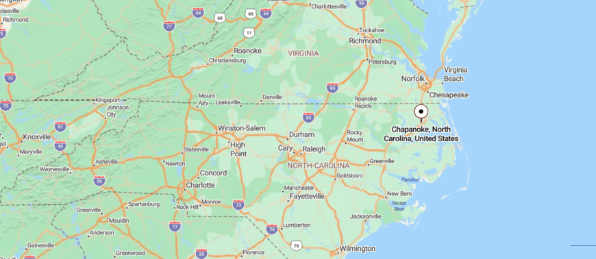
Chapanoke is tucked into the coastal plain of northeastern North Carolina, within Perquimans County just a few miles west of Elizabeth City and near the Albemarle Sound. It lies only about 6–7 miles from Elizabeth City and is accessed via U.S. 17 before turning off onto quiet country lanes through farmland, marshes, and wooded wetlands.
The roads narrow and curve past canal locks and historic fields, gently drawing you into this low‑lying place at only 9 feet above sea level. With its marsh-fringed stillness, scattered homesteads, and distant hum of the sound, Chapanoke feels deeply secluded—still, wet, and softly held apart from the rush beyond.
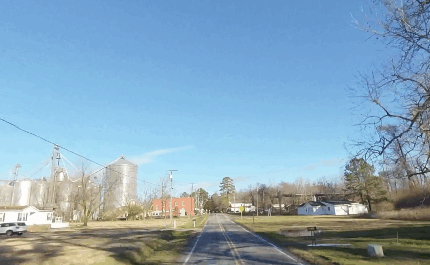
10. Colerain – Riverside Solitude along the Chowan
Colerain holds fewer than 200 permanent residents, making every front porch a front-row seat to calm river views. Locals fish for striped bass at the public pier on Wagstaff Lane, browse handmade quilts at the weekly farmers market, and gather for hushpuppies during the summertime fish fry at Colerain Beach.
Farming and small timber outfits provide most paychecks, while a boutique catfish processor ships fillets throughout the Mid-Atlantic. Bluffs rising almost twenty feet above the Chowan River shelter cottages from floodwaters and outside sightlines, adding a layer of privacy rarely found so close to the water.
There is no grocery store in town and no hotel in a twenty-mile radius, which prevents weekend crowds from piling in. With forest covering half the surrounding land, evenings settle into little more than cicadas and the distant call of a barred owl.
Where is Colerain?
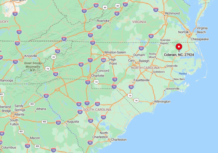
Colerain sits in northern Bertie County, roughly halfway between Edenton and Windsor. The Chowan River curves along its eastern edge, and miles of mixed hardwood forest separate the village from the nearest four-lane highway.
Drivers reach the town by following NC-45, a two-lane road that meanders through cotton fields and cypress bottoms. Those arriving by boat tie up at the modest public ramp, then walk uphill to find almost everything on a single tree-lined street.
9. Maple – Currituck County’s Canal-Laced Countryside
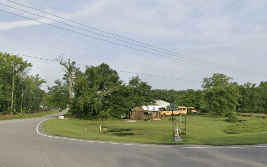
About 1,300 people live among the fields and drainage ditches of Maple, though one could pass through at noon and see only egrets stalking the canals. Residents kayak the brackish water beside Maple Park, ride horses at the Currituck Rural Center, and hunt whitetails along longleaf pine breaks that muffle road noise.
Agriculture and the county’s small regional airport create a limited job base, with most commuters headed north to Virginia shipyards or south to tourism hubs on the Outer Banks. Tall reeds, patchy maritime forest, and a twelve-mile buffer from any commercial strip sever Maple from the hum of US-158.
Streetlights are scarce, and the prevailing sound at dusk is wind sliding across corn tassels. Even the Coast Guard auxiliary airstrip, a local landmark, sees fewer touch-and-go maneuvers each year, preserving the hush.
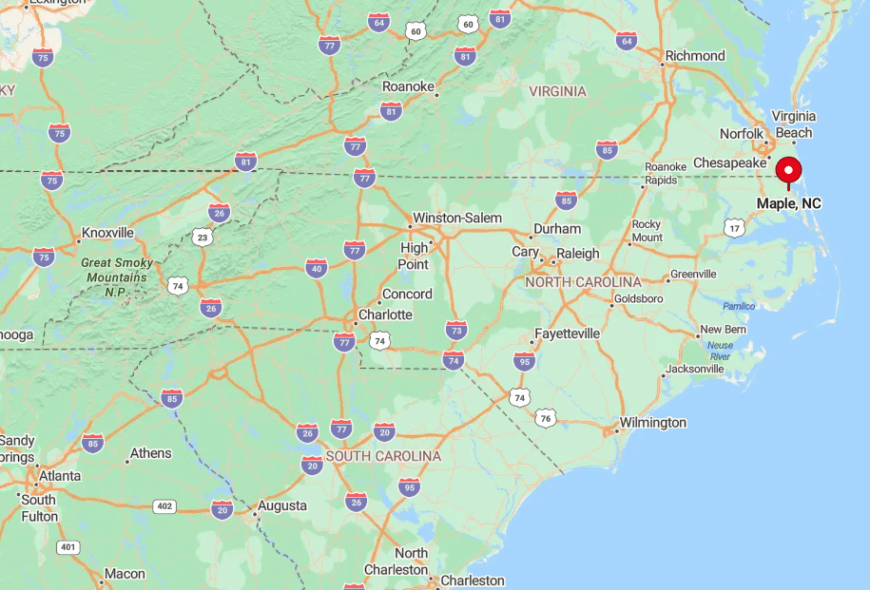
Where is Maple?
🔥 Would you like to save this?
Maple lies on the mainland side of Currituck County, west of the Currituck Sound and east of the Great Swamp Canal system. Its flat terrain, stitched with man-made waterways, creates a natural acoustic barrier that keeps passing motorists out of earshot.
NC-168 delivers visitors, yet the turnoff onto Maple Road feels like stepping behind a curtain once tall pines close overhead. Most newcomers rely on GPS, since no directional sign larger than a mailbox flag points the way.
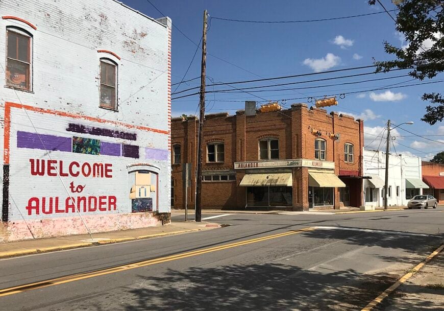
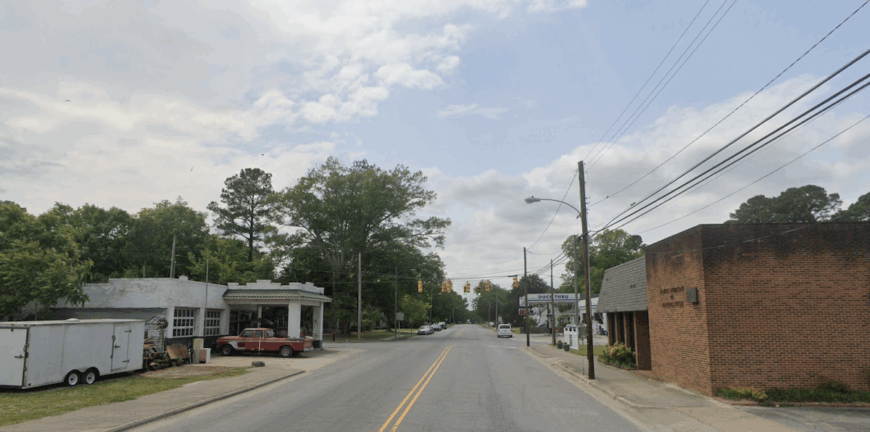
8. Aulander – Bertie County’s Oak-Shaded Hideaway
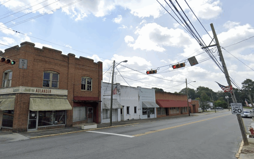
Aulander’s population hovers near 800, and the slow-moving Main Street shows little change from the 1950s. Residents visit the volunteer-run Garrett-Thompson Museum, sip sweet tea during Friday night bluegrass jams at the town hall, and tend extensive backyard gardens fed by sandy loam soil.
Row crops and a peanut shelling cooperative still drive the local economy, though a progressive solar farm outside town hints at new income streams. A thousand-acre belt of soybeans, cotton, and swamp blocks sightlines to the next settlement, locking in remarkable quiet once day laborers leave the fields.
There are no chain stores, so the absence of neon leaves the skies almost pitch-black after sunset. Crickets and an occasional freight train echo louder than conversations, underscoring the seclusion.
Where is Aulander?
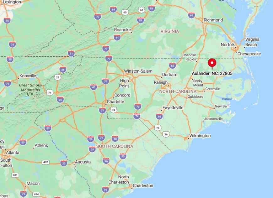
Aulander rests in western Bertie County, twenty minutes south of the Cashie River. The flat river plain funnels noise away, and the nearest divided highway sits fifteen miles distant.
Visitors exit US-13 onto St. John-Millennium Road and follow a patchwork of farm lanes that narrow the deeper one drives. Reliable cell service flickers by the last bend, reminding guests they have stepped off the main grid.
7. Knotts Island – Marsh-Rimmed Escape on Currituck Sound
Roughly 2,100 residents share Knotts Island’s orchards, tidal marsh, and single convenience store. Popular pastimes include birding at Mackay Island National Wildlife Refuge, picking peaches at Martin Farm and Winery, and casting for red drum from sand spits locals reach by jon boat.
Jobs revolve around boutique agriculture, refuge management, and a small craft seafood trade that ships blue crabs to Norfolk restaurants. Salt marsh surrounds the island on three sides, while the fourth is cut off by a broad expanse of private hunt club land, isolating homes on one-acre lots from mainland traffic.
Even though Virginia Beach skyscrapers are visible across the water on clear days, the ferry and a single causeway limit access. The soft slap of waves against Spartina grass replaces car horns, reinforcing the separation.
Where is Knotts Island?
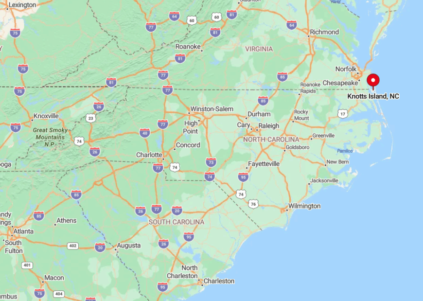
The island straddles the North Carolina-Virginia line in Currituck Sound, accessible from the south via a free state ferry that departs Currituck twice daily. High marsh and open water act as natural buffers, with only Princess Anne Road connecting the north end to Virginia’s rural back pocket.
Visitors who miss the ferry must loop fifty miles by car, underscoring how geography protects the community’s quiet. Even parcel delivery vans arrive on a predictable midday crossing, leaving mornings eerily still.
6. Weeksville – Pasquotank County’s Riverside Retreat
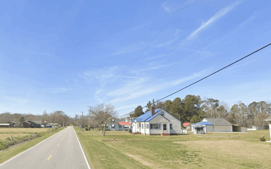
Weeksville counts about 550 year-round residents spread across a checkerboard of cornfields and river lots. Locals launch kayaks on the Pasquotank River, explore the historic airship hangar at the old Naval Air Station, and gather for crab boils at a backyard screen porch rather than a public café.
Grain elevators and a modest boatworks support a handful of paychecks, while most households rely on Elizabeth City for employment. Broad tracts of open farmland combined with bends in the river create sight and sound barriers that keep tourism traffic away.
Homes sit behind cedar windbreaks, and the absence of streetlights preserves dark skies ideal for meteor showers. Only the infrequent drone of a vintage warbird practicing touch-and-go landings disrupts the hush.
Where is Weeksville?
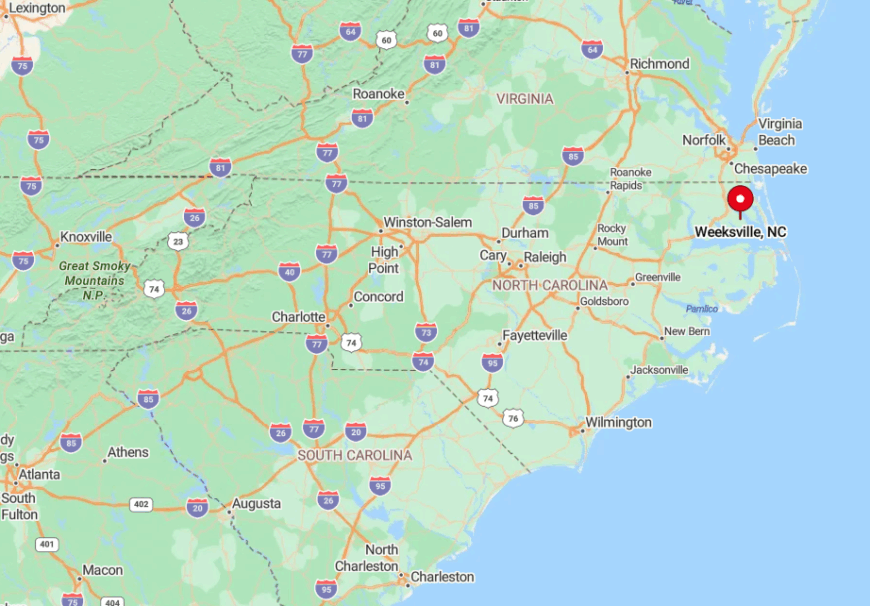
Weeksville occupies the eastern fringe of Pasquotank County, ten miles south of Elizabeth City along NC-344. The river loops form a near peninsula, isolating the settlement on three sides with water and marsh.
Visitors travel a two-lane road bordered by endless soybeans before spotting the landmark blimp hangar that signals arrival. Beyond that rusting giant, the turns grow sparse and the GPS directions clear out as cellular towers fade.
5. Tyner – Back-Road Bliss in Chowan County
Tyner’s permanent count sits close to 400, yet its network of gravel lanes makes the village feel even smaller. Residents hunt turkey in the Hoffman Forest Game Lands, cool off in private farm ponds, and volunteer at the one-room post office that doubles as an information hub.
The local economy rests on row crops, small sawmills, and seasonal guide services for duck hunters who know the secret potholes hidden in nearby pocosins. Deep woods, broad farm lots, and total absence of commercial lighting create black-sky nights perfect for backyard telescopes.
The few through roads are so lightly traveled that deer linger in ditches at dusk, undisturbed by engines. Mailboxes stand half a mile apart, giving newcomers a quick lesson in rural quiet.
Where is Tyner?
Tyner lies northwest of Edenton in central Chowan County, roughly eight miles from any stoplight. Thick loblolly stands wrap the community on all sides, muffling the sound of distant farm machinery.
Access comes via NC-32, then a web of county roads that narrow into gravel before reaching the village core. Those who miss the final turn often wait at a field lane to regain cell coverage, then backtrack by tree-line landmarks locals use instead of signs.
4. Como – Hertford County’s Tiny Pines-Fringed Village
Fewer than 100 residents live in Como, filling century-old farmhouses that sit as close to the Virginia line as they do to the Meherrin River. A pocket park beside the volunteer fire station hosts the annual sweet-potato bake-off, while birdwatchers search for prothonotary warblers along Horse Swamp Road.
Farming and forestry dominate the slim payroll, with a boutique sawmill producing kiln-dried heart pine flooring shipped nationwide. Loblolly pines form a dense ring around the settlement, and a fifteen-mile gap to the nearest four-lane road seals off most engine sound.
Nights grow silent enough for residents to hear owls glide overhead. Streetlights end at the Methodist church, where gravel shoulders replace sidewalks.
Where is Como?
Como sits in northern Hertford County, less than two miles from the Virginia border. The absence of a river bridge or rail line forces travelers onto lightly marked county roads that parallel abandoned tobacco barns.
Tall pine plantations line both approaches, creating a visual tunnel that hides the village until the last minute. Drivers leaving US-258 often remark how quickly cell reception dips once the asphalt narrows.
3. Gum Neck – Tyrrell County’s Peninsula of Pure Quiet
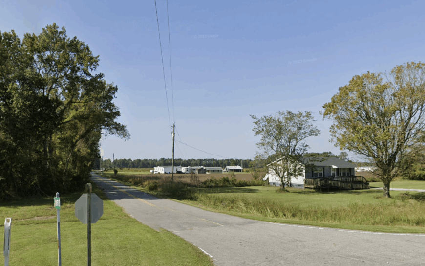
Gum Neck’s isolated population of roughly 150 people spreads along a skinny spit between the Alligator River National Wildlife Refuge and the Albemarle Sound.
Fishing skiffs idle toward catfish nets at dawn, deer hounds bay across miles of cypress swamp, and locals trade news at the community center that doubles as a hurricane shelter.
A smattering of commercial blue-crab traps and guided black-bear hunts supply income, though most families rely on satellite offices or seasonal tourism from Nags Head, an hour away.
Only one two-lane road threads the peninsula, bordered by impenetrable pocosin where cell towers would sink, making the area feel cut off from time.
Cottages often stand a mile apart, separated by curtain walls of gum and pond pine, ensuring privacy. Night air carries the low rumble of bull alligators, a reminder that wild nature is the nearest neighbor.
Where is Gum Neck?
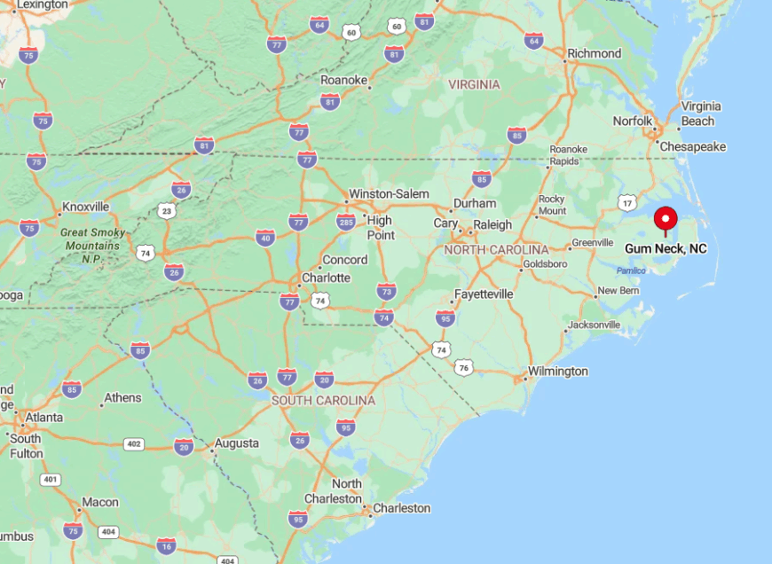
The community lies in southern Tyrrell County, jutting into the Albemarle Sound like a weathered thumb. Water and swamp flank both sides, so the sole access route is South Gum Neck Road off US-264 near Kilkenny.
Drivers follow thirteen miles of straight asphalt with no gas station or store before the tree canopy opens to sound views. During heavy rain, road edges flood, reinforcing how geography guards the settlement.
2. Corapeake – Gateway to the Great Dismal Swamp
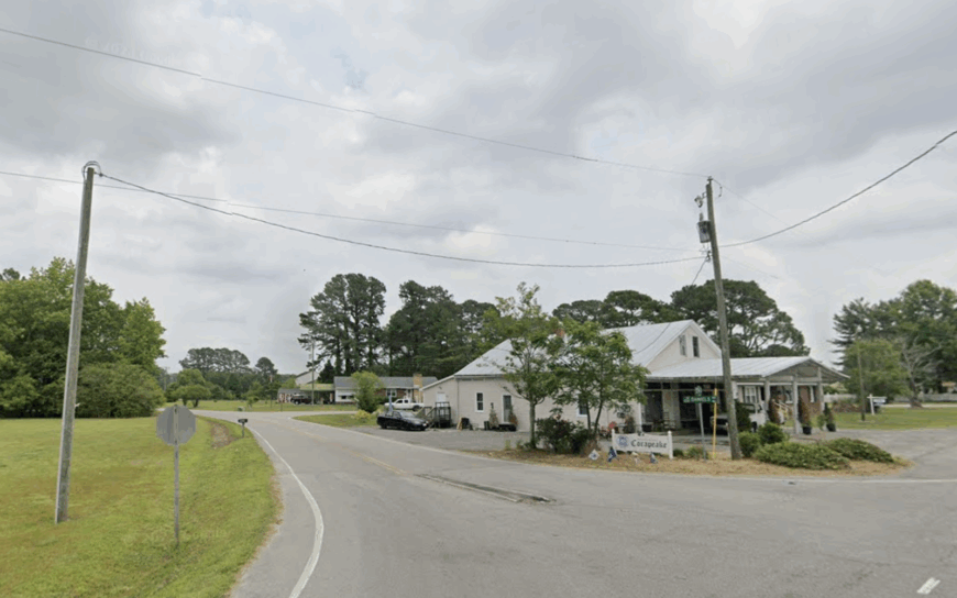
Corapeake counts just under 300 residents who share a patchwork of farms bordered by the Great Dismal Swamp National Wildlife Refuge. Locals ride four-wheelers on sandy firebreaks, attend gospel sings at the 1925 brick church, and kayak Lilly Creek where otters outnumber people.
Peanut farming and low-impact forestry feed the local tax base, while a small honey cooperative bottles tupelo blends prized in coastal markets. Forest buffers, zero through-traffic, and the continuous hum of swamp insects cancel most outside noise, making Corapeake feel invisible to the modern world.
A single gas station doubles as both a store and a social hub, and it closes by dusk. After that, darkness claims roads so completely that visitors often pull over to admire the starlight.
Where is Corapeake?
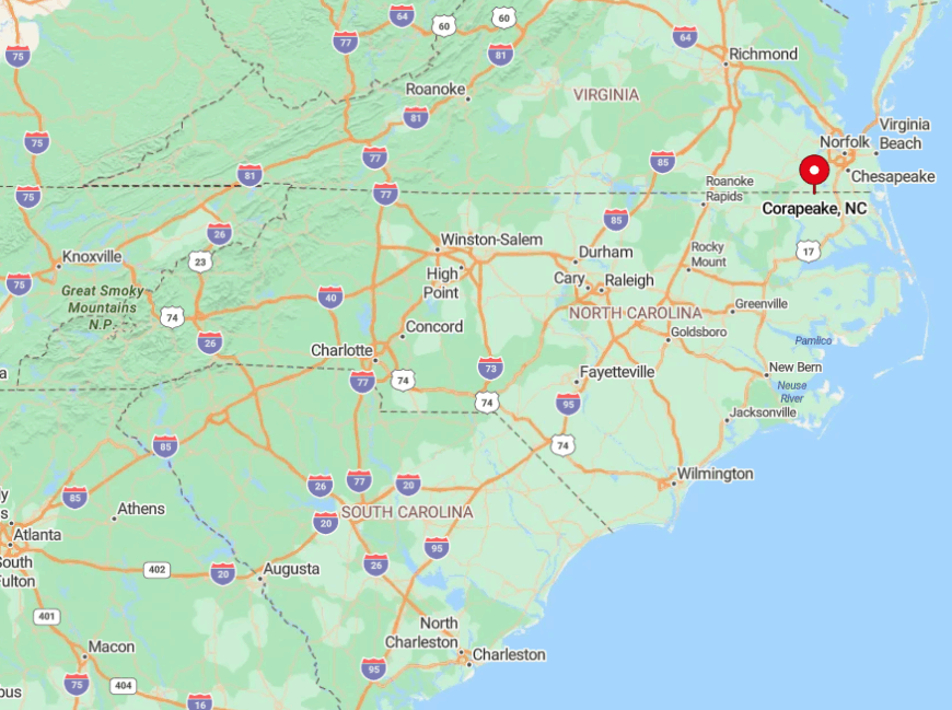
Corapeake rests in northern Gates County, steps from the Virginia state line and the edge of the Great Dismal Swamp. Thick wetland forest blocks alternate routes, so NC-32 and NC-158 serve as the only reliable access corridors.
Drivers heading south from Suffolk, Virginia, cross county lines without seeing a welcome sign, then notice reception fading as the swamp canopy encloses the pavement. The last mile turns unmarked, a fitting entry to one of the region’s quietest enclaves.
1. Belvidere – Perquimans County’s Quaker Farmland Haven
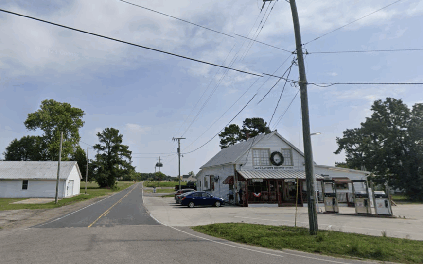
Belvidere, home to roughly 200 residents, is best described as a crossroads framed by endless soybeans and historic Quaker meetinghouses dating back to 1701.
Activities center on heritage: visitors tour the Old Brick House, trace family names in the Up River Cemetery, and paddle Perquimans River backwaters that slip through forgotten rice canals.
Farming remains the primary industry, though a growing community of telecommuters enjoys reliable fiber optics installed to support precision agriculture.
Vast multi-acre homesteads stretch between field edges, and the nearest convenience store sits several miles away in Hertford, giving everyday life a purposeful slowness.
Big skies greet sunrise without obstruction, and night offers unobstructed photo opportunities for astrophotographers chasing the Perseids. Without tourist routes nearby, only farm equipment and migrating Canada geese interrupt the solemn hush.
Where is Belvidere?
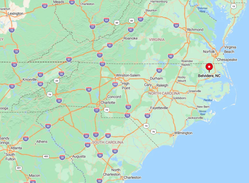
The village lies in northern Perquimans County, ten miles west of the Albemarle Sound and twenty miles south of the Virginia line. Open cropland forms a natural moat that hides the settlement from US-17 travelers headed to the Outer Banks.
Access comes by turning onto small numbered roads like SR-1201, where mailboxes outnumber houses and GPS often mispronounces the Quaker surnames on street signs. Anyone arriving after dark navigates by moonlight on unlit asphalt, realizing quickly why residents prize the privacy.


