🔥 Would you like to save this?
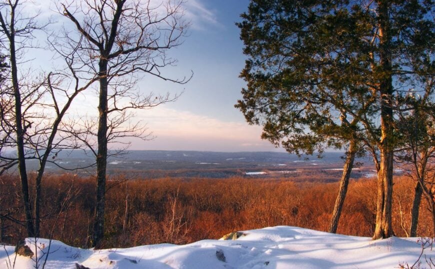
Northeast New Jersey is known for bedroom communities and busy toll roads, yet pockets of deep quiet still linger among the ridges, lakes, and river valleys. These hamlets sit beyond the commuter belt, where cell service flickers and gravel crunches under the tires.
Our list counts down 25 places where porch lights outnumber streetlights and night skies still showcase constellations. Each town offers a different flavor of escape, from a near-empty river outpost to wooded lake districts tucked behind switchbacks.
In order to come up with the very specific design ideas, we create most designs with the assistance of state-of-the-art AI interior design software.
Readers will find hidden picnic groves, silent reservoirs, and farm lanes that rarely see more than a handful of cars a day. With that, we begin the journey toward New Jersey’s quieter corners.
25. Lake Mohawk, Sparta Township – Alpine Village on a Private Shoreline
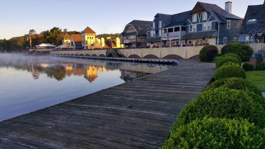
Lake Mohawk’s 2,500 residents live in a private lakeside community modeled after a Bavarian alpine village, where cobblestone plazas meet forested hills. Because access to the water and beaches is reserved for members, summer crowds never swell beyond what the shoreline can handle.
Residents boat, paddleboard, and fish in a lake ringed by strict building covenants that protect sightlines and preserve original architecture. Small cafés, a handful of boutiques, and the historic boardwalk form the social center, yet the lake’s long coves hide cabins deep in the pines. With no public boat launch and a gated marina, casual passersby rarely linger.
Night air carries the scent of pine and lake water, and the loudest noise after dark is the creak of a dock in the current. It’s the kind of place where a weekend visit can feel like a trip overseas without leaving Sussex County.
Where is Lake Mohawk?
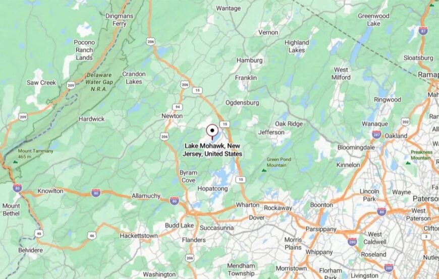
Lake Mohawk lies in the heart of Sparta Township, about 12 miles north of Interstate 80 and 15 miles from Newton. It’s reached via Route 181, which dips into a valley before winding along the lake’s edge.
The absence of major through roads around the water’s perimeter helps it stay calm and contained. Visitors arriving over the ridge get their first glimpse of rooftops tucked among evergreens, with the lake shining like glass in the distance.
24. Oak Ridge, Jefferson Township – Pine Barrens and Quiet Reservoir Shores
Oak Ridge’s 11,000 residents are spread widely across forested hills, hidden cul-de-sacs, and the shorelines of Green Pond and Echo Lake Reservoir. Despite its size, the commercial core is small—just a post office, a few delis, and a scattering of local shops—so the community retains a distinctly rural edge.
Trails weave through the Mahlon Dickerson Reservation, where oak and hickory close out the horizon. Birdsong and the smell of woodsmoke dominate over traffic noise, especially in winter when snow softens every sound. Residents hike, snowshoe, and kayak without ever leaving township lines, and many homes back directly onto preserved land.
The lack of direct highway frontage keeps Oak Ridge out of sight for most travelers. It’s a pocket of the highlands that feels more like an Adirondack village than a New York City suburb.
Where is Oak Ridge?
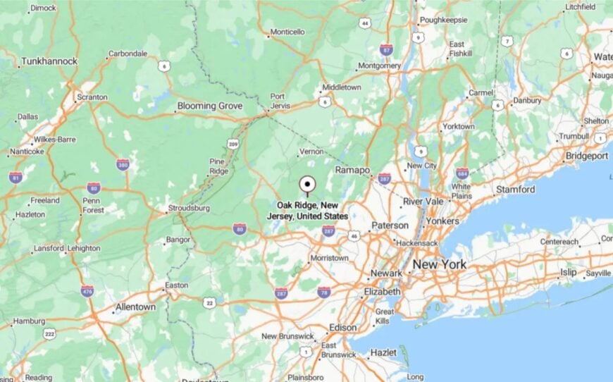
Oak Ridge straddles Morris and Passaic counties in northern New Jersey’s highlands region. It’s roughly 12 miles west of Route 23 and about 45 miles from midtown Manhattan.
Access comes via a series of county roads that climb and dip through wooded ridges. By the time you reach the center, the bustle of nearby suburbs feels worlds away.
23. Green Pond, Rockaway Township – A Crystal-Clear Private Lake in the Highlands
Green Pond’s shoreline is ringed by fewer than 300 homes, many passed down through generations, giving it the feel of a family summer colony frozen in time. The lake’s remarkable clarity—fed by mountain springs—draws swimmers, sailors, and ice skaters year-round.
As a private community, access is strictly limited, preserving a quiet unlike any public lake in the region. Residents gather for sailing regattas, beach bonfires, and cross-country skiing on unplowed winter lanes.
No commercial buildings break the wooded ridgeline, and the nearest grocery store is miles away. Streetlights are rare, leaving the Milky Way to spill across the sky on clear nights. It’s a place where life orbits around the water and the seasons.
Where is Green Pond?

Green Pond lies in the northern section of Rockaway Township, about 10 miles from Interstate 80. The only access road, Green Pond Road, threads through miles of forest and wetland.
Its single-point entry reinforces its seclusion, as you either live here or have a reason to visit. Cresting the final ridge, the view of still water framed by mountains marks the end of the road—and the start of a retreat.
22. Newfoundland – Where Three Counties Meet in the Pines
Newfoundland is a small crossroads village straddling Morris, Passaic, and Sussex counties, yet it feels far from anywhere. The heart of the hamlet holds a historic train station, tiny post office, and old houses shaded by tall pines.
With no large stores or chain restaurants, life moves at the pace of its two-lane roads. Residents hike in the nearby Pequannock Watershed, paddle quiet stretches of the Passaic River, and attend the annual dog show at the firehouse field.
Heavy snow can close roads for days in winter, keeping the world at bay. Newfoundland’s mix of forest, history, and small-town warmth gives it a charm that’s hard to replicate.
Where is Newfoundland?
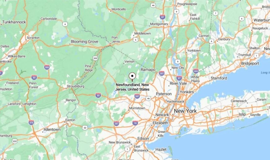
The village sits at the junction of Route 23 and Green Pond Road, about 35 miles from New York City. Surrounded by watershed lands, it has natural buffers that keep development light.
It’s reachable only by winding state and county roads, with forested hills on all sides. Those who stop find themselves in a pocket of quiet hidden in plain sight.
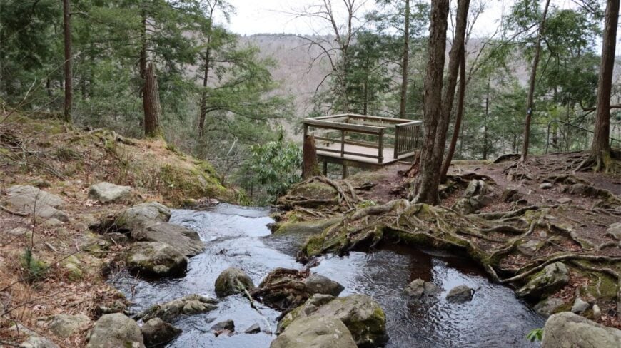
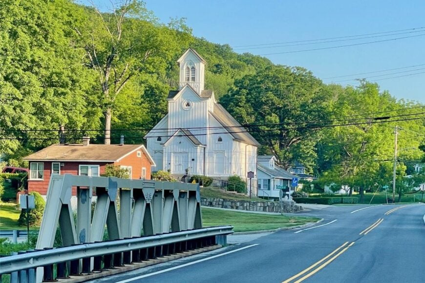
21. Layton – A River Hamlet with a 19th-Century Heart
Layton feels like a step back into the 1800s, with its cluster of historic homes, the preserved Layton General Store, and a church steeple rising above the treeline. The village is small enough that you can stroll from one end to the other in minutes, passing shaded porches and old stone fences.
Residents fish the Delaware, hike nearby Tillman Ravine, and stop for ice cream at the seasonal stand along Route 560. With no chain stores, no traffic lights, and limited cell coverage, the pace here is naturally unhurried.
Agriculture and small-scale tourism from hikers provide the modest local income. In autumn, the maples and oaks turn the village lanes into tunnels of gold and crimson. It’s the kind of place where the stillness feels like part of the landscape itself.
Where is Layton?
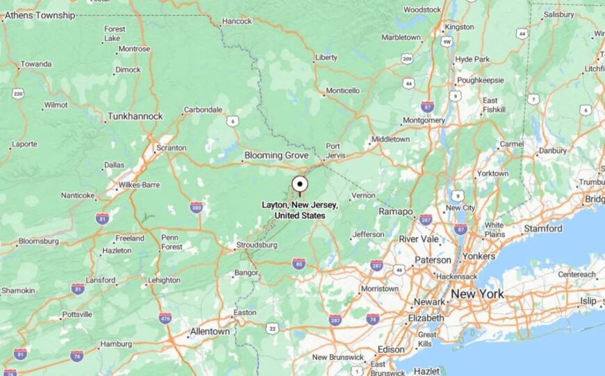
Layton sits in Sandyston Township, Sussex County, along Route 560 just east of the Delaware River and the Pennsylvania border. It’s about 8 miles west of Branchville, reached by winding country roads that cut through forest and farmland.
Protected parkland surrounds much of the area, limiting growth. Arriving here feels like crossing into a corner of New Jersey where time decided to leave alone.
20. Hibernia, Rockaway Township – A Mining Hamlet Turned Forest Refuge
Hibernia once buzzed with iron mining, but today its few streets are lined with historic homes and surrounded by Morris County forest. The old rail beds now form part of the Wildcat Ridge Wildlife Management Area, where black bears and bald eagles are more common than cars.
Residents hike to the ruins of the Hibernia mine, fish in Splitrock Reservoir, or explore the hawk watch at Wildcat Ridge. There’s no commercial center, and the nearest convenience store is miles away.
In autumn, the hills blaze with color, and in winter, the only sound might be snow sliding off a tin roof. Hibernia’s transformation from industry to sanctuary is complete.
Where is Hibernia?
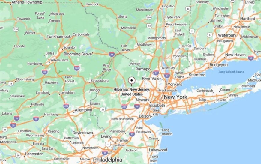
Hibernia lies off Green Pond Road in the northernmost part of Rockaway Township. It’s about 8 miles from Interstate 80 but separated by miles of steep, winding road.
The surrounding watershed and parklands keep it naturally insulated from development. Arriving here feels like stepping back into a slower, quieter era.
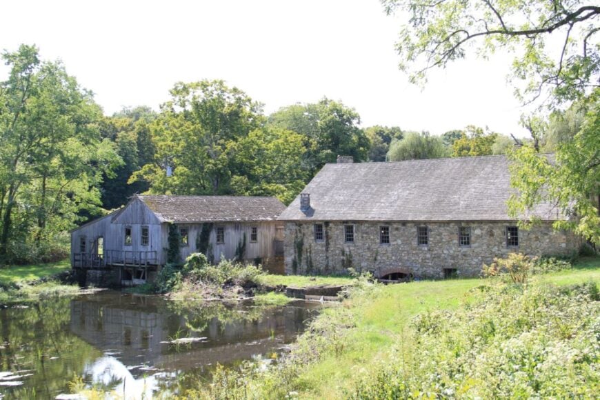
19. Waterloo Village, Byram Township – A Preserved Canal Town by the River
🔥 Would you like to save this?
Waterloo Village is a restored 19th-century canal town surrounded by Allamuchy Mountain State Park. Only a handful of caretakers and park staff live nearby, giving the area a stillness broken mainly by birdsong and the rush of the Musconetcong River.
Visitors explore stone gristmills, historic houses, and towpaths shaded by sycamores. Canoeing, hiking, and picnicking are favorite pastimes, with trails leading deep into the park’s wooded ridges.
The absence of modern buildings keeps the landscape historically intact. As twilight falls, the village lamps cast a golden glow that seems borrowed from another century.
Where is Waterloo Village?
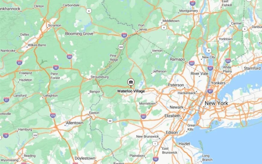
It’s located in Sussex County near the Stanhope border, just off Waterloo Road. The nearest major road is Interstate 80, a short drive away, yet the park’s boundaries and forest cover mute all highway noise.
Access is by a single entry road that winds past fields and the river. Once inside, you’re surrounded by history and nature in equal measure.
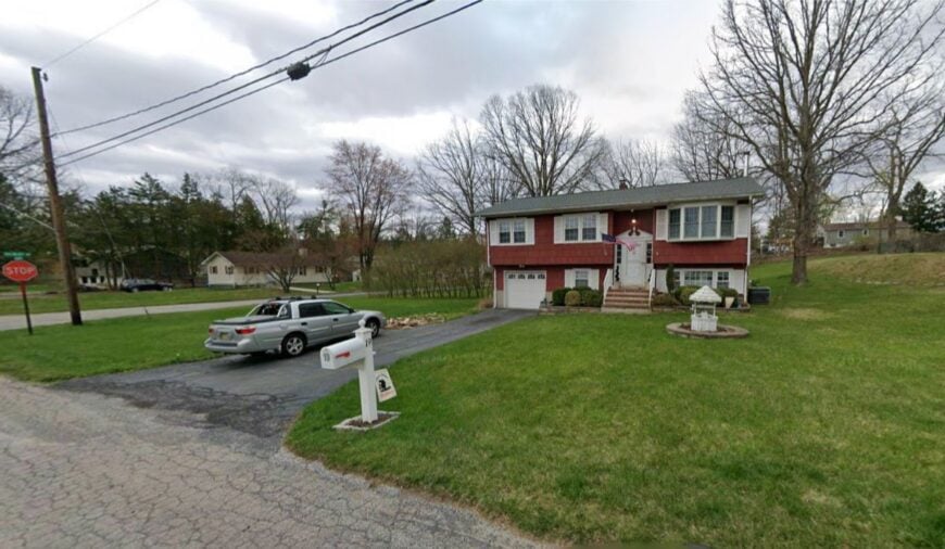
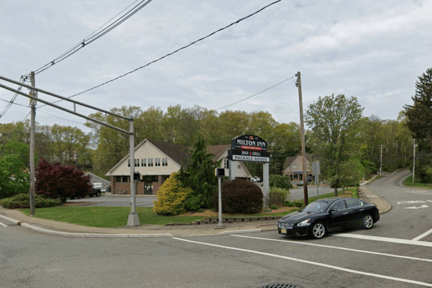
18. Milton, Jefferson Township – A Lakeside Corner with a Village Feel
Milton is a quiet section of Jefferson Township where the houses cluster near Lake Hopatcong’s northern coves but remain screened by maple and pine. Once a stop for vacationers arriving by train, it now serves mostly year-round residents who value its small-town atmosphere.
Locals fish from shaded docks, kayak in early morning calm, and walk to the historic general store for coffee. With no large commercial strip, traffic stays light and evenings are free of city glare. Many homes sit back from the road on wooded lots, giving privacy even within walking distance of neighbors.
The old lakeshore hotels are gone, but the slow pace and friendly nods endure. Milton is the sort of place where the lake’s changing light becomes the day’s main entertainment.
Where is Milton?
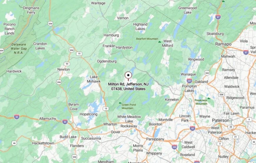
Milton lies on the northern end of Lake Hopatcong in Jefferson Township, Morris County. It’s about 5 miles west of Route 15, reached by winding residential roads that hug the shoreline.
Hills and the lake’s irregular shape limit through-traffic. By the time you reach the waterfront, you feel far removed from the suburban sprawl beyond the ridge.
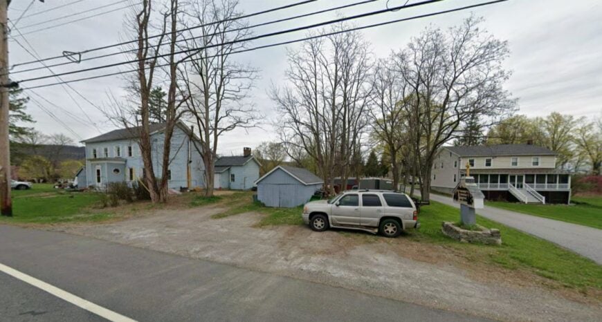
17. Vernon Valley – Meadows and Ridges at the State’s Northern Edge
Vernon Valley is a broad swath of farmland and low ridges in Sussex County, where dairy cows outnumber roadside mailboxes. Residents ride bikes along the Appalachian Trail corridor, pick blueberries in summer, and watch hot air balloons drift over fields.
The lack of large developments and the wide spacing between homes give it a pastoral calm. Small farmstands and family-run stables form the heart of local commerce.
Autumn brings a hush broken only by geese overhead and the crunch of leaves underfoot. Even with ski slopes nearby, the valley itself stays rooted in its agricultural rhythm.
Where is Vernon Valley?
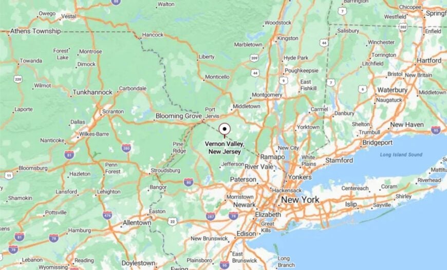
It sits in the northeastern corner of Sussex County, between the Pochuck and Wawayanda mountains. Access comes via Route 94 or smaller county lanes that thread through farmland.
The surrounding ridges screen it from busier neighboring towns. It’s close enough to reach from New York State, yet the moment you drop into the valley, the world feels far away.
16. Beemerville, Wantage Township – Fire Tower Views and Rolling Fields
Beemerville is best known for its historic fire tower, where sweeping views take in three states on a clear day. The hamlet itself is a scattering of homes along quiet roads that wind through cornfields and pasture.
Residents garden, keep small flocks, and hike the surrounding ridges for exercise and solitude. There’s no main street—just a few intersecting lanes and a volunteer firehouse.
The open skies and mountain backdrops give a sense of scale rare in this part of the state. On summer nights, you can hear crickets and the far-off bark of a dog, but not much else.
Where is Beemerville?

Located in Wantage Township, Beemerville sits near the northwest corner of Sussex County. It’s about 8 miles north of Route 23, reached by gently curving county roads.
The Kittatinny Mountains form a natural boundary to the west. The final stretch to town passes more barns than houses, hinting at its unspoiled character.
15. Hope – A Historic Moravian Village in the Hills
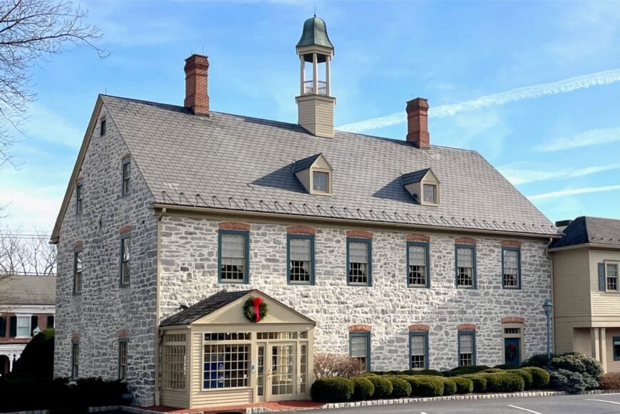
Hope retains its 18th-century Moravian layout, with stone houses and a central green surrounded by preserved farmland. The town is small enough that church bells carry across the fields, and most errands can be done on foot.
Visitors browse antique shops, tour the Moravian Grist Mill, or hike nearby Jenny Jump State Forest. Farming remains the quiet economic base, supplemented by heritage tourism.
With no big-box stores and minimal traffic, evenings are especially calm. It’s the kind of place where the rhythm of life matches the turning of the seasons.
Where is Hope?
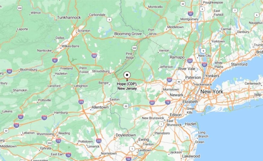
Hope is in Warren County, just south of the Sussex County line. Interstate 80 runs nearby, but the village is reached by smaller roads that loop through farmland first.
Its location in a shallow valley shields it from highway noise. Arriving feels like stepping into a preserved slice of early American history.
14. Liberty Township – Lakes and Woodland Hideaways
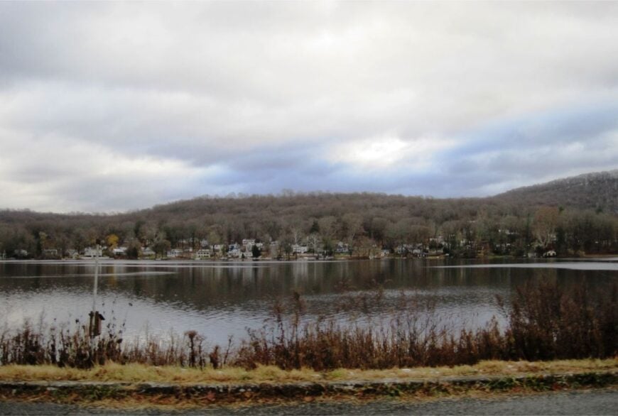
Liberty Township’s mix of small lakes, wooded ridges, and tucked-away neighborhoods makes it one of Warren County’s quietest spots. Residents swim or fish at Mountain Lake, hike the Paulins Kill trails, or simply sit on porches with a view of forested hills.
The community has no dense commercial district—just scattered businesses along rural roads. Many properties are wooded acreages, adding to privacy and wildlife sightings.
Autumn brings a blaze of color that reflects off still water. Even long-time residents say the township’s charm lies in its low-key, unhurried lifestyle.
Where is Liberty Township?
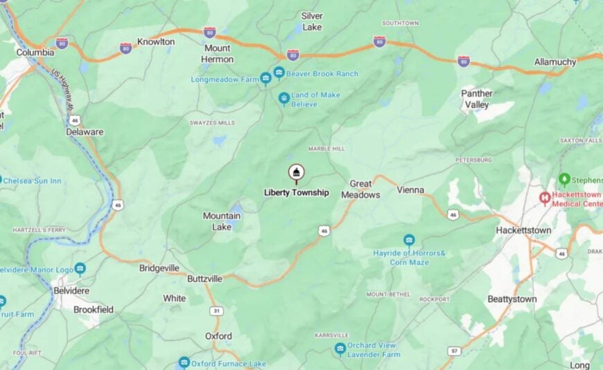
It’s in northern Warren County, about 10 miles south of Newton. Routes 46 and 519 provide the only direct access, with winding lanes leading deeper into residential areas.
Surrounded by ridges and lakes, it feels insulated from faster-paced neighbors. It’s close enough to major roads for convenience, yet far enough to remain a retreat.
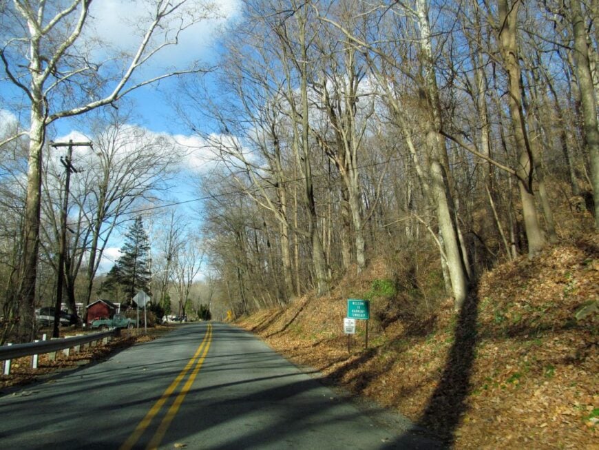
13. Harmony Township – River Bluffs and Farming Quiet
🔥 Would you like to save this?
Harmony Township stretches along the Delaware River, with a landscape of steep bluffs, fertile fields, and old barns. Locals enjoy fishing, cycling the river roads, and exploring preserved tracts that offer sweeping views across to Pennsylvania.
Agriculture and small-scale vineyards anchor the local economy. The lack of retail centers means the roads stay light on traffic.
Evenings bring sunsets that turn the river gold and the sky a soft violet. It’s a township that seems to resist the idea of rushing.
Where is Harmony Township?
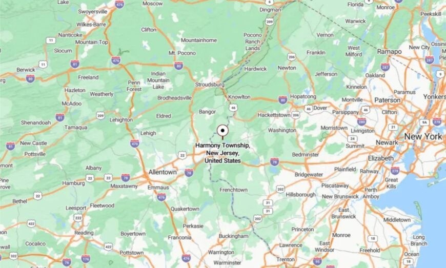
Harmony sits in western Warren County, south of Phillipsburg. It’s reached by Route 519, a two-lane road that hugs farmland and forest.
The river forms its western edge, with bluffs that deter large-scale development. Visitors arriving from the east cross ridge after ridge before dropping into its quiet valley.
12. Knowlton Township – Where the Delaware Meets the Mountains
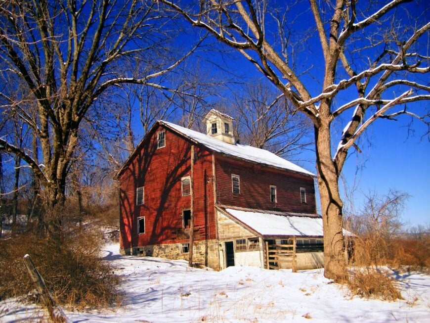
Knowlton Township blends mountain backdrops with riverfront stretches, creating natural buffers on all sides. Residents paddle quiet coves, hike to overlooks in the Delaware Water Gap, and wander old farm lanes bordered by stone walls.
There’s no real commercial strip, and most shopping requires a trip to neighboring towns. Historic houses dot the hillsides, many with views that haven’t changed in decades.
The blend of water, forest, and farmland gives it a layered beauty that encourages lingering. Even passing traffic slows to take in the scenery.
Where is Knowlton Township?
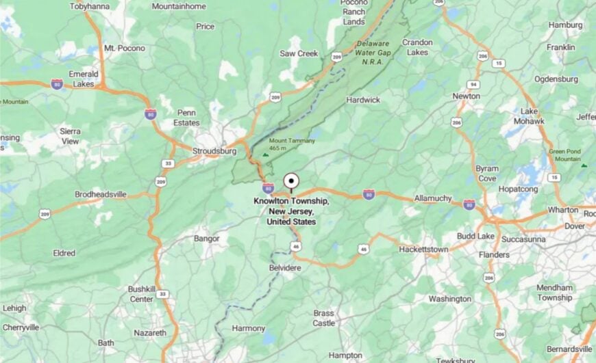
It lies in Warren County’s northwestern corner, bordering Pennsylvania along the Delaware River. Interstate 80 crosses near its southern edge, but much of the township is accessed only by back roads.
The Kittatinny Ridge rises to the east, further enclosing it. Entering from any direction feels like you’re slipping behind a natural curtain.
11. Frelinghuysen Township – Open Meadows and a Starlit Sky
Frelinghuysen Township’s rolling meadows and wooded ridges are home to fewer than 2,300 people, ensuring quiet roads and wide horizons. Residents garden, ride horses, and attend small community gatherings at the town hall.
The air carries the scent of wildflowers in summer and woodsmoke in winter. A handful of farms and family businesses make up the local economy, with conservation easements protecting large tracts of open space.
Nights are dark enough for clear stargazing, and mornings often arrive with a mist over the low fields. It’s a place where life slows to match the turning of the seasons.
Where is Frelinghuysen Township?
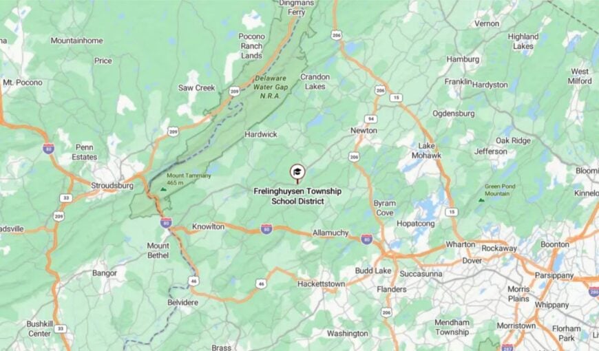
The township lies in Warren County, east of Blairstown and north of Route 94. Small county roads wind through hills and meadows to reach it.
With no major highways cutting through, it remains free from commuter traffic. Travelers cresting the ridges are greeted by views that seem to stretch all the way to the Delaware
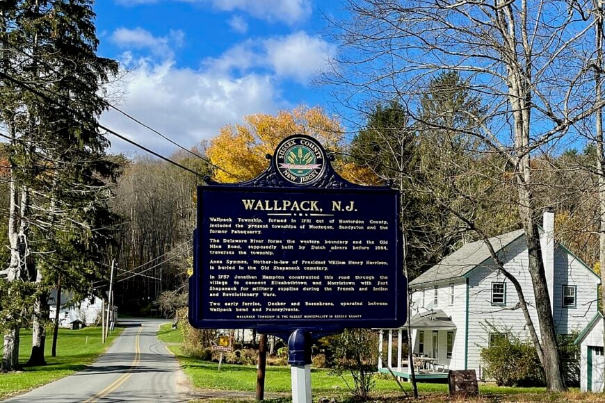
10. Walpack Township – A Two-Digit Population Hidden in the Delaware Water Gap
Fewer than a dozen residents maintain addresses in Walpack Township, giving the place an almost ghost-town feel. Visitors find unpaved lanes perfect for cycling past abandoned farmsteads, the preserved Van Campen Inn, and grassy meadows patrolled only by white-tailed deer.
Seasonal tourism tied to hiking, kayaking, and photography replaces any true local industry, as former farmland has largely reverted to parkland. National Park Service rules prevent new development, so nightfall arrives without neon and only the Delaware River’s murmur breaks the hush.
Old cemeteries, stone foundations, and sweeping views toward Mount Tammany serve as reminders of a busier past. The absence of stores, schools, and even a gas pump underscores why this tiny township epitomizes seclusion.
Where is Walpack Township?
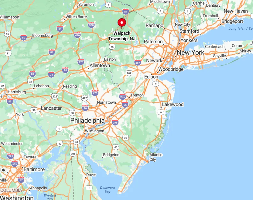
Walpack sits in Sussex County, fully enveloped by the Delaware Water Gap National Recreation Area along Route 615. Steep river bluffs box it in on the west while forested Kittatinny ridges rise on the east, leaving a single low-speed road as the main approach.
Reaching it requires a turn off County Route 560 or Old Mine Road, both of which narrow to one lane in places. Limited signage, no cell towers, and seasonal closures help the township stay invisible to all but determined explorers.
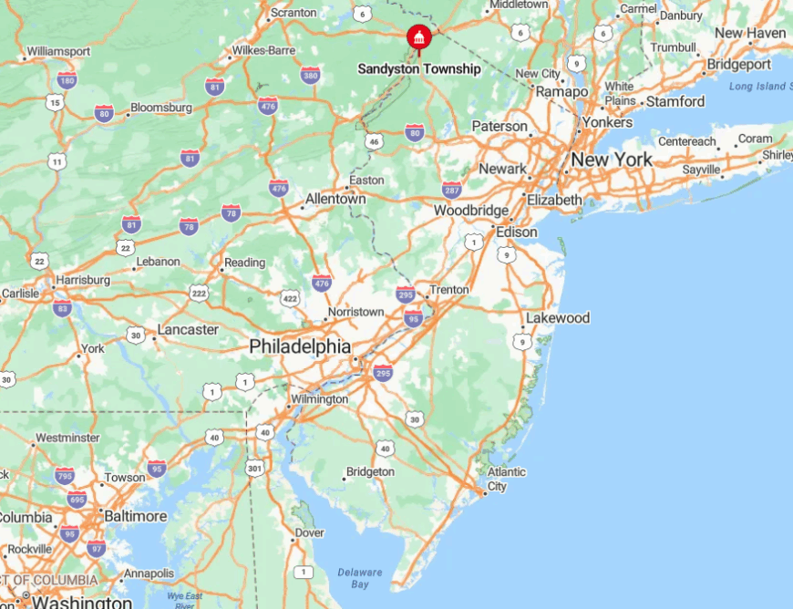
9. Sandyston Township – Forested Ridges and One-Acre Homesteads
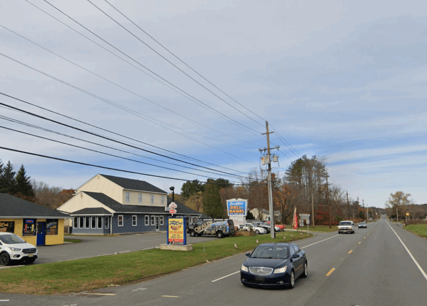
About 1,900 people share thirty-plus square miles in Sandyston Township, translating to plenty of elbow room between homes. Life centers on trout fishing in Flat Brook, berry picking along Ennis Road, and hiking the Appalachian Trail that traces the Kittatinny spine overhead.
Small family farms, a handful of B&Bs, and state-park employment form the economic core, though many locals work remotely. Dense woodlands and cedar-lined roads screen even neighboring properties from view, offering a sense of privacy rare in the state’s northern tier.
Historic farms such as Peters Valley Craft Center host weekend craft markets that draw modest crowds without disturbing the quiet. With no strip malls and only one flashing light, the township remains hidden from suburban expansion.
Where is Sandyston Township?
🔥 Would you like to save this?
Located just south of Walpack in Sussex County, Sandyston hugs the New Jersey-Pennsylvania line inside the Delaware Water Gap corridor. Elevation swings from river flats to 1,400-foot ridges, which block through-traffic and cell reception alike.
Drivers typically arrive via Route 206, then wind westward on County Route 560 before dipping onto smaller lanes. The combination of mountainous terrain and protected parkland helps the township stay off most GPS shortcuts.
8. Upper Greenwood Lake, West Milford – A Wooded Lake Community Far from the Turnpike
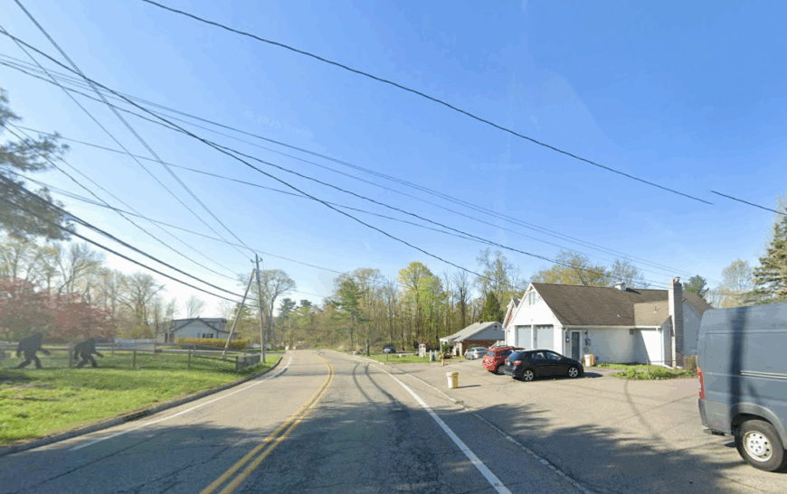
Around 4,200 residents circle the glassy waters of Upper Greenwood Lake, yet tree cover keeps most cabins hidden from the shoreline. Residents spend free time paddling at sunrise, photographing mist that clings to the water, or trekking into adjacent Wawayanda State Forest.
Local commerce consists mainly of a seasonal beach club, a marina, and a pair of family-run delis that double as community hubs. Curvy, unstriped roads discourage through-traffic, and the nearest highway cloverleaf is nearly thirty minutes away.
Properties often sit on double lots, so even weekend crowds never feel dense. The lake’s private status, backed by vigilant homeowners’ rules, preserves a level of calm that public lakes rarely enjoy.
Where is Upper Greenwood Lake?
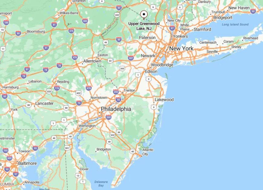
Positioned in the northwest corner of Passaic County, the community straddles the New Jersey-New York border near the town of Warwick. Access comes via Warwick Turnpike or the steep climbs of Breakneck Road, both of which narrow to one lane before reaching the water.
The absence of mass-transit links and mountainous approaches isolate the area from busier parts of West Milford. Visitors who brave the switchbacks are rewarded with stands of old-growth oak and a sunset that paints the lake in copper tones.
7. Stonetown, Ringwood – Stone Walls, Reservoir Views, and Zero Commercial Clutter
Stonetown hosts roughly 350 residents scattered along Ringwood’s northern reaches, where mossy stone fences trace property lines older than the republic. Weekends revolve around hiking the Stonetown Circular Trail, watching bald eagles over Monksville Reservoir, or wandering historic farms like Long Pond Ironworks.
Economic activity is limited to small-scale agriculture and seasonal guide services for anglers targeting record-size walleye. Dense hardwood forests and protected watershed land forbid new storefronts, so no commercial glow interrupts stargazing.
Old farm lanes twist between glacial boulders, slowing travel to a crawl and keeping visitor numbers low. Even Ringwood locals joke that GPS gives up before it gets to Stonetown, underscoring its tucked-away character.
Where is Stonetown?
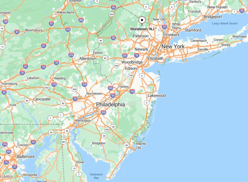
Stonetown occupies Ringwood’s northwest corner near the Passaic-Sussex county line, pinned between Wanaque and Monksville Reservoirs. Only Stonetown Road threads the valley, terminating at a gate that bars casual through-traffic.
The nearest highway, Route 287, lies seven miles southeast as the crow flies yet feels a world away thanks to mountain ridges that force a half-hour detour. Visitors typically follow Skyline Drive, drop past Ringwood Manor, then navigate a series of unmarked turns before stone walls announce arrival.
6. Highland Lakes, Vernon – Hilltop Cabins Encircled by Wawayanda State Forest
Highland Lakes counts about 5,100 residents, yet seasonal cabins outnumber full-time homes by a wide margin. Locals kayak on five connected lakes, hike Pochuck Mountain for rare pitch pine barrens, and ski nearby Mountain Creek each winter.
Employment leans toward hospitality, ski-area jobs, and home-based businesses that benefit from fiber service quietly threaded under the dirt lanes. The private lake association restricts motorboats and road access, ensuring a low noise floor year-round.
Evergreen corridors and multi-acre lots create sightlines where cabins peek between pines rather than sit in open view. Because visitor passes are required to use the lakes, the enclave remains free of summer party crowds.
Where is Highland Lakes?
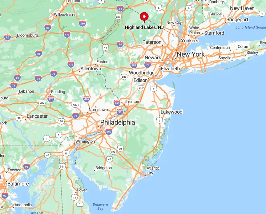
Nestled in Vernon Township near the New York border, Highland Lakes sits 1,200 feet above sea level on the Wawayanda Plateau. Drivers leave Route 515, then climb Highland Lakes Road as it narrows to a forest-shaded ribbon.
The plateau’s height and surrounding state forest block major arteries, explaining the patchy radio reception and quiet nights. Those who reach the top find a temperature a few degrees cooler than the valleys, ideal for pine-scented evening walks.
5. Stillwater Township – Farm Fields, Swans on Swartswood Lake, and No Traffic Lights
About 4,200 people live in Stillwater Township, spread across colonial farmsteads and lakeside cottages that share a single post office. Recreation centers on bass fishing at Swartswood Lake, photographing swans at dawn, and browsing heirloom vegetables at the Saturday farm stand run by Kittatinny Meadow Farm.
Agriculture and heritage tourism drive the modest local economy, most visible during the annual Historic Farmstead Tour every September. No traffic lights and only one general store preserve the township’s unhurried pace, causing drivers to slow naturally.
Meadow vistas stretch uninterrupted to the Kittatinny Ridge, adding to a sense of boundless space. Even during foliage season, the lake’s mirror finish often remains undisturbed save for a lone kayak.
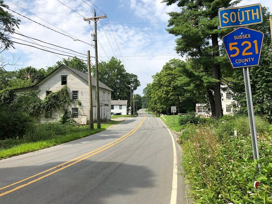
Where is Stillwater Township?
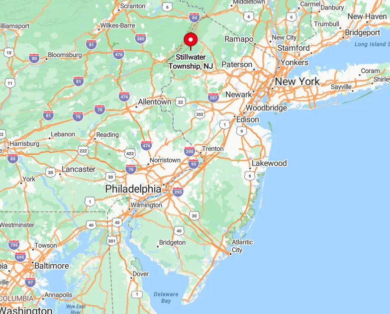
Stillwater rests south of Newton in Sussex County, buffered by the state’s oldest designated park, Swartswood State Park. Access arrives via County Route 521, which dips through wetlands and rises over hayfields before reaching the lake.
Absence of a direct interstate exit means visitors log an extra twenty minutes on country roads, discouraging casual day-trippers. Rolling hills and patchy cell coverage reinforce the feeling of being off the grid despite the township’s hour-and-a-half proximity to Manhattan.
4. Montague Township – Remote River Bluffs at New Jersey’s Northern Tip
A population of roughly 3,800 occupies Montague’s forty-five square miles, making it one of the state’s least dense municipalities. Residents hike to High Point Monument, cast for shad along the Delaware, and explore Minisink Island’s seldom-used trails.
Seasonal farm markets and a scattering of river outfitters form the bulk of local enterprise alongside state-park jobs. The township bans billboards and large commercial structures, preserving a skyline dominated by spruce and hemlock.
Dramatic overlooks such as Riverview Pavilion offer vistas more reminiscent of the Adirondacks than of New Jersey. Sparse development and long drives between neighborhoods lend the entire area an edge-of-the-map ambiance.
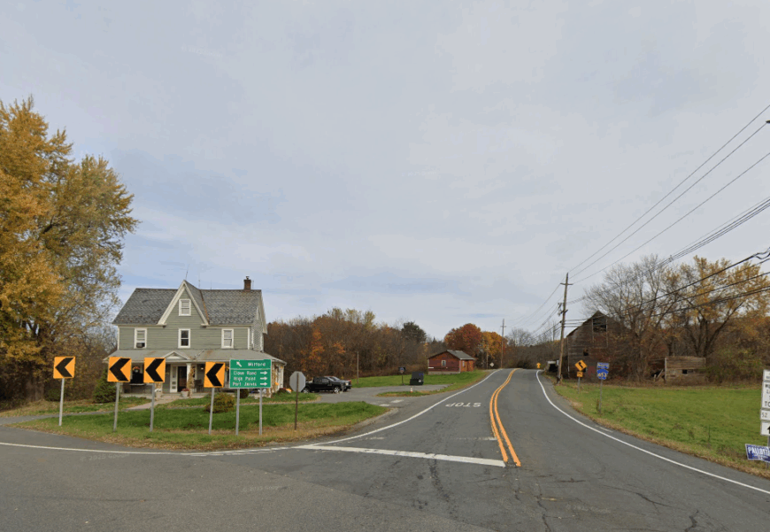
Where is Montague Township?
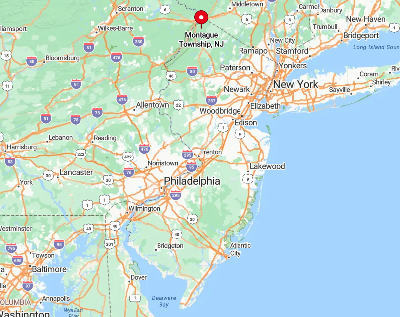
Sitting at New Jersey’s extreme northwestern tip, Montague touches both Pennsylvania and New York. Drivers must exit Interstate 84 in Port Jervis, cross the Delaware, then loop south on Route 206 before local signs appear.
Steep river bluffs and protected floodplain discourage new roads, ensuring existing routes remain lightly traveled. Winter often brings the state’s earliest snow, further isolating the township when plows focus on larger highways first.
3. Jefferson Township’s Cozy Lake District – Pine-Shaded Lots off Winding Gravel Roads
Cozy Lake and its sister ponds host about 850 year-round residents amid Morris County’s highlands. Kayaking at dawn, searching for chanterelle mushrooms on township greenway trails, and birdwatching for migratory warblers occupy most weekends.
A single lakeside tavern and a handful of home-based craftsmen supply limited local commerce while larger errands require a drive to Oak Ridge. Gravel switchbacks, posted at 15 mph, twist between boulders and vintage log cottages, slowing any would-be shortcut traffic.
Lots often exceed an acre and sit beneath tall white pines that muffle road noise. Even mail delivery groups several addresses at shared roadside kiosks, hinting at the area’s non-suburban layout.
Where is the Cozy Lake District?
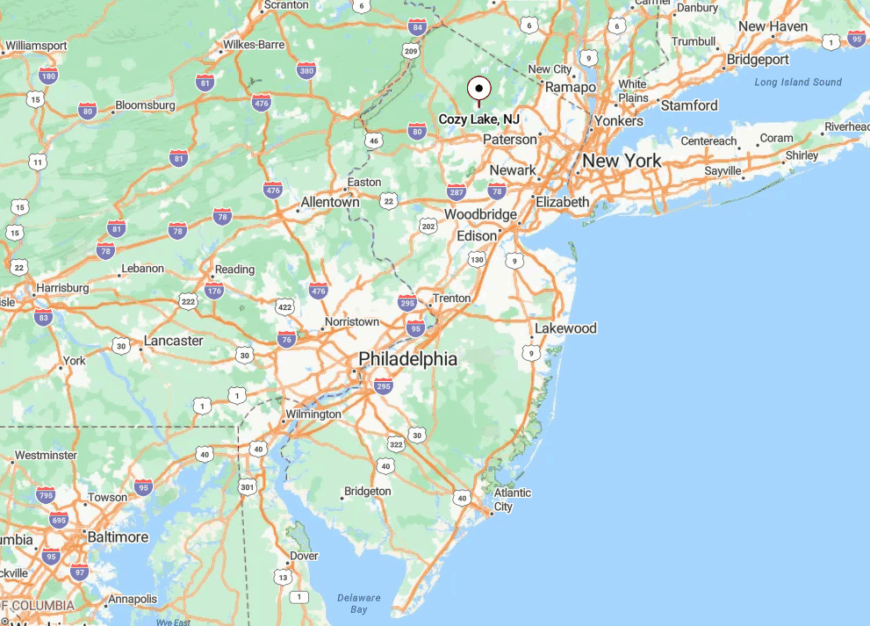
Set within Jefferson Township’s northern tier, Cozy Lake lies three miles west of Route 15 yet feels far deeper in the woods. Approach comes via Schoolhouse Road or Cozy Lake Road, both turning to gravel shortly after the last convenience store.
The district’s elevated watershed position keeps it free from truck routes and commercial zoning. Navigation apps frequently mislabel unmarked lanes, adding an extra layer of privacy for residents.
2. Fardale, Mahwah – Horse Properties Tucked Behind the Ramapo Foothills
Fardale’s equestrian enclave includes around 1,200 residents living on generous parcels south of the state line. Afternoon routines involve trail rides on the Ramapo Valley Reservation bridle paths, visits to the century-old DeBaun House, or picnic lunches near Masonicus Brook.
Boarding stables, riding instructors, and small organic farms anchor the local economy, complemented by remote workers who appreciate fiber-optic service. Stone walls and split-rail fences trace long driveways that vanish into hardwood stands, hiding barns and paddocks from the road.
Despite Mahwah’s bustling retail corridor just five miles away, Fardale’s zoning forbids commercial signage and limits lot subdivision. The resulting landscape feels more Hunterdon than Bergen County.
Where is Fardale?
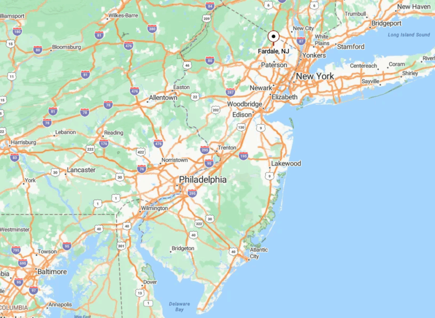
Fardale occupies Mahwah’s southwestern corner, tucked between the Ramapo Mountains and the Franklin Lakes border. The area is reached via Campgaw Road or Pulis Avenue, both of which narrow after passing the last traffic signal.
Hills and wooded ravines eliminate direct cut-throughs, so drivers must loop back to Route 202 for any north-south travel. As a result, passing traffic is usually limited to horse trailers and local delivery vans.
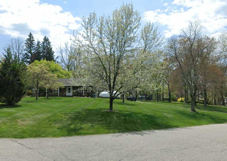
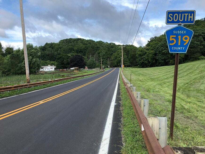
1. Green Township – Rolling Meadows and Sprawling Estates Beyond the Commuter Zone
Green Township’s 3,600 residents share broad valleys dotted with hay bales and centuries-old stone farmhouses. Weekend pastimes include biking the Paulins Kill Valley Trail, browsing antiques at Trinca’s barn sale, and catching bluebird song along Greendell Road at sunrise.
Agriculture remains active here, from hay production to pick-your-own orchards, with boutique wineries and apiaries gaining traction. Vast setbacks and conservation easements keep rooftops from cluttering the horizon, offering long sightlines across meadows where red-tailed hawks glide.
The township contains only one neighborhood store, so errands require a planned trip, reinforcing the slow-paced lifestyle. Residents often note that sunsets linger longer when nothing vertical interrupts the sky.
Where is Green Township?
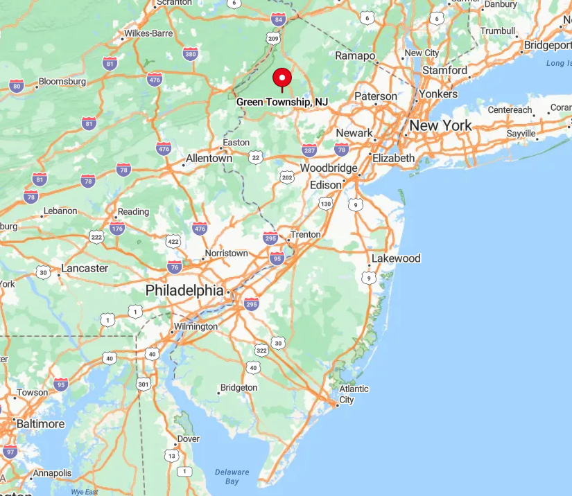
Green sits in southeastern Sussex County, just north of the Warren County line and six miles off Interstate 80. Though the interstate hum can be heard on a still night, reaching any exit involves a ten-minute drive on S-curves through farmland.
Limited public transit and an absence of major retail centers reduce through-traffic to a trickle. Rolling topography and large conservation tracts keep the township insulated from the sprawl marching up the interstate corridor.