🔥 Would you like to save this?
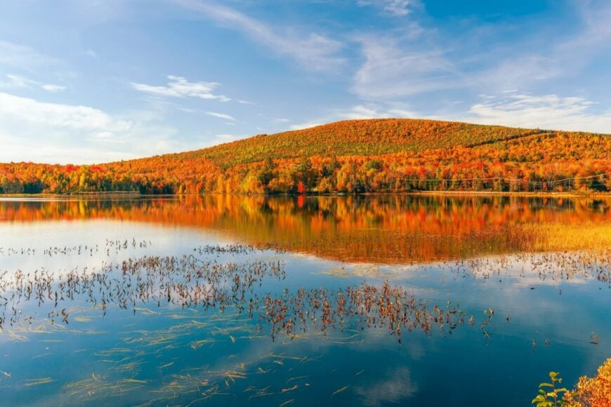
New Hampshire’s northern tip rewards patient travelers with hamlets so quiet that the loudest evening sound might be a loon call echoing across a glassy lake. These townships and tiny villages feel set apart not only by geography but also by the deliberate pace of life that prevails once the pavement ends and gravel takes over.
Populations sit in the dozens, forests stretch uninterrupted for miles, and cell service often fades to nothing long before the last turn. Keen observers will spot telltale signs of busy wildlife, shuttered logging roads and forgotten barns rather than traffic lights or fast-food chains.
In order to come up with the very specific design ideas, we create most designs with the assistance of state-of-the-art AI interior design software.
Whether one seeks a cabin retreat, a landscape to photograph or a place where neighbors wave from porches half a mile away, this corner of the Granite State answers that call. The following countdown starts with a township above the treeline and ends at a name that appears on very few road signs at all.
25. Pittsburg – North Country’s Vast Back Pocket of Lakes and Forest
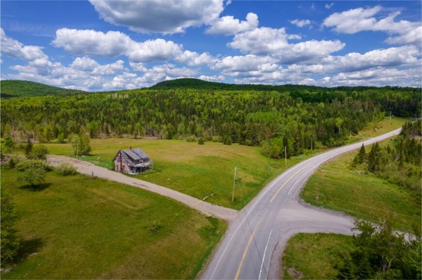
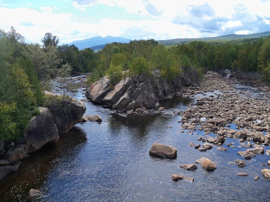
Pittsburg is New Hampshire’s northernmost town and feels more like a wild province than a municipality. Covering nearly 300 square miles yet home to only about 800 residents, it’s stitched together by logging roads, trout streams, and the glassy expanse of the Connecticut Lakes.
Visitors come to fish for landlocked salmon, spot moose grazing roadside, or paddle through still coves at dawn. Lodges and small sporting camps form the backbone of the economy, catering to hunters, snowmobilers, and those seeking deep-woods solitude.
The Canadian border lies just up the road, but the sense of separation is more than geographic—it’s a rhythm dictated by seasons and weather. Even in summer, the silence here is a living thing, filling the gaps between the wind and the call of loons.
Where is Pittsburg?
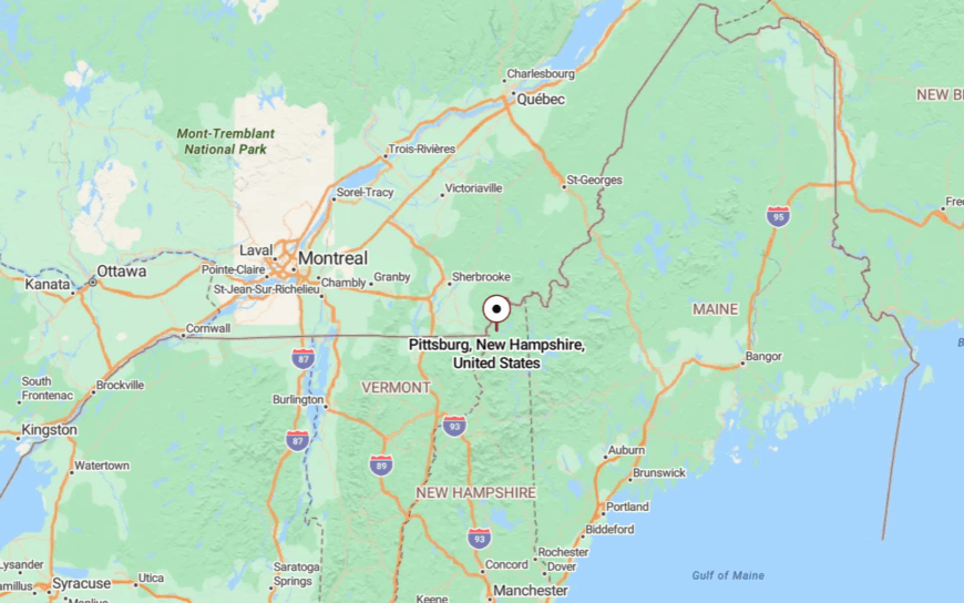
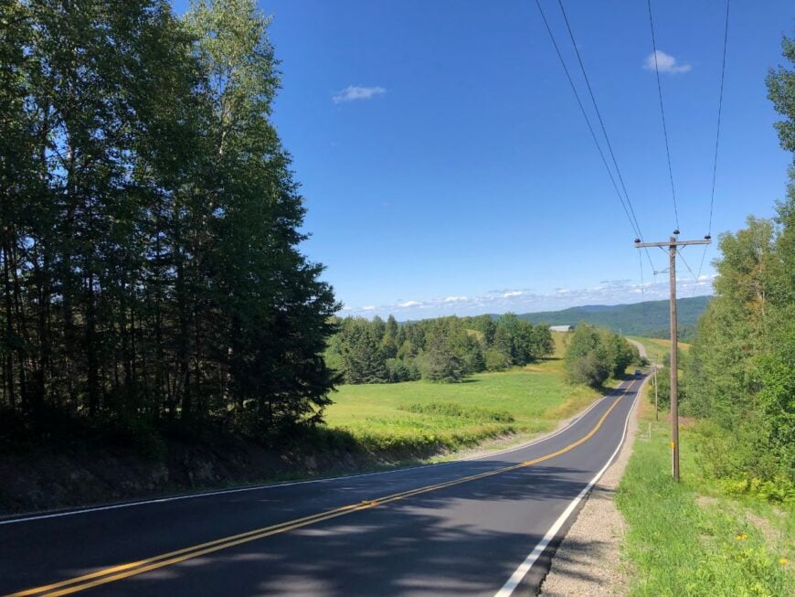
Pittsburg sits at the very top of New Hampshire, north of the 45th parallel and roughly 50 miles from Colebrook. Route 3 is the only major road tracing the Connecticut River past a string of lakes.
The journey north winds through miles of spruce and fir before the final village appears. It’s the kind of drive where every mile feels like you’re slipping further off the map.
24. Clarksville – A Hilltop Hamlet Overlooking Canada’s Edge
Clarksville’s small population—barely over 250—spreads out across high ridges with views that sweep into Quebec. Rolling hayfields and weathered barns dominate the landscape, with only a few paved roads threading between them.
Life here is rural in the purest sense: maple sugaring in spring, haying in summer, hunting in autumn, and wood-stove warmth in winter. Outdoor lovers hike old logging trails, fish remote ponds, and search for the perfect sunset vantage from the hills.
Logging and small-scale farming provide a modest living for residents, while solitude does the rest. It’s the kind of place where the horizon seems to breathe with you.
Where is Clarksville?

Clarksville lies in Coös County, just west of Pittsburg and north of Colebrook. The easiest access is via Route 145, a winding two-lane highway that climbs and dips through open farmland.
Nearest services are in Colebrook, about 15 minutes south. Once you crest the last hill into town, the openness feels infinite.
23. Stewartstown – Riverbend Villages and Mountain Shadow
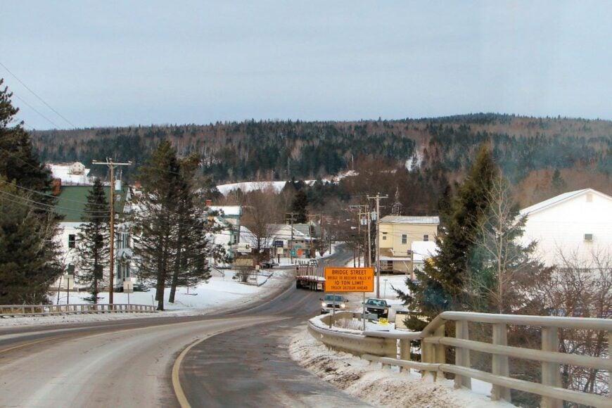
Stewartstown’s scattered villages—West Stewartstown, Stewartstown Hollow—sit in a valley guarded by distant mountain walls. With fewer than 1,000 residents across 46 square miles, it’s a place of backroads, covered bridges, and the meander of the Connecticut River.
Fishing, hiking, and quiet country drives are the main activities here, along with seasonal fairs that still feel homegrown. Small businesses, farming, and cross-border trade with Vermont keep the community afloat.
The separation from busy routes and the broad stretches between neighbors make the days stretch long. In the cool evening air, it feels like the world slows to match the river’s pace.
Where is Stewartstown?
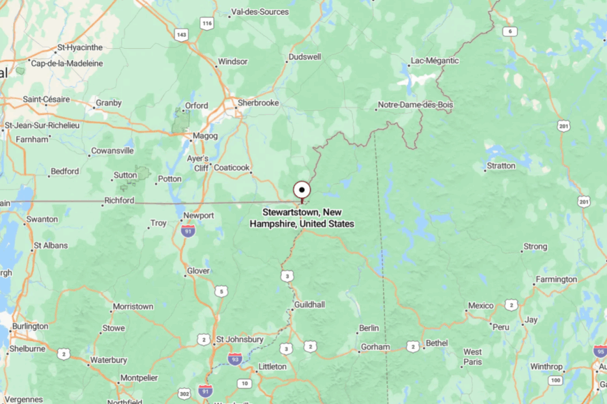
The town is tucked into New Hampshire’s northwest corner, bordered by Vermont to the west and Canada to the north. Route 3 runs through, but most residents live alongside roads closer to the river.
Colebrook is the nearest hub, about 7 miles south. The broad valley gives a sense of space that’s hard to shake.
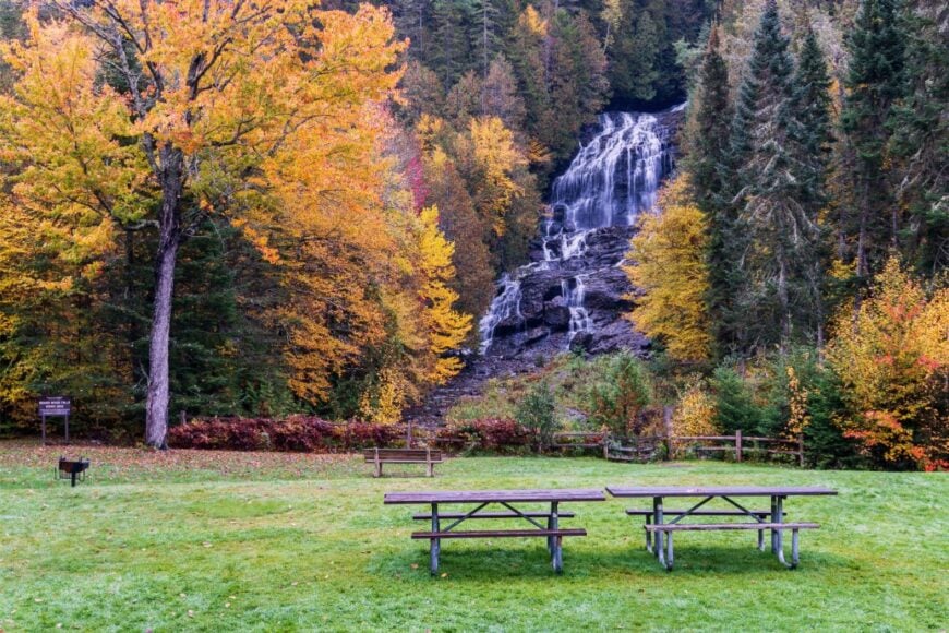
22. Dixville – Home of the Notch and Very Little Else
Dixville is famous for its midnight presidential votes, but for the rest of the year, it’s a place where nature is the star. The dramatic granite walls of Dixville Notch rise above Mirror Lake, and trails lead to airy views over the Balsams Wilderness.
Fewer than 20 people live here full-time, their homes tucked into pockets of forest along the narrow road. Outdoor recreation—hiking, fishing, skiing—is the lifeblood, with the surrounding state park drawing small but steady visitors.
The lack of any sizable commercial district keeps the nights truly dark and the mornings startlingly quiet. It’s a sliver of New Hampshire where the air feels untouched.
Where is Dixville?
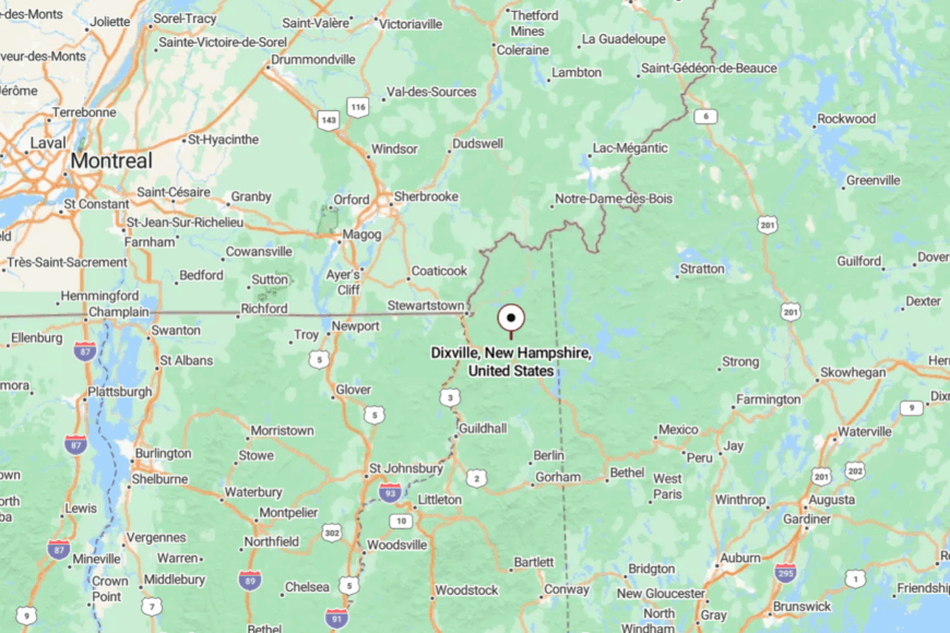
Dixville sits along Route 26, about 10 miles east of Colebrook. The notch itself is a narrow pass between steep cliffs, with the road twisting sharply between them.
Approaching from either side feels like entering a hidden corridor. Once inside, the rock walls and dense woods block out the wider world.
21. Colebrook – A Remote Hub at the Edge of the Wild
Colebrook may be the “big town” of the far north, but with just over 2,000 residents, it still feels remote. Its main street offers a few shops, cafés, and a movie theater, but step outside town and you’re instantly in open farmland or deep woods.
Residents fish the Mohawk River, hike Magalloway Mountain, and ride ATVs along an expansive trail network. Logging, farming, and tourism make up the bulk of the economy.
The long drive from any interstate means fewer casual visitors and a community that moves at its own pace. It’s a blend of small-town friendliness and wide-open space.
Where is Colebrook?
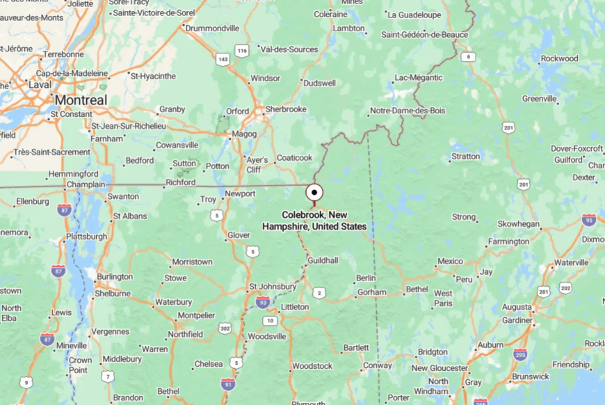
Colebrook is in northern Coös County, just 10 miles from the Vermont border. Route 3 is the main artery, connecting south to Lancaster and north toward Pittsburg.
The approach is lined with fields and forest, the mountains building in the distance. Arriving feels like finding a port at the edge of a wilderness sea.
20. Stratford – Valley Stillness Beneath Mount Percy
Stratford’s 700 or so residents share a narrow valley along the Upper Ammonoosuc River. Farms and woodlots dominate the view, with Mount Percy rising steeply to the north.
Hunting, fishing, and hiking keep people close to the land, while seasonal logging work brings a steady hum to the woods in winter. With no large stores or heavy traffic, Stratford’s days pass in a gentle rhythm.
The river’s quiet bends and the rustle of wind in spruce define its soundtrack. It’s a place where stillness feels natural, not manufactured.
Where is Stratford?
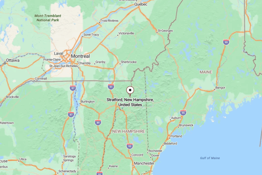
Stratford sits along Route 3 between Lancaster and Colebrook, about 20 miles south of the latter. The highway follows the river, but much of the town’s population lives on side roads hidden by trees.
Access is easy, but the sense of being apart is strong. The mountains on either side make the valley feel self-contained.
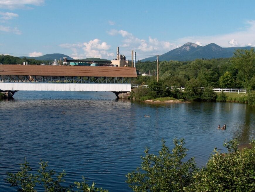
19. Northumberland – Village Charm with a Rural Backdrop
🔥 Would you like to save this?
Northumberland’s heart is the village of Groveton, a cluster of homes and businesses along the Upper Ammonoosuc. While the paper mill days are gone, the close-knit feel remains, with community events and Friday night games drawing everyone together.
Fishing, kayaking, and snowmobiling are favorite pastimes, and the surrounding hills offer endless backroad drives. Agriculture and small-scale industry keep the lights on, but the slower pace sets the tone.
With few outsiders passing through, life feels comfortably familiar. Even the river seems to slow its current here.
Where is Northumberland?
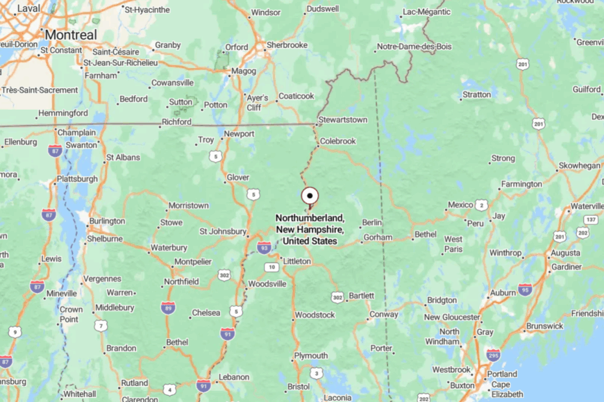
The town is in northern Coös County, just south of Stratford on Route 3. Lancaster, the nearest larger town, is about 10 miles south.
Groveton sits at the confluence of the Upper Ammonoosuc River and Nash Stream. Arriving from any direction means passing long stretches of fields and forest.
18. Lancaster – Gateway to the North Country
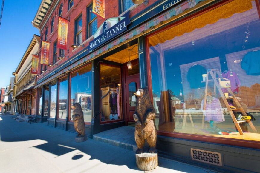
Lancaster is often called the “gateway” to the North Country, but it’s far enough from the interstate to feel genuinely removed. Its classic Main Street, lined with brick buildings and a historic courthouse, gives way to rolling farmland and White Mountain views.
Residents hike Weeks State Park, kayak the Israel River, and browse the local farmers’ market. Tourism blends with agriculture as the main economic anchors.
Even with a bit more bustle than its neighbors, Lancaster retains a calm, lived-in charm. It’s a place where the northern horizon always calls.
Where is Lancaster?
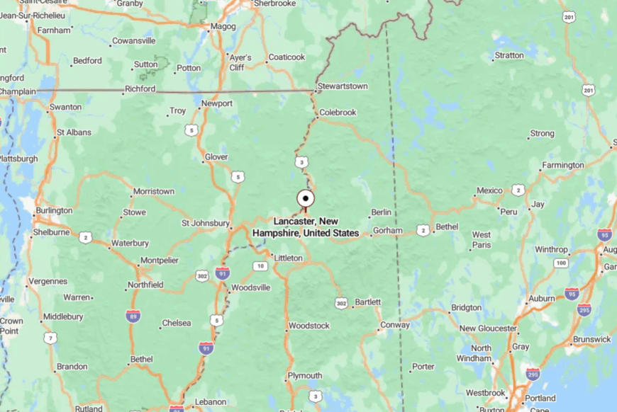
Lancaster lies at the junction of Routes 2 and 3, about 20 miles from the Vermont border. The drive in from I-93 takes nearly 40 minutes, winding through smaller villages.
Once there, the wide streets and open views make it feel spacious yet contained. The White Mountains rise to the east, hinting at wilder places beyond.
17. Jefferson – Meadows Under Mountain Shadows
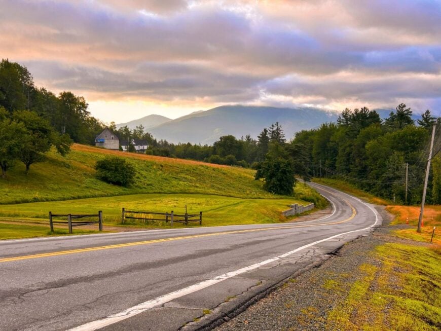
Jefferson’s long views of Mount Washington and the Presidentials make it one of the prettiest places in the state. The town is small, with scattered farms and a few family-run inns.
Hiking trails, cross-country ski routes, and wildlife watching keep visitors and locals outdoors. Agriculture and seasonal tourism sustain the economy.
With no major commercial strip, nights stay dark and quiet. It’s the kind of town where the mountains feel like neighbors.
Where is Jefferson?
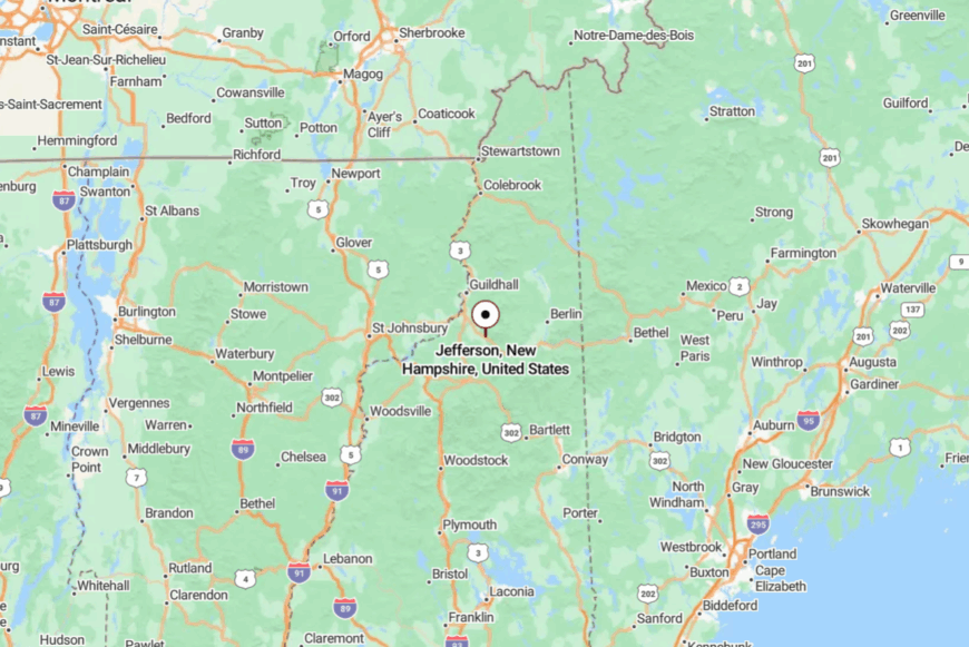
Jefferson is in Coös County, east of Lancaster along Route 2. The road passes through meadows and forests before reaching the village.
Larger stores are in Lancaster or Gorham, each about 15–20 minutes away. The open land between gives Jefferson its peaceful separation.
16. Columbia – Wide Valleys and a Ribbon of River
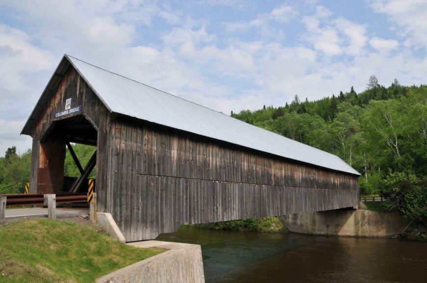
Columbia stretches along the Connecticut River, with broad meadows that glow gold in late summer and frost white in winter. Fewer than 800 residents share this quiet space, most living along Route 3 or tucked on side roads that vanish into the hills.
Farming and logging have long been the backbone of life here, with hayfields, sugar maples, and woodlots defining the landscape. Anglers wade into the river at dawn, while snowmobilers pass through in winter on the state’s extensive trail system.
The low population and distance from any major highway keep it peaceful even on holiday weekends. At night, the river’s slow current and the call of owls fill the darkness. It’s the sort of place where the horizon feels comfortably far away.
Where is Columbia?
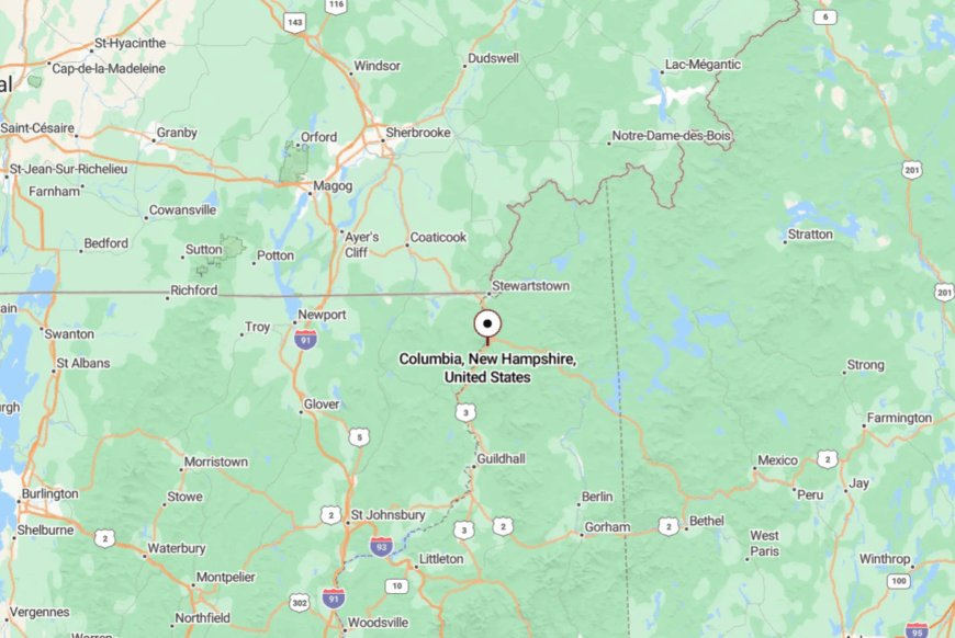
Columbia sits between Colebrook and North Stratford in Coös County, along the Connecticut River. Route 3 is the main road, tracing the water’s edge for miles.
The nearest services are in Colebrook, about 7 miles north. Driving in feels like following the river into a quieter, wider world.
15. Gorham – Small Town at the Edge of the Wild
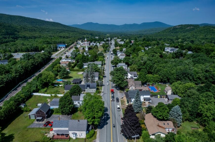
Gorham serves as a basecamp for White Mountain adventures, yet retains a relaxed, small-town feel once you step off Main Street. Trails to Mount Madison and Mount Washington start nearby, and the Moose Brook State Park offers wooded camping and swimming holes.
Local diners, gear shops, and motels form the backbone of the economy. Even with tourist traffic, the neighborhoods tucked along the river stay calm and shady.
The mountains press close, hemming in the town with green walls. It’s a spot where wild and settled meet gently.
Where is Gorham?
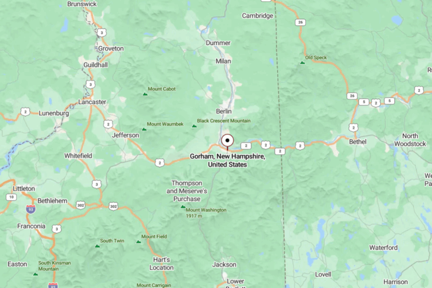
Gorham sits in eastern Coös County, at the junction of Routes 2 and 16. It’s about 8 miles north of Pinkham Notch.
The drive in from any direction is flanked by steep ridges and thick forest. Once you’re here, it feels both accessible and far from the rush.
14. Milan – River Curves and Quiet Backroads
Milan’s 1,300 residents live among the bends of the Androscoggin River, where farmland meets low wooded hills. Boating, fishing, and exploring Milan Hill State Park are favorite ways to spend the day.
Logging and small farms still provide livelihoods, and the pace is set by the seasons. With no dense development, nights are dark and peaceful.
The quiet is punctuated only by the call of geese or the whir of a passing snowmobile. It’s the definition of rural calm.
Where is Milan?
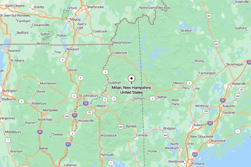
Milan lies along Route 110B, about 7 miles north of Berlin. The river valley opens and closes along the way, offering glimpses of water through the trees.
The nearest major services are in Berlin, but the surrounding landscape keeps the two worlds apart. Driving in feels like following the river into its own secluded bend.
13. Dummer – Hills, Lakes, and a Sparse Map of Neighbors
🔥 Would you like to save this?
Dummer’s few hundred residents are spread over 50 square miles of rolling hills and small lakes. Hunting, fishing, and berry-picking are staples of life here, along with maintaining woodlots for winter fuel.
The absence of a dense village center keeps it feeling more like a series of homesteads. Seasonal camps dot the shores of Cedar Pond and Pontook Reservoir.
With no streetlights, stars spill freely across the night sky. It’s a place where the map feels bigger than the population.
Where is Dummer?

Dummer is north of Milan, reached by Route 16. The road climbs gently through the forest before opening to scattered clearings.
Berlin is the closest city, about 15 minutes south. The space between homes and the surrounding woods gives it a rare, open quiet.
12. Stark – Covered Bridges and Mountain Stillness
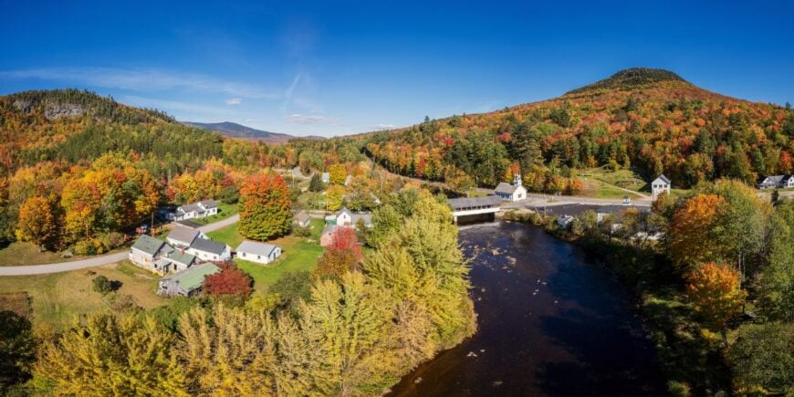
Stark’s iconic red covered bridge and white church sit against a backdrop of Mahoosuc Range peaks. The population barely tops 500, spread between the river valley and the wooded slopes.
Fishing the Upper Ammonoosuc, hiking Devil’s Slide, and photographing the bridge are favorite activities. Small farms and tourism form the economic base.
The narrow valley holds sound close, so quiet feels amplified here. It’s a village that wears its postcard beauty lightly.
Where is Stark?
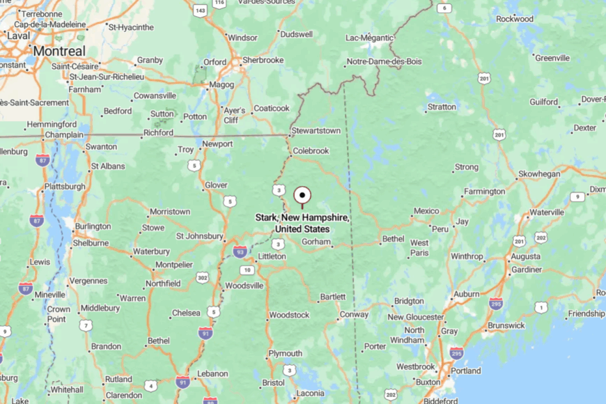
Stark is east of Groveton along Route 110. The approach follows the river, with mountains leaning in on both sides.
Nearest services are in Northumberland, about 10 miles west. Crossing the covered bridge feels like stepping into a slower century.
11. Kilkenny – A Township of Trails and Almost No Residents
Kilkenny is an unincorporated township with only a handful of camps and no year-round population. The Kilkenny Ridge Trail runs its length, linking remote peaks like Cabot and the Weeks.
Wildlife outnumber people here by far—moose, bear, and spruce grouse move through the spruce-fir forest. There’s no industry, no streetlights, and no hum of traffic, just the wind and the sound of boots on the trail.
Streams run cold and clear, and the nights are dark enough for the Milky Way to glow overhead. It’s a place where seclusion is complete.
Where is Kilkenny?
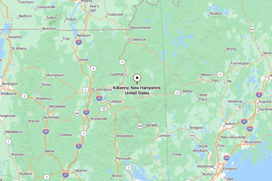
Kilkenny lies east of Lancaster, between Jefferson and Stark, in Coös County. Access is via forest roads branching from Route 110 or Route 2.
Most visitors arrive on foot from trailheads at either end. The lack of roads ensures that once you’re here, you’re truly away from it all.
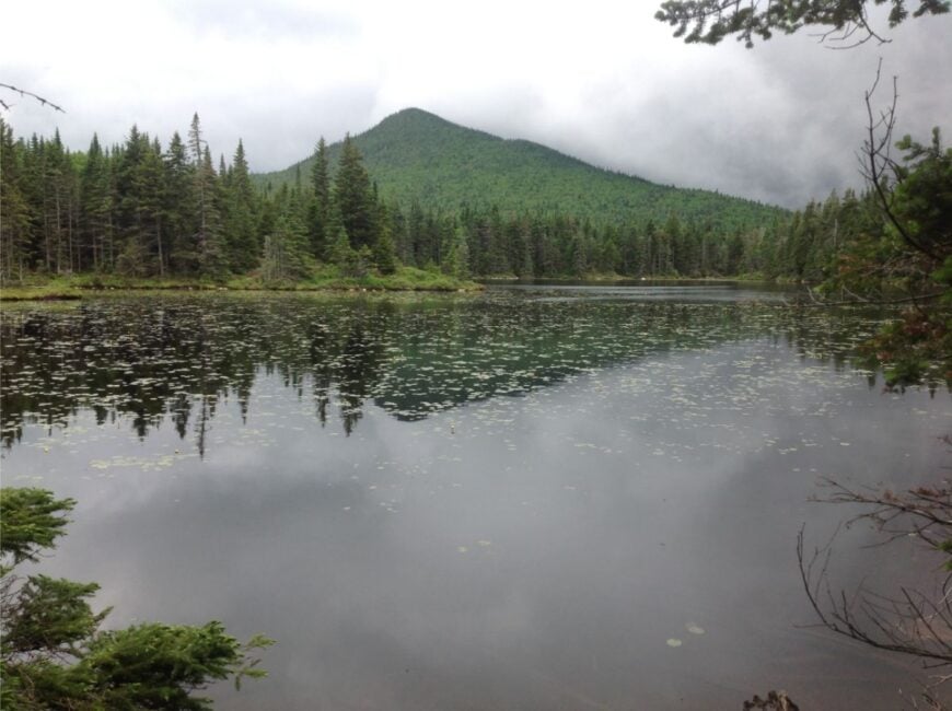
10. Bean’s Purchase – High-Elevation Wilderness Where Roads End and Trails Begin
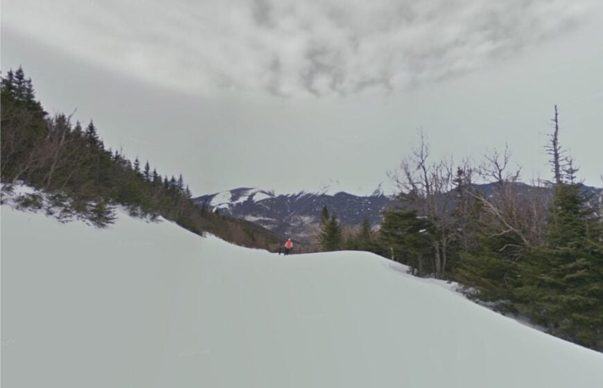
Bean’s Purchase claims roughly zero permanent residents, making it one of the emptiest spots east of the Mississippi. Hikers arrive for rugged paths such as the Ammonoosuc Ravine Trail and for backcountry ski lines that drop toward the Dry River headwaters.
With nearly every acre held by the White Mountain National Forest, formal industry is limited to occasional forestry leases and seasonal guiding. The township’s alpine ponds, like lonely Spaulding Lake, reward those willing to bushwhack for sunrise reflections beneath Mount Monroe.
Long winters and steep terrain deter development, while gated service roads preserve the hush that defines the place. Even on July weekends, it is possible to stand beside the old stone chimney at the former Montvale logging camp and hear only wind in the spruces.
Where is Bean’s Purchase?
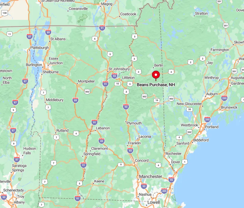
The township occupies 25 square miles on the western flank of Mount Washington, roughly five miles southeast of Bretton Woods. Slopes rise quickly above 3,000 feet, and mountain walls block both radio signals and casual visitors.
Access comes by foot from Base Road or through a short stretch of the cog railway service route before trails branch off. Anyone planning a visit should expect to walk the final miles, carry a map and keep an eye on rapidly changing weather.
9. Hale’s Location – A Tiny Notch Carved Between Cathedral Ledge and Whitehorse
Home to about 130 year-round residents, Hale’s Location feels more like a private glen than a municipality. Residents favor rock climbing at nearby Cathedral Ledge, leaf-peeping strolls on the Bryce Path and early-morning paddleboard sessions on small but scenic Echo Lake.
Tourism and hospitality linked to neighboring North Conway provide modest employment, yet strict zoning keeps lot sizes large and commercial activity sparse. Granite cliffs on two sides muffle sound and limit outward expansion, while a single entrance road curtails passing traffic.
Autumn brings vivid foliage that lights up the ledges, creating a natural amphitheater of color visible from almost every porch. Because utilities run underground and streetlights remain minimal, night skies here retain surprising clarity for a valley so close to a resort area.
Where is Hale’s Location?
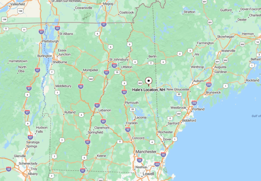
This township sits just west of North Conway off West Side Road, enclosed by Cathedral Ledge to the east and Whitehorse Ledge to the south. The rock walls form a narrow corridor that blocks both wind and highway noise.
Reaching the area requires a short detour from Route 302, and no through road continues beyond the neighborhood. Visitors often park at Echo Lake State Park, pass under towering granite and suddenly realize the bustle of the Mount Washington Valley has vanished.
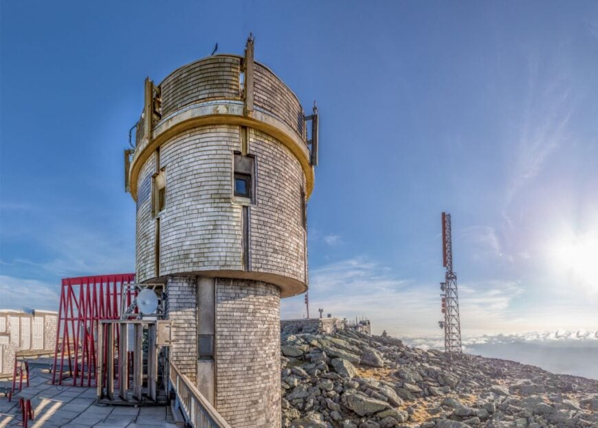
8. Randolph – Mossy Trails, 4,000-Foot Peaks and a Scattered Year-Round Community
🔥 Would you like to save this?
Randolph counts around 330 residents spread across 47 square miles of upland forest. Locals maintain a network of volunteer-blazed footpaths like the Amphibrach and the Pasture Path, many of which link directly to summits in the northern Presidential Range.
Seasonal rental cabins and a historic summer library support a modest tourism economy, while small-scale maple sugaring provides a bit of local income each spring. Massive ridges including Mount Adams and King Ravine shield homes from U.S. Route 2 sounds, giving the village an unexpectedly insulated feel.
Nighttime reveals some of New England’s darkest skies, prized by backyard astronomers who set up telescopes on gravel driveways. A beloved hidden gem is Mossy Glen, a fern-lined brook only a quarter mile from the road yet rarely found by visitors without a local’s tip.
Where is Randolph?
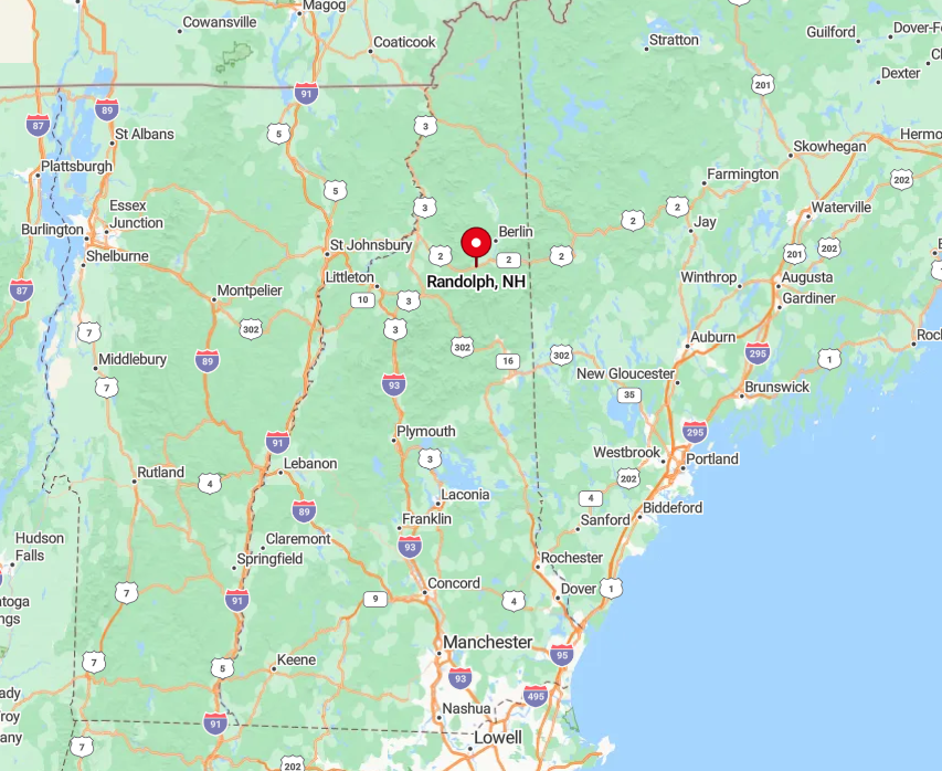
The town lies west of Gorham along Route 2, but most residences perch on side roads that climb toward 3,000 feet. Mountain walls on three sides slow storm fronts and dampen signals, contributing to its calm atmosphere.
Travelers typically exit the state highway at Durand Road or Randolph Hill Road and proceed up steep switchbacks that deter large vehicles. Public transportation ends in Gorham, so arrival almost always involves a private car followed by a short, winding ascent.
7. Shelburne – River-Edge Homesteads Guarded by the Mahoosuc Mountains
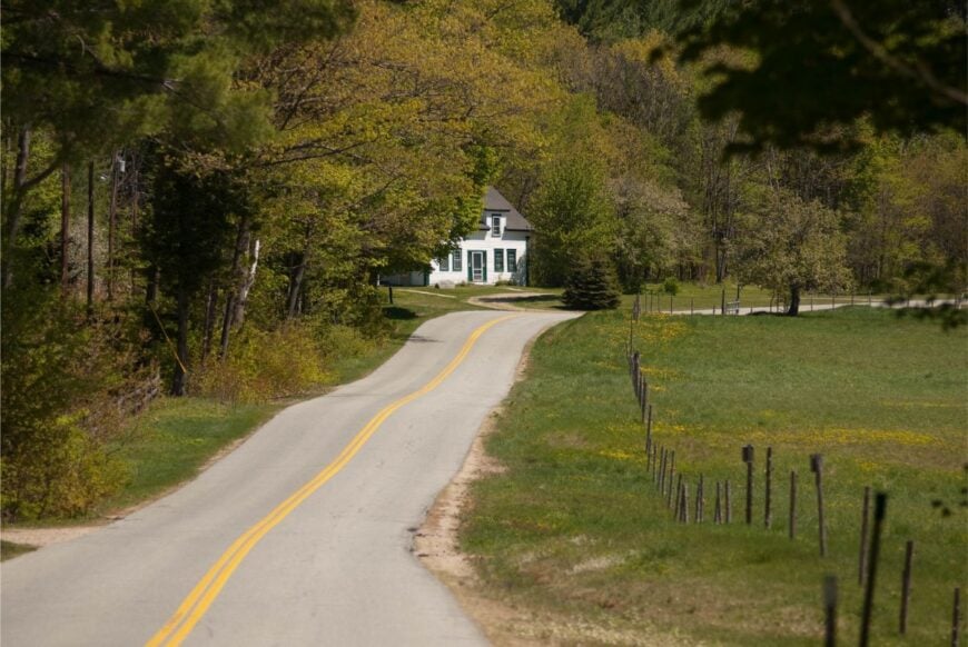
Shelburne hosts roughly 350 inhabitants along a particularly twisty stretch of the Androscoggin River. Fly-fishing for brook trout, cycling the river road, and hiking to Giant Falls top the local pastime list.
Timber harvesting and small organic farms make up the primary economic pursuits, with a few bed-and-breakfasts filling out the ledger. The Mahoosuc Range forms a granite curtain to the north, blocking both weather fronts and the din of Interstate 93 far away.
Homesteads sit at generous intervals, often separated by fields reclaimed from nineteenth-century dairy farms. Little-known Mad Brook Trail starts behind an unmarked gate and leads adventurous hikers to glorious, crowd-free vistas of Grafton Notch.
Where is Shelburne?
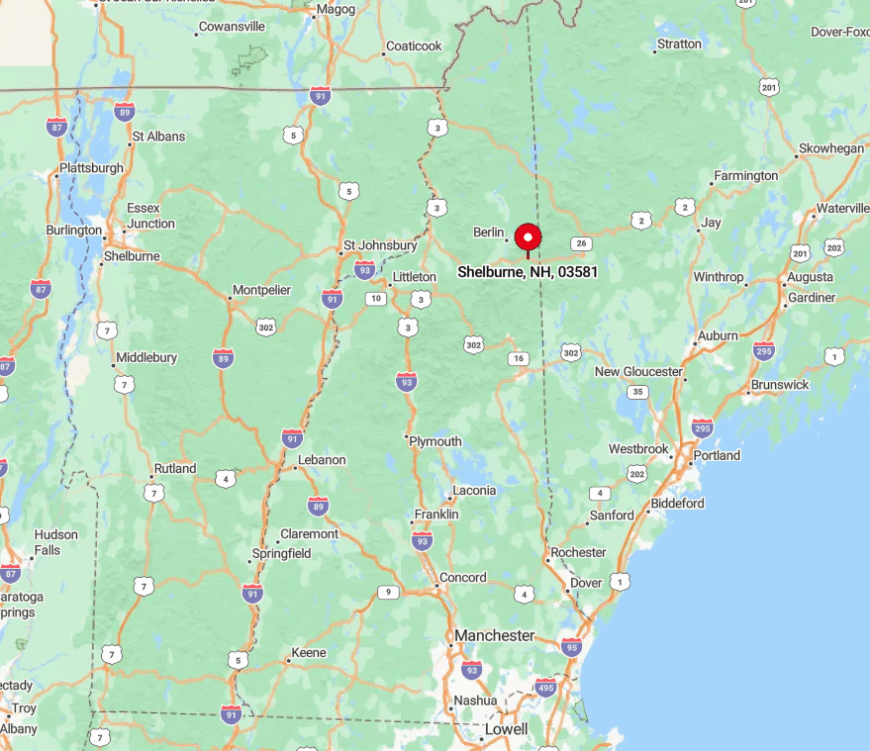
The village rests five miles east of Gorham on U.S. Route 2 near the Maine border. Although the highway passes through, the bulk of residents live on North Road, a quieter alternative that follows historical stagecoach grades.
Dense forest on both sides of the corridor absorbs sound and limits new building sites. Visitors reach the area most easily by car, but those arriving by bicycle often praise the gentle river-grade incline that keeps traffic speeds low.
6. Chatham – A Pocket Valley Encircled by Baldface Peaks and Thick Forest
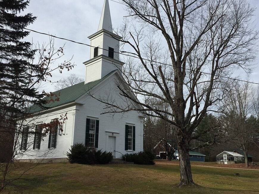
Chatham’s full-time population hovers near 340, yet its houses scatter across so many hollows that neighbors can be out of sight for weeks. Outdoor explorers ascend South Baldface, paddle Cold River and pick late-summer blueberries in town-managed fields.
Logging contracts and seasonal recreation guide services supply modest incomes, while a cooperative fiber-optic project keeps remote workers online without adding roadside infrastructure. Twenty miles of forest service roads act as both buffer and gatekeeper, ensuring the valley remains quiet even in peak foliage season.
The steep Baldface Range hems the settlement on three sides, limiting cellular reach and creating natural sound barriers. Hidden behind a simple wooden sign, the Basin is a round glacial pond whose perfectly still water mirrors cliffs in a tableau usually enjoyed only by locals.
Where is Chatham?
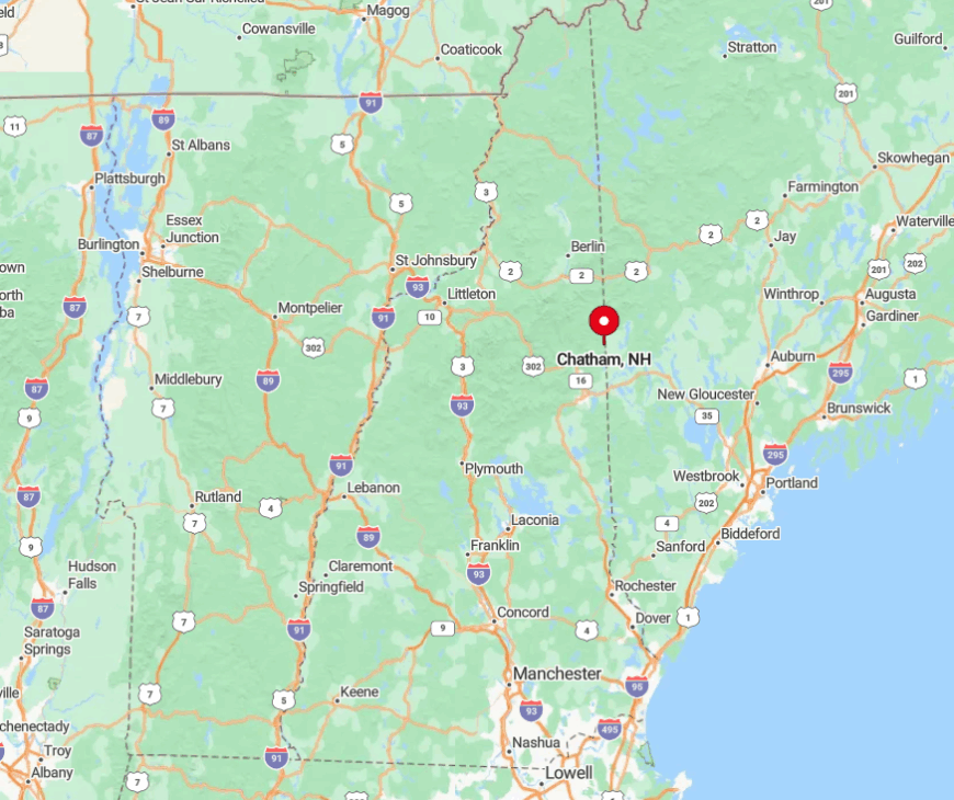
Located at New Hampshire’s easternmost notch, Chatham sits just south of Evans Notch on the Maine border. The sole paved approach is via Route 113 from Fryeburg, after which dirt roads thread into the valley.
Snowfall renders many secondary tracks impassable for months, adding to the sense of isolation. Those who make the trip often remark that the last ten miles feel as if the modern world has slipped away.
5. Wentworth Location – Log Cabins Dotted Along a Wild, Meandering River
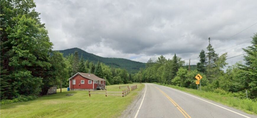
Around 33 residents share Wentworth Location’s 17 square miles, with cabins nestled along the upper Androscoggin’s sweeping bends. Canoeists drift past osprey nests, anglers seek landlocked salmon, and autumn visitors watch river fog rise against scarlet hillsides.
The economic picture centers on seasonal tourism, small-scale forestry and work with state wildlife agencies that manage nearby conservation parcels. Mountain ridges and 50 percent protected land corral development, guaranteeing long stretches where only river noise breaks the quiet.
Large lots allow woodcutters to keep traditional outdoor boilers humming without disturbing neighbors. A seldom-mentioned treat is the hand-operated Pontook Dam fish ladder, where patient observers can spot migrating shad each spring.
Where is Wentworth Location?
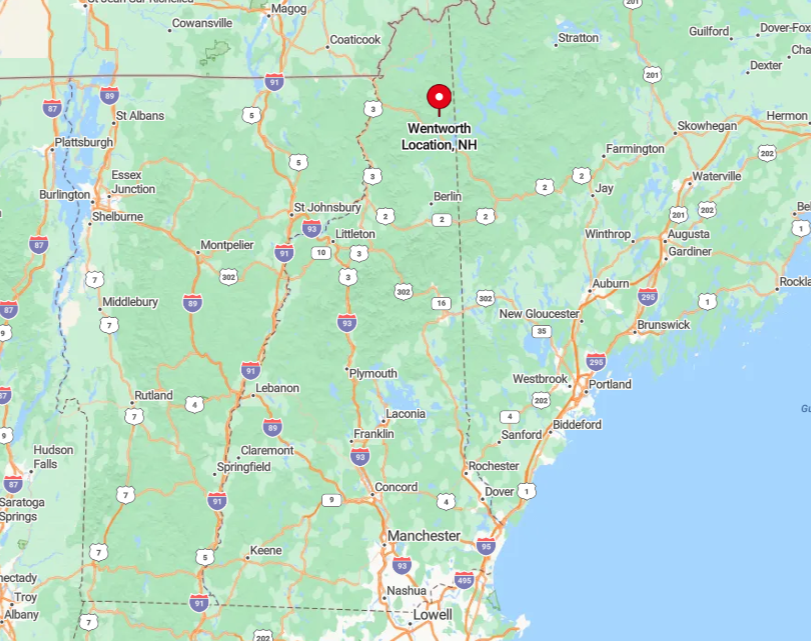
The township lies immediately north of Errol along Route 16, though most dwellings sit down narrow gravel spurs closer to the water. Tall spruce on the valley floor hush highway sounds and limit sightlines, reinforcing solitude.
Reaching a cabin often means crossing a single-lane plank bridge that discourages heavy traffic. Cell reception fades quickly after leaving Errol, reminding visitors they have stepped off the grid.
4. Cambridge – Eight Residents, Endless Bog Cotton and Glassy Lakes
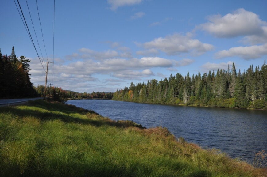
Cambridge listed only eight people in the last census, yet its footprint spans nearly 20 square miles of wetland, forest and shoreline. Canoes glide over the northern lobe of Lake Umbagog, while birders scan floating mats of bog cotton for secretive sedge wrens.
Local income comes almost entirely from seasonal guiding and campsite maintenance handled by the Umbagog National Wildlife Refuge. Marshes and kettle ponds serve as natural moats, discouraging road building and keeping the township nearly roadless.
Nights remain pitch-black, inviting astrophotographers to capture Milky Way reflections on still water. An under-appreciated gem hides at Sturtevant Pond where carnivorous pitcher plants thrive in a floating peat bog accessible only by paddling.
Where is Cambridge?
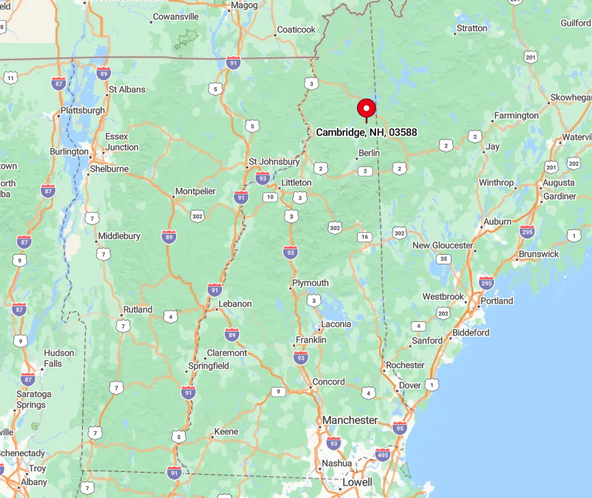
Cambridge sits south of Millsfield and west of Errol, bordered by the Maine state line to the east. Its single public road, Greenough Pond Road, ends after five miles at a locked gate maintained by the refuge.
Visitors must continue by foot or boat, ensuring human presence stays light. Those arriving from Route 26 often remark that once the pavement ends, so do cell bars and any sense of hurry.
3. Millsfield – A Two-Dozen-Person Hamlet Hidden Behind Miles of Gravel Roads
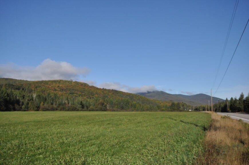
Millsfield’s population hovers near 25, spread among farmhouses and camps that cluster below the 3,000-foot Millsfield Pond ridge. Photographers set up at Millsfield Pond’s north shore for unbroken views of star-rich skies, while ATV riders explore the town-maintained Success Trail network.
Forestry remains a modest employer, complemented by seasonal rentals for leaf-peepers and snowmobilers. Ninety-five percent of land remains undeveloped, and gravel roads branching from Route 16 often close in spring mud season, amplifying the sense of remove.
Wildlife sightings include pine martens and the occasional boreal owl, species that favor the deep woods and minimal light. Tucked behind a line of firs, the tiny Saint Hermenegilde Chapel hosts a single July service attended by nearly every resident.
Where is Millsfield?
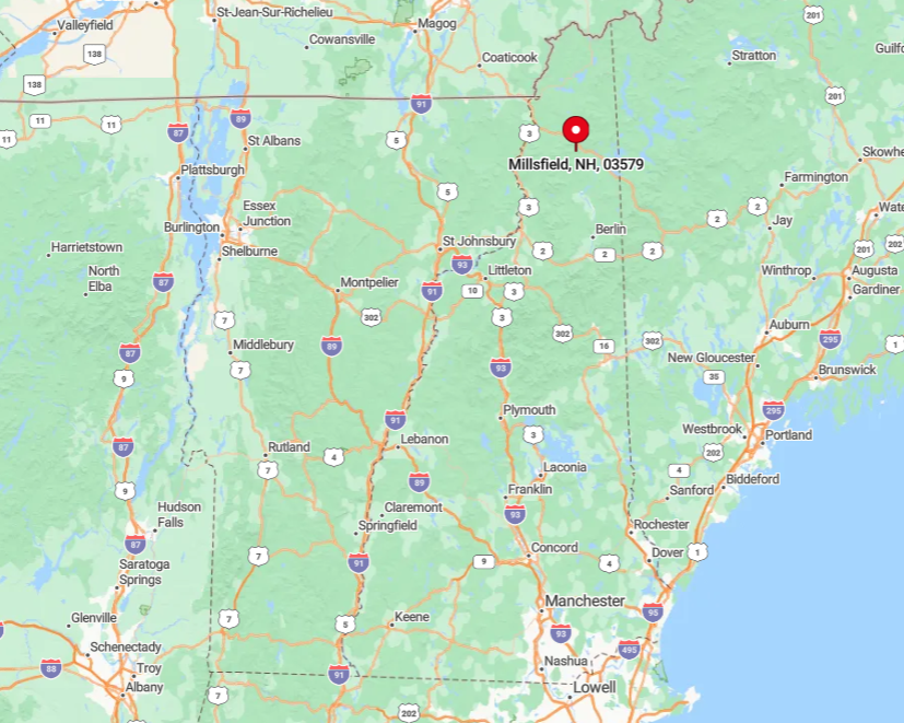
The township lies west of Errol between Routes 16 and 26, yet reaching central homes requires driving several miles of graded gravel. Elevation rises quickly, and snow lingers into May, which naturally limits casual visitation.
The absence of through roads keeps traffic almost entirely local. Travelers should fill gas tanks in Errol because the next station sits nearly 30 miles away in Colebrook.
2. Errol – Where Moose Outnumber People on the Androscoggin’s Headwaters
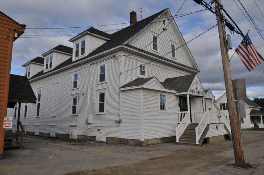
Errol counts about 300 residents in a compact village surrounded by vast stretches of spruce bog and rolling uplands. Activities center on fishing Umbagog Lake, spotting moose along Route 16 at dawn and paddling the Androscoggin’s swift upper reaches.
Small outfitters, a family-owned sawmill and a general store comprise the core local businesses that keep travelers stocked and boats in the water. The town’s remoteness stems from its distance to any interstate, with cell towers obscured by dense forest and peaks trimming radio horizons.
Wildlife corridors cross every major road, keeping speed limits low and conservations efforts visible. Hidden just south of town, Bragg Bay’s still water offers sunrise mirror images that photographers guard like a secret.
Where is Errol?
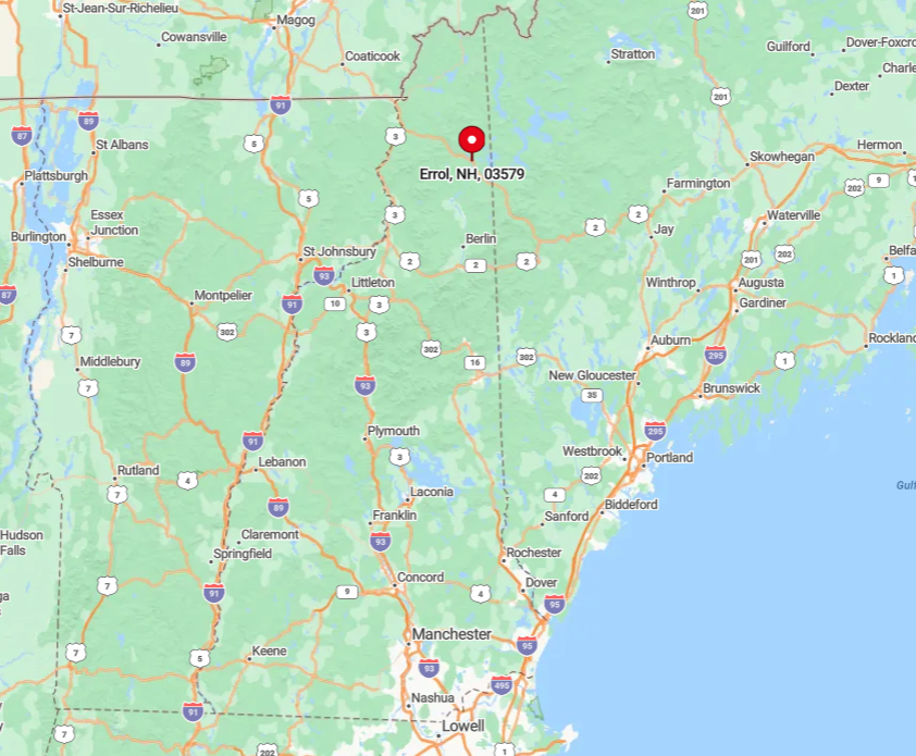
Errol sits at the junction of Routes 16 and 26, 40 road miles north of Berlin and nearly 100 miles from the closest commercial airport. Surrounding wetlands absorb road noise and reduce development opportunities, preserving the area’s quiet reputation.
Travelers typically approach via winding two-lane highways bordered by moose-warning signs. Public bus routes stop in Berlin, making private vehicles the only practical way to reach the village.
1. Success – An Uninhabited Township Swallowed by the White Mountain Forest
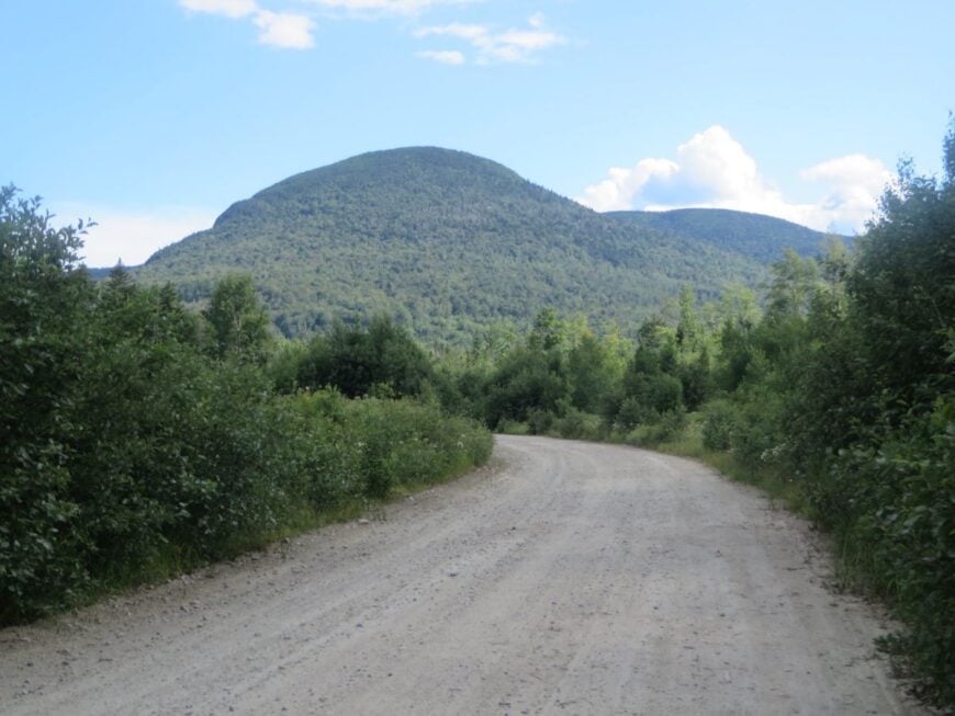
Success has no full-time residents and only a handful of seasonal camps scattered across 24,000 acres of unbroken spruce and fir. Off-road enthusiasts follow the rugged Success Pond Road to fish brook-trout pools or to bushwhack toward Mount Success for sweeping views into Maine.
Any economic activity ended with the last logging operation decades ago, leaving only rusted sluice gates and collapsed skidder bridges as relics. The absence of electricity, potable water lines and maintained public roads makes the area one of New England’s purest pockets of wild land.
Silence reigns to such an extent that visitors often hear only wind sifting through tree tops and the occasional creak of old logging cables. Those who hike at night can sometimes catch the faint glow of distant paper mills forty miles away, confirming just how far they have ventured from modern bustle.
Where is Success?
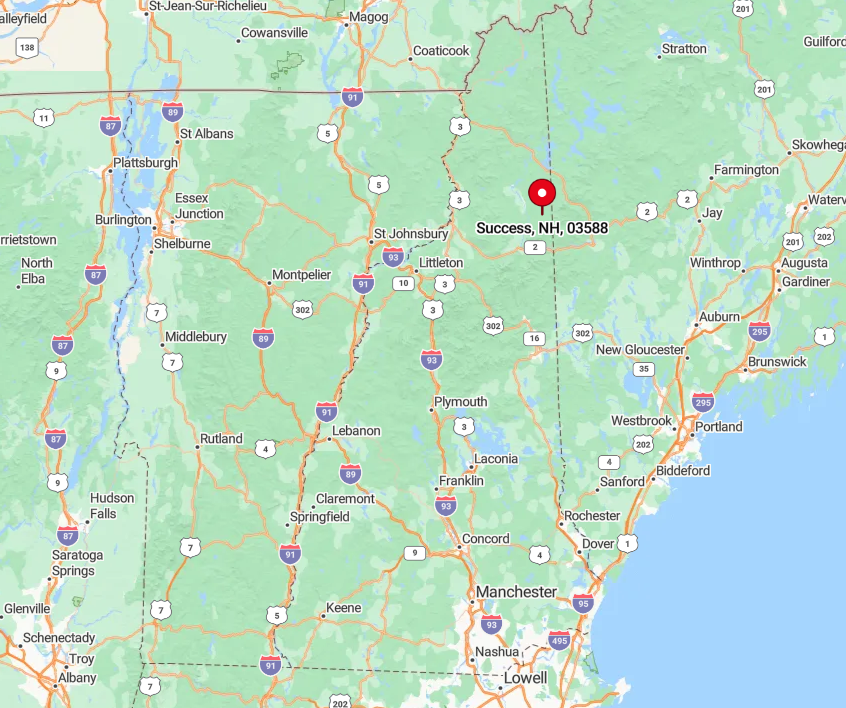
The township lies directly east of Berlin, with the primary access being the unpaved Success Pond Road beginning near the city’s outskirts. Thick forest and a patchwork of beaver wetlands isolate the interior, while rough road conditions slow all travel to a crawl.
No public utilities extend past the gate, and winter snowfall frequently closes the route until late April. Adventurers must carry everything they need and be ready for the long return journey to the nearest store, a reality that keeps this wilderness as empty as its census count suggests.


