Would you like to save this?
In the far reaches of Northeast California, there are towns that quietly resist the modern world’s demands, content in their solitude and tucked gently behind forests, nestled in valleys, or resting alongside winding rivers. These places seem to whisper, rather than call out, to those who happen upon them, offering a haven that feels both timeless and forgotten.
With populations that barely stretch into the hundreds, each town carries a rooted, unhurried charm—untouched by the noise of cities, and unbroken by the hands of progress. They are quiet enclaves where life still flows slowly, where the streets remain familiar, and the landscapes offer peace rather than haste.
For those who seek solace, nature, or a return to something simpler, these hidden gems offer a rare opportunity to breathe deeply and connect with a rhythm that’s often lost in the wider world.
25. Montague – A Quiet Gateway to the Siskiyous
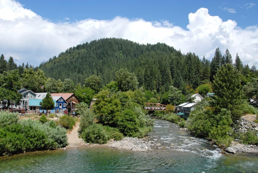
Montague, a peaceful town of just under 1,500 people, sits nestled at the base of the Siskiyou Mountains. Tucked away from the usual tourist crowds, it offers a serene retreat for those looking to escape the hustle and bustle. The town’s charm lies in its simplicity, with the Shasta River offering ample opportunities for fishing and the nearby Pacific Crest Trail tempting hikers to explore its scenic beauty.
Steeped in history, Montague’s past as a railroad hub is still apparent in the preserved depot, a testament to the town’s rich heritage. The depot serves as a reminder of an era long past, giving visitors a glimpse into its once-thriving role as a transportation center. Although small in size, Montague embraces its cultural heritage with local art, lively community events, and quaint antique shops that give the town a unique personality.
The surrounding wilderness is just as captivating as the town itself, with wide-open spaces and majestic mountain views. It’s a place where nature lovers and outdoor enthusiasts can enjoy the quiet, undisturbed beauty of the Siskiyous, while the slower pace of life allows for true relaxation. Montague’s charm comes not from flashy attractions, but from its understated serenity and deep connection to nature.
Where is Montague?
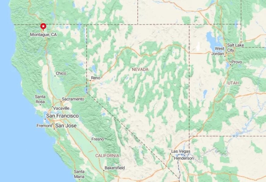
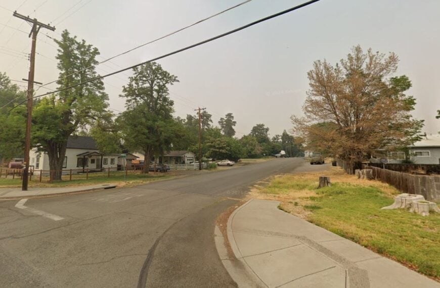
Montague is tucked away in Siskiyou County, located along Highway 97, about 12 miles south of Yreka and 45 miles from the Oregon border. The town’s location places it on the edge of California’s northernmost reaches, surrounded by expansive farmland and dense forests that add to its sense of remoteness.
The drive to Montague is a journey through quiet, winding roads, often closed by snowstorms in the winter, which only deepens the town’s isolation. While it is accessible by car, its seclusion makes it feel like a place apart, where the world outside seems a distant memory.
24. Macdoel – Timbered Town Between Volcanoes and Valleys
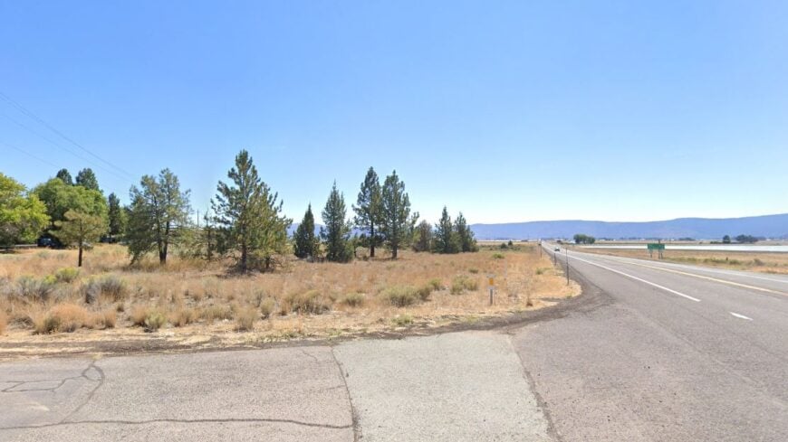
Macdoel, with a population of fewer than 100 people, feels more like a hidden secret than a town. Situated on the edge of the Shasta Valley, it offers breathtaking views of the surrounding landscape, with Mount Shasta towering to the south and the Modoc Plateau stretching out in the distance.
The town’s quiet charm lies in its isolation, offering peace and solitude for those who venture here. Macdoel’s economy is rooted in the timber industry, with local sawmills playing a key role in the small town’s livelihood. But beyond its industry, the area is a paradise for outdoor enthusiasts.
The nearby lava beds and dense forests provide opportunities for hiking, birdwatching, and immersing oneself in unspoiled nature. It’s a peaceful hideaway where nature reigns, perfect for anyone looking to escape into the wilderness.
Where is Macdoel?
Macdoel is located along Highway 97, about 25 miles north of the California-Oregon border. Nestled between volcanic mountains, the town offers stunning views of Mount Shasta to the southeast, with the surrounding valleys and forests providing a scenic backdrop.
While accessible by road, Macdoel’s location adds to its sense of seclusion, making it feel like a world apart.
23. Tulelake – Quiet Ranches at the Edge of the Lava Beds
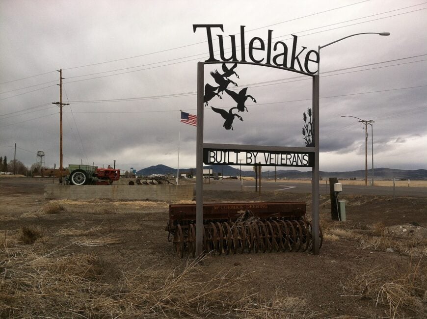
Tulelake, with a population just over 1,000, rests in the northeastern corner of California, offering a peaceful retreat into rural beauty. Located near the Lava Beds National Monument, the town is a gateway to fascinating volcanic landscapes, including caves, craters, and historic sites that speak to the area’s ancient past. The town’s charm is rooted in its slow pace and vast open spaces, where agriculture thrives and the land stretches out in quiet solitude.
Farming is the heartbeat of Tulelake, with fields of crops dotting the valley, and the agricultural lifestyle permeates the town. Nature lovers will find plenty to enjoy, from the nearby Tule Lake National Wildlife Refuge to the stillness of the surrounding countryside.
It’s the kind of place where time slows down, offering both quiet reflection and an intimate connection with nature, making it perfect for those seeking an escape from the usual rush of life.
Where is Tulelake?
Tulelake is nestled in Siskiyou County, near the Oregon border, approximately 15 miles northwest of Klamath Falls, Oregon. Accessible via Highway 139, the town is surrounded by sweeping agricultural lands and the dramatic lava fields that stretch across the region.
The area’s remote location contributes to its peaceful ambiance, making it feel like a world away from busy urban life.
22. Dorris – Quiet Haven by the Oregon Border
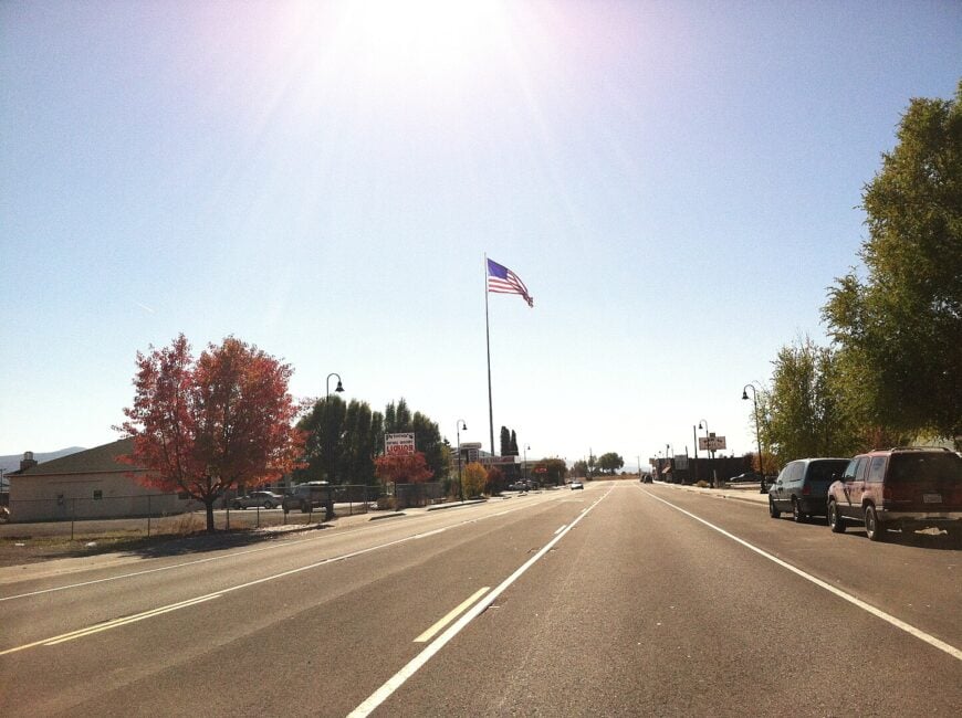
Dorris, a tiny town with fewer than 1,000 residents, lies at the far northern edge of California, a peaceful haven near the Oregon border. The town offers a tranquil, rural lifestyle, far from the noise and distractions of city living. With its open spaces and fresh air, Dorris feels like a world apart, where time seems to slow and nature takes center stage.
Farming and ranching are the core of Dorris’s economy, with the surrounding fields and hills providing a scenic backdrop. The area is a haven for birdwatchers, particularly during migratory seasons when flocks of birds make their way through the region.
It also offers outdoor enthusiasts access to nearby forests and mountains, with hiking trails leading to quiet lakes and rugged terrain. Dorris, with its unhurried pace, is the perfect place to disconnect and enjoy nature in its most serene form.
Where is Dorris?
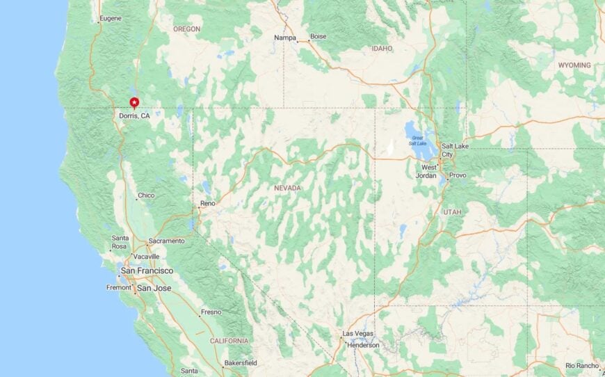
Dorris is located in Siskiyou County, just a stone’s throw from the Oregon border, about 4 miles north of Yreka. Accessible via Highway 97, the town is surrounded by vast farmland and rolling forested hills, contributing to its sense of isolation and calm. Its remote location offers the perfect escape into nature, where quietude and beauty await at every turn.
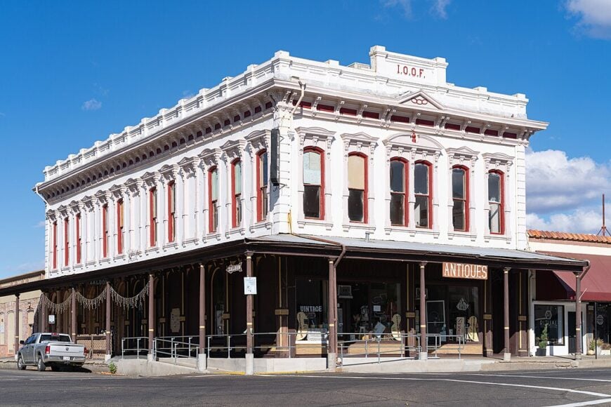
21. Yreka – Historic Gateway to the Golden North
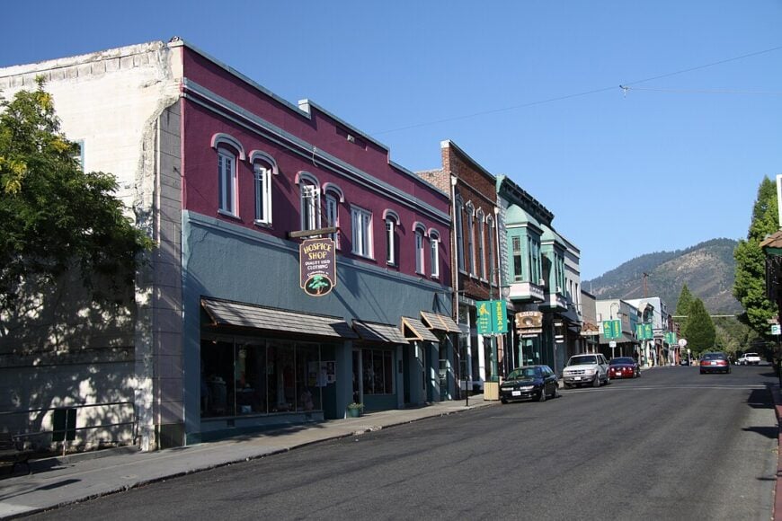
Yreka, with a population of around 7,500, is a charming town nestled in the Siskiyou Mountains, offering visitors a rare glimpse into California’s past. Known for its well-preserved Victorian architecture, Yreka blends history and nature in a way few towns can. The streets are lined with buildings that harken back to the Gold Rush era, each telling a story of a time when this town was a bustling mining hub.
As a crossroads town, Yreka sits at the junction of several hiking and driving routes, leading adventurers to the surrounding mountains, lakes, and forests. Whether you’re exploring the town’s rich history in its local museums or venturing into the great outdoors, there’s something for everyone.
The town’s Gold Rush legacy is still very much alive, with preserved buildings and museums bringing the past to life for history enthusiasts. Yreka offers the perfect combination of small-town charm and natural beauty, making it a must-visit for both history buffs and nature lovers.
Where is Yreka?
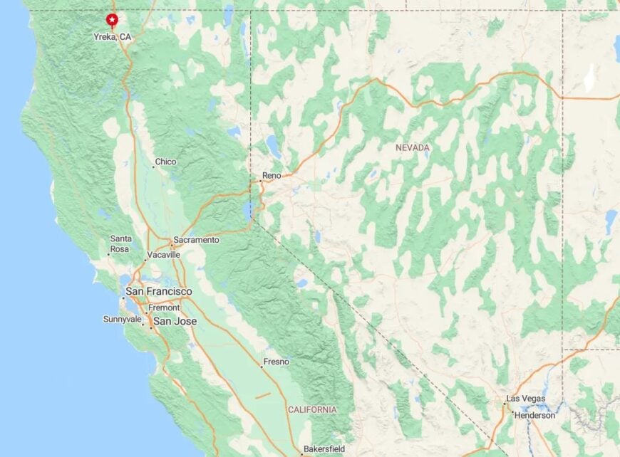
Yreka is located along Interstate 5, about 50 miles south of the Oregon border. Set against the backdrop of the Siskiyou Mountains, the town serves as a gateway for travelers heading into the rugged northern reaches of California.
Its location makes it an ideal stop for those seeking both outdoor adventures and a taste of California’s historic past.
20. Gazelle – Remote Ranch Town Near Mount Shasta
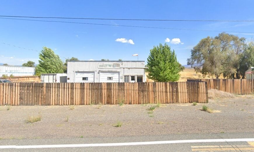
Gazelle, with fewer than 500 residents, is a peaceful town tucked at the base of Mount Shasta, offering an idyllic escape into the heart of nature. The town sits at the intersection of Highways 89 and 97, providing easy access to the sprawling landscapes of the Shasta Valley and the surrounding national forests. Gazelle’s small size and rural character give it a unique tranquility, where time moves at a slower pace and the sounds of nature fill the air.
Agriculture is at the core of life here, with ranching, hay farming, and livestock driving the local economy. The town’s charm lies in its unhurried way of life, offering visitors a quiet retreat to enjoy the natural beauty of the region.
Gazelle also serves as a perfect base for outdoor activities, with Mount Shasta just a short distance away and its scenic hiking trails waiting to be explored. Whether you’re looking to immerse yourself in the serenity of rural life or venture into the mountains, Gazelle offers a perfect starting point.


Where is Gazelle?
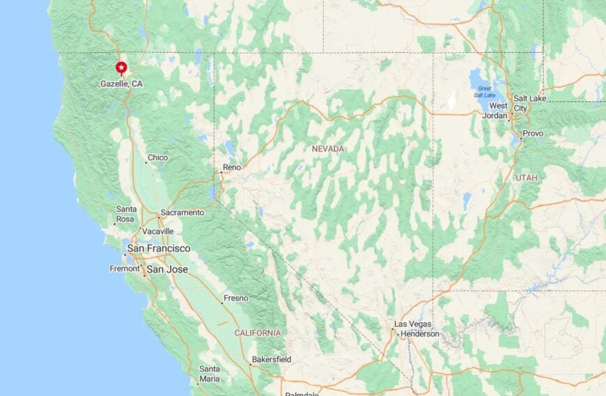
Gazelle is located along Highway 89, about 15 miles south of Yreka. Nestled between the Klamath River and the towering presence of Mount Shasta, the town’s secluded setting offers stunning views of the surrounding mountains.
Its peaceful location makes it an ideal retreat, where the noise of the world feels distant and the beauty of nature surrounds you.
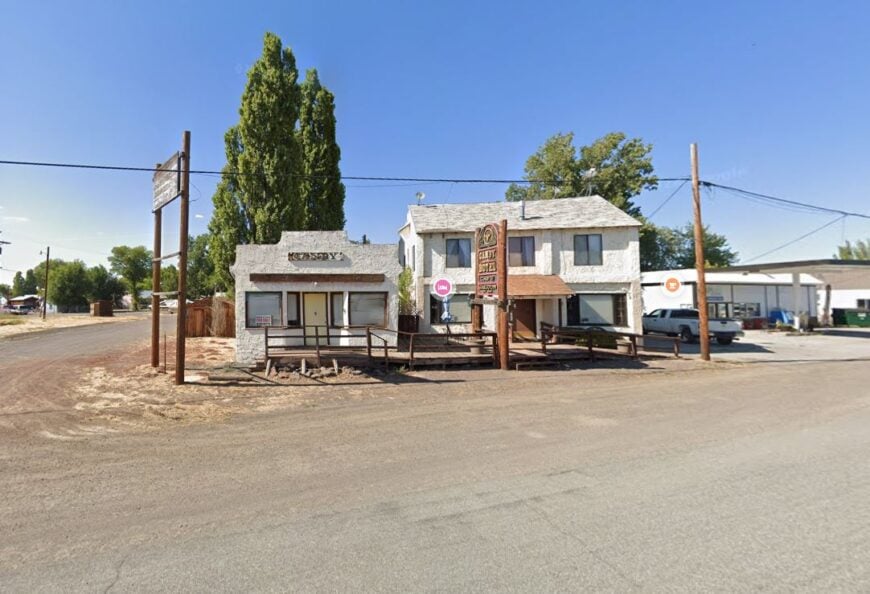
19. Canby – Quiet Crossroads on the Modoc Plateau
Would you like to save this?
Canby, with fewer than 400 residents, is a humble ranching town nestled in the vast, sweeping high desert of Modoc County. It’s a place where Highways 139 and 299 converge, serving more as a waypoint than a true destination—but that’s exactly what makes it so intriguing. The town feels timeless, perched between expansive skies and dry hills, where old barns and gravel roads speak of years of quiet endurance.
Life here is slow, with little noise aside from the occasional hum of the wind and the call of distant birds. The surrounding landscape is an endless stretch of solitude—empty roads, hidden creeks, and fields of sagebrush rolling out toward mountain ridges. The silence here is profound, interrupted only by the soft rustling of the desert.
Nightfall brings a different kind of beauty, with stars blanketing the sky and the chance to witness mule deer more often than a passing car. Canby offers a genuine calmness, a peaceful retreat where the hustle of the world seems far away and forgotten.
Where is Canby?
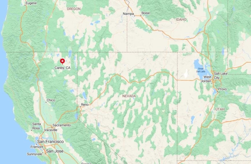
Canby lies in northeastern California’s Modoc County, about 17 miles northwest of Alturas. It sits on the Modoc Plateau at the crossroads of Highways 139 and 299, surrounded by expansive ranchlands, volcanic hills, and the occasional remnants of old railroads.
This rugged, remote location gives Canby its frontier feel, where the landscape’s untouched beauty reminds you that you’ve truly stepped off the beaten path.
18. McCloud – A Mountain Village with a Scenic Railroad Legacy
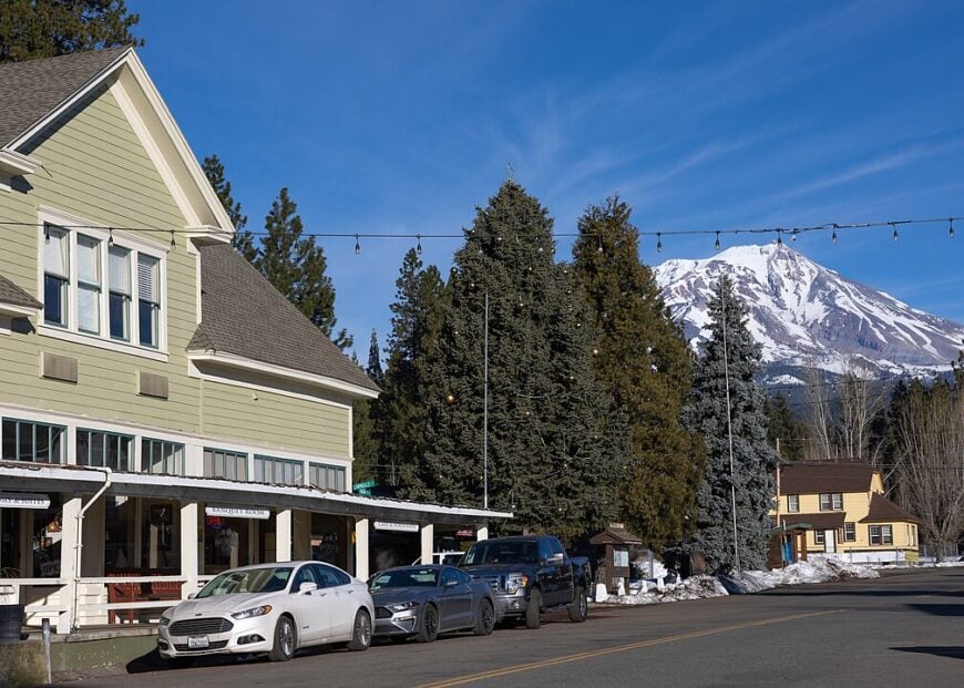
McCloud, with a population of around 1,000, lies at the foot of the majestic Mount Shasta, offering both a peaceful retreat and a link to the past. The town’s origins as a historic lumber hub are still evident, with its charming district filled with old sawmills and railroad tracks. These remnants of its industrial past offer visitors a fascinating glimpse into McCloud’s history while maintaining a quaint, welcoming atmosphere.
Nature lovers are drawn to McCloud for its stunning landscapes. The McCloud River, with its picturesque waterfalls, invites exploration, while McCloud Lake is a popular destination for boating, fishing, and camping.
With its mix of outdoor beauty and historical charm, McCloud serves as the perfect destination for both adventure seekers and history buffs alike.
Where is McCloud?
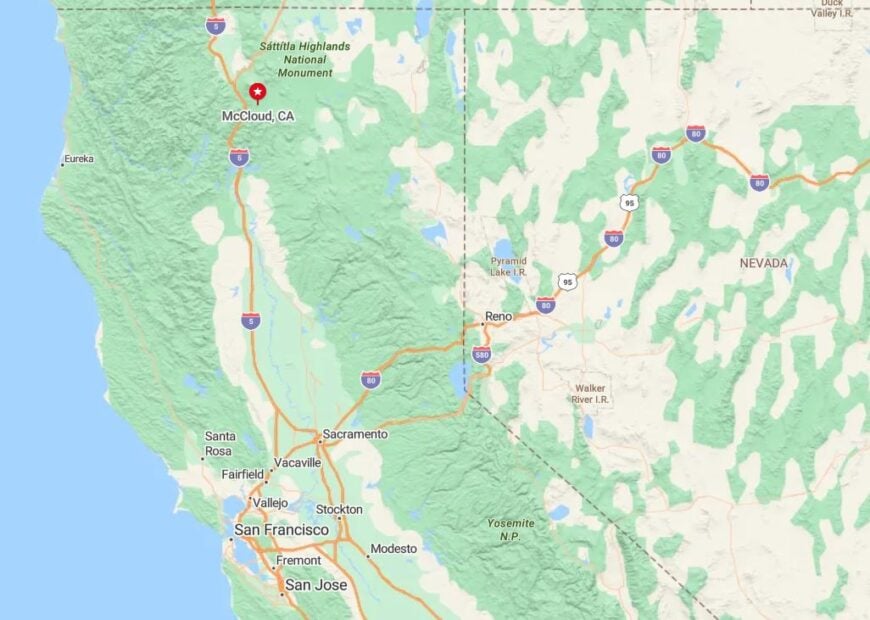
McCloud is located along Highway 89 in Siskiyou County, about 12 miles south of Mount Shasta. Surrounded by lush forests and the towering mountains, McCloud is a prime spot for outdoor enthusiasts looking to explore the wild beauty of northern California.
Its close proximity to the mountain makes it an excellent base for hiking, fishing, and history-focused adventures.
17. Weed – Gateway to Mount Shasta and Scenic Outdoors
Weed, a small town with a population of about 2,500, sits at the base of the majestic Mount Shasta, offering stunning views of the iconic peak. Located at the intersection of Interstate 5 and Highway 97, it serves as a popular stop for travelers heading toward the mountain. Though modest in size, Weed is steeped in history, with its roots firmly planted in the logging industry.
The town offers a variety of outdoor activities year-round, from fishing and hiking in the warmer months to skiing and snowshoeing in the winter. For those seeking solitude and a connection to nature, Weed is the perfect stop, offering breathtaking views of Mount Shasta and access to the surrounding forests.
It’s a quiet retreat for anyone looking to escape into the beauty of the northern California outdoors.
Where is Weed?
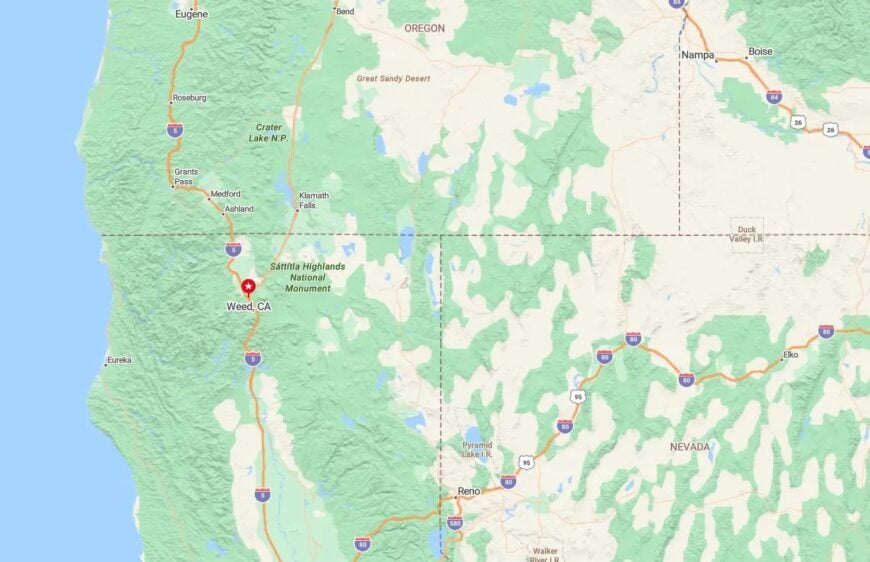
Weed is located along Interstate 5 in Siskiyou County, about 10 miles south of Mount Shasta. Easily accessible from major highways, the town offers travelers an excellent base for exploring the mountain and surrounding areas.
With its stunning vistas of Mount Shasta to the north, Weed provides a picturesque and serene escape into the beauty of northern California.
16. Shasta – The Quiet Gold Rush Town
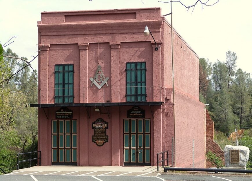
Shasta, a tiny town with fewer than 100 residents, is a serene gem tucked away in the hills of the Shasta-Trinity National Forest. The town’s remote location and peaceful atmosphere make it feel like time has stood still, offering a quiet retreat for those seeking solitude. Visitors are drawn to Shasta for its well-preserved gold rush-era buildings, which stand as reminders of California’s rich mining history.
Though small, Shasta offers a fascinating glimpse into the past, with its historic town square and preserved structures that transport you back to the 19th century. Surrounded by lush forests and towering mountains, the town is an ideal spot for nature lovers and history buffs alike.
It’s a place where the past and present come together in a quiet, secluded setting, offering peace and reflection to all who visit.
Where is Shasta?
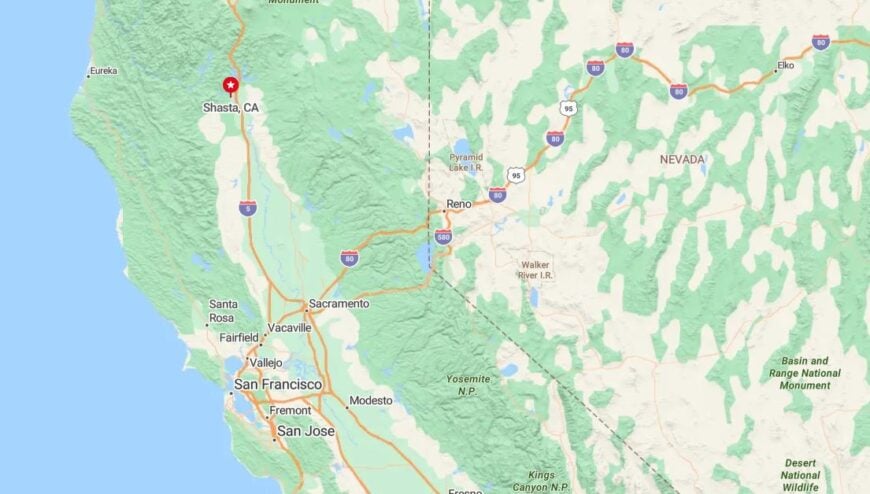
Shasta is located along Highway 299, about 12 miles west of Redding. Nestled within the Shasta-Trinity National Forest, the town is surrounded by pristine wilderness, offering access to hiking, fishing, and other outdoor activities.
Its historical charm and tranquil location make it the perfect spot for those looking to immerse themselves in both nature and California’s mining history.
15. Red Bluff – Historic Riverside Retreat
Red Bluff is a picturesque town set along the banks of the Sacramento River in Tehama County. Known for its historic downtown, the town blends small-town charm with easy access to nature, creating a relaxing atmosphere for both residents and visitors. With a welcoming community vibe, Red Bluff offers a peaceful retreat that’s perfect for those seeking a break from the hustle and bustle of city life.
The town offers a variety of activities, including leisurely strolls along the river, enjoying the annual fair, or venturing out to the nearby Lassen Volcanic National Park. Whether you’re exploring the outdoors or simply soaking in the town’s historic charm, Red Bluff provides a delightful escape.
Its blend of natural beauty and small-town warmth makes it a great destination for relaxation and exploration.
Where is Red Bluff?
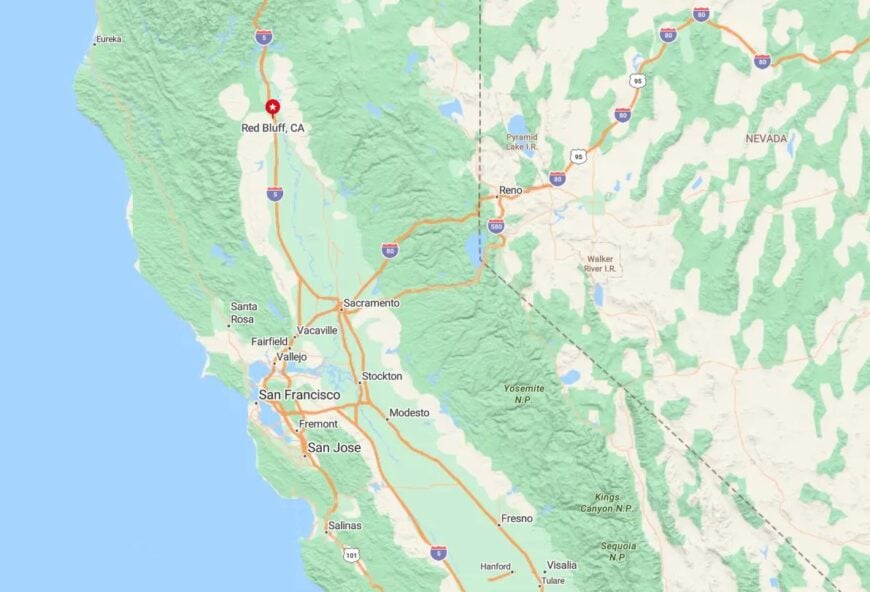
Red Bluff is located off Interstate 5 in Tehama County, about 30 miles south of Redding. Its convenient location along the highway makes it easily accessible, offering visitors the chance to experience both the tranquility of the Sacramento River and the adventure of nearby outdoor destinations.
Whether seeking peace or adventure, Red Bluff is the perfect base for exploring northern California.
14. Happy Camp – Remote Siskiyou Sanctuary
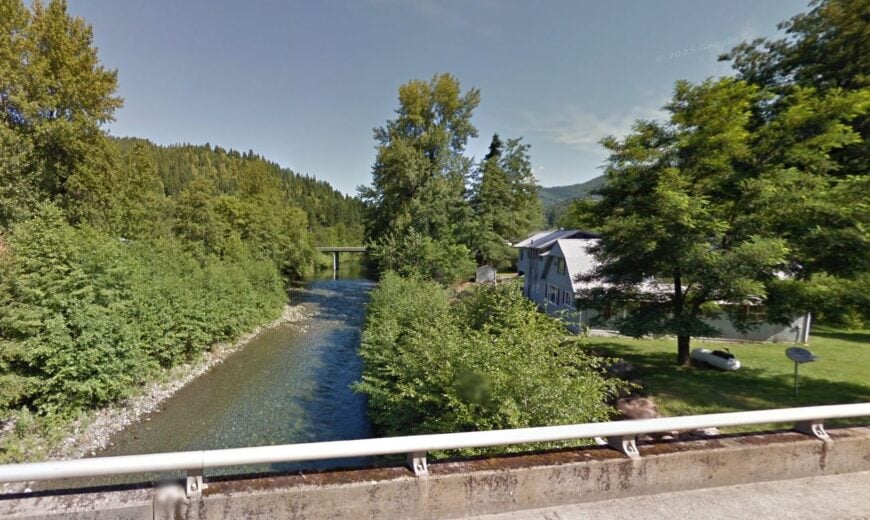
Happy Camp, with a population of fewer than 1,000 residents, is a peaceful town tucked away in the heart of the Siskiyou Mountains. Known for its stunning natural beauty, the town provides access to the Klamath River, a popular spot for fishing, rafting, and exploring.
Its remote location offers a serene escape, where outdoor adventures await around every corner, making it a hidden gem for nature lovers. The town’s charm lies in its quiet atmosphere and the rugged landscapes that surround it. Hiking trails wind through the dense forests, and the river provides ample opportunities for outdoor recreation.
Happy Camp’s sense of isolation makes it the perfect place to disconnect from the world, while the breathtaking beauty of the Siskiyou Wilderness invites you to reconnect with nature in its purest form.
Where is Happy Camp?
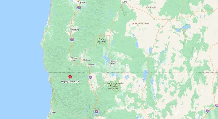
Happy Camp is located 55 miles northeast of Yreka, easily accessible via Highway 96. Nestled between dense forests and the Klamath River, it serves as a gateway to the Siskiyou Wilderness, offering a peaceful retreat surrounded by natural wonders.
Its remote setting enhances its allure, making it an ideal base for exploring the surrounding wilderness.
13. Horse Creek – Quiet Corner of the Klamath
Would you like to save this?
Horse Creek, a tiny town with fewer than 200 residents, is tucked into the serene Klamath River Canyon, offering a peaceful retreat far from the hustle and bustle of modern life. The town’s tranquil atmosphere is its greatest asset, with no commercial distractions to interrupt the natural flow of life. This makes it the perfect spot for those seeking a true sense of solitude, surrounded by the beauty of nature.
Outdoor enthusiasts flock to Horse Creek for its many recreational opportunities. Secluded hiking trails wind through the surrounding forests, offering stunning views of the canyon and access to hidden corners of the Klamath National Forest. Trout fishing in the river is also a popular activity, with the waters offering plentiful catches for those looking to relax and connect with nature.
Horse Creek’s small size and remote location ensure that the town remains quiet throughout the year. The peaceful ambiance and natural beauty of the area make it an ideal destination for those who want to get away from it all and experience the calming solitude of rural California.
Where is Horse Creek?
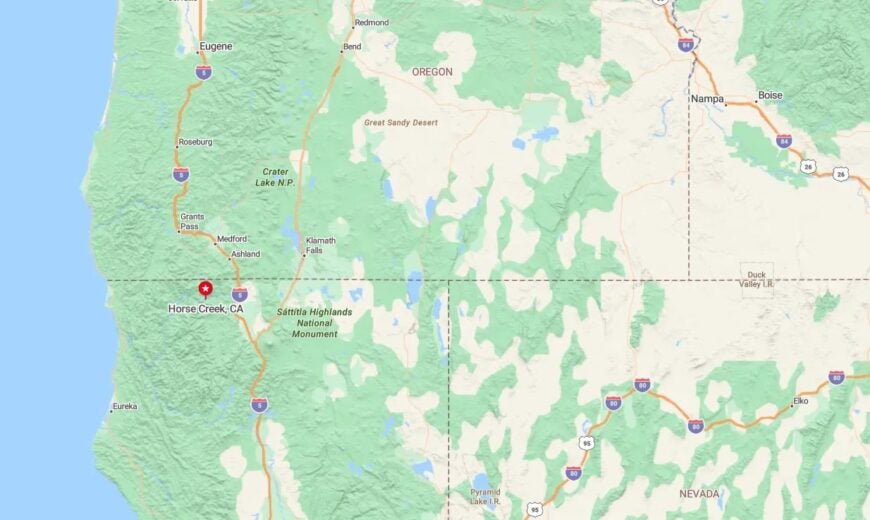
Horse Creek is located along Highway 96, about 35 miles north of Weaverville. Its remote setting, nestled in the rugged Klamath River Canyon, contributes to its secluded charm. With little in the way of tourist infrastructure, Horse Creek remains one of the hidden gems of the Klamath region, offering visitors an authentic escape into nature.
12. Klamath – A Remote River Town in the Shadows of the Klamath Mountains
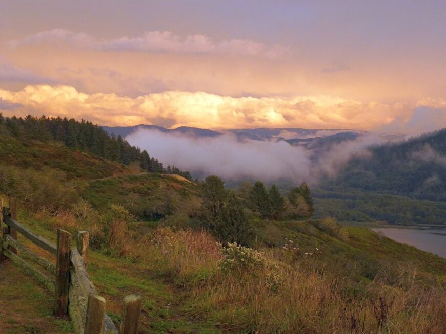
Klamath, nestled in the far northern reaches of California, offers visitors a peaceful, riverfront escape in a landscape of lush forests and towering mountains. The town’s close proximity to the Klamath River makes it a perfect haven for fishing enthusiasts, offering plentiful opportunities to cast a line in serene surroundings. The sound of the river flowing through town adds to the calming atmosphere, creating a soothing backdrop to everyday life.
Small and tight-knit, Klamath has a sense of timelessness, with its rural character and isolation making it a perfect retreat for those looking to disconnect. The town feels almost suspended in time, offering a serene way of life that is far removed from the noise of urban centers. Visitors are drawn to Klamath for its natural beauty, where the Klamath Mountains rise in the distance, promising an array of outdoor adventures just waiting to be explored.
Nature lovers will find Klamath to be an ideal base for hiking, fishing, and immersing themselves in the surrounding wilderness. With its tranquil setting and peaceful atmosphere, it is a place where one can truly appreciate solitude and the unspoiled beauty of California’s northernmost landscapes.
Where is Klamath?
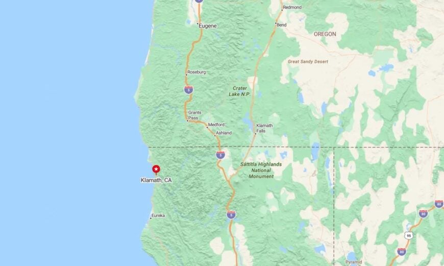
Klamath is located along Highway 101 in Del Norte County, about 35 miles from the Oregon border. The town sits at the mouth of the Klamath River, with majestic mountains and forests providing a stunning natural backdrop.
Its remote setting offers the perfect escape, with the rugged beauty of the landscape adding to its allure as a peaceful retreat from the hustle of city life.
11. Orleans – Peaceful River Town Near the Wilds of the Klamath
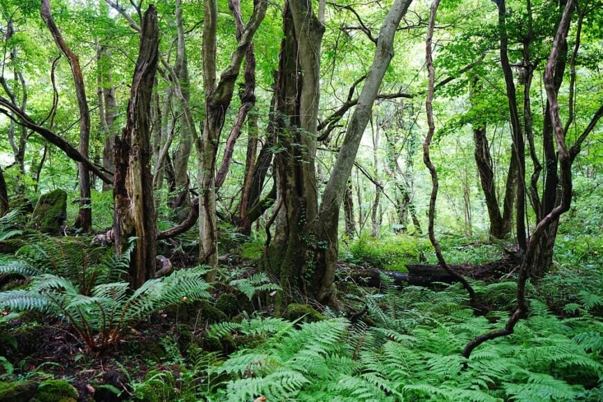
Orleans, a quiet town nestled in the heart of the Klamath River Canyon, is a haven for outdoor enthusiasts and nature lovers. With a population of fewer than 800 residents, this small community offers an escape into nature, where visitors can enjoy hiking, fishing, and birdwatching in the nearby Klamath National Forest. The town’s peaceful atmosphere, coupled with its stunning natural surroundings, makes it a perfect place to disconnect and experience the raw beauty of the region.
The town of Orleans is ideal for those who appreciate the calm of small-town life, surrounded by dense forests and the constant flow of the Klamath River. While the town remains quiet, it offers a few local cafés and general stores where travelers can relax, chat with friendly locals, and take in the tranquil setting.
Nature lovers will find Orleans to be a peaceful and picturesque base for exploring the Klamath River Canyon and its surrounding wilderness. The town’s access to rivers and forests makes it an excellent spot for outdoor recreation, offering endless opportunities to immerse yourself in the beauty of Northern California.
Where is Orleans?
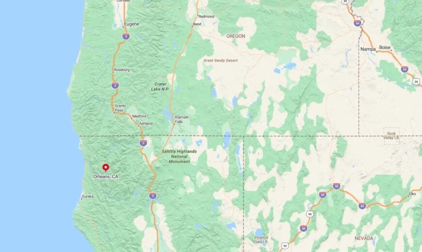
Orleans is located along Highway 96 in Humboldt County, about 35 miles east of Crescent City. Positioned along the Klamath River, the town is surrounded by dense forests and wilderness, offering seclusion and serenity.
Its remote location and access to the wild Klamath River make Orleans an idyllic retreat for those seeking tranquility and adventure in nature.
10. Sierraville – Wide-Open Meadow Village Ringed by Peaks
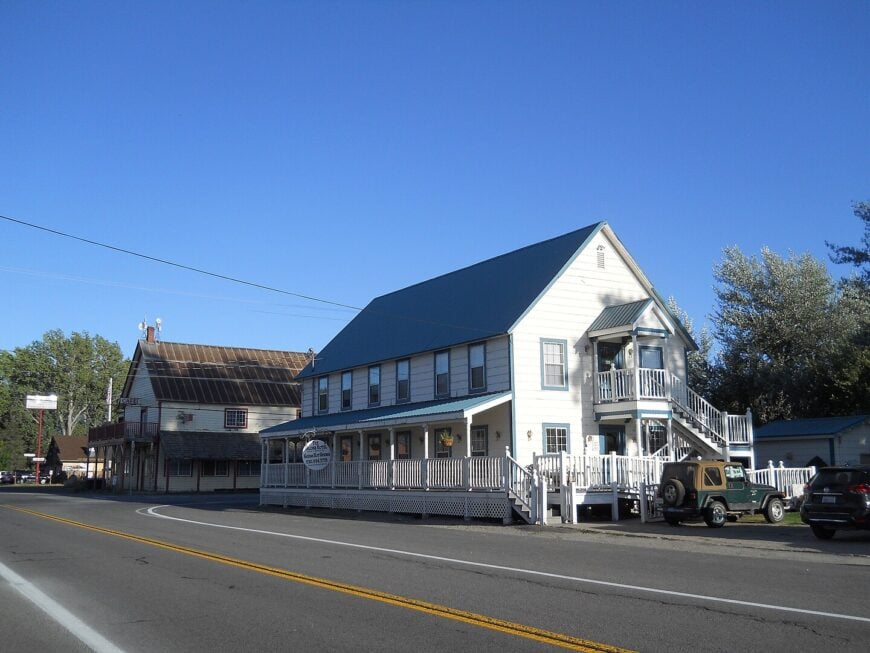
Sierraville counts roughly 200 residents clustered around a single crossroads of pastel storefronts and weathered barns.
Daytime pursuits include soaking in nearby private hot springs, casting a line for trout in the Little Truckee River, and photographing the Sierra Buttes as alpenglow washes over the 5,000-foot-high meadow.
Cattle ranching and small-scale tourism sustain the local economy, with roadside cafés serving ranch hands and cyclists tackling Highway 89. Steaming geothermal vents, endless sage flats, and that lofty bowl of mountains make the village feel worlds away from Tahoe’s bustle just over the pass.
Even summer weekends stay uncrowded because lodging is limited to a handful of vintage motels and farm-stay cabins. All told, Sierraville’s remoteness is preserved by both geography and deliberate pacing—nothing here moves faster than the afternoon clouds.
Where is Sierraville?
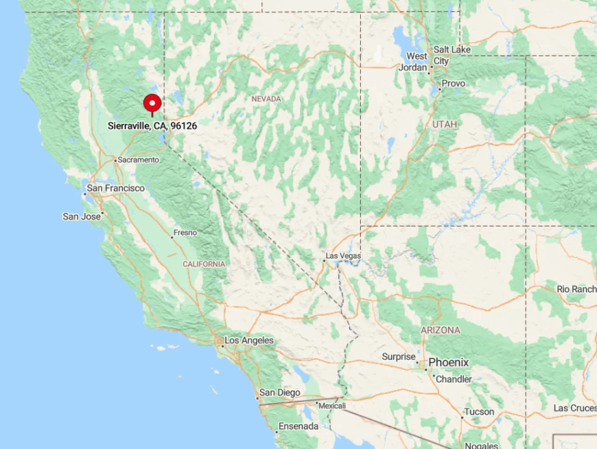
Sierraville sits in southern Sierra County at the junction of Highways 89 and 49, twenty-five miles north of Truckee and Interstate 80. The meadow is hemmed in by the Sierra Nevada on three sides, so snowpack and seasonal road closures keep traffic light for much of the year.
Travelers wind over 6,700-foot Yuba Pass or drop down from Jackson Meadows to reach town, both routes offering tight curves that discourage hurried driving. Public transport is nonexistent, so arrival usually means a personal vehicle—or the occasional dual-sport motorcycle eager for quiet miles.
9. Downieville – Gold-Rush Gem Deep in the Yuba River Canyon
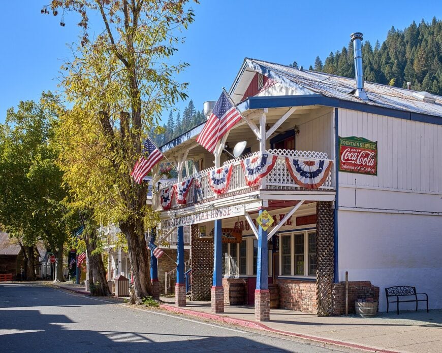
Home to about 325 year-round residents, Downieville clings to steep canyon walls where the North Yuba and Downie Rivers meet. Visitors paddle emerald pools, fish for native trout beneath 19th-century wooden bridges, and ride some of California’s most famous shuttle-served mountain-bike trails.
Today’s income leans on outdoor recreation, a small courthouse staff (this is the Sierra County seat), and a smattering of cafés occupying restored saloons. Sheer granite walls, dense pine forest, and a single ribbon of pavement isolate the town so effectively that winter storms can leave it temporarily cut off.
Locals embrace the seclusion, swapping supplies at the two-room grocery and sharing trail intel at the riverfront bar. Because expansion is hemmed in by both geography and historic-district rules, Downieville remains frozen—in the best way—in its gold-rush scale.
Where is Downieville?
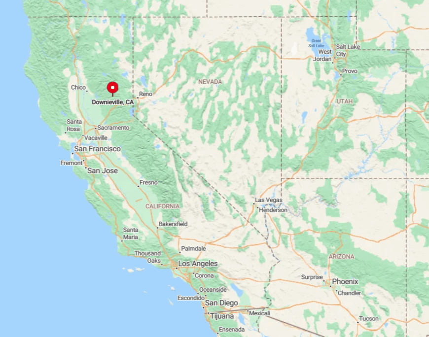
Would you like to save this?
Downieville lies 60 winding miles northwest of Nevada City on Highway 49, buried in the deepest part of the North Yuba River canyon. The road’s hairpin turns, single-lane bridges, and 3,000-foot drop-offs keep large RVs—and crowds—at bay.
No public transit reaches the town; visitors either drive or book a seasonal bike shuttle that doubles as a de facto bus. Once the sun sets, the nearest streetlight outside town is nearly twenty miles away, reinforcing just how tucked in this place is.
8. Mineral – Gateway to Lassen Park’s Quiet South Entrance
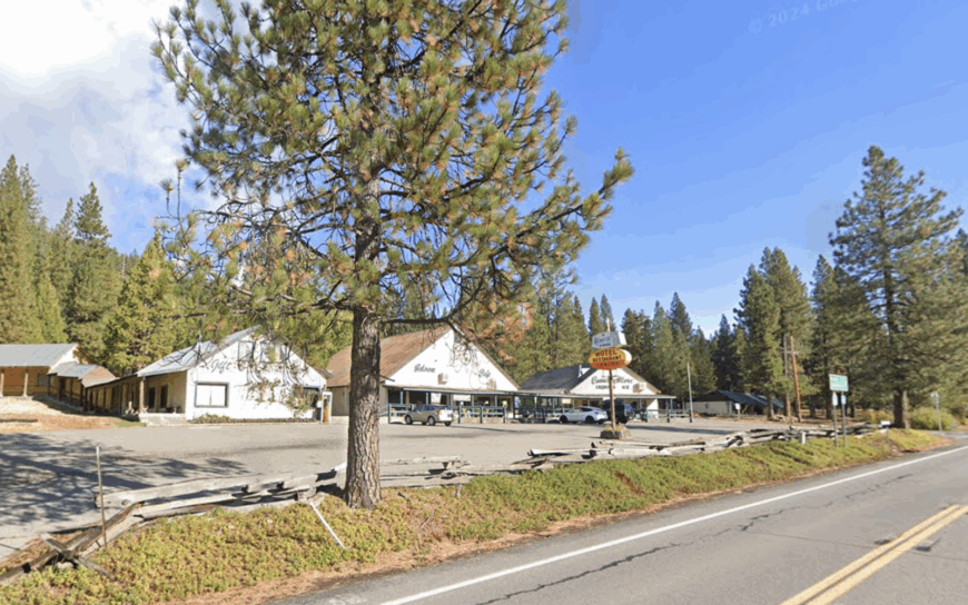
Around 120 full-time residents occupy Mineral’s roomy acre-lots threaded through red fir forest at 4,900 feet. Days revolve around hiking to Boiling Springs Lake, cross-country skiing the South Side trails of Lassen Volcanic National Park, and swapping stories at the century-old Mineral Lodge café.
Seasonal tourism and U.S. Forest Service jobs are the primary paychecks, with a few snow-removal crews hustling during the long winter. Heavy snowfall, limited cell coverage, and the absence of chain hotels keep Mineral blissfully uncrowded even in peak summer.
The three-person volunteer fire crew knows every chimney—and every dog—in town, proof of how small the footprint remains. With shuttered ski-resort ruins on one ridge and untamed wilderness on the other, Mineral offers seclusion welded to volcanic wonder.
Where is Mineral?
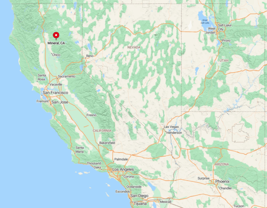
Mineral anchors a lonely stretch of Highway 36, forty miles east of Red Bluff and twenty miles west of Lassen’s Kohm Yah-mah-nee Visitor Center. Thick forest and winter road closures up on Lassen Peak limit through-traffic for nearly half the year.
The closest grocery beyond a mini-mart sits thirty minutes away in Chester, so visitors arrive self-sufficient. Those who make the trek earn front-row seats to Lassen’s southern sunrise—often without another car in sight.
7. Hat Creek – Stargazer’s Haven on the Volcanic Legacy Byway
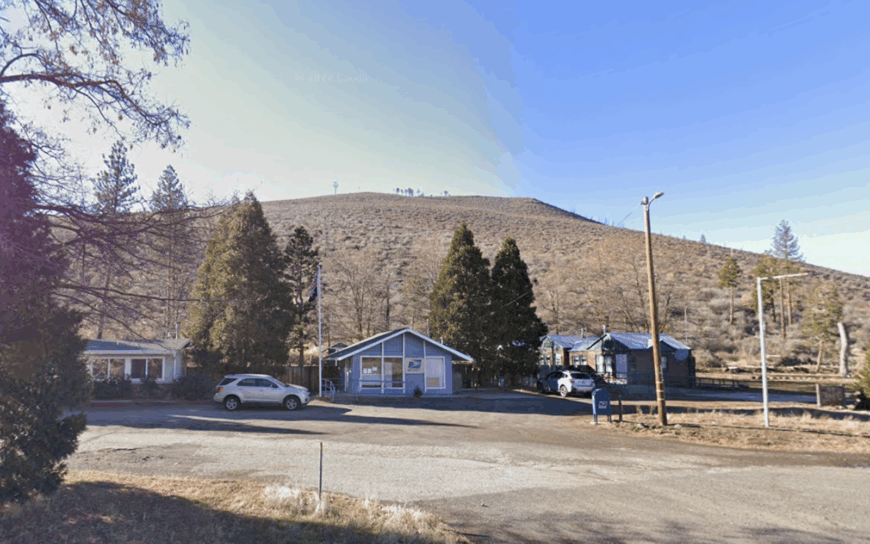
Only a few dozen cabins and ranch houses scatter along a ten-mile stretch of Highway 89 near the crystal-clear creek that lends this hamlet its name. Fly-fishing, lava-tube caving at Subway Cave, and late-night astrophotography at the Hat Creek Rim Overlook keep outdoor enthusiasts busy.
Ranching and the nearby Hat Creek Radio Observatory provide modest employment, the latter quietly scanning the cosmos with its field of radio dishes. Vast lava fields, absence of city lighting, and the protective embrace of national forest grant Hat Creek some of California’s darkest skies.
Even the general store closes early, leaving the Milky Way as the brightest marquee in town. In summer, the biggest traffic jam involves mule deer crossing the two-lane highway at dusk.
Where is Hat Creek?
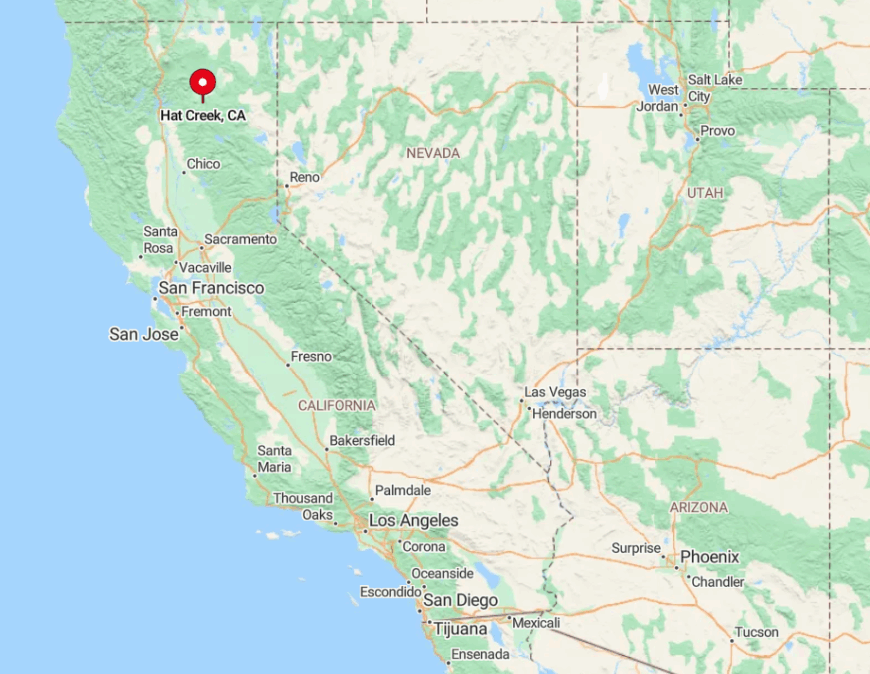
Hat Creek sits in Shasta County between Lassen Park and Burney, straddling the Volcanic Legacy Scenic Byway. Flanked by forest and pumice flats, the community lies thirty minutes from the nearest stoplight in either direction.
Access comes via Highways 44 or 299, both prone to winter ice and summer wildfire closures that further thin visitor numbers. No bus routes venture this far, so a full gas tank and a sense of adventure are mandatory.
6. Westwood – Lassen’s Pine-Scented Company Town Relic
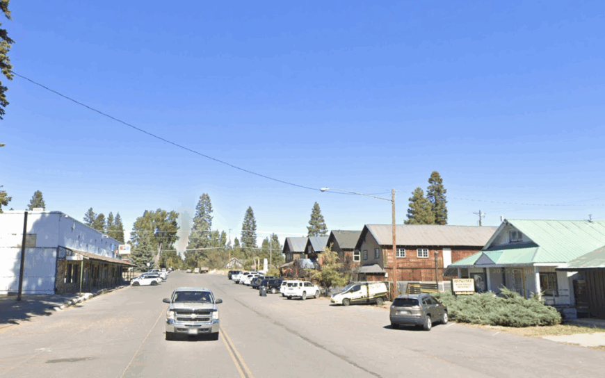
Roughly 1,600 residents live among a grid of wide streets originally planned by the Red River Lumber Company in the 1910s. Photo ops start with the 24-foot-tall Paul Bunyan statue and continue at the historic mill pond where otters now replace timber rafts.
Logging still supports some families, though many locals commute to Susanville or work seasonal gigs tied to nearby Lake Almanor recreation. Encircled by Lassen National Forest and sitting ten miles off any major highway, Westwood keeps its tranquil vibe even on holiday weekends.
The vacant mill itself—California’s largest for a time—still stands, offering a hulking reminder of the town’s roots and a backdrop for urban-exploration style photography. Tall pines hush road noise, so evenings reveal little more than crickets and the distant whistle of a Union Pacific freight.
Where is Westwood?
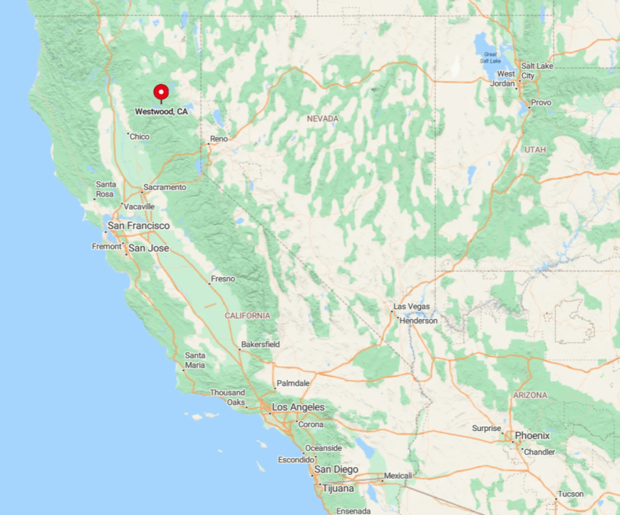
Westwood rests in Lassen County, five miles north of Highway 36 and about an hour east of Red Bluff. Visitors crest 5,000-foot Fredonyer Pass before dropping into town, a drive complicated by frequent winter chain controls.
There’s no commercial airfield nearby; the closest is Reno–Tahoe International, two hours south. Once the ridge is crossed, cell reception blinks out and the forest claims center stage—exactly the seclusion Westwood’s residents cherish.
5. Bieber – Bridge Town on the Wild & Scenic Pit River
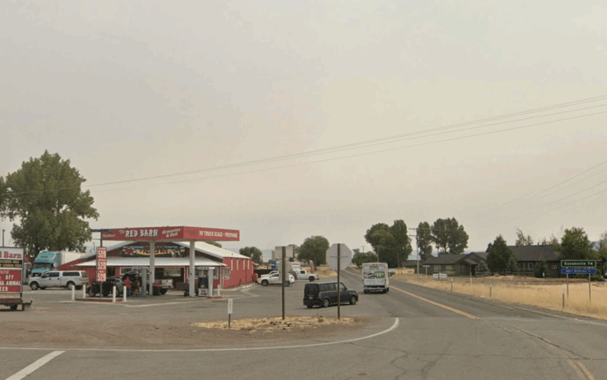
Close to 300 people call Bieber home, many tracing family ties to its early-1900s lumber boom. Anglers still praise the Pit River’s riffles, while photographers favor dawn shots of the steel rail trestle that spans misty pastureland.
Today, hay farming, small-scale logging, and Union Pacific rail maintenance keep paychecks circulating. Bieber’s isolation stems from its location on the far edge of Lassen County, where Highway 299 narrows and traffic thins.
The nearest chain restaurant sits forty miles away, so community events at the Grange Hall double as social lifelines. Quiet nights echo only with frogs from the river and the occasional distant locomotive.
Where is Bieber?
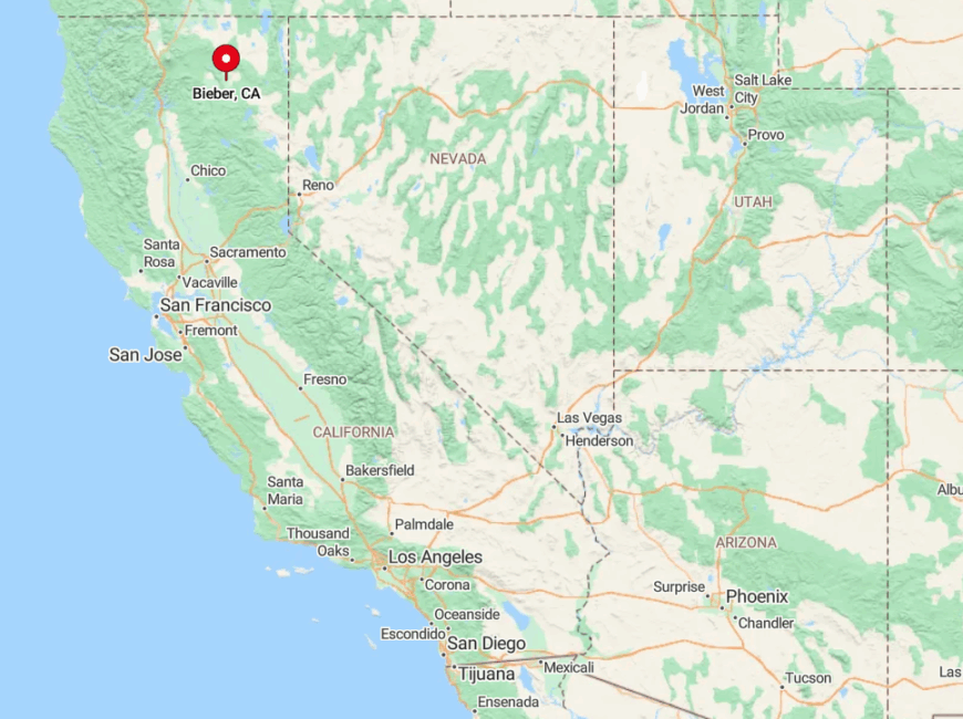
Bieber nestles along Highway 299, halfway between Burney and Alturas on the Modoc Plateau. Surrounding hills and a sparse road network make detours lengthy, while winter storms can close Cedar Pass and isolate the valley entirely.
Driving remains the only realistic way in; the former passenger rail line closed in the 1950s. Those who brave the miles arrive to find more cattle than cars and a river that meanders at the same unhurried pace as the town.
4. Likely – Modoc’s Lakeside Ranch Community
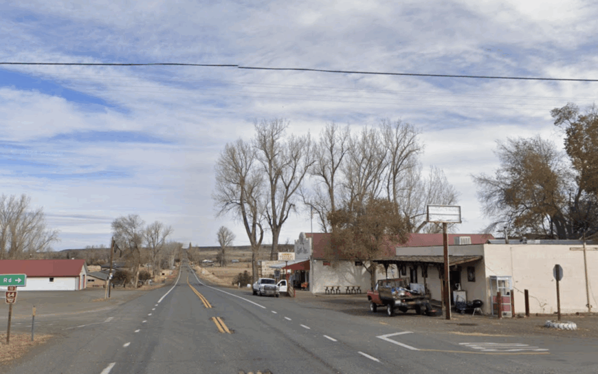
Likely counts fewer than 100 residents, most living on working cattle spreads that roll down to South Fork Reservoir’s glassy shoreline. Dawn kayaks, horseback rides across open pasture, and birdwatching for sandhill cranes are the day’s principal “appointments.”
Ranching reigns supreme, though a tiny RV park and general store accommodate the occasional angler. The nearest stoplight is forty miles away in Alturas, a gap that keeps weekend crowds nonexistent.
Endless vistas, minimal development, and a single paved road reinforce Likely’s sense of spacious isolation. On clear nights, barn owls and the slap of beaver tails provide the only soundtrack.
Where is Likely?
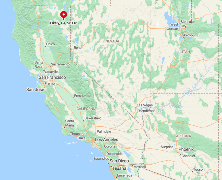
Likely sits on Modoc County’s Highway 395, twenty miles south of Alturas and a full three hours from the closest interstate. The valley is boxed in by Warner Mountains to the east and the South Fork of the Pit River to the west, limiting expansion.
Travelers generally reach town via the two-lane “Three Flags Highway,” a route light on gas stations but heavy on pronghorn sightings. With no public transit for miles, self-reliant visitors find the solitude they came for.
3. Adin – Tiny Timber Town on the Big Valley Prairie
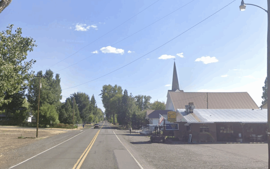
About 250 people live in Adin, an unincorporated pocket where Highway 299 meets Highway 139. Locals frequent the century-old redwood-clad Adin Supply Company for coffee, then head out to hunt upland birds, fish the Pit River, or explore surrounding Modoc National Forest trails.
Alfalfa farming, cattle ranching, and seasonal timber cutting form the backbone of the economy. Encircled by sagebrush hills and flanked by Big Valley’s sweeping prairie, Adin feels tucked far from urban chaos.
The nearest large grocery store is forty minutes away in Susanville, so the town’s single pump and community market are genuine hubs. Even during the Big Valley Days rodeo, crowds top out in the hundreds, preserving Adin’s easygoing pace.
Where is Adin?
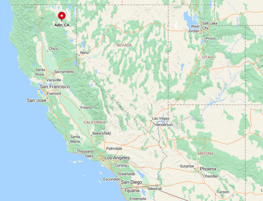
Adin anchors the crossroads of Highways 299 and 139 in Lassen County, an hour northwest of Susanville. Two-lane roads across dry basin country discourage casual detours, and winter black ice frequently closes the steep grade over Adin Pass.
No regional buses run this route; arrival means driving or landing a small plane at the gravel strip two miles south of town. Once there, visitors encounter expansive skies and little else to distract from them.
2. Fort Bidwell – Remote Outpost at California’s Far Corner
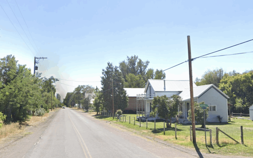
Fewer than 200 hardy residents share Fort Bidwell’s sprawling cattle ranches and the vestiges of an 1865 cavalry post. Days revolve around branding season, exploring petrified lava flows on the nearby Warner Rim, and grabbing supplies at the one-room Fort Bidwell Store.
Ranching and tribal government jobs tied to the Fort Bidwell Indian Community of the Paiute Nation supply most livelihoods. Sandstone mesas, empty highways, and the sheer distance to any city underscore the town’s remoteness; cell service flickers and gas pumps close by sundown.
Fort Bidwell’s historic adobe officers’ quarters still stand, offering a little-known photo gem framed by sagebrush and distant thunderheads. Visitors quickly learn that neighbors here are counted in miles, not yards.
Where is Fort Bidwell?
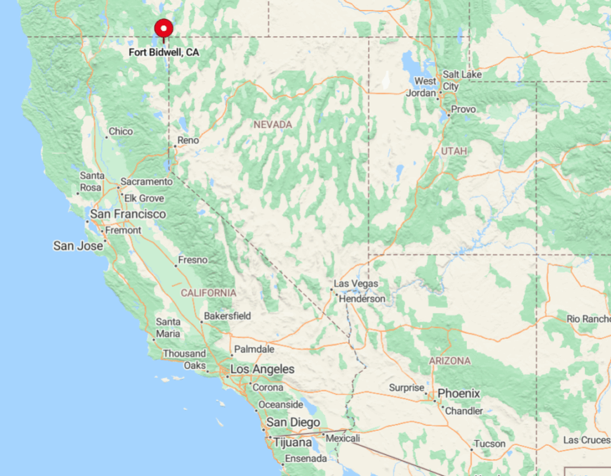
Fort Bidwell perches in Modoc County’s extreme northeast corner, three miles from Oregon and eight from Nevada. The settlement lies at the terminus of County Road 1, a two-hour drive north of Alturas across empty basin-and-range terrain.
Winter snows can shut the high-desert pass south of town, leaving residents reliant on stocked pantries and woodpiles. That dead-end road, coupled with three state lines’ worth of distance from major services, keeps Fort Bidwell peacefully off nearly everyone’s radar.
1. Cedarville – High-Desert Hamlet in the Warner Mountains
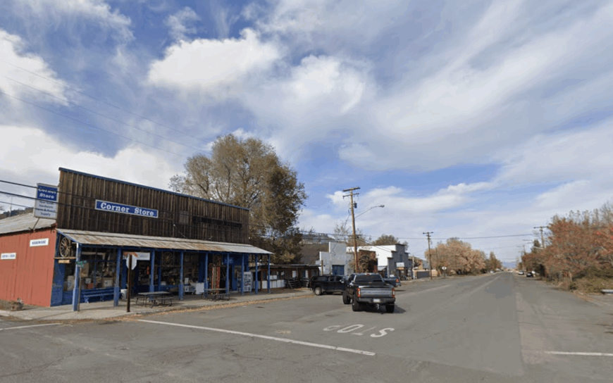
Cedarville’s roughly 500 residents line a broad valley beneath the southern Warner Mountains, their false-front storefronts echoing a frontier past. Visitors rise early to catch sunrise panorama shots over endless sage flats, then hike to Surprise Valley Hot Springs or the aspen-rimmed summit of Fandango Pass.
Ranching, small-scale alfalfa production, and a modest trade in adventure tourism support the ledger, while annual events like the Surprise Valley Cowboy Poetry Gathering keep community ties strong.
Cedarville’s isolation stems from its placement east of the Warners, where the asphalt thins to one road and snow often lingers into June. With no fast-food chains or traffic lights, evenings melt into sweeping starscapes and the faint hiss of distant irrigation wheels.
Despite the solitude, an artist colony and a co-op bakery add unexpected cultural sparks to Main Street.
Where is Cedarville?
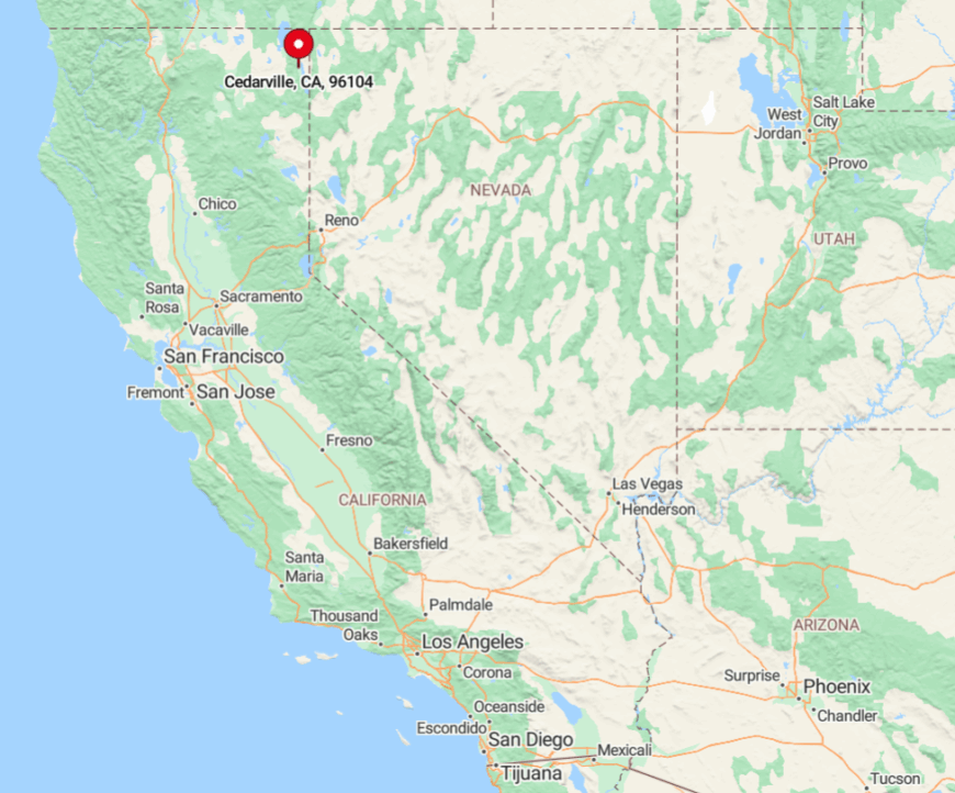
Cedarville sits along Highway 299, 22 miles east of Alturas and over 140 miles from the nearest commercial airport in Klamath Falls, Oregon. The Warner Mountains rise immediately to the west, and Nevada’s Black Rock Desert starts just forty minutes east, locking the town into a high-desert cul-de-sac.
Travelers reach it by cresting 6,305-foot Cedar Pass, a route often closed by winter storms that reinforce the area’s seclusion. Those who navigate the pass discover a valley so quiet that even a passing pickup truck turns heads.