🔥 Would you like to save this?
There’s a line of coast in far Down East Maine where the road thins, the cell signal falters, and time begins to behave differently. Locals call it the Bold Coast—a name earned honestly by its sheer granite ledges, fog-wrapped coves, and a maritime stubbornness that laughs off the idea of convenience. The region stretches from Jonesboro to Lubec, brushing up against Canada and the Atlantic in equal measure, and includes the Cutler Coast Public Reserved Land—a staggering wilderness where spruce forests tip into sea cliffs and silence carries farther than radio.
This isn’t the Maine of postcards and popovers. It’s rough-hewn, saltbitten, and uncrowded. In towns like Pembroke and Dennysville, the stories are folded into clapboard and tide charts. In Whiting, the lakes outnumber the shops. Beals Island hangs off the mainland by a bridge and a boat line, while Trescott Township skips incorporation altogether. At the center sits Cutler, a harbor village cinched tight to the edge of the continent, where trails pick up where roads let go.
In order to come up with the very specific design ideas, we create most designs with the assistance of state-of-the-art AI interior design software. Also, assume links that take you off the site are affiliate links such as links to Amazon. this means we may earn a commission if you buy something.
These 25 towns aren’t hiding—they simply don’t perform. There are no welcome centers, no curated detours, only real places shaped by weather, tide, and patience. They hold fast to a rhythm that favors early mornings, working boats, and long looks at the horizon.
This is the Bold Coast. Remote but never vacant, weathered but never worn out. A stretch of shoreline for those who’d rather find than follow. 25 towns that don’t ask for attention—but reward it richly.
25. Danforth – Lakes, Pines, and Long Quiet
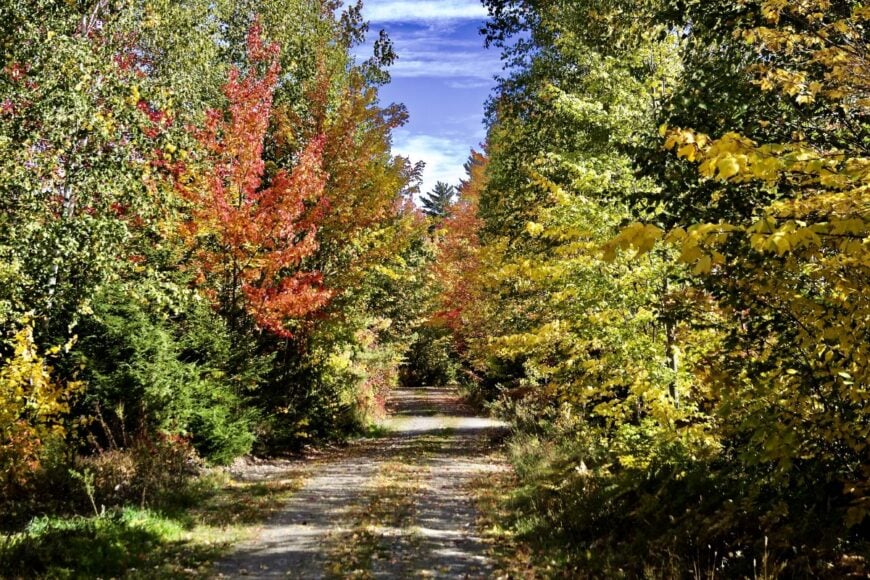
Tucked near the headwaters of East Grand Lake, Danforth feels like a last outpost where pine wind and loon calls run the schedule instead of traffic. Its seclusion comes from distance—hourglass roads and miles of timber between here and the turnpikes—and from the vast woods of Aroostook and Washington Counties that press in like a soft, green tide.
The vibe is practical and old-Maine: simple camps, friendly nods at the general store, and boats nosing out at first light. Days lean toward paddling the Baskahegan Stream, fishing off quiet points on Hot Brook Lake, or browsing seasonal crafts at small-town fairs.
Timber, guiding, and camp life are the anchors; the economy hums along at a human scale. Twilight lingers long on the water, and it’s the kind of hush that resets your breathing. It’s the sort of place that reminds you how quiet the world can be.
Where is Danforth?
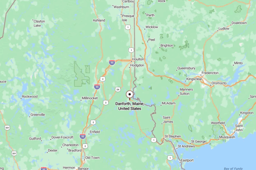
Set in far eastern Maine at the north end of Washington County, Danforth sits about 35 miles north of Calais on the edge of the St. Croix River watershed. Most arrive via U.S. Route 1 and a last stretch of two-lane blacktop that trades billboards for spruce. The approach winds past lakes and logging roads where cell bars thin and stars thicken. It’s close enough to reach, but far enough to feel like you’ve left everything behind.
24. Topsfield – High Ground and Hidden Ponds
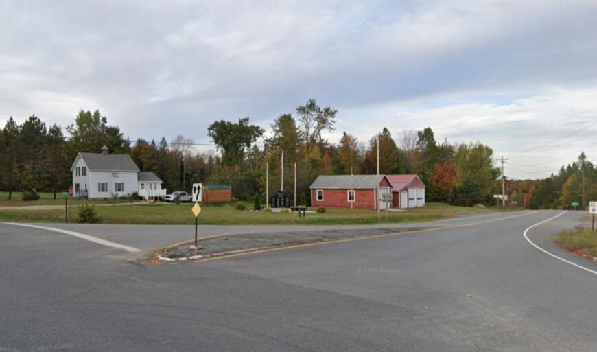
Topsfield keeps to the uplands, a scatter of homes and camps threaded between Pocomoonshine Lake and long, still bogs where moose track the margins. Seclusion here is geographic: few services, long gaps between porch lights, and the deep cushion of conserved timberlands that dulls every echo.
The vibe is unhurried and woodsmoke-warm—bait buckets on tailgates, snowmobile club breakfasts, and kids learning to paddle before they can parallel park. Spend a morning hiking old tote roads, cast for smallmouth on Pocomoonshine, or follow autumn birdsong along nearby trails.
Work here tends to be seasonal and resource-based—forestry, trades, and hands that do what the land asks. When night drops, the silence feels like a blanket pulled to the chin. It’s the kind of quiet that stays with you.
Where is Topsfield?
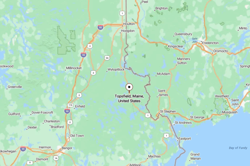
In northeastern Washington County, Topsfield sits roughly 30 miles northwest of Calais and a short drive east of Route 6. You thread in on two-lane roads that shrug off hurry, passing more lakes than gas stations.
The map looks simple; the reality meanders in the best way. Pines close ranks, and the horizon opens only for water and sky.
23. Grand Lake Stream – Trout Water and Timber Lore
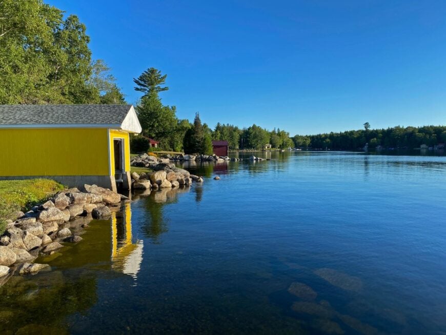
World-famous among fly fishers, Grand Lake Stream is still a tiny crossroads swaddled by wilderness and old sporting camps. Seclusion is its signature: one main road, a ribbon of current, and millions of surrounding trees that hush everything but the stream.
The vibe blends classic guide culture with neighborly understatement—canvas canoes, hand-tied flies at the shop, and porch stories that run longer than sunset. Days revolve around casting to landlocked salmon, hiking trail loops, and watching loons stitch the lakes together.
Conservation and low-key tourism underpin the economy; timber still whispers in the background. The air smells like cedar shavings and cold water. You’ll leave speaking a little softer.
Where is Grand Lake Stream?
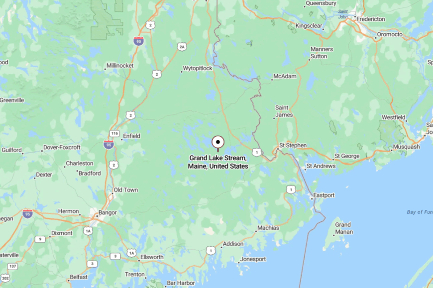
Set in interior Washington County, the village lies about 30 miles west of Calais and 20 miles north of Princeton. Access is via Route 6 and a final glide on Grand Lake Stream Road.
The drive trades highway speed for lake-to-lake wandering. By the time you hear the water, the world has already quieted down.
22. Wesley – The Long Stretch
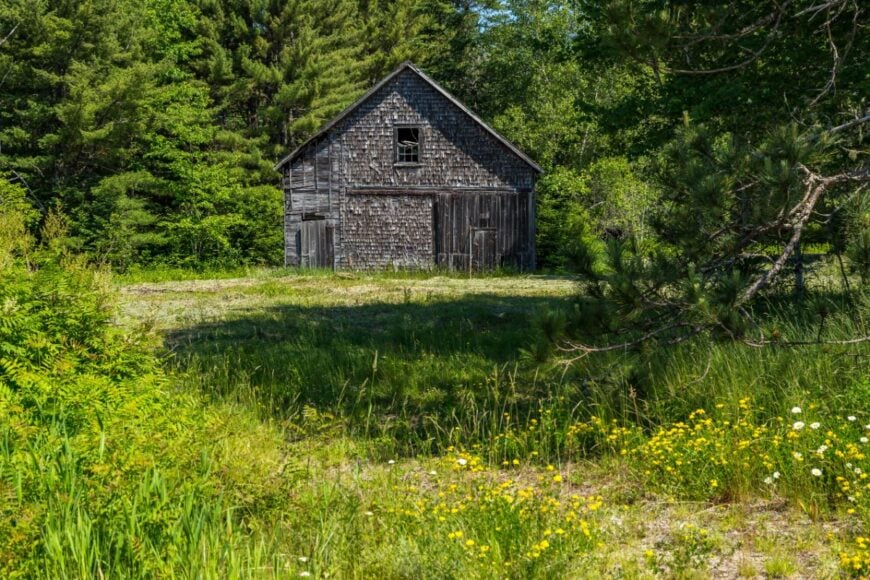
On the old Airline Road between Bangor and Calais, Wesley is a name on a sign and a wide hush of blueberry barrens, cedar swales, and wind. Seclusion here is measured in distance between neighbors and in how quickly your phone gives up.
The vibe is utilitarian with a streak of stubborn grace—blueberry rakes in summer, stacked cords in fall, and winter nights that sparkle. Hike or bird the Great Heath, follow logging tracks into deep spruce, or detour for a leg-stretch at Pike Brook.
Blueberries and woods work hold the line for the local economy. The horizon feels big and lightly used—a rare luxury. It’s a place that teaches patience.
Where is Wesley?
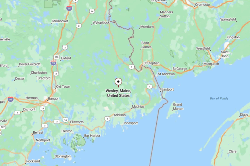
Midway along eastern Maine’s Route 9 corridor, Wesley sits about 45 miles east of Bangor and 40 miles west of Calais. You get there by committing to the two-lane and letting the odometer do its work.
Services are sparse by design; scenery is not. The barrens open like a red-gold sea when the season turns.
21. Meddybemps – Glassy Water, Small Footprint
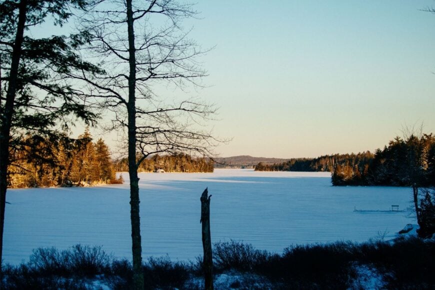
Meddybemps gathers lightly around the shores of its namesake lake, where camps peep through firs and mornings steam off the coves. Seclusion is lake-locked: long peninsulas, few public launches, and backroads that curl like old rope.
The vibe is camp-casual—kayaks on the bank, loons calling at dusk, and potluck smiles. Paddle to quiet islands, cast for bass, or walk woodland conservation parcels that stitch the shoreline.
Many folks split time here; the economy leans on seasonal trades and services. Nights are ink-dark and star-thick. It’s easy to forget the clock.
Where is Meddybemps?
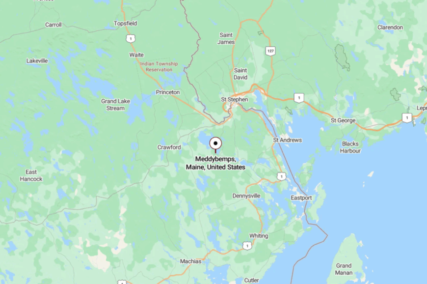
In south-central Washington County, Meddybemps lies roughly 12 miles southwest of Calais, just off U.S. 1. The last miles bend through forest and water views that slow any hurry.
Short on signage, long on calm, the approach feels like a gentle exhale. The lake does the rest.
20. Charlotte – Border Backroads
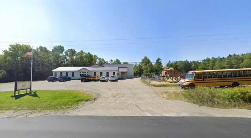
Charlotte is a crossroads town stitched with farm fields, stone walls, and dirt lanes that wander toward the St. Croix River. Its seclusion comes from proximity to the border yet distance from any bustle—close to Canada, far from crowds.
The vibe is neighborly and plainspoken: farmstands, Grange suppers, and a calendar built around seasons. Walk quiet town roads, bird along wetlands, or slip into nearby Moosehorn National Wildlife Refuge for miles of trails.
Small farms and trades keep things ticking. The land rolls softly, and the days do too. You’ll catch yourself waving to every passing truck.
Where is Charlotte?
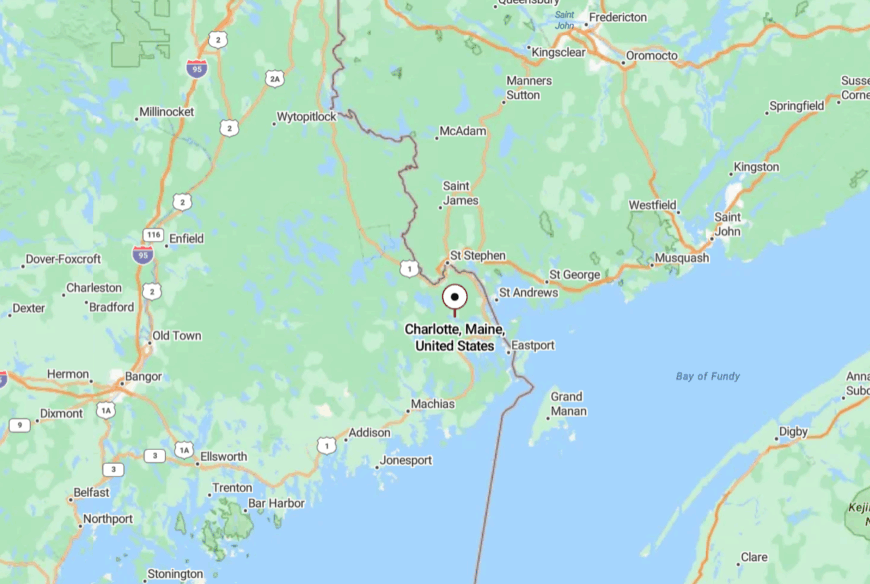
Southwest of Calais and north of Robbinston, Charlotte sits a few miles off U.S. 1 on a web of rural roads.
Most routes drift past hayfields and hedgerows before the trees close in. Distances are short, but the pace is shorter. It feels like a side pocket of time.
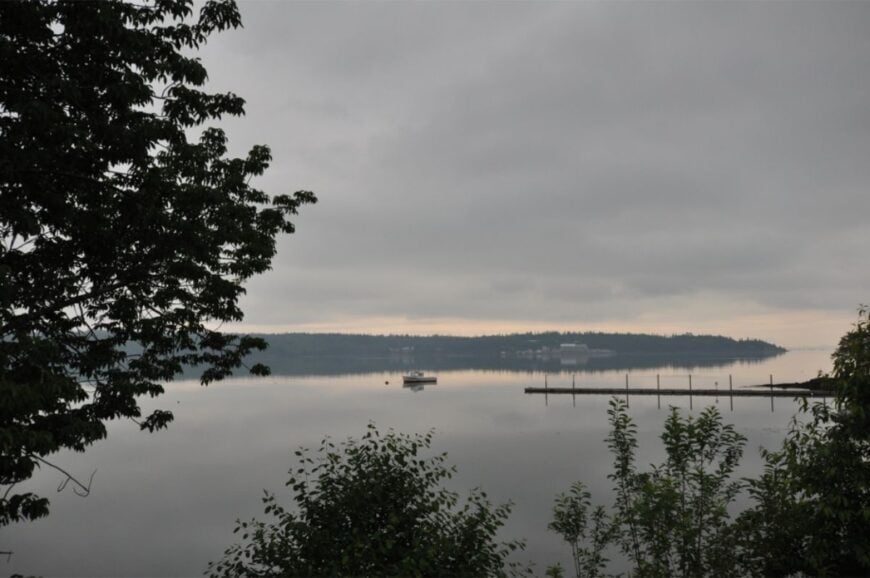
19. Robbinston – Tidal Farms and Tall Water
🔥 Would you like to save this?
Along the broad St. Croix estuary, Robbinston strings a few quiet villages between coves where fog pools at dawn. Seclusion is a matter of scale: long views, few neighbors, and tides that write the day’s script.
The vibe is salt-rustic—clapboard, work skiffs, and the hum of Route 1 softened by distance. Explore shore access points, scan for eagles along Todd’s Point, or drive the scenic river road to admire weathered farms.
Fishing, small agriculture, and cross-border errands set the rhythm. Even the breeze seems to slow down here. It’s a stretch of coast that rewards a second look.
Where is Robbinston?
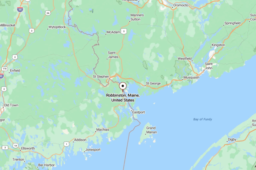
Robbinston sits south of Calais and north of Perry on U.S. 1 along the St. Croix. You arrive by following the river’s broad bend as Maine leans toward New Brunswick.
The road is easy; the mood is far. Fog and tide do most of the talking.
18. Brookton – Pines, Portage, and Quiet Roads
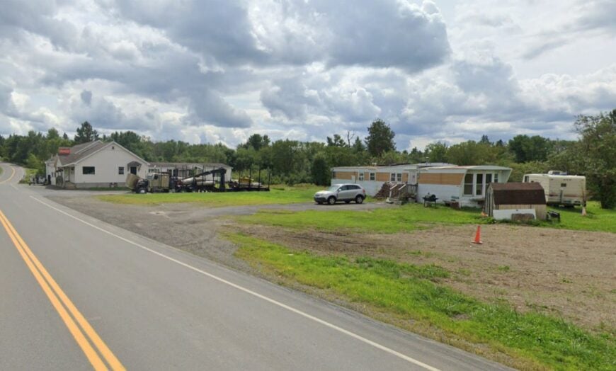
Brookton is a hush in the forest where Route 1 slows to meet the edge of East Grand Lake country. Seclusion is written into its layout—just a post office, a scattering of homes, and long miles of woods in every direction.
The vibe is pine-sweet and minimalist: a town that whispers rather than calls, where the rhythm is set by loons, logging trucks, and the occasional canoe portage. Days lean toward slow drives under canopy, checking trail cameras, or dropping a line in Spednic Lake just to see what bites.
Many residents live off the land or drift into nearby towns for work, but come back for the stillness. There’s a clarity in the quiet here, as if the air itself has fewer distractions. It’s the kind of place where your thoughts have room to echo.
Where is Brookton?
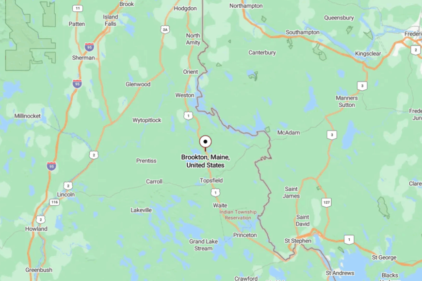
Brookton lies in the northern tier of Washington County, close to the Aroostook County line, along U.S. Route 1. It’s about 15 miles northeast of Danforth and a short hop from the Forest City border crossing into New Brunswick. The settlement is more a cluster of homes and a post office than a formal town, set against long corridors of pine and the watersheds of East Grand and Spednic Lakes.
Getting there means following Route 1 north until the pavement feels like it belongs more to the woods than the highway. Lakes appear in the gaps between spruce stands, and traffic thins to almost nothing. The farther you drive, the more the road feels like a ribbon connecting forest to sky.
17. Baring Plantation – River Bend and Rail Echo
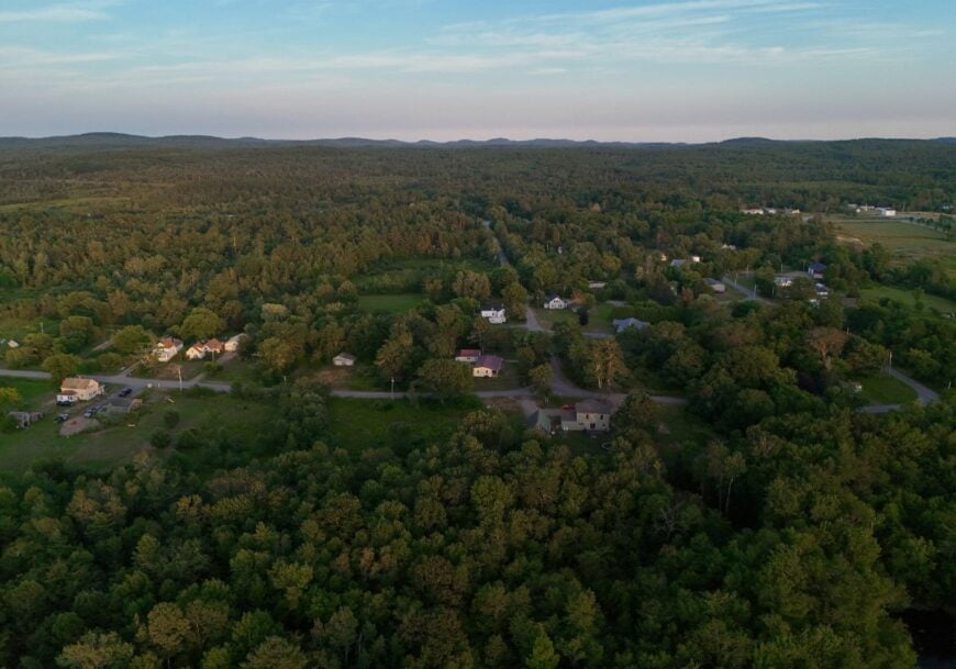
Baring Plantation is a slim ribbon along the St. Croix River where old rail beds and quiet roads share the flats with deer. Seclusion here is scale and setting: no village center, just stretches of water, trees, and sky.
The vibe is spare and peaceful—canoes on car roofs, evenings on porches, and the faint history of rails-to-trails. Paddle side channels, fish the current seams, or wander sandy river bars when the flow is low.
Work ties to nearby service centers or outdoor trades. Dusk paints wide light across the river and sends you looking for a chair. The silence shows up early and stays late.
Where is Baring Plantation?
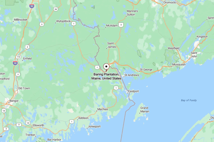
Just south of Calais on U.S. 1, Baring hugs the inside bend of the St. Croix. Getting there is as simple as not missing the sign.
The river does the rest of the orientation. It’s the in-between that feels like a destination.
16. Princeton – Lakeside Hub with Edges of Wild
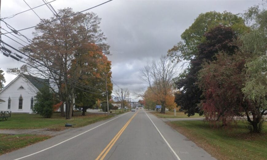
Though a small service hub, Princeton still feels tucked away by the sheer sprawl of West Grand and Big Lake on its doorstep. Seclusion is the moat of water and woods that surrounds Main Street, making every errand a scenic detour.
The vibe is practical with an outdoorsman’s grin—gas, groceries, and a boat launch all within a few unhurried blocks. Fish for salmon, bike toward Grand Lake Stream, or bird the Moosehorn backroads.
Guiding, small retail, and school days keep the calendar full enough. Even on a busy weekend, the edges go back to quiet in a hurry. It’s town life with a wilderness back porch.
Where is Princeton?
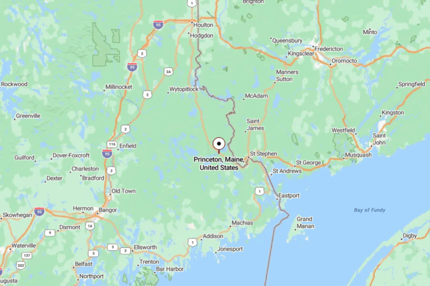
Northwest of Calais by about 20 miles, Princeton sits along Route 1A and the outflow of the Grand Lakes. The drive rolls past water on both sides until you’re not sure where land leads.
Roads are straightforward; choices are pleasantly few. The lakes make sure the world slows down.
15. Alexander – Ridge Lines and Quiet Roads
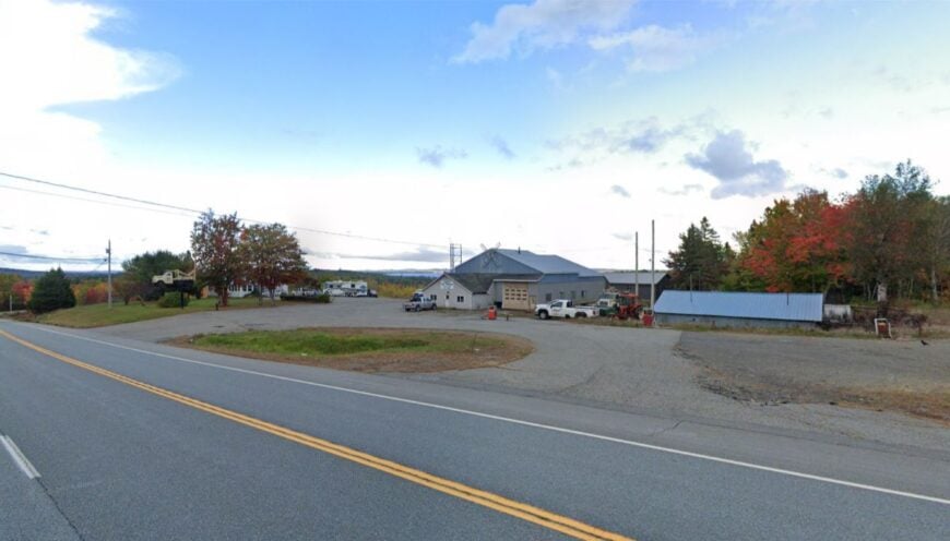
Alexander rides a set of ridges between Pleasant Lake and a patchwork of wetlands where beaver do the engineering. Seclusion grows from elevation and emptiness—long sightlines, low population, and the steady hush of Route 9 a few miles off.
The vibe is classic rural Maine: tidy yards, ATV trailheads, and dogs that know every truck. Walk gravel spurs to blueberry views, watch stars punch through the sky, or fish small kettle ponds nobody brags about.
Work runs to trades and commuting; home runs to porches. The nights feel a degree or two quieter than you expect. It’s a good place to hear your own thoughts.
Where is Alexander?
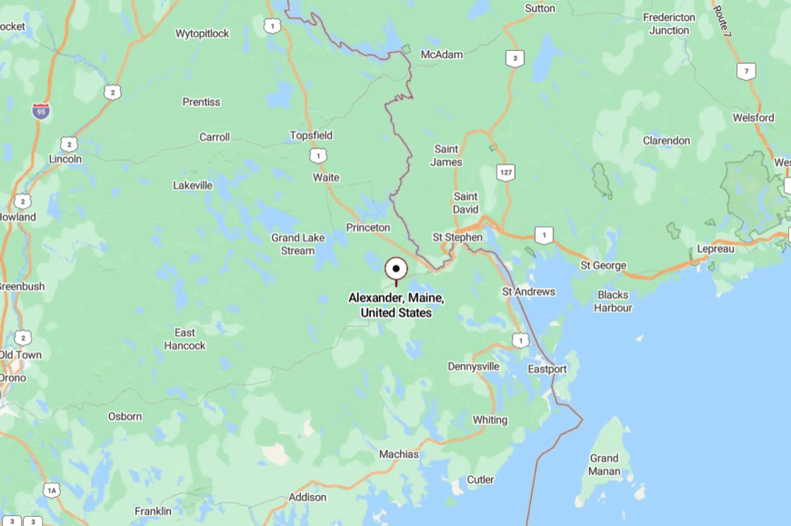
About 25 miles west of Calais and just north of Route 9, Alexander sits between the Airline and the border river towns. You reach it on local roads that rise and fall like a slow breath.
The map is simple; the countryside is not. Hills and lakes conspire to hide most everything but the sky.
14. Talmadge – A Few Roads and a Lot of Forest
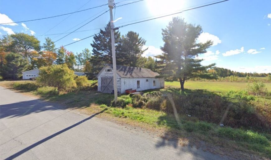
Talmadge is one of those towns you hear about before you ever find—handful of roads, deep timber, and the quiet certainty of people who like it that way. Seclusion is structural: minimal services, long drives for errands, and neighbors separated by stands of spruce.
The vibe is no-nonsense and kind—chainsaws, casseroles, and venison recipes swapped at kitchen tables. Walk old tote roads for miles, scout for moose sign, or sneak a canoe into Little River when the water’s up. Most work is mobile or seasonal; the rest is self-reliance.
Sunsets feel larger when there’s nothing to block them. It’s a place that doesn’t perform, and that’s the charm.
Where is Talmadge?
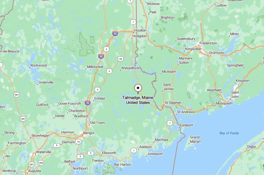
Northwest of Princeton by a short hop on local roads, Talmadge sits well off U.S. 1 in interior Washington County. There’s no single “main way” in; you follow the roads that feel right.
The forest hems you in, then opens to a clearing or a pond as if on cue. It’s close on the map and far in the mind.
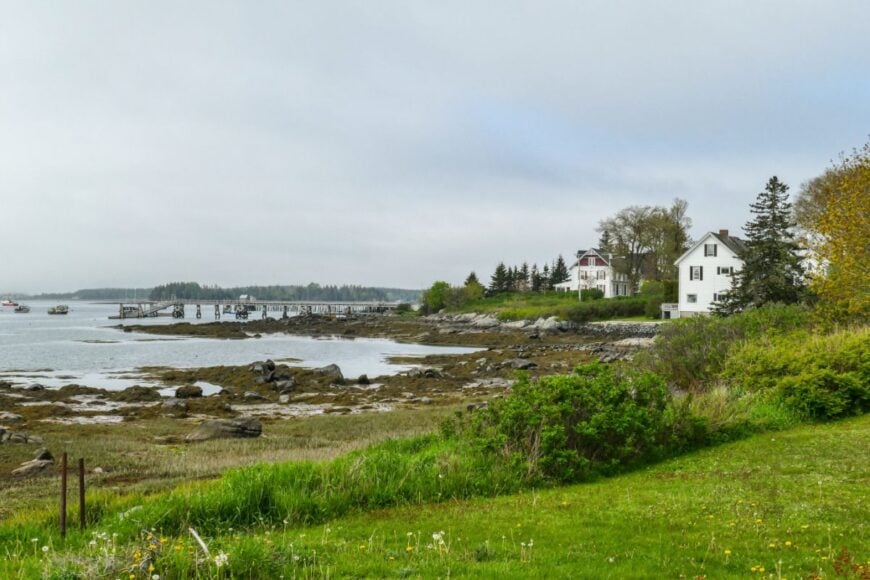
13. Jonesport – Working Harbor at the End of the Road
🔥 Would you like to save this?
Though better known than some, Jonesport still feels end-of-the-earth once you cross the bridge and watch the lobster fleet swing with the tide. Seclusion is maritime: peninsulas, islands, and a web of backroads that end at salt.
The vibe is salty and sincere—boatyards, clapboard houses, and gulls that own the airwaves. Walk Sandy River Beach, day-trip to Beals Island, or trace headlands toward Great Wass Island Preserve. Fishing is the backbone; small shops and summer visitors help in season.
Fog writes different stories on the water every morning. It’s a harbor that asks for your attention and gives you back the day.
Where is Jonesport?
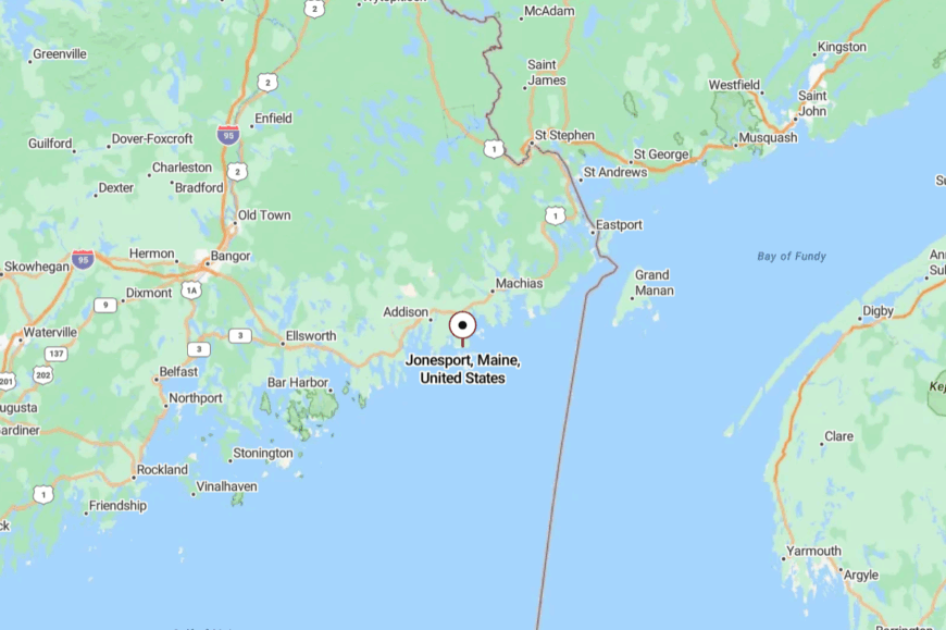
On the Washington County coast southwest of Machias, Jonesport hangs off Route 187 at the end of a scenic detour from U.S. 1. You’ll weave through spruce and salt marsh before town appears.
The last miles feel like a commitment, which is partly the point. The ocean meets you like an old friend.
12. Addison – Quiet Coves and Tide-Polished Stone
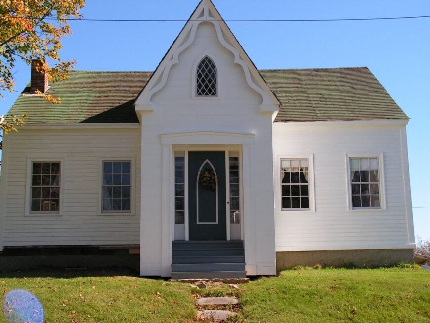
Addison is a study in coves—Wohoa Bay, narrow guts, and ledges that catch the sun just so. Seclusion comes from a coastline too intricate for hurry and a road network that seems to pause for tide tables.
The vibe is undramatic and beautiful—working wharves, clam flats, and afternoon light sliding across shingles. Walk shore access points, paddle glassy mornings, or bird the nearby preserves. The economy is salt-leaning: fishing, aquaculture, and the trades that keep boats moving.
Even the gulls sound softer here. It’s a place that stays with you as a color more than a postcard.
Where is Addison?
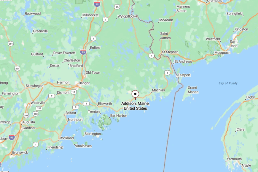
South of Jonesport and east of Milbridge, Addison spreads along Route 187 and side roads that end at the tide.
You get there by choosing the slower line off U.S. 1. The peninsulas keep turning until they finally say stop. That’s where the quiet begins.
11. Machias – College Town with Wild Edges
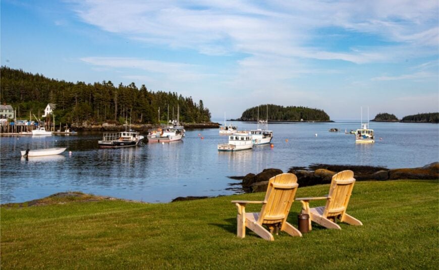
Machias carries a little more bustle—a college campus, a few lights, a proper Main Street—but it’s bracketed by wild rivers, barrens, and bays that push back the wider world. Seclusion is the fringe; ten minutes in any direction and you’re into beaches, river corridors, or blueberry fields that run to the horizon.
The vibe mixes student energy with Downeast steadiness—ice cream windows, historic mills, and fishermen fueling up at dawn. Walk Bad Little Falls Park, browse local galleries, or catch the Wild Blueberry Festival when August turns the town sweet.
Education, health services, and fishing keep the ledger steady. Nights tilt quiet again when the students head home. It’s a small hub that still feels like an edge.
Where is Machias?
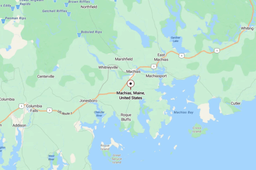
Machias sits at the center of Washington County on U.S. Route 1, about 60 miles east of Ellsworth and 20 miles west of Lubec. The town spreads along the Machias River as it empties into Machias Bay, making it both a service hub and a coastal outpost. Its location gives it an unusual balance—college campus and courthouse on one side, blueberry barrens and saltwater flats on the other.
Most visitors arrive by way of Route 1, which drops into town after miles of pine and granite ledge. Once there, side roads branch toward nearby beaches, coves, and parks within minutes. Machias feels accessible yet ringed by wild country, a place where errands and errands into nature blur together.
10. Jonesboro – Forested Retreats

With just over 600 residents, Jonesboro is a small town edged by the Chandler River and surrounded by working blueberry fields and deep forest. The pace here is unhurried, with scattered homes, long drives through timber, and a sense of quiet that lingers even along Route 1.
Outdoor life leans more toward simple pleasures than mapped trail systems—casting a line in the river, paddling nearby streams, or wandering backroads where fields meet woods. The community gathers around seasonal fairs like the Downeast Salmon Federation Smolt Fry, which celebrates local conservation and the return of wild salmon.
Timber and blueberry work anchor the economy, echoing a long connection to the land. Seclusion comes not from distance but from the way the landscape folds in, muffling the noise of the wider world.
Where is Jonesboro?

Jonesboro lies in central Washington County along U.S. Route 1, just 7 miles west of Machias. The town sits beside the Chandler River, surrounded by low ridges, dense forest, and working blueberry barrens that stretch to the horizon. It’s small in scale but right on the main coastal artery, which makes it easy to reach yet still distinctly quiet.
Travelers usually pass through Jonesboro on the way to Machias, Lubec, or the Bold Coast, but pulling off reveals its tucked-away clearings and river views. The lack of sprawl and the dominance of woods and water give it a retreat-like feel, even though the highway runs close at hand.
9. Machiasport – Historic Seclusion

Home to around 1,100 residents, Machiasport is a coastal town steeped in history and natural beauty. Visitors can explore Fort O’Brien State Historic Site, which offers insights into the area’s role in the American Revolution, or enjoy bird watching and kayaking along the scenic coastline.
The local economy is largely driven by fishing and small-scale maritime industries, reflecting its deep-rooted connection to the sea. Machiasport’s secluded nature is evident in its quiet harbors, sparsely populated neighborhoods, and unspoiled landscapes that provide a peaceful retreat from the hustle and bustle of modern life.
Where is Machiasport?

🔥 Would you like to save this?
Nestled in Washington County, Machiasport lies on a peninsula jutting into Machias Bay, about 85 miles east of Bangor. Its remote location is enhanced by winding coastal roads and limited through traffic, making it a hidden gem along Maine’s rugged shoreline.
Visitors can reach Machiasport via Route 92 off U.S. Route 1, but the journey through picturesque countryside reinforces its sense of isolation. Surrounded by water on three sides, the town’s geography contributes to its tranquil seclusion and offers stunning ocean vistas.
8. Lubec – America’s Easternmost Quietude

Lubec, with a population of just over 1,200, holds the distinction of being the easternmost town in the United States. It’s a haven for those seeking peace, boasting serene lighthouses like the iconic West Quoddy Head Light, endless coastal vistas, and abundant opportunities for whale watching and hiking.
The economy revolves around fishing and tourism, but the town maintains a quiet, laid-back atmosphere. Lubec’s seclusion is amplified by its remote location and the enveloping presence of the Atlantic Ocean, offering a tranquil escape where the sunrise greets the country first each morning.
Where is Lubec?

Situated at the tip of Maine’s rugged coastline, Lubec is located in Washington County, right on the border with Canada’s Campobello Island. Its isolation is pronounced, with the Atlantic Ocean to the south and east and limited access via winding coastal roads.
To reach Lubec, travelers typically take U.S. Route 1 before branching off onto Route 189, a journey that highlights the area’s untouched beauty. The town’s distant position from major highways and urban centers enhances its secluded charm, making it a peaceful outpost on Maine’s eastern edge.
7. Pembroke – Hidden Passages to Nature

With a small population hovering around 800 residents, Pembroke is a quiet coastal town rich in natural beauty. Outdoor enthusiasts can explore Reversing Falls Park, a hidden gem where tidal currents create a spectacular natural phenomenon as the tides reverse the flow of the river.
The town’s industries are primarily fishing and small-scale agriculture, maintaining a simple and sustainable way of life. Pembroke’s seclusion is due to its vast natural surroundings, including dense forests and quiet coves, providing ample privacy and a serene environment away from busy urban centers.
Where is Pembroke?

Located in northeastern Maine in Washington County, Pembroke sits along the banks of the Pennamaquan River. Its secluded nature is enhanced by the limited roadways and natural barriers that surround it. Access is mainly via U.S. Route 1, but the drive through rolling countryside and along the coast underscores its remoteness.
The town’s position away from major cities and its embrace of nature make Pembroke a hidden retreat ideal for those seeking peace and solitude amidst Maine’s natural splendor.
6. Beals – Island Seclusion

Beals is a small fishing community with around 500 residents, situated on Beals Island off the coast of Maine. The island’s rugged natural landscapes, including beautiful beaches and forests, provide a tranquil setting for outdoor activities like hiking, bird watching, and exploring the shoreline.
Fishing, particularly lobstering, is the mainstay of the local economy, preserving the town’s maritime heritage. Beals offers an island retreat feel, with its seclusion stemming from its geographic isolation, yet it’s accessible via a bridge connecting it to the mainland, blending convenience with peaceful solitude.
Where is Beals?

Beals Island is located in Washington County, connected to the mainland town of Jonesport by the Beals Island Bridge. This island’s remoteness is characterized by its separation from the mainland and limited access roads. To reach Beals, visitors travel along U.S. Route 1 before turning onto local roads leading to Jonesport, and then cross the bridge to the island.
The journey enhances the sense of seclusion, making Beals a unique island escape where the rhythm of the tides sets the pace of life.
5. Dennysville – Timeless Rural Escape

Dennysville, with a population of approximately 300 residents, offers a glimpse into Maine’s timeless rural charm. The town is dotted with historic buildings and quaint homes, reflecting its rich heritage dating back to the early 19th century. Activities here include fishing in the Dennys River, exploring the peaceful countryside, and enjoying the simplicity of small-town life.
The primary industries are small-scale farming and forestry, maintaining a close connection to the land. Dennysville’s seclusion is due to its low population density and the surrounding natural landscapes that keep it untouched by modern development.
Where is Dennysville?

Nestled in Washington County, Dennysville is situated near the northeastern corner of Maine, not far from the Canadian border. Its remote location is accentuated by limited main roads and its distance from major urban centers. Access is typically via U.S. Route 1, but the sparse traffic and vast stretches of wilderness en route reinforce its secluded nature.
Dennysville’s peaceful atmosphere and remote setting make it an ideal spot for those seeking a retreat into rural tranquility and a slower pace of life.
4. Roque Bluffs – Coastal Beauty Untouched

Roque Bluffs is a small community with about 300 residents, known for its pristine coastline and serene environment. The Roque Bluffs State Park is a highlight, featuring a beautiful sandy beach—uncommon in Maine—alongside freshwater ponds and hiking trails that showcase the area’s natural beauty.
The town lacks significant industrial activity, focusing instead on conservation and maintaining the untouched quality of its landscapes. Its secluded atmosphere comes from the quiet beaches, absence of crowds, and a commitment to preserving the coastal environment, making it a perfect escape from more populated tourist destinations.
Where is Roque Bluffs?

Located in Washington County, Roque Bluffs lies southeast of Machias, accessible via a network of local roads that wind through forested areas. The town’s seclusion is amplified by its position away from major highways and the limited signage directing travelers there.
Visitors often reach Roque Bluffs by taking U.S. Route 1 to Machias and then navigating rural roads toward the coast. The journey through secluded landscapes contributes to the sense of discovery upon arrival, reinforcing its image as an untouched coastal haven.
3. Whiting – Serenity by the Lakeside

Whiting is a peaceful town of around 500 residents, nestled among quiet lakes and dense forests. It’s an ideal location for fishing, boating, and wildlife observation, with access to several pristine lakes such as Indian Lake and Orange Lake. The town’s economy is modest, centered around small businesses and outdoor recreation services.
Whiting’s seclusion is due to its natural surroundings and minimal development, offering a serene environment where one can truly disconnect and enjoy the simplicity of nature.
Where is Whiting?

Situated in Washington County, Whiting is located east of Machias along U.S. Route 1. Its secluded charm is heightened by the expansive forests and water bodies that envelop the town, creating natural barriers from the outside world. The main route to Whiting is via U.S. Route 1, but the lack of urban sprawl and the abundance of nature along the way enhance the feeling of remoteness. Access to the town is straightforward yet feels like stepping into a tranquil lakeside retreat where time slows down.
2. Trescott Township – Wilderness at Your Doorstep

Trescott Township is an unincorporated area with a sparse population, offering vast undeveloped lands and a true wilderness experience. Outdoor activities abound, from hiking in the Cutler Coast Public Reserved Land to exploring rugged coastal cliffs and forest trails.
With no significant industries, the area remains largely untouched, catering to those who value solitude and a deep connection with nature. Trescott’s seclusion is a product of its vast open spaces, limited population, and minimal infrastructure, making it an ideal spot for those seeking an off-the-grid lifestyle.
Where is Trescott Township?

Located in eastern Maine, Trescott Township sits between the towns of Lubec and Cutler in Washington County. Its remoteness is underscored by the limited roadways and large expanses of wilderness that surround it. Access is primarily via State Route 191 or rural roads branching off U.S. Route 1, which can be challenging to navigate for the uninitiated.
The area’s isolation is a draw for adventurers and solitude seekers, offering a sense of escape into the heart of Maine’s rugged coastal wilderness.
1. Cutler – A Hidden Harbor Village

With a population of approximately 500 residents, Cutler is a picturesque harbor village that epitomizes secluded coastal living. The town is known for its dramatic cliffs, scenic hiking trails in the Cutler Coast Public Reserved Land, and the opportunity to watch fishing boats set sail in the early morning mist.
The main industry is fishing, particularly lobster and scallop harvesting, sustaining the traditional maritime lifestyle. Cutler’s seclusion comes from its remote location, rugged landscapes, and the tranquil lifestyle it offers, far removed from urban hustle and tourist crowds.
Where is Cutler?

Nestled along the northeastern coastline of Maine in Washington County, Cutler is situated east of Machias and north of Lubec. Its remote location is accentuated by limited access routes, mainly State Route 191, which winds through dense forests and along the rugged shoreline.
Travelers reach Cutler by taking U.S. Route 1 and turning onto State Route 191, a journey that emphasizes the untouched natural surroundings. The town’s position on the far edge of the coast, away from major highways and cities, reinforces its hidden gem status and provides a peaceful harbor escape.