Eastern Oregon stretches for hundreds of lonely miles, where basalt canyons, high-desert playas, and evergreen mountains shelter some of the most isolated communities in the American West. We found 25 of these pockets of quiet, each defined by small populations, abundant landscapes, and the kind of silence that lets wind and wildlife provide the only soundtrack.
In order to come up with the very specific design ideas, we create most designs with the assistance of state-of-the-art AI interior design software.
Ranch hands still swap news at single-pump gas stations, anglers trade stories beside forgotten rivers, and night skies remain unpolluted by city glow. Though sparse, these settlements offer spirited cafés, historic lodges, or hot springs that reward the traveler willing to roam far from interstates.
What follows is a countdown through the region’s hidden hamlets, highlighting why they stay so tranquil and how curious explorers can find them. Pack a full tank and plenty of curiosity; long stretches of open road lie ahead.
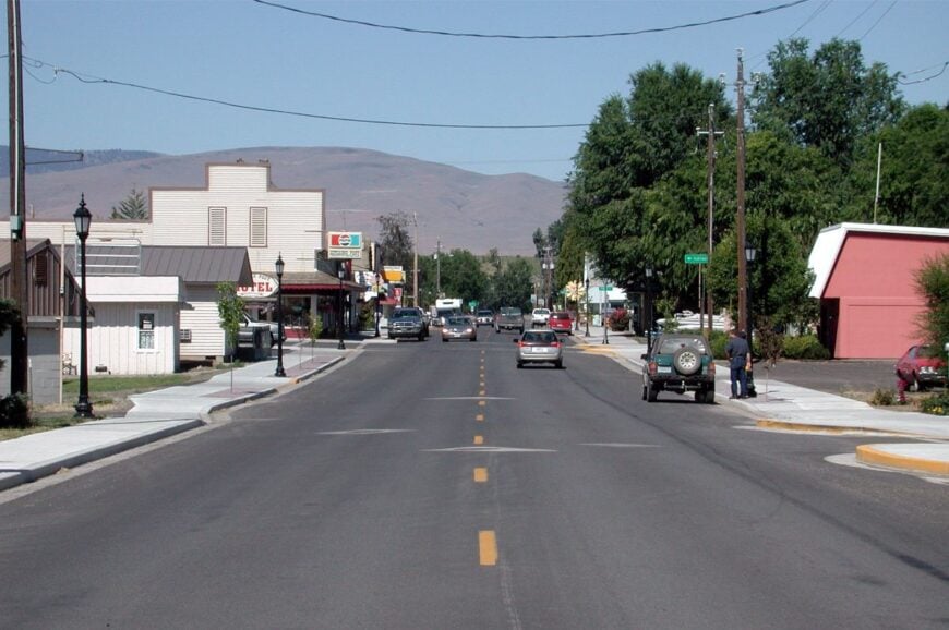
25. Ukiah – Forest Hamlet in a Meadow Basin
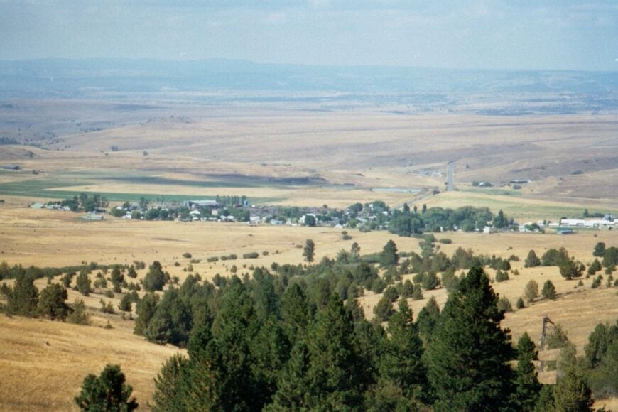
Ukiah, with barely 200 residents, sits like a small clearing carved into the Umatilla National Forest. The surrounding lodgepole pines and meadowed valleys give the town an almost storybook stillness, broken only by the occasional logging truck or elk bugle in autumn.
Locals gather at the one café or the small general store, where conversation is as steady as the woodstoves in winter. Fishing at Camas Creek, snowmobiling in the Blue Mountains, and camping at Ukiah-Dale State Park are the main diversions.
Logging and grazing form the economic backbone, though many residents also rely on seasonal recreation work. Nights fall deep and silent, with only the stars to remind you the outside world exists. Ukiah is the kind of place where the quiet feels almost physical.
Where is Ukiah?
Ukiah is tucked into Umatilla County, about 50 miles south of Pendleton via Highway 395. The road curves through mountain forest before dropping into a small valley where the town appears.
With no major highways passing nearby, travel feels deliberate rather than incidental. Arriving, you sense you’ve entered a meadow pocket the world forgot.
24. Granite – Gold Rush Ghost Echoes
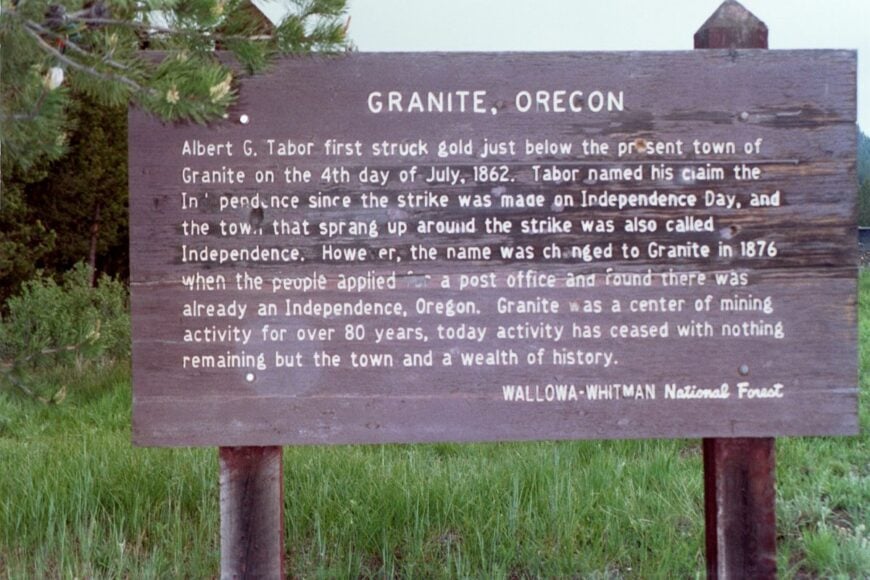
Granite once boomed with thousands during Oregon’s 1860s gold rush, but today fewer than 50 hardy souls remain among pine-clad slopes. Crumbling stone walls and wooden storefronts hint at its past, while modern life hums quietly around wood stoves and snowplows.
Visitors wander old mine tailings, hike into the North Fork John Day Wilderness, or fish alpine lakes nearby. The economy is minimal—mostly tourism, ranching, and logging on the forest’s edge.
Winters are fierce, with snow isolating the town for weeks at a time, adding to its forgotten quality. Granite feels like a settlement holding history in its bones, waiting for curious travelers.
Where is Granite?
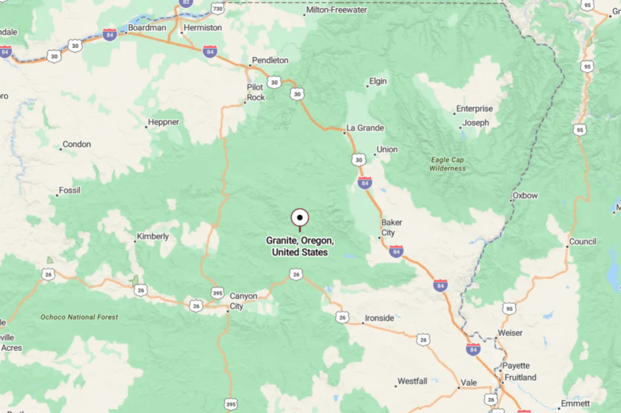
Granite lies in Grant County, 15 miles north of Sumpter along Highway 73, deep in the Elkhorn Mountains. Reaching it means a long drive from Baker City or John Day through twisting canyon roads.
The lack of through-traffic preserves its hushed, frozen-in-time atmosphere. When you arrive, you feel the hush of the pine forest swallow the modern world.
23. Fox – Wide Valley Whisper
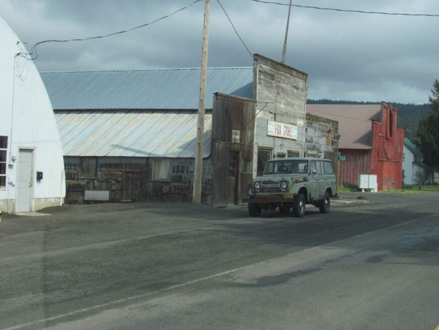
Fox counts only a handful of ranch homes spread along Grant County’s State Highway 395. The community stretches more like a wide valley neighborhood than a town, framed by meadow flats and pine slopes.
Its few public buildings—an old schoolhouse and church—stand as markers of a once-busier stop. Birders watch meadowlarks, while hunters seek mule deer in the Ochoco foothills. Ranching dominates, with hayfields and cattle defining the landscape.
What makes Fox secluded is its sheer sparseness—mile-long gaps between neighbors and no commercial hub. It’s the kind of place where the wind itself feels like company.
Where is Fox?
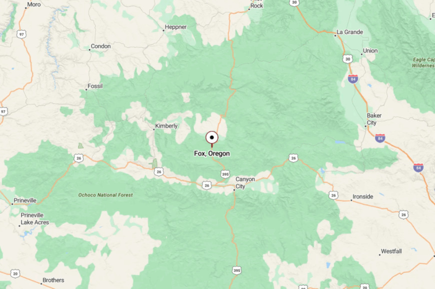
Fox sits about 15 miles north of Long Creek in Grant County, halfway between John Day and Ukiah. Access comes via Highway 395, a lightly traveled mountain highway through timber and meadows.
The nearest groceries and fuel are 30–40 minutes away. Arrival is signaled not by signs but by the sudden appearance of wide, silent valley floors.
22. Kimberly – At the Confluence of Quiet Rivers
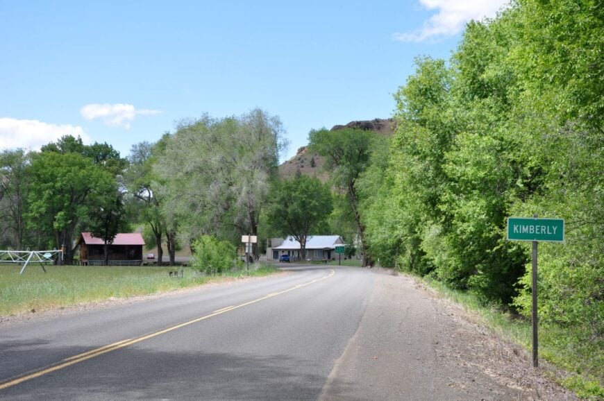
Kimberly rests where the John Day and North Fork John Day rivers merge, surrounded by basalt cliffs and orchard country. With fewer than 100 residents, the town’s claim to fame is fruit—peaches, apples, and cherries flourish in its sheltered canyon.
Visitors wander the John Day Fossil Beds’ Sheep Rock Unit nearby or picnic under cottonwoods along the river. Farming and fruit stands make up the economy, supplemented by passing tourists bound for the fossil beds.
Its seclusion lies in geography: tall rimrock walls and river valleys cut it off from broader development. Kimberly feels like an oasis—lush, quiet, and surprisingly green amid desert hills.
Where is Kimberly?
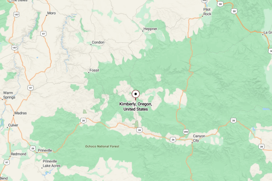
Kimberly sits in Grant County, about 45 miles northwest of John Day via Highway 19. The route hugs river bends and canyon walls, narrowing in places where basalt cliffs loom close.
With no direct highway to larger cities, the town remains a last stop in its own hidden valley. Arriving feels like stumbling upon a fertile secret kept by rivers.
21. Spray – Riverbend Village with Fossil Country Soul
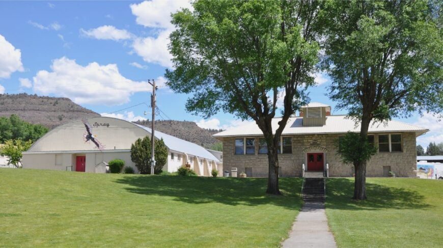
Spray, population about 150, is perched on a dramatic bend of the John Day River. Known for its rodeo, the town comes alive each May when cowhands and visitors gather, then returns to quiet fishing and rafting days the rest of the year.
Old wooden storefronts, a café, and a schoolhouse mark the compact downtown. Anglers cast for steelhead, rafters float the river, and hikers explore rimrock canyons.
Cattle ranching and tourism form the main livelihoods. With sheer cliffs rising above the river and no nearby cities, Spray feels tucked into a geological amphitheater. It’s a place where the river’s rhythm sets the pace of life.
Where is Spray?
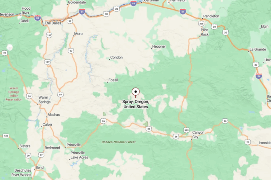
Spray sits in Wheeler County, 45 miles east of Fossil along Highway 19. The road curves past fossil beds and sheep pastures before dropping into town.
The lack of nearby highways and distant services reinforces its backwater calm. By the time you cross the bridge into Spray, you’re already steeped in canyon quiet.
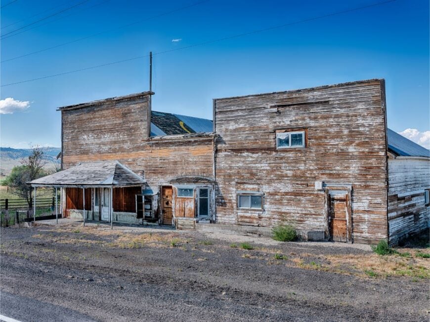
20. Drewsey – Crossroads of the Harney Backcountry
Drewsey hosts about 20 residents in a scattering of homes around an old store, post office, and a café long known for its pies. The town’s charm lies in its isolation—surrounded by sagebrush and rimrock with mountains rising faintly on the horizon.
Ranching drives the local economy, with hayfields and cattle dotted across the Harney Basin. Hunters, birders, and anglers pass through, bound for the Malheur River or Warm Springs Reservoir.
Nights here are especially silent, with coyotes carrying their calls across vast flats. Drewsey feels more like a frontier waystation than a town, frozen in a simpler rhythm.
Where is Drewsey?
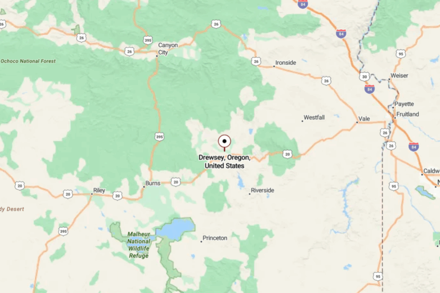
Drewsey lies 50 miles west of Burns along Highway 20, a lonely desert stretch. The highway runs through raw sage country with almost no development.
Travelers reach it via two-lane pavement and little else—there’s no bypass or alternate road. That single ribbon of asphalt is the only tether to the outside world, leaving Drewsey deeply isolated.
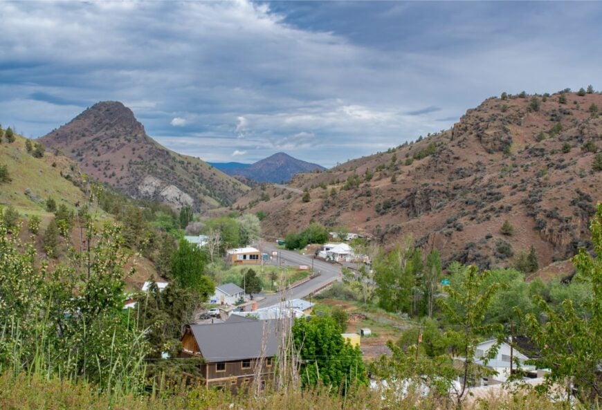
19. Ironside – Tiny Stop in Canyon Country
🔥 Would you like to save this?
Ironside is a speck of a settlement with fewer than 30 people, anchored by a store and a few ranch buildings. It lies nestled in a canyon of Malheur County, where rolling hills shield it from outside view.
Ranching is the lifeblood, with fields of hay and grazing cattle dominating the valley floor. Passing travelers pause for fuel or supplies, then disappear into the hills again. The economy is modest, but the community spirit is strong—neighbors know everyone for miles.
Its seclusion is geographic: tucked off the main highway, surrounded by canyon ridges. Ironside feels like a pause button pressed on the wider world.
Where is Ironside?
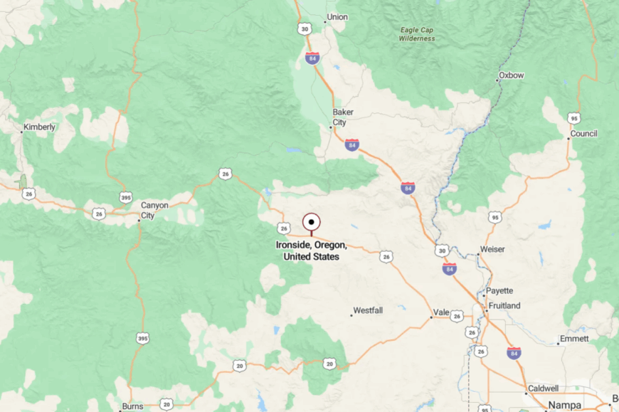
Ironside sits on US 26 about 40 miles northwest of Vale. The road winds through canyons and creeks before revealing the small cluster of homes.
There’s little else in sight for many miles, accentuating the sense of remoteness. Arriving feels like discovering a ranch town hidden in a fold of the land.
18. Juntura – Hot Springs Hamlet on the Malheur River
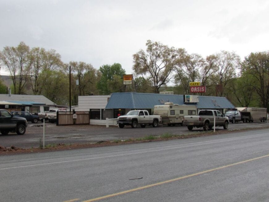
Juntura, population about 100, stretches along the Malheur River where cottonwoods lean over quiet pools. Its claim to fame is Juntura Hot Springs, where travelers soak beneath a canopy of sky.
Ranching and highway services are the main industries, with a café and store serving as gathering places. Visitors fish the river, watch migrating geese, or venture to nearby Leslie Gulch’s hoodoo formations.
Its seclusion comes from distance—Vale and Burns are each an hour away, leaving Juntura to itself. Nights are starlit and hushed, interrupted only by the gurgle of river water. Juntura offers a gentle refuge where time runs slower.
Where is Juntura?
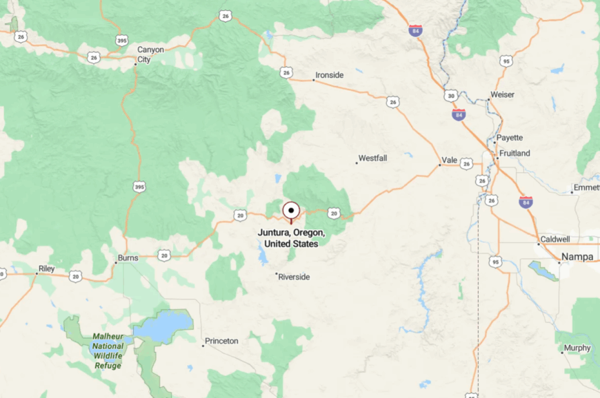
Juntura lies on US 20 in Malheur County, 60 miles west of Vale. Though it rests on a highway, the surrounding desert plateau and sparse population keep it isolated.
Travelers often break here only if they know about the hot springs. That mix of remoteness and hidden comfort makes Juntura quietly alluring.
17. Sumpter – Gold Rush Relic in Pine Country
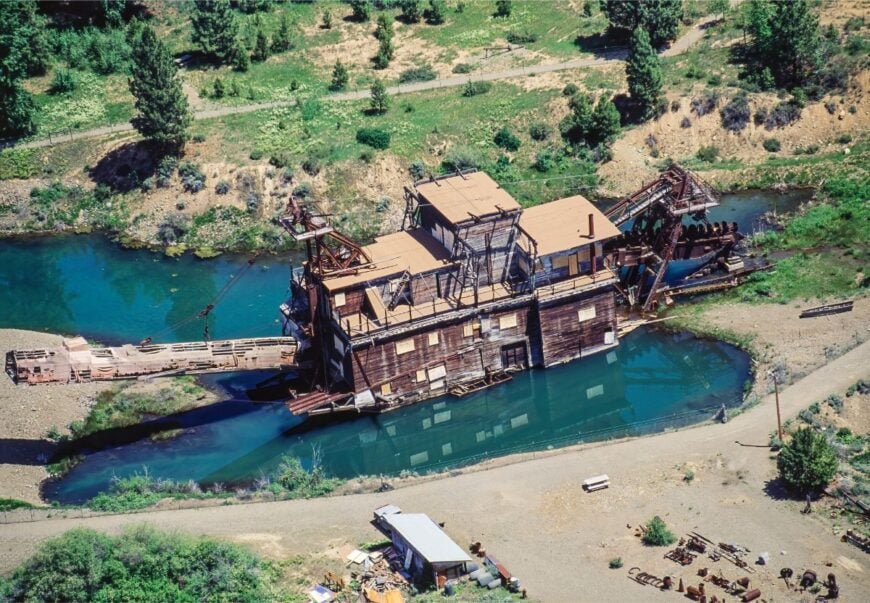
Sumpter, once a roaring gold-mining town of 2,000, now holds about 200 residents scattered among pine forests and mining ruins. The restored Sumpter Valley Dredge dominates the townsite, offering visitors a glimpse into Oregon’s gold fever past.
Narrow-gauge rail excursions, antique shops, and hiking trails into the Elkhorns draw curious travelers. Tourism and logging support the town, though winters are quiet under heavy snow.
Its seclusion is double-edged: accessible by highway, but still 25 miles from Baker City through forested passes. Sumpter feels like a frontier memory preserved in wood, stone, and pine-scented air.
Where is Sumpter?
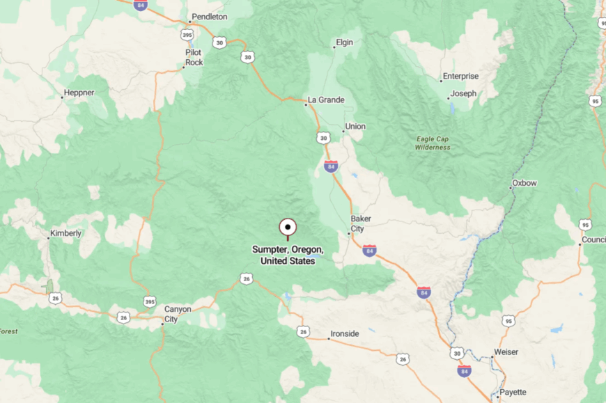
Sumpter is located in Baker County, 25 miles west of Baker City via Highway 7. The road climbs through pine forests and mining relics before reaching the townsite.
No major highways pass directly through, preserving its small scale. Arrival is marked by the dredge pond glimmering like a time capsule
16. Seneca – Basin Town with Elk for Neighbors
Seneca houses around 200 residents in a broad meadow basin surrounded by ponderosa pine. Known for cold winters, it once held the state record low temperature.
Today, its small school, gas pump, and café serve as the town’s center. Hunting, logging, and ranching sustain families, while elk often wander right down Main Street.
The town’s remoteness is obvious—surrounded by Malheur National Forest, far from major cities. Seneca feels like a wildlife refuge with a town tucked quietly inside it.
Where is Seneca?
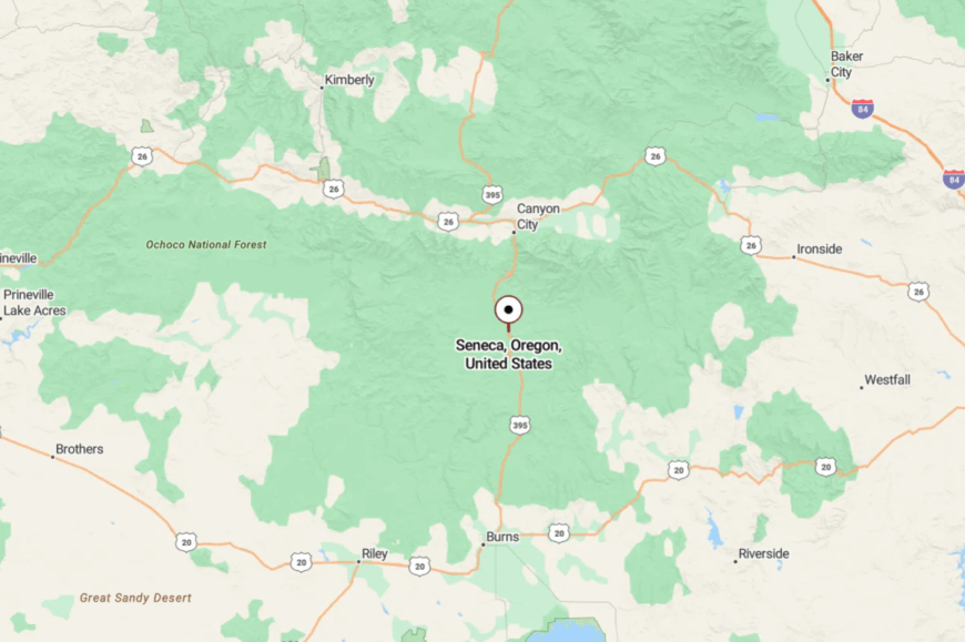
Seneca sits in Grant County, 23 miles south of John Day along Highway 395. The road threads through pine forests and open meadow flats before reaching the basin.
Winters can close routes temporarily, heightening its isolation. Arriving, you sense the forest and meadows have claimed more space than people ever could.
15. Mitchell – Fossil Beds Gateway with Small-Town Heart
Mitchell, with about 130 residents, stands at the foot of Painted Hills, one of Oregon’s most photographed natural wonders. Despite the attraction nearby, the town itself remains hushed, with a general store, diner, and three-block main street.
Visitors explore the fossil beds, hike Painted Hills trails, or join locals at the quirky Tiger Town Brewing Company. Tourism supplements ranching and small trade, but Mitchell never feels crowded thanks to its canyon setting.
Its isolation is preserved by distance—50 miles to Prineville, 60 to John Day, with long gaps of sage and rimrock in between. Mitchell is both a gateway and a refuge, straddling history and quietude.
Where is Mitchell?
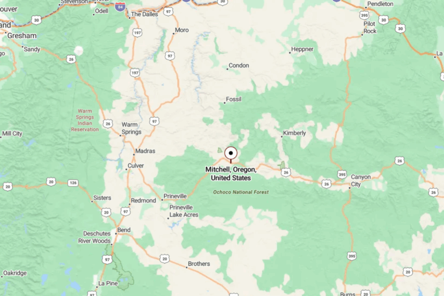
Mitchell lies in Wheeler County on Highway 26, about 50 miles east of Prineville. The highway narrows into canyons and climbs rimrock bluffs before descending into the tiny valley town.
With few nearby settlements, it stands as a solitary hub amid painted desert. Visitors sense right away they’ve stepped into a self-contained world.
14. Bates – Forest Outpost with Logging Roots
Bates, once a bustling sawmill town, now counts only a handful of residents surrounded by pine forest and mountain creeks. The old mill site is gone, replaced by meadows and a campground that welcomes hunters and anglers.
Trails lead into the Malheur National Forest, and wildlife sightings are frequent—deer, elk, and black bear. Its economic roots in timber remain visible, though most families have moved on.
With no services beyond the campground, Bates is defined by what it doesn’t have: stores, gas, or noise. Its seclusion is total, a forest hollow claimed back by nature.
Where is Bates?
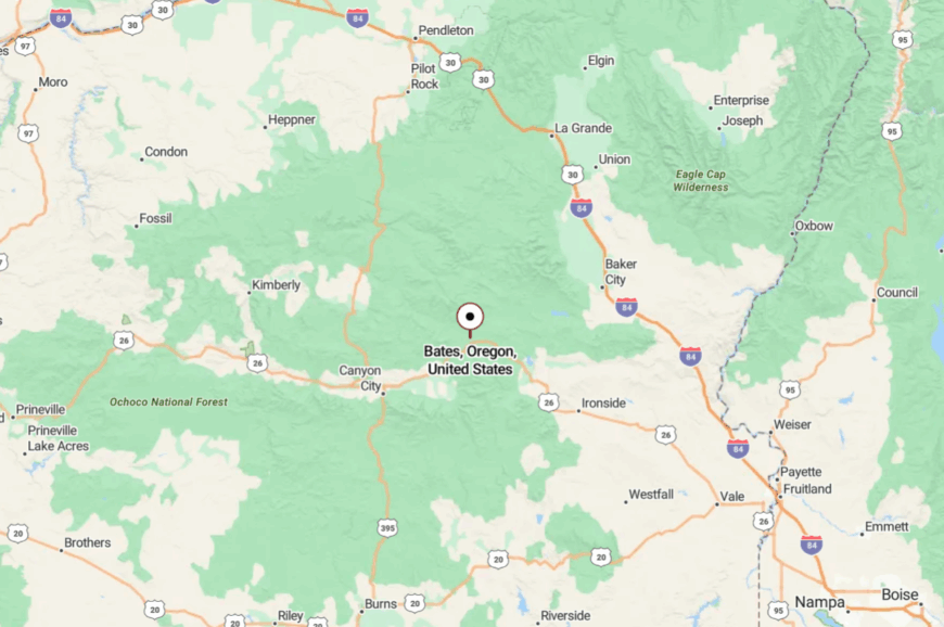
Bates is found 45 miles west of John Day in Grant County, just off Highway 26. The settlement sits along the Middle Fork John Day River, hidden in a wooded canyon.
Access is limited to the single highway route. Arriving feels like entering a forgotten forestry camp wrapped in green silence.
13. Prairie City – Edge-of-the-Mountains Refuge
🔥 Would you like to save this?
Prairie City, population about 900, lies against the Strawberry Mountains where valley ranchland gives way to forested peaks. The small main street is lined with century-old buildings, a café, and antique shops, all framed by snowy summits.
Ranching and forestry dominate the economy, with tourism slowly growing thanks to hiking, fishing, and the nearby Strawberry Lake. Despite its mountain beauty, Prairie City is well off the beaten path, 12 miles east of John Day and 70 miles from any larger city.
Its charm is its mix of heritage and horizon. Prairie City feels like a frontier town that found its peace and kept it.
Where is Prairie City?
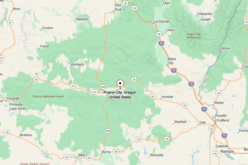
Prairie City sits in Grant County, along Highway 26, 12 miles east of John Day. To the south rise the Strawberry Mountains, creating a natural barrier.
The two-lane highway provides access but no nearby interstates feed through traffic. Its mountain backdrop both beautifies and isolates, reinforcing its slow rhythm.
12. Dayville – Fossil Beds Hamlet Beside the John Day River
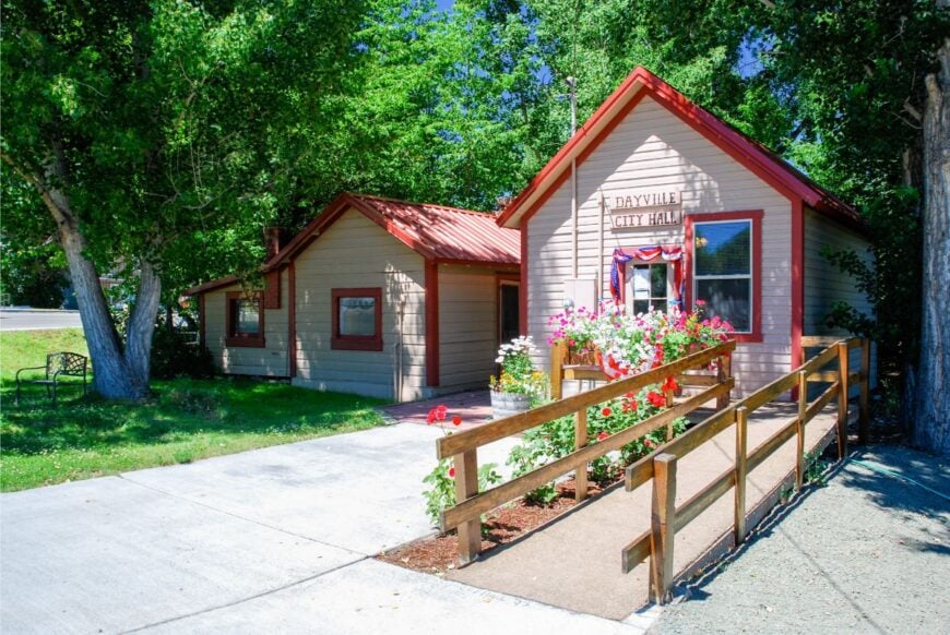
Dayville, home to about 150 residents, sits beside the John Day River where canyons open into a broad valley. The town supports a café, gas pump, and tiny mercantile, mostly serving ranchers and travelers to the John Day Fossil Beds.
Activities include fishing, hiking Blue Basin, or exploring nearby ranching museums. Agriculture underpins the economy, though summer tourism provides a seasonal lift.
Its seclusion comes from distance and scale—services are small, the town is quiet, and the landscape feels far older than the people in it. Dayville is a place where fossils and frontier still shape the pace of life.
Where is Dayville?
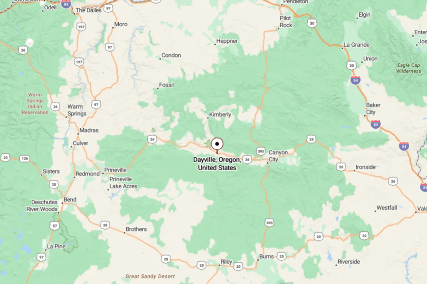
Dayville is located in Grant County on Highway 26, 30 miles west of John Day. The road parallels the John Day River and threads between rimrock canyons before the town emerges.
No large towns are nearby, leaving Dayville self-contained. Arriving, it feels like stepping into Oregon’s deep past as much as a community.
11. Richland – Valley Town by the Snake River Hills
Richland, with about 150 residents, sits in a sheltered valley just north of the Snake River. Its main street is modest—post office, store, café—but the surrounding fields glow green against canyon walls.
Farming and orchards fuel the economy, with irrigation water pulled from the river. Visitors fish Hells Canyon Reservoir, hike Lookout Mountain, or camp by Eagle Creek.
Its seclusion comes from geography—hemmed in by mountains, far from freeways or airports. Richland’s valley silence and deep night skies give it a timeless appeal.
Where is Richland?
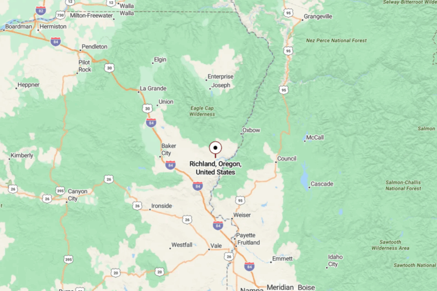
Richland is located in Baker County, about 40 miles east of Baker City via Highway 86. The road climbs and drops through canyon passes before reaching the quiet valley.
With Hells Canyon to the east and Eagle Cap Wilderness to the north, barriers ring the community. Arriving here feels like settling into a fertile pocket hidden by ridges.
10. Fields – A High-Desert Outpost on the Edge of the Alvord Playa

Fields counts fewer than 150 permanent residents who live among saltbush flats and grazing cattle near the Nevada border. Visitors sip milkshakes at the combined gas station, café, and post office before heading out for bird-watching at the neighboring playa or hiking up Steens Mountain’s wild eastern face.
Ranching and seasonal tourism form the town’s modest economy, with hay trucks and gravel-dusted SUVs the most common traffic. A 65-mile gap to the nearest stoplight in Burns underscores the settlement’s remoteness, and cell service often fades by the time the pavement ends.
Locals relish 360-degree horizons where sunsets spill across alkali flats without a power-line in sight. Wide-open skies, sparse infrastructure, and vast public land keep Fields wonderfully detached from modern bustle.
Where is Fields?
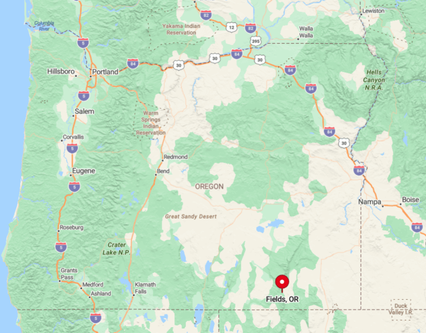
Fields sits in Oregon’s far-southern Harney County, just west of the vast Alvord Desert and south of 9,738-foot Steens Mountain. Surrounding Bureau of Land Management acreage creates a buffer of raw sagebrush that muffles outside influence.
Travelers reach the hamlet via State Route 205, a ribbon of asphalt where pronghorn often outnumber cars. The final leg is simple: fuel up at that singular combination store, because the next services are more than an hour away in any direction.
9. Frenchglen – Steens Mountain’s Storybook Stagecoach Stop
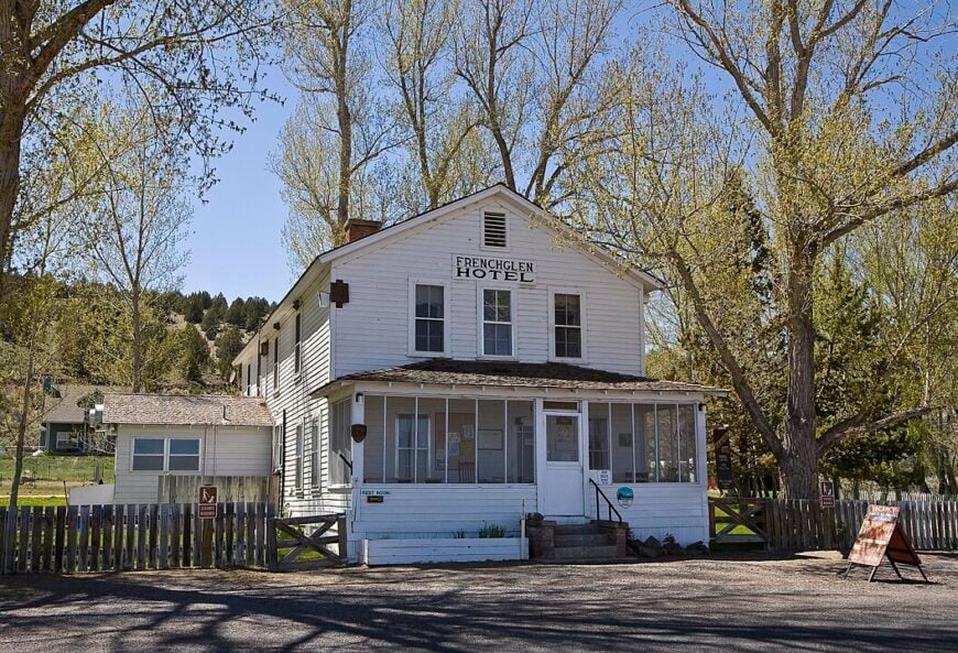
Roughly 75 people call Frenchglen home, gathering around a handful of buildings that date to the early 1900s. The historic Frenchglen Hotel serves family-style dinners and rooms to birders heading into the adjacent Malheur National Wildlife Refuge.
Cattle ranching endures as the main industry, with seasonal hospitality adding a small economic boost each spring and fall. Frenchglen’s quiet comes from a 60-mile ring of refuge marsh, sage steppe, and mountain foothills that blocks suburban creep.
Evening light filters through cottonwoods along the Blitzen River, and the only traffic jam might involve sandhill cranes on the gravel road. That natural moat of protected land maintains a hush that feels unchanged since stagecoaches stopped here.
Where is Frenchglen?

🔥 Would you like to save this?
The hamlet lies on State Route 205, 60 miles south of Burns and two miles from the Blitzen River’s head-gates. Its position against the western toe of Steens Mountain places it more than an hour from the closest chain grocery or stoplight.
Visitors usually drive in from Burns or Lakeview, admiring endless sage flats before cottonwoods signal arrival. Limited road access and refuge boundaries leave Frenchglen insulated from through-traffic and development.
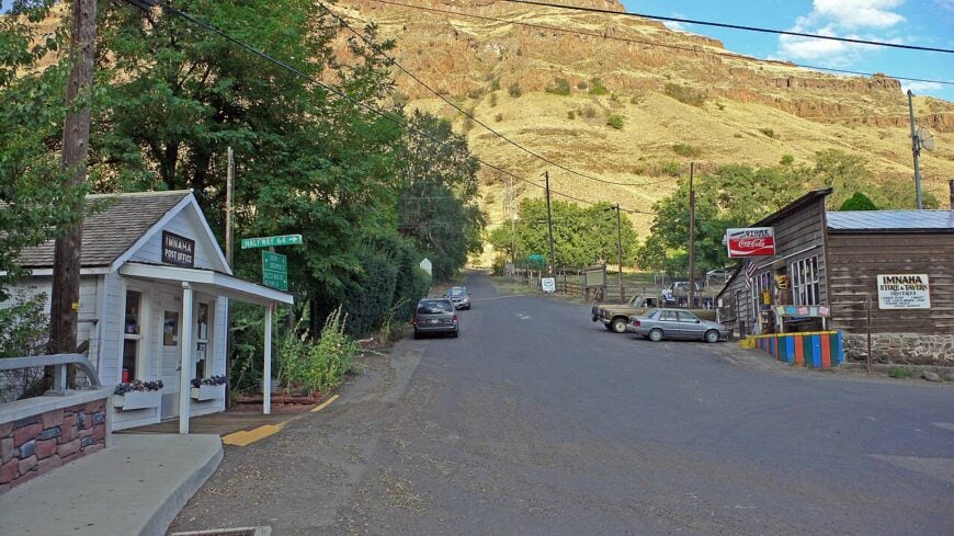
8. Imnaha – Wallowa County’s Canyon-Carved Hideaway
Imnaha’s year-round population hovers below 100, tucked at the confluence of Little Sheep and Imnaha Rivers beneath towering basalt walls. Anglers cast for steelhead and trout, while adventurous hikers tackle the Hat Point Road for canyon panoramas reaching into Idaho.
A small mercantile and the local tavern serve ranchers, hunters, and forest-service crews, reflecting an economy rooted in livestock and seasonal recreation. The final 30 miles from Joseph follow a single-lane, cliff-edged route that discourages casual day-trippers.
National-forest land surrounds the settlement, muting cell signals and keeping night skies pitch dark. Imnaha’s combination of rugged approach and canyon geography locks it in near-permanent solitude.
Where is Imnaha?
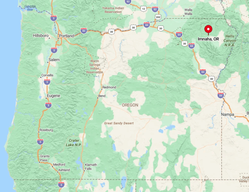
Located in Oregon’s far northeastern corner, Imnaha sits 30 winding miles east of the artsy town of Joseph and just shy of the Idaho border. Basalt ramparts on three sides and Hells Canyon National Recreation Area to the east form a natural fortress.
Access is by County Road 350, a ribbon that hugs riverbanks and climbs switchbacks without guardrails. Once drivers descend to creek level, isolation becomes obvious—there are no alternate routes, and the nearest gas pump is back in Joseph.
7. Arock – Basque Sheep Country Beyond the Owyhee River

Arock lists about 50 residents, many descended from Basque sheepherders who settled the Owyhee Plateau more than a century ago. Stone bunkhouses from that era still dot the range, and weekend explorers search petroglyph-lined cliffs while mule-deer herds graze below.
Sheep ranching remains the chief livelihood, supplemented by small-scale alfalfa farming drawn from Owyhee River irrigation. Neighbors sit miles apart, linked by gravel tracks that disappear into volcanic rimrock, ensuring very little noise beyond bleating lambs and the wind.
A lack of commercial centers, schools, or even a café enhances the sense of timelessness. Endless distance between ranch gates and the absence of highway traffic place Arock firmly off the grid.
Where is Arock?
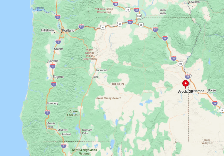
This crossroads occupies southeastern Malheur County, 40 miles southwest of Jordan Valley and 100 miles from the nearest sizable grocery in Ontario. Set amid Owyhee River canyons and sagebrush flats, the community sees more sheep trailers than sedans.
Reaching Arock requires leaving U.S. Highway 95 for the gravel Cove Road, which skirts rimrock ledges and river bends. The route’s length and unpaved nature keep visitor counts low, preserving the plateau’s deep quiet.
6. Starkey – Blue Mountains Enclave Hidden by Ponderosa Forest

Starkey’s population seldom tops 30, scattered among two-acre home sites surrounded by thick ponderosa pines. Residents hunt elk in the morning, then pick up mail at the one-room post office that doubles as a social hub.
Logging and forest-service research deliver occasional paychecks, yet most households rely on remote work or retirement income. The community sits at the end of a Forest Road spur, hemmed in by the 250,000-acre Starkey Experimental Forest and Range that restricts development.
With trees swallowing sound and sightlines, neighbors can vanish for days without notice. Dense timber, minimal services, and a dead-end road keep Starkey wrapped in peaceful seclusion.
Where is Starkey?
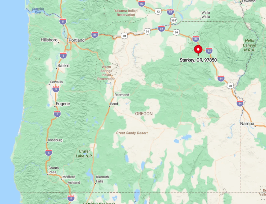
Find Starkey 28 paved miles southwest of La Grande in Union County, then another eight miles on Forest Road 21. Towering pines quickly replace wheat fields as the road narrows and cell bars drop away.
Public transportation is nonexistent; private vehicles or snowmobiles in winter are the only options. The surrounding research forest restricts through traffic, so few outsiders stumble upon the hamlet by chance.
5. Service Creek – River Bend Refuge off the John Day Scenic Byway

Service Creek supports roughly 25 full-time residents clustered around a single café-lodge and an old wooden schoolhouse now used for storage. Rafters launch onto the wild and scenic John Day River here, while anglers seek steelhead in shoulder seasons and hikers pick wildflowers on nearby basalt bluffs.
Hospitality at the lodge and guiding services for float trips serve as the area’s primary income sources. Sheer canyon walls funnel the river and the road through a tight gap, discouraging expansion beyond a few buildings.
Even during summer rush, most travelers pass through after topping off coffee, leaving streets empty by dusk. That end-of-the-road vibe is preserved by geography as much as by community choice.
Where is Service Creek?

The settlement sits in Wheeler County where Oregon Highway 19 crosses the John Day River, 30 miles northwest of fossil-rich Spray. Steep volcanic cliffs and the meandering river form natural barriers that limit both construction and cellular coverage.
Motorists arrive via the John Day Scenic Byway, a route celebrated for tight curves and minimal shoulders. Absence of alternate roads means anyone reaching Service Creek made a deliberate detour, ensuring traffic remains thin.
4. Riley – Sagebrush Junction with More Antelope than People
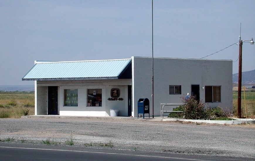
Riley’s population doesn’t break 75, yet its crossroads gas station, café counter, and post office serve a wide circle of ranches scattered across Harney Basin. Travelers pause to photograph pronghorn grazing near the pumps or scan sky-wide horizons unbroken by mountains.
Cow-calf operations dominate the business ledger, with highway services bringing modest supplemental income. Riley’s solitude stems from a 40-mile gap to Burns in one direction and an 82-mile gap to Bend in the other, leaving the junction surrounded by raw sagebrush.
Evening brings pitch-black skies where the Milky Way blazes without interference from streetlights. This unbroken desert plateau guards Riley’s quiet like a moat of open space.
Where is Riley?
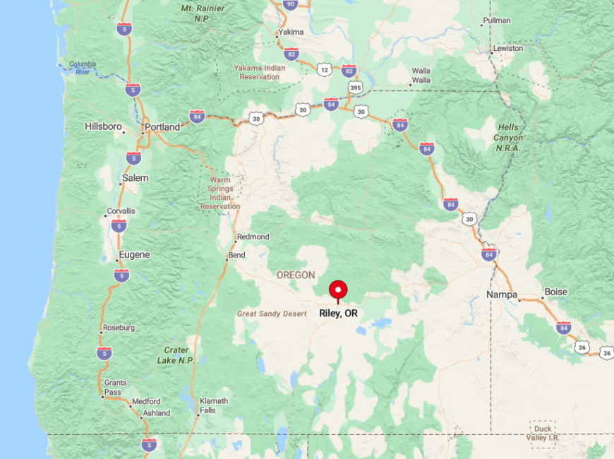
Positioned on U.S. Highway 20 at its intersection with State Route 395, Riley anchors Oregon’s largest county by land area. Despite the crossing of two highways, average daily traffic rarely feels busy because no sizable towns sit within an hour’s drive.
The nearest bus stop or commercial flight is in Bend, reached by a straight shot across high desert. The sheer distances involved keep Riley calm, with only ranch trucks and long-haul drivers punctuating the silence.
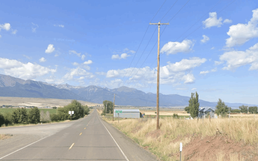
3. Medical Springs – Hot-Spring Hamlet in the Elkhorn Foothills
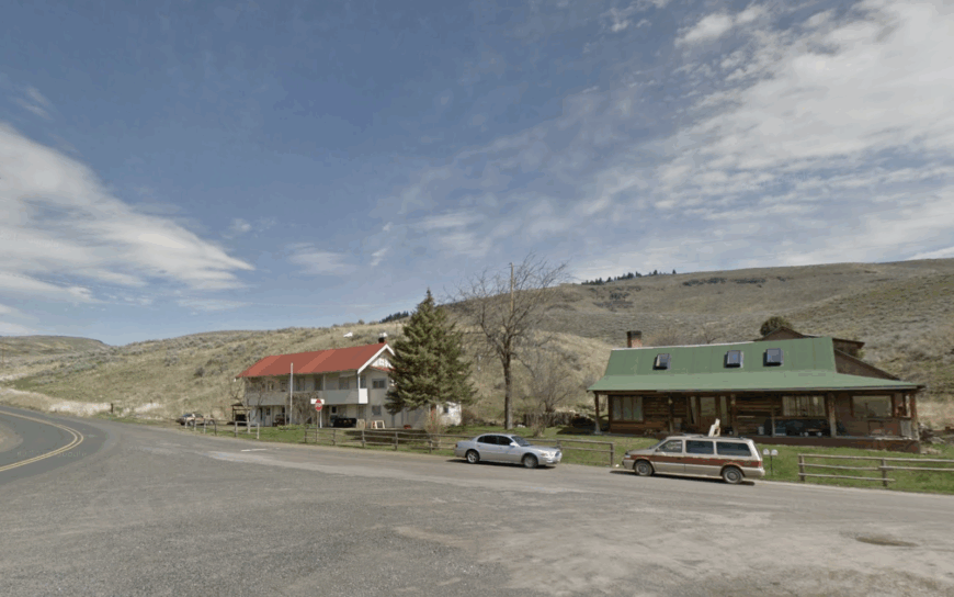
Medical Springs maintains about 60 inhabitants whose homes cluster near a steaming mineral pool once billed as a Victorian spa cure-all. Modern visitors soak in the restored stone bathhouse or fish for rainbow trout in Catherine Creek a short walk away.
Small-scale ranching and vacation rentals supply modest income while relics of the 19th-century resort lend historical character. Encircling fir-covered hills and the Elkhorn Mountains break radio signals and block expansion, so life moves slowly and quietly.
Wildlife often outnumber residents; elk wander the main street on winter mornings. The hot springs’ gentle gurgle fills evenings that remain mercifully free of traffic noise.
Where is Medical Springs?
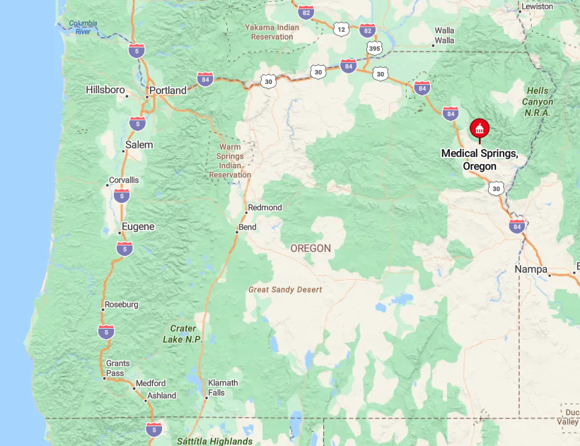
The village rests 25 miles northeast of Union along sparsely traveled State Route 203 in Union County. Winding two-lane pavement climbs through forest, and snow can close the pass in stormy weather, adding an extra layer of insulation. No scheduled transit serves the route, so personal vehicles are essential.
With Baker City and La Grande each about 40 minutes away, Medical Springs enjoys just enough distance to stay hidden while remaining reachable for supply runs.
2. Paulina – Rimrock-Ringed Ranchland in the Big Empty
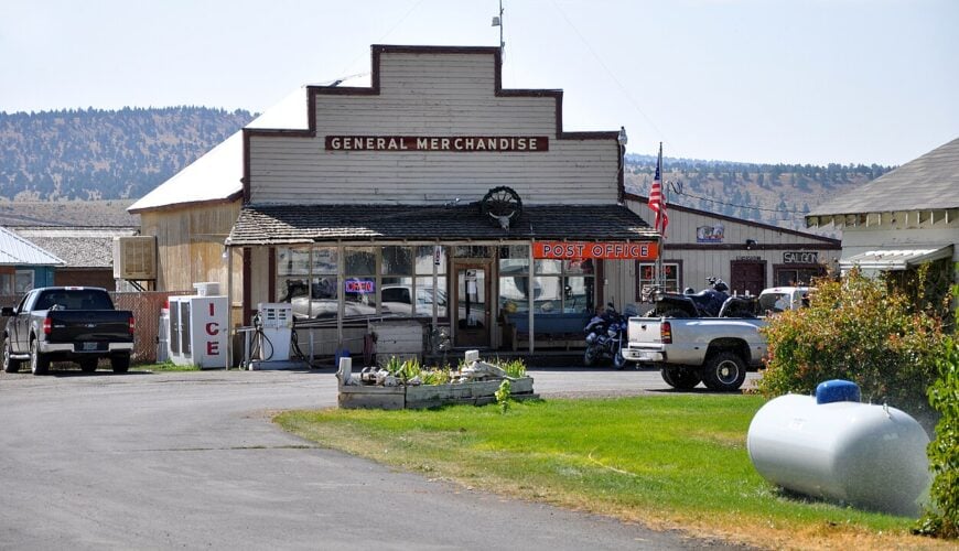
Paulina claims roughly 200 residents along a single paved street flanked by the grange hall, a compact mercantile, and a volunteer fire shed. Locals ride horseback between sprawling cattle spreads or gather for weekend potlucks at the community center, while hunters pursue mule deer in the surrounding Ochoco National Forest.
Ranching fuels the economy, with forestry and limited tourism from rockhounds chasing thunder eggs contributing occasional paychecks. Over an hour’s drive to Prineville, the nearest full-service town, Paulina enjoys natural insulation from city clamor.
Sagebrush mesas and red-rimmed buttes encircle the valley, muting both wind and wireless signals. That backdrop delivers star-laden night skies and a palpable sense of breathing room.
Where is Paulina?
The town sits 55 miles east of Prineville via State Route 380, a two-lane ribbon that winds past cattle guards and open range. Beyond Paulina, pavement fades to gravel, turning the settlement into the last reliable service stop for hunters and loggers.
Public transportation is nonexistent, and winter storms can close the road for days. Those factors keep Paulina quiet and self-reliant, with community ties strengthened by distance.
1. Rome – Honey-Colored Cliffs Guarding the Owyhee Badlands
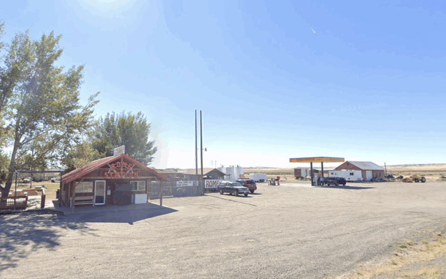
Rome hosts fewer than 40 people clustered around a lone country store, RV spaces, and a Bureau of Land Management outpost shadowed by the “Pillars of Rome,” towering tan hoodoos that once guided wagon trains.
Day adventurers paddle the Owyhee River, hunt for agates in dry washes, or explore chalky badlands that resemble a lunar landscape. Ranching and seasonal guiding are the only industries, and even those slow to a trickle outside spring runoff.
Surrounded by millions of acres of public desert and bookended by distant canyon rims, Rome feels like frontier territory in the 21st century. Evenings bring coyotes yipping across broad flats where cell towers have yet to arrive.
Where is Rome?
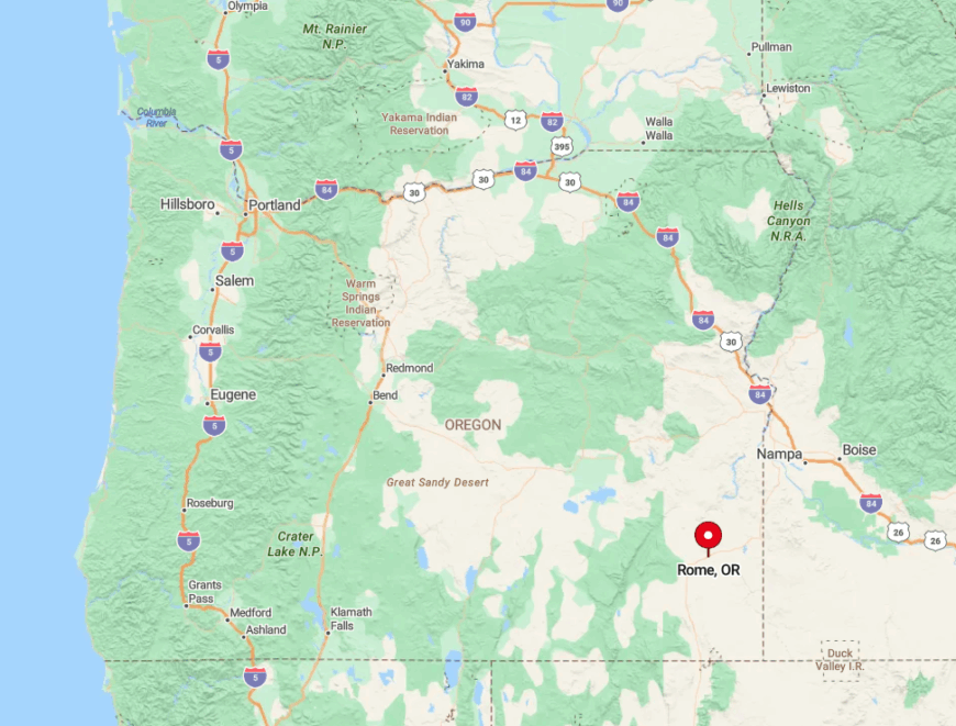
Rome perches on U.S. Highway 95 near the Idaho border, 100 miles from the nearest grocery in Ontario and 90 miles from Winnemucca, Nevada. Honey-colored cliffs and the serpentine Owyhee River hem in the site, leaving no alternate routes except rugged, unsigned dirt tracks.
Drivers must carry extra fuel and water; the next gas station in either direction is nearly an hour away. That commitment required to reach Rome keeps crowds thin and the surrounding desert wonderfully undisturbed.


