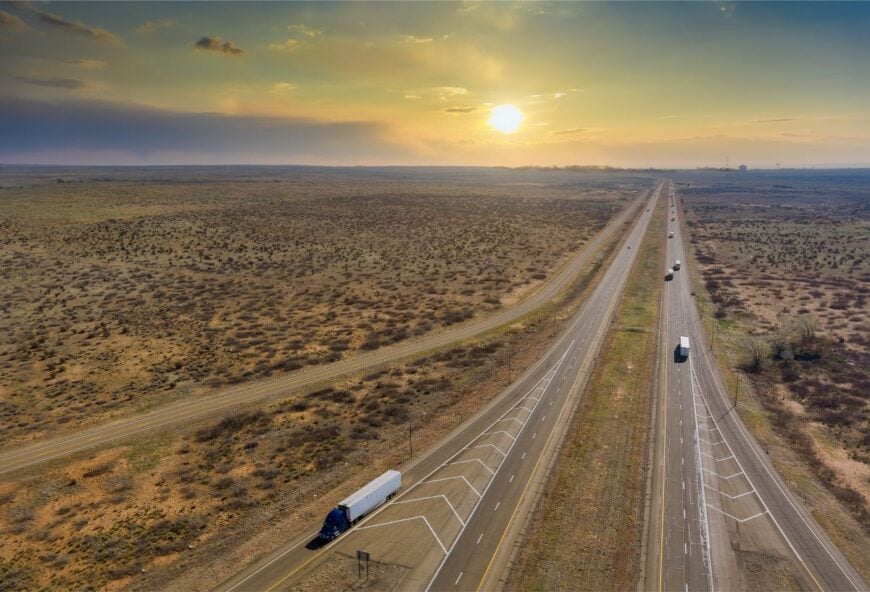
From the high plains where dust devils roam to the dry riverbeds carved by centuries of wind, eastern New Mexico has always been a land of distance and endurance. This corner of the state stretches wide and flat, and its settlements often feel more like waypoints than towns, stitched into the landscape by rail spurs, ranch roads, and stubborn families who never left.
In order to come up with the very specific design ideas, we create most designs with the assistance of state-of-the-art AI interior design software.
Many of these places are little more than clusters of houses or the remains of schools and churches. Their populations can be counted in dozens, sometimes in single digits, but their histories reach back to cattle drives, homesteading schemes, and the fevered days of the railroad. Empty motels and boarded-up depots sit in the sun like forgotten props, reminders that bustle once came through here before the highways curved elsewhere.
What they offer now is something rarer: true quiet. Nights are marked by the whistle of distant trains or the sudden cry of coyotes. Days unfold to the rhythm of cattle gates and windmills, with the horizon stretching so far that weather announces itself an hour before it arrives. Travelers find not just scenery but a scale of silence that urban life has nearly erased.
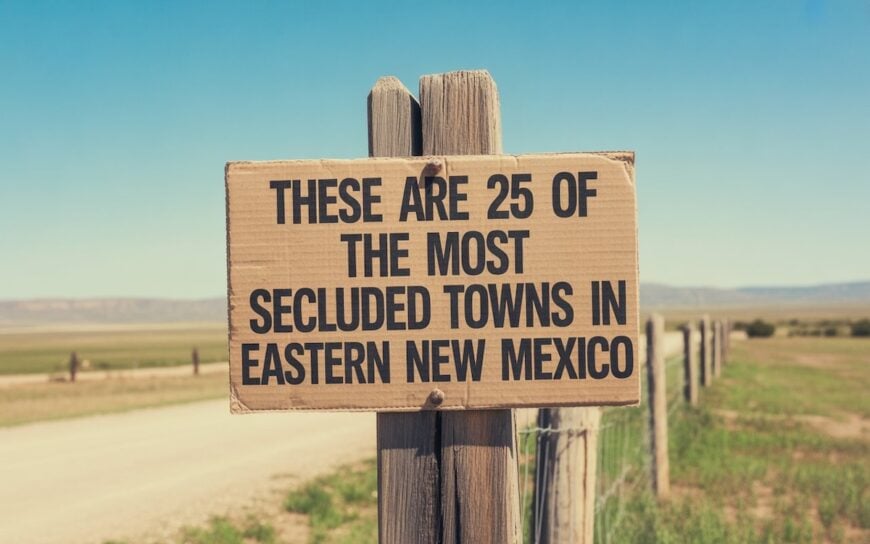
This list of 25 secluded towns traces a line through eastern New Mexico’s empty quarters. Some are ghostly, others still alive with Friday night basketball games or seasonal fairs. All of them are places where the land dictates the pace, where space itself feels like the main attraction, and where visitors quickly learn that seclusion here isn’t an inconvenience—it’s the point.
25. Garita
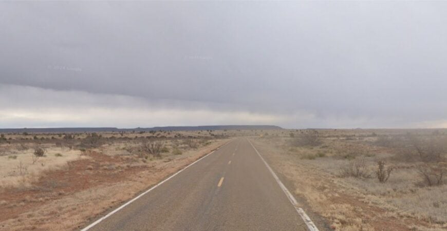
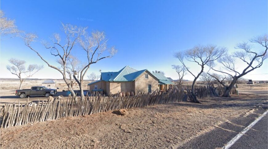
Garita is a near-forgotten hamlet tucked into sandstone bluffs and cottonwood draws along the Pecos River. With only a handful of residents today, its most striking landmark is the crumbling San Jose de la Garita Church, built in the 1800s and still standing watch over the plains.
The town once served sheepherders and stagecoaches, but now the silence is broken mostly by wind and doves fluttering from the canyon walls. Visitors can explore the old stone church, photograph weathered barns, or hike to nearby river overlooks.
Ranching remains the backbone of local life, though many families have long since moved away. Its seclusion comes from being miles off the main highway, with no services to anchor it. Garita feels like a hidden shrine to New Mexico’s past, where history and solitude linger side by side.
Where is Garita?
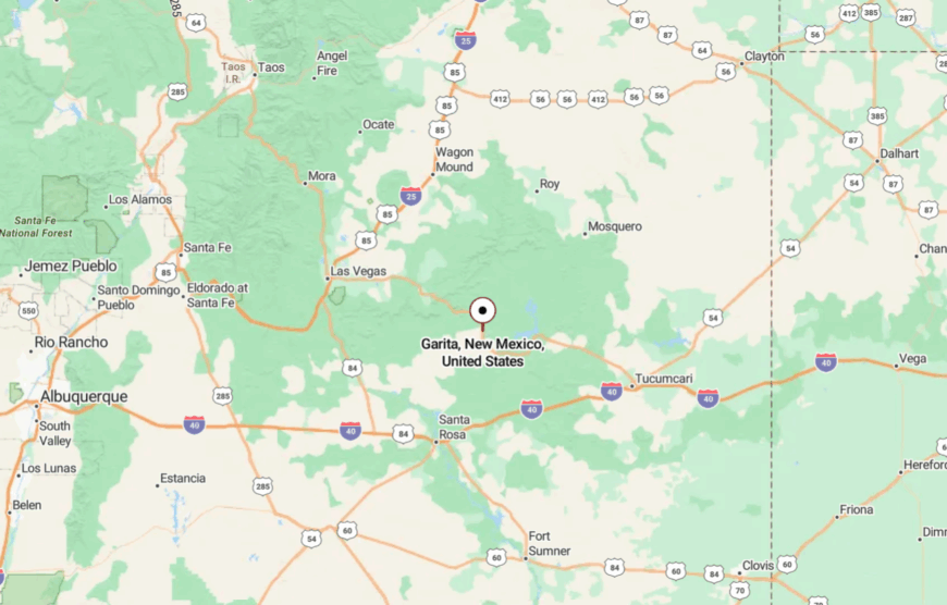
Garita lies in San Miguel County, about 50 miles northwest of Tucumcari, reached by NM-104 and winding county roads. The drive passes mesas, canyons, and miles of open grassland with little sign of modern development.
The nearest groceries and fuel are in Las Vegas, nearly an hour’s drive west. When you finally arrive, it feels like you’ve uncovered a secret preserved by distance and time.
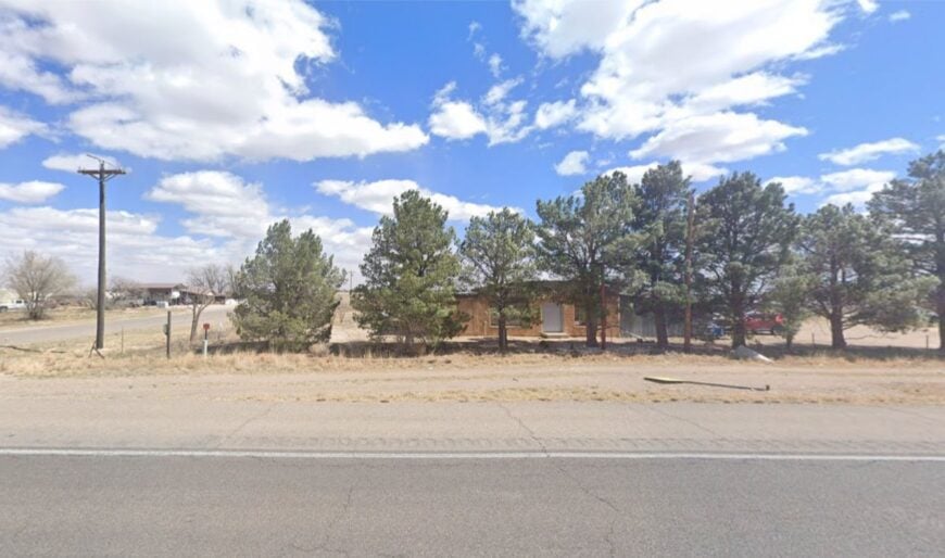
24. Bueyeros
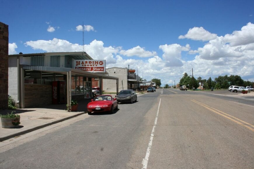
Bueyeros is a tiny ranch hamlet tucked against red sandstone mesas in Harding County. With fewer than 50 residents, it has a one-room community center, a scattering of adobe homes, and quiet roads that end in open pasture.
The town’s name, meaning “oxen drivers,” reflects its roots in Spanish cattle drives that once crossed the region. Today, it’s known for its dramatic cliffs, birdwatching, and the eerie quiet that lingers after sunset.
Ranching remains the lifeblood, with families passing land down through generations. Visitors who stumble upon it often remark on the timelessness of its landscape. It’s a place where the earth itself feels older, untouched by modern rush.
Where is Bueyeros?
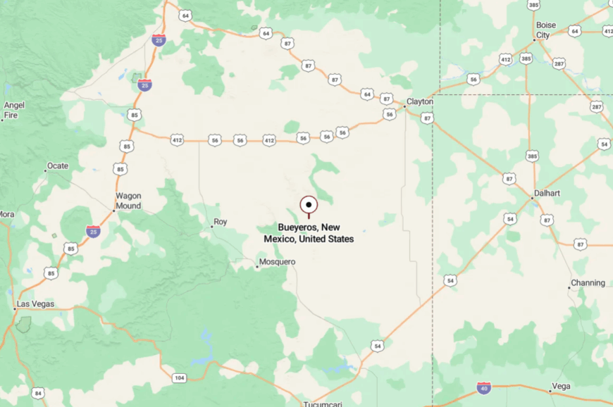
Bueyeros lies in far northeastern New Mexico, about 30 miles north of Mosquero along NM-102. Access requires a winding drive through empty grasslands and red rock outcroppings.
The nearest fuel stop is in Roy, a half-hour away. The long drive in is rewarded with skies so wide you feel small beneath them.
23. McDonald
McDonald, in southeastern Lea County, is a scattering of homes, grain silos, and fields stretching flat to the horizon. With fewer than 150 residents, the town thrives on ranching, cotton, and peanuts.
Its quiet is broken only by passing farm trucks or the distant thunder of summer storms. Travelers who visit might stop to admire historic windmills, walk among abandoned school foundations, or simply enjoy the uninterrupted horizon.
Nights here glow with stars that seem close enough to touch. The lack of commercial centers or through-traffic makes McDonald deeply secluded. It’s the kind of place where time feels measured by seasons, not by clocks.
Where is McDonald?
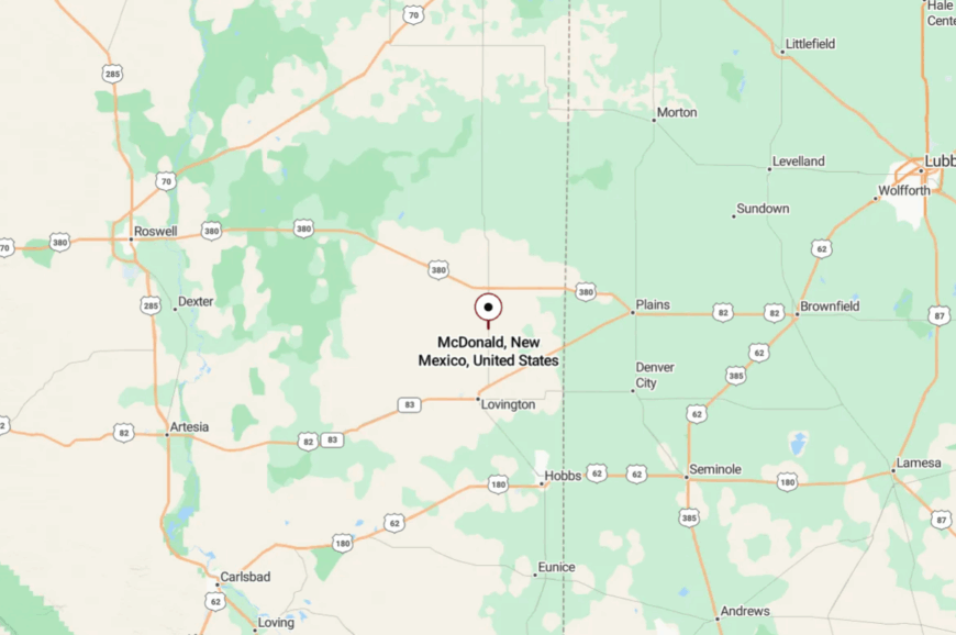
McDonald is located about 35 miles southeast of Tatum, reached via NM-206 and country roads. The nearest city services are in Lovington, nearly an hour away.
Getting here means long stretches of road with little but jackrabbits and mesquite for company. When you arrive, it feels like you’ve reached the end of a chapter written in wide skies.
22. Bard
Bard, now little more than ruins along old Route 66, is a forgotten dot on the plains of Quay County. Once a small service stop, today it’s an abandoned schoolhouse and weathered church that stands alone against the prairie winds.
A few ranch houses still dot the landscape, but most of Bard exists only as memory and broken walls. Travelers wander among crumbling foundations, listening to meadowlarks and the hum of passing freight trains.
Ranching families nearby maintain the land, but no stores or gas stations remain. Its seclusion comes from being bypassed when I-40 was built. Bard offers that haunting sense of how quickly towns can fade back into the earth.
Where is Bard?
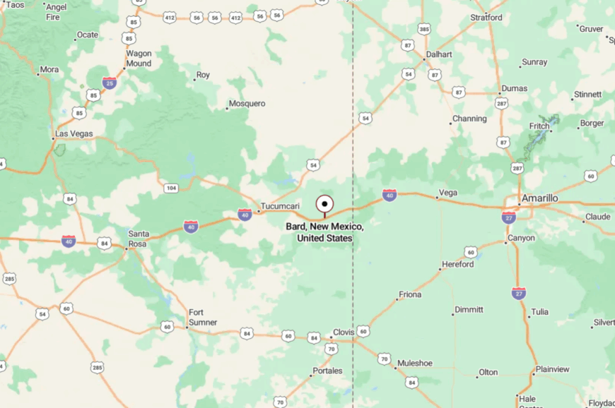
Bard lies 22 miles east of Tucumcari along old US-66, now Frontage Road. Interstate 40 runs nearby, but exits are sparse, so few visitors stop here.
The drive-in passes rusting cars and forgotten homesteads. The isolation deepens with every mile, until you feel you’ve stepped into a ghost’s shadow.
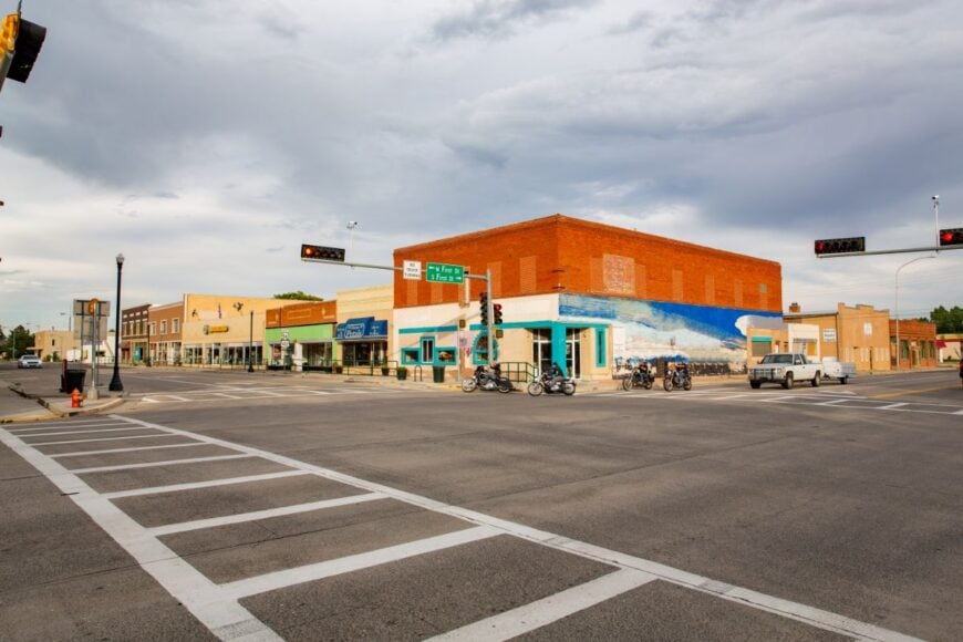
21. San Jon
San Jon is a village of about 300 people, sitting quietly on the plains where Route 66 once bustled with travelers. Today, a few cafes and motels still stand, but most of the old neon lies dark, leaving the streets hushed.
Ranching and farming sustain the community, while its slower pace attracts history buffs chasing the Mother Road’s fading echoes. Visitors can still find the remnants of vintage gas stations, explore prairie trails, or attend small-town fairs.
Despite the highway nearby, San Jon feels overlooked, bypassed by modern travelers. The silence of its main street is its most striking feature. It’s the kind of place where yesterday feels closer than tomorrow.
Where is San Jon?
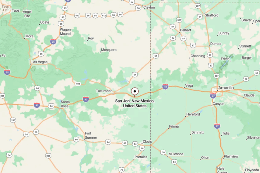
San Jon rests in Quay County, about 25 miles east of Tucumcari along I-40. Travelers usually exit onto NM-469 to enter the village.
The town’s position, surrounded by flat ranchlands and distant mesas, keeps it far from big-city noise. Even with an interstate nearby, it feels like a hidden pocket of time.
20. Melrose

Melrose is a farming town of about 700 residents, quietly straddling the high plains west of Clovis. The grain elevators rise like sentinels above the railroad tracks, while rows of modest houses reflect the town’s agricultural roots.
It’s known for wide skies, quiet nights, and the nearby Melrose Air Force Range, whose restricted lands preserve open prairie. Visitors stroll tree-lined streets, stop at local diners, or wander out to nearby wildlife areas for birdwatching.
Farming anchors the local economy, supported by wheat, sorghum, and cattle ranching. Melrose is secluded not by distance but by pace—the world feels slower here. It’s the kind of place where stillness feels like a gift.
Where is Melrose?
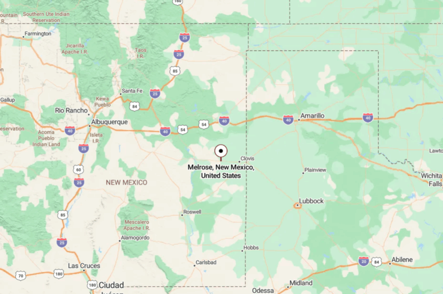
Melrose lies in Curry County, about 25 miles west of Clovis on US-60. The drive in is long and straight, passing more silos than stoplights.
The closest large town is Clovis, nearly half an hour away. Arriving here feels like entering an agricultural time capsule.
19. Vaughn
🔥 Would you like to save this?
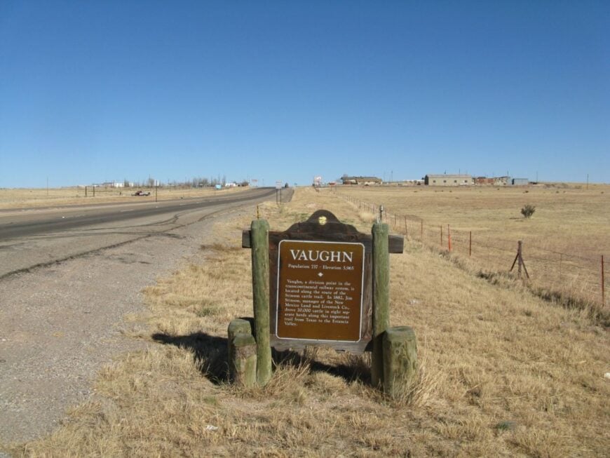
Vaughn, with about 400 residents, feels like a relic of crossroads travel. Once a rail and highway hub, today it sits quietly at the junction of US-54, US-60, and US-285. Abandoned motels and old depots give it a slightly eerie, timeless vibe, while ranching and small businesses sustain daily life.
Travelers photograph rusting neon signs or admire the broad plains rolling away in all directions. Migratory birds flock to stock ponds, adding life to the stark landscape.
Its isolation is amplified by distance—Albuquerque is nearly two hours away. Vaughn feels like a town waiting for travelers who rarely come.
Where is Vaughn?
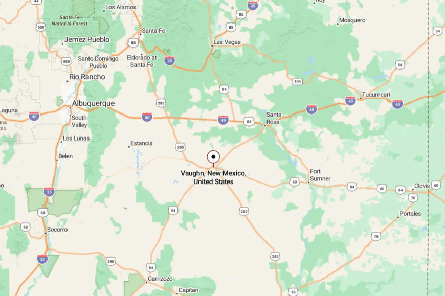
Vaughn is in Guadalupe County, central-eastern New Mexico. The town sits at a crossroads 118 miles southeast of Albuquerque.
The drive in is long and empty, with few services along the way. The openness and quiet amplify its sense of seclusion.
18. Grady
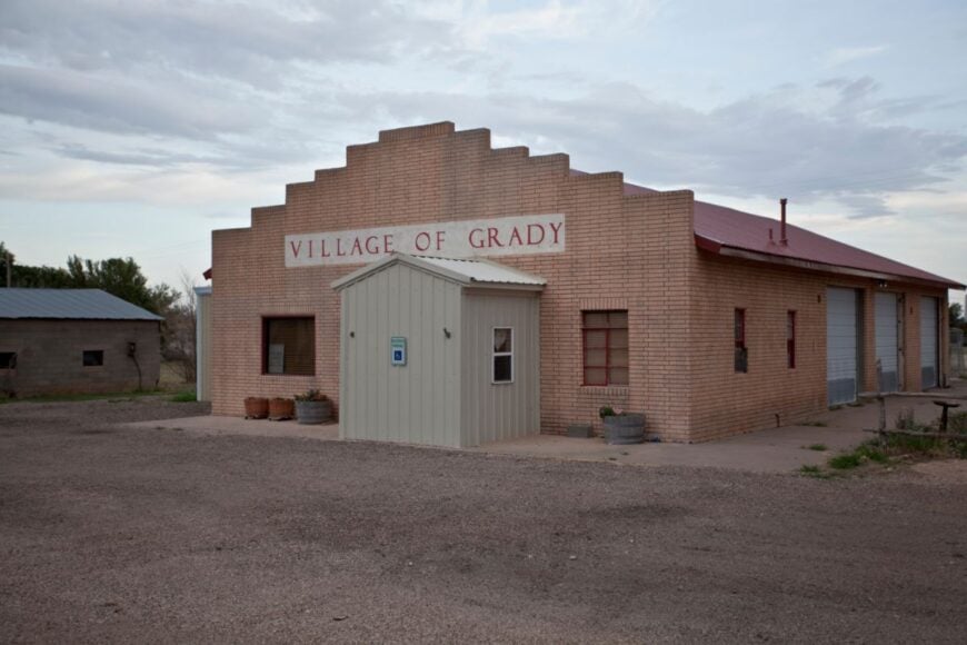
Grady, in Curry County, counts fewer than 100 residents and a single school that doubles as the hub of community life. Surrounded by endless wheat and cattle land, it feels cut off from the world except during Friday night basketball games.
Visitors may pause to photograph the rustic grain elevator or wander the quiet cemetery overlooking the plains. Farming remains the heartbeat here, with sorghum, hay, and cattle shaping the local economy.
The quiet roads and distant horizons reinforce its small-town serenity. Grady is secluded by space, family roots, and the slow turn of rural life. It’s the kind of place where generations measure time, not minutes.
Where is Grady?
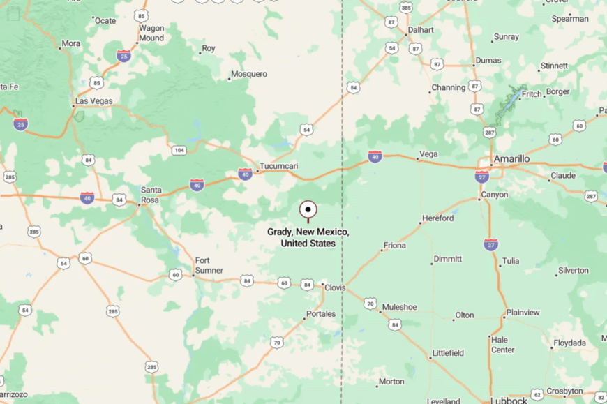
Grady sits about 30 miles north of Clovis in northeastern Curry County. The only way in is via NM-209, a two-lane road crossing open prairie.
The nearest services are in Clovis, a 40-minute drive away. The wide, empty landscape ensures it feels far removed from modern distractions.
17. Roy
Roy, with about 250 people, rests beneath sandstone mesas in Harding County. Known for its historic stone buildings and old trading posts, the town has a quiet, frontier-like atmosphere.
Visitors can hike in nearby Mills Canyon, a hidden gem of the Canadian River gorge, or admire the stonework of the 1930s WPA projects in town. Ranching anchors daily life, while tourism trickles in during summer.
Its seclusion comes from being far off interstate routes, with few services nearby. Roy feels like a portal to New Mexico’s rugged past. It’s the kind of place where history echoes off canyon walls.
Where is Roy?

Roy is in northeastern New Mexico, 44 miles south of Clayton along NM-39. Travelers typically arrive by narrow highways that thread through mesa country.
The nearest larger town is Las Vegas, over an hour away. The isolation makes Roy feel like a secret tucked into canyon country.
16. Logan
Logan, with around 1,000 residents, sits quietly on the Canadian River near Ute Lake. Its seclusion is balanced by water recreation—boating, fishing, and camping draw visitors, but never crowds.
The town’s adobe storefronts and vintage motels hint at its Route 66 heritage. Residents rely on tourism, ranching, and nearby dam operations. Visitors often fish for walleye, explore Ute Lake State Park, or watch sunsets ripple across the water.
Its small size and distance from urban centers keep Logan peaceful year-round. It’s the kind of place where water and sky share the horizon in equal measure.
Where is Logan?
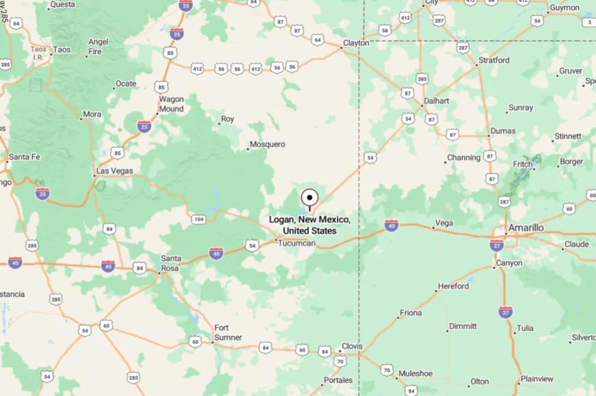
Logan lies in Quay County, 24 miles northeast of Tucumcari. It’s reached via US-54, which winds past mesas and across the Canadian River.
The closest services are in Tucumcari, a 30-minute drive away. The lake and quiet roads preserve its sense of escape.
15. Clayton Lake Hamlet
Near Clayton Lake, a small unincorporated community offers seclusion beneath high plains skies. The hamlet is a cluster of cabins and ranch houses where people live close to both water and prairie.
Visitors come for stargazing at Clayton Lake State Park, famous for its International Dark Sky designation, and to hike among 100-million-year-old dinosaur tracks. Ranching and tourism share the economic load, though life remains slow and neighborly.
Nights here are deeply quiet, broken only by coyotes or wind across the lake. Its seclusion is amplified by the surrounding ranchland and distance from larger towns. It’s the kind of place that reminds you how quiet the world can be.
Where is Clayton Lake Hamlet?
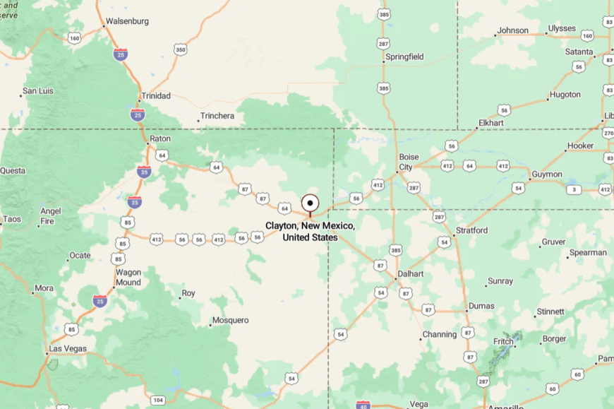
The hamlet sits in Union County, about 12 miles north of Clayton near NM-370. Access requires a drive across ranch roads that roll gently toward the lake.
The nearest stores and services are in Clayton itself. The short but remote trip makes the settlement feel far removed once you arrive.
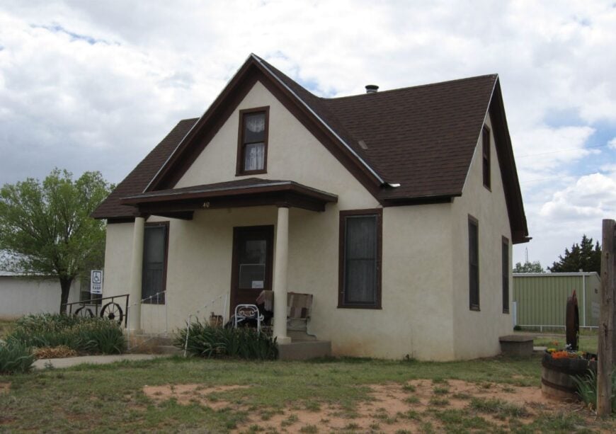
14. Nara Visa
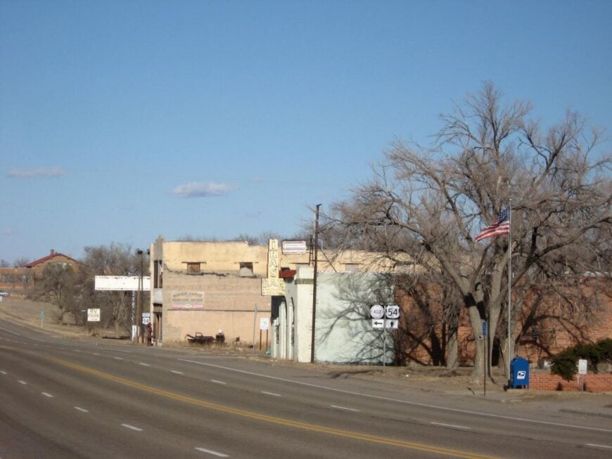
Nara Visa is a fading settlement of fewer than 100 people, straddling old Route 66 in Quay County. Its abandoned school and weathered motels line a road that now sees little traffic, giving the town an eerie, quiet feel.
Ranching families remain, alongside a few artists drawn to the isolation and desert light. Visitors explore the historic schoolhouse, admire murals, or wander the old trading post.
The silence of its empty main street contrasts with the roar it once knew from Route 66’s heyday. Its seclusion stems from being bypassed by I-40. Nara Visa is where nostalgia lingers in the dust.
Where is Nara Visa?
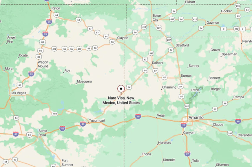
Nara Visa sits 40 miles east of Tucumcari along US-54 near the Texas border. The town is surrounded by wide cattle pastures and mesas.
Travelers reach it by a two-lane highway that rarely sees heavy traffic. Its quiet location makes it feel forgotten by time.
13. Amistad
🔥 Would you like to save this?
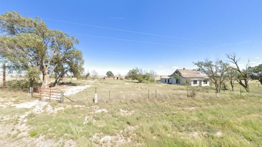
Amistad, meaning “friendship,” is a tiny Harding County hamlet of about 50 residents. Built in the early 1900s as a utopian settlement, today it’s a quiet ranching community surrounded by endless grassland.
Visitors can see the historic stone church, wander dirt roads, or watch pronghorn sprint across the plains. The economy is modest, focused on ranching and farming. With no stores or gas stations, residents rely on trips to Clayton or Roy for supplies.
Its seclusion comes from the sheer emptiness surrounding it. Amistad feels like a place where the horizon is your closest neighbor.
Where is Amistad?
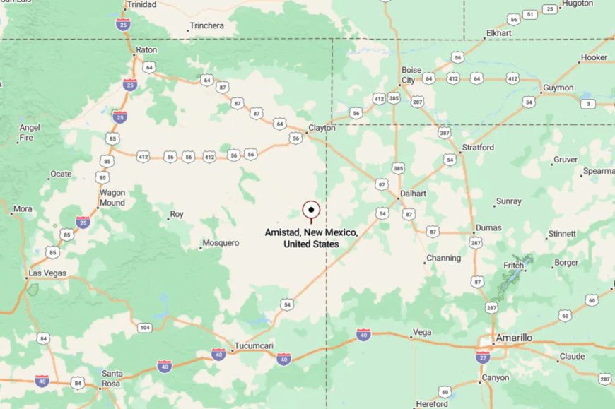
Amistad is in northeastern New Mexico, about 40 miles south of Clayton along NM-402. The road to town winds through open plains with few landmarks but windmills.
Services are distant, requiring careful planning. The remoteness makes arriving feel like entering another world.
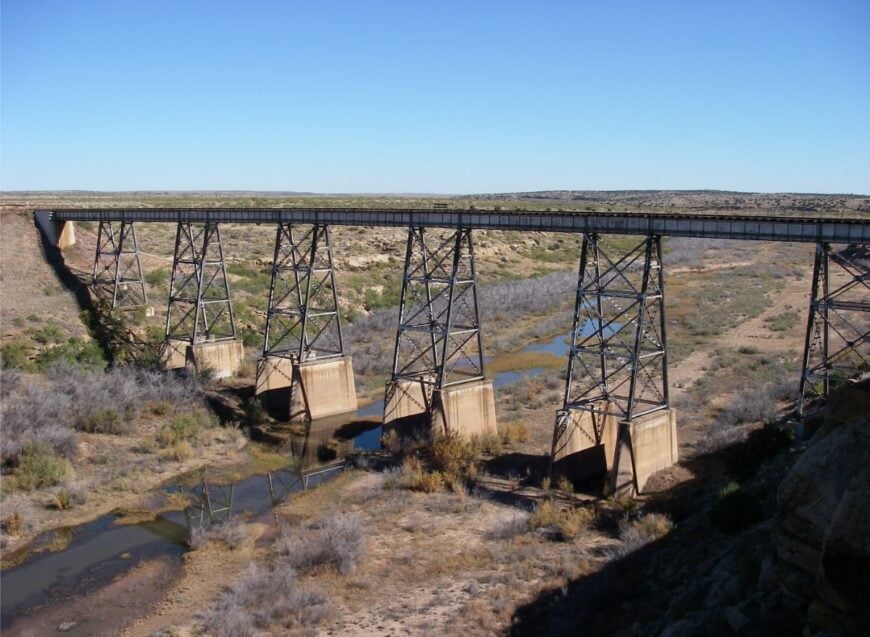
12. Seneca
Seneca is a near-ghost town in Union County, with fewer than 20 residents and a scattering of abandoned buildings. Its silence is broken only by passing freight trains and prairie winds.
Ranching families nearby still graze cattle, but the town itself feels frozen in the early 20th century. Visitors wander old storefronts, take photos of collapsing barns, or walk among cottonwoods along the Cimarron River.
The emptiness lends it an almost eerie charm. Seclusion defines Seneca—it’s a place left behind by modern maps. It’s the kind of place that whispers of lives once lived.
Where is Seneca?

Seneca sits about 10 miles north of Clayton along US-87 near the Colorado border. Access is easy by highway, but it feels lonely, as traffic is sparse.
The nearest stores are in Clayton, a short but significant drive away. The town’s near-abandonment makes it feel far more remote than its distance suggests.
11. Des Moines
Des Moines, with about 100 residents, rests at the foot of Capulin Volcano in Union County. This small ranching community is known for its breathtaking scenery—dormant volcanic cones rising from grassy plains.
Visitors stop to hike Capulin Volcano National Monument, watch wildlife, or explore basalt formations nearby. Ranching is the lifeblood of the town, with cattle herds dotting the mesas.
Its seclusion comes from being tucked in the state’s far northeast corner, where roads are long and neighbors are few. Des Moines is a place where the landscape feels larger than life. It’s the kind of place where horizons seem to go on forever.
Where is Des Moines?
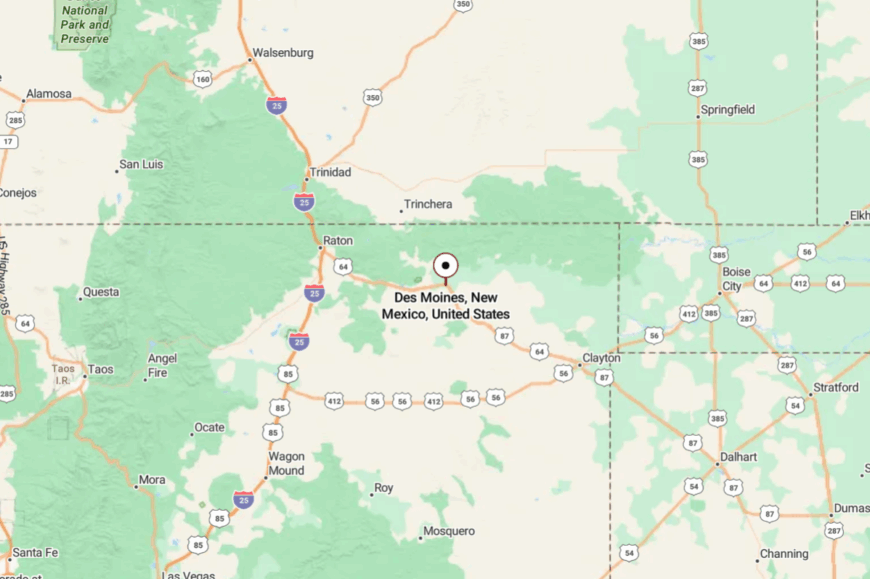
Des Moines sits in Union County, about 60 miles east of Raton on US-87. It’s surrounded by volcanic buttes and open prairie, with few services between towns.
Access comes via a long two-lane drive across sparsely settled ranchland. By the time you arrive, you feel wrapped in the stillness of New Mexico’s high plains.
10. Yeso
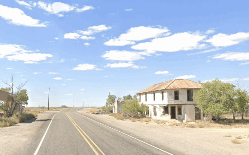
Yeso claims a population of roughly a dozen hardy residents spread across the open plains of De Baca County. Photographers stop to capture the crumbling adobe storefronts, while prairie hikers admire horned larks and sweeping sunsets in near silence.
The old railroad siding once shipped cattle but today the only regular job is the morning shift at the tiny post office that still hands out mail three days a week. Ranching and seasonal hunting leases make up most of the remaining economic activity.
With no gas station, cafe, or streetlight, the town goes dark after dusk and feels separated from the modern world. Endless short grass that runs unbroken to the horizon seals the sense of seclusion.
Where is Yeso?
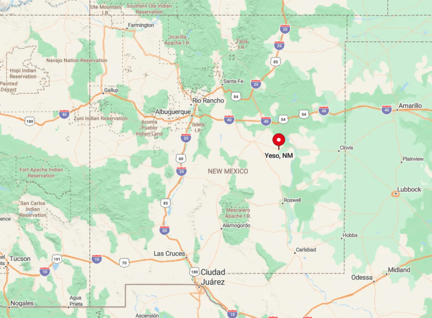
Yeso sits on US 60 about 60 miles west of Fort Sumner in eastern New Mexico. The nearest grocery store is almost an hour away, and cell service flickers off outside the post office parking lot.
A single set of train tracks and a two-lane highway are the only links to the outside. Drivers reach the site by following US 60, where the next sign of life is often a distant windmill.
9. Encino
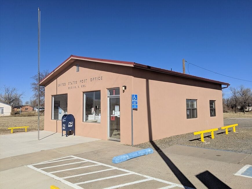
Encino counts fewer than 100 residents who occupy a scattering of century-old adobe and wood-frame houses along historic US 285.
Visitors stop to photograph St. John the Baptist Church, its sun-bleached bell tower framed by wind-bent cottonwoods, or to explore remnants of roadside motor courts from the Route 66 era.
Sheep ranching and small hay farms form the backbone of the local economy, supported by a modest freight depot that loads wool each spring. Birdwatchers appreciate the quiet stock ponds that draw migratory sandhill cranes during fall.
Because the village sits two hours from any big-box store and lacks a convenience market of its own, life here feels paused in an earlier decade. The flat, sparsely settled grasslands that spread in every direction keep Encino unmistakably secluded.
Where is Encino?
🔥 Would you like to save this?
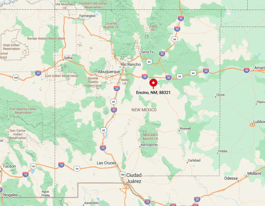
Encino stands at the intersection of US 285 and State Road 3, roughly 70 miles south of Santa Rosa. Surrounding ranchland and limited services create long stretches of empty highway that accentuate its remoteness.
Rail and bus service bypass the area, so the only practical access is by personal vehicle. Travelers usually exit Interstate 40 at Clines Corners then drive twenty quiet miles south to reach the crossroads.
8. House
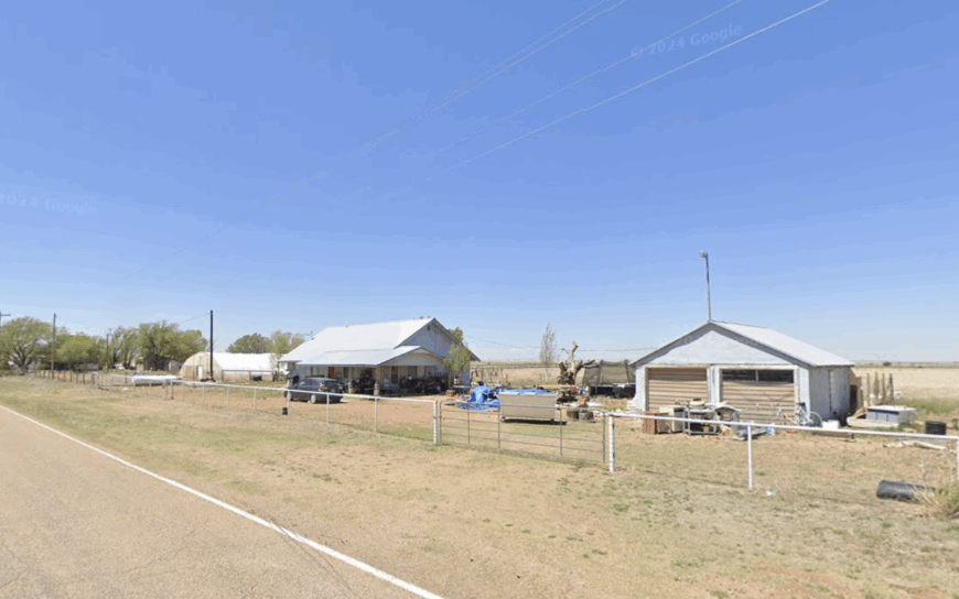
House is home to about 60 residents, many of whom have the same family names etched on century-old headstones in the small hilltop cemetery. Locals gather on Friday nights in the school gym for six-man basketball, while visitors often aim their cameras at the broad mesas that ring the village like silent sentinels.
Cattle ranching and dry-land farming keep the community afloat, and the tiny co-op gas pump doubles as a social hub. Stargazing is superb because the nearest streetlamp is fifteen miles away, and meteor showers paint the sky without competition from city glow.
Gravel lanes loop past modest adobe homes before fading into open pasture, reinforcing the sense that House has more cows than cars. The towering horizon and lack of commercial development make it one of the most isolated spots in Quay County.
Where is House?
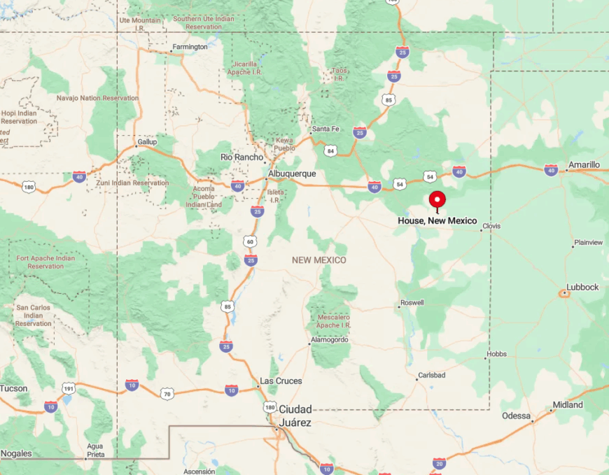
House lies along State Road 114 about forty miles northwest of Clovis on the eastern rim of the Llano Estacado. Vast cattle ranges and mesa-lined draws limit cell coverage and break up any hint of suburban sprawl.
Reaching House typically involves a slow drive across ranch roads that may see only a handful of vehicles each day. The nearest commercial airport sits ninety minutes away in Amarillo, underscoring the trip-back-in-time feeling.
7. Causey
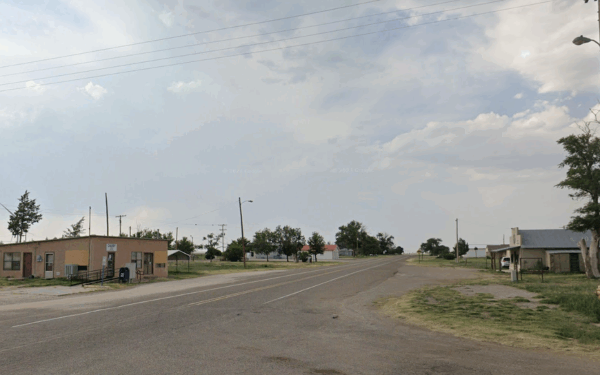
Causey supports around 70 residents living along a neat grid of dirt streets broken only by rows of mature elm trees planted a century ago. Visitors can climb the old wooden staircase inside the vintage grain elevator for panoramic views of sorghum and winter-wheat fields that stretch to the horizon.
Dry-land farming dominates employment, complemented by a seasonal peanut-processing shed that runs during harvest. Quail hunters arrive each December to test the surrounding Conservation Reserve Program acres that remain almost untouched.
With no motel, café, or stoplight, nights settle quietly and wind rattles tin roofs in a town that seems forgotten by time. The mile-wide vistas and lack of neighboring settlements accentuate its secluded nature.
Where is Causey?
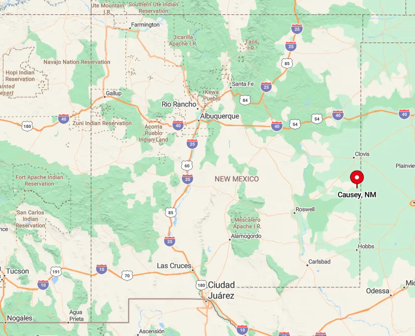
Causey is tucked in southeastern Roosevelt County along State Road 114, fifteen miles shy of the Texas state line. Empty fields on all sides mean that radio stations fade to static long before the village appears.
Access comes via a single paved road that ends in dirt after passing the last house. The closest full-service town is Portales, forty minutes northwest, so stocking up before arriving is wise.
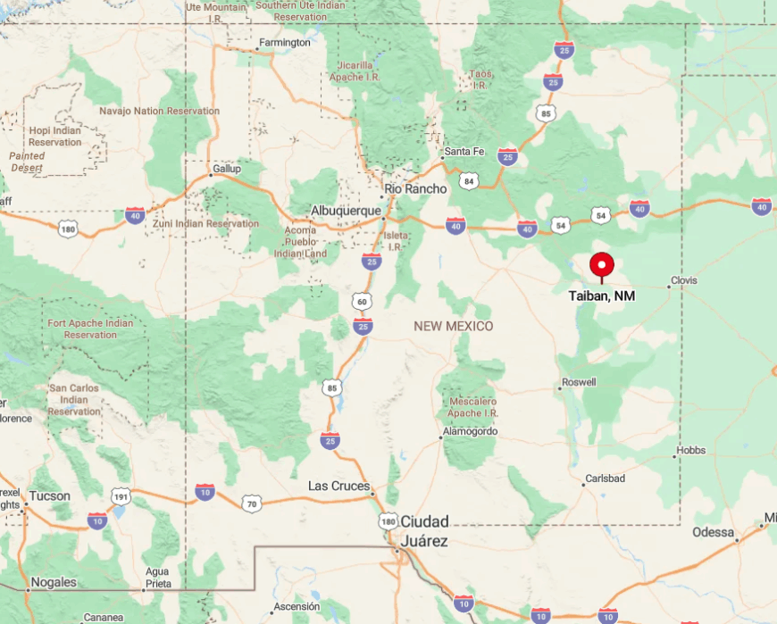
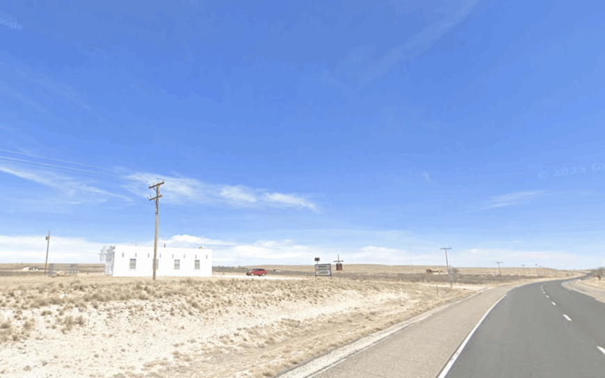
6. Taiban
Taiban counts roughly 30 residents, yet its most famous citizen may be the roofless stone church that sits alone beside US 60, drawing sunrise photographers from around the world.
Daytime diversions include exploring the remnants of cattle-shipping pens, walking the old highway alignment, and watching antelope graze undisturbed on the open flats.
Ranching and a handful of renewable-energy maintenance jobs provide limited local income. The tiny volunteer fire station doubles as a community center for holiday potlucks and weather alerts.
Once night falls, no neon sign or porch light competes with the Milky Way, and freight trains pass like distant thunder. The vast vacant rangeland surrounding Taiban underscores how isolated this relic of the frontier still is.
Where is Taiban?
Taiban sits 18 miles west of Fort Sumner at the junction of US 60 and US 84 on the Pecos River plains. The nearest fuel stop is in Fort Sumner, making careful trip planning important.
Travelers typically exit Interstate 40 at Santa Rosa and drive an hour south through open ranch country to reach the site. Wide spaces, minimal traffic, and patchy cell coverage remind visitors that they have entered a true backwater.
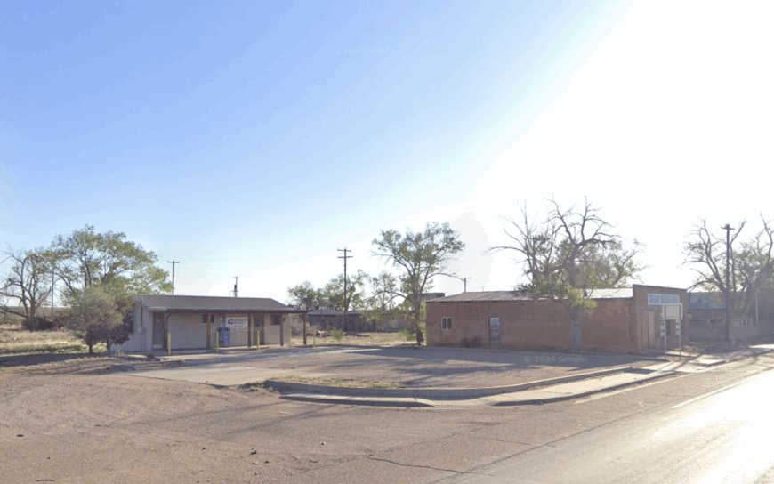
5. Kenna
Kenna hosts about 50 residents and a scattering of weather-worn buildings that once served as a bustling cattle-loading hub on the Southern Pacific line. Today, people stop to photograph the century-old depot ruins and the skeletal remains of towering windmills that creak in the prairie gusts.
Ranching is still the dominant livelihood, with large parcels averaging several thousand acres under single family ownership. Seasonal branding parties and chuckwagon cookouts provide rare bursts of activity.
Otherwise only pronghorn herds and oilfield service trucks break the quiet of rolling grassland. With no retail outlets and miles of caliche roads before the next ranch gate, Kenna maintains a deep sense of seclusion.
Where is Kenna?
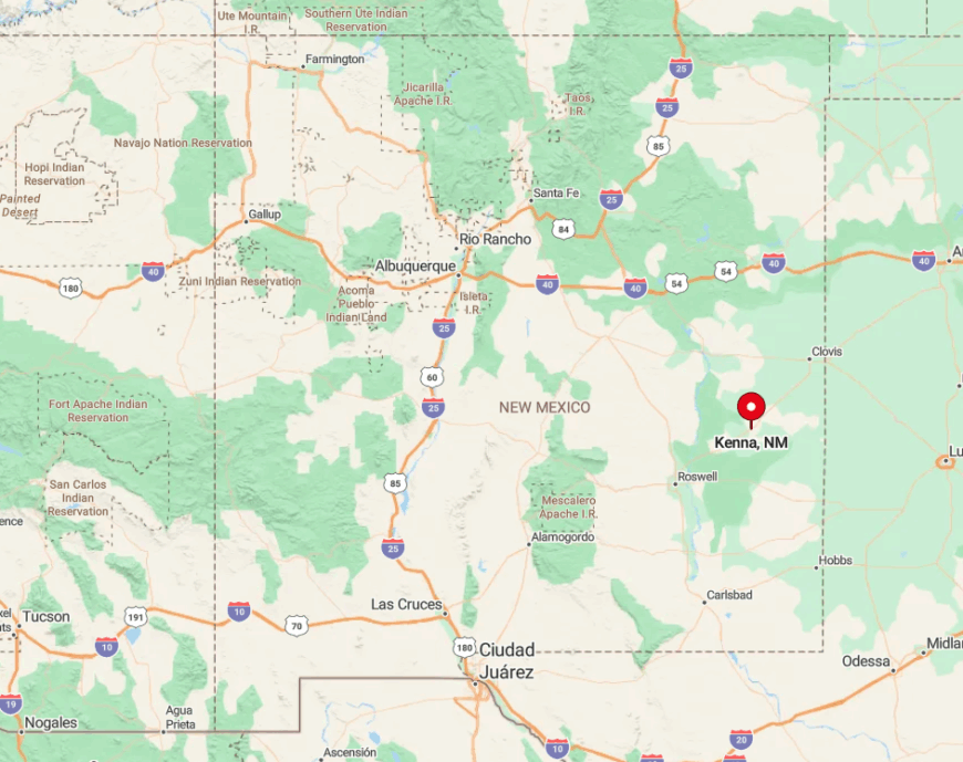
Kenna lies along US 70 about 30 miles southwest of Clovis on the high plains of Roosevelt County. Its position between broad cattle ranches means the horizon is unbroken by trees or towers for many miles.
Visitors reach the hamlet by following US 70 until the pavement seems to blend into the grass, then turning onto a short spur road to the depot site. The absence of commercial air travel or rail passenger service keeps the town off mainstream itineraries.
4. Lingo
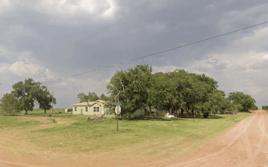
Lingo shelters about 20 residents who tend aging farmsteads scattered across the tabletop expanse of the Llano Estacado. Points of interest include a rusty water tower emblazoned with the town name and several weather-beaten barns that offer stark western photo backdrops.
Dry-land cotton and peanut farming, along with seasonal custom-harvest crews, form the economic base. Prairie dogs chatter unabated along county roads, and summer storms roll in unimpeded, providing dramatic sky-watching.
With neighbors often a mile apart and no local businesses, social life centers on county-fair gatherings in distant Portales. The sheer flatness and absence of traffic render Lingo one of the quietest communities in New Mexico.
Where is Lingo?
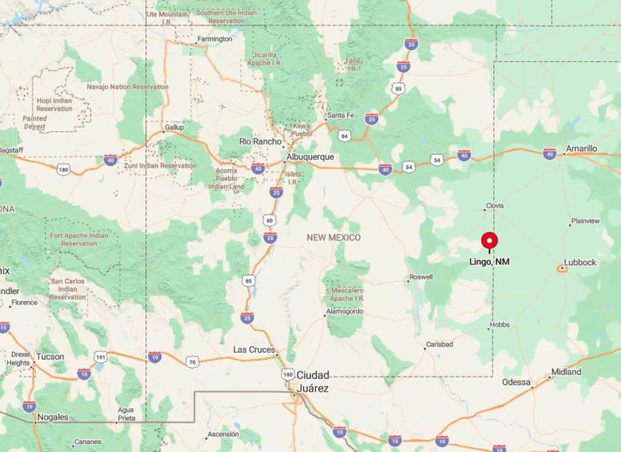
Lingo sits two miles north of the Texas border on Roosevelt County Road 2, roughly an hour southeast of Clovis. The route crosses open farmland where dust devils frequently outnumber vehicles.
Arriving requires navigating unsigned gravel roads that disappear into the horizon, so first-time visitors often rely on GPS coordinates rather than addresses. Lack of cell towers means even that technology can falter, reinforcing the out-of-the-way feel.
3. McAlister
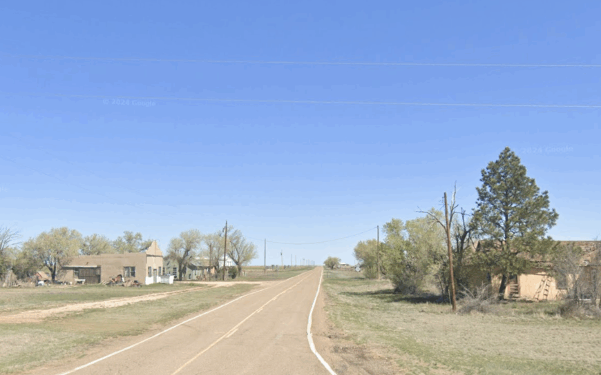
McAlister holds about 35 residents and a lone grain silo rising above the prairie like a lighthouse on land. Travelers pull over to examine abandoned storefronts with intact tin ceilings and to trace rutted wagon paths that predate the highway.
Wheat farming and seasonal cattle grazing supply the few local jobs, supplemented by hunting leases for mule deer. Each summer the community hosts a potluck in the one-room community hall that once served as a school.
Nights are silent enough to hear coyotes answering freight train whistles from ten miles away. The absence of services and the long, empty county roads that surround the settlement preserve its profound seclusion.
Where is McAlister?
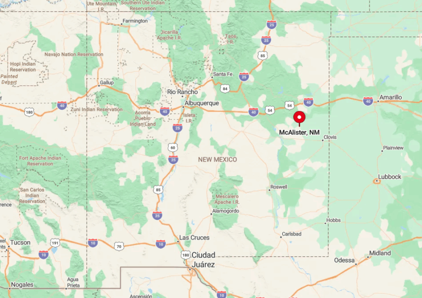
McAlister sits in northeastern Quay County at the junction of State Road 252 and County Road 12, midway between Tucumcari and Fort Sumner. The region is so sparsely populated that the nearest traffic light is almost fifty miles away.
Reaching the hamlet involves a twenty-mile drive on paved state road followed by several miles of gravel, depending on the approach. Visitors often fuel up in Tucumcari before venturing into this quiet corner.
2. Tolar
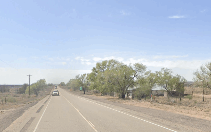
Tolar now claims fewer than ten inhabitants, and evidence of its former rail town glory lies in deserted embankments dusted with red sand. History enthusiasts walk among scattered stone foundations and envision the 1944 ammunition-train explosion that once rattled windows 100 miles away.
Today, cattle graze where saloons once stood, and the sole industry is ranching on vast leases that surround the site. Spring wildflowers dot the sand sagebrush, offering unexpected color for intrepid photographers.
Even daytime brings an eerie hush broken only by the wind sifting through collapsed boxcars. The lack of nearby communities and the slowly encroaching desert mark Tolar as one of the most secluded spots in Curry County.
Where is Tolar?
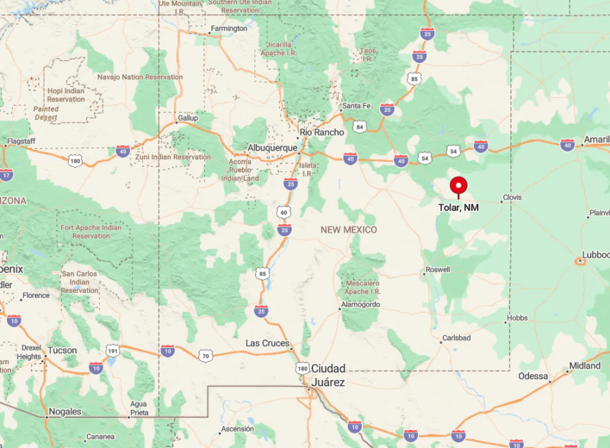
Tolar is hidden along a little-used stretch of County Road A in northwestern Curry County, about 30 miles southwest of Clovis. Abandoned rail beds and sandy caliche tracks mean standard sedans should travel with caution.
Access generally involves a detour from US 60 at Taiban, followed by a sequence of unsigned county roads that see more livestock than cars. With no utilities and sporadic cell reception, visitors quickly appreciate just how far off the map they have come.
1. Monument
Monument, with about 200 residents, forms a sparse cluster of homes and businesses set amid the pumpjacks of Lea County’s oil patch. Day visitors often take the wildflower loop south of town each April, then picnic at the small roadside park maintained by local volunteers.
Oil and gas extraction is the primary employer, though many families also manage cattle or operate service rigs from home lots bigger than city parks. The volunteer-run Heritage Museum occupies a converted bunkhouse and displays early ranch brands not found in larger collections.
Even with the hum of distant pump motors, nights remain strikingly quiet because the nearest incorporated city is more than thirty miles away. Broad acreage, minimal street lighting, and endless lease roads that vanish into the horizon give Monument its peculiar brand of seclusion.
Where is Monument?
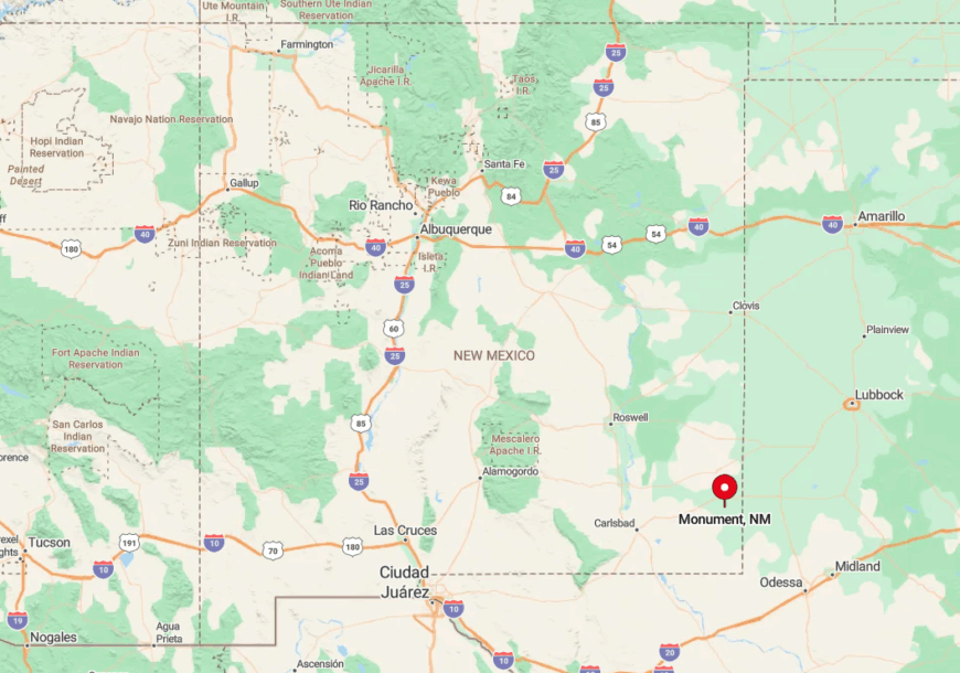
Monument sits at the crossroads of State Road 8 and State Road 322, 24 miles west of Hobbs in southeastern New Mexico. The town is surrounded by rolling mesquite plains and scattered oil pads that provide landmarks instead of street signs.
Travelers usually reach Monument via US 62 then turn north on the lightly traveled state road where jackrabbits outnumber vehicles. With no commercial airport nearby and limited public transport, private car remains the only practical route into this quiet oil-patch outpost.