🔥 Would you like to save this?
The back roads east of Indianapolis wander past cattle-striped pastures, slow rivers, and woodlots that still glow with fireflies on midsummer nights. Along those roads, small communities persist in near-perfect quiet, their post offices long gone yet their charm fully intact.
We gathered 25 of these hideaways where the nearest traffic light often sits miles away and where a neighbor’s wave counts as morning news. Each town offers a pocket of history, honest work, and countryside leisure that feels worlds apart from the four-lane corridors skirting the region.
In order to come up with the very specific design ideas, we create most designs with the assistance of state-of-the-art AI interior design software. Also, assume links that take you off the site are affiliate links such as links to Amazon. this means we may earn a commission if you buy something.
Follow our countdown to discover places where porch swings creak louder than highways and where evening stars still outshine streetlamps.
25. Metamora
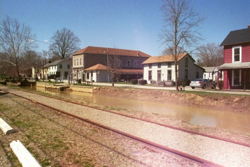
Metamora feels tucked into its own century, a canal village wrapped in wooded hills and the easy chatter of the Whitewater River. Its seclusion comes from narrow approach roads and a valley that keeps the town visually hidden until you’re nearly on Main Street.
The vibe is storybook—stone mill, clapboard shops, and porches strung with old-fashioned lanterns. Spend an afternoon riding the canal boat (in season), watching the grist mill turn, walking the towpath, or browsing handmade quilts and candies.
Weekends hum softly with fiddles on the porch and the clink of iron at the blacksmith shed. Tourism and small crafts anchor the local economy without overrunning the quiet. It’s the sort of place that teaches you to listen for water again.
Where is Metamora?
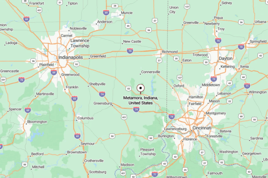
Metamora sits in southeastern Indiana’s Franklin County, about 14 miles northwest of Brookville and 9 miles southeast of Connersville. You reach it by meandering along U.S. 52 or Indiana 229 and turning onto a short valley road where the hills fold you in.
The last mile is slow on purpose, as if the town wants you to arrive unhurried. It’s close enough for a day trip, but tucked just deep enough to feel like a time slip.
24. Laurel
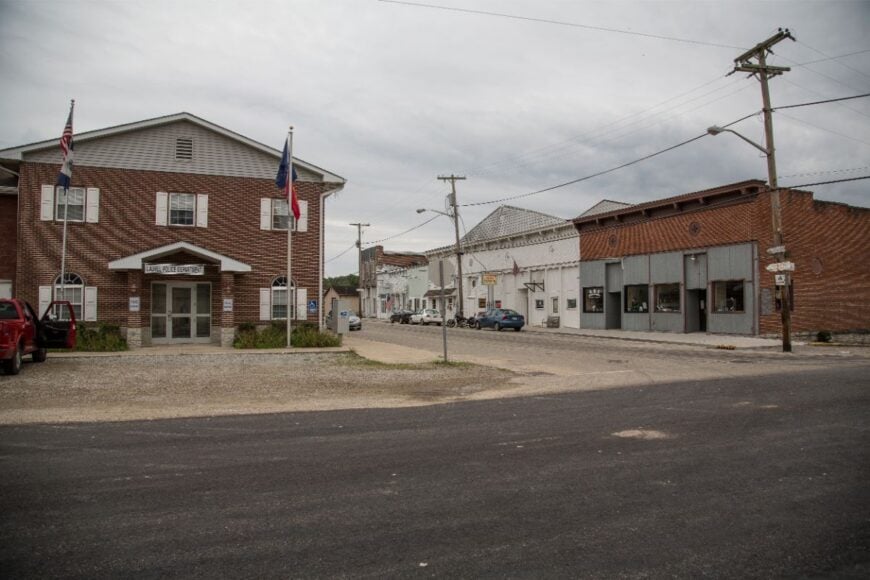
Laurel is a riverside pocket where cornfields meet timbered bluffs and life keeps a porch-swing pace. Seclusion comes from the Whitewater River hemming one side and farm blocks guarding the others, so most traffic prefers to flow around it.
The vibe is quietly practical—historic storefronts, a café that knows your order, and fishermen easing jon boats into the current at first light. Paddle a lazy river stretch, walk the riverbank at dawn for herons, hunt morels on nearby hillsides, or browse outdoor markets when the season turns.
Farming and small shops keep the calendar steady. Nights are dark and honest, full of frogs and a faint river hush. It’s the kind of town that reminds you how steady the world can be.
Where is Laurel?
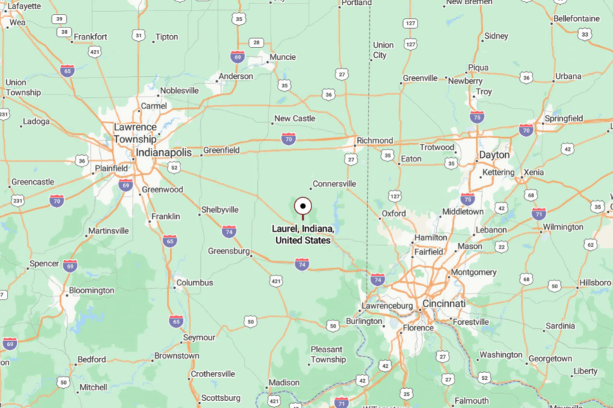
You’ll find Laurel in northern Franklin County, about 10 miles south of Connersville and a few minutes west of U.S. 52. Most folks come in via Indiana 121 and then a short jog of county roads.
The way narrows, the trees close in, and the river guides the last turns. It’s close enough to visit often, but far enough that the stars return.
23. Bath
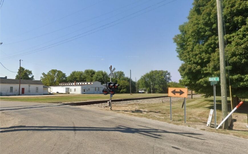
Bath is a state-line hamlet where barns outnumber businesses and the horizon feels wide as a grin. Its tucked-away character comes from sitting just off U.S. 52 with no real reason for anyone to pass through unless they mean to.
The vibe is crossroads-rural—elevator silhouettes, a white-steepled church, and produce stands that pop up when melons are ripe. Cycle the quiet county grid, cast a line in nearby creeks, drive to Brookville Lake for an evening paddle, or photograph iron bridges after a golden storm.
Farms set the rhythm, with a few contractors and craftspeople filling gaps. Dusk drops softly here, like a hand on your shoulder. It’s the kind of quiet that stays with you on the drive home.
Where is Bath?
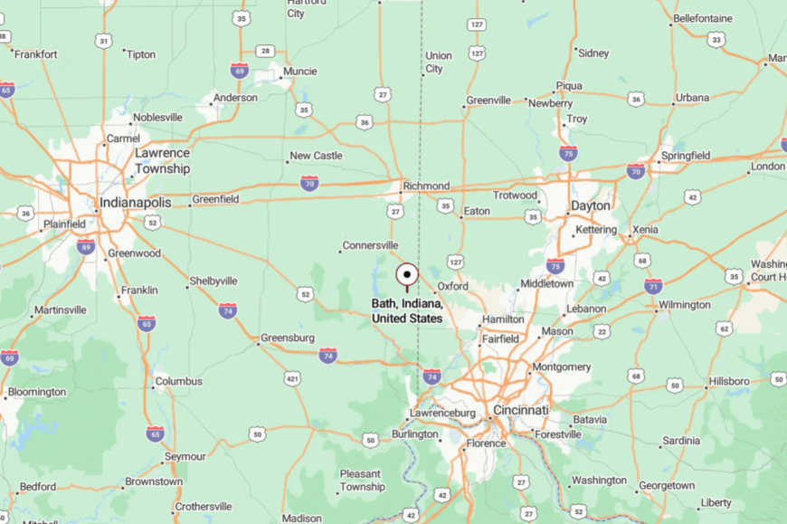
Bath rests in northeastern Franklin County near the Ohio state line, roughly 12 miles northeast of Brookville. Approach on U.S. 52 and peel off onto a short run of county blacktop.
The final stretch rolls through open fields with long, clean sightlines. It’s easy to reach on a map, but you’ll feel the countryside gather around you.
22. Alpine

Alpine is a tiny river-and-rail remnant where the whistle is memory and the woods keep most of the noise for themselves. Seclusion is built in: hills and the Whitewater Valley fold the place into a green pocket, and there’s no through-route to tempt strangers.
The vibe is pleasantly timeworn—porches with geraniums, gravel pull-offs, and the soft rattle of leaves over the old alignment of the canal. Walk the riverbank, hunt spring wildflowers, photograph mill foundations, or drift backroads toward covered bridges in the next county.
A patchwork of farming, logging, and weekend cabins sustains local life. Even on sunny Saturdays, the town never raises its voice. It’s a little corner that rewards moving slowly.
Where is Alpine?
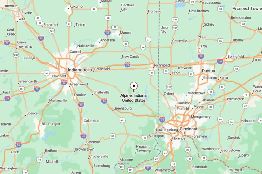
Alpine sits in southern Fayette County, about 9 miles south of Connersville and west of Laurel. Drivers follow Indiana 121 and then taper to county lanes alongside the river.
The approach is curvy and shaded, with the valley revealing itself a piece at a time. It’s close enough for an afternoon, and far enough to reset your pace.
21. Bentonville
Bentonville holds steady at a broad crossroads where old maples shade tidy yards and grain trucks come and go like tides. Its seclusion comes from being off any numbered highway; all roads here seem to turn politely into somewhere else.
The vibe is simple and welcoming—an American flag on every porch, a community hall that does double duty for fish fries and craft sales. Bird the hedgerows, join a gravel-bike loop past working farms, picnic under the big trees, or wander cemeteries where hand-carved stones lean toward the sun.
Farming is the backbone, with a handful of home trades filling in the edges. Evenings are blue and quiet. It’s the sort of place that never startles you.
Where is Bentonville?

You’ll find Bentonville in northwestern Fayette County, roughly 15 miles northwest of Connersville. Most visitors reach it via Indiana 44 and then a few miles of county grid.
The last turns pass through pastures and hay bales stacked like sculptures. It’s near everything and next to nothing, in the best way.
20. Glenwood
Glenwood sits where Rush and Fayette counties shake hands, a pocket town shaded by big sycamores and the bends of Little Flatrock Creek. Its tucked-away feel comes from long stretches of farmland between it and any larger service center.
The vibe is gently seasoned—church suppers, porch guitars, and a post office that still knows first names. Walk creek banks for fossils, pedal the backroads at sunset, photograph iron truss bridges, or drive a lazy loop through rolling fields that flush gold in September.
Small shops, farm work, and school commutes tie the week together. Nights land softly here. It’s a crossroads that keeps the world at arm’s length.
Where is Glenwood?
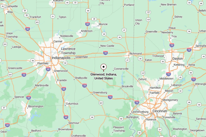
Glenwood straddles the Fayette–Rush county line about 9 miles south of Connersville and 10 miles northeast of Rushville. Approach on Indiana 44, then ease south on a short county spur.
The trees close over the road just before town, like a curtain. It’s close enough to check your mail, and far enough to hear your own steps.
19. Cadiz
🔥 Would you like to save this?
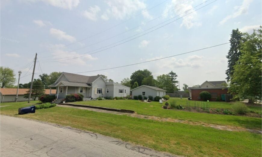
Cadiz is a pint-sized grid of porches and windbreaks where tractors set the clock and summer dusk smells faintly of cut hay. Seclusion comes from being one turn off the routes most people take—visible from the map, largely invisible in real life.
The vibe is unhurried and tidy: barn quilts on sheds, neat gardens, and a café window with a hand-lettered daily pie. Take a slow drive on the barn-quilt loop, fish farm ponds with permission, watch storm clouds build over bean fields, or wander to nearby small-town festivals.
Farming and a few home businesses pay the bills. The calm feels deliberate, like a town that chose its size. It’s where the world quiets to a purr.
Where is Cadiz?
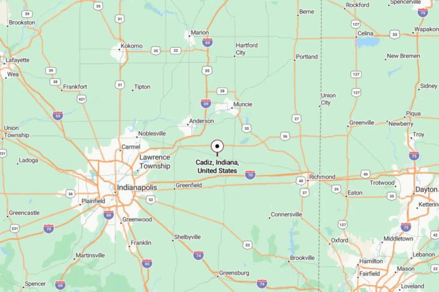
Cadiz lies in western Henry County, about 6 miles southwest of New Castle. Most travelers slip off Indiana 38 or U.S. 36 onto a short county lane.
The approach trades traffic for birdsong in about a minute flat. It’s close to errands, far from bustle.
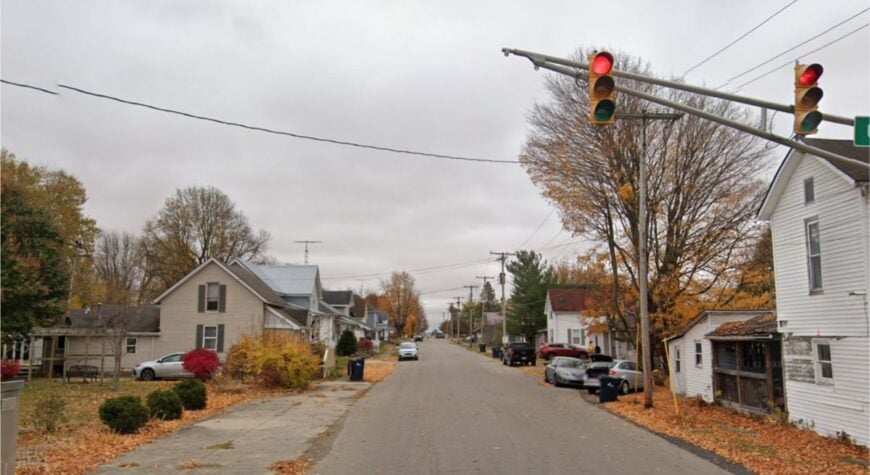
18. Blountsville

Blountsville is a barefoot kind of place—gravel crunch, porch talk, and long views across low hills. Its seclusion owes to being small even by small-town standards and sitting between larger towns that draw the through-traffic away.
The vibe is friendly-rustic: a clapboard church, a handful of blocks, and farm dogs that nap in the shade. Cast for bass at Prairie Creek Reservoir (a short drive north), wander Summit Lake State Park’s trails (to the south), trace old fence lines for wildflowers, or photograph sunrise fog pooling in the hollows.
Cattle, hay, and a few trades keep folks busy. Nights arrive with owl calls and room-dark darkness. It’s a town-sized deep breath.
Where is Blountsville?
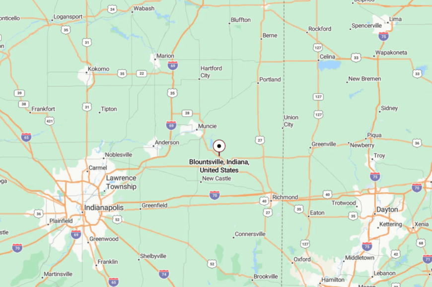
You’ll find Blountsville in northeastern Henry County, roughly 11 miles southeast of Muncie and 9 miles north of New Castle. Indiana 67 gets you in the neighborhood; the last turns are on quiet county blacktop.
The landscape opens wide just before you arrive. It’s a short drive from amenities, and a long way from noise.
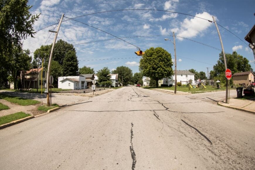
17. Straughn
Straughn sits along the Old National Road but feels a step removed, as modern traffic favors the interstate miles away. Seclusion comes from a small footprint and side streets that drift quickly into fields and pasture.
The vibe is heritage-humble—brick storefronts, a grain elevator, and a diner where the coffee pot never cools. Antique a bit, walk the old roadbed at golden hour, pedal to neighboring farm stands, or time your visit with the big yard-sale weekends the highway is famous for.
Farming and roadside trade keep the lights on. After sunset, trucks fade to a distant hush and crickets take over. It’s a quiet outpost with a long memory.
Where is Straughn?
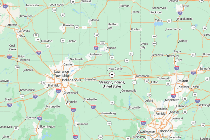
Straughn is in southern Henry County, about 10 miles east of Knightstown on U.S. 40. Most travelers leave I-70 at the Knightstown exit and follow the old road east through rolling fields.
The town reveals itself all at once—silo, café, steeple. It’s easy to reach but easier to linger.
16. Mooreland
Mooreland looks like a tidy postcard—tree-canopied streets, tidy yards, and a water tower watching over a square mile of calm. Its secluded mood comes from being a few miles off the bigger routes and bordered by farm ground that keeps the horizon broad.
The vibe is neighborly and outdoorsy: kids on bikes, garden rows, and anglers hauling kayaks to Summit Lake at daybreak. Spend the day at Summit Lake State Park, watch sandhill cranes in migration, browse a seasonal farmers’ market, or follow a sunset drive past white-fenced pastures.
Farming, park visitors, and a handful of shops shape the week. Twilight here feels unreasonably gentle. It’s the kind of small that fits in your chest.
Where is Mooreland?
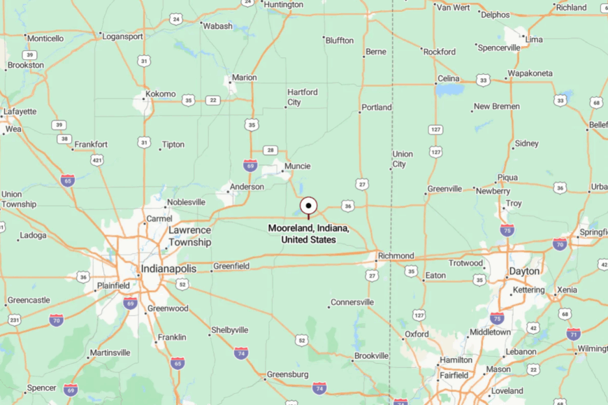
Mooreland sits in northern Henry County, about 9 miles northeast of New Castle along Indiana 36. The last mile slips under old trees and over a shallow creek.
Traffic thins to almost nothing once you turn off the highway. It’s near the park, far from the push.
15. Greens Fork

Greens Fork keeps itself folded into a little valley where Nettle Creek braids through sycamores and summer cicadas set the tempo. Its seclusion is shaped by a pair of gently rising ridges that separate the town from U.S. 40 and the interstate’s hum.
The vibe is warmly worn—front-porch rockers, a modest main street, and a park where kids chase fireflies after ball games. Walk the creek path, browse small-town antiques, detour to Cope Environmental Center’s trails nearby, or cycle the low-traffic county grid at sunrise.
Small shops and farm work share the load. When the creek talks after rain, everything else goes quiet. It’s a pocket of calm that feels kept.
Where is Greens Fork?
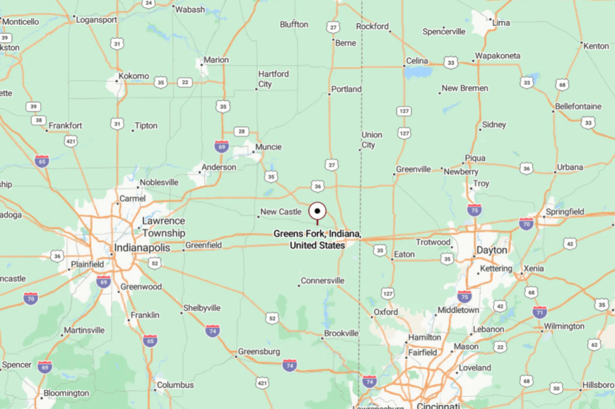
The village rests in central Wayne County, about 8 miles northwest of Richmond and 6 miles north of Centerville. Approach on Indiana 38 or U.S. 40, then ease onto a short run of county roads into the valley.
The last descent hides the town until the final bend. It’s close to the corridor, but cradled just out of sight.
14. Boston
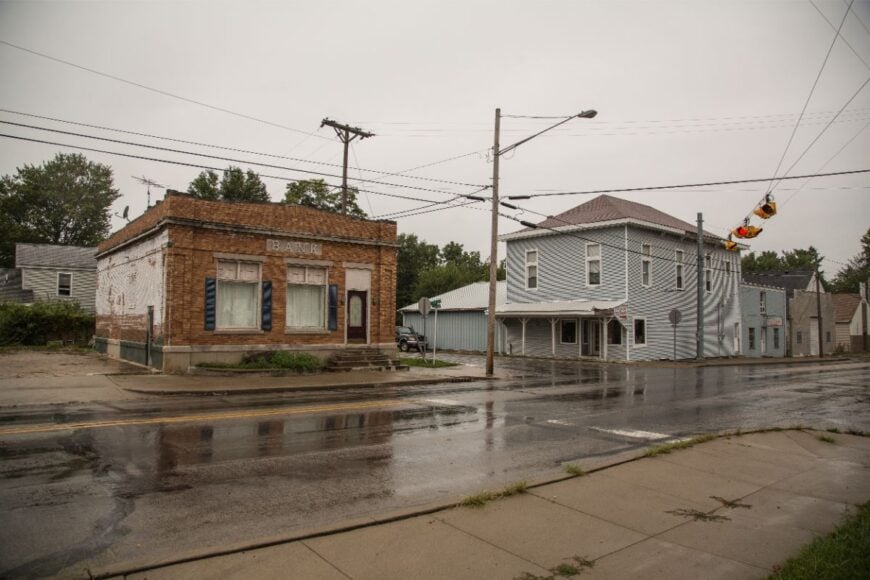
Boston is a tidy cluster south of Richmond where brick homes line old shade streets and the Whitewater Valley opens under a big sky. Seclusion comes from sitting just off U.S. 27 with most traffic breezing past on the big roads.
The vibe is neighborly and bike-friendly—garden beds, porch flags, and quiet lanes that reward a slow roll. Pedal backroads toward Abington, picnic in small parks, hike Richmond’s gorge and waterfalls nearby, or follow country lanes to roadside orchards in season.
A mix of commuters, small trades, and farms keeps things steady. Even when the city is closed, Boston keeps its voice low. It’s where you can hear the breeze again.
Where is Boston?
Boston sits in southern Wayne County, about 6 miles south of downtown Richmond and a quick jog west of U.S. 27. The best approach is a short county-road turnoff that trades speed for shade.
You’ll know you’ve arrived when traffic falls away and lawns widen. It’s a near-city address with a country-heart hush.
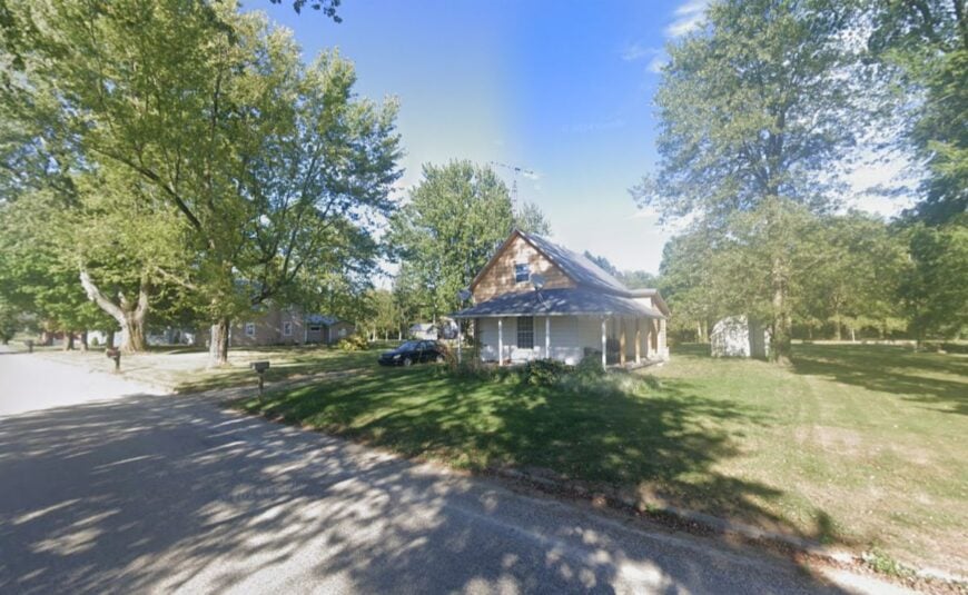
13. Carlos
🔥 Would you like to save this?
Carlos doesn’t so much sit on the map as whisper from a crossroads—three dozen homes, a church, and miles of fence line. Its seclusion stems from distance to services and the way surrounding fields swallow sound and sightlines.
The vibe is bare-bones rural: windbreak pines, mailbox clusters, and a sun that takes its time going down. Photograph weathered barns, walk a mile under hawks and high clouds, cast for bluegill in permission ponds, or drive a sunset loop past hay rolls and corn tassels.
Farming and shop work in nearby towns keep households afloat. Nights here fall like a blanket. It’s as quiet as you thought Indiana couldn’t be anymore.
Where is Carlos?
Carlos lies in northwestern Randolph County, about 7 miles north of Fountain City and 10 miles west of Winchester. Approach from Indiana 227, then ease onto county roads that narrow to one lane in spots.
Signage is scarce by design. It’s close enough to find, yet shy enough to feel secret.
12. Modoc

Modoc is a one-stoplight dot on U.S. 36 where grain trucks idle at noon and the rest of the day moves like warm honey. Seclusion comes from being ringed by big-acre farms and windbreaks that hush whatever the highway forgets to.
The vibe is straight-ahead rural—elevator bins, tidy porches, and a café chalkboard that doubles as a town bulletin. Browse a couple of small shops, roll a backroad loop under big sky, cast a line at nearby ponds, or detour to quiet prairie remnants west of town.
Agriculture anchors most livelihoods, with a few remote workers peeking out from restored farmhouses. When the sun tilts, shadows lengthen across a whole mile at once. It’s the sort of ordinary that feels rare.
Where is Modoc?

Modoc sits in southwestern Randolph County, about 14 miles southeast of Muncie and 15 miles west of Winchester on U.S. 36. The approach is as simple as it gets—two lanes, hedgerows, big sky.
Turn off onto side streets and the noise drops to nearly nothing. It’s easy to reach but happily off the way to anywhere else.
11. Losantville
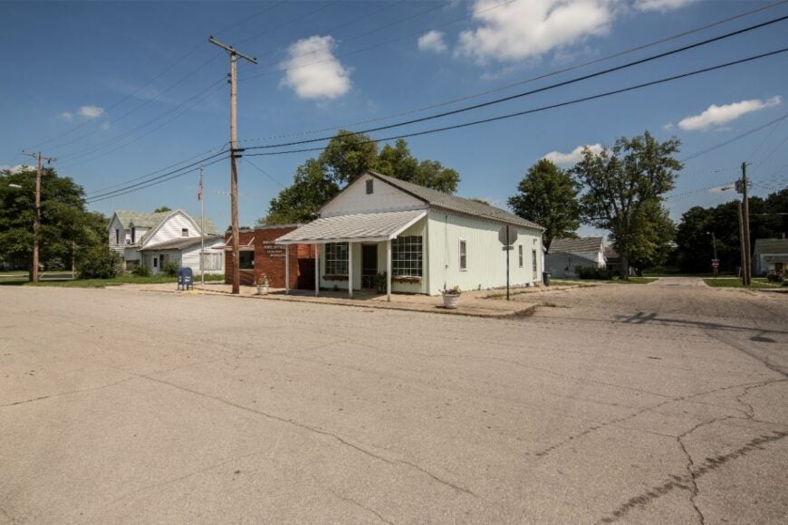
Losantville gathers itself around the gentle arc of State Road 35, a compact village where front yards run to the edge of corn and the mornings smell like cut hay. Its best-kept secret is how secluded it feels once you step off the state road and onto side streets that dead-end into hedgerows and fields.
The vibe is trail-town mellow—bike helmets on porches, friendly waves, and a rhythm set by birds and bicycles. Ride the Cardinal Greenway right from town, look for deer at tree lines at dusk, sip coffee on a slow bench downtown, or wander out to watch combines stitch the horizon in fall.
Farming and trail visitors share the economic lift. At night, tires on crushed limestone are the loudest thing you’ll hear. It’s a tiny hub that makes room for quiet.
Where is Losantville?
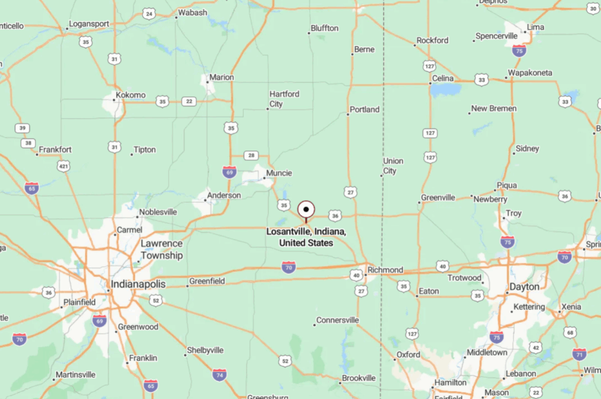
Losantville sits in southwestern Randolph County where Indiana 35 meets the Cardinal Greenway, about 12 miles south of Winchester and 15 miles north of New Castle. Most people arrive via Indiana 35, then park beside the trailhead.
The moment you step away from the road, the soundscape changes to wind and birds. It’s close to a long trail, and far from hurry.
10. Bloomingport
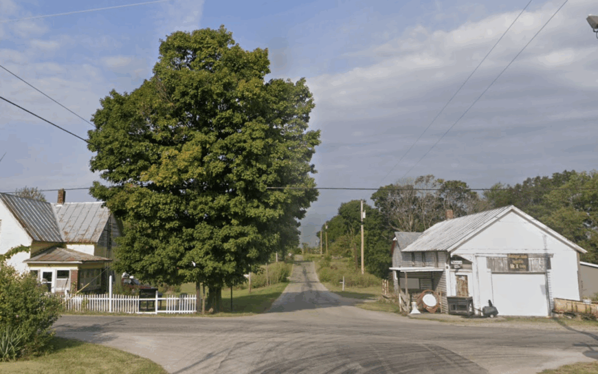
Bloomingport claims roughly 80 residents, most living in century-old farmhouses set well back from the one-lane county road that stitches the hamlet together. Weekend visitors stop for self-guided photo walks among weathered barns, maple groves, and the little brick schoolhouse converted into a craft-quilting studio.
Agriculture—corn, soybeans, and a growing number of small-batch maple-syrup plots—anchors the local economy, with seasonal fieldwork providing part-time employment. A single pair of grain silos rises above the tree line, but beyond that there is no commercial cluster, lending the village its hushed atmosphere.
Even cellular reception fades as the fields widen, preserving an almost pre-digital calm. That stripped-down setting is precisely what makes Bloomingport feel secluded despite sitting only 22 miles northwest of Richmond.
Where is Bloomingport?
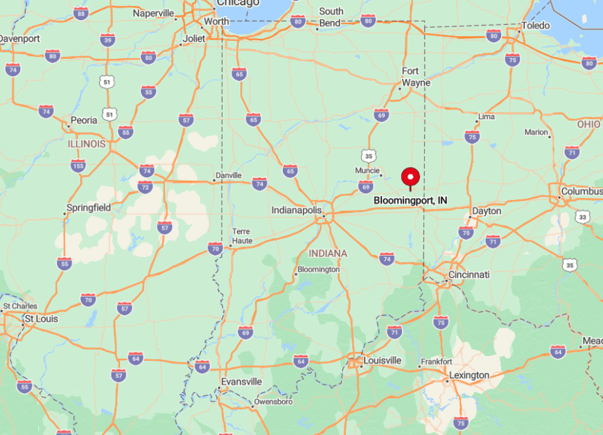
The hamlet rests in north-central Randolph County, tucked between State Roads 227 and 1 yet reached only by gravel County Road 1050N. Thick maples shelter the route, and a lack of signage means most passersby overshoot without realizing it.
GPS directions typically reroute through farm lanes, so arriving requires a careful eye for the lone white church spire peeking above corn tassels. Once there, the nearest gas station is a 15-minute drive, reinforcing Bloomingport’s out-of-the-way feel.
9. Millville
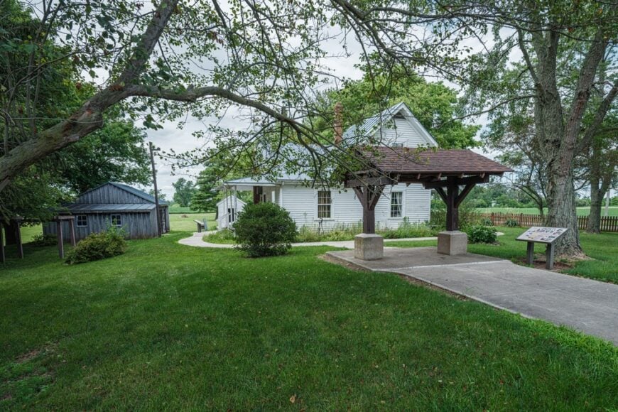
Home to nearly 90 people, Millville spreads across low hills that once echoed with the tinkering of Wilbur Wright’s boyhood experiments. Today, visitors tour the Wilbur Wright Birthplace & Museum, fish for bluegill at nearby Summit Lake State Park, or wander sunrise trails that weave past the iconic white chapel.
Small-scale livestock and hay production form Millville’s economic core, supplemented by heritage tourism linked to the Wright family. With houses perched on acre-plus lawns and no commercial strip save a pop-up produce stand, noise rarely rises above birdcall.
The folds of the surrounding terrain shield the town from State Road 38 traffic, allowing morning mist to linger well past dawn. That gentle isolation has turned Millville into a living postcard of early-1900s rural Indiana.
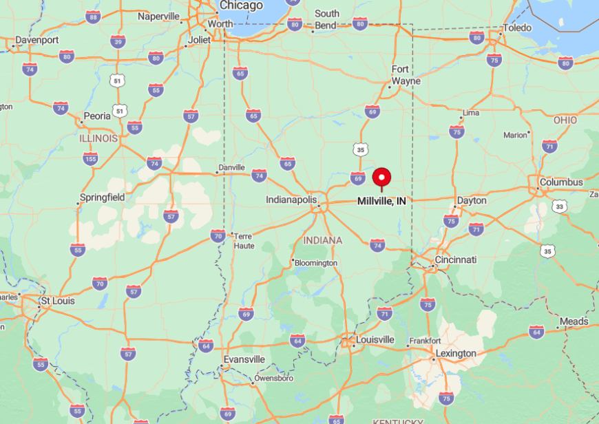
Where is Millville?
🔥 Would you like to save this?
Sitting 15 miles east of New Castle in Henry County, Millville lies two miles south of U.S. 36 yet feels far deeper in the countryside. The approach follows a serpentine ridge road that loses its centerline just before town, one reason larger vehicles seldom appear.
Visitors usually exit I-70 at State Road 3, then wind north and east for twenty quiet minutes. The last mile offers sweeping barn-roof views that signal you’ve reached Millville’s hidden hollow.
8. Roll
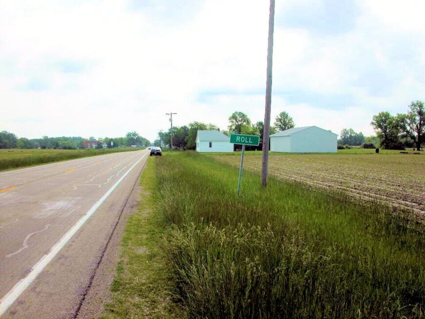
Roll’s population hovers just under 100, a far cry from the thousand-plus who thronged its streets during Indiana’s natural-gas boom of the 1890s. Travelers now come to photograph the abandoned brick storefronts or to birdwatch along prairie windbreaks where kestrels ride the thermals.
Grain farming and a specialty seed cooperative support most households, though a few residents telecommute thanks to a local wireless tower. The nearest four-lane highway sits nearly ten miles away, and rows of pine shelterbelts hush passing winds, creating an almost chapel-like quiet.
Streetlights number fewer than a dozen, so nighttime skies spill with constellations seldom seen in more built-up counties. Roll’s secluded character rests in that blend of historic remnants and unbroken farmland stretching to every horizon.
Where is Roll?
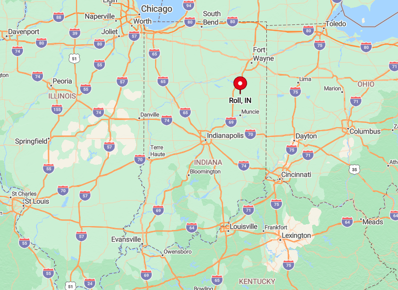
The village occupies a notch in southeastern Blackford County, roughly five miles northeast of Hartford City via County Road 800E. Because GPS maps still label some approaches as “seasonal,” most locals advise entering from State Road 26 and following wooden way-finders painted by the 4-H club.
Public transit ends in Hartford City, leaving personal car or bicycle as the only access. That limited infrastructure helps keep Roll blissfully quiet year-round.
7. Wheeling
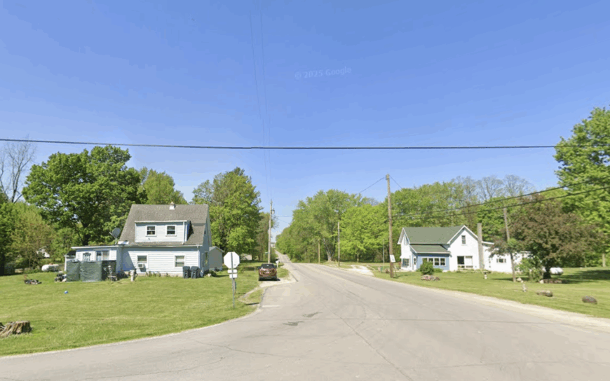
Only about 70 people reside in Wheeling, where the timber-truss covered bridge spanning the Mississinewa River serves as both landmark and gathering spot. Paddlers launch kayaks beneath the bridge, while hikers explore the floodplain trails alive with spring trilliums and barred-owl calls.
Small-parcel farming persists, but river recreation and maple-syrup hobbyists increasingly shape the local scene. Dense woods covering more than half the surrounding acreage muffle road noise and screen the town from nearby State Route 167.
Evening brings chorus frogs and the soft rush of the river, with little else to break the silence. Such natural buffers grant Wheeling an enveloped seclusion rare this close to Muncie.
Where is Wheeling?
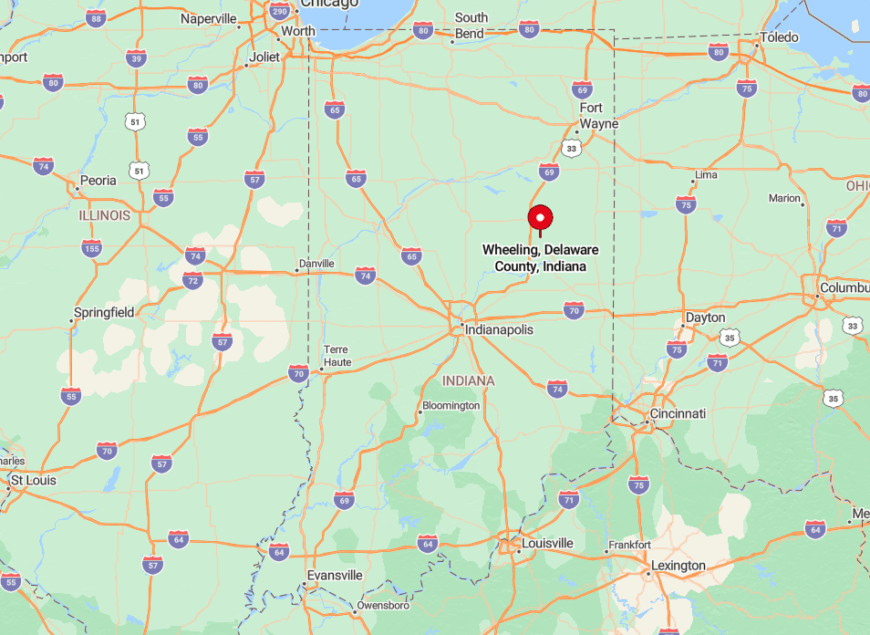
Wheeling nestles in extreme northern Delaware County, six curving miles west of Albany via North Wheeling Pike. The Mississinewa loops around three sides of the town, forcing all traffic across the historic bridge that caps vehicle weight at three tons.
Those restrictions deter heavy trucks and tour buses, keeping visitor numbers modest. Access is easiest from Muncie by county roads, yet the trip feels like slipping into another century once the tree canopy closes overhead.
6. Jacksonburg
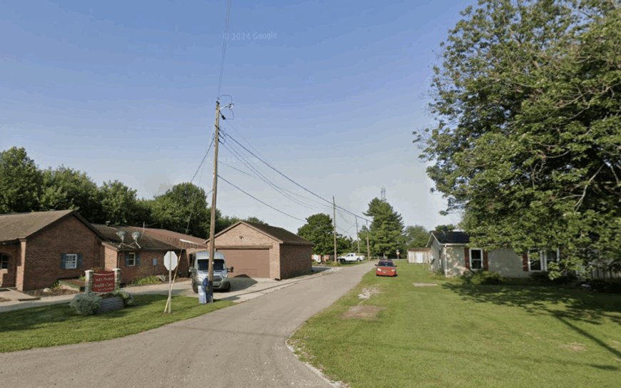
Jacksonburg records roughly 110 inhabitants who tend clapboard homes dating to the Civil War era and attend potluck suppers in the tin-roofed community hall. Photographers favor the town for golden-hour shots of sycamore-lined pastures and the occasional Amish horse-and-buggy clip-clopping down Main Street.
Dairy farming, custom woodworking, and a boutique goat-milk-soap workshop supply modest livelihoods. With only two streets and no through-traffic, tranquility sets the daily rhythm.
Absence of street signs in parts of town is deliberate, a resident effort to preserve privacy. That conscious minimalism keeps Jacksonburg’s footprint small and its solitude intact.
Where is Jacksonburg?
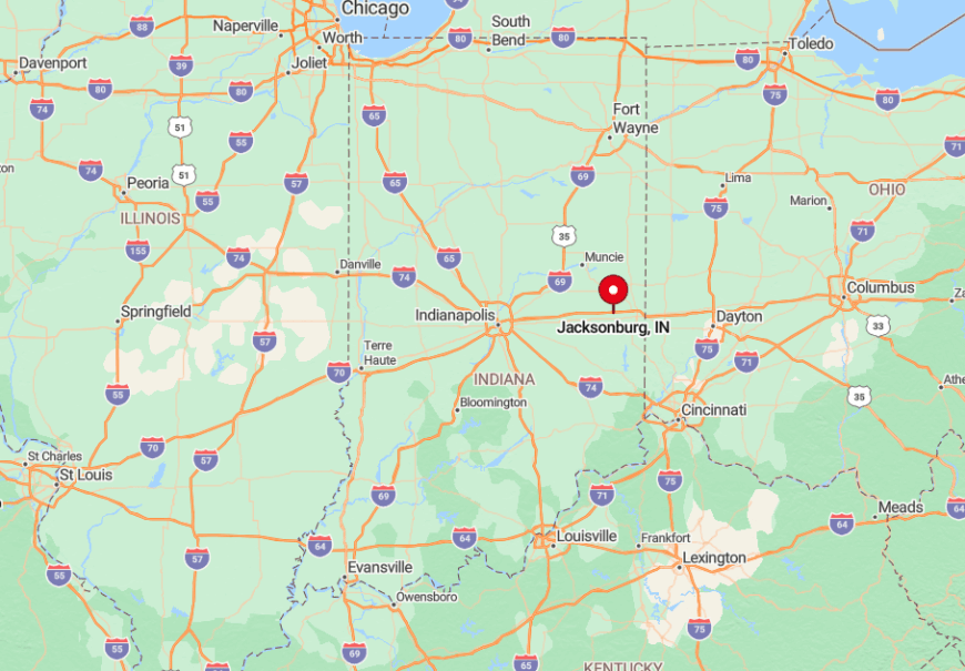
The settlement lies 17 miles northwest of Richmond in Wayne County, accessible by turning off U.S. 40 onto gravel Jacksonburg Road. A low ridge of sycamores hides the town until the final quarter-mile, making first arrival feel like a reveal.
There is no gas station or cafe, so travelers top off in Centerville before continuing. The lack of service businesses means casual pass-through traffic is virtually nonexistent.
5. New Corydon
An estimated 150 people call New Corydon home, their houses spread wide at a crossroads where a solitary grain elevator punctuates the skyline.
Visitors might stroll the historic cemetery, browse the twice-monthly junk-and-gem flea market in the former feed store, or bike the surrounding “bean loop” that runs past vivid yellow-flowered ditch banks in August.
Soybean cultivation dominates the economy, supplemented by a heritage-turkey hatchery that ships poults nationwide. The nearest big-box retailer sits over 20 miles away, and evening traffic rarely tops a handful of pickups.
Open fields let prairie winds sweep through, creating a soundscape of rustling crops rather than engines. That vast sky and distance from retail hubs give New Corydon its pronounced sense of retreat.
Where is New Corydon?

Positioned in southern Jay County, New Corydon meets at the junction of County Roads 800S and 400E, seven miles south of Portland. Approaching drivers pass nothing but soybean rows for minutes on end, which makes the village sign feel almost abrupt.
State Road 1 is the closest highway, though its intersection lies five miles west, providing easy exit without funneling constant traffic through town. Visitors typically arrive by car or on bicycle tours that favor the region’s flat terrain.
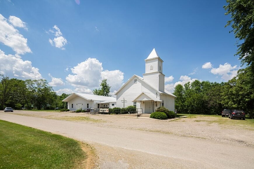
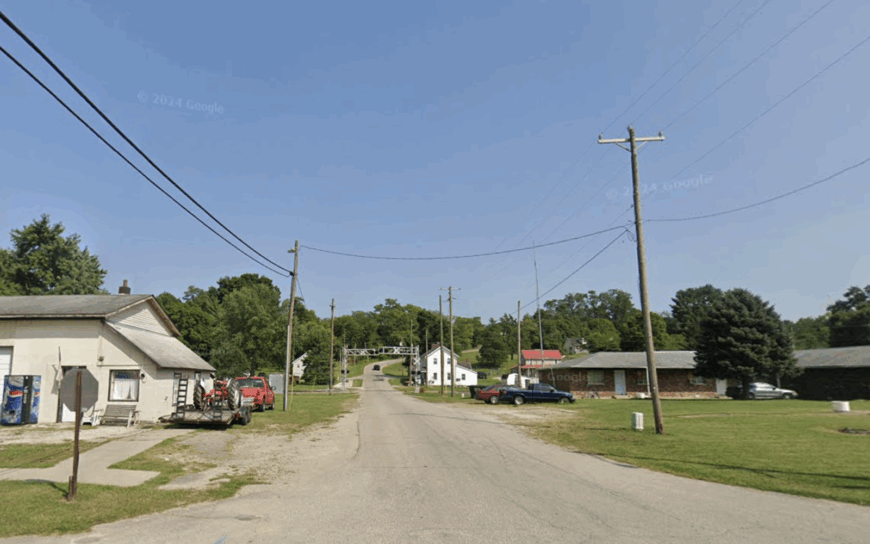
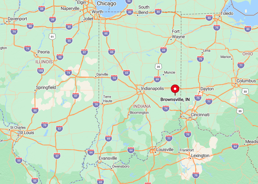
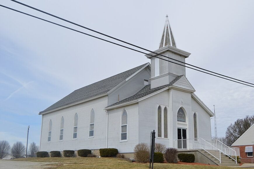
4. Brownsville
Brownsville supports about 200 residents who wake to the hum of the Whitewater River coursing just yards from many back porches. Anglers cast for smallmouth bass, while families picnic at the hidden riverside pull-off known locally as “Sycamore Landing” where monarch butterflies cluster in September.
Beef cattle, hay fields, and a cottage industry crafting river-reclaimed hardwood furniture comprise the economic mix. Steep wooded banks on both sides of the river enclose the town, muting outside noise and limiting development footprints.
With only a volunteer fire station and no traffic lights, Brownsville’s nights stay remarkably dark. That riverside enclosure ensures an intimacy rare in the broader Whitewater Valley.
Where is Brownsville?
The village sits 18 miles north of Brookville in Union County, just off County Road 250N where it crosses the Whitewater River. Dense forest atop the river bluffs obscures the town from Indiana 101 travelers until they descend the final hill.
Access is by two narrow bridges—one steel, one concrete—each with a 15-mph curve, naturally filtering heavy vehicles. The result is a peaceful back-eddy apart from regional traffic flows.
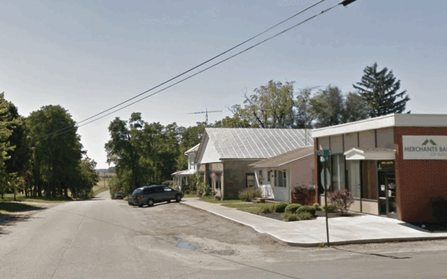
3. Everton
Everton counts close to 220 inhabitants occupying gabled farmhouses spaced along a lazy crescent of county lanes. Attractions include sunrise balloon launches over hay fields, birding walks through nearby Possum Hollow Woods, and the annual pie-social in the restored brick schoolhouse.
Hay production and cow-calf operations drive local income, complemented by an artisanal honey enterprise that sets hives amid the surrounding oak stands. Rolling terrain diffuses sound, and sizable property setbacks keep neighbors at a comfortable distance.
Cell service can be spotty, encouraging residents to trade phone time for porch chats. Those characteristics combine to give Everton a quiet openness treasured by anyone seeking room to breathe.
Where is Everton?
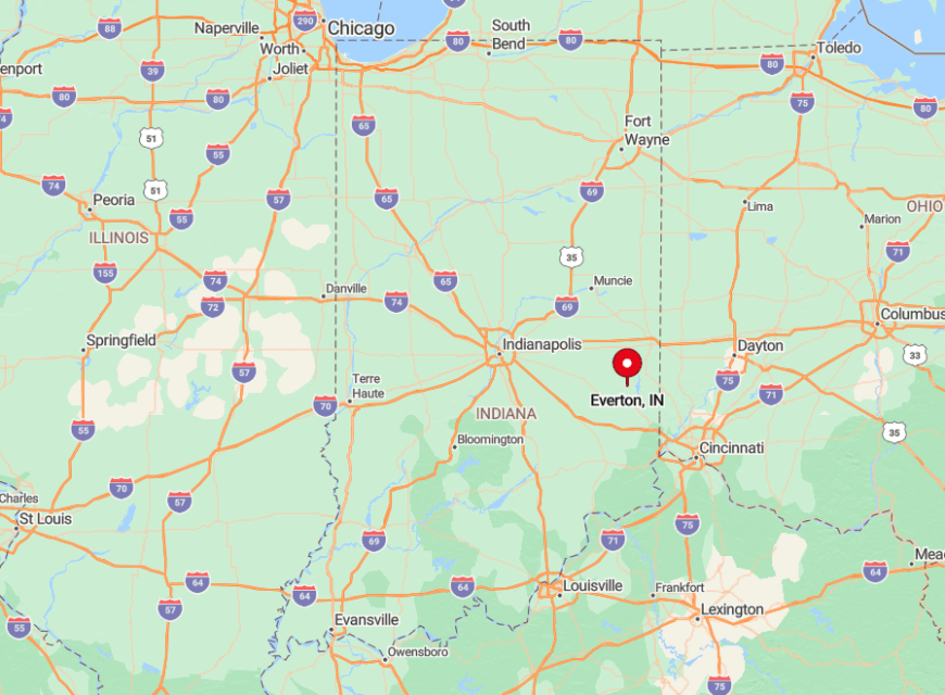
Located 16 miles southeast of Connersville in Fayette County, Everton hides just east of State Road 1 on twisty County Road 450S. Drivers often miss the discreet sign reading “Everton 2 mi.” and must double back through hay-field switchbacks.
Without a direct highway spur, most traffic consists of locals and the occasional antiques hunter following hand-painted roadside arrows. The isolation becomes clear as radio stations fade and the horizon fills with nothing but green ridgelines.
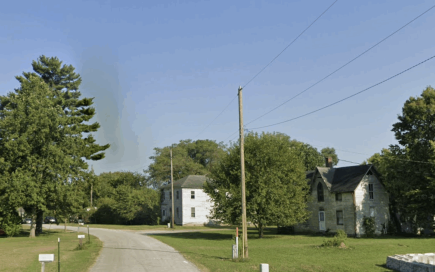
2. Spartanburg
Spartanburg keeps its headcount just below 60, centered on a white-steepled church built in 1866 and an adjoining cemetery filled with weather-worn limestone markers.
Many visitors arrive for genealogical research, then stay to walk the woodland paths that start behind the church and wind toward a beaver pond locals rarely publicize. Timber management and niche organic gardens drive modest revenue, with several households selling shiitake logs from shaded groves.
Gravel roads hem the hamlet, and the nearest four-lane highway lies more than ten miles west, sealing the area in deep quiet.
Nighttime brings whip-poor-will calls in place of street noise, since there are no streetlights after the last porch lamp clicks off. Spartanburg’s aura of seclusion owes much to that deliberate preservation of simplicity.
Where is Spartanburg?
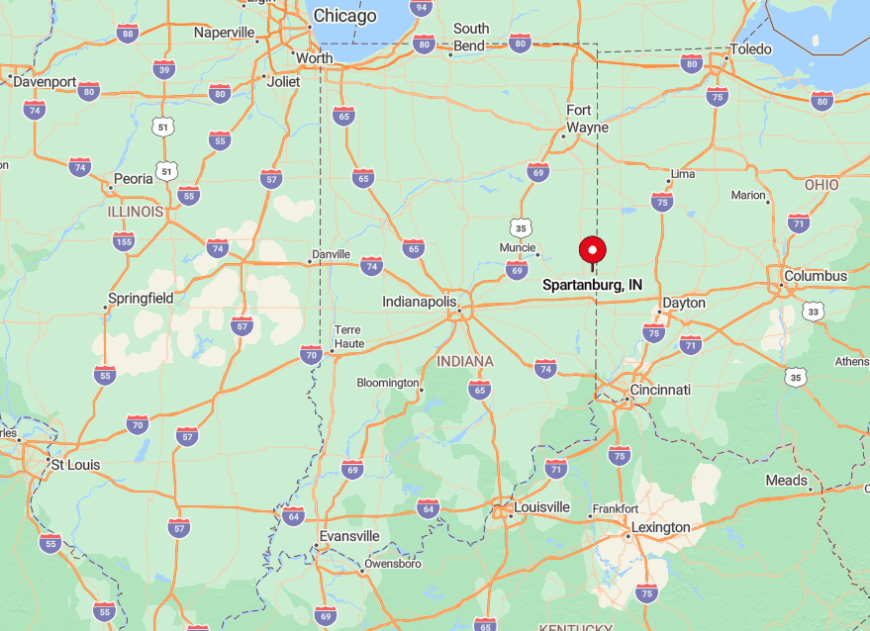
The town rests in northern Randolph County, a stone’s throw from the state line yet hidden two miles east of State Road 27. Drivers must follow unmarked gravel lanes that sometimes close in winter, leaving all-season residents accustomed to self-reliance.
Public transport does not serve the area, so arrival is strictly by personal vehicle. Those rough roads deter casual exploration, preserving Spartanburg’s stillness year-round.
1. Dunlapsville
Dunlapsville hosts roughly 95 full-time residents who enjoy expansive lake views from porches overlooking Brookville Lake’s northern coves. Boaters slip canoes into a tiny, lightly advertised launch where herons fish undisturbed, while hikers venture into adjacent Whitewater Memorial State Park to hunt morels each spring.
Agriculture—chiefly corn and hay—remains the backbone industry, but several residents earn income guiding off-season eagle-watch tours along the lake. State-forest acreage wraps three sides of the settlement, blocking future resort development and keeping visitor numbers low.
Roads dead-end at coves, so through-traffic simply doesn’t exist. That combination of water, woodland, and limited access crowns Dunlapsville as perhaps Eastern Indiana’s most secluded spot.
Where is Dunlapsville?
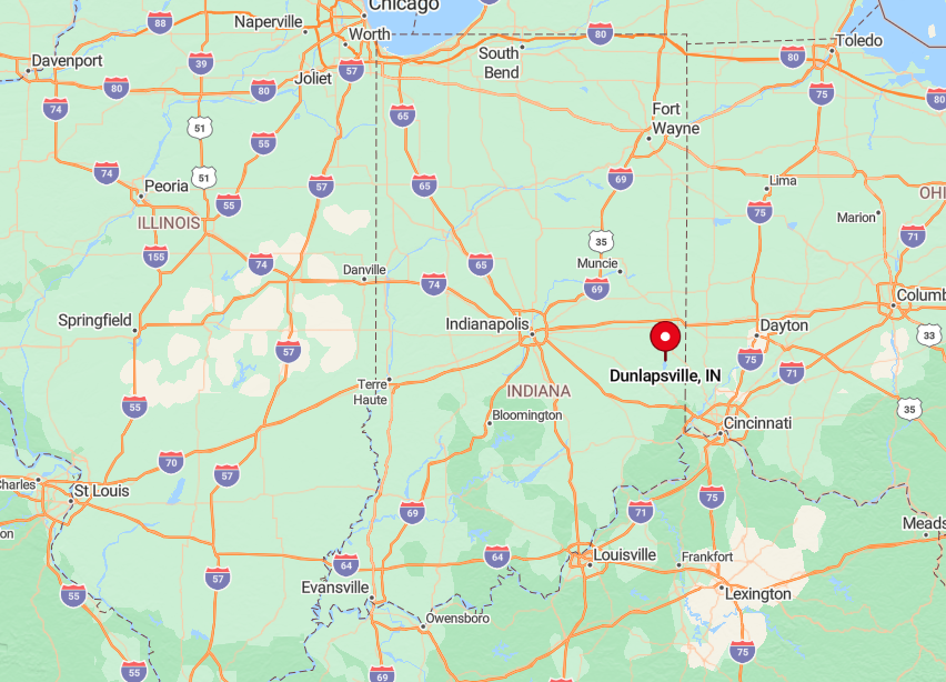
The village perches in Union County on a high ridge above Brookville Lake, eight sinuous miles northeast of Liberty via Dunlapsville Road. Only two paved routes lead in, both ending at water’s edge, forcing return along the same winding path.
Cell-tower coverage drops by half once drivers descend into the coves, underscoring the remove. Reaching Dunlapsville rewards travelers with panoramic lake vistas that feel surprisingly wild for a site just over an hour from Cincinnati.