Would you like to save this?
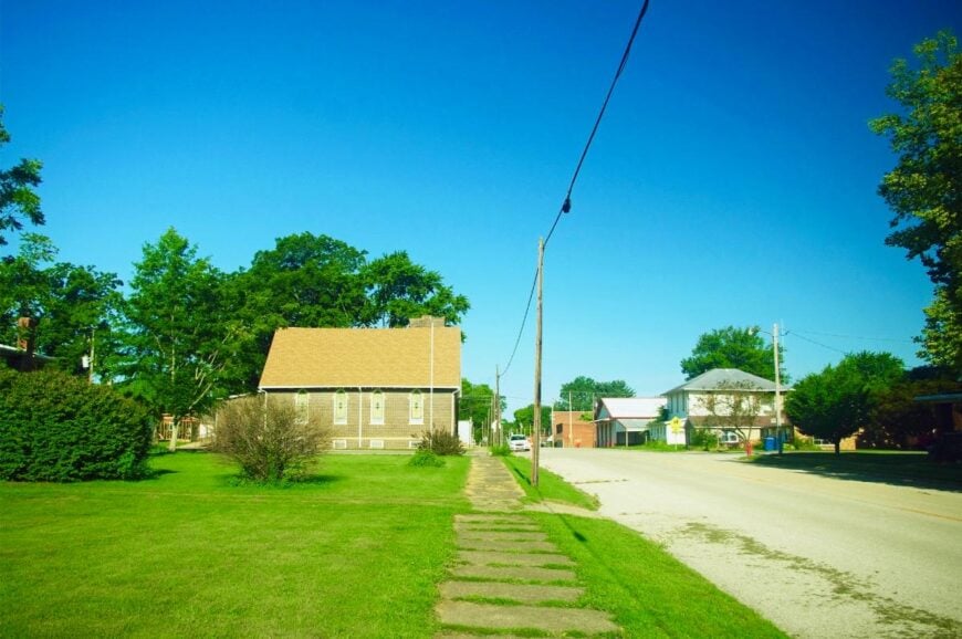
Eastern Illinois hides a string of little settlements where cornfields touch blue sky, main streets unfold at a walking pace, and night sounds are more cricket than car. We gathered 25 of those places for travelers or future residents who crave quiet scenery and elbowroom.
Each village offers its own blend of prairie vistas, riverbank shade, or century-old storefront charm, yet all share a distance from busy highways and large cities.
Our countdown begins with a riverside hamlet of only sixty-five people and ends with covered-bridge country. Pack a camera, keep an eye out for local food stands, and enjoy the slower rhythm of waiting along these backroads.
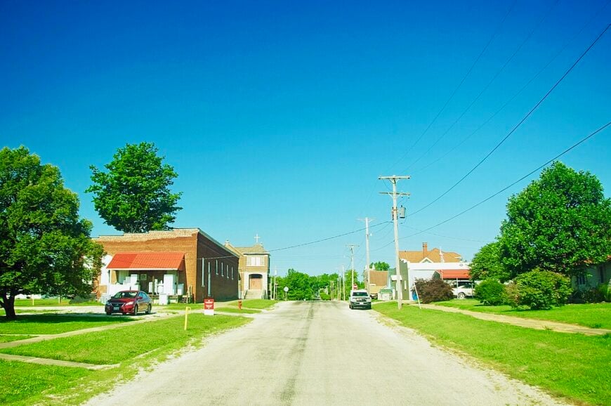
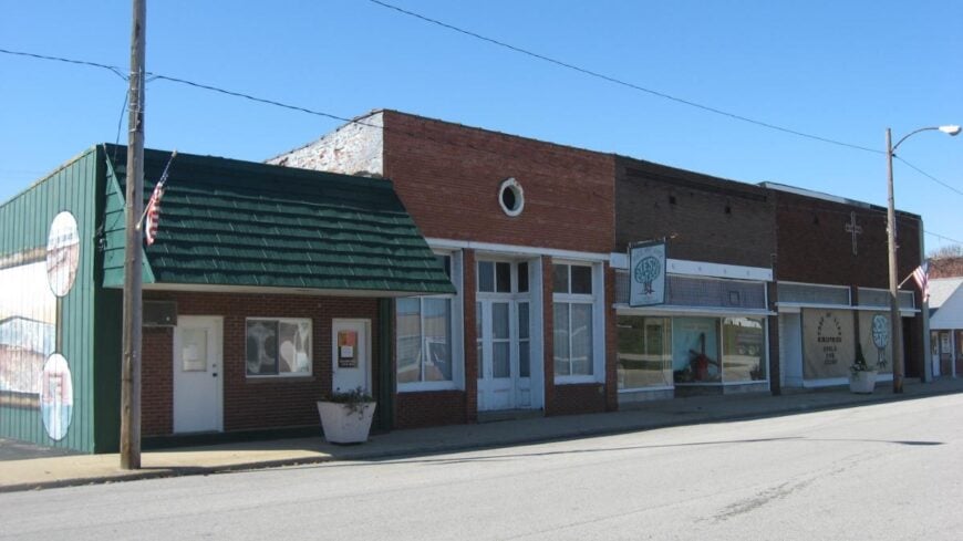
25. St. Francisville
St. Francisville hovers above the Wabash River like a quiet lookout, its bluff-top streets shaded by old elms and soft evening light. Seclusion comes naturally here: the river on one side, bottomland woods on the other, and only a trickle of traffic passing through.
The vibe is river-rustic—front porches with swing chains, church bells on Sundays, and towboat horns drifting up from the water. Walk the bluff sidewalks, pause at the overlook to watch herons lift from the shallows, or follow a gravel lane down to a tiny boat launch.
Small shops and farmwork anchor daily life, while fishermen trade stories at tailgates. After dusk, frogs tune up along the backwater sloughs. It’s the kind of place where the river seems to set your watch.
Where is St. Francisville?
Tucked in Lawrence County along the Wabash River, St. Francisville sits opposite Indiana and east of Illinois Route 1. It’s about 12 miles southeast of Lawrenceville, reached by two-lane roads that slip between fields and timber.
The last bends rise to a bluff with sudden views of water and sky. Close on the map, far in mood.
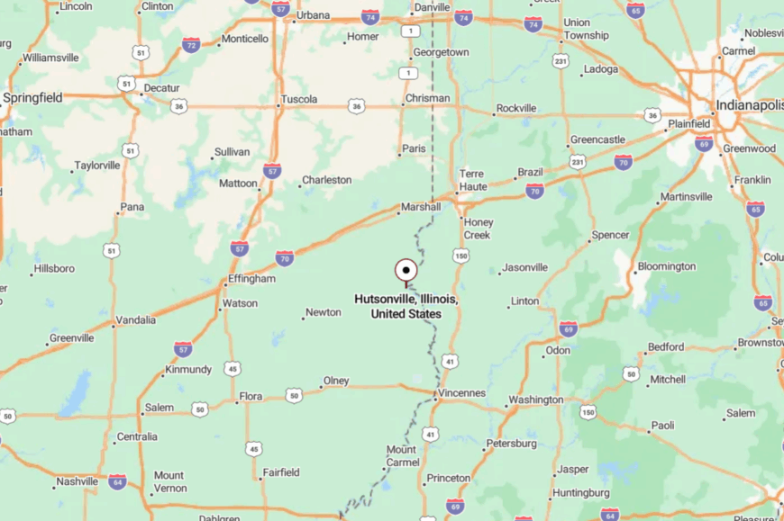
24. Hutsonville
Hutsonville gathers along a gentle curve of the river plain, with neat streets and porch flags that flutter like quiet greetings. Its apartness comes from being a few miles off the main highway, buffered by cropland and the river bottoms.
The feel is neighborly and unhurried—kids on bikes, evening walkers, and the soft clank of a screen door. Stroll the compact downtown, picnic in the riverside park, or hunt for arrowheads after spring floods.
Harvest brings a chorus of grain trucks, then nights go still again. Local farms and small trades keep the lights on. Under big prairie sunsets, Hutsonville hums at a lower volume.
Where is Hutsonville?
Kitchen Style?
In Crawford County, Hutsonville lies 8 miles northeast of Robinson, near the Wabash River. Arrive via county blacktop that threads fencerows and low woods.
Signs are modest, so you find it by its water tower and tree line. The last mile feels like a gentle exhale.
23. Keensburg
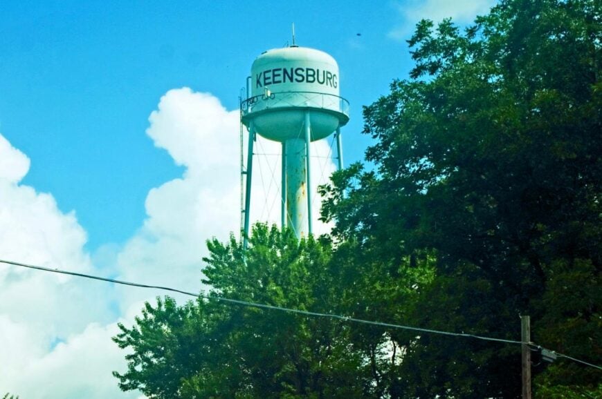
Keensburg is the kind of village you can hear before you see—wind through sycamores, cicadas in the heat, and the faraway rustle of the river forest. Seclusion comes from the absence of direct highway access and a cloak of bottomland trees.
The vibe is old-home simple: tidy yards, garden rows, and folks waving from riding mowers. Wander shady streets, cast for catfish at a nearby backwater, or drive to a local orchard for late-summer peaches.
Farming is the backbone here, with weekends set aside for church and cookouts. At night, stars pour over the treetops. Quiet finds you first, then stays awhile.
Where is Keensburg?
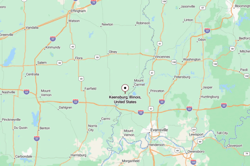
Keensburg sits in Wabash County, about 9 miles northwest of Mount Carmel. You reach it by a few calm county roads branching from Illinois Route 1.
The approach tucks into tall timber as the ground dips toward the floodplain. It feels like crossing a green threshold into slower time.
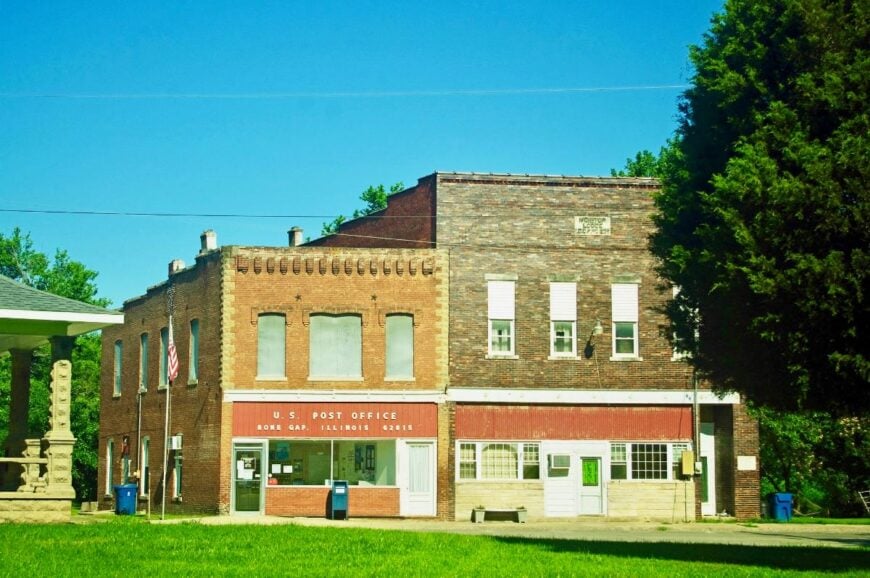
22. Bone Gap
Home Stratosphere Guide
Your Personality Already Knows
How Your Home Should Feel
113 pages of room-by-room design guidance built around your actual brain, your actual habits, and the way you actually live.
You might be an ISFJ or INFP designer…
You design through feeling — your spaces are personal, comforting, and full of meaning. The guide covers your exact color palettes, room layouts, and the one mistake your type always makes.
The full guide maps all 16 types to specific rooms, palettes & furniture picks ↓
You might be an ISTJ or INTJ designer…
You crave order, function, and visual calm. The guide shows you how to create spaces that feel both serene and intentional — without ending up sterile.
The full guide maps all 16 types to specific rooms, palettes & furniture picks ↓
You might be an ENFP or ESTP designer…
You design by instinct and energy. Your home should feel alive. The guide shows you how to channel that into rooms that feel curated, not chaotic.
The full guide maps all 16 types to specific rooms, palettes & furniture picks ↓
You might be an ENTJ or ESTJ designer…
You value quality, structure, and things done right. The guide gives you the framework to build rooms that feel polished without overthinking every detail.
The full guide maps all 16 types to specific rooms, palettes & furniture picks ↓
Bone Gap is a mile-square patchwork of clapboard homes, orchard trees, and soft-shouldered lanes. Its apartness stems from being well off four-lane routes, wrapped in fields that roll to the horizon.
The vibe is pastoral and personal—mailboxes with hand-painted names, dogs napping on stoops, and the smell of cut hay after supper. Visit a small farm market, bike the grid of quiet roads, or follow a sandy creek to a shaded picnic spot. Livelihoods lean on grain, cattle, and crafts.
Even the noon hour seems unhurried, a bell tone rather than a buzzer. It reminds you how gentle the middle of the day can be.
Where is Bone Gap?
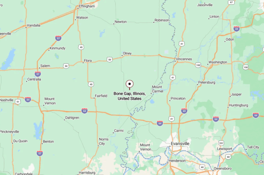
Set in Edwards County, Bone Gap lies 7 miles northeast of Albion. Two-lane county roads lead in, flanked by hedgerows and windbreaks.
The town rises slowly—first a silo, then a steeple, then porches. You’ll know you’ve arrived when the sky feels bigger than the street.
21. West Salem
West Salem sits on a slight rise above orchard country, a compact village known for tidy streets and generous shade. Seclusion comes from distance: a good half hour to big-box amenities and a world away in pace.
The vibe is porch-friendly and practical—farm trucks at the curb, quilts airing on rails, and kids chalking hopscotch in front of the library. Tour a local museum, grab cider from a family orchard, or walk to the park for dusk softball.
Agriculture and small shops keep the week steady. When the lights click off, you can hear the leaves talking to the wind. It’s comfort woven into the countryside.
Where is West Salem?
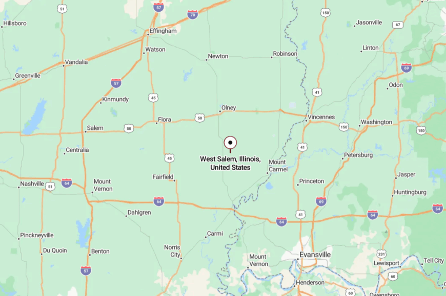
In Edwards County, West Salem lies 10 miles west of Mount Carmel along calm state routes. Approaches cross orchard rows and bean fields with wide sightlines.
The water tower is your landmark as the road lifts onto the village rise. It’s close enough for errands, far enough for stars.
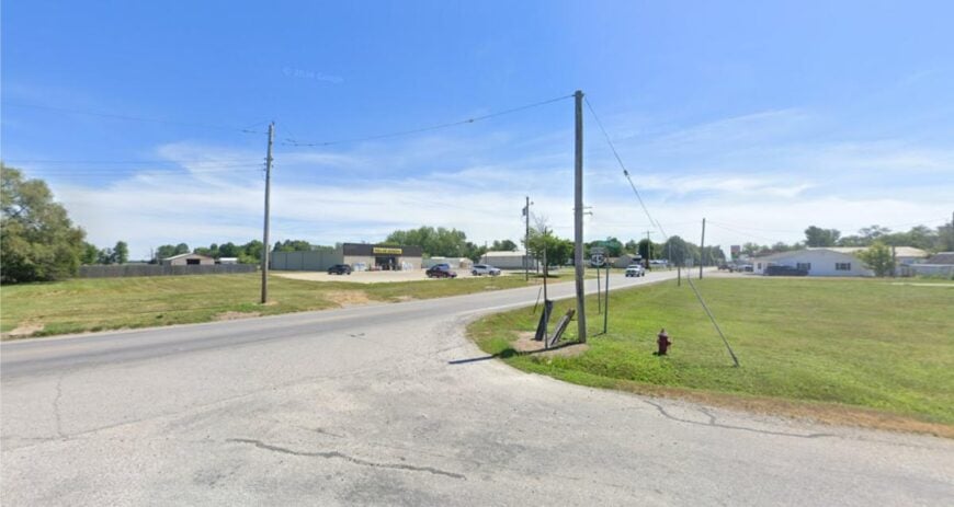
20. Keenes
Keenes is scarcely more than a crossroads village, and that’s the charm—no stoplight, few signs, and fields that seem to fold the streets into themselves. Its apartness is the open kind, miles from interstates and softened by wind in the corn.
The vibe is minimalist Midwest: a post office flag, a church bell, a handful of homes with big gardens. Photograph grain bins at sunset, browse a roadside stand, or meander a gravel lane to a hidden fishing pond.
Farmwork sets the calendar here. Even on busy days, the horizon holds steady. It’s quiet, you can measure in acres.
Where is Keenes?
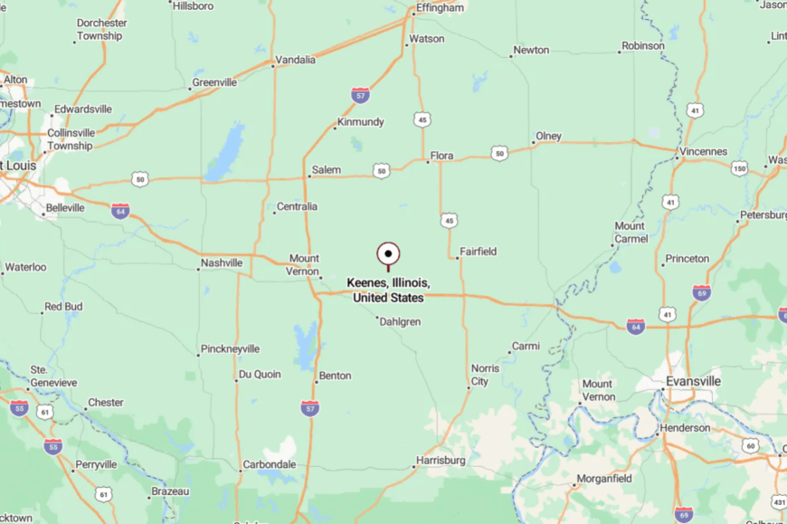
Keenes sits in Wayne County, about 10 miles north of Fairfield, near Illinois Route 15. You get there on straight, two-lane roads that trade speed for sky.
The last turn reveals a cluster of roofs and a steeple. Simple directions, simpler days.
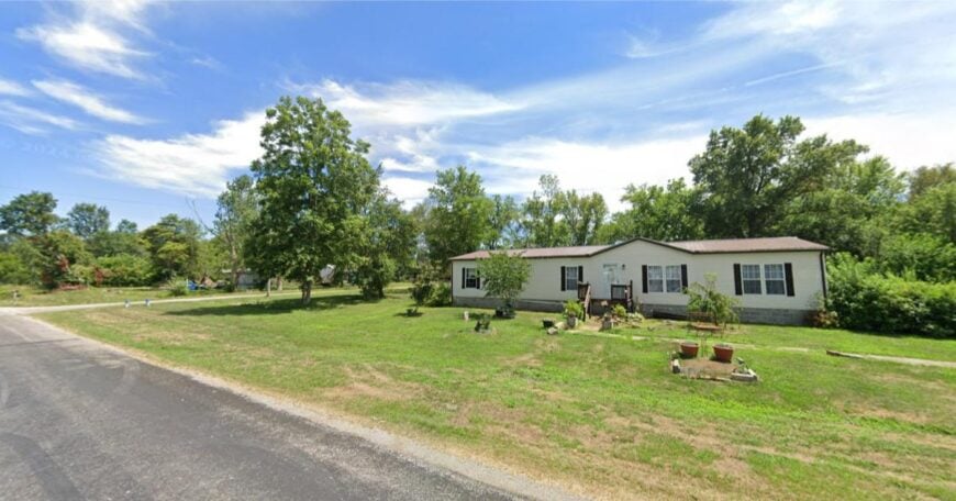
19. Cisne
Cisne feels like a small quilt stitched from porches, maple shade, and Friday-night ball games. Its seclusion comes from being ringed by section roads and pasture, with no reason for through-traffic to pass.
The vibe is friendly and grounded—feed trucks at dawn, kids on bikes by noon, and neighbors chatting beneath the water tower at dusk. Walk the park path, stop for pie at the café, or explore gravel spurs that end at creek crossings.
Grain and school sports are the week’s twin anchors. On clear nights, constellations look close enough to borrow. It’s a town that asks you to breathe deeper.
Where is Cisne?
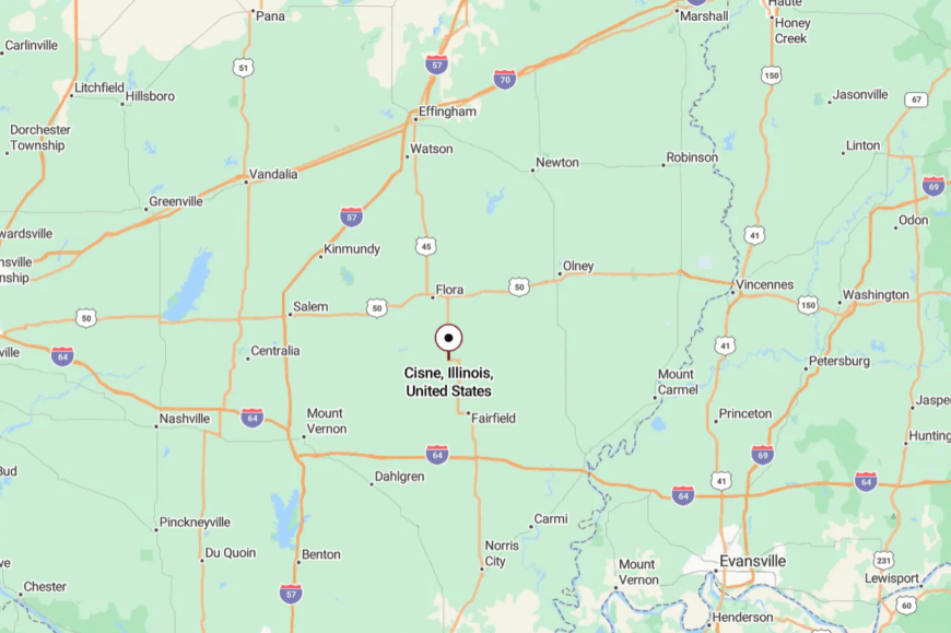
Located in Wayne County, Cisne lies 12 miles west of Fairfield off Illinois Route 45. The drive in is all straight horizons and fencerows.
You’ll spot it by the elevator complex and ballfield lights. Far from the rush, close to what matters.
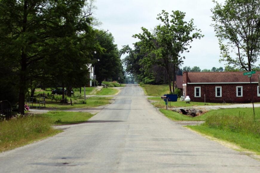
18. Rinard
Rinard is a whisper of a place where the tracks and the trees run side by side, and most roads end in corn or timber. Seclusion holds because it sits between bigger towns with little to pull a crowd.
The mood is hushed and woodsy—screen doors creak, trains murmur, and cardinals flash through the hedges. Photograph old depots, watch deer at a field edge, or fish a farm pond with permission.
Work is farm-adjacent; leisure is sunrise and songbirds. The days feel drawn by pencil, not pen. It’s a dot on the map that fills the whole afternoon.
Where is Rinard?
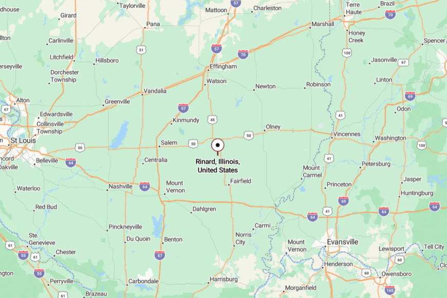
Rinard rests in Wayne County, roughly 9 miles northwest of Flora. Access comes by county roads that slip past farmsteads and short timber lots.
You’ll cross the tracks just before the houses gather. It’s near enough to find, far enough to hush the phone.
17. Louisville
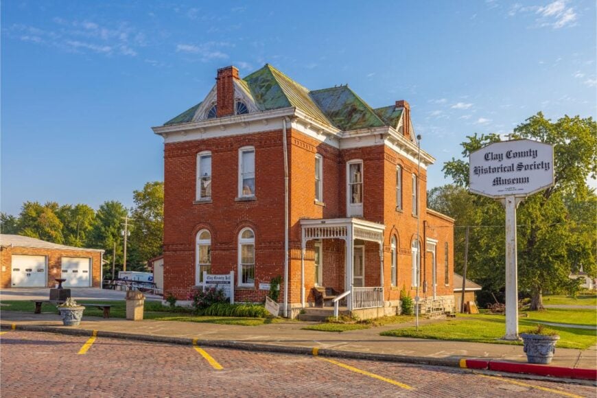
Louisville folds quietly into low ridges and creek bottoms, a small courthouse town that closes early and sleeps well. Its apartness comes from distance to four-lane roads and the slow bends of the Little Wabash, which keep growth at arm’s length.
The vibe is traditional—brick storefronts, courthouse lawn picnics, and hardware-store conversations that last longer than your list. Wander downtown, try a plate lunch, or follow a gravel lane to a covered picnic shelter by the river.
County offices and farm services share the workload. When twilight slides across the square, the town seems to breathe out. It’s comfort wrapped in brick and shade.
Where is Louisville?
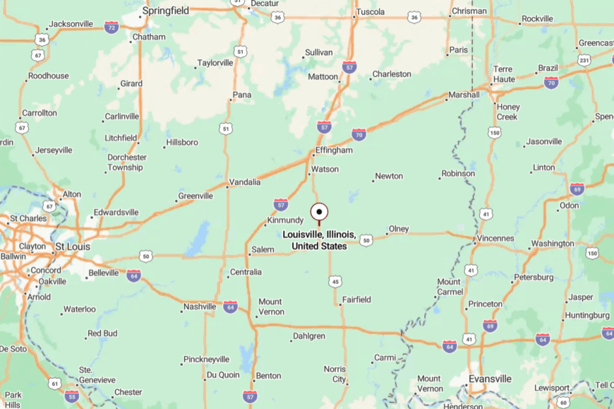
In Clay County, Louisville sits along U.S. 45, about 17 miles south of Effingham. You roll in on two-lane blacktop where fields meet timber.
The courthouse dome is your bearing point from a distance. It’s close enough for a day trip, far enough to reset.
16. Sailor Springs
Would you like to save this?
Sailor Springs is a tiny spa town without the spa, a remnant of mineral-spring days that now feels like a clearing in the woods. Its seclusion comes from the creek bottoms and timber tracts that hem it in, along with roads that curve just enough to hide what’s ahead.
The vibe is nostalgic and leafy—rustle of cottonwoods, porch gliders, and the hush of a place that unplugs itself. Explore the old spring sites, picnic under big shade trees, or follow a dirt lane to a low-water crossing.
What little commerce exists is seasonal and neighborly. Even the air seems slower here, scented with damp earth after rain. It’s a pocket of quiet you can fold into your pocket.
Where is Sailor Springs?

Found in Clay County, Sailor Springs lies 7 miles south of Louisville near smaller county roads. The approach drifts through woods and creek flats with gentle bends.
Signs are few; trees do the welcoming. It’s close enough to reach, far enough to forget the clock.
15. Xenia
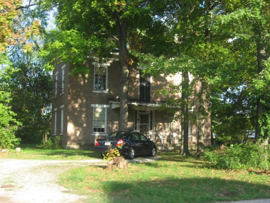
Xenia gathers around a small square and lets the countryside do most of the talking. Its apartness stems from distance to interstates and the way farm parcels keep streets short and simple.
The vibe is classic prairie—grain trucks, porch rockers, and a café where pie goes first. Visit the pocket park, follow a birding loop along hedgerows, or time a trip for a harvest parade.
Grain and trucking outfits are the workday spine. Sunset turns silos to silhouettes and the whole town to amber. It’s a good place to love ordinary days.
Where is Xenia?
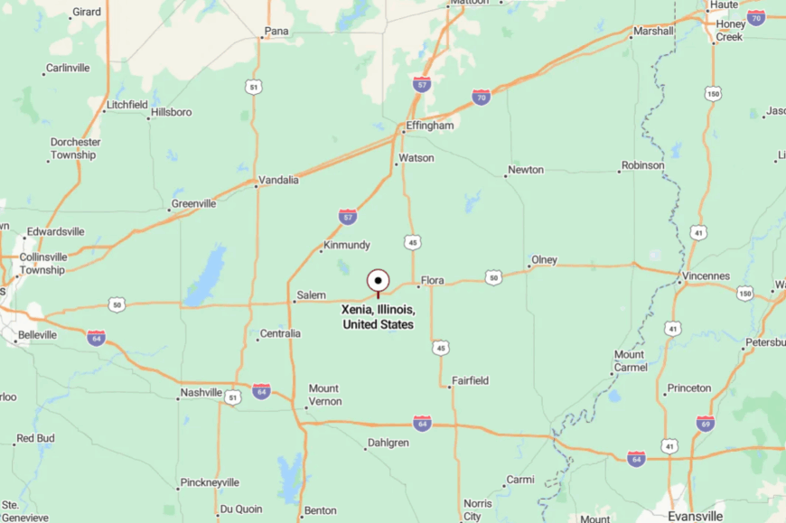
In Clay County, Xenia sits 10 miles north of Flora along U.S. 50 and local connectors. The drive trades freeway noise for wind in the beans. The village appears suddenly—water tower, steeple, then houses. Blink once, slow twice, and you’re there.
14. Ste. Marie
Ste. Marie feels like a French postcard tucked into the prairie—white steeples, tidy gardens, and a central green where church bells carry. Seclusion comes from being far off the main routes, with timber and river flats giving the village a protected pocket.
The vibe is heritage-rich and peaceful—homemade pastries after mass, summer picnics, and neighbors who still speak with a lilt of old country. Visit the historic church, browse cemetery statuary, or explore a nearby nature preserve along the Embarras.
Farming and small crafts sustain the rhythm. Evening light softens everything to honey. It’s serenity with a story to tell.
Where is Ste. Marie?

Located in Jasper County, Ste. Marie sits 12 miles southeast of Newton. Arrive via two-lane roads that dip across creeks and rise into groves.
Wayfinding is by spire and shade tree more than signs. It’s near enough for a Sunday drive, yet it feels set apart.
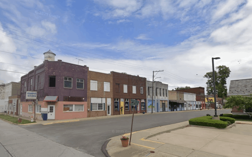
13. Oblong
Oblong stretches along a straight main street where grain elevators and murals share the skyline. Its apartness comes from light traffic and a ring of farmland that stays stubbornly open.
The vibe is friendly and practical—vintage shopfronts, festival weekends, and parks where kids chase kites. Browse a small museum, walk the mural loop, or drive to a nearby lake for paddling.
Agribusiness and local retail hold steady through the seasons. As dusk falls, porch lights flicker on like a string of quiet stars. You can hear your own footsteps here, and that feels right.
Where is Oblong?
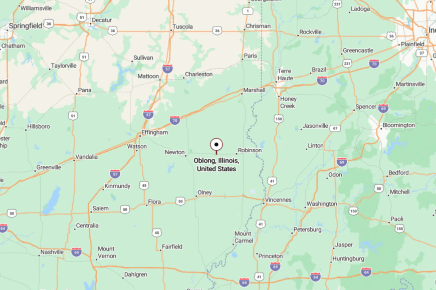
Oblong lies in Crawford County, 10 miles southwest of Robinson along calm state routes. Roads in are arrow-straight, lined with hedgerows and utility poles.
The town edges into view all at once—elevators, water tower, then brick fronts. It’s easy to find and easier to slow down for.
12. Palestine
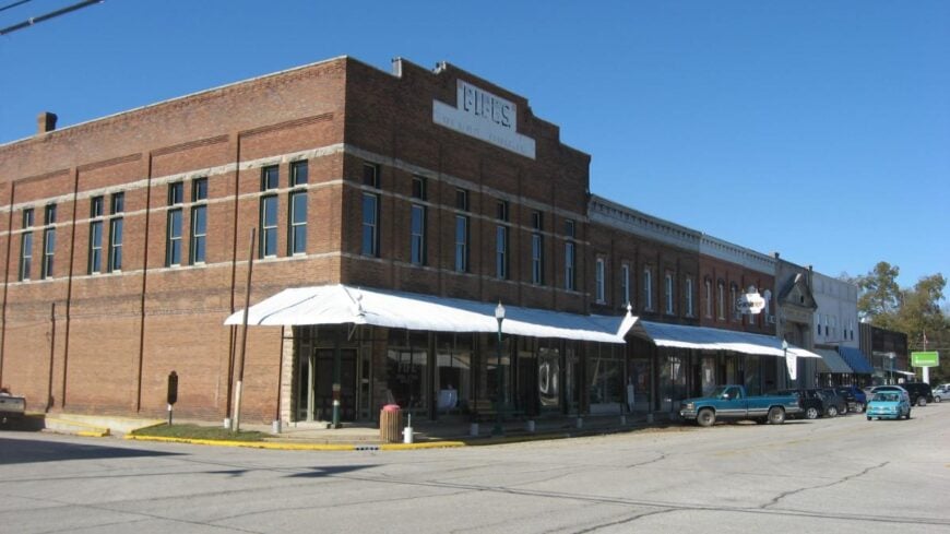
Palestine is one of the state’s oldest villages, its brick walks and frame houses shaded by towering oaks. Seclusion lingers in the curve of the river valley and the way modern routes skim past without intruding.
The vibe is historic and artsy—gallery days on the square, porch concerts, and antique hunts in creaky-floored shops. Walk the old jail museum, ramble the shady residential streets, or picnic at a bluff-top park.
Tourism mixes gently with small-town routines. When a violin drifts from a front stoop at twilight, time hums instead of hurries.
Where is Palestine?
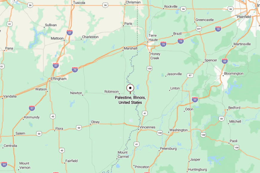
Set in Crawford County along the Wabash Valley, Palestine sits 8 miles east of Robinson. Two-lane state roads lead to brick streets framed by mature trees.
You’ll crest a small rise and the historic district gathers around you. It’s close enough for an afternoon, yet it lingers like a weekend.
11. Greenup
Greenup wears its nickname—“Village of Porches”—with easy pride, balconies and gingerbread trim lining Main Street like a parade. Seclusion comes from its perch along the Embarras River and a bypassed slice of old National Road, which keeps modern rush at arm’s length.
The vibe is storybook and strollable—covered bridge photo ops, antique shops, and soda-fountain stools that still swivel. Walk the riverside path, tour the restored covered bridge, or browse weekend flea markets under shade trees.
Local retail and heritage tourism share the load. When evening lights glow under the eaves, the town looks ready for a painting. It’s close to the interstate, yet it feels a century away.
Where is Greenup?
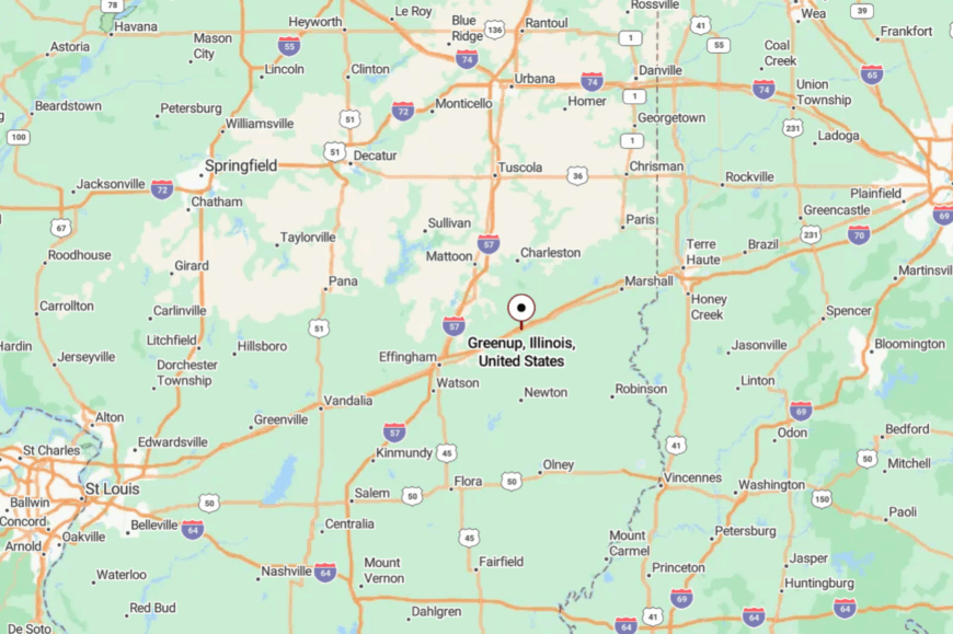
Greenup sits in Cumberland County, 14 miles east of Effingham, just south of I-70. Exit the interstate and amble a mile or two as the road narrows and slows.
The Embarras River and old storefronts frame the approach. It’s close enough to reach, but far enough to feel like you’ve stepped off the main road of time.
10. Golden Gate
Home to roughly 65 residents, Golden Gate hugs the wooded banks of the Little Wabash River in Wayne County. Anglers cast for catfish at dawn, while bird-watchers follow the riparian trail that loops behind the volunteer fire station.
Farming and small-scale forestry are the chief ways neighbors earn a living, and many properties include sheds for equipment rather than garages. Acre-sized lots and a single gravel main street keep traffic nearly nonexistent, so children still ride bikes down the middle of the road.
Even mail is slow here, delivered from a larger post office twenty minutes away, which adds to the unhurried feel. The result is a postcard scene of river, woods, and vintage clapboard homes untouched by modern sprawl.
Where is Golden Gate?
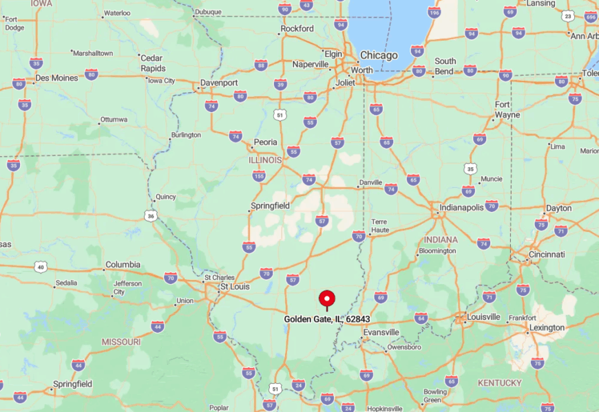
The village sits about 20 miles northwest of the city of Fairfield, tucked between State Routes 15 and 45 but reached only by county roads that twist through soy fields. Tall sycamores along the riverbank obscure it from the highway, contributing to its hidden quality.
Visitors generally exit Interstate 64 at Albion or Grayville, then follow two-lane roads for half an hour before the first “Golden Gate” sign appears. The absence of any direct highway access is exactly what preserves this settlement’s calm.
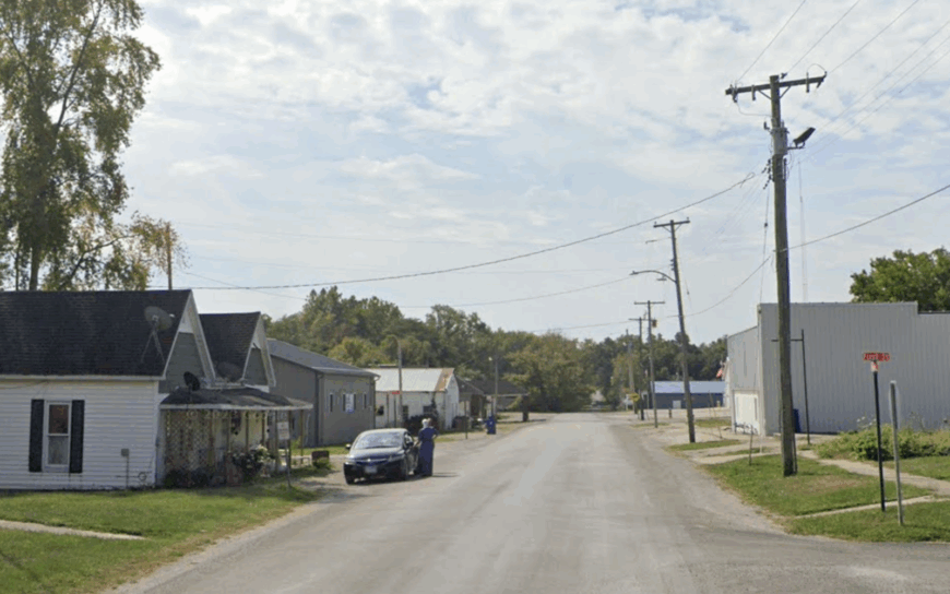
9. Brocton
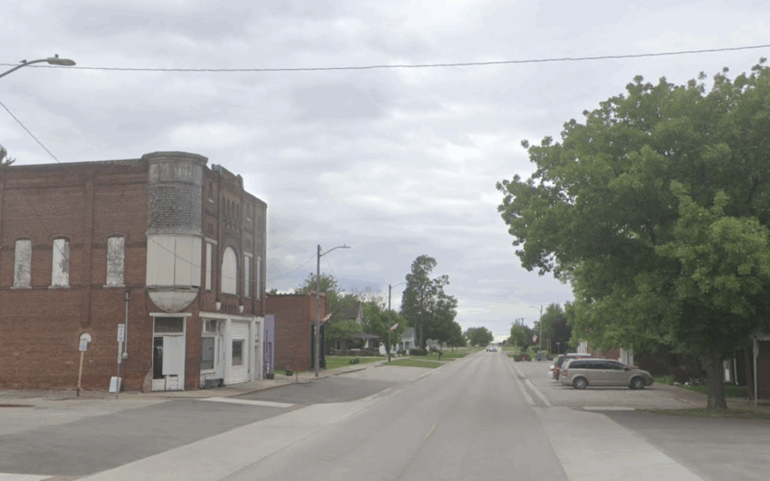
Brocton counts close to 300 residents who rise beside giant silver grain elevators that glint in the morning sun. Locals gather for coffee at the corner gas station, then spend free time photographing barn quilts or walking the mile-long cornfield lane behind the community park.
Agriculture dominates the economy, with corn and soy trucks rumbling to the elevators during harvest and a seed-cleaning cooperative providing off-season jobs. The nearest divided highway sits 15 miles away, and the village grid holds more tractors than sedans.
A wide-open prairie sky means summer sunsets fill every window, yet light pollution remains nearly zero for stargazing. That blend of limitless horizon and tiny population gives Brocton a stillness rare in the Midwest.
Where is Brocton?
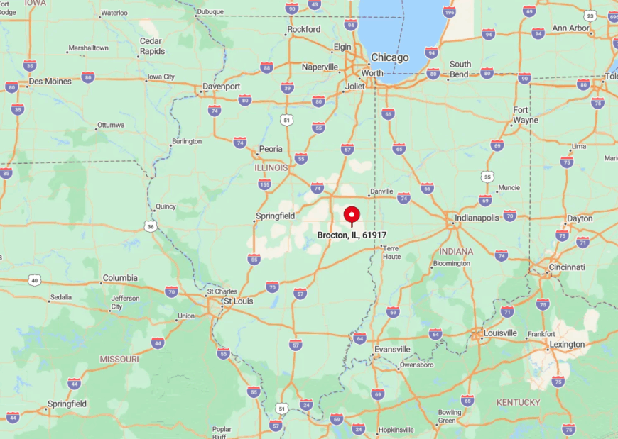
Brocton lies in Edgar County, south of U.S. 36 and west of Illinois 49, but travelers must detour onto County Road 500 afterwards. Grain bins taller than the church steeple act as the first landmark seen from a distance across flat cropland.
Decatur and Champaign are both over an hour away, which discourages commuter traffic. Reaching Brocton feels like driving into the center of a green ocean, with corn waves on all sides.
8. Flat Rock
Flat Rock shelters about 323 people behind a fringe of Crawford County timber and a necklace of reclaimed strip-mine lakes now stocked with bluegill. Visitors kayak the clear water or browse century-old brick storefronts where antique dealers trade arrowheads found in local woods.
Oil service work and row-crop farming share the economic load, and a family-run sawmill processes storm-felled oak. Because Old Route 1 bypassed the village decades ago, newer travel corridors never reached its doorstep.
Tree-lined lanes muffle sound, and night brings only the distant bark of a fox from Harrison Woods State Nature Preserve. That lush buffer keeps Flat Rock feeling like a secret clearing.
Where is Flat Rock?
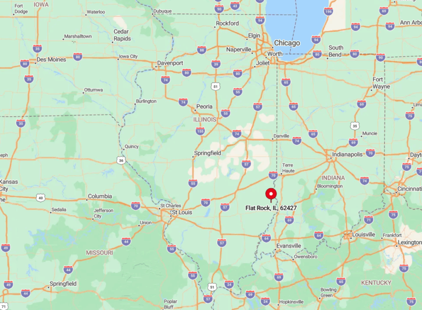
The hamlet sits eight miles south of Robinson along County Highway 9, with no direct interstate nearby. Surrounding forests and the absence of large signage mean many drivers pass within a mile without realizing a town is there.
The closest commercial airport is in Terre Haute, Indiana, a 50-minute drive. Most visitors simply follow Illinois Route 1 until a small wooden sign directs them west toward the trees.
7. Parkersburg
Would you like to save this?
Parkersburg counts fewer than 200 residents, all clustered around one short downtown block where a 1911 bank building now houses a quilting studio. Afternoon walks lead through rolling meadows pocked with working oil pumpjacks whose slow rhythm sets a peaceful beat.
The petroleum field, small-farm hay production, and hunting leases form the main income streams. Oversized lots, mature oak groves, and the total absence of stoplights keep views clear of modern clutter.
Local history buffs point out the limestone foundations of the original opera hall that burned in 1918, a hidden marker of another era. Together, these factors lend a time-capsule quality hard to replicate elsewhere.
Where is Parkersburg?
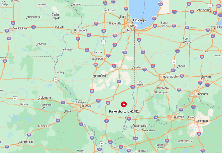
The village rests in Richland County between Olney and Clay City, eleven miles from Illinois Route 130. Low ridges hide it from passing traffic, and cellphone coverage drops as one nears the creek bottoms.
Drivers exit Interstate 57 at Effingham, then weave south on county blacktop for half an hour before the first Parkersburg mailbox appears. This indirect route is why the downtown café closes only when the cook decides the day is done, not when tourists arrive.
6. Henning
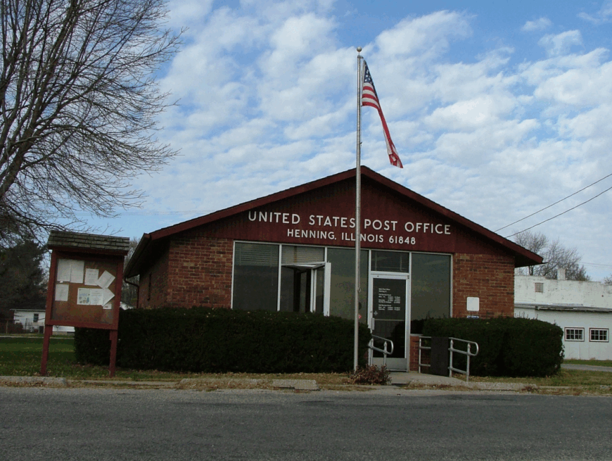
Henning, population around 240, occupies a quiet pocket of Vermilion County where tall-grass prairie restoration projects edge backyard fences. Residents spend weekends birding for Henslow’s sparrows at the Kerr Meadow preserve or attending Friday night fish fries in the volunteer fire hall.
Corn and soybean farming dominate paychecks, supplemented by seasonal seed-corn research plots. The village sits a full 12 miles from Danville and lacks a convenience store, so life here encourages planning and neighborly sharing.
Shelterbelt trees planted during the Dust Bowl enclose many properties, buffering wind and outside noise alike. That combination of distance and deliberate plantings frames Henning in gentle hush.
Where is Henning?
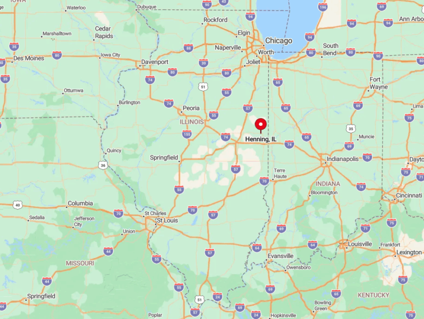
Set just east of Illinois Route 1, Henning hides behind a series of north-south gravel roads parallel to the Vermilion River. The absence of any exit sign on U.S. 136 keeps through drivers unaware of its presence.
Amtrak trains rumble past two miles away without a stop, reinforcing isolation. Most visitors arrive by turning at the lone grain-co-op sign, then following a faint whiff of drying corn to town.
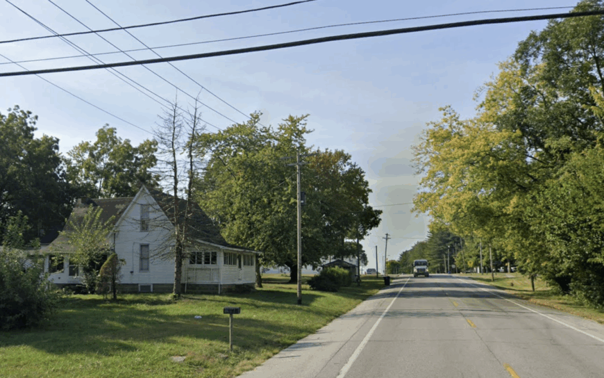
5. Kansas
Kansas lists close to 700 residents living along brick streets shaded by maples, with deep-set Victorian porches perfect for summer lemonade. Kayakers float the nearby Embarras River, and hikers trace old wagon ruts in Lincoln Trail State Park ten minutes away.
Local jobs revolve around livestock feed mills, independent trucking, and the K-12 school that anchors community events. Seclusion stems from being 18 miles from any urban center, plus cell towers purposely limited by zoning to protect the historic skyline.
Downtown storefronts stand quiet by 6 p.m., save for a weekly bluegrass jam in the hardware store. That early stillness turns porch swings into prime gathering spots once cicadas start humming.
Where is Kansas?
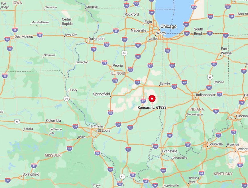
The village sits in Edgar County at the junction of Illinois Routes 16 and 49, yet both are two-lane roads with light traffic. Prairie flats stretch in every direction, and a bend of the Embarras River blocks any straight-line expansion.
Springfield and Champaign are each more than an hour away, so most visitors come via scenic backroads rather than interstates. The closest public transit stop is a rural dial-a-ride van that arrives twice weekly.
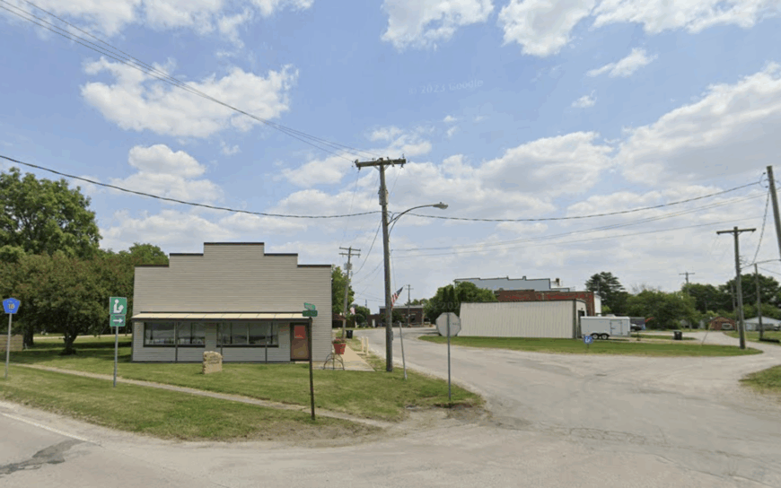
4. Allendale
Allendale claims about 475 residents whose homes perch on bluffs rising above the Wabash River floodplain, offering sunrise views across open farmland. Anglers and photographers gather at dawn near the white-steeple church to catch the mist lifting off the bottomland.
Mixed-grain farming and river-adjacent hunting leases are the primary income sources, while a small orchard north of town supplies seasonal cider. Bluff-top acreage lots mean houses sit well apart, and riverbank forest shields them from passing barges.
No chain businesses operate here, and streetlights switch off at 11 p.m., leaving the Milky Way bright overhead. These elements weave together a quiet that feels almost elevated, like living above the world’s noise.
Where is Allendale?
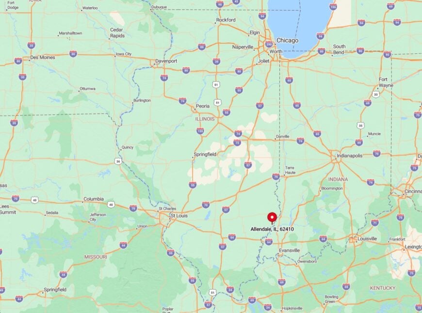
The community rests in Wabash County, five miles east of Illinois Route 1 and across the river from Indiana farm country. It is accessed by a single bridge that often closes during high water, adding a natural gatekeeper.
Travelers usually exit Interstate 64 at Grayville, then drive north through row crops until the bluff rises suddenly. The lack of alternate routes keeps the car count low and serenity high.
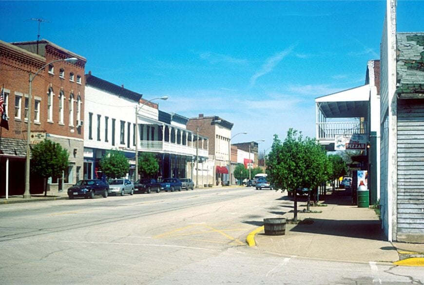
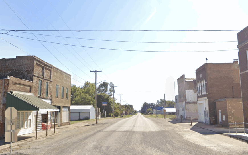
3. Sidell
Sidell’s 550 residents inhabit a grid of red-brick streets laid out during the coal era, now lined with mature walnuts and aging depots. Locals wander the abandoned railbed turned walking trail, scanning for prairie smoke wildflowers in spring.
Row-crop agriculture and a small pallet factory support most households, while retired miners share stories at the café’s back table each morning. The nearest four-lane highway lies 14 miles away, and surrounding shelterbelts cut wind and noise, turning freight trains into distant whispers.
Architectural details like pressed-metal cornices and stained-glass transoms linger untouched, offering ready subjects for history-minded photographers. Sidell, therefore, feels half museum, half living town, wrapped in deep rural quiet.
Where is Sidell?
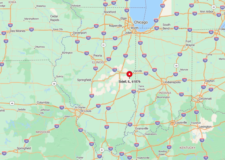
Located in southern Vermilion County, Sidell sits just west of the Little Vermilion River and south of U.S. 150. Reaching it involves a series of ninety-degree turns along section roads once meant for horse carts.
The absence of truck stops or big box stores within ten miles keeps commercial traffic minimal. Most guests arrive via Illinois Route 49, then follow a wooden “Sidell” arrow nailed to a power pole.
2. Westfield
Westfield has 576 inhabitants who enjoy two-acre lots, a solitary water tower, and prairie horizons where cloudscapes stage daily theater. Residents host monthly astronomy nights at the old football field, taking advantage of low light levels for telescope viewing.
Grain farming rules the local economy, with a seasonal detasseling crew hiring teens each July. Being 25 minutes from the closest highway interchange and surrounded by corn on all sides makes spontaneous visitors rare.
Main Street storefronts may appear empty, yet a community potluck behind the library reveals vibrant local ties. That balance of vast space and neighborly connection defines Westfield’s charm.
Where is Westfield?
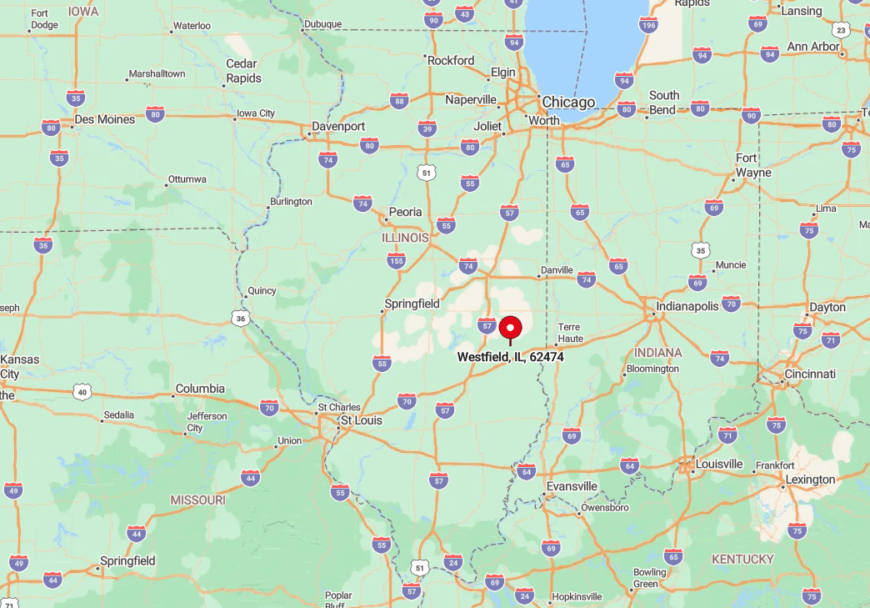
You will find Westfield in Clark County at the crossroads of Illinois Routes 49 and 133, though signage is modest. Treeless fields create a visual sea that conceals the town until travelers are nearly upon it.
The nearest Amtrak stop is in Mattoon, requiring a 30-minute drive through uninterrupted cropland. With no direct interstate access, the village keeps its skies dark and its evenings hushed.
1. Camargo
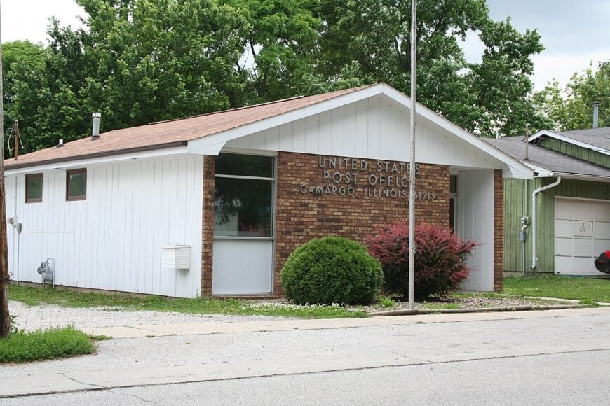
Camargo, population about 450, sits amid Douglas County’s wooded creeks and is famed for the historic Embarras covered bridge built in 1883. Families picnic near the bridge, then hike Sugar Creek Conservation Area for spring morels or autumn foliage.
Small-scale livestock farms and a local cabinetry shop anchor employment, and a summer peach orchard brings seasonal crowds for only a few weekends. Large homesteads, absence of commercial sprawl, and strict signage rules preserve an idyllic, nostalgia-rich panorama.
Evening brings the scent of wood smoke and the sound of bullfrogs from hidden ponds. The sense that time slides more slowly here appeals to anyone seeking quiet corners of Illinois.
Where is Camargo?
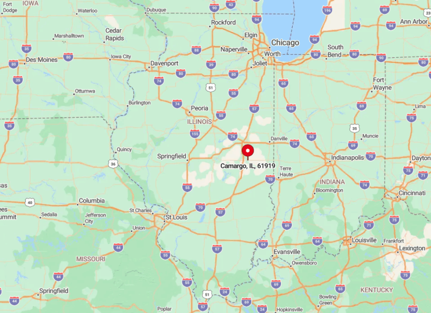
The village rests along Illinois Route 130, ten miles south of the university town of Charleston, yet buffered by forested creek bottoms. Gentle hills and meandering waterways hide it from motorists on higher ground.
Visitors often exit Interstate 57 at Tuscola, then steer east through soybean country before dipping into the trees surrounding Camargo. That final two-mile stretch without billboards or gas stations signals entry into genuine hideaway territory.