Would you like to save this?
Western New Hampshire’s highlands hide a surprising number of small towns where gravel roads beat out highways and porch lights are outnumbered by stars. These are places with roomy lots, rolling timberland, and more loons than neighbors, yet each offers its own mix of lakes, peaks, and community traditions.
We pulled together 25 of the quietest corners, counting backward from Lempster’s wind-polished ridges to Grafton’s flower-filled meadows. Every entry highlights what locals actually do for fun, how folks make a living, and why the outside world feels so far away.
Think hiking trails that start behind town hall, farm stands running on the honor system, and general stores where staff still know which coffee you drink. If an escape to wide-open New England sounds appealing, the following towns deserve a spot on the short list.
25. Lyman – Ridge Farms Above the Ammonoosuc
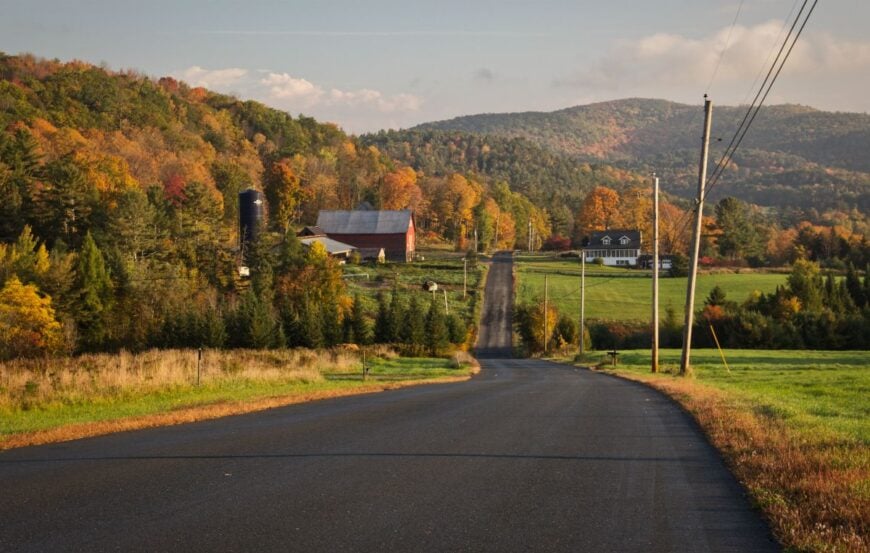
Lyman feels like the quiet edge of New Hampshire, where dead-end lanes run past hill farms and spruce hems in the views. It’s secluded by design—no interstates, no village center to speak of, just scattered homes tucked between old stone walls and sugarbush.
Mornings begin with mist over the Ammonoosuc Valley and end with owls calling from the tree line. Hike old tote roads, fish the cool brooks, or wander gravel spurs that rise toward the Vermont line.
The economy is small and local—wood lots, trades, and a few home businesses that don’t mind the long drive to town. Even summer weekends pass softly up here, with more tractors than tail lights. Lyman invites you to turn down the radio and listen for wind in the pines.
Where is Lyman?
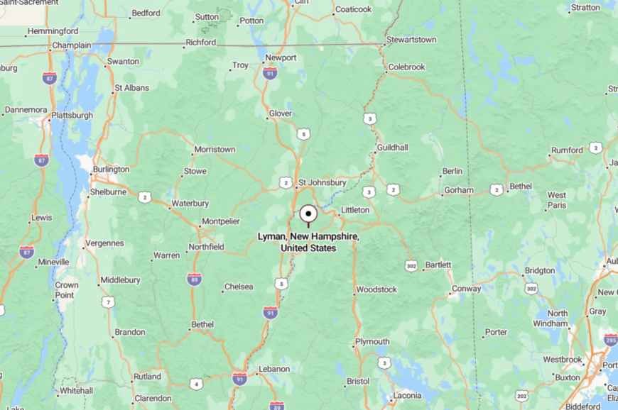
Tucked in far northwestern Grafton County, Lyman sits above the Ammonoosuc River basin and west of Littleton. It’s well off the main corridors; you reach it by meandering backroads that climb away from US-302 and I-93.
Those last miles narrow to shaded lanes that feel more like driveways than throughways. It’s close enough to the Whites to see their shoulders, but far enough to feel you’ve slipped behind them.
24. Landaff – Pastures Between Quiet Peaks
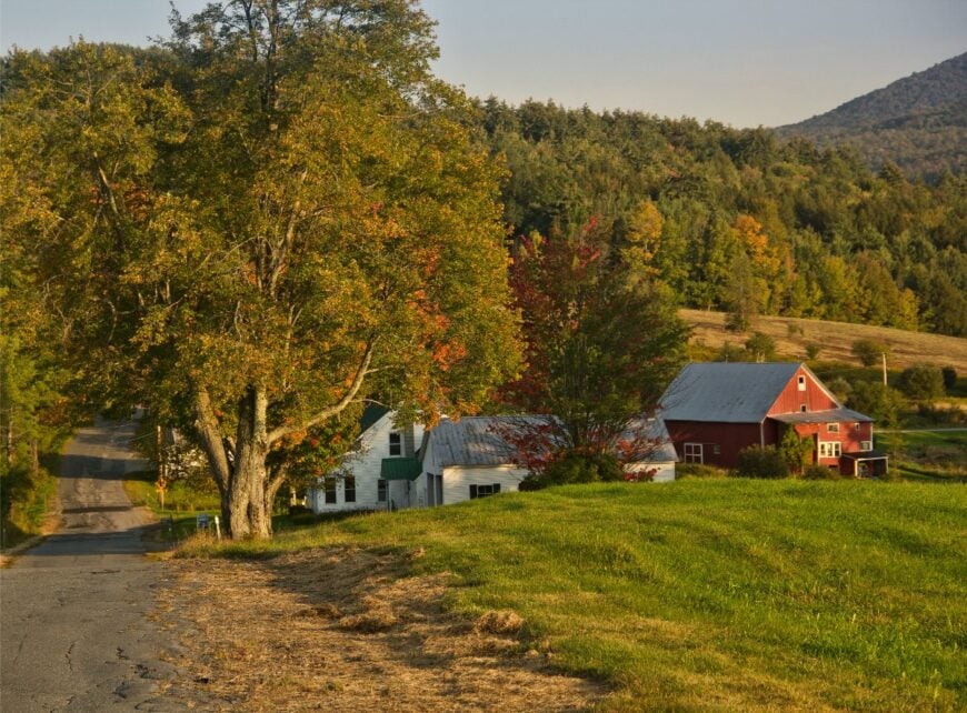
Landaff’s landscape is all old fields and high meadows, with blue hills holding the horizon in every direction. The town’s seclusion comes from its web of winding roads and the absence of any busy commercial strip—just a church, town hall, and long views.
Walk the ridge lanes at golden hour, watch hay roll in the fields, or follow bird song through thickets where cellar holes mark vanished farms. Residents balance small agriculture, trades, and remote work that thrives on solitude.
On clear nights, stars feel close enough to touch, reflecting off beaver ponds that sit just beyond the fence lines. It’s the kind of place where a waving neighbor is the day’s biggest event. Landaff makes quiet feel like a craft.
Where is Landaff?
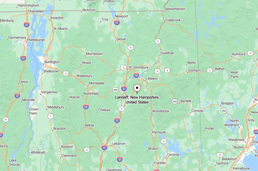
Set in western Grafton County between Lisbon and Bath, Landaff sits a few ridges off US-302 and I-93. Drivers peel away from those routes onto narrow town roads that roll over drumlins and pastureland.
The approach slows you down before you even arrive. It’s a short hop to the river towns, but the hills make it feel worlds away.
23. Ellsworth – A Tiny Town in Big Woods
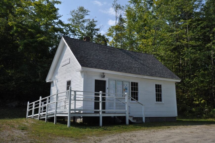
Ellsworth is the definition of tucked-away—one of New Hampshire’s smallest towns, wrapped in deep forest and steep hillsides. There’s no main street buzz here, just gravel spines that vanish into hemlock and maple.
Days pass with brook fishing, roadside berry picking, and long walks beneath cathedral-tall conifers. A handful of residents keep things going—some in the woods, some online—content with a town where the loudest sound is spring melt in the culverts.
Trails slip toward the White Mountain National Forest, and you can wander for hours without crossing a centerline. Night skies are black and brilliant. Ellsworth reminds you how big quiet can be.
Where is Ellsworth?
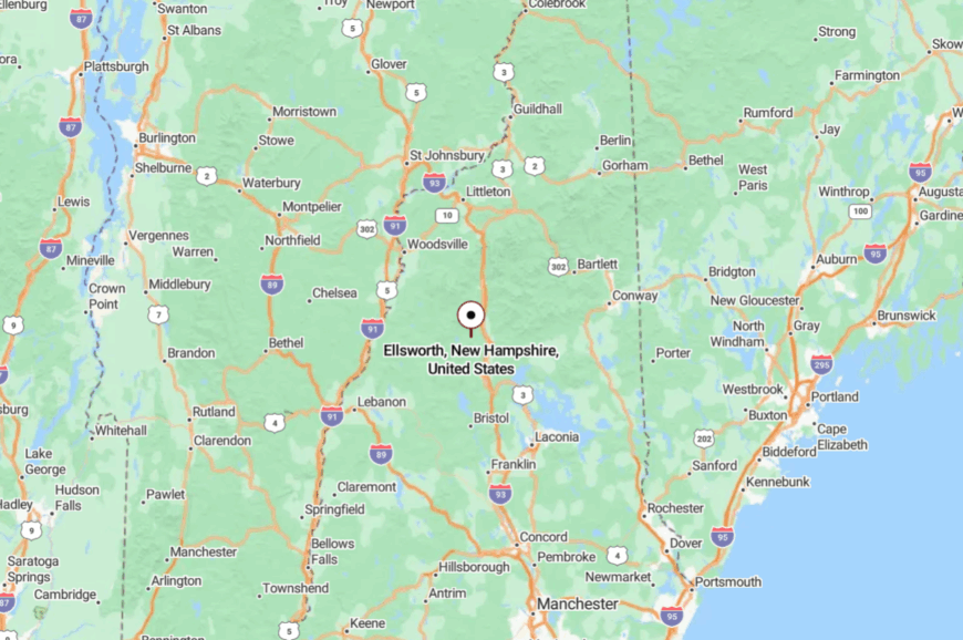
Hidden in central Grafton County, Ellsworth lies east of the Connecticut River Valley and south of the Kancamagus corridor. You reach it via two-lane routes that twist over high saddles before dropping to the town’s backroads.
There are no fast approaches; the land itself insists on a slower pace. It’s close to famous peaks, yet the forest keeps it secret.
22. Wentworth – On the Baker River’s Quiet Bends
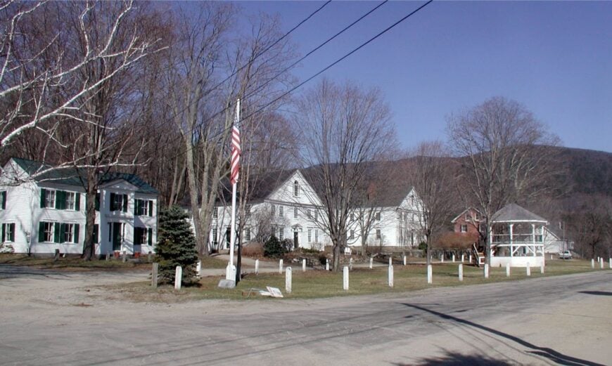
Wentworth spreads along the Baker River where gravel bars, oxbows, and farm fields stitch together a sleepy valley. Its off-grid feeling comes from being a step beyond the tourist bustle, with trailheads and conserved corners that stay hushed even in foliage season.
Paddle the Baker at dawn, poke around Plummer’s Ledge, or bike dirt loops that pass weathered barns and sugarhouses. Local life leans on small farms, trades, and a few river-season rentals.
In town, a simple green and white-steepled buildings keep time with the river. The whole place moves at the pace of the current over cobble. Wentworth is for people who measure a day by light and water.
Where is Wentworth?
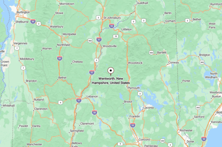
Wentworth sits in western Grafton County between Warren and Rumney, south of Mount Moosilauke. Most folks arrive on NH-25, then drift onto quieter lanes along the Baker River.
The highway fades fast; the sound of water takes over. It’s easy to reach, yet easier to forget where you were headed.
21. Rumney – Crags Above a Sleepy Village

Rumney is famous among climbers, yet the village itself keeps a low, neighborly hum. Step off the main crag parking lots and you’re in a river town of porches, gardens, and long, shaded lanes.
Hike the lesser-known forest roads, fish the Baker’s pools, or detour to covered bridges and farm stands in nearby valleys. A blend of outdoor tourism and local trades anchors the economy, but the residential pockets stay cocooned behind maples and stone walls.
Even on busy weekends, dusk quiets everything but peepers and the rush of the river. Rumney proves you can live next to adventure and still come home to calm.
Where is Rumney?
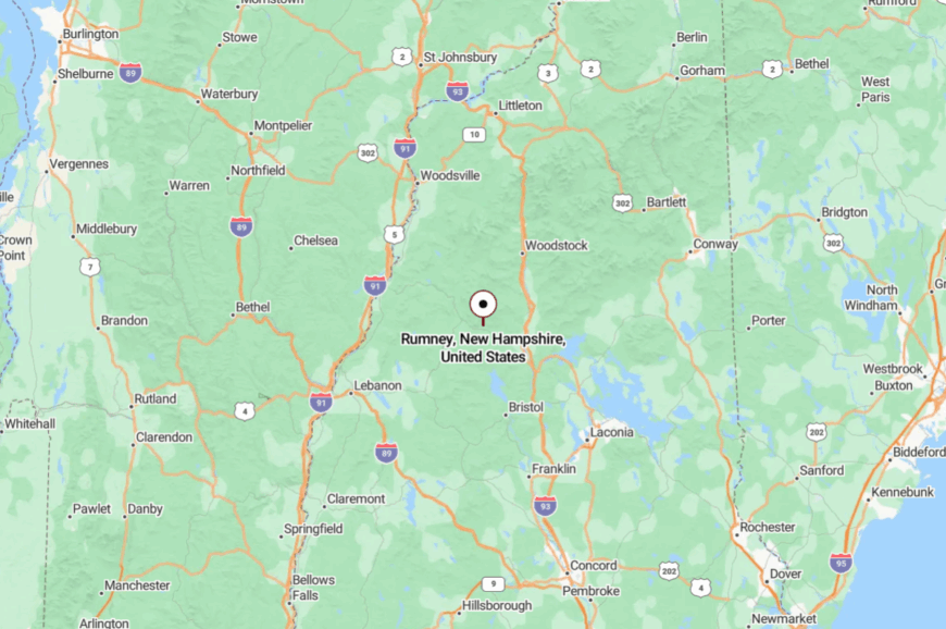
On the west side of the Pemigewasset Valley in Grafton County, Rumney sits just off NH-25 and a little west of Plymouth. The final miles wind along the Baker River toward Rattlesnake Mountain’s cliffs.
That bend off the main corridor keeps casual traffic down. The village feels tucked behind its own granite curtain.
20. Warren – Trailheads, Timber, and a Rocket on the Green
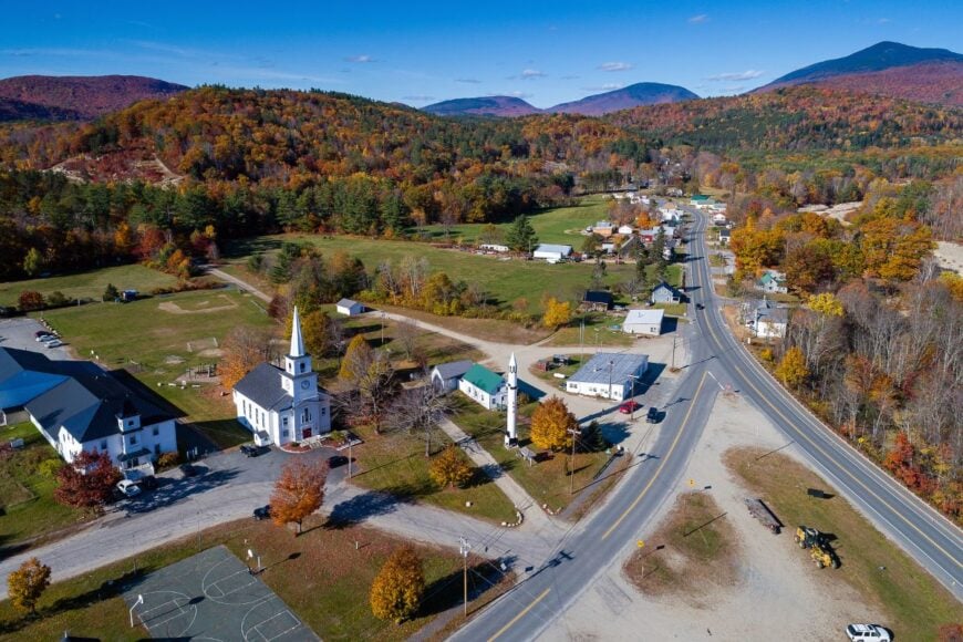
Warren looks like a gateway to big woods, with roads that arrow into the White Mountain National Forest and logging trucks as common as sedans. The town is sparsely settled, strung along valleys where moose sign appears in sandbars and the Baker River runs cold.
Hike toward Mount Moosilauke, swim deep holes, or start long gravel-bike loops into a forest that swallows cell service. Work tends to be seasonal and hands-on—forestry, trades, and small tourism tied to trailheads. The village green carries a quirky landmark: a restored Redstone rocket that makes kids grin and travelers do a double-take.


Evening comes on with woodsmoke and the sound of water over the ledge. Warren is wild country with a wink.
Where is Warren?
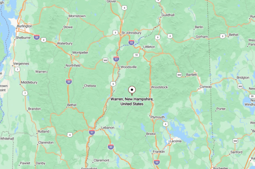
North of Wentworth in western Grafton County, Warren sits along NH-25 at the foot of Moosilauke. Once you leave Plymouth, the valley narrows and traffic thins to local pace.
Side roads quickly turn to gravel and disappear into the National Forest. It’s a straight shot on the map and a world away on the ground.
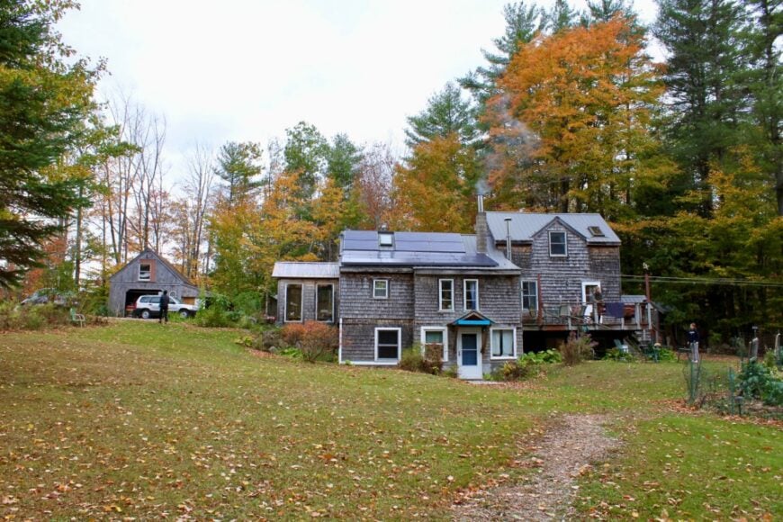
19. Springfield – Sunapee’s Quiet Back Side
Would you like to save this?
Springfield feels like the hush behind the Sunapee scene—lakes, long gravel lanes, and big tracts of state forest where cell bars fade. Gile State Forest and small ponds rimmed with spruce keep the town steeped in green.
Favorite days mean walking the Butterfield Pond path, launching a canoe at first light, or drifting past old cellar holes on mossy woods roads. People make a living via trades, remote gigs, and seasonal work tied to nearby resort towns—but they come home to deep quiet.
With no commercial strip and only a few wayfinding signs, the place keeps outsiders moving past without realizing what they’ve missed. Night skies return every star you’ve forgotten. Springfield is where the dial turns down to peaceful.
Where is Springfield?
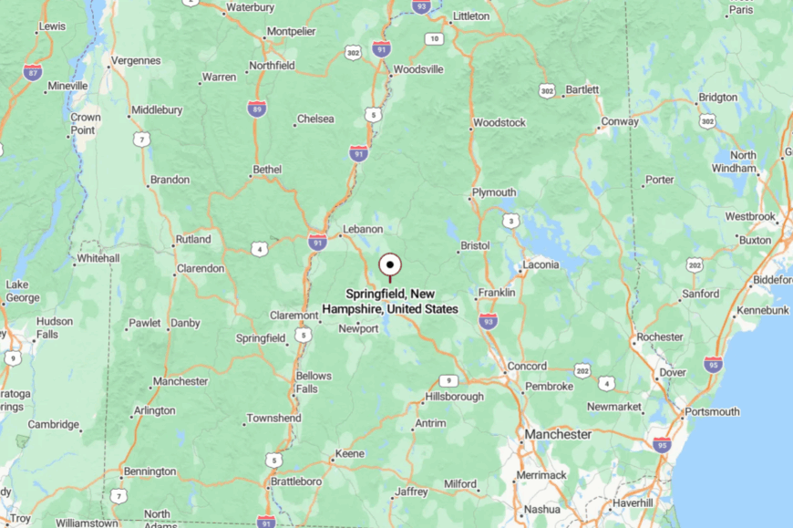
At the northeast corner of Sullivan County, Springfield lies east of Grantham and north of New London. You reach it off I-89 via smaller routes, especially NH-4A as it coils between woods and water.
Those last miles feel like a green tunnel. Close to everything—and somehow apart from it.
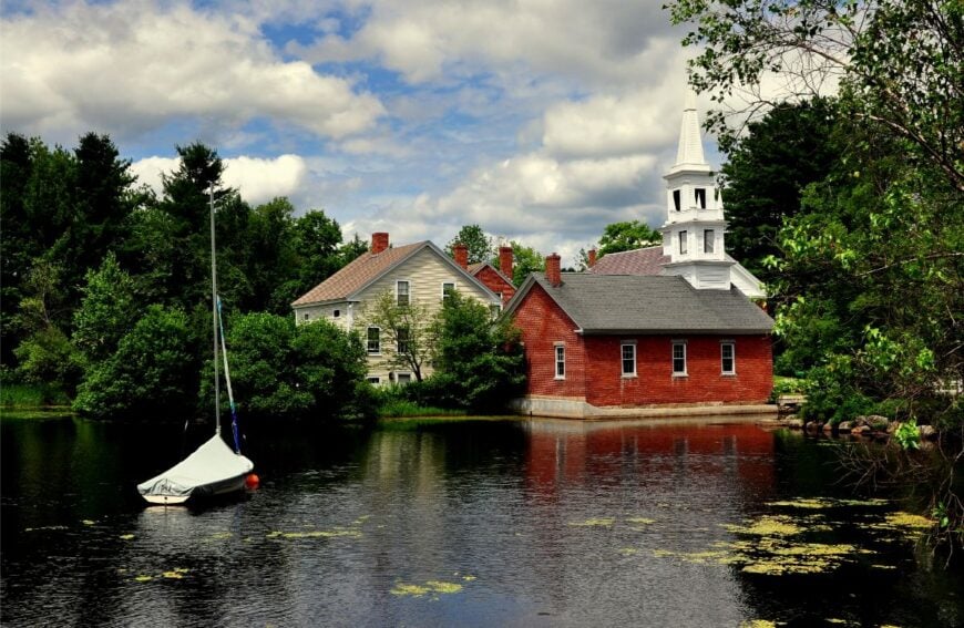
18. Nelson – Stonewalls, Fiddle Tunes, and Lake Breezes
Nelson’s hills are stitched with old stone fences and ring to the occasional fiddle from its long-running contra dance tradition. The town feels secluded by topography—steep, shoulder-to-shoulder uplands that keep traffic slow and the nights dark.
Swim Granite Lake at sunrise, walk the old town roads past cellar holes, or catch a community dance where strangers become partners in a few steps. Small farms, crafts, and remote work fit the rhythm here.
The historic village green is tiny, tidy, and unhurried—more conversation than commerce. When mist lifts off the lake, the day feels like a secret shared. Nelson is where time keeps a gentler beat.
Where is Nelson?
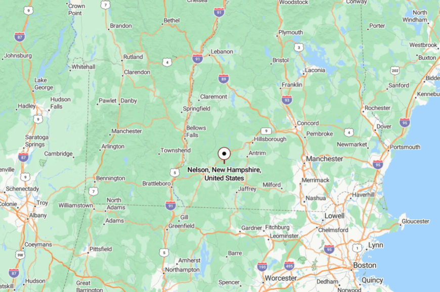
Nelson sits in Cheshire County, north of Keene and just off NH-101, tucked in the Monadnock highlands. Access is via curving, shoulderless roads that climb and dip through hardwoods.
The trip is short by miles and long by minutes. You crest a rise, and suddenly the modern world is behind you.
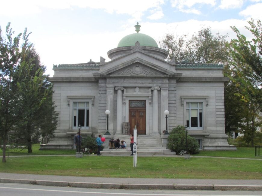
17. Harrisville – Mill Ponds in a Bowl of Hills
Harrisville gathers around brick mills and a chain of shimmering ponds, a little red-brick village cupped by forested ridges. Its sense of seclusion comes from being off the main drags and wrapped in water—the dams, brooks, and lakes that once powered looms now slow everything down.
Stroll the historic district, paddle glassy Harrisville Pond at dusk, or browse the general store before a loop around Nubanusit’s shores. Local livelihoods blend heritage crafts, small farms, and creative workspaces in restored mill buildings.
The village sounds are water over gates and the murmur of neighbors on front steps. When the mill walls glow at sunset, the scene feels timeless. Harrisville is proof that quiet can be lovingly made.
Where is Harrisville?
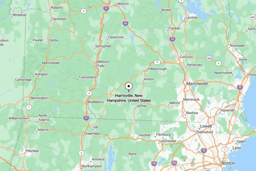
In the Monadnock Region of southwestern New Hampshire, Harrisville sits about 10 miles east of Keene, set back from NH-101 on smaller town roads. You approach through rolling pasture and stone-lined lanes that ease you into village speed.
Hills on every side muffle the outside world. It’s close enough for errands, far enough for stillness.
16. Alstead – Waterfalls and Back Roads North of Keene
Alstead sprawls across hilly country patterned with brooks, hidden ponds, and sugar maples, so even locals navigate by waterfalls and bend-in-the-road landmarks. The feeling of being off the grid comes from the distance to big stores and a patchwork of gravel byways that prefer pickup trucks to parking meters.
Explore town forests, wander to quiet cascades, or circle old farm lanes where stone walls and apple trees hint at earlier lives. People work in the trades, on small farms, or commute to Keene—then hurry home to a porch swing and the sound of water.
Summer brings farm stands and a few low-key gatherings; winter is for woodstoves and blue shadows on snow. Nights are ink-dark and starry. Alstead is the kind of place that reminds you how quiet the world can be.
Where is Alstead?
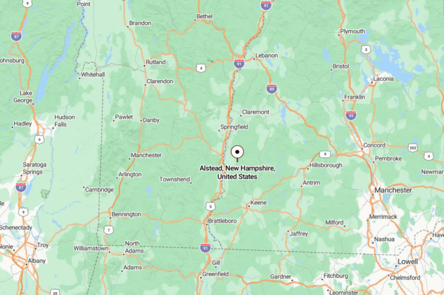
Alstead sits in northern Cheshire County, a cluster of uplands north of Keene and west of Lake Sunapee country. Most visitors snake in via Route 123 or 12A before peeling onto town roads that feel more like wooded lanes.
The last stretch slows you down, whether you planned to or not. It’s near everything by map, and far away once you arrive.
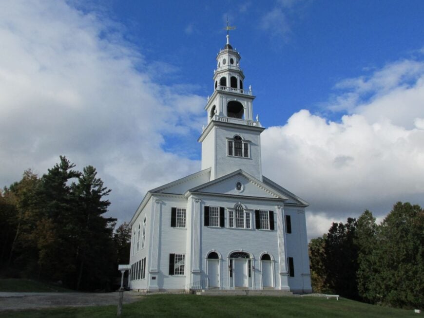
15. Acworth – A Hilltop Hamlet Above the Valley
Acworth’s hilltop setting makes it feel like a town lifted above the world. With just over 800 residents scattered across old farmsteads, the roads curl upward past stone walls and sugar maples until the horizon drops away into Vermont’s Green Mountains.
Days move slowly here, marked by visits to the historic village store, berry-picking along back roads, or concerts in the town hall that has stood since the 1820s. Logging and small-scale farming provide much of the income, while others commute quietly to nearby Claremont.
At night, the ridge seems to float in darkness, unbroken except for the glimmer of stars and the occasional porch light. Acworth’s silence isn’t empty—it feels protective, wrapping around those who call it home. It’s the kind of place that reminds you life can be both simple and high above the noise.
Where is Acworth?
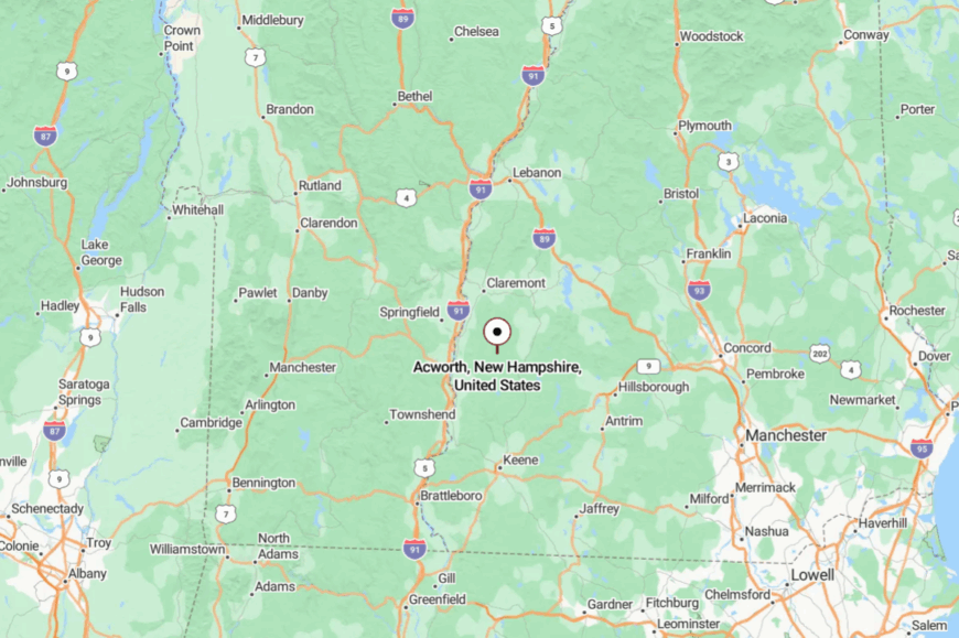
Acworth rests in southern Sullivan County, about 15 miles north of Bellows Falls, Vermont. Drivers reach it by climbing a winding series of county roads off NH Route 123.
The journey is steep, narrow, and often shaded by maples, which makes the arrival feel like stepping into a tucked-away hill village. From the crest, the valley below looks distant, as though the modern world stopped at the ridge line.
14. Goshen – The Hidden Door to Mount Sunapee
Though it borders the bustle of Mount Sunapee Resort, Goshen feels worlds apart, sheltered by wooded ridges and quiet backroads. The town is small, barely over 800 residents, with life centered around its one-room town hall and the occasional farm stand along the roadside.
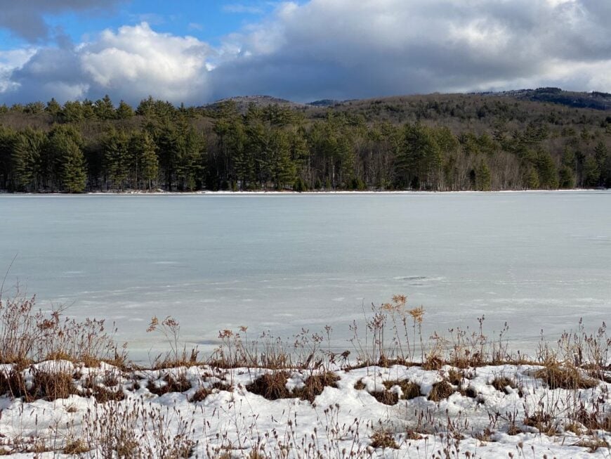
Locals pass the time fishing in Gunnison Lake, walking the quiet trails that loop its shores, or tapping maples in early spring. Employment is modest—retirees, small farm owners, and seasonal workers tied loosely to the resort—but the lack of a commercial strip keeps it hushed. Snow lies longer here, and the winding roads feel almost secretive in winter.
Goshen’s beauty lies in its modesty: a few lakes, a few fields, and more trees than people. It’s a reminder that the quietest places often hide right next to the busiest ones.
Where is Goshen?
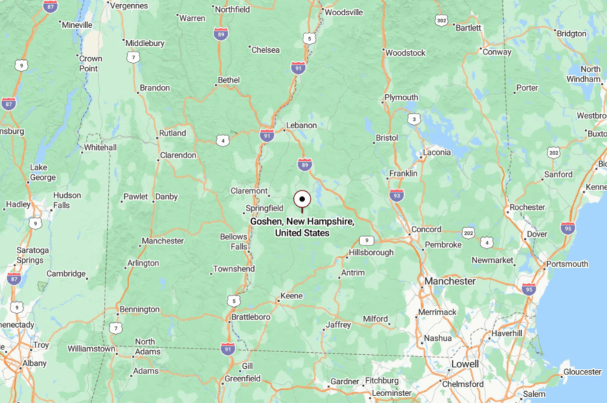
Goshen lies at the base of Mount Sunapee in Sullivan County, about 15 miles west of New London. Most visitors arrive via NH Route 10 before turning onto the narrower roads that wind through pine forest and farmland.
The town lacks a main highway exit, which naturally filters out through-traffic. Even with a ski resort next door, Goshen remains wrapped in its own calm, like a side road the world forgot.
13. Plainfield – Quiet Fields by the River

Would you like to save this?
Plainfield feels like a crossroads left behind, where meadows stretch toward the Connecticut River and white church steeples stand guard over time. Roughly 2,500 residents call it home, yet the village cores of Plainfield and Meriden retain the air of small hamlets.
Cultural surprises hide here, like the galleries at the Saint-Gaudens National Historic Site, but most of life revolves around farm chores, quiet walks, and small community suppers. Dairy, orchards, and craft businesses anchor the economy, with many commuting to Lebanon or Hanover. The back roads here are shaded, curving, and slow, giving the whole town a hushed, rural rhythm.
On foggy mornings, the valley feels adrift from the rest of the state. Plainfield draws you in with its sense of steadiness, as if nothing has to rush when the river is always near.
Where is Plainfield?

Plainfield rests in western Sullivan County, tucked along the Connecticut River about 10 miles south of Lebanon. Access comes by way of Route 12A, which traces the valley floor before turning into smaller farm lanes.
Without an interstate exit or big-box stores, the area maintains its quiet pace. From the riverbank, the rest of New Hampshire feels comfortably far away.
12. Orange – A Notch Town in the Shadows of Cardigan
Orange is the kind of place where the forest feels endless and the mountain takes center stage. Fewer than 400 people live here, spread out on dirt roads that vanish into hemlock stands. The town leans against the bulk of Mount Cardigan, where hikers find fire tower views and old stone foundations along forgotten trails.
Work is scattered—logging, sugaring, and remote jobs from nearby towns—but community still gathers at the Grange Hall for suppers. Nights are silent but for the whisper of wind through pines, and winters are long, with snow sometimes lingering into April.
There is no “main street,” just the comfort of space and solitude. Orange seems to whisper that wild country still exists if you know where to look.
Where is Orange?

Orange sits in Grafton County, just west of Newfound Lake and about 12 miles east of Lebanon. NH Route 118 is the main road in, cresting ridges before dropping into town.
No highway touches it, leaving the settlement shielded by hills and forest. The approach itself feels like a boundary crossing into another rhythm of life.
11. Marlow – Granite & Water Reflections
Marlow is as small as it is picturesque, with a classic white church mirrored in the Ashuelot River and hills closing in on every side. Barely 700 people live here, and the village green seems unchanged for centuries.
Fishing, kayaking, and snowshoeing dominate free time, while a few local farms and trades keep the workday steady. There’s no supermarket or gas station, just the sound of rushing water beneath the covered bridge and the call of geese overhead.
Route 10 passes through, but few cars stop, leaving the heart of town serene. It’s a place where history holds still and nature has the upper hand. For anyone seeking stillness, Marlow’s beauty is in its refusal to hurry.
Where is Marlow?
Marlow lies in southern Sullivan County, 15 miles north of Keene along NH Route 10. While a state highway runs through it, the surrounding ridges and forest quickly swallow traffic noise.
Visitors often pass through without realizing the village even exists. For those who pause, the feeling is of a river valley untouched by time.
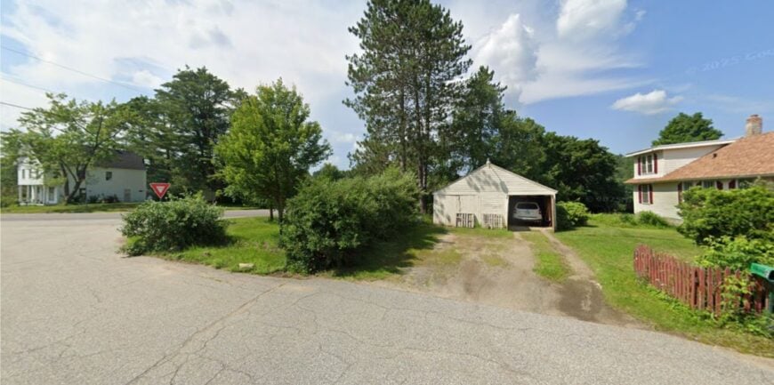
10. Lempster – Wind-Swept Ridge Living
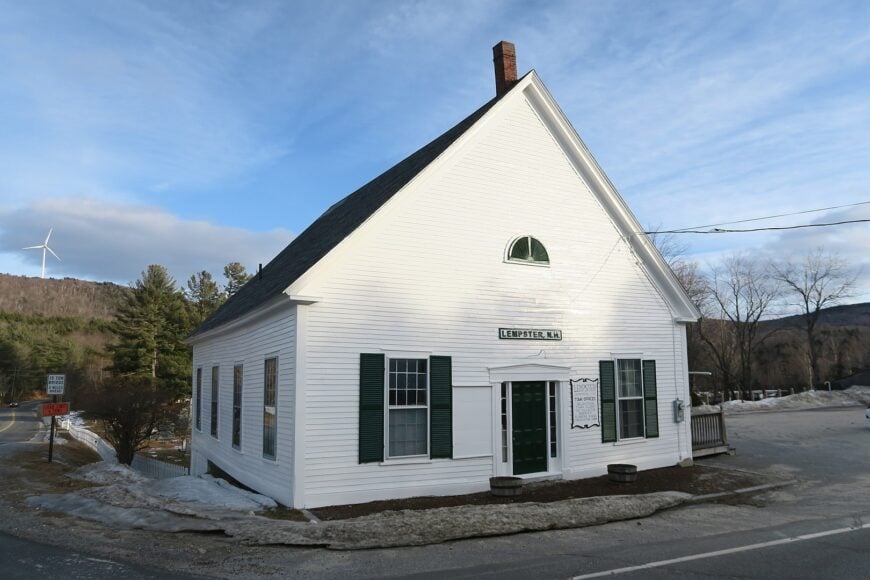
Roughly 1,000 people call Lempster home, most scattered across a 32-square-mile patchwork of spruce hills and old pasture. Residents spend weekends paddling on Long Pond, walking the gentle trails of Prentiss Forest, or climbing Oak Hill for a front-row look at the 24 gleaming turbines that now crown the ridge.
Aside from commuting to Keene or working remotely, income tends to come from small logging outfits, craftspeople, and the wind farm itself, which provides maintenance jobs and tax relief.
Night skies stay nearly ink-black thanks to the lack of retail lighting, and the only regular traffic noise comes from ATVs heading toward the multi-use rail trail.
Homes sit on three-, five-, or even twenty-acre lots, so neighbors remain visible only when invited. All of this combines to create a setting where silence and sweeping views feel like part of the deed.
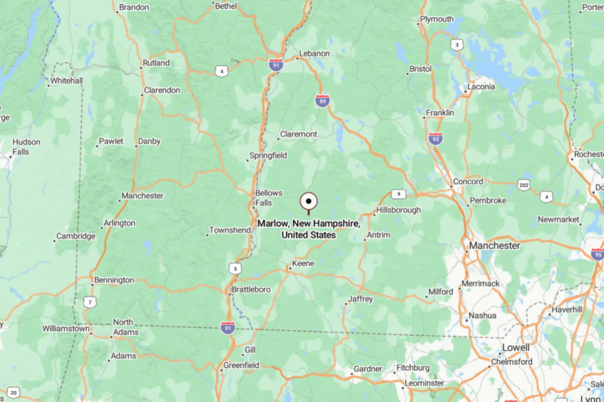
Where is Lempster?
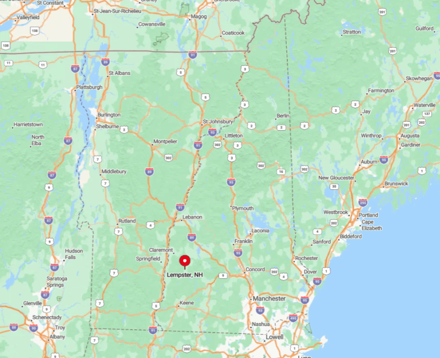
Lempster lies in southern Sullivan County, about 25 miles north of Keene and a few ridgelines west of Mount Sunapee. The town is boxed in by forest and town-owned conservation parcels, which block any direct highway approach and amplify its tucked-away vibe.
Drivers usually reach it by following NH Route 10 to a series of well-marked but winding local roads that climb steadily past stone walls and sugar maples. Winter visitors should plan on extra time, as plows leave the pavement last here and GPS signals occasionally fade among the higher hollows.
9. Washington – Lakes, Peaks and Little Else
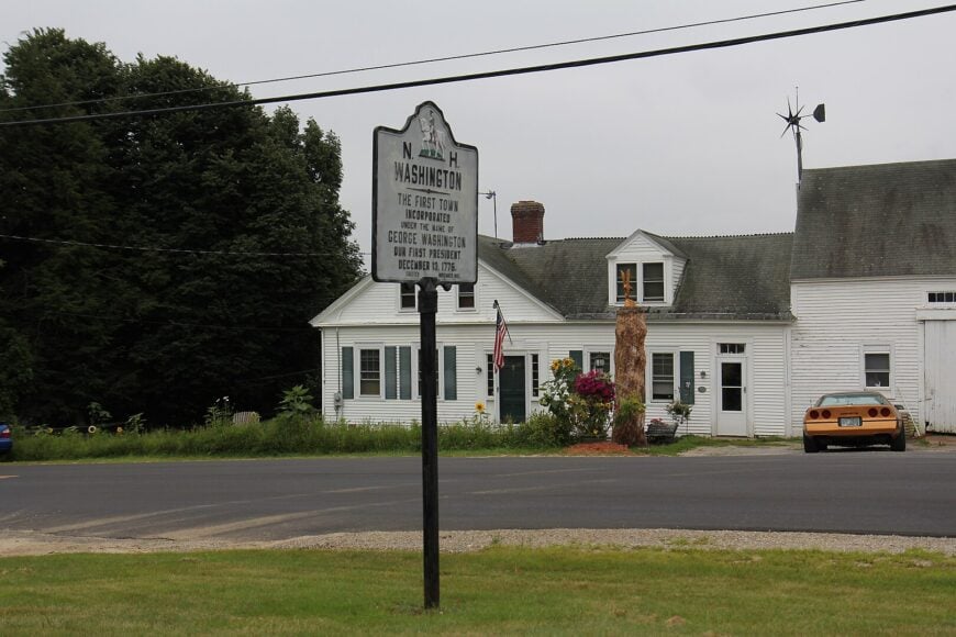
Washington supports just over 1,100 year-round residents spread over 48 square miles, translating to fewer than 30 people per square mile. Locals spend free hours fishing Highland Lake, swimming at the public beach on Millen Pond, or heading up the 2,018-foot summit of Lovewell Mountain for views clear to Vermont.
Seasonal tourism and cottage rentals around the lakes supply many paychecks, supplemented by forestry, maple sugaring, and a small but active home-based business scene. Gravel roads outnumber paved ones, and cell service still drops behind certain bends, keeping the modern world at a respectful distance.
Nightlife means a campfire and the echo of loons rather than neon signs. Because 80 percent of the land remains uncleared woodland, even peak summer feels calm once the last boat leaves the water.
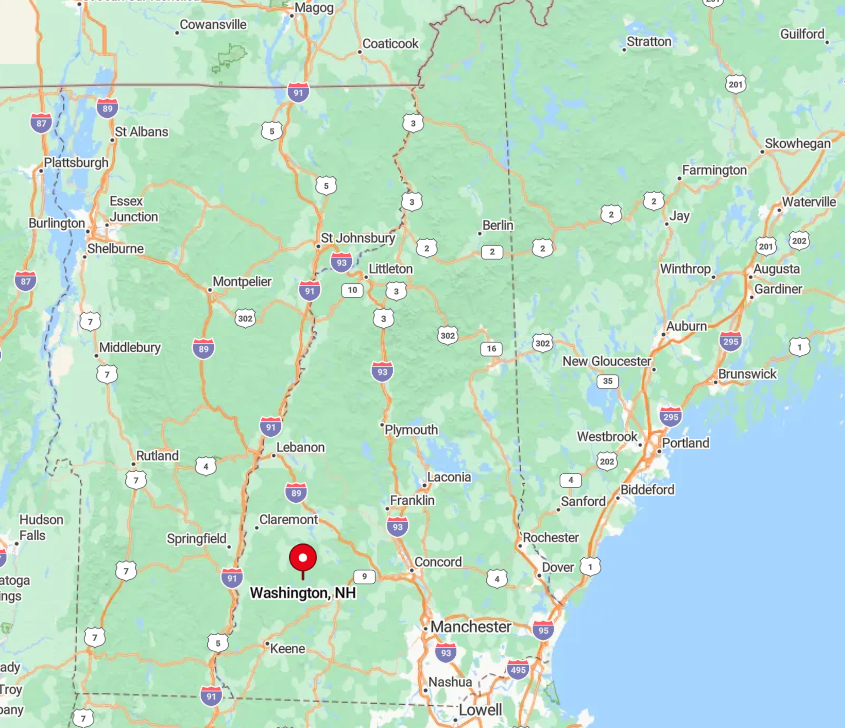
Where is Washington?
Would you like to save this?
Set in the uplands of northern Hillsborough County, Washington sits roughly halfway between Newport and Hillsborough yet remains a solid 30-minute drive from the nearest full grocery store. The ring of lakes and the Pillsbury-Sunapee Highlands form a natural moat that discourages through-traffic.
Access comes by way of NH Route 31, but drivers quickly find themselves on town-maintained gravel spurs that slow the pace to under 30 miles per hour. Winter requires either good snow tires or a local plow contract, which helps explain why the town keeps its low profile.
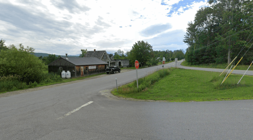
8. Dorchester – A Timbered Hideaway off the Appalachian Trail

Fewer than 400 residents share Dorchester’s 45 square miles of spruce-cloaked slopes, making it one of Grafton County’s most lightly settled places. Hikers often tackle the nearby Jeffers Brook segment of the Appalachian Trail or explore the abandoned hill farms along the Class VI roads that thread the forest.
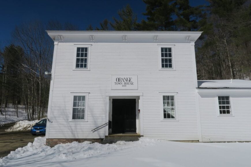
Employment leans toward small-scale logging, maple syrup operations, and remote tech work that piggybacks on a handful of fiber lines strung in recent years. Town events center on the historic Town House, built in 1828, where potluck suppers still pack the room each autumn.
Wildlife outnumbers people by a healthy margin, evident in the moose tracks that regularly appear on the town clerk’s dirt parking lot. The sheer distance to chain stores or fast food, coupled with a landscape dominated by conserved timberland, grants Dorchester its deep-woods calm.
Where is Dorchester?
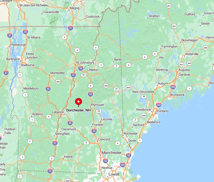
Dorchester sits east of the Connecticut River Valley, 18 twisting miles north of Lebanon and several ridgelines beyond any Interstate. The absence of major east-west highways means visitors approach via NH Route 118, a roller-coaster of pavement that tops out at nearly 2,000 feet before dropping into town.
Cell reception fades in the hollows, and the last gas station sits back in the village of Canaan, so travelers top off before making the climb. Those willing to navigate the curves are rewarded with quiet trailheads and stream-cooled campsites seldom marked on tourist maps.
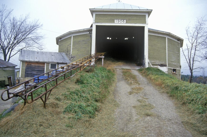
7. Benton – At the Foot of Mount Moosilauke
Permanent population in Benton hovers near 60, although summer cottages briefly triple that figure during July blueberry season. Outdoor life revolves around climbing 4,802-foot Mount Moosilauke, wandering Tunnel Brook Trail among beaver ponds, and hunting the hidden waterfalls in scenic Wild Ammonoosuc Gorge.
Paid work is scarce; most residents either manage vacation rentals, harvest timber on family lots, or commute to construction jobs in neighboring Warren. The town center consists of a white-clapboard church, a one-room schoolhouse now used for meetings, and a tiny post office that shares a wall with the fire station.
Because the community sits entirely within the White Mountain National Forest, granite ledges and thick spruce stands block noise from nearby tourist corridors such as Route 112. Even on fall foliage weekends, Benton keeps its unhurried hush.
Where is Benton?
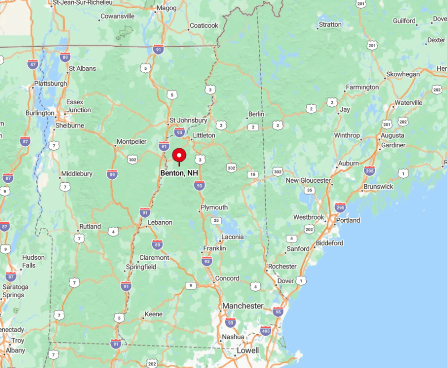
Benton occupies a high valley in northwestern Grafton County, wedged between Kinsman Ridge and the bulk of Moosilauke. The surrounding federal forest restricts development, ensuring that only a handful of gravel roads break the treeline.
Access comes from the south via Tunnel Brook Road or from the east by crossing Kinsman Notch on Route 112, both of which close to through traffic once the first heavy snow falls. As a result, winter visitors often arrive by snowmobile or backcountry skis rather than by sedan.
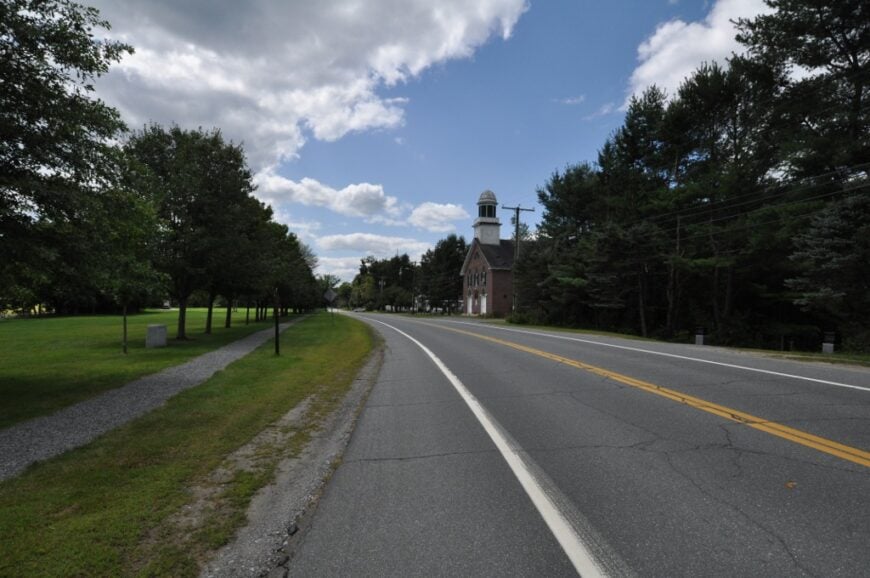
6. Piermont – Connecticut River to Mountains Solitude
About 760 residents live in Piermont, enjoying a rare mix of fertile bottomland along the Connecticut River and the forested slopes of 2,717-foot Piermont Mountain.
Favorite pastimes include paddling the river’s calm oxbows at dawn, casting for trout in Lake Tarleton, and browsing the Saturday farm stand that operates on the honor system beside the town green.
Agriculture—dairy, corn, and maple—still provides several full-time livelihoods, complemented by telework from Dartmouth-Hitchcock employees who prefer a quieter ZIP code. With only one general store, a handful of B&B rooms, and no streetlights along Route 25, nighttime stays crisp and dark.
The river forms a natural western boundary, while state-owned woodland hems in the east, buffering Piermont from expanding suburbs. That geographical sandwich keeps daily life here steady and slow.
Where is Piermont?
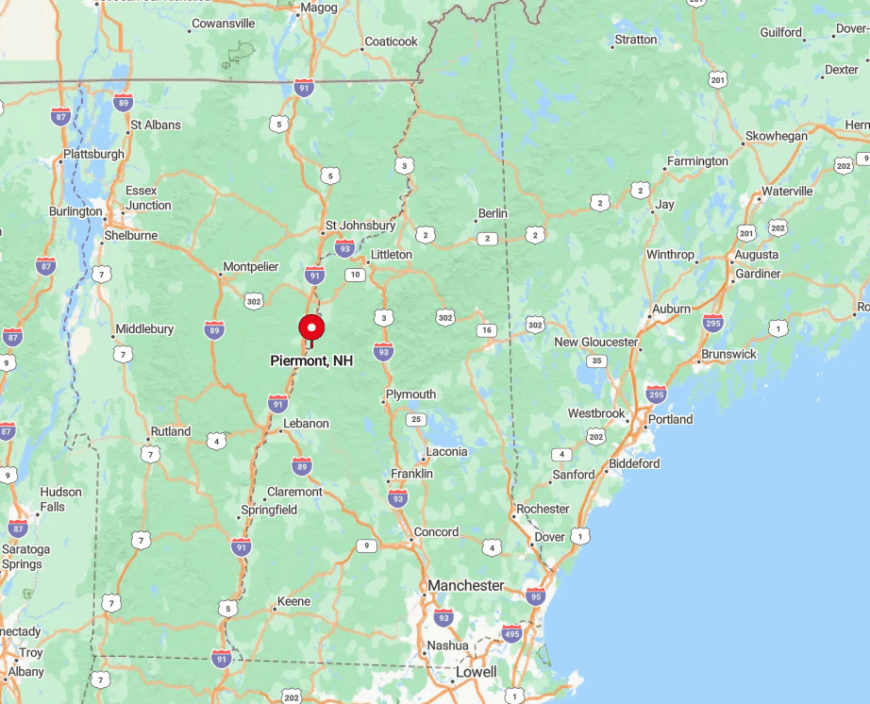
Piermont rests on the Vermont border, twenty miles north of Hanover but far enough from Interstate 91 to dodge through-traffic. The river, soft floodplain soils, and a lack of bridges channel motorists toward the town’s sole crossing at Bradford, Vermont, limiting casual drop-ins.
Most visitors arrive via NH Route 25, then follow a short loop up Cape Moonshine Road for trailhead access or farm visits. In winter, the terrain funnels prevailing winds in ways that drift the roads; locals keep shovels and sand bags in every truck.
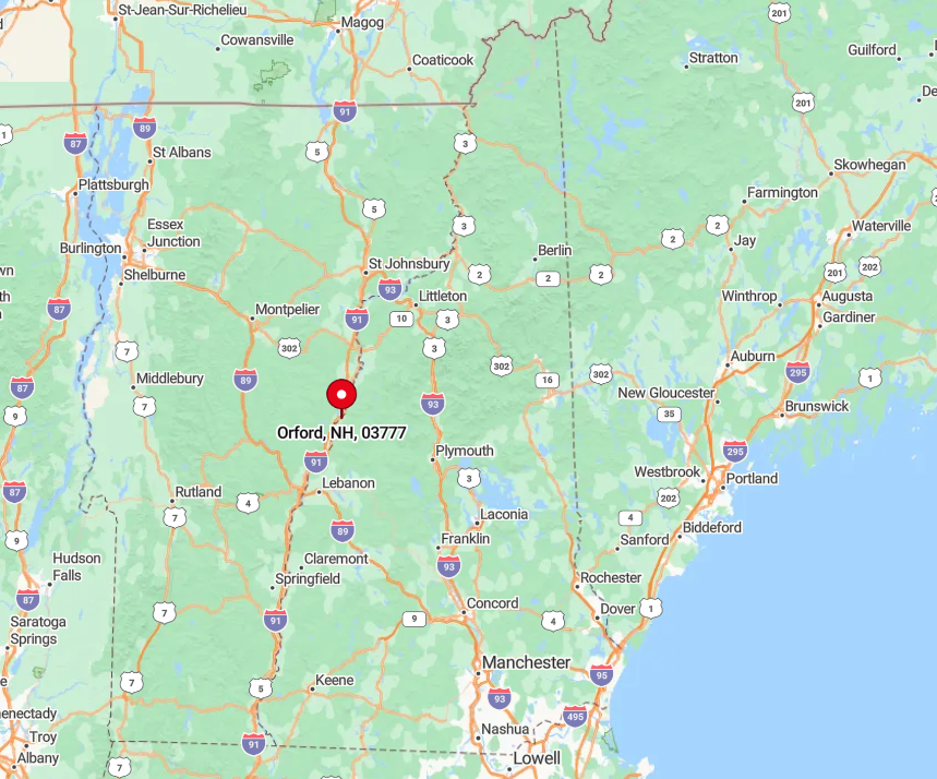
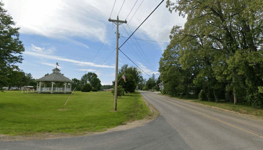
5. Orford – Hidden Hill Farms and Historic Ridge Stretches
Orford’s population sits just over 1,200, with homesteads tucked behind the famous “Seven Ridge Houses,” a stretch of Federal-style homes admired by architectural students nationwide.
Recreation ranges from kayaking the Connecticut River to bushwhacking up 2,000-foot Sunday Mountain, whose summit meadows burst with lupine each June.
Agriculture and small equine businesses form the economic backbone, but many households also rely on high-speed fiber to telecommute to Dartmouth College or startups in the Upper Valley. Strict zoning requires multi-acre parcels, ensuring that stone walls, not subdivision signs, dominate the landscape.
Even the village center carries a timeless feel, with a single blinking light and a library housed in an 1851 Greek Revival building. This deliberate protection of open space keeps Orford insulated from modern sprawl.
Where is Orford?
Located on NH Route 10 along the east bank of the Connecticut, Orford lies fifteen minutes north of Lyme yet feels far removed once one turns up the ridge roads toward Quinttown. The Green Mountains guard the western horizon, while to the east an unbroken chain of forest climbs toward Mount Cube, discouraging lateral travel.
Visitors approach via a scenic byway rather than an interstate exit, which slows things down from the first mile. The nearest franchise store sits across the river in Fairlee, Vermont, leaving local businesses to set the pace.
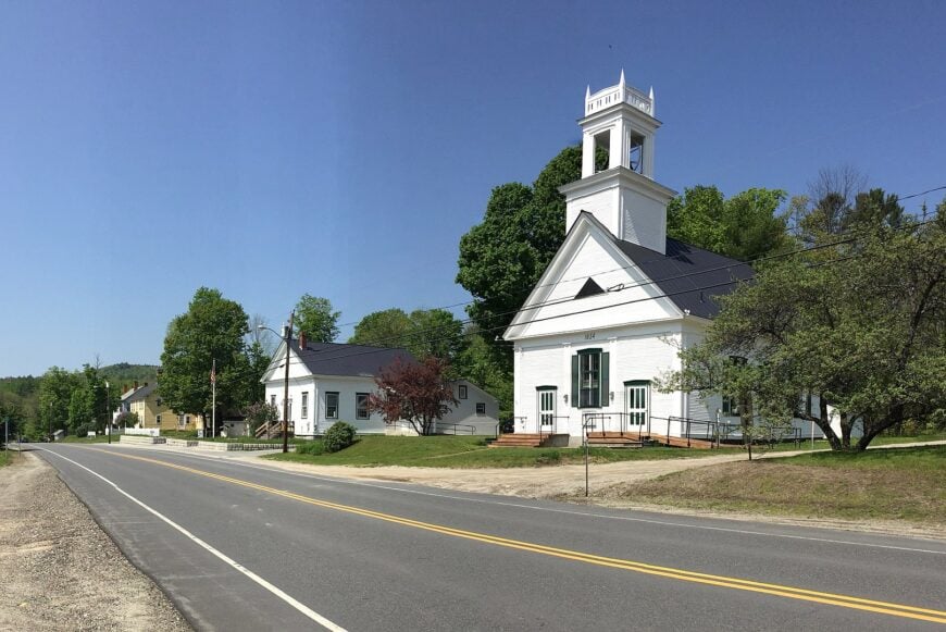
4. Unity – Granite Knolls and Quiet County Roads
Unity’s 1,700 residents have plenty of elbow room thanks to zoning that preserves roughly half the town as open space laced with granite outcrops and kettle ponds. Locals fish in Crescent Lake, ride horses along the historic Second NH Turnpike, and stop for ice cream at the seasonally open Main Street stand in neighboring Newport.
Timber, small-scale agriculture, and trades work in Claremont provide most paychecks, with a growing group of remote employees enjoying fiber installed along the main corridors.
Traffic rarely amounts to more than a school bus and a few pick-ups, allowing owls to be heard clear across the valley at dusk. Long sightlines from Summit Road reveal why housing lots here average five acres or more. Those generous buffers play a big part in the town’s reputation for privacy.
Where is Unity?
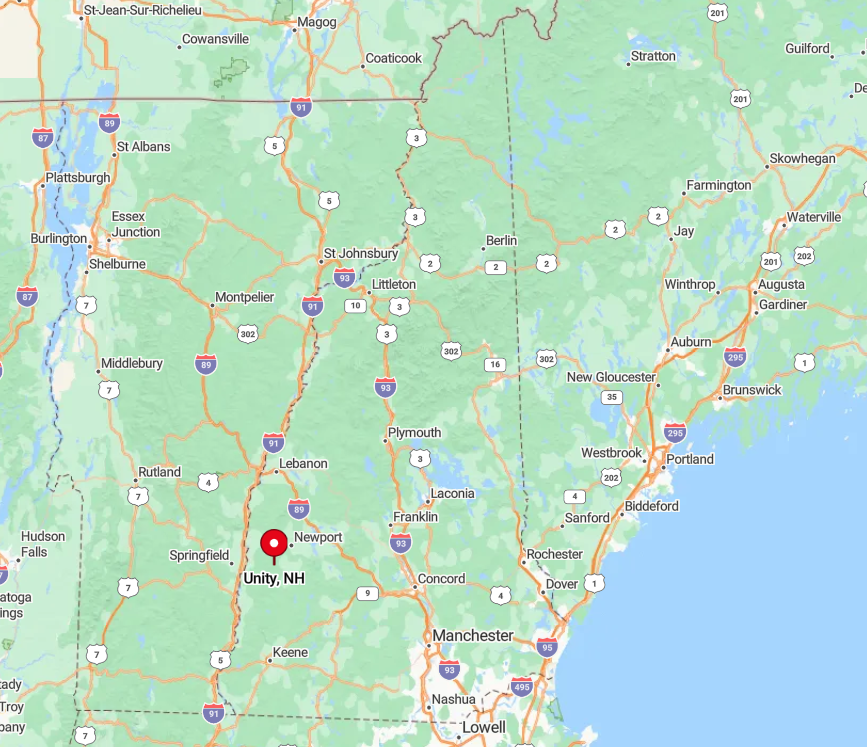
Unity sits south of Mount Sunapee in Sullivan County, buffered from resort crowds by a set of parallel ridges that hide it from Route 103. The lack of a direct highway exit means travelers loop in from Claremont on NH Route 12, then weave along county roads that rise and dip like a roller coaster.
Winter weather can turn those same roads into snow tunnels that dissuade casual day-trippers. As a result, Unity remains largely the domain of residents and their invited guests.
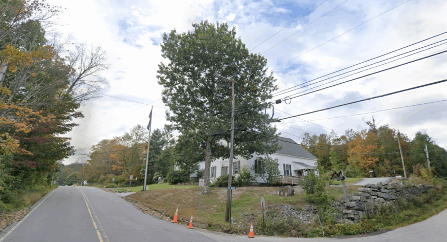
3. Croydon – Sunapee Range’s Secluded Sister
Only 714 people reside in Croydon, most on large wooded lots scattered around Crescent and Spectacle Ponds. Recreation leans heavily toward the outdoors: paddling Coniston Lake at dawn, hiking Croydon Peak’s unblazed route, or attending the annual bluegrass weekend at Newport’s Chase Landing just over the line.
Income stems from cottage rentals, small farms, and seasonal work at nearby Mount Sunapee, though the absence of a commercial strip keeps the tax base modest. There is no downtown beyond the village school, a white steepled church, and the venerable town hall, all of which close by eight.
Forested ridgelines form a natural barrier between Croydon and its busier neighbor, shielding residents from tourist traffic and cellphone towers alike. Even during peak foliage, one can drive a mile without seeing another vehicle.
Where is Croydon?
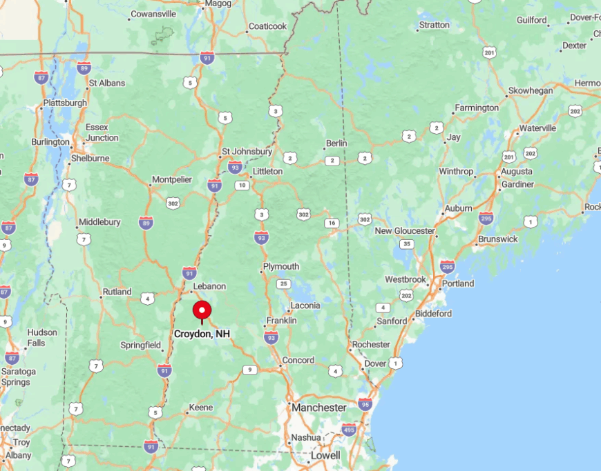
Croydon lies directly west of Lake Sunapee yet remains out of sight of the resort’s slopes, nestled between Routes 10 and 11 with no signage luring motorists off the main drag. Access comes via Croydon Brook Road or the aptly named Cash Street, both of which narrow to single-lane stretches bordered by stone walls.
This limited entry, combined with thousands of acres of conserved forest, reinforces the town’s low-key aura. Visitors who brave mud season should expect to share the way with more wild turkeys than cars.
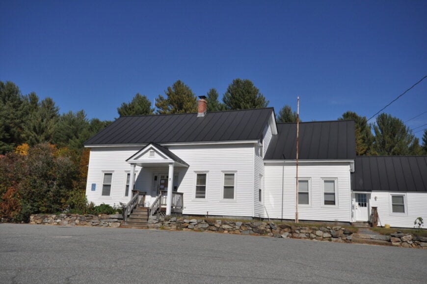
2. Stoddard – Pitcher Mountain’s Fire-Tower Frontier
Stoddard supports just under 1,300 full-time residents, but houses average one per forty acres thanks to high-elevation plateaus and extensive conservation land.
Families spend free time climbing the short yet rewarding Pitcher Mountain trail, picking wild blueberries near the summit fire tower, or paddling Island Pond’s glassy waters. Local wages come from cottage rentals, sustainable forestry, and a small network of artisans who sell pottery and stained glass at summer festivals.
Because most roads top out above 1,500 feet, snowfall lingers here long after Keene’s sidewalks have turned to slush, discouraging casual commuters. Electric power lines follow buried routes to preserve views, and the absence of billboards keeps night skies pristine.
Those features, along with the twisting back roads north of Peterborough, make Stoddard feel worlds away despite its place on the map.
Where is Stoddard?
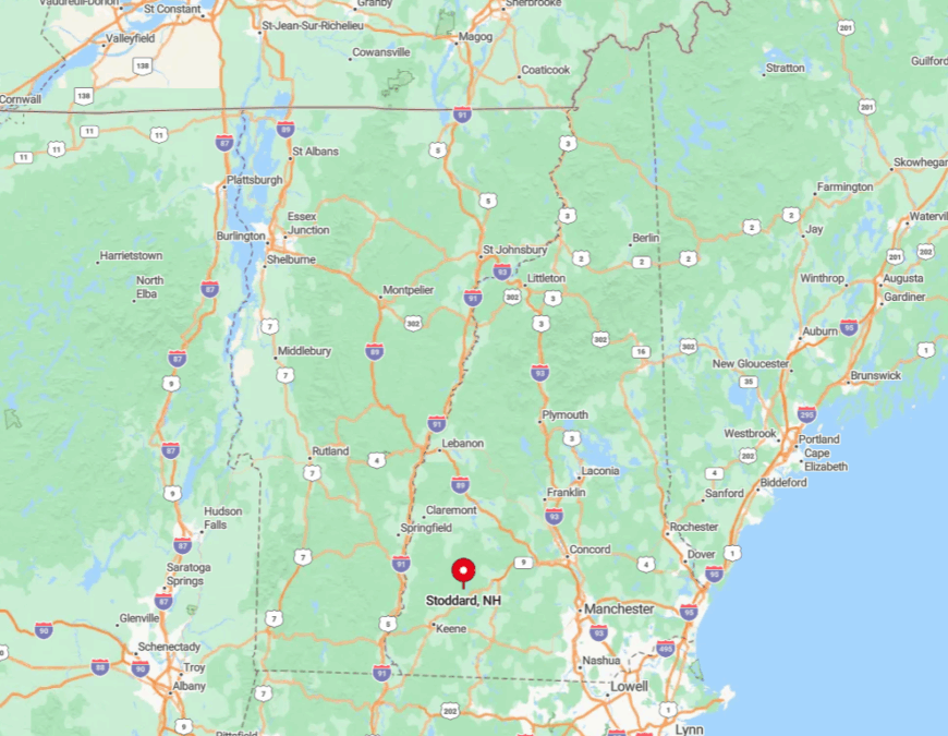
This Cheshire County town sits along NH Route 123, twenty miles southeast of Grantham yet thirty minutes from the closest grocery run in Peterborough or Keene. The upland terrain and kettle ponds create natural bottlenecks that keep traffic sparse.
Drivers typically enter from Route 9, then slow to a crawl on Old Antrim Road’s gravel segments before reaching the village center. Winter access sometimes hinges on whether the volunteer road crew has reached your stretch before dawn, a reality that preserves Stoddard’s frontier mood.
1. Grafton – Wildflower Meadows Between Two Peaks
Around 1,340 residents make their homes in Grafton, which fans out across 45 square miles between Ragged Mountain to the south and Mount Cardigan to the north.
Weekend pursuits include photographing lupine fields along Wild Meadow Road, paddling Kilton Pond for sunset loon calls, or cycling the Northern Rail Trail that slices through town. The local economy is a patchwork of hay farms, home workshops, and outdoor guides who lead climbing trips on nearby cliffs.
With a population density near 24 people per square mile and no traffic lights, quiet dominates, broken only by spring peepers or the occasional passing freight on the New England Central line.
Numerous cellar holes from abandoned nineteenth-century farmsteads remind newcomers how long this valley has resisted crowding. That historical resistance continues today through strict land-use rules that favor five-acre minimums and keep big-box retailers comfortably distant.
Where is Grafton?
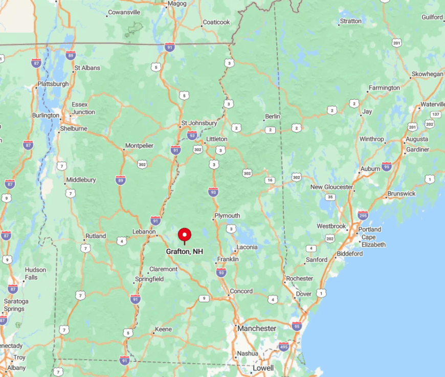
Grafton occupies a broad basin in northern Merrimack Valley headwaters, fifteen curvy miles east of Interstate 89 at Enfield. The town’s only state route, NH 4A, winds past beaver ponds and rolling hay fields before connecting with larger roads, effectively slowing visitation.
Granite ridges on both flanks block cell towers and confine settlement to the valley floor, adding to the sense of retreat. For travelers without a car, the closest intercity bus stop sits all the way in Lebanon, underscoring just how removed Grafton remains.