🔥 Would you like to save this?
Western Maine’s high country is a lattice of ridges, lakes, and winding roads that cut through spruce forests and weathered granite. The terrain rises and falls in long folds, shaped by glacial ice and river currents, with towns tucked into hollows or spread along the shorelines of deep, cold lakes. In summer, the air carries the resin of pine and the hum of insects; in winter, snow mutes everything but the wind.
These communities are small enough that a single store might double as a post office, café, and bulletin board. You’ll find clapboard houses leaning toward the sun, barns with their paint worn thin, and narrow bridges that lift you over quick-running streams. Some of the main streets still have hitching posts, not as ornament, but because someone might actually use them.
In order to come up with the very specific design ideas, we create most designs with the assistance of state-of-the-art AI interior design software. Also, assume links that take you off the site are affiliate links such as links to Amazon. this means we may earn a commission if you buy something.
Seclusion here isn’t a marketing promise — it’s the result of geography. Roads loop in and out like threads in a loose weave, often ending where a mountain shoulder or a chain of ponds decides they should. A neighbor might live a mile down a dirt road, yet still know what time you cut your firewood.
Each town carries its own rhythm. In one, the day’s center might be the clink of pool balls at a general store. In another, it’s the sudden scatter of gulls when the mail truck rattles into view. Western Maine’s secluded mountain towns don’t announce themselves; they let the landscape do the talking.
25. Rangeley Plantation
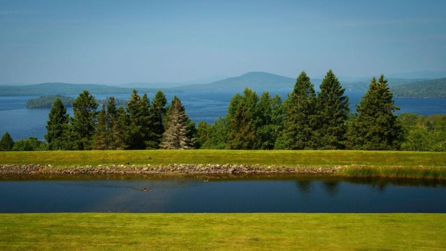
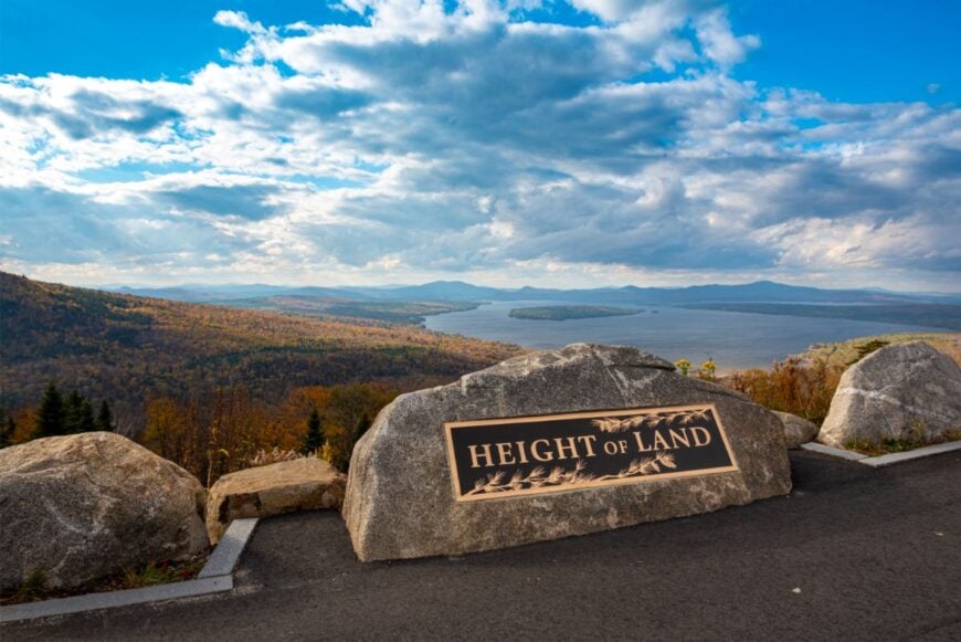
Rangeley Plantation is a quilt of lakeshore, pine forest, and slow roads stitched together with the kind of quiet you can step into. Its seclusion is a mix of geography and choice—just far enough from the busier Rangeley village, and wrapped by the wide arms of Rangeley and Mooselookmeguntic Lakes.
Cast for trout at dawn, hike up Bald Mountain for a view that seems to swallow the map, or drift by canoe into coves where you hear only the wind on water. Many camps are seasonal, and the year-round neighbors tend woodstoves and small gardens in sight of the shore.
The nights are black-velvet dark, pierced by stars and the occasional loon call. Life moves here at the pace of paddles and footsteps. It’s the kind of place where even the air feels unrushed.
Where is Rangeley Plantation?
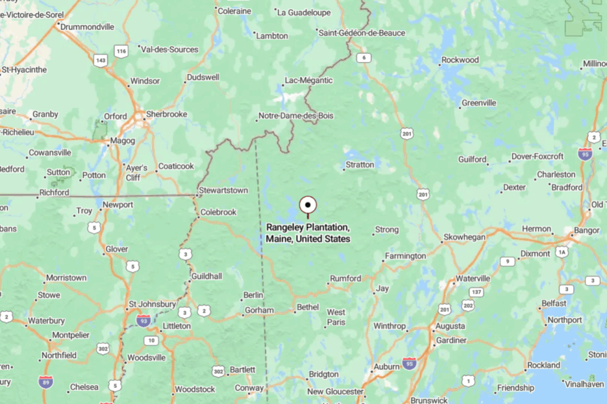
Rangeley Plantation sits in western Franklin County, about 10 miles southwest of the village of Rangeley along ME-4. The drive skirts the lake’s eastern shore before bending into quieter stretches with water glimpses through the trees.
Gravel turn-offs lead to small docks, trailheads, and hidden camp roads. It’s close enough for a grocery run, yet feels like a separate, slower world.
24. Byron
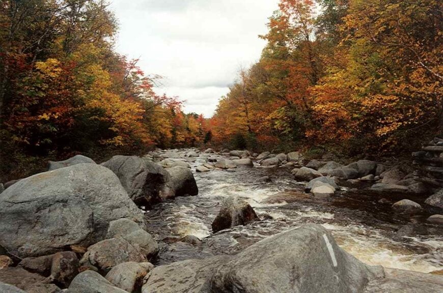
Byron is a ribbon of homes along Route 17 where the Swift River braids through boulders and the hills close ranks. Seclusion here is equal parts distance and terrain—steep forested ridges, long gaps between neighbors, and a road that prefers scenery to speed.
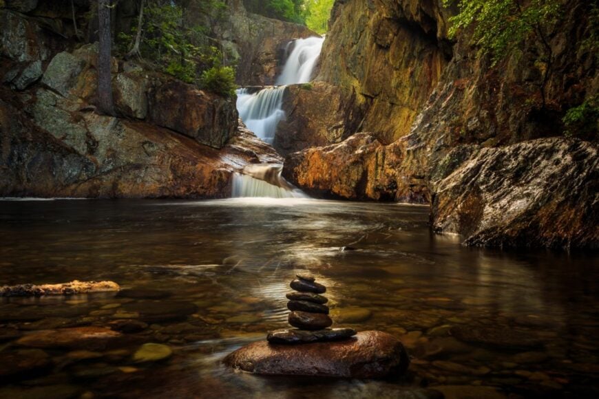
Swim or picnic at Coos Canyon, pan a little gold in the river gravel, or trace old tote roads that climb toward blueberry knobs. A few maple shacks steam in March, and small woodlots keep chainsaws humming at dawn.
Night skies go inky fast once the canyon shadows lengthen. The town feels sturdy, hand-hewn, and a little bit mythic. It’s the kind of place that teaches you to listen for water.
Where is Byron?
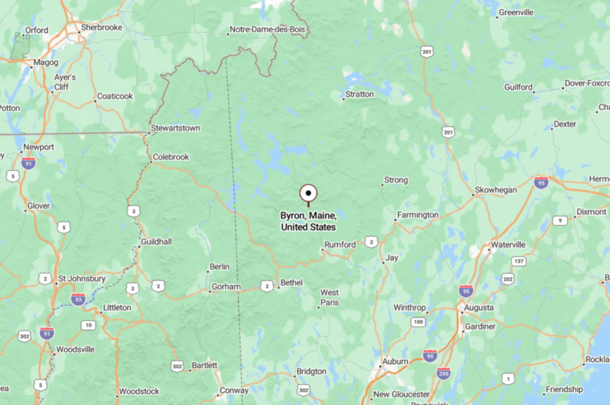
You’ll find Byron in Oxford County on the scenic “Moose Alley” stretch of ME-17 between Mexico and Rangeley. Approaches twist beside the Swift River, with guardrails giving way to granite and spray.
Services thin out quickly after you leave the Androscoggin Valley. When you arrive, cliffs and current make it clear you’re somewhere apart.
23. Madrid Township
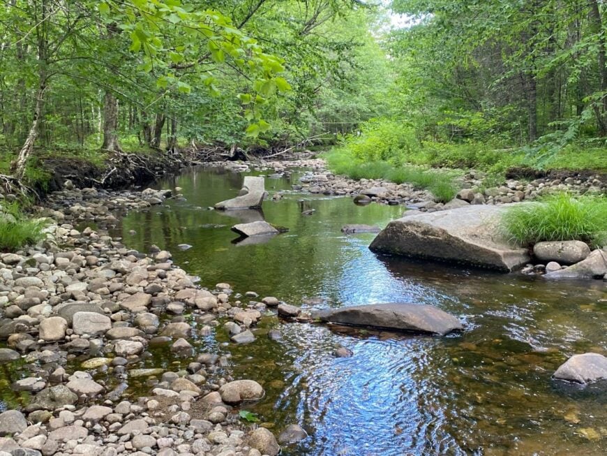
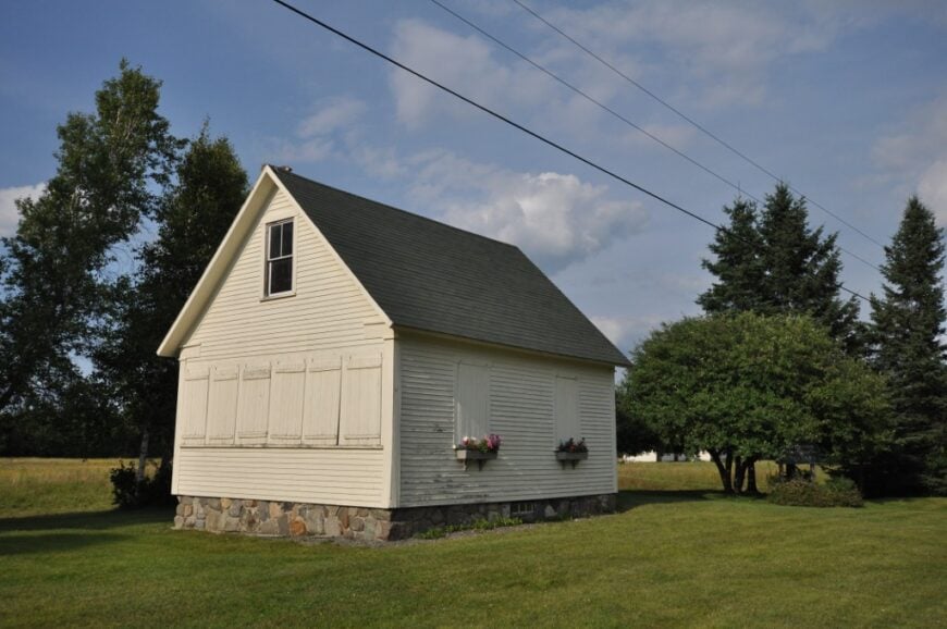
Madrid Township is all quiet roads and stone-walled clearings, a deorganized place where the forest reclaimed most of what people built. Its tucked-away feel comes from long distances between driveways and the way the hills of the High Peaks lean inward.
Walk to Smalls Falls before breakfast, paddle eddies on the Sandy River, or follow the Fly Rod Crosby Trail through ferns and old cellar holes. The economy is part-time cabins, sugaring seasons, and the occasional logging cut.
Evenings smell like pine pitch and woodsmoke, and loons carry sound down the valley like a string. It’s humble, spare, and beautiful. It’s the kind of stillness you can hear.
Where is Madrid Township?
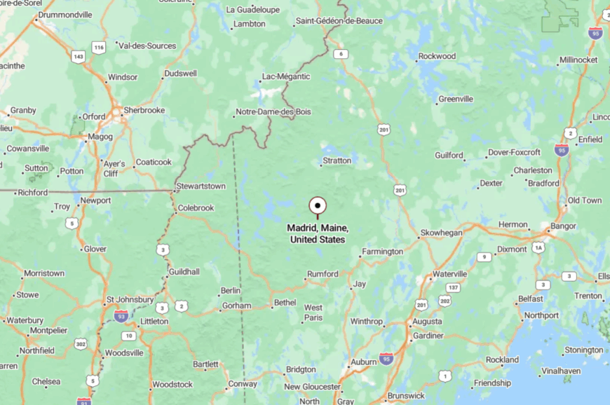
Madrid sits in northern Franklin County along ME-4, roughly 12 miles south of Rangeley. The highway narrows to a scenic byway with few services and fewer signs.
Side roads turn to gravel in a mile or two, then to two-track. You’ll know you’ve arrived when the river grows louder than traffic.
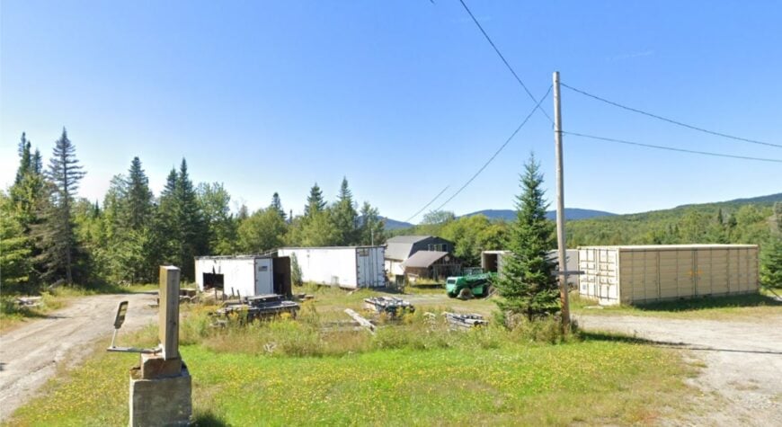
22. Coplin Plantation
Coplin Plantation spreads out beneath broad sky and spruce ridges, its homes tucked far back from the pavement. Isolation comes easy here—few streets, lots measured in acres, and the Bigelow Range throwing a protective shoulder to the east.
Ski Sugarloaf by day, fish the North Branch Dead River at dusk, and warm up in a camp where the generator hum is the only appliance soundtrack. Work is a blend of carpentry, guiding, and seasonal mountain jobs.
Roadside snowbanks grow taller than the mailbox come February, making the world feel smaller and cozier. The vibe is self-reliant and quietly proud. It’s the kind of place that rewards those who make their own light.
Where is Coplin Plantation?
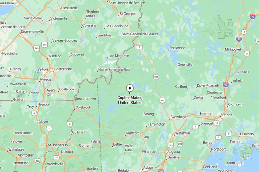
Set in western Franklin County on ME-27, Coplin lies between Carrabassett Valley and Eustis. You get there on a two-lane highway that rides through valleys and climbs frost-heaved hills.
Cell service dips as you near the plantation line, and the forest takes over. It’s on the way to big peaks but feels distinctly off the grid.
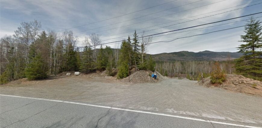
21. Dennistown Plantation
Dennistown Plantation is a ridge-top scatter of homes looking out over endless spruce, a waypoint that never quite becomes a town. Seclusion here is geographic and deliberate: long driveways, the Canadian border an invisible neighbor, and winter that arrives early and leaves late.
Cast from a canoe on Brassua Stream, watch sunrise steam lift off Parlin Pond, or track moose sign along logging spurs that fade into green. Much of the work is timber, camp upkeep, and a little guiding.
Nights are so dark that the Milky Way looks like frost. The quiet has edges—crisp, clean, and kind. It’s the kind of place that reminds you you’re small in the best way.
Where is Dennistown Plantation?
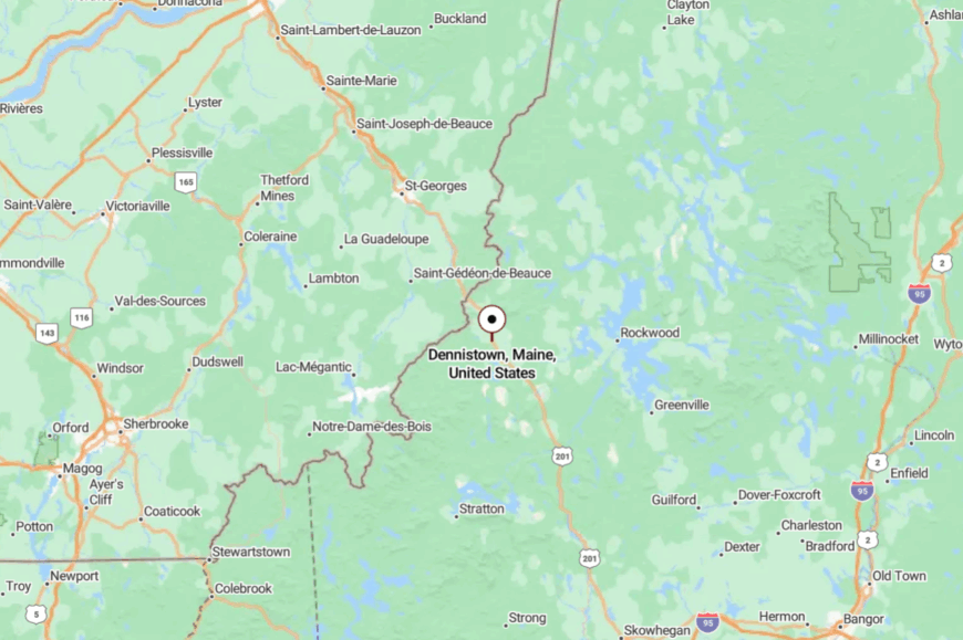
You’ll find it in northwestern Somerset County on US-201, about 8 miles south of Jackman. The highway climbs and straightens across high country where services are sparse.
Side roads turn to dirt quickly and stay that way. It feels like a frontier, even with pavement under your tires.
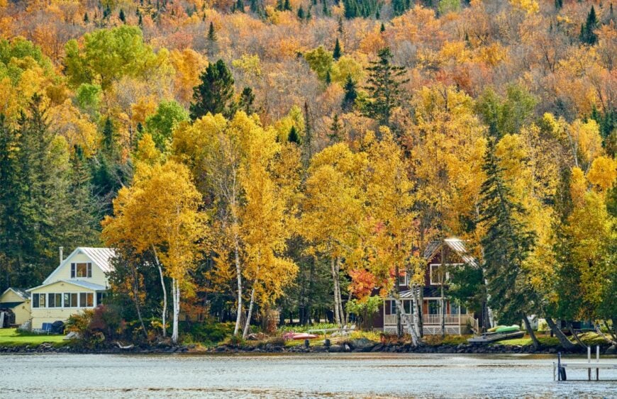
20. Wyman Township
Wyman Township is a swath of river and ridgeline where the Carrabassett swings wide and the Bigelows rise like a wall. It stays secluded by design—mostly unorganized land, domed sky, and a forest that wraps around everything.
Bike the Narrow Gauge trail, ski the backcountry off Stratton Brook, or stand on the wire bridge and listen to the river write its long sentence. Economy here is seasonal and slim: trail crews, rentals, and a saw buzzing somewhere in the trees.
Sunset turns the range copper and violet. It’s a hush that lingers even after the wind dies.
Where is Wyman Township?
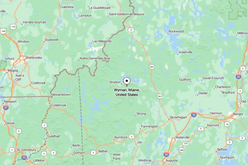
Wyman sits in western Franklin County along ME-27 between Carrabassett Valley and Stratton. Approaches ride the valley floor with mountains crowding close.
Trailheads outnumber storefronts, and side lanes end in gates or gravel. It’s close to famous peaks, yet it feels like the margins of the map.
19. Oquossoc
🔥 Would you like to save this?
Oquossoc is a lakeside village with a camp-town soul, where Rangeley and Mooselookmeguntic meet under a spread of big Maine sky. Seclusion here arrives with water and distance—bays, islands, and miles of shoreline that scatter sound and slow the clock.
Troll for salmon, paddle into evening glass, or browse the tiny museum that smells of varnish and cedar. Shops keep seasonal hours; conversation keeps steady ones. Guides, marinas, and cottage caretakers anchor livelihoods.
When loons start up, everyone lowers their voice. It’s the kind of place where twilight takes its time.
Where is Oquossoc?
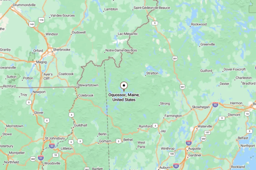
Oquossoc is in the town of Rangeley, western Franklin County, at the junction of ME-4 and ME-17. The ride in is all water glimpses and forest tunnels. Distances look short on a map, but the curves insist on patience. You arrive feeling like you crossed an invisible border into calm.
18. Andover
Andover is a square of classic New England—white steeple, green common—surrounded by a hundred miles of quiet. It’s secluded by mountain collars and the way the road narrows after Rumford, turning from commute to amble.
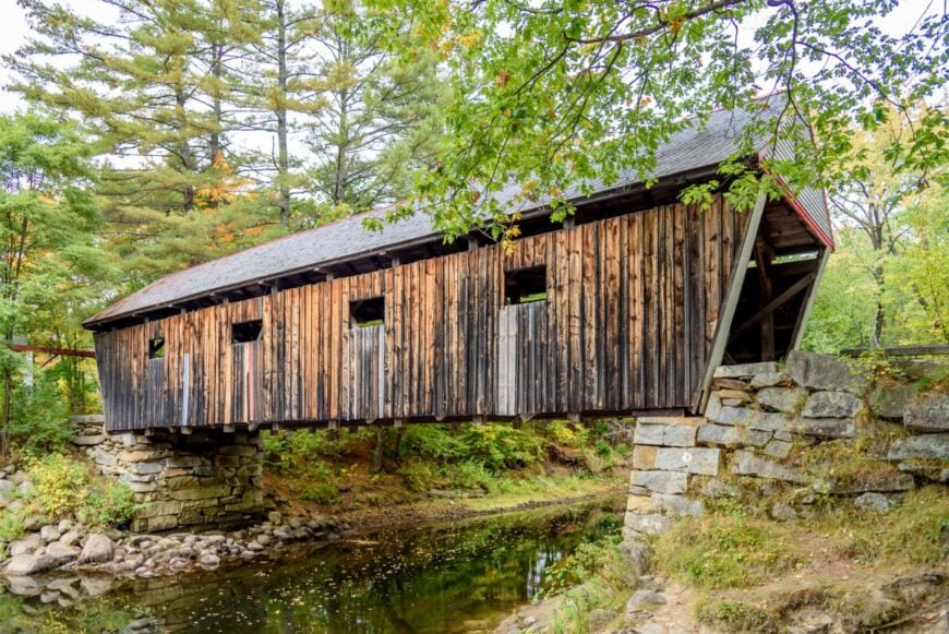
Fish the Ellis River, wander Lovejoy Covered Bridge, or climb to Dunn Notch where the water threads through granite. Work leans on forestry, small shops, and ATV/sled tourism that ebbs with the seasons.
When the first snow flies, the town sounds like a held breath. It’s neighborly without being noisy. It’s the kind of place where your boots earn the day.
Where is Andover?
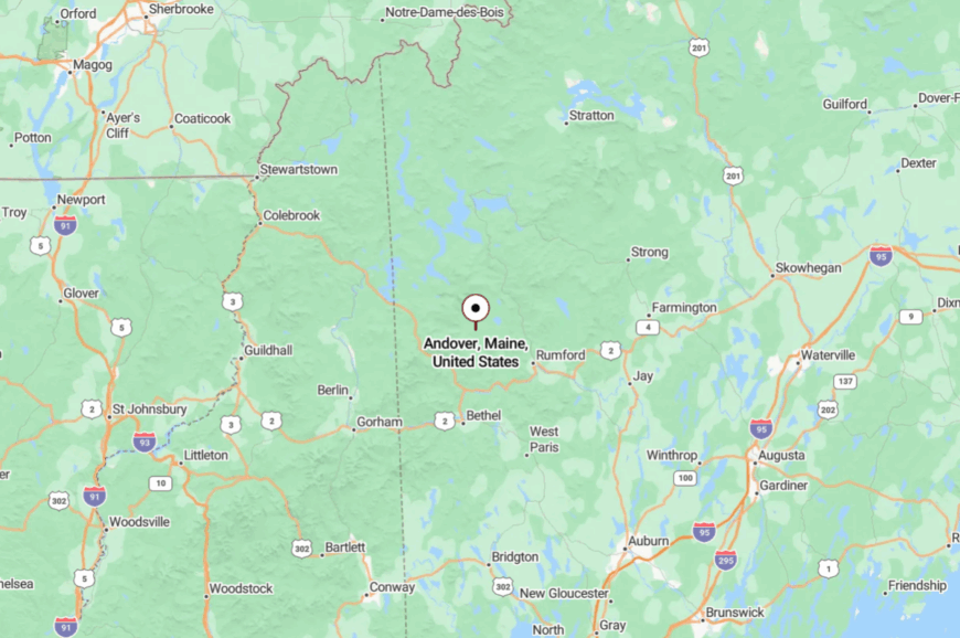
Located in northern Oxford County, Andover sits about 12 miles north of Rumford via ME-5/120. The last miles trace the Ellis River through tight curves and tall maples.
Cell service hiccups as hills close in. It’s near enough for errands, far enough to feel kept.
17. Roxbury
Roxbury runs along the Swift River and up into the hills, a place of camps, old orchards, and roads that turn to gravel without apology. Its tucked-away feel comes from narrow valleys and a patchwork of public land that limits sprawl.
Climb Glassface Ledges for a sweep of the river valley, launch a canoe at Roxbury Pond, or look for moose sign in alder breaks at dusk. Income is a mix of woods work, quarry runs, and lodge jobs toward Rumford.
Night falls early where the ridges lean close. The quiet here has a granite backbone and a soft edge.
Where is Roxbury?
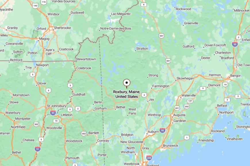
You’ll find Roxbury in Oxford County on ME-17 northwest of Rumford. The highway hews to the river; side roads slip into the forest in a few turns.
Winter plows keep the main open, but camps up the hill can wait out storms. It’s a near-town that feels off-map.
16. Weld
Weld gathers around Webb Lake under the shoulder of Mount Blue, a postcard you can walk into. Seclusion is courtesy of the mountains that cup the water, and the fact that the road ends at the lake and ledge.
Swim at the state park, climb Tumbledown nearby, or watch loons etch ripples across an evening that smells like pine and grill smoke. A general store, a few camps, and trailheads make up most commerce.
The lake holds light late, as if the day hates to leave. Weld feels both lively and hushed, depending on where you stand. It’s the kind of beauty that asks for your full attention.
Where is Weld?
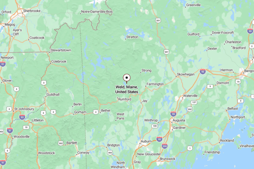
In western Franklin County, Weld sits about 26 miles northwest of Farmington via ME-156/142. The approach winds through the foothills until the lake flashes between trees.
Once you reach shore, the pavement narrows and the mountains take over the skyline. It’s close enough for a swim, far enough to change your mood.
15. Temple
Temple is the end of the road in the best sense—paved turns to dirt, and the forest steps closer with every mile. The seclusion is real: few businesses, many trailheads, and a town line that reads like a promise to keep things quiet.
Walk to Varnum Pond at dawn, follow stone walls into sugarbush, or snowshoe the old tote roads when the world goes white. People make a living by commuting to Farmington, sugaring, and craft work in backyard shops.
Owls hold the night; chickadees take the morning shift. The vibe is contemplative, hand-built, and kind. It’s the kind of place that keeps its own counsel.
Where is Temple?
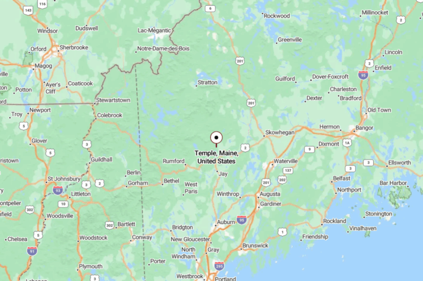
Temple lies in western Franklin County, five miles west of Farmington at the very end of ME-43. The last stretch climbs into hills where mailboxes are spaced out and bars drop to one.
In winter, the plow berms make the road feel like a corridor. It’s just beyond convenient—and that’s the point.
14. Kingfield
Kingfield sits on the Carrabassett like a pocket of light under tall hills, with painted storefronts and an old mill holding court by the bridge. Though it’s a gateway to Sugarloaf, it keeps a secluded rhythm—nights are dark, mornings are slow, and side roads go to the forest fast.
Sip coffee on Main, bike the river path, or drift north to narrow waterfalls that only locals know. Work comes from small industry, galleries, and the winter economy, but the town never feels hurried.
Come leaf-drop, you can hear your own footsteps on the boardwalk. It’s artful, sturdy, and a little bit wild at the edges. It’s the kind of place that makes you linger.
Where is Kingfield?
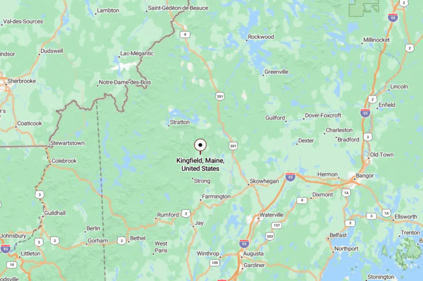
You’ll find it in northern Franklin County on ME-27, about 20 miles south of Carrabassett Valley. The road tracks the river with long sightlines and low traffic.
One turn puts you on dirt headed for the mountains. It’s a crossroads that still feels off to one side.
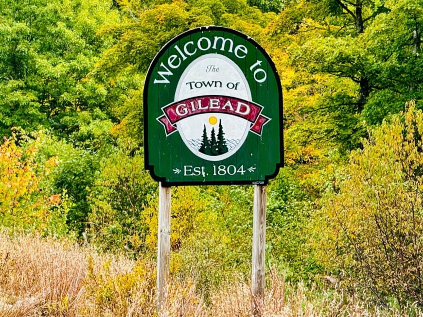
13. Gilead
🔥 Would you like to save this?
Gilead is a border sliver of houses and rails pressed between the Wild River and the White Mountains—blink and you’ll miss it, but the quiet will stay. Seclusion is baked into the landscape: national forest on three sides, a single ribbon of highway, and steep slopes that steal the sun early.
Fish the Androscoggin backwaters, wander into the Wild River Wilderness, or watch trains slide past like moving history. There’s no downtown to speak of—just porches, trail signs, and the soft rush of water.
The whole place feels like a threshold. It’s the kind of calm that prefers whispers.
Where is Gilead?
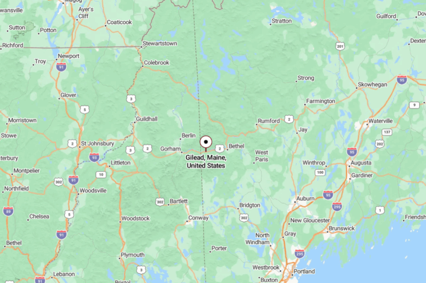
Gilead sits at Maine’s western edge in Oxford County on US-2, five miles east of the New Hampshire line. The highway threads a narrow valley with mountains crowding close.
Side roads quickly become forest lanes or gated spurs. You’re on a main route, but it feels like a secret passage.
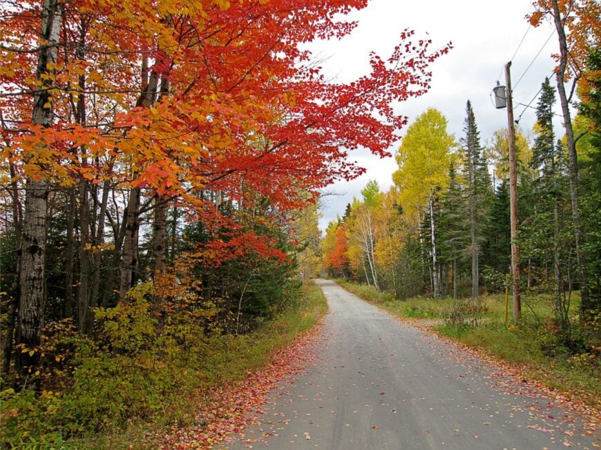
12. Phillips
Phillips is mill-town bones with mountain heart: a riverside grid, handsome brick, and woods waiting at the street’s end. Its tucked-away feel survives because bigger roads run elsewhere and the Sandy River loops like a moat.
Ride the Sandy River & Rangeley Lakes heritage rail, hunt for waterfalls in cool clefts, or browse a flea market that feels like a family reunion. Jobs lean rural—woods work, small shops, seasonal gigs around Rangeley.
When the whistle echoes off the hills, time folds a little. It’s modest, enduring, and sweet with pine. It’s the kind of place that feels like found time.
Where is Phillips?
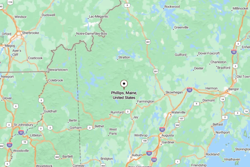
In north-central Franklin County, Phillips lies off ME-142/4, about 20 minutes east of Rangeley. The approach slides through meadow and brook with few other cars for company.
Town streets end quickly at treeline and two-track. It’s close to the peaks but content to be quiet.
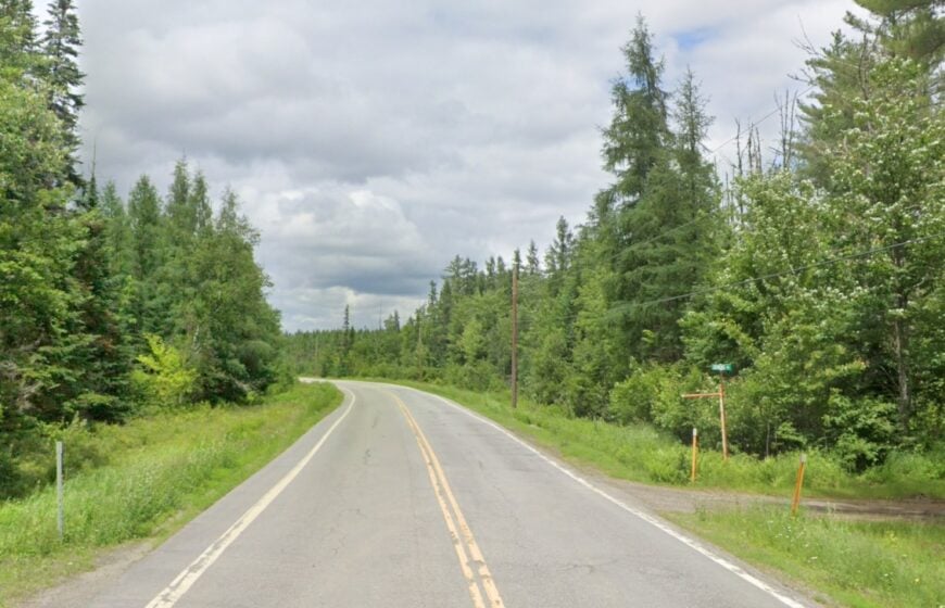
11. Eustis
Eustis stretches along Flagstaff Lake with mountains standing guard—Bigelow mirrored in water so still it feels like glass. Seclusion comes from space: long lake miles, sparse lights, and camp roads that end in silence.
Paddle down coves, hike the Fire Warden’s Trail, or sit on a dock while loons lay down the evening soundtrack. Work revolves around camps, guiding, and the snow season, with generators buzzing behind pines where the grid thins.
After dark, the stars are crowded enough. The whole place is a long exhale. It’s the kind of quiet that stays with you on the drive home.
Where is Eustis?
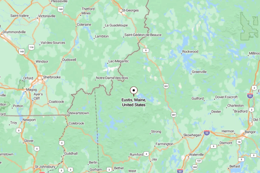
Eustis lies in northern Franklin County on ME-27, a half hour north of Carrabassett Valley and just shy of the Quebec line. The highway climbs through high country with lake glimpses and few services.
Side lanes turn to gravel within minutes and run straight to water or woods. It’s accessible—then suddenly, beautifully remote.
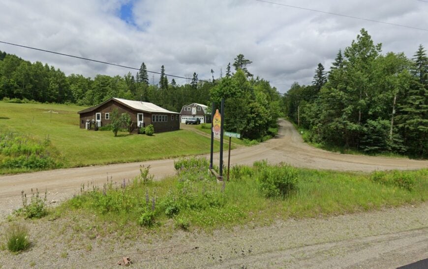
10. Magalloway Plantation
Home to barely 40 year-round residents, Magalloway Plantation strings a few dozen cabins along the glassy coves of Aziscohos Lake. Visitors launch canoes at Lincoln Pond Landing, keep an eye out for the resident loon pair, and often spot moose browsing at dawn near the tree line.
Forestry and seasonal tourism form the main economic threads, with outfitters supplying anglers chasing brook trout in the Magalloway River. Local life runs on propane lanterns, wood stoves, and VHF radio because cell towers sit far beyond the spruce ridges.
A grocery run means driving more than 30 miles to Oquossoc, emphasizing just how removed the plantation is from daily conveniences. The surrounding hills rise like a natural barricade, muffling all but wind in the pines and the call of a distant barred owl.
Where is Magalloway Plantation?
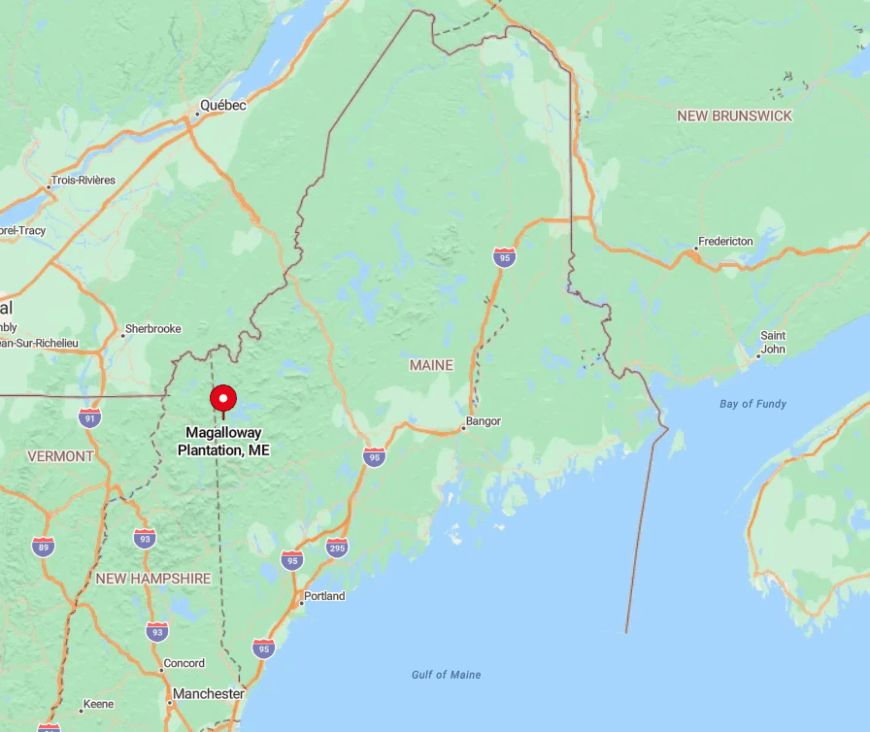
Magalloway lies at the northwestern tip of Oxford County, brushing against the New Hampshire border and Québec’s wild forestland. The absence of state highways forces travelers onto Route 16, then miles of gravel that hug the shoreline before reaching the scattered camps.
This back-road approach, combined with limited winter maintenance, keeps traffic counts almost nonexistent. Those who make the trek are rewarded with unfettered lake views and a night sky bright enough to reflect on the water.
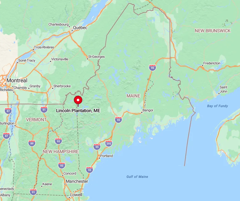
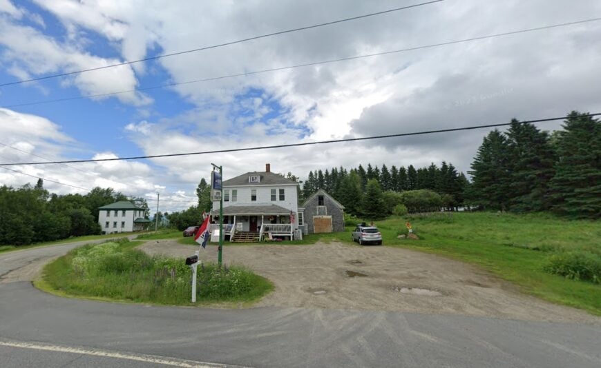
9. Lincoln Plantation
Roughly 45 residents claim Lincoln Plantation, where roomy homesteads overlook the frothy Rapid River and sit on parcels that often exceed ten wooded acres. Anglers paddle down the river’s famed Class III rapids, while hikers tackle nearby Old Speck Mountain for sweeping views of the Mahoosucs.
Logging and guiding services provide most local employment, though small maple-syrup operations thrive on the high-elevation sap runs each spring. There is no cellular reception, and landlines remain the communication lifeline for households scattered along gravel spurs off Forest Road 17.
Thick forest and miles of former timberland roads shield the community from through-traffic, lending nights an almost uncanny quiet. Even in peak foliage season, headlights are a rarity after sunset.
Where is Lincoln Plantation?
🔥 Would you like to save this?
The plantation sits just south of Umbagog Lake and east of the New Hampshire line, tucked between the Mahoosuc Range and the Aziscohos watershed. Reaching it requires a deliberate turn off Maine Route 16 and a patient crawl along logging roads that twist through fir thickets.
Winter access relies on local knowledge, snow tires, and occasionally snowmobile shuttles when drifts cover the final miles. This isolation preserves a landscape where the river’s rush often feels like the loudest sound around.
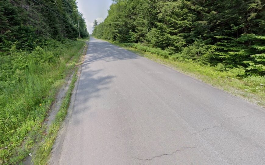
8. Upton
Upton counts fewer than 100 full-time inhabitants, most living in weather-worn farmhouses clustered beside Route 26 near the southern gate of Umbagog National Wildlife Refuge.
Kayakers glide over the refuge’s back channels, while birders scan for bald eagles and the elusive spruce grouse. Cottage rentals and guiding outfits support the modest local economy, complemented by small-scale hay farming on the rolling foothill pastures.
Once Route 26 curves north toward Errol, New Hampshire, traffic thins dramatically, leaving the village wrapped in meadow hush. The isolation deepens after dusk when distant coyote calls replace any hint of road noise.
Broad parcels and conservation easements ensure new construction remains sparse, preserving the historic character of the village core.
Where is Upton?
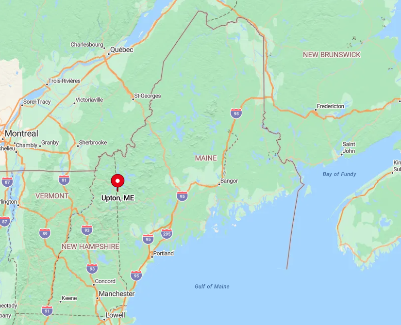
Perched on Maine’s western border, Upton sits 30 miles north of Bethel along a scenic byway that climbs Evans Notch. The absence of nearby service centers means travelers must plan fuel and food stops well in advance.
Winter storms can close Evans Notch entirely, funneling access along a longer route through New Hampshire and back into Maine. These seasonal hurdles maintain Upton’s reputation as a place reached only by those determined to enjoy its quiet beauty.
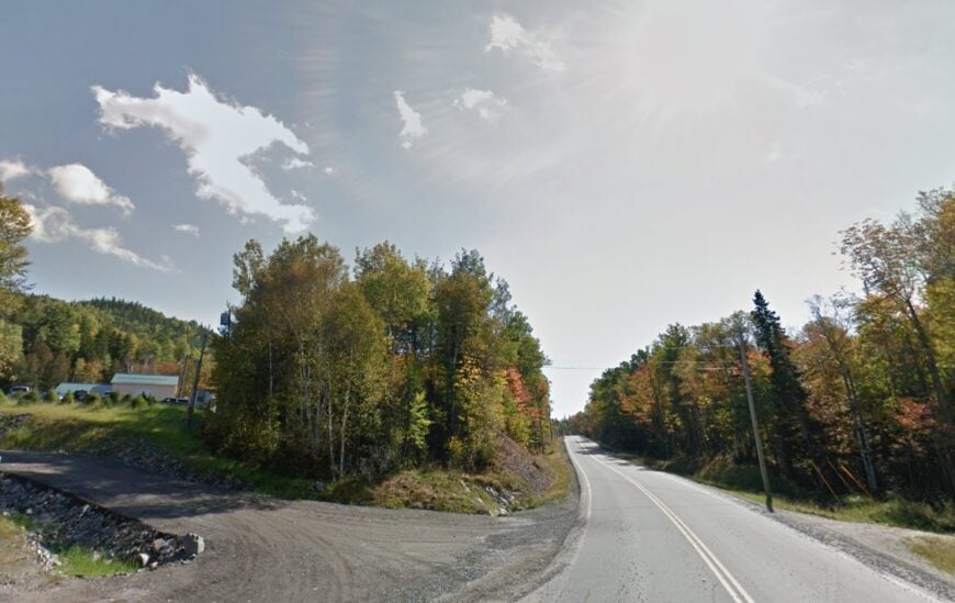
7. Adamstown Township
With a population hovering near 200, Adamstown Township is stitched together by narrow gravel lanes that meander between Richardson and Rangeley Lakes. Boaters favor the quiet coves of Upper Richardson, while snowmobilers link to the ITS 84 trail network once the water freezes.
Cottage upkeep, bait sales, and small logging crews comprise most local work, though many camps remain off-grid and see owners only on weekends. Dense pine ridges wrap around one-acre clearings, muting echoes and blocking any glimpse of neighboring lights.
The nearest hardware store glows 40 minutes away in Rangeley, underscoring the township’s separation from routine errands. After dark, the Milky Way spills across the sky with little interference from human activity.
Where is Adamstown Township?
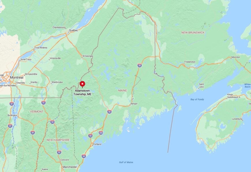
Adamstown sits in Franklin County’s northwestern corner, sandwiched between the Richardson Lakes to the west and the Bald Mountain range to the east. Reaching most camps involves turning off Maine Route 17 onto networked camp roads originally cut for 19th-century log drives.
Spring mud season often turns those lanes into soft clay, further discouraging casual visitors. The resulting solitude makes each lakeside morning feel like wilderness opening day.
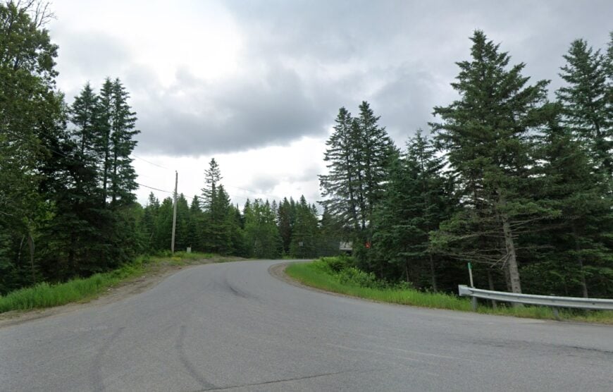
6. Chain of Ponds Township
Only about 160 people reside in Chain of Ponds Township, where a series of sparkling ponds—Natanis, Long, Bag, and Round—follow Route 27 north toward Québec. Paddlers drift under the shadow of the Bigelow foothills, fishing for landlocked salmon amid dead-silent coves broken only by loon calls.
Seasonal rentals and a modest campground support a tiny service sector, while the broader economy still sees income from selective logging on former timber plots. Cabin sites sit far apart on old logging spurs, giving every porch an undisturbed water view.
Undeveloped shoreline, minimal boat traffic, and a lack of commercial lighting preserve a stillness that newcomers quickly notice. Even generators fall silent by 10 p.m., leaving only the crackle of campfires and owl hoots.
Where is Chain of Ponds?
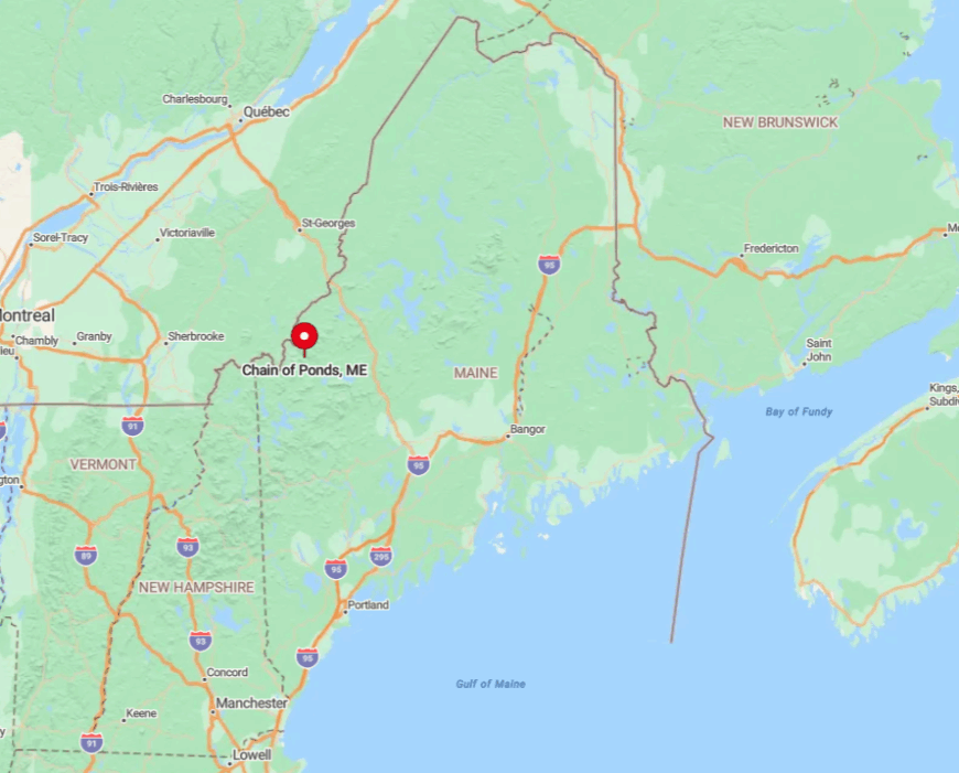
Located along the northernmost stretch of Franklin County, this township hugs the Canadian border, 30 miles above Stratton. Travelers follow Route 27, a scenic mountain highway that narrows as it climbs toward Coburn Gore crossing.
Beyond the roadside picnic pullouts, no paved roads penetrate the interior, so most access occurs via small boat launches or gated timber tracks. The lack of alternate routes all but guarantees traffic never rises beyond a trickle.
5. Redington Township
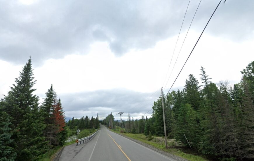
Redington Township’s year-round census barely tips 60, spread across expansive parcels beneath the spinning blades of the Saddleback wind farm.
Backcountry skiers skin up the unmaintained Caribou Valley Road for powder turns, and hikers tackle the Appalachian Trail’s rugged Crocker Mountain section that passes through the township.
Small firewood operations and seasonal guiding supply limited income, while many residents telecommute using satellite internet due to the absence of cable. With no incorporated municipal government, local services stop at county-maintained culverts and the occasional grader visit after spring thaw.
Mile-long driveways and deep pine thickets erase any hint of neighborly noise. The result is a landscape where starlight bounces off unplowed snowfields and silence often feels complete.
Where is Redington?
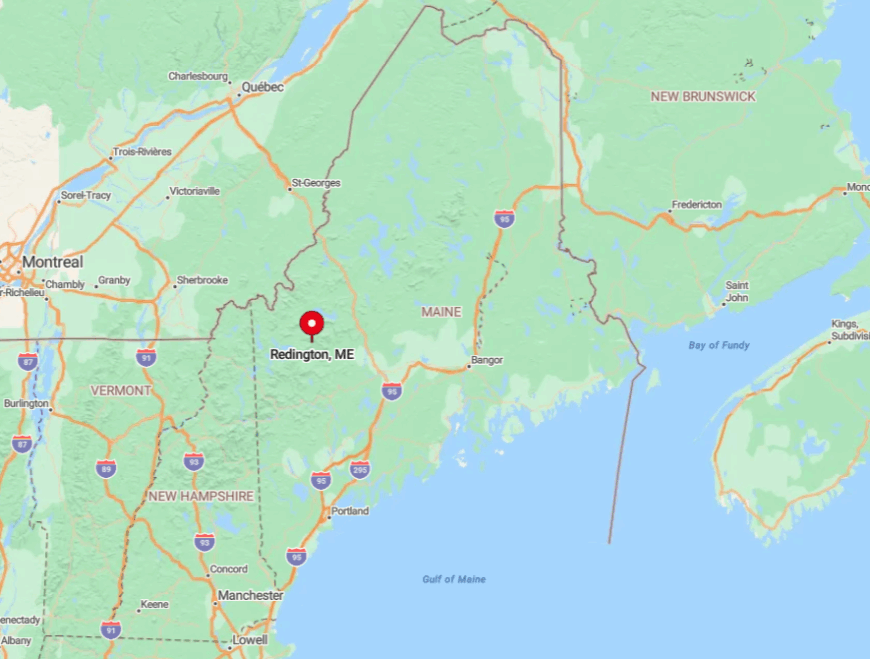
Nestled between Sugarloaf and Saddleback ski areas, Redington sits squarely in western Maine’s high country, accessible only by Caribou Pond Road off Route 27 or a rugged connector from Sandy River Plantation. Both roads turn to rough gravel beyond the first mile, discouraging casual sightseeing.
Winter closures can last months, leaving snowmobile or fat-bike travel as the only options. These logistical quirks leave the township largely to wildlife and the handful of residents who relish true quiet.
4. Dallas Plantation
Dallas Plantation hosts roughly 350 residents who favor secluded chalets tucked into maple forest near the base of Saddleback Mountain. Outdoor life revolves around the South Branch of the Dead River, mountain biking on the Fly Rod Crosby Trail, and powder days at the reopened Saddleback Resort.
Hospitality jobs tied to the ski area mix with small woodworking shops and home-based crafts to form the economic backbone. Zoning requires lots of at least one acre, and an absence of strip malls or stoplights keeps the community’s back-country character intact.
Thick tree cover and curving secondary roads limit lines of sight, making each driveway entrance feel like a portal to its own clearing. Even during peak ski weekends, nights remain hushed save for wind curling through the hardwoods.
Where is Dallas Plantation?
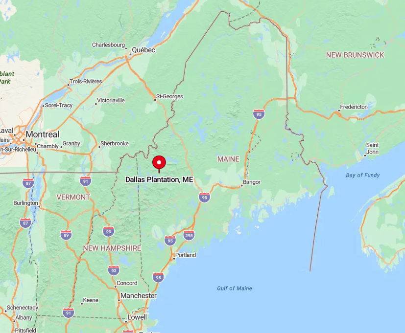
The plantation sits just south of Rangeley Lake, five miles from the village of Rangeley along gently rising Route 4. Turning onto Dallas Hill Road, visitors climb toward Saddleback, quickly leaving cell signal behind as the valley drops away.
Winter storms frequently close the hill road for plowing, reinforcing the area’s semi-remote feel. Those willing to drive the extra miles find broad views of the High Peaks framed by maple boughs in every season.
3. Sandy River Plantation
Sandy River Plantation’s population hovers near 500, dispersed among camps and cottages that ring the clear waters of Porter Lake. Residents spend summer days swimming off modest sand beaches, while anglers cast for landlocked smelt in shadowy coves once dusk settles.
Part-time rental management and lake-service businesses drive the small local economy, augmented by winter work at nearby Sugarloaf, 15 miles away over winding mountain passes.
Hemlock groves and gravel connectors keep homes unseen from one another, preserving the sense of being alone in the forest. With no main street or downtown cluster, community events gather at the tiny firehouse or the lakeside picnic shelter.
The absence of through traffic ensures nights are guided by loon calls and the rustle of shoreline reeds.
Where is Sandy River Plantation?
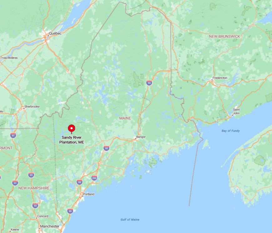
Located southeast of Rangeley, the plantation is accessed via Route 4, then a sharp turn onto the narrow Dallas Hill–Township Road that skirts the lake’s western shore. Winter drivers navigate two steep grades where plows often lag, adding to the feeling of venturing someplace tucked away.
Porter Lake’s horseshoe shape blocks road extension around its eastern half, so vehicular access remains limited to a single shoreline loop. That natural bottleneck helps keep visitor numbers low even in July.
2. Albany Township
Albany Township supports around 1,000 residents spread across a broad valley patchworked with former pastureland and bracketed by the White Mountain National Forest. Horseback riders follow the Miles Notch Trail, and locals paddle the slow bends of the Crooked River in near-total solitude.
Small dairy farms, maple operations, and home-based artisans make up the economic mix, with many selling goods at Bethel’s Saturday market 12 miles east. Old stone walls line winding lanes, hinting at 19th-century field boundaries now swallowed by second-growth forest.
No stoplights, scant signage, and the surrounding federal forest act as natural buffers, ensuring only purposeful travelers pass through. Even peak leaf-peeping traffic skims the outer edges, leaving most back roads untroubled.
Where is Albany?
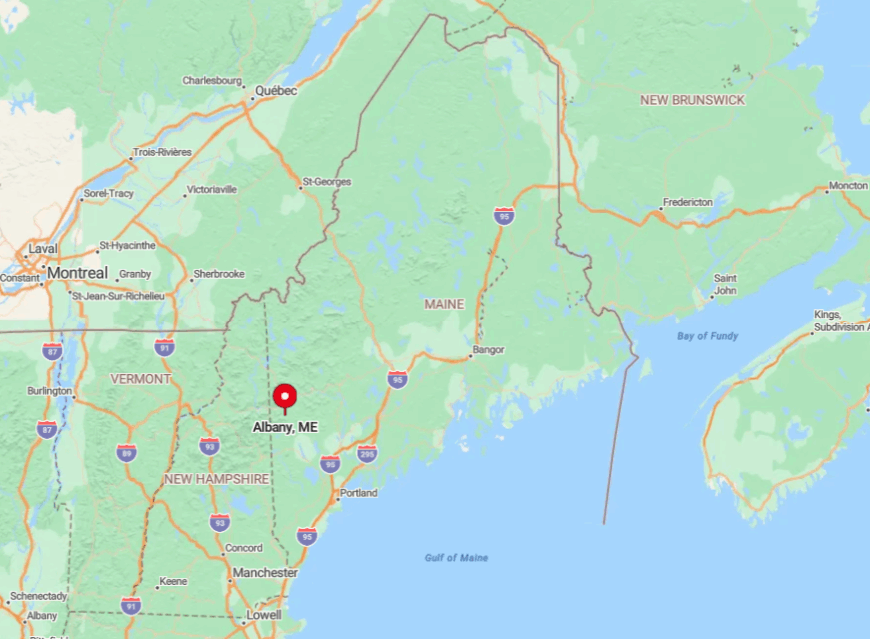
The township sits west of Bethel on Route 5, yet most homes lie off Snow Falls or Hunts Corner roads where pavement ends and packed dirt begins. White Mountain ridges to the south preclude any shortcut from New Hampshire, so drivers must loop north through Gilead or east through Bethel.
Public transportation never made it this far, and cell coverage fades near the forest boundary. These geographic limits preserve a valley atmosphere that feels much farther from ski-town bustle than the mileage suggests.
1. Letter D Township
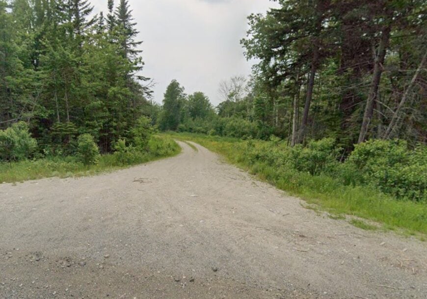
Letter D Township houses about 60 year-round residents and a scattering of seasonal cabins perched along the headwaters of the Swift River. Anglers wade for native brook trout while hikers climb toward Tumbledown Mountain via the rarely used Parker Ridge approach.
Occasional timber harvests and a tiny maple-syrup collective provide income, but most of daily life revolves around subsistence gardens and woodlot maintenance. More than 80 percent of township land remains undeveloped, blanketing hills in birch and fir that dampen sound and starlight alike.
Roads are dirt, signage minimal, and power outages linger since crews must travel from Rumford 25 miles away. This blend of rugged access and raw landscape means silence descends early and lasts until robins break it at sunrise.
Where is Township D?
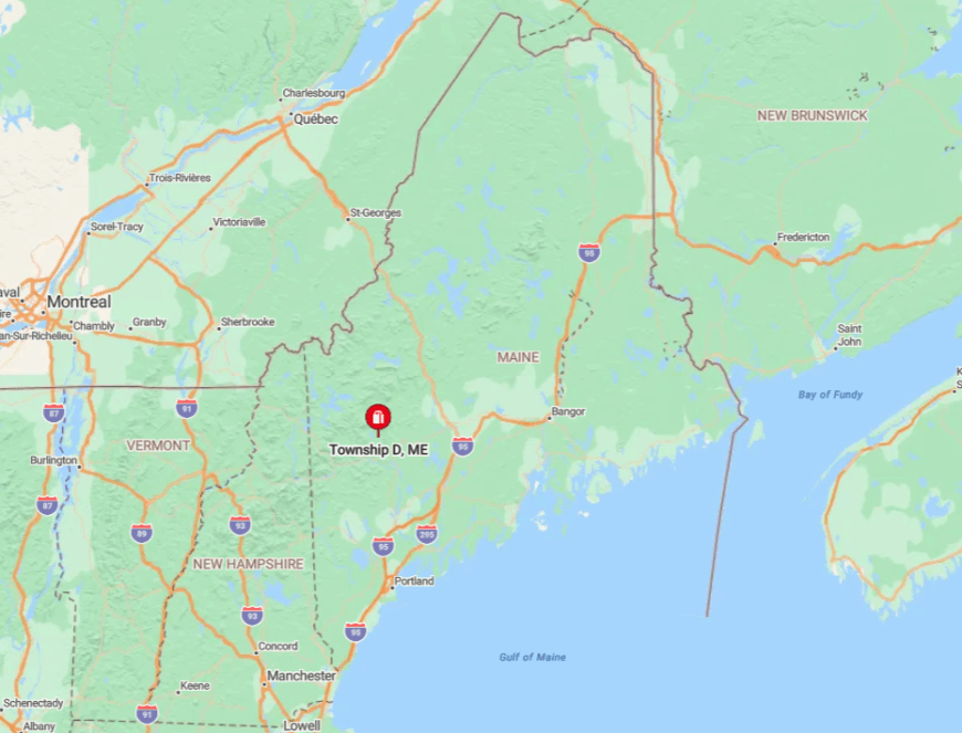
Found off Route 17 south of Rangeley, Letter D requires a turn onto the unsigned Swift River Road, a narrow track following the river’s rocky course. Spring runoff often floods low spots, forcing drivers to wait out the water or detour miles upstream.
No paved roads cross into adjoining townships, creating a pocket of near-wilderness bounded by ridgelines and waterways. For those seeking a genuine escape, the journey’s end feels like another time zone, not merely another zip code.