Would you like to save this?
Southern New Mexico is laced with winding canyon roads, steep forested passes, and tiny settlements that feel years removed from modern bustle.
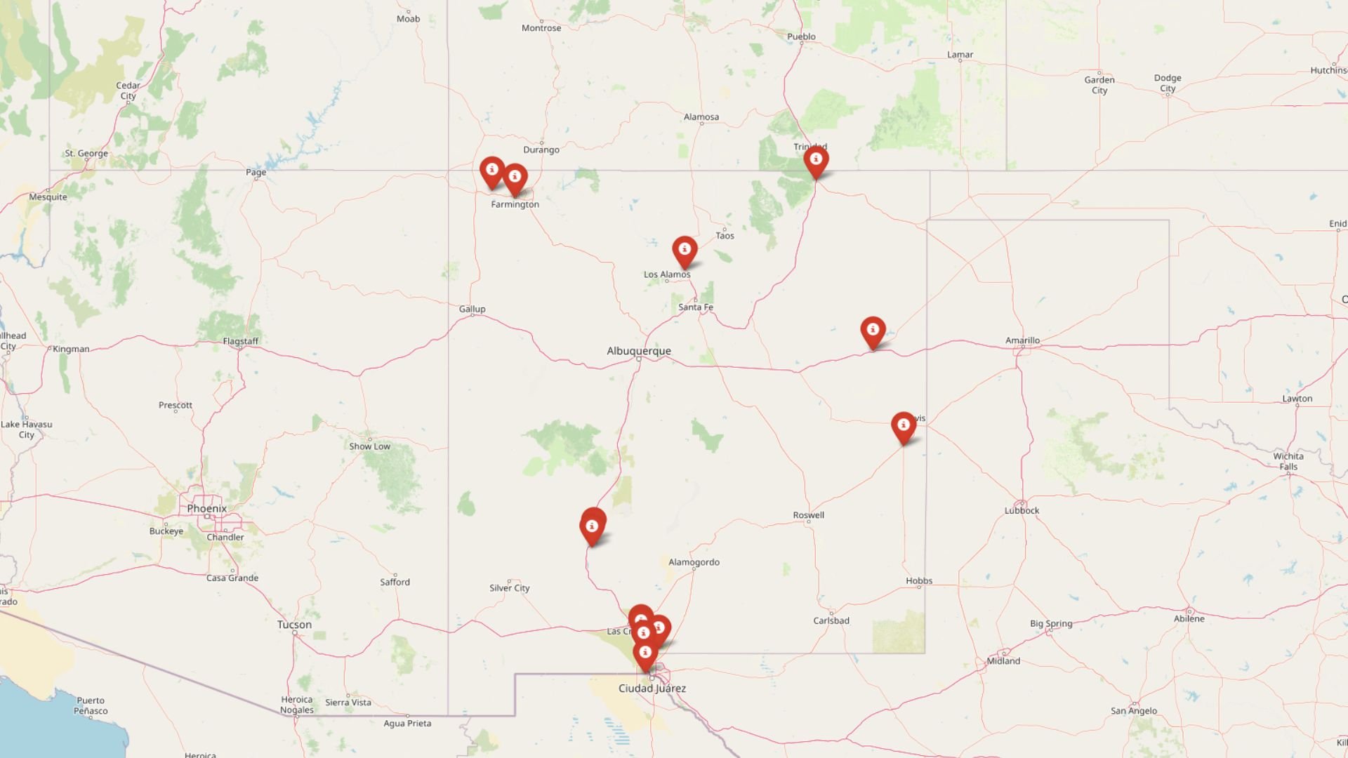
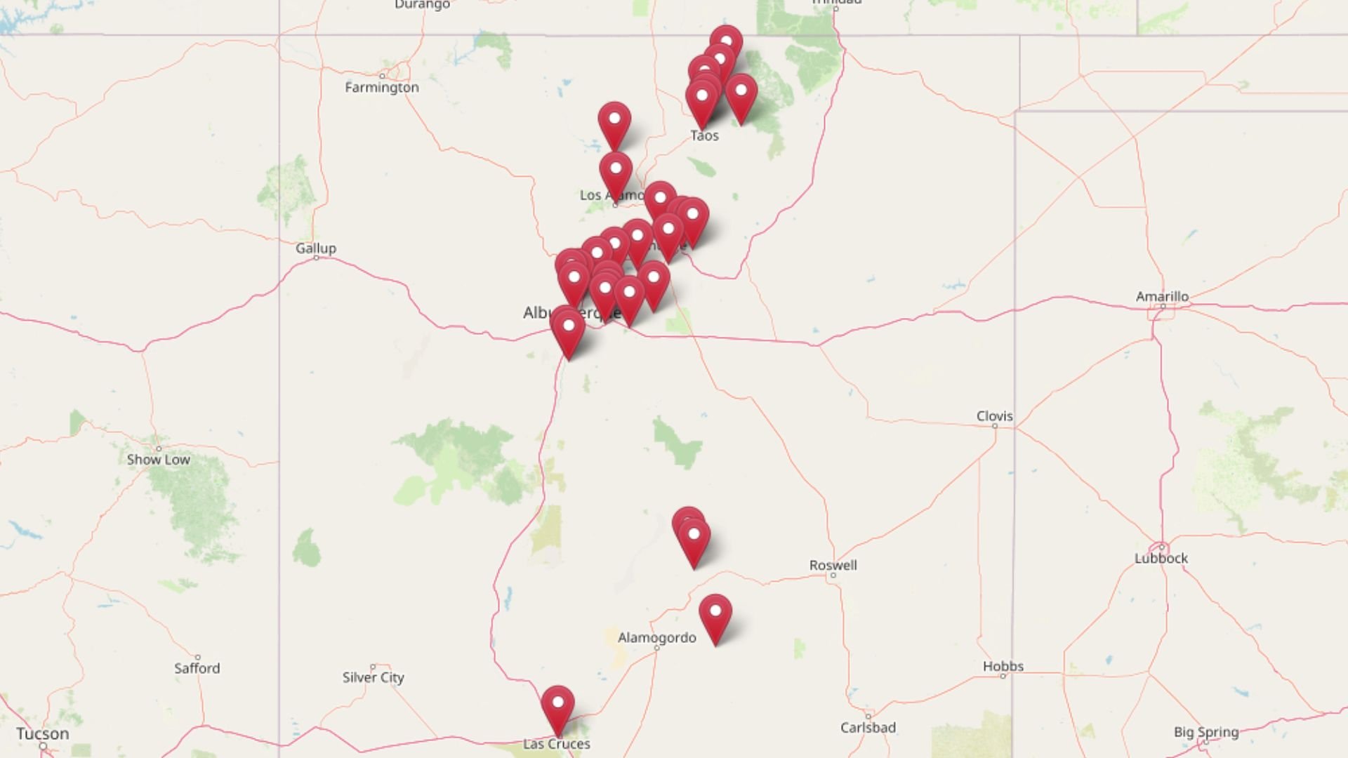
The following 25 mountain towns reward the curious traveler with quiet streets, almost-empty trailheads, and skies bright enough to shock anyone used to city glow.
Our list counts down from sizable (yet still mellow) communities to single-lane hamlets where finding a cup of coffee can feel like a minor quest. Each spot has a story: abandoned mines, century-old orchards, river-side hot springs, or a mountaintop observatory that peers straight into the sun.
We highlight what residents do for work, what visitors can explore, and why these places remain so delightfully out of the way. Pack a paper map, fill the tank, and discover corners of the Land of Enchantment that most highway travelers never hear about.
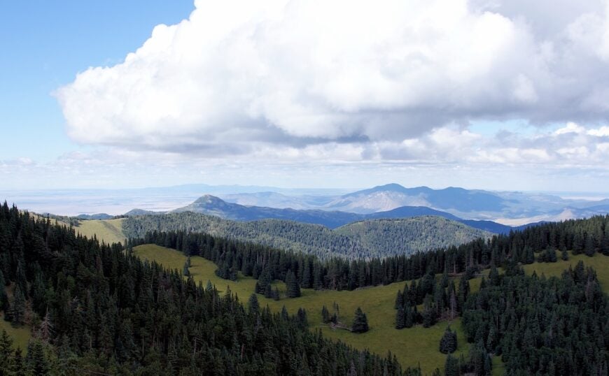
25. Mescalero – Tribal Village Between Sky Island Peaks
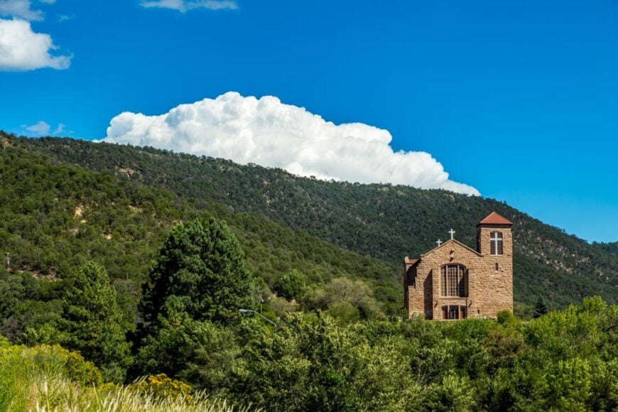
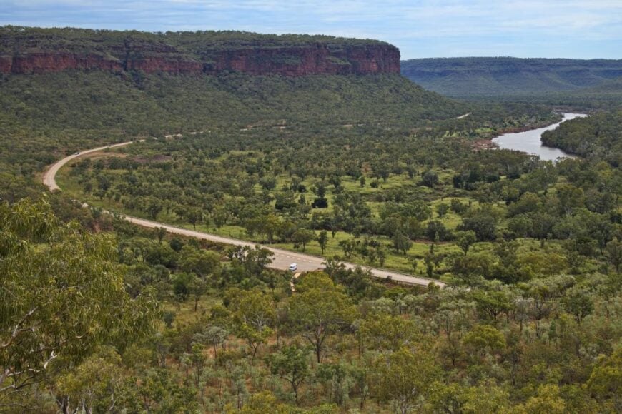
Mescalero sits high in the Sacramento Mountains of southern New Mexico, surrounded by dense pine forests, rushing creeks, and peaks that seem to hold the clouds in place. Far from major cities, it feels like a world apart, reached by winding mountain roads that open to wide, breathtaking views.
Life here moves with the land’s rhythm—mornings bring cool air scented with pine, and evenings settle beneath a sky crowded with stars. Visitors can explore the Mescalero Apache Reservation, fish or paddle at Lake Mescalero, hike trails in the Lincoln National Forest, or ski in nearby Ski Apache.
Seasonal powwows and cultural events keep traditions alive while welcoming those who come to learn. Tourism, outdoor recreation, and tribal enterprises support the community, blending heritage with modern life. It’s the kind of place where the mountains themselves seem to keep watch, guarding a quiet that feels rare in the world today.
Where is Mescalero?
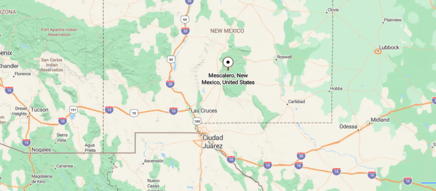
Mescalero sits in south-central New Mexico, high in the Sacramento Mountains on the Mescalero Apache Reservation. It’s about 8 miles northeast of Ruidoso, reached along US Highway 70 as the road winds through pine-covered slopes and open mountain views.
The journey takes you past alpine meadows, cool forests, and nearby landmarks like Ski Apache and Lake Mescalero. It’s close enough to connect easily with surrounding towns, yet its elevation and mountain air give it a feeling of peaceful remoteness.
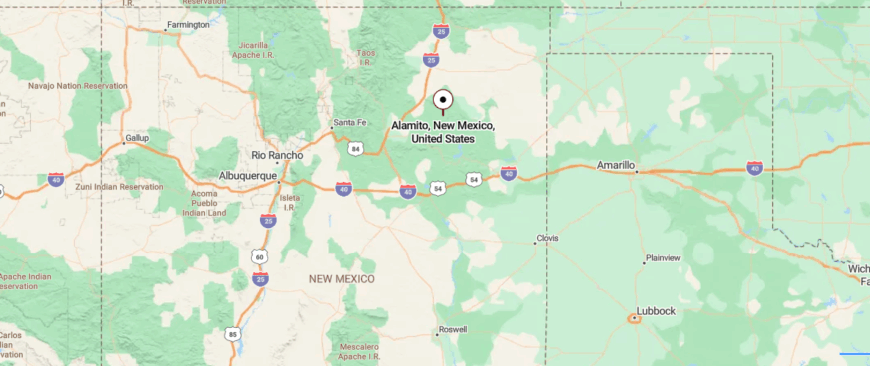
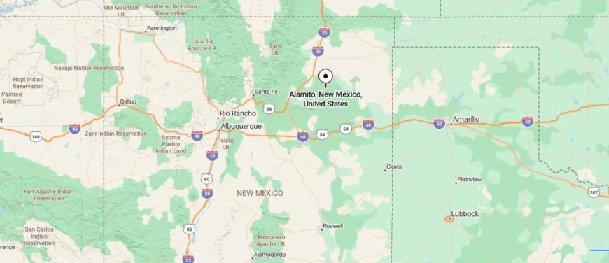
24. Alamito – Creekside Hamlet Along a Forgotten Spur
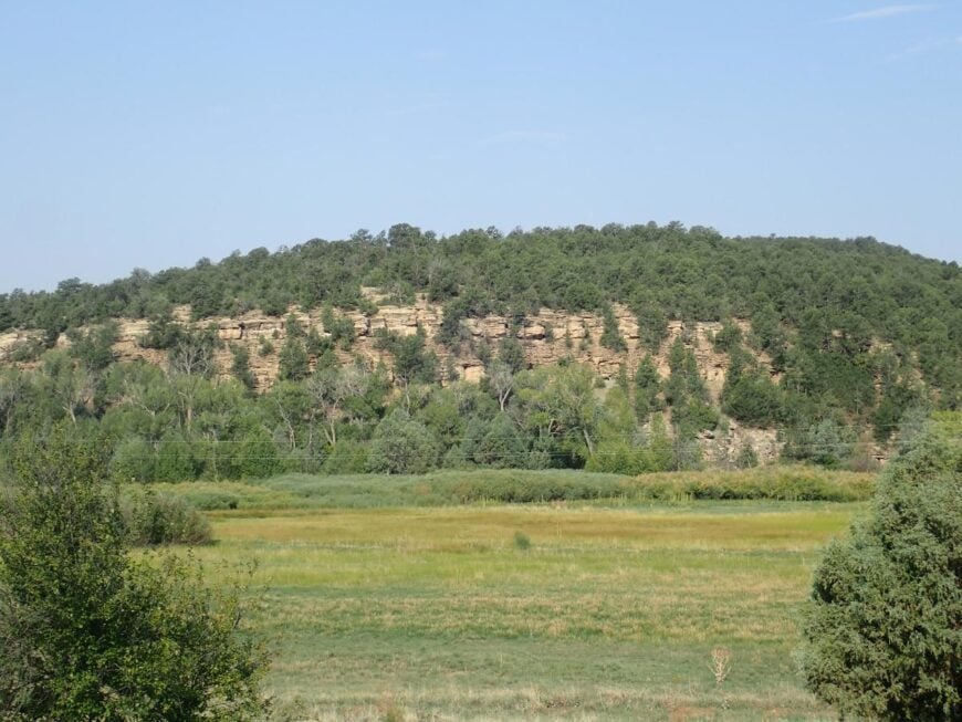
Alamito is a quiet settlement in the uplands of northern New Mexico, tucked into Mora County’s rolling hills where the nearest major highway feels miles farther than the map suggests. Sparse homes and wide stretches of open land keep it feeling almost hidden, with only winding country roads and the sweep of high desert sky to mark the way in.
Life here follows the sun and the seasons—mornings bring cool air scented with sage, and evenings fade into skies scattered with stars. Visitors can wander dirt roads to take in the views, explore nearby canyons, hike in the surrounding hills, or trace the contours of Cañon Alamito’s rugged terrain.
Farming and small ranching keep the landscape working, but never at the cost of its stillness. The pace is slow, the air feels unhurried, and the quiet settles around you like a well-worn blanket. It’s the kind of place that reminds you there are still corners of the world where time doesn’t feel in a rush to move on.
Where is Alamito?
Kitchen Style?
Alamito is a rural spot in northeastern New Mexico, set in Mora County among rolling hills and open ranchland. It’s located northeast of Wagon Mound, reached by quiet county roads that branch off from nearby state routes.
The drive takes you through wide stretches of grassland and low canyons, with few signs of development along the way. It’s the kind of place where the open sky and distant ridgelines create a feeling of complete quiet.
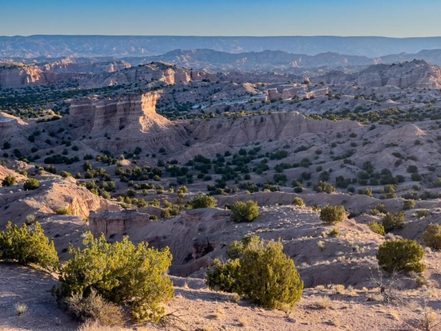
23. Tularosa – Adobe-Lined Streets at the Edge of the Basin
Tularosa sits quietly at the edge of the Sacramento Mountains, its sense of seclusion shaped by the wide sweep of desert that stretches for miles in every direction. The town feels like a place time forgot, with cottonwood-shaded streets, low adobe walls, and the faint scent of chile roasting in the air during harvest season.
Here, life moves at a slow, deliberate pace, grounded in traditions that have endured for generations. Visitors can stroll through its historic district, explore the nearby Three Rivers Petroglyph Site, wander into White Sands National Park’s rolling dunes, or drive into the cool mountain trails of Lincoln National Forest.
Farming and ranching remain at the heart of the local economy, tying the rhythm of daily life to the land itself. The quiet is deep here, broken only by the rustle of leaves or the call of a distant bird. It’s the kind of place where the horizon feels endless, and the world beyond seems a lifetime away.
Where is Tularosa?
Tularosa sits in southern New Mexico, nestled at the edge of the Tularosa Basin about 17 miles north of Alamogordo along U.S. Highway 54. Its position between the Sacramento Mountains to the east and the vast White Sands to the west lends it a sense of natural enclosure.
Travelers reach it by a straightforward highway drive that gradually shifts from open desert into a tree-lined village. It’s the kind of place that feels removed from the rush, where the horizon and quiet seem to stretch just for you.
22. Bent – One-Lane Village in a Narrow Canyon
Home Stratosphere Guide
Your Personality Already Knows
How Your Home Should Feel
113 pages of room-by-room design guidance built around your actual brain, your actual habits, and the way you actually live.
You might be an ISFJ or INFP designer…
You design through feeling — your spaces are personal, comforting, and full of meaning. The guide covers your exact color palettes, room layouts, and the one mistake your type always makes.
The full guide maps all 16 types to specific rooms, palettes & furniture picks ↓
You might be an ISTJ or INTJ designer…
You crave order, function, and visual calm. The guide shows you how to create spaces that feel both serene and intentional — without ending up sterile.
The full guide maps all 16 types to specific rooms, palettes & furniture picks ↓
You might be an ENFP or ESTP designer…
You design by instinct and energy. Your home should feel alive. The guide shows you how to channel that into rooms that feel curated, not chaotic.
The full guide maps all 16 types to specific rooms, palettes & furniture picks ↓
You might be an ENTJ or ESTJ designer…
You value quality, structure, and things done right. The guide gives you the framework to build rooms that feel polished without overthinking every detail.
The full guide maps all 16 types to specific rooms, palettes & furniture picks ↓
Bent rests along a quiet stretch of highway between the Sacramento Mountains and the rolling desert, its small cluster of homes and ranches tucked away from the rush of city life. The surrounding hills and cottonwood-lined streams give it a sheltered, almost hidden feeling, as if it were meant to be discovered only by those passing slowly enough to notice.
Life here is simple and tied to the land, with many locals connected to ranching, small farms, or the nearby mountain communities. Visitors can explore the scenic drive through Tularosa Canyon, hike in Lincoln National Forest, or fish in the cool waters of nearby mountain streams.
Wildflowers brighten the fields in spring, and crisp air drifts down from the peaks year-round. In Bent, the days are quiet, and nights bring skies thick with stars. It’s the kind of place where you can hear your own thoughts and feel them settle.
Where is Bent?
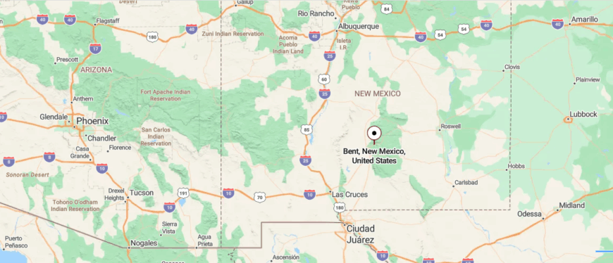
Bent lies in south-central New Mexico, about 15 miles east of Alamogordo along U.S. Highway 70. Tucked between the Sacramento Mountains and wide desert valleys, its location feels sheltered from the busier routes that pass nearby.
You reach it by following the highway through a winding stretch of foothills, where the scenery shifts from open flats to forested slopes. It’s close enough to touch the conveniences of town, yet far enough to settle into a slower, quieter rhythm.
21. Mescal Canyon – Remote Cluster by the Old Logging Grade
Mescal Canyon lies hidden in the rugged hills near Truth or Consequences, shielded from the outside world by stretches of desert and rocky ridges. Its narrow valley and sparse vegetation give it a hushed, timeless feel, as though it’s a place meant to be stumbled upon rather than sought out.
Life here moves at an unhurried pace, shaped by the rhythms of nearby ranches, small farms, and the quiet pull of the land. Visitors can wander the shores of Elephant Butte Lake, soak in the hot springs of Truth or Consequences, or hike the surrounding desert trails where silence is as much a companion as the scenery.
In spring, bursts of wildflowers break the muted tones of the canyon walls, and in summer, warm breezes drift lazily through the valley. Nights bring a dome of stars so clear it feels close enough to touch. It’s the kind of place where the world feels wide, yet your thoughts find room to rest.
Where is Mescal Canyon?
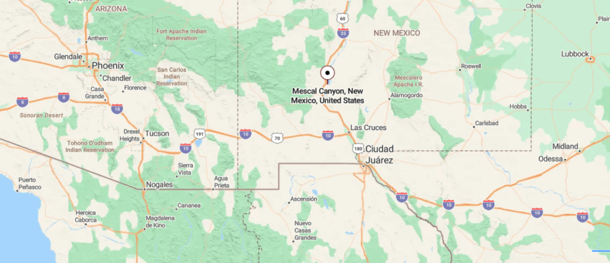
Mescal Canyon sits in southern New Mexico’s Sierra County, just a few miles south of Elephant Butte and near the town of Truth or Consequences. Nestled between rugged desert ridges and the Rio Grande, it remains hidden from the main travel routes that pass nearby.
Access comes by way of a smaller road that winds through dry, rolling hills before dropping into the canyon’s rocky embrace. It’s a short distance from town, yet it feels worlds away in its quiet, unhurried stillness.
20. Pinon – High Desert Outpost with Towering Junipers
Pinon rests in the remote foothills of the Sacramento Mountains, far from busy highways and surrounded by open rangeland that stretches to the horizon. The quiet here is broken only by the wind moving through junipers and the distant calls of wildlife.
Life is rooted in ranching, small-scale farming, and the close ties of a tight-knit community. Visitors can explore nearby Lincoln National Forest, drive winding backroads that reveal hidden valleys, or camp beneath wide skies where the air carries the scent of pine.
In spring, wildflowers color the hillsides, and in autumn, golden light lingers across the landscape. Evenings bring cool air and starlit silence. It’s the kind of place where time slows, and the stillness feels like a gift.
Where is Pinon?
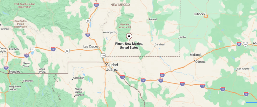
Pinon rests in south-central New Mexico, about 54 miles east of Alamogordo along State Route 24. Surrounded by the Sacramento Mountains and open stretches of high desert, it sits well off the main highways, giving it a quiet, out-of-the-way feel.
You reach it by a two-lane road that winds through rolling hills and scattered pines before opening into the small community. It’s within reach of larger towns, yet distant enough to feel entirely its own.
19. Timber Creek – Seasonal Cabins Along a Forest Stream
Timber Creek sits tucked within forested slopes and rugged canyons, far from the hum of city streets and the press of traffic. Tall pines and winding dirt roads give it a sheltered, almost secretive character, with life moving at the easy rhythm of the seasons.
Many here make their living through ranching, forestry, or small-scale tourism tied to the surrounding wilderness. Visitors can hike shaded trails that follow the creek, fish in cool mountain waters, or explore nearby forest roads that open to sweeping overlooks.
In summer, wildflowers brighten the meadows, and in winter, a hush falls over the snow-dusted trees. Nights are deeply quiet, with only the creek’s murmur beneath a sky thick with stars. It’s the kind of place where you feel far away, yet completely at home.
Where is Timber Creek?
Timber Creek lies in the Sacramento Mountains of south-central New Mexico, about 18 miles southeast of Cloudcroft along a winding mountain road. Set among dense forests and steep ridges, it’s well removed from the busier routes that cross the region.
The drive in follows a narrow, curving stretch that climbs and dips through shaded valleys before reaching the quiet creekside area. It’s close enough for a day trip from nearby towns, yet it feels tucked away in its own secluded corner of the mountains.
18. Sacramento – Hilltop Community Overlooking Desert Plains
Sacramento rests high in the Sacramento Mountains, surrounded by dense forest and miles of winding roads that keep it far from the pace of city life. The air is cool and scented with pine, and the quiet is broken only by birdsong and the rustle of wind through the trees.
Life here revolves around ranching, small local businesses, and the rhythms of the mountain seasons. Visitors can hike into Lincoln National Forest, picnic along shaded streams, or take in sweeping views from nearby overlooks.
Summer brings fields of wildflowers, while autumn paints the slopes in gold and amber. Evenings settle into a calm stillness beneath a sky crowded with stars. It’s the kind of place where the mountains feel like both a boundary and a sanctuary.
Where is Sacramento?

Sacramento sits high in the Sacramento Mountains of south-central New Mexico, about 27 miles southeast of Cloudcroft along State Route 521. Surrounded by forested slopes and open mountain meadows, it remains far from major highways, giving it a peaceful, remote feel.
The route in winds through dense pines and rolling ridges, with glimpses of wide valleys below. It’s a short drive from nearby mountain towns, yet it feels like a place set apart from the rest of the world.
17. Arabela – Historic Ranching Settlement by the Hondo River
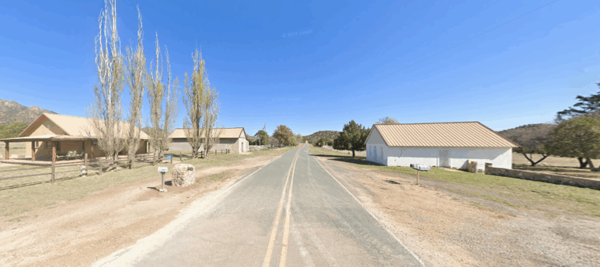
Arabela lies hidden in the foothills of the Sierra Blanca Mountains, its few homes and ranches scattered along a quiet stretch of winding road. The surrounding mesas and tree-lined creeks create a sense of seclusion, as if the outside world drifts far beyond the ridges.
Life here is shaped by ranching, farming, and the deep-rooted traditions of families who have called the area home for generations. Visitors can explore nearby hiking trails, follow the scenic route toward Lincoln National Forest, or watch wildlife in the open valleys.
In spring, the land blooms with wildflowers, and in fall, the air turns crisp under a canopy of changing leaves. Nights are peaceful, with only the soft sounds of the land in the dark. It’s the kind of place where the horizon feels close, yet endlessly wide.
Where is Arabela?
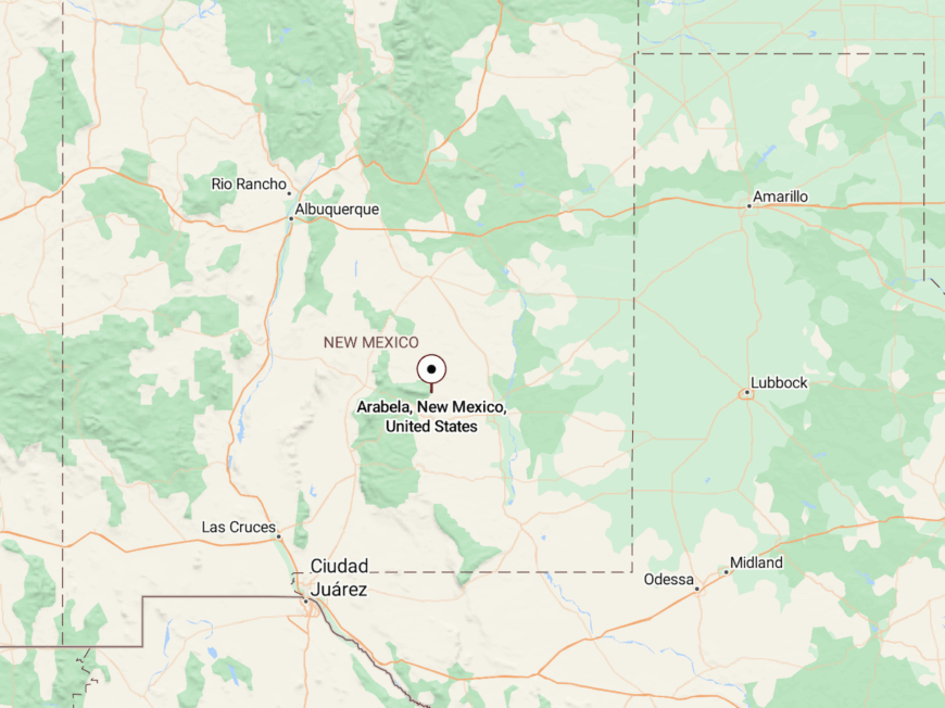
Arabela is located in south-central New Mexico, about 28 miles east of Ruidoso along a narrow county road. Nestled at the base of the Sierra Blanca range and near the Rio Hondo, it sits far from main highways, lending it a sense of deep quiet.
The approach follows a winding rural route through open ranchland and low hills before the small settlement comes into view. It’s close enough to reach in under an hour, yet it feels untouched by the pace of modern life.
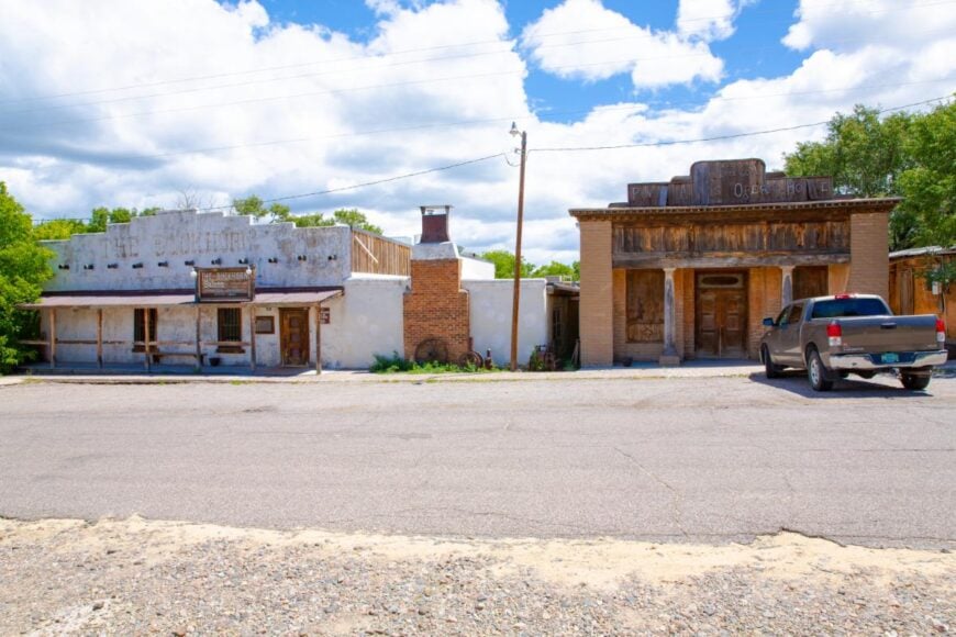
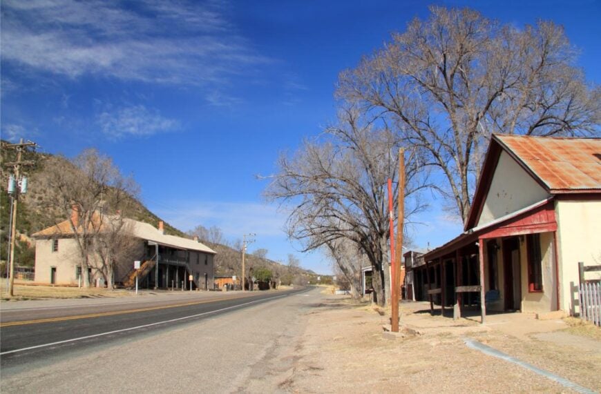
16. Lincoln – Living History Village in a Narrow Valley
Would you like to save this?
Lincoln stretches along a narrow valley in the Sacramento Mountains, its preserved adobe and stone buildings standing as quiet witnesses to centuries of history. The town feels removed from the modern world, with long, quiet streets and the hum of the nearby Rio Bonito replacing the noise of traffic.
Life here is tied to tourism, ranching, and the seasonal rhythm of visitors drawn to its Old West legacy. Guests can walk through the Lincoln Historic Site, explore museums and old storefronts, or follow trails that wind into surrounding hills.
In summer, the sun warms the adobe walls, and in winter, the valley rests beneath a hush of cold air. Evenings bring a stillness broken only by the river’s gentle flow. It’s the kind of place where the past feels present, and time moves unhurried.
Where is Lincoln?
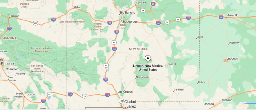
Lincoln lies in south-central New Mexico, about 57 miles west of Roswell along U.S. Highway 380. Framed by the Capitan Mountains and the Rio Bonito, it sits apart from larger towns while still following a historic route through the valley.
The drive in traces gentle curves past open fields and weathered buildings that hint at its storied past. It’s within easy reach of nearby cities, yet it feels suspended in a quieter, older rhythm.
15. Chloride – Ghost Town Reborn in a Box Canyon
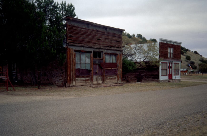
Chloride sits at the end of a winding road in the San Mateo Mountains, its cluster of 19th-century buildings surrounded by rugged hills and open sky. Once a silver mining town, it now feels tucked away from the world, with only the sound of wind and the creak of old wooden porches breaking the silence.
Life here is centered on its history, with locals maintaining museums, shops, and remnants of the mining era for the few who make the journey. Visitors can wander the preserved main street, explore the Pioneer Store Museum, or hike the nearby canyon trails.
In spring, desert blooms brighten the landscape, while autumn brings cooler air and long golden sunsets. Nights are quiet enough to hear the coyotes call across the hills. It’s the kind of place where history lingers in the stillness.
Where is Chloride?
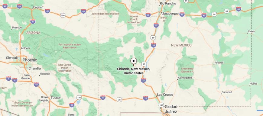
Chloride is tucked into the Black Range of southwestern New Mexico, about 40 miles west of Truth or Consequences via State Route 52 and a smaller county road. Surrounded by rugged hills and narrow canyon walls, it sits well off the main travel routes, adding to its quiet, hidden character.
The approach winds through open desert before narrowing into a shaded canyon lined with old wooden storefronts. It’s not far from modern conveniences, yet it feels like stepping into a place where time has slowed.
14. Winston – Ranching Crossroads with a Single Main Street
Winston rests in a wide valley north of the Gila National Forest, surrounded by open rangeland and distant mountain ridges that keep it far from the rush of city life. The town’s few streets are lined with simple homes, old storefronts, and the quiet hum of a community tied to ranching and small-scale tourism.
Life moves slowly here, shaped by the changing seasons and the steady rhythm of the land. Visitors can drive scenic byways into the Gila, fish in nearby creeks, or explore the remnants of old mining camps scattered through the hills.
In spring, wildflowers paint the fields, and in fall, cool breezes carry the scent of woodsmoke. Evenings bring a calm that settles over the valley like a blanket. It’s the kind of place where open skies and quiet roads feel endless.
Where is Winston?
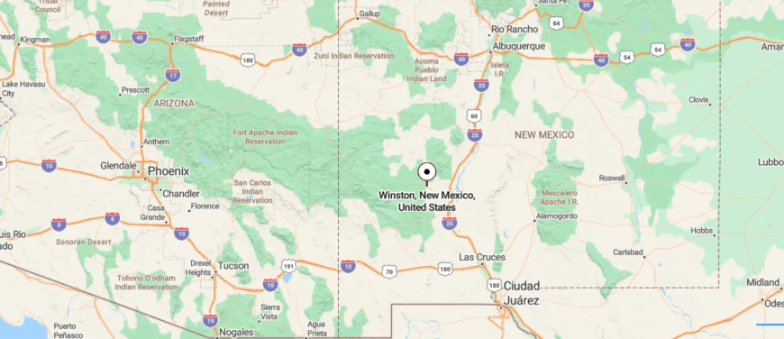
Winston sits in southwestern New Mexico, about 32 miles northwest of Truth or Consequences along State Route 52. Framed by the Sierra Cuchillo Mountains and open ranch country, it lies far from major highways, giving it a quiet, removed atmosphere.
The road in stretches through wide desert valleys and gentle hills before reaching the small community. It’s near enough for a day trip, yet it feels firmly rooted in its own unhurried world.
13. Hillsboro – Former Gold Town Turned Quiet Artist Haven
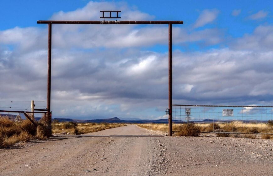
Hillsboro rests along a quiet stretch of Highway 152, nestled in the foothills of the Black Range where winding roads and rugged terrain keep it well off the beaten path. Historic adobe and stone buildings line its main street, remnants of its 19th-century gold mining days that now lend the town a timeless charm.
Life here is shaped by a blend of ranching, local artisans, and the slow pace of a small mountain community. Visitors can explore the Hillsboro Historical Society Museum, wander through art galleries, or take scenic drives into the Black Range for hiking and birdwatching.
Spring brings bursts of wildflowers to the surrounding hills, and autumn bathes the valley in warm, golden light. Nights are quiet beneath a blanket of stars. It’s the kind of place where history and solitude meet in perfect stillness.
Where is Hillsboro?
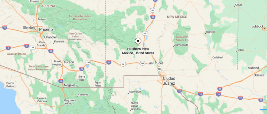
Hillsboro rests in the foothills of the Black Range in southwestern New Mexico, about 32 miles west of Truth or Consequences along State Route 152. Surrounded by rugged mountains and winding canyon terrain, it sits away from the state’s main corridors, fostering a sense of quiet seclusion.
The drive in follows a narrow, twisting road through scenic hills and desert brush before opening into the historic village. It’s close enough to reach in under an hour, yet it feels worlds apart from the pace of nearby towns.
12. Apache Springs – Off-Grid Cabins at the Forest Edge
Apache Springs lies hidden in the Sacramento Mountains, surrounded by dense forest and meadows that keep it far from the noise of modern life. Its quiet roads and scattered cabins blend into the pines, giving the area a sense of seclusion that feels almost untouched.
Life here follows the rhythms of nature, with many drawn to its cool mountain air and the simplicity of living close to the land. Visitors can hike into Lincoln National Forest, follow trails that wind past natural springs, or watch wildlife in the open clearings.
Summer brings green slopes and the sound of rushing water, while autumn cloaks the trees in rich color. Evenings are marked by crisp air and the glow of starlight through the branches. It’s the kind of place where the mountains seem to hold the world at a gentle distance.
Where is Apache Springs?
Apache Springs is located in the Sacramento Mountains of south-central New Mexico, about 16 miles south of Cloudcroft along State Route 6563 and forest roads. Encircled by tall pines and cool mountain air, it sits well away from main highways, adding to its sense of retreat.
The route in climbs and curves through dense forest, with clearings that reveal sweeping ridge views. It’s not far from neighboring mountain communities, yet it feels tucked deep into its own peaceful setting.
11. Cloudcroft – Alpine Village Above the Desert Floor
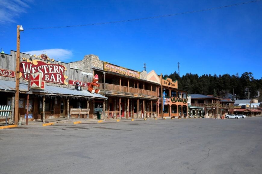
Cloudcroft rests high in the Sacramento Mountains at over 8,600 feet, its cool alpine air and winding approach roads setting it far apart from the desert lowlands below. Tall pines and aspen surround the village, and the scent of woodsmoke drifts through the streets in every season.
Life here thrives on tourism, with small shops, cafes, and lodges catering to hikers, skiers, and those seeking an escape from the heat. Visitors can explore trails in Lincoln National Forest, ride the historic trestle recreation area, or enjoy winter skiing at Ski Cloudcroft.
Summer brings wildflowers and shaded hikes, while autumn turns the slopes into a tapestry of gold. Nights are crisp and quiet, the stars bright against the mountain sky. It’s the kind of place where the air feels fresher, and the world seems far away.
Where is Cloudcroft?
Cloudcroft sits high in the Sacramento Mountains of south-central New Mexico, about 17 miles east of Alamogordo along U.S. Highway 82. Perched at over 8,600 feet, it’s surrounded by dense pine forests and cool mountain air, offering a stark contrast to the desert below.
The drive in follows a winding mountain highway with sweeping views of the Tularosa Basin before climbing into the shaded village. It’s close enough for a quick escape, yet it feels like a world apart in both pace and scenery.
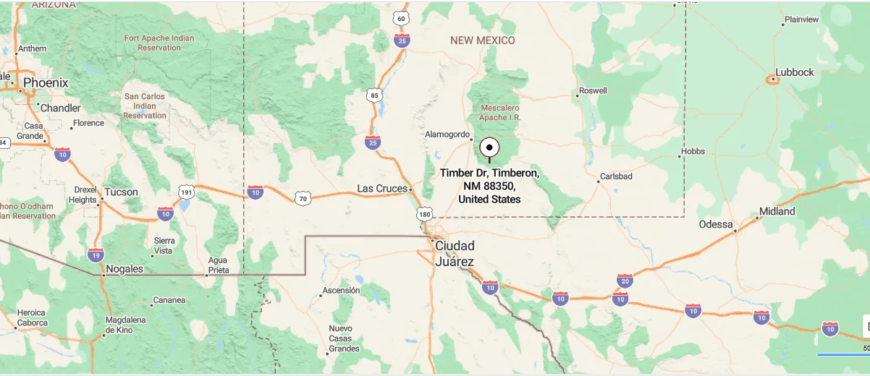
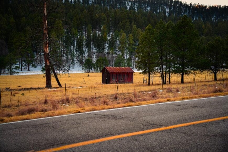
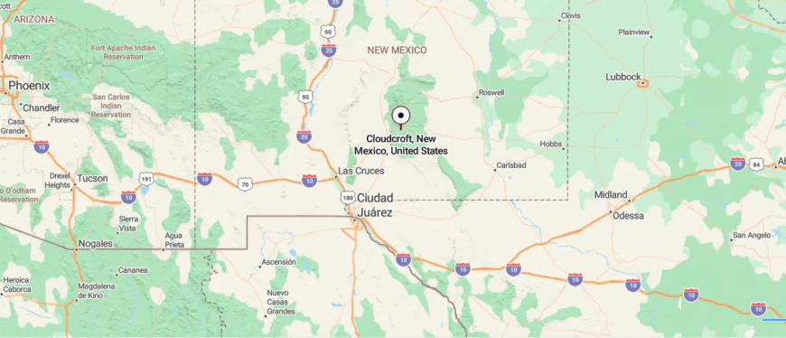
10. Timberon – Pine-Shaded Cabins Around a Quiet Mountain Airstrip
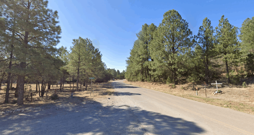
Roughly 300 year-round residents occupy Timberon, an unincorporated enclave tucked in the southern Sacramento Mountains. Anglers drift along two spring-fed trout ponds, golfers play a nine-hole course ringed by ponderosa pines, and hikers slip down the Carr Peak Trail for sweeping desert views.
Local commerce is limited to a combination café–general store, a volunteer fire department, and a sprinkling of cabin-rental outfits, with many households relying on pensions or remote work.
Aviation buffs fly their Cessnas into Timberon’s 4,600-foot private runway, a grassy strip that doubles as the town’s social hub during summer fly-ins.
Seclusion comes from being 30 miles from the nearest stoplight and from lots laid out in one-acre chunks that disappear into heavy timber. Nightfall brings coyotes yipping and a Milky Way so bright that porch lights feel unnecessary.
Where is Timberon?
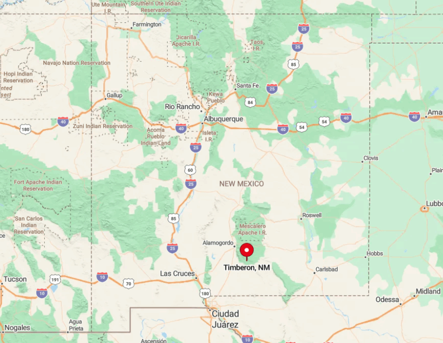
The community sits on a high mesa southeast of Cloudcroft, reached by NM 130 and a final stretch of curvy County Road 506. Elevations hover near 7,000 feet, and the surrounding Lincoln National Forest blocks cell signals in many folds of the landscape.
With no through-road, Timberon is a terminus rather than a waypoint, which helps keep traffic thin. Visitors typically arrive via Alamogordo, then climb 90 minutes of switchbacks before pines swallow the edges of their windshield.
9. Weed – High-Elevation Hamlet on the Edge of the Lincoln National Forest
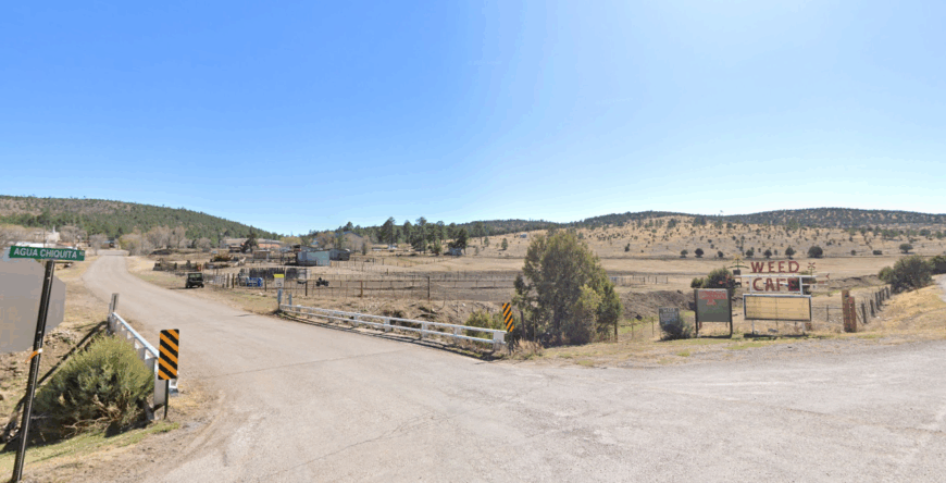
Fewer than 100 people call Weed home, a cluster of weather-worn buildings perched at 7,200 feet. Photographers wander the old mercantile façade and capture afternoon thunderheads rolling over open meadows where elk graze.
Ranching and small-scale logging provide modest income, while the lone café serves as both post office and gossip exchange. Miles of dirt ranch roads branch toward Argentina Canyon and Sacramento Peak, making horseback rides and 4×4 outings a daily pastime.
Weed feels isolated because there is no fuel station for 30 miles and winter storms frequently close the only paved approach. Landlines still outnumber cell phones, and a good snowstorm can leave the town in hushed white stillness for days.
Where is Weed?
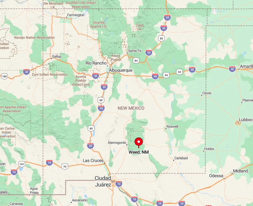
Weed lies 48 miles southeast of Alamogordo, reached via scenic NM 130 and NM 24 as they snake along ridgelines of the Sacramento crest. Forested slopes to the west and the vast Tularosa Basin to the east result in minimal radio or cellular coverage once a vehicle drops off the ridge.
The nearest grocery run involves a one-hour drive to Cloudcroft along winding pavement with no shoulders. That physical separation preserves Weed’s pocket-of-time atmosphere.
8. Mayhill – Creekside Retreat Where Mountain Laurel Meets Wide Sky
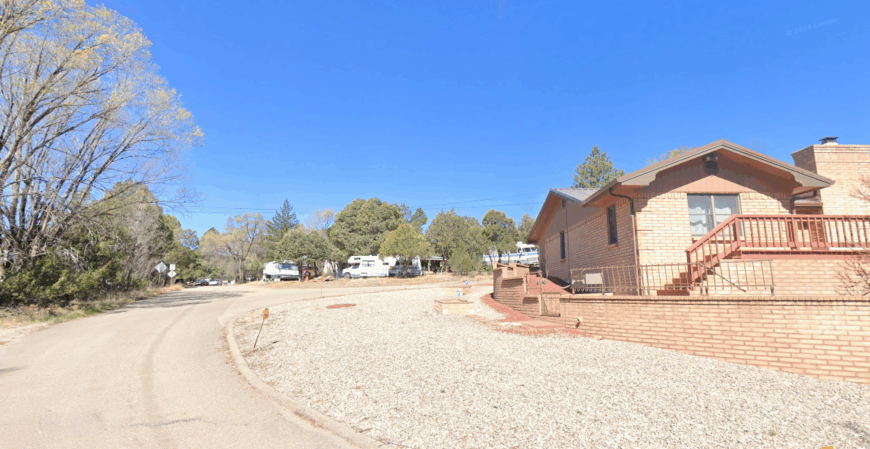
About 70 permanent residents live in vintage log homes scattered beside James Canyon Creek, a ribbon of water shaded by cottonwood and laurel. Travelers pause at the century-old Mayhill Café for green-chile cheeseburgers before strolling the wooden footbridge to spot rainbow trout in clear pools.
Small guest cabins and a modest RV park create seasonal income, while ranching and Forest Service jobs round out the economic picture. Birders cherish Mayhill’s position along the hummingbird migration corridor, and spring lilacs perfume the whole canyon.
The hamlet remains secluded because it sits in a steep valley where cell towers and expansion are impractical, and there’s virtually no commercial strip beyond the café and post office. At dusk, the only sounds are creek water and wind brushing conifer needles on the canyon walls.
Where is Mayhill?
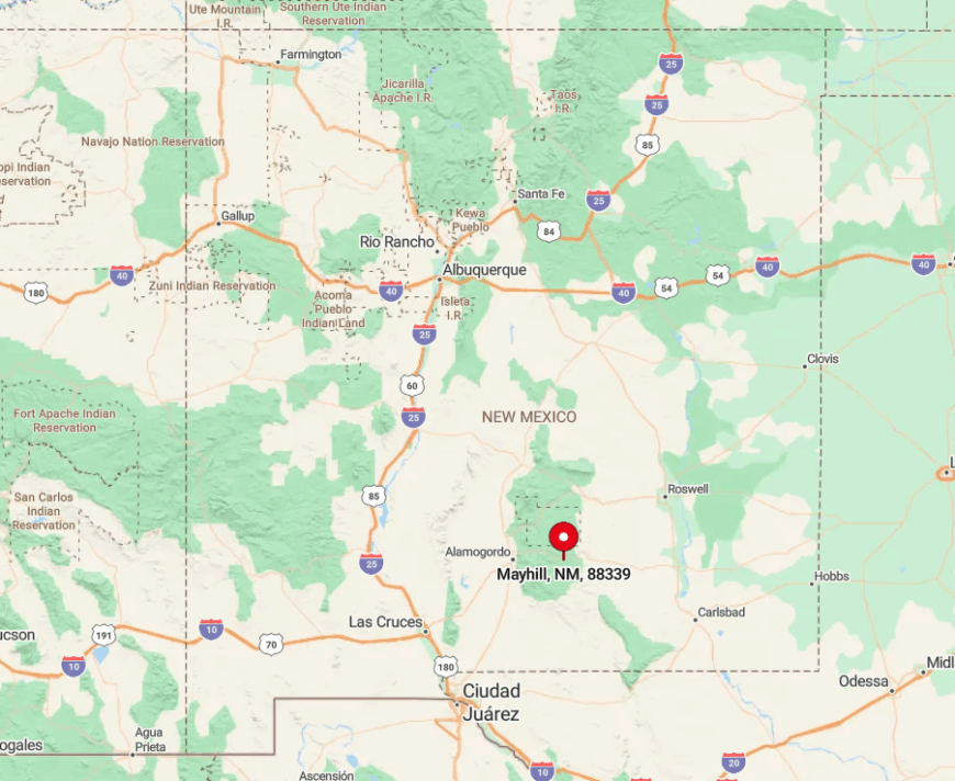
Mayhill is 19 miles east of Cloudcroft on US 82, a scenic byway that tunnels through rock cuts and high bridges over James Canyon. Cliffs rise sharply on both sides, limiting any lateral development and creating a cozy corridor effect.
Public transit is nonexistent; the closest airport with scheduled flights is in El Paso, a two-hour drive away. Visitors exit the highway, cross a single-lane bridge, and immediately feel wrapped in mountains.
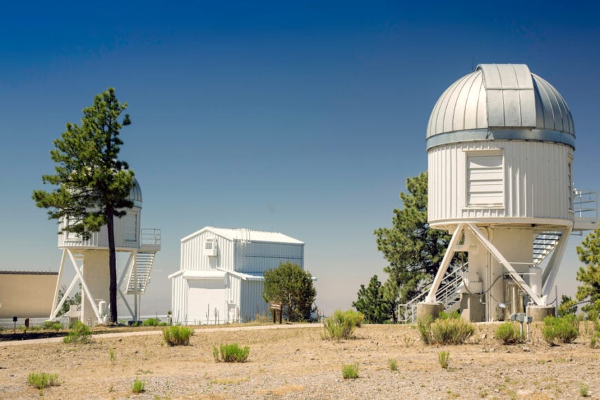
7. Sunspot – Observatory Village Above the Clouds
Would you like to save this?
With barely 30 residents, mostly scientists and caretakers, Sunspot clings to a 9,200-foot ridge crowned by the gleaming domes of the National Solar Observatory.
Day visitors walk the self-guided “Sunspot Scenic Byway Trail,” peeking into instrument towers that study solar flares, while hikers descend the Rim Trail for breathtaking views over White Sands.
Employment revolves around research and the visitor center gift shop; otherwise, locals drive to Cloudcroft for supplies. Strict dark-sky ordinances keep porch lights dim, making nightly meteor showers part of the routine.
Seclusion stems from altitude, a single access road, and a campus gated after hours to protect sensitive equipment. Even midday, clouds drift below the ridge, giving the sensation of living on an island in the sky.
Where is Sunspot?
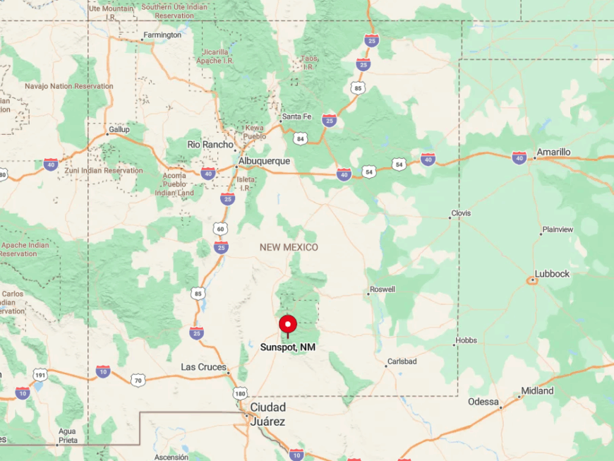
The village crowns Sacramento Peak at the southern tip of Lincoln National Forest, 17 miles south of Cloudcroft via NM 6563, a road numbered after the wavelength of the hydrogen-alpha spectral line. Sheer drops on one side and dense fir forest on the other discourage side roads or sprawl.
Winter storms can close the route, leaving residents to wait for Forest Service plows before descending. Those arriving from Alamogordo climb nearly 5,000 vertical feet in under an hour, underscoring the settlement’s lofty isolation.
6. High Rolls–Mountain Park – Apple Orchards Hidden in a Mountain Bowl
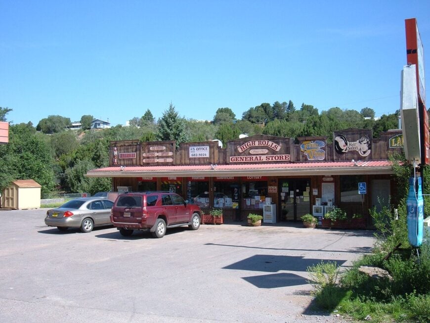
Close to 600 people live between High Rolls and Mountain Park, two adjoining villages cradled in a bowl-shaped valley 4,800 feet above the Tularosa Basin. Visitors time trips for the April cherry and October apple festivals, when century-old orchards burst with blossoms or crimson fruit.
Agriculture, primarily apples, cherries, and recently lavender, anchors the local economy, supported by a smattering of B&Bs and roadside pie stands. Several creekside trails lead to Little Apache and Bridal Veil Falls, while train buffs explore the remains of the Alamogordo & Sacramento Mountain Railway grade.
The valley sits above desert heat yet below heavy snow lines, and surrounding granite cliffs act as a natural wall that hides the community from highway sightlines. That embracing geography, plus scarce lodging, keeps foot traffic pleasantly thin outside festival weekends.
Where is High Rolls–Mountain Park?
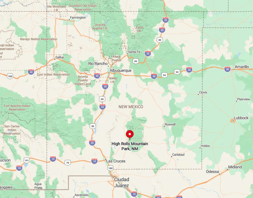
The villages lie 14 miles northeast of Alamogordo off US 82; a sharp turn onto Fresnal Canyon Road drops travelers into orchards within minutes. Cliffs block cell towers, so service flickers after the first bend, reinforcing the tucked-away feel.
Only one paved road connects the valley to the wider world; any alternate routes are rough Forest Service tracks that close after heavy rain. Drivers emerging from the canyon often remark how suddenly the desert reappears, proving just how hidden the orchard bowl really is.
5. Nogal – Old Mining Settlement with Sweeping Sierra Blanca Vistas
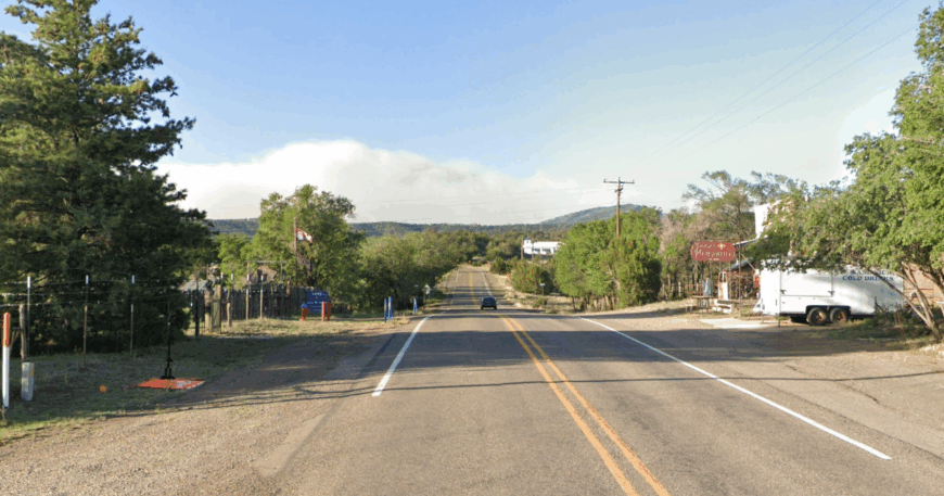
About 150 residents inhabit Nogal’s sage-speckled valley beneath 11,981-foot Sierra Blanca Peak. ATV riders follow mining roads toward the abandoned Parsons Mine, and day hikers tackle Nogal Peak for panoramic shots of white-capped mountains and juniper flats.
Small-scale cattle ranching and vacation rentals dominate local income, with occasional art sales from metalsmiths repurposing historic mine scraps. In late summer, lightning-lit monsoon storms paint cinematic skies that draw landscape photographers.
Nogal feels remote because it sits well north of the tourist flow to Ruidoso, and properties sprawl across rangeland where neighbors are often a half-mile apart. Night silence here is broken only by distant cow calls and the creak of old windmills.
Where is Nogal?
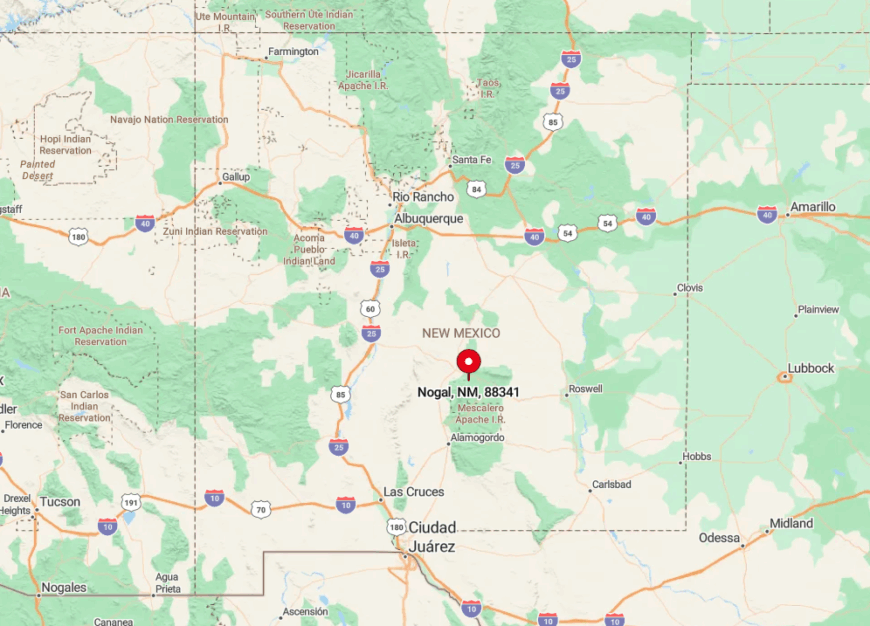
The village stands along NM 37, roughly 18 miles northwest of Ruidoso and 60 miles south of Carrizozo. Surrounded by Lincoln National Forest on three sides and ranch land on the fourth, Nogal lacks retail or gas, compelling residents to plan weekly trips to Ruidoso Downs.
The approach from US 380 crosses broad open mesa, then dives into tight piñon canyons, underscoring the transition from high desert to mountain hideaway. Travelers in winter should watch for black ice on shaded curves that see little maintenance.
4. Pinos Altos – Gold-Rush Ghost Town in the Gila Highlands
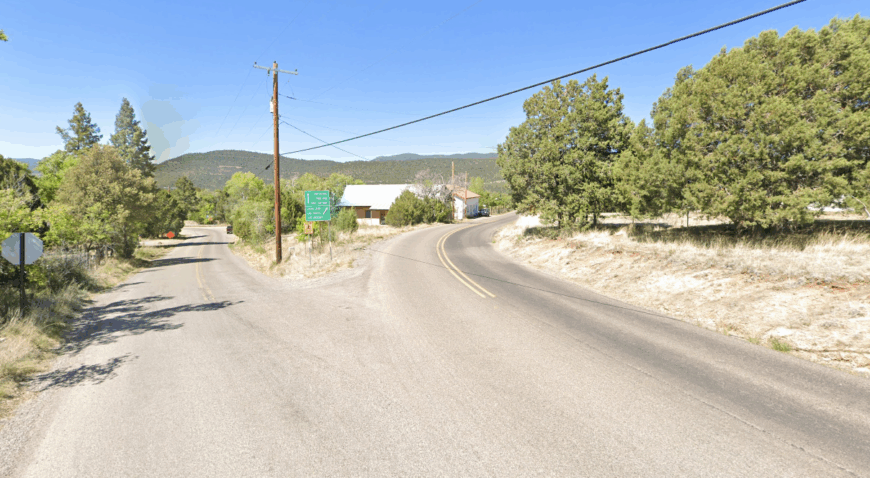
Pinos Altos hosts roughly 200 people among 19th-century log saloons, gravel lanes, and tall ponderosa trunks that inspired the town’s Spanish name. Visitors sip craft beer at the Buckhorn Saloon, peek inside the 1866 opera house, and mountain-bike the signal-peak loop that skirts 10,000-foot ridges.
Income comes from heritage tourism, a handful of artisans, and hikers resupplying before diving into the surrounding Gila National Forest. Prospectors still try their luck in Bear Creek with small sluice boxes, though gold fever now feels quaint rather than feverish.
Despite being only six miles from Silver City, a 1,300-foot climb over hairpin curves plus the lack of streetlights or sidewalk development preserves a frontier quiet. The scent of pine pitch and distant hammering on a guitar drifting from a porch set the evening mood.
Where is Pinos Altos?
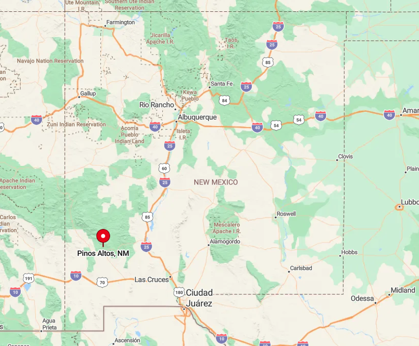
The settlement perches on NM 15, the same road that later twists toward the Gila Cliff Dwellings. Dense forest on either side forces the highway to remain narrow, discouraging RV traffic and large-scale development.
Bicyclists know the route as a lung-busting climb, while winter visitors may find the pass closed after heavy snow. Those who brave the switchbacks are rewarded with a main street that feels plucked from a Western film set.
3. Mogollon – Cliff-Hugging Enclave at the End of a Winding Canyon Road
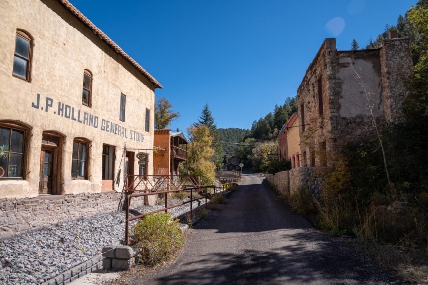
Fewer than a dozen seasonal residents keep Mogollon alive, its wooden boardwalks clinging to the walls of Silver Creek Canyon. Day-trippers explore the Mogollon Museum, wander past weathered miner’s cabins, and photograph St. Jude Church perched against ponderosa slopes.
A couple of art galleries and the Purple Onion Café open on summer weekends, creating the town’s only commerce beyond occasional film-set rentals. Flash-flood debris from the creek still marks doors eight feet up, a reminder of nature’s control here.
Seclusion is absolute: no cell reception, no winter plowing, and a canyon so narrow that buildings touch bedrock behind them. Nights reverberate with flowing water and owl calls echoing between sheer rock walls.
Where is Mogollon?

Located 75 miles northwest of Silver City, Mogollon sits at the dead-end of NM 159, a single-lane ribbon climbing 4,000 feet in fewer than 15 miles. Sharp drop-offs lack guardrails, keeping traffic cautious and sparse.
The road closes after the first significant snow, often from November through April, isolating any remaining residents. Those determined to visit in summer typically launch from the tiny community of Glenwood, 9 miles away, where fuel and last-chance supplies await.
2. Kingston – Black Range Hideaway Beneath Aspen-Lined Switchbacks
Kingston’s population hovers near 30, scattered among stone ruins and a lovingly restored 1884 hotel once visited by Buffalo Bill. Travelers tour Percha Bank Museum, hike the Iron Creek Trail into aspen groves, and watch mule deer graze behind crumbling storefronts along NM 152.
A historic bed-and-breakfast and the U.S. Forest Service ranger station supply the few local jobs; residents otherwise ranch or telecommute when the internet cooperates.
Quiet reigns because the once-booming silver mines closed over a century ago, leaving wide-open slopes and abandoned shafts now reclaimed by oak and juniper.
Kingston’s remoteness comes from being nestled deep in the Black Range with no services for 30 miles in either direction. Fall turns surrounding hillsides gold, yet crowds stay away, deterred by steep switchbacks.
Where is Kingston?

The hamlet sits along NM 152, halfway between Hillsboro and Emory Pass at nearly 6,200 feet. Tight curves and 1,000-foot drop-offs demand low gears and undivided attention, slowing traffic to a trickle. No cellular towers pierce the ridgeline, so travelers plan rendezvous points the old-fashioned way.
Anyone arriving from Interstate 25 must budget an hour to climb from desert floor to cool mountain air, a journey that underlines Kingston’s removed setting.
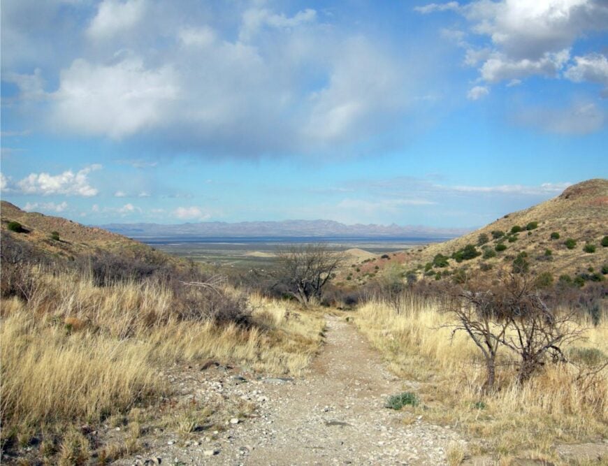
1. Gila Hot Springs – River-Side Oasis Surrounded by Wilderness Peaks
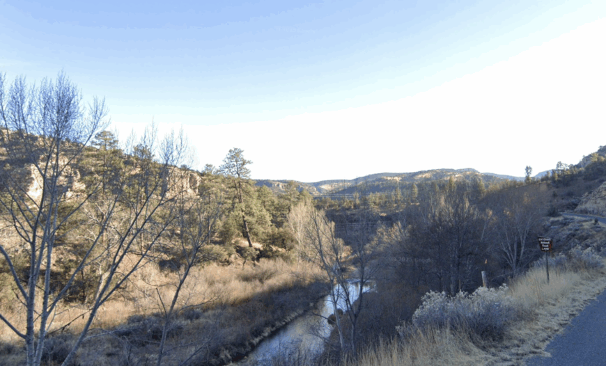
Only about 40 folks reside full-time in Gila Hot Springs, a bend of the Gila River lined with steaming pools shaded by cottonwoods. Visitors soak in rustic rock-rimmed baths, paddle kayaks downstream, or set off on the Middle Fork trail into true wilderness less than a mile away.
The local economy centers on two small campgrounds, a tiny store stocked with ice cream and fishing tackle, and guiding services for backpackers heading into the nation’s first designated wilderness.
Seclusion is intensified by off-grid cabins powered by solar, no cell service, and the nightly chorus of river rapids mixing with canyon wrens. This is a place where stars dominate the sky and conversation drifts toward trail conditions rather than headlines.
Where is Gila Hot Springs?
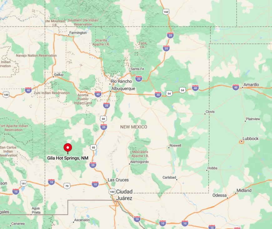
The settlement hides 40 miles north of Silver City along NM 15, past a gauntlet of hairpins that discourage large RVs. Steep granite walls and ponderosa forest hem in the narrow river valley, blocking any thought of expansion.
Drivers should expect nearly two hours of travel for those 40 miles, with the last gas and pavement widening back in Silver City. Once past the Gila Cliff Dwellings turnoff, the road dead-ends at a small bridge, cementing Gila Hot Springs as the very definition of a pocket of peace.