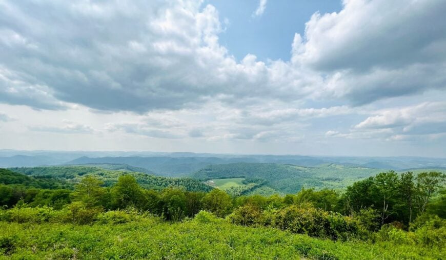
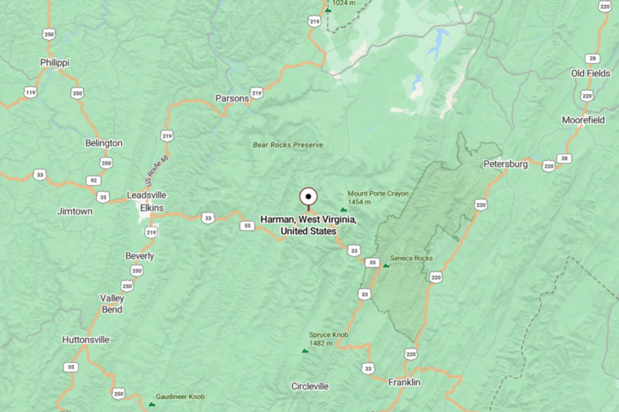
Eastern West Virginia sits squarely in Appalachia, where two mountain worlds overlap. The Allegheny Highlands rise like a spine in the west, while the folded Ridge-and-Valley country spreads out to the east. Between them lie rivers that run fast and towns that stay small, places shielded by rock walls and thick forests.
In order to come up with the very specific design ideas, we create most designs with the assistance of state-of-the-art AI interior design software. Also, assume links that take you off the site are affiliate links such as links to Amazon. this means we may earn a commission if you buy something.
In these valleys, seclusion is built into the terrain. Roads climb sharp switchbacks, crest narrow passes, and then drop into clearings where a dozen houses and a church make up the map. Some communities still echo the Allegheny logging era, others carry the farm traditions of the long valleys, but all share a rhythm that moves slower than the highways left behind.
The Appalachian character shows up in details: clapboard houses leaning against the weather, old railroad grades turned into trails, gardens tucked behind barns, and festivals that keep European and mountain traditions alive. It’s not nostalgia, but persistence—an everyday life held together by ridges and rivers.
This survey gathers 25 such towns across Eastern West Virginia, from the limestone hollows near Seneca Rocks to the spruce-covered heights of Cheat Mountain. Each one carries its own shape of Appalachian quiet, a reminder that in these hills, distance is measured more by terrain than by miles.
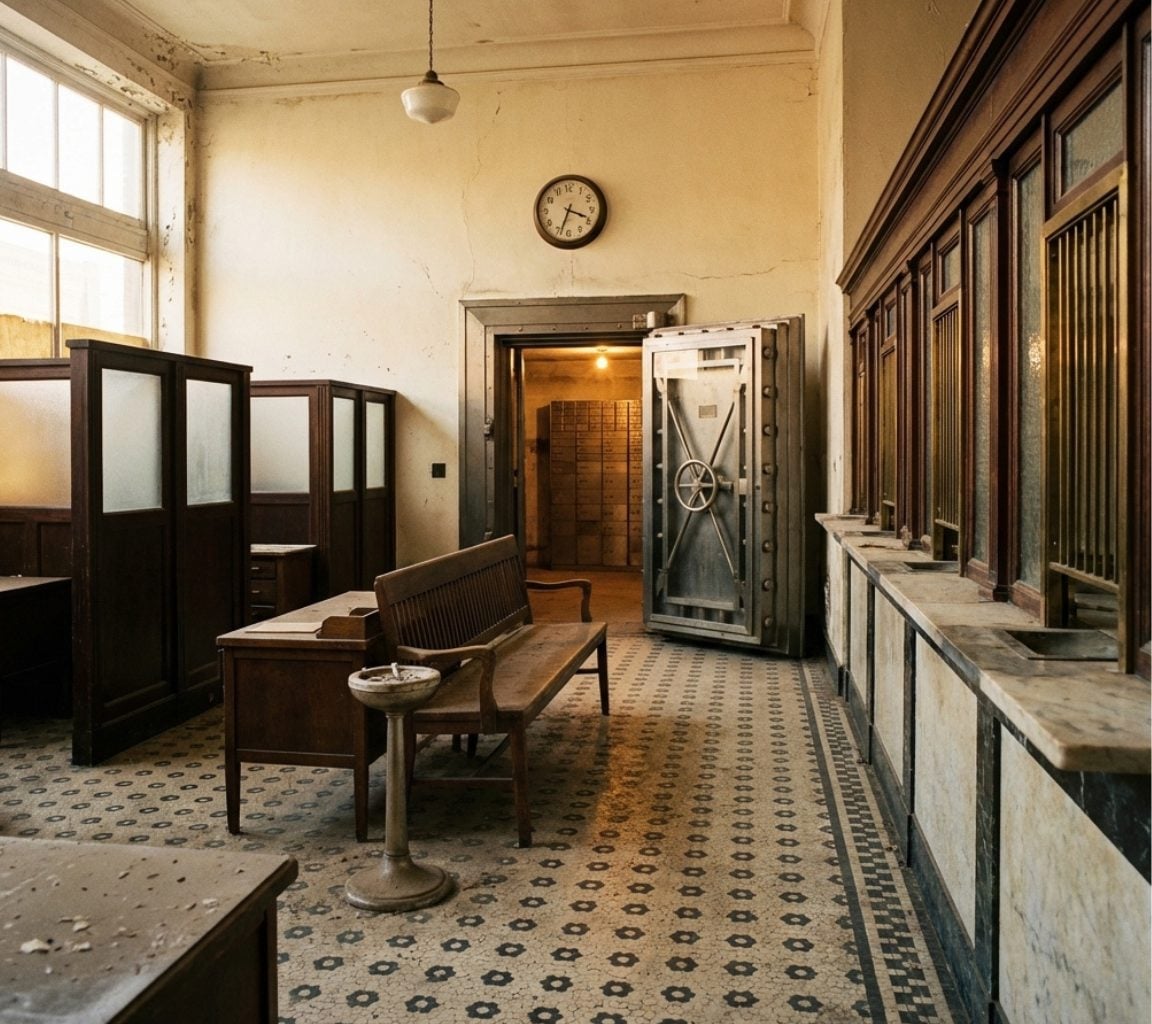
25. Bayard – A Riverside Mill Town that Time Forgot
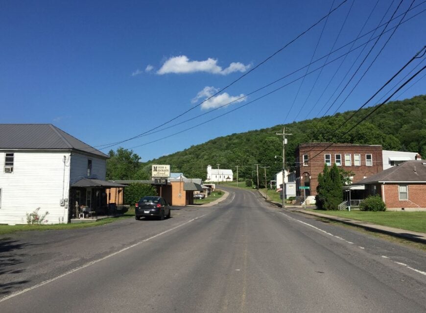
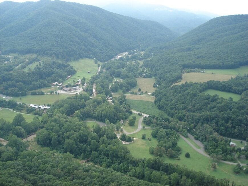
Bayard rests on the banks of the North Branch of the Potomac, a tiny Grant County community where old brick mill buildings still stand watch over the river. Fewer than 300 people call it home, and its distance from major highways makes it feel frozen in an earlier century.
Trout anglers wade into the cool current, hikers trace the old railroad grade, and autumn travelers admire how the river cuts a bright ribbon through the hills. Most families make a living through farming or logging, though a handful commute out for work.
The town vibe is one of resilience and patience, a place where people wave from porches and kids fish until the dinner bell rings. Nights here are dark and hushed, punctuated only by river sounds. It’s the kind of place where the outside world feels optional.
Where is Bayard?
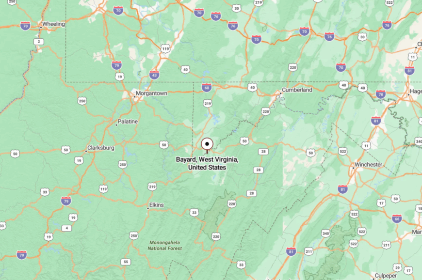
BBayard lies in Grant County in northeastern West Virginia, pressed right against the Maryland state line. The town rests on the North Branch of the Potomac River, where forested hills flatten into a narrow river valley.
It’s about 40 miles northeast of Elkins, reached by WV Route 90 and smaller county roads that trace the river bends. The approach is slow and winding, and by the time you arrive, the Maryland border feels closer than the bustle of any West Virginia city.
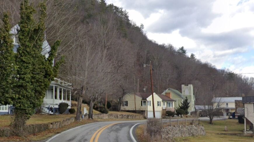
24. Durbin – A Railroad Village at the Edge of Wilderness
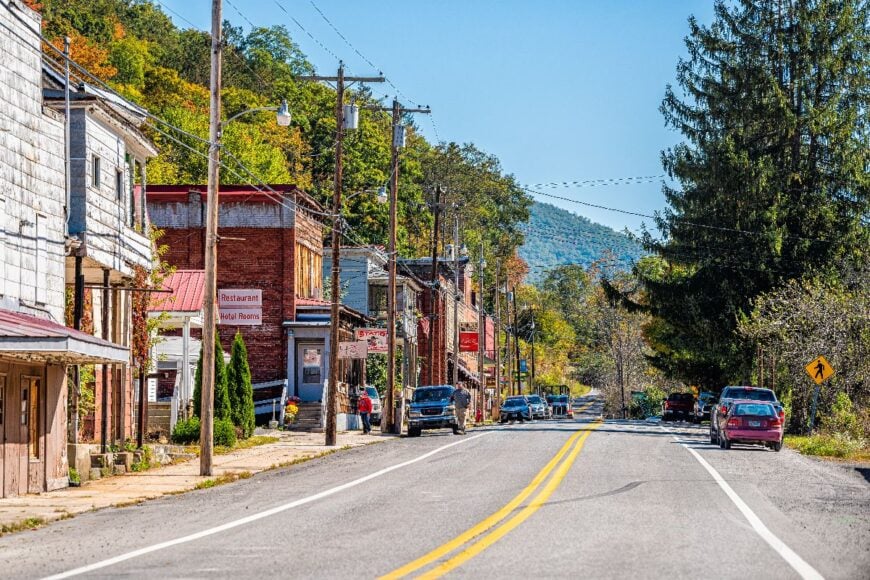
Durbin is a whistle-stop of about 250 residents where the Greenbrier River bends against Pocahontas County ridges. The old Durbin & Greenbrier Valley Railroad still runs scenic excursions, its whistle echoing through valleys that feel more forest than town.
Life revolves around small shops, a modest diner, and weekend tourists who come for rail trips, fishing, or access to the Monongahela National Forest. Lumber and tourism keep the economy steady, but sprawl has never touched these streets.
Wooden houses with deep porches line the lanes, their paint worn by mountain winters. Evenings sink into quiet so complete you hear the river breathing. It’s a place where you can lose track of the clock and never mind.
Where is Durbin?
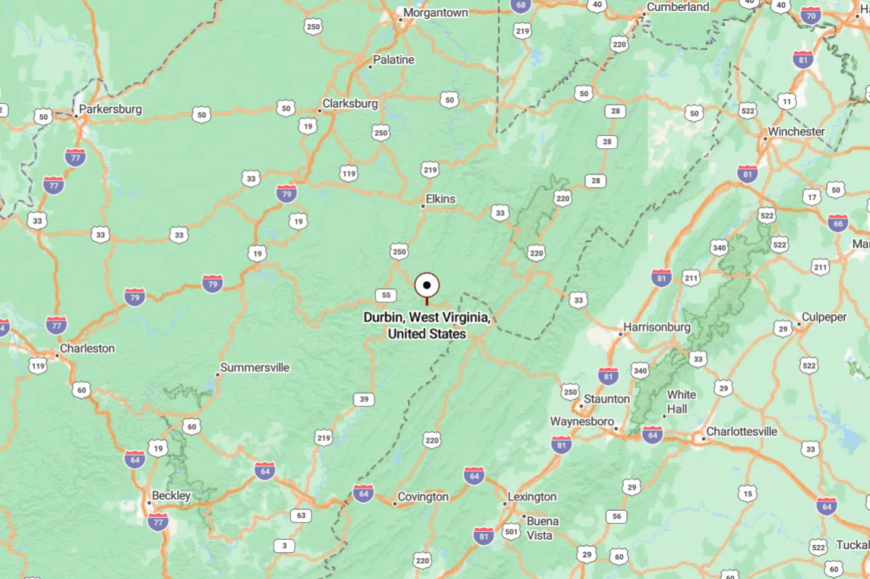
Durbin lies in northern Pocahontas County, about 25 miles east of Elkins via US 250. The approach winds over Cheat Mountain, where hairpin curves test every driver’s patience.
Once you crest the ridge, the valley narrows into a quiet channel where the town sits. The trip is slow-going, but that’s why it still feels so undisturbed.
23. Sugar Grove – An Old Naval Station in a Remote Valley
Sugar Grove is best known for its shuttered Naval Radio Station, a relic of Cold War secrecy now surrounded by deep Highland ridges. With fewer than 400 residents, the town leans on cattle farming and logging, its few streets quiet under a canopy of hardwoods.
Visitors hike into nearby Shenandoah Mountain, fish the cool streams, or simply explore the quiet remnants of the old base. The absence of commercial strips means evenings are filled with farm sounds instead of neon. A mood of mystery lingers here, tied to the valley’s hidden history.
Locals embrace both the solitude and the silence, saying it’s a good place for those who value space more than spectacle. It’s the kind of seclusion that feels deliberate, almost protective.
Where is Sugar Grove?
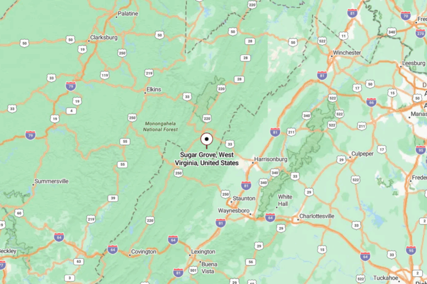
Sugar Grove sits in Pendleton County, tucked within the George Washington National Forest near the Virginia line. The valley is about 15 miles southwest of Franklin and roughly 40 miles southeast of Harrisonburg, Virginia, separated by ridges that guard its quiet.
Reaching it means taking US 33 or US 220 before turning onto narrow county roads that cross Shenandoah Mountain. The drive is slow and twisting, and the sense of distance lingers long after you arrive.
22. Riverton – A Quiet Bend in the Potomac
Riverton’s name suits it well—just a curve of houses gathered where the North Fork of the Potomac River makes its slow sweep through Pendleton County. Maybe 150 residents call it home, most of them tied to farming, small forestry jobs, or guiding visitors into the nearby national forest.
Photographers come for the wide views of Germany Valley, anglers for the trout pools, and hikers for the trailheads tucked just outside town. With no fast-food outlets, no stoplights, and barely a storefront, the vibe is more village than town.
At night, the river reflects starlight with more clarity than any lamp. To live here is to live with the river’s pace, not the world’s.
Where is Riverton?
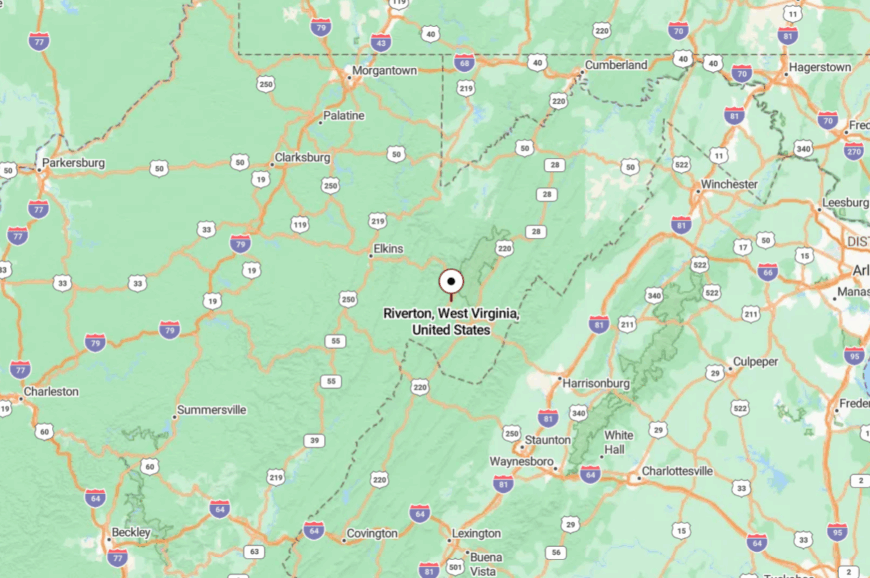
Riverton sits in Pendleton County on WV Route 33/28, at the heart of Germany Valley along the North Fork of the South Branch Potomac River. The community lies about 15 miles south of Seneca Rocks, framed by dramatic limestone walls.
Travelers reach it via US 33, which twists across mountain passes before opening into the valley. The highway narrows to a two-lane ribbon, giving the town the feel of a quiet bend discovered mid-journey.
21. Hambleton – A Little Mill Town Along the Cheat River
Hambleton hugs a bend in the Black Fork of the Cheat River, where old sawmills once gave the town its purpose. Today, only about 200 people remain, many still tied to logging or small-scale farming.
The town’s charm is its endurance—clapboard houses, rust-red barns, and riverbanks where children still skip stones. Visitors use Hambleton as a quiet base to access Blackwater Falls State Park, the Allegheny Highlands Trail, and nearby trout streams.
The hum of saws has faded, replaced by the murmur of the river and the occasional train horn. Neighbors know each other by name, and strangers stand out quickly. It’s the sort of place that whispers of an earlier West Virginia, intact and unhurried.
Where is Hambleton?
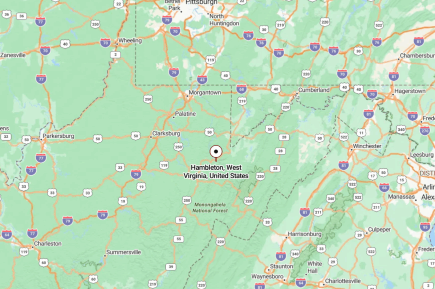
Hambleton sits in Tucker County along the Black Fork of the Cheat River, just a couple of miles west of Parsons. The town follows a curve of the Black Fork, with forested ridges pressing close to the water.
US Route 219 passes nearby, but the river valley and steep slopes keep the place pocketed away. The setting feels quiet and self-contained, with the sound of the river carrying farther than highway noise.
20. Bowden – Gateway Hamlet at the Edge of Monongahela
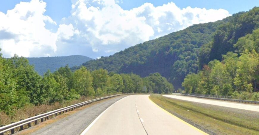
Bowden is more of a wide spot in the road than a true town, with perhaps 75 residents scattered across a valley floor. Still, its placement on the Shavers Fork of the Cheat River makes it a hidden gem for anglers, kayakers, and hikers heading into Monongahela National Forest.
The local vibe is rustic and minimal—an inn, a diner, and not much else beyond thick woods and water. Logging and small hospitality ventures provide what little commerce exists.
Visitors often stop to breathe in the cool river air before disappearing deeper into the forest. Nights bring the steady rush of water against rock, a lullaby that feels timeless. It’s less a place you arrive at than one you stumble upon.
Where is Bowden?
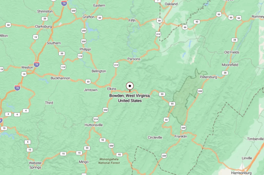
Bowden lies just 7 miles east of Elkins in Randolph County, but feels much farther away. It sits along US 33, surrounded on both sides by the national forest.
The highway narrows as it bends along the river, hemmed in by rock faces. The feeling is of a threshold town—civilization behind you, wilderness ahead.
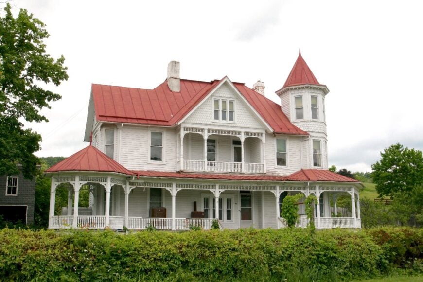
19. Franklin – A Hidden County Seat in the Valleys
🔥 Would you like to save this?
Franklin may be Pendleton County’s seat, but with barely 600 residents it feels more like an oversized village. Old stone churches and a historic courthouse anchor downtown, while tidy farmsteads spread into the surrounding valley.
Tourism, farming, and small government jobs sustain the economy, though there’s no rush or crowd to be found here. The vibe is quietly dignified, a town that has endured floods and storms but still holds its head high. Visitors stop for antique shops, riverside walks, and access to Spruce Knob or Seneca Rocks nearby.
The town seems to breathe slowly, like it knows the mountains are its true clock. Spend a night here and you’ll understand why many never leave.
Where is Franklin?
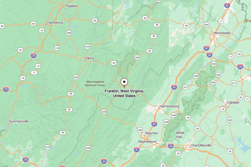
Franklin sits at the crossroads of US Route 33 and US 220 in Pendleton County. It’s about 50 miles south of Elkins, but the drive involves mountain passes that slow the journey.
High ridges enclose the valley, keeping the town sheltered. By the time you arrive, you feel like you’ve entered a small sanctuary in the hills.
18. Harman – A Mountain Hollow with Deep Roots
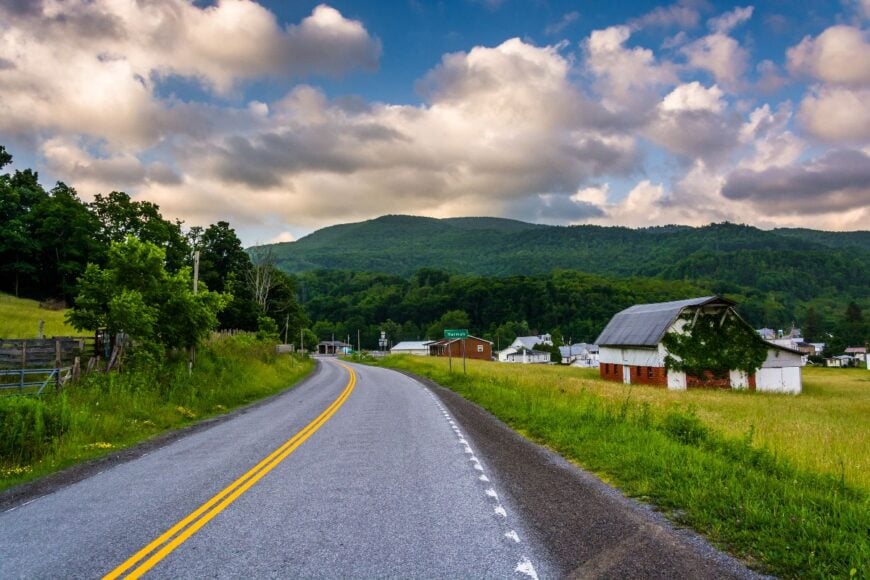
Harman is a speck of a town in Randolph County with under 150 people, tucked into a hollow between Cheat Mountain and Allegheny ridges. Generations of families still farm the bottomlands or cut timber from the slopes, keeping traditions alive.
The town is rustic but inviting, with one café, a church, and neighbors who all know each other’s dogs by name. Anglers cast in nearby Dry Fork streams, while hikers set out for Dolly Sods and Seneca Creek.
The winters are long and often isolating, but the summers are lush and green. Harman’s vibe is quiet strength, a community built to endure. It’s the kind of place where the mountains feel like family.
Where is Harman?
Harman lies in Randolph County along US Route 33, about 22 miles southeast of Elkins. The road climbs high ridges before dropping into the hollow where the town sits, a trip that feels longer than the mileage suggests.
The settlement occupies a narrow valley surrounded by Cheat Mountain and Allegheny ridges. Approaching Harman means easing through tight curves and steep grades, the kind of route that naturally filters out heavy traffic.
17. Thomas – An Arts Town in a Coal Canyon
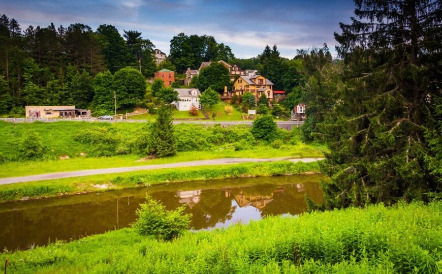
Thomas is one of the few places where seclusion has turned into artistry. Once a coal-mining town, its downtown is lined with restored brick buildings now housing galleries, cafés, and music venues.
Only about 600 people live here, but the vibe is lively in its own quiet way—creative energy set against the backdrop of steep, wooded slopes. The Blackwater Canyon rail-trail begins just beyond town, offering hikers miles of forest solitude.
While tourism supports many, the old industrial bones of the town still peek through, giving it grit. The contrast between art and wilderness makes Thomas feel both hidden and surprising. It’s a tucked-away place that somehow hums with possibility.
Where is Thomas?
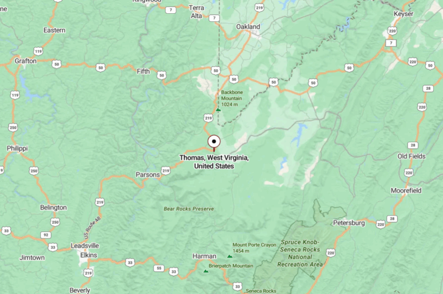
Thomas sits in Tucker County along US Route 219, just a few miles north of Davis. It perches above the Blackwater River canyon, its buildings clinging to a hillside.
The nearest interstate is over an hour away, and the mountain drive keeps casual visitors at bay. Arriving feels like you’ve stumbled into a secret gallery hidden in the woods.
16. Beverly – A Civil War Town Preserved in a Valley
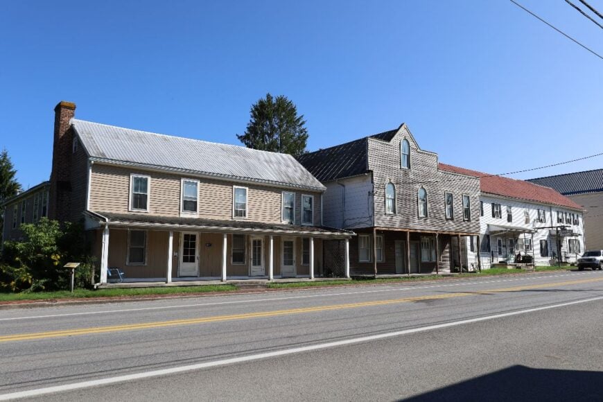
Beverly is a town of about 600 where history hangs thick in the air. Old log homes, Civil War sites, and antique shops line streets that once saw armies march through.
Despite its history, Beverly remains quiet, with farming and tourism keeping the economy afloat. The town is small and self-contained, a place where children ride bikes past 18th-century cabins.
Visitors come for historical tours, Civil War reenactments, or access to the surrounding forest trails. Evenings bring a stillness that feels layered with memory. Beverly is as much about the stories that linger as the people who remain.
Where is Beverly?
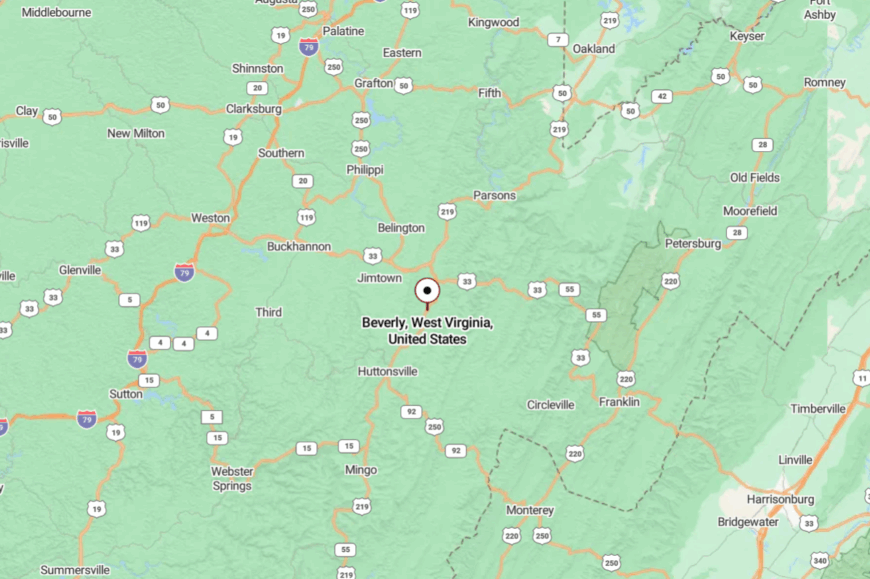
Beverly lies in Randolph County, about 7 miles south of Elkins on US Route 219. It sits in a broad valley along the Tygart Valley River, surrounded by forested hills.
The roads here are winding and slow, keeping traffic modest. Arriving feels like stepping into a living history tucked quietly away.
15. Marlinton – A River Town on the Edge of Monongahela
Marlinton, with around 1,000 residents, is one of the larger settlements in Pocahontas County, yet still feels removed from the wider world. The Greenbrier River curves past downtown, where a few cafés, shops, and an old train depot set the rhythm.
Locals bike the Greenbrier River Trail, fish for trout, and host the autumn Roadkill Cook-off—an event as quirky as it is beloved. The economy leans on tourism, small government jobs, and seasonal forestry.
The vibe is eccentric but grounded, a place that welcomes wanderers yet never loses its mountain reserve. Nights settle with the sound of crickets and the river’s whisper. It’s easy to feel at home in Marlinton, even as a stranger.
Where is Marlinton?
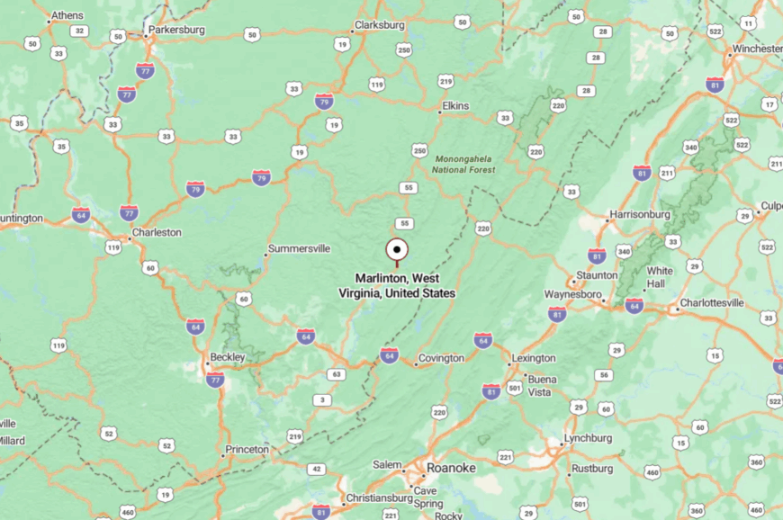
Marlinton sits in central Pocahontas County along US Route 219, about 45 miles north of Lewisburg. The Greenbrier River curves past downtown, boxed in by long ridgelines on either side.
Reaching town means winding through mountain passes that stretch travel times. That sense of remove lingers after arrival, with the valley feeling more like a tucked-away river bend than a county seat.
14. Cass – A Company Town Turned Living Museum
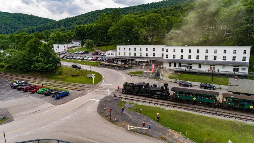
Cass is a ghostly company town reborn as a state park, where restored white company houses and a rail depot tell stories of logging’s heyday. Only a handful of permanent residents remain, but visitors come for the Cass Scenic Railroad, where steam engines chug up Cheat Mountain.
The vibe is historical and a little eerie, with the skeleton of an industry preserved among endless forest. Blacksmith shops, railroad rides, and ranger talks provide things to do, while hiking trails stretch into the highlands.
The economy here is tourism, plain and simple, though it never feels crowded. At dusk, steam whistles and crickets seem to trade verses in the valley air. Cass feels like a secret museum where the walls are mountains.
Where is Cass?
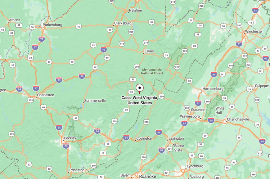
Cass lies in Pocahontas County, about 12 miles north of Marlinton, along WV Route 66. The approach passes through narrow valleys and dense forest, with few signs of life between towns.
The Greenbrier River and steep hills guard the settlement tightly. Arriving feels like pulling back a curtain on another time.
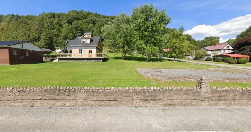
13. Hendricks – A One-Street Town Along the Blackwater
🔥 Would you like to save this?
Hendricks is no more than a line of houses along the Blackwater River, a blink-and-you’ll-miss-it place in Tucker County. With fewer than 300 residents, the town lives quietly off farming, logging, and small crafts.
Anglers and kayakers appreciate its riverside setting, while hikers launch into nearby Blackwater Canyon. A single church and general store mark its social heart. The town feels rustic and familial, where everyone knows who’s passing through.
Nights settle with the steady voice of the river and little else. Hendricks is small enough to overlook, which is exactly why it endures.
Where is Hendricks?
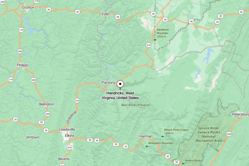
Hendricks rests at the confluence of the Blackwater River and the Dry Fork, where the two streams join to form the Black Fork. The settlement lies just south of Parsons in Tucker County, set tight against wooded slopes.
Access comes by a short spur from US 219, which runs along the valley. The town’s location at the meeting of rivers gives it a tucked-in feel, almost hidden in plain sight beside the water.
12. Parsons – A Forest-Fringed County Seat
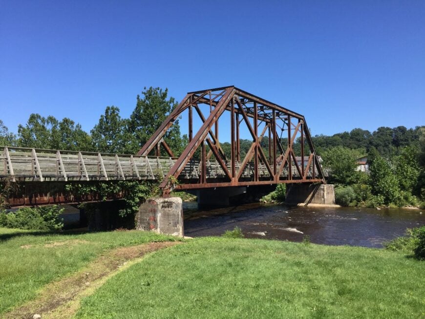
Parsons may be Tucker County’s hub, but with under 1,500 people it still feels tucked in between river and ridge. Downtown holds a few government offices, shops, and diners, while just outside town the Cheat River draws anglers and kayakers.
The Allegheny Highlands Trail begins here, inviting hikers and bikers to slip into the woods within minutes. Local industry blends small government, forestry, and outdoor tourism. The vibe is friendly but unhurried, the kind of place where a courthouse square still anchors life.
At night, the stars stretch across the valley in a canopy unbroken by big-city glare. Parsons proves even a county seat can feel secluded when the mountains do the keeping.
Where is Parsons?
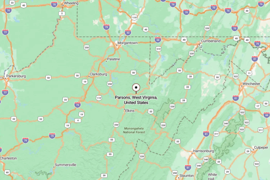
Parsons sits at the confluence of the Shavers Fork and Black Fork, forming the Cheat River in Tucker County. It’s about 30 miles northeast of Elkins via US 219.
Ridges ring the valley closely, narrowing the routes in and out. The setting makes the town feel contained, a small clearing amid a vast forest.
11. Helvetia – A Swiss Village in the Appalachians

Helvetia is unlike anywhere else in West Virginia, a Swiss settlement of about 60 year-round residents tucked into Randolph County’s high ridges. Founded in the 1860s by Swiss immigrants, it still celebrates Fasnacht, a raucous pre-Lenten festival with masks, music, and bonfires.
The town vibe is whimsical and cultural, with alpine-style houses, a general store, and a café serving rösti and sauerbraten. Artists and retirees mingle with farm families, keeping both traditions and creativity alive. Hikes into nearby Holly River Wilderness, folk-dance events, and small craft fairs mark the calendar.
There’s no gas station, no chain store, and no cell service, only the sounds of fiddles and creek water. Helvetia feels like stepping into another country without ever leaving the mountains.
Where is Helvetia?
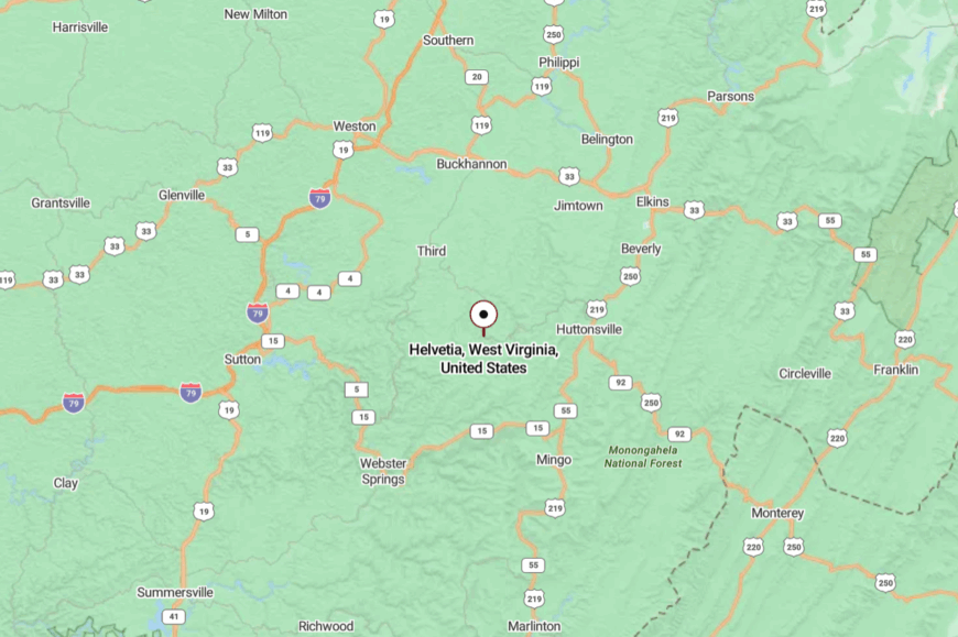
Helvetia lies in southwestern Randolph County, about 25 miles from Buckhannon and farther still from Elkins. The settlement hides in a high valley, reached only by narrow county roads that climb over ridges and dip into hollows.
Surrounding land falls within the Monongahela National Forest, and the mountains keep it far from through traffic. The drive in feels like stepping away from West Virginia altogether, only to arrive in a Swiss pocket preserved by geography.
10. Seneca Rocks – A Tiny Outpost Beneath a Towering Quartz Fin
Seneca Rocks counts fewer than 200 year-round residents, most tucked along the bends of the North Fork South Branch Potomac River. Rock climbers flock to the 900-foot quartzite fin that rises behind town, while hikers favor the lookout trail for sunrise shots that splash pink on the stone.
Outfitters, small cafés, and a handful of cabins form the local economy, though many families still keep cattle on valley pastures. The Monongahela National Forest surrounds every backyard, limiting development and keeping property lines wide.
Sparse cell service and a single general store emphasize how removed daily life feels. Even in midsummer, evenings settle in with only creek noise and the hoot of a barred owl.
Where is Seneca Rocks?
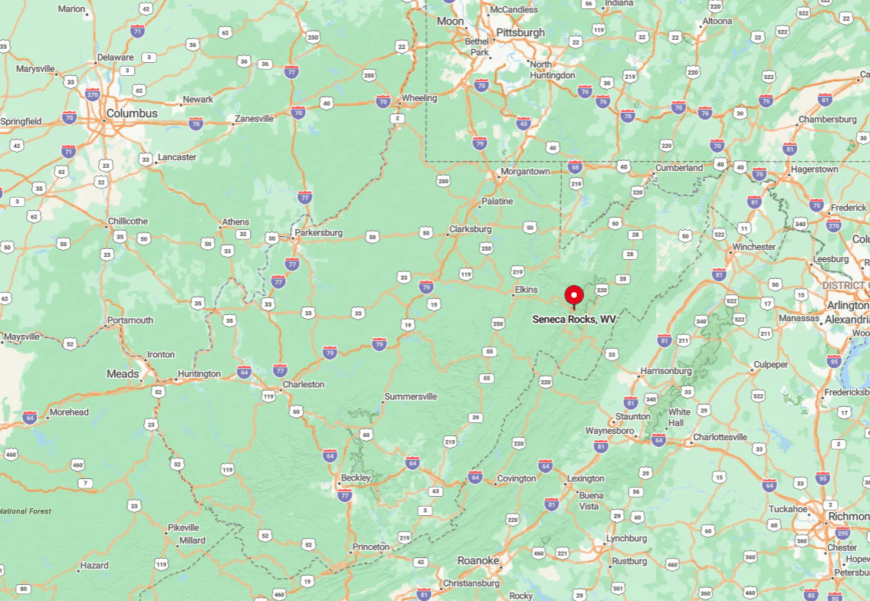
Seneca Rocks sits in Pendleton County at the junction of US Route 33 and WV Route 28, about forty miles east of Elkins. The quartz cliffs rise straight out of the valley floor, with ridges closing in tight on either side.
The approach follows mountain highways that twist across steep passes, keeping the pace slow. With no interstate anywhere nearby, the remoteness holds steady even as the Rocks remain one of the state’s most photographed landmarks.
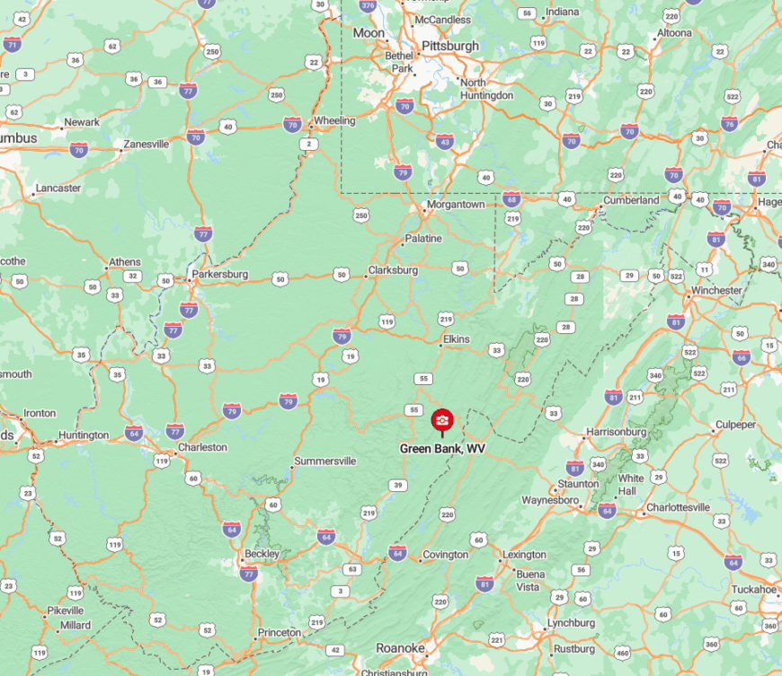
9. Green Bank – Silence, Stars, and Seclusion in the National Radio Quiet Zone
Roughly 150 people live in Green Bank, where front porches face hayfields instead of neighbors’ windows. Daytime pursuits revolve around tours of the Green Bank Observatory, trout fishing on Deer Creek, and dark-sky astronomy programs that take advantage of the mandated radio silence.
Farming and observatory research anchor local employment, and both thrive without fast-food glow or cell towers. A sixty-mile-wide federal Radio Quiet Zone prohibits wireless signals, so even GPS units struggle for a lock.
That technology blackout leaves nights astonishingly still and sky views razor sharp. Locals joke that the only bars in town are on handheld walkie-talkies.
Where is Green Bank?
🔥 Would you like to save this?
Green Bank sits in Pocahontas County along WV Route 28/92, about 25 miles north of Marlinton. The town lies inside the National Radio Quiet Zone, where strong radio signals are limited but the mountains provide most of the hush.
Visitors reach it on US 250 or US 219, both of which climb mountain passes before dropping into the valley. The Green Bank Observatory is the landmark here, rising against the ridges that shelter the town’s quiet.
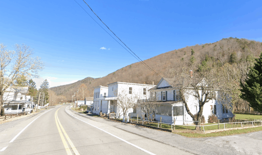
8. Lost City/Lost River – A Valley That Lives Up to Its Name
Only about 225 residents share the Lost River Valley, where antique farmhouses dot meadows cut by the namesake stream. Visitors kayak the glassy bends, hunt morels on damp slopes, and browse artisan goods at the restored Lost River General Store.
Small-scale farming and seasonal tourism sustain most households, while a growing cluster of remote workers rely on satellite internet. The valley sits fifteen miles from the nearest traffic signal, and ridges on three sides block through roads.
That geographic bowl muffles outside noise and keeps night skies dark enough for Milky Way portraits. Locals say mail still arrives faster by pickup truck than by app notification.
Where is Lost City?
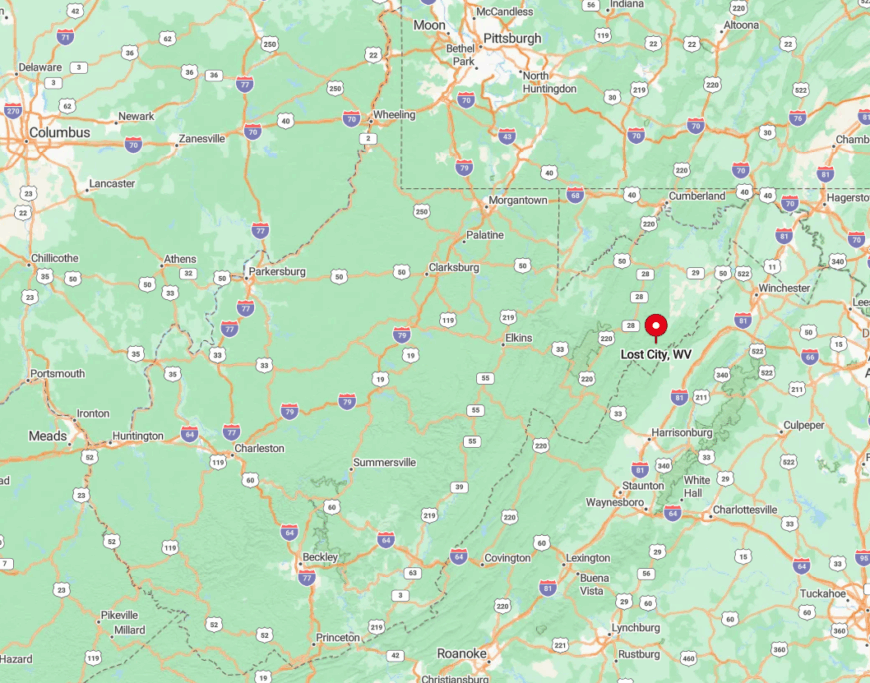
The twin settlements rest in Hardy County along WV Route 259, roughly two hours west of Washington, D.C. Dense hardwood ridgelines shove the highway into a single narrow corridor, adding a natural gate at each end.
Drivers reach the valley by cresting Wolf Gap or Wardensville Grade, both steep and winding enough to discourage casual day-trippers. No public transportation crosses those passes, preserving the valley’s tucked-away feel.
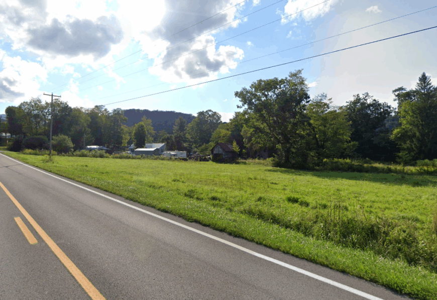
7. Circleville – Where the North Fork Winds Past One-Acre Homesteads
Circleville’s population hovers around 120, gathered where the North Fork loops past tidy clapboard homes. Anglers cast for trout beneath the town’s tiny bridge, and photographers aim lenses at the red roof of the 1896 Presbyterian Church set against forested peaks.
Cattle ranching and a seasonal maple-syrup operation anchor livelihoods, with one country store handling most commerce. The settlement sits inside the deep cleft of Germany Valley, which walls off sprawl and blocks cell towers.
Empty forest service land surrounds the village on three sides, reinforcing the sense of insulation. Nights drop silent enough that spring peepers create their own concert hall.
Where is Circleville?
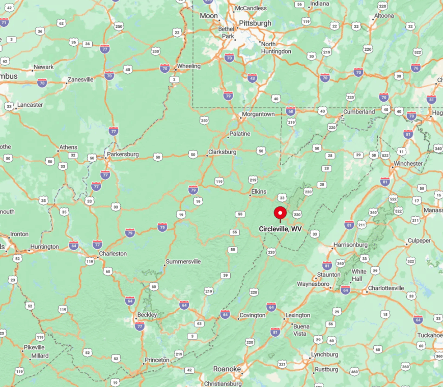
Circleville rests in northern Pendleton County along WV Route 28, roughly midway between Seneca Rocks and Franklin. The town lies in the North Fork Valley, framed by North Fork Mountain on one side and Spruce Mountain on the other.
Travelers usually arrive via US 33 before turning into the valley, where hairpin turns discourage large vehicles. The steep walls and limited routes keep Circleville enclosed, a settlement folded neatly into mountain country.
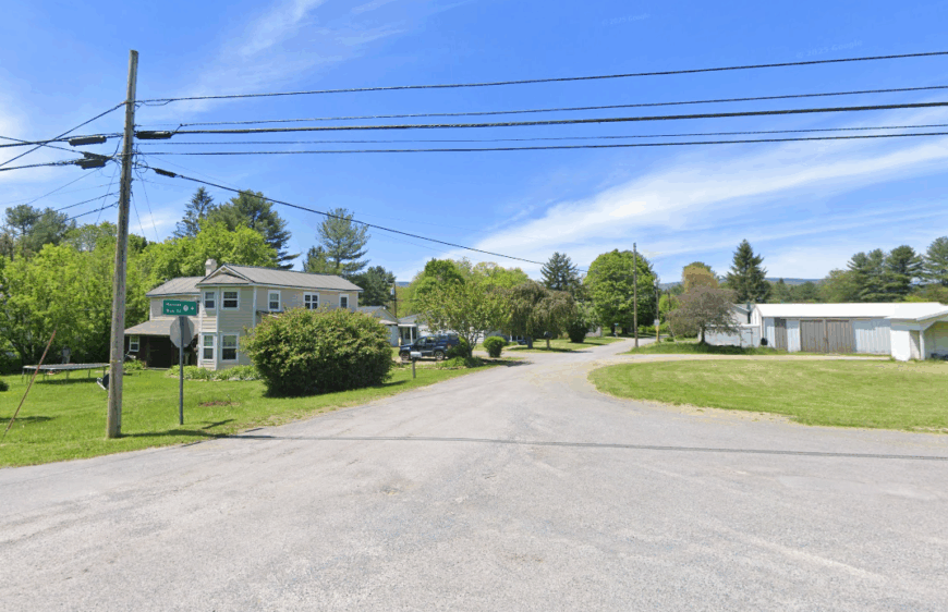
6. Dryfork – Hidden Meadows on the Back Side of Canaan Mountain
Dryfork claims around 90 year-round residents, spread across clearings in Tucker County where the river of the same name cuts through farmland. The community is scattered, with clapboard houses, hayfields, and churches that double as gathering halls. The pace is unhurried, shaped by fishing seasons and hay cuttings.
Outdoor life centers on the Dry Fork River itself, along with nearby Dolly Sods Wilderness and the slopes of Canaan Mountain. Families tend mixed woodland and pasture plots, cutting timber one season and stacking hay the next. Gravel lanes outnumber paved streets, and the post office doubles as the town’s bulletin board.
With much of the surrounding land protected by the Monongahela National Forest, sprawl has never reached this valley. Nights are quiet enough that crickets and creek water provide the soundtrack, a reminder that Dryfork is more outpost than town.
Where is Dryfork?
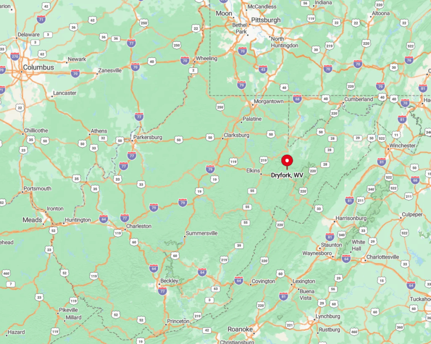
Dryfork lies in Tucker County along WV Route 32, about nine miles south of Davis. The settlement follows the bends of the Dry Fork River, surrounded by mountains that rise sharply on either side.
Instead of rail-trails, the draw here is the river itself, along with access to Dolly Sods Wilderness and Canaan Mountain. WV 32 carries you into the valley on a narrow two-lane route that feels like it belongs to locals alone.
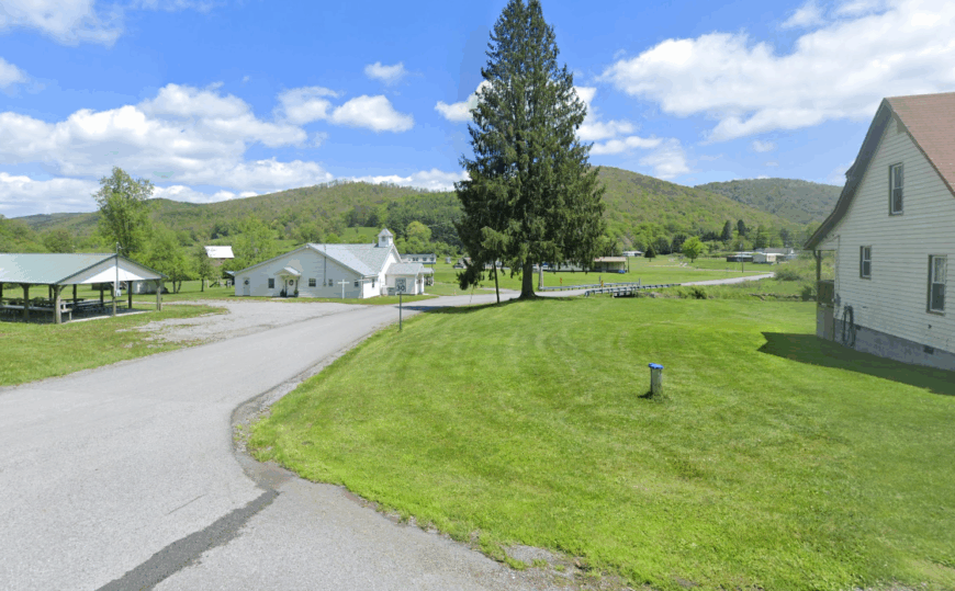
5. Arbovale – Riverside Quiet in the Heart of Pocahontas County
Arbovale’s roughly 140 residents enjoy front-row seats to the Greenbrier River as it meanders through a wide meadow. Canoe launches, riverside picnic spots, and the Greenbrier River Trail tempt both locals and low-key travelers.
Forestry service jobs and family beef farms dominate the income stream, complemented by a modest craft-woodworking scene. With no commercial strip and only one blinking light, the landscape remains open from ridge to ridge.
The absence of large industry lets morning fog hang over hayfields long after sunup. Even the local volunteer fire hall hosts more potlucks than emergencies.
Where is Arbovale?
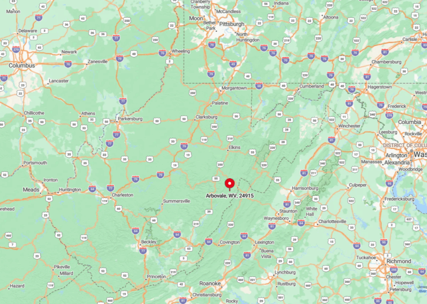
The settlement rests just off WV Route 92, thirteen miles north of Marlinton. Surrounding peaks rise quickly, funneling road access to a single valley floor.
Most arrive via U.S. 219, then follow the river north along a two-lane road that weaves between farms and forest. Winter snows often close secondary routes, further reducing traffic for days.
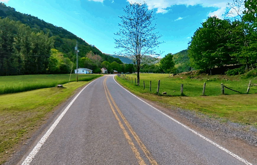
4. Glady – A Postcard Valley Guarded by Spruce and Hemlock
Glady maintains about 50 year-round inhabitants, many living in century-old farmhouses on multi-acre lots. Visitors fish Glady Fork, pick chanterelles on moist hillsides, and capture sunrise fog lifting off hay bales framed by timbered peaks.
A small sawmill, seasonal maple production, and freelance guiding bring in modest income. The Monongahela National Forest surrounds the valley, preventing suburban creep. Only a narrow paved spur leads in, so traffic rarely exceeds a few dozen vehicles per day. Nights remain dark enough that porch lights stand out for miles.
Where is Glady?
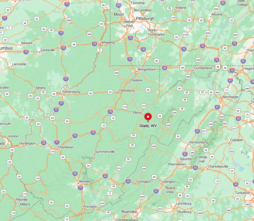
Located in Randolph County, Glady sits at the terminus of County Route 27, fourteen miles southeast of Elkins. Steep ridges hem in the valley, limiting expansion and blocking radio signals.
Reaching town requires following the Tygart Valley River upstream and then climbing Glady Road, a path susceptible to ice and fog. No scheduled buses serve the area, which helps maintain its hidden-away charm.
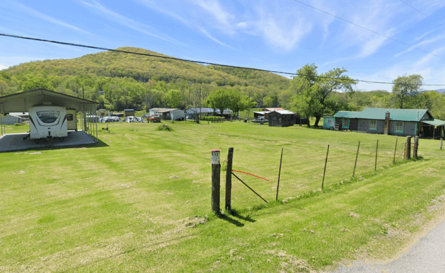
3. Whitmer – Headwaters Hamlet Near Spruce Knob
Whitmer’s population rests near 140, perched at 3,000 feet where the Dry Fork of Cheat River begins. Residents spend free hours hiking toward Spruce Knob, hunting on Seneca Creek Backcountry lands, and swapping stories at the small community center.
Logging and cattle grazing still provide most paychecks, supplemented by seasonal tourism from anglers and foliage photographers. The high elevation and broad clearings create striking contrasts between open pasture and encircling hardwood ridges.
Few through roads exist, and winter storms often isolate the hamlet for days. Even in July, nighttime temperatures can dip low enough to keep windows closed, adding another layer of quiet.
Where is Whitmer?
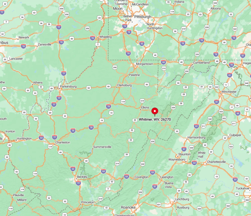
Whitmer lies in Randolph County along WV Route 29/CR 45, roughly 30 miles south of Elkins. The town rests in a bowl of mountains, which blocks cellular and FM reception.
Access involves navigating the twisting US 33 corridor over Cheat Mountain, then turning onto a smaller valley road. The final stretch follows the river and features single-lane bridges that naturally slow arrivals.
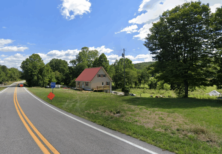
2. Thornwood – Rail-Trail Silence Along the Shavers Fork
Thornwood holds fewer than 70 residents, scattered among old lumber-camp houses along the Shavers Fork of Cheat River. The town’s quiet is its greatest asset, a place where water rush and wind in the trees carry farther than engines. Families still keep gardens and cut wood, living in step with the river.
The nearby West Fork Rail Trail traces the old rail line, now a path for cyclists, anglers, and hikers. Autumn brings fiery color to Gaudineer Knob, and the ridges rise so close that shadows fall early in the day. Logging has faded, but the forest still provides—whether for hunting, fishing, or firewood.
Today the settlement is little more than a cluster of houses, a seasonal campground, and a small store. With no cell service and limited roads, Thornwood feels reclaimed by the valley, left to keep its pace while the rest of the world hurries past.
Where is Thornwood?
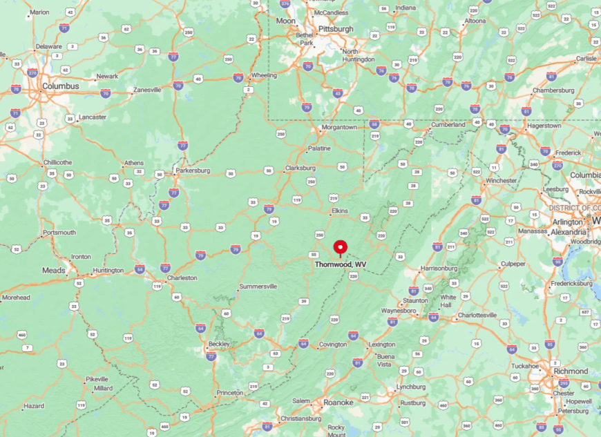
Thornwood rests in Pocahontas County along County Route 44, about a dozen miles southeast of Durbin. The hamlet sits in a steep gorge carved by the Shavers Fork of the Cheat River, where forest closes in quickly.
The West Fork Rail Trail begins nearby, following the old railroad bed toward Glady and Durbin. Drivers usually come in from WV 28 or US 250, then follow gravel stretches that can turn impassable under winter snow.
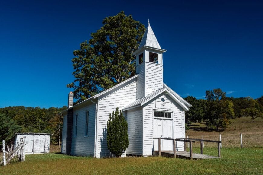
1. Brushy Run – One Church, One Road, and Miles of Untouched Hillside
Brushy Run supports about 60 residents spread along a single ribbon of pavement that traces its namesake creek. Locals hunt deer on adjacent public game lands, tend small gardens, and gather at the white-steepled church that doubles as a social hall.
Small-scale sheep farming and remote contract work provide limited incomes, but most households value space over paychecks. Surrounding ridgelines rise steeply, preventing subdivision and shielding the valley from neighboring lights.
The absence of commercial buildings amplifies a sense of pure landscape, perfect for photographers chasing big-sky backdrops. Even midsummer afternoons carry more birdcalls than engine noise.
Where is Brushy Run?
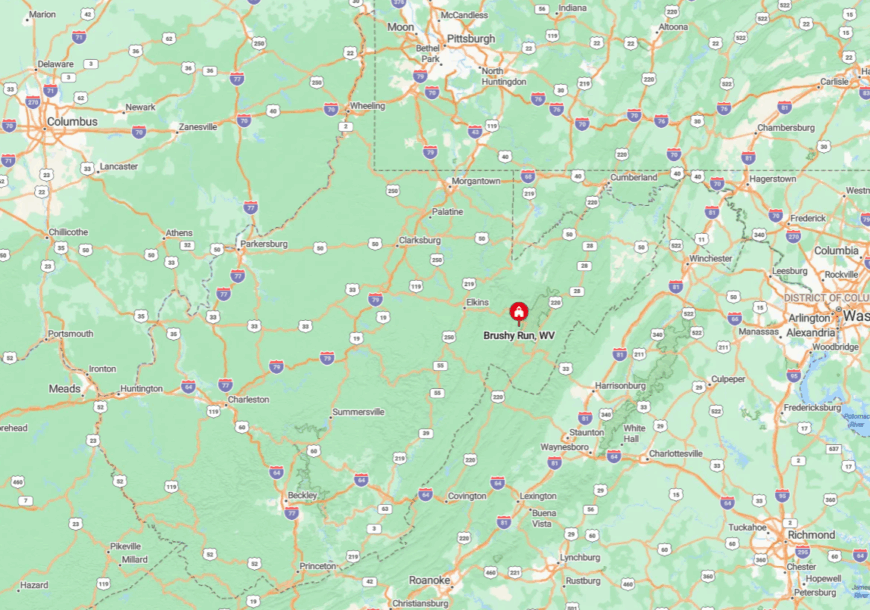
Brushy Run lies in northern Pendleton County along WV Route 28, about 13 miles north of Franklin and 20 miles south of Petersburg. The village takes shape along Brushy Run Creek, with forested slopes pressing close.
WV 28 is the only through road, a winding two-lane that squeezes between farms and ridges. The enclosure of the valley makes the place feel private, as though the hills themselves are holding it apart.