🔥 Would you like to save this?
In Eastern California, these places still exist: small, rooted communities where the days are shaped by snowmelt and silence, not by clocks. They’re hemmed in by towering granite, stretched across high desert basins, or hidden behind cottonwoods along cold-running creeks. Each one carries a steady kind of stillness, where front porch conversations linger, cell signals fade, and the loudest sound might be wind brushing through juniper.
These towns aren’t preserved for tourists, and they don’t put on a show. They endure in their own way—weathered, unchanged, content. You won’t find billboards pointing the way, and you might pass right through without knowing what you missed.
In order to come up with the very specific design ideas, we create most designs with the assistance of state-of-the-art AI interior design software.
But for those who seek a gentler pace, a feeling of place, or the deep comfort of being far from everything, these 25 secluded mountain towns feel like places that remember how to hold still.
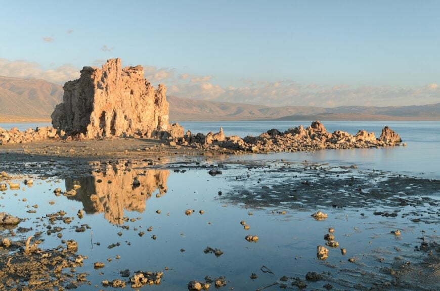
25. Little Lake – Lava Cliffs and Echoes of a Lost Resort
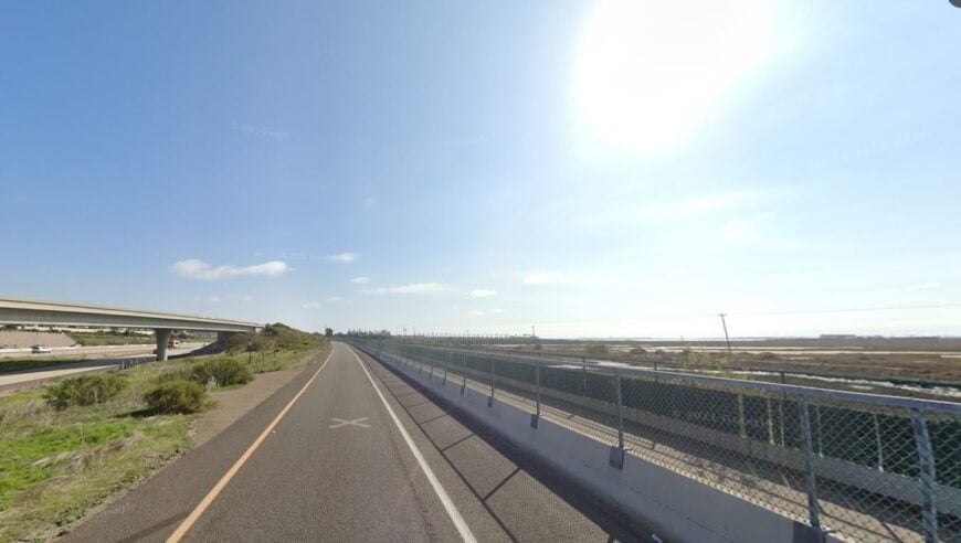
Once a thriving stopover between Mojave and Bishop, Little Lake now lies mostly forgotten beneath volcanic cliffs. The cracked remnants of a hot springs resort still cling to life, guarded by rusting fences and the wind.
Ponds fed by warm artesian flow reflect red rock pinnacles, and black basalt flows stretch like a frozen tide. Fewer than 20 people remain, living in trailers tucked behind crumbling walls and tangled tamarisk.
There’s no gas, no café, not even a store, just the hum of US-395 and the call of red-tailed hawks soaring over the canyon. The air smells of minerals and still water, unchanging and strangely peaceful.
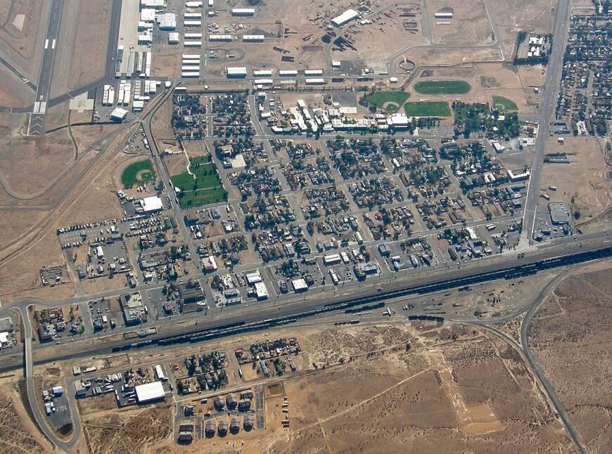
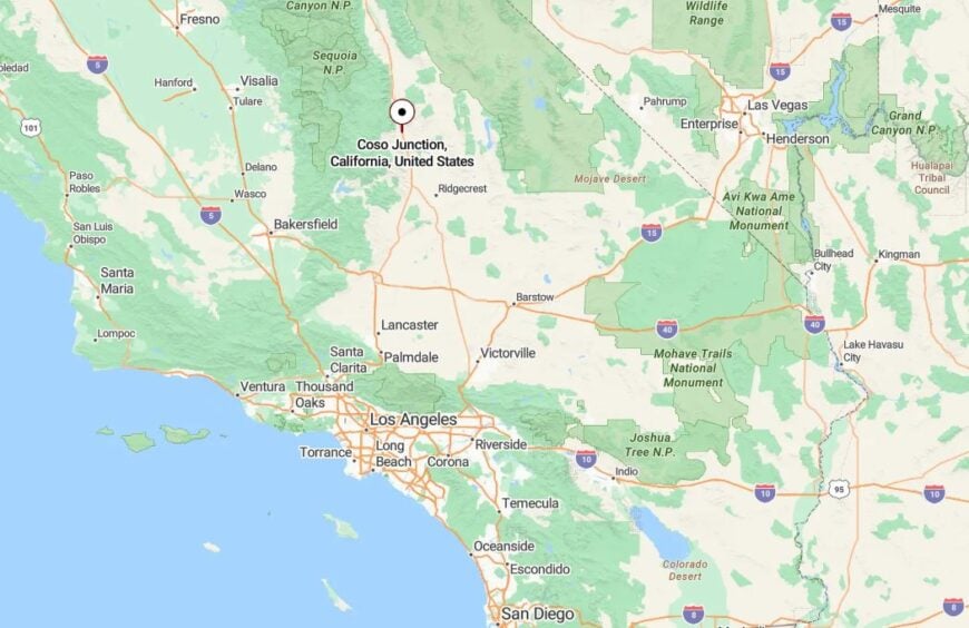
Where is Little Lake?
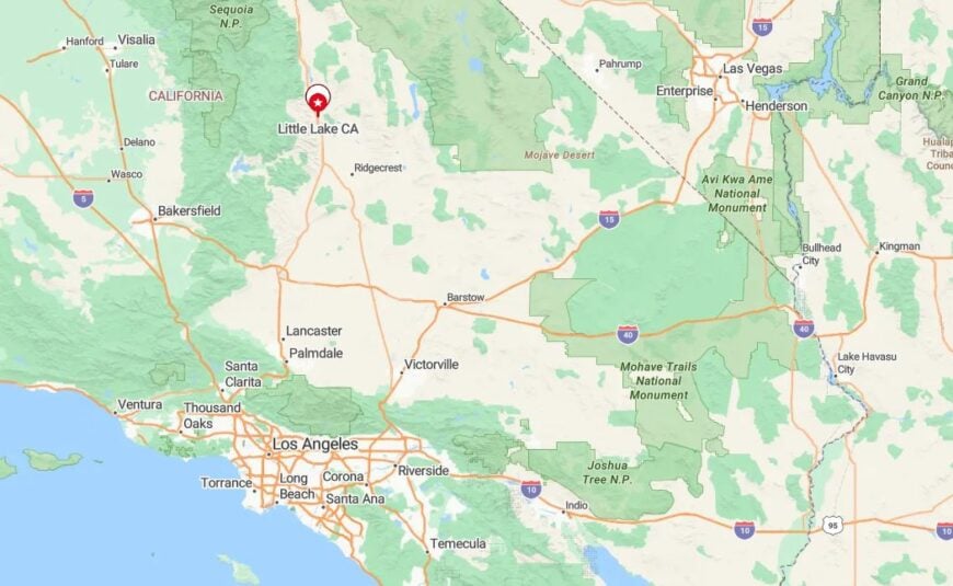
Little Lake sits in southern Inyo County, just north of Coso Junction and south of Olancha, right off US-395. Most travelers never notice it, mistaking the ruins for an old industrial site.
The lake itself is natural, fed by volcanic springs and framed by lava bluffs. With the old resort shuttered and public access limited, this once-bustling stop now offers only whispers from the past.
24. Mono Mills – Whispering Pines and Weathered Timber
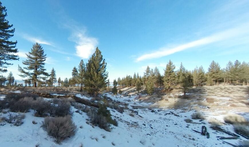
Tucked into a high pine bench southeast of Mono Lake, Mono Mills was once a lumber boomtown supplying nearby Bodie. Today, only a few cabins and logging relics remain among the stumps and sage.
Wooden flumes and collapsed mill structures hint at the town’s 19th-century heyday. But today, it’s the sound of wind in the trees and the crunch of pine cones under boots that dominate.
Visitors come for the solitude, perhaps to hunt obsidian or trace old wagon routes toward the Bodie Hills. Nights are still and crisp, with the stars shining between tall lodgepole trunks.
Where is Mono Mills?
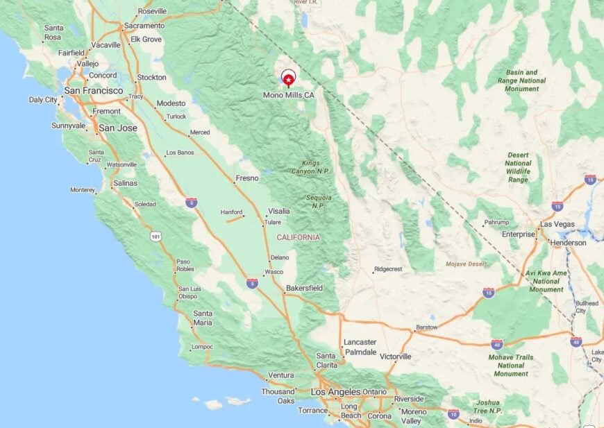
Mono Mills lies along California Route 120 East, about 9 miles from Lee Vining. A gravel road forks south from the pavement, winding into national forest lands with no signage and no facilities.
The surrounding terrain—rolling forest edged by volcanic flats—has kept the area undeveloped and rarely visited. Only those looking for silence or history usually make the trip.
23. Highlands – A Hillside Hamlet Above Bishop
Above Bishop on the winding ascent toward Westgard Pass, Highlands hides behind a row of cottonwoods and dusty switchbacks. A few dozen homes dot the hillside, barely visible from below.
Originally built as a worker’s enclave, the town has evolved into a quiet retreat for artists and retirees. Hand-painted signs mark gravel lanes, and dogs nap in the shade of piñon pines.
There’s no cell reception, and snow sometimes cuts access in winter. But the view—across the Owens Valley and into the shimmering White Mountains—feels like its own reward.
Where is Highlands?
Highlands sits off West Line Street (SR 168), just west of Bishop, on the lower slope of the Inyo National Forest boundary. A series of dirt roads branches from the main canyon drive, curving into the hill.
The settlement lies high enough to catch cool breezes but low enough to escape deep Sierra snow. It remains hidden in plain sight, a quiet notch just above town.
22. Sand Canyon – A Cracked Crevice of Granite and Solitude
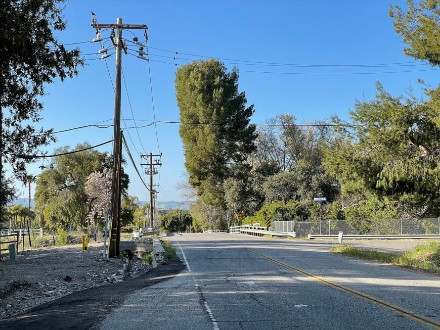
On the eastern flank of the Sierra near Inyokern, Sand Canyon is little more than a wash and a whisper. A handful of homes and weathered shacks cling to the rim of the rocky ravine.
Wild burros wander the brush, and the sound of windblown gravel is constant. Residents haul water, solar power their homes, and wave to the rare car that dares the rutted road.
Sunrises are fiery, backlighting granite spires in oranges and purples. After dark, there’s only the chorus of crickets and a sky filled with stars.
Where is Sand Canyon?
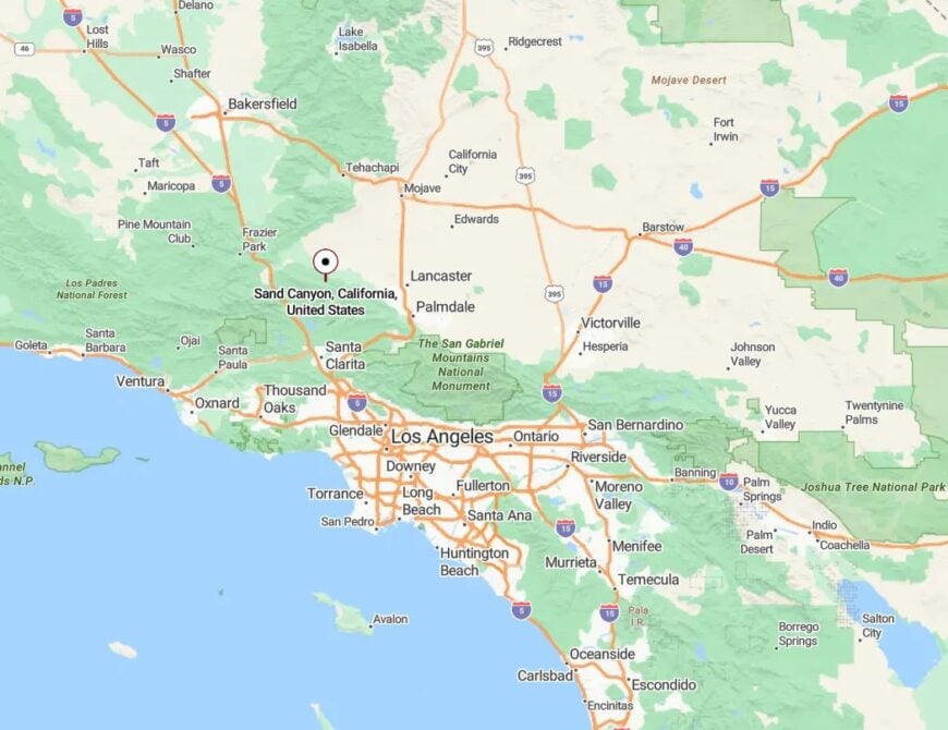
Sand Canyon is located in northeastern Kern County, about 8 miles west of Inyokern off Highway 178. A series of unpaved roads climb into the Sierra foothills, where the canyon walls create a natural shield from the desert basin.
Access is rough, often requiring high-clearance vehicles, and snow or flash floods can block routes. This isolation is exactly what keeps Sand Canyon so untouched.
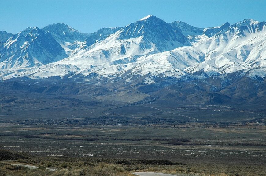
21. Round Valley – Boulders, Bristlecones, and Big Sky
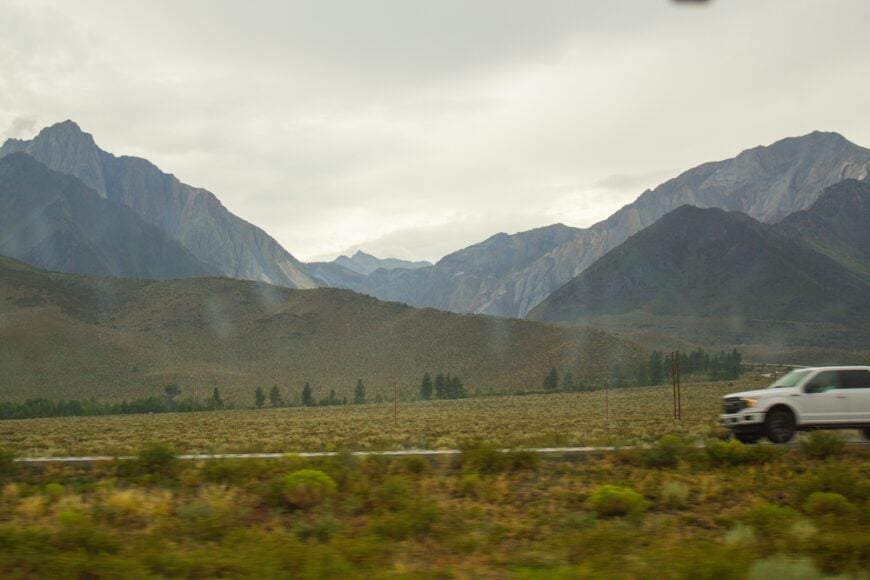
Between Bishop and Swall Meadows, Round Valley spreads across a windswept plain lined with granite boulders and views of the Sierra wall. It’s home to climbers, craftspeople, and lifelong locals who value elbow room over convenience.
Kids ride bikes past ancient piñon groves, and ranch dogs bark at passing clouds. Old water towers, stone fences, and schoolhouse relics dot the open land.
Some homes run on solar, some on propane, but all face west into sunsets that blaze across the Palisade skyline. The silence is nearly complete after dark.
Where is Round Valley?
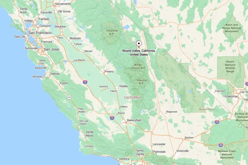
Round Valley lies just northwest of Bishop, accessible via Pine Creek Road or Ed Powers Road. The valley sits between the White Mountains to the east and Sierra Nevada to the west, forming a natural bowl.
Despite its proximity to Bishop, zoning restrictions and vast public lands have preserved its rural character. It remains one of the least-altered pockets of the upper Owens Valley.
20. Paradise Valley – High-Altitude Stillness Above Mono Basin
Tucked above Mono Lake near Tioga Pass, Paradise Valley isn’t a town so much as a scattering of cabins and solitude beneath the Cathedral Range. The air is thin, the road steep, and the silence profound.
Most homes are seasonal, closed up tight once the snow flies. Summer brings only a few visitors—usually anglers or hikers headed to nearby alpine lakes tucked above 9,000 feet.
Old rail ties and mining timbers linger in the brush, reminders of an era when more people once passed through. Today, it’s mostly wind, water, and granite that remain.
Where is Paradise Valley?
Paradise Valley lies west of Lee Vining, off Highway 120 en route to Tioga Pass. The narrow access road snakes upward, eventually dead-ending in Inyo National Forest land.
Winter closures and limited signage mean most travelers miss it entirely. But for those who find it, the valley offers quiet beyond measure and skies clearer than memory.
19. Aberdeen – Dust, Silence, and the Distant Sierra
🔥 Would you like to save this?
Aberdeen’s few residents live in trailers and historic cabins spaced far apart, huddled near cottonwoods and the long shadow of the Inyo Mountains. Once a stage stop and produce shipping point, the town is now more ghost than grid.
The water still runs cold from nearby springs, and the wind rattles tin roofs and barbed wire. A general store stood here once—its frame now tilts among the tumbleweeds.
Locals haul supplies from Big Pine or Independence, preferring the wide open to the buzz of town. They know every jackrabbit and juniper by name.
Where is Aberdeen?
Aberdeen sits along US-395 between Independence and Big Pine, slightly hidden behind a stand of desert willows. It’s not signed on the highway, and most drive past without a glance.
With no businesses, few permanent structures, and no noise but the wind, Aberdeen remains a quiet landmark of what once was, and what never needed to change.
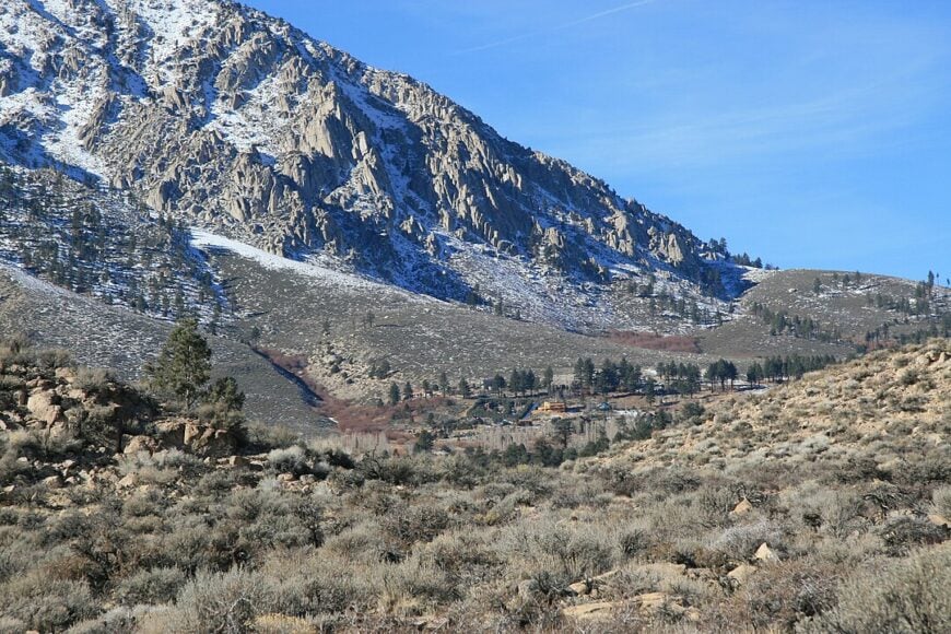
18. Coso Junction – Roadside Relic With Geothermal Bones
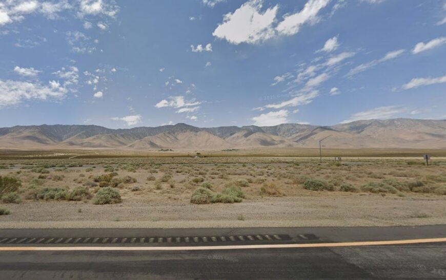
Located at a quiet bend in the highway north of Ridgecrest, Coso Junction is a near-ghost settlement with ties to the vast geothermal fields of the Coso Volcanic Range. A café and rest stop are all that remain active.
The rest is silence—fenced-off trailers, wind-worn pumps, and desert scrub creeping over cracked pavement. The earth here literally steams beneath your boots.
Occasionally, scientists and utility workers pass through, but most days belong to the ravens and dust devils. The desert keeps its secrets—and this place is one of them.
Where is Coso Junction?
Coso Junction lies in southern Inyo County, about 30 miles north of Ridgecrest along US-395. It sits near the entrance to the China Lake Naval Weapons Center and the volcanic domes that fuel its power.
Marked only by a faded sign and a trucker’s café, it’s easy to miss. Those who do stop often marvel at how instantly the world seems to fall silent.
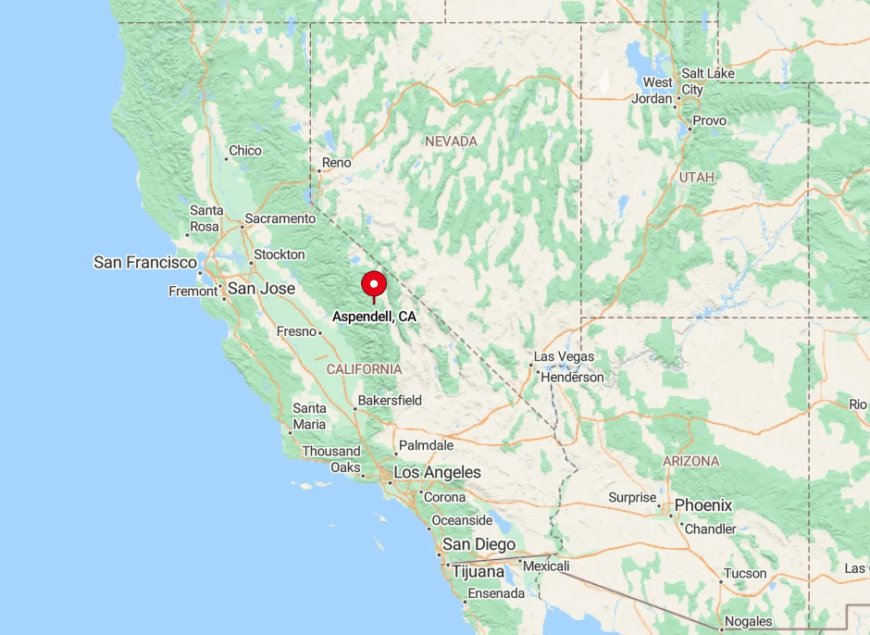
17. Aspendale – An Echoing Name in the Bishop Creek Canyons
A few miles past Aspendell but before the road ends at Lake Sabrina, Aspendale lives on only in maps and memories. A dozen or so forest cabins still huddle under fir and aspen, disconnected from nearly everything.
Most have no internet or cell service—just propane, firewood, and the occasional bear nosing through the trash bins. The creek rushes nearby, and trout flick in its shallows.
In fall, yellow leaves rain from the trees, and the only sounds are chickadees and the wind against tin roofs. The place feels forgotten, and yet exactly as it should be.
Where is Aspendale?
Aspendale lies west of Bishop, just above Aspendell on State Route 168 in Inyo County. The paved road becomes narrower here, with turnouts few and far between.
Snow closes the road most winters, and even in summer, visitors often pass without realizing they’ve crossed into this timeless stretch of canyon life.
16. Mount Whitney Fish Hatchery – Ivy Walls and Quiet Pools
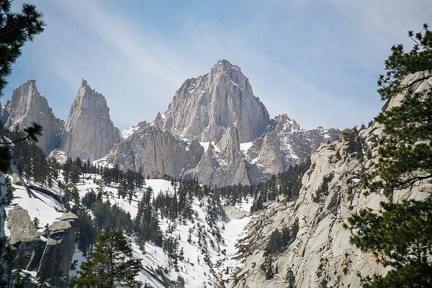
Though no one resides in the stone buildings of the Mount Whitney Fish Hatchery, the grounds carry a profound hush. Granite walls built in 1917 shield koi-filled ponds, shaded by old cottonwoods.
It’s a ghost of utility, transformed into a place of peace. No hum of generators, no clatter of trucks—just birdsong and the ripple of water in narrow channels.
Volunteers and the occasional ranger maintain the grounds, but most days you’ll find only deer in the grass and clouds reflecting in the ponds.
Where is Mount Whitney Fish Hatchery?
The hatchery lies just northwest of Independence, accessible via Fish Hatchery Road. Though no longer in full operation, it’s maintained as a heritage site and quiet picnic area.
Hemmed in by granite and shielded from the highway, the site feels like a cloistered garden tucked between desert and peak. Few places better capture the stillness of the Eastern Sierra.
15. Hammil Valley – Windswept Homesteads Between Ranges
Flanked by the White Mountains to the east and the Excelsior Range to the west, Hammil Valley is pure open basin country. Wind howls down the long valley floor, whipping past century-old ranch fencing and solar-powered outposts.
Only a few families remain, running cattle, repairing windmills, and watching for late snow. Old schoolhouses and hay sheds stand as silent sentinels under endless sky.
There are no stores and no marked town center—just mailbox clusters and metal gates creaking in the breeze.
Where is Hammil Valley?
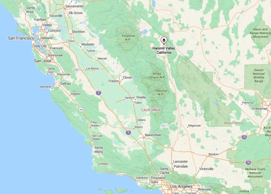
Hammil Valley stretches along Highway 120 near the Nevada border, northeast of Benton. It’s a remote reach of Mono County, bounded by both state and BLM land.
The long, lonely drive to reach it passes through sagebrush flats and dry lakebeds. For those who make it, the isolation is complete—and entirely earned.
14. Walker Creek – Granite Shadows and Whispering Pines
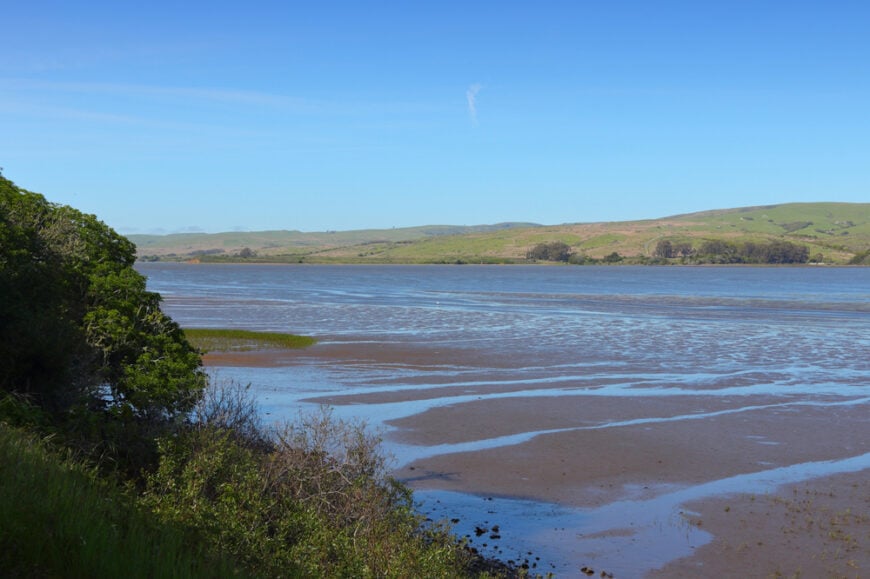
Not far from Lee Vining but tucked up a forgotten canyon, Walker Creek offers solitude in the form of a few scattered homesteads and camps. The creek slips quietly past mossy boulders and fallen logs.
A few cabins hide beneath incense cedar, their roofs bent from snowpack and time. Mule deer leave tracks on the soft trails between creek and ridge.
There are no street names, no lights, and no signs—just the hush of cold water and wind pushing through the gorge.
Where is Walker Creek?
Walker Creek Canyon lies south of Lee Vining off Highway 120, past Mono Lake. A rugged Forest Service road veers west, climbing toward the Sierra crest.
Snow blocks access for months each year, keeping this sliver of land hidden from the usual traffic. Those who wander in rarely encounter company.
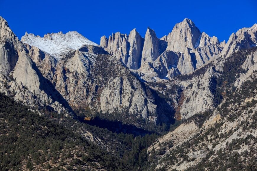
13. Mazourka Canyon – A Hidden Gash in the Inyos
🔥 Would you like to save this?
East of Independence, Mazourka Canyon slashes into the Inyo Mountains with no warning and little welcome. A rocky track climbs into it, passing abandoned mines, trickling springs, and forgotten stone ruins.
Desert bighorns watch from ledges, and the rare burro may bray in the canyon’s hush. But otherwise, the world here feels paused—a hush preserved by heat and distance.
A few off-grid camps hide in side gullies. Life here is quiet, deliberate, and deeply rooted in stone.
Where is Mazourka Canyon?
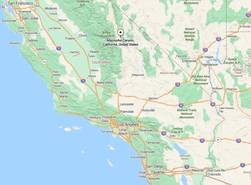
Mazourka Canyon is accessed via Mazourka Canyon Road east of Independence, a wide dirt road that becomes narrow and rough as it climbs.
This route crosses BLM land and remote mining claims, eventually connecting to the crest of the Inyos. The terrain and road condition deter most traffic, ensuring the canyon remains peaceful and largely unseen.
12. Grant – Sage Flats and Forgotten Tracks
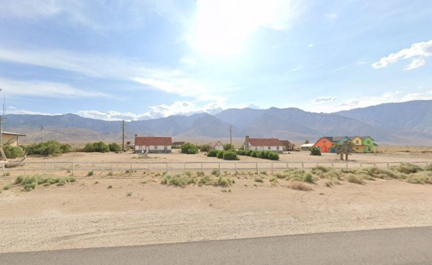
South of Mono Lake, the tiny settlement of Grant blends into the sagebrush. A couple of ranch houses, a water tank, and one old windmill are all that hint at life.
It’s the kind of place where fences sag into the dust and cows drift like ghosts in early morning fog. You won’t find a store or signpost—only the quiet of open desert.
Locals tend stock, mend wire, and sit on porches watching for hawks. There is no schedule here but the seasons.
Where is Grant?
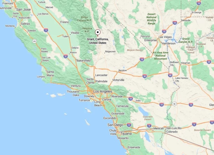
Grant lies in Mono County off Highway 167, northeast of Mono Lake and not far from the Nevada line. The closest notable town is Lee Vining, about 20 miles away.
Most maps barely mark it, and there’s no paved road for miles. But for those who crave silence and sky, Grant delivers both in endless supply.
11. Pine Glade – A Secluded Rim Between Rock Creek and the Sky
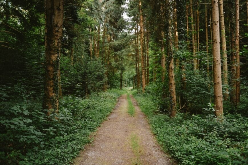
Above Rock Creek Lake but before the snowline, Pine Glade offers a pocket of high-elevation quiet. Just a few cabins and aging USFS structures remain, framed by thick pine and fir.
Access is seasonal, and many homes are boarded up much of the year. When open, the place hums with bees, breezes, and not much else.
A trail skirts the ridge to hidden alpine meadows, and most afternoons pass without a single human voice echoing through the trees.
Where is Pine Glade?
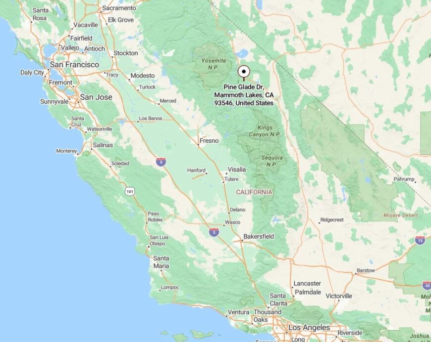
Pine Glade sits near the top of Rock Creek Road in Mono County, just below Mosquito Flat. It’s reachable by a narrow, winding climb from Toms Place.
Snow usually blocks access from November through May, but in summer, it’s a forgotten gem at 9,000 feet. Most people drive straight past it to the trailhead—leaving Pine Glade in peace.
10. Markleeville – Alpine County’s Hidden High-Country Hamlet
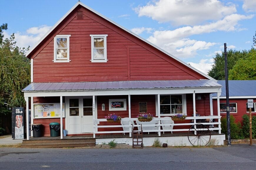
Roughly 200 residents call Markleeville home, and many of them can be found chatting outside the 150-year-old courthouse or casting flies in Markleeville Creek.
Visitors soak in mineral pools at nearby Grover Hot Springs State Park, pedal the lung-busting Monitor Pass climb, or set out on foot toward 9,000-foot trailheads that lead into the Mokelumne Wilderness.
A handful of cafés, a historic hotel, and a seasonal general store make up the town’s commercial core, while county jobs and small-scale tourism provide most paychecks. Logging trucks no longer rumble through, leaving the pine-scented main street as quiet as it was in the 1880s.
Towering ridges block cell service in spots, snow closes secondary roads for months, and the nearest chain grocery sits forty miles away, all of which underlines the settlement’s seclusion. Night falls to the sound of the Carson River and little else.
Where is Markleeville?
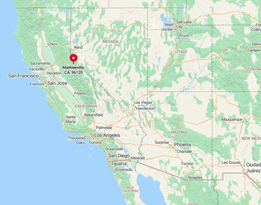
Markleeville rests in Alpine County just south of Lake Tahoe, tucked where State Route 89 meets State Route 4. Steep canyons, avalanche zones, and seasonally closed passes isolate the village every winter, making it feel like an island in the Sierra.
Summer access arrives via the winding Monitor Pass from the east or Woodfords Canyon from the north, both scenic drives with scant traffic. Those willing to brave the curves are rewarded with uncrowded trailheads and hot springs steam rising against distant peaks.
9. June Lake – A Quiet Loop of Glassy Water and Granite Walls
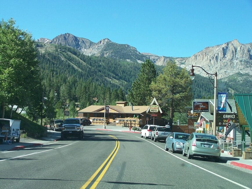
About 600 year-round locals inhabit the compact grid of cabins and lodges known as June Lake Village. Anglers cast for rainbow trout on four linked lakes, hikers trace the Rush Creek Trail toward Thousand Island Lake, and winter guests glide down the uncrowded runs at family-owned June Mountain.
Small inns, a craft brewery, and a marina form the town’s economic backbone, with seasonal fishing and ski tourism rounding out livelihoods. Dense stands of lodgepole pine and sheer cliffs keep development in check, so shoreline campfires still glow in silence once the day-trippers leave.
State Route 158 forms a 16-mile horseshoe off US-395, meaning through-traffic is nonexistent. Evening reflections of Carson Peak on Gull Lake remind visitors why locals guard their solitude.
Where is June Lake?
🔥 Would you like to save this?
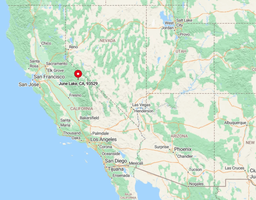
June Lake sits in Mono County twenty miles north of Mammoth Lakes, reached by exiting US-395 onto the June Lake Loop. Granite walls rise on three sides, and winter storms often shut the northern half of the loop, increasing the sense of isolation.
The closest commercial airport is an hour away in Bishop, while limited bus service only runs in summer. Drivers arriving after dark frequently pull over, stunned by the Milky Way mirrored on the slate-black water.
8. Lee Vining – Gateway to Tioga Pass Without the Crowds
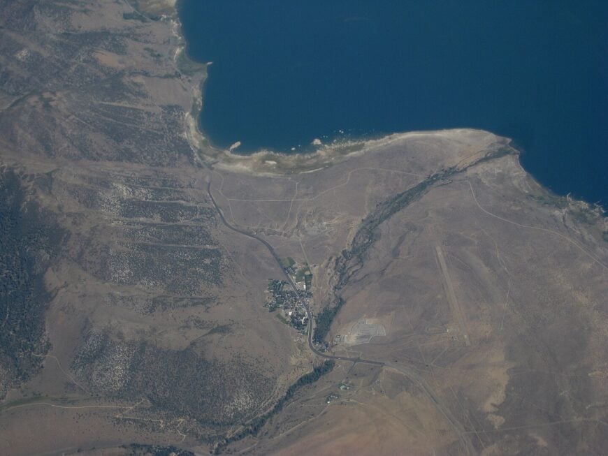
Lee Vining claims a population of roughly 500, though that number dips when the first snow closes Tioga Pass. Travelers sip coffee at Nicely’s Diner, browse the high-desert flora at Mono Basin Scenic Area Visitor Center, or rent kayaks to paddle beneath Mono Lake’s otherworldly tufa towers.
Gas stations, rustic motels, and ranger offices form the town’s modest service sector, catering to climbers and photographers heading into Yosemite’s east entrance. Ten-thousand-foot cliffs rise directly behind the storefronts, leaving little room for sprawl.
Winter closures of both Tioga and Sonora Pass sever two major routes, trimming traffic to locals and adventurous overlanders. Off-season evenings feel almost eerie as wind whistles through sagebrush and neon motel signs flicker against empty sidewalks.
Where is Lee Vining?
The village stands on US-395 at the northeast corner of Mono Lake, 77 miles south of Carson City and 140 miles north of Ridgecrest. Sheer walls of the Sierra on the west and the treeless Great Basin on the east create natural barriers that reinforce its quiet.
In summer, Highway 120 climbs from town to Yosemite’s Tioga Pass, yet in winter the gate locks just above Lee Vining, ensuring months of near-total stillness. Visitors typically arrive by car, though adventurous cyclists tackle the high-elevation roads for bragging rights and panoramic views.
7. Bridgeport – Wide-Open Ranchland Meets Sawtooth Ridge
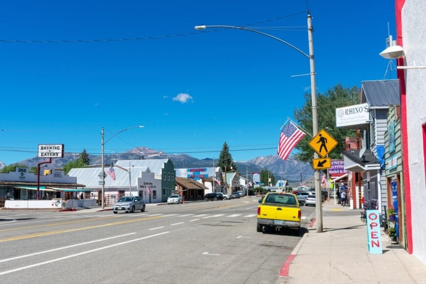
About 575 people live among the hay fields, rust-red barns, and weathered boardwalks of Bridgeport. Anglers wade the trout-rich East Walker River, crews launch boats on Bridgeport Reservoir, and hikers explore granite spires in the Hoover Wilderness.
Cattle ranching still pays many bills, supplemented by heritage tourism drawn to the 1880 Mono County Courthouse and the legendary Rhino Bar. A vast valley floor keeps the town spread out, while the sawtooth skyline discourages expansion toward the west.
Miles of open rangeland buffer Bridgeport from larger communities, so dark nights and quiet streets prevail. Even at peak season, traffic lights remain unnecessary and locals still wave from pickup trucks.
Where is Bridgeport?
Bridgeport lies on US-395 near the Nevada border, roughly halfway between Lake Tahoe and Bishop. To the west, 11,000-foot peaks guard the only paved route into Yosemite’s northern backdoor, while high desert emptiness stretches east to ranch country.
Winter storms can close Sonora Pass to the north and Tioga Pass to the south, effectively narrowing access to one plowed highway. The closest commercial airport sits 90 miles away in Reno, preserving the valley’s slow pace.
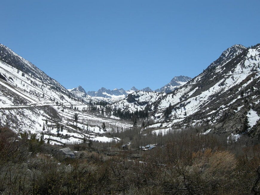
6. Aspendell – A Pocket Village at 8,400 Feet
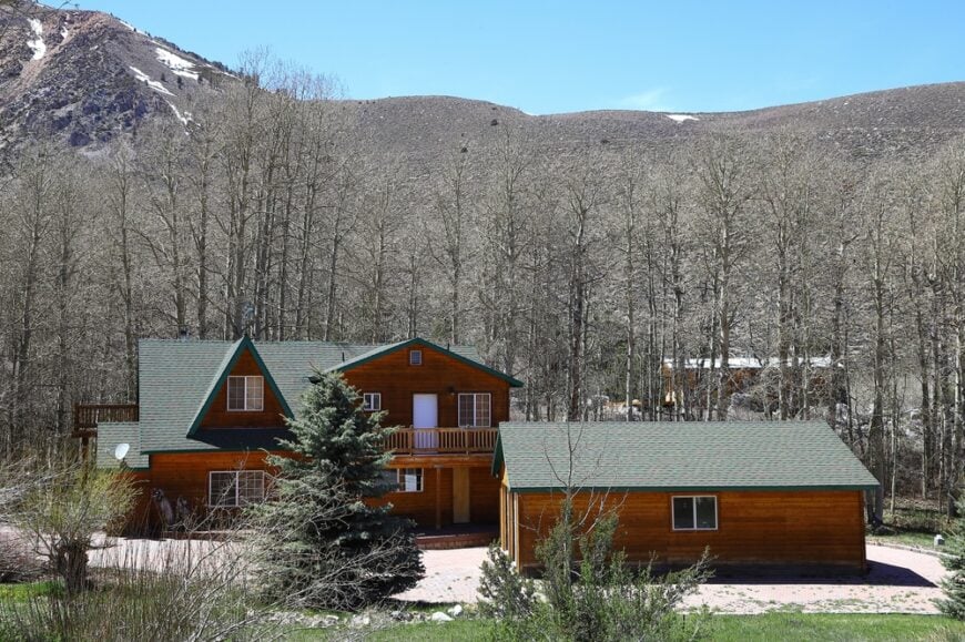
Fewer than 100 cabins perch along aspen-lined lanes in tiny Aspendell, where many owners arrive only on weekends or during summer. Fly fishers stalk trophy trout in Bishop Creek, hikers start toward Sabrina Basin’s turquoise lakes, and autumn leaf peepers fill memory cards with gold-glowing foliage.
The settlement has no businesses beyond a seasonal lodge, so residents drive twenty minutes down canyon for supplies in Bishop. Towering ridges funnel snowdrifts that often bury roofs to the eaves, occasionally cutting power and phone lines.
Narrow lots, strict forest-service leases, and deep snows limit growth, ensuring Aspendell remains hidden among the quaking leaves. Nights bring little light but the glow of woodstoves and a sky so bright with stars it feels almost artificial.
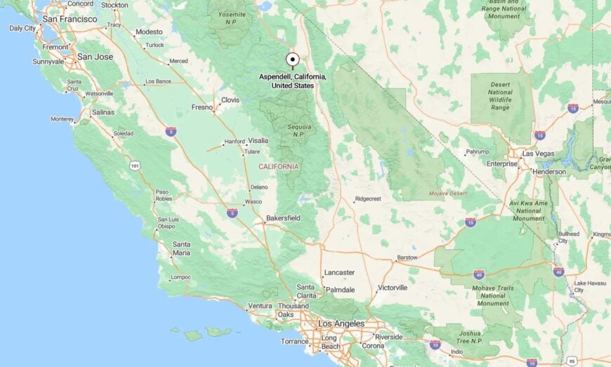
Where is Aspendell?
The village sits at the end of State Route 168 west of Bishop, hemmed in by peaks topping 13,000 feet. A single road climbs the canyon, and heavy winter storms can delay plowing for days, keeping outsiders at bay.
Summer visitors wind past Cardinal Village Resort, cross the creek, and roll into a settlement small enough to miss if one blinks. Those who brave the altitude find trailheads within walking distance and the peaceful hush of a high-country cul-de-sac.
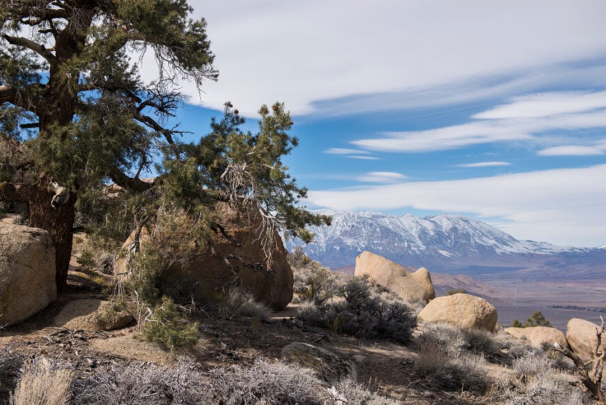
5. Swall Meadows – Sage, Juniper, and Infinite Night Skies
Only about 220 residents occupy the one-acre lots scattered across Swall Meadows’ sagebrush terrace. Mule deer wander through backyards, amateur astronomers set up telescopes on gravel driveways, and hikers access the McGee Creek trail system five minutes up the highway.
A rural residential character dominates, with most income earned in Bishop or Mammoth Lakes, forty and twenty minutes away respectively. Absence of commercial zoning, wide spacing between homes, and strict dark-sky guidelines keep the settlement quiet after sunset.
A 2015 wildfire spared many houses but removed enough brush to reveal sweeping Owens Valley vistas that locals now cherish. Coyotes yip in the distance while porch lights stay low to preserve starlight unrivaled in more built-up towns.
Where is Swall Meadows?
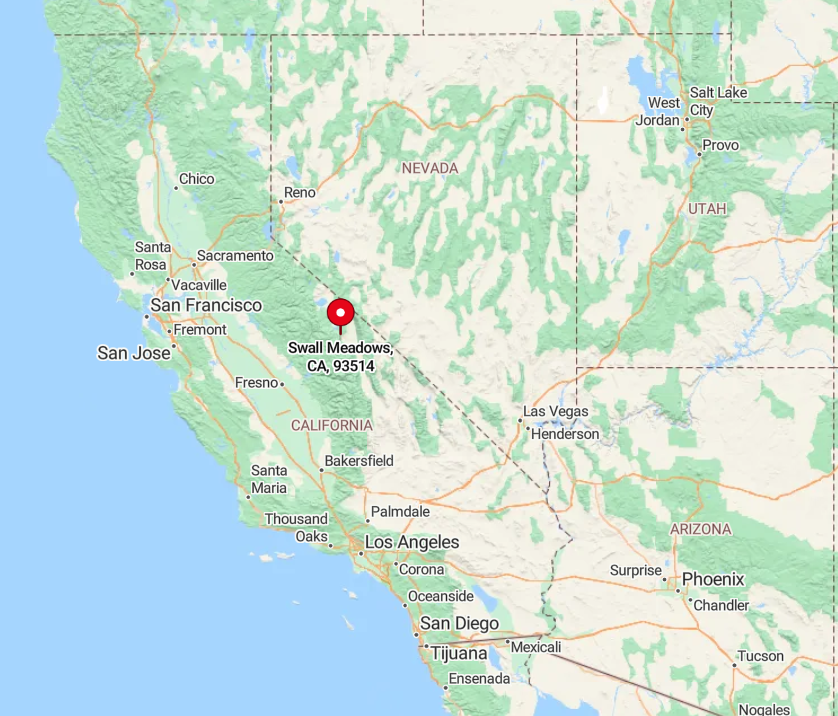
This unincorporated community clings to the Sherwin Grade off US-395, midway between Tom’s Place and Crowley Lake. Steep drop-offs on one side and granite walls on the other discourage through-traffic, isolating the neighborhood from the busy highway below.
Access comes via a single paved lane that climbs two miles of switchbacks, occasionally closing in winter storms until county plows arrive. Visitors who reach the plateau are rewarded with sweeping views from White Mountain Peak to the Sierra crest.
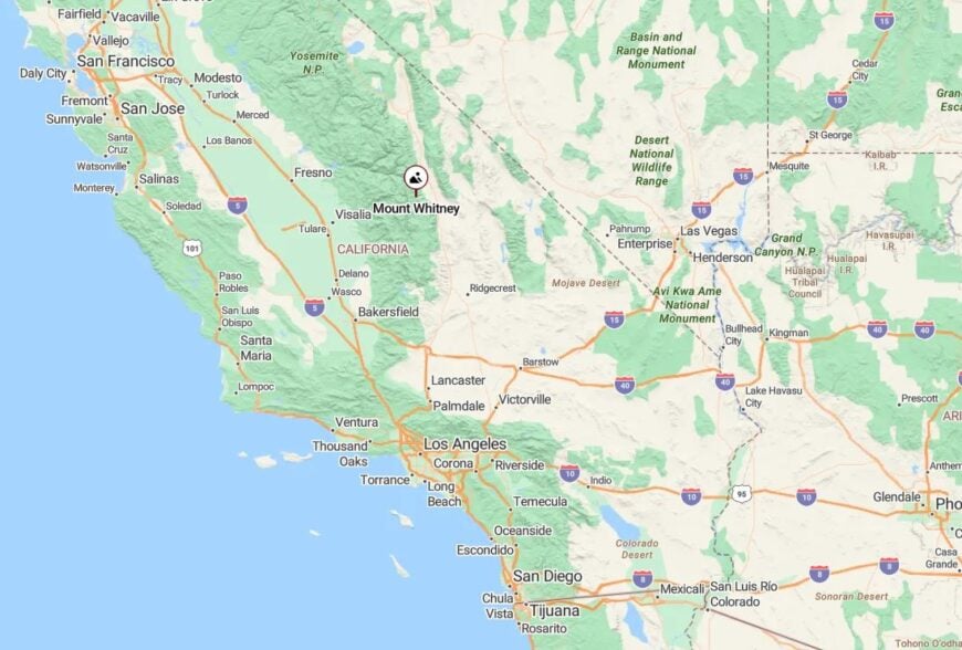
4. Independence – Historic Courthouse Beneath Kearsarge Peaks
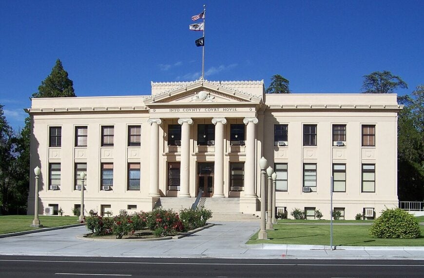
Roughly 600 people live beneath cottonwood canopies along Independence’s quiet grid of 19th-century streets. Travelers tour the Eastern California Museum, step into the 1870s jailhouse where rusted iron bars still swing, or lace up boots for the Kearsarge Pass trail starting just three miles west.
Government work at the county seat, a small motel cluster, and seasonal hikers supply modest employment. Jagged granite walls rise abruptly behind town while vast Owens Valley space stretches out front, limiting expansion and muffling urban noise.
A single grocery store, limited dining, and spotty cell coverage keep the pace unhurried. Locals often know every vehicle that passes the lone traffic signal.
Where is Independence?
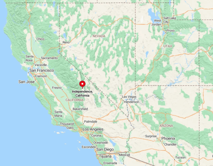
The town sits on US-395 roughly halfway between Lone Pine and Bishop, with Mount Williamson looming overhead. Sierra peaks block radio signals and road options to the west, and the desert’s wide reach deters growth to the east.
Visitors typically arrive by car, though Eastern Sierra Transit buses make limited daily stops. After dark, the historic courthouse clock chimes across streets so quiet one can hear crickets over the hum of the highway.
3. Olancha – Where the Sierra Touches the Desert
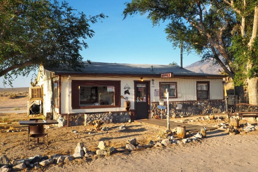
Only about 200 residents reside in Olancha’s scattering of ranch houses and roadside cafés. Travelers stop for jerky at the wooden shack by the gas station, venture onto the salt flats of the Owens Lake bed for sunset photography, or summit the 12,132-foot Olancha Peak by a challenging trail that begins near town.
Cattle ranching, a small bottle-water plant, and seasonal tourism keep the lights on. Flanked by the Inyo Mountains to the east and the Sierra to the west, Olancha’s isolation is magnified by the empty miles that separate it from bigger towns like Lone Pine and Ridgecrest.
Night skies sparkle over the high desert while coyotes roam the old movie set remnants on the valley floor. Residents cherish the silence broken only by the occasional tractor or passing freight truck.
Where is Olancha?
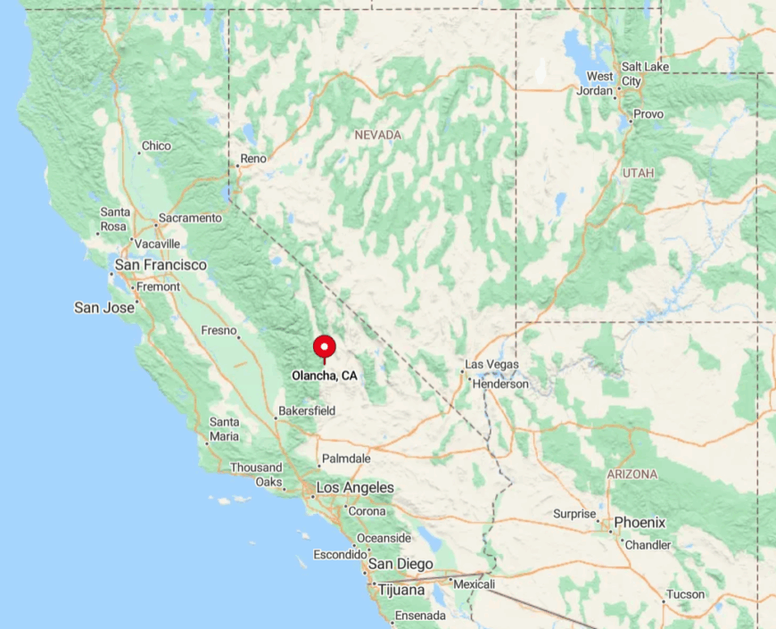
Olancha lies on US-395 near the south end of Owens Lake, ninety minutes north of Ridgecrest and an hour south of Bishop. The Sierra abruptly climbs ten thousand feet behind town, while the lake’s salty plain deters development out front.
Access comes almost exclusively by highway, with no scheduled bus or rail service and a patchwork of dirt roads radiating into the desert. Those who persevere often have Crystal Geyser’s sporadic freshwater spout or the historic Cartago soda ash kilns entirely to themselves.
2. Paradise – An Appropriately Named Bluff Above the Owens River
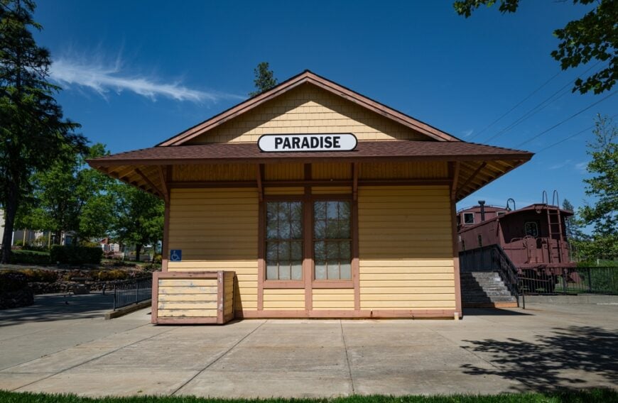
About 150 people inhabit Paradise’s pine-dotted plateau where stone cottages perch above the Owens River Gorge. Residents cast flies in secluded bends, ride horses along the old aqueduct trail, or sip coffee on porches overlooking 13,652-foot Mount Tom.
Most work in Bishop below, though a handful maintain home studios crafting pottery or metalwork for regional fairs. The bluff’s narrow access road, lack of commercial services, and protective federal land boundaries keep the hamlet quiet and free from new subdivisions.
Rock climbers appreciate hidden granite crags nearby, yet crowds rarely materialize. Evenings echo with the rustle of pine needles rather than freeway noise.
Where is Paradise?
The settlement sits five miles off US-395, reached by a steep paved climb just north of Bishop. Sheer cliffs on three sides and a deep river canyon on the fourth create a natural fortress that limits both visitors and cell signals.
Drivers must navigate hairpin turns to reach town, a deterrent that preserves the bluff’s tranquility. Those who conquer the grade find trailheads to Pine Creek Pass and a view stretching from the White Mountains to the tallest peaks of the Sierra.
1. Bodie – A Frozen-in-Time Ghost Town in the High Sierra
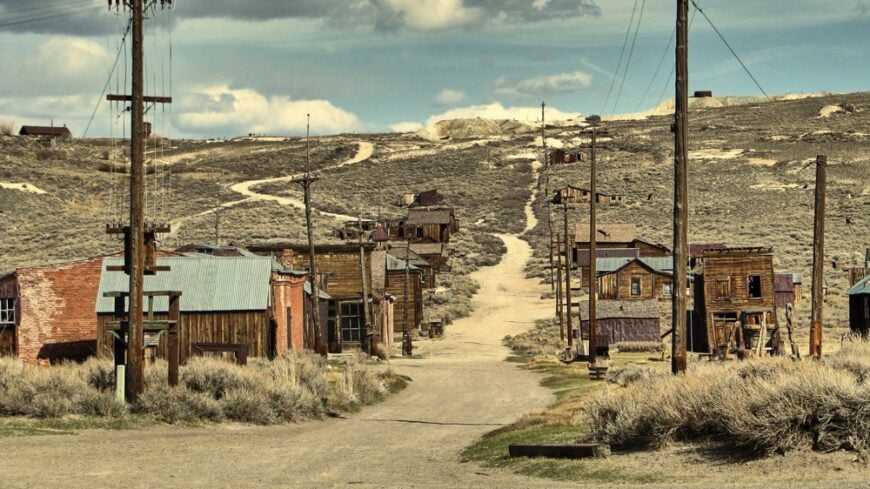
Officially, Bodie’s current population is zero, yet more than 170 weather-worn buildings stand as silent witnesses to the boomtown that once held 10,000 miners. Day visitors peek into dust-coated saloons, photograph the Standard Mill’s towering stamp battery, and wander streets where rusted Model A cars still sit on flat tires.
California State Parks staff and a tiny crew of historians provide the only employment, preserving structures in a state of “arrested decay.” At 8,379 feet, winter storms bury the site and close the park for months, while the last resident departed decades ago, leaving creaking boardwalks to the howling wind.
With no modern services, no permanent electricity, and no cell reception, Bodie embodies isolation like few places in America. The silence is so complete that a single raven’s call can echo across the barren sage hills.
Where is Bodie?
Bodie State Historic Park lies thirteen miles off US-395 north of Lee Vining, reached by State Route 270, the last three miles of which are unpaved washboard that rattles hubcaps off the unprepared. The road closes after the first significant snow, sealing the ghost town from November into late spring and reinforcing its deserted mood.
Summer visitors must drive at least thirty minutes from the nearest fuel or food, and no public transport ventures anywhere near the site. Those who make the trek arrive to find a town paused in 1881, with nothing but wind and distant thunder for company.