🔥 Would you like to save this?
Western New York is peppered with small lakeside pockets where quiet mornings, lapping waves, and star-filled skies replace traffic noise and neon glare. We gathered 25 of the most tucked-away communities, each promising tranquil water views and room to breathe.
Most sit far from thruways, and several still rely on dirt lanes or single-lane bridges, so visitors often feel they have stepped back a few decades. Farming, fishing, and seasonal cottage rentals shape daily life, while tourism arrives in gentle spurts instead of torrents.
In order to come up with the very specific design ideas, we create most designs with the assistance of state-of-the-art AI interior design software.
The result is a region where herons glide across mirrorlike coves and porch lights double as the only nighttime illumination. Here is our countdown of Western New York’s most secluded lakeside towns, ready for anyone seeking real breathing space.
25. Cassadaga – Three Quiet Lakes and a Village in the Trees
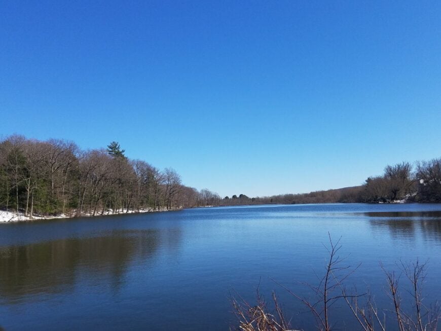
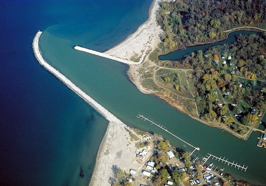
Cassadaga curls around a small chain of lakes where dawn mist hangs low and paddles barely ripple the water. Its seclusion comes from tree-lined backroads, modest shorelines with no big marinas, and a pace set by loons and church bells.
The vibe is leafy and low-key: porch swings, clapboard cottages, and a main street that still pauses for parades. Kayak the Upper, Middle, and Lower Cassadaga Lakes, cast for bass along lily pads, stroll the village green, or wander to nearby trailheads in the state forest for a shaded hike.
Summer brings small arts events and lakeside picnics, while cottages and a handful of cafés support the local week. Nights are dark enough to read constellations right off the water. It’s the kind of place that teaches your shoulders to drop an inch.
Where is Cassadaga?
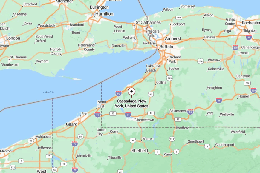
Set in northern Chautauqua County, Cassadaga sits about 10 miles south of Fredonia and Lake Erie’s shore. Most visitors come down NY-60, then turn onto short lakeside lanes that quickly leave highway noise behind.
With no through-route skirting the water, traffic thins to locals, anglers, and cyclists. It’s close on the map, but the last mile feels like you’ve slipped into a green, quiet room.
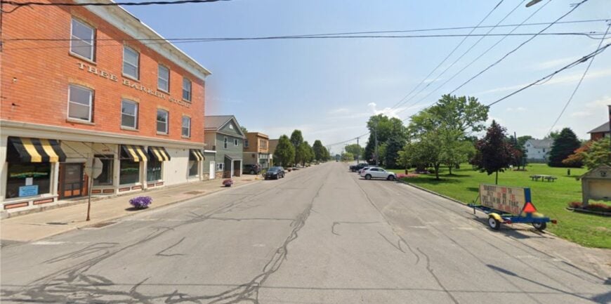
24. Olcott – Carousel Town on a Quiet Reach of Shore
Olcott keeps an old-summer rhythm: porches with wicker chairs, a vintage carousel, and boats sliding out at dawn. Seclusion comes from broad farm belts between villages and a shoreline that hides behind bluffs and hedgerows.
The mood is breezy and nostalgic—fresh-cut grass, bell buoys, and the smell of fry stands near the pier. Walk Krull Park’s lakefront, beachcomb after a west wind, fish from the long pier, or browse small antique corners along Main Street. Seasonal shops and marinas float the local economy.
Sunset turns the lake into hammered metal and the boardwalk into a whisper. It’s a pocket of summer that never hurries.
Where is Olcott?
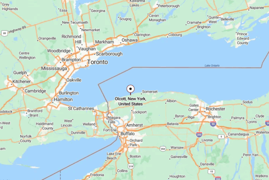
The hamlet sits in the Town of Newfane, northern Niagara County, about 20 miles northeast of Niagara Falls. You reach it on NY-78 or Lake Road, both two-laners that thread vineyards and orchards. Side streets dead-end at the bluff, protecting the shoreline from cut-throughs. The last block feels like a reveal—water, sky, and wind.
23. Barker – Lighthouse Country with Wind in the Wires
Barker feels small and self-contained, a lakeside village buffered by fields and the broad shoulder of Golden Hill State Park. Its secluded feel comes from minimal shoreline development and miles of two-lane roads that prefer tractors to trucks.
The vibe is simple and wind-bright: clapboard houses, gulls over the point, and long views to a clean horizon. Climb the Thirty Mile Point Lighthouse grounds, picnic above the cobble beach, cycle Lake Road at golden hour, or drift-fish when waves settle.
Farming and park jobs anchor the week. Nights bring the soft pulse of a beacon and stars you can actually count. It’s the kind of quiet that sticks to your sleeves.
Where is Barker?
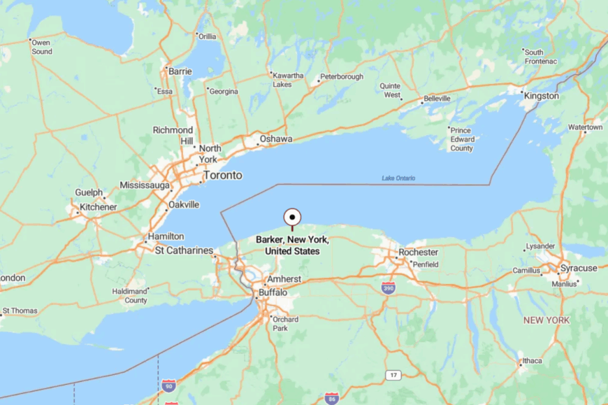
On Lake Ontario’s south shore in Niagara County, Barker lies roughly 30 miles east of Niagara Falls. Drivers follow Route 148 or Lake Road to the shoreline, then slip into park roads that end at the bluffs.
With the lake on one side and fields on the other, there’s nowhere to rush. You arrive at waves, not traffic.
22. Lyndonville – Creek Mouth, Marsh Light, Orchard Air
Lyndonville sits a few country miles back from Lake Ontario, where Johnson Creek widens into marsh and then lake. Seclusion is baked in: orchards on three sides, cattail flats on the fourth, and few reasons for anyone to pass through.
The vibe is tidy and rural: church bells on Sundays, wooden docks, and farmstands stacked with peaches. Paddle the creek mouth at daybreak, photograph herons in the reeds, cast for bass in sheltered bends, or wander the tiny main street for coffee.
Fruit farms and small shops keep the lights on. Even the breeze seems to arrive gentler here. It’s the sort of place that breathes for you.
Where is Lyndonville?
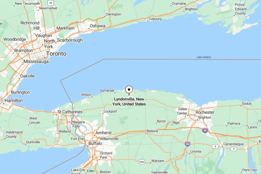
In northeastern Orleans County, Lyndonville sits about 15 miles north of Medina and a short drive south of Lake Ontario. You reach the water by quiet lanes like Lakeshore Road, where the creek turns toward the lake.
With few cross routes, traffic thins to locals and anglers. Fields and marshes make a soft boundary from the wider world.
21. Hamlin Beach – Pines, Dunes, and a Long Horizon
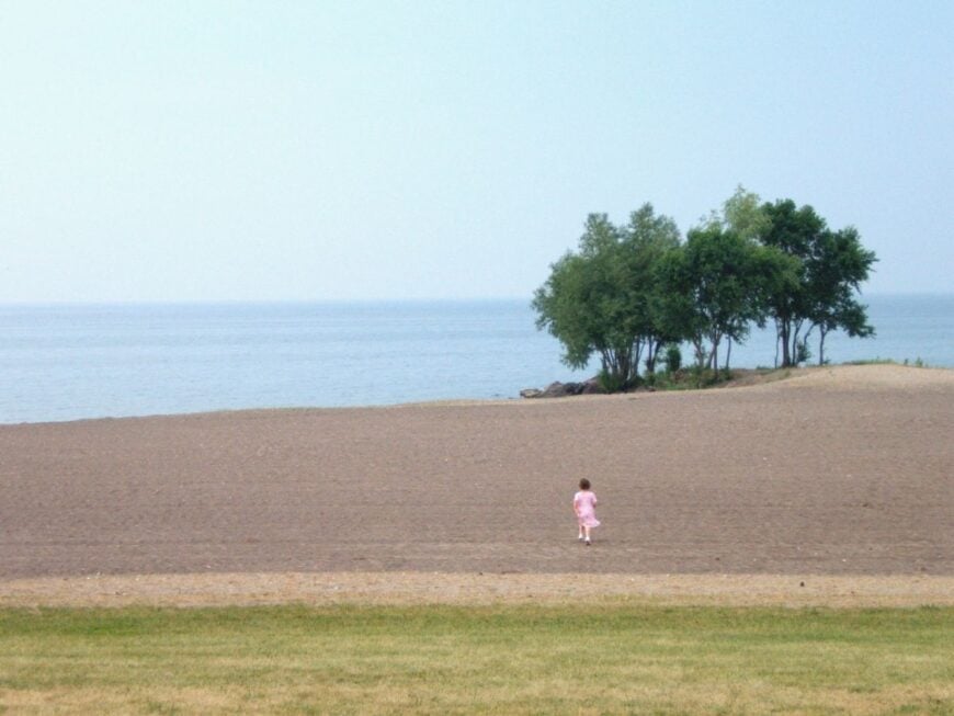
Hamlin Beach trades main-street bustle for wind in the pines and a string of pocket beaches hidden by dunes. Its seclusion comes from parkland buffers and a shoreline where no commercial strip ever took root.
The vibe is beach-simple: dune grass, driftwood, and picnic tables in a cathedral of evergreens. Walk the Yanty Marsh trail, bike the park loops at dusk, scan for migrating hawks from the bluff, or launch a kayak when the lake goes glassy.
Seasonal park work and nearby farms shape the week. Even on warm weekends, you can hear waves more than voices. It’s close to Rochester, but it feels like another latitude.
Where is Hamlin Beach?
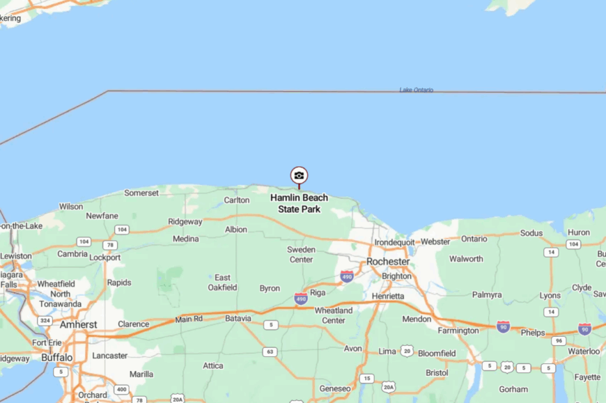
Set on Lake Ontario in northwest Monroe County, the park sits about 25 miles northwest of downtown Rochester. Access is off the Lake Ontario State Parkway, then into a network of slow, tree-tunneled park roads.
There’s no through street—most lanes end at dunes or pines. The last turn trades engine noise for surf.
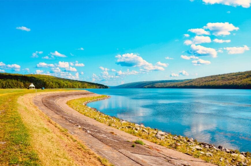
20. Onoville – Reservoir Coves and Pine-Shadow Quiet
Onoville feels like a shoreline whispered to the map, with long blue coves tucked under pine and hemlock. Its seclusion comes from the Allegheny Reservoir’s braided fingers, miles from interstates and ringed by public forest and national lands that keep development thin.
The vibe is lake-simple and woodsy: docks creaking softly, minnows flashing in shallows, and loons calling across morning mist. Launch at Onoville Marina, slip a kayak into glassy backwaters, fish for walleye or smallmouth along rocky points, hike quiet ridge roads for overlooks, or spread a picnic under the tall trees.
Seasonal marina work, cottage rentals, and a few outfitters provide the week’s hum. Nights arrive dark and generous, with stars mirrored twice—above and in the water. It’s the kind of calm that resets your breathing without asking.
Where is Onoville?
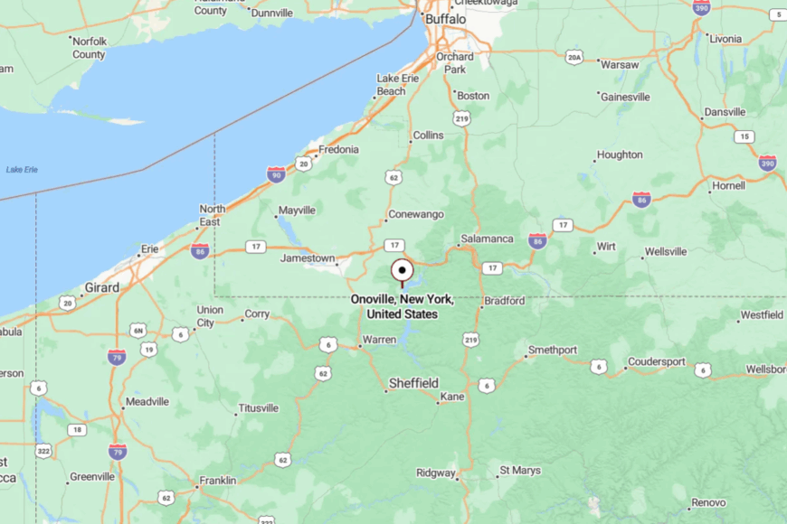
Onoville sits in southeastern Cattaraugus County near the Pennsylvania line, about 20 miles south of Salamanca and 30 miles from Ellicottville. Most visitors exit I-86 near Steamburg, then follow NY-394 and county roads as they narrow toward the reservoir.
The last miles wind through forest and along high-water inlets before ending at the marina and shoreline lanes. It’s close enough for a day trip, yet far enough that the world fades to blue water and green hills.
19. Branchport – Keuka’s Western Fork with Porch-Light Nights
🔥 Would you like to save this?
Branchport gathers at the head of Keuka’s west arm, where hills fold tight and docks point toward a long V of water. Its seclusion is geographic: one road in from vineyard country and slow curves that keep the day unhurried.
The vibe is vine-scented and neighborly: clapboard cottages, clinking halyards, and a single intersection that knows every story. Paddle along sugar-maple shores, visit a farm winery, fish for lake trout at dawn, or stroll to the tiny historic schoolhouse.
Grapes, small eateries, and marinas support the rhythm. After dark, porches glow like constellations along the shore. It’s a postcard that exhales.
Where is Branchport?
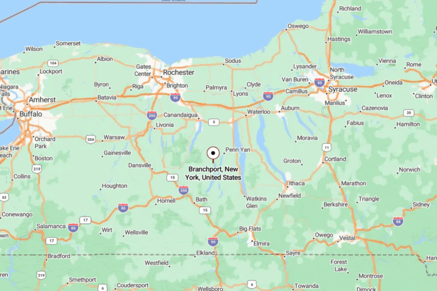
In Yates County on Keuka Lake’s northwest tip, Branchport sits about 9 miles west of Penn Yan. You arrive via Route 54A or Italy Hill’s backroads—both scenic, both slow.
The final descent reveals the water all at once. Hills and vines keep it cozily apart from busier lake towns.
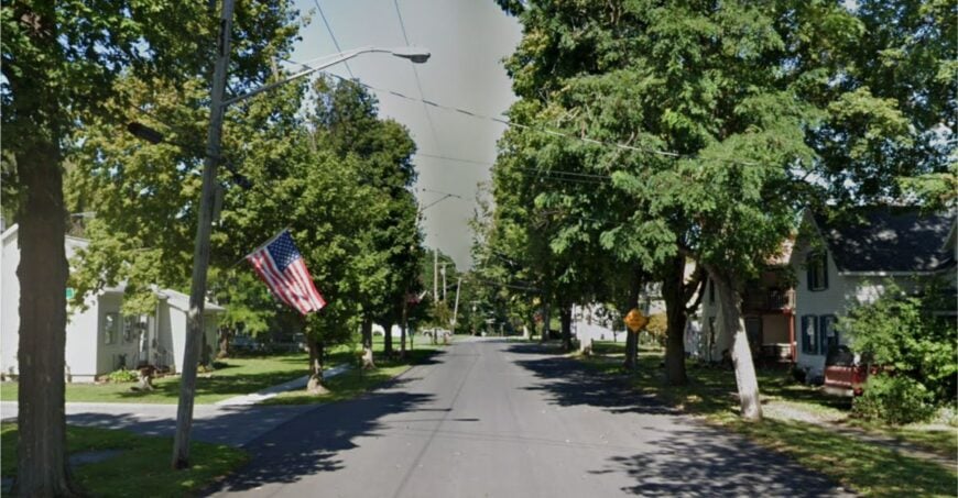
18. Hammondsport – Storybook Harbor at Keuka’s Foot
Hammondsport feels sheltered by amphitheater hills, its green square a short stroll from docks that barely ripple at sunrise. Seclusion comes from sitting at the very end of the lake, and the way routes in curl over ridges before dropping to the water level.
The vibe is historic and walkable: gingerbread porches, tasting rooms, and wooden launches nodding at their moorings. Sip along the Keuka wine trail, rent a skiff for a morning troll, visit the Glenn H. Curtiss museum, or walk the shoreline promenade with coffee in hand.
Tourism and winemaking keep storefronts lively, but evenings settle to a hush. When fog lifts, the hills step forward like actors taking a bow. It’s busy enough to browse, quiet enough to think.
Where is Hammondsport?
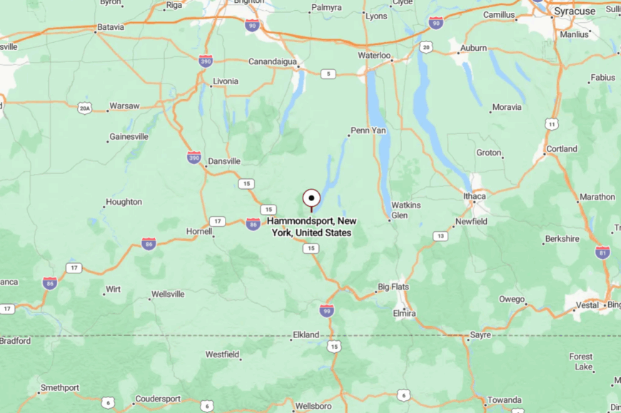
At Keuka Lake’s south end in Steuben County, Hammondsport is about 20 miles south of Penn Yan and 10 miles north of Bath. Drivers reach it via Route 54, which tightens into lake-hugging curves.
Hills hem the village on three sides, and water guards the fourth. The setting feels like a room with a very high ceiling.
17. Dresden – Little Docks on Seneca’s Still Morning
Dresden sits low and quiet on Seneca Lake’s western shore, a hamlet of short streets and long lake views. Its tucked-away feel comes from a small footprint and the way vineyards and fields buffer it from the highway grid.
The vibe is pocket-harbor simple: kayaks lined like pencils, grape leaves chattering in a breeze, and boats ghosting past at dawn. Launch a canoe from the village ramp, pedal country lanes to tasting rooms, birdwatch along the shore, or picnic where the breeze lifts off deep water.
Grapes and small services sustain the week. Mornings feel like a held breath before the day begins. It’s the kind of quiet you remember later.
Where is Dresden?
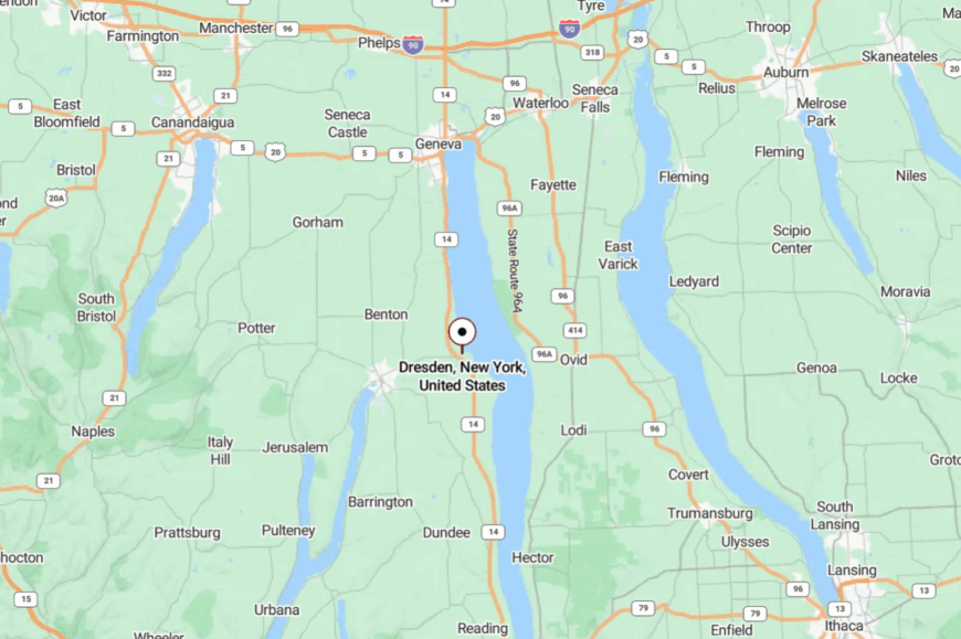
In Yates County, roughly midway down Seneca’s west side, Dresden lies about 7 miles south of Geneva. You reach it off NY-14 via smaller lanes that turn toward the lake.
With no major commercial strip, traffic tapers quickly. Water to the east and vines to the west make a gentle boundary.
16. Lodi Point – Willow Shade and Open Water

Lodi Point is a grassy triangle of shoreline and a handful of lanes where willows trail their fingers in Seneca Lake. Seclusion comes from state parkland, vineyard buffers, and a quiet stretch far from larger marinas.
The vibe is picnic blankets and aluminum boats, cottage porches and clinking tackle boxes. Cast for smallmouth off the point, paddle to glass-calm coves, stroll Lodi Point State Park, or sip along nearby back-road wineries.
Grapes and seasonal visitors keep things ticking. When the wind dies, the lake looks like polished stone. It’s close to the wine trail but keeps its own hush.
Where is Lodi Point?
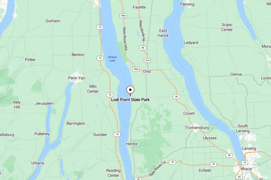
On Seneca’s east-central shore in Seneca County, Lodi Point sits about 12 miles north of Watkins Glen. Access is via NY-414 to short lakeside lanes that end in parkland.
With no through road, visitors come on purpose and leave slowly. The last hundred yards swap engine noise for wave slap.
15. Himrod – Rail-Side Hamlets and Quiet Water
Himrod is more clustered than a village, with a few lanes near the shore where vineyards run right to the tracks and the lake. Its seclusion stems from tiny turnoffs off NY-14 and long gaps between neighbors.
The vibe is work-boots and weekend skiffs: grape trucks during harvest, herons in the shallows year-round. Walk the lakeside pull-offs at sunrise, fish from a small launch, follow gravel backroads to family wineries, or watch the excursion train roll past grape rows.
Wine and farm work lead the calendar. The lake’s breath seems to slow everything down. It’s a good place to practice going gently.
Where is Himrod?
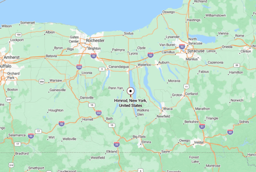
Midway down Seneca’s west shore in Yates County, Himrod is about 10 miles north of Watkins Glen.
You peel off NY-14 onto short lanes that dead-end at water or vines. With few amenities, most stops are intentional. The simplicity is exactly the charm.
14. Honeoye – Wide Water, Small Footprint
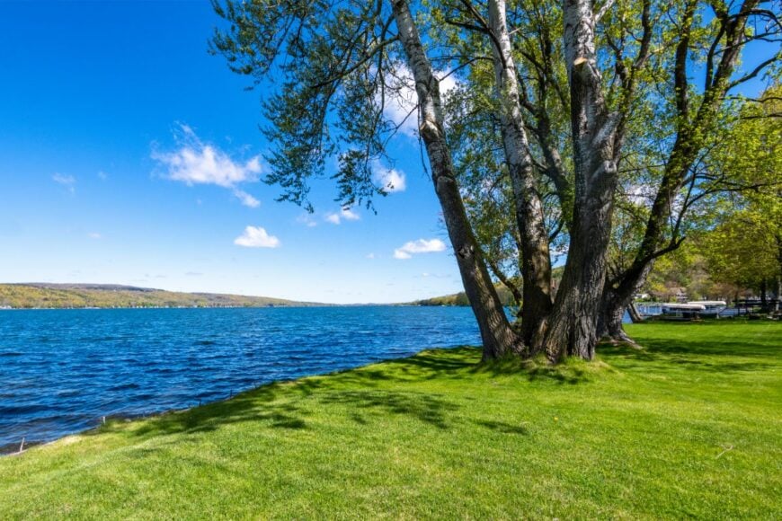
Honeoye clusters at the north end of one of the smallest Finger Lakes, with long views south to low green hills. Seclusion is helped by a ban on high-horsepower chaos and a shoreline that stays mostly residential and wooded.
The vibe is family-dock friendly and bird-rich: loons calling, paddleboards nosing along, and campfires at dusk. Paddle the inlet marsh, climb Harriet Hollister Spencer for ridgeline vistas, fish weedlines at sunrise, or stroll for ice cream in the tiny hamlet.
Small shops and seasonal rentals share the load. Even busy weekends feel measured and soft-spoken. It’s an easy lake to fall quiet on.
Where is Honeoye?
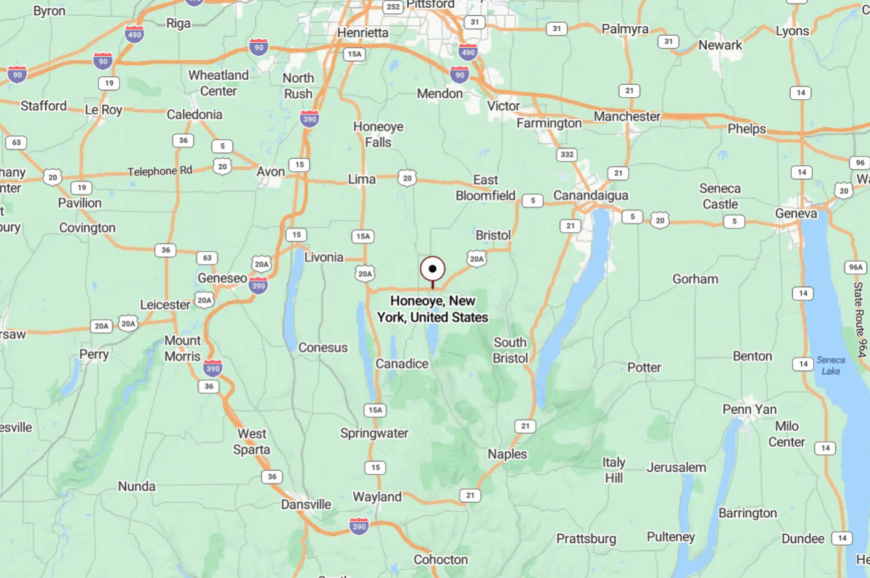
In northern Ontario County, Honeoye sits about 30 miles south of Rochester. Routes 20A and 15A wind you through drumlins and pastures before a sudden blue sheet opens ahead.
With only a few public access points, shoreline traffic stays light. The lake feels like a calm sentence with a long pause.
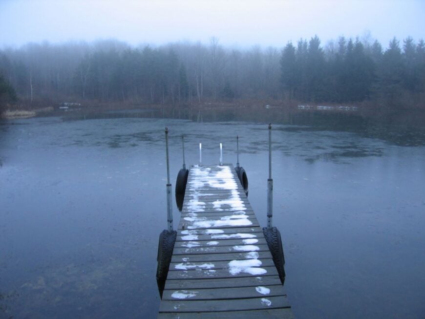
13. Hemlock – Protected Shores, Cathedral Forest
🔥 Would you like to save this?
Hemlock keeps to itself because the water is a protected Rochester reservoir—no lakeside development, few boats, just wind and trees. Its seclusion is policy and terrain: steep, forested slopes and watershed rules that keep the banks quiet.
The vibe is reverent and wild: hemlock shade, osprey platforms, and the smell of rain in the needles. Hike Hemlock-Canadice State Forest, launch a car-top boat where permitted, listen for loons at dusk, or photograph fog lifting off the coves.
Conservation work and low-key recreation set the pace. The silence feels intentional here. It’s the kind of stillness that clears a backlog of thoughts.
Where is Hemlock?
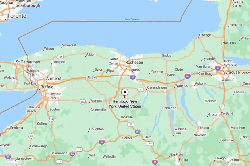
South of Rochester in Livingston and Ontario counties, Hemlock Lake sits a few miles west of Honeoye. You reach it by 15A or county lanes that drop into a narrow wooded valley.
With no cottages or commercial strip, there’s little reason for casual cruising. The last curve replaces storefronts with pines and water.
12. Findley Lake – Two Basins, One Unhurried Village
Findley Lake wraps a tidy main street around twin basins stitched by a short channel, all fringed in spruce and porches. Its tucked-away feel comes from the far southwest corner of the state and a lattice of county roads that take their time.
The vibe is porch-swing and paddle-wheel nostalgic: church bells, kayaks, and an old-timey general store. Rent a canoe, bike quiet loops to the state line, fish lily-edged coves, or browse local craft nooks.
Small inns, lakeside rentals, and seasonal shops buoy the economy. Sunsets smear the water in orange and gold until the first porch lights bloom. It’s a summer-sweet kind of quiet.
Where is Findley Lake?
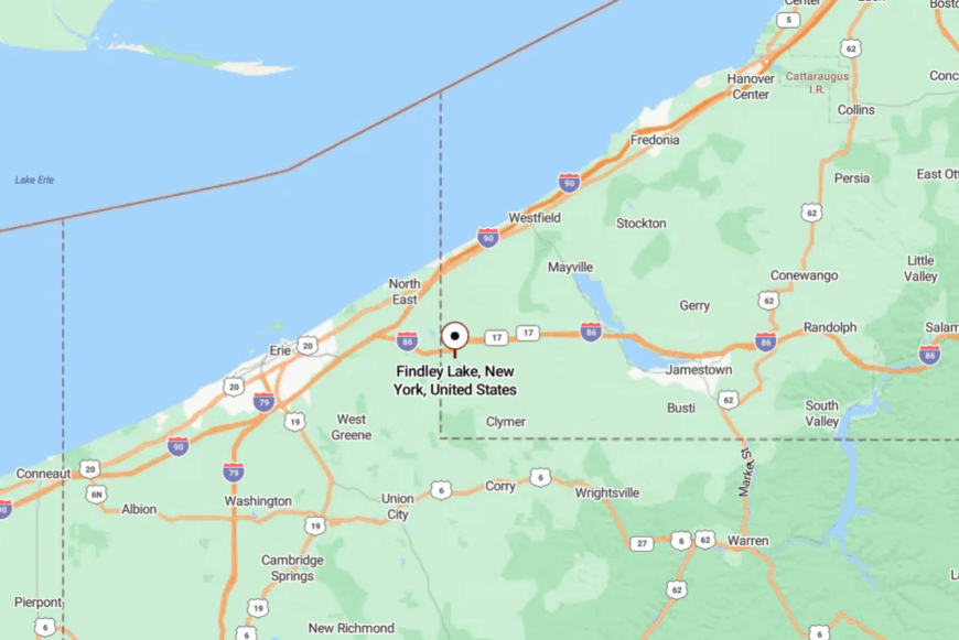
In southwestern Chautauqua County, a mile from Pennsylvania, the village sits about 20 minutes south of Westfield and Lake Erie. NY-426 and rural connectors curl through hills and dairy country before dropping to shore.
There’s no bypass—everyone slows to village speed. The lake greets you like an exhale.
11. Maple Springs – Chautauqua’s Leafy, Low-Key Shore
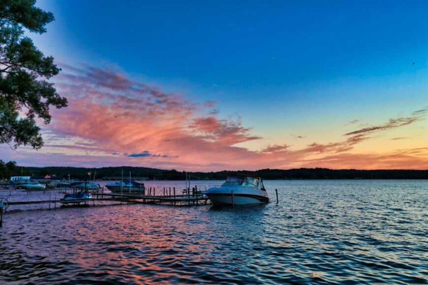
Maple Springs hides under tall trees on Chautauqua Lake’s east shore, a pocket of porches and boathouses facing long afternoon light. Seclusion lives in its narrow lanes, steep banks, and the way traffic diverts to bigger towns across the water.
The vibe is leafy and literary: quiet docks, birdsong, and weekenders reading on Adirondack chairs. Paddle to Long Point State Park, fish weedbeds at dawn, walk the shady lake road, or ride the old ferry to Bemus Point when it runs.
Rentals and a handful of small businesses keep things humming softly. When sunset slides across the lake, the whole shoreline glows like a lantern. It’s the rare place where water lowers the volume on everything.
Where is Maple Springs?
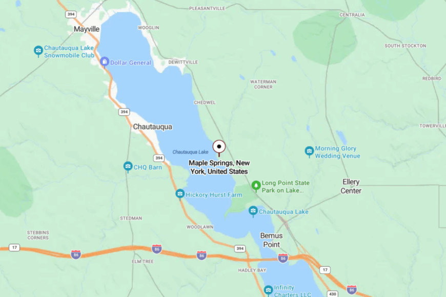
On the east shore of Chautauqua Lake in Chautauqua County, Maple Springs sits about 8 miles north of Jamestown by shoreline roads. Access is via NY-430 and then smaller lakeside lanes that climb and dip among cottages.
With no through route hugging the water, passing traffic is scarce. Trees, bluffs, and slow water make a natural hush.
10. Pulteney – Vine-Draped Hills on Keuka Lake’s Quiet Western Shore
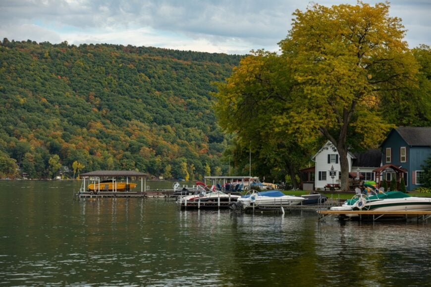
Pulteney, a rural township of roughly 1,300 residents, clings to steep vineyard slopes that rise directly from Keuka Lake’s west branch. Days revolve around tasting rooms, shoreline picnics, and wandering hardwood forests threaded with deer paths.
Small wineries and family orchards supply most local jobs, while a handful of carpenters and fishing guides round out the workforce. Sprawling properties average fewer than 50 homes per square mile, and the absence of marinas keeps boat traffic light.
Photographers come for solitary wooden docks that catch the first blush of sunrise and for lake water that often sits as still as glass. Pulteney feels secluded because no state highways hug this side of the Y-shaped lake, and cell signals struggle in the folds of the hills.
Where is Pulteney?
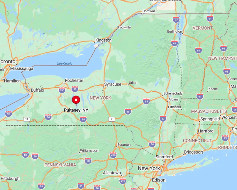
The hamlet lies in Steuben County, about 15 miles north of the small city of Bath. Thick forest buffers it from Route 54A, and the winding county roads discourage hurried travel.
Visitors usually exit I-86 at Bath, then meander past cornfields and grape rows for twenty slow minutes until lake views suddenly appear. Public access is limited to two town parks, keeping crowds thin even on holiday weekends.
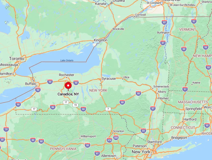
9. Canadice – Hemlock-Ringed Cabins Beside the Smallest Finger Lake
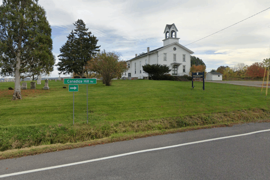
The Town of Canadice hosts just under 1,700 people, many of whom live in seasonal cabins scattered along a one-mile stretch of the lake’s east bank. Residents spend free hours paddling canoes, fishing for lake trout, or hiking the Canadice Outlet Trail that follows an old mill race through spruce groves.
Logging and small-scale maple syrup operations provide modest employment, with weekend tourism adding a little extra income. More than half of the shoreline is protected watershed owned by the City of Rochester, so no homes or roads intrude on long sections of forested bank.
Gas engines are banned on the water, allowing loons to call without competition from motor noise. All this protection leaves the lake feeling almost private, even in midsummer.
Where is Canadice?
🔥 Would you like to save this?
Canadice Lake sits in Ontario County, twenty miles south of Rochester’s suburbs yet worlds apart in pace. It rests in a narrow, glacially carved valley where steep hemlock ridges block radio and cellular reception.
The best approach is along Canadice Lake Road, a winding ribbon that drops sharply from Route 15A before hugging the treeline. Limited parking lots fill quickly, but once a visitor sets off on foot or in a kayak, silence reigns.
8. Rushford – Hidden Coves and Floating Docks on Allegany County’s Reservoir
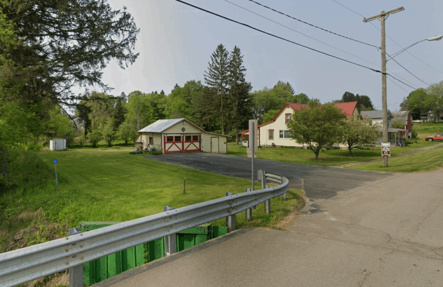
Rushford, a town of about 1,150 full-time residents, wraps around a man-made reservoir known for clear water and sandy bottom coves. Locals split their time between paddling, sailing on small catamarans, and visiting the nearby Hanging Bog Wildlife Management Area for rare orchids and sphagnum moss.
Dairy farms and summer cottage rentals are the primary sources of income, supplemented by seasonal bait shops that open when walleye bite. Rushford Lake is 15 miles from the nearest four-lane highway, with dense pine ridgelines blocking outside views and noise.
Waterfront parcels average one acre, giving each cottage its own stretch of shoreline and floating dock. Evening campfires flicker against dark water, and neighbors often see only a handful of lights across the entire north basin.
Where is Rushford?
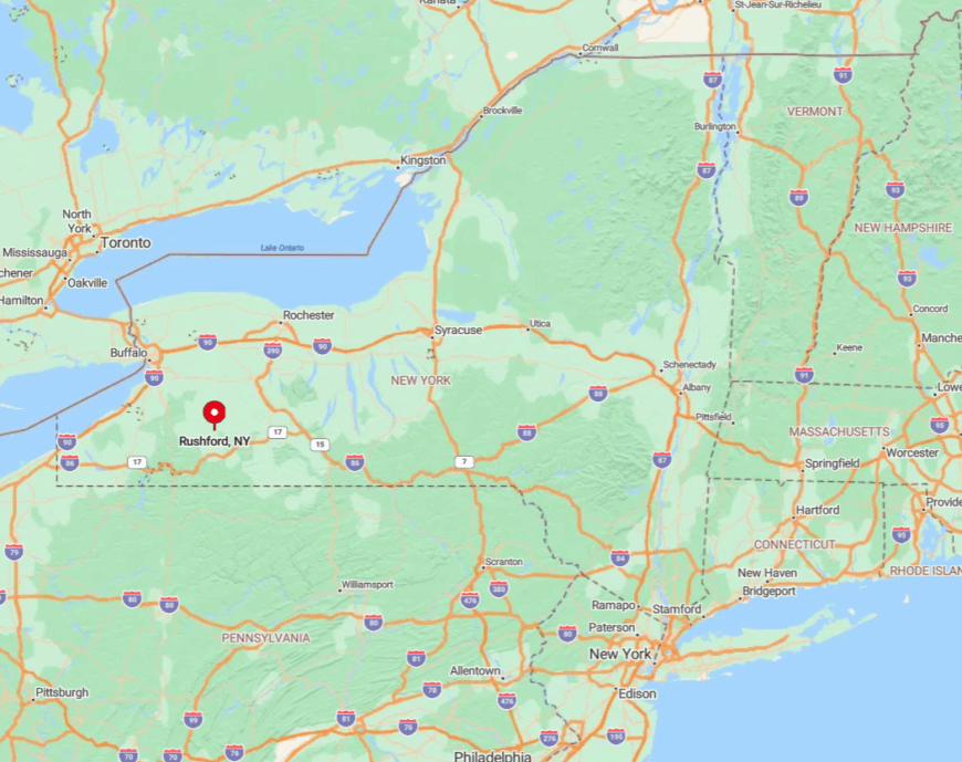
The reservoir lies in Allegany County, southwest of the Village of Cuba and east of Houghton College. Drivers follow NY-243, then branch onto county roads that twist through maple stands before dropping to lake level.
Snow blankets the hills early, so winter trips often require four-wheel drive. Sparse signage and limited cellular data mean first-time visitors rely on printed maps or a downloaded GPS route.
7. Van Buren Point – Weathered Shingle Cottages Facing Endless Lake Erie
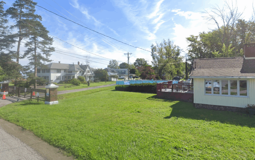
This century-old summer colony numbers roughly 150 residents in the off-season, though porches fill with families once July arrives. Daily rhythms include beachcombing for wave-tumbled glass, kite flying on steady onshore winds, and watching freighters inch across the horizon.
A few caretakers maintain the historic shingle cottages, while small landscaping crews find work pruning hemlocks that guard the single access lane. Commercial strips are miles away, and even grocery runs require a drive to Westfield or Fredonia.
Windswept sand and uninterrupted lake views replace billboards, and sunsets paint the sky in layers of pink and copper. The absence of streetlights keeps night skies dark enough for meteor spotting.
Where is Van Buren Point?
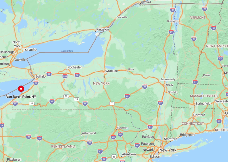
The community clings to the Lake Erie shoreline in Chautauqua County, just west of the Barcelona Lighthouse. Route 5 passes a half mile inland, but the approach road narrows to one lane as it descends through forest.
Public transit does not reach this pocket, so visitors rely on personal vehicles or bicycles along the Seaway Trail. High bluffs shield the cottages from highway noise, preserving their quiet charm.
6. Sunset Bay – Sandy Peninsula Shielded by the Cattaraugus Creek Dunes
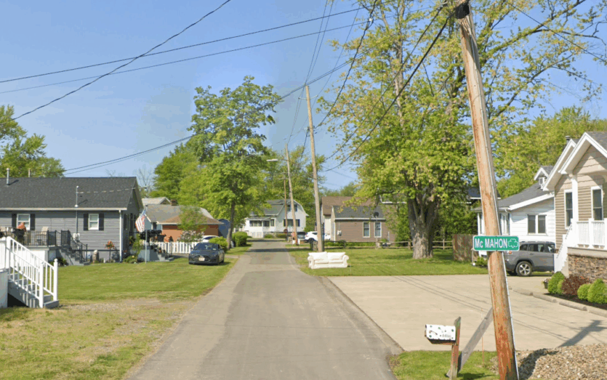
About 500 year-round residents call Sunset Bay home, though summer sees a pleasant uptick thanks to its broad, pale sand beach. Fishing for smallmouth bass, strolling the boardwalk of Seneca Nation’s Marina, and birding in the creek’s cattail marsh top the to-do list.
Seasonal restaurants and a pair of bait shops provide most jobs, supplemented by charter captains who run lake tours when conditions allow. The settlement sits on a narrow finger of land bordered by dunes, forest, and braided creek channels, blocking through traffic.
Pastel beach cottages perch behind dune grass, and skiffs tie up to weathered wooden posts along the back bay. Even peak afternoons find enough elbow room for spreading out towels without overhearing neighbors.
Where is Sunset Bay?
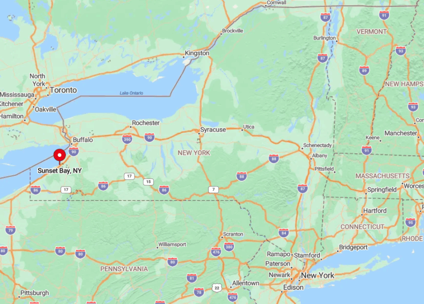
Sunset Bay belongs to the Town of Hanover in Chautauqua County, thirty miles southwest of Buffalo. Access comes via a twisting county road that dead-ends at the peninsula, so no travelers pass through unless they intend to stop.
A low drawbridge over Cattaraugus Creek can back up during boat openings, adding to the sense of isolation. Public parking is limited, nudging most visitors to arrive early or plan a weekday trip.
5. Point Breeze – Lighthouse Silhouettes Where Oak Orchard Meets Lake Ontario
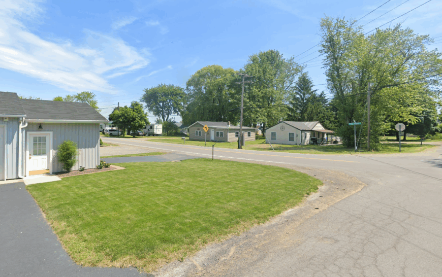
Point Breeze hosts only a few dozen permanent households scattered among marshland and windswept shoreline. Days revolve around trolling for salmon, climbing the 1871 Oak Orchard Lighthouse, and wandering vacated piers that jut into open lake water.
Charter fishing boats and a small marina offer seasonal employment; otherwise locals raise crops on inland farms or commute to Albion. Broad marshes ring the hamlet, and the nearest village sits five miles south, leaving long stretches of shoreline untouched.
Migrating birds wheel above reed beds, and sailors often find they have the inlet completely to themselves. Nightfall arrives with the soft blink of the lighthouse and the hush of waves against breakwalls.
Where is Point Breeze?
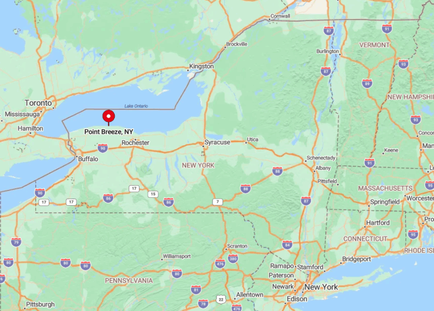
The hamlet rests in Orleans County at the mouth of Oak Orchard Creek, roughly midway between Rochester and Niagara Falls. Only county roads reach the water, and the last mile crosses open farmland that yields to cattail flats.
Visitors generally exit the Lake Ontario State Parkway at Route 98 then creep toward the shoreline on a two-lane blacktop bordered by apple orchards. With no nearby rail or bus service, private cars are the only realistic option.
4. Lakeville’s South Point – Rolling Farms Meeting Quiet Conesus Lake
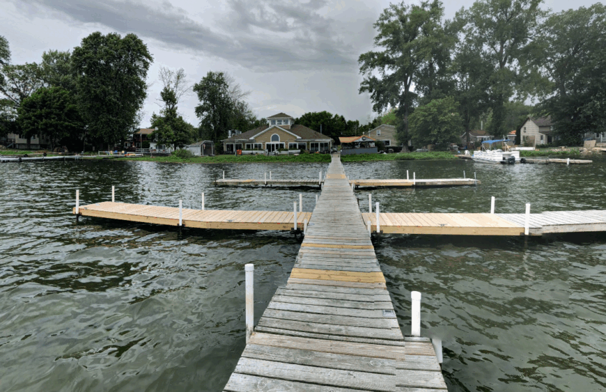
South Point counts fewer than 400 full-time residents, many residing in 19th-century farmhouses tucked behind old boathouses. Locals spend mornings fishing for largemouth bass, afternoons horseback riding across rolling pastures, and evenings sipping cider from nearby orchards while the sun slips behind low hills.
Agriculture remains the chief employer, especially dairy herds and hay fields that line East Lake Road; cottage rentals add supplemental income in summer. The southern tip lies three miles from the Village of Lakeville proper, and no major roads skirt this end of Conesus, so daily traffic hovers near zero.
Horses grazing beside mirrorlike water at dawn create postcard scenes that rarely include another human. Heavy morning fog often hangs over the lake, muffling sound and enhancing the sense of remoteness.
Where is Lakeville’s South Point?
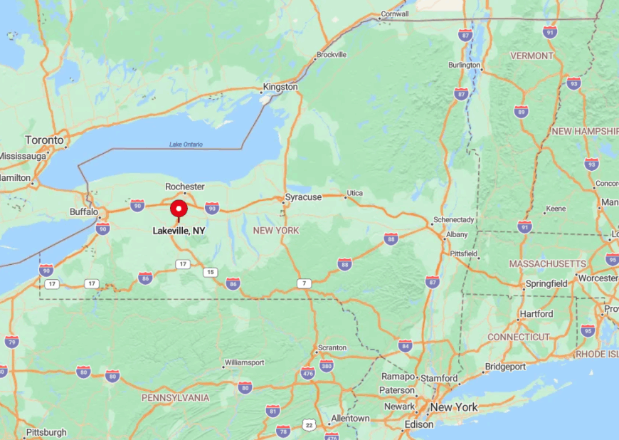
Conesus Lake sits in Livingston County, with South Point anchored where West Lake Road gives way to gravel spurs and farm lanes. The nearest expressway, I-390, lies five miles west, hidden behind low ridges dotted with oak trees.
Reaching the peninsula requires slowing to 30 mph through open farmland and over a narrow causeway that locals plow themselves in winter. Public transit ends in Geneseo, so visitors depend on cars or road bikes.
3. Middlesex – Steep Gorges and Hidden Bays on Canandaigua’s Remote End
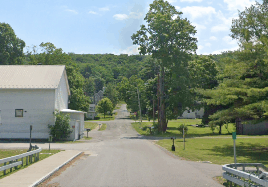
Middlesex, population about 1,200, stretches along the undeveloped southern tip of Canandaigua Lake where shale cliffs tower above deep teal water. Residents kayak beneath waterfalls, hike the High Tor Wildlife Area, and forage for wild ramps on shaded slopes each spring.
Timber management and a pair of family lumber mills make up the main industries, along with small farm stands that sell heirloom tomatoes and honey. Forested bluffs and one-acre wooded lots hide most houses from the shoreline, and the nearest full-service grocery store is 25 minutes away.
Hidden bays remain free of marinas, so even on busy weekends paddlers find quiet coves to themselves. Early risers often spot osprey swooping for trout without another boat in sight.
Where is Middlesex?
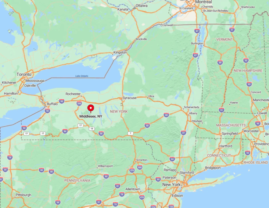
The hamlet sits in Yates County, directly south of Naples along Route 245. Tall ridges create a physical barrier that shelters it from the bustle at Canandaigua’s north end.
Travelers weave through vineyard-lined gullies, then descend a steep grade before meeting the lake road. No public transportation reaches this corner, and winter conditions can temporarily close the hill routes, reinforcing its hidden nature.
2. Pultneyville – Orchard-Framed Harbor on a Quiet Stretch of Lake Ontario
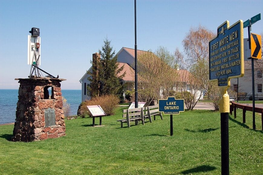
Roughly 800 residents live among wide-spread Federal-era homes and fruit farms that slope gently toward a protected harbor. Sailing small craft, browsing the Pultneyville Historical Society’s one-room museum, and sampling fresh peaches at roadside stands fill leisurely days.
Apple and cherry orchards dominate the economy, supplemented by a handful of marine repair shops that service antique wooden sailboats. The surrounding farms buffer the village from Route 104, so only locals and boaters turn down Hamilton Street toward the lake.
Antique boathouses line the creek mouth, and the horizon often shows nothing but blue water and white sails. Nighttime brings complete calm as the nearest streetlight is several hundred yards from the quay.
Where is Pultneyville?
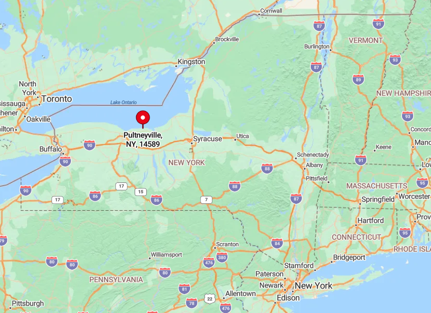
The hamlet lies in Wayne County, 25 miles east of Rochester and three miles north of Williamson. Visitors exit the Lake Ontario State Parkway, then tunnel through orchards on narrow lanes that reward patience with sudden harbor views.
Trees overhang much of the approach, and the final blocks lack sidewalks, emphasizing the rural setting. No bus routes run this far north, so access is solely by car or by sailboat entering from the lake.
1. Caneadea – Forested Point Overlooking Rushford Lake’s Northern Reach
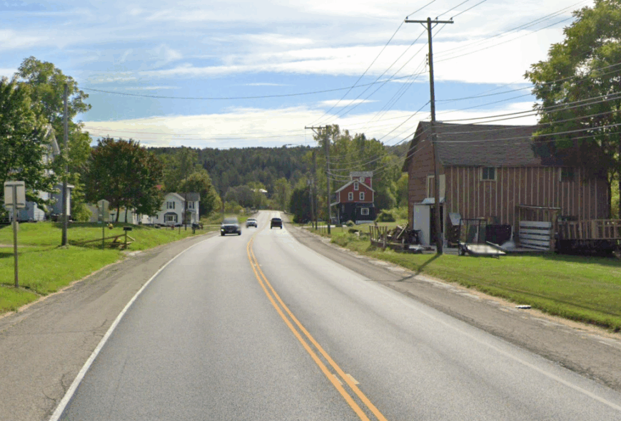
Caneadea hosts just over 2,000 residents scattered among forest groves, gravel lanes, and lakeside cottages perched on acre-plus lots. Anglers greet dawn with fly rods, hikers tackle the Finger Lakes Trail that skirts the north rim, and autumn leaf-peepers drift along the shoreline in silent canoes.
Small sawmills and a community college satellite campus supply modest employment, with tourism dollars arriving via cabin rentals and bait shops. The lake’s north point is shielded by maple and oak stands, and the absence of streetlights keeps it pitch-black after sunset.
Gravel lanes dead-end at the water, preventing through traffic and preserving the calm. Even peak holiday weekends rarely bring more than a low murmur of distant laughter across the cove.
Where is Caneadea?
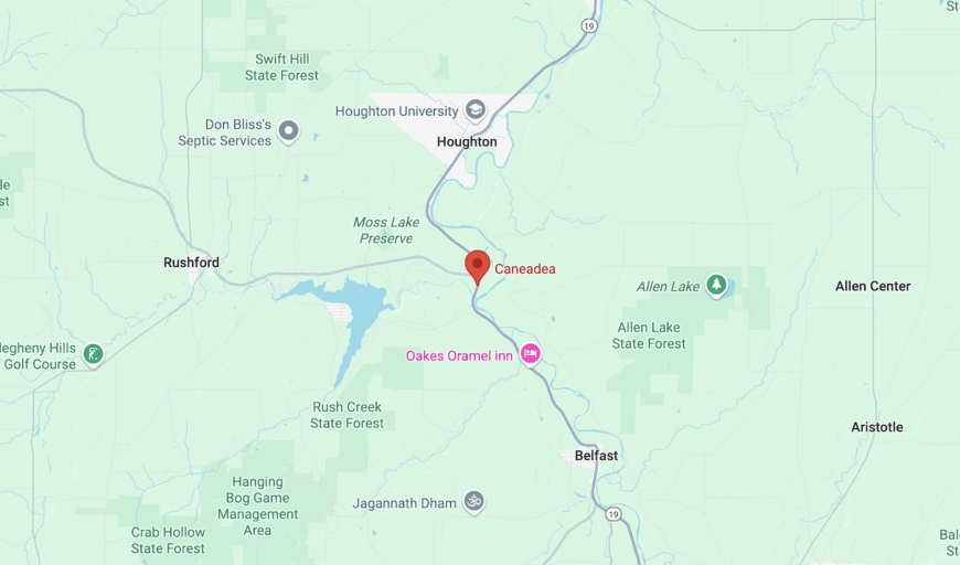
Caneadea sits in Allegany County, 70 miles south of Buffalo and a solid 40-minute drive from I-86. Forested hills hem in the town, and the Genesee River loops around three sides, making expansion unlikely.
From Route 19, visitors turn onto East Hill Road, then follow a descending ribbon of gravel until the lake suddenly appears. Limited cell coverage and the absence of gas stations on the last stretch encourage travelers to fuel up and download maps before leaving the main highway.


