Southwestern Oregon’s coast feels worlds away from the crowded boardwalks farther north.
In order to come up with the very specific design ideas, we create most designs with the assistance of state-of-the-art AI interior design software. Also, assume links that take you off the site are affiliate links such as links to Amazon. this means we may earn a commission if you buy something.
A string of tiny settlements clings to the edge of the Pacific here—places where fog rolls through spruce trees, fishing boats provide the morning soundtrack, and whole beaches sit empty except for drifting kelp and an occasional set of footprints.
We have gathered 25 of these hard-to-find communities, counting down from the comparatively “busy” Port Orford to the near-hidden Winchuck at the California line. Each village offers its own mix of windswept sand, river estuaries, and forested bluffs, yet all share one trait: a welcome absence of crowds.
Read on for population details, local pastimes, and directions that often involve little more than Highway 101 and a gravel turn-off.
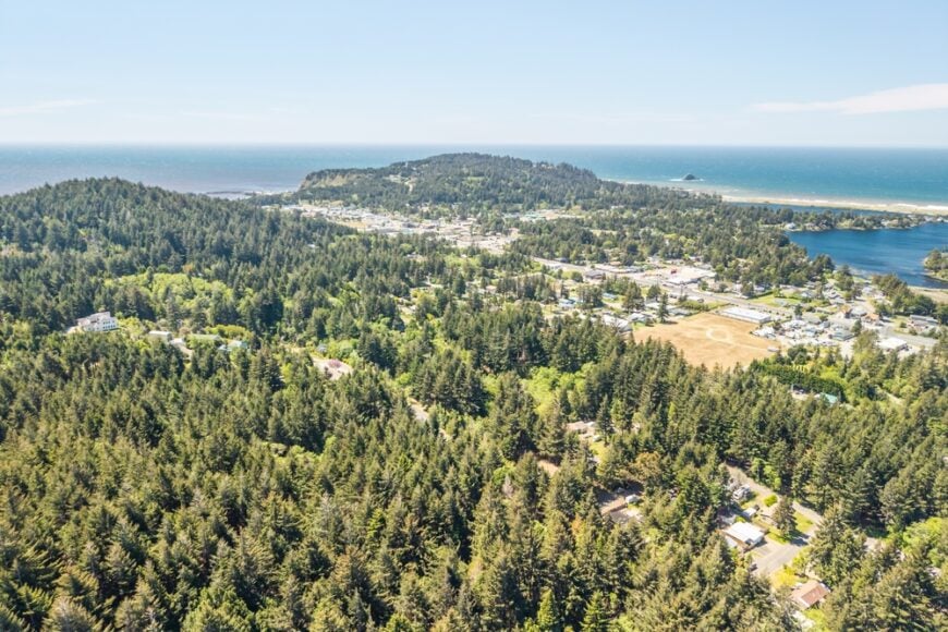
25. Gardiner – River Mist and Retired Mill Quiet
Gardiner sits where the Umpqua River widens to meet the sea, a pocket of clapboard houses wrapped in morning fog. Its seclusion comes from being wedged between tidal marsh, timbered hills, and the skeletons of old mill works—no strip malls, just tide and time.
The vibe is hushed and historical: weathered storefronts, gulls on pilings, and backstreets that end at water. Walk the levee at daybreak, scan for harbor seals near the bridge, or poke around the remnants of the mill era with a camera. Angling on the lower Umpqua and winter storm-watching are simple, satisfying pastimes.
A few marine trades and small shops keep the lights on, but nights belong to river and wind. It’s the sort of place that reminds you how quietly a town can breathe.
Where is Gardiner?
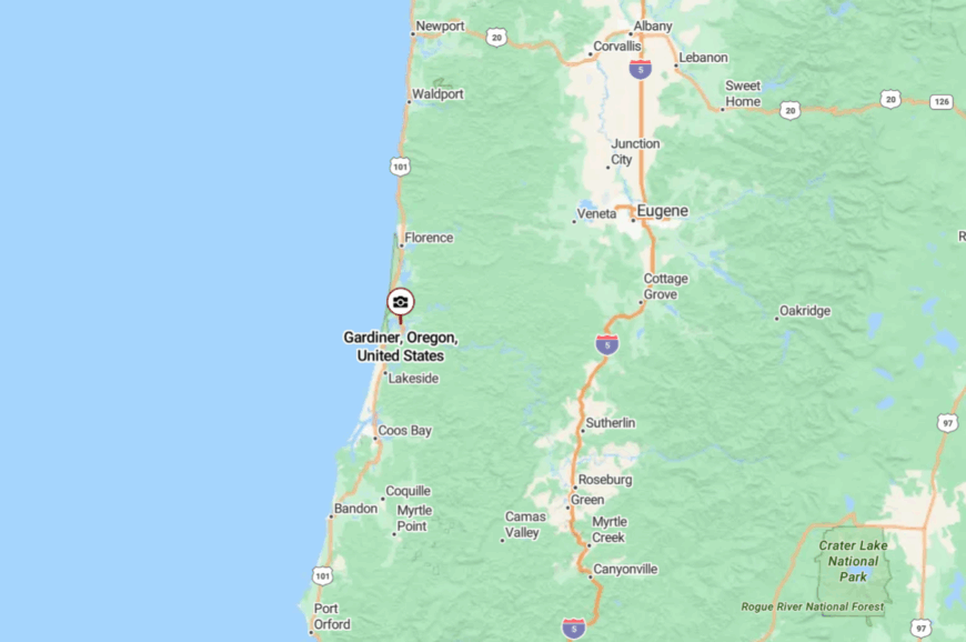
Tucked in northern Douglas County on the lower Umpqua, Gardiner sits just north of Reedsport and a few miles from the ocean. It’s about 80 miles west of Eugene, with U.S. 101 slipping past on the river’s edge.
Turn onto side streets that dead-end at docks and marsh, and the highway hum falls away. Close enough to the coast for salt air, far enough to feel like you’ve stepped off the main road.
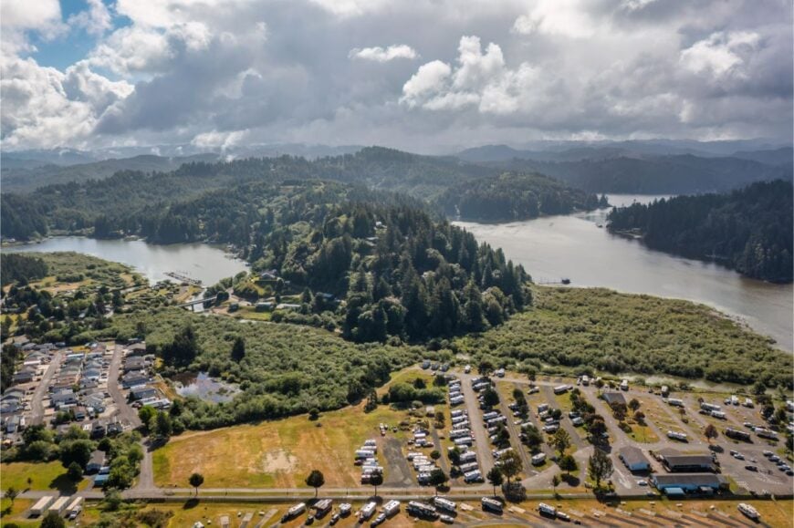
24. Winchester Bay – Lighthouse Light and Dune Shadows
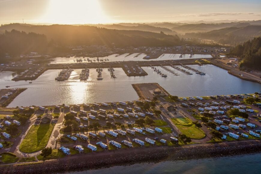
Winchester Bay keeps to its harbor, a crescent of boats and boardwalks shielded by jetties and towering dunes. Seclusion arrives with the fog and the windbreak of the Umpqua spit; most through-traffic stays on 101 and never bothers the back basin.
The vibe is salty and slow: crab pots stacked on decks, chowder steam in winter, and the lighthouse blinking from across the river bar. Drop a trap for Dungeness from the pier, beachcomb the jetty flats, climb the dunes for sunset, or stroll the tiny gift shacks around the marina.
Charter fishing and small-scale tourism share the work with boat repair and marina life. Even in summer, corners of the harbor feel like your own private postcard. It’s close to the ocean but set aside from the hurry of it.
Where is Winchester Bay?
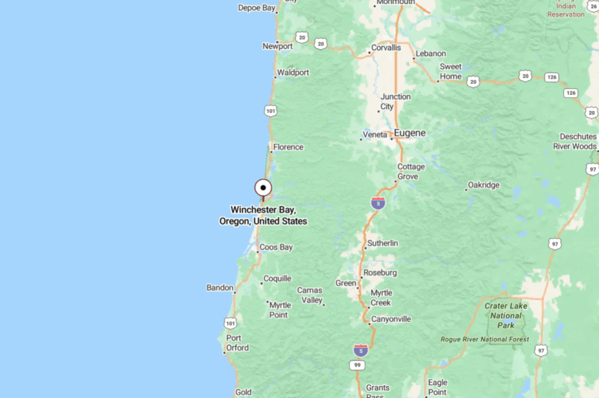
In coastal Douglas County, it sits 4 miles southwest of Reedsport at the mouth of the Umpqua River. Reach it by peeling off U.S. 101 onto Salmon Harbor Drive and following the curve of the marina.
The road dead-ends at sand and jetty—no reason to hurry through. Once the last gull settles on a piling, the rest of the world goes quiet.
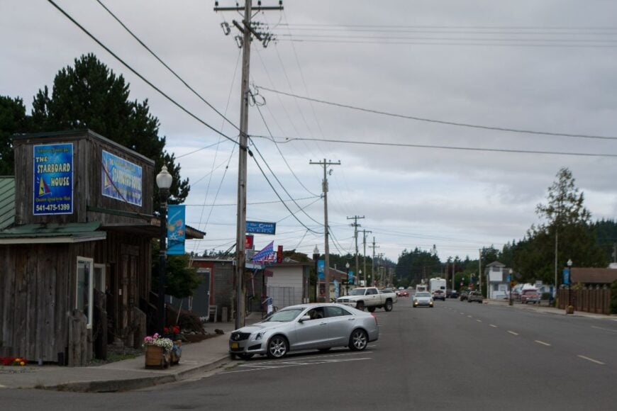
23. Lakeside – Tenmile’s Glassy Coves and Pine-Framed Silence
Lakeside gathers along Tenmile Lakes, a splash of docks and cabins tucked behind forested hills and far from any freeway roar. Its seclusion is half water, half woods: miles of shoreline reachable only by boat, and winding backroads that forget to be busy.
The vibe is pine-scented and easygoing—kayaks on porches, loon calls at dusk, a burger stand with a handwritten menu. Paddle into still coves, fish for perch and bass, watch osprey dive, or take a short drive to the nearby dunes for a hike over wind-carved ridges.
A handful of marinas, cafes, and lake rentals steady the local economy. Even the air moves softer over water. It’s the kind of quiet that settles in your shoulders.
Where is Lakeside?
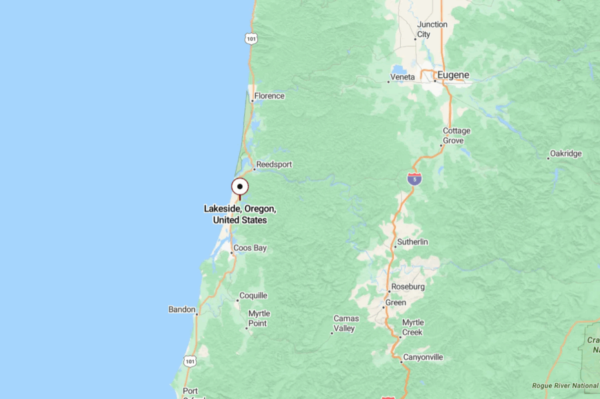
Northern Coos County, about 16 miles north of Coos Bay and 13 miles south of Reedsport. U.S. 101 brings you to town, then Lakeside Drive and marina lanes hug the water.
The highway falls away quickly as pines and shoreline take over. It’s easy to reach, yet every turn draws you deeper into blue and green.
22. Hauser – Little Hamlet in a Sea of Sand
Hauser is closer to a hamlet than a town, a handful of homes and a store tucked between shore pine and the broad shoulders of the Oregon Dunes. Its tucked-away feel comes from the sand itself—shifting, vast, and a natural buffer that keeps things quiet except for the wind in the grass.
The vibe is rustic and low-profile: ATVs buzz on distant ridges, but in the neighborhoods you mostly hear surf and shorebirds. Wander to a dune overlook at dusk, beachcomb along the North Spit, or watch fog pour through the tree line.
Work here is a mix of small services and recreation-related outfits, with bigger errands done in North Bend. Nights arrive early under tall trees. It’s small enough to feel like a secret, even on summer weekends.
Where is Hauser?
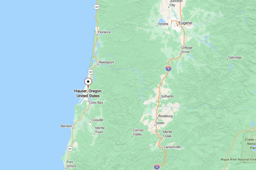
Just north of North Bend in Coos County, tucked a mile or two west of U.S. 101. Access is via Trans Pacific Lane and sandy side roads that thread through pine.
With dunes and bay hemming it in, there’s no real “through” route—most roads simply end at sand. One bend from town and you’re alone with wind and tide.
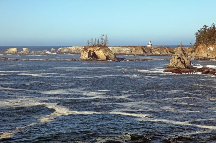
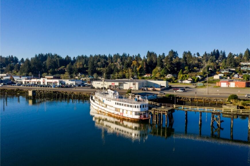
21. Charleston – Working Harbor at the End of the Road
Charleston sits at the terminus of a peninsula, a snug working harbor ringed by fishing boats and gulls. Seclusion comes from geography: Coos Bay on one side, South Slough on the other, and only a couple of two-lane bridges in or out.
The vibe is salty, scientific, and unhurried—boats unload crab while students stroll to the marine labs and birders fan out to the slough. Watch fleets at the docks, walk the South Slough estuary trails, picnic at Sunset Bay, or catch tidepools at Cape Arago.
Commercial fishing, the university’s marine facilities, and a few cafes keep things steady. When the foghorn moans, conversation lowers with it. This is a harbor that keeps its own tide table.
Where is Charleston?
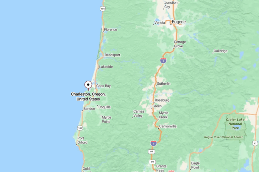
Southwestern edge of Coos County, about 10 miles southwest of Coos Bay/North Bend. Follow Cape Arago Highway from 101 until the water wraps three sides of the road.
The peninsula layout ensures the town isn’t on the way to anywhere else. Past the last curve, it’s all ocean, rocks, and quiet.
20. Barview – Jetty Town with a Back-Porch Pace
Barview is a sliver of homes and cottages hugging the north edge of Coos Bay’s mouth, where the jetty points to open water. It stays secluded because most travelers never leave 101, and the neighborhoods dead-end into dunes and marsh.
The vibe is porch-swing coastal—kids on bikes, crab pots drying in driveways, and pelicans drafting the wind line. Walk the jetty for crashing surf theater, beachcomb the North Spit, or watch the tide sluice around the bar at twilight.
A marina, a café or two, and marine trades are the main heartbeat. Sunsets paint the channel copper, and the houses go quiet. It’s the feeling of living beside a doorway the world seldom notices.
Where is Barview?
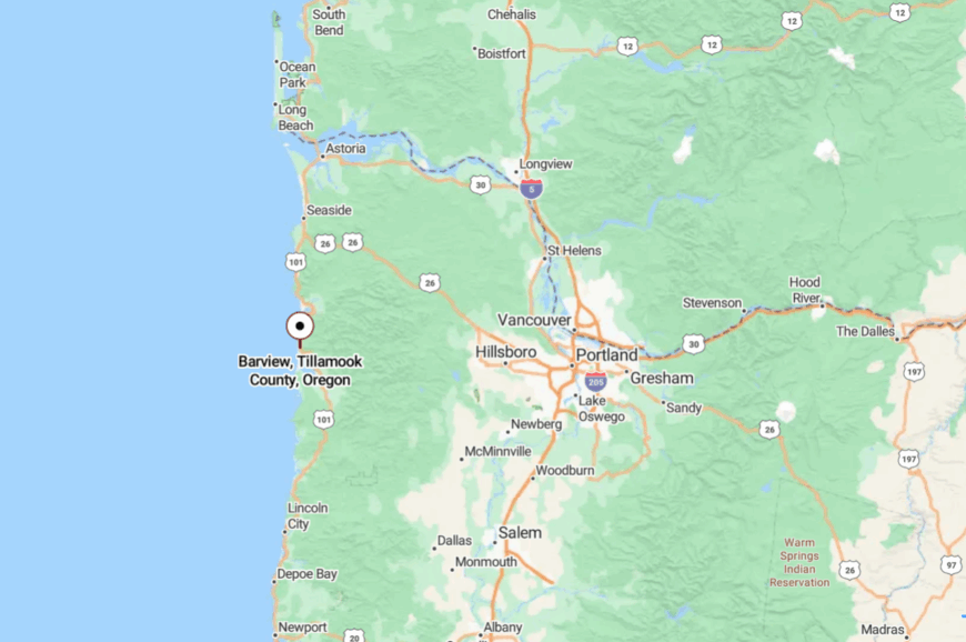
On the north side of the Coos Bay bar in Coos County, a few minutes west of North Bend. Turn off U.S. 101 toward Trans Pacific Lane or Cape Arago Highway and drift into neighborhood streets.
The grid gives way to sand roads and bay views. Once you smell salt and creosote, you’re there.
19. Allegany – River Bends and Rainforest Green
🔥 Would you like to save this?
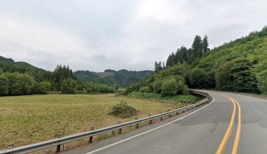
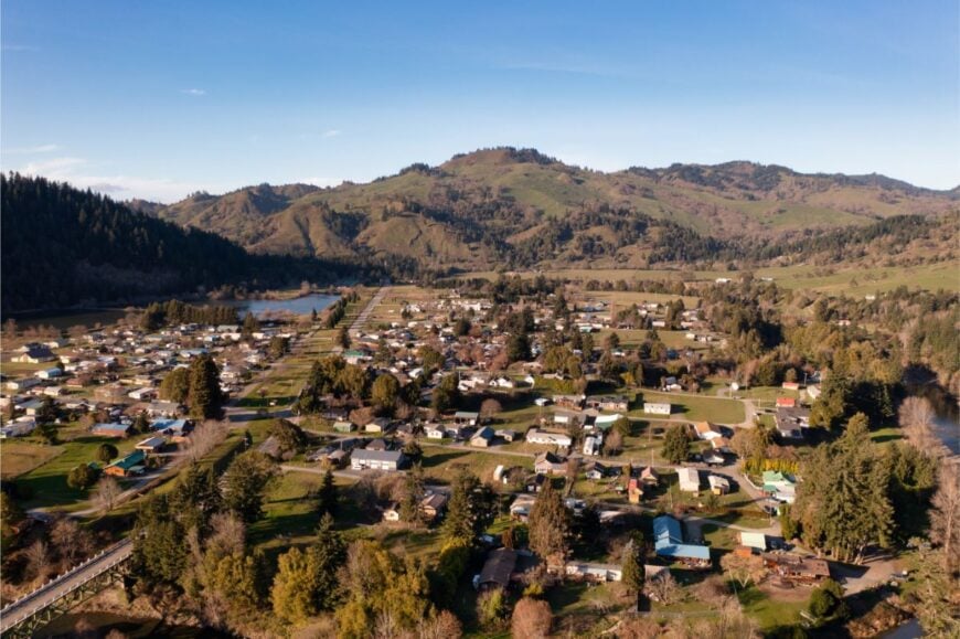
Allegany curls along the East Fork of the Millicoma River, a mossy ribbon of homes beneath towering spruce and maple. Its isolation is the mountains’ doing: deep, forested valleys and a road that follows water more than it serves speed.
The vibe is creekside and quiet—gardens under cedar shade, drift boats trailered in driveways, and woodsmoke on autumn air. Fish for steelhead, hike to Golden and Silver Falls, kayak slow pools, or hunt mushrooms after a rain.
Logging and a handful of service jobs tie folks to nearby Coos Bay, but the forest sets the mood. When rain drums the roof, the whole valley hums. It’s the kind of green that hushes you without asking.
Where is Allegany?
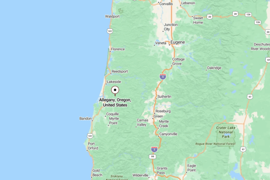
Northeast of Coos Bay in the Coast Range, about 14 miles up Coos River Highway (OR-241). The paved road narrows to river-hugging curves and shadowed corridors.
With no through-route to anywhere big, traffic stays thin. Past the last bend, it’s just river talk and leaves.
18. Powers – One-Road Town in the Siskiyou Foothills
Powers is wrapped by mountains and the South Fork Coquille, a neat little grid at the end of a long scenic road. Seclusion comes from distance: miles of Coast Range on all sides and a route that slows you with every bend.
The vibe is blue-collar and woodsy—classic diners, tidy yards, and trailheads that start where sidewalks stop. Hike Elk Creek Falls, pedal the old rail grade, fish shaded pools, or camp beneath Douglas firs at Powers County Park.
Forest work, schools, and small shops anchor the week. On summer nights, stars fill in where porch lights end. It’s a five-minute town surrounded by a million acres of quiet.
Where is Powers?

Deep in southern Coos County, about 20 miles south of Myrtle Point via OR-542 (the Powers Highway). The drive is all river canyons and covered bridges, not a single freeway in sight.
Roads past Powers turn to gravel and keep going into the wilderness. By the time you arrive, your calendar has already unclenched.
17. Remote – Truth in Advertising Beside the Coquille

Remote is exactly what it says: a bend in the South Fork Coquille with a handful of mailboxes and a store. Its isolation is the old highway’s legacy—bypassed by bigger plans, it remains a pause on a curving river road.
The vibe is minimalist and mellow: the river doing its work, a few neighbors waving from pickups, a sky full of hawks. Pull off for a picnic by the water, watch autumn leaves drift downstream, or photograph the old signs that made the name famous.
Ranching and pass-through travelers offer a modest economic pulse. It’s a dot on the map that feels like a deep breath. When you leave, you take the quiet with you for a while.
Where is Remote?

In eastern Coos County along OR-42, about 16 miles east of Myrtle Point and 40 miles west of Roseburg. You reach it by two-lane highway that threads river bends and canyon walls.
There’s no sprawl, just a few driveways and the river for company. Blink and you’ll miss it; stop and you’ll hear everything you’ve been missing.
16. Dora – Meadow Edges and One-Room Memories

Dora lies in a soft valley of the Coast Range, a scatter of farmsteads, a historic schoolhouse, and fields that glow at sundown. It’s secluded by distance and topography—quiet county roads, steep timber, and no reason to rush through.
The vibe is pastoral and nostalgic: white fences, blackberry hedges, and the murmur of the creek in summer. Visit the old schoolhouse for a glimpse of pioneer days, fish shaded runs on the East Fork, or wander gravel lanes that end at pasture gates.
Ranching is the backbone; neighbors share tools and stories in equal measure. Even the breeze seems to move politely here. It’s a whisper of an earlier Oregon that still holds.
Where is Dora?

About 20 miles east of Myrtle Point in inland Coos County, reached via the Coos River Highway and quiet county spurs. The road narrows to hedgerows and timber as you get close.
There’s no main street to announce arrival—just meadows and mailboxes. It’s close enough for a day trip, far enough to reset your pace.
15. Denmark – A Prairie Blink with Ocean Air

Denmark is a tiny wide spot on 101, south of Langlois, where barns and berry fields lean toward the sea breeze. Its seclusion comes from being little more than a name and a crossroads, with most drivers sailing past the old store without a glance.
The vibe is farm-simple and salt-tinged: hand-painted signs, quiet lanes to pastures, and swallows stitching the sky. Detour to Floras Creek for birds, hunt fossils on nearby beaches, or load up on local jam at a roadside stand.
Farming and a few cottage industries are the whole story. When fog pours over the coast range, the world turns to soft gray and birdsong. It’s a dot that rewards anyone who stops.
Where is Denmark?

Northern Curry County on U.S. 101, about 5 miles south of Langlois and 11 miles north of Port Orford. Side roads slip west toward ranchland and hidden shorelines.
With no services to anchor a crowd, the pace stays rural. One turn off the highway and you’re in the hush between pasture and surf.
14. Elk River – Clear Water and Canyon Shade

Elk River isn’t a town so much as a ribbon of cabins and trailheads following one of Oregon’s clearest streams. Its seclusion comes from a narrow canyon, miles of forest, and a road that slows to the river’s pace.
The vibe is crystalline and quiet—emerald pools, cedar perfume, and the steady fizz of riffles. Swim at Butler Bar, hike to Elk River Falls, cast for cutthroat, or pan a sunny gravel bar for color.
A tiny resort, a campground, and a seasonal fishing guide make up the human footprint. When evening light hits the water, the whole canyon glows. It’s the sound of a river teaching you to listen.
Where is Elk River?

East of Port Orford in northern Curry County, reached by Elk River Road from U.S. 101. The pavement dwindles to patched lanes, then good gravel as the canyon tightens.
There’s no through-route—eventually, the forest simply says “enough.” Go until the map turns green and the water turns glassy.
13. Agness – Rogue River Bend with a Post Office and a Porch

🔥 Would you like to save this?
Agness clings to a confluence of the Rogue and Illinois, a pocket of cabins, a general store, and a post office with stories in the walls. Its remoteness is the Rogue’s doing: miles of winding road, steep canyon walls, and winter storms that make time elastic.
The vibe is river-camp friendly—jet boats chugging by, anglers swapping lies over coffee, and deer nosing through orchards. Fish the Rogue for salmon and steelhead, hike Rogue River Trail segments, poke around the historic mule-bridge sites, or sip something cold on a shaded porch.
A lodge or two and guide work are the main economy, with a little mail and a lot of river. Night falls quickly in the canyon, and stars take their time. It’s a bend in the world where clocks matter less.
Where is Agness?

Up-canyon from Gold Beach in north-central Curry County, about 30 winding miles by Jerry’s Flat/Agness Road. The drive follows the Rogue the whole way—slow, scenic, and entirely two-lane.
Past town, pavement gives way to forest roads and deep quiet. Close on the map, far in the best way.
12. Illahe – Wild & Scenic and Nearly Off the Grid

Illahe is a riverside speck along the Wild and Scenic Rogue, a place of gardens, river smell, and silence between mail days. It’s secluded by design and distance: limited access, seasonal services, and canyon walls that fold you into green.
The vibe is self-sufficient and tender—apple trees, neat woodpiles, and porches with lifejackets hung like flags. Walk the Rogue River Trail, launch into mellow current for a drift, visit historic Rogue River Ranch, or watch for osprey working the bends. A small campground and caretaker posts are about the only “industry.”
Nights are dark enough that the river sounds brighter. It’s the kind of quiet you can feel in your ribs.
Where is Illahe?

Roughly 40+ road miles upriver from Gold Beach in central Curry County, along Agness–Illahe Road. Getting there means slow switchbacks, cliffside vistas, and stretches where the forest leans in.
There’s no quick way in and no faster way out. By the time you arrive, you’ve left hurry behind.
11. Carpenterville – Ghost of Old 101 on a Skyline Ridge

Carpenterville perches on a high ridge of the old Roosevelt Highway, a vanished town that left behind a name, a few homesteads, and wind that never stops talking. Its seclusion comes from being bypassed decades ago—now the new 101 runs below while this ridge keeps its birds and views.
The vibe is airy and a little haunting: meadows drop to sea cliffs, fenceposts go silver in the fog, and wildflowers take over where a café once stood. Pull off on Carpenterville Road for grandstand views, wander short ridge walks, or hunt for traces of the old highway grade.
A scattering of ranch places and mailboxes suggests life without storefronts. When sunset sets the offshore stacks to purple, the ridge remembers. It’s a quiet so wide it feels like sky.
Where is Carpenterville?

On the high line between Pistol River and Brookings in Curry County, reached via Carpenterville Road paralleling U.S. 101. The access is steep and winding, with no services and few pullouts.
Most travelers never climb up, which keeps the ridge empty. It’s close enough to see the highway, far enough to feel like the road ended in the clouds.
10. Port Orford – The Westernmost Fishing Village with Empty Beaches

Home to roughly 1,200 residents, Port Orford rests on a rocky bluff that looks straight into the sunset over miles of open ocean. Visitors can watch dories and crab boats hoisted onto the historic “dolly dock,” then wander Battle Rock Wayside or the seldom-trod stretch of Agate Beach for agates and sunrise photography.
Commercial fishing and small-batch art galleries anchor the town’s economy, with cafes and wood-carving studios rounding out the harbor district. Pacific gales, limited lodging, and a 27-mile buffer to the next sizable town keep visitor numbers low year-round.
The absence of big-box stores and night life preserves a slow rhythm where the loudest evening sound is often the buoy bell off the cape. All of this lends Port Orford an appealing blend of working-harbor grit and windswept solitude.
Where is Port Orford?
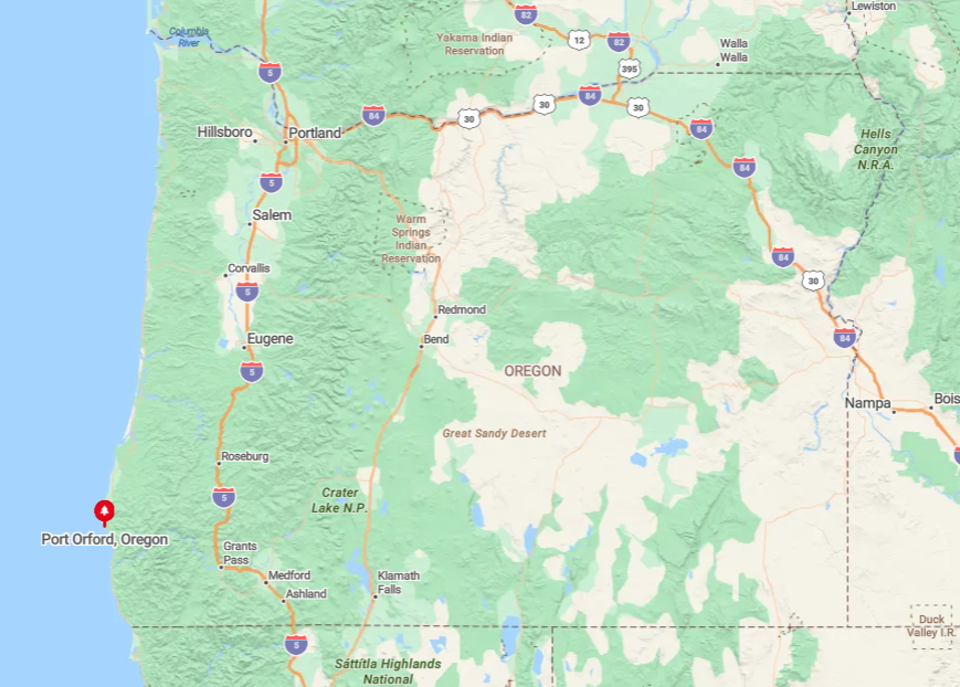
The town sits halfway between Bandon and Gold Beach along Highway 101, perched on Oregon’s westernmost point. Seclusion stems from its remote cape setting and the fact that the nearest interstate is more than two hours inland across the Coast Range.
Drivers typically reach Port Orford via a scenic but winding 60-mile section of 101 without cell service in places. Small planes can land at the municipal strip south of town, though most arrive by car and instantly grasp why the harbor still feels like the end of the road.
9. Nesika Beach – A Pocket Community Hidden Between Sea Stacks

Nesika Beach claims about 450 inhabitants scattered across one-acre lots above the Pacific. Beachcombing ranks high here, with tide pools among the offshore sea stacks and long logs perfect for sunset campfires.
A handful of family-owned vacation rentals and home-based artisans supply what little commerce exists, while retirees maintain small gardens overlooking the surf. Dense Sitka spruce, the lack of a formal town center, and a bluff that shelters cottages from Highway 101 traffic keep foot traffic scarce.
Visitors often drive past without noticing the discreet turnoff, adding to the settlement’s hush. The result is a tight-knit coastal enclave where foghorns and gulls take the place of streetlights and storefronts.
Where is Nesika Beach?

🔥 Would you like to save this?
Located seven miles north of Gold Beach, the village sits on a plateau west of Highway 101. Steep access roads and no public signage beyond a single exit marker help maintain its hidden quality. Travelers should watch for milepost 330, then descend a short hill to reach the shoreline parking lot.
Those willing to navigate the hairpin driveway are rewarded with sea-stack vistas and beaches that often feel private.
8. Ophir – Rogue-River Rapids Meet Wild Pacific Surf

Ophir’s year-round population hovers near 75, spread along the meeting point of the Rogue River and the Pacific. Kayakers launch into mellow estuary waters, while surfers chase the beach break just north of the river mouth.
Aside from a seasonal roadside produce stand, economic activity is limited to commercial salmon fishing and a small RV park. Tall dunes, forested headlands, and the absence of streetlights leave nighttime skies pitch-black, highlighting its remoteness.
Many homes are tucked behind hedgerows or up gravel drives, so the settlement virtually disappears from the highway. The blend of river and ocean soundtracks underscores Ophir’s back-of-the-map feel.
Where is Ophir?

Find Ophir ten miles north of Gold Beach where the Rogue crosses under Highway 101. The closest full-service grocery store is back in Gold Beach, contributing to the out-there sensation.
Visitors use the small gravel pull-out at the bridge for river access or continue another half mile to a signed beach lot reached by a bumpy spur road. Winter storms occasionally close this spur, reinforcing that residents live at nature’s discretion.
7. Langlois – Farm Stands, Fiber Arts, and Solitude by the Sea

Langlois counts around 180 residents clustered at one flashing light on Highway 101. Travelers stop for a famous chili dog at the Langlois Market, then browse wool socks and local yarns at Wild Rivers Wool Factory reflecting the town’s sheep-ranch history.
Beyond the highway, Floras Creek Road leads to cliffs above a two-mile beach that is almost always empty except for the odd fossil hunter. Small-scale agriculture and fiber arts dominate the micro-economy, while the nearest chain restaurant lies 25 minutes away in Bandon.
A flat coastal plain dotted with barns separates residents from the sea, reinforcing the sense of distance between Langlois and busier coastal corridors. Quiet evenings bring only the rustle of pasture grass and distant breakers.
Where is Langlois?

The hamlet sits 17 miles south of Bandon and 13 miles north of Port Orford. Its inland position on a straight stretch of 101 means many motorists zip past without noticing the single gas pump or the vintage post office.
Beach access requires a short drive west on Langlois Mountain Road followed by a half-mile hike over dunes, further limiting crowds. Those who make the trip often share the entire shoreline with grazing elk rather than people.
6. Sixes – Rivers, Ranchland, and a Lighthouse on the Horizon

Fewer than 400 neighbors reside in Sixes, a broad valley where the Sixes River meanders toward the sea. Anglers cast for steelhead in winter, while birders scan the estuary for ospreys and great blue herons. Cattle ranching supplies the main income, complemented by an organic berry farm that opens for U-pick in July.
With Cape Blanco Lighthouse blinking in the distance and no street grid or downtown, Sixes feels more like loosely connected homesteads than a town. Deep river channels and wetlands create a natural barrier that keeps casual beachgoers away. At night, only lighthouse flashes and the rumble of surf break the silence.
Where is Sixes?

Sixes lies four miles north of Port Orford, tucked inland from Cape Blanco State Park. Visitors take Cape Blanco Road west off 101, then cross a one-lane bridge to reach ranch fields and beach trailheads. The final mile is gravel, discouraging large RVs and preserving the park’s near-empty shoreline.
Most residents shop in Port Orford, enhancing the sense that Sixes lives on the fringe.
5. Pistol River – Windswept Sand Dunes for Miles

About 100 people call Pistol River home, many of them windsurfers drawn by world-class summer gusts that funnel through offshore stacks. Hikers explore the Pistol River State Scenic Viewpoint, while horse owners trot their mounts along wave-carved dunes extending south toward Gold Beach.
Small-scale ranching and a pair of vacation-rental managers represent the primary businesses in town. Persistent winds, minimal signage, and the shield of thick shore pines deter most casual travelers. Evening fog rolls over the dunes and quickly erases any hint of nearby civilization.
Where is Pistol River?

The settlement straddles Highway 101 10 miles south of Gold Beach, but the actual beach access sits a mile west down gravel Meyers Creek Road. No fuel stations exist between Gold Beach and Brookings, so drivers must plan ahead.
The route’s twisting nature and blowing sand often slow traffic to a crawl, naturally limiting visitor numbers. Those who persevere can watch sunset from a dune crest with nothing but offshore monoliths in view.
4. Floras Lake – Kiteboarder Paradise Tucked Behind Coastal Pines

Around 50 full-time residents occupy cabins and campsites around Floras Lake, a glassy lagoon famous for steady thermals perfect for kiteboarding lessons each May through September. Freshwater paddlers glide across the lake, then walk a short trail over a windswept spit to reach crashing ocean surf.
Seasonal tourism supports one lakeside lodge, a small campground, and a sailboard school; otherwise, the area remains wild. Thick shore pine forests and the lake’s position behind a protective dune wall shield the community from highway noise. Cell reception is patchy, reinforcing the break from modern bustle.
Even midsummer, it’s common to have both lake and beach nearly to yourself once day-trippers leave.
Where is Floras Lake?

The lake sits three miles west of Langlois via Floras Lake Loop Road, which turns to gravel before reaching Boice-Cope County Park. No through-road connects to other towns, so visitors must double back the way they came. This geographic cul-de-sac keeps traffic light and wildlife sightings high.
A small airstrip south of the lake handles occasional bush planes, but most arrive by car with kiteboards strapped atop roof racks.
3. Cape Blanco Hamlet – Where Oregon Juts Furthest West

Only about 30 year-round residents occupy the windswept grasslands around Cape Blanco, most living in off-grid cabins reached by dusty ranch lanes. Sightseers come for Oregon’s oldest standing lighthouse and panoramic cliff-top trails, yet few stay overnight because there is no lodging beyond a biker-friendly state campground.
Sheep grazing and seasonal lighthouse tours represent nearly the entire economic output. The cape’s isolation, constant 30-knot winds, and a narrow approach road bordered by pastures ensure low visitation after day-light hours.
Sunset often delivers brilliant alpenglow on offshore fog while meadowlarks provide the evening chorus. The hamlet itself virtually disappears once the park gate closes.
Where is Cape Blanco?

From Highway 101, Cape Blanco Road heads west for nine miles north of Port Orford before dead-ending at the lighthouse. The last two miles are open-range, so drivers often slow for roaming cattle—another natural speed bump deterring hurried travelers.
No services exist along this road, meaning visitors must bring supplies or backtrack to Port Orford. That extra effort rewards them with cliff-edge picnic tables free of crowds even in August.
2. Wedderburn – Quiet Rogue River Retreat Across from Gold Beach

Wedderburn’s 300 residents cluster along the north bank of the Rogue River where it meets the Pacific, directly across from the busier town of Gold Beach. Early risers cast for chinook salmon at the original Curry County Cannery pilings or stroll the wide sandbar that mirrors sunrise colors in the river’s still water.
Most locals work in charter fishing, small marinas, or remote-friendly tech jobs thanks to newly installed fiber lines. Separation from Gold Beach comes courtesy of Isaac Lee Patterson Bridge, whose narrow pedestrian path discourages heavy foot traffic and maintains Wedderburn’s quiet character.
At dusk, porch lights and boat masthead lamps replace city glare, opening a dark canvas for stargazing. Even peak summer finds plenty of space on the riverbank to spread a blanket and listen to sea lions bark downstream.
Where is Wedderburn?

The village begins immediately after crossing the Rogue River bridge northbound on Highway 101. Beyond a mini-mart and bait shop, side streets dead-end at river or hillside, so through-traffic is minimal.
Many visitors stay in Gold Beach and drive two minutes north, but few cross the bridge on foot, leaving Wedderburn’s beach mostly to residents. Those seeking the sandbar turn west on Edson Creek Road, then park by the boat ramp for a short walk.
1. Winchuck – Last Stop before California with Hidden Tide Pools

Winchuck houses roughly 200 people in cedar-sided homes tucked between evergreen ridges and the Pacific’s final Oregon cove.
Explorers can follow a faint trail north of the county beach access to reach basalt tide pools teeming with purple sea urchins—spots locals jokingly call “the aquarium” because they remain unknown to most guidebooks.
Logging and small-scale tourism provide limited employment, though many residents commute to Brookings eight miles south. The community’s isolation derives from steep headlands, a single-lane bridge over the Winchuck River, and the absence of streetlights or commercial signage beyond a modest RV park.
On clear nights, the Milky Way arches over silent headlands, unspoiled by light pollution. During storm season, wave spray drifts above the cliffs, visible from living-room windows yet seldom witnessed by outsiders.
Where is Winchuck?

Situated three miles north of the California border, Winchuck sits off Highway 101 via Oceanview Drive, which parallels the coast before ending in a small turn-around. The closest grocery store is over the state line, so locals plan weekly trips south, reinforcing the town’s end-of-Oregon feel.
Visitors can reach the beach by crossing the low concrete bridge, parking beside drift logs, and walking 500 feet to the cove. With no public transit and scant signage, only those in the know make the detour—precisely why Winchuck remains the most secluded spot on this already quiet coast.


