🔥 Would you like to save this?
Southwestern Louisiana’s Gulf edge is a quilt of tidal marshes, chenier ridges, and hushed bayous, where small settlements cling between sky and sea. Visitors who venture past the busy I-10 corridor discover one-road villages where shrimp boats outnumber streetlights and broad horizons swallow all sound but wind.
Our list explores 25 places, counting down from the most familiar to the almost hidden, each offering its own mix of solitude, scenery, and stubborn resilience.
In order to come up with the very specific design ideas, we create most designs with the assistance of state-of-the-art AI interior design software.
Populations here are measured in dozens or low hundreds, yet cultural wealth surfaces in rustic seafood shacks, front-porch music, and time-honored hunting camps.
Whether traveling for a weekend or considering a genuine change of pace, these towns remind us how restorative quiet can be. Pack an ice chest, a camera, and a healthy respect for coastal weather, then set out on roads that end where the Gulf begins.
25. Sweet Lake’s Prairie and Marsh Divide
Sweet Lake is a quiet farming hamlet where open rice fields meet stretches of marshland that seem to go on forever. Its seclusion comes from being bypassed by travelers hurrying toward Lake Charles or the Gulf coast, leaving its gravel roads hushed and nearly empty.
The town’s heart beats around agriculture, particularly rice and crawfish, and neighbors often gather at the local church for small festivals or fish fries. A drive through reveals wind-bent cane, tractors rolling at dawn, and egrets lifting white against a vast horizon. There’s little commerce beyond a handful of farm services, reinforcing its remote character.
Visitors might stop for birdwatching, drive levee roads at sunset, or simply enjoy the quiet beauty of working farmland merging into wild marsh. Sweet Lake feels like a pause button pressed on the modern world.
Where is Sweet Lake?
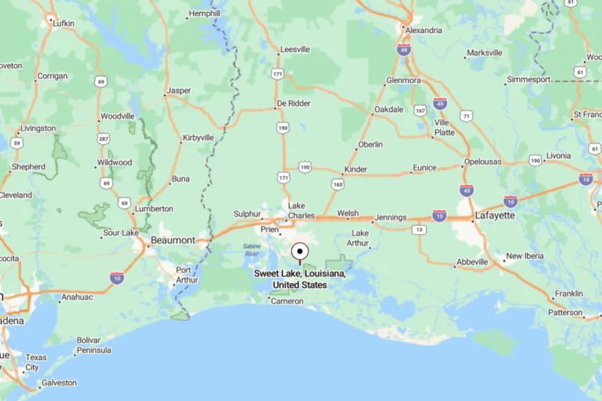
Sweet Lake lies in Cameron Parish, about 15 miles south of Lake Charles along Louisiana Highway 384. The approach passes through broad prairie before suddenly narrowing into a marsh-rimmed roadway.
With no major highways or bustling towns nearby, the area feels worlds away. Arriving here, it’s the sweep of land and sky that signals you’ve stepped out of the everyday.
24. Big Lake’s Reflected Horizons
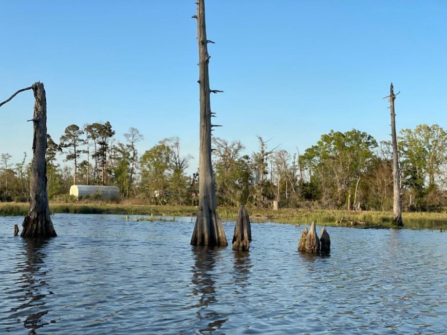
Big Lake feels more like a hidden waterscape than a town, with homes scattered along quiet lanes that dead-end at the shimmering waters of Calcasieu Lake. Its isolation is tied to geography—surrounded on three sides by water and marsh, it feels like an island without being one.
Locals fish for speckled trout and redfish at dawn, kayak into back-bay inlets, or watch sunsets reflect twice across the lake and sky. The vibe is restful, with stilted camps, dockside chairs, and little else to disturb the calm. Small-scale tourism mixes with fishing and shrimping, but the pace never rises above slow.
Visitors linger on porches, where night breezes carry only the sound of herons and the hum of crickets. Big Lake is the kind of place that teaches patience.
Where is Big Lake?
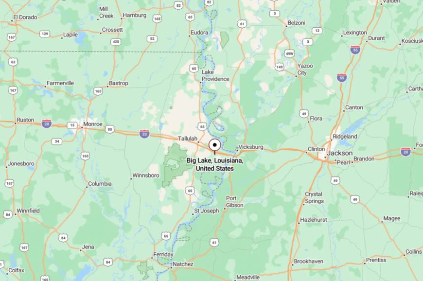
Big Lake is in Calcasieu Parish, about 15 miles south of Lake Charles via LA-384. A single road threads through marshes until it seems to vanish at the water’s edge.
Its position on the eastern shore of Calcasieu Lake cuts it off from through-traffic, leaving it as a quiet cul-de-sac on the map. Arriving feels like reaching the end of both road and time.
23. Grand Lake’s Water-Rimmed Fields

Grand Lake lies on a wide plain broken by canals and bayous, where farms and wetlands weave into a patchwork that feels both expansive and hidden. Its sense of remoteness comes from the lack of any true town center—just scattered homesteads, churches, and a school serving the area’s few hundred residents.
The mood is steady and rural, with tractors on levee roads, herons stalking shallow ditches, and families gathering at Friday night football games. Visitors find peace in the open landscapes, where fishing, crawfish ponds, and waterfowl hunting are daily rhythms.
Rice and cattle sustain the area, while small churches anchor community life. To spend an evening here is to feel the horizon stretch in all directions, leaving the wider world behind.
Where is Grand Lake?
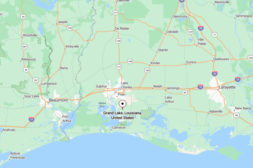
Grand Lake is located about 12 miles south of Lake Charles in Cameron Parish, accessible by LA-384. The approach is long and flat, surrounded by open prairie and ribboned waterways.
Because there are no real commercial strips, it feels more like the countryside than the town. The combination of distance and openness makes it feel as if you’ve stepped into another pace of life.
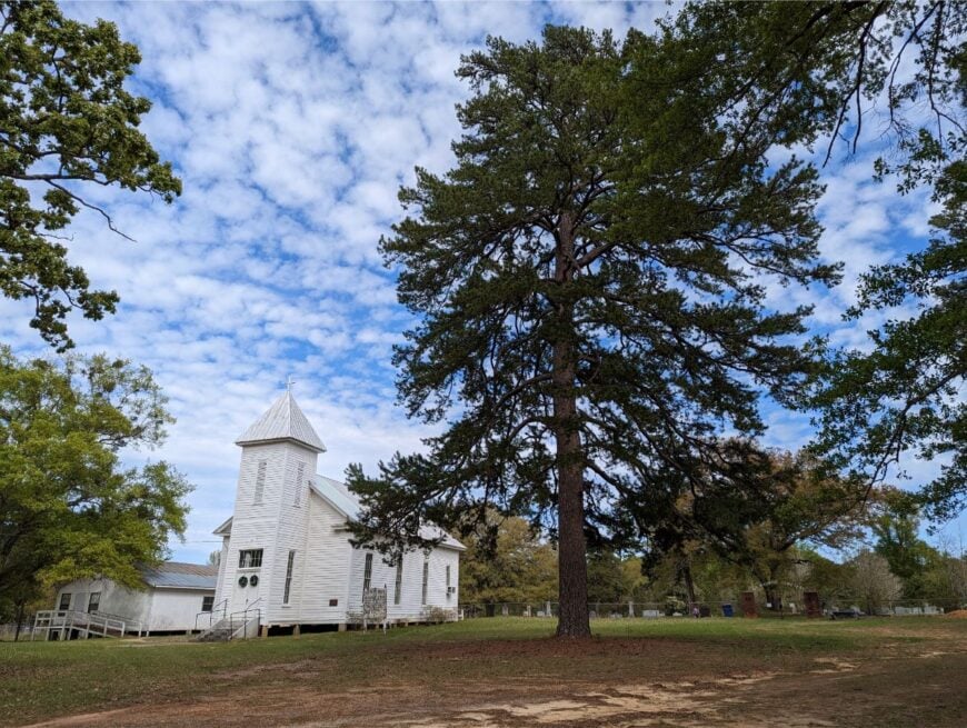
22. Chataignier’s Quiet Cane Fields
Chataignier, a village of fewer than 400 people, rests in the quiet folds of Evangeline Parish, where sugarcane and crawfish ponds stretch to the horizon. Its seclusion comes from being tucked off LA-29, a place most travelers never stumble upon unless they’re visiting family.
The vibe is unhurried and deeply rural: children ride bikes along gravel roads, church bells mark the hours, and evenings end with neighbors gathered on porches watching the fields fade into dusk. Visitors can fish the small bayous, wander through fields alive with red-winged blackbirds, or take a short drive to nearby Ville Platte for a taste of Cajun music.
Farming remains the heartbeat here, keeping life tied to the soil and seasons. Chataignier feels like a Louisiana pocket where the outside world slows to match the cane rows swaying in the wind.
Where is Chataignier?
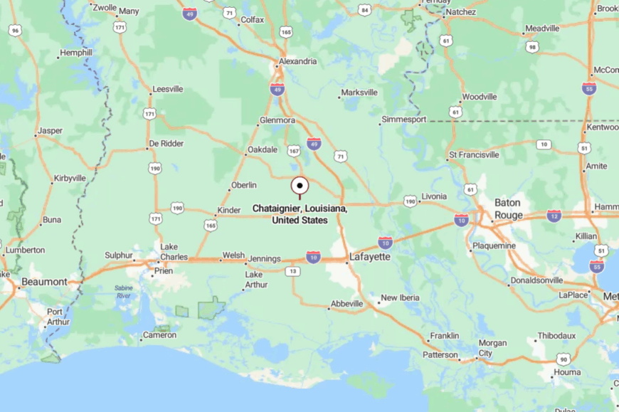
Chataignier is located in Evangeline Parish, about 8 miles southeast of Ville Platte and 25 miles north of Lafayette. Travelers reach it via LA-29, a two-lane country road that meanders past farmsteads and bayous.
With no interstate nearby, the trip requires intention, reinforcing its quiet atmosphere. By the time you arrive, it feels like you’ve stepped into a corner of Louisiana hidden in plain sight.
21. Kaplan’s Prairie Gateway

Kaplan, though larger than many on this list, holds a subtle seclusion at the edge of prairie country where commerce quickly gives way to farmland. Its quiet comes not from size but from location—removed from interstates and hemmed in by open country.
Downtown’s old brick storefronts, Cajun cafés, and a historic theater give it a nostalgic charm. Music and food anchor life here, from fais-do-dos to weekend boudin stops. Visitors can detour for prairie drives, birding at White Lake, or simple strolls beneath moss-draped oaks.
While some residents commute to larger towns, farming and small trades keep the community grounded. Kaplan whispers seclusion by making time itself seem slower.
Where is Kaplan?
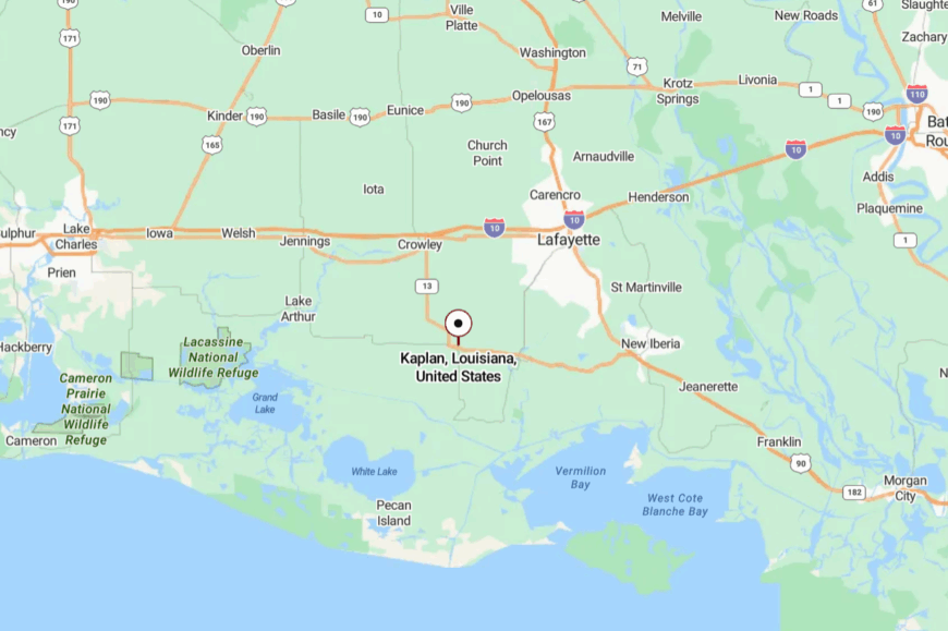
Kaplan is in Vermilion Parish, about 25 miles south of Lafayette, accessible via LA-13 or LA-14. Though only a short drive from Acadiana’s heart, it feels off-grid thanks to surrounding farmland and marsh edges.
The nearest highway bypasses it entirely, keeping through-traffic scarce. To arrive here is to find a small city that still feels comfortably apart.
20. Maurice’s Hidden Cane Fields
Maurice may be just a short drive from Lafayette, yet its atmosphere feels rural and tucked away thanks to the cane fields that surround it on all sides. Its seclusion is relative—it’s not far in distance, but it’s worlds apart in mood.
A handful of diners and grocers cluster along the highway, but side roads quickly dissolve into quiet farmland. Life here revolves around agriculture, small local schools, and weekend football games. Visitors might pause for plate lunches, attend fall festivals, or simply take in the serenity of fields shimmering in summer heat.
Despite slow growth, Maurice still feels like a hidden edge of Cajun country. It’s the kind of town where silence returns the moment you turn off Main Street.
Where is Maurice?
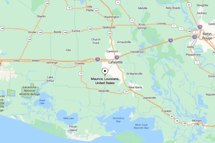
Maurice is in Vermilion Parish, about 10 miles south of Lafayette along US-167. The highway makes access simple, but the surrounding farmland erases the sense of being near a city.
A few turns off the main drag lead to gravel lanes bordered by sugarcane. It’s a reminder that seclusion can be as much about atmosphere as geography.
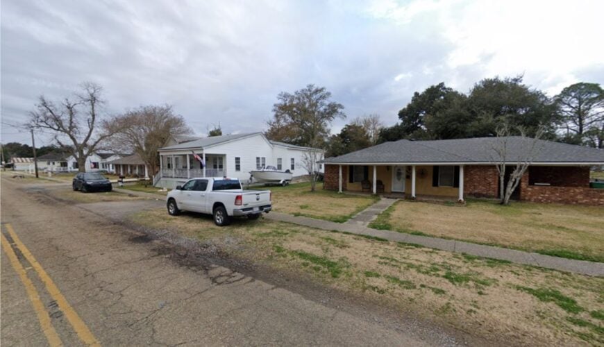
19. Erath’s Bayou Edge Calm
🔥 Would you like to save this?
Erath sits quietly along Bayou Tigre, its stilted houses and cypress groves giving it a hushed, watery atmosphere. The town feels tucked away because it sits south of main highways, accessible only by smaller parish roads.
Its vibe is warmly Cajun, with front-porch music, a small museum honoring Acadian heritage, and families gathering for shrimp boils. Fishing, farming, and crawfish ponds provide much of the livelihood here.
Visitors enjoy driving the bayou roads, attending the lively Fourth of July festival, or simply watching herons at sunset. Erath’s combination of history and hiddenness creates an intimacy that feels like stepping into another era.
Where is Erath?
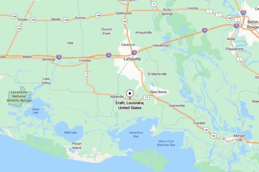
Erath is in Vermilion Parish, about 10 miles east of Abbeville via LA-14 and LA-331. It’s not directly on any main routes, requiring side roads that trace quiet bayous.
The detour itself sets the mood, drawing you into slower scenery. By the time you arrive, the world feels reduced to water, trees, and music on the breeze.
18. Delcambre’s Shrimping Silence
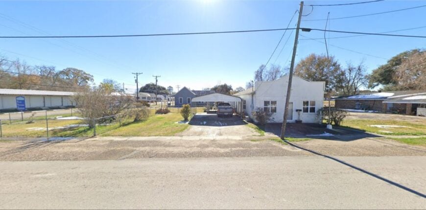
Delcambre is a waterfront village where shrimp boats outnumber cars, clustered along canals that feed into Vermilion Bay. Its seclusion is tied to the working waterfront—narrow streets end at docks, and there’s little traffic beyond locals and fishermen.
The vibe is salt-tinged and industrious, yet unhurried, with peeling paint on shrimp houses and nets drying under the sun. Visitors can sample fresh catch at seasonal festivals, walk the quiet levee, or watch sunsets spill across shrimp boat masts.
Fishing dominates the economy, with shrimp season shaping the town’s pulse. In Delcambre, solitude is measured by the spaces between tides.
Where is Delcambre?
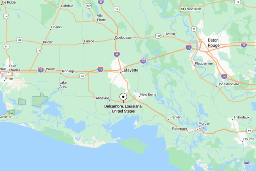
Delcambre straddles Vermilion and Iberia Parishes, about 20 miles southwest of New Iberia via LA-14 and LA-330. The town sits at the end of bayou-side roads, cut off from major highways.
Arriving means following the water as much as the pavement. Its tucked-away docks feel far from urban Louisiana, even while connected by bayou channels to the Gulf.
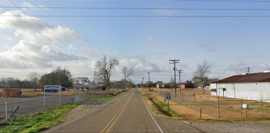
17. Perry’s Marsh-Side Pause

Perry is little more than a bend in the Vermilion River south of Abbeville, yet its handful of houses and church radiate quiet. Its isolation comes from being on a dead-end road that serves locals only, leaving traffic nonexistent.
The mood is pastoral and simple, defined by fishing, crawfish ponds, and evenings when the river reflects endless stars. Visitors might kayak the Vermilion, stop at the tiny general store, or fish from shaded banks.
Farming and small trades keep families here, but it is the sense of stillness that defines Perry most. The town’s seclusion feels like an embrace, wrapping newcomers in a gentle calm.
Where is Perry?
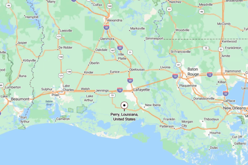
Perry is in Vermilion Parish, about 4 miles south of Abbeville via LA-82. The road ends at the Vermilion River, reinforcing its cut-off feeling.
Surrounded by water and farmland, it has no through-traffic to speak of. The stillness upon arrival feels like stepping into a forgotten fold of Louisiana.
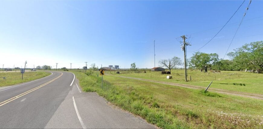
16. Grosse Isle’s Marshland Memory
Grosse Isle is an unincorporated settlement scattered among winding marsh roads southeast of Erath. Its sense of seclusion comes from distance—there are few direct routes, and homes are hidden among cane fields and bayous.
The vibe is quiet and heritage-rich, with families rooted here for generations. Visitors find charm in old churches, roadside shrines, and the sounds of frogs and crickets rising louder than any car engine.
Small farming and fishing sustain the few who remain. Grosse Isle is not a place of spectacle, but of memory and permanence. It’s the kind of hidden community that seems whispered rather than spoken.
Where is Grosse Isle?
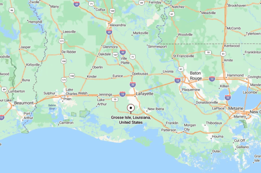
Grosse Isle lies in Vermilion Parish, about 15 miles southeast of Abbeville, reachable only via winding parish roads. The journey threads through cane fields, pastures, and bayous before arriving at the scattered settlement.
Because it lacks a central town, it feels more like a landscape than a destination. Its isolation makes the area feel known only to those who seek it.
15. Esther’s Forgotten Edge
Esther is a speck of a community near the marshes, with one main road, a few homes, and a tiny church anchoring the quiet. Its seclusion stems from being several miles off any main route, where cane fields give way to wetlands and the horizon empties.
The town vibe is simple and rustic, with neighbors gathering at the churchyard or fishing local canals. Visitors pass through to birdwatch, photograph rice fields, or join friends for seasonal crawfish boils.
Farming and fishing are the mainstays, though the sense of heritage is just as strong. Esther is the kind of place where time seems to stretch like the landscape itself.
Where is Esther?
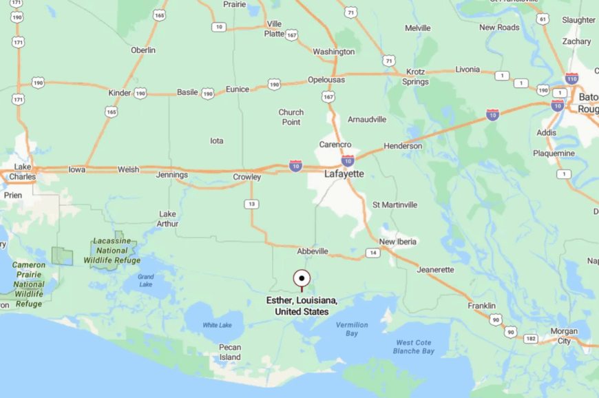
Esther sits in Vermilion Parish, about 10 miles south of Abbeville via LA-82 and local parish roads. It’s not directly on a highway, requiring detours through farm country.
With only one true road in and out, the place feels more like a hidden pocket than a town. By the time you reach Esther, you know you’ve stepped aside from the main flow of the world.
14. Abbeville’s Hidden Corners
Though Abbeville is a small city, its river bends and old oaks create quiet corners that feel far removed from the bustle. The seclusion lies in its historic district, where brick sidewalks, shadowed courtyards, and wrought-iron balconies feel hushed even at midday.
The mood is timeless, touched with Cajun culture, music, and cuisine. Visitors stroll Magdalen Square, tour St. Mary Magdalen Church, or sample gumbo at century-old cafés. Though trade and commerce support the area, it still feels like a place where heritage outweighs modern rush.
Abbeville is a reminder that even towns with names on the map can hide quiet within their folds.
Where is Abbeville?
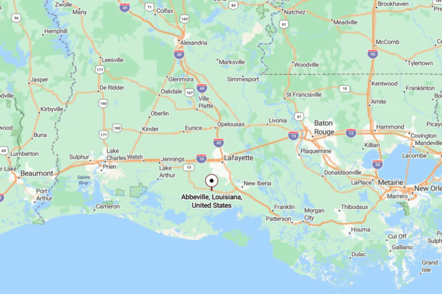
Abbeville is the parish seat of Vermilion Parish, about 20 miles south of Lafayette via LA-167. Surrounded by cane fields and bayou roads, it is at once accessible and remote.
Approaches are two-lane highways that narrow into tree-lined streets. The combination of culture and quiet makes it feel hidden in plain sight.
13. Gueydan’s Duck Capital Calm
🔥 Would you like to save this?
Gueydan, known as the “Duck Capital of America,” is a prairie town where hunting and rice farming shape the rhythms of life. Its seclusion is rooted in geography—the wide prairies stretch endlessly, with little to break the horizon.
The mood is rustic and outdoorsy, with blinds scattered across marshes and shotgun reports echoing at dawn in season. Visitors come for the Duck Festival, local diners serving crawfish étouffée, and the nearby White Lake Wetlands.
Farming and guiding are mainstays of the economy. Gueydan feels tucked away, not because it’s far, but because it belongs entirely to the land around it.
Where is Gueydan?
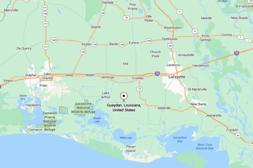
Gueydan is in Vermilion Parish, about 50 miles southwest of Lafayette via LA-14. Surrounded by rice fields and wetlands, it sits far from major highways.
The approach is a flat, open drive where the sky dominates. By the time you arrive, it feels like you’ve entered a town preserved by waterfowl and wind.
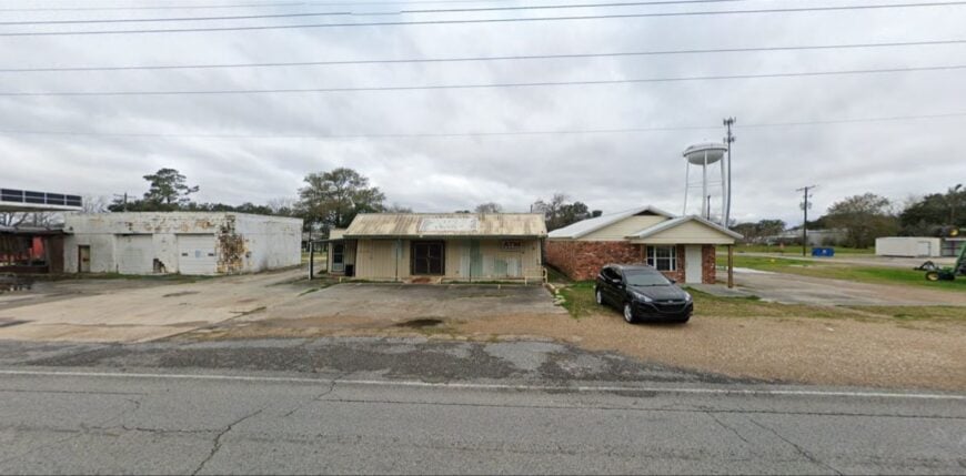
12. Mermentau’s Riverbend Refuge
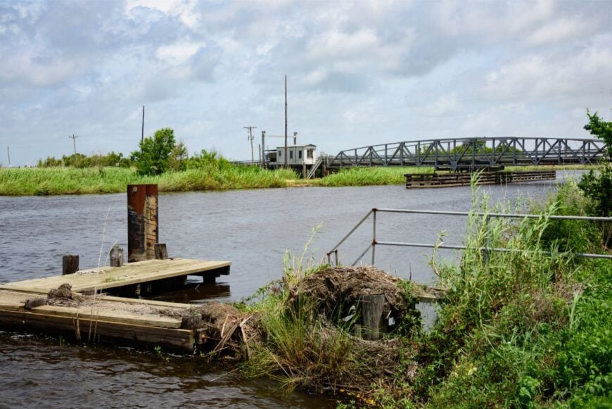
Mermentau curls along the bends of the Mermentau River, where cypress roots and levees keep it secluded. Its quiet comes from geography: with only a small bridge connecting it, the town feels pocketed by water.
The vibe is riverine and timeless—boats tied up to porches, children fishing from docks, and cicadas filling the evening air. Visitors can paddle the river, birdwatch, or explore historic churches.
Fishing and agriculture support the modest community. Life here feels as steady and winding as the river itself.
Where is Mermentau?
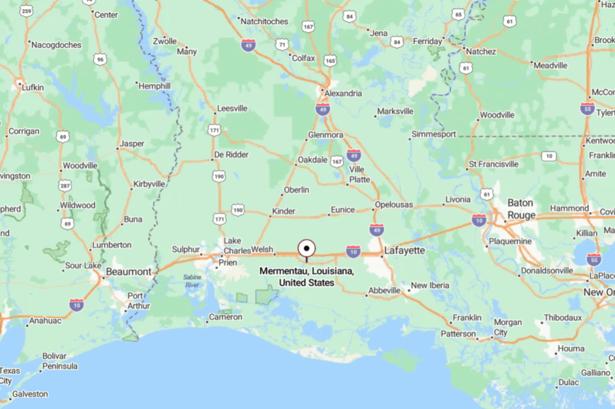
Mermentau sits in Acadia Parish, about 30 miles southeast of Lake Charles along US-90. Despite being near the highway, the river’s meanders create a sense of separation.
Travelers cross a small bridge into the heart of town, leaving behind open prairie. The water-framed setting makes it feel sheltered and apart.
11. Morse’s Prairie Horizon
Morse is a village of fewer than 1,000 people surrounded entirely by rice fields that stretch until they meet sky. Its seclusion is plain to see—there are no large roads cutting through, just long two-lane stretches bordered by irrigation canals.
The town vibe is modest and close-knit, with a school, a church, and a scattering of small shops supporting daily life. Visitors might stop for birdwatching during migration, watch harvests unfold, or join seasonal crawfish boils.
Rice farming is the heartbeat here, anchoring generations of families. Morse is a reminder that the prairie itself can be the greatest wall against the wider world.
Where is Morse?

Morse is in Acadia Parish, about 12 miles west of Crowley along LA-92. Surrounded by fields and irrigation levees, it sits far from interstate traffic.
The roads leading in are long and empty, broken only by farm equipment and the occasional egret. Reaching Morse feels like slipping into an ocean of grass and sky.
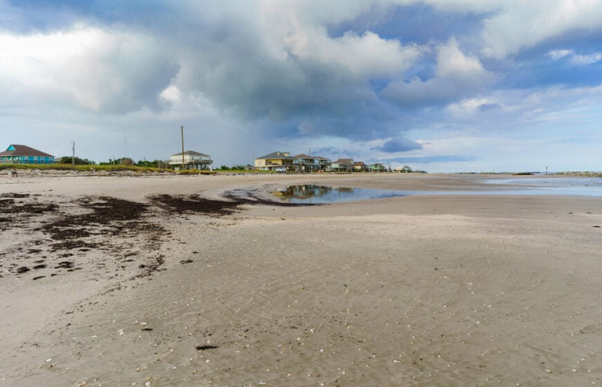
10. Holly Beach’s Endless Shell-Strewn Shoreline
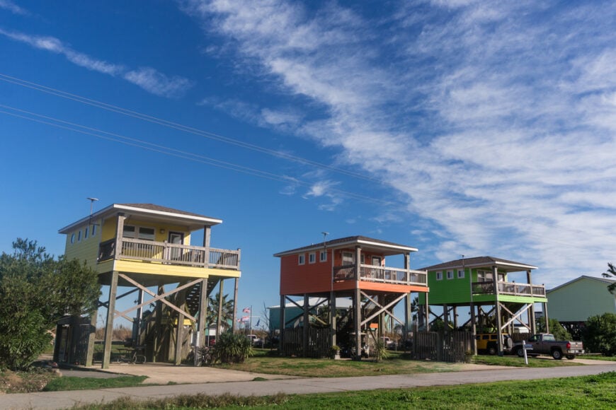
Holly Beach claims roughly 250 year-round residents, though the number swells on sunny weekends when anglers and shell collectors roll up in pickups. Days revolve around surf fishing, crabbing with chicken necks on string, and wandering miles of firm sand that doubles as an informal coastal highway.
Casual rentals and weathered cabins support a small cleaning-service trade, yet most income still flows from offshore crews who bunk here between boat assignments.
With no buildings taller than two stories and nothing but dune grass between porches and water, the settlement feels exposed to sun, stars, and every Gulf breeze.
Nights are darker than many visitors have ever seen, and pelicans gliding at eye level replace city traffic. The absence of chain stores, stoplights, and even a proper grocery store underscores how far removed Holly Beach is from mainstream bustle.
Where is Holly Beach?
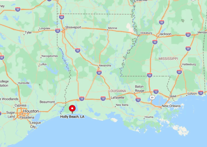
The town rests on Louisiana Highway 82 in Cameron Parish, about forty miles south of Lake Charles as the crow flies yet well over an hour by road. Marshes hem in the pavement for much of that drive, explaining why Holly Beach remains so lightly peopled.
Travelers reach it by following LA-27 to the Cameron ferry, crossing the Calcasieu Ship Channel, then continuing west along 82 until the Gulf overtakes the horizon. Once the asphalt ends, so does any sense that commerce holds sway over the coastline.
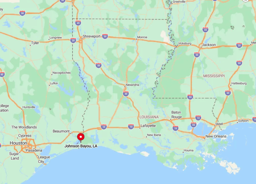
9. Johnson Bayou’s Windswept Chenier Ridge
Johnson Bayou supports close to 400 inhabitants scattered along a rare ribbon of high ground where ancient live oaks lean inland from the salt breeze. Birders stop for migrating warblers at Peveto Woods Sanctuary, while locals spend their free hours surf-casting or launching kayaks into mudflat pockets for redfish.
Income stems from seasonal creel limits, small repair yards that service offshore platforms, and contract work for nearby gas facilities visible offshore. Hurricane scars linger in empty slabs, reinforcing a sense of isolation that only a handful of porch lights pierce after dusk.
The ridge’s slight elevation keeps homes above marsh flooding, yet it also separates the community from neighbors by miles of watery wilderness. Evening silhouettes of oil rigs blinking on the horizon highlight the gulf between industry and inhabitants.
Where is Johnson Bayou?
🔥 Would you like to save this?
Located ten miles west of Holly Beach on LA-82, Johnson Bayou hugs the last chenier before the Texas border. Salt marsh surrounds the ridge on three sides, leaving the narrow highway as the sole land route. Limited cell service and an hour-plus ride to the nearest supermarket accentuate its seclusion.
Visitors simply follow the coast road; if they miss the faded school marquee, they’ve already crossed into Texas.
8. Pecan Island’s Marsh-Bound Duck Blinds
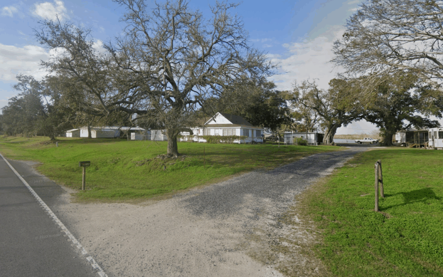
Pecan Island’s roughly 300 residents live amid an ocean of brackish wetlands where mallards and teal dictate morning schedules each fall. Sportsmen rent raised camps and hire guides who navigate labyrinthine canals in surface-drive boats, while summer visitors chase speckled trout along White Lake’s edges.
A handful of outfitters, a combination fuel-and-grocery stop, and part-time cattle operations provide modest employment. Because every structure sits on pilings above hurricane wash, and because the nearest town with a traffic light is forty miles away, solitude comes built in.
Even the local Catholic church stands elevated, its long ramp doubling as a community gathering place during crawfish boils. Whip-poor-wills and airboat props form the evening soundtrack where highways end in cattails.
Where is Pecan Island?
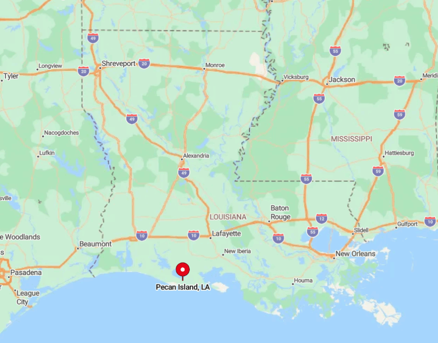
The community lies in Vermilion Parish on LA-82 east of the Mermentau River, halfway between Grand Chenier and Esther. Marsh and open water surround the slender roadway, discouraging unnecessary travel and keeping the population low.
Visitors typically drive south from Kaplan on LA-35 before turning west onto 82, a route that climbs atop narrow levees for much of its length. The feeling of isolation grows as pavement meets water on both sides and only distant duck blinds break the horizon.
7. Intracoastal City’s Shrimp-Boat Silence at Dawn

With an estimated 200 full-time residents, Intracoastal City is more working waterfront than town, its life measured by tides and trawler departures. Dawn brings the soft whir of ice machines and diesel rumble as shrimp captains head for Vermilion Bay while dock cats patrol quiet wharves.
Most jobs revolve around seafood processing, small fabrication yards, and helicopter pads ferrying crews to offshore rigs unseen beyond the horizon. Storefronts are few; gulls fill the auditory gaps where traffic might be.
The settlement feels secluded because activity clusters along canals hidden behind miles of cane fields and marsh, invisible from main highways. Once the last boat pushes off, silence settles so completely that even mullet splashes echo.
Where is Intracoastal City?
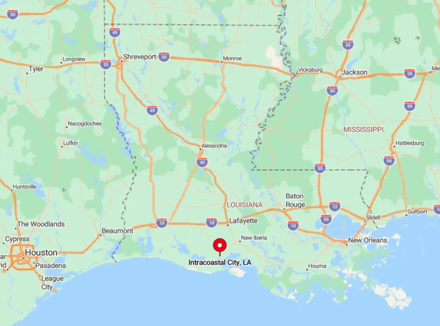
Intracoastal City sits at the southern end of LA-333 where the Vermilion River meets the Gulf Intracoastal Waterway, twenty-three miles south of Abbeville. Approaching motorists leave paved shoulders for raised levee roads edged by sugarcane and spartina grass, a journey that discourages casual detours.
No public transit reaches the docks; travelers must drive or arrive by boat. Its tucked-away position on a man-made canal keeps it both connected to commerce and distinctly apart from suburban sprawl.
6. Grand Chenier’s Live-Oak Tunnel Lanes
Grand Chenier counts about 700 residents who share a long ribbon of oak-shaded highway bordering wide cattle pastures that slope toward the Gulf. Weekends bring families to the Rockefeller Wildlife Refuge for early-morning bird drives, alligator-watching, and surf casting, where pavement simply disappears into sand.
Livelihoods center on cow-calf operations, oyster leases in nearby bays, and contract work at the refuge headquarters. Houses sit far apart, often fronted by broad lawns that dissolve abruptly into open water, giving the area a frontier feel despite centuries of habitation.
The absence of retail strips or stop signs for ten-mile stretches contributes to its remote character. Sunset light filtering through moss-hung branches turns the road itself into a hidden Louisiana cathedral.
Where is Grand Chenier?

The community unfolds along LA-82 east of Cameron, a scenic drive framed by mossy live oaks and back-bayous. Marsh on the south and the Mermentau River delta to the north isolate the chenier, requiring east-west travel for any supply run.
The nearest full grocery store sits an hour away in the town of Kaplan via LA-82 and LA-35. Visitors simply stay on 82 until oak branches meet overhead and pastures give way to Gulf spray.
5. Cameron’s Lonely Ferry Landing
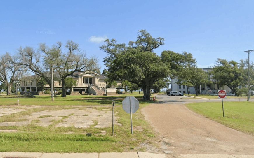
Cameron, parish seat in name yet home to only about 350 people, clusters around the Calcasieu Ship Channel where shrimp nets dry beside shuttered shops.
Travelers linger to watch the free ferry shuttle a handful of vehicles while brown pelicans draft in its wake, or they tour the Cameron Prairie National Wildlife Refuge a few miles up LA-27. Government offices, seafood processing plants, and pilot services guiding tankers through the channel provide most employment.
Since successive hurricanes erased many homes and businesses, broad patches of empty lot lend town streets an eerie quiet that underscores its seclusion. Even parish meetings occur in portable buildings, a reminder of distance from urban resources. Nights fall with little more than buoy bells and the soft churn of outgoing tide.
Where is Cameron?
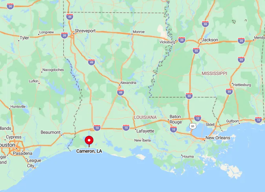
Cameron lies forty-eight road miles south of Lake Charles via LA-27, with the last leg requiring a ferry crossing that shuts down during foul weather. Marshlands and the ship channel surround the town, effectively limiting expansion and casual through-traffic.
Visitors must plan around the ferry schedule or detour many extra miles west to the Sabine Pass bridge. The combination of water barriers and storm-damaged infrastructure preserves its quiet character.
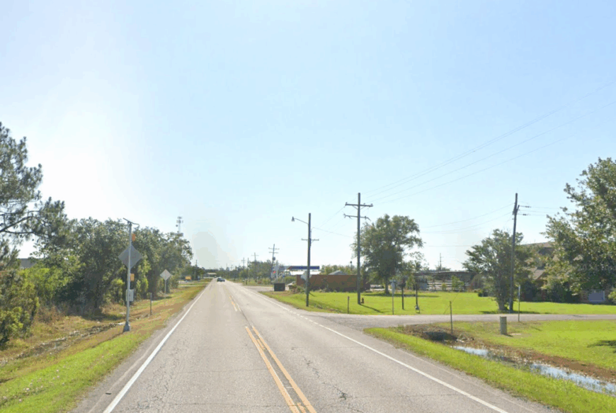
4. Hackberry’s Hidden Saltwater Bayous
Hackberry harbors about 1,200 residents dispersed around Calcasieu Lake’s north shore, where hidden boat launches provide quick access to legendary redfish flats.
During daylight, anglers skirt gnarled cypress and submerged railroad pilings while birders explore the gentle boardwalk at Black Lake for roseate spoonbills. Employment splits between the LNG export terminal north of town, guide services, and small convenience stores supplying bait and coffee at dawn.
Houses tuck along winding bayou spur roads; thick walls of cattails and live oak conceal them from the main highway so thoroughly that first-time visitors often miss turns. Evenings settle with the muffled clank of anchor chains and choruses of tree frogs that drown out any hum from industry across the lake.
The town feels worlds apart despite sharing a parish with metropolitan Lake Charles.
Where is Hackberry?
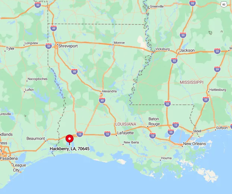
The settlement sits on LA-27 between Sulphur and Cameron, yet most residential lanes peel off toward the water, out of sight of passing traffic. The expansive marsh to the south and the Sabine National Wildlife Refuge to the west confine development to a narrow upland strip.
Reaching Hackberry involves a twenty-five-mile drive south from I-10 through empty prairie, enough distance to thin crowds. Once there, guests rely on GPS or local directions; many boat launches are unsigned gravel tracks ending at mirror-calm water.
3. Creole’s Prairie-Meets-Gulf Horizon
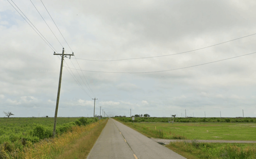
Creole sustains roughly 250 inhabitants on an open sweep where cattle prairie fades seamlessly into tidal marsh. Visitors photograph hurricane-scarred St. Eugene Church, then head south on gravel Beach Road to the rarely crowded Gulf shoreline for surf fishing or driftwood collecting.
Limited jobs come from cattle ranching, alligator farming, and seasonal positions at the nearby Sabine National Wildlife Refuge headquarters. Because prairie stretches uninterrupted for miles and the nearest neighboring towns themselves are tiny, Creole feels particularly exposed to both sky and storm.
The landscape offers little vertical relief—just the occasional barn or water tower punctuating the horizon. Such uninterrupted vistas give residents sunsets that seem to last forever.
Where is Creole?
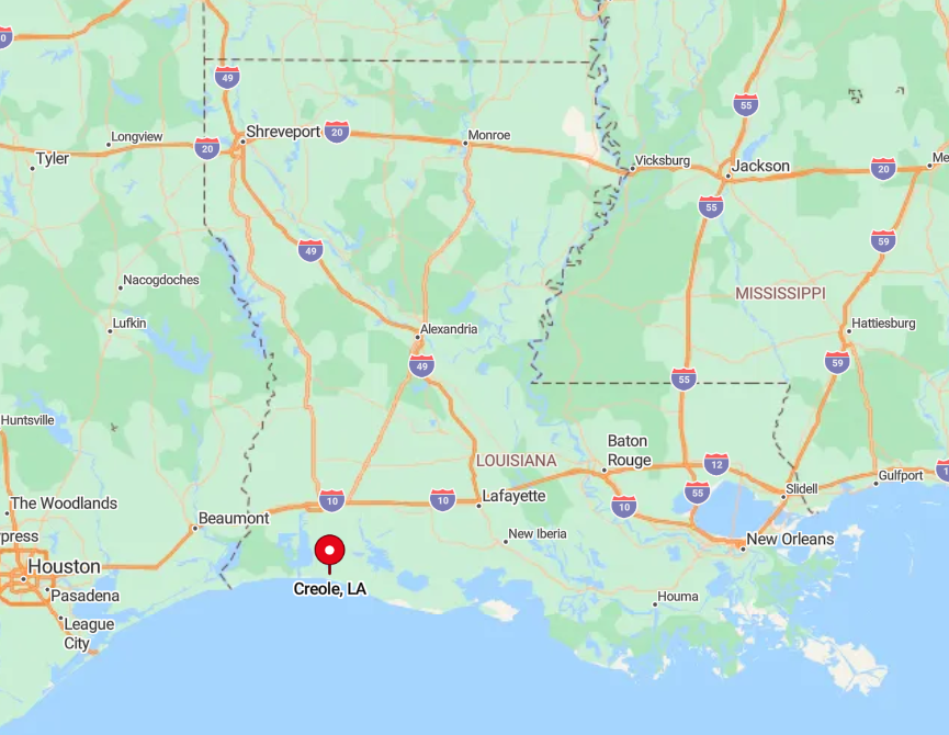
Creole sits at the junction of LA-27 and LA-82, twenty miles east of Cameron and twenty miles west of Grand Chenier, placing it squarely in marsh country. Only these two highways connect it to the outside world, both bordered by water on either side.
Travelers usually arrive via the Cameron ferry or by looping around through Holmwood and Bell City, each approach crossing wide causeways. Sparse services along the route remind drivers how quickly civilization drops away.
2. Oak Grove’s Rutherford Beach Camps
Oak Grove counts close to 200 full-time residents, most living in stilted camps that face the Gulf across Rutherford Beach’s broad, vehicle-friendly sand. Beachcombing for lightning whelks, kite flying in persistent breezes, and late-night stargazing with no light pollution fill leisurely hours.
Seasonal rental cleaning, small-scale charter fishing, and delivery work from inland suppliers make up modest local earnings. Power lines and houses end abruptly at the beach access point, beyond which only sea oats and driftwood fences meet the eye.
This sharp transition from habitation to raw coastline heightens the area’s secluded atmosphere. In summer, loggerhead turtles nest undisturbed just yards from campers’ porch swings.
Where is Oak Grove?
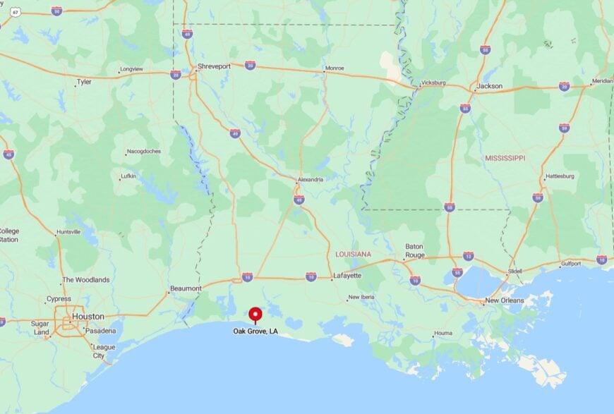
The village lies off LA-82 east of Creole, marked by a single sign pointing south toward Rutherford Beach Road. The turn quickly narrows to a shell-topped lane flanked by tall cordgrass, underscoring the quick departure from through-traffic.
Visitors from Lake Charles need roughly ninety minutes, including the ferry crossing, to reach the camp driveways. Once settled, the nearest gas pump is a thirty-minute drive back the way they came.
1. Forked Island’s Cypress-Framed Backroads
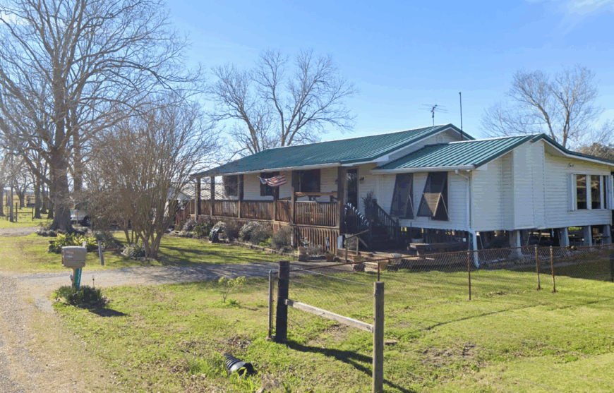
Forked Island, home to approximately 500 residents, is a maze of gravel lanes weaving past flooded rice fields, giant cypress, and occasional crawfish ponds that glow pink at sunrise.
Locals spend weekends casting for bass in Coulee Canard, tending crab traps, or slipping into hidden boat slips that open onto Vermilion Bay for flounder gigging after dark. Agriculture, especially rice and crawfish, supports most families, supplemented by guide services that bring a trickle of eco-tourism.
The community’s scattered homesteads sit on slight ridges surrounded by water, giving every mailbox the feel of an island outpost. Dense tree lines block views of neighboring houses, and the absence of roadside businesses beyond a single general store amplifies the sense of privacy.
Evening mists rising off flooded paddies erase any lingering notion of the wider world.
Where is Forked Island?
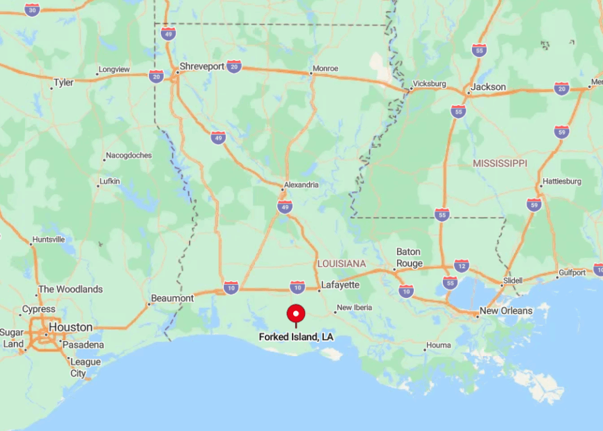
Positioned twenty miles south of Abbeville along LA-82 and LA-35, Forked Island straddles the northern rim of Vermilion Bay where marsh drains mingle with farmland. High water on Bayou Tigre often cuts the backroads, making elevated routes essential and reinforcing isolation.
Travelers reach the area by driving through Maurice, then winding past sugarcane and live oaks until pavement narrows and cypress knees line the ditches. With no public transit and few visible landmarks, first-time visitors often rely on the lone Spur station’s bright sign as proof they have arrived.