🔥 Would you like to save this?
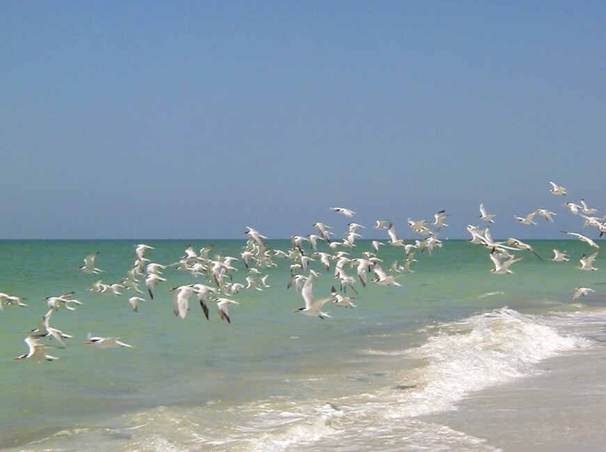
Southwest Florida still holds pockets of quiet that feel decades removed from the condo boom farther up the coast. Our team singled out 25 coastal communities where tides and seabirds outnumber traffic lights, and where a camera can fill its card long before the nearest store comes into view.
These hamlets sit behind mangrove mazes, at the far end of single-lane roads, or on ferry-only islands, so the gulf breeze arrives unfiltered and the night sky keeps its stars. Each place carries its own flavor, from Calusa shell mounds to golf-cart lanes, yet all share the luxury of distance.
In order to come up with the very specific design ideas, we create most designs with the assistance of state-of-the-art AI interior design software.
Visitors come for back-bay fishing, shelling that never seems picked over, and sunsets that glow peach and lavender behind leaning sabal palms. Whether scouting a new address or a weekend far from crowds, these towns prove that the region’s quieter side is still very much alive.
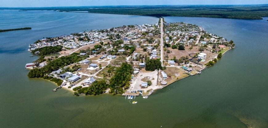
25. Matlacha, Island of Color and Quiet
Matlacha is a slice of Old Florida painted in bright hues and fringed with mangroves. Its cottages, art galleries, and bait shops perch on stilts above calm backwaters, where dolphins and paddleboarders often share the same view.
Despite being just minutes from Cape Coral, the tiny island feels like another world. There are no high-rises, no beach bars—just narrow lanes, laughter from porches, and the steady lap of Pine Island Sound.
It’s the kind of place where locals know every boat by name, and the rhythm of the tide means more than the tick of the clock.
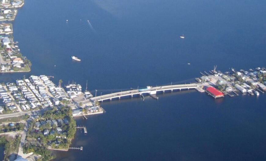
Where is Matlacha?
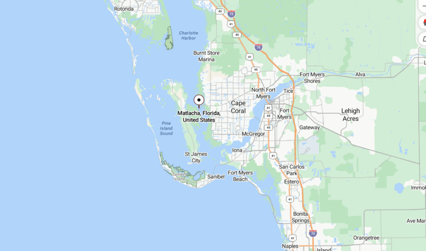
Matlacha sits between the mainland and Pine Island in Lee County, connected by a causeway along Pine Island Road. Travelers must slow down to cross the island’s two small bridges, where fishing lines often hang in the breeze.
Its location as a literal in-between keeps the crowds moving past it, making Matlacha a hidden haven for those who stop and stay.
24. Everglades City, Swamp’s Edge Serenity
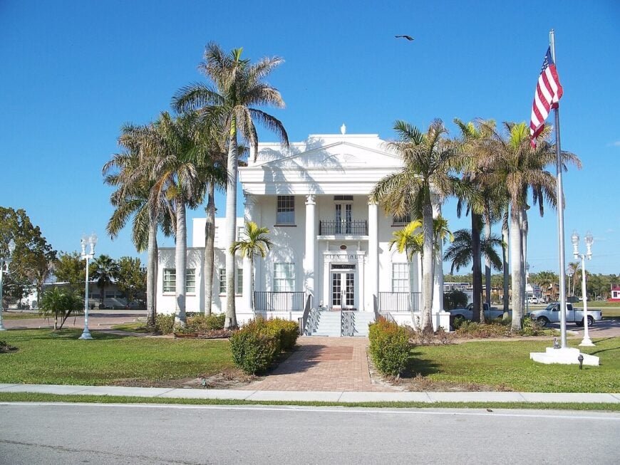
Everglades City feels like a frontier town surrounded by sawgrass, where airboats hum at sunrise and stone crabs rule the dinner table. With just a few hundred residents, it holds onto a salty, slow-moving past.
Wooden docks and weathered bungalows edge the Barron River, while herons and egrets stride through backyards like regulars. The downtown is little more than a handful of old fish houses and the occasional canoe launch.
You don’t stumble upon Everglades City by accident. You choose it, and in return it gives you peace wrapped in cattails and sky.
Where is Everglades City?
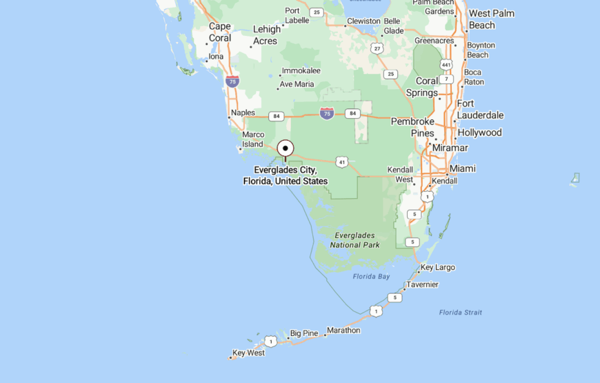
Located at the western entrance to Everglades National Park, the town sits at the end of State Road 29 in Collier County. It’s nearly an hour south of Naples, but the last stretch winds through swamp and marsh, cutting off city noise completely.
By land or water, the trip in always feels like a departure from the modern world—and that’s the point.
23. Goodland, Tiny Harbor with Big Stillness
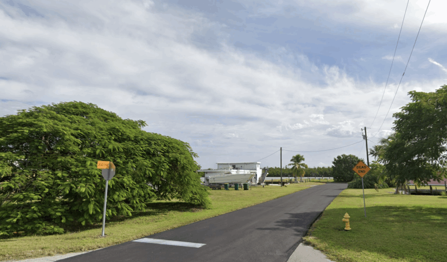
Goodland is a sleepy, salt-crusted village tucked away in a quiet corner of Marco Island. A handful of seafood joints and pastel homes wrap around a gentle bay where mullet jump and the tide talks softly.
Its personality is quirky and relaxed—a town that celebrates Sunday jam sessions at the local bar and doesn’t care much for clocks. Time stretches longer here, especially when the sun dips behind the mangroves.
At night, porch lights shimmer on the water and you feel like you’re a million miles from anywhere.
Where is Goodland?
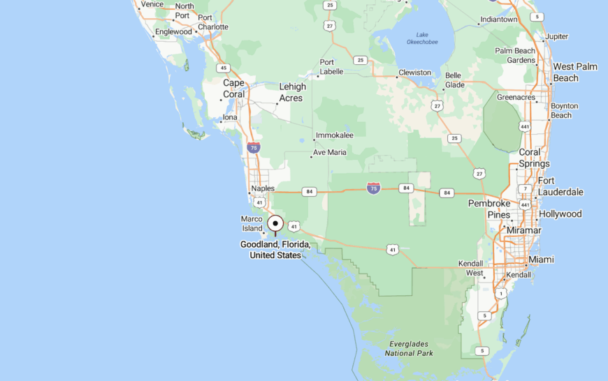
You’ll find Goodland on the southeast edge of Marco Island, near the very end of Collier Boulevard. Though Marco itself is busy, the route to Goodland narrows into a slow, winding drive with few signs and fewer buildings.
The cul-de-sac nature of its layout ensures you arrive only if you mean to—and most people don’t.
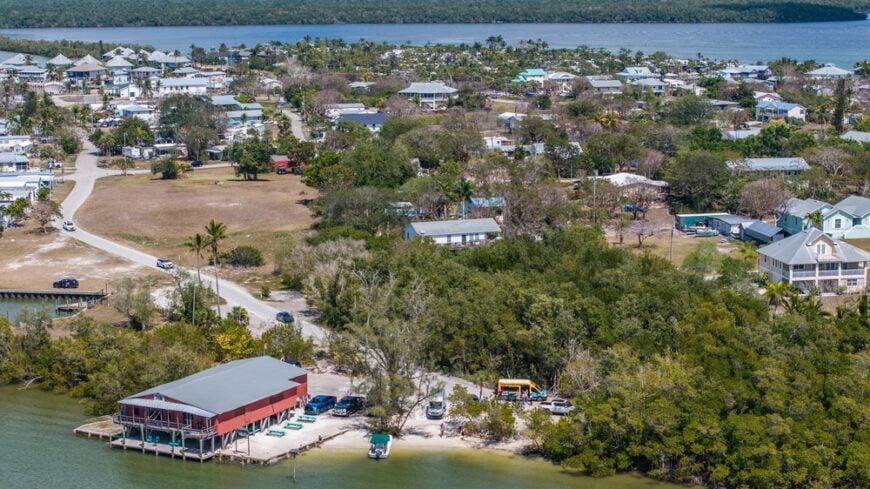
22. St. James City, South Pine Island Hideaway
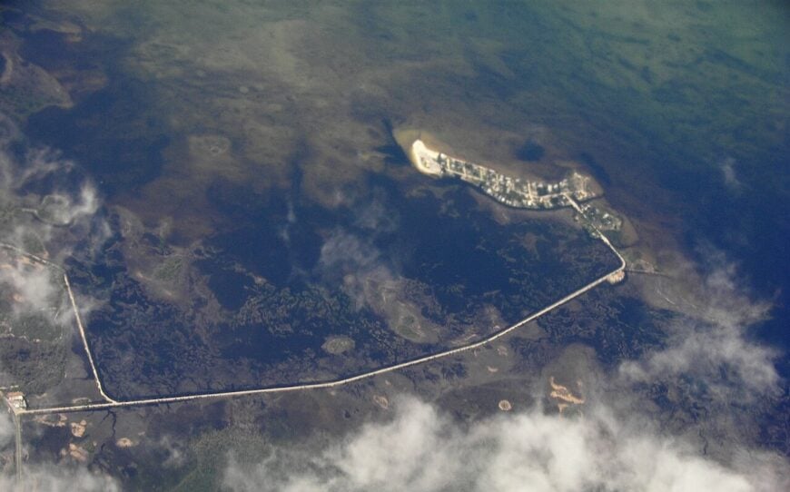
St. James City is a quiet waterfront community at the southern tip of Pine Island, where fishing boats dock behind backyards and sunsets stretch across the water like oil paintings. Life here is measured in tides, not time.
Few buildings rise above one story, and most roads end at the sea. Locals wave from golf carts or screen porches, often with a cold drink in hand and nowhere pressing to be.
Even the birds move slower here, gliding low above the canals as if in no hurry at all.
Where is St. James City?
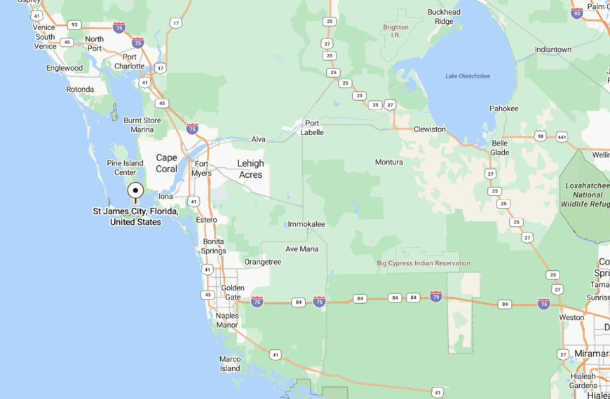
It rests at the far end of Stringfellow Road on Pine Island in Lee County. To get there, you must first cross Matlacha, pass Bokeelia and Pineland, and continue until pavement runs out.
This end-of-the-line geography adds to its quiet, making it one of Pine Island’s most secluded corners.
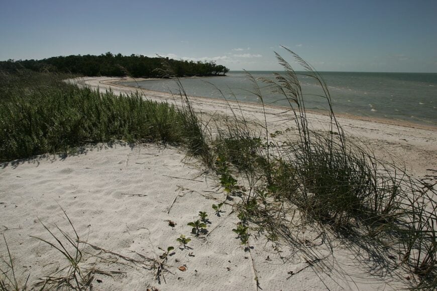
21. Keewaydin Island, Untouched Barrier Gem
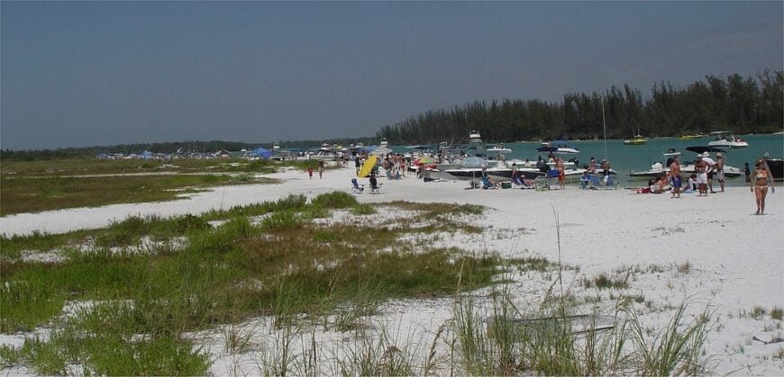
Keewaydin Island offers no roads, no cars, and no noise beyond the wind and surf. It’s an undeveloped stretch of sand and trees just off Naples, where wildflowers grow between shells and dolphins patrol the shallows.
Visitors arrive by boat, setting up picnic blankets or dropping anchor offshore, but no one stays overnight unless they bring a tent. That lack of amenities keeps the island pristine.
In the hush of late afternoon, as the sun lowers and the tide shifts, it feels like a secret passed only by whisper.
Where is Keewaydin Island?
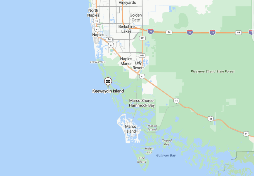
Keewaydin lies between Naples and Marco Island, shielded by the Intracoastal Waterway and accessible only by private boat or water taxi. The island stretches for eight miles along the Gulf but remains largely undeveloped.
Because there are no docks or bridges, reaching it requires intention—which keeps it delightfully off the radar.
20. Isles of Capri, Hidden Canals off the Causeway
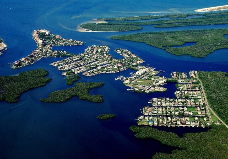
Tucked between Naples and Marco Island, the Isles of Capri is a network of canals, cottages, and calm water. It’s a place where pelicans rule the docks and the loudest noise might be a manatee surfacing.
Though close to modern bustle, it feels half-forgotten, like a sleepy cousin watching from the mangroves. Locals fish, paddle, and wave from porch swings without much worry about schedules.
Even the air here seems softer, filtered by mangrove and sea breeze.
Where is Isles of Capri?
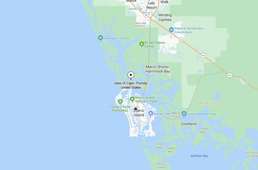
The isles sit just off Collier Boulevard, connected by a small causeway that most drivers miss unless they’re looking for it. Officially part of Naples, the community is separated from town by water and mindset.
That gentle detachment lets Isles of Capri remain still while the world rushes past.
19. Coon Key, Shell-Strewn and Barely Known
🔥 Would you like to save this?
Coon Key is little more than a wrinkle in the Ten Thousand Islands, but what it lacks in size it makes up for in solitude. There are no buildings, no docks—just white sand, shells, and an endless horizon.
It’s a favorite rest stop for paddlers exploring the maze of mangroves, offering a place to stretch legs, scan for osprey, and listen to silence. Low tide reveals sandbars scattered with conchs and moon snails.
There’s nothing to buy, nothing to check in to—just a stretch of Florida that forgot to change.
Where is Coon Key?
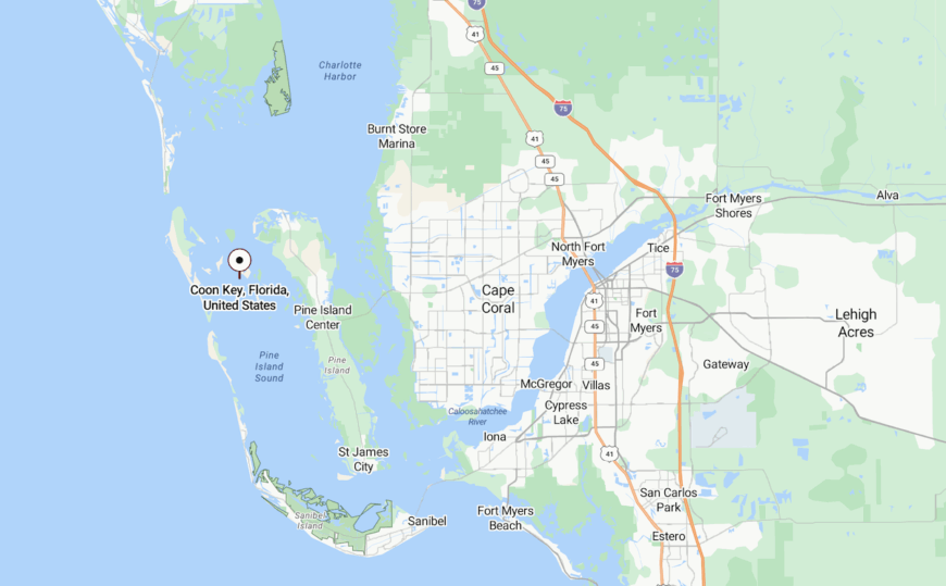
Coon Key lies just south of Goodland in Collier County, tucked within the Ten Thousand Islands National Wildlife Refuge. It’s accessible only by kayak or shallow boat from the backwaters of Marco.
Its remoteness and lack of development ensure it stays off maps, off guides, and off most people’s radar.
18. Captiva Drive North, Beyond the Bends
This northernmost curve of Captiva Island feels like a tropical afterthought—lush, shaded, and winding. Fewer than a dozen homes dot the final bend, and nearly all are set behind dense vegetation.
Tide pools form along the beach at low tide, and the ocean sounds louder here, untouched by resort noise. Visitors who make it past the shops and crowds rarely go further, making the end of Captiva feel like a place discovered twice.
On moonlit nights, ghost crabs scuttle along sand dunes and the world shrinks to one long, narrow road.
Where is Captiva Drive North?
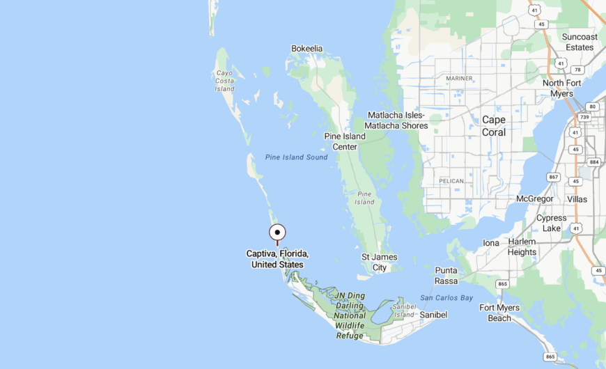
Located on the far end of Captiva Island, this stretch begins past the last public beach access. Reaching it means driving from Sanibel through thick vegetation and residential roads that taper to nothing.
The land itself ends in a private cul-de-sac, turning back all but the most curious explorers.
17. Henderson Creek, Mangrove-Laced Pocket
Henderson Creek isn’t a town so much as a quiet cove with a cluster of cabins tucked into shadowy mangroves. It’s where fishermen launch jon boats at dawn and herons glide like ghosts over glassy water.
The pace is silent and slow. Most residents came here decades ago and never left, drawn by the hush, the simplicity, and the fish.
Tucked under tree canopy, the homes seem to lean into the creek as if listening for the tide.
Where is Henderson Creek?
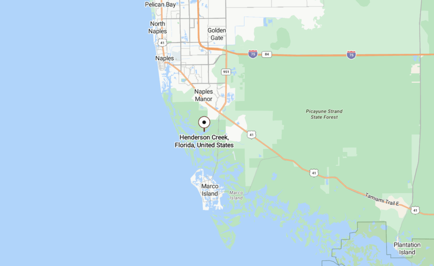
This quiet pocket sits east of Collier Boulevard near Naples, down unmarked roads that snake through wetlands inland from Rookery Bay. It’s technically a neighborhood, but feels more like a river settlement carved from the trees.
Its remote creekside position gives it a feeling of separation from even nearby towns.
16. Estero Bay Shores, Canal-Front Stillness
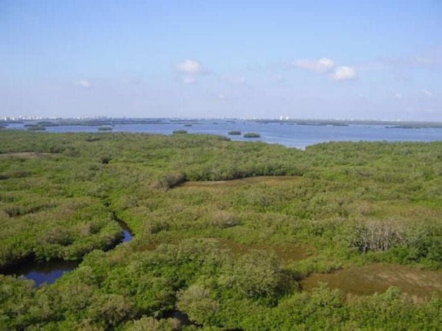
Estero Bay Shores is a hidden grid of quiet streets and small homes on deep-water canals. Boats sleep behind almost every house, and the main sounds are outboard motors heading for the back bay.
Even with Bonita Springs nearby, it keeps a hush, protected by marshland and lack of signage. Most homes have screened porches, weathered docks, and the kind of views that change with every tide.
At night, the only lights are porch bulbs and the occasional blinking channel marker.
Where is Estero Bay Shores?
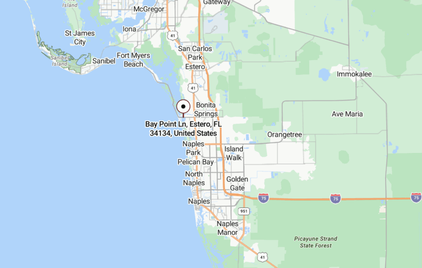
It’s tucked just west of U.S. 41 in Lee County, nestled into a bend of Estero Bay and reached by a low-key neighborhood road. Without resorts, beaches, or through-streets, few outsiders stumble upon it.
Its location near the bay but shielded from traffic keeps it as serene as the tide it borders.
15. Port Boca Grande, Southernmost Secret

At the very bottom of Gasparilla Island lies Port Boca Grande, a historic fishing village that whispers rather than shouts. White fences wrap around banyan-shaded homes, and bikes outnumber cars even during peak season.
It feels like a storybook corner left behind by time, where mail still comes by boat and the library sits in a repurposed lighthouse.
The sea speaks clearly here, and people listen.
Where is Port Boca Grande?
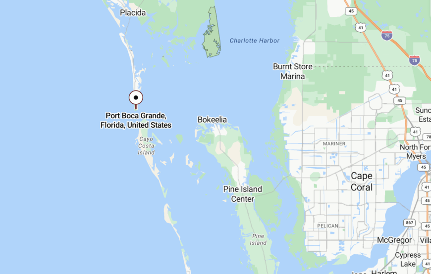
It’s the southern tip of Gasparilla Island, below the more visited Boca Grande area. A single road leads in, past dunes and beach access points that thin as you go.
Because it’s both remote and residential, few travelers venture that far south—and those who do usually stay awhile.
14. Coconut, The Vanished Village
Coconut was once a Calusa fishing camp, later a cluster of cabins near Estero Bay. Today, only foundations and palms remain, whispering stories to those who come by kayak.
It’s a ghost village with roots that stretch far into Florida’s past, offering only footprints in the sand and a sense of having found something few others know.
Even time treads lightly here.
Where is Coconut?
The site lies in the southern reaches of Estero Bay Preserve State Park, reachable only by paddle or shallow-draft boat. There are no signs, no trails—only memory and tide.
Its inaccessible location ensures it stays untouched, a true secret buried in the mangroves.
13. Delnor-Wiggins North Shore, Dune-Kissed Refuge
🔥 Would you like to save this?
Just north of Naples sits a quiet strip of sand and sea oats, where the boardwalk ends and the wilderness begins. This stretch of the preserve is less trafficked, shaded by sea grapes and brushed by a constant breeze.
No buildings interrupt the view—just dune, shell, and horizon. It’s where shorebirds feed without flinching and the pace of life matches the roll of the tide.
You can sit here for hours and hear nothing but waves and your own breath.
Where is Delnor-Wiggins North Shore?
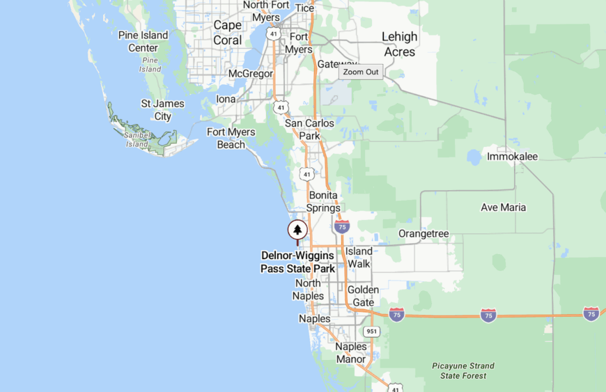
It’s part of Delnor-Wiggins Pass State Park in Collier County, but beyond the main beach. A narrow trail runs parallel to the dunes, leading to a quiet spot locals guard closely.
Being just outside the park’s main loop means it’s often skipped—and that’s exactly why it stays so serene.
12. Panther Key, Wilderness Within Reach
Panther Key is one of the largest in the Ten Thousand Islands, yet few have walked its shell-lined shore. Its sandy campsites are primitive and wild, with only sea breeze and osprey calls for company.
Most days it’s empty. Just footprints, driftwood, and the sound of something ancient brushing through the brush.
Campers come to unplug, to fish, to feel the pulse of Florida before pavement.
Where is Panther Key?
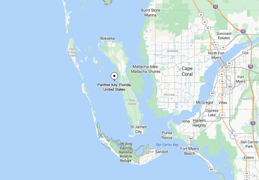
Panther Key lies southwest of Everglades City, reachable only by boat or kayak through the maze of mangrove channels. It’s part of the Ten Thousand Islands National Wildlife Refuge.
Because there’s no signage, amenities, or commercial presence, it feels untouched—a perfect patch of seclusion only the tide knows how to find.
11. Wulfert, Sanibel’s Last Curve
Wulfert is the final whisper at the end of Sanibel Island’s west end—a cluster of homes and trails where the road nearly gives up. Beyond here lies only conservation land, lagoon, and sky.
This corner feels far from the bike-rental bustle of town. Roseate spoonbills glide overhead, and alligators sun on boardwalks that thread through wetland.
Even at peak season, Wulfert stays quiet, a curve of calm past the curve of the causeway.
Where is Wulfert?
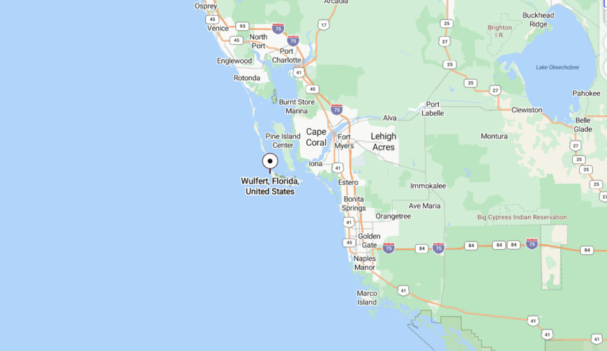
It’s located at the westernmost end of Sanibel Island, just before the entrance to the J.N. “Ding” Darling National Wildlife Refuge. The neighborhood edges brackish estuary and mangrove bayou.
Reaching it requires driving past the shops and beaches to where the road narrows, the trees thicken, and solitude begins.
10. Chokoloskee Island, Everglades Edge
Roughly 400 people call this oyster-shell island home, and many families trace their roots to the net-fishing camps of the early 1900s. Kayak anglers paddle into Buttonwood Bay at dawn, then return for stone-crab claws at small dockside cafés that close when the catch runs out.
Charter guides, air-boat operators, and a lone bait shop form the island’s modest economy, supplemented by artisans selling handmade cast nets. Time seems to stall among the century-old stilt cottages, weathered cisterns, and fish-house ruins that sit above the tide line.
Its position at the very end of the Tamiami Trail leaves it surrounded on three sides by the Ten Thousand Islands and on the fourth by the sawgrass fringe of Everglades National Park. That watery buffer keeps noise and new construction firmly at bay.
Where is Chokoloskee Island?
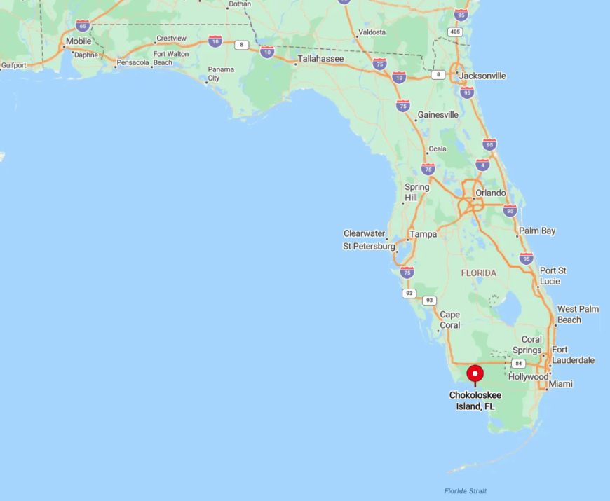
The island rests seven miles south of Everglades City in Collier County, connected to the mainland by a single narrow causeway. Mangrove tunnels and shallow oyster bars make large-vessel travel impractical, reinforcing the sense of isolation.
Visitors from Miami or Naples follow U.S. 41 before turning onto County Road 29, a drive that trades billboards for spoonbills in under an hour. Once across the causeway, the nearest traffic signal is fifteen miles behind.
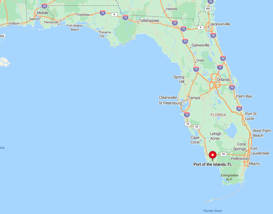
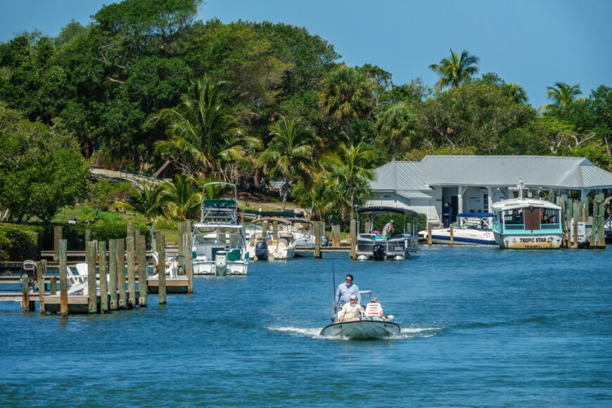
9. Port of the Islands, Ten Thousand Islands Gateway
This canal-lined community hosts around 300 permanent residents, many of whom keep flats boats tied behind their back doors. Dawn brings a silvery fog that lifts off the water, revealing manatees grazing on hydrilla and osprey perched on channel markers.
The local economy centers on its full-service marina, a modest hotel, and eco-tour outfitters who run trips into Fakahatchee Strand. Bird-watching platforms, brackish-water fishing, and quiet paddling routes through sawgrass prairies fill most days.
No commercial strip intrudes, and vacant lots still outnumber completed homes, so evenings settle into cricket-song darkness. Hemmed in by public conservation land on three sides, the neighborhood maintains a removed feel despite being only thirty miles from Naples.
Where is Port of the Islands?
🔥 Would you like to save this?
It lies on U.S. 41 between Naples and Everglades City, yet the surrounding wetlands hide it from highway glance. Access comes via Orchid Parkway, a spur road that ends at the marina basin. Because there is no through-route, casual traffic is rare.
Naples residents usually arrive by car in forty minutes, while adventurous visitors sometimes dock straight from the Gulf after threading the Barron River.
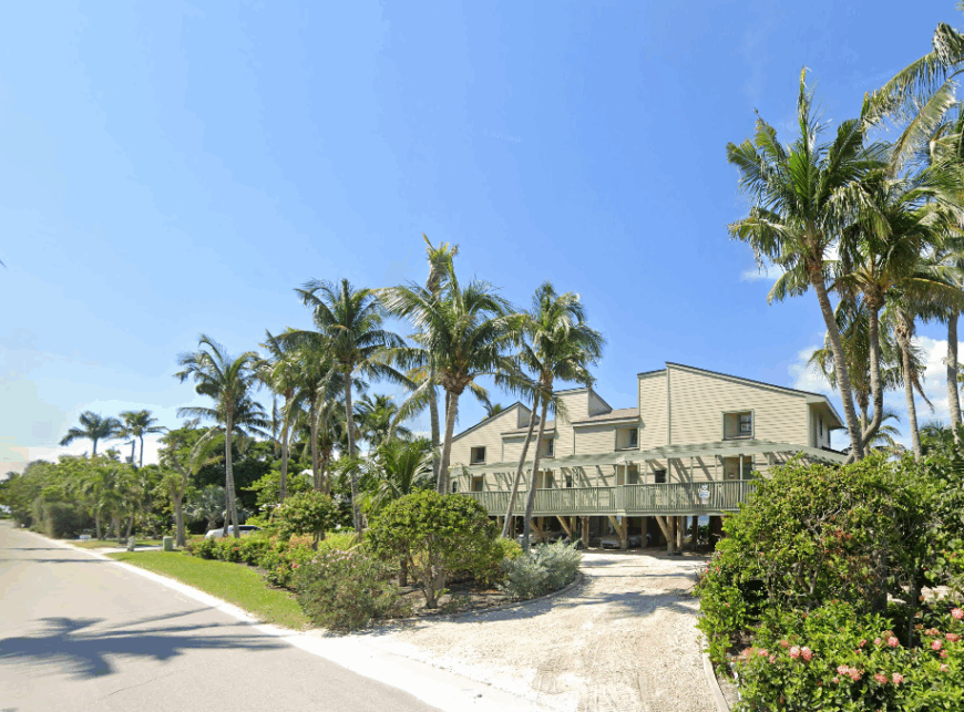
8. Useppa Island, Private Paradise in Pine Island Sound
Fewer than 100 cottages occupy this 100-acre island, creating an exclusive enclave where golf carts roll along crushed-shell lanes under spreading banyan trees. Guests spend mornings on the croquet greens, afternoons drifting over grass flats for snook, and evenings beneath the pink stucco arches of the historic Collier Inn.
Employment revolves around the island club, marina services, and estate caretaking, preserving a service-oriented micro-economy. No cars, shops, or public docks break the calm, giving residents the hush of a classic yacht-club retreat.
Dense mangroves and private ownership limit foot traffic, and security staff greet every arriving boat. All of this protects a tranquility that feels far removed from the bustle of nearby Captiva.
Where is Useppa Island?
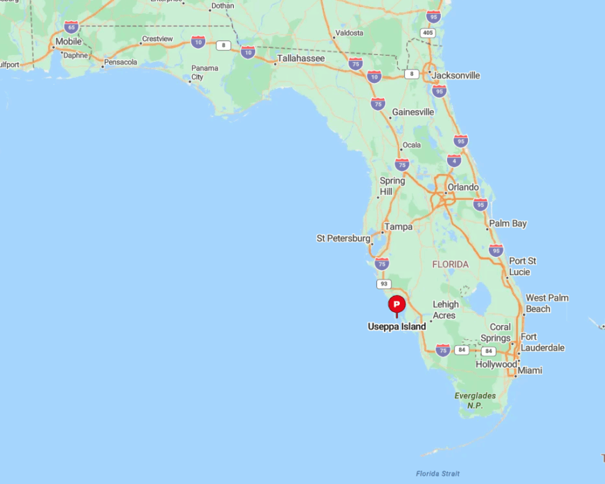
The isle sits just east of Cayo Costa in the middle of Pine Island Sound, roughly fifteen miles northwest of Fort Myers. Access is strictly by private boat or the island’s launch out of Bocilla Marina on Pine Island.
The winding Intracoastal channel deters casual visitors, and day passes are issued only to guests of members. That combination of boat-only travel and controlled entry keeps Useppa peaceful even in high season.
7. Bokeelia, Northern Tip of Pine Island
Around 1,800 people live in this laid-back community where white-capped waves meet rows of royal palms and mango orchards. Locals fish from the 1920s concrete pier, sip lime coolers at the waterfront inn, or scout osprey nests along Stringfellow Trail.
Agriculture and charter fishing dominate the economy; roadside stands sell mango salsa beside skiffs hauling tarpon anglers. Bokeelia’s long, narrow geography leaves it ringed by water on three sides and reachable only by a single north-south roadway.
That bottleneck reduces visitor numbers, giving sunsets over Charlotte Harbor an unhurried, watercolor calm. Many homes sit on multi-acre lots, so neighbors remain a whisper apart.
Where is Bokeelia?
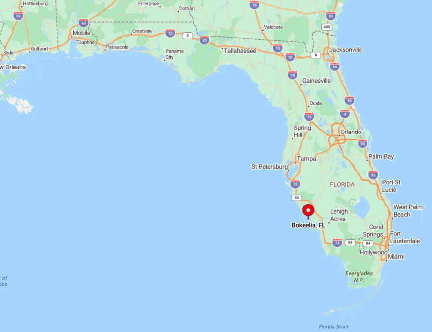
Located at the extreme north of Pine Island in Lee County, Bokeelia is thirty miles west of downtown Fort Myers yet feels twice that distance. Drivers must cross two small toll bridges onto Pine Island before following Stringfellow Road to its terminus.
The lack of beaches or resorts along the route keeps traffic light. For boaters, Jug Creek Marina offers the simplest approach through Jug Creek Pass.
6. Pineland, Calusa Coastline Relic

Pineland’s population hovers near 500, clustered among ancient oak canopies on the western edge of Pine Island. Visitors explore the Randell Research Center’s 2,000-year-old shell mounds, kayak the Great Calusa Blueway, or linger over shrimp and grits at the single white-tablecloth café.
Citrus groves, small-scale aquaculture, and heritage tourism keep money flowing without altering the landscape. The town’s grid never grew beyond a few cross streets, and large pasture-style lots leave wide breathing room between houses.
Absence of streetlights preserves starry nights, while tidal flats stretch nearly a mile before deep water, discouraging large-boat development. These elements combine to create a hush that belies its proximity to Cape Coral.
Where is Pineland?
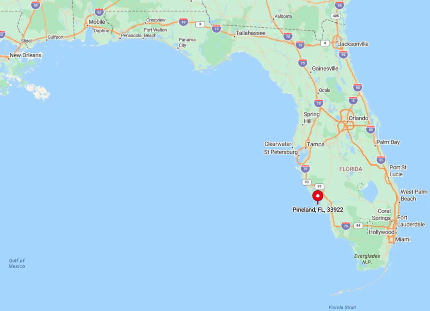
Pineland sits five miles north of the Matlacha Pass bridge on the western shore of Pine Island. Reaching it requires the same two-bridge approach as Bokeelia, then a westward jog down Pine Island Road.
Because no through-route connects to the mainland, only destination traffic arrives. Boats can tie up at the tiny Pineland Marina, which is hemmed in by oyster bars that naturally slow speed.
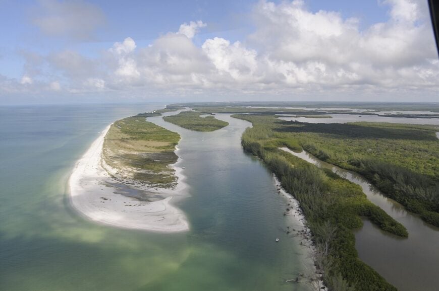
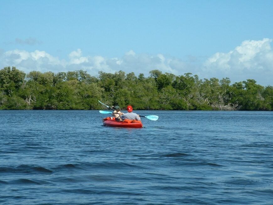
5. Cayo Costa Island, Gulf Shore Wilderness
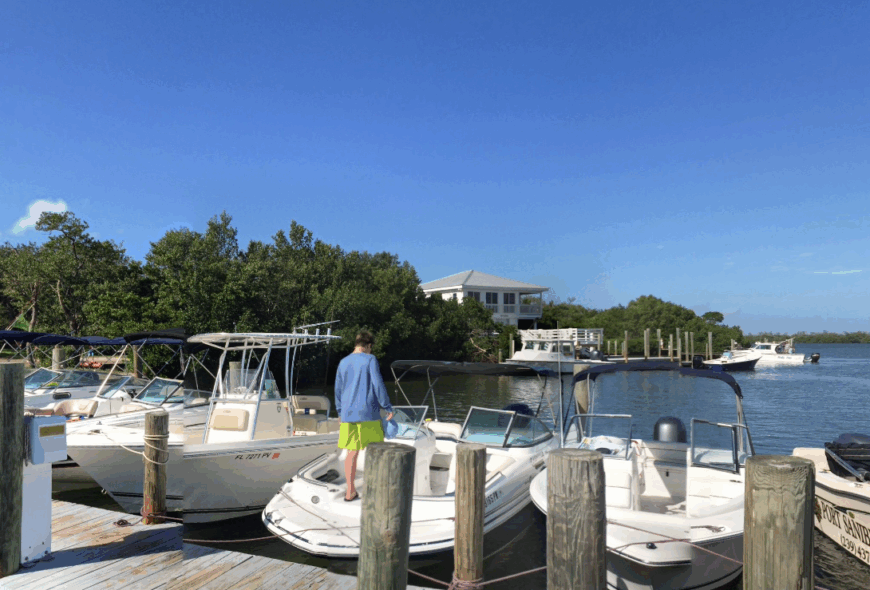
No one resides here full time, though a rotating staff of park rangers oversees rustic cabins and campsites along nine miles of undeveloped beach. Day trippers snorkel the clear surf, hunt for lightning whelks, and bike sandy lanes under slash pines that have never heard a car engine.
The state park generates limited seasonal employment while protecting sea-turtle nests and gopher tortoise burrows. With zero commercial buildings and no electricity beyond solar panels at the ranger station, the island retains a raw gulf-front character.
Distance from the mainland and a cap on daily ferry visitors keep crowds low even on holiday weekends. Nightfall brings a surf soundtrack uninterrupted by anything mechanical.
Where is Cayo Costa Island?
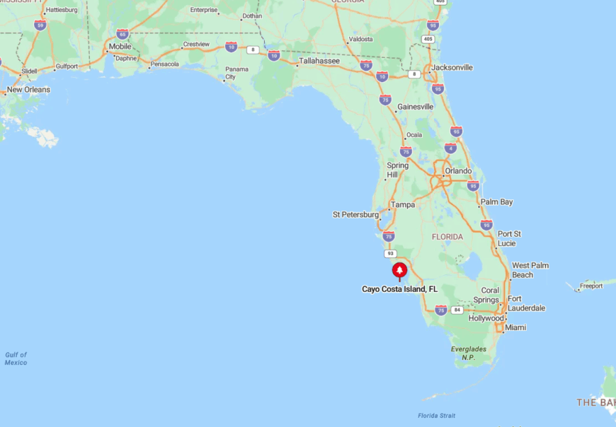
The island rests north of Captiva and west of Pine Island, shielded by Boca Grande Pass. Access comes only by private boat or the permitted ferry from Bokeelia and Punta Gorda.
Shallow flats and shifting sandbars funnel traffic through a single marked channel, limiting spontaneous visits. Once ashore, transportation is by foot or bike, sealing in the off-grid experience.
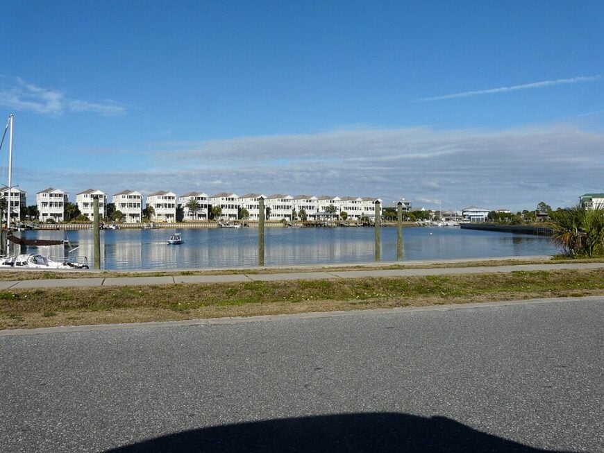
4. Boca Grande, Gasparilla Island’s Quiet North End
Just over 1,700 residents share this village of pastel cottages trimmed with gingerbread fretwork and framed by hibiscus hedges.
Mornings begin with bicycles on Banyan Street, afternoons shift to tarpon fishing in Boca Grande Pass, and evenings often gather at the 1890s Port Boca Grande Lighthouse museum for a sky streaked in coral hues.
Real estate, boutique retail, and guide services support a small-town economy that still pauses for a midday lemonade at the Loose Caboose café. Cars take a back seat to golf carts, which hum along coral-rock lanes barely two vehicles wide.
The island’s toll causeway and steep day-parking fees tamp down casual traffic, especially to the quieter north tip. Lack of chain hotels ensures nights settle into porch-swing silence.
Where is Boca Grande?
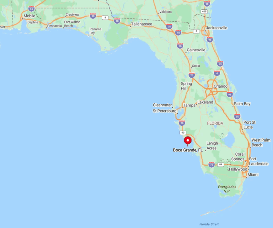
Situated on Gasparilla Island in Charlotte County, Boca Grande lies about forty miles northwest of Fort Myers. Visitors reach it via the Charlotte Harbor Causeway off Placida, crossing a bascule bridge that collects a hefty toll.
Once on island, a single north-south road leads to the historic village, narrowing further beyond it. Those arriving by water often dock at Whidden’s Marina, a century-old fish house where tarpon scales still hang on the wall.
3. Little Gasparilla Island, No-Bridge Sanctuary

A scattered community of roughly 500 part-time residents occupies this seven-mile barrier island, living among sea-grape tunnels and boardwalks elevated above the dunes. Days revolve around hunting sharks’ teeth, casting for pompano, and reading on porches where the loudest sound is palm fronds rustling.
Home rentals and a small maintenance trade form the bulk of economic activity, with groceries ferried in coolers from the mainland. Since no roads exist, residents rely on electric carts or bare feet, instantly lowering the human footprint.
The absence of a vehicular bridge insulates the island from casual tourism and preserves miles of shell-strewn shoreline for nesting turtles. Even during peak season, one can stroll a quarter-mile without seeing another person.
Where is Little Gasparilla Island?
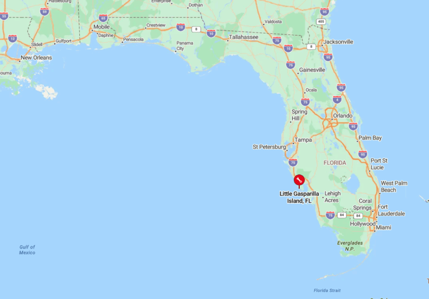
The island sits south of Gasparilla and north of Don Pedro Island in Charlotte County. Water taxis depart from Eldred’s Marina in Placida, a ten-minute ride across the Intracoastal Waterway.
Shifting passes and shallow grass flats discourage larger boats, adding another layer of seclusion. Once ashore, boardwalks weave between homes and dunes, eliminating any need for pavement.
2. Placida, Old Florida Fishing Outpost
Placida itself counts about 800 year-round inhabitants clustered near a weathered railroad trestle and rows of pastel bait shacks. Anglers wade broad tidal flats for redfish, cyclists pick up the paved Cape Haze Trail, and art lovers browse weekend markets under tin-roof pavilions.
The economy revolves around commercial mullet netters, crab-trap yards, and charter captains who ferry clients to Boca Grande Pass. Placida’s shoreline remains largely undeveloped, with only a handful of low-rise buildings peeking above mangroves.
Being tucked against the sound with water on three sides leaves little room for expansion, and a maze of inlets deters through-traffic. This geography lets pelicans glide over pilings with only the faint clatter of fish boxes to break the quiet.
Where is Placida?
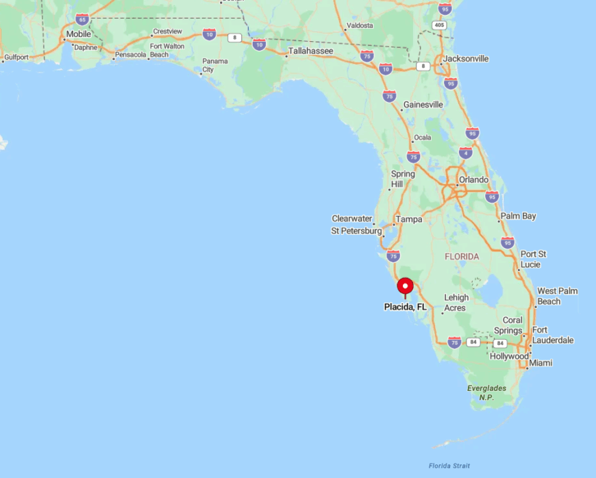
Placida occupies a hook-shaped bend on Charlotte Harbor, twenty miles northwest of Port Charlotte. State Road 771 ends at the harbor, so drivers coming from Interstate 75 soon leave four-lane comfort for two-lane oak tunnels.
Boats navigate marked channels between shallow bars dotted with crab pots, an approach that rewards slow speed. The lack of a direct coastal highway keeps Placida off most GPS-powered itineraries.
1. Shell Point, Pine Island Sound’s Hidden Bend
Around 350 people live on these one-acre waterfront lots shaded by towering royal palms and gumbo-limbo trees. Residents launch kayaks from grassy banks, cast for spotted sea trout at first light, and share potluck dinners at the single neighborhood pavilion.
Aside from a tiny landscaping outfit and a family-run oyster farm, there is virtually no commercial enterprise, leaving wildlife calls to fill the soundscape. Shell Point’s winding lanes dead-end at mangrove creeks, so passing cars are practically nonexistent.
Dense vegetation and a lack of streetlights create natural privacy screens between homes, enhancing the feeling of being tucked away. Even cellphone service softens here, reinforcing its reputation as the quietest bend in Pine Island Sound.
Where is Shell Point?
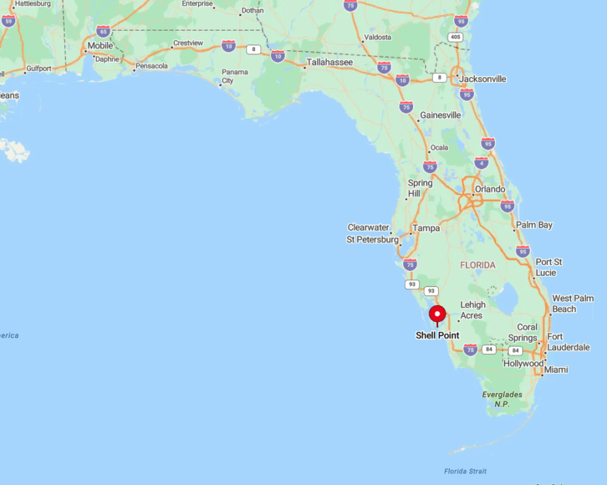
Located on the eastern shore of Pine Island Sound, Shell Point hides at the end of Stringfellow Road south of Bokeelia. The final mile narrows to a canopied lane with water on both sides, discouraging casual exploration.
Boaters thread Buzzard Bay Channel to reach the small community dock, a route too skinny for most cruisers. With no public beach, store, or signage, Shell Point remains a place discovered only by those who already know it exists.