Michigan’s eastern shoreline curls along Lake Huron and Saginaw Bay with pockets of quiet sand, pine woods, and weathered harbor lights that many travelers never notice while racing up US-23 or M-25.
Those who do pull off the highway discover hamlets where freighter horns replace traffic and starfields outshine street lamps. Our guide explores 25 of those places, each holding fewer residents than a city block yet offering photo-worthy scenery, heritage sites, and a pace slow enough to reset any hurried schedule.
From 1800s quarries now claimed by beach grass to twin lighthouses standing watch in hardwood forests, these spots prove that Michigan’s coast still keeps secrets.
We counted down the settlements that feel most removed from modern noise while remaining reachable by shoreline road. Pack a picnic, a camera, and maybe a fishing rod, then let Lake Huron’s quieter side do the talking.
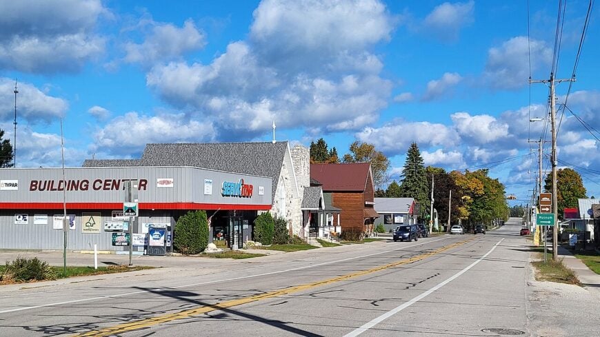
25. Harsens Island – Ferry-Only Delta Quietude
Slip across the St. Clair River delta by car ferry and the noise of the mainland drops away almost immediately. Marsh channels braid through the island, where herons lift off at the sound of your tires and cottages hunker behind reed beds.
There are no bridges and no through-routes—just looping lanes, a small store or two, and miles of shoreline where the loudest thing you’ll hear is wind over cattails. Kayakers trace the flats at first light, anglers idle out to the channels, and beachcombers collect drift-polished glass.
A handful of marinas and seasonal services support the slower rhythm here, with most activity keyed to the water. It feels like a place that prefers whispers over announcements, the kind of spot where the ferry ride itself becomes a velvet rope. It’s the kind of place that reminds you how quiet the world can be.
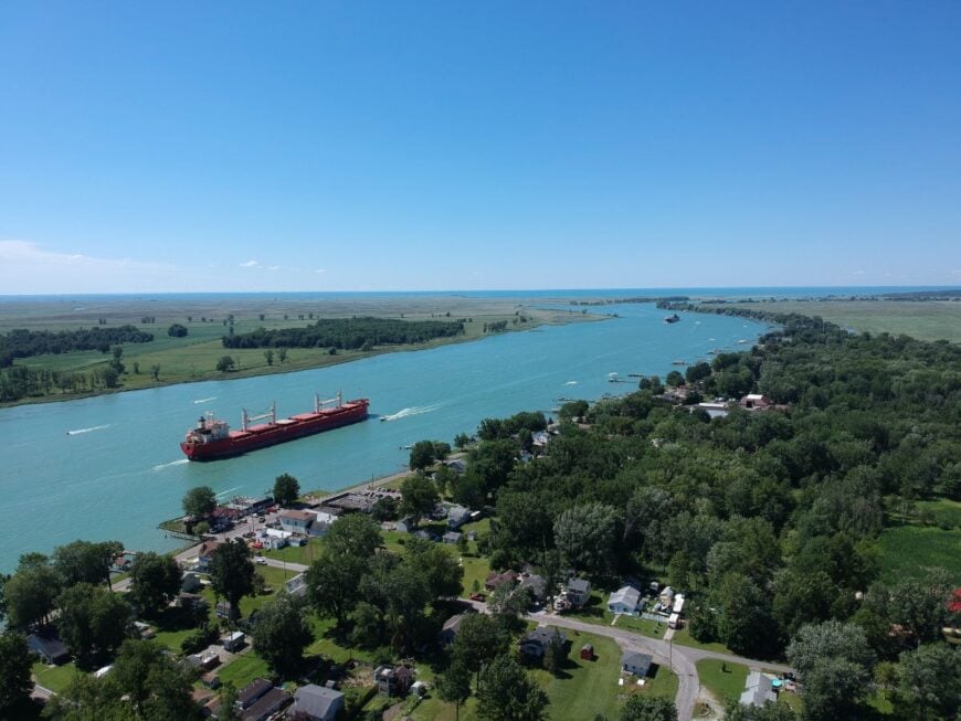
Where is Harsens Island?
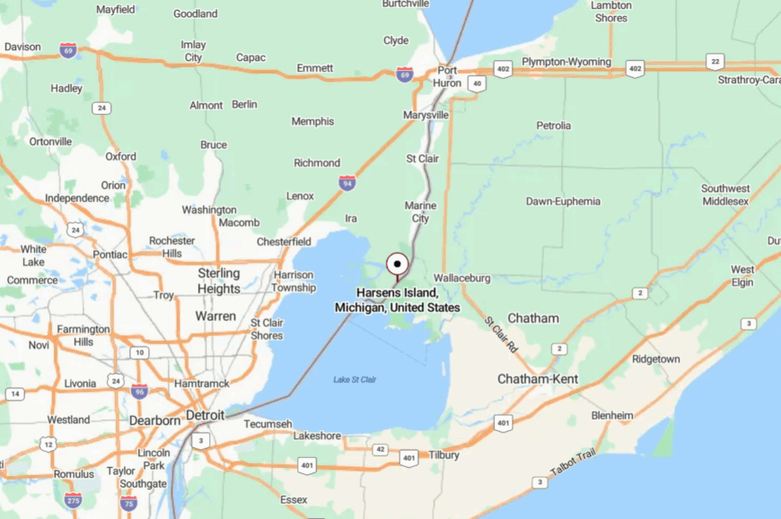
At the far southeast edge of Michigan, Harsens Island sits in the St. Clair River delta opposite Algonac. You reach it only by Champion’s Auto Ferry, a five-to-ten-minute crossing that shaves away urgency with each churn of the prop.
Most exploring happens along a web of two-lane island roads and backwaters best seen by bike or boat. Close enough for a day trip, but ferry-only enough to feel like you slipped off the map.
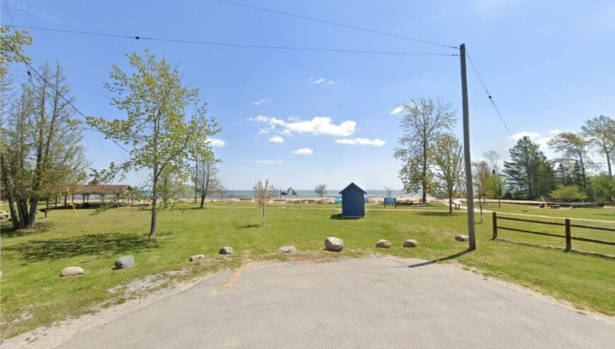
24. Forestville – Tiny Harbor Hamlet Hidden by Dunes
Forestville is the sort of village you can miss if you blink, then turn around because the lake smell pulls you back. A handful of streets gather near a small launch on Lake Huron; there’s no flashy marina, just a ramp, a pier, and long views over blue water.
Summer brings fishermen trailering skiffs and families skipping stones; in shoulder seasons, you might have the shore to yourself. With under a hundred residents, evenings come soft and early—just gulls and the swish of waves under a pale sky.
Work here is modest—farming nearby, a few seasonal rentals, and lake-tied odds and ends. The absence of neon or bustle is the point; Forestville wears quiet like a sweater. You come to exhale and remember how good plain water and sky can be.
Where is Forestville?
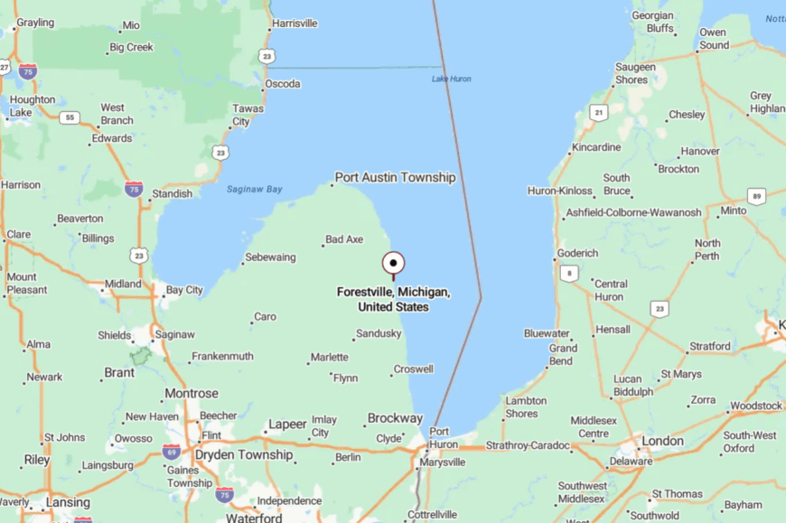
This least-populous Michigan village sits on Lake Huron in Sanilac County, a short hop north of Port Sanilac on M-25. It’s reached by a small spur road that dead-ends at the launch, keeping drive-through traffic to near zero.
Harbor Beach’s amenities are close enough for supplies, but the waterfront here stays unruffled. It’s close enough to reach, far enough to feel like your own shoreline.
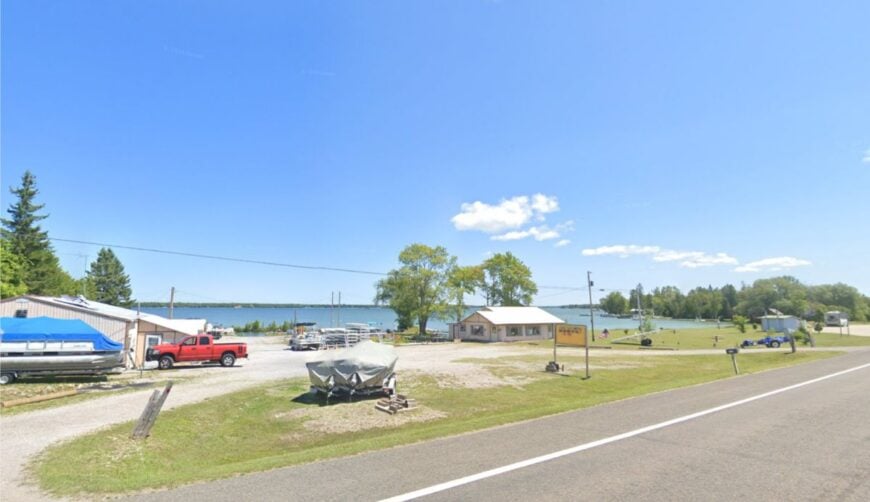
23. Black River (Alcona County) – River Mouth Cottages and Empty Shore
Where the Black River meets Lake Huron, a scatter of cottages, a township park, and a quiet harbor create a pocket of solitude. Paddlers slide out of the protected river mouth toward the wild beaches of Negwegon State Park; anglers work the channel; kids dig in sugar sand.
The roads end in water and woods, not commerce, and the night is inked with stars. A few rentals, some charter guides, and township maintenance are the main “industries,” the rest is lake-time.
Waves slap the breakwall in a steady metronome, and gulls stitch slow circles over the mouth. You can still hear your own footsteps on the dock boards at dusk. It’s the kind of place that resets your pulse to lake speed.
Where is Black River?
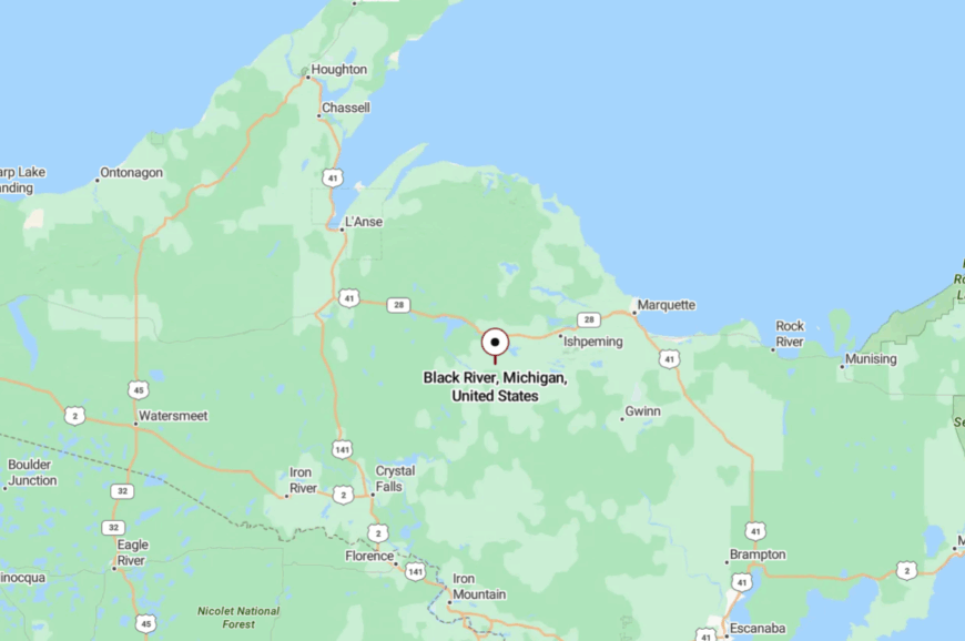
Black River sits in Alcona County between Harrisville and Ossineke along US-23, with a short paved spur leading to the launch. The park is at the river’s mouth, opening directly to Lake Huron.
Getting here is easy to navigate but not obvious, which helps keep crowds thin. The final turn reveals a horizon of water and the feeling you’ve arrived at the end of the road.
22. Ossineke – Piney Bluffs and Retro Dinosaurs by the Lake
Ossineke is a lake town with a forest soul—white pines on the bluffs, shorebirds along the flats, and a beloved throwback roadside park full of dinosaur sculptures tucked under the trees. In summer, locals wander the beach at sunrise and swing by the dinosaur gardens for a kid-in-all-of-us amble.
The vibe is warmly nostalgic and quietly outdoorsy—fishing piers, birding, sandy picnics, and evening campfires. Economy here is small-scale—cabins, cafes, and seasonal attractions—leaving noise and hurry to larger neighbors. You’ll hear the lake before you see it, and often have a stretch of strand to yourself.
The town’s edges blend into woods and water in a way that erases hard lines. It’s a place that nudges you to slow down and look twice.
Where is Ossineke?
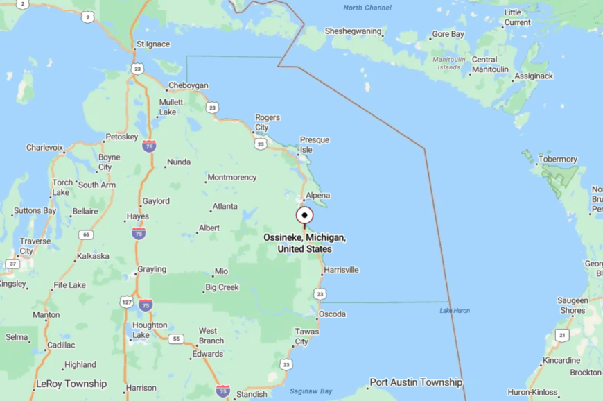
Ossineke sits on US-23 about 12 miles south of Alpena on Lake Huron’s northeast shore. A couple of gentle turns pull you from the highway toward small parks and bluff overlooks.
Many visitors pair a beach stop with a stroll through Dinosaur Gardens a few minutes inland. It’s easy to reach, but the pines muffle everything but wind and waves.
21. Grand Lake (Presque Isle) – Rock Ledges Between Twin Lights
Set between the famed Old and New Presque Isle Lighthouses, Grand Lake feels like a secret inland sea rimmed with rocky ledges and maple shade. Loons yodel at dusk, and flat-water mornings invite a first paddle before coffee cools.
The shoreline is lightly developed—mostly cottages and a few rentals—so you rarely see more than a handful of boats. A small marina, local service jobs, and seasonal tourism keep things humming at a whisper.
Trails slip to hidden shelves of stone and pocket beaches that look borrowed from the Northwoods. If you want bustle, Alpena is down the road; if you want silence, it’s at the end of your dock. This is where the calendar loosens its grip.
Where is Grand Lake?
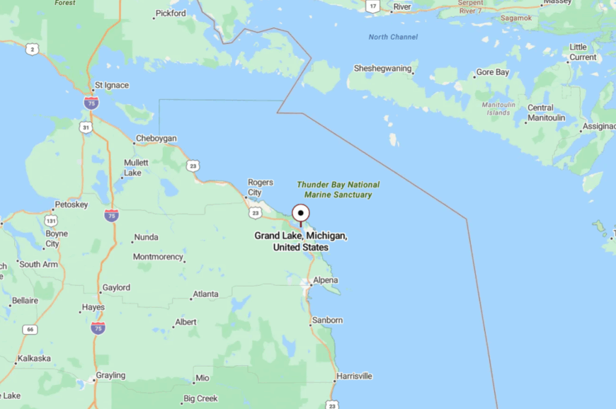
Grand Lake lies on the Presque Isle peninsula about 16 miles north of Alpena, a short detour east of US-23. Most visitors turn onto County Road 638 and follow signs toward the lighthouse parks, then spur inland to the lake.
The twin lighthouses sit minutes away, yet the forested lanes keep the lake pocketed from traffic. Close to icons, yet tucked away enough to feel private.
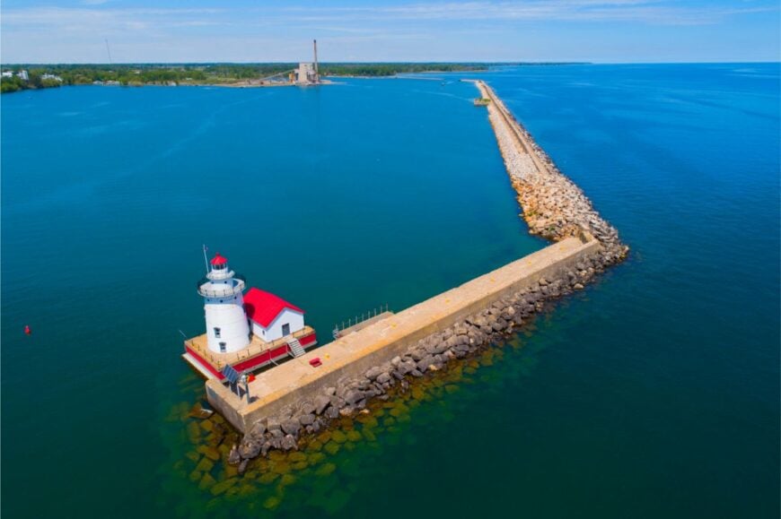
20. Port Austin – Thumb’s End-of-the-Road Harbor Town
At the very tip of Michigan’s Thumb, Port Austin feels like the end of the map, where Lake Huron stretches wide and the horizon swallows the sun. Known for Turnip Rock, a wave-sculpted formation reached only by kayak, the area is dotted with coves, cliffs, and quiet beaches.
The town itself is modest—a harbor, a farmers’ market, and a handful of galleries that open with the season. Locals mix fishing, small shops, and summer tourism to keep things humming, but the pace is never rushed.
At dawn, the harbor is a hush of gull calls and sailboat halyards; by night, starlight falls over the pier. With miles of undeveloped shoreline east and west, it’s a place that feels both tucked away and welcoming. It’s where the road’s end becomes the lake’s beginning.
Where is Port Austin?
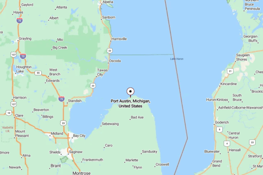
Port Austin sits at the very tip of Michigan’s Thumb, about 35 miles northeast of Bad Axe via M-53 and M-25. The drive narrows to two-lane roads winding through farms before the land gives way to open water.
You reach it by following M-25 until there’s nowhere further to go but into the harbor. It’s easy enough to find, yet far enough to feel like you’ve left the mainland behind.
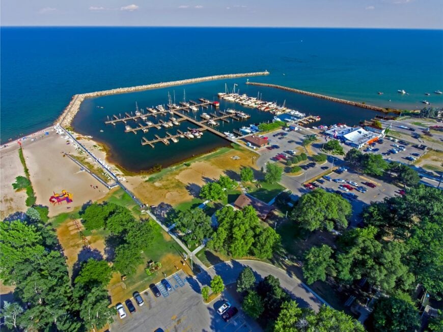
19. Harbor Beach – Historic Port on a Sheltered Bay
🔥 Would you like to save this?
Harbor Beach holds the title of the world’s largest freshwater man-made harbor, but its atmosphere is anything but busy. Fishing boats and sailboats share the deepwater marina, while families wander sandy stretches shaded by dune grass.
The town itself is small and neighborly, with a lighthouse museum, old brick storefronts, and a single-screen theater that still flickers to life on summer nights. Industry here leans on farming and fishing, with a quiet tourism thread that grows in July.
Even then, the town’s broad beaches rarely feel crowded, thanks to the wide breakwall that frames them. Evening walks to the pier end in lighthouse silhouettes against the pink Huron sky. Harbor Beach is proof that a great harbor can also be a quiet refuge.
Where is Harbor Beach?
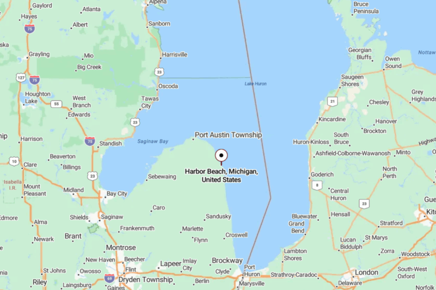
Located on Michigan’s eastern Thumb coast, Harbor Beach lies about 20 miles north of Port Hope along M-25. Travelers approach through open farmland before the lake suddenly widens into a sheltered bay.
The drive ends at the marina and lighthouse, with most activity clustered around the waterfront. It’s a straightforward route, yet the sense of enclosure by the breakwall makes the town feel like its own world.
18. Lexington – Lakeside Charm with a Small-Town Heart
Lexington feels like a pocket of New England on Lake Huron, with a snug harbor, clapboard shops, and shady streets lined with century-old homes. The marina bustles lightly with summer boaters, while the downtown serves up ice cream cones, antiques, and local music.
Festivals and outdoor concerts bring neighbors together, but stroll a block toward the lake and quiet returns instantly. The town thrives on a blend of tourism, marinas, and small dining spots, with fishing and farming still nearby.
Its beaches are modest but intimate, tucked between stone piers and bluffs. The atmosphere is cheerful yet unhurried, the kind of place where locals wave from porches. Lexington invites you to linger longer than planned.
Where is Lexington?
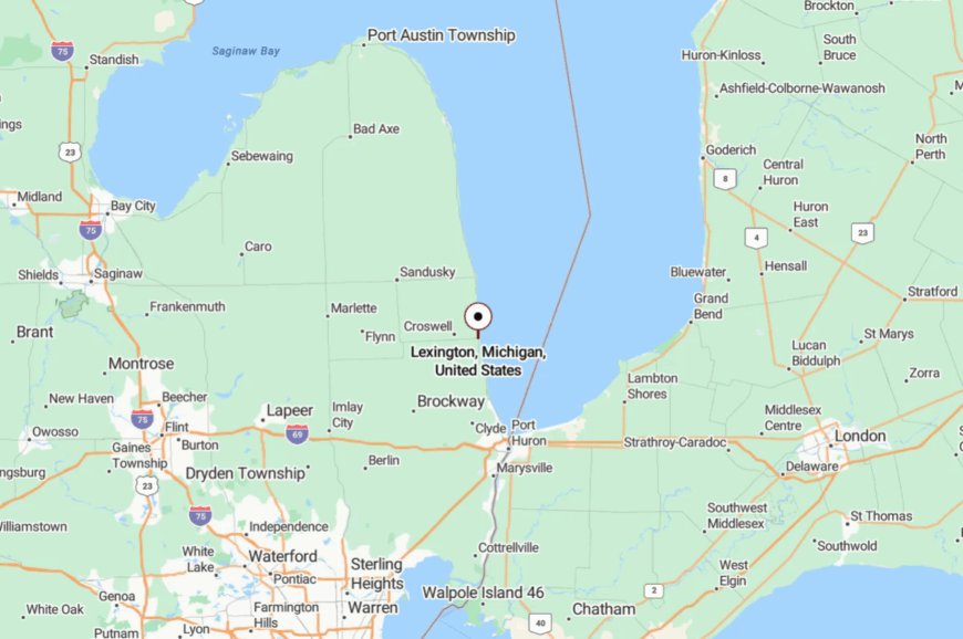
You’ll find Lexington in Sanilac County, about 12 miles north of Port Huron along M-25. The town sits directly on Lake Huron’s shore, with its marina and pier forming the heart of the village.
Access is simple, a straight shot up the shoreline highway, yet it feels distinctly apart from urban sprawl. It’s close enough for a day trip but far enough to feel like stepping into another pace of life.
17. Caseville – Perch Capital with Wide Sandy Bay
Caseville curves around Saginaw Bay with wide sandy beaches and a reputation as Michigan’s “Perch Capital.” Known for its quirky annual Cheeseburger Festival, the rest of the year it feels like a sleepy fishing town with one of the Thumb’s best stretches of public sand.
Charter boats head out daily for walleye and perch, while families wander the boardwalk or grill fresh catch at the park. The economy hums on fishing, tourism, and summer cottages, with winter settling into a hush.
Sunset here is wide-screen, spreading pink and gold across the bay. Even during festival week, step a few blocks away and you’ll find only gulls and the soft shush of waves. It’s equal parts playful and peaceful, a rare balance.
Where is Caseville?
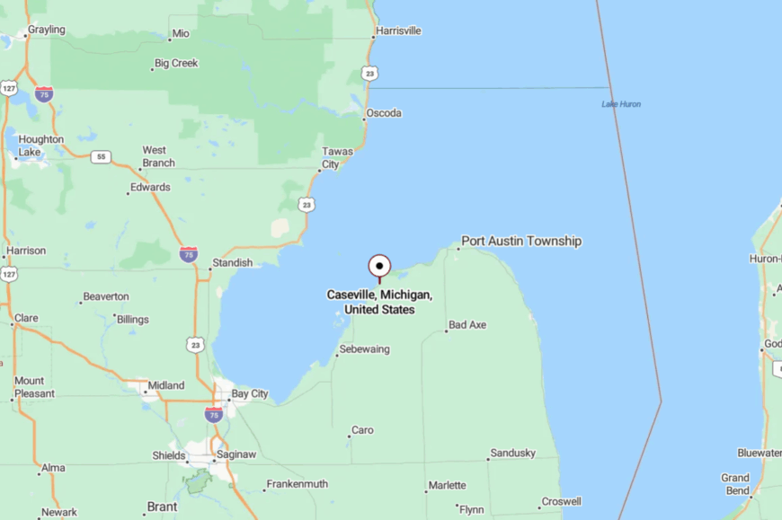
Caseville sits on the northwest edge of Michigan’s Thumb, about 20 miles west of Port Austin along M-25. The approach is a shoreline highway that winds through farm country before suddenly revealing miles of sand and open water.
The town is compact and easy to navigate, with its beaches and harbor at the center. Close enough for a weekend, yet wide enough to feel like summer lasts longer here.
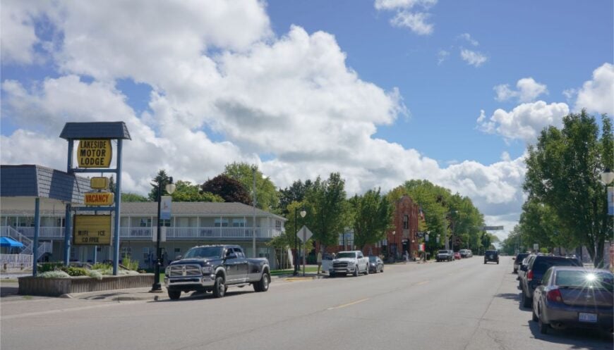
16. Cheboygan – River Gateway to the Open Lake
Cheboygan sits at the mouth of the Cheboygan River, where it empties into the Straits of Mackinac and Lake Huron. The downtown is small but historic, with old brick blocks, a lighthouse guarding the river mouth, and a waterfront park where music drifts on summer nights.
The ferry to Bois Blanc Island leaves from here, adding to the sense of being on the edge of open water. Industry blends tourism, boating, and small manufacturing, with fishing and forestland nearby.
The town feels like a gateway, but not a crowded one—freighters pass offshore, and quiet backwaters invite paddling within minutes of downtown. On clear days, you can see lighthouses winking across the straits. Cheboygan whispers of both frontier and hometown.
Where is Cheboygan?
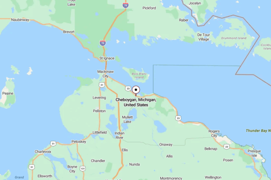
Cheboygan lies in far northeastern Michigan, about 15 miles east of I-75 at Mackinaw City via US-23. The town sits where the Cheboygan River meets Lake Huron, making water central to its identity.
Arriving means following river bends until they widen into open straits. It’s a journey that ends with both history and horizon unfolding at once.
15. Au Gres – Harbor Town Facing the Islands
Au Gres looks outward, toward the islands that punctuate Saginaw Bay and the slow curve of the sunrise coast. The Harbor of Refuge is more neighborhood marina than tourist machine, and evenings end with dock lines creaking softly.
Day-trippers book boat rides to the historic Charity Island Lighthouse or cast for walleye where the river meets the bay. The main economy blends small lodging, marinas, and charter boats, plus a few cafes that know your name by day two.
Streets are quiet after dark; the lake does most of the talking. It’s the sort of place where a map of shoals doubles as art on the wall. Come for the crossing; stay because you didn’t realize how much you needed calm.
Where is Au Gres?
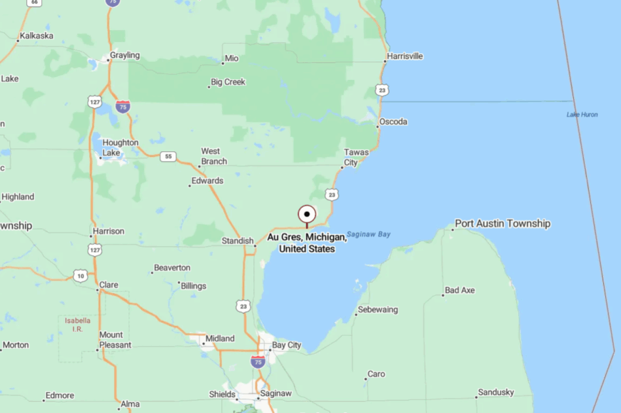
Au Gres sits along US-23 in Arenac County, about 20 miles southeast of Tawas City at the mouth of the Au Gres River. The harbor is downtown, steps from ice cream and the bait shop.
Trips to Big Charity Island depart nearby when weather allows, adding to the “edge-of-the-bay” feel. It’s easy to reach but oriented toward open water, which keeps it unhurried.
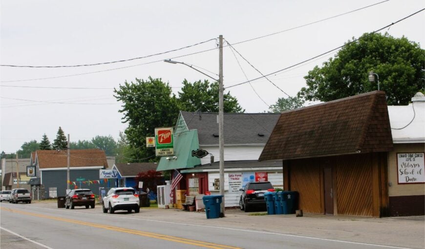
14. Omer – Michigan’s Smallest City with a River Heart
Omer wears its title lightly: the smallest city in Michigan, where the Rifle River loops close enough to scent the water. Anglers fan out at dawn, paddlers thread under low bridges, and locals linger at the seasonal market for conversation as much as produce.
There’s no rush here—just tidy streets, a few small businesses, and the easy rhythm of a river town. History runs deep for such a tiny place, and the community calendar is homespun rather than hyped.
Many residents commute or farm, with river recreation rounding out the economy. Evening comes with crickets and porch light halos. It’s small in size, big in peace.
Where is Omer?
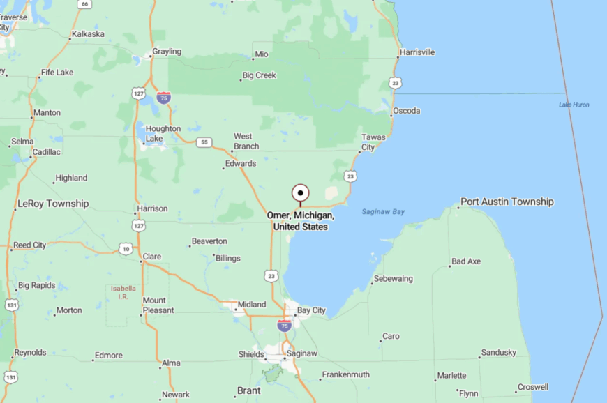
You’ll find Omer just off US-23 in Arenac County, about 20 miles south of Tawas City and a short hop from the Rifle River Recreation Area. Access is simple; the feeling is removed.
Backroads lead quickly to quiet put-ins and sandy bends. It’s the kind of place where directions come with landmarks, not stoplights.
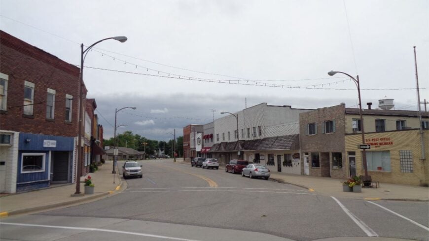
13. Linwood – Marsh Edge on Saginaw Bay
🔥 Would you like to save this?
Linwood sits beside wild country—thousands of acres of cattails and open water at Nayanquing Point State Wildlife Area. Dawn brings clouds of ducks lifting like smoke and the soft hiss of the marsh; evenings bring silhouettes of cranes and the chop of a bay breeze.
Services are practical—bait, fuel, a few taverns—and everything else is wind, water, and sky. Locals fish, guide, and work in nearby Bay City; weekends belong to marsh watchers and small-boat anglers.
The lack of beachy hoopla keeps it blissfully under the radar. If your favorite color is “wetlands at dusk,” you’ll feel at home.
Where is Linwood?
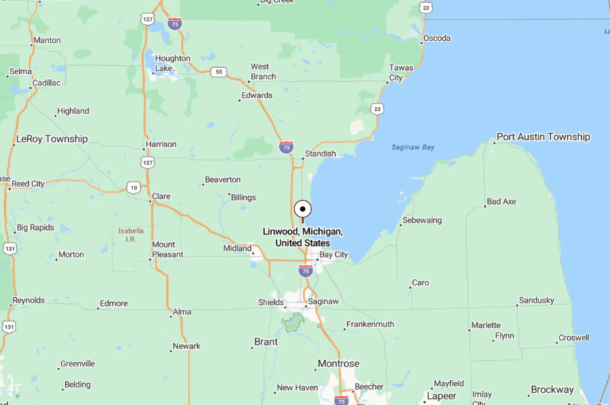
On the west side of Saginaw Bay in Bay County, Linwood is just east of I-75 and north of Bay City. You reach the marsh on township roads that fade from neighborhoods to cattails in minutes.
Nayanquing Point sits only a few miles away but feels like a world apart. Close to the interstate, but the last mile belongs to birds.
12. Sebewaing – Sugar-Beet Village with Quiet Backwaters
Sebewaing curls around a protected harbor and canal that slide into Saginaw Bay, a working waterfront where fishing boats and kayaks share the same lanes. The village’s heart beats with the sugar beet campaign and a summertime festival that’s more neighborly than noisy.
Off the main drag, you’ll find cattail coves, side channels, and a harbor walk where sunsets paint factory stacks and sail masts equally warm. People here work hard—farming, the Michigan Sugar plant, marina labor—and relax harder by the water.
It smells like lake wind and roasted beets in season, a strangely comforting mix. Even in July, you can find a bench to yourself. If you like your scenery honest and unvarnished, Sebewaing sticks with you.
Where is Sebewaing?
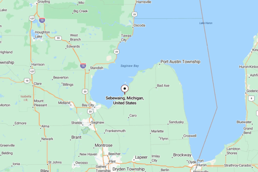
Sebewaing sits on the Thumb’s inner shore along Saginaw Bay, about 20 miles northeast of Bay City via M-25/Unionville Road. The harbor and canals are right in town, sheltered from open-bay chop.
Access is simple, yet the low, marshy horizon stretches the town thin in the best way. It’s a quick drive that ends in slow water.
11. Rogers City – Limestone Cliffs and Quiet Harbor
Rogers City sits proudly on Lake Huron’s northern shore, a working port town softened by quiet parks and wide-water views. Known as the “Nautical City,” it’s tied to the great limestone quarry nearby, but its harbor and lighthouse trails feel worlds removed from industry.
Families wander Lakeside Park, where sandy shoreline and playgrounds run right up to the lake, while history buffs tour the Calcite quarry overlook or the Great Lakes Lore Maritime Museum. Summer brings light festivals and small parades, but evenings quickly return to a hush of gulls and ship horns.
The main street is tidy, with diners, antique shops, and a theater marquee glowing like a time capsule. Rogers City feels anchored, steady, and welcoming without being busy. It’s a place where the lake feels both immense and intimate.
Where is Rogers City?
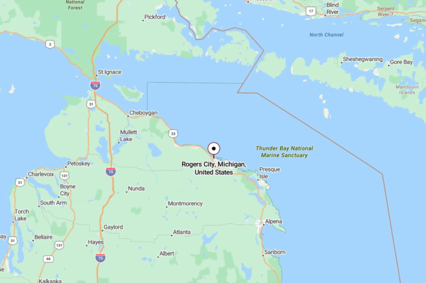
Rogers City lies along US-23 on Lake Huron’s Sunrise Coast, about 40 miles north of Alpena. The highway hugs the shore, offering long blue glimpses before you roll into town.
Harbor docks, quarry overlooks, and lighthouse trails are just minutes apart once you arrive. The town is easy to reach, but the endless horizon makes it feel far away from everything else.
10. Pointe Aux Barques – Lighthouse Lookouts at the Tip of the Thumb
Year-round residents hover around 15, making Pointe Aux Barques one of Michigan’s smallest townships. Day visitors tour the 1848 Pointe Aux Barques Lighthouse Museum, cycle the lightly traveled loop roads that skirt 30-foot limestone cliffs, and watch raptors ride the updrafts over Lake Huron.
Seasonal cottages and a single township park account for most employment, supplemented by charter-boat captains who work the nearby reef. Local traffic rarely rises above a handful of cars per hour, and night skies remain pitch black because there are no stores, gas stations, or neon signs within miles.
Empty shoreline roads and miles of state forest create an “edge of the map” feeling that keeps crowds away even in July. The constant lake breeze whispering through old cedars is often the loudest sound.
Where is Pointe Aux Barques?
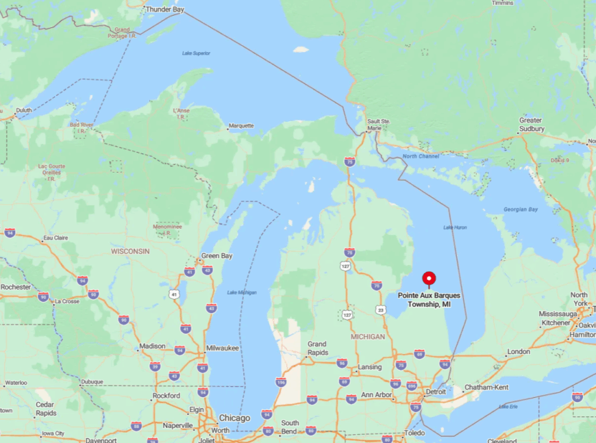
The cape sits at Michigan’s Thumb tip, 17 miles northeast of Port Austin along M-25. Surrounded on three sides by open water, it feels more island than peninsula, with only one paved road connecting it to the rest of Huron County.
Travelers reach it by following M-25 past farm fields until cell signals fade and the lighthouse rises above the trees. Lack of nearby lodging and the long drive from any interstate help preserve its solitude.
9. Grindstone City – Lost Quarry Village Turned Quiet Beach Hideaway
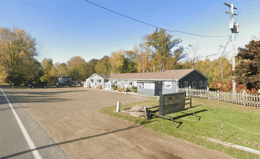
Roughly 150 people live among the abandoned stone cutting sheds and weathered company houses of Grindstone City.
Visitors wander sandstone beaches dotted with old grindstone blanks, photograph the ivy-cloaked boiler house, and grab a hand-scooped cone at the century-old general store known locally for its cherry vanilla.
A handful of charter anglers and an artisanal stone-carving studio carry on the quarry tradition, but tourism is the modest economic engine today. Massive sandstone blocks, the ghostly ruins, and a lack of modern development give the area a movie-set atmosphere that photographers cherish.
Even in peak season parking remains easy because the shoreline park is hidden behind pine rows and unmarked on many GPS maps. Sunset light on the red sandstone cliffs seals the sense of traveling back in time.
Where is Grindstone City?
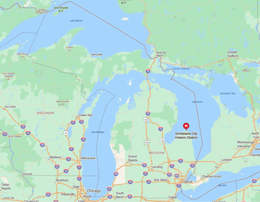
🔥 Would you like to save this?
The village rests on Lake Huron’s Thumb coast, eight miles east of Port Austin via Grindstone Road. Hemmed in by farm fields to the west and unbroken lake horizon to the east, it escapes drive-through traffic.
Arrival requires a deliberate turn off M-25 which filters out casual tourists. The absence of chain businesses and spotty cell service amplify its out-of-the-way vibe.
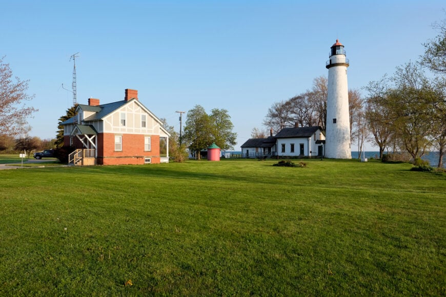
8. Port Hope – Historic Harbor with Endless Horizons
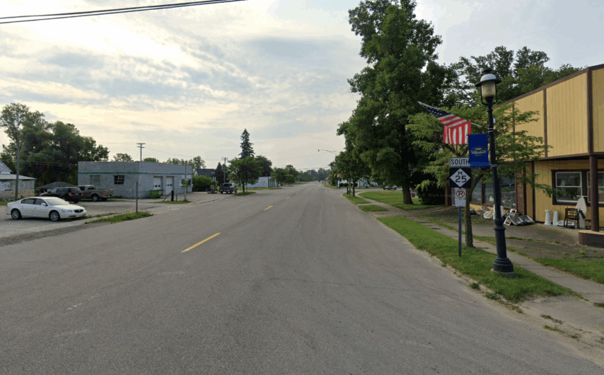
Port Hope claims about 250 full-time residents clustered around a postcard harbor built in the 1850s. Anglers cast for lake trout from the vintage pier, history buffs tour the 1878 lighthouse keeper’s dwelling, and walkers follow the shoreline Heritage Trail to a restored 1926 rail depot.
Farming and small-scale marina services provide most local income, with a single family grocery doubling as community hub. One-acre lots and undeveloped bluffs mean neighboring roofs rarely intrude on lake views, reinforcing the spacious feel.
The harbor light often glows alone at dusk with no competing shoreline glow for miles. Even during summer festivals, one can find an empty stretch of sand within a five-minute stroll.
Where is Port Hope?
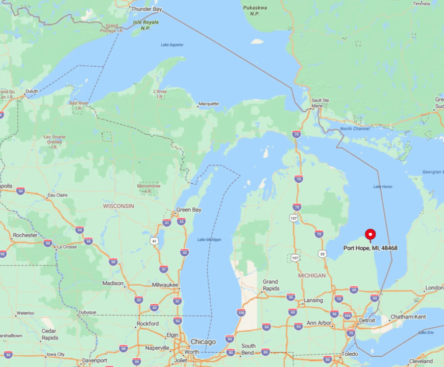
The village sits 14 miles southeast of Harbor Beach along M-25 on the Thumb’s eastern rim. A protective reef fronting Lake Huron shelters the harbor, but the same reef discourages large-craft tourism, leaving the waterfront peaceful.
Most visitors arrive by scenic highway rather than freeway, a two-hour drive from the nearest interstate ramp. That journey through open farmland contributes to the sense of arriving somewhere removed from modern bustle.
7. Forester – Shipwreck Shores Beneath Whispering Pines
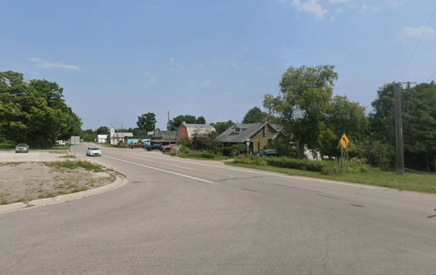
About 75 residents share this unincorporated Sanilac County settlement tucked between dense state forest and Lake Huron.
Beachcombers hunt for wave-tumbled copper nails from 19th-century schooners wrecked just offshore, campers pitch tents under red pines at Sanilac County Park No. 2, and ghost-story fans visit the small cemetery where marble stones date to 1859.
Forestry work and a rustic campground office supply the limited employment, while a lone seasonal diner serves perch sandwiches to passing cyclists. Lack of streetlights, commercial strip, or even a gas pump keeps nights silent enough to hear owls calling from the dunes.
The blend of forest scent and open-water breeze produces a calming backdrop few populated beaches can match. Shipwreck silhouettes visible on clear days remind visitors how isolated these waters once were and still feel.
Where is Forester?
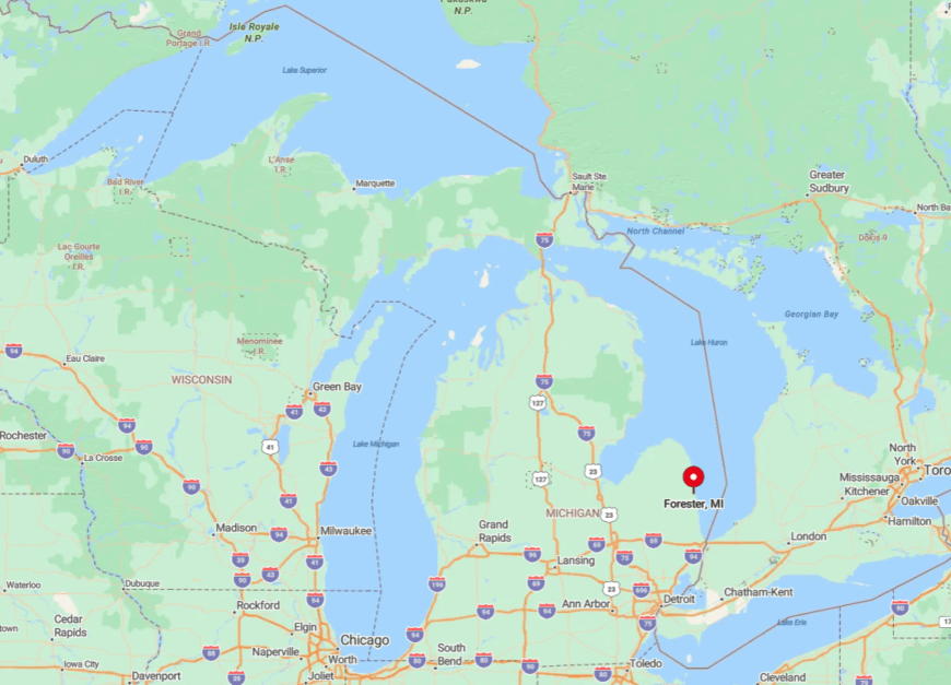
Forester lies 11 miles north of Port Sanilac on M-25, marked only by a brown county-park sign. Lake Huron borders the east and 4,000 acres of state land hug the west, preventing sprawl.
Reaching it involves a tree-lined drive without cell towers, so first-timers often overshoot the turn and double back. That slight navigation challenge, paired with limited amenities, keeps visitor numbers pleasantly low.
6. Bay Port – Saginaw Bay’s Quiet Fishing Hamlet
Bay Port hosts roughly 450 people who wake to gull cries over calm Saginaw Bay rather than traffic hum. Travelers browse the century-old Bay Port Fish Company shanties, kayak through surrounding cattail marshes, or watch purple martins swirl above the harbor at dusk.
Commercial fishing remains the cornerstone industry, supplemented by small farms on the township outskirts and a weekend farmers market. Wide marshlands shield the village from development pressures that have reshaped other shoreline towns.
Long views across reed beds and gentle bay waves give the place a gentle hush even during summer fish fries. Photographers often find great blue herons posing undisturbed thanks to the light visitor load.
Where is Bay Port?
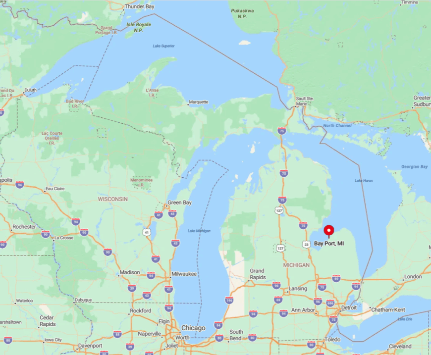
The hamlet sits on the eastern edge of Wild Fowl Bay, 18 miles southwest of Caseville via M-25 and Bay Port Road. Marsh on three sides and open water on the fourth make it feel like a peninsula within a peninsula.
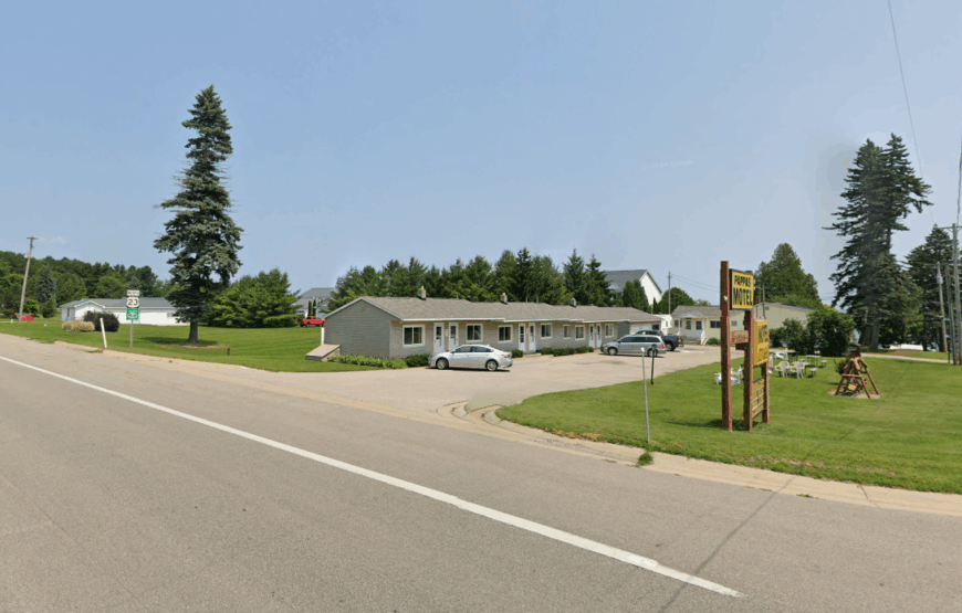
Drivers must leave the main highway for a winding spur that ends near the fish docks, so few stumble upon it by accident. The closest motel sits 12 miles away, reinforcing its tranquil character after sundown.
5. Huron City – Seasonal Ghost Town Among the Dunes
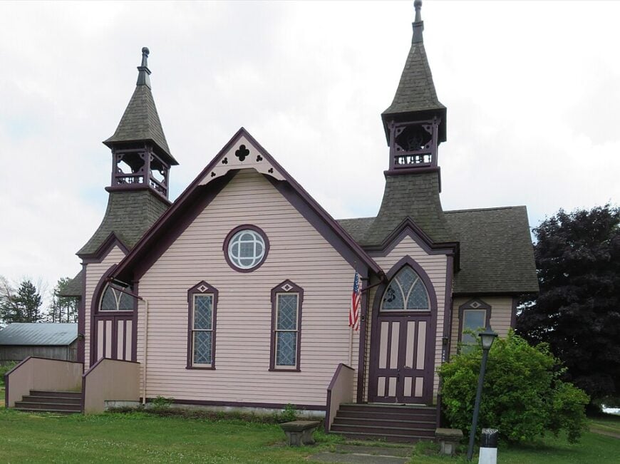
Fewer than 40 people reside year-round in Huron City, though summer docents briefly swell numbers while opening the seven preserved Victorian buildings.
Day guests tour the 1882 Pointe Aux Barques Lifesaving Station, picnic in the tree-lined village green, and climb dune overlooks where Lake Huron thunder is the only soundtrack.
Heritage tourism employs most locals for three warm months, leaving the settlement nearly empty the rest of the year. Boarded windows, leaf-strewn lanes, and unlit porches add a contemplative mood beloved by painters and writers seeking quiet retreat.
The nearest convenience store sits eight miles away, so evening walks happen under starlight rather than neon glow. Even on holiday weekends traffic rarely tops a dozen vehicles an hour.
Where is Huron City?
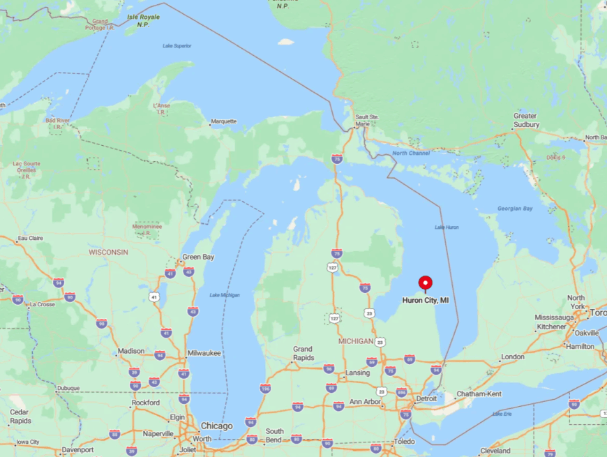
Huron City rests halfway between Port Hope and Pointe Aux Barques along Huron City Road, a spur off M-25 that dead-ends at undeveloped shoreline. Sand dunes to the east and state forest to the west discourage expansion.
Visitors follow wooden heritage signs off the highway, navigating gentle curves that block any glimpse of town until the final turn. With no through-road and limited cell coverage, it remains one of Lake Huron’s most convincing time capsules.
4. Greenbush – Pine-Framed Beaches Off US-23
Home to about 300 permanent residents, Greenbush offers cedar-scented hiking in Huron National Forest, sunrise beachcombing at Old Orchard Park, and late-night stargazing beside inland Lake Iosco. Small sawmills and seasonal cabin rentals supply modest employment, while a single tavern functions as social anchor.
Large wooded lots hide cottages from one another, letting travelers feel alone even when campfires glow a short walk away. The town lacks a central business strip, so squirrels outnumber pedestrians on most days.
Lake Huron’s steady roar mixes with wind in tall white pines for nature’s version of surround sound. Photographers treasure the spot where the Au Sable River Lighthouse lens is on occasional display at the local historical society, a fact few guidebooks mention.
Where is Greenbush?
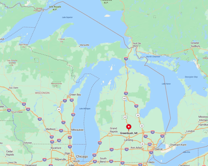
Greenbush lies on US-23 between Oscoda and Harrisville, yet dense forest screens it from the highway so drivers can pass without noticing the cluster of lakeside lanes. To the west stretches 400,000 acres of national forest, while to the east sits undeveloped Lake Huron shoreline, factors that have checked growth for decades.
Access comes by a single county road looping under railroad tracks to the beach park. Absence of a marina or publicized attractions keeps traffic light and the night sky remarkably dark.
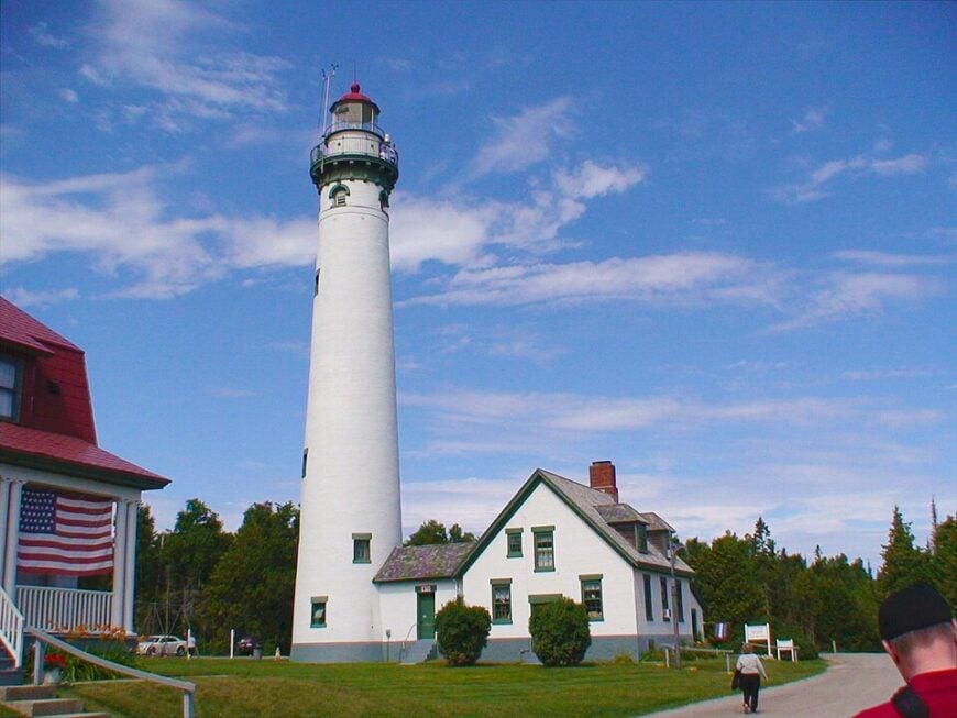
3. Alpena’s Presque Isle Township – Twin Lighthouses in Total Tranquility
Presque Isle Township hosts about 1,600 residents spread across 72 square miles, giving it one of Michigan’s lowest coastal population densities.
Day trippers bike the seven-mile trail linking the 1840 Old Presque Isle Lighthouse and the 1870 New Presque Isle Light, pause at hidden Grand Lake rock ledges, and picnic beneath maples that blaze crimson each October.
Cottage rentals and modest marina services drive seasonal income, with limited year-round work at the township hall and a small quarry. Towering hardwoods, deep bays, and long drives between homes create a hush broken only by lapping waves and gull chatter.
The older lighthouse’s claim of being haunted draws small evening groups, yet one can still hear loons calling across the water at dusk. Ample public land means the vista from any trail bench remains unmarred by condos or billboards.
Where is Presque Isle Township?
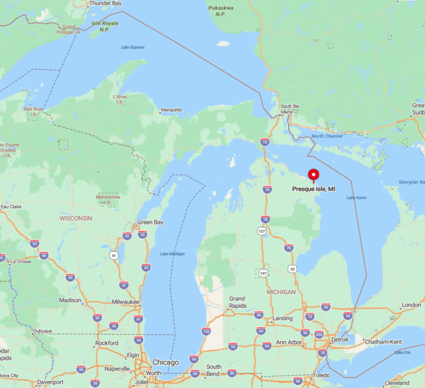
The township forms a peninsula 16 miles north of Alpena, accessible via US-23 then County Road 638 which ends at the lighthouse park. Water surrounds three sides, and marshy lowlands close off the fourth, limiting future development.
Visitors often arrive by private boat, anchoring in the clear shallows near the light towers, which enhances the area’s secluded aura. The nearest chain coffee shop is a 25-minute drive, a statistic locals happily share with quiet-seeking guests.
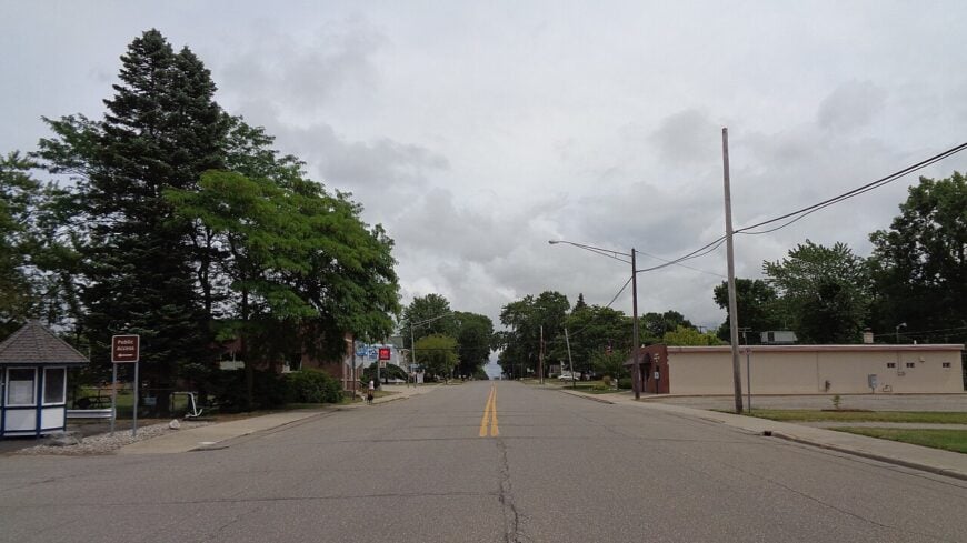
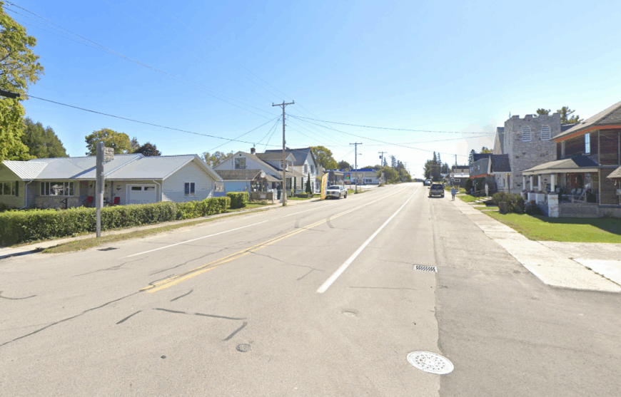
2. Harrisville – Michigan’s Smallest Seaside City You’ve Never Heard Of
Harrisville’s official city status belies its population of just under 500 residents living between harbor, state park, and courthouse square.
Beachgoers sprawl on 3,000 feet of sugar-sand at Harrisville State Park, sailors berth at a marina that feels more neighborhood dock than commercial port, and music lovers attend Friday-night concerts on the depot lawn.
Local government and small hospitality outfits provide most jobs, with an artisan coffee roaster and two antique shops adding flavor. State park forests hug the north and south city limits, halting sprawl and muffling highway noise.
Evening walks often feature starlight glinting off Lake Huron unspoiled by city glare. Even the Fourth of July parade feels intimate, with spectators recognizing every participant.
Where is Harrisville?
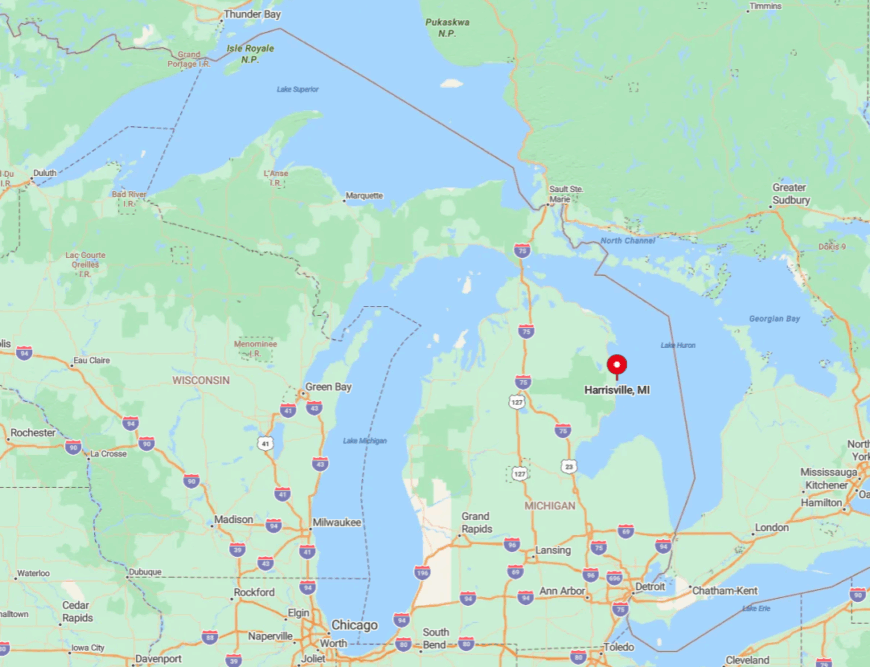
The city sits halfway between Oscoda and Alpena along US-23 yet feels worlds apart thanks to the buffer of Harrisville State Park’s old white pines. Inland hills block 4G towers, so reception drops the moment one turns toward the harbor, a welcome digital detox for many.
Amtrak’s seasonal through-bus stops once daily, making car travel via US-23 the typical access route. With no direct interstate or commercial airport nearby, the city retains its slow coastal rhythm year-round.
1. De Tour Village – Where Lake Huron Meets the Wild North
De Tour Village supports roughly 330 inhabitants who share sunrise views over the meeting point of Lake Huron and the St. Marys River. Visitors watch 1,000-foot freighters slip past the public beach, explore cedar-rimmed Scott’s Bay by kayak, and catch the Drummond Island car ferry for a day of trail riding.
Charter fishing and the ferry service are the primary employers, backed by a handful of eateries serving fresh whitefish. Situated near Michigan’s easternmost Upper Peninsula tip, the village sits hours from large towns, and dark-sky ordinances keep nights ink black.
Miles of jack-pine barrens and uninhabited shoreline north and south reinforce its frontier vibe. Aurora sightings are common in spring and fall due to minimal light pollution.
Where is De Tour Village?
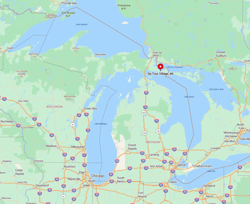
The settlement lies 56 miles northeast of St. Ignace along M-134, a two-lane scenic byway with more deer than cars. Water surrounds three sides, and vast Hiawatha National Forest stretches to the west, limiting expansion.
Reaching De Tour requires a deliberate drive past the last interstate exit and across the Mackinac Bridge, a filter that keeps crowds thin. Once parked, most locals recommend exploring the shoreline by bike because every back street ends with a view of sparkling water and almost complete silence.


