Would you like to save this?
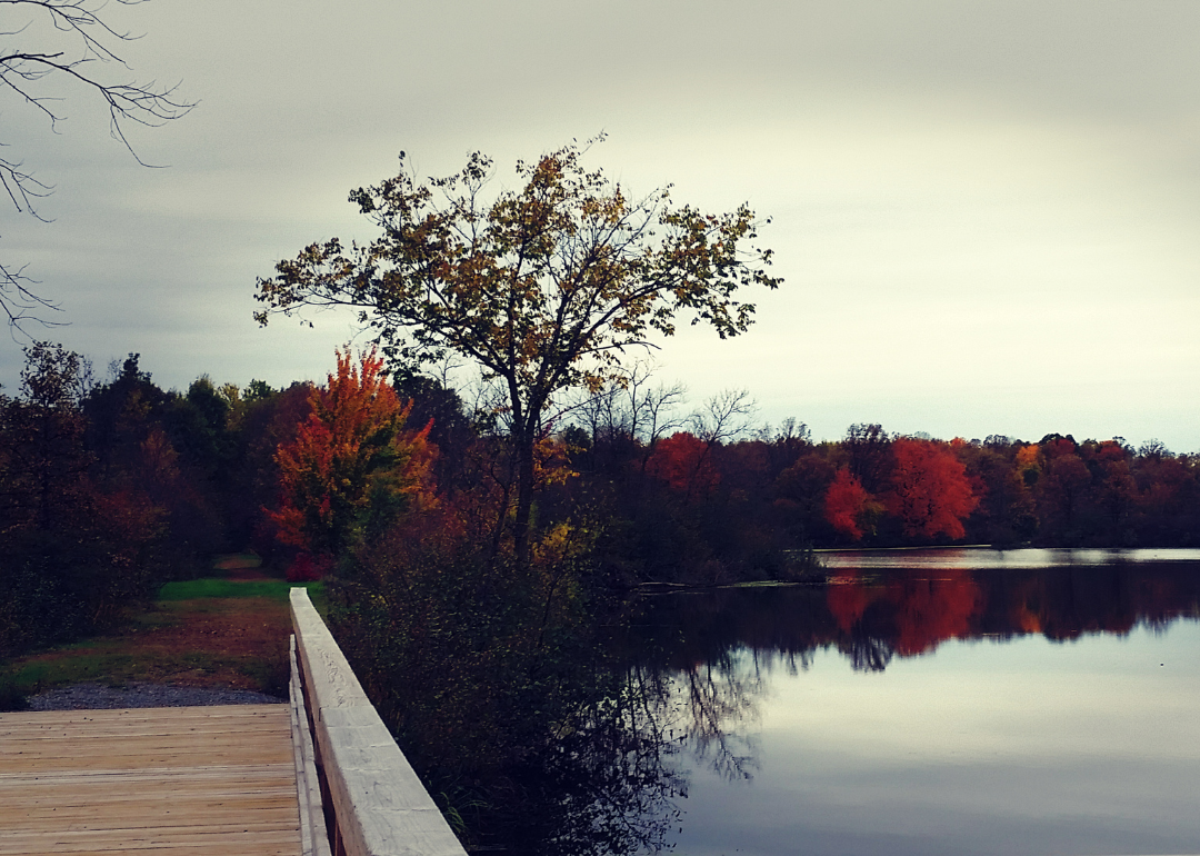
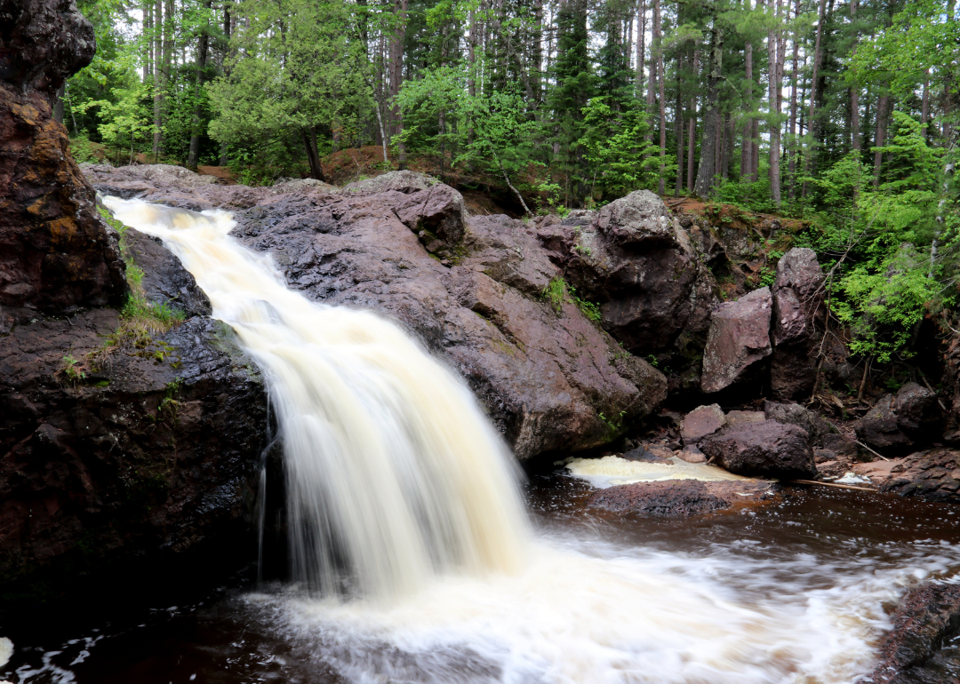
Counties with the shortest life expectancy in Wisconsin
Life expectancy can be affected by a variety of factors. About 25% of your lifespan is determined by genetics, according to the National Library of Medicine. Health and wellness habits—like following a balanced, nutrient-rich diet; not smoking; drinking minimal alcohol; maintaining a healthy weight; and staying physically active—can add more than a decade to your life, research from the National Institutes of Health shows. While these factors are significant, another important element that you might not have considered is your environment and community.
While life expectancy generally increases annually in the United States—jumping from about 70.8 years old to 77.5 between 1970 and 2022, according to the Centers for Disease Control and Prevention—this particular metric can vary from state to state or even county to county. In some parts of the country, the average lifespan is getting shorter based on a variety of risk factors on top of health, including socioeconomic factors like poverty, unemployment, income, and education.
According to a 2020 study from researchers at Penn State, West Virginia, and Michigan State Universities, communities with a higher population density, more fast food restaurants, and a high number of extraction industry-based jobs tend to have shorter life expectancies.
To find out how life expectancy varies within Wisconsin, Stacker used 2024 County Health Rankings & Roadmaps from the University of Wisconsin Population Health Institute to identify the counties with the shortest life expectancy. Life expectancy measures the average number of years from birth a person can expect to live and is calculated based on the number of deaths in a given time period and the average number of people at risk of dying during that period. Counties with unreliable or insufficient data were excluded from the analysis. Mortality data came from the National Vital Statistics System.
Read on to see if your county is on the list.
You may also like: Best counties to live in Wisconsin
#32. Sauk County (tie)
– Life expectancy: 78.2 years
— Same as state average
About
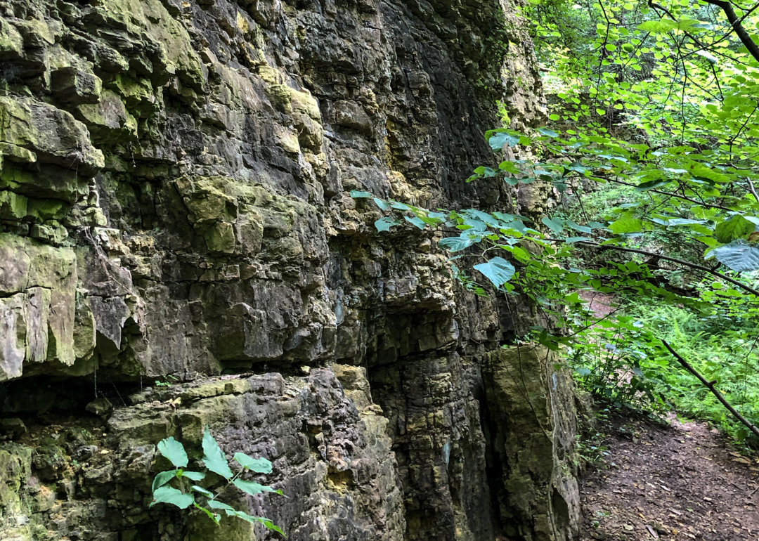
Sauk County blends rural charm with vibrant community life, featuring rolling farmland, forested hills, and scenic river valleys. Its small towns and cities foster local arts, independent businesses, and a strong sense of tradition. Known for outdoor recreation, the region offers opportunities for hiking, fishing, and cultural festivals throughout the year.
Economically, the county balances agriculture, tourism, and small-scale manufacturing, reflecting both its heritage and evolving industries. Educational institutions and historical societies contribute to a deep-rooted cultural identity. The landscape and values of Sauk County reflect a blend of preservation and progress, grounded in community and natural beauty.
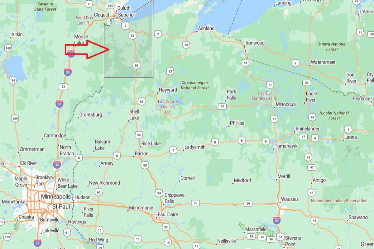
Where is Sauk County?
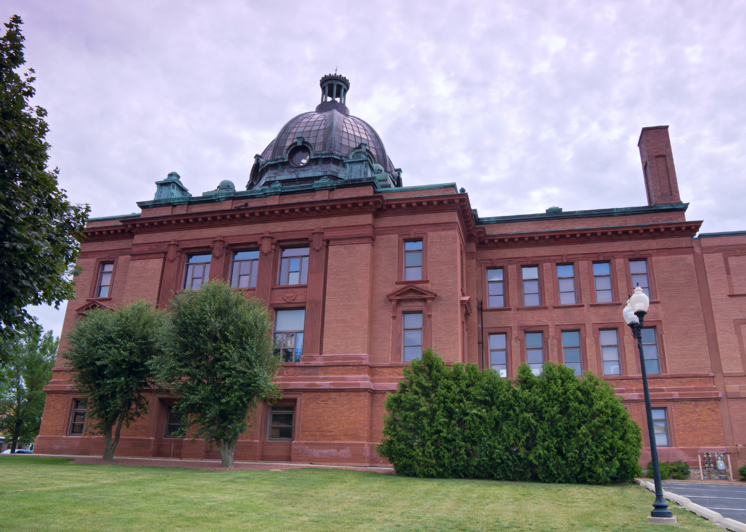
Sauk County, Wisconsin is located in the south-central part of the state, within the Driftless Area known for its rolling hills and river valleys. It is approximately 47 miles northwest of Madison, the state capital, accessible via U.S. Route 12. The county seat, Baraboo, is known for its natural beauty and as the home of the Circus World Museum.
From Milwaukee, Sauk County is about 113 miles west, offering a route through rural and scenic landscapes. It is also roughly 190 miles northwest of Chicago, Illinois, placing it within reach of major Midwestern cities. The county’s location supports tourism, agriculture, and outdoor recreation, especially near the Wisconsin Dells and state parks.
#32. Walworth County (tie)
– Life expectancy: 78.2 years
— Same as state average
About
Walworth County is characterized by its picturesque lakes, rural farmlands, and a blend of small-town charm with upscale resorts and recreational areas. The area thrives on seasonal tourism, agriculture, and a growing number of local businesses that support both residents and visitors. Its communities foster a welcoming atmosphere with strong civic engagement and cultural traditions.
The county hosts a variety of outdoor activities year-round, from boating and golfing in the summer to snow sports in the winter. Educational institutions, historical landmarks, and arts venues enrich local life. Walworth County maintains a balance between preserving natural beauty and promoting thoughtful development.
Where is Walworth County?
Walworth County, Wisconsin is located in the southeastern part of the state, near the Illinois border. It is approximately 45 miles southwest of Milwaukee, accessible via Interstate 43 and U.S. Route 12. The county seat, Elkhorn, is surrounded by lakes, farmland, and recreational areas.
From Madison, Walworth County is about 65 miles southeast, making it part of the extended metropolitan region. It is also roughly 80 miles northwest of Chicago, Illinois, placing it in a strategic location for cross-state travel. The county’s position supports tourism, agriculture, and a blend of rural and suburban communities.
#32. Waushara County (tie)
– Life expectancy: 78.2 years
— Same as state average
About
Waushara County features a peaceful landscape of forests, lakes, and rolling countryside that supports a lifestyle centered on nature and community. Small towns and rural neighborhoods are connected by local events, seasonal markets, and outdoor traditions. The county economy leans on agriculture, tourism, and small enterprises rooted in local values.
Recreational opportunities such as fishing, hiking, and camping are abundant across public lands and waterways. Cultural identity is shaped by a mix of historical preservation and community pride, often showcased in local fairs and gatherings. Waushara County offers a quiet, grounded way of life surrounded by natural beauty.
Where is Waushara County?
Would you like to save this?
Waushara County, Wisconsin is located in the central part of the state, within a region of forests, lakes, and farmland. It is approximately 43 miles west of Oshkosh, accessible via State Highway 21. The county seat, Wautoma, serves as the local center for government and services.
From Madison, Waushara County is about 85 miles north, offering a connection to central and northern Wisconsin. It is also roughly 100 miles northwest of Milwaukee, placing it within reach of southeastern urban centers. The county’s location supports outdoor recreation, agriculture, and small-town living.
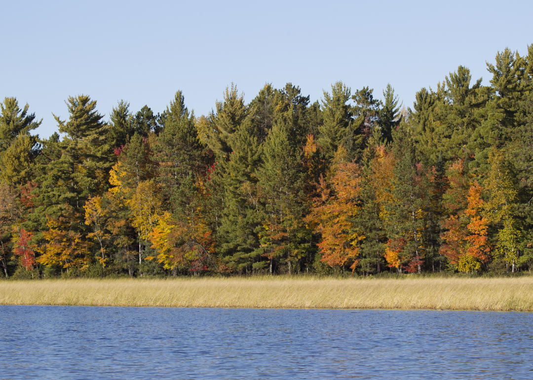
#30. Oneida County (tie)
– Life expectancy: 78.1 years
— 0.1 years lower than the state average
About
Oneida County is known for its dense forests, clear lakes, and a strong tradition of outdoor recreation. Tourism plays a central role in the local economy, especially through fishing, boating, and snowmobiling across its extensive trail systems. Small businesses, hospitality services, and conservation efforts reflect the community’s connection to nature.
The area’s heritage is rooted in logging, Native American history, and early Northwoods settlements. Cultural events, local museums, and seasonal festivals contribute to a strong sense of identity and pride. Oneida County blends rustic beauty with community-oriented living and year-round activity.
Where is Oneida County?
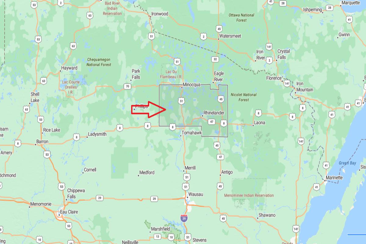
Oneida County, Wisconsin is located in the northern part of the state, within the Northwoods region known for its forests and lakes. It is approximately 66 miles north of Wausau, accessible via U.S. Route 51. The county seat, Rhinelander, serves as a regional hub for tourism and outdoor recreation.
From Green Bay, Oneida County is about 125 miles northwest, providing access to northern Wisconsin’s natural attractions. It is also roughly 210 miles north of Madison, placing it in a remote but scenic area. The county’s location supports a strong tourism economy centered around fishing, boating, and seasonal retreats.
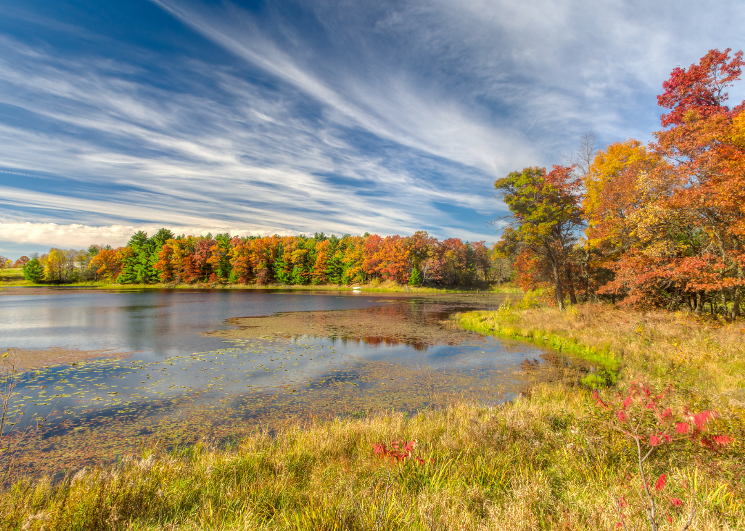
#30. Polk County (tie)
– Life expectancy: 78.1 years
— 0.1 years lower than the state average
About
Polk County is defined by its rolling landscapes, clean lakes, and a way of life deeply connected to the outdoors. Residents and visitors alike enjoy fishing, hiking, and boating, with seasonal events bringing the community together. Agriculture and tourism are key economic drivers, supported by family-run farms and local enterprises.
The area maintains a strong sense of identity through local arts, historical preservation, and civic pride. Small towns throughout the county offer welcoming atmospheres and vibrant community engagement. Polk County combines natural beauty with a rooted, small-town spirit.
Where is Polk County?
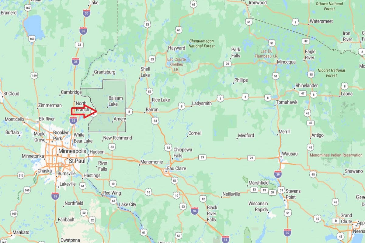
Polk County, Wisconsin is located in the northwestern part of the state, near the Minnesota border. It is approximately 51 miles northeast of St. Paul, Minnesota, accessible via U.S. Route 8. The county seat, Balsam Lake, is surrounded by lakes, forests, and small rural communities.
From Eau Claire, Polk County is about 75 miles northwest, placing it within reach of western Wisconsin’s economic centers. It is also roughly 280 miles northwest of Madison, offering a connection to the Twin Cities metropolitan area. The county’s location supports outdoor recreation, tourism, and a blend of rural and cross-border economic activity.
You may also like: Highest-rated breweries in Wisconsin
#29. Grant County
– Life expectancy: 77.9 years
— 0.3 years lower than the state average
About
Grant County features a varied landscape of rivers, bluffs, and farmland that support agriculture, outdoor recreation, and close-knit rural communities. Its economy thrives on farming, education, and small industries that reflect a blend of tradition and innovation. Local festivals and fairs highlight community pride and historical roots.
Recreation is shaped by access to waterways, trails, and scenic natural areas, attracting residents and visitors year-round. Cultural life includes historical societies, local arts initiatives, and strong educational institutions. Grant County offers a balance of natural beauty, productive land, and community heritage.
Where is Grant County?
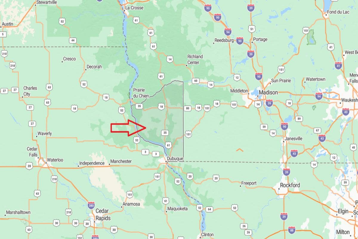
Grant County, Wisconsin is located in the southwestern corner of the state, bordered by the Mississippi River and the states of Iowa and Illinois. It is approximately 65 miles west of Madison, accessible via U.S. Route 151. The county seat, Lancaster, lies in a region of rolling hills and agricultural land.
From Milwaukee, Grant County is about 120 miles southwest, providing a route through rural southern Wisconsin. It is also roughly 175 miles northwest of Chicago, Illinois, making it part of a tri-state region. The county’s location supports farming, river commerce, and regional tourism.
#27. Barron County (tie)
– Life expectancy: 77.8 years
— 0.4 years lower than the state average
About
Barron County blends agricultural strength with natural beauty, offering expansive farmland, lakes, and forests. Dairy farming and food production play a major role in the local economy, supported by a strong network of small towns and family-owned businesses. Community life thrives through fairs, markets, and seasonal events rooted in local traditions.
Outdoor activities such as fishing, hunting, and hiking are popular year-round, contributing to tourism and quality of life. Cultural programs, historical sites, and local schools help maintain a strong sense of identity and pride. Barron County reflects a steady mix of rural resilience, natural resources, and community connection.
Where is Barron County?
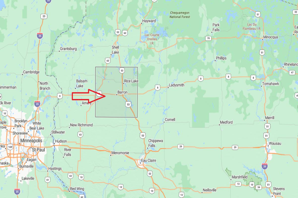
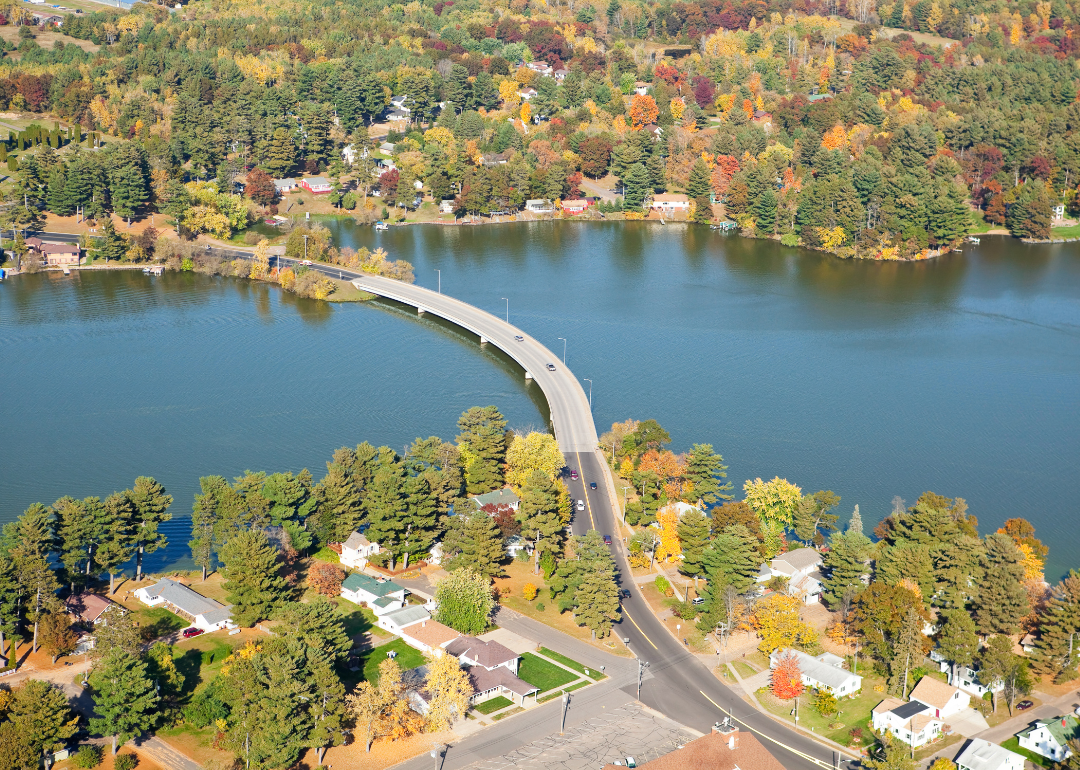
Barron County, Wisconsin is located in the northwestern part of the state, in a region of lakes, forests, and farmland. It is approximately 47 miles northwest of Eau Claire, accessible via U.S. Route 53. The county seat, Barron, serves as a local hub for agriculture and community services.
From St. Paul, Minnesota, Barron County is about 75 miles northeast, making it part of the extended Twin Cities region. It is also roughly 220 miles northwest of Madison, placing it deep within Wisconsin’s rural northern tier. The county’s location supports a mix of farming, manufacturing, and outdoor recreation.
#27. Clark County (tie)
– Life expectancy: 77.8 years
— 0.4 years lower than the state average
About
Clark County is characterized by its rich farmland, dense forests, and a strong agricultural heritage that shapes both its economy and lifestyle. Dairy farming, logging, and small-scale manufacturing provide the backbone for local employment and community growth. Towns and villages foster a close-knit atmosphere with a focus on tradition and self-reliance.
Residents enjoy a range of outdoor activities including snowmobiling, hiking, and fishing across the county’s trails and waterways. Cultural life is supported by county fairs, historic sites, and local arts initiatives. Clark County offers a blend of rural productivity, natural beauty, and enduring community values.
Where is Clark County?
Clark County, Wisconsin is located in the central part of the state, within a region known for dairy farming and forestland. It is approximately 44 miles east of Eau Claire, accessible via U.S. Route 10 and State Highway 29. The county seat, Neillsville, is surrounded by rural communities and agricultural areas.
From Wausau, Clark County is about 60 miles west, offering easy access to both central and western Wisconsin. It is also roughly 135 miles north of Madison, placing it in a productive yet quiet part of the state. The county’s location supports farming, forestry, and a strong rural heritage.
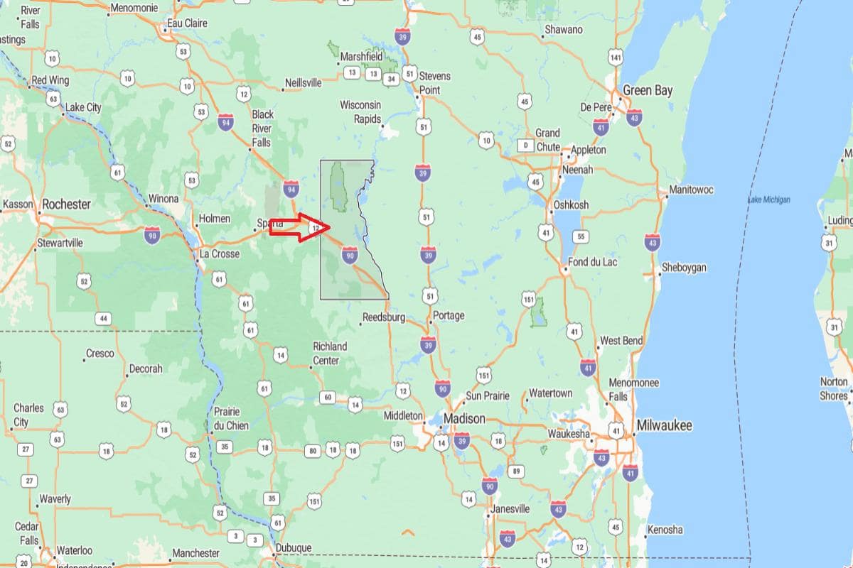
#25. Monroe County (tie)
– Life expectancy: 77.7 years
— 0.5 years lower than the state average
About
Monroe County features a diverse landscape of ridges, valleys, and fertile farmland that supports agriculture, forestry, and outdoor recreation. The economy is rooted in dairy farming, food processing, and military presence, with a strong emphasis on local resilience and industry. Community life centers around local events, historic preservation, and small-town values.
The county offers abundant opportunities for hiking, biking, and river activities through its parks and trail systems. Cultural identity is shaped by a mix of rural heritage, veteran traditions, and growing arts and educational programs. Monroe County reflects a balance of natural resources, hardworking communities, and evolving local pride.
Where is Monroe County?
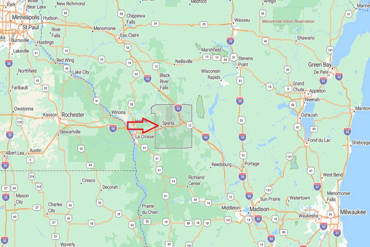
Monroe County, Wisconsin is located in the west-central part of the state, in a region of rolling hills and river valleys. It is approximately 42 miles east of La Crosse, connected by Interstate 90. The county seat, Sparta, is known as the “Bicycling Capital of America” and serves as a regional hub.
From Madison, Monroe County is about 100 miles northwest, offering direct highway access to the central part of the state. It is also roughly 170 miles northwest of Milwaukee, placing it in a primarily rural but well-connected area. The county’s location supports agriculture, outdoor recreation, and regional travel.
Would you like to save this?
#25. Shawano County (tie)
– Life expectancy: 77.7 years
— 0.5 years lower than the state average
About
Shawano County is defined by its mix of farmland, forests, and lakes, offering a lifestyle deeply connected to the outdoors. Agriculture, manufacturing, and tourism contribute to a diverse local economy supported by small towns and family-owned businesses. Community life is enriched by festivals, markets, and longstanding cultural traditions.
Outdoor recreation like fishing, boating, hunting, and snowmobiling is central to daily life and local identity. The area also highlights Native American heritage, local arts, and historical preservation through museums and cultural events. Shawano County blends natural beauty, economic variety, and deep-rooted community pride.
Where is Shawano County?
Shawano County, Wisconsin is located in the northeastern part of the state, in a region of forests, rivers, and agricultural land. It is approximately 37 miles northwest of Green Bay, accessible via State Highway 29. The county seat, Shawano, sits along the Wolf River and near Shawano Lake.
From Appleton, Shawano County is about 45 miles north, offering convenient access to the Fox Valley region. It is also roughly 120 miles north of Madison, placing it in the upper third of the state. The county’s location supports outdoor recreation, farming, and tourism in northeastern Wisconsin.
You may also like: How drunk driving fatalities in Wisconsin compare to the rest of the US
#23. Green Lake County (tie)
– Life expectancy: 77.3 years
— 0.9 years lower than the state average
About
Green Lake County is known for its serene lakes, rolling countryside, and a strong sense of community built around tradition and nature. Tourism, agriculture, and small businesses drive the local economy, with seasonal events and farmers markets playing a central role. The area supports a quiet, relaxed lifestyle rooted in local pride and outdoor living.
Residents and visitors enjoy fishing, boating, hiking, and cultural festivals throughout the year. Historical landmarks and arts programs reflect the county’s commitment to preserving its heritage while fostering creativity. Green Lake County offers a blend of scenic beauty, recreational opportunities, and close-knit rural charm.
Where is Green Lake County?
Green Lake County, Wisconsin is located in the east-central part of the state, known for its lakes, farmland, and small-town charm. It is approximately 37 miles west of Oshkosh, accessible via State Highway 23. The county seat, Green Lake, is situated on the shores of Wisconsin’s deepest natural lake.
From Madison, Green Lake County is about 60 miles north, offering a scenic route through rural countryside. It is also roughly 95 miles northwest of Milwaukee, placing it within reach of southeastern urban centers. The county’s location supports tourism, agriculture, and recreational activities year-round.
#23. Wood County (tie)
– Life expectancy: 77.3 years
— 0.9 years lower than the state average
About
Wood County features a landscape of rivers, forests, and farmland that supports a balanced mix of industry, agriculture, and community life. The economy is driven by paper manufacturing, healthcare, and local businesses, with strong civic institutions anchoring its towns. Residents value tradition, innovation, and a strong work ethic.
Outdoor recreation includes biking, fishing, skiing, and exploring scenic parks and trails. Community events, historical preservation, and local arts foster a vibrant cultural environment. Wood County offers a stable, well-rounded lifestyle rooted in natural resources and community pride.
Where is Wood County?
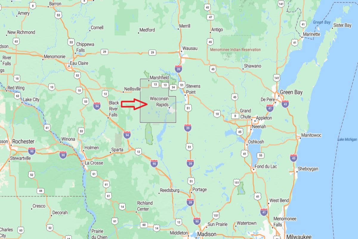
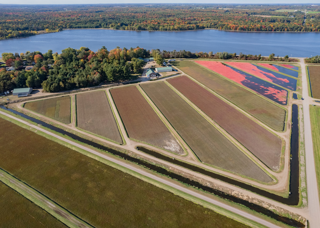
Wood County, Wisconsin is located in the central part of the state, known for its mix of industry, agriculture, and forested land. It is approximately 44 miles southeast of Wausau, accessible via State Highways 13 and 73. The county has two major cities: Wisconsin Rapids, the administrative center, and Marshfield, a regional medical and economic hub.
From Madison, Wood County is about 100 miles north, offering convenient access to central Wisconsin. It is also roughly 135 miles northwest of Milwaukee, placing it in a well-connected yet rural region. The county’s location supports healthcare, paper manufacturing, and agricultural industries.
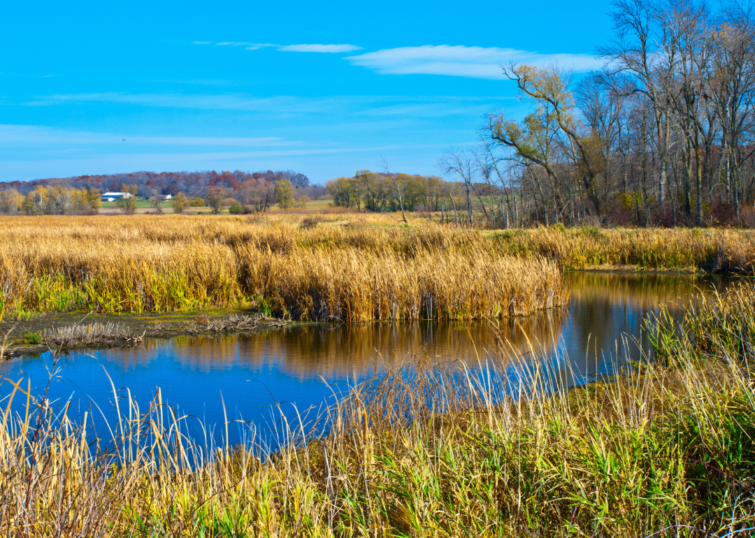
#21. Dodge County (tie)
– Life expectancy: 77.2 years
— 1.0 years lower than the state average
About
Dodge County features a mix of fertile farmland, wetlands, and small-town communities that support both agriculture and manufacturing. The local economy is driven by dairy farming, machinery production, and a growing network of local services. Community events, county fairs, and historical traditions help maintain a strong rural identity.
Outdoor enthusiasts enjoy wildlife areas, trails, and lakes for year-round recreation. Cultural life includes museums, performing arts, and community organizations that reflect local values and heritage. Dodge County offers a steady balance of productivity, natural beauty, and strong civic spirit.
Where is Dodge County?
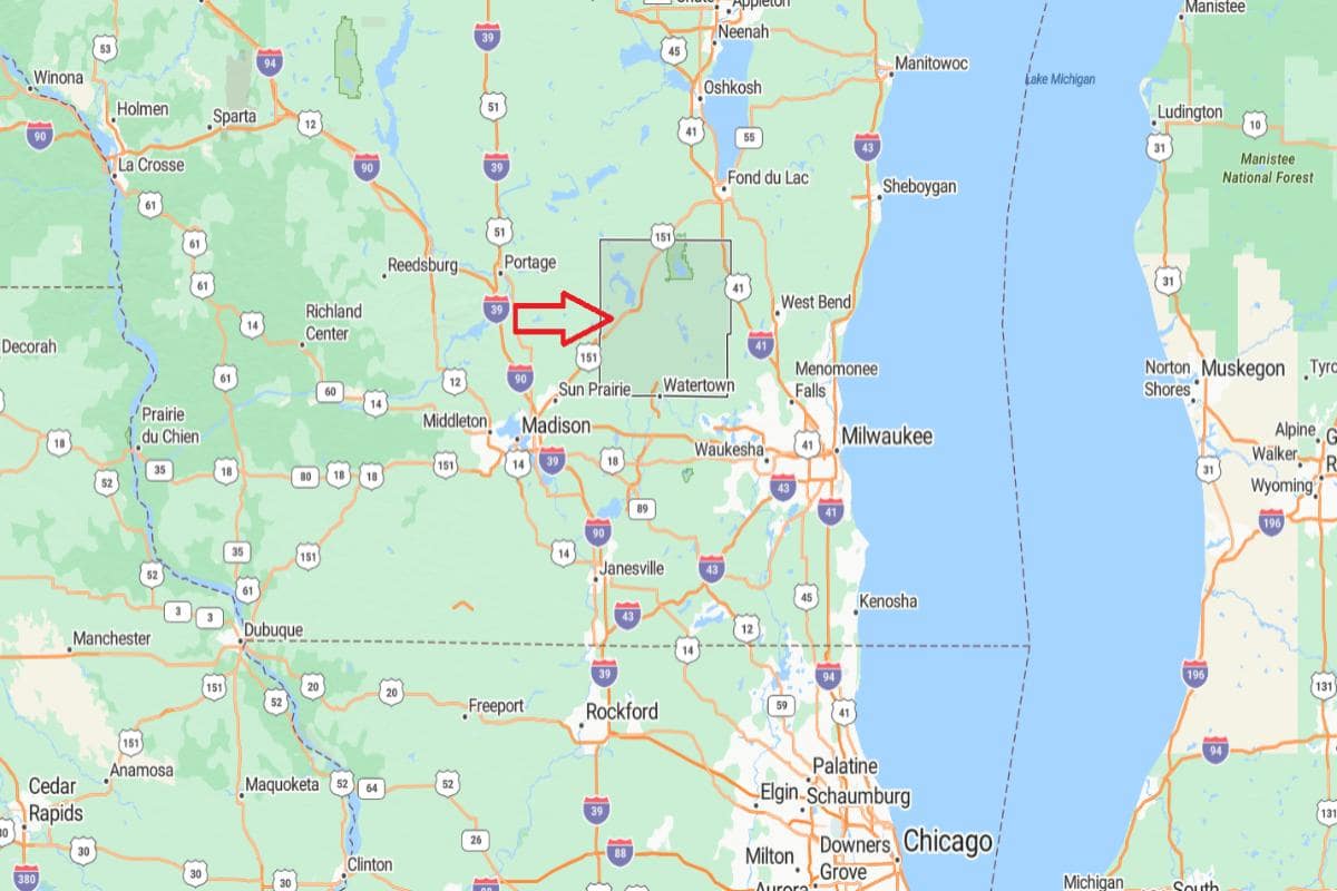
Dodge County, Wisconsin is located in the southeastern part of the state, characterized by rolling farmland and small towns. It is approximately 41 miles northeast of Madison, accessible via U.S. Route 151. The county seat, Juneau, lies near the geographic center of the county.
From Milwaukee, Dodge County is about 55 miles northwest, making it part of the extended Milwaukee metropolitan region. It is also roughly 120 miles northwest of Chicago, Illinois, placing it within reach of major Midwestern cities. The county’s location supports agriculture, manufacturing, and regional transportation.
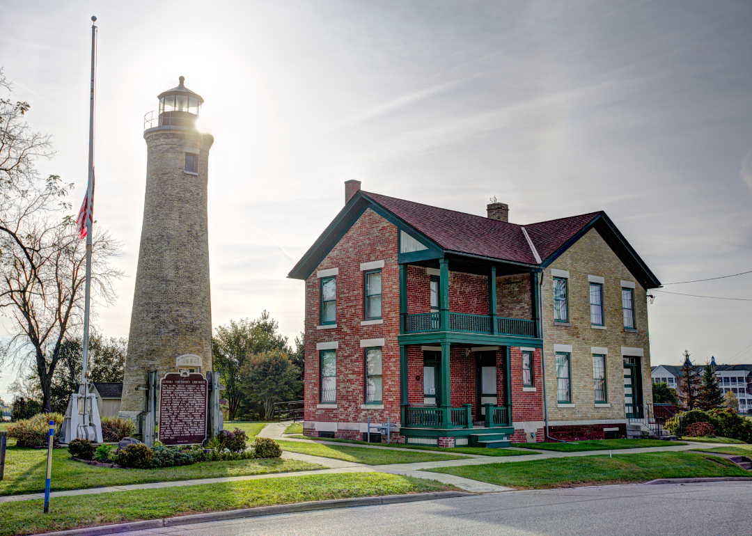
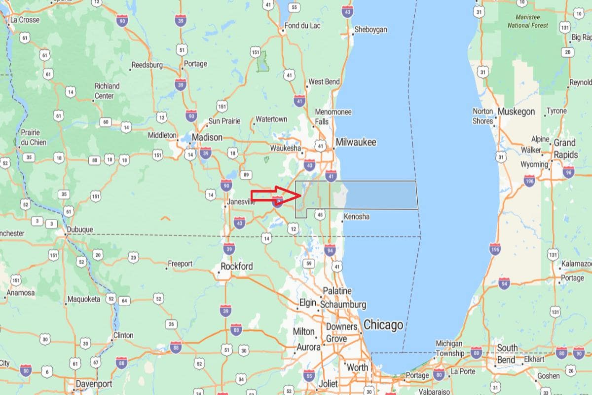
#21. Kenosha County (tie)
– Life expectancy: 77.2 years
— 1.0 years lower than the state average
About
Kenosha County combines urban energy with rural charm, offering a dynamic mix of industry, commerce, and open spaces. Its economy is fueled by manufacturing, retail, and education, with growing investments in technology and development. Community life thrives through cultural festivals, farmers markets, and strong neighborhood ties.
Recreational options include parks, trails, and lakes that support outdoor activities year-round. Arts venues, museums, and historic districts enrich the cultural landscape and reflect a diverse heritage. Kenosha County blends economic vitality with tradition, community focus, and access to natural beauty.
Where is Kenosha County?
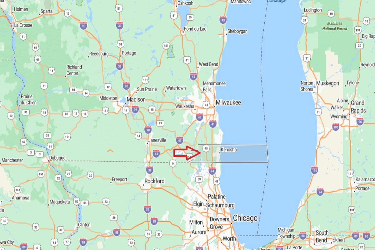
Kenosha County, Wisconsin is located in the southeastern corner of the state, along the shore of Lake Michigan and the Illinois border. It is approximately 39 miles south of Milwaukee, connected by Interstate 94. The county seat, Kenosha, serves as a major economic and cultural center in the region.
From Chicago, Illinois, Kenosha County is about 60 miles north, making it a key link between two major metropolitan areas. It is also roughly 90 miles southeast of Madison, placing it within Wisconsin’s most urbanized corridor. The county’s location supports manufacturing, transportation, and cross-border commerce.
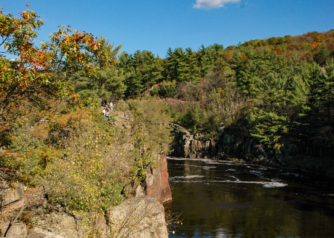
#18. Washburn County (tie)
– Life expectancy: 77.1 years
— 1.1 years lower than the state average
About
Washburn County is known for its quiet forests, clear lakes, and a lifestyle centered around nature and community. Forestry, tourism, and small-scale agriculture shape the local economy, supported by local shops and seasonal businesses. Residents value tradition, outdoor living, and close community connections.
Fishing, hunting, snowmobiling, and trail exploration are popular throughout the year. Cultural life is marked by local festivals, historical preservation, and a strong appreciation for the area’s natural heritage. Washburn County offers a peaceful blend of rustic charm, outdoor recreation, and rural resilience.
Where is Washburn County?
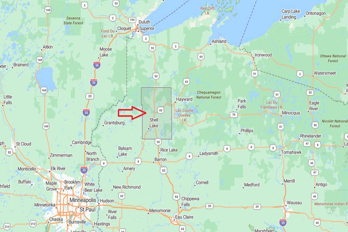
Washburn County, Wisconsin is located in the northwestern part of the state, in a region known for its forests, lakes, and outdoor recreation. It is approximately 46 miles southeast of Superior, accessible via U.S. Route 53. The county seat, Shell Lake, sits along its namesake lake and serves as the administrative and cultural center.
From Eau Claire, Washburn County is about 90 miles north, offering a route through scenic rural landscapes. It is also roughly 275 miles northwest of Madison, placing it deep within Wisconsin’s Northwoods. The county’s location supports tourism, forestry, and a peaceful rural lifestyle.
You may also like: Wisconsin small businesses thrive in these counties
#18. Douglas County (tie)
– Life expectancy: 77.1 years
— 1.1 years lower than the state average
About
Douglas County blends industrial history with abundant natural landscapes, featuring forests, rivers, and a strong maritime heritage. The economy includes manufacturing, shipping, tourism, and education, with a focus on innovation and regional development. Communities are shaped by working-class roots, cultural diversity, and civic pride.
Outdoor recreation plays a major role in local life, with opportunities for hiking, fishing, skiing, and exploring scenic areas. Events, museums, and arts initiatives reflect the area’s historical significance and creative energy. Douglas County offers a unique combination of industrial strength, natural beauty, and community spirit.
Where is Douglas County?
Douglas County, Wisconsin is located in the far northwestern corner of the state, along the shores of Lake Superior. It is approximately 3 miles south of Duluth, Minnesota, connected by bridges over the St. Louis River. The county seat, Superior, is a key port city and regional economic hub.
From Eau Claire, Douglas County is about 110 miles north, accessible via U.S. Route 53. It is also roughly 295 miles northwest of Madison, placing it in a remote and scenic area of northern Wisconsin. The county’s location supports shipping, tourism, and cross-border commerce with Minnesota.
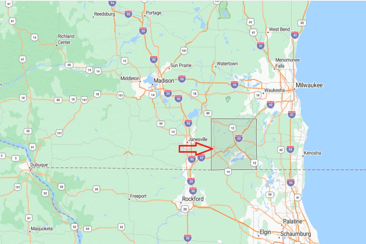
#18. Rock County (tie)
– Life expectancy: 77.1 years
— 1.1 years lower than the state average
About
Rock County features a mix of urban centers, rural landscapes, and a strong industrial and agricultural base. Manufacturing, healthcare, and education play central roles in the economy, alongside family farms and growing small businesses. Community life is supported by local events, cultural institutions, and neighborhood pride.
Residents enjoy parks, river trails, and a variety of recreational opportunities throughout the year. Arts programs, historical preservation, and civic engagement contribute to a well-rounded cultural environment. Rock County balances economic growth with heritage, community values, and access to outdoor living.
Where is Rock County?
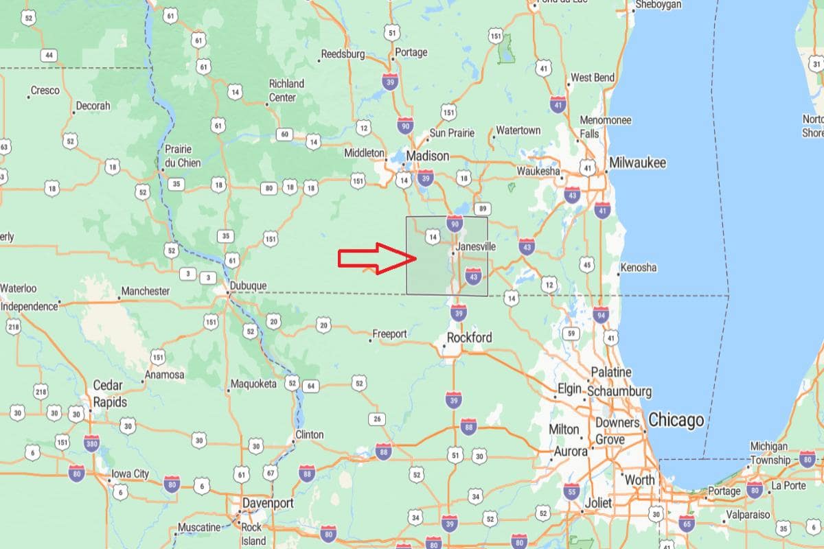
Rock County, Wisconsin is located in the south-central part of the state, along the Illinois border. It is approximately 41 miles south of Madison, accessible via Interstate 90. The county seat, Janesville, is a major economic and transportation hub for the region.
From Milwaukee, Rock County is about 75 miles southwest, offering convenient access to southeastern Wisconsin. It is also roughly 100 miles northwest of Chicago, Illinois, placing it in a key corridor between major urban centers. The county’s location supports manufacturing, commerce, and cross-border connectivity.

#11. Langlade County (tie)
– Life expectancy: 76.7 years
— 1.5 years lower than the state average
About
Langlade County is defined by its dense forests, winding rivers, and a deep connection to outdoor recreation and rural traditions. The economy relies on forestry, agriculture, and tourism, with small towns offering services and community-centered living. Residents take pride in local history, seasonal events, and a strong sense of place.
Year-round activities include hiking, ATV riding, fishing, and snowmobiling across well-maintained trails and natural areas. Cultural life is supported by local festivals, museums, and efforts to preserve the county’s heritage. Langlade County offers a peaceful, nature-focused lifestyle grounded in tradition and community spirit.
Where is Langlade County?
Langlade County, Wisconsin is located in the north-central part of the state, known for its forests, rivers, and rural landscapes. It is approximately 38 miles northeast of Wausau, accessible via State Highway 45. The county seat, Antigo, serves as the commercial and administrative center of the area.
From Green Bay, Langlade County is about 85 miles northwest, offering a connection to northeastern Wisconsin. It is also roughly 160 miles north of Madison, placing it in a quiet, scenic region of the state. The county’s location supports outdoor recreation, forestry, and small-town living.
#11. Florence County (tie)
– Life expectancy: 76.7 years
— 1.5 years lower than the state average
About
Florence County features a resource-based economy driven by forestry, tourism, and small-scale manufacturing. Its natural surroundings support outdoor recreation industries, including hunting, fishing, snowmobiling, and camping. Local businesses often reflect a close connection to the land and a tradition of self-reliance.
Community life centers around seasonal events, local schools, and a strong sense of neighborly support. Public lands, lakes, and trails offer residents and visitors access to scenic beauty and adventure year-round. The county values conservation, heritage, and a quiet, rural lifestyle.
Where is Florence County?
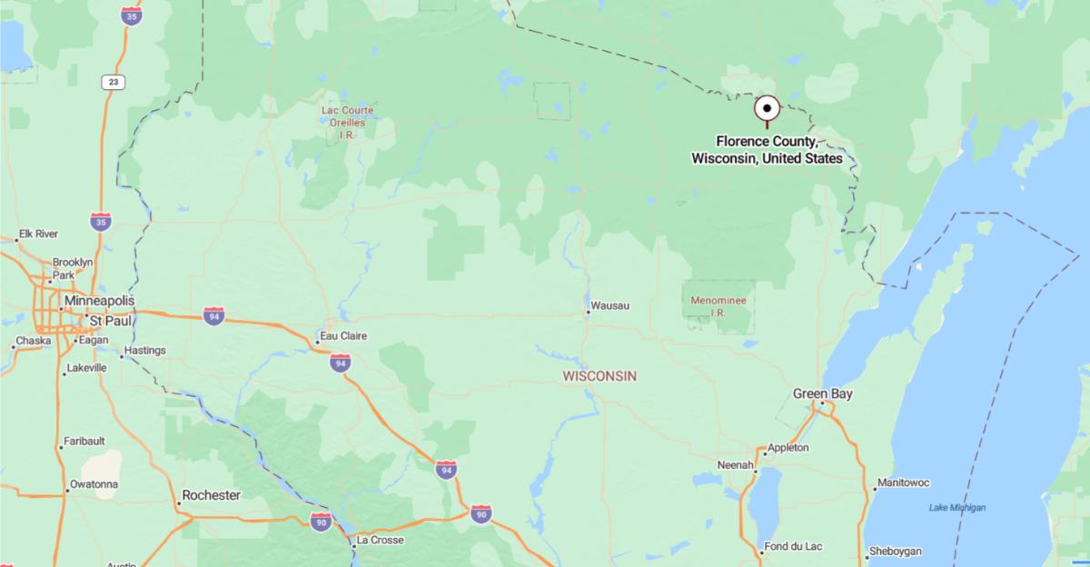
Florence County is located in northeastern Wisconsin, bordering Michigan’s Upper Peninsula. The county seat, Florence, is about 85 miles north of Green Bay. It lies approximately 35 miles northeast of Rhinelander.
The county is roughly 50 miles northwest of Marinette and about 25 miles southeast of Iron Mountain, Michigan. Florence is situated around 115 miles northwest of Wausau. U.S. Highway 2 and Wisconsin Highway 101 provide access to nearby towns and forested areas.
#11. Rusk County (tie)
– Life expectancy: 76.7 years
— 1.5 years lower than the state average
About
Rusk County features a landscape of forests, rivers, and farmland that supports a quiet, rural lifestyle rooted in nature and tradition. The economy is driven by forestry, manufacturing, and agriculture, with small towns offering local businesses and community services. Residents value independence, hard work, and close community ties.
Outdoor recreation is a key part of life, with opportunities for fishing, hunting, canoeing, and snowmobiling throughout the seasons. Cultural identity is preserved through local events, historic sites, and a strong appreciation for the natural environment. Rusk County offers a blend of rustic charm, resource-based industry, and community pride.
Where is Rusk County?
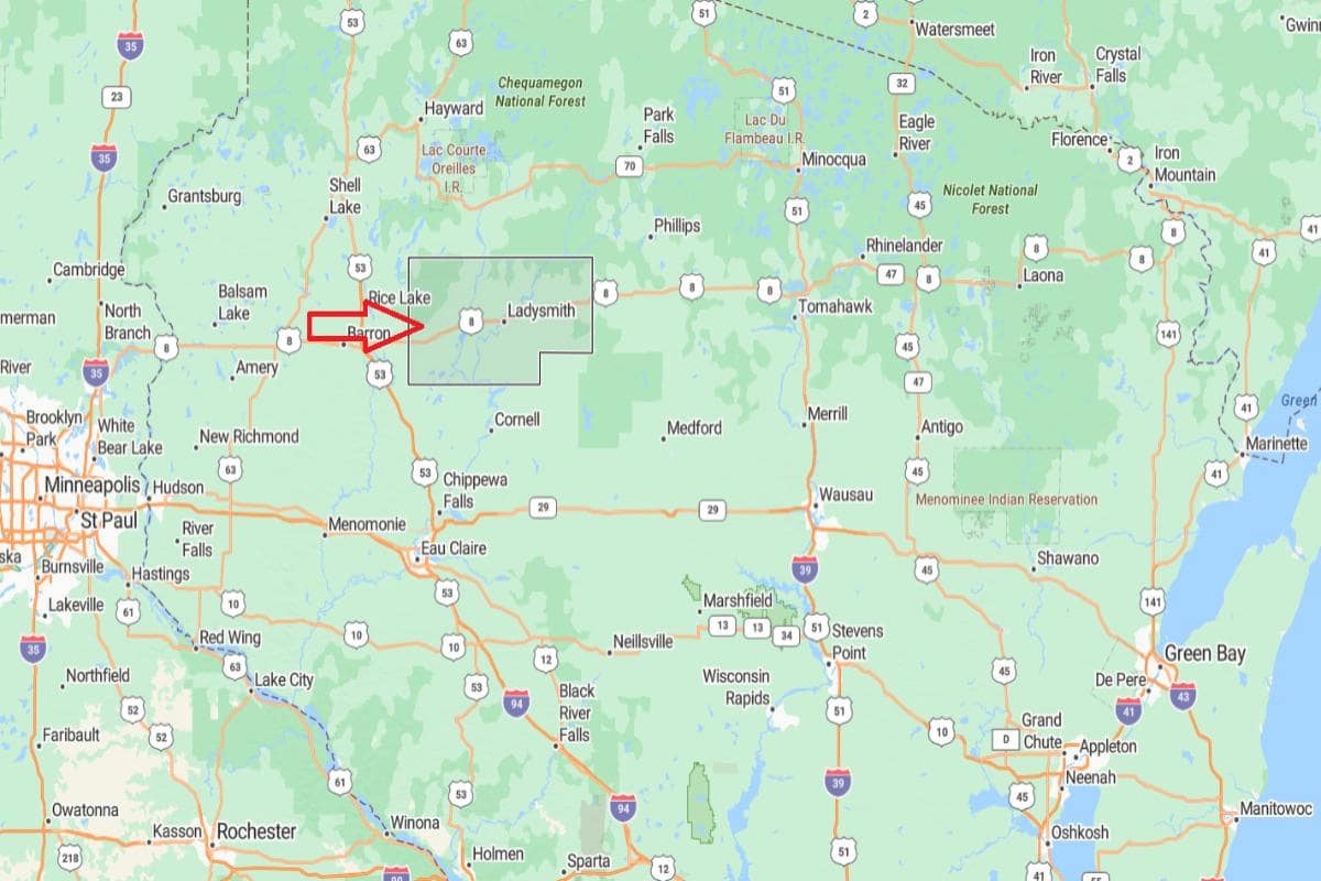
Rusk County, Wisconsin is located in the northwestern part of the state, known for its rivers, forests, and rural communities. It is approximately 60 miles north of Eau Claire, accessible via State Highway 27. The county seat, Ladysmith, sits along the Flambeau River and serves as the region’s economic and service center.
From Wausau, Rusk County is about 95 miles northwest, connecting central and northern Wisconsin. It is also roughly 190 miles north of Madison, placing it in the quieter, less-developed Northwoods area. The county’s location supports forestry, recreation, and small-scale agriculture.
You may also like: How road conditions in Wisconsin have deteriorated since 2000
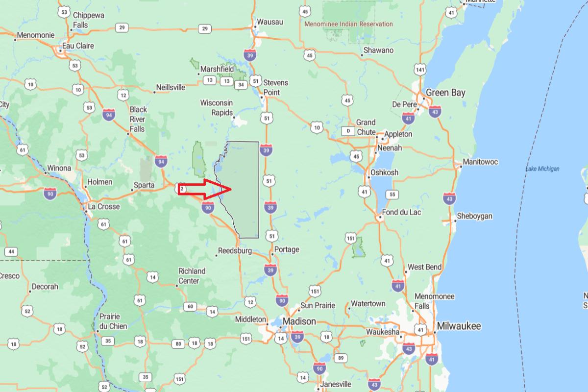
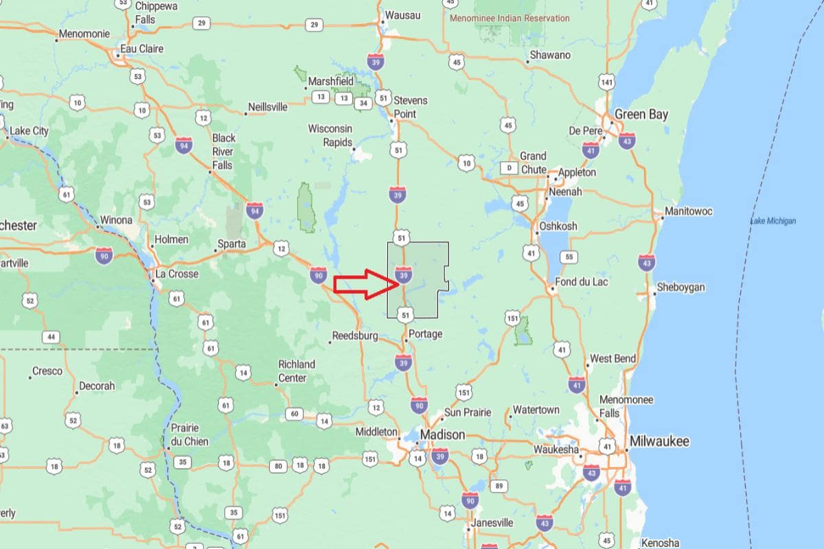
#11. Juneau County (tie)
– Life expectancy: 76.7 years
— 1.5 years lower than the state average
About
Juneau County offers a mix of woodlands, lakes, and agricultural land that supports both recreation and rural living. The local economy is centered on farming, tourism, and light manufacturing, with small towns fostering strong community networks. Seasonal festivals, markets, and outdoor traditions reflect the county’s cultural roots.
Residents and visitors enjoy activities like boating, fishing, hiking, and snowmobiling throughout the year. Historical sites, local museums, and civic organizations help preserve and celebrate the area’s heritage. Juneau County combines natural beauty, local resilience, and a deep sense of community.
Where is Juneau County?
Juneau County, Wisconsin is located in the central part of the state, known for its lakes, rivers, and agricultural land. It is approximately 42 miles northeast of La Crosse, accessible via Interstate 90 and U.S. Route 12. The county seat, Mauston, lies along the Lemonweir River and serves as the area’s commercial and governmental center.
From Madison, Juneau County is about 75 miles north, offering convenient access to central and western Wisconsin. It is also roughly 135 miles northwest of Milwaukee, placing it within the state’s inland rural corridor. The county’s location supports tourism, agriculture, and access to recreational destinations like Castle Rock Lake and Wisconsin Dells.
#11. Waupaca County (tie)
– Life expectancy: 76.7 years
— 1.5 years lower than the state average
About
Waupaca County features a landscape of rivers, lakes, and farmland that supports agriculture, tourism, and outdoor recreation. The economy is anchored by dairy farming, manufacturing, and a growing network of small businesses. Community life is shaped by local events, strong schools, and a deep connection to tradition.
Residents enjoy fishing, camping, snowmobiling, and exploring scenic trails year-round. Cultural offerings include historical sites, art programs, and seasonal fairs that highlight local heritage. Waupaca County blends rural charm, natural beauty, and a strong sense of civic pride.
Where is Waupaca County?
Waupaca County, Wisconsin is located in the east-central part of the state, characterized by rolling farmland, forests, and lakes. It is approximately 40 miles west of Appleton, accessible via U.S. Route 10 and State Highway 54. The county seat, Waupaca, is known for the Chain O’ Lakes and serves as a regional tourism and service center.
From Green Bay, Waupaca County is about 65 miles southwest, offering a direct route through northeastern Wisconsin. It is also roughly 110 miles north of Madison, placing it in a central location within the state. The county’s position supports agriculture, outdoor recreation, and small-town living.
#11. Lincoln County (tie)
– Life expectancy: 76.7 years
— 1.5 years lower than the state average
About
Lincoln County is characterized by its vast forests, rivers, and a way of life centered around natural resources and community values. The economy is supported by forestry, manufacturing, and small-scale agriculture, with strong local ties among residents. Small towns offer essential services, cultural events, and a welcoming, close-knit atmosphere.
Recreation plays a key role in daily life, with opportunities for snowmobiling, fishing, hiking, and hunting throughout the seasons. Historical preservation, local traditions, and civic pride contribute to a strong community identity. Lincoln County blends natural beauty, working landscapes, and a deep-rooted rural lifestyle.
Where is Lincoln County?
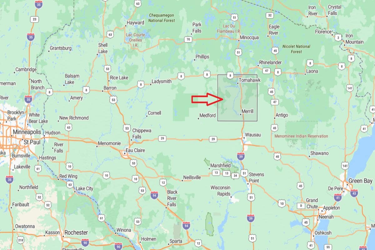
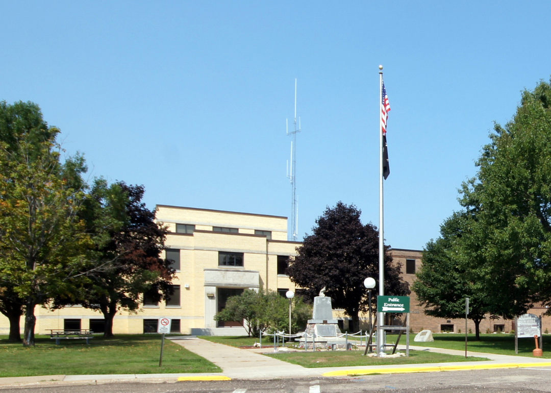
Lincoln County, Wisconsin is located in the north-central part of the state, known for its forests, rivers, and outdoor recreation. It is approximately 17 miles north of Wausau, accessible via U.S. Route 51. The county seat, Merrill, sits along the Wisconsin River and serves as the administrative and economic hub.
From Green Bay, Lincoln County is about 105 miles northwest, offering a connection through central Wisconsin. It is also roughly 165 miles north of Madison, placing it within the state’s Northwoods region. The county’s location supports forestry, tourism, and a quiet rural lifestyle.
#11. Vilas County (tie)
– Life expectancy: 76.7 years
— 1.5 years lower than the state average
About
Vilas County is known for its dense forests, countless lakes, and a strong culture of outdoor recreation and seasonal living. The local economy is centered on tourism, supported by resorts, small businesses, and natural attractions. Communities maintain a welcoming atmosphere with a blend of year-round residents and returning visitors.
Activities like boating, fishing, snowmobiling, and hiking define the area’s lifestyle across all seasons. Cultural traditions, local festivals, and Native American heritage enrich community life. Vilas County offers a peaceful retreat rooted in nature, recreation, and a strong sense of place.
Where is Vilas County?
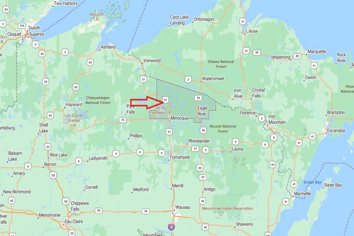
Vilas County, Wisconsin is located in the northernmost part of the state, known for its vast forests, clear lakes, and recreational opportunities. It is approximately 31 miles north of Rhinelander, accessible via U.S. Route 51 and State Highway 70. The county seat, Eagle River, is a popular destination for fishing, boating, and seasonal tourism.
From Wausau, Vilas County is about 90 miles north, offering a scenic drive through the heart of the Northwoods. It is also roughly 215 miles north of Madison, placing it in one of the most remote and wooded regions of the state. The county’s location supports tourism, outdoor activities, and a peaceful natural environment.
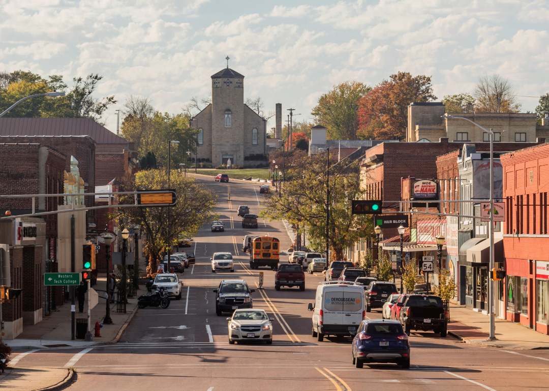
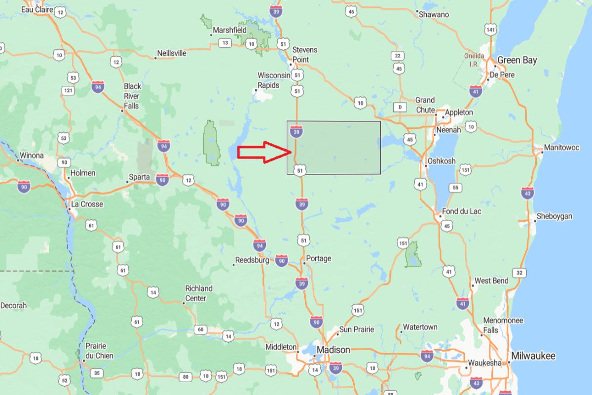
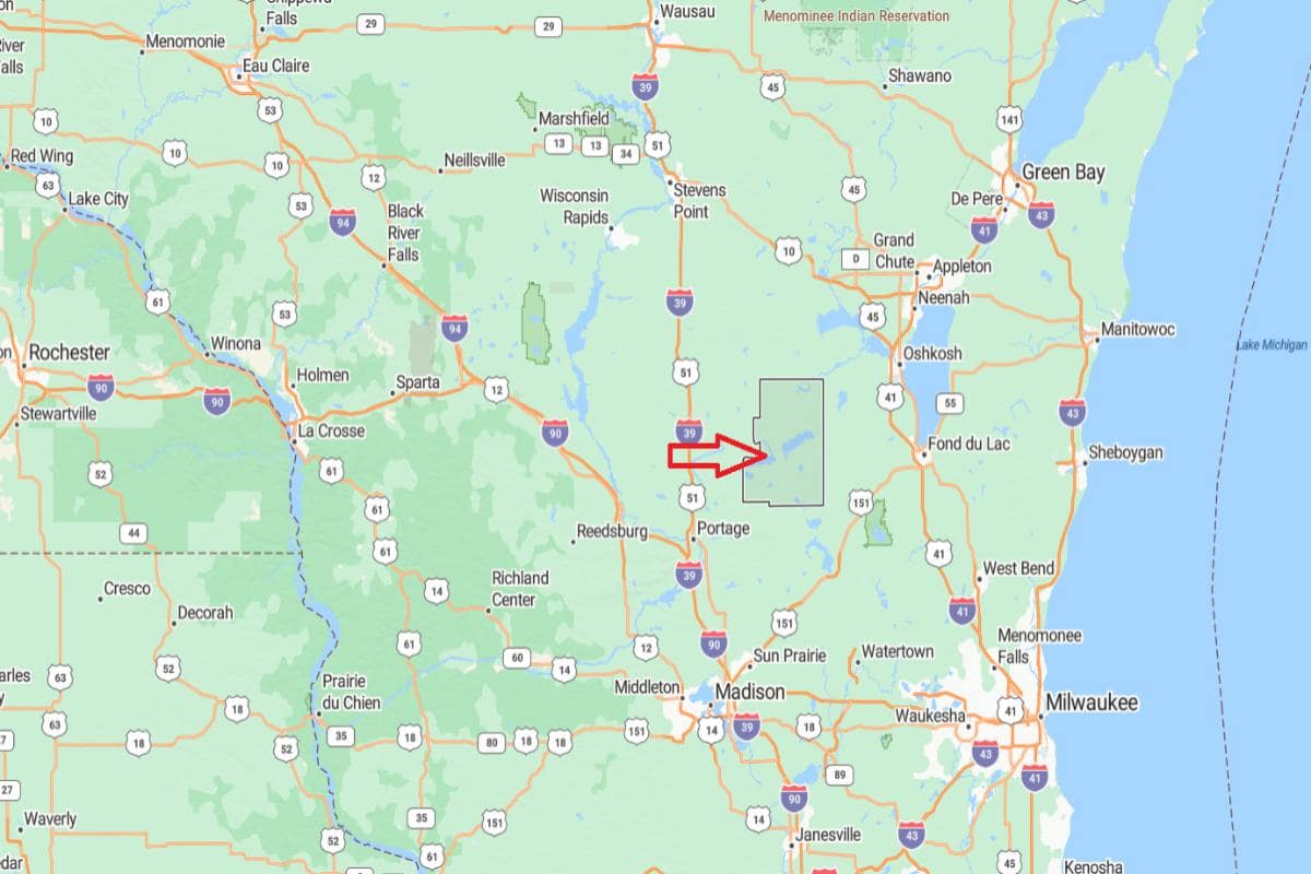
#10. Jackson County
– Life expectancy: 76.6 years
— 1.6 years lower than the state average
About
Jackson County features a diverse landscape of forests, rivers, and farmland that supports agriculture, forestry, and a growing recreational economy. The local workforce is centered on farming, wood products, and small industries, with communities emphasizing tradition and self-sufficiency. Cultural life is grounded in local festivals, family-run businesses, and deep community ties.
Outdoor activities such as ATV riding, hunting, and canoeing are popular across the county’s trails and waterways. Native American heritage and historical landmarks play a key role in shaping regional identity. Jackson County offers a strong connection to nature, heritage, and rural values.
Where is Jackson County?
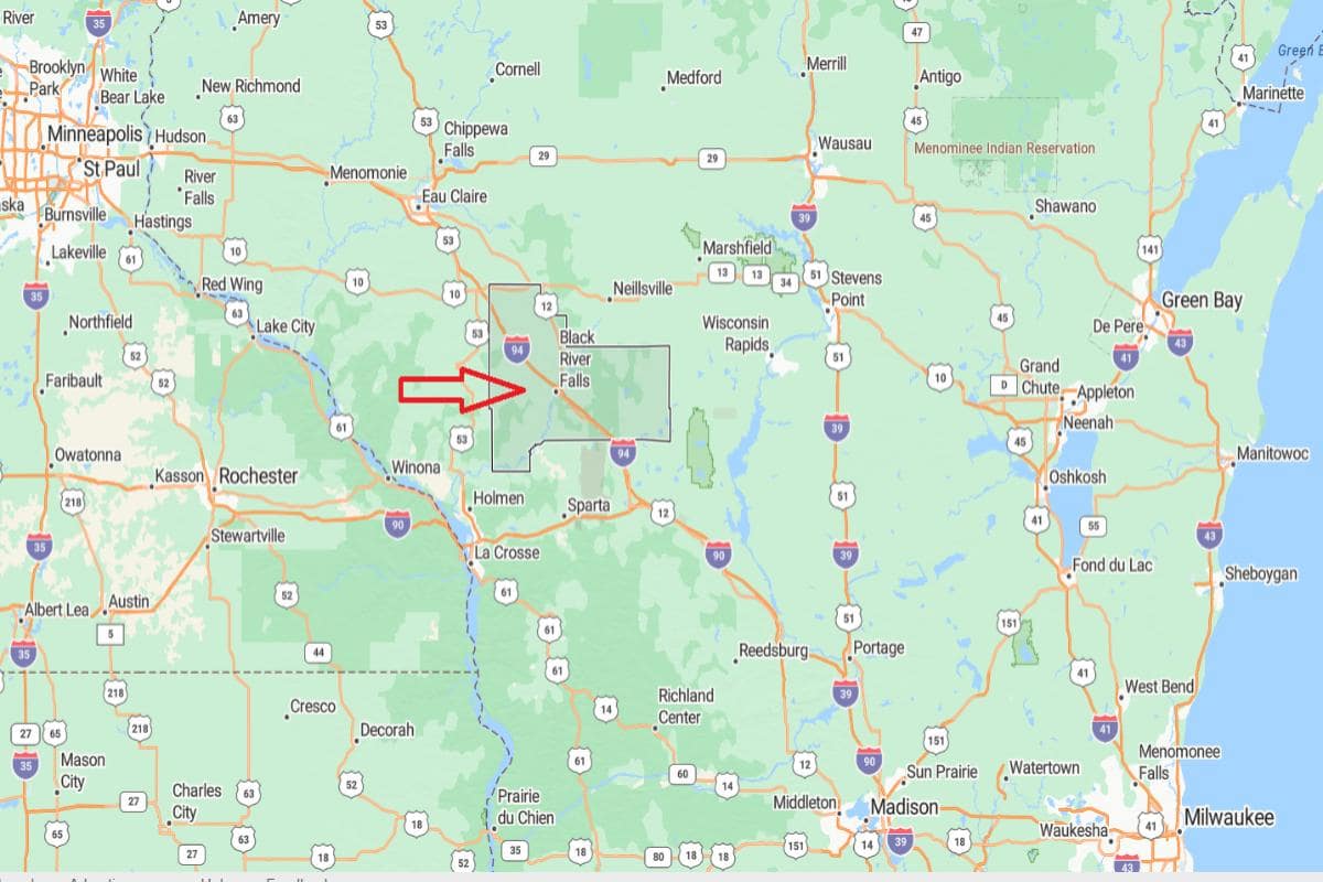
Jackson County, Wisconsin is located in the west-central part of the state, featuring a mix of forests, farmland, and river valleys. It is approximately 44 miles southeast of Eau Claire, accessible via Interstate 94 and State Highway 27. The county seat, Black River Falls, lies along the Black River and serves as the cultural and economic center.
From Madison, Jackson County is about 115 miles northwest, providing a connection to central and western regions of Wisconsin. It is also roughly 160 miles northwest of Milwaukee, placing it within the state’s scenic Driftless and forested areas. The county’s location supports logging, recreation, and rural community life.
You may also like: Best suburbs to live in Wisconsin
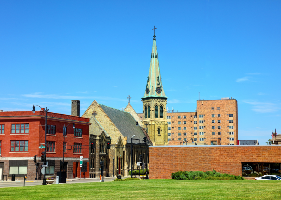
#9. Racine County
– Life expectancy: 76.5 years
— 1.7 years lower than the state average
About
Racine County blends urban industry with rural charm, featuring manufacturing centers, small towns, and scenic open spaces. The economy is driven by manufacturing, healthcare, and service industries, with a focus on innovation and community development. Local pride is reflected in cultural events, public art, and strong neighborhood involvement.
Recreation includes lakefront access, biking trails, and parks that support an active lifestyle year-round. Historical preservation, diverse cultural influences, and a growing arts scene contribute to the county’s identity. Racine County offers a mix of economic opportunity, cultural richness, and community spirit.
Where is Racine County?
Racine County, Wisconsin is located in the southeastern part of the state, along the western shore of Lake Michigan. It is approximately 24 miles south of Milwaukee, easily accessible via Interstate 94. The county seat, Racine, is an industrial and cultural hub with strong ties to manufacturing and lakefront tourism.
From Chicago, Illinois, Racine County is about 66 miles north, placing it within the busy corridor between two major cities. It is also roughly 90 miles southeast of Madison, offering a central location within southeastern Wisconsin. The county’s position supports commerce, transportation, and regional development.
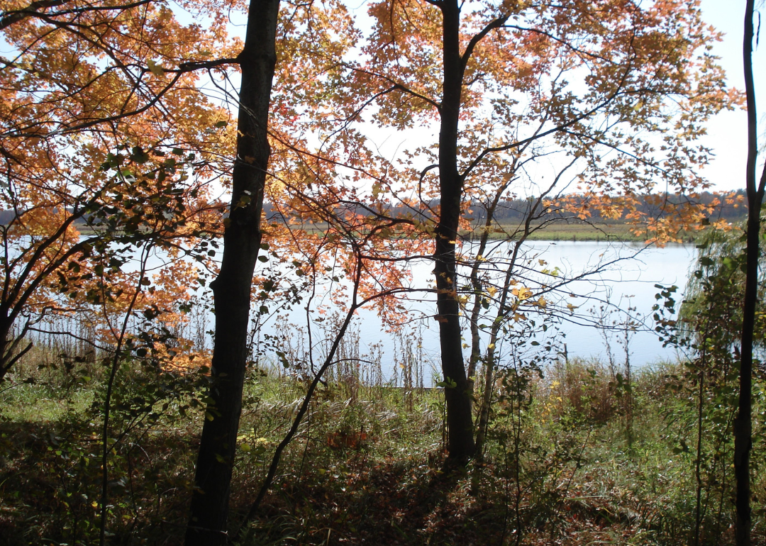
#8. Adams County
– Life expectancy: 76.4 years
— 1.8 years lower than the state average
About
Adams County features a blend of forests, farmland, and lakes that support a quiet, rural lifestyle focused on outdoor living and local traditions. The economy relies on agriculture, tourism, and small businesses that serve both residents and seasonal visitors. Community events and local markets highlight the area’s strong sense of pride and connection.
Recreation plays a central role, with opportunities for fishing, boating, ATV riding, and camping throughout the year. Historical landmarks and conservation areas add cultural and environmental depth to the region. Adams County offers a peaceful environment rooted in nature, community values, and rural resilience.
Where is Adams County?
Adams County, Wisconsin is located in the central part of the state, known for its forests, lakes, and access to recreational areas. It is approximately 27 miles south of Wisconsin Rapids, accessible via State Highway 13. The county seat, Friendship, lies near Castle Rock Lake and is part of a popular outdoor destination.
From Madison, Adams County is about 70 miles north, offering a convenient route through central Wisconsin. It is also roughly 115 miles northwest of Milwaukee, placing it in a quiet, rural part of the state. The county’s location supports tourism, outdoor activities, and small-town living.
#6. Marinette County (tie)
– Life expectancy: 76.2 years
— 2.0 years lower than the state average
About
Marinette County is defined by its rugged forests, flowing rivers, and a strong tradition of outdoor recreation and industry. The local economy is supported by manufacturing, forestry, and tourism, with small communities offering services and local pride. Residents value hard work, self-reliance, and a close relationship with the land.
Activities like hunting, fishing, snowmobiling, and whitewater rafting are central to the county’s lifestyle. Cultural life is enriched by local fairs, heritage sites, and community events that celebrate regional history. Marinette County blends natural adventure with industrial strength and strong community roots.
Where is Marinette County?
Marinette County, Wisconsin is located in the northeastern part of the state, along the border with Michigan’s Upper Peninsula. It is approximately 50 miles north of Green Bay, accessible via U.S. Route 41. The county seat, Marinette, lies on the Menominee River across from Menominee, Michigan, and serves as a regional industrial and commercial center.
From Appleton, Marinette County is about 75 miles northeast, offering a direct route to the Lake Michigan shoreline. It is also roughly 170 miles north of Milwaukee, placing it in Wisconsin’s upper lake region. The county’s location supports manufacturing, cross-border trade, and outdoor recreation.
#6. Marquette County (tie)
– Life expectancy: 76.2 years
— 2.0 years lower than the state average
About
Marquette County features rolling farmland, quiet lakes, and woodlands that support a rural lifestyle centered on simplicity and natural beauty. The local economy is grounded in agriculture, tourism, and small businesses that reflect community values and independence. Residents take pride in local traditions, seasonal events, and a strong sense of place.
Outdoor recreation is a key part of daily life, with fishing, hiking, and hunting available throughout the year. Cultural activities include local fairs, historical societies, and art programs that preserve and celebrate regional identity. Marquette County offers a peaceful, grounded environment with a focus on nature, heritage, and community connection.
Where is Marquette County?
Marquette County, Wisconsin is located in the central part of the state, characterized by lakes, forests, and agricultural land. It is approximately 34 miles west of Oshkosh, accessible via State Highway 23 and U.S. Route 51. The county seat, Montello, sits along the Fox River and serves as a quiet administrative and recreational hub.
From Madison, Marquette County is about 60 miles north, offering an easy drive into the heart of rural Wisconsin. It is also roughly 95 miles northwest of Milwaukee, placing it in a central and accessible location. The county’s setting supports tourism, fishing, and small-town living.
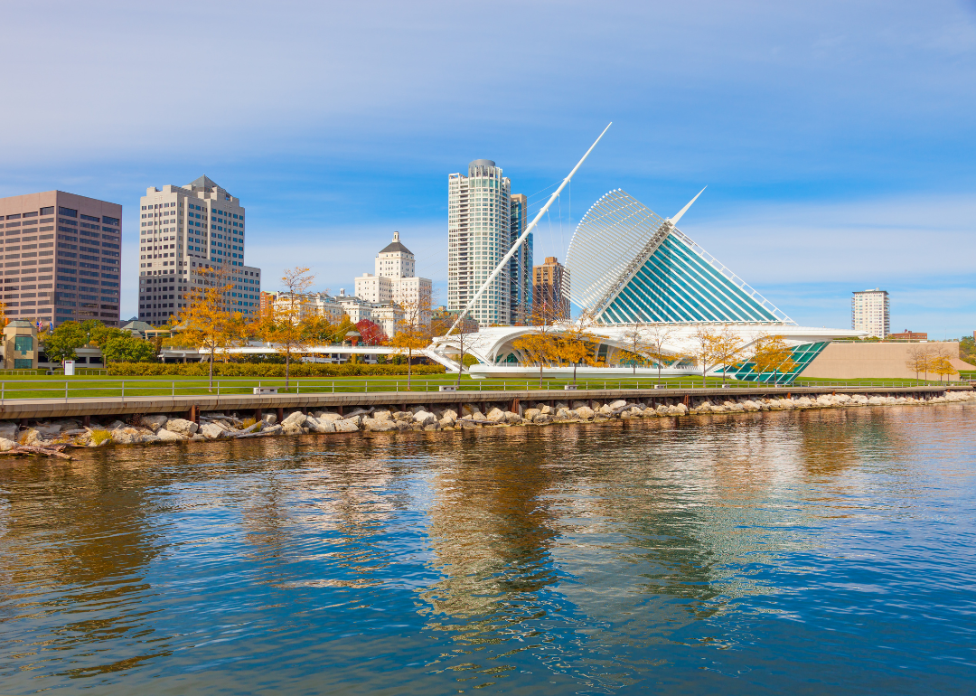
#5. Milwaukee County
– Life expectancy: 75.1 years
— 3.1 years lower than the state average
About
Milwaukee County is a hub of culture, commerce, and community life, marked by diverse neighborhoods, historic architecture, and a thriving arts scene. The economy is powered by healthcare, education, manufacturing, and a growing tech sector, with strong public institutions and civic engagement. Festivals, museums, and local businesses reflect the county’s cultural richness and dynamic identity.
Parks, trails, and waterfront access offer year-round recreation and green space in an urban setting. The county embraces innovation while honoring its industrial roots and multicultural heritage. Milwaukee County balances metropolitan energy with deep community connections and cultural depth.
Where is Milwaukee County?
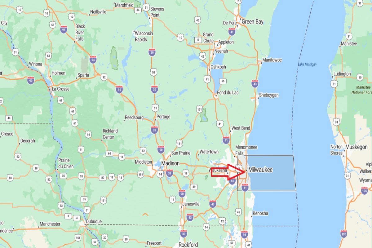
Milwaukee County, Wisconsin is located in the southeastern part of the state, along the western shore of Lake Michigan. It is approximately 79 miles east of Madison, connected via Interstate 94. The county seat, Milwaukee, is the largest city in the state and serves as a major cultural, economic, and transportation center.
From Chicago, Illinois, Milwaukee County is about 92 miles north, making it part of the greater Great Lakes urban corridor. It is also roughly 107 miles southeast of Green Bay, offering connectivity to northeastern Wisconsin. The county’s location supports industry, commerce, and vibrant metropolitan life.
You may also like: Counties where homes are selling the fastest in Wisconsin
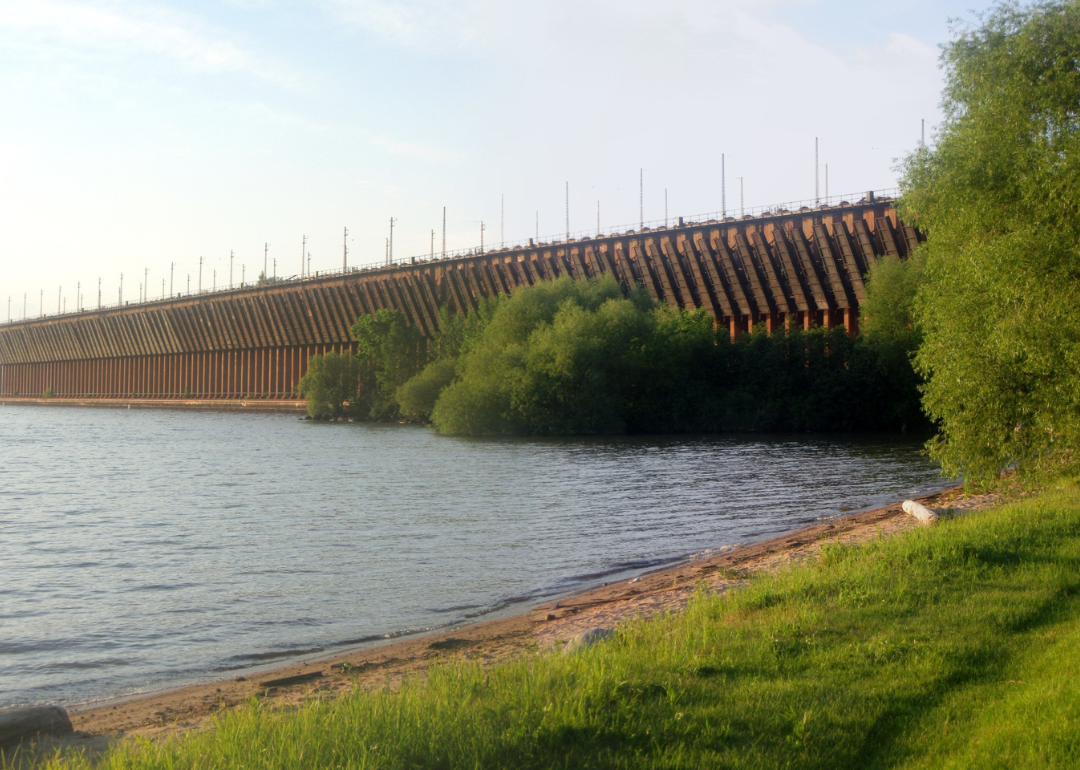
#4. Ashland County
– Life expectancy: 74.8 years
— 3.4 years lower than the state average
About
Ashland County is shaped by its rich natural resources, forested landscapes, and deep cultural heritage. The economy relies on tourism, forestry, education, and healthcare, with strong ties to local history and environmental stewardship. Communities are known for their resilience, local pride, and a commitment to preserving regional traditions.
Outdoor activities such as fishing, hiking, kayaking, and snowshoeing are popular year-round. Cultural life includes Native American heritage, historic sites, arts programs, and community festivals. Ashland County offers a blend of scenic beauty, cultural depth, and a strong sense of place.
Where is Ashland County?
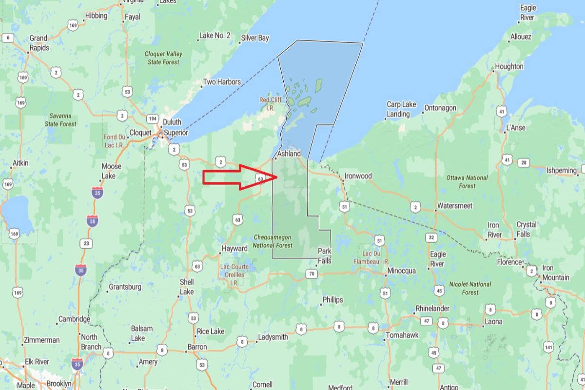
Ashland County, Wisconsin is located in the northern part of the state, along the southern shore of Lake Superior. It is approximately 70 miles northwest of Rhinelander, accessible via U.S. Route 2 and State Highway 13. The county seat, Ashland, is a port city known for its lakefront, historic architecture, and access to the Apostle Islands.
From Wausau, Ashland County is about 145 miles north, offering a scenic route through the Northwoods. It is also roughly 300 miles north of Madison, placing it in one of the most remote and northern regions of the state. The county’s location supports tourism, forestry, and outdoor recreation along Lake Superior.
#3. Sawyer County
– Life expectancy: 74.7 years
— 3.5 years lower than the state average
About
Sawyer County is known for its vast forests, clean lakes, and a lifestyle deeply connected to nature and recreation. The economy is supported by tourism, forestry, and small businesses that serve both residents and seasonal visitors. Communities value tradition, self-reliance, and strong local engagement.
Outdoor activities such as fishing, snowmobiling, and trail exploration play a central role in daily life. Cultural life includes Native American heritage, local festivals, and art initiatives that celebrate the region’s identity. Sawyer County offers a peaceful, nature-rich setting grounded in community and cultural pride.
Where is Sawyer County?
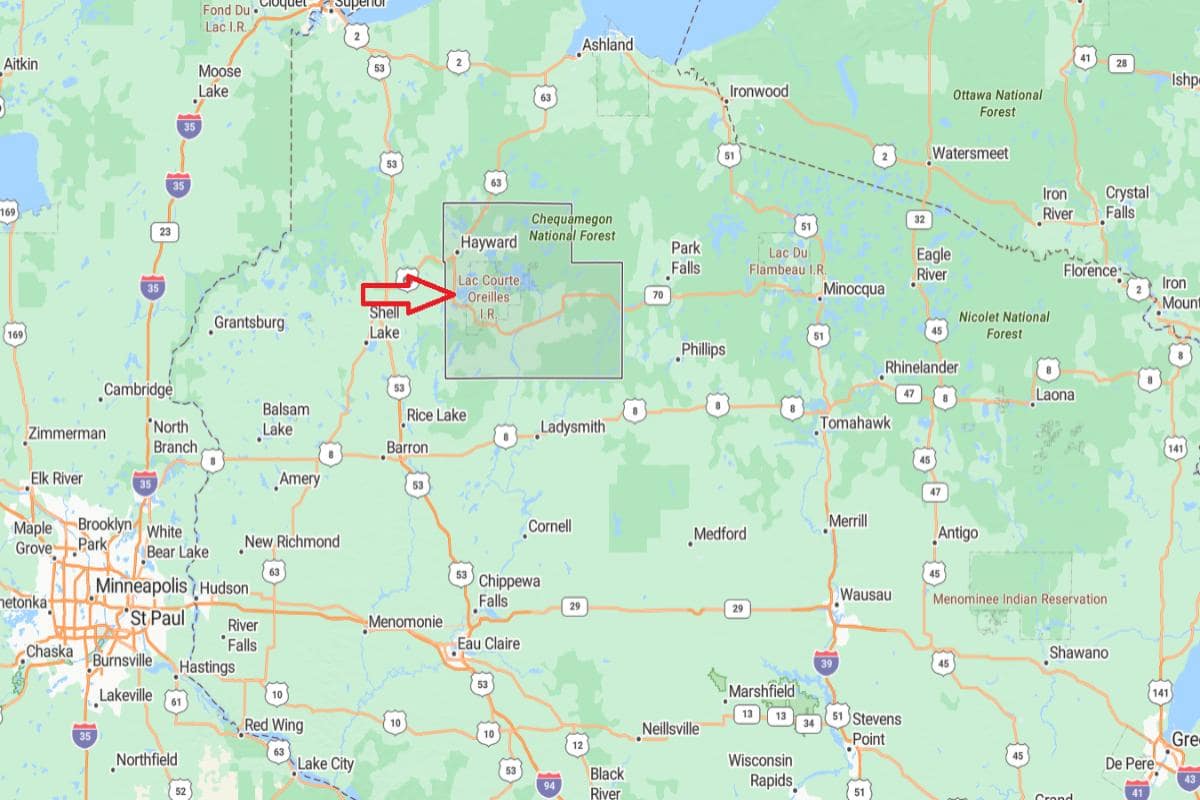
Sawyer County, Wisconsin is located in the northwestern part of the state, known for its dense forests, lakes, and outdoor recreation. It is approximately 70 miles north of Eau Claire, accessible via State Highways 27 and 63. The county seat, Hayward, is a popular destination for fishing, snowmobiling, and annual sporting events.
From Wausau, Sawyer County is about 120 miles northwest, offering access to Wisconsin’s scenic Northwoods. It is also roughly 250 miles north of Madison, placing it in a remote and tranquil area ideal for tourism and wilderness activities. The county’s location supports a strong recreation-based economy and rural lifestyle.
#2. Forest County
– Life expectancy: 72.9 years
— 5.3 years lower than the state average
About
Forest County is defined by its dense woodlands, abundant wildlife, and a way of life rooted in tradition and the outdoors. The local economy is driven by forestry, tribal enterprises, and tourism, with small towns and communities maintaining a close-knit atmosphere. Residents value independence, cultural heritage, and a strong connection to the land.
Recreational opportunities like hunting, fishing, ATV riding, and snowmobiling are central to daily life. The county also highlights Native American culture, local events, and efforts to preserve its natural resources. Forest County offers a quiet, resilient lifestyle shaped by nature and history.
Where is Forest County?
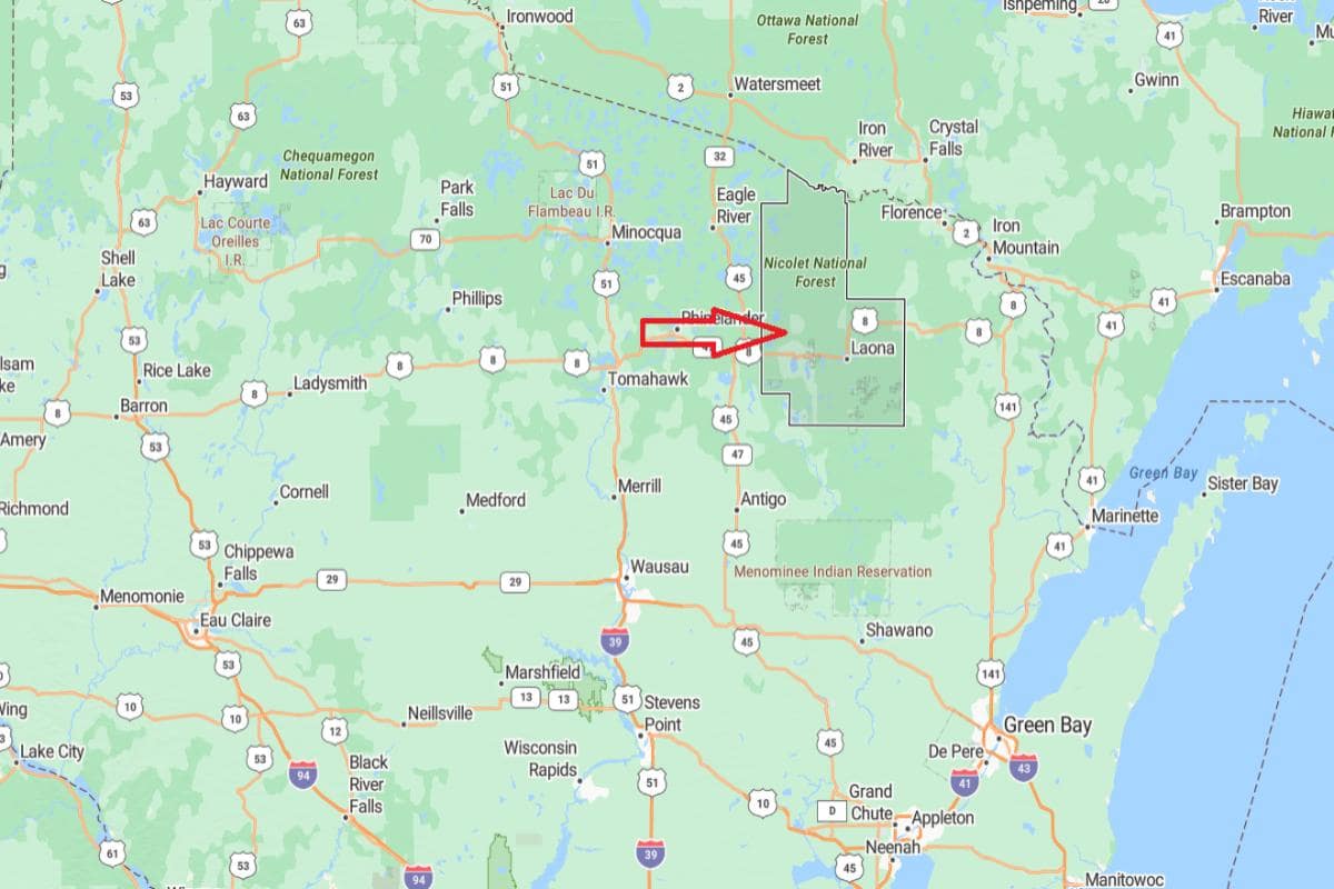
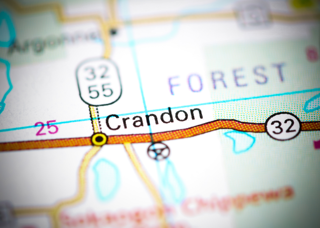
Forest County, Wisconsin is located in the northeastern part of the state, known for its vast forests, lakes, and tribal lands. It is approximately 43 miles northeast of Rhinelander, accessible via U.S. Route 8 and State Highway 32. The county seat, Crandon, lies near the Nicolet National Forest and is central to the county’s outdoor tourism.
From Green Bay, Forest County is about 90 miles northwest, offering a scenic route into the heart of Wisconsin’s Northwoods. It is also roughly 180 miles north of Madison, placing it in a quiet, remote region of the state. The county’s location supports forestry, tribal governance, and year-round recreation.
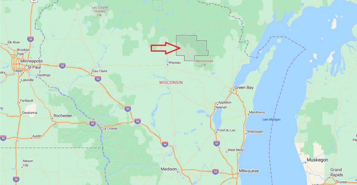
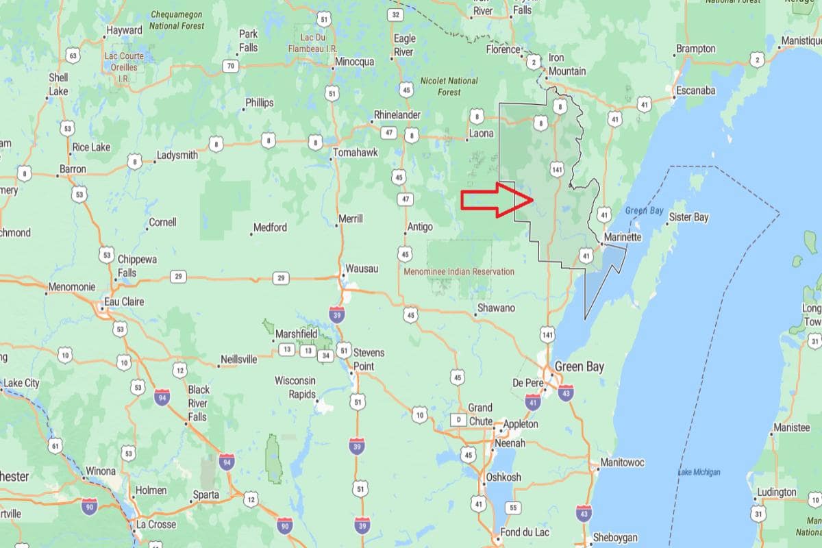
#1. Menominee County
– Life expectancy: 65.9 years
— 12.3 years lower than the state average
About
Menominee County is deeply rooted in Native American heritage, with its identity shaped by tribal traditions, community values, and forest stewardship. The economy centers on tribal governance, forestry, and public services, emphasizing sustainable practices and cultural preservation. Local life reflects a strong sense of unity, respect for the land, and pride in heritage.
Outdoor activities such as hunting, fishing, and hiking are closely tied to cultural practices and the surrounding natural environment. Education, language revitalization, and community programs strengthen intergenerational connections. Menominee County offers a unique blend of tradition, resilience, and deep cultural meaning.
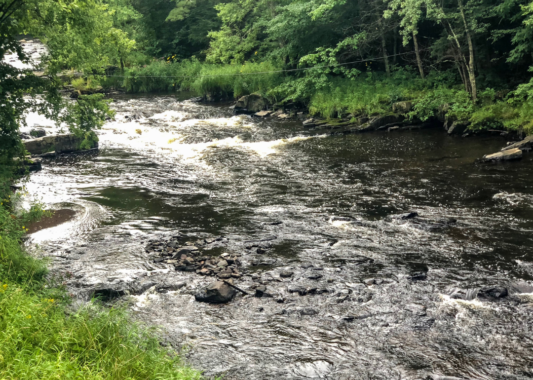
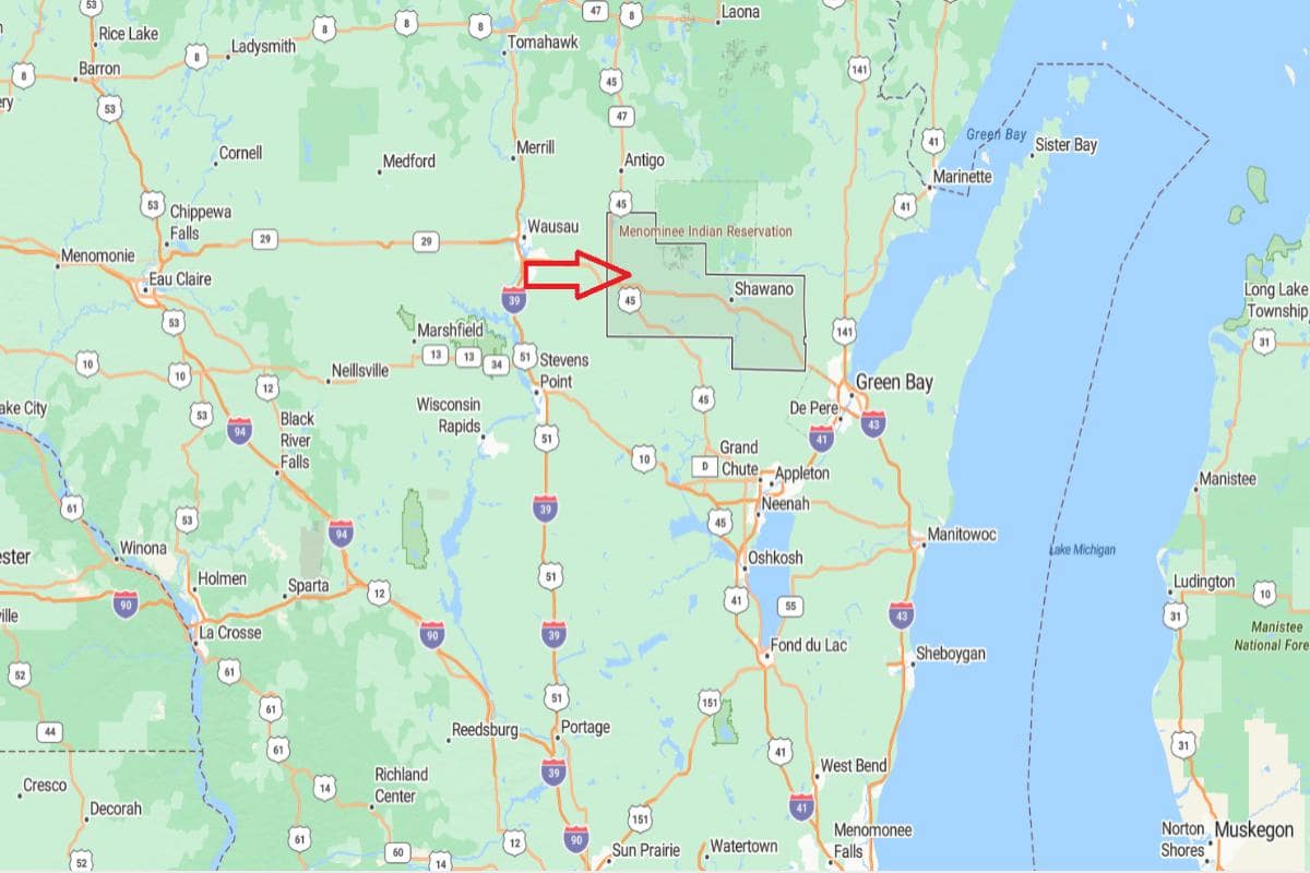
Where is Menominee County?
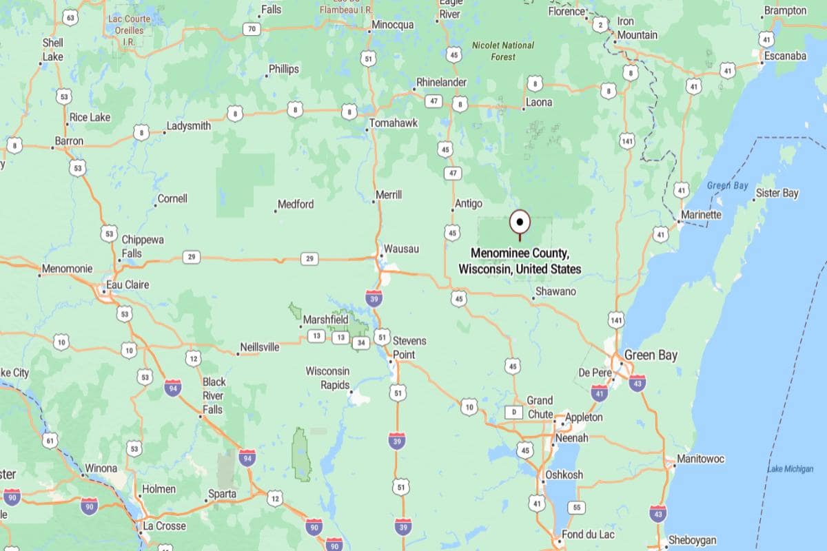
Menominee County, Wisconsin is located in the northeastern part of the state and is home to the Menominee Indian Reservation. It is approximately 42 miles northwest of Green Bay, accessible via State Highway 47. The county seat, Keshena, lies near the Wolf River and serves as the cultural and administrative center of the Menominee Nation.
From Appleton, Menominee County is about 50 miles north, placing it within reach of the Fox Valley region. It is also roughly 140 miles north of Madison, offering a rural and forested setting. The county’s location supports tribal governance, natural resource preservation, and outdoor recreation.
This story features data reporting by Karim Noorani, writing by Kiersten Hickman, and is part of a series utilizing data automation across 49 states.
By Stacker