Would you like to save this?
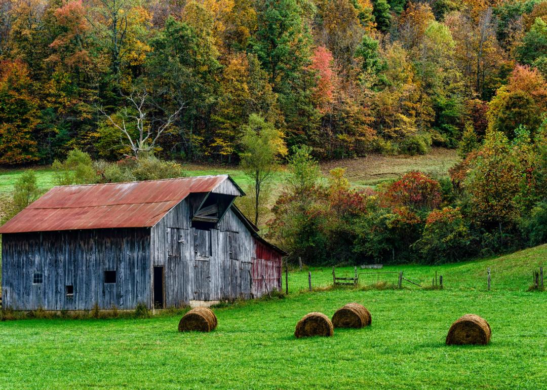
Counties with the shortest life expectancy in West Virginia
Life expectancy can be affected by a variety of factors. About 25% of your lifespan is determined by genetics, according to the National Library of Medicine. Health and wellness habits—like following a balanced, nutrient-rich diet; not smoking; drinking minimal alcohol; maintaining a healthy weight; and staying physically active—can add more than a decade to your life, research from the National Institutes of Health shows. While these factors are significant, another important element that you might not have considered is your environment and community.
While life expectancy generally increases annually in the United States—jumping from about 70.8 years old to 77.5 between 1970 and 2022, according to the Centers for Disease Control and Prevention—this particular metric can vary from state to state or even county to county. In some parts of the country, the average lifespan is getting shorter based on a variety of risk factors on top of health, including socioeconomic factors like poverty, unemployment, income, and education.
According to a 2020 study from researchers at Penn State, West Virginia, and Michigan State Universities, communities with a higher population density, more fast food restaurants, and a high number of extraction industry-based jobs tend to have shorter life expectancies.
To find out how life expectancy varies within West Virginia, Stacker used 2024 County Health Rankings & Roadmaps from the University of Wisconsin Population Health Institute to identify the counties with the shortest life expectancy. Life expectancy measures the average number of years from birth a person can expect to live and is calculated based on the number of deaths in a given time period and the average number of people at risk of dying during that period. Counties with unreliable or insufficient data were excluded from the analysis. Mortality data came from the National Vital Statistics System.
Read on to see if your county is on the list.
You may also like: Highest-rated wineries in West Virginia, according to Yelp
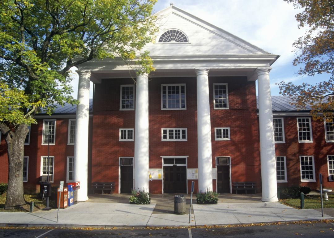
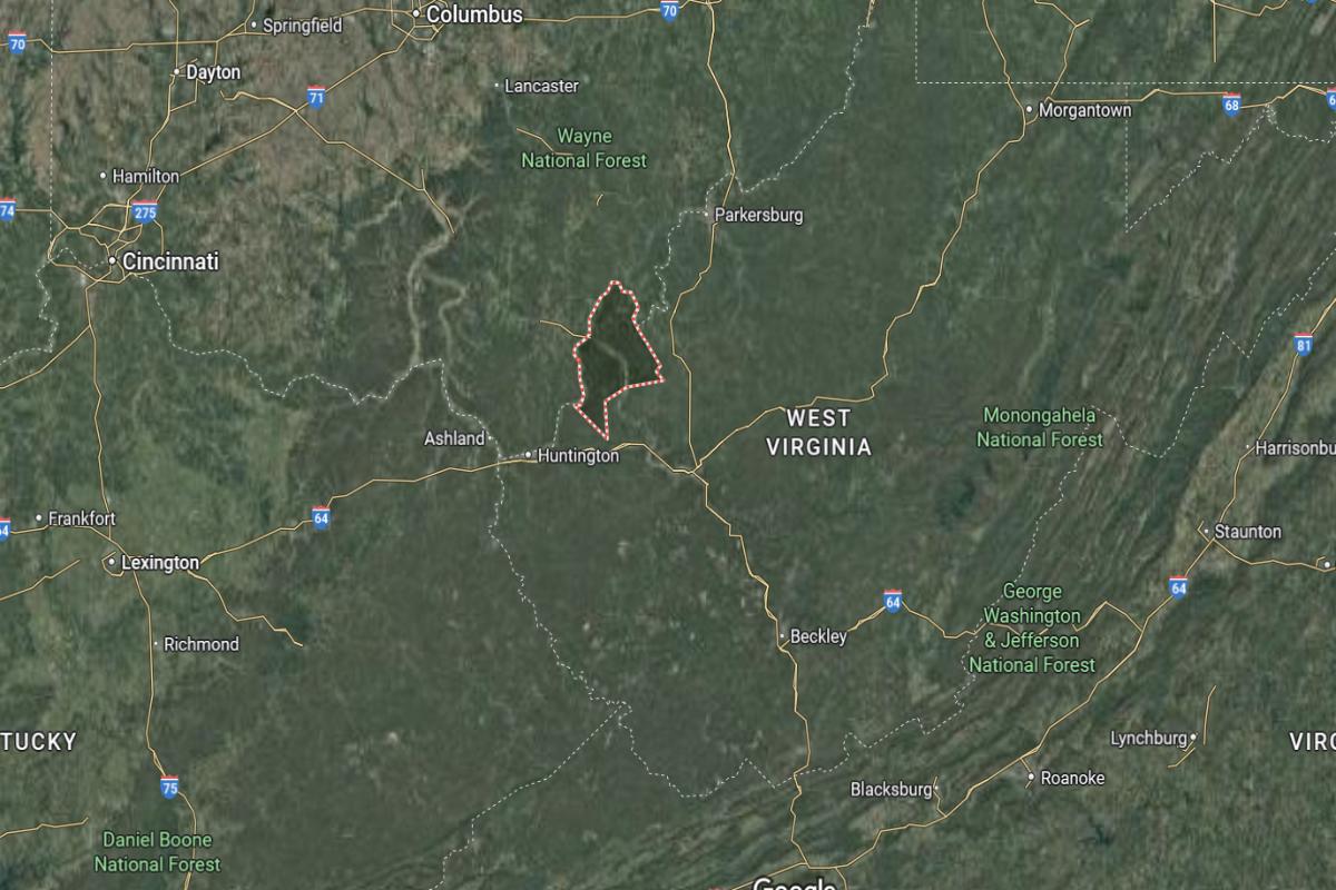
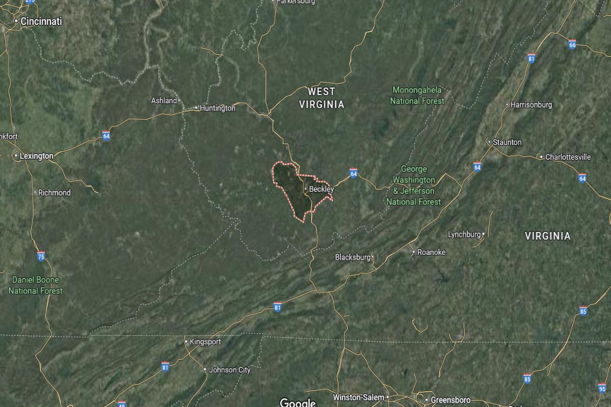
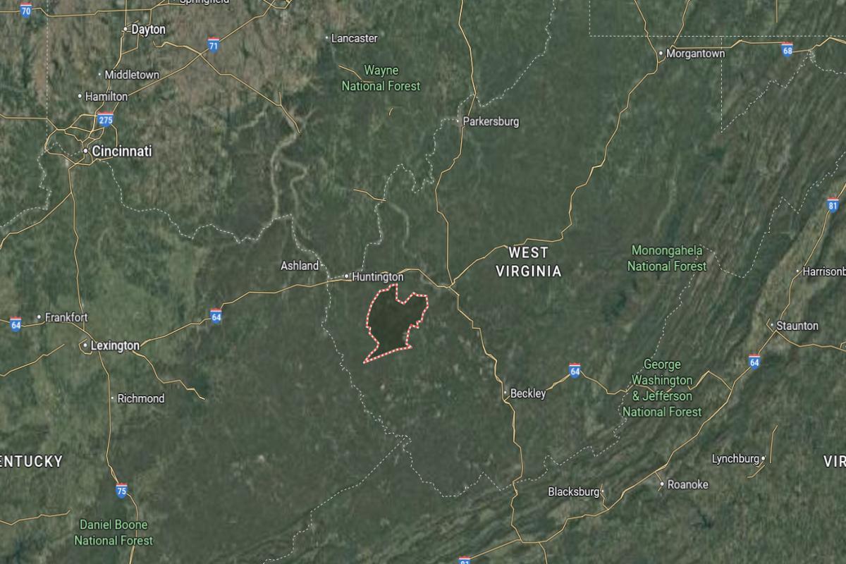
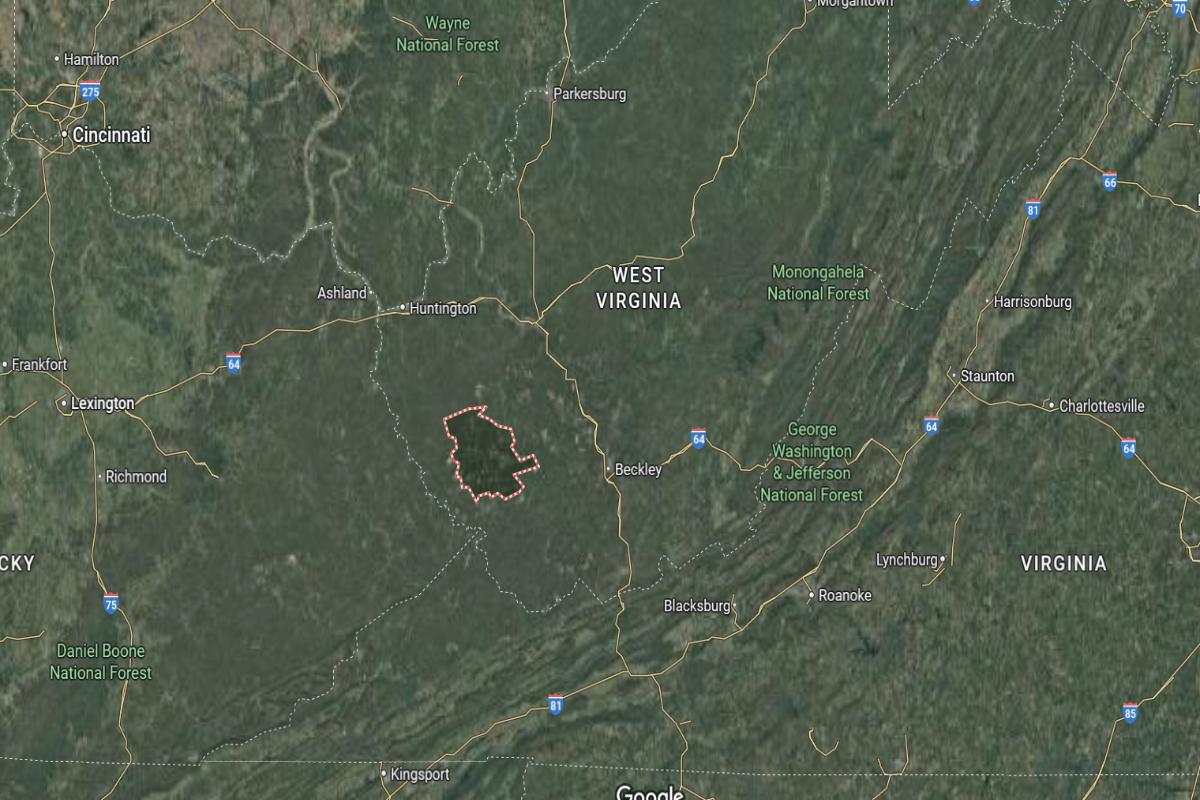
#19. Nicholas County
– Life expectancy: 72.7 years
— 0.2 years lower than the state average
About
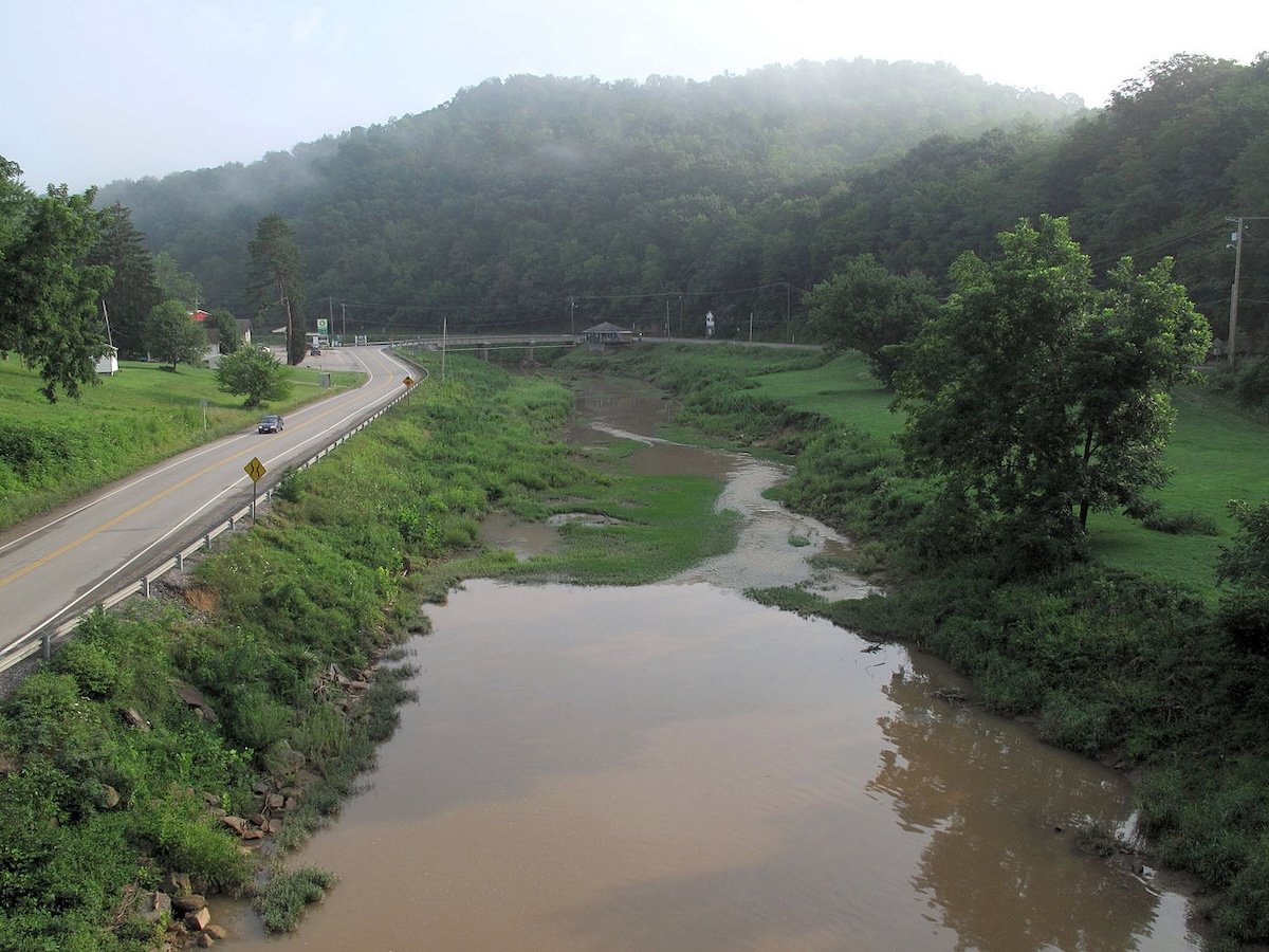
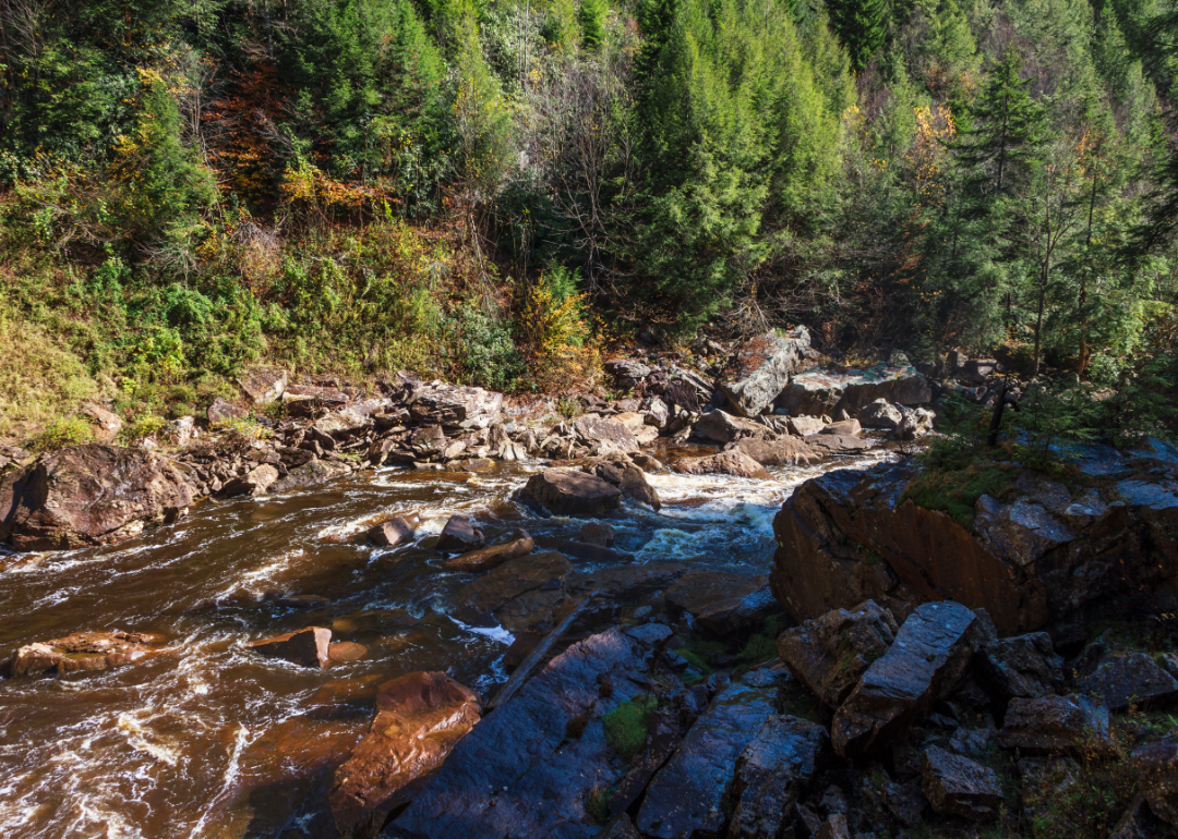
Nicholas County is defined by its rolling hills, forested landscapes, and a strong sense of Appalachian heritage and pride. The region is shaped by coal mining, timber, and outdoor traditions that foster resilience and deep community roots. Its towns reflect a quiet determination, where history and nature blend seamlessly.
Residents enjoy hunting, fishing, local fairs, and gatherings that highlight family and tradition. Life follows a steady rhythm guided by seasonal changes and close community ties. Nicholas County embodies the heart of rural West Virginia—tough, proud, and deeply connected to its land and people.
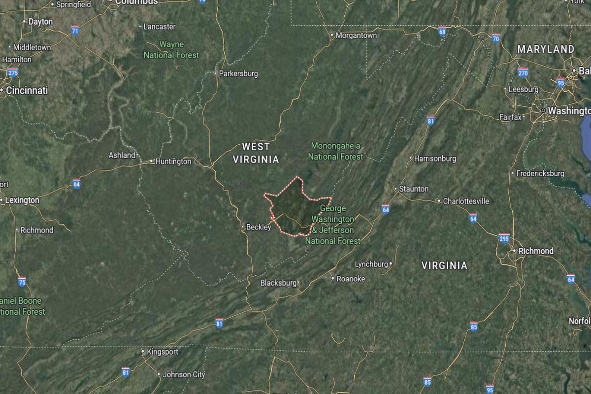
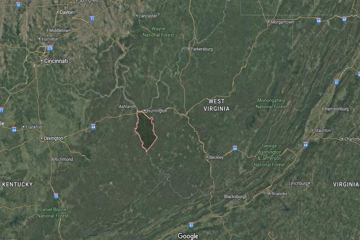
Where is Nicholas County?
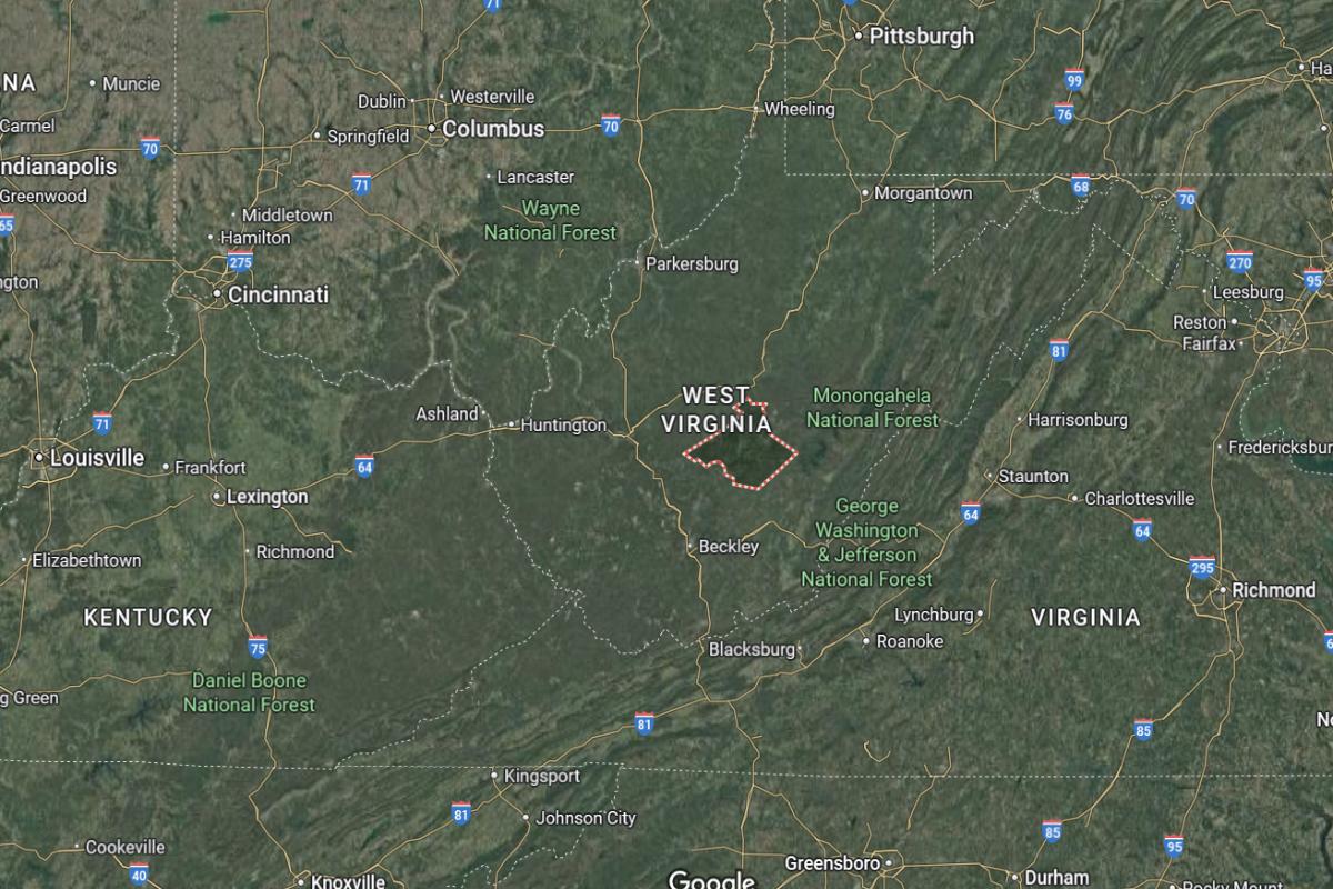
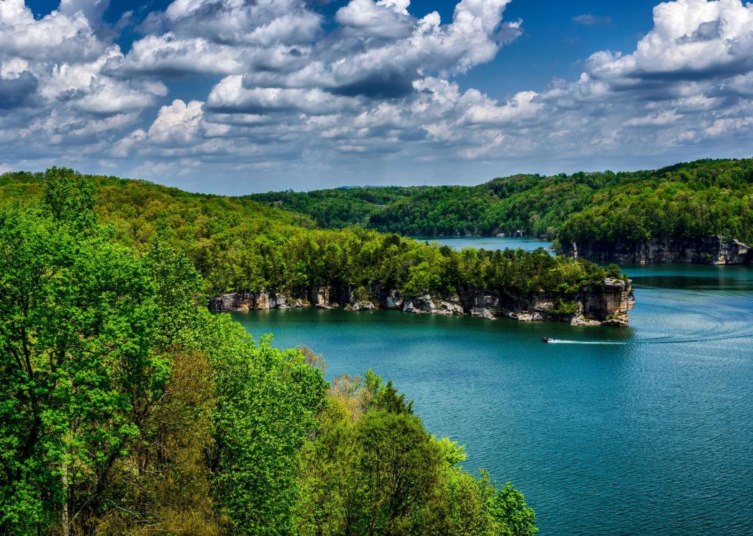
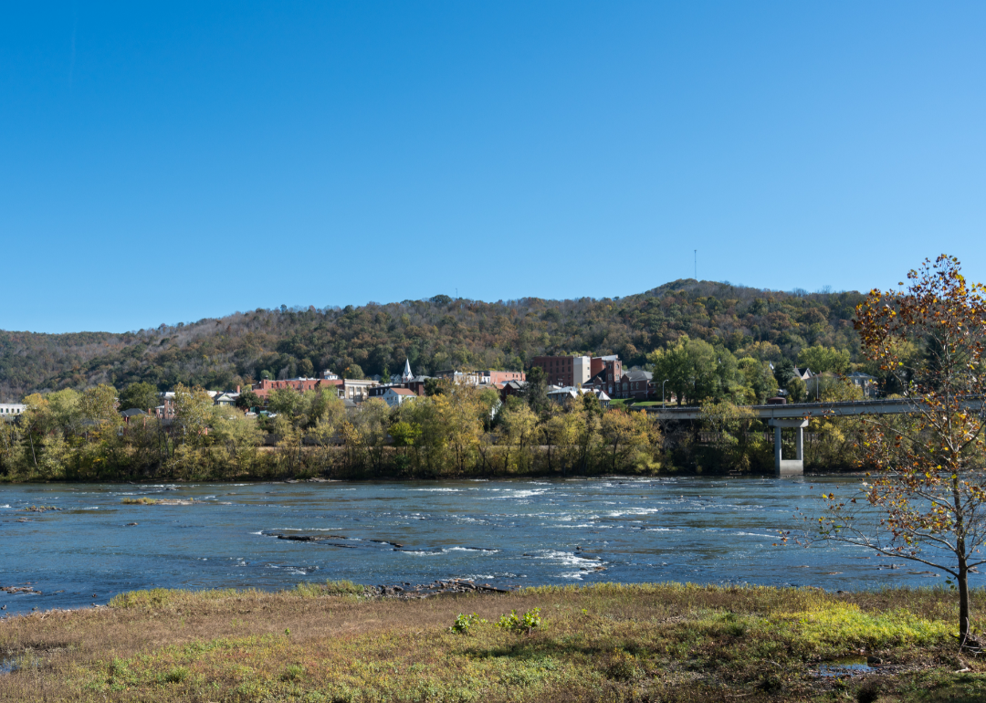
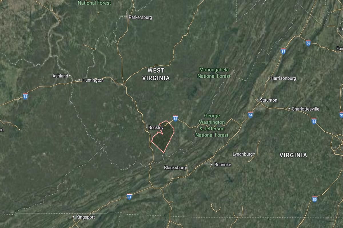
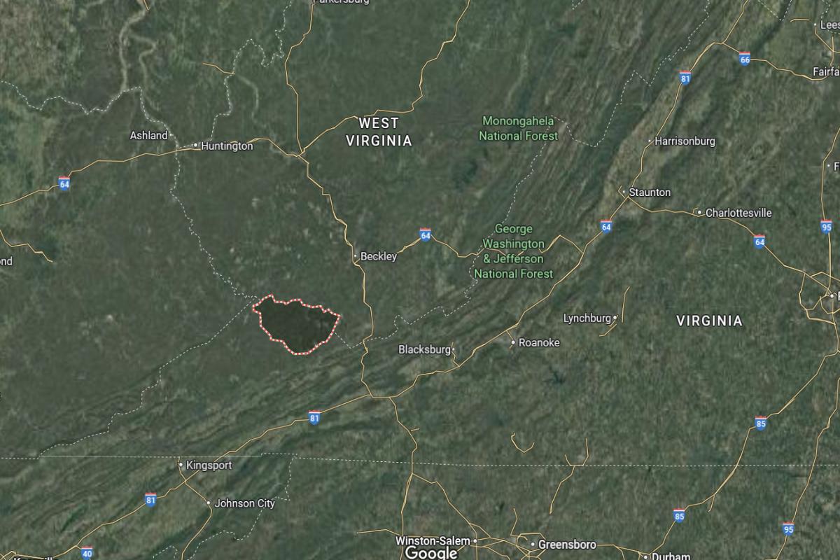
Nicholas County is located in central West Virginia, nestled in the Appalachian Mountains. It is approximately 70 miles east of Charleston and 50 miles north of Beckley. The county spans about 35 miles from north to south and 30 miles from east to west.
Summersville, the county seat, is around 25 miles west of Richwood and 60 miles south of Weston. It also lies about 75 miles northeast of Huntington. Nicholas County is known for its forested hills, Summersville Lake, and access to outdoor recreation in the Gauley River region.
#18. Greenbrier County
– Life expectancy: 72.5 years
— 0.4 years lower than the state average
About
Greenbrier County blends historic charm, natural elegance, and a strong cultural presence shaped by Appalachian traditions. The region features scenic valleys, artistic communities, and a deep-rooted appreciation for hospitality and heritage. Its towns reflect a blend of timeless beauty, creativity, and pride.
Residents enjoy festivals, outdoor adventures, and a lifestyle that values connection, craftsmanship, and community spirit. The area supports a peaceful pace with a focus on quality of life and preservation. Greenbrier County represents a graceful balance of tradition, culture, and natural richness in the heart of West Virginia.
Where is Greenbrier County?
Greenbrier County is located in southeastern West Virginia, near the Virginia state line in the Allegheny Mountains. It is approximately 110 miles southeast of Charleston and 80 miles northeast of Beckley. The county spans about 50 miles from north to south and 40 miles from east to west.
Lewisburg, the county seat, is around 30 miles west of Covington, Virginia and 25 miles south of Rainelle. White Sulphur Springs, another key town, is located about 10 miles east of Lewisburg. Greenbrier County is known for its historic resorts, mountain scenery, and cultural events.
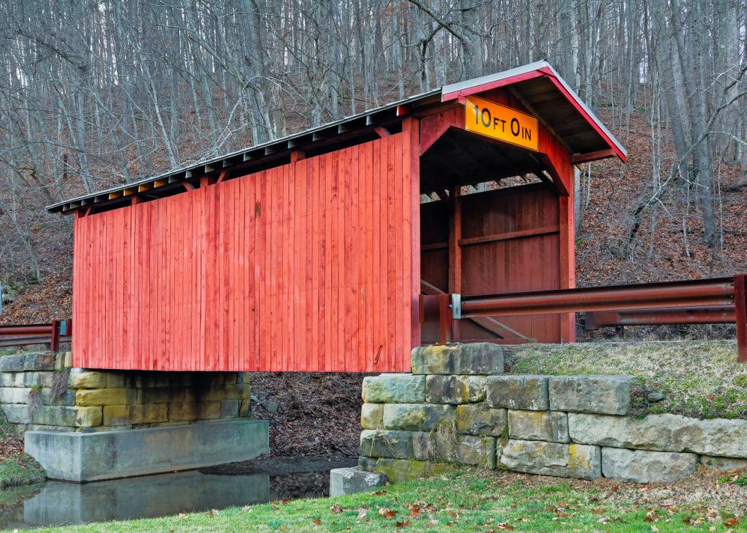
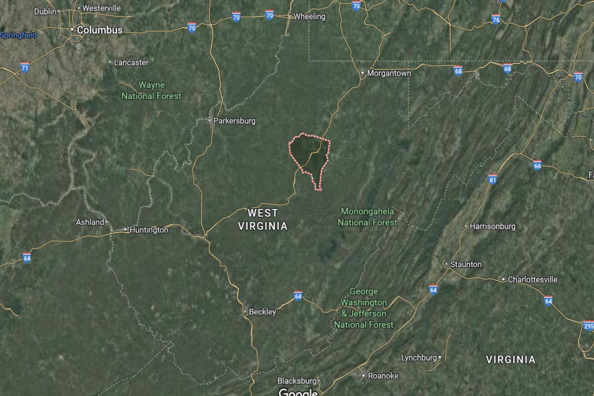
#17. Wetzel County
– Life expectancy: 72.1 years
— 0.8 years lower than the state average
About
Wetzel County is shaped by its river valleys, wooded hills, and a heritage rooted in coal, oil, and hardworking Appalachian traditions. The area reflects a strong sense of self-reliance, where small communities value faith, family, and the land. History and resilience are deeply woven into daily life.
Residents enjoy community festivals, hunting seasons, and gatherings that emphasize togetherness and pride. The lifestyle is modest, grounded, and centered around enduring values and close relationships. Wetzel County represents the steadfast spirit of rural West Virginia—quiet, proud, and deeply connected to its roots.
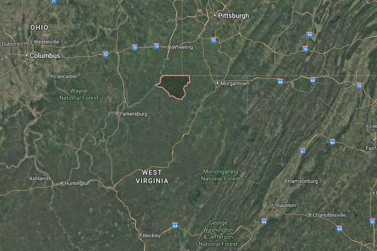
Where is Wetzel County?
Would you like to save this?
Wetzel County is located in northern West Virginia along the Ohio River, bordering Ohio to the west. It is approximately 40 miles south of Wheeling and 100 miles northeast of Charleston. The county spans about 30 miles from north to south and 25 miles from east to west.
New Martinsville, the county seat, is around 30 miles southwest of Moundsville and 35 miles north of Parkersburg. Hundred, a small town in the eastern part of the county, is located about 20 miles east of New Martinsville. Wetzel County is known for its river access, rolling hills, and a mix of small towns and rural communities.

#16. Mason County
– Life expectancy: 71.8 years
— 1.1 years lower than the state average
About
Mason County is defined by its rich river heritage, agricultural traditions, and a strong sense of historical continuity. The area’s landscape and culture are shaped by farming, industry, and community resilience passed down through generations. Its towns reflect a blend of rural charm and enduring pride.
Residents enjoy local fairs, scenic views, and a pace of life rooted in faith, family, and hard work. Events and traditions foster close community bonds and a shared sense of place. Mason County represents the quiet strength and steady values that define much of West Virginia’s heartland.
Where is Mason County?
Mason County is located in western West Virginia along the Ohio River, directly across from southern Ohio. It is approximately 40 miles northwest of Charleston and 50 miles southeast of Portsmouth, Ohio. The county spans about 30 miles from north to south and 25 miles from east to west.
Point Pleasant, the county seat, is around 20 miles south of Ravenswood and 40 miles northeast of Huntington. Hartford, a smaller town, lies about 10 miles north of Point Pleasant. Mason County is known for its riverfront location, historical landmarks, and the legend of the Mothman.

#14. Kanawha County (tie)
– Life expectancy: 71.5 years
— 1.4 years lower than the state average
About
Kanawha County blends industrial heritage, civic life, and natural beauty into a region marked by resilience and history. The area has long been a hub for energy, government, and culture, reflecting a dynamic balance between progress and tradition. Its communities are built on hard work, pride, and deep local ties.
Residents enjoy riverfront parks, historic landmarks, and a variety of cultural and community events. Life here is grounded in strong neighborhoods, public service, and Appalachian spirit. Kanawha County represents a steady, evolving blend of heritage, determination, and civic pride in central West Virginia.
Where is Kanawha County?
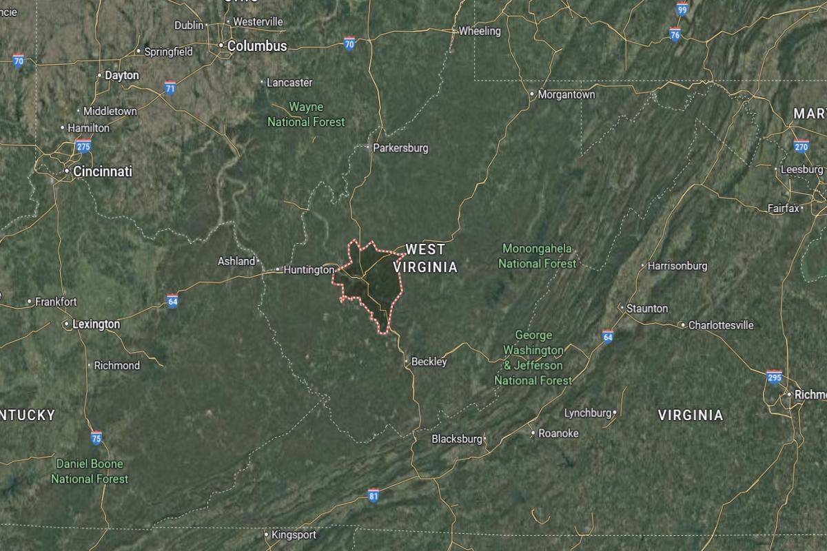
Kanawha County is located in the west-central part of West Virginia and is home to the state capital, Charleston. It is approximately 160 miles west of Roanoke, Virginia and 50 miles north of Beckley. The county spans about 45 miles from east to west and 35 miles from north to south.
Charleston, the county seat and largest city, is around 55 miles southeast of Huntington and 30 miles west of Montgomery. Nitro, another key city in the county, is located about 15 miles northwest of Charleston. Kanawha County serves as a political, economic, and transportation hub for the state.
You may also like: What Medicaid acceptance looks like at West Virginia substance use treatment centers
#14. Lewis County (tie)
– Life expectancy: 71.5 years
— 1.4 years lower than the state average
About
Lewis County is known for its scenic hills, quiet towns, and a deep appreciation for history, tradition, and rural living. The area reflects a strong agricultural and timber legacy, with communities rooted in resilience and self-sufficiency. Its charm lies in the simplicity of daily life and the pride of generations who have called it home.
Residents enjoy local festivals, outdoor activities, and the steady rhythm of a community built on close relationships and shared values. A sense of peace, hard work, and heritage shapes the county’s identity. Lewis County represents the quiet strength and enduring character of Appalachian West Virginia.
Where is Lewis County?
Lewis County is located in north-central West Virginia, within the Appalachian foothills. It is approximately 100 miles northeast of Charleston and 75 miles south of Morgantown. The county spans about 30 miles from north to south and 25 miles from east to west.
Weston, the county seat, is around 25 miles west of Buckhannon and 35 miles south of Clarksburg. Jane Lew, a smaller town, is located about 10 miles north of Weston. Lewis County is known for its rolling hills, Civil War history, and scenic rural landscapes.
#13. Summers County
– Life expectancy: 71.3 years
— 1.6 years lower than the state average
About
Summers County is known for its natural beauty and small-town charm, with a strong sense of community rooted in tradition. The region features scenic rivers, historic architecture, and a relaxed pace of life that appeals to both residents and visitors. Outdoor recreation like hiking, fishing, and whitewater rafting is a major draw in the area.
The county also showcases cultural heritage through local festivals, artisan crafts, and family-run businesses. Education and civic pride are central to community life, with schools and local organizations fostering engagement. Summers County offers a tranquil yet active lifestyle, shaped by its people and surroundings.
Where is Summers County?
Summers County is located in southern West Virginia, nestled in the Appalachian Mountains and along the New River. It is approximately 60 miles southeast of Charleston and 25 miles southwest of Beckley. The county spans about 25 miles from north to south and 30 miles from east to west.
Hinton, the county seat, is around 30 miles east of Princeton and 20 miles south of Fayetteville. Talcott, a smaller community, lies about 10 miles northeast of Hinton. Summers County is known for its river valleys, historic rail lines, and outdoor recreation opportunities along the New River and Bluestone Lake.
#12. Fayette County
– Life expectancy: 71.2 years
— 1.7 years lower than the state average
About
Fayette County is rich in Appalachian heritage and outdoor adventure, with a strong connection to coal mining history and rugged mountain landscapes. Its dramatic cliffs, forested trails, and rivers make it a haven for rock climbers, hikers, and whitewater enthusiasts. Local communities blend historic character with modern creativity, hosting art fairs, music events, and small business ventures.
The area thrives on a deep sense of local pride and environmental appreciation, attracting those drawn to nature and tradition. Residents support conservation efforts and sustainable tourism, preserving the area’s natural and cultural assets. Fayette County continues to evolve while honoring its roots and fostering a close-knit, welcoming atmosphere.
Where is Fayette County?
Fayette County is located in south-central West Virginia, within the Appalachian Plateau region. It is approximately 55 miles southeast of Charleston and 20 miles north of Beckley. The county spans about 35 miles from north to south and 30 miles from east to west.
Fayetteville, the county seat, is around 25 miles west of Summersville and 15 miles northeast of Oak Hill. Montgomery, a smaller city, lies about 20 miles northwest of Fayetteville. Fayette County is known for the New River Gorge, whitewater rafting, and rugged mountain scenery.
#11. Wayne County
– Life expectancy: 71.1 years
— 1.8 years lower than the state average
About
Wayne County is defined by its deep agricultural roots, family traditions, and rolling hills that shape its rural character. Generations of families have lived and worked the land, creating a tight-knit community centered around farming, coal heritage, and small-town values. The landscape features quiet hollows, winding creeks, and wide stretches of countryside.
The county’s culture is grounded in local pride, with festivals, high school sports, and community gatherings playing a key role in daily life. People here value resilience, independence, and strong neighborly ties. Wayne County reflects a blend of simplicity and strength, shaped by both its history and its people.
Where is Wayne County?
Wayne County is located in the southwestern corner of West Virginia, along the Ohio River and bordering Kentucky to the west. It is approximately 60 miles southwest of Charleston and 10 miles west of Huntington. The county spans about 35 miles from north to south and 30 miles from east to west.
Wayne, the county seat, is around 20 miles south of Huntington and 35 miles northwest of Logan. Fort Gay, another town in the county, lies about 15 miles south of Wayne, near the Kentucky border. Wayne County is known for its rural landscapes, riverfront access, and Appalachian heritage.
Would you like to save this?
#10. Clay County
– Life expectancy: 70.7 years
— 2.2 years lower than the state average
About
Clay County is known for its rugged hills, deep forests, and a lifestyle rooted in self-reliance and community tradition. The county has long been shaped by timber, coal, and farming, with generations of families tied to the land. Quiet roads and scenic hollows give it a peaceful, secluded feel.
Community life centers around schools, churches, and seasonal festivals that reflect strong local identity. Residents value independence, resourcefulness, and connection to nature. Clay County offers a slower pace of life where heritage and resilience are central to its character.
Where is Clay County?
Clay County is located in central West Virginia, nestled in the Appalachian hills between Charleston and Sutton. It is approximately 40 miles northeast of Charleston and 30 miles southwest of Sutton. The county spans about 30 miles from north to south and 25 miles from east to west.
Clay, the county seat, is around 20 miles north of Clendenin and 35 miles east of Elkview. It is also about 45 miles southeast of Weston. Clay County is known for its forested terrain, winding rivers, and quiet, rural communities.
You may also like: Best counties to raise a family in West Virginia

#9. Cabell County
– Life expectancy: 70.4 years
— 2.5 years lower than the state average
About
Cabell County blends historic charm with urban energy, offering a mix of educational, cultural, and business influences. Its communities feature vibrant neighborhoods, active arts scenes, and a focus on innovation balanced with tradition. Parks, libraries, and public spaces reflect strong civic investment and community pride.
The county’s residents are diverse and engaged, with schools, universities, and local events fostering connection and growth. Healthcare, education, and commerce drive the local economy, creating a dynamic atmosphere. Cabell County represents a balance of progress and heritage, shaped by its people and institutions.
Where is Cabell County?
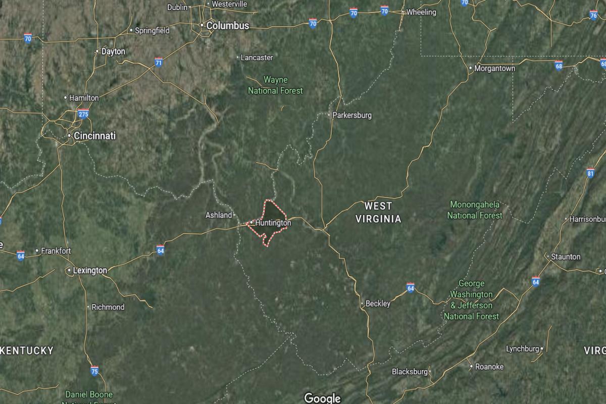
Cabell County is located in western West Virginia along the Ohio River, bordering Ohio to the west. It is approximately 50 miles west of Charleston and 25 miles northeast of Ashland, Kentucky. The county spans about 30 miles from north to south and 25 miles from east to west.
Huntington, the county seat and one of the largest cities in the state, is around 10 miles east of the Ohio border and 35 miles west of Hurricane. Barboursville, another key town, lies about 10 miles east of Huntington. Cabell County is a regional center for education, healthcare, and commerce, anchored by Marshall University.
#7. Wyoming County (tie)
– Life expectancy: 70.0 years
— 2.9 years lower than the state average
About
Wyoming County is rooted in coal mining history, close-knit communities, and a deep respect for Appalachian traditions. The landscape features rugged terrain, forested ridges, and quiet towns where family ties run strong. Life moves at a steady pace, shaped by hard work and shared heritage.
Locals take pride in their resilience, celebrating their roots through festivals, storytelling, and strong community bonds. Outdoor activities like hunting, fishing, and ATV riding are central to daily life. Wyoming County reflects the spirit of perseverance and connection to the land.
Where is Wyoming County?
Wyoming County is located in the southern part of West Virginia, nestled in the Appalachian Mountains. It is approximately 70 miles south of Charleston and 35 miles west of Beckley. The county spans about 35 miles from north to south and 30 miles from east to west.
Pineville, the county seat, is around 20 miles southeast of Oceana and 25 miles northwest of Welch. Mullens, another notable town, lies about 15 miles northeast of Pineville. Wyoming County is known for its coal mining heritage, mountainous terrain, and scenic river valleys.
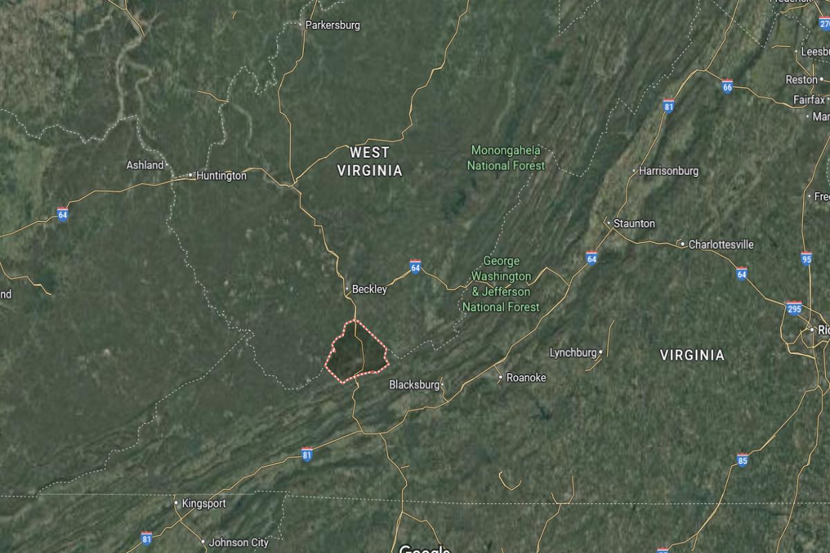
#7. Raleigh County (tie)
– Life expectancy: 70.0 years
— 2.9 years lower than the state average
About
Raleigh County combines a legacy of coal mining with a growing focus on education, healthcare, and regional development. Its towns and communities reflect a blend of historical pride and forward-thinking progress. The area features cultural institutions, recreational facilities, and a strong network of local businesses.
Residents are known for their hospitality, resilience, and involvement in civic life. Community events, youth programs, and volunteer efforts highlight the county’s commitment to growth and unity. Raleigh County offers a balanced lifestyle rooted in tradition and evolving opportunity.
Where is Raleigh County?
Raleigh County is located in southern West Virginia, within the Appalachian Plateau. It is approximately 55 miles southeast of Charleston and 80 miles west of Lewisburg. The county spans about 35 miles from north to south and 30 miles from east to west.
Beckley, the county seat and regional hub, is around 25 miles south of Fayetteville and 45 miles northeast of Princeton. Sophia, another town in the county, is located about 8 miles southwest of Beckley. Raleigh County is known for its coal mining history, transportation routes, and access to outdoor recreation in the surrounding mountains.
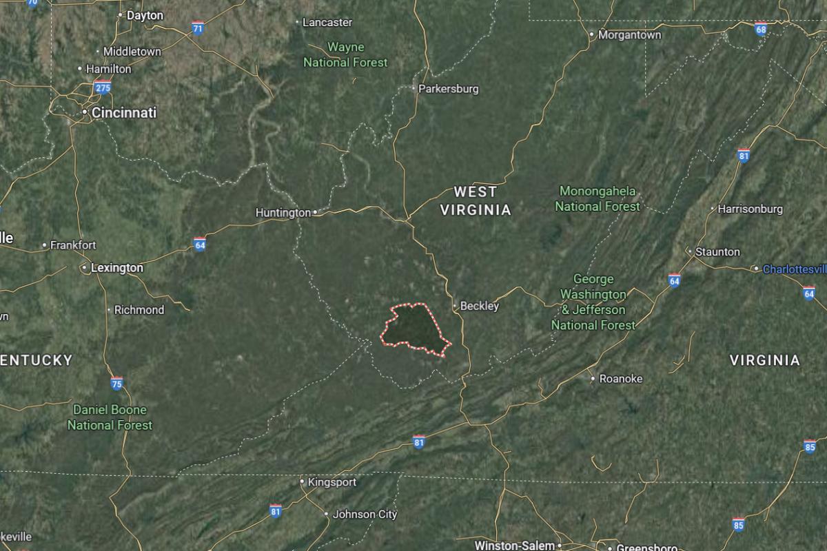
#6. Mercer County
– Life expectancy: 69.9 years
— 3.0 years lower than the state average
About
Mercer County is known for its strong educational presence, historic architecture, and deep Appalachian roots. The landscape is a mix of scenic valleys, wooded hills, and well-preserved towns with cultural significance. Community pride is evident in local festivals, school spirit, and long-standing family traditions.
Economic activity includes healthcare, education, tourism, and small businesses that reflect both heritage and innovation. Residents value connection, craftsmanship, and storytelling as part of everyday life. Mercer County offers a welcoming atmosphere shaped by resilience, history, and regional identity.
Where is Mercer County?
Mercer County is located in the southern part of West Virginia, bordering Virginia to the south. It is approximately 100 miles south of Charleston and 90 miles northwest of Roanoke, Virginia. The county spans about 30 miles from north to south and 35 miles from east to west.
Princeton, the county seat, is around 10 miles east of Bluefield and 25 miles southwest of Beckley. Bluefield, another major city in the county, lies just 5 miles from the Virginia state line. Mercer County is known for its mountainous landscape, rail and coal history, and its role as a transportation and economic center in the region.
#4. Lincoln County (tie)
– Life expectancy: 69.8 years
— 3.1 years lower than the state average
About
Lincoln County is characterized by its rural charm, strong family roots, and enduring connection to the land. Generations have lived in small communities surrounded by forests, creeks, and farmland, where traditions run deep. Life here is simple, with a focus on hard work, faith, and community ties.
Residents often gather at local churches, schools, and seasonal events that foster unity and pride. Agriculture and timber play a role in the local economy, supported by a spirit of self-reliance. Lincoln County reflects the values of perseverance, tradition, and close community bonds.
Where is Lincoln County?
Lincoln County is located in southwestern West Virginia, nestled between the cities of Charleston and Huntington. It is approximately 35 miles southwest of Charleston and 40 miles east of Huntington. The county spans about 30 miles from north to south and 25 miles from east to west.
Hamlin, the county seat, is around 15 miles south of Hurricane and 20 miles northwest of Madison. Alum Creek, a community on the northern edge, is about 20 miles southeast of Charleston. Lincoln County is known for its rural communities, forested hills, and ties to Appalachian culture and coal country heritage.
You may also like: Counties with the most tornadoes in West Virginia
#4. Boone County (tie)
– Life expectancy: 69.8 years
— 3.1 years lower than the state average
About
Boone County is steeped in coal mining heritage, with a strong sense of identity shaped by generations of hardworking families. The rugged hills and winding roads frame a landscape where tradition and resilience are deeply rooted. Community pride is expressed through local events, school sports, and shared history.
Residents are known for their toughness, neighborly spirit, and deep ties to the land and one another. Life centers around family, faith, and a commitment to preserving local values. Boone County embodies the enduring strength of Appalachian culture and community.
Where is Boone County?
Boone County is located in southwestern West Virginia, within the Appalachian Mountains and part of the state’s coal-producing region. It is approximately 30 miles south of Charleston and 60 miles northwest of Beckley. The county spans about 35 miles from north to south and 30 miles from east to west.
Madison, the county seat, is around 25 miles east of Logan and 15 miles west of Danville. Whitesville, another town in the county, lies about 20 miles northeast of Madison. Boone County is known for its rugged terrain, coal mining heritage, and strong community ties.
#3. Mingo County
– Life expectancy: 67.2 years
— 5.7 years lower than the state average
About
Mingo County carries a powerful legacy of coal mining, labor history, and Appalachian pride. Its hills and hollows have witnessed generations of families rooted in hard work, storytelling, and deep cultural identity. The community maintains a strong connection to its past while facing modern challenges with determination.
Locals value loyalty, tradition, and the strength that comes from tight-knit relationships. Community gatherings, high school sports, and outdoor activities bring people together throughout the year. Mingo County stands as a symbol of resilience, heritage, and unwavering spirit.
Where is Mingo County?
Mingo County is located in the southwestern corner of West Virginia, along the Kentucky border in the Appalachian region. It is approximately 75 miles southwest of Charleston and 40 miles south of Logan. The county spans about 35 miles from north to south and 30 miles from east to west.
Williamson, the county seat, is around 30 miles west of Gilbert and 25 miles north of Pikeville, Kentucky. Matewan, another historic town, lies about 15 miles northeast of Williamson. Mingo County is known for its coal mining history, mountain terrain, and significant role in labor union struggles.
#2. Logan County
– Life expectancy: 66.7 years
— 6.2 years lower than the state average
About
Logan County is rich in coal mining history and Appalachian traditions, with a landscape defined by steep hills, winding creeks, and close-knit communities. The area reflects a legacy of labor movements, strong family ties, and pride in local heritage. Music, storytelling, and cultural events help keep its identity alive.
The people of Logan County are known for their resilience, hospitality, and deep-rooted values. Community life centers on schools, churches, and events that bring generations together. Logan County offers a powerful sense of place shaped by struggle, unity, and enduring pride.
Where is Logan County?
Logan County is located in southwestern West Virginia, deep within the Appalachian Mountains and coalfields. It is approximately 60 miles south of Charleston and 40 miles north of Williamson. The county spans about 30 miles from north to south and 25 miles from east to west.
Logan, the county seat, is around 25 miles northeast of Gilbert and 35 miles west of Madison. Chapmanville, another town in the county, lies about 10 miles north of Logan. Logan County is known for its coal mining heritage, mountain landscapes, and close-knit communities.
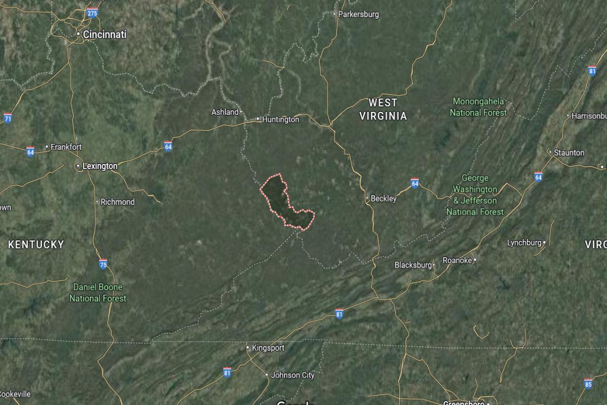
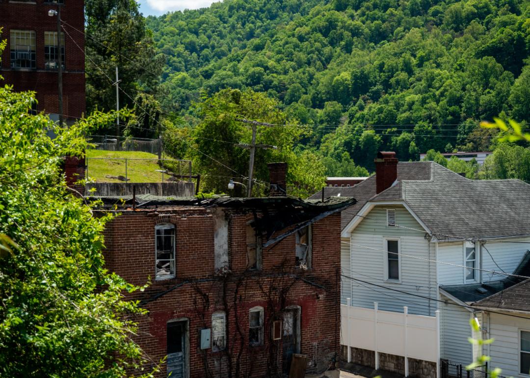
#1. McDowell County
– Life expectancy: 66.3 years
— 6.6 years lower than the state average
About
McDowell County holds a storied past shaped by coal mining, railroads, and the strength of working-class communities. The rugged terrain and historic towns reflect a time when the area was a hub of industrial growth and cultural richness. Though challenges have emerged over time, the spirit of resilience remains strong.
Residents maintain close community bonds, drawing on shared experiences and a deep connection to their heritage. Local traditions, music, and storytelling continue to play a vital role in preserving identity. McDowell County stands as a symbol of perseverance, pride, and the enduring heart of Appalachia.
Where is McDowell County?
McDowell County is located in the southernmost part of West Virginia, bordering Virginia to the south. It is approximately 110 miles south of Charleston and 40 miles west of Bluefield. The county spans about 30 miles from north to south and 35 miles from east to west.
Welch, the county seat, is around 25 miles southeast of Logan and 20 miles northwest of Bluefield. War, one of the southernmost towns in the state, is located about 10 miles south of Welch. McDowell County is known for its steep hills, coal mining history, and strong Appalachian culture.
This story features data reporting by Karim Noorani, writing by Kiersten Hickman, and is part of a series utilizing data automation across 49 states.
By Stacker