Would you like to save this?
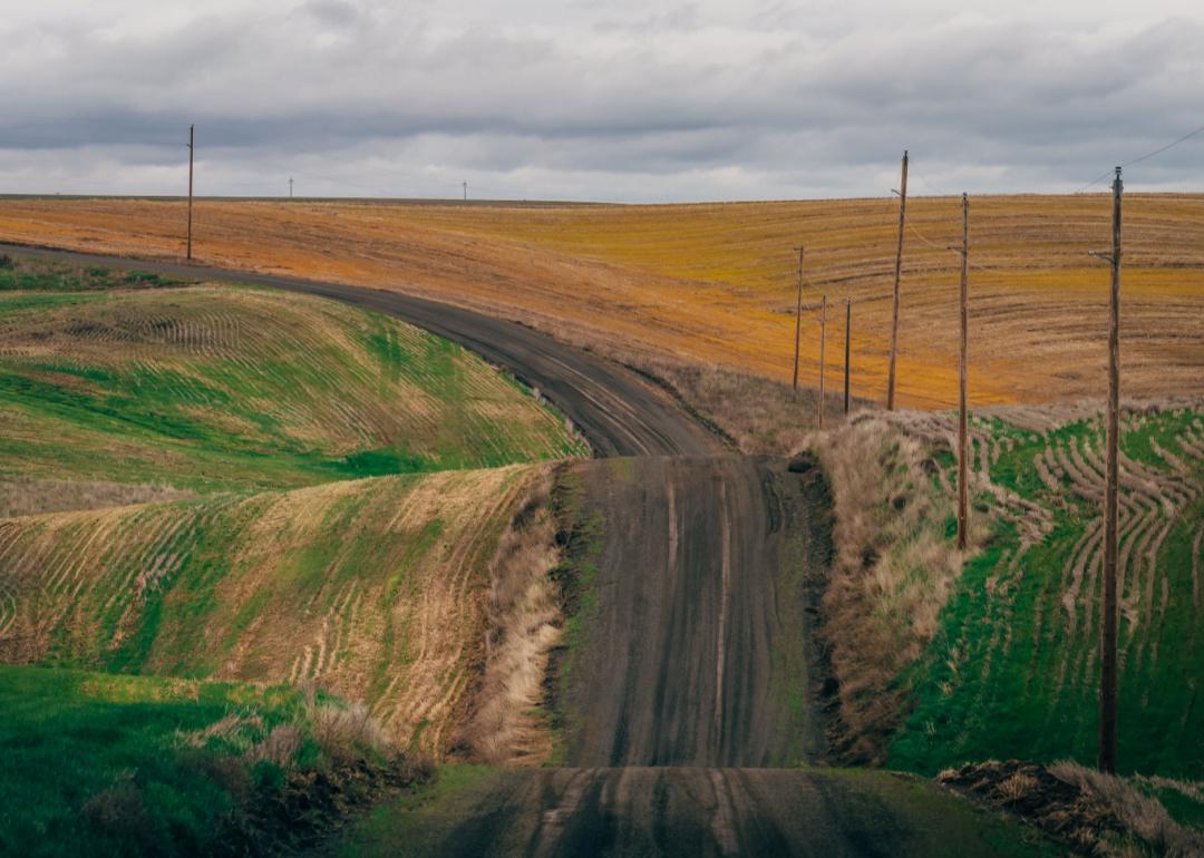
Counties with the shortest life expectancy in Washington
Life expectancy can be affected by a variety of factors. About 25% of your lifespan is determined by genetics, according to the National Library of Medicine. Health and wellness habits—like following a balanced, nutrient-rich diet; not smoking; drinking minimal alcohol; maintaining a healthy weight; and staying physically active—can add more than a decade to your life, research from the National Institutes of Health shows. While these factors are significant, another important element that you might not have considered is your environment and community.
While life expectancy generally increases annually in the United States—jumping from about 70.8 years old to 77.5 between 1970 and 2022, according to the Centers for Disease Control and Prevention—this particular metric can vary from state to state or even county to county. In some parts of the country, the average lifespan is getting shorter based on a variety of risk factors on top of health, including socioeconomic factors like poverty, unemployment, income, and education.
According to a 2020 study from researchers at Penn State, West Virginia, and Michigan State University, communities with a higher population density, more fast food restaurants, and a high number of extraction industry-based jobs tend to have shorter life expectancies.
To find out how life expectancy varies within Washington, Stacker used 2024 County Health Rankings & Roadmaps from the University of Wisconsin Population Health Institute to identify the counties with the shortest life expectancy. Life expectancy measures the average number of years from birth a person can expect to live and is calculated based on the number of deaths in a given time period and the average number of people at risk of dying during that period. Counties with unreliable or insufficient data were excluded from the analysis. Mortality data came from the National Vital Statistics System.
Read on to see if your county is on the list.
You may also like: The best beach towns in Washington

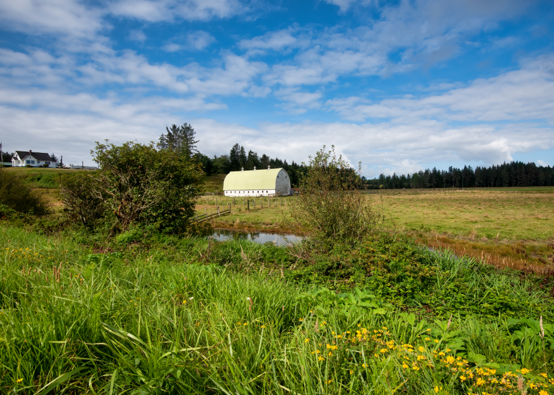
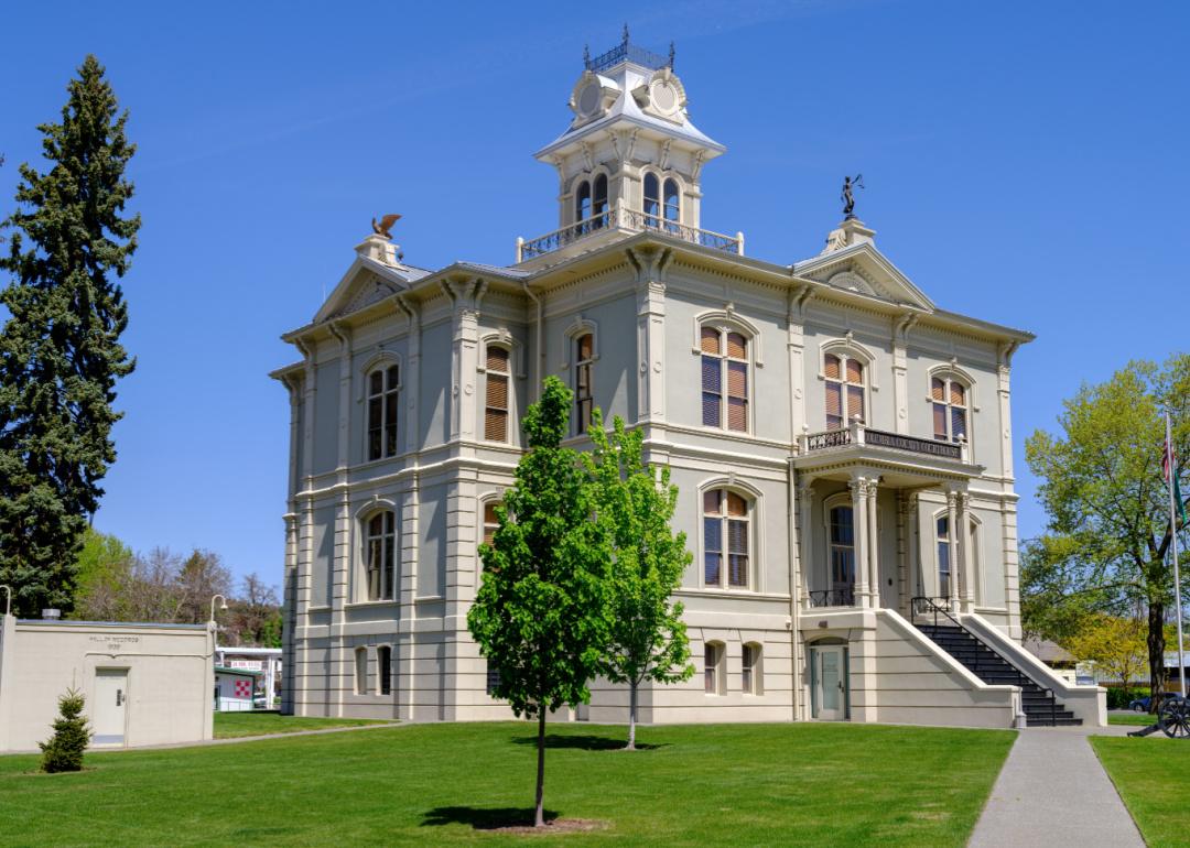
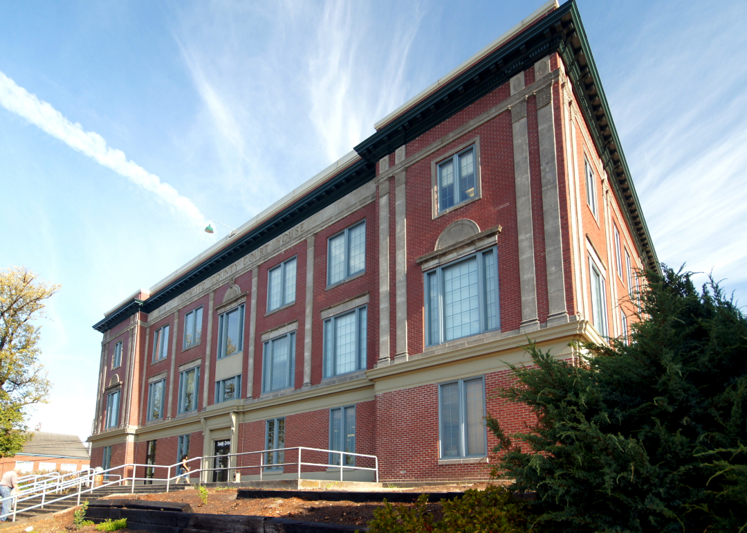
#19. Benton County (tie)
– Life expectancy: 78.8 years
— 0.6 years lower than the state average
About
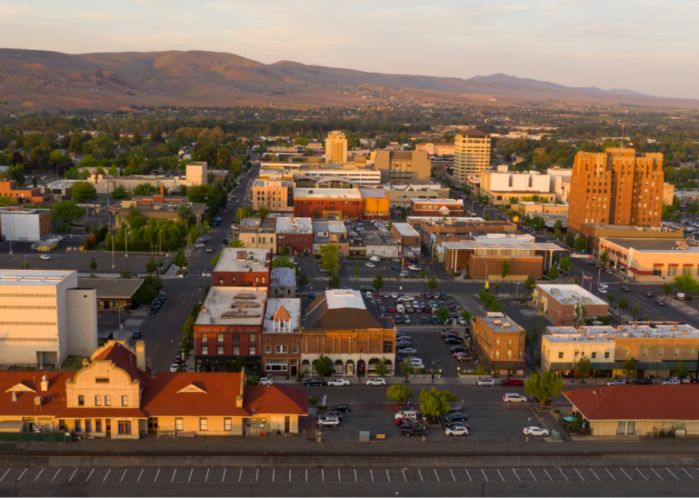
Benton County, Washington is known for its contributions to science, agriculture, and clean energy. The economy is anchored by research institutions, viticulture, and technology, alongside a strong agricultural sector. Communities in the county emphasize innovation, education, and strategic growth.
Cultural events, local wineries, and scenic landscapes shape the area’s identity and quality of life. Residents enjoy access to outdoor recreation, art venues, and community festivals throughout the year. Benton County blends scientific progress, agricultural tradition, and a dynamic community spirit.
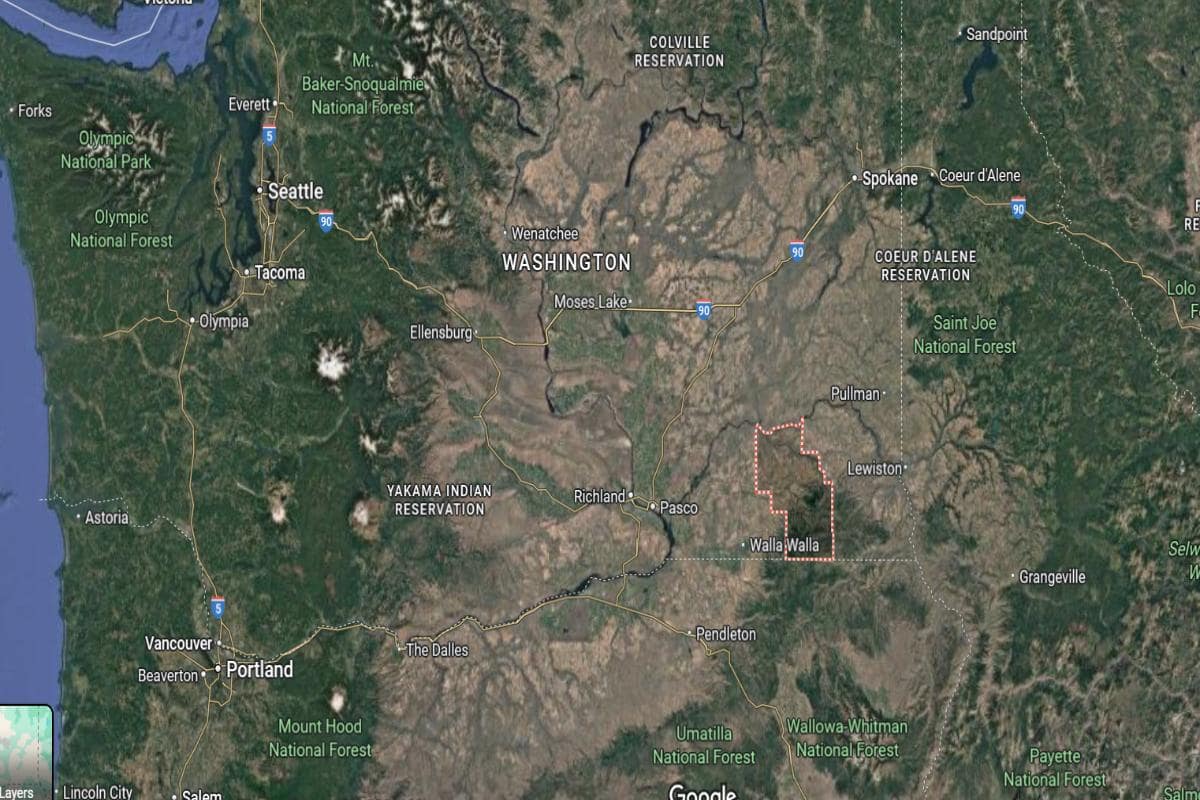
Where is Benton County?
Benton County is located in southeastern Washington, about 140 miles southwest of Spokane and 200 miles southeast of Seattle. The county seat, Prosser, lies roughly 35 miles west of the Tri-Cities area, which includes Kennewick, Pasco, and Richland. The county is part of the Columbia Basin and follows the Columbia River along its eastern edge.
The area is approximately 45 miles south of Yakima and 90 miles northeast of The Dalles, Oregon. Interstate 82 and U.S. Route 12 run through the county, offering key transportation routes. Benton County is also about 35 miles north of the Oregon border near Umatilla.

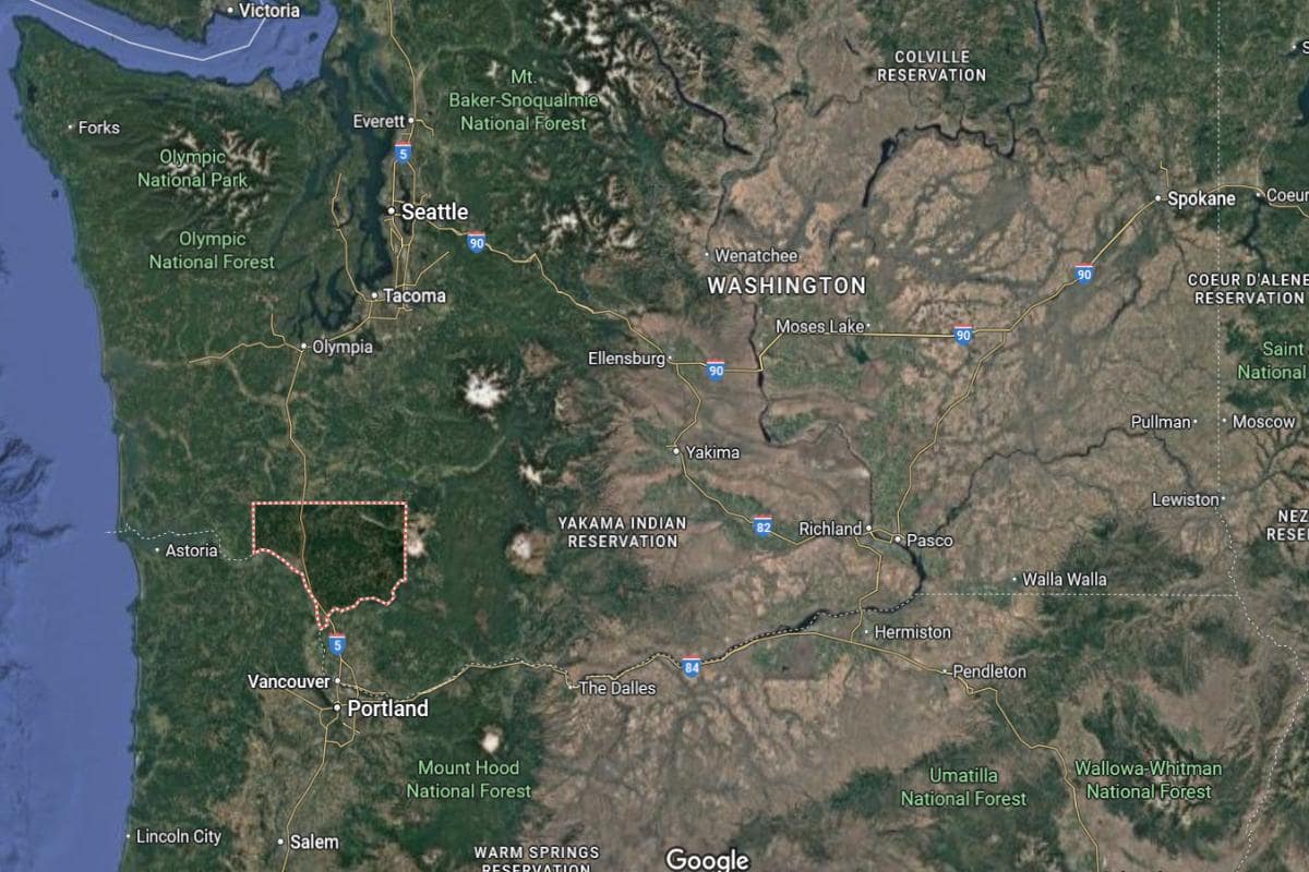
#19. Clark County (tie)
– Life expectancy: 78.8 years
— 0.6 years lower than the state average
About
Clark County blends suburban growth with natural beauty, offering a mix of residential communities, green spaces, and local commerce. The area features a vibrant arts scene, strong school systems, and a commitment to sustainable development. Historic districts and modern amenities exist side by side, reflecting a balance of tradition and progress.
Residents are active in civic life, enjoying parks, farmers markets, and community events throughout the year. Economic growth is supported by technology, healthcare, and small businesses. Clark County fosters a high quality of life rooted in community engagement and regional pride.
Where is Clark County?
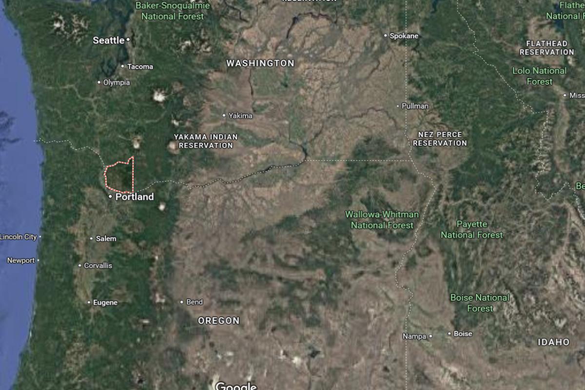
Clark County is located in southwestern Washington, along the north bank of the Columbia River and directly across from Portland, Oregon. It is approximately 10 miles north of downtown Portland and 100 miles south of Olympia, the state capital. The county spans about 30 miles from east to west and 25 miles from north to south.
Vancouver, the county seat and largest city, is around 10 miles south of Ridgefield and 20 miles southwest of Battle Ground. Camas, another major city, lies about 15 miles east of Vancouver. Clark County is known for its suburban growth, proximity to Portland, and access to rivers, forests, and mountain views.
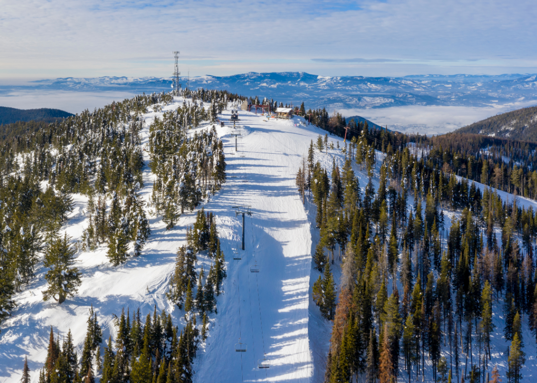
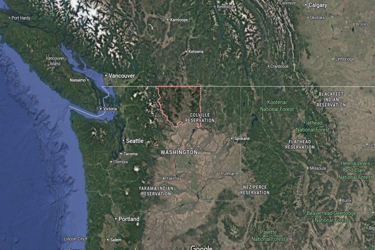
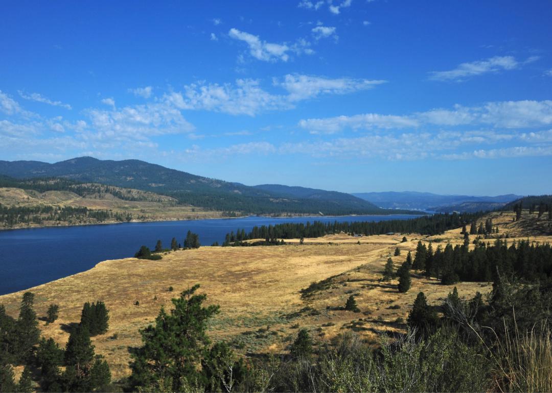
#18. Stevens County
– Life expectancy: 78.3 years
— 1.1 years lower than the state average
About
Stevens County is known for its vast forests, agricultural heritage, and a lifestyle centered around self-reliance and outdoor living. The landscape includes lakes, rivers, and mountain views that support year-round recreation and quiet rural life. Small towns and family farms create a strong sense of place and continuity.
Community events, local markets, and seasonal festivals reflect the county’s tight-knit spirit. Residents value independence, nature, and the traditions passed down through generations. Stevens County offers a peaceful way of life shaped by natural beauty and enduring values.
Where is Stevens County?
Would you like to save this?
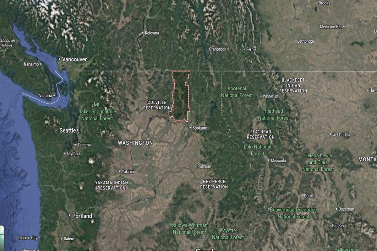
Stevens County is located in northeastern Washington, bordering Canada to the north and stretching west of the Spokane area. It is approximately 50 miles north of Spokane and 120 miles northwest of Coeur d’Alene, Idaho. The county spans about 90 miles from north to south and 40 miles from east to west.
Colville, the county seat, is around 70 miles north of Spokane and 35 miles south of the Canadian border. Chewelah, another town in the county, lies about 20 miles south of Colville. Stevens County is known for its forests, lakes, mountains, and access to outdoor recreation in the Selkirk Range.
#16. Pierce County (tie)
– Life expectancy: 78.1 years
— 1.3 years lower than the state average
About
Pierce County features a dynamic blend of urban centers, suburban communities, and striking natural landscapes. The area is known for its cultural diversity, historic neighborhoods, and vibrant arts and entertainment scenes. Economic activity is driven by healthcare, education, and military presence, creating a well-rounded regional economy.
Residents enjoy access to parks, trails, and waterfronts that support an active lifestyle. Community pride is reflected in local events, public spaces, and a strong emphasis on education and innovation. Pierce County offers a balanced mix of growth, culture, and natural beauty.
Where is Pierce County?
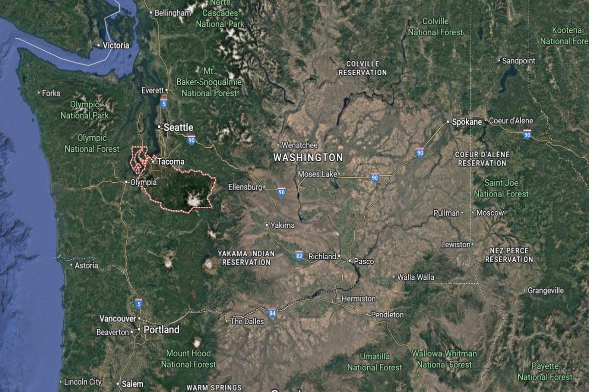
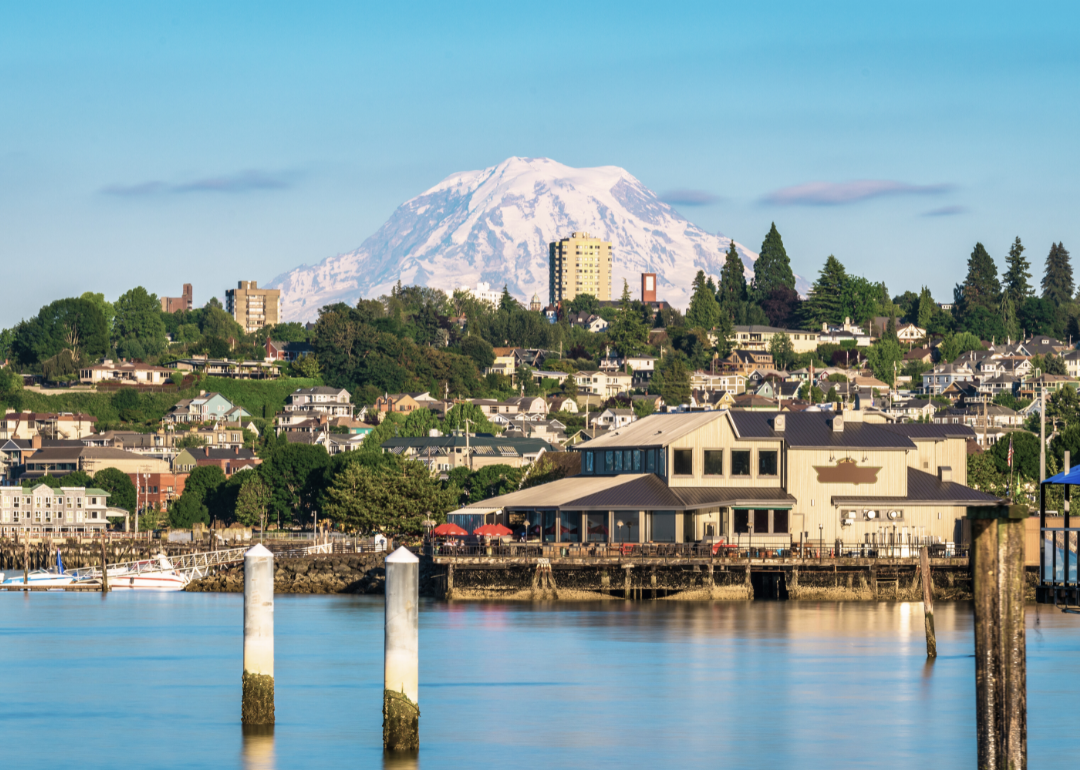
Pierce County is located in western Washington State, approximately 35 miles south of Seattle and about 140 miles north of Portland, Oregon. It stretches from the shores of Puget Sound in the west to Mount Rainier National Park in the east, offering a mix of urban areas and rugged natural landscapes. The county seat is Tacoma, which sits around 30 miles northeast of Olympia, the state capital.
This region is part of the greater Seattle-Tacoma-Bellevue metropolitan area and is known for its accessibility to both mountain and coastal environments. Mount Rainier, the highest peak in Washington, is roughly 60 miles southeast of Tacoma and visible from much of the county. The area is also about 20 miles north of Joint Base Lewis-McChord, a major military installation.
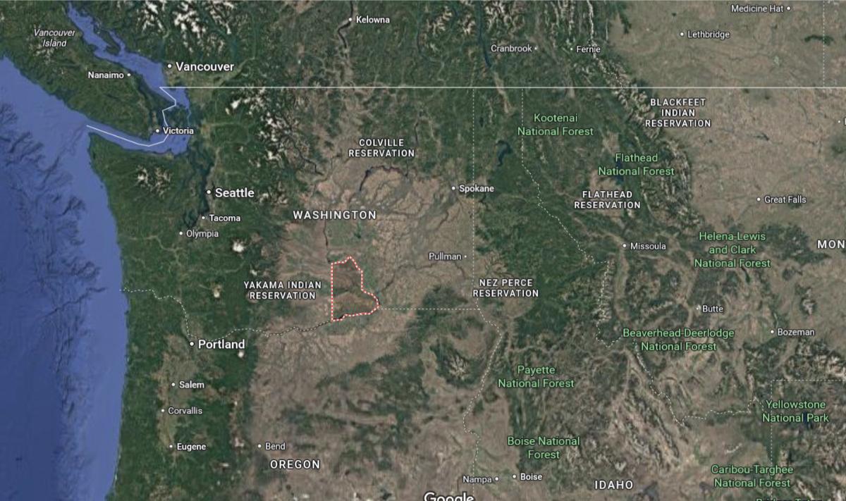
#16. Adams County (tie)
– Life expectancy: 78.1 years
— 1.3 years lower than the state average
About
Adams County is shaped by its agricultural roots, wide-open landscapes, and a way of life centered on farming and small-town values. Fields of wheat and other crops stretch across the horizon, reflecting a strong connection to the land. Communities are close-knit, where tradition and hard work define daily life.
Local events and fairs bring residents together, celebrating heritage and rural pride. The pace of life is steady, focused on family, faith, and generational continuity. Adams County offers a grounded lifestyle supported by resilience, simplicity, and deep agricultural ties.
Where is Adams County?
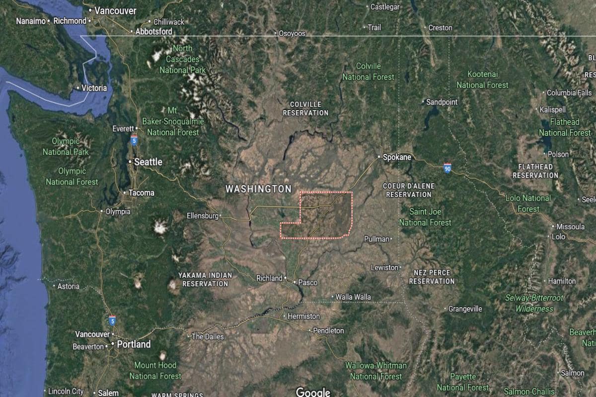
Adams County is located in eastern Washington, about 110 miles southwest of Spokane and 160 miles southeast of Seattle. Its county seat, Ritzville, lies roughly 65 miles west of the Idaho border and 45 miles northeast of the Tri-Cities area. The county is part of the Columbia Plateau, characterized by vast farmland and open prairies.
This region is largely rural and situated approximately 30 miles north of the Snake River and 50 miles east of the Columbia River. Interstate 90 runs through the northern part of the county, making it accessible from major urban centers. The area is about 80 miles west of Pullman, home to Washington State University.
You may also like: Fastest-growing jobs in Washington
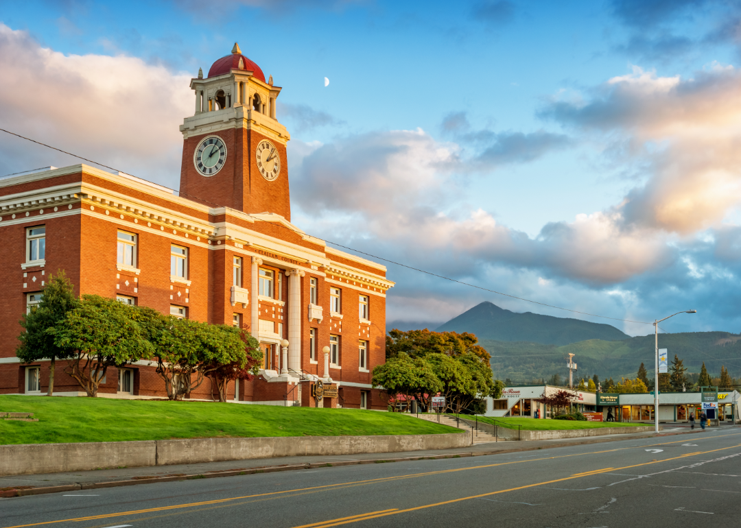
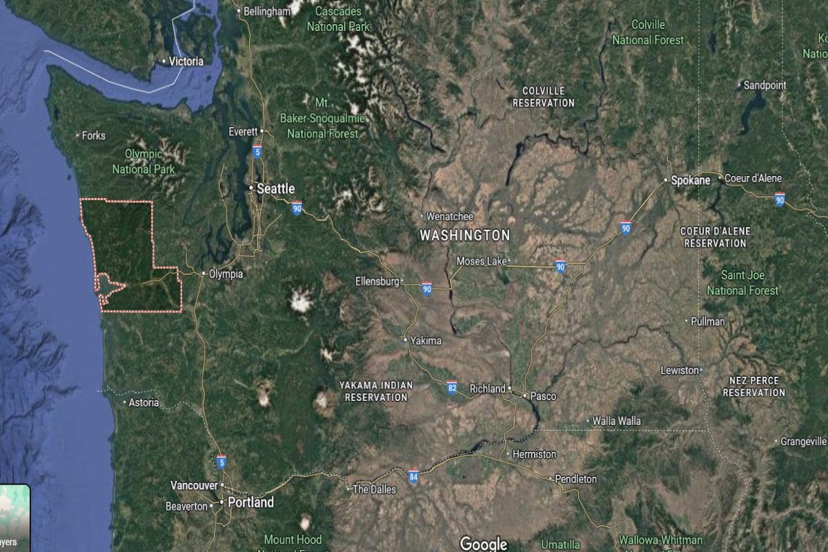
#15. Clallam County
– Life expectancy: 77.9 years
— 1.5 years lower than the state average
About
Clallam County is known for its dramatic coastal scenery, forested landscapes, and strong environmental values. The area supports a lifestyle that blends outdoor recreation with artistic expression and community involvement. Small towns and rural areas offer a quiet, nature-connected way of life.
Residents take pride in local traditions, sustainable living, and cultural events that reflect regional identity. Fishing, tourism, and artisan industries contribute to the local economy. Clallam County offers a peaceful yet vibrant environment shaped by nature, creativity, and community spirit.
Where is Clallam County?
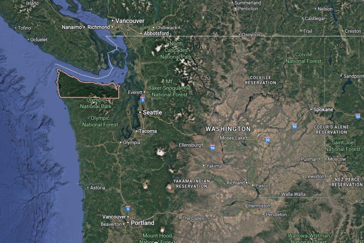
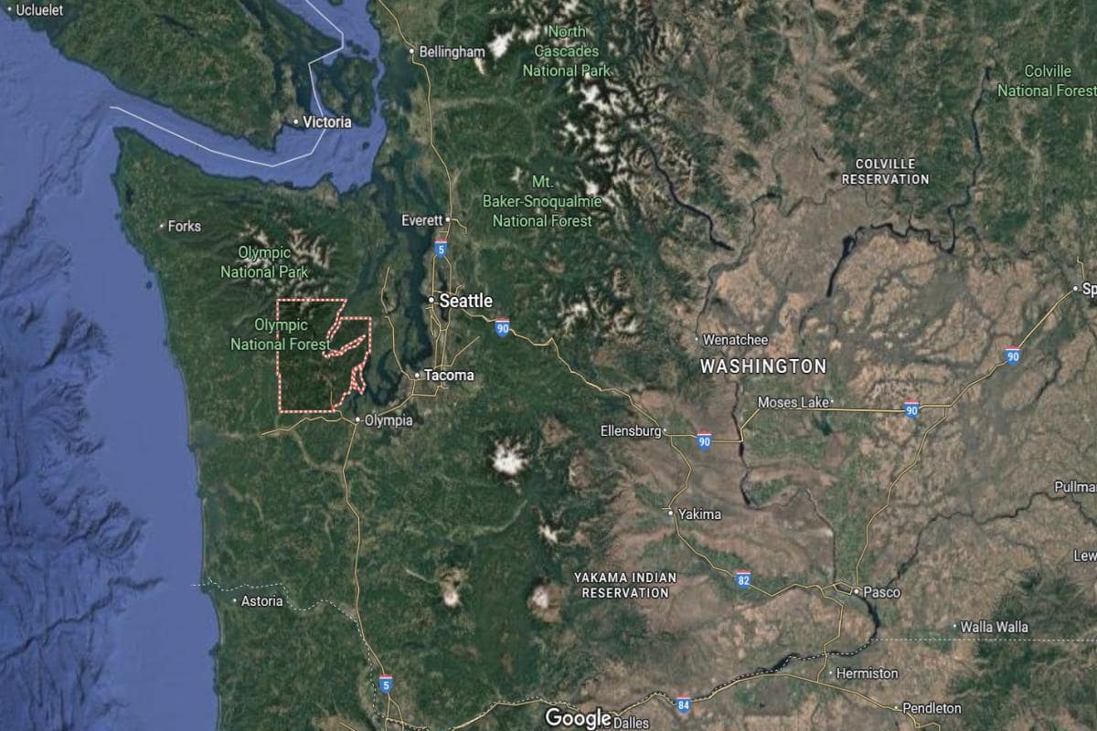
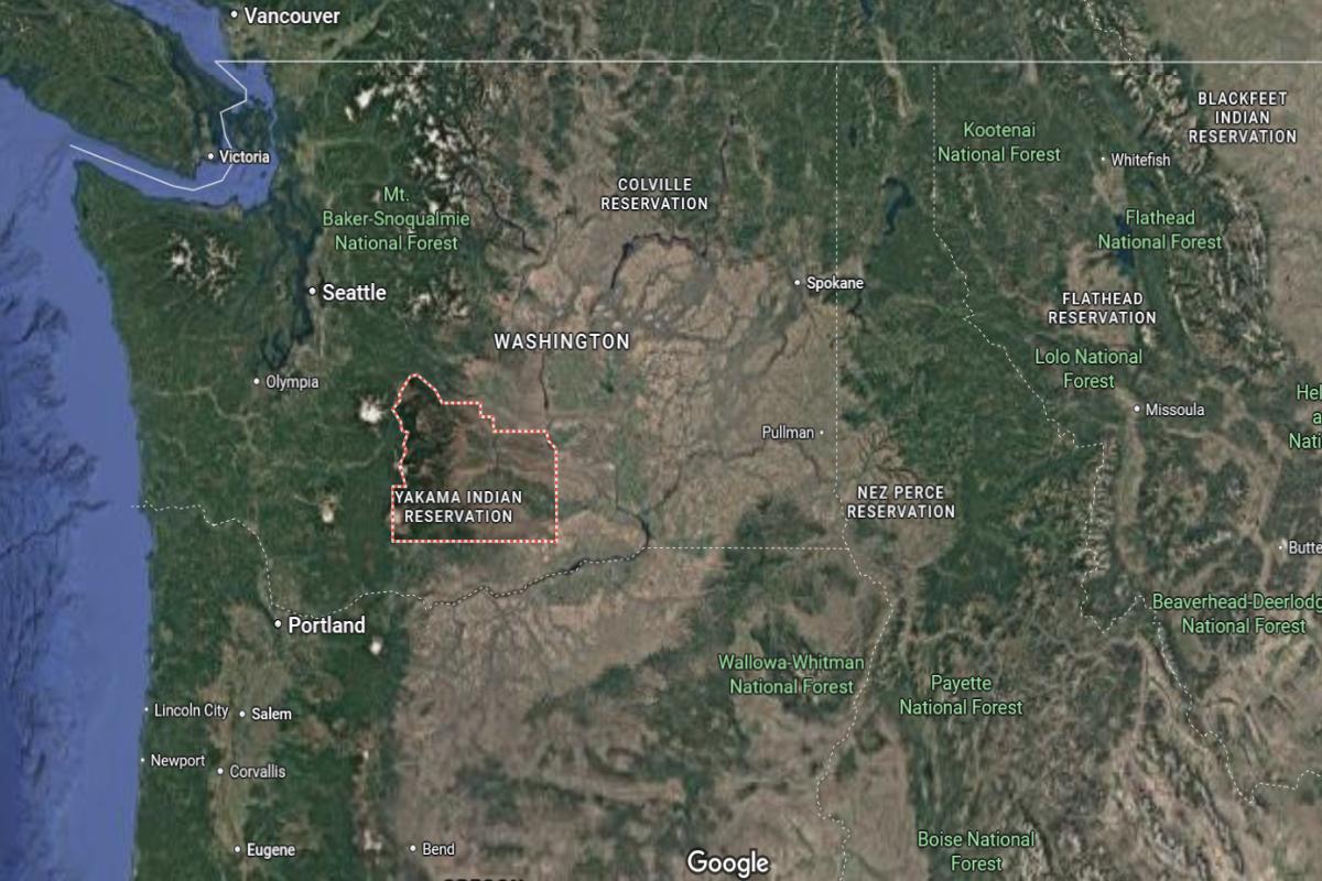
Clallam County is in the northwestern corner of Washington State, about 85 miles northwest of Seattle across Puget Sound. It spans the northern portion of the Olympic Peninsula and borders the Strait of Juan de Fuca, with Canada located roughly 20 miles across the water. The county seat, Port Angeles, sits around 60 miles west of Port Townsend.
Olympic National Park covers much of the county’s interior, with rugged mountains located just 30 miles south of the coast. The area is about 55 miles north of Lake Quinault and roughly 75 miles from the Pacific Ocean shoreline to the west. Clallam County is also around 25 miles from the Makah Reservation and Neah Bay at the far northwest tip of the state.
#14. Mason County
– Life expectancy: 77.7 years
— 1.7 years lower than the state average
About
Mason County is defined by its deep forests, winding waterways, and a culture rooted in craftsmanship and natural beauty. The area supports a mix of forestry, shellfish farming, and outdoor tourism that reflects its connection to land and water. Small communities maintain a welcoming, down-to-earth character.
Residents value independence, tradition, and a close relationship with the environment. Seasonal festivals, local markets, and recreational activities bring people together throughout the year. Mason County offers a quiet, resilient lifestyle shaped by nature and strong community ties.
Where is Mason County?
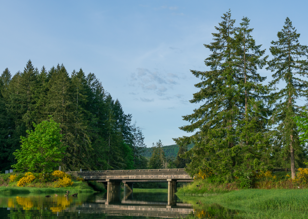
Mason County is located in western Washington, about 25 miles northwest of Olympia, the state capital. The county seat, Shelton, is roughly 75 miles southwest of Seattle and 60 miles north of the Pacific Ocean. The area sits along the southern end of the Hood Canal, offering access to inland waters and forested hills.
It lies approximately 45 miles east of the Olympic Mountains and 30 miles south of Bremerton. U.S. Route 101 runs through the county, connecting it to coastal and Puget Sound communities. Mason County is also situated about 35 miles west of Tacoma, making it part of the broader Puget Sound region.
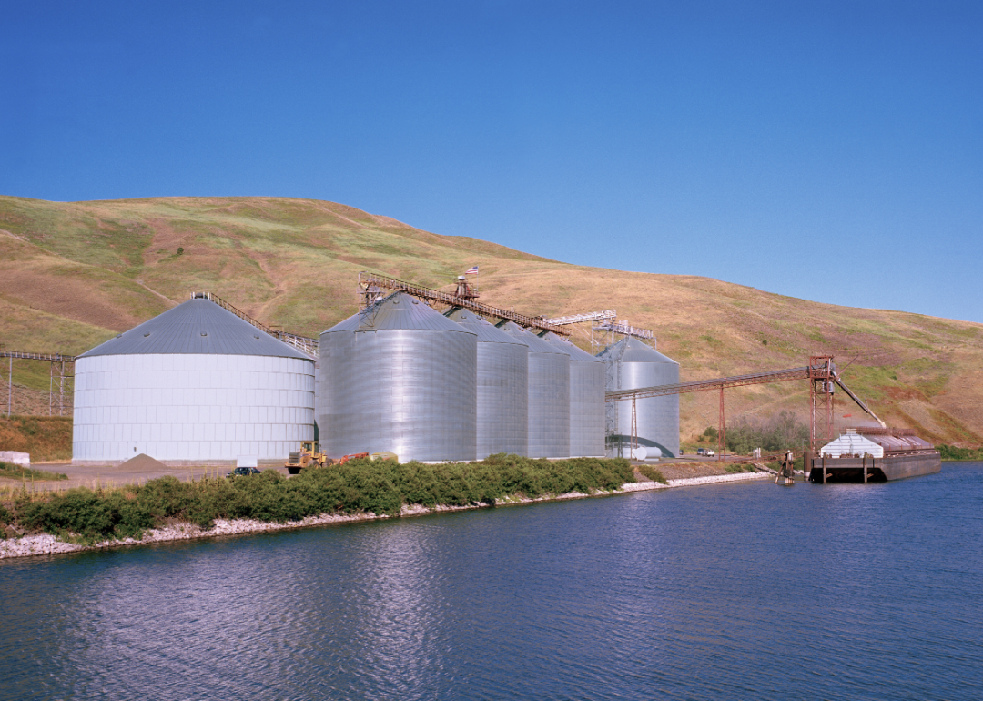
#13. Grant County
– Life expectancy: 77.6 years
— 1.8 years lower than the state average
About
Grant County is known for its vast agricultural plains, irrigation-powered farms, and strong ties to rural industry. The landscape features open skies, fertile fields, and communities that thrive on hard work and innovation. Local life revolves around farming, family, and small-town traditions.
Residents take pride in their role in feeding the region and supporting energy development and agribusiness. Fairs, festivals, and local events highlight the area’s culture and community spirit. Grant County offers a grounded, productive way of life shaped by the land and a shared work ethic.
Where is Grant County?
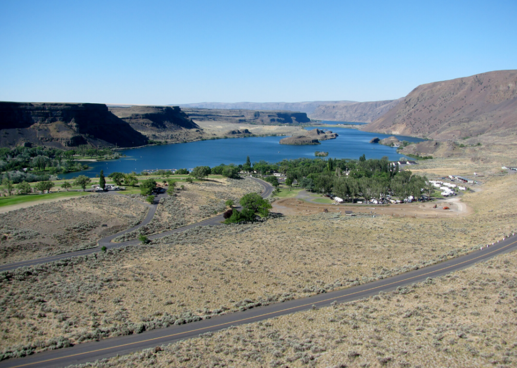
Grant County is located in central Washington, about 175 miles east of Seattle and 100 miles west of Spokane. The county seat, Ephrata, is situated roughly 60 miles north of the Tri-Cities area and 70 miles east of Wenatchee. This region lies within the Columbia Basin and is known for its agriculture and irrigation systems.
The county includes Moses Lake, a major city located about 25 miles southeast of Ephrata and 45 miles west of Ritzville. It is approximately 35 miles north of the Hanford Site and 55 miles south of the Grand Coulee Dam. Grant County is also around 85 miles northeast of Yakima, making it a central hub for surrounding rural communities.
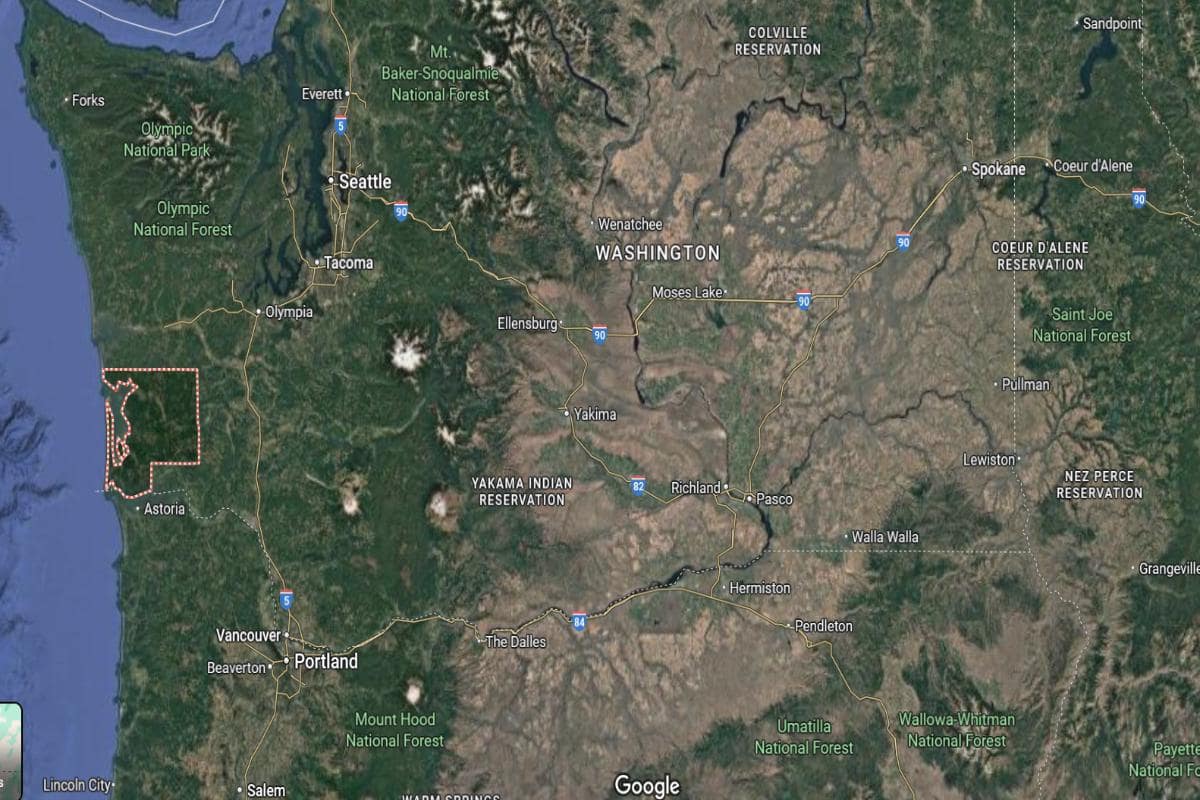
#10. Asotin County (tie)
– Life expectancy: 77.4 years
— 2.0 years lower than the state average
About
Asotin County offers a blend of river valleys, rolling hills, and a lifestyle rooted in outdoor living and close community ties. Agriculture, recreation, and local businesses shape the daily rhythm of life. The area reflects a balance of tradition, natural beauty, and small-town resilience.
Residents value connection, independence, and the slower pace of rural life. Community events, school activities, and outdoor gatherings foster strong social bonds. Asotin County embodies a peaceful, hardworking spirit grounded in land and legacy.
Where is Asotin County?
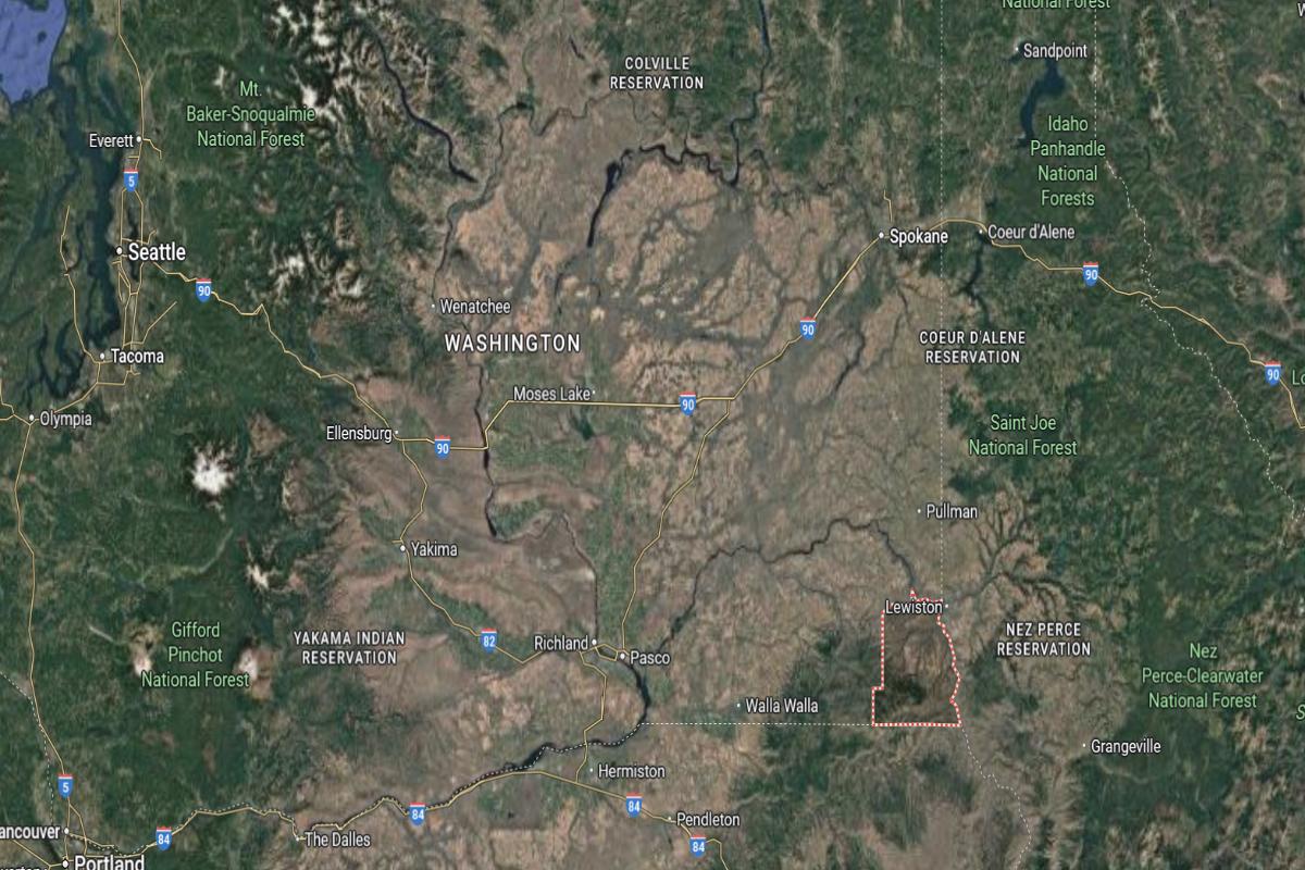
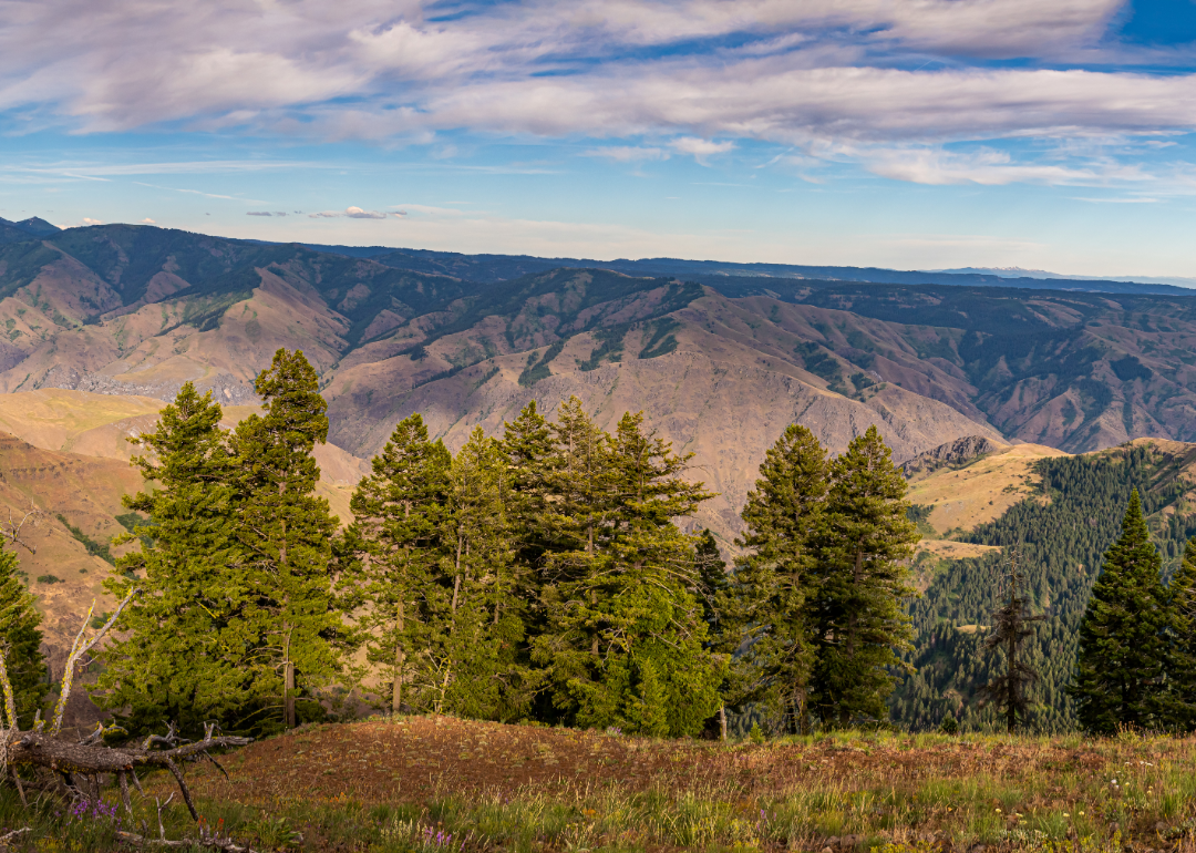
Asotin County is located in the southeastern corner of Washington State, about 125 miles south of Spokane and 65 miles east of Walla Walla. The county seat, Asotin, sits roughly 3 miles south of Clarkston, which lies directly across the Snake River from Lewiston, Idaho. This area is around 6 miles from the Idaho state line and about 40 miles west of the Montana border.
The county is situated about 75 miles northeast of the Tri-Cities and 25 miles southeast of Pomeroy. U.S. Route 12 runs through the region, connecting it with surrounding towns and states. Asotin County is also located approximately 50 miles south of Pullman, home to Washington State University.
Would you like to save this?
#10. Spokane County (tie)
– Life expectancy: 77.4 years
— 2.0 years lower than the state average
About
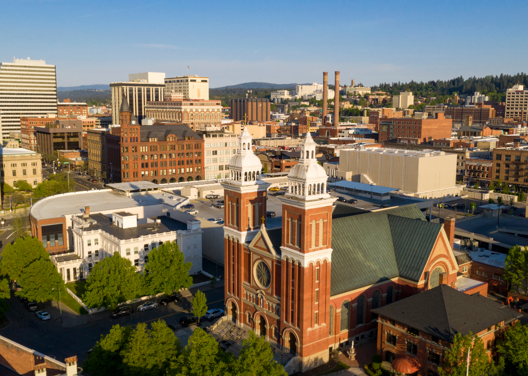
Spokane County blends urban vitality with natural surroundings, offering a mix of city life, suburban neighborhoods, and scenic outdoor spaces. The area supports a diverse economy driven by healthcare, education, manufacturing, and technology. Cultural institutions, festivals, and public art contribute to a vibrant community identity.
Residents enjoy access to trails, rivers, and parks that encourage year-round recreation and connection to nature. Local pride is reflected in strong civic engagement and investment in public services and schools. Spokane County represents a dynamic mix of innovation, culture, and outdoor living.
Where is Spokane County?
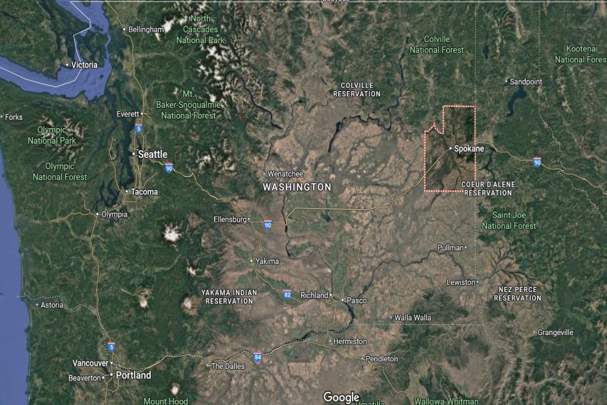
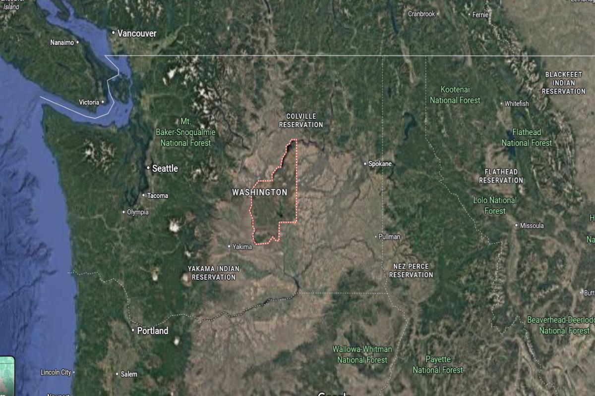
Spokane County is located in eastern Washington, about 280 miles east of Seattle and 90 miles south of the Canadian border. The county seat, Spokane, is approximately 20 miles west of the Idaho state line and 110 miles north of Lewiston, Idaho. It sits in the Inland Northwest region and serves as a major urban center for the surrounding rural areas.
Spokane County is roughly 65 miles northeast of the Tri-Cities and 75 miles east of Moses Lake. U.S. Route 2 and Interstate 90 cross through the county, providing direct access to western Washington and northern Idaho. The area is also about 30 miles north of Pullman, home to Washington State University.
You may also like: Washington ranks #10 in mental health care deserts
#10. Pacific County (tie)
– Life expectancy: 77.4 years
— 2.0 years lower than the state average
About
Pacific County is shaped by its coastal character, fishing heritage, and deep connection to forests and waterways. Small towns and rural communities maintain a quiet rhythm, grounded in tradition and natural beauty. The local economy revolves around seafood, tourism, and artisan craftsmanship.
Residents value independence, sustainability, and preserving cultural and environmental resources. Community life centers on seasonal festivals, maritime history, and a strong sense of place. Pacific County offers a peaceful, authentic lifestyle influenced by land, sea, and legacy.
Where is Pacific County?
Pacific County is located in the southwestern corner of Washington State, along the Pacific Ocean. The county seat, South Bend, is about 130 miles southwest of Seattle and 80 miles west of Olympia. It lies roughly 30 miles north of the Oregon border and 20 miles from the mouth of the Columbia River.
The county is about 55 miles west of Longview and 65 miles northwest of Vancouver, Washington. U.S. Route 101 runs along its coast, connecting small towns like Raymond, Ilwaco, and Long Beach. Pacific County is also around 75 miles south of Ocean Shores, another coastal destination in the state.
#9. Garfield County
– Life expectancy: 77.3 years
— 2.1 years lower than the state average
About
Garfield County is characterized by wide-open farmland, rolling hills, and a strong agricultural tradition passed down through generations. The landscape supports wheat farming and ranching, creating a lifestyle centered on hard work and rural values. Small-town life is marked by quiet streets, close neighbors, and deep community pride.
Residents cherish independence, tradition, and a steady rhythm rooted in the land. Local events and gatherings bring families together to celebrate heritage and connection. Garfield County reflects simplicity, resilience, and a deep respect for its rural roots.
Where is Garfield County?
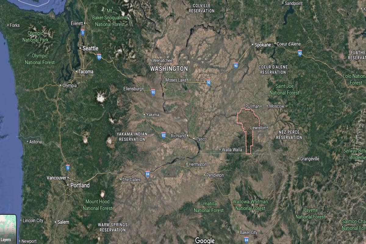
Garfield County is located in southeastern Washington, about 135 miles south of Spokane and 100 miles east of the Tri-Cities. The county seat, Pomeroy, is situated approximately 30 miles west of Clarkston and the Idaho border. It lies within the rolling hills of the Palouse region and is the least populous county in the state.
The area is about 60 miles northeast of Walla Walla and 55 miles southwest of Pullman. U.S. Route 12 runs through the county, connecting it to other southeastern Washington towns. Garfield County is also around 90 miles northwest of Lewiston, Idaho.
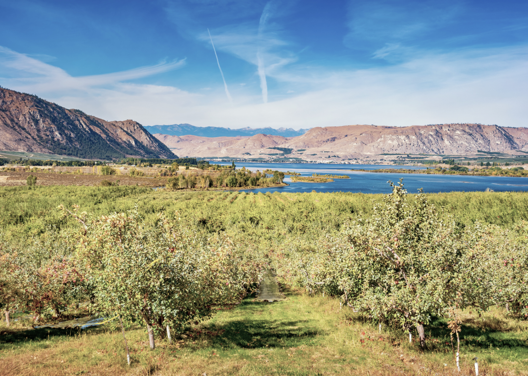
#8. Okanogan County
– Life expectancy: 76.8 years
— 2.6 years lower than the state average
About
Okanogan County is known for its rugged terrain, expansive valleys, and a way of life deeply connected to nature and agriculture. Orchards, farms, and ranches shape both the economy and the community’s identity. Outdoor recreation and seasonal events highlight the region’s strong sense of place.
Residents embrace independence, tradition, and stewardship of the land. Small towns and rural communities foster tight social bonds and multigenerational pride. Okanogan County offers a lifestyle built on resilience, natural beauty, and deep-rooted values.
Where is Okanogan County?
Okanogan County is located in north-central Washington, about 200 miles northeast of Seattle and 150 miles northwest of Spokane. The county seat, Okanogan, is roughly 35 miles south of the Canadian border and 80 miles northwest of Wenatchee. It is the largest county in Washington by area and includes part of the Okanogan-Wenatchee National Forest.
The town of Omak, a central hub in the county, is about 30 miles north of Brewster and 50 miles east of Twisp. U.S. Route 97 runs through the county, connecting it from the Canadian border down to the central part of the state. Okanogan County is also located approximately 110 miles north of Yakima.
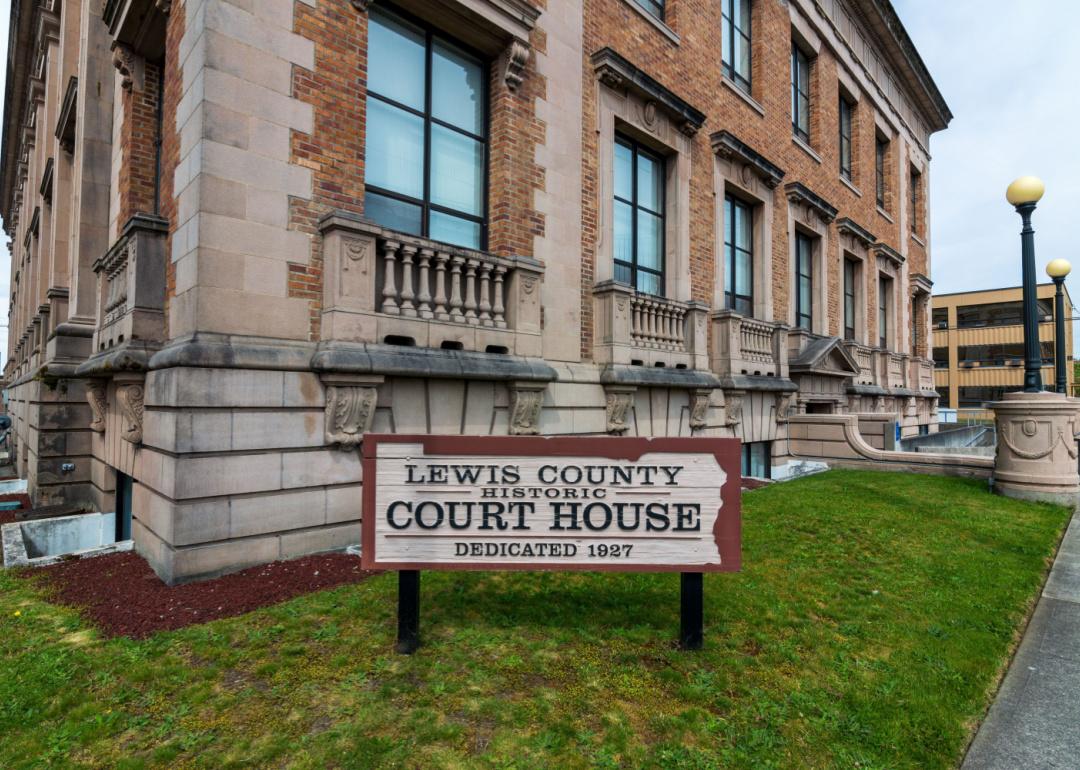
#7. Lewis County
– Life expectancy: 76.2 years
— 3.2 years lower than the state average
About
Lewis County is shaped by its forestry heritage, agricultural landscape, and deep-rooted community traditions. Rolling fields, forests, and small towns reflect a lifestyle grounded in hard work and regional pride. Logging, farming, and local markets form the backbone of its economy and identity.
Residents value self-reliance, family, and a strong connection to the land. Community events, school spirit, and historic preservation bring people together across generations. Lewis County offers a steady, authentic way of life rooted in tradition and natural surroundings.
Where is Lewis County?
Lewis County is located in southwestern Washington, about 90 miles south of Seattle and 60 miles north of the Columbia River. The county seat, Chehalis, lies approximately 30 miles south of Olympia and 50 miles west of Mount Rainier. It is positioned along the Interstate 5 corridor, providing direct access between Portland and Seattle.
The area is about 85 miles north of Vancouver, Washington and 70 miles east of the Pacific Ocean. Centralia, the county’s largest city, is situated just 4 miles north of Chehalis. Lewis County also lies around 95 miles northwest of the Tri-Cities region.
#6. Columbia County
– Life expectancy: 76.1 years
— 3.3 years lower than the state average
About
Columbia County is defined by its open landscapes, wheat fields, and a rural lifestyle centered on agriculture and heritage. The area’s small communities maintain a quiet, steady rhythm where tradition and family are central. Farming and local craftsmanship continue to shape the economy and culture.
Residents value hard work, community spirit, and deep-rooted connections to the land. Seasonal fairs, local gatherings, and school events foster strong social bonds. Columbia County offers a peaceful, grounded way of life built on resilience and rural pride.
Where is Columbia County?
Columbia County is located in southeastern Washington, about 130 miles south of Spokane and 65 miles northeast of Walla Walla. The county seat, Dayton, is roughly 30 miles east of Waitsburg and 40 miles west of the Idaho state line. It lies within the Blue Mountains region, offering a mix of farmland and forested terrain.
The area is approximately 55 miles north of Lewiston, Idaho and 70 miles southeast of the Tri-Cities. U.S. Route 12 runs through the county, connecting it to surrounding communities. Columbia County is also about 45 miles southeast of Pomeroy in neighboring Garfield County.
You may also like: Highest-rated breweries in Washington
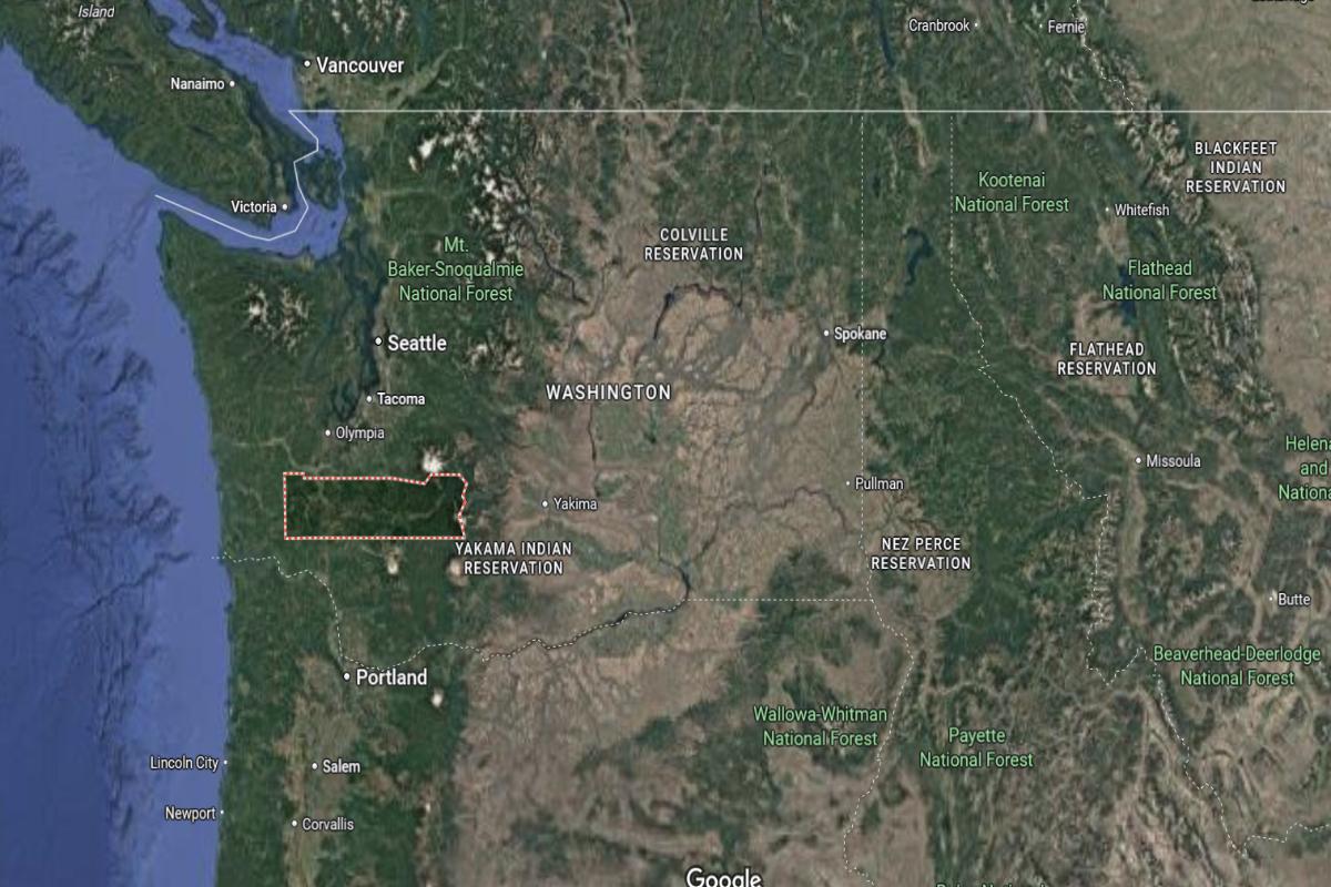
#5. Yakima County
– Life expectancy: 75.9 years
— 3.5 years lower than the state average
About
Yakima County is known for its rich agricultural production, especially fruit orchards and vineyards that stretch across fertile valleys. The region supports a diverse population, with strong ties to farming, family businesses, and cultural heritage. Local life blends rural tradition with growing economic and creative activity.
Residents celebrate community through festivals, markets, and multigenerational family gatherings. Agriculture, education, and healthcare play central roles in shaping the economy and daily life. Yakima County offers a vibrant, hardworking lifestyle rooted in the land and cultural diversity.
Where is Yakima County?
Yakima County is located in south-central Washington, about 140 miles southeast of Seattle and 110 miles southwest of Spokane. The county seat, Yakima, is situated roughly 60 miles south of Ellensburg and 50 miles north of the Columbia River. It lies in the Yakima Valley, a major agricultural region east of the Cascade Mountains.
The area is approximately 85 miles northeast of Vancouver, Washington and 75 miles northwest of the Tri-Cities. Interstate 82 runs through the county, connecting Yakima to surrounding areas like Sunnyside and Grandview. Yakima County is also about 90 miles southeast of Mount Rainier National Park.
#4. Cowlitz County
– Life expectancy: 75.7 years
— 3.7 years lower than the state average
About
Cowlitz County is shaped by its industrial roots, forested landscapes, and hardworking communities with strong ties to timber and manufacturing. River access, transportation networks, and local businesses support both economic growth and small-town stability. The area reflects a blend of historical resilience and ongoing development.
Residents value tradition, family, and community connection, with local events and civic pride playing a central role. Schools, parks, and volunteer organizations foster engagement across generations. Cowlitz County offers a balanced lifestyle grounded in heritage, industry, and regional pride.
Where is Cowlitz County?
Cowlitz County is located in southwestern Washington, about 50 miles north of Portland, Oregon and 120 miles south of Seattle. The county seat, Kelso, lies adjacent to Longview and is roughly 65 miles southwest of Mount St. Helens. It is positioned along the Interstate 5 corridor and bordered by the Columbia River to the south.
The area is approximately 45 miles west of the Cascade Mountains and 70 miles east of the Pacific Ocean. It is about 90 miles north of Astoria, Oregon and 55 miles south of Olympia. Cowlitz County is also around 40 miles west of Mount Adams in neighboring Skamania County.
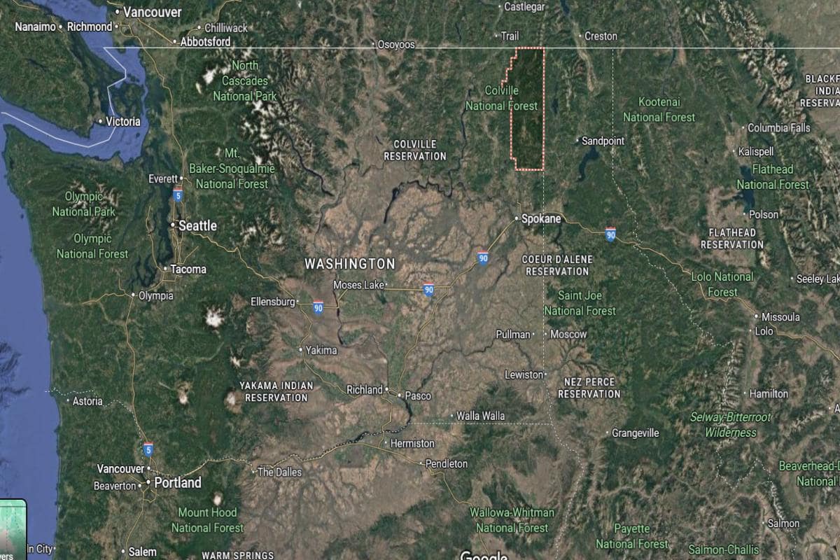
#3. Ferry County
– Life expectancy: 75.6 years
— 3.8 years lower than the state average
About
Ferry County is marked by its mountainous terrain, forested wilderness, and a deep connection to independent, rural living. The economy centers around natural resources, small-scale farming, and outdoor recreation. Quiet communities and open spaces provide a peaceful, self-reliant way of life.
Residents embrace a strong sense of community, tradition, and stewardship of the land. Local gatherings, fairs, and seasonal events reflect deep regional pride. Ferry County offers a rugged yet close-knit lifestyle shaped by nature and heritage.
Where is Ferry County?
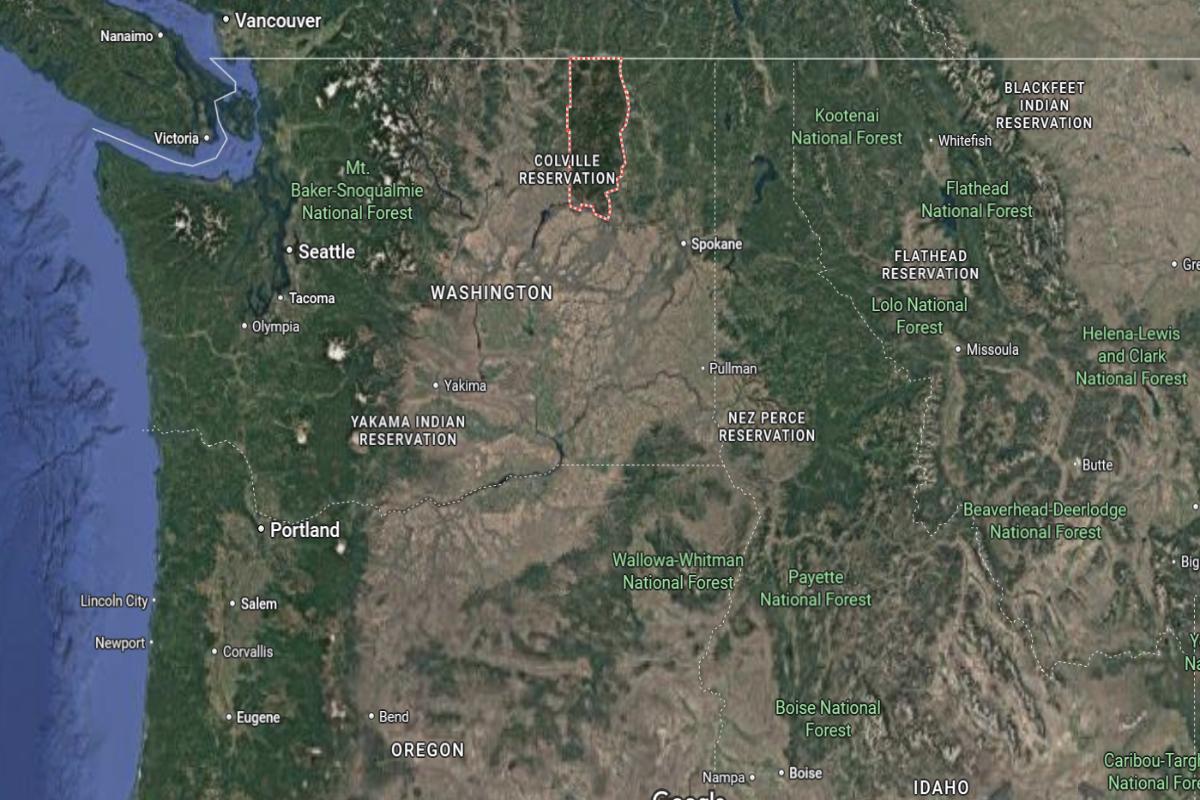
Ferry County is located in northeastern Washington, about 110 miles northwest of Spokane and directly bordering Canada to the north. The county seat, Republic, is situated roughly 40 miles west of Kettle Falls and 45 miles north of the Colville Indian Reservation. It lies in a mountainous region, with much of its area covered by the Colville National Forest.
The area is approximately 90 miles northeast of Omak and 70 miles east of the North Cascades. State Route 20 runs through the county, connecting it to the surrounding rural regions. Ferry County is also about 30 miles south of the Canadian town of Grand Forks, British Columbia.
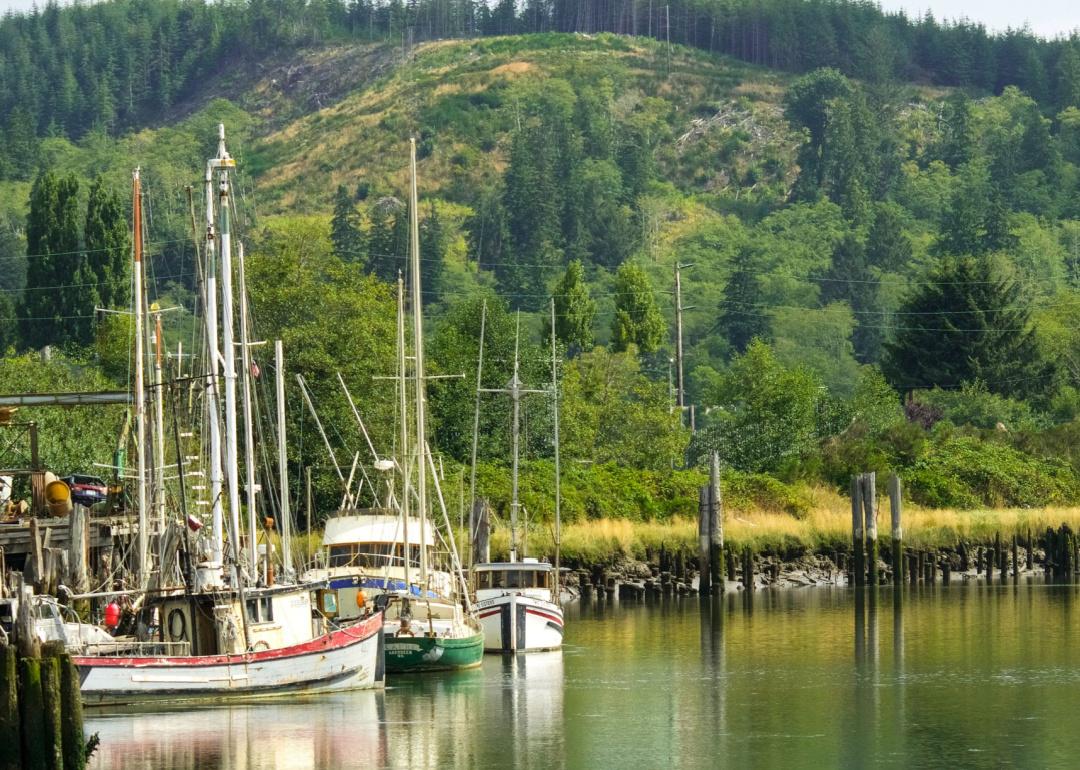
#2. Grays Harbor County
– Life expectancy: 75.5 years
— 3.9 years lower than the state average
About
Grays Harbor County is defined by its coastal character, timber legacy, and resilient working-class communities. Fishing, logging, and small industries have shaped its economy and cultural identity for generations. The natural environment—wetlands, forests, and beaches—plays a central role in daily life.
Residents take pride in their heritage, supporting local events, artisans, and community traditions. Efforts toward revitalization and sustainable development reflect a commitment to both past and future. Grays Harbor County offers a grounded, weathered strength built on perseverance and regional pride.
Where is Grays Harbor County?
Grays Harbor County is located on the southwestern coast of Washington, about 50 miles west of Olympia and 110 miles southwest of Seattle. The county seat, Montesano, is roughly 15 miles east of Aberdeen and 25 miles inland from the Pacific Ocean. It lies at the mouth of the Chehalis River and borders the southern end of Olympic National Forest.
The area is approximately 65 miles north of the Columbia River and 80 miles northwest of Vancouver, Washington. U.S. Route 12 and U.S. Route 101 pass through the county, connecting coastal towns like Hoquiam and Westport. Grays Harbor County is also around 70 miles southwest of Port Angeles.
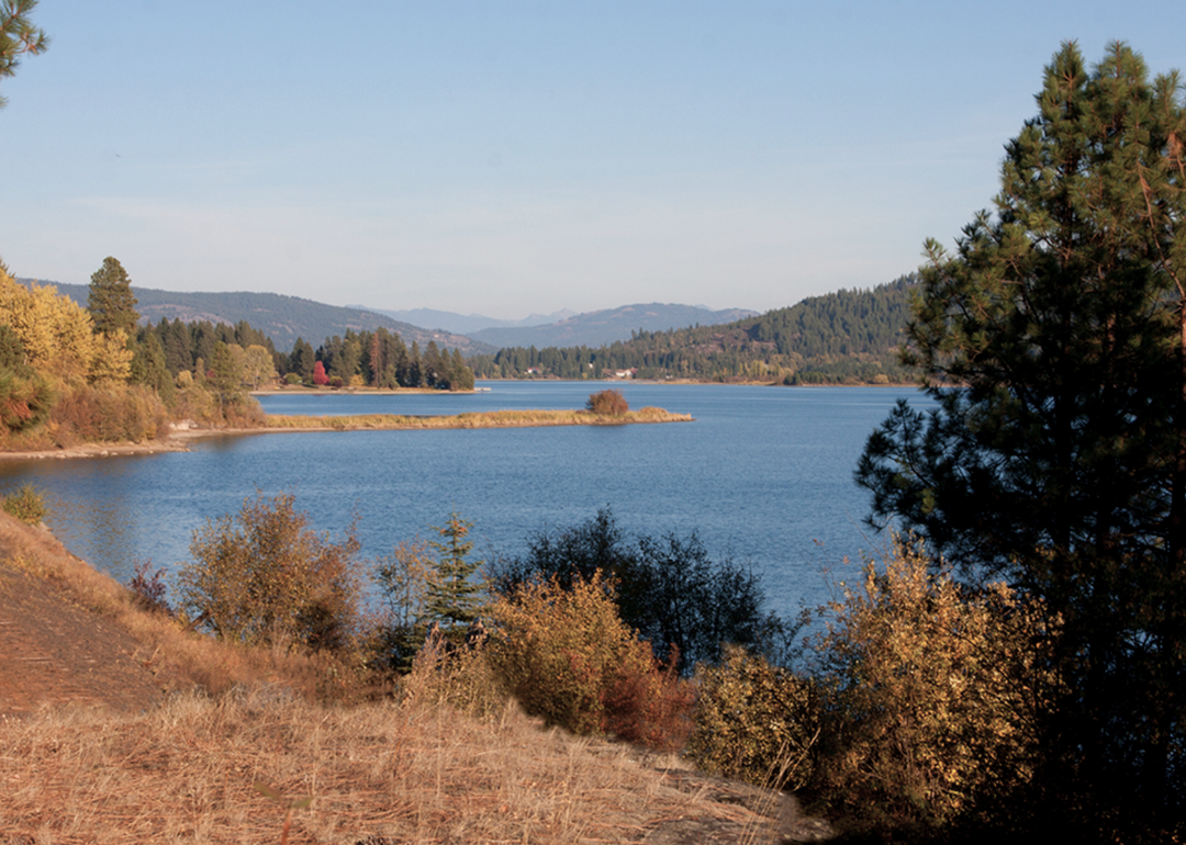
#1. Pend Oreille County
– Life expectancy: 74.9 years
— 4.5 years lower than the state average
About
Pend Oreille County is known for its rugged mountains, dense forests, and a lifestyle closely tied to nature and self-sufficiency. Logging, hydropower, and outdoor recreation form the foundation of its economy and way of life. Small towns and rural homesteads foster a quiet, independent spirit.
Residents value solitude, tradition, and a strong connection to the natural world. Community gatherings, seasonal festivals, and shared local history create deep-rooted bonds. Pend Oreille County offers a peaceful, resilient life shaped by wilderness and heritage.
Where is Pend Oreille County?
Pend Oreille County is located in the northeastern corner of Washington, directly bordering Canada and Idaho. The county seat, Newport, lies about 55 miles north of Spokane and 10 miles west of the Idaho border. It is part of a mountainous and forested region along the Pend Oreille River.
The area is approximately 75 miles southeast of Colville and 60 miles northeast of Deer Park. U.S. Route 2 runs through the county, providing access to nearby towns and states. Pend Oreille County is also about 90 miles south of Cranbrook, British Columbia.
This story features data reporting by Karim Noorani, writing by Kiersten Hickman, and is part of a series utilizing data automation across 49 states.
You may also like: Cities with the most expensive homes in Washington
By Stacker