Would you like to save this?
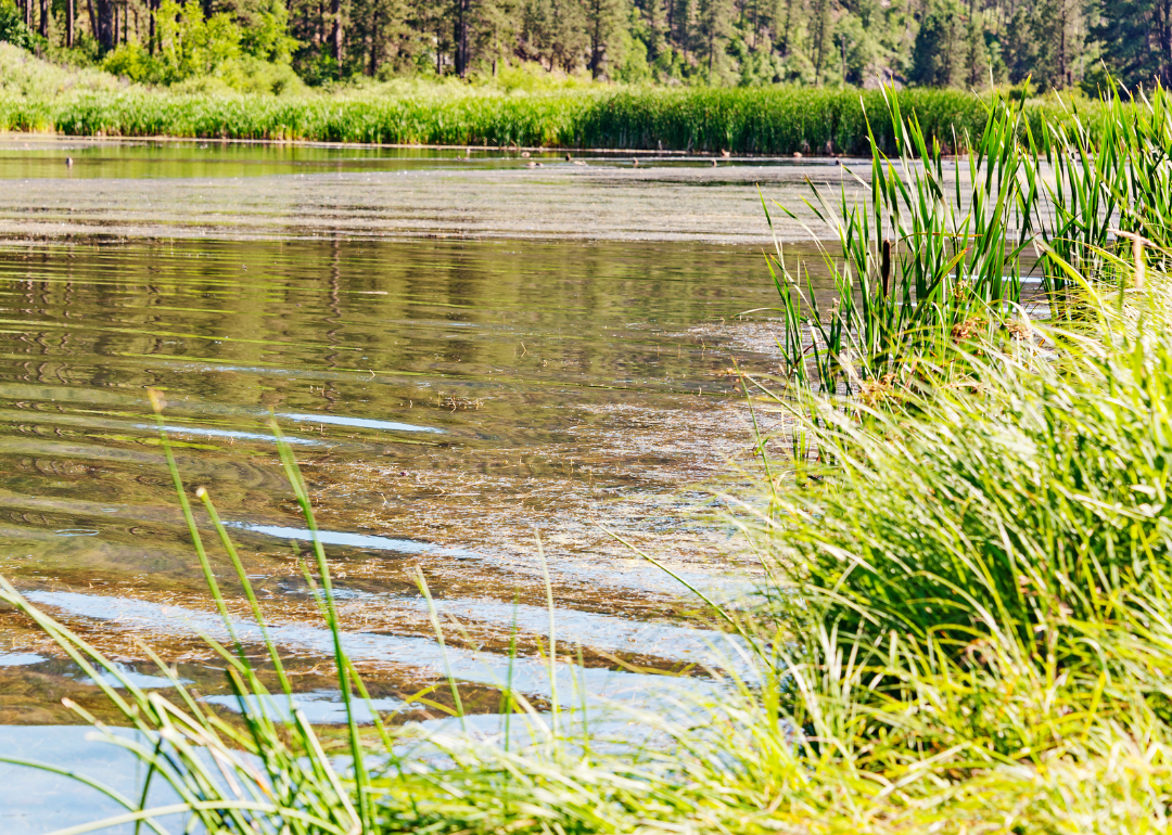
Counties with the shortest life expectancy in South Dakota
Life expectancy can be affected by a variety of factors. About 25% of your lifespan is determined by genetics, according to the National Library of Medicine. Health and wellness habits—like following a balanced, nutrient-rich diet; not smoking; drinking minimal alcohol; maintaining a healthy weight; and staying physically active—can add more than a decade to your life, research from the National Institutes of Health shows. While these factors are significant, another important element that you might not have considered is your environment and community.
While life expectancy generally increases annually in the United States—jumping from about 70.8 years old to 77.5 between 1970 and 2022, according to the Centers for Disease Control and Prevention—this particular metric can vary from state to state or even county to county. In some parts of the country, the average lifespan is getting shorter based on a variety of risk factors on top of health, including socioeconomic factors like poverty, unemployment, income, and education.
According to a 2020 study from researchers at Penn State, West Virginia, and Michigan State Universities, communities with a higher population density, more fast food restaurants, and a high number of extraction industry-based jobs tend to have shorter life expectancies.
To find out how life expectancy varies within South Dakota, Stacker used 2024 County Health Rankings & Roadmaps from the University of Wisconsin Population Health Institute to identify the counties with the shortest life expectancy. Life expectancy measures the average number of years from birth a person can expect to live and is calculated based on the number of deaths in a given time period and the average number of people at risk of dying during that period. Counties with unreliable or insufficient data were excluded from the analysis. Mortality data came from the National Vital Statistics System.
Read on to see if your county is on the list.
You may also like: The top careers hiring for AI skills in South Dakota, according to job postings
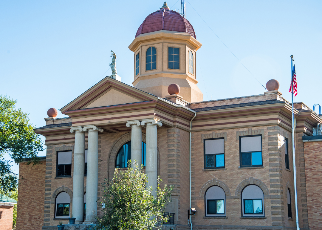
#24. Butte County (tie)
– Life expectancy: 77.1 years
— 0.2 years lower than the state average
About
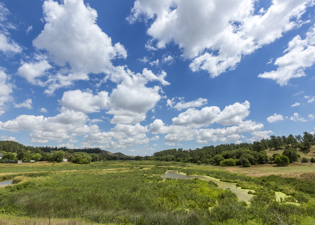
Butte County is defined by its wide-open landscapes, ranching heritage, and strong agricultural economy. Cattle grazing, crop production, and small-town commerce form the backbone of the local livelihood. The land offers expansive views, natural beauty, and a quiet, rural lifestyle.
The community values independence, hard work, and close community ties through local events, fairs, and civic traditions. Growth remains modest, focused on sustaining agricultural traditions while supporting essential services. Residents enjoy a peaceful environment rooted in land, legacy, and resilience.
Where is Butte County?
Butte County is located in the northwestern corner of South Dakota, bordering Montana to the west. The county seat, Belle Fourche, is about 60 miles northwest of Rapid City and approximately 25 miles north of Deadwood. It lies around 100 miles southeast of Miles City, Montana.
The county is about 350 miles west of Pierre, the state capital, and roughly 100 miles east of the Wyoming border near Gillette. Butte County is also around 300 miles northeast of Casper, Wyoming. Its location places it within the high plains region, near the northern edge of the Black Hills.
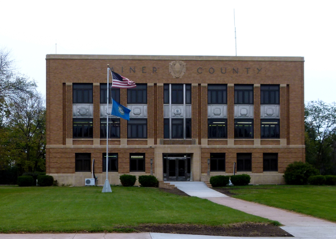
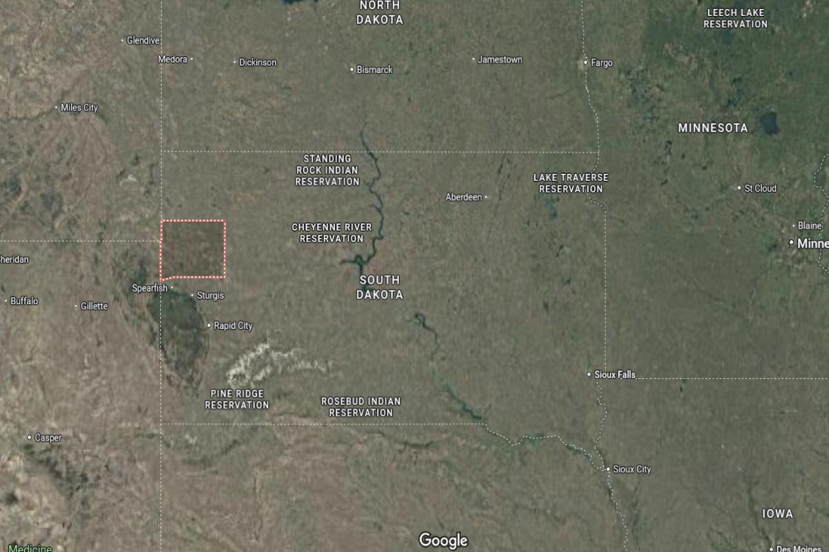
#23. Miner County (tie)
– Life expectancy: 77.1 years
— 0.2 years lower than the state average
About
Miner County is characterized by its agricultural roots, open prairies, and small-town simplicity. Farming, especially grain and livestock production, drives the local economy and shapes daily life. The landscape offers wide skies, quiet roads, and a strong connection to the land.
The community values tradition, cooperation, and resilience through local events, school activities, and civic pride. Growth is minimal and focused on maintaining essential services while preserving rural character. Residents enjoy a steady, grounded lifestyle centered on family, work, and community.
Where is Miner County?
Miner County is located in the eastern part of South Dakota, within the James River Valley region. The county seat, Howard, is about 60 miles northwest of Sioux Falls and roughly 30 miles south of Huron. It is approximately 90 miles east of Mitchell.
The county lies around 230 miles east of Rapid City and about 90 miles southwest of Brookings. Miner County is also approximately 160 miles southeast of Aberdeen. Its central-eastern location provides access to both rural communities and regional trade centers.
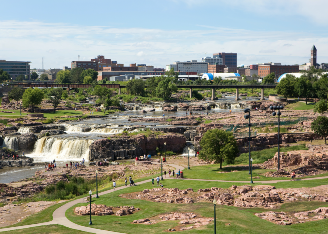
#22. Minnehaha County
– Life expectancy: 77.0 years
— 0.3 years lower than the state average
About
Minnehaha County blends urban energy with rural traditions and a steadily growing economy. Its industries include healthcare, finance, manufacturing, and agriculture, supporting both city and small-town life. Parks, cultural venues, and recreational spaces enhance the area’s livability and appeal.
The community values innovation, education, and civic engagement through public programs, events, and strong institutions. Development focuses on smart growth, infrastructure, and preserving community character. Residents enjoy a balanced lifestyle rooted in opportunity, culture, and a strong sense of place.
Where is Minnehaha County?
Would you like to save this?
Minnehaha County is located in the southeastern corner of South Dakota, bordering Minnesota to the east. The county seat, Sioux Falls, is the largest city in the state and lies about 15 miles west of the Minnesota border. It is approximately 80 miles north of Sioux City, Iowa.
The county is about 240 miles southeast of Pierre and roughly 190 miles southwest of Minneapolis, Minnesota. Minnehaha County is also around 60 miles east of Mitchell. Its location makes it a major hub for commerce, transportation, and population in the region.
#21. Sanborn County
– Life expectancy: 76.6 years
— 0.7 years lower than the state average
About
Sanborn County is defined by its agricultural landscape, quiet communities, and deep-rooted rural values. The economy centers on farming and livestock production, with fields and open skies shaping the daily rhythm of life. Small towns and local businesses support a close-knit, self-reliant population.
The community emphasizes tradition, cooperation, and a strong connection to the land through fairs, school events, and civic pride. Growth is modest and focuses on maintaining essential services and rural character. Residents enjoy a peaceful, grounded lifestyle built on family, hard work, and community spirit.
Where is Sanborn County?
Sanborn County is located in the east-central part of South Dakota, within the James River Valley. The county seat, Woonsocket, is about 25 miles northwest of Mitchell and roughly 35 miles south of Huron. It is approximately 95 miles west of Sioux Falls.
The county lies around 230 miles east of Rapid City and about 140 miles south of Watertown. Sanborn County is also about 160 miles southeast of Aberdeen. Its location supports access to regional farming communities and small urban centers.
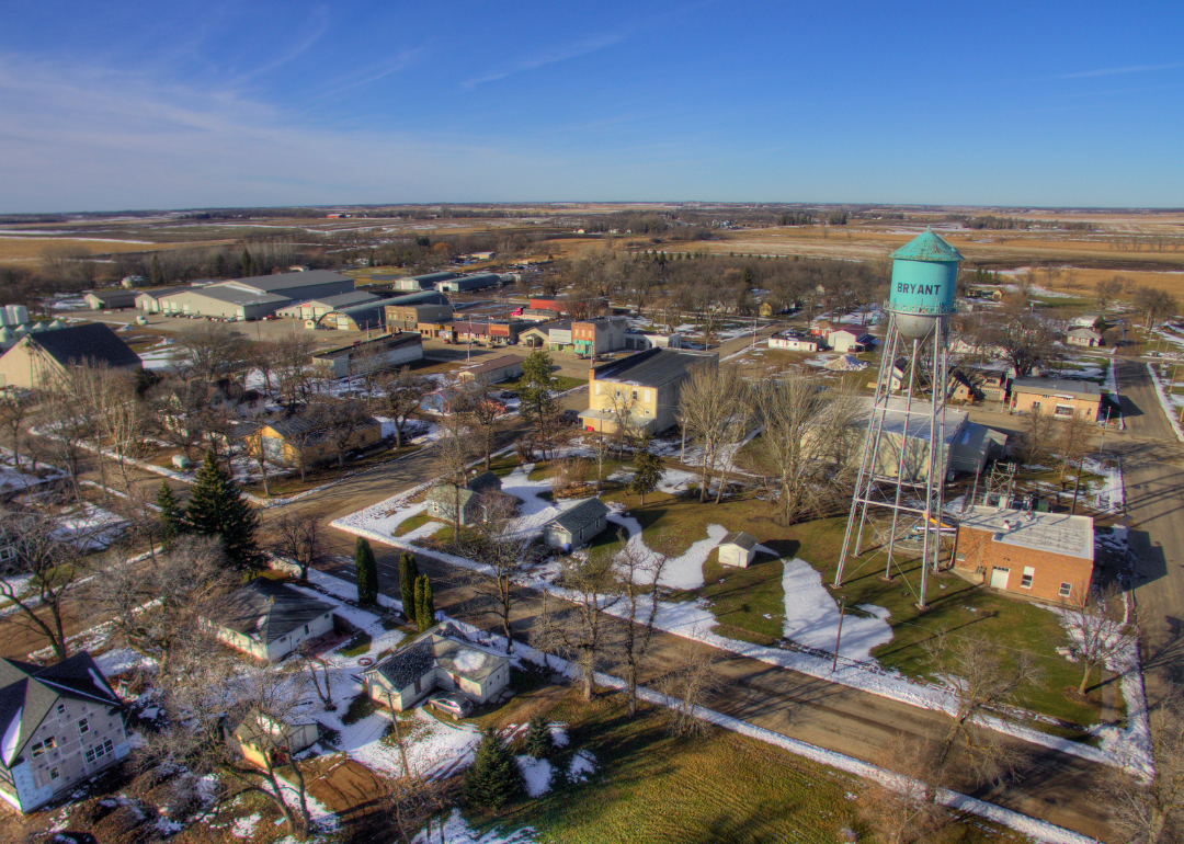
#20. Hamlin County
– Life expectancy: 76.5 years
— 0.8 years lower than the state average
About
Hamlin County offers a peaceful rural setting shaped by agriculture, lakes, and small-town life. The economy is primarily supported by crop farming, livestock, and local businesses that reflect the area’s agricultural roots. Open fields, quiet roads, and natural water features provide both livelihood and leisure.
The community values hard work, tradition, and connection through school events, county fairs, and local gatherings. Growth remains steady and focused on sustaining rural services and preserving community identity. Residents enjoy a lifestyle grounded in nature, family values, and a strong sense of belonging.
Where is Hamlin County?
Hamlin County is located in the northeastern part of South Dakota, within the Coteau des Prairies region. The county seat, Hayti, is about 25 miles west of Watertown and approximately 100 miles north of Sioux Falls. It is around 70 miles east of Huron.
The county lies about 160 miles northeast of Mitchell and roughly 130 miles southeast of Aberdeen. Hamlin County is also around 80 miles west of the Minnesota border near Marshall. Its position offers access to both agricultural areas and nearby regional cities.
You may also like: Counties with the highest cancer rates in South Dakota
#18. Aurora County (tie)
– Life expectancy: 76.4 years
— 0.9 years lower than the state average
About
Aurora County is defined by its wide-open landscapes, agricultural economy, and strong sense of rural identity. Farming and livestock production are central to daily life, supported by small towns and local enterprises. The area offers a quiet, scenic setting with a focus on tradition and self-reliance.
The community values hard work, family, and civic pride through local fairs, school activities, and community events. Growth is modest and carefully managed to maintain the county’s rural character and essential services. Residents enjoy a peaceful lifestyle rooted in land, heritage, and community connections.
Where is Aurora County?
Aurora County is located in the southeastern part of South Dakota, within the James River Valley. The county seat, Plankinton, is about 15 miles west of Mitchell and approximately 90 miles west of Sioux Falls. It is around 140 miles southeast of Pierre.
The county lies about 60 miles east of Chamberlain and roughly 110 miles southwest of Brookings. Aurora County is also about 70 miles south of Huron. Its central location along Interstate 90 provides convenient access to both eastern and western parts of the state.
#18. Pennington County (tie)
– Life expectancy: 76.4 years
— 0.9 years lower than the state average
About
Pennington County blends natural beauty, economic diversity, and cultural energy into a dynamic and growing region. Its economy is supported by tourism, healthcare, retail, and government services, offering both opportunity and stability. Mountains, parks, and outdoor attractions provide a strong connection to nature and recreation.
The community values innovation, education, and civic engagement through public initiatives, events, and institutions. Development focuses on smart growth, infrastructure, and preserving natural landscapes. Residents enjoy a vibrant lifestyle that balances progress, tradition, and scenic living.
Where is Pennington County?
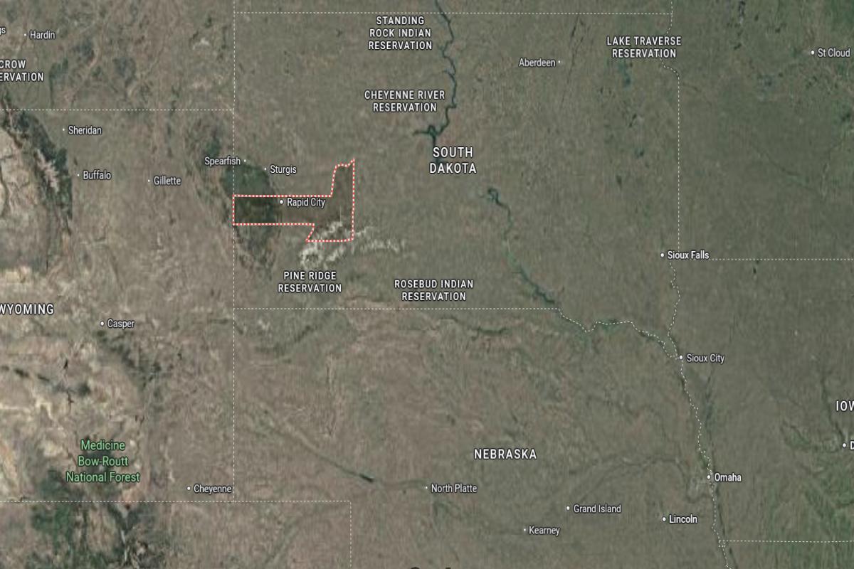
Pennington County is located in the western part of South Dakota, in the heart of the Black Hills region. The county seat, Rapid City, is about 55 miles east of the Wyoming border and approximately 30 miles northeast of Mount Rushmore. It is around 145 miles west of Pierre.
The county lies about 350 miles west of Sioux Falls and roughly 110 miles southwest of Belle Fourche. Pennington County is also about 60 miles north of Custer. Its position makes it a central hub for tourism, history, and outdoor recreation in western South Dakota.

#17. Hughes County
– Life expectancy: 75.9 years
— 1.4 years lower than the state average
About
Hughes County offers a blend of government-centered activity, natural beauty, and a strong sense of community. The local economy is driven by public administration, professional services, and small businesses, all supported by a stable infrastructure. Scenic river views, parks, and open spaces provide residents with ample recreational opportunities.
The community values civic involvement, heritage, and quality of life through local events, institutions, and well-maintained public amenities. Development is steady, with a focus on preserving natural resources and enhancing community services. Residents enjoy a peaceful, well-connected lifestyle grounded in tradition and public service.
Where is Hughes County?
Hughes County is located in central South Dakota, along the Missouri River. The county seat, Pierre, is the state capital and sits about 115 miles northwest of Mitchell and approximately 190 miles west of Sioux Falls. It is around 145 miles east of Rapid City.
The county lies about 140 miles south of Mobridge and roughly 100 miles north of Winner. Hughes County is also about 170 miles southwest of Huron. Its central location and position on the river make it a key administrative and transportation point in the state.
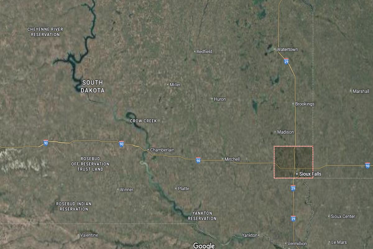
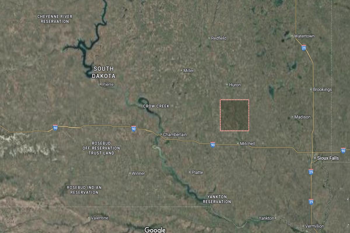
#16. McCook County
– Life expectancy: 75.7 years
— 1.6 years lower than the state average
About
McCook County is shaped by its agricultural heritage, open landscapes, and close-knit rural communities. The local economy is driven by farming, livestock production, and small businesses that support day-to-day life. Fields, quiet towns, and a steady pace define the area’s character.
The community values hard work, family ties, and civic pride through school events, county fairs, and local gatherings. Growth is modest and focused on maintaining essential services while preserving rural charm. Residents enjoy a grounded lifestyle rooted in tradition, nature, and strong community bonds.
Where is McCook County?
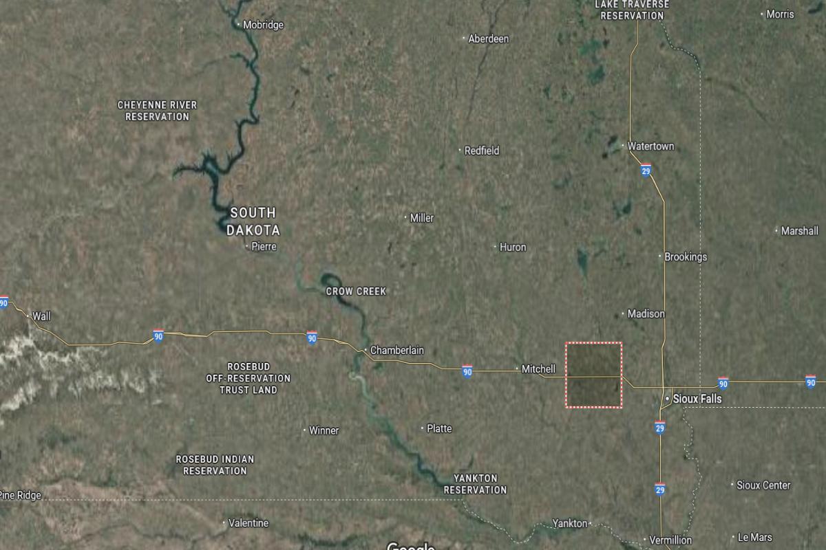
McCook County is located in southeastern South Dakota, within the eastern plains region. The county seat, Salem, is about 35 miles west of Sioux Falls and approximately 45 miles east of Mitchell. It is around 160 miles southeast of Pierre.
The county lies about 90 miles south of Brookings and roughly 85 miles north of Yankton. McCook County is also about 65 miles west of the Minnesota border. Its location along Interstate 90 supports easy travel between major cities in the region.
Would you like to save this?
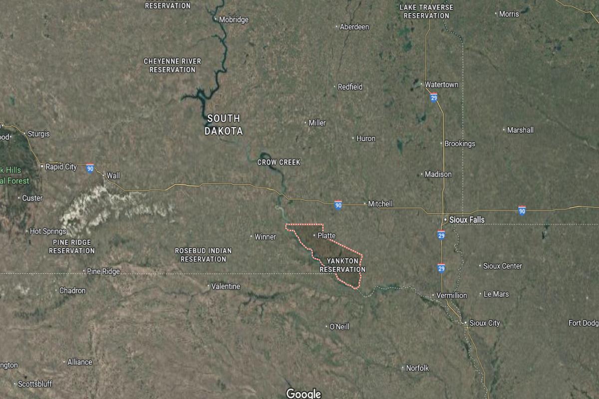
#15. Tripp County
– Life expectancy: 74.9 years
— 2.4 years lower than the state average
About
Tripp County is defined by its expansive prairies, strong ranching and farming traditions, and resilient rural culture. The economy revolves around agriculture, particularly cattle and crop production, supported by small-town businesses and services. The landscape offers wide horizons, open skies, and a peaceful, natural setting.
The community values independence, heritage, and connection through local events, school activities, and county fairs. Development remains modest, focusing on preserving rural identity and supporting essential needs. Residents enjoy a quiet, hardworking lifestyle rooted in family, land, and tradition.
Where is Tripp County?
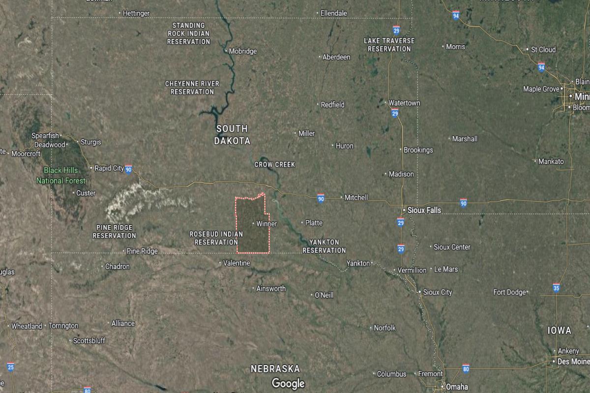
Tripp County is located in south-central South Dakota, along the Nebraska border. The county seat, Winner, is about 90 miles southwest of Mitchell and approximately 160 miles south of Pierre. It is around 170 miles west of Sioux Falls.
The county lies about 110 miles southeast of Rapid City and roughly 80 miles northwest of Valentine, Nebraska. Tripp County is also about 140 miles south of Huron. Its border location supports access to both central South Dakota and northern Nebraska.
You may also like: Best colleges in South Dakota
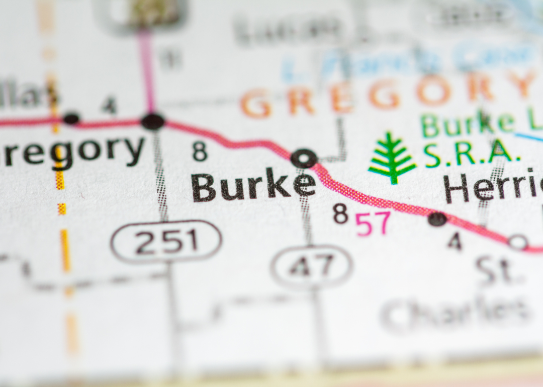
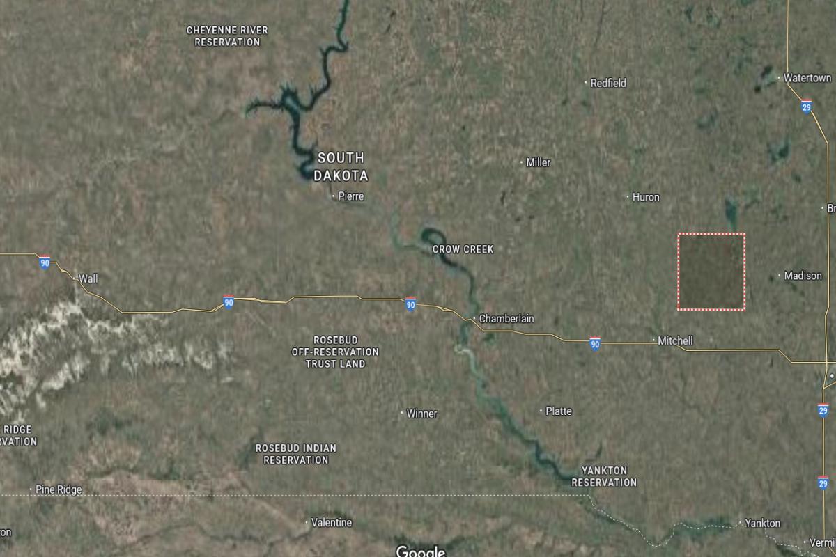
#14. Gregory County
– Life expectancy: 74.3 years
— 3.0 years lower than the state average
About
Gregory County is known for its rich agricultural landscape, hunting traditions, and strong rural values. The local economy is driven by farming, ranching, and seasonal outdoor tourism, especially related to wildlife and fishing. Rolling plains, river valleys, and small towns define the region’s visual and cultural identity.
The community emphasizes tradition, self-reliance, and civic engagement through fairs, local events, and close community ties. Growth is modest and focused on sustaining essential services while preserving the area’s heritage. Residents enjoy a quiet, nature-centered lifestyle rooted in hard work and community pride.
Where is Gregory County?
Gregory County is located in south-central South Dakota, along the border with Nebraska and the Missouri River. The county seat, Burke, is about 110 miles southwest of Mitchell and approximately 140 miles south of Pierre. It is around 180 miles west of Sioux Falls.
The county lies about 90 miles southeast of Winner and roughly 70 miles northeast of Valentine, Nebraska. Gregory County is also about 130 miles south of Huron. Its location near the river and state border provides access to both agricultural lands and cross-state travel.
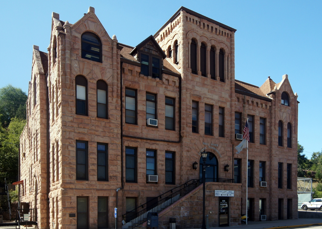
#13. Fall River County
– Life expectancy: 74.0 years
— 3.3 years lower than the state average
About
Fall River County blends rugged natural landscapes with a deep-rooted history and a strong sense of independence. Its economy is supported by agriculture, tourism, and small businesses, with a focus on outdoor recreation and wellness. Hot springs, hills, and open space create a unique and restorative environment.
The community values tradition, resilience, and self-sufficiency through local festivals, heritage sites, and civic involvement. Growth is measured and aimed at preserving natural resources while enhancing quality of life. Residents enjoy a tranquil lifestyle grounded in nature, heritage, and community spirit.
Where is Fall River County?
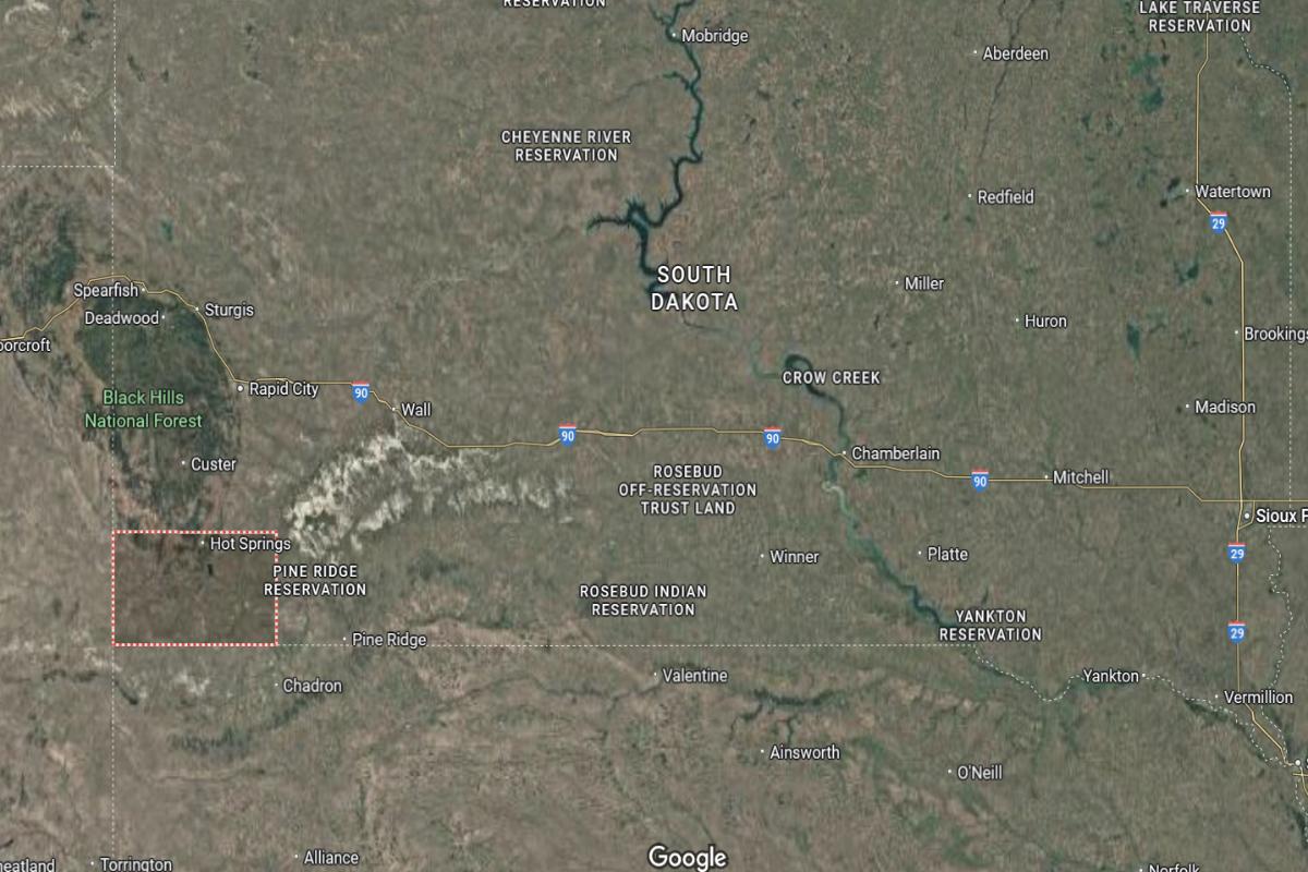
Fall River County is located in the southwestern corner of South Dakota, bordering both Wyoming and Nebraska. The county seat, Hot Springs, is about 60 miles south of Rapid City and approximately 20 miles north of the Nebraska border. It is around 55 miles east of the Wyoming border.
The county lies about 160 miles west of Valentine, Nebraska, and roughly 300 miles west of Mitchell. Fall River County is also about 200 miles southwest of Pierre. Its location places it at the southern edge of the Black Hills, near several historic and recreational sites.
#12. Roberts County
– Life expectancy: 73.4 years
— 3.9 years lower than the state average
About
Roberts County is shaped by its agricultural economy, diverse cultural heritage, and wide-open rural landscapes. Farming, livestock production, and local enterprises form the backbone of daily life. Lakes, prairies, and rolling hills add natural beauty and support outdoor activities year-round.
The community values tradition, family, and collaboration through cultural events, school functions, and civic gatherings. Development is steady, focused on preserving rural identity while supporting essential services. Residents enjoy a peaceful lifestyle rooted in land, heritage, and close community ties.
Where is Roberts County?
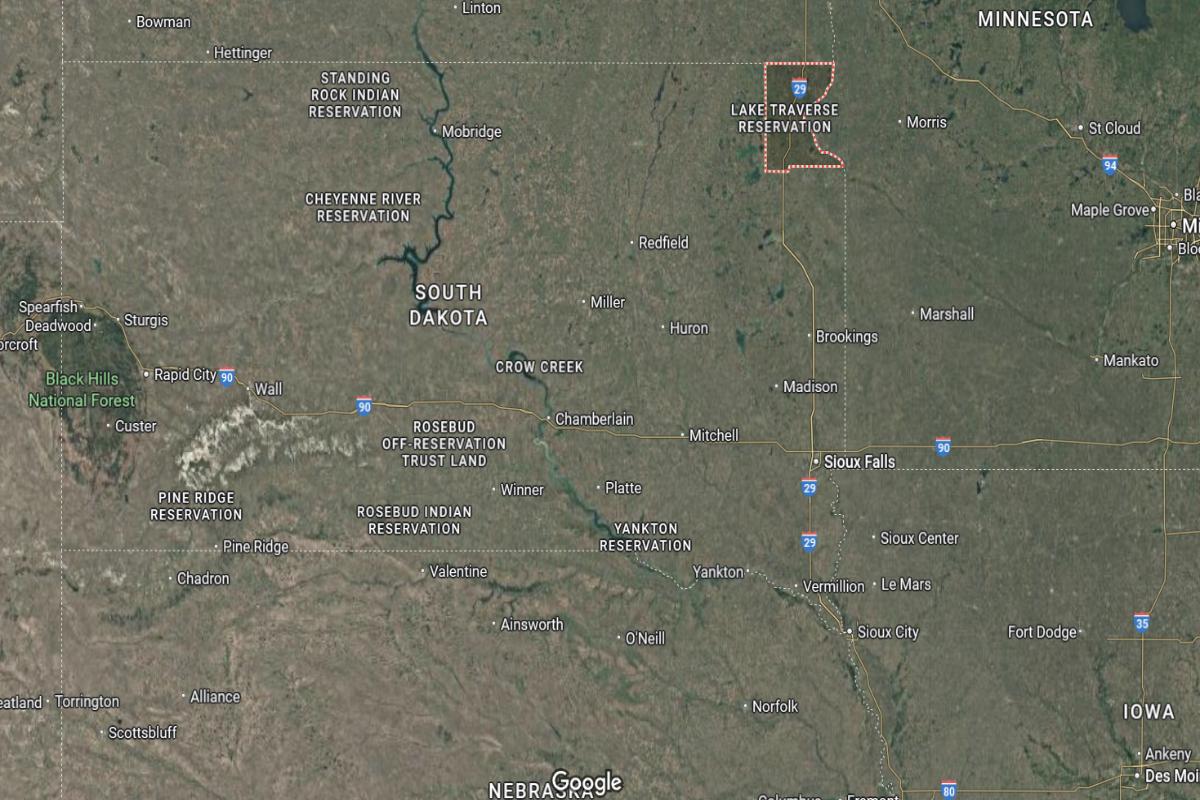
Roberts County is located in the northeastern corner of South Dakota, bordering both Minnesota and North Dakota. The county seat, Sisseton, is about 70 miles northeast of Watertown and approximately 110 miles north of Brookings. It is around 160 miles north of Sioux Falls.
The county lies about 90 miles southeast of Fargo, North Dakota, and roughly 180 miles northeast of Pierre. Roberts County is also about 25 miles west of the Minnesota border near Browns Valley. Its tri-state location supports access to regional trade and transportation routes.
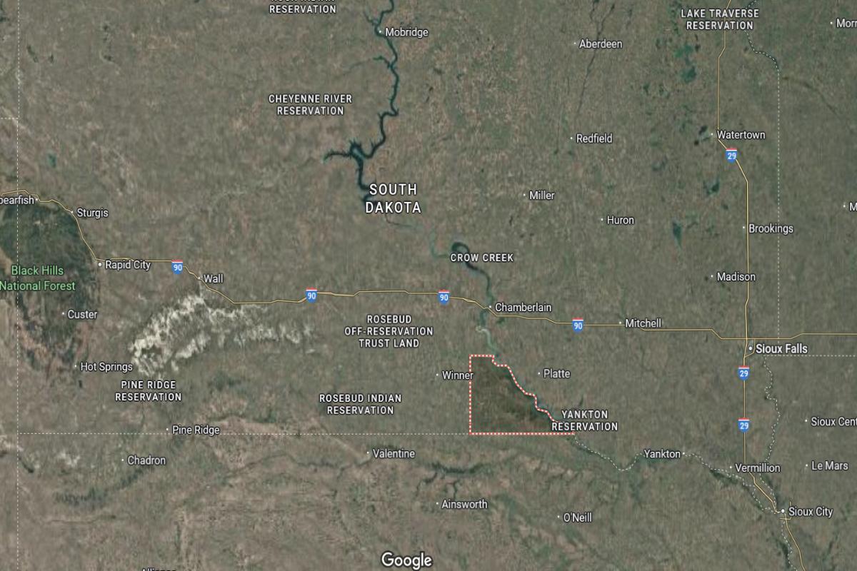
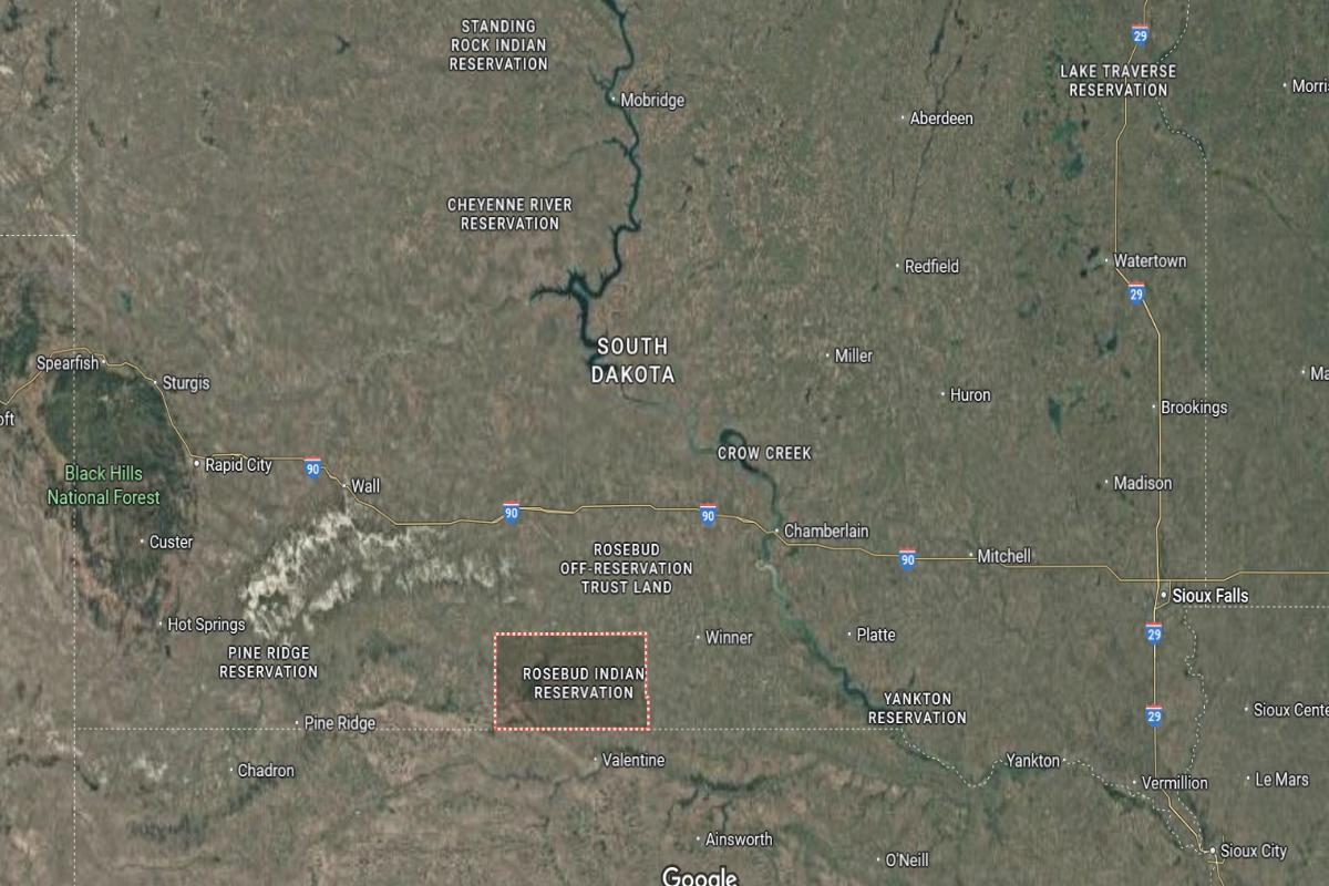
#11. Charles Mix County
– Life expectancy: 71.3 years
— 6.0 years lower than the state average
About
Charles Mix County is known for its rich blend of agricultural productivity, cultural heritage, and natural resources. The economy is driven by farming, ranching, and local businesses, with strong ties to the land and seasonal outdoor activity. Lakes, open plains, and river valleys shape the county’s scenic and economic landscape.
The community values tradition, resilience, and cooperation through school events, powwows, and county fairs. Growth is measured and focuses on preserving cultural identity while improving infrastructure and services. Residents enjoy a grounded, community-centered lifestyle rooted in history, nature, and rural pride.
Where is Charles Mix County?
Charles Mix County is located in southeastern South Dakota, along the Missouri River and near the Nebraska border. The county seat, Lake Andes, is about 90 miles southwest of Sioux Falls and approximately 70 miles south of Mitchell. It is around 150 miles southeast of Pierre.
The county lies about 110 miles north of Norfolk, Nebraska, and roughly 80 miles west of Yankton. Charles Mix County is also about 140 miles south of Huron. Its riverfront position and proximity to state borders support regional agriculture and transportation.
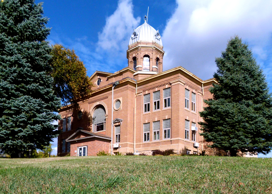
#10. Lyman County
– Life expectancy: 70.9 years
— 6.4 years lower than the state average
About
Lyman County is characterized by its expansive prairies, agricultural focus, and deep rural roots. The economy centers around farming, cattle ranching, and small-town commerce, creating a lifestyle closely tied to the land. Rivers, rolling landscapes, and open skies provide a peaceful and productive environment.
The community values tradition, resilience, and local pride through fairs, school events, and strong family ties. Growth is modest and centered on maintaining essential services while preserving the rural way of life. Residents enjoy a quiet, grounded lifestyle built on hard work, heritage, and community connection.
Where is Lyman County?
Lyman County is located in central South Dakota, along the Missouri River. The county seat, Kennebec, is about 30 miles west of Chamberlain and approximately 85 miles southeast of Pierre. It is around 150 miles west of Mitchell.
The county lies about 250 miles west of Sioux Falls and roughly 190 miles east of Rapid City. Lyman County is also about 120 miles south of Huron. Its central location and proximity to Interstate 90 make it a key east-west travel route in the state.
You may also like: Counties with the highest STI rates in South Dakota
#9. Bennett County
– Life expectancy: 69.5 years
— 7.8 years lower than the state average
About
Bennett County is marked by its vast plains, agricultural traditions, and cultural diversity. Farming, ranching, and local businesses form the core of its economy, providing stability and a strong connection to the land. The wide-open landscape supports both natural beauty and rural productivity.
The community values resilience, heritage, and cooperation through local events, cultural gatherings, and shared civic efforts. Development is minimal and focused on sustaining essential services while honoring the area’s identity. Residents enjoy a lifestyle rooted in tradition, family, and the rhythms of rural life.
Where is Bennett County?
Bennett County is located in the south-central part of South Dakota, near the Nebraska border. The county seat, Martin, is about 90 miles southeast of Rapid City and approximately 40 miles north of Valentine, Nebraska. It is around 180 miles southwest of Pierre.
The county lies about 310 miles west of Sioux Falls and roughly 120 miles south of Kadoka. Bennett County is also about 150 miles west of Winner. Its location near state and tribal lands offers access to open plains and cross-border travel.
#8. Ziebach County
– Life expectancy: 68.5 years
— 8.8 years lower than the state average
About
Ziebach County is defined by its wide prairies, ranching culture, and strong ties to Native American heritage. The local economy relies on livestock production, community-based services, and a deep connection to the land. Open landscapes and quiet roads reflect a life of simplicity and endurance.
The community values tradition, self-reliance, and cultural identity through gatherings, storytelling, and local involvement. Development is limited, with an emphasis on preserving natural resources and supporting community needs. Residents live a grounded, resilient lifestyle shaped by history, heritage, and close community bonds.
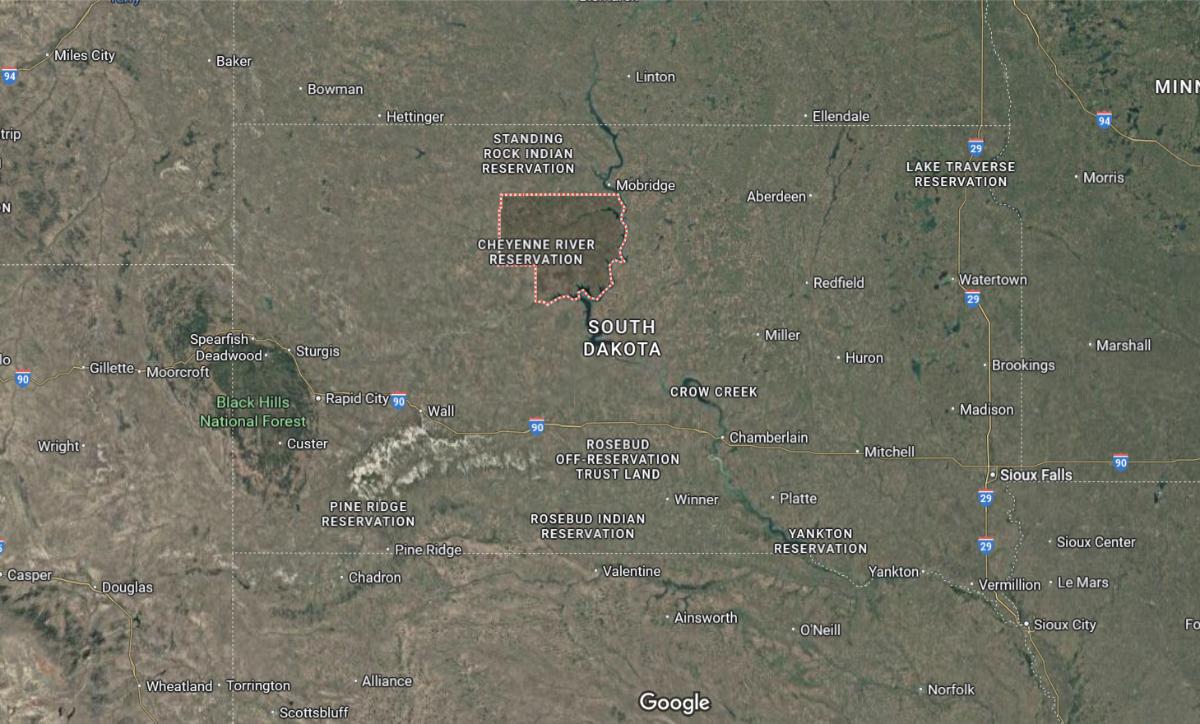
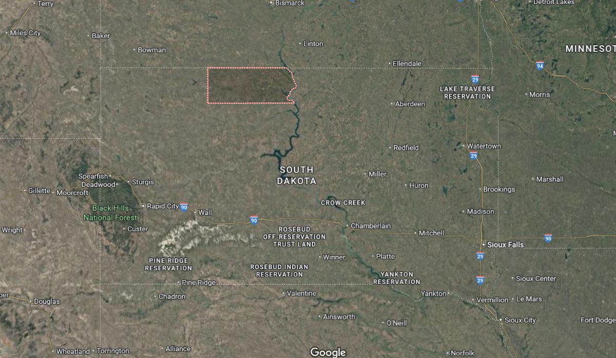
Where is Ziebach County?
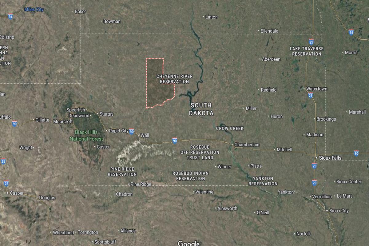
Ziebach County is located in north-central South Dakota, within the Cheyenne River Indian Reservation. The county seat, Dupree, is about 90 miles west of Pierre and approximately 75 miles east of Eagle Butte. It is around 170 miles northwest of Chamberlain.
The county lies about 250 miles west of Huron and roughly 160 miles northeast of Rapid City. Ziebach County is also about 280 miles northwest of Mitchell. Its remote location places it in one of the most rural and sparsely populated areas of the state.
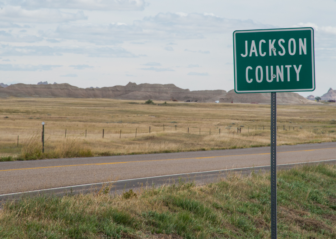
#7. Jackson County
– Life expectancy: 66.1 years
— 11.2 years lower than the state average
About
Jackson County is characterized by its expansive plains, rugged beauty, and deep cultural roots. The economy centers on agriculture, ranching, and tribal enterprises, reflecting a lifestyle closely tied to the land. Natural landmarks and open space offer opportunities for solitude, reflection, and outdoor activity.
The community values heritage, resilience, and unity through local traditions, cultural events, and family-centered living. Growth is minimal and focused on preserving identity and supporting essential services. Residents enjoy a quiet, grounded existence built on history, nature, and strong communal ties.
Where is Jackson County?
Jackson County is located in southwestern South Dakota, partially within the Badlands region. The county seat, Kadoka, is about 100 miles east of Rapid City and approximately 80 miles west of Chamberlain. It is around 180 miles southwest of Pierre.
The county lies about 300 miles west of Sioux Falls and roughly 110 miles south of Belle Fourche. Jackson County is also about 60 miles north of Martin. Its position along Interstate 90 supports travel through the state’s western plains and national park areas.
#6. Mellette County
– Life expectancy: 65.9 years
— 11.4 years lower than the state average
About
Mellette County is shaped by its wide-open landscapes, agricultural economy, and strong cultural heritage. Ranching and farming form the foundation of daily life, supported by local services and community ties. The terrain offers vast prairies and quiet surroundings that reflect a deep connection to the land.
The community values resilience, tradition, and unity through school events, cultural celebrations, and civic involvement. Development is modest and centered on preserving rural character while meeting basic needs. Residents enjoy a peaceful, hardworking lifestyle rooted in heritage, family, and shared purpose.
Where is Mellette County?
Mellette County is located in south-central South Dakota, just north of the Nebraska border. The county seat, White River, is about 45 miles west of Winner and approximately 140 miles southwest of Pierre. It is around 190 miles west of Mitchell.
The county lies about 260 miles west of Sioux Falls and roughly 100 miles southeast of Kadoka. Mellette County is also about 65 miles north of Valentine, Nebraska. Its location offers access to rural plains, tribal lands, and cross-state travel routes.
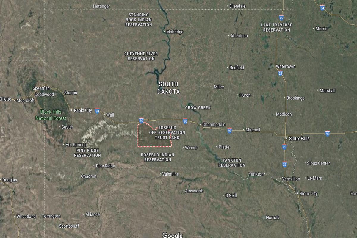
#3. Todd County (tie)
– Life expectancy: 61.4 years
— 15.9 years lower than the state average
About
Todd County is known for its strong Native American heritage, open landscapes, and deep cultural roots. The local economy is supported by tribal government, education, healthcare, and community services, with a close connection to traditional practices and values. Expansive prairies and rural surroundings define the county’s quiet, resilient character.
The community values unity, cultural preservation, and collective strength through ceremonies, education, and local initiatives. Development efforts focus on improving infrastructure, housing, and access to services while honoring cultural identity. Residents maintain a lifestyle grounded in heritage, community support, and respect for the land.
Where is Todd County?
Todd County is located in south-central South Dakota, along the border with Nebraska. The county seat, Mission, is about 25 miles north of Valentine, Nebraska and approximately 80 miles southeast of White River. It is around 160 miles south of Pierre.
The county lies about 270 miles west of Sioux Falls and roughly 120 miles southwest of Mitchell. Todd County is also about 100 miles east of Martin. Its location within the Rosebud Indian Reservation and near the state border supports both tribal and regional connectivity.
You may also like: How many people are receiving substance use treatment in South Dakota
#3. Dewey County (tie)
– Life expectancy: 61.4 years
— 15.9 years lower than the state average
About
Dewey County features wide plains, a strong Native American presence, and a lifestyle deeply connected to the land. The local economy is rooted in tribal governance, agriculture, and community-based services that support both tradition and daily needs. Expansive natural landscapes provide space for ranching, reflection, and cultural expression.
The community values heritage, self-reliance, and togetherness through local events, cultural ceremonies, and shared initiatives. Growth is modest and focused on improving essential services while maintaining the area’s identity. Residents live a grounded, community-centered life shaped by history, nature, and enduring cultural ties.
Where is Dewey County?
Dewey County is located in north-central South Dakota, largely within the Cheyenne River Indian Reservation. The county seat, Timber Lake, is about 85 miles northwest of Pierre and approximately 75 miles northeast of Eagle Butte. It is around 170 miles north of Kadoka.
The county lies about 280 miles west of Huron and roughly 130 miles southeast of Lemmon. Dewey County is also about 250 miles northwest of Mitchell. Its remote setting offers wide plains and strong tribal community presence in the region.
#3. Corson County (tie)
– Life expectancy: 61.4 years
— 15.9 years lower than the state average
About
Corson County is defined by its vast prairies, agricultural traditions, and strong Native American heritage. The economy is centered on ranching, farming, and tribal governance, providing a foundation of stability and cultural continuity. The landscape offers open skies, quiet terrain, and a deep connection to natural surroundings.
The community values tradition, unity, and resilience through ceremonies, community gatherings, and intergenerational ties. Development remains modest, focused on maintaining essential services and cultural preservation. Residents enjoy a life rooted in heritage, community strength, and the enduring rhythms of rural living.
Where is Corson County?
Corson County is located in the north-central part of South Dakota, along the North Dakota border and the Missouri River. The county seat, McIntosh, is about 85 miles northwest of Mobridge and approximately 115 miles north of Pierre. It is around 75 miles south of Bismarck, North Dakota.
The county lies about 200 miles north of Kadoka and roughly 320 miles northwest of Sioux Falls. Corson County is also about 150 miles northeast of Rapid City. Its location along the river and state line connects it to both tribal lands and cross-state routes.
#2. Oglala Lakota County
– Life expectancy: 60.1 years
— 17.2 years lower than the state average
About
Oglala Lakota County is deeply rooted in Native American culture, tradition, and a strong connection to the land. The local economy is supported by tribal government, education, and community services that reflect the area’s rich cultural heritage. Expansive prairies, sacred landscapes, and a strong spiritual presence define the region’s identity.
The community values resilience, cultural preservation, and unity through ceremonies, language, and shared responsibility. Development focuses on improving housing, healthcare, and infrastructure while honoring traditional ways of life. Residents live a life grounded in heritage, community support, and respect for history and nature.
Where is Oglala Lakota County?
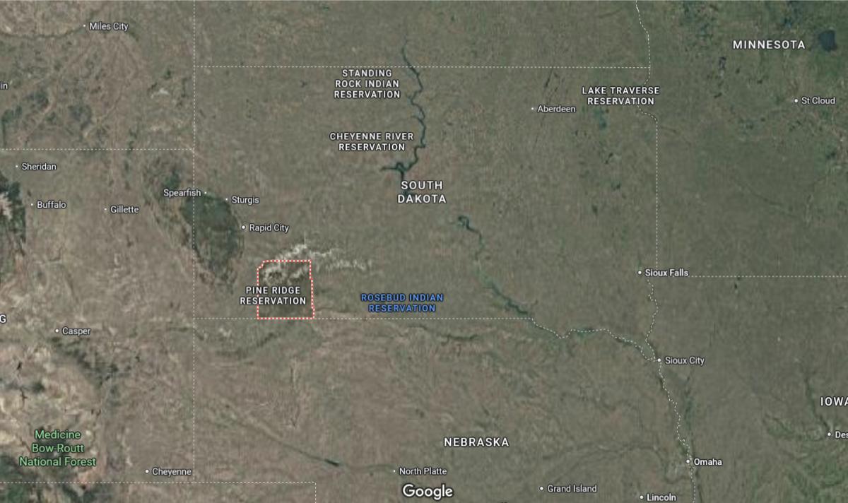
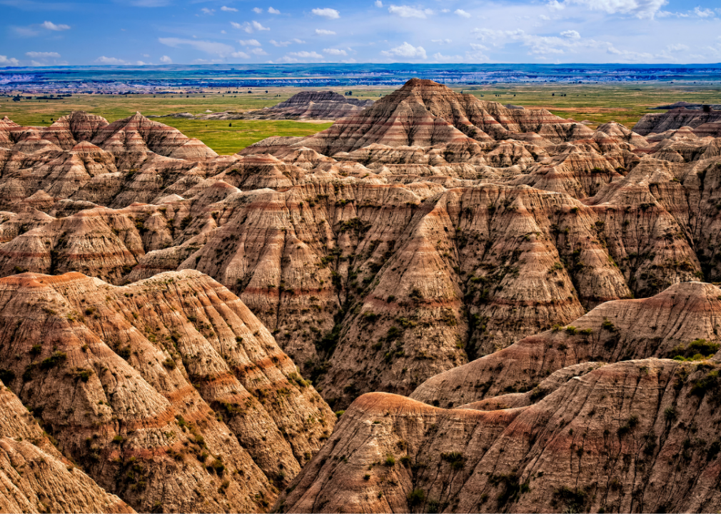
Oglala Lakota County is located in the southwestern corner of South Dakota, entirely within the Pine Ridge Indian Reservation. The administrative center, Pine Ridge, is about 65 miles south of Rapid City and approximately 20 miles north of the Nebraska border. It is around 100 miles west of Martin.
The county lies about 300 miles west of Mitchell and roughly 160 miles southwest of Pierre. Oglala Lakota County is also about 40 miles east of Custer. Its location includes parts of the Badlands and serves as a cultural and geographic center for the Lakota people.
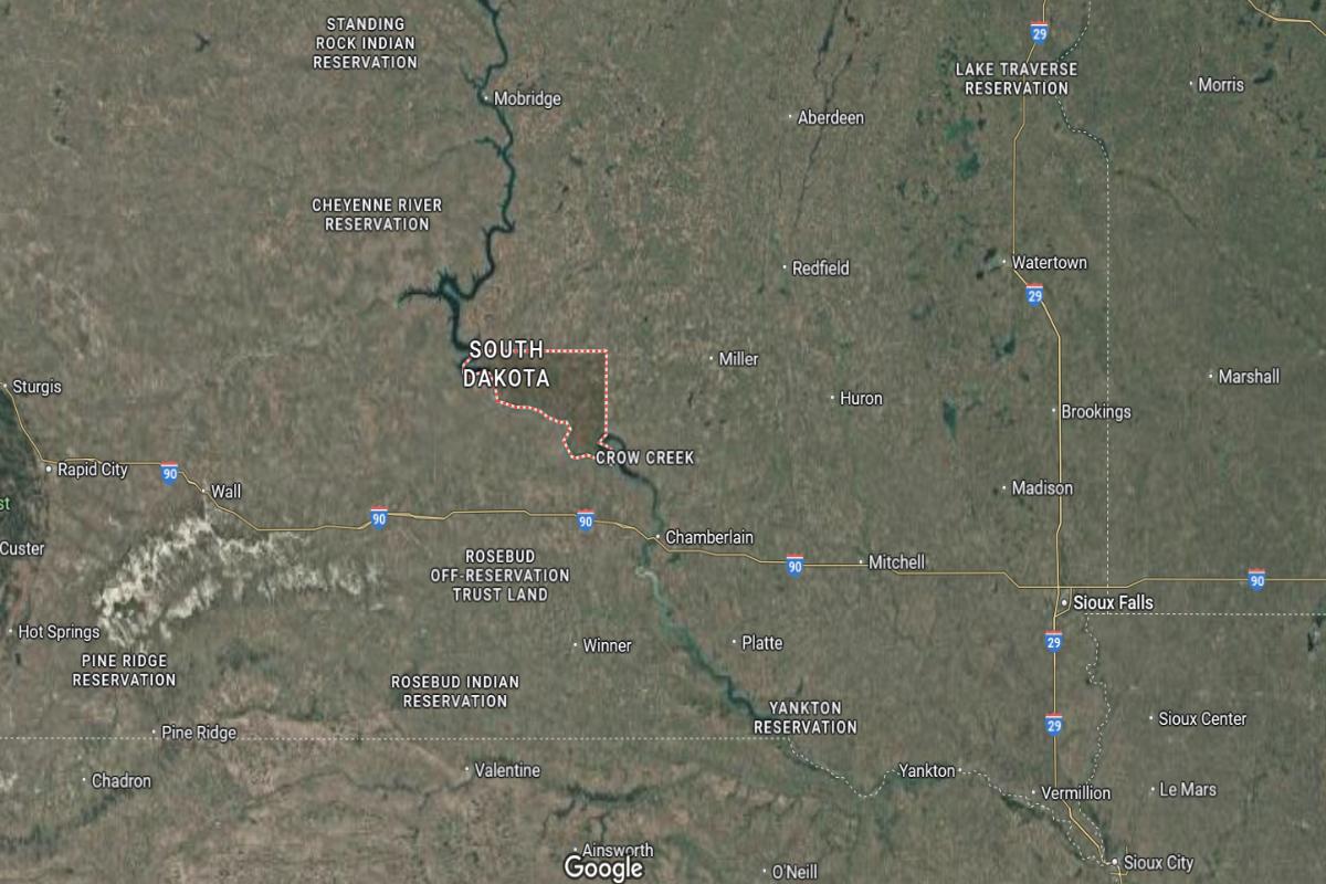
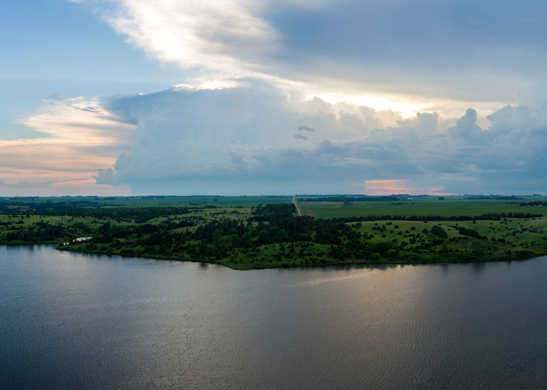
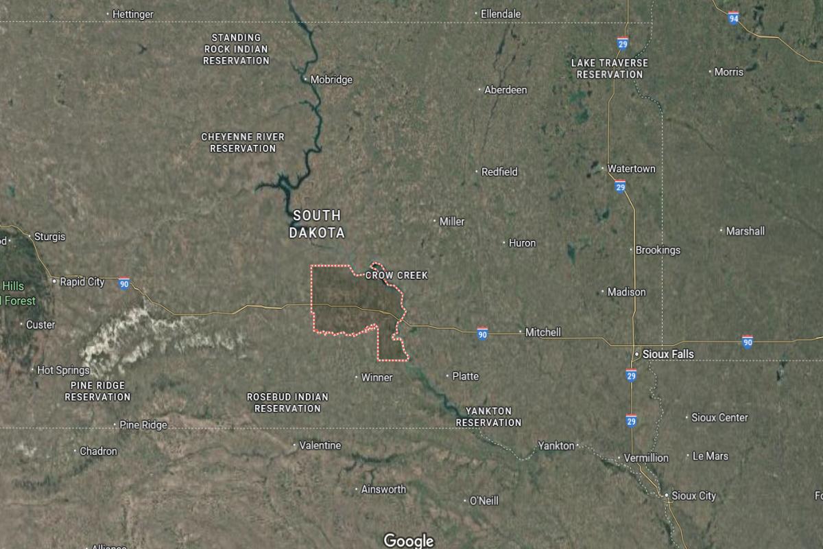
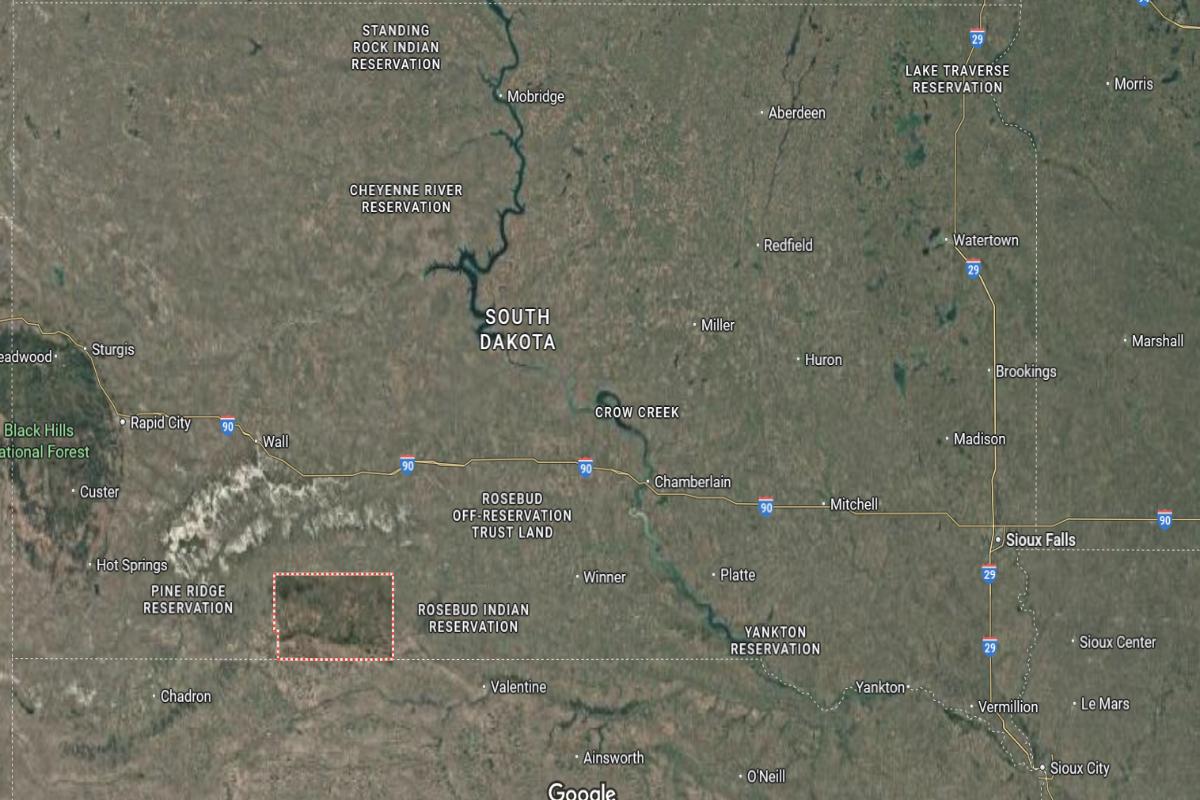
#1. Buffalo County
– Life expectancy: 55.9 years
— 21.4 years lower than the state average
About
Buffalo County is characterized by its open landscapes, agricultural presence, and strong Native American heritage. The economy relies on tribal governance, farming, and community-based services, creating a close connection between land and livelihood. Wide prairies and natural beauty provide a quiet, grounded environment for daily life.
The community values cultural continuity, resilience, and cooperation through traditional practices, local events, and civic engagement. Development is gradual, focused on meeting essential needs while preserving cultural identity. Residents maintain a lifestyle rooted in family, tradition, and a shared connection to the land.
Where is Buffalo County?
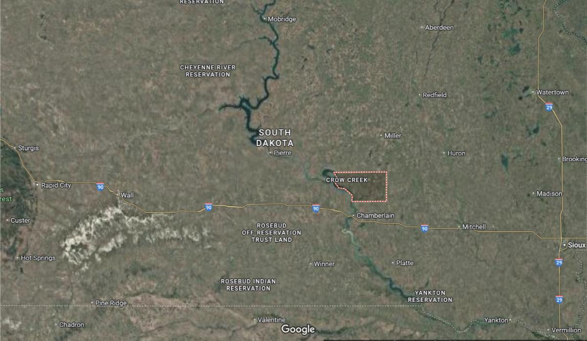
Buffalo County is located in central South Dakota, along the eastern bank of the Missouri River. The county seat, Gann Valley, is about 25 miles north of Chamberlain and approximately 45 miles west of Huron. It is around 110 miles northwest of Mitchell.
The county lies about 170 miles west of Sioux Falls and roughly 150 miles southeast of Pierre. Buffalo County is also about 90 miles south of Redfield. Its central location along the river supports rural communities and agricultural activities.
This story features data reporting by Karim Noorani, writing by Kiersten Hickman, and is part of a series utilizing data automation across 49 states.
By Stacker