
🔥 Would you like to save this?
Counties with the shortest life expectancy in Oregon
Life expectancy can be affected by a variety of factors. About 25% of your lifespan is determined by genetics, according to the National Library of Medicine. Health and wellness habits—like following a balanced, nutrient-rich diet; not smoking; drinking minimal alcohol; maintaining a healthy weight; and staying physically active—can add more than a decade to your life, research from the National Institutes of Health shows. While these factors are significant, another important element that you might not have considered is your environment and community.
While life expectancy generally increases annually in the United States—jumping from about 70.8 years old to 77.5 between 1970 and 2022, according to the Centers for Disease Control and Prevention—this particular metric can vary from state to state or even county to county. In some parts of the country, the average lifespan is getting shorter based on a variety of risk factors on top of health, including socioeconomic factors like poverty, unemployment, income, and education.
In order to come up with the very specific design ideas, we create most designs with the assistance of state-of-the-art AI interior design software.
According to a 2020 study from researchers at Penn State, West Virginia, and Michigan State Universities, communities with a higher population density, more fast food restaurants, and a high number of extraction industry-based jobs tend to have shorter life expectancies.
To find out how life expectancy varies within Oregon, Stacker used 2024 County Health Rankings & Roadmaps from the University of Wisconsin Population Health Institute to identify the counties with the shortest life expectancy. Life expectancy measures the average number of years from birth a person can expect to live and is calculated based on the number of deaths in a given time period and the average number of people at risk of dying during that period. Counties with unreliable or insufficient data were excluded from the analysis. Mortality data came from the National Vital Statistics System.
Read on to see if your county is on the list.
You may also like: Counties with the most bridges in Oregon
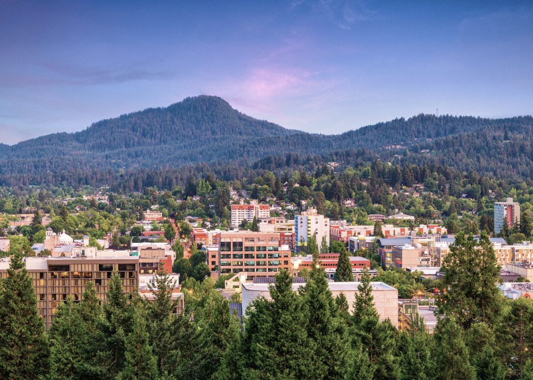
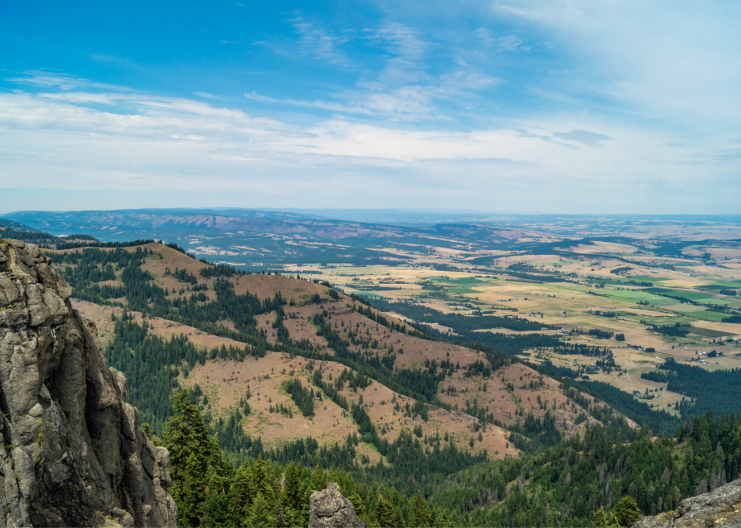
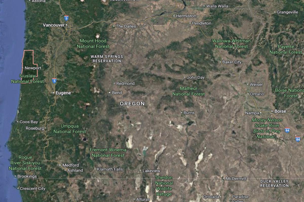
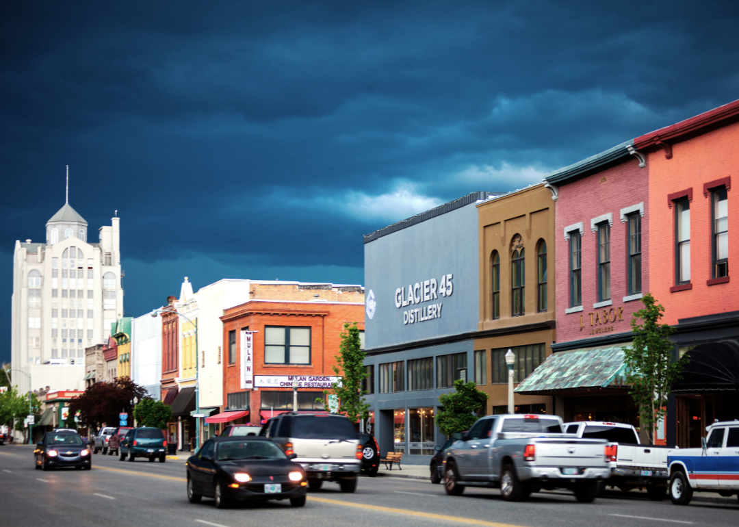
#18. Lane County
– Life expectancy: 77.9 years
— 0.8 years lower than the state average
About
Lane County, Oregon features a diverse landscape that includes forests, rivers, valleys, and coastal access, supporting a wide range of outdoor activities. Its economy is driven by education, healthcare, timber, and a growing tech sector, along with strong support for arts and local entrepreneurship. The region values sustainability, community development, and environmental stewardship.
Residents enjoy a mix of urban amenities and natural beauty, with access to parks, trails, and cultural events year-round. The area fosters a vibrant local culture through music, farmers markets, and public festivals. Lane County balances progressive values, natural preservation, and economic resilience in a dynamic community setting.
Where is Lane County?
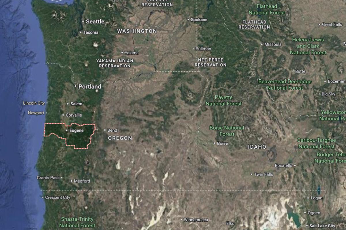
Lane County is located in western Oregon, about 110 miles south of Portland and 70 miles east of the Pacific Ocean. The county seat, Eugene, lies roughly 50 miles north of Roseburg and 90 miles west of Bend. It stretches from the Cascade Mountains in the east to the Oregon Coast in the west.
The area is approximately 60 miles south of Salem and 80 miles north of Medford. Interstate 5 runs through the county, providing a major north-south route. Lane County is also about 45 miles east of Florence on the coast.
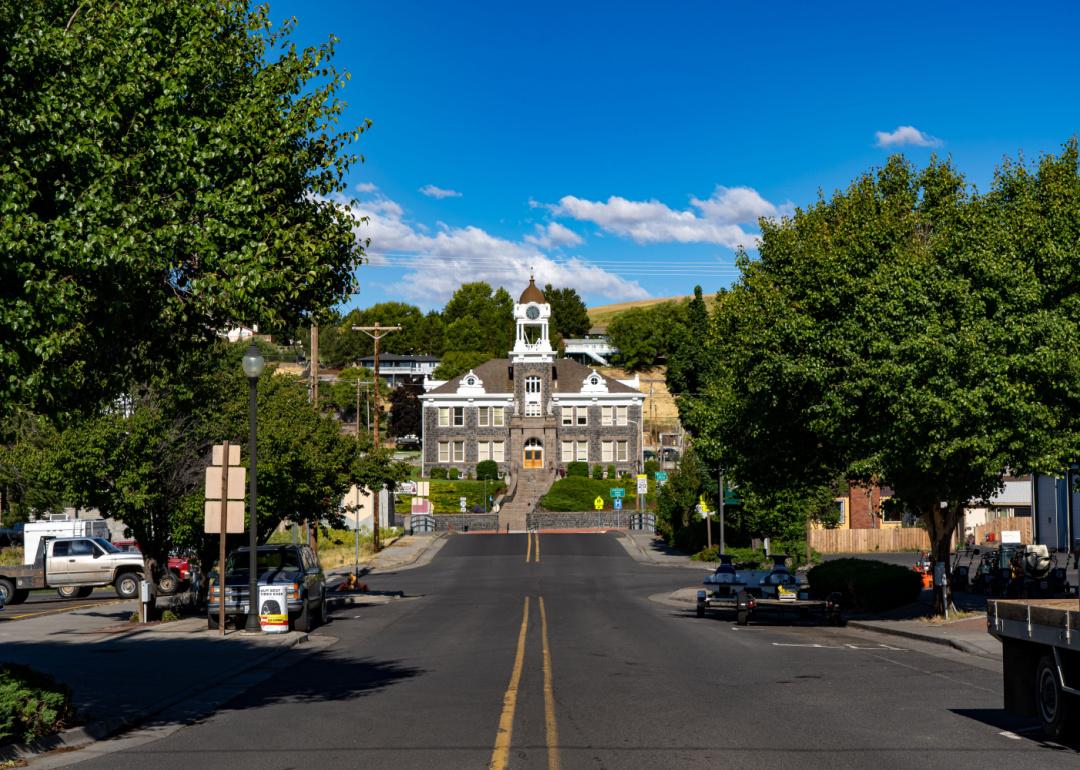
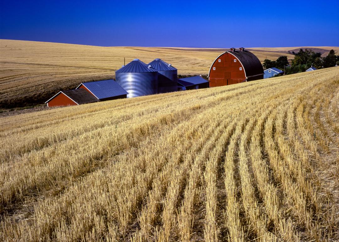
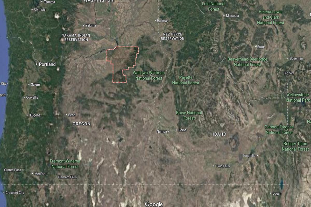
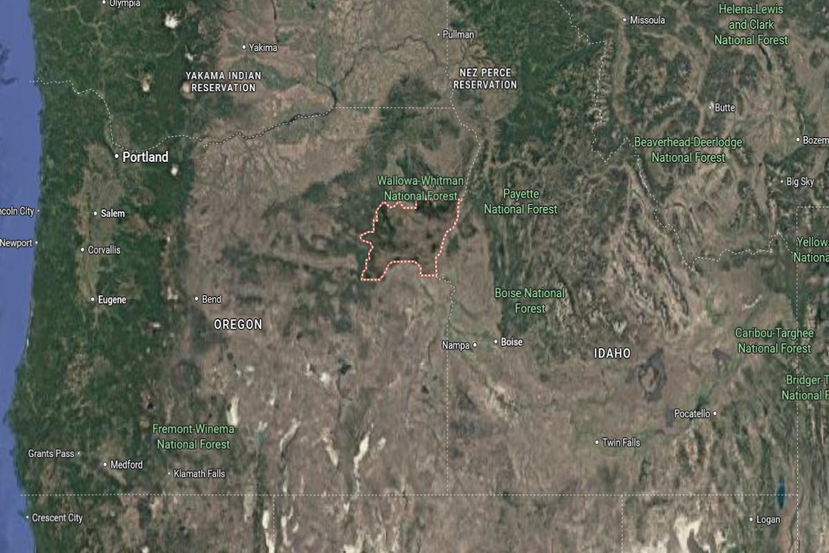
#17. Morrow County
– Life expectancy: 77.5 years
— 1.2 years lower than the state average
About
Morrow County, Oregon is defined by its wide-open landscapes, agricultural productivity, and strong ties to natural resources. The local economy is supported by farming, food processing, energy production, and transportation industries. It values a rural lifestyle rooted in hard work, tradition, and close community bonds.
The county hosts fairs, rodeos, and community gatherings that reflect its agricultural heritage and small-town spirit. Outdoor recreation, including hunting, fishing, and boating, plays a key role in local life. Morrow County offers a grounded, resource-rich environment with a focus on self-reliance and regional pride.
Where is Morrow County?
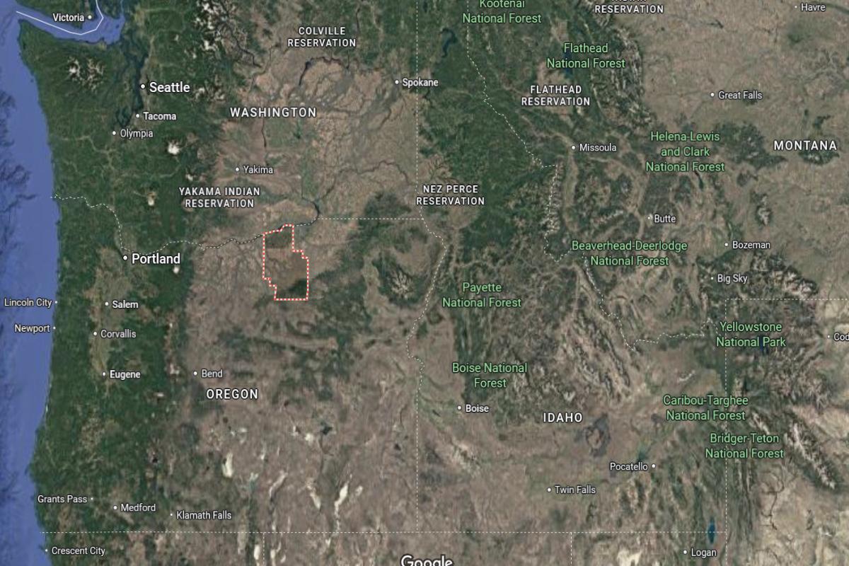
Morrow County is located in northeastern Oregon, about 180 miles east of Portland and 120 miles west of the Idaho border. The county seat, Heppner, lies roughly 40 miles south of Hermiston and 60 miles southwest of Pendleton. It is situated in a region of rolling hills, farmland, and high desert terrain.
The area is approximately 100 miles north of John Day and 65 miles east of The Dalles. Interstate 84 runs through the northern part of the county near the Columbia River. Morrow County is also about 90 miles west of Baker City.
#16. Union County (tie)
– Life expectancy: 77.0 years
— 1.7 years lower than the state average
About
Union County, Oregon is known for its natural beauty, rich history, and strong agricultural roots. The economy is supported by farming, forestry, education, and small business enterprises that sustain local communities. Historic towns and scenic landscapes create a unique balance of tradition and outdoor living.
Community events, heritage festivals, and local markets reflect a deep sense of pride and connection among residents. Parks, trails, and recreational areas offer year-round opportunities for hiking, fishing, and exploring nature. Union County embraces a rural lifestyle grounded in resilience, heritage, and community spirit.
Where is Union County?
#15. Lincoln County (tie)
– Life expectancy: 77.0 years
— 1.7 years lower than the state average
About
Lincoln County, Oregon is recognized for its coastal beauty, maritime heritage, and strong ties to fishing and tourism industries. The economy is driven by a mix of hospitality, seafood processing, healthcare, and small businesses that serve both residents and visitors. The region values natural conservation and sustainable development alongside its economic growth.
Cultural festivals, local art, and historical landmarks highlight the area’s diverse and vibrant community. Outdoor recreation is central to life, with access to beaches, forests, and marine ecosystems. Lincoln County blends scenic living, community pride, and economic resilience in a coastal setting.
Where is Lincoln County?
Lincoln County is located on the central coast of Oregon, about 55 miles west of Corvallis and 90 miles southwest of Salem. The county seat, Newport, lies roughly 60 miles northwest of Eugene and 25 miles south of Lincoln City. It stretches along the Pacific Ocean, with coastal towns and forested inland areas.
The area is approximately 135 miles southwest of Portland and 85 miles north of Coos Bay. U.S. Route 101 runs along the coastline, connecting the county’s communities. Lincoln County is also about 50 miles west of Albany in the Willamette Valley.
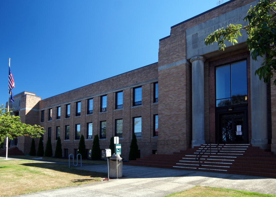
#14. Tillamook County
– Life expectancy: 76.9 years
— 1.8 years lower than the state average
About
Tillamook County, Oregon is known for its dairy industry, scenic landscapes, and strong rural character. The economy is supported by agriculture, forestry, tourism, and small-scale manufacturing. The community emphasizes sustainability, local traditions, and stewardship of natural resources.
Residents and visitors enjoy outdoor activities such as hiking, fishing, and exploring coastal and forest areas. Local events, farmers markets, and historical attractions reflect the area’s cultural and agricultural heritage. Tillamook County offers a peaceful lifestyle rooted in nature, resilience, and community connection.
Where is Tillamook County?
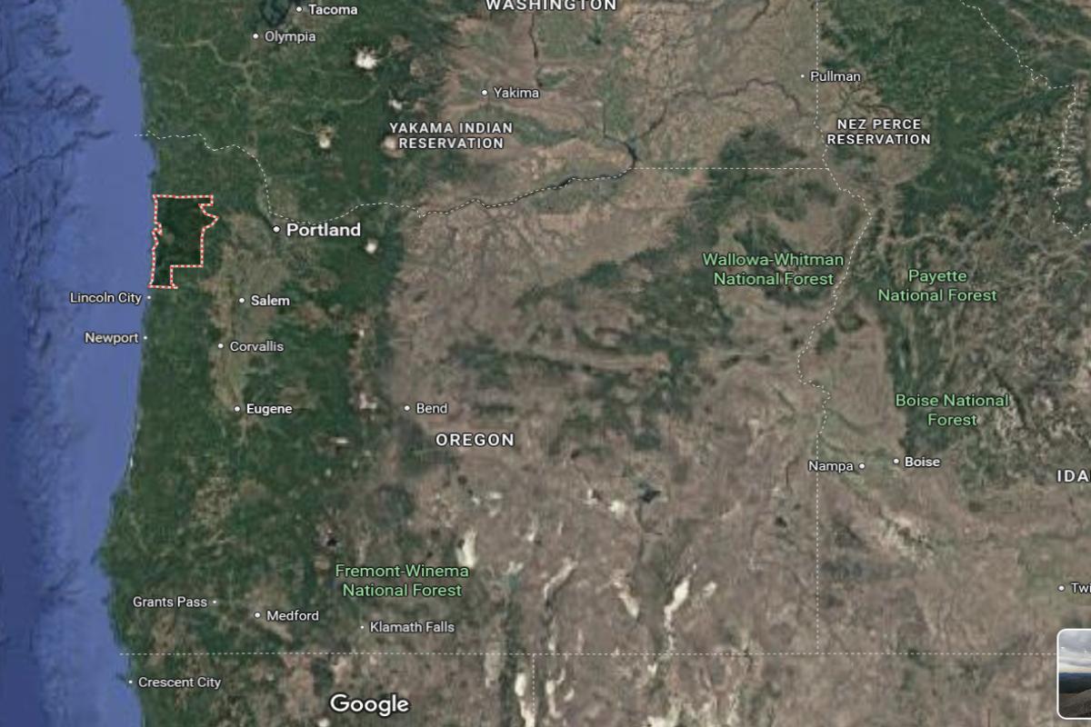
Tillamook County is located on the northwestern coast of Oregon, about 75 miles west of Portland and 50 miles north of Lincoln City. The county seat, Tillamook, lies roughly 40 miles southwest of Astoria and 60 miles northwest of McMinnville. It borders the Pacific Ocean and includes beaches, forests, and parts of the Coast Range.
The area is approximately 90 miles northwest of Salem and 85 miles southwest of Longview, Washington. U.S. Route 101 runs along the coast, connecting the county’s towns. Tillamook County is also about 45 miles west of Forest Grove in the Willamette Valley.
You may also like: These 10 car insurers have the highest market share in Oregon
#13. Umatilla County
– Life expectancy: 76.6 years
— 2.1 years lower than the state average
About
Umatilla County, Oregon is shaped by its agricultural strength, cultural diversity, and deep historical roots. The economy relies on farming, food processing, transportation, and regional trade, with a growing emphasis on renewable energy and manufacturing. Communities here value hard work, tradition, and collaboration.
Local events, rodeos, and cultural festivals showcase the area’s heritage and vibrant social life. Residents enjoy outdoor activities like fishing, hunting, and hiking in a variety of natural settings. Umatilla County offers a strong sense of identity, economic resilience, and connection to land and community.
Where is Umatilla County?
Umatilla County is located in northeastern Oregon, about 210 miles east of Portland and 40 miles southwest of Walla Walla, Washington. The county seat, Pendleton, lies roughly 30 miles southeast of Hermiston and 60 miles northwest of La Grande. It spans a mix of agricultural land, river valleys, and foothills of the Blue Mountains.
The area is approximately 45 miles west of Baker City and 100 miles north of John Day. Interstate 84 and U.S. Route 395 run through the county, offering major transportation routes. Umatilla County is also about 30 miles south of the Washington state border.
🔥 Would you like to save this?
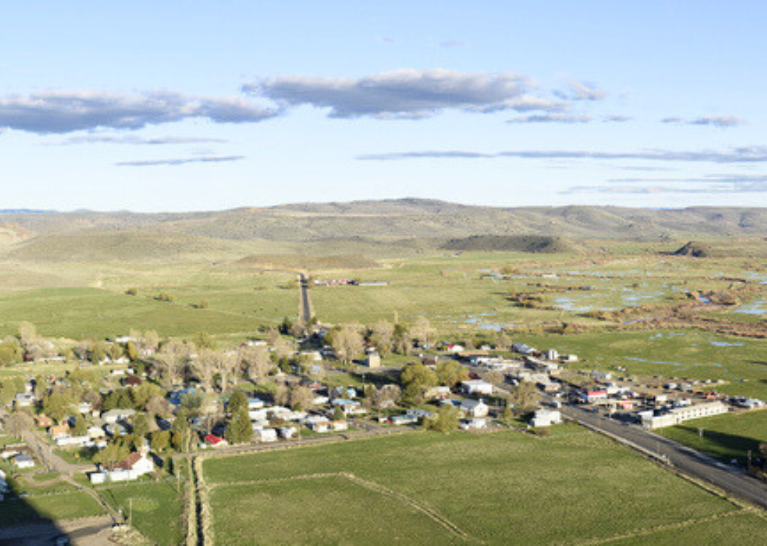
#12. Lake County
– Life expectancy: 76.5 years
— 2.2 years lower than the state average
About
Lake County, Oregon is characterized by its vast open spaces, rugged terrain, and deep agricultural traditions. The local economy centers around ranching, timber, and natural resource management, with growing interest in renewable energy. Its communities are close-knit, self-reliant, and grounded in rural values.
The county offers abundant opportunities for outdoor recreation, including hiking, birdwatching, and hot springs exploration. Historical landmarks and annual events celebrate pioneer heritage and community pride. Lake County embraces a lifestyle defined by independence, natural beauty, and a strong connection to the land.
Where is Lake County?
Lake County is located in south-central Oregon, about 230 miles southeast of Eugene and 150 miles northeast of Klamath Falls. The county seat, Lakeview, lies roughly 15 miles north of the California border and 95 miles west of Burns. It is a remote area with high desert landscapes, forests, and lakes.
The area is approximately 200 miles southeast of Bend and 190 miles south of John Day. U.S. Route 395 runs through the county, connecting it north to the Columbia Basin and south into California. Lake County is also about 120 miles east of Medford.
#11. Linn County
– Life expectancy: 76.4 years
— 2.3 years lower than the state average
About
Linn County, Oregon is known for its rich agricultural lands, forestry resources, and diverse economy. Key industries include farming, wood products, manufacturing, and healthcare, with strong support from local infrastructure and education. The region blends rural charm with growing communities and a spirit of innovation.
Community events, heritage festivals, and farmers markets highlight the area’s cultural identity and seasonal rhythms. Outdoor recreation is widely enjoyed, with access to rivers, forests, and parks supporting an active lifestyle. Linn County offers a well-rounded environment rooted in tradition, productivity, and natural beauty.
Where is Linn County?

Linn County is located in western Oregon, about 70 miles south of Portland and 45 miles east of Newport. The county seat, Albany, lies roughly 25 miles south of Salem and 45 miles north of Eugene. It stretches from the Willamette Valley in the west to the Cascade Mountains in the east.
The area is approximately 60 miles northwest of Bend and 30 miles east of Corvallis. Interstate 5 runs through the county, providing a major north-south route. Linn County is also about 90 miles northeast of Roseburg.
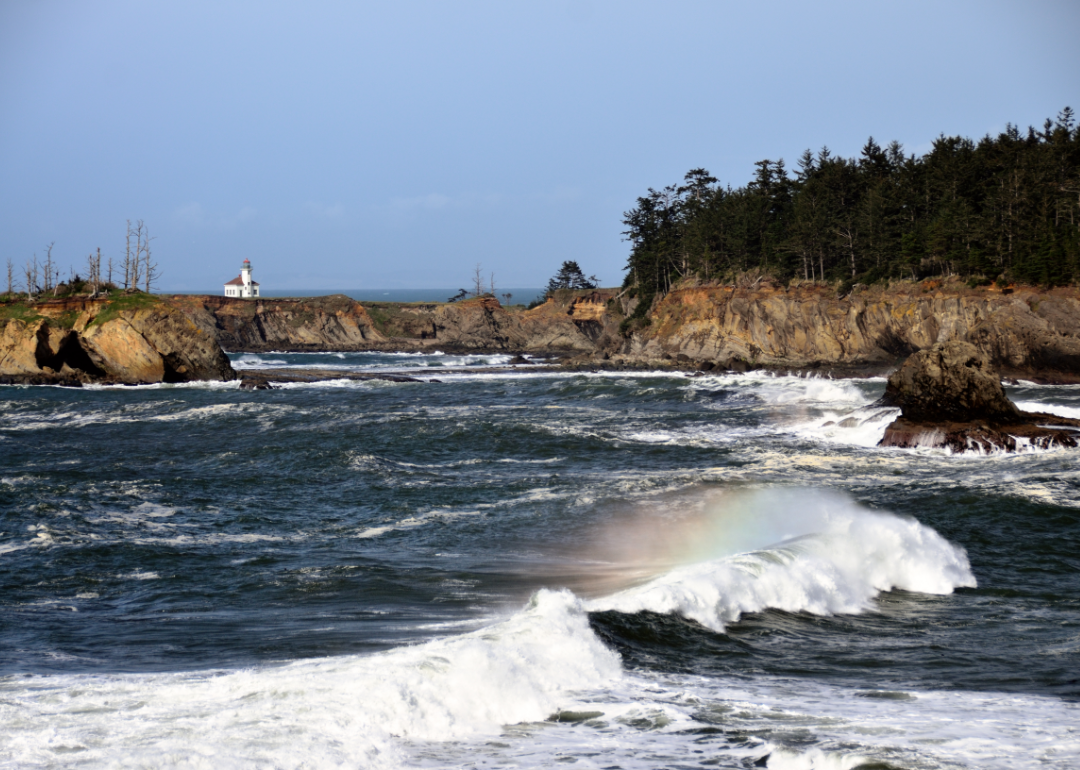
#10. Coos County
– Life expectancy: 76.3 years
— 2.4 years lower than the state average
About
Coos County, Oregon is defined by its maritime heritage, forested landscapes, and strong community values. Its economy is supported by industries such as timber, fishing, tourism, and healthcare, with ongoing efforts in economic diversification. The county maintains a balance between preserving natural resources and promoting sustainable development.
Local culture thrives through festivals, art, and historical celebrations that reflect its coastal and logging traditions. Residents enjoy access to beaches, dunes, trails, and waterways that offer year-round recreation. Coos County combines natural beauty, resilience, and a deep sense of local pride.
Where is Coos County?
Coos County is located on the southwestern coast of Oregon, about 200 miles south of Portland and 85 miles southwest of Roseburg. The county seat, Coquille, lies roughly 20 miles east of Coos Bay and 55 miles north of Gold Beach. It is bordered by the Pacific Ocean and includes coastal towns, forests, and rivers.
The area is approximately 90 miles west of Grants Pass and 120 miles northwest of Medford. U.S. Route 101 runs through the county, connecting the coastal communities. Coos County is also about 70 miles southwest of Eugene.
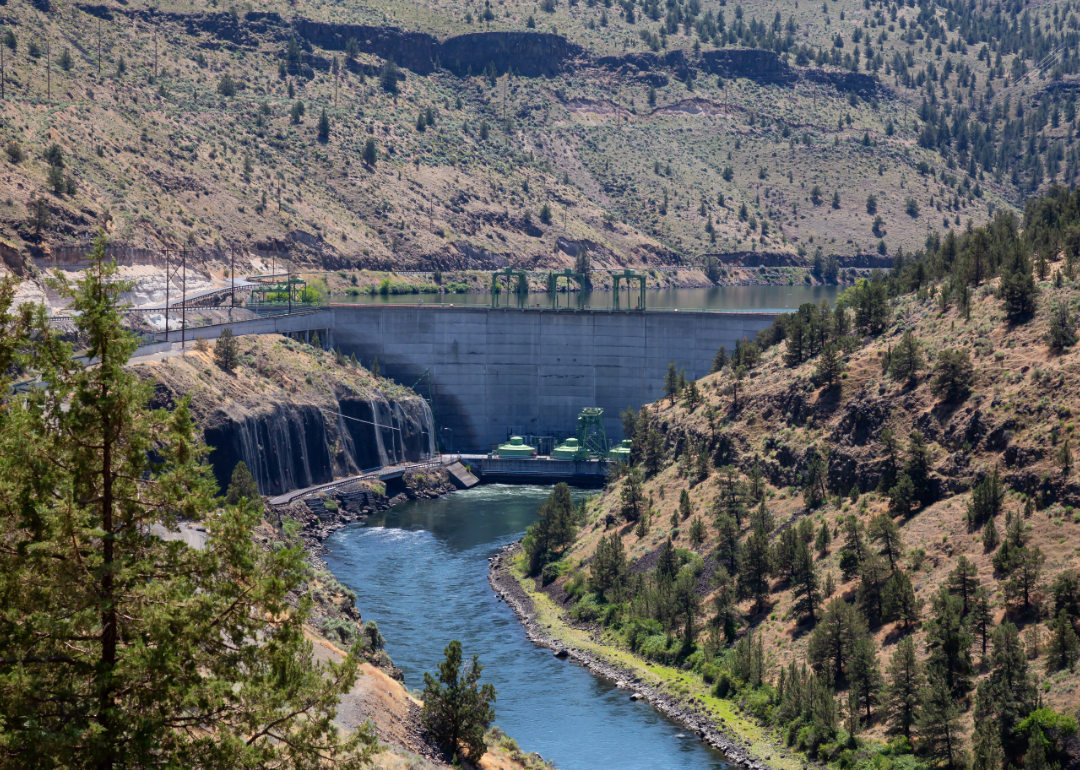
#9. Wasco County
– Life expectancy: 76.2 years
— 2.5 years lower than the state average
About
Wasco County, Oregon is known for its historical significance, agricultural productivity, and connection to regional trade. The economy includes farming, renewable energy, technology, and tourism, with efforts focused on preserving heritage while encouraging innovation. Its communities are tight-knit, with a strong emphasis on self-reliance and civic involvement.
Cultural events, museums, and seasonal festivals celebrate the area’s diverse roots and pioneer legacy. Outdoor activities like hiking, cycling, and river sports attract residents and visitors alike. Wasco County offers a rich blend of history, economic diversity, and scenic outdoor living.
Where is Wasco County?
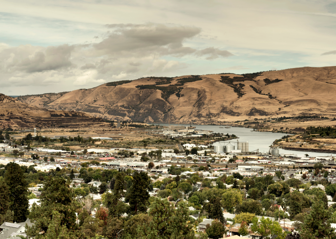
Wasco County is located in north-central Oregon, about 85 miles east of Portland and 65 miles north of Madras. The county seat, The Dalles, lies along the Columbia River and is roughly 70 miles west of Pendleton. It sits at the eastern edge of the Columbia River Gorge and includes both river valley and high desert landscapes.
The area is approximately 100 miles northeast of Salem and 90 miles northwest of Bend. Interstate 84 and U.S. Route 197 provide access through the county. Wasco County is also about 60 miles southeast of Hood River.
You may also like: Best private high schools in Oregon
#8. Harney County
– Life expectancy: 76.1 years
— 2.6 years lower than the state average
About
Harney County, Oregon is marked by its wide-open landscapes, ranching heritage, and deep-rooted independence. The economy is centered on agriculture, particularly cattle ranching, along with forestry and public land management. Residents value self-sufficiency, tradition, and a close connection to the land.
Community life is shaped by local events, rodeos, and a strong spirit of cooperation. Outdoor recreation such as birdwatching, hiking, and hunting is abundant, reflecting the county’s rich natural resources. Harney County offers a way of life grounded in resilience, open space, and rural pride.
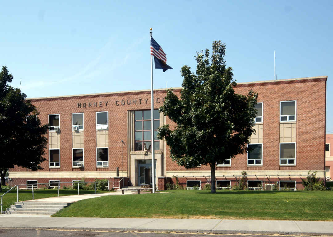
Where is Harney County?
Harney County is located in southeastern Oregon, about 200 miles southeast of Bend and 115 miles west of the Idaho border. The county seat, Burns, lies roughly 130 miles east of Lakeview and 120 miles south of John Day. It is the largest county in Oregon by area, with vast high desert, mountains, and wetlands.
The area is approximately 260 miles southeast of Salem and 185 miles south of Baker City. U.S. Route 20 and U.S. Route 395 intersect in the county, providing east-west and north-south access. Harney County is also about 140 miles north of the Nevada border.
#7. Baker County
– Life expectancy: 76.0 years
— 2.7 years lower than the state average
About
Baker County, Oregon is steeped in frontier history, scenic beauty, and a tradition of self-reliance. Its economy is driven by agriculture, tourism, mining heritage, and small businesses that support rural communities. The area is known for preserving its historical roots while embracing thoughtful growth.
Residents take pride in community events, historic landmarks, and cultural celebrations that reflect their pioneering spirit. Outdoor opportunities like hiking, skiing, and exploring natural parks offer year-round adventure. Baker County blends history, natural splendor, and a strong sense of local identity.
Where is Baker County?
Baker County is located in northeastern Oregon, about 245 miles east of Portland and 45 miles west of the Idaho border. The county seat, Baker City, lies roughly 95 miles southeast of Pendleton and 80 miles northeast of John Day. It sits along Interstate 84 in a mountainous region near the Wallowa and Blue Mountains.
The area is approximately 130 miles northwest of Boise, Idaho and 90 miles east of La Grande. U.S. Route 30 and Oregon Route 7 provide additional access through the county. Baker County is also about 70 miles south of Enterprise in Wallowa County.
🔥 Would you like to save this?
#6. Malheur County
– Life expectancy: 75.9 years
— 2.8 years lower than the state average
About
Malheur County, Oregon is shaped by its strong agricultural foundation, wide-open landscapes, and rural resilience. The local economy relies on farming, ranching, food processing, and cross-border trade, supporting a tradition of hard work and self-sufficiency. Communities maintain deep-rooted ties to the land and a practical approach to daily life.
Cultural heritage is celebrated through local fairs, rodeos, and community gatherings that foster regional pride. Residents enjoy outdoor activities such as fishing, hiking, and wildlife observation across diverse natural settings. Malheur County offers a grounded lifestyle centered on tradition, natural beauty, and enduring community values.
Where is Malheur County?
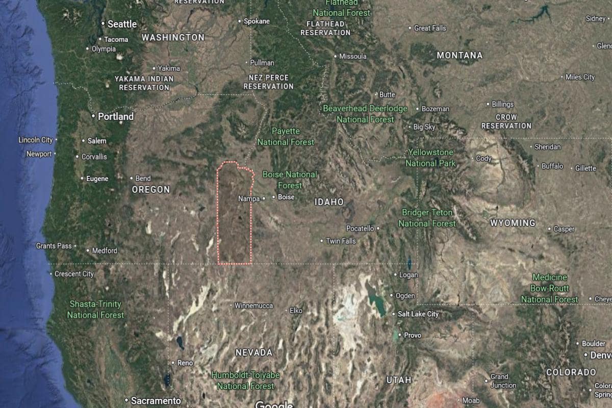
Malheur County is located in southeastern Oregon, directly along the Idaho border and about 50 miles southwest of Boise. The county seat, Vale, lies roughly 20 miles west of Ontario and 100 miles southeast of Baker City. It spans a wide area of high desert and agricultural land in the Treasure Valley.
The area is approximately 185 miles southeast of Pendleton and 260 miles east of Bend. U.S. Route 20 and U.S. Route 95 run through the county, connecting it with central Oregon and southwestern Idaho. Malheur County is also about 60 miles north of the Nevada border.

#5. Douglas County (tie)
– Life expectancy: 75.3 years
— 3.4 years lower than the state average
About
Douglas County, Oregon is known for its deep forestry roots, rugged landscapes, and strong sense of community. The economy is supported by timber, agriculture, winemaking, and outdoor tourism, with local industries closely tied to natural resources. Residents value tradition, resilience, and stewardship of the environment.
Community life is enriched through fairs, local festivals, and historical sites that reflect its pioneer and logging heritage. The county offers abundant outdoor recreation, including hiking, fishing, and exploring scenic rivers and forests. Douglas County blends economic heritage, natural beauty, and small-town pride in a distinctly rural setting.
Where is Douglas County?
Douglas County is located in southwestern Oregon, about 70 miles south of Eugene and 160 miles south of Salem. The county seat, Roseburg, lies roughly 80 miles north of Grants Pass and 100 miles east of Coos Bay. It stretches from the Cascade Mountains in the east to the Pacific Coast Range in the west.
The area is approximately 180 miles south of Portland and 90 miles northwest of Klamath Falls. Interstate 5 runs through the county, serving as its main north-south corridor. Douglas County is also about 65 miles west of Crater Lake National Park.
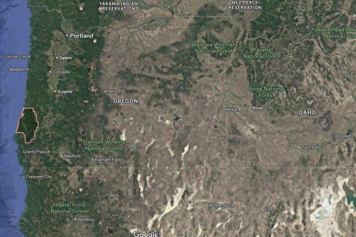
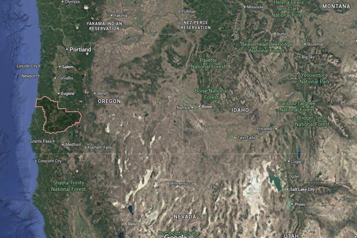
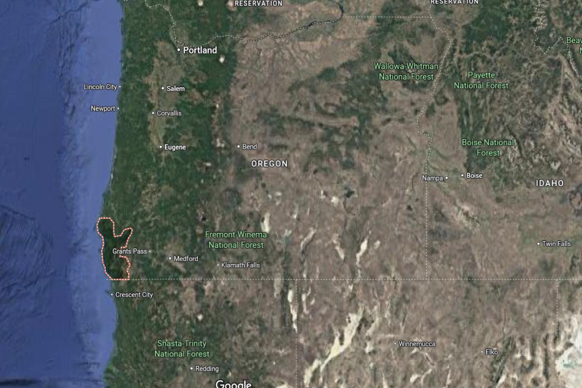
#4. Josephine County (tie)
– Life expectancy: 75.3 years
— 3.4 years lower than the state average
About
Josephine County, Oregon is known for its natural beauty, artistic culture, and independent spirit. The local economy is supported by healthcare, tourism, small businesses, and a legacy of mining and forestry. Communities here value creativity, self-reliance, and a strong connection to the surrounding landscape.
Local events, farmers markets, and arts festivals foster a vibrant, community-focused atmosphere. Residents enjoy outdoor activities like rafting, hiking, and exploring wilderness areas year-round. Josephine County offers a unique blend of natural richness, cultural expression, and rural charm.
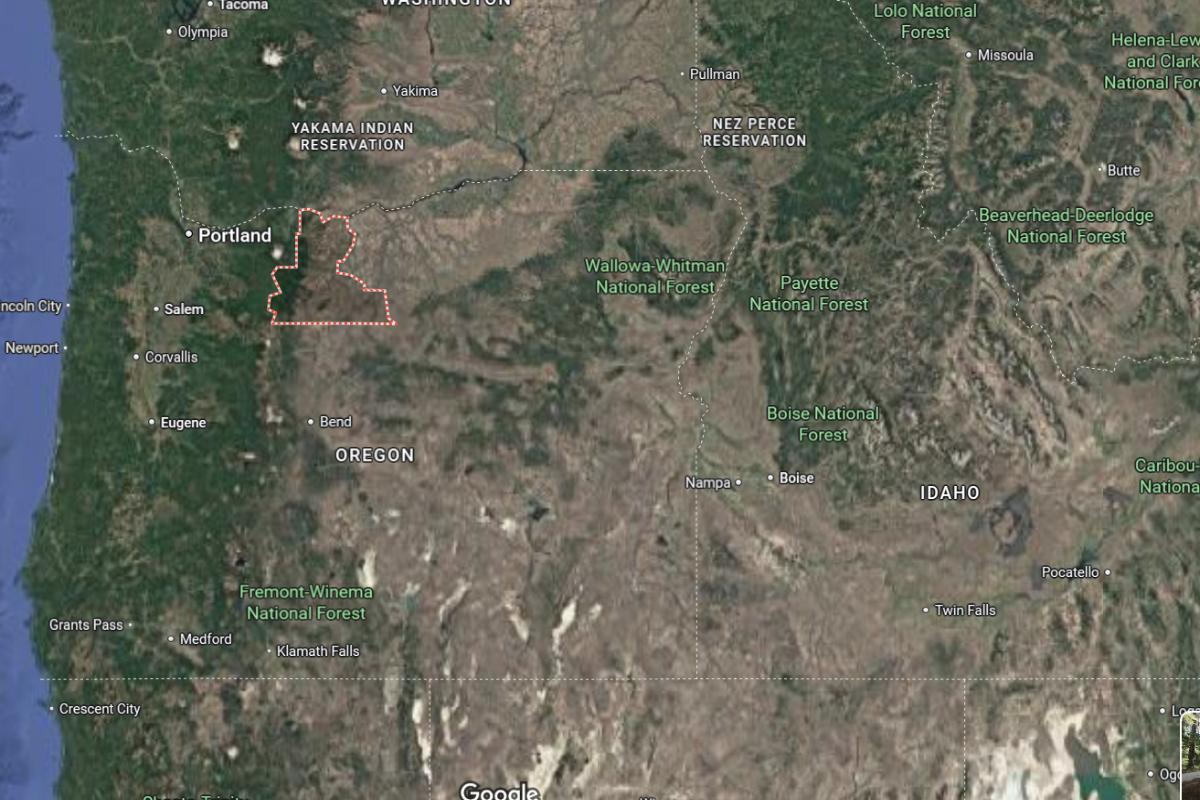
Where is Josephine County?
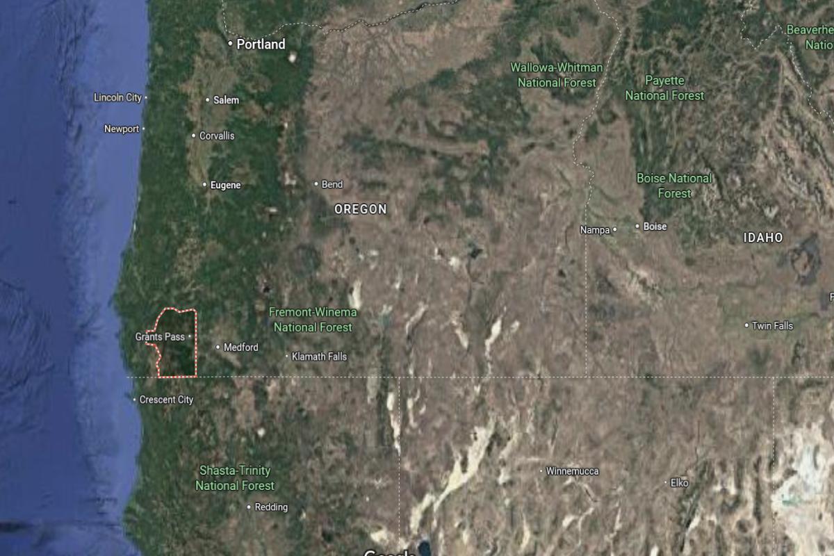
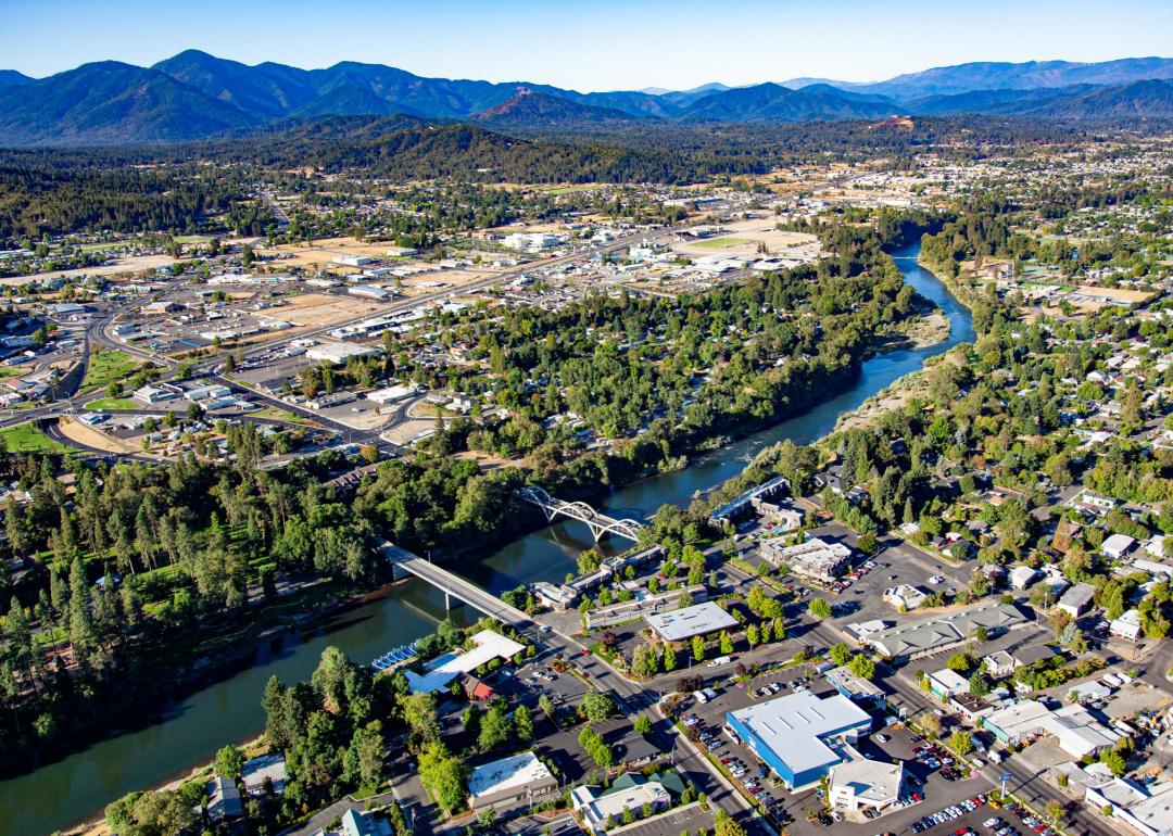
Josephine County is located in southwestern Oregon, about 250 miles south of Portland and 70 miles northwest of Medford. The county seat, Grants Pass, lies roughly 35 miles west of Ashland and 55 miles northeast of Crescent City, California. It is nestled in the Rogue Valley and surrounded by forested mountains.
The area is approximately 95 miles southwest of Crater Lake and 90 miles north of the California border via U.S. Route 199. Interstate 5 runs through the county, connecting it to major cities in the region. Josephine County is also about 60 miles southeast of Coos Bay.
You may also like: How compensation compares between Oregon staff and travel nurses
#3. Curry County
– Life expectancy: 74.4 years
— 4.3 years lower than the state average
About
Curry County, Oregon is defined by its dramatic coastal scenery, quiet rural communities, and deep ties to fishing and forestry. The local economy is shaped by natural resource industries, tourism, and small businesses that reflect a resilient and self-sufficient way of life. Residents value privacy, open space, and a strong connection to nature.
Community events, art gatherings, and farmers markets highlight local creativity and coastal culture. Outdoor recreation such as beachcombing, hiking, and wildlife viewing is a key part of daily life. Curry County blends natural splendor, independence, and a close-knit community spirit.
Where is Curry County?
Curry County is located on the southwestern coast of Oregon, about 300 miles south of Portland and 120 miles southwest of Grants Pass. The county seat, Gold Beach, lies roughly 30 miles north of Brookings and 55 miles south of Port Orford. It borders the Pacific Ocean to the west and the California state line to the south.
The area is approximately 90 miles west of Medford and 75 miles south of Coos Bay. U.S. Route 101 runs along the coast, connecting the county’s communities. Curry County is also about 40 miles north of Crescent City, California.
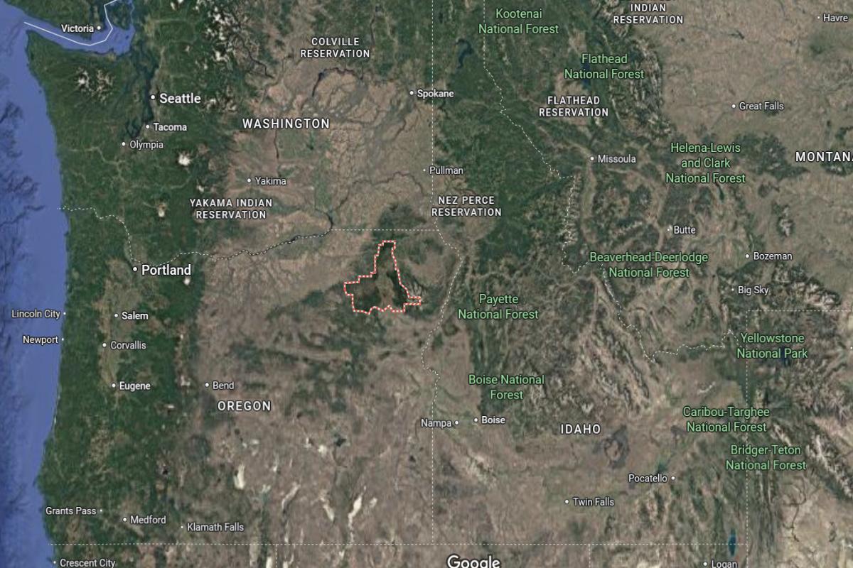
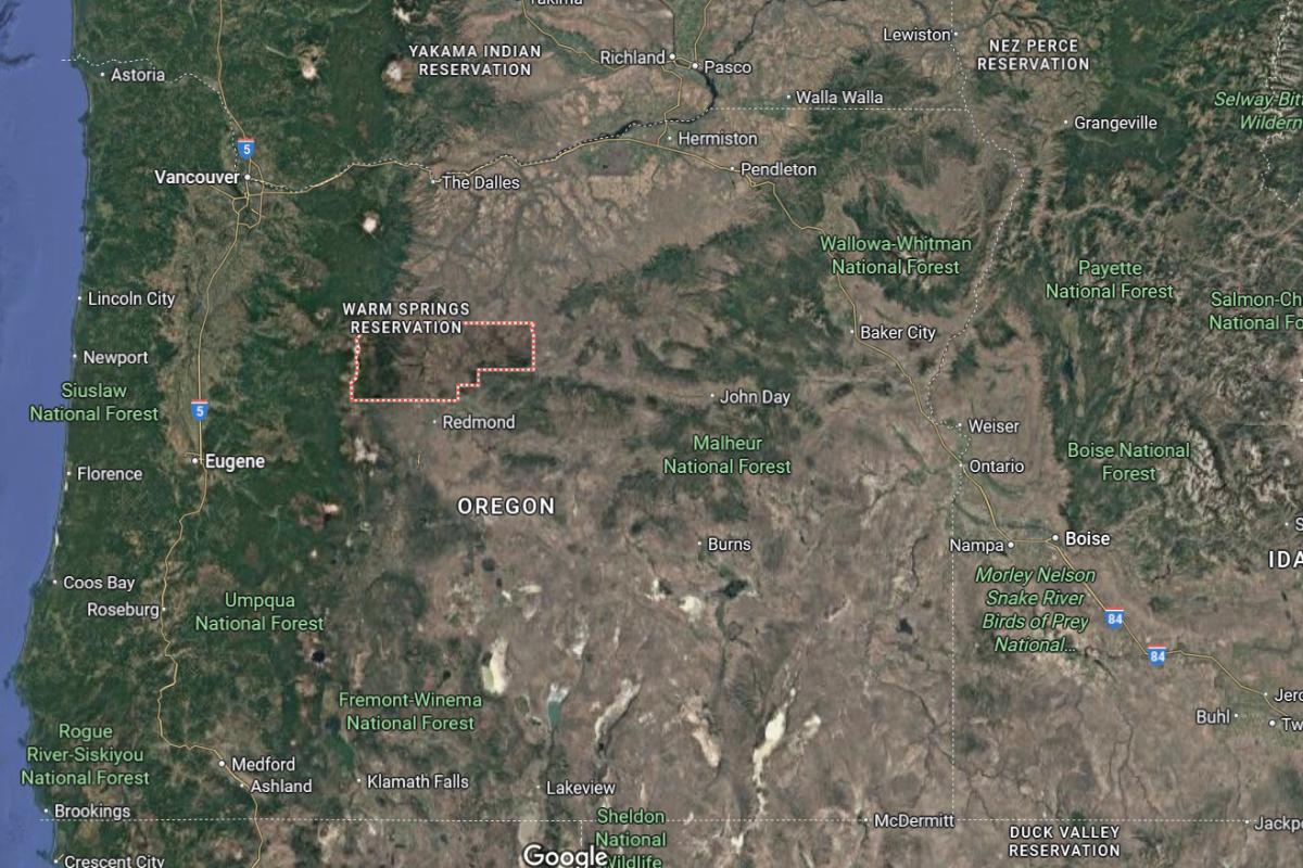
#2. Jefferson County
– Life expectancy: 74.2 years
— 4.5 years lower than the state average
About
Jefferson County, Oregon is known for its agricultural strength, high desert landscapes, and cultural diversity. The economy is supported by farming, ranching, outdoor recreation, and tribal enterprises, with a strong emphasis on land stewardship and community resilience. The county values tradition, self-reliance, and local collaboration.
Community events, cultural celebrations, and markets reflect the area’s heritage and inclusive spirit. Residents enjoy access to wide-open spaces, rivers, and mountain views that offer year-round recreational opportunities. Jefferson County blends rural pride, natural beauty, and a deep connection to community and land.
Where is Jefferson County?
🔥 Would you like to save this?
Jefferson County is located in central Oregon, about 115 miles southeast of Portland and 40 miles north of Bend. The county seat, Madras, lies roughly 60 miles south of The Dalles and 70 miles northeast of Sisters. It sits in the high desert region east of the Cascade Mountains.
The area is approximately 95 miles northeast of Eugene and 85 miles west of Prineville. U.S. Route 97 runs through the county, serving as a key north-south route. Jefferson County is also about 50 miles southeast of Mount Hood.
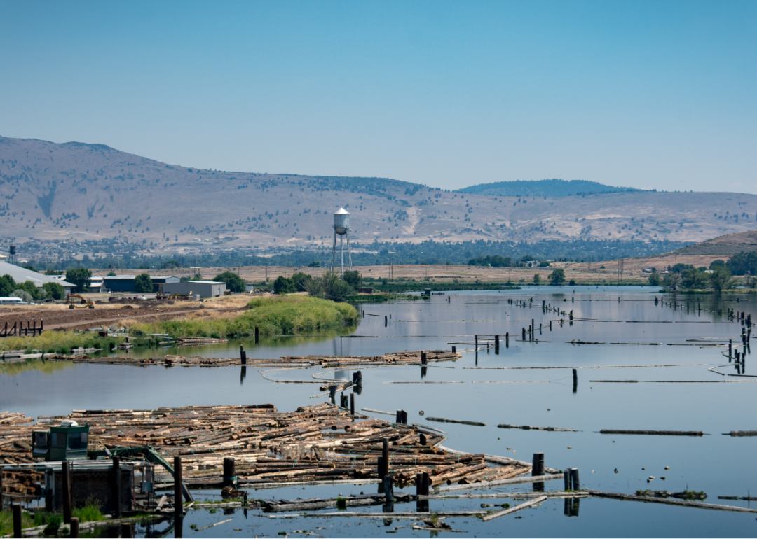
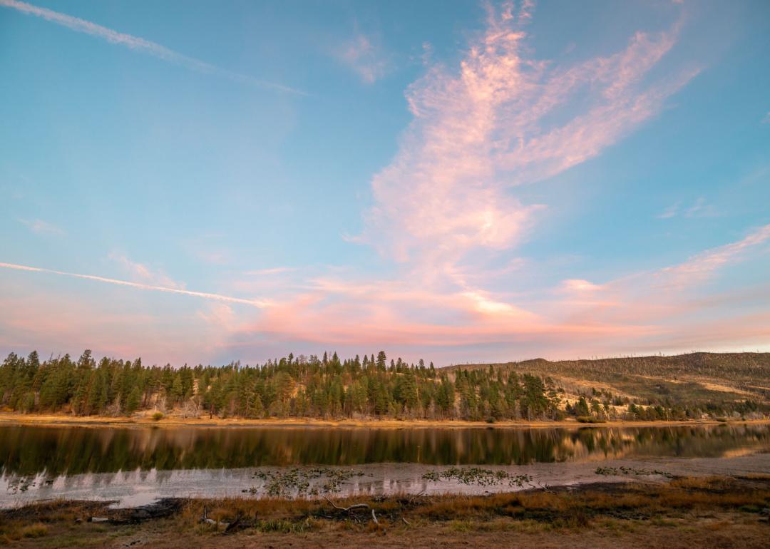
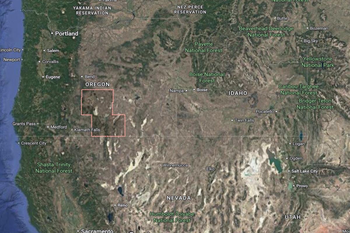
#1. Klamath County
– Life expectancy: 73.9 years
— 4.8 years lower than the state average
About
Klamath County, Oregon is shaped by its high desert environment, rich natural resources, and agricultural traditions. The economy is driven by farming, timber, renewable energy, and outdoor tourism, with a strong foundation in environmental and water management. Communities emphasize resilience, independence, and sustainable growth.
Local life is enriched by seasonal events, historical landmarks, and a strong sense of heritage. Residents enjoy abundant outdoor recreation, including fishing, hiking, and birdwatching across diverse landscapes. Klamath County offers a lifestyle grounded in natural beauty, resourcefulness, and regional pride.
Where is Klamath County?
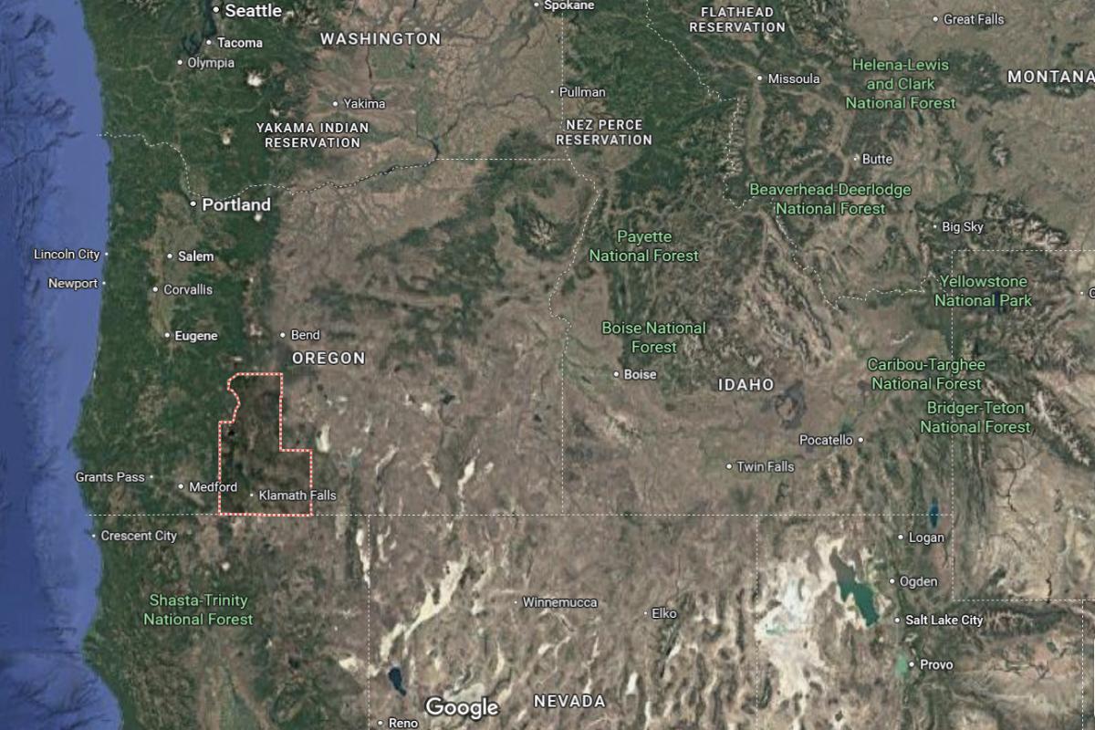
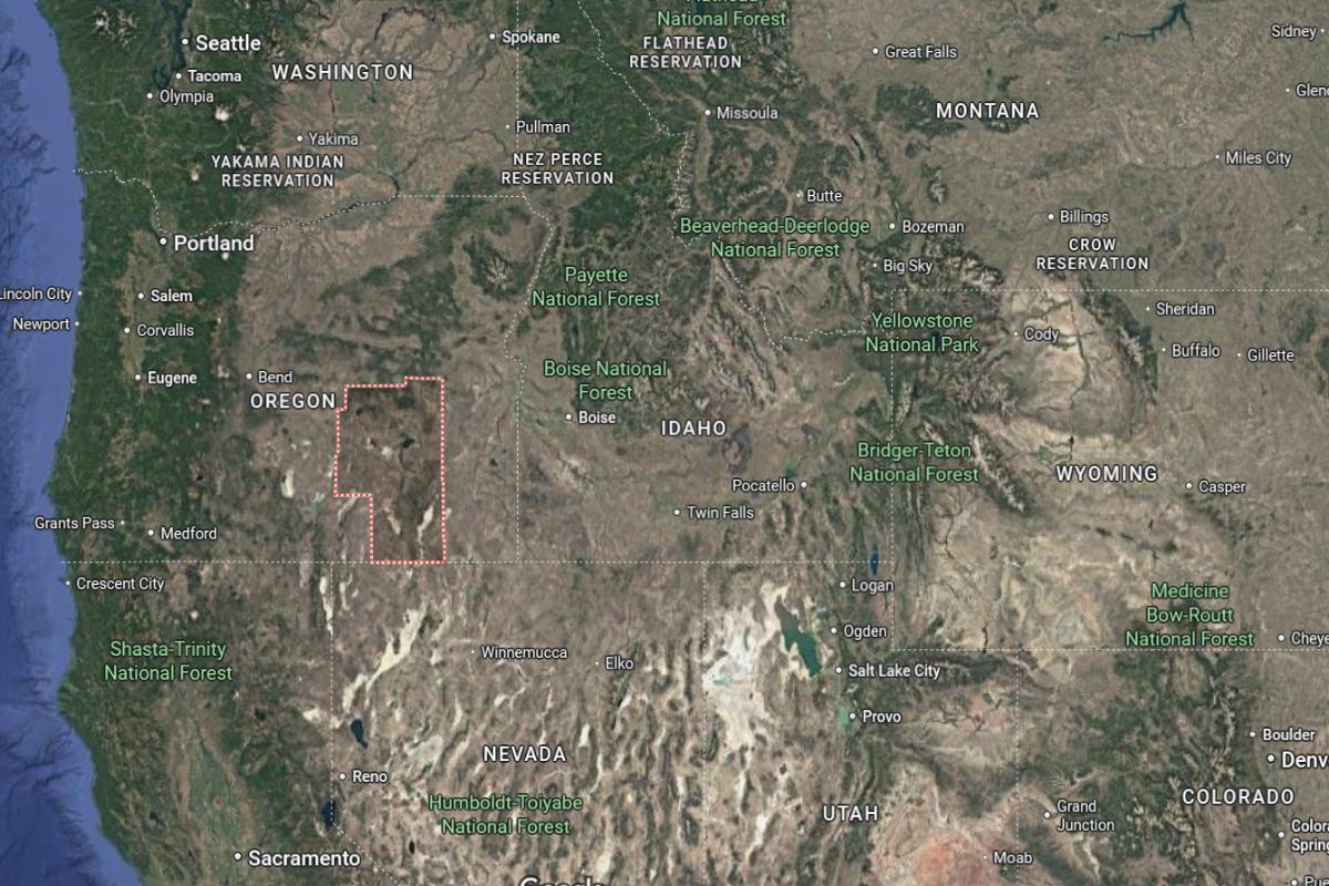
Klamath County is located in south-central Oregon, about 250 miles south of Portland and 80 miles southeast of Medford. The county seat, Klamath Falls, lies roughly 20 miles north of the California border and 65 miles south of Crater Lake. It is situated in a high desert basin near the Cascade Mountains.
The area is approximately 170 miles northeast of Redding, California and 100 miles east of Ashland. U.S. Route 97 and Oregon Route 140 provide key access through the county. Klamath County is also about 95 miles southwest of Bend.
This story features data reporting by Karim Noorani, writing by Kiersten Hickman, and is part of a series utilizing data automation across 49 states.
By Stacker